[INSERT PENNDOT LOGO]
File info: application/pdf · 47 pages · 5.28MB
[INSERT PENNDOT LOGO]
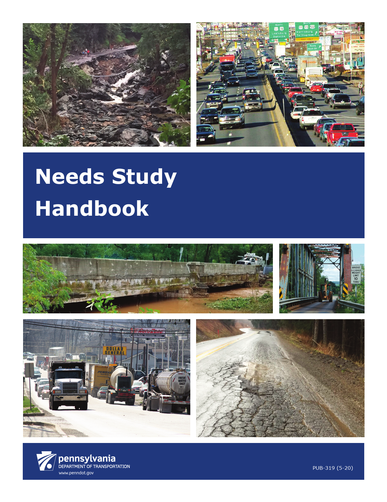
Needs Study Handbook
Pub. 319 PennDOT Needs Study Handbook 1 May 2020 1.0 INTRODUCTION The requirement for the purpose and need statement began with the National Environmental Policy Act
Needs Study Handbook - PennDOT
PennDOT Pub. 638A, the Pennsylvania Safety Predictive. Analysis Methods Manual, explains in detail how the HSM analysis works and how it is ...
Extracted Text
Needs Study Handbook

www.penndot.gov

PUB-319 (5-20)

Contents

Pub. 319

TABLE OF CONTENTS
PREFACE....................................................................................................................................... i
1.0 INTRODUCTION .............................................................................................................. 1
2.0 LEGAL REQUIREMENTS .............................................................................................. 1
3.0 IMPORTANCE OF PURPOSE AND NEED IN PLANNING AND PROJECT DELIVERY ......................................................................................................................... 2
3.1 Why is Purpose and Need Important? ............................................................................. 2 3.2 When does Purpose and Need Development Begin?....................................................... 3 3.3 When is a Purpose and Need Required? .......................................................................... 4 3.4 Who is Involved in Purpose and Need Development? .................................................... 5 3.5 How is Purpose and Need Documented?......................................................................... 5
4.0 HOW TO DEVELOP THE PURPOSE AND NEED STATEMENT............................ 7 4.1 What to Consider When Developing Purpose and Need ................................................. 7 4.2 Congestion ....................................................................................................................... 9 4.3 Facility Deficiencies ...................................................................................................... 10 4.4 System Linkage.............................................................................................................. 13 4.5 Modal Interrelationships ................................................................................................ 14 4.6 Legislation...................................................................................................................... 15 4.7 Economic Development................................................................................................. 17 4.8 Mobility.......................................................................................................................... 18 4.9 Guidelines and Examples for Incorporating Safety in Project Need Statements........... 20
LIST OF ACRONYMS ................................................................................................................ a
GLOSSARY................................................................................................................................... b
OTHER RESOURCES................................................................................................................. k
LIST OF APPENDICES
Apendix A � Examples of How to Correct an Incorrect Purpose and Need Statement
LIST OF EXHIBTS
Exhibit 4.1 � Congestion Data and Data Sources ...................................................................... 10 Exhibit 4.2 � Facilities Deficiencies Data and Data Sources..................................................... 12 Exhibit 4.3 � System Linkage Data and Data Sources .............................................................. 14 Exhibit 4.4 � Modal Interrelationships Data and Data Sources................................................. 15 Exhibit 4.5 � Legislation Data and Data Sources ...................................................................... 16 Exhibit 4.6 � Economic Development Data and Data Sources ................................................. 17 Exhibit 4.7 � Mobility Data and Data Sources .......................................................................... 19 Exhibit 4.8 � Sample output from PCIT: Crash History Report................................................ 21 Exhibit 4.9 � Sample output from PCIT: Point Map ................................................................. 22 Exhibit 4.10 � Overview of the HSM Process ........................................................................... 23 Exhibit 4.11 � PennDOT HSM Tools and Data ........................................................................ 24 Exhibit 4.12 � PennDOT HSM Tool A Summary Report ......................................................... 25

PennDOT Needs Study Handbook

i

May 2020

Preface

Pub. 319

PREFACE
This handbook provides guidance to the Pennsylvania Department of Transportation's (PennDOT's) district offices, consultants, and planning partners (metropolitan planning organizations, rural planning organizations, county planning offices, municipalities or citizens) on the procedures for preparing and documenting purpose and need for transportation improvement projects in the Commonwealth of Pennsylvania under the National Environmental Policy Act (NEPA) of 1969 and Pennsylvania Act 120. The guidance is consistent with the Federal Highway Administration's "Planning and Environmental Linkages" initiative. This is a guidance document, not a rule or regulation. There is no intent on the part of PennDOT to give the procedures in this guidance weight or deference. This document establishes the framework within which PennDOT will exercise its administrative discretion in the future. PennDOT reserves the discretion to deviate from this guidance if circumstances warrant. This guidance is for informational purposes only; it is not regulatory.

This guidance should be used as an informational toolkit for preparing purpose and need statements. This handbook replaces the earlier edition of Publication No. 319 from 2010. Please direct questions about this handbook to the PennDOT, Bureau of Project Delivery, Environmental Policy and Development Section.

PennDOT Needs Study Handbook

i

May 2020

Pub. 319
1.0 INTRODUCTION
The requirement for the purpose and need statement began with the National Environmental Policy Act (NEPA) in 1970. NEPA requires federal agencies to consider the impacts of their actions on the environment. The purpose and need statement establishes the reasons why an agency is proposing a project and justifies the expenditure of public funds.
A purpose and need statement is required to be included in all environmental studies prepared for PennDOT/Federal Highway Administration (FHWA) review. These studies include categorical exclusion evaluations (CEEs), environmental assessments (EAs), and environmental impact statements (EISs), as well as state-funded projects documented with an environmental evaluation report (EER) or environmental documentation (ED) in accordance with PA Act 120.
Despite the importance of a good purpose statement and well-stated project needs, purpose and need statements are very routinely drafted incorrectly. The most common problems are:
 Purpose statements that are so broad that any possible project alternative would work;  Purpose statements that are so focused that only one alternative can work;  Needs statements that presuppose the solution;  Needs statements that do not state a problem;  Needs statements that are not supported by facts or data;  Needs statements that state a problem, but are too broad (e.g., "traffic is congested," or "the bridge
is in poor condition");  Needs statements that only identify the problems that PennDOT plans to address (e.g., only
identifying roadway condition, but not pedestrian access issues).
Poorly written purpose and need statements make it more difficult to assess and screen project alternatives, perform a Section 4(f) analysis, complete the Section 106 process, or justify the project to the public, agencies, and FHWA. Well-written purpose and need statements have the opposite effect.
2.0 LEGAL REQUIREMENTS
Purpose and need is a critical element of NEPA. The project purpose and need is required documentation in accordance with the Council on Environmental Quality (CEQ) regulations at 40 CFR 1502.13 and Federal Highway Administration (FHWA) regulations at 23 CFR 771.111(f). NEPA CEQ Regulation 40 CFR 1502.13 states: "The statement shall briefly specify the underlying purpose and need to which the agency is responding in proposing the alternatives including the proposed action."
Based on the regulations above, the FHWA Technical Advisory T 6640.8A directs state departments of transportation (DOTs) to "identify and describe the proposed action and the transportation problem(s) or other needs which it is intended to address."
PennDOT guidance for the preparation of NEPA documentation, including CEs, (PennDOT Publication 10B, DM-1B) calls for proposals to "include a description of the project need."
23 CFR 139 gives the lead agency in the NEPA process responsibility for defining the purpose and need. The lead agency is required to provide stakeholder agencies and the public with an opportunity for involvement in defining the purpose and need. The law gives lead agencies substantial flexibility with how to provide this opportunity but recommends that it occur "as early as practicable."

PennDOT Needs Study Handbook

1

May 2020

Pub. 319
In 2015, Section 139 was amended to require that "all federal permits and reviews for a project shall rely on a single environmental document prepared under NEPA under the leadership of the lead agency." This avoids the potential for different NEPA documents with different definitions of the project's purpose and need.
The purpose and need also play an important role under other laws. Under Section 4(f), PennDOT must determine whether there is any "feasible and prudent" alternative that avoids the use of significant publicly owned parks, recreation areas, and wildlife or waterfowl refuges, as well as any significant historic sites. If an alternative does not meet the purpose of the project, it can be eliminated under Section 4(f) (AASHTO 2016).
Under Section 404 of the Clean Water Act, the U.S. Army Corps of Engineers (USACE) must determine whether there is any "practicable" alternative that avoids the use of aquatic resources within its jurisdiction. An alternative that does not meet the purpose of the project can be eliminated from consideration under Section 404 (AASHTO 2016). A project purpose and need narrative is also required for projects involving PA Chapter 105 water encroachment permits.
Under Section 106 of the National Historic Preservation Act, PennDOT must determine the impact that a project may have on historic properties. An alternative that results in adverse effects to identified historic properties may be dismissed under Section 106.
Compliance with Section 106 under procedures found in PennDOT's Publication No. 689, Cultural Resources Handbook may include the preparation of a Determination of Effects report, which must contain the project purpose and need. The project purpose and need statement must not preclude an outcome (i.e. the project purpose and need statement must not indicate that the only way to achieve the purpose and need is to remove the historic resource) or PennDOT will not be in compliance with Section 106 regulations which require the evaluation of alternatives or modifications to the undertaking that could avoid or minimize effects to the resource.
Section 106 compliance for the rehabilitation or removal of a historic resource, such as a historic bridge, may also include the preparation of a feasibility analysis. The purpose of this analysis is to demonstrate whether it is prudent or feasible to rehabilitate the historic bridge and meet the purpose and needs of the project. It is important that this analysis be based upon a defensible purpose and need statement that takes into account the requirements of Section 106 and the FHWA's Historic Bridge Program (Title 23, Section 144(o)). The purpose and need statement cannot preclude consideration of a rehabilitation alternative.
3.0 IMPORTANCE OF PURPOSE AND NEED IN PLANNING AND PROJECT DELIVERY
3.1 Why is Purpose and Need Important?
Purpose and need are the foundation of a project and identify what the project is intended to accomplish. It explains to the public and decision makers that the expenditure of funds is necessary and worthwhile. Purpose and need drives the process for alternatives consideration, influences the environmental analysis, and ultimately the alternative selection.
The project purpose and need must be defined in order to identify the range of alternatives to consider in the project development/NEPA phase. A purpose and need statement is also a requirement for Section 106, including historic bridge rehabilitation analysis, Section 404 permits, PA Chapter 105 permits, and Section 4(f) analyses. The purpose and need statement is crucial to the selection of the preferred alternative. The purpose and need statement will justify the expenditure of public funds and support the acquisition of right-of-way required for projects.

PennDOT Needs Study Handbook

2

May 2020

Pub. 319

A well-written purpose and need statement helps to:
 Avoid developing an ill-conceived project;  Develop a shared understanding of the transportation problems, objectives and possible solutions;  Define a project's scope;  Guide development of alternatives;  Evaluate alternatives;  Allow transportation decisions to be legally defensible;  Justify impacts and spending of funds; and  Justify projects for programming.
3.2 When does Purpose and Need Development Begin?
Needs assessment begins at the earliest stages of the transportation program development and project delivery process and continues to be refined throughout the process. The program development and project delivery process is detailed in PennDOT Publication 10A (DM-1A), Publication 10B (DM-1B) and Publication 10X (DM-1X).
Planning The purpose and need statement is initially drafted during the "problem assessment" stage. This refers to the initial advancement of any transportation-related problem intended for inclusion in a long-range transportation plan (LRTP) for a planning organization, and subsequent advancement of that problem to a proposal, that is studied, ranked, and later developed into a specific project for inclusion in a regional transportation improvement program (TIP), and the state transportation improvement program (STIP).
This first step is to define the transportation needs for the proposal by PennDOT or planning partners. In addition to identifying the problems/needs on the PennDOT Connects form, it is important that the data source and, if possible, the data and information supporting the problem, be identified and attached to the form. The needs must establish evidence of a current or future transportation problem or deficiency and are factual and quantifiable. Therefore, it is important to provide the supporting data that are to be gathered and documented at this stage. If data and information is available at this step but upon review does not support the stated transportation needs, the proposal should be reconsidered.
PennDOT and planning partners should use existing and easily accessible sources of data and information to minimize the need for additional data collection and analysis during the planning process.
To the extent possible, the purpose and needs documented on PennDOT Connects forms should be wellwritten and avoid the errors identified in the introduction to this document.
A more defined purpose and need may be required for the proposal through the preparation of a detailed planning study. If the focus of the study includes further clarification of purpose and need, coordination with the MPO/RPO, the proposal advocate, and appropriate stakeholders, including local officials, is recommended. Public involvement activities aimed at gathering input and comment on purpose and need may be performed during this step.
Preliminary Engineering/NEPA Decision Preliminary engineering consists of the preparation of engineering studies, designs, analyses, and associated documentation to support the environmental studies and develop a detailed scope of work for final design. This preparation is required to further refine and/or verify the scope of improvements, as determined during the scoping field view, that meet the project purpose and need. The transportation purpose and needs may be further refined for inclusion in NEPA documents.

PennDOT Needs Study Handbook

3

May 2020

Pub. 319
Verify previously identified information in order to accept this information as the basis for scoping in NEPA. If there is a time delay, then the purpose and need data may require updating. If updates are necessary, make arrangements to gather the necessary information. Document additional needs data and information gathered during this step in the scoping form and/or NEPA document and included in the project's technical support data files. Obtain concurrence on purpose and need from FHWA for EAs and EISs. Consider obtaining FHWA concurrence on CE projects that have impacts to historic resources (PennDOT Publication 10B, DM-1B).
Purpose and need is then documented in the NEPA document (CEEs, EAs and EISs) or the state environmental document (EER or ED) prepared for each project.
3.3 When is a Purpose and Need Required?
A project purpose and need statement is required for all PennDOT projects. Specifically, it is required as part of the following studies:
 NEPA: The purpose and need statement is a key factor in determining the range of alternatives considered for a transportation project. The purpose and need limits the range of alternatives because an agency can dismiss, without detailed study, any alternative that fails to meet the project's purpose and need. EISs and EAs are typically required for more complex projects and as such, the purpose and need statements required a greater level of detail then CEEs.
 Section 4(f)/Section 2002: Under Section 4(f)/Section 2002 of PA Act 120, the U.S. DOT/PennDOT are required to determine whether there is any "feasible and prudent" alternative that avoids the use of significant publicly owned parks, recreation areas, and wildlife or waterfowl refuges, as well as any historic sites that are eligible for or listed on the National Register of Historic Places. An alternative that does not meet the purpose and/or need of a project is not prudent and therefore can be eliminated from consideration under Section 4(f)/Section 2002.
 Permits: Section 404 of the Clean Water Act requires the U.S. Army Corps of Engineers to determine if there is any "practicable" alternative to the use of aquatic resources within its jurisdiction for any projects that fill or obstruct a waterway or wetland. Under Section 404, an alternative is not considered practicable if it does not meet the project purpose. PADEP environmental assessment form (Form 3150-PM-BWEW0017A), part of their Chapter 105 water obstruction permits, requires a project purpose and need statement which is used to justify the impact to the protected resource.
 Section 106 of the National Historic Preservation Act of 1966: Projects that impact any National Register eligible or listed resource are required to document that there is no other alternative that meets the project purpose and need. For National Register eligible or listed historic bridges, the rehabilitation alternative must be thoroughly evaluated and the project purpose and need statements play a significant role in this analysis.
 PA Act 100/Act 43: Requires that PennDOT obtain approval from the Agricultural Lands Condemnation Approval Board (ALCAB) to condemn farmland for certain transportation projects (see Publication 324 for a list of project types). ALCAB will approve condemnation only if it determines that there is no reasonable and prudent alternative to the permanent conversion of farmland for highway purposes. As part of this process, each alternative will be tested against its

PennDOT Needs Study Handbook

4

May 2020

Pub. 319

ability to meet the project needs. Alternatives are not considered prudent if they do not meet the project needs. See Pub. 324 Agricultural Resources Evaluation Handbook.
3.4 Who is Involved in Purpose and Need Development?
During planning, PennDOT and its planning partners work collaboratively to identify potential transportation problems. The planning partners help develop project needs, identify potential alternatives, ensure environmental responsibility, and create a fundable transportation plan, which contains proposals and potential projects that will sustain and enhance the transportation network and our Commonwealth's communities.
PennDOT has placed a renewed emphasis on planning and collaboration under the PennDOT Connects policy which was issued on December 19, 2016. This policy commits PennDOT to collaborate with MPO/RPO staff and local government planners/staff during the planning process. The objective of this collaboration policy is to identify needs of communities and related contextual issues early in project planning through the collaborative planning process. For more complex projects, planners should consider reaching out to public stakeholders for input on developing the project purpose and need, as appropriate.
The role of local government planners/staff in the process is to make PennDOT and the MPO/RPO aware of visions and aspirations for the community as well as identified local transportation problems. PennDOT and the MPO/RPO need to work with local government planners/staff to determine if community-related project features are justified to be incorporated as part of the transportation proposal.
3.5 How is Purpose and Need Documented?
When developing purpose and need, the level of detail will vary depending on a project's stage in the planning and project delivery process, and the level of NEPA documentation required.
Documentation During Planning and Programming Purpose and need are first considered during the initiation of the PennDOT Connects process. Although it is possible that a proposed project in the PennDOT Connects process will have a well-stated purpose and need, it is as likely to need additional work. It is common for purpose and need statements identified during planning and programming to presuppose the solution -- for example, "The purpose of the project is to add left turn lanes and a signal ..." or stating a project need as, "There is no traffic signal at the intersection of ...." It is important during the PennDOT Connects process to work with the planning partners and local governments to identify the transportation problems they are experiencing that lie behind the solutions they would like to implement. Document that coordination during planning and programming.
Documentation at this stage is important to create a record of any decisions made. Proposals that enter this process may not be advanced for many years, so when the proposal is reviewed in the future staff from the PennDOT District, the MPO/RPO and local planning entities may have changed. Documentation allows for those decisions that were made to be reviewed and understood in the future and a determination to be made whether the proposal should be revisited.
Documentation for CEEs/EDs PennDOT guidance for the preparation of CEs/EDs and Bridge and Roadway Programmatic Agreement (BRPA) documents calls for projects to "include a description of the project need" (PennDOT Publication 10B, DM-1B). There are three types of documents within the PennDOT's online CE Expert System for CEEs: the scoping document, and the CE/ED documents, and BRPA documents. A scoping document must be completed and approved prior to preparation of a CE/ED and the BRPA documents, under most situations. In the scoping document, the first page "General Project Information" contains the project

PennDOT Needs Study Handbook

5

May 2020

Pub. 319

purpose and need questions. These questions must be completed during the scoping phase. In the CE/ED, in Evaluation Part A: General Project Identification & Description, there is a section entitled "Project Purpose and Need." For the BRPA, the project purpose and need is documented within the Project Description section of the BRPA matrix. These sections must be completed for the document to be approved.
The level of detail required will depend upon the complexity of the project and its surrounding environment. For routine projects, these sections should be very brief. For more complex projects, where there is greater potential for involvement with environmental features, more detailed information should be provided. For most projects requiring the preparation of a CEE or ED, the purpose and need may be expressed in a few sentences. Supporting data and information associated with purpose and need should be referenced and must also be included in the project's Technical Support Data files. Technical Support Data guidance is provided in Appendix F of PennDOT Publication 10X, DM-1X.
Documentation for EAs The CEQ regulations for an EA (Environmental Assessment 40 CFR 1513.9) require that the EA "shall include brief discussions of the need for the proposal." Prior to preparing an EA, a scoping form needs to be prepared following the procedures outlined above for CE projects. After the scoping form is approved, an EA can be prepared. EAs are not prepared within the CE System and the procedures for preparing an EA are presented in PennDOT Publication 10B, DM-1B.
The existence of technical documents that serve as support for the purpose and need section of the EA must be noted in the supporting documentation. Supporting documentation on purpose and need must also be included in the project's technical support data file. Technical support data guidance is provided in Appendix F of PennDOT Publication 10X, DM-1X.
Documentation for EISs The CEQ regulations for an EIS (Purpose and Need 40 CFR 1502.13) mandate that the project sponsor define the "underlying purpose and need which the agency is responding to by proposing alternatives, including the proposed action." The 40 CFR 1502.10(d) suggests that the EIS include a chapter on purpose and need. Prior to preparing an EIS, a scoping form needs to be prepared following the procedures outlined above for CE projects. After the scoping form is approved, an EIS can be prepared. Procedures for preparing an EIS are presented in PennDOT Publication 10B, DM-1B. As per PennDOT Publication 10B, DM-1B, chapter 5 PennDOT has established a general format for EISs.
The first section within the "main body" of the EIS documents and is typically entitled "Purpose and Need." Within the purpose and need section of the EIS the following information is to be presented:
 Clearly demonstrate that a "need" exists in terms understood by the general public  Describe proposed action  History and background  Project needs and purpose statement
As per CEQ guidance dated May 12, 2003, purpose and need can typically be summarized in one or two paragraphs (CEQ 2003). As per the resulting joint FHWA/FTA guidance on purpose and need dated July 23, 2003, "The purpose and need statement should be as concise and understandable as possible...While a short purpose and need statement may not be possible for a few transportation projects, every effort should be made to develop a concise purpose and need statement that focuses on the primary transportation challenges to be addressed. Relevant information on factors considered during the metropolitan or statewide planning processes should be presented or incorporated by reference, as appropriate" (FHWA 2003).

PennDOT Needs Study Handbook

6

May 2020

Pub. 319

As per PennDOT Publication 10B, DM-1B, it is suggested that the purpose and needs be listed as bullet points. Then each need can be addressed separately by explaining how it was determined that the need was real and not just a perception. Document evidence found/identified, reference detailed technical data (traffic analysis, crash statistics, bridge inspection reports, etc.) and use tables, graphics, photos, and other means to display information in a more understandable/readable way. The purpose statement should follow the needs information, summarizing what the proposed project is intended to accomplish. Within an EIS, the purpose and need statement can be several paragraphs to several pages long.

Supporting documentation on purpose and need must also be included in the project's technical support data files and be listed on the technical support data files. Technical support data guidance is provided in appendix F of PennDOT Publication 10X, DM-1X.

4.0 HOW TO DEVELOP THE PURPOSE AND NEED STATEMENT
A purpose and need statement is a fundamental requirement when developing a project that will require future NEPA documentation. Other federal processes, such as granting a Section 404 permit, or receiving Section 4(f) approval, also require a purpose and need statement. The purpose and need statement must be developed prior to developing alternatives.

4.1 What to Consider When Developing Purpose and Need
The purpose statement is comprised of one or two sentences that articulate a project's primary objective(s). The purpose is not a solution, but the reason why an agency is proposing a certain project, and what it plans to accomplish with the project.

The purpose statement should not be written to indicate a particular action (e.g. the 2-lane bridge should be replaced with a 4-lane bridge). Instead, the purpose should identify problems to be addressed (e.g. the purpose of the project is to increase roadway capacity due to a major increase in traffic volumes). Purpose statements should be clear, concise, and easy to read.

A project may have more than one purpose. If a project has several distinct purposes, each purpose should be individually listed. However, the purpose statement should not be a laundry list of all the potential benefits of building a project, nor should it list every possible purpose that could conceivably apply.

The need (transportation problem) section provides data to support the purpose statement. The needs statements answer the question: "why is this project needed?" The need describes the key problem or problems that are being addressed and the cause of those problems. Project needs are based on technical information and analyses, such as measures of traffic flow, congestion and travel demand. The need is the factual foundation for the statement of project purpose. Needs are framed in terms of problems and deficiencies, not solutions.

Simpler projects may have only one straight-forward need (e.g., address facility deficiency concerns) while more complex projects may have several needs (e.g., address capacity, safety, facility deficiencies, and mobility). In all cases, succinctly describe the problem by, for example, identifying the roadway deficiencies (crumbling shoulder, roughness, potholes), bridge deficiencies (scour, cracks, spalling), congestion (provide delay times and time of day), and safety (sight lines, crashes, pedestrian and vehicle conflicts).

Example of Purpose Statement with Air Quality as a Component
"The Purpose of this project is to increase the availability of transit services in western Allegheny County, improve corridor mobility, and improve regional air quality."

PennDOT Needs Study Handbook

7

May 2020

Pub. 319

Avoid the temptation to include poorly supported needs to "bulk up" the purpose and need. It is best to stick with one or two well-supported needs.

Primary vs. Secondary Purposes

 Planners should distinguish between primary and secondary purposes.

 A primary purpose is a "driver" of the project. It reflects the fundamental reason why a project is

being pursued.

 A secondary purpose is another desirable outcome, but not the core reason behind a

Example of Primary and Secondary Purposes

project.

The purpose of the project is to improve roadway

deficiencies (primary purpose) along Route 22

Data must be provided for both primary and between Colonial Road and Progress Avenue. In

secondary purposes. Primary purposes must be addition, a goal of the project is to improve safety addressed to the extent feasible to satisfy the purpose conditions for pedestrians (secondary purposes).

and need. Secondary purposes may or may not be

addressed depending on the costs and impacts they

create. For example, a municipality may have approved a "Complete Streets Master Plan" in which

components may be considered secondary purposes to incorporate during alternative development.

An alternative that does not achieve a primary purpose could be eliminated from further consideration under NEPA, Section 4(f), or Section 404. An alternative that does not meet a secondary purpose would not necessarily be eliminated.

Other Goals and Objectives Project outcomes beyond the transportation issues identified in the project purpose should be included in the purpose and need statement as goals and objectives. Goals and objectives may include:
 Community goals � e.g., improving air quality, or creating an uncongested, pedestrian friendly downtown business district
 Environmental goals � e.g., enhancement opportunities, improvements in energy conservation and/or efficiency
 Regulatory compliance � e.g., protecting wetlands, wildlife or historic properties
The text box below lists project types that frequently have environmental quality as another goal or objective.
Other goals, objectives or desirable outcomes would not, by themselves, provide a basis for eliminating alternatives.
Logical Termini and Independent Utility To define the purpose and need, first identify the physical location of the problem. Logical termini are defined as the rational end points for a transportation

Examples of Projects with Environmental Quality as Another Goal or Objective
High Occupant Vehicle (HOV) lanes High Occupant Toll (HOT) lanes Truck-only lanes Bus Rapid Transit (BRT) and/or Bus-only lanes Transit-friendly features (bus pulloffs, signal preemption, etc.) Park and Ride facilities Energy efficient lighting Upgrades to LED signals Signal interconnection and coordination Smart Toll Collection Passenger Rail Transit Oriented Development (TOD) Rail Freight Airport design Port facilities

PennDOT Needs Study Handbook

8

May 2020

Pub. 319

improvement and for the review of environmental impacts. Logical termini can be very straightforward, such as the boundary for a bridge replacement. For more complex projects, logical termini should be established during needs development. FHWA guidance recommends three principles for framing a project. A proposed project should:

 Connect logical termini and be of sufficient length to address environmental matters on a broad scale

 Not restrict consideration of alternatives for other reasonably foreseeable transportation improvements, and

 Have independent utility or independent significance, i.e., be useable, and be a reasonable expenditure even if no additional transportation improvements in the area are made

Establishing logical termini justifies the decision to propose a project between two end points, with supporting documentation, and helps prevent the segmentation of projects (i.e., breaking an action down into smaller parts to minimize impacts).

Key Steps for Defining Purpose and Need Practitioners should: 1) obtain relevant data, 2) use the data to analyze existing and future conditions, and 3) document the resulting need(s).

Ensure that the purpose and need statement does not have the errors identified in the introduction to the document. Appendix A provides examples of how to correct an incorrect purpose and need statement.

The sections below present descriptions of typical need categories, common data sources and examples of purpose and need statements.

4.2 Congestion
Congestion is characterized by slower speeds, longer travel times, and increased queuing. Capacity is the maximum traffic flow obtainable on a given facility under normal conditions. When traffic demand approaches or exceeds the available capacity of the system, congestion occurs.

Congestion is the result of several root causes, often interacting with each other: physical

Example Purpose and Need Statement: Congestion

bottlenecks, traffic incidents, work zones, weather, traffic control devices and special events.

Purpose: To improve capacity by reducing congestion and improving operation of the corridor. The purpose of the project is to improve peak hour congestion levels on

S.R. 0001 to an acceptable level of service (LOS "C" or There are two basic types of congestion: better) in Anytown, PA

recurring and non-recurring. Recurring

congestion takes place virtually every day Need: Seven of the eight intersections studied along the

when and where traffic demand exceeds the existing roadway capacity. Non-recurring congestion is caused by random events such as

S.R. 0001 corridor in Anytown, PA operate at LOS "D" or "E" during the AM and PM peak hours in the current and future design years.

crashes, roadway hazards, highway

construction, adverse weather, and special events.

PennDOT Needs Study Handbook

9

May 2020

Pub. 319

The level of acceptable performance can vary by the type of transportation facility, by location, and by time of day. There is not always a universally agreed-upon definition of unacceptable congestion levels for a particular MPO/RPO, community, or even project.
Data Sources and Analysis When considering congestion as a purpose, ask: What are the root causes? Is the capacity of the present facility inadequate for the present traffic? Projected traffic? What capacity is needed? What is the level of service for existing and proposed facilities? What level of service (or volume to capacity ratio) is considered acceptable in this setting?
Review the existing and future conditions traffic data for daily, peak hour, non-peak hour and annual periods to support congestion as a need. Compare the existing and forecasted operating conditions to the level considered acceptable.

Exhibit 4.1 � Congestion Data and Data Sources Data
 Functional classification  Traffic volumes  Level of service (LOS)  Amount of delay (time below desired operating
condition)  Travel speed  Travel time  Volume to capacity (V/C) ratio  Vehicle miles traveled (VMT)  Density/Headway (amount of space between
traveling vehicles)  Traffic signal cycle failure  Queue length

Data Sources
 PennDOT District Traffic Unit  PennDOT Bureau of Planning and Research  PennDOT Internet Traffic Monitoring System
(ITMS)  PennDOT Roadway Management System (RMS)
or District RMS Coordinator  PennDOT County Traffic Volume Maps  MPO/RPO LRTP, Congestion Management Plans,
Corridor/Traffic Studies  Regional/County/Local Comprehensive Plans or
traffic studies  Traffic Studies performed for private developments  Highway Capacity Manual

4.3 Facility Deficiencies
Facility deficiencies are present when part of the existing transportation system is in disrepair or deteriorated condition or has substandard geometrics.
For a bridge project, a facility deficiency need exists when a bridge component (deck, superstructure, substructure, or culvert) is rated 4 or lower on FHWA's condition rating scale. See the July 2018 PennDOT memorandum, New PennDOT Bridge Website and Change in Bridge Terminology.
A bridge rated 4 on the FHWA scale should be described in the purpose and need statement as "poor" condition, meaning has the bridge has deterioration to one or more of its major components, and is in need of costly repairs or replacement to bring it to current standards. Although deterioration is present, a bridge rated "poor" is safe. Bridges rated lower than 4 on the FHWA scale should be described as follows:

PennDOT Needs Study Handbook

10

May 2020

Pub. 319

 3 = Serious, deterioration has seriously affected the primary structural components  2 = Critical, deterioration of primary structural components has advanced and bridge will be closely
monitored, or closed, until corrective action can be taken.  1 = Imminent failure, major deterioration in critical structural components. Bridge is closed but
corrective action may put the bridge back into light service.  0 = Failed, bridge is out of service and beyond corrective action.

Point out the reasons for the deficiencies such as scour, cracks, and spalling. The condition alone is not enough information to determine a preferred alternative for corrective action. It is possible that the preferred alternative for a bridge in "critical" condition could be a rehab, while a different bridge in "poor" condition could have replacement as its preferred alternative. Use plain language as much as possible to describe the bridge's problems.

Similarly, to describe a facility deficiency as a project need for a bridge, such as inadequate geometric design features (e.g., bridge widths or weight limits), describe the specific inadequate feature in the purpose and need statement.

Example Purpose and Need Statement: Facility

Roadway deficiencies result from pavement

Deficiencies

condition, sight distance, narrow or lacking

shoulders, or lack of bicycle/pedestrian facilities. Purpose: The purpose of the project is to provide

Document the specific roadway deficiency by a sustainable travelway/crossing which addresses

describing the vertical or horizontal deficiencies, facility deficiencies.

the existing curvature versus what is desirable, and/or what the sight distance is versus what it should be.

Needs: The existing structure is in poor condition because the deck underside has numerous areas of delamination and spalls, exposed rusting rebar,

Consider the roadway users: Are there many heavy trucks? Are there lots of bicyclists, pedestrians, Amish buggies? Do narrow or lacking shoulders cause problems for users?

and leaching. All areas of the reinforced concrete T-beams have delamination and spalls with exposed rusting rebar on the sides. The bridge features narrow lanes, no shoulders and has a restrictive height clearance. The bridge is currently

load posted for 25 tons/35 tons.

For roadways or bridges with height or weight

restrictions, document how the community is

affected: Are fire service or bus routes impacted? Do farmers or commercial businesses have to route

their goods around the restriction (e.g., milk or lumber trucks)?

Planners can also coordinate with PennDOT to initiate a roadway deficiency survey. This survey, conducted by qualified engineers, can identify operation or design deficiencies of the roadway/intersection.

Data Sources and Analysis PennDOT tracks potential facility deficiencies through several programs:
 The Department's Highway Performance Monitoring System (HPMS) is a federally-mandated reporting program which provides FHWA and PennDOT with data to assess the state's highways.
 The RMS is used to monitor the state-owned highway network, maintaining an inventory of the roadway features, conditions, and characteristics. Each PennDOT District has an RMS Coordinator.
 The Bridge Management System (BMS) and Bridge Risk Assessment Tool are used to monitor the state's bridges. The BMS contains the inventory, as well as the condition and maintenance history of the

PennDOT Needs Study Handbook

11

May 2020

Pub. 319
bridges. The Risk Assessment Tool provides a mathematical risk analysis that formulates the relative level of risk for a bridge due to a number of structural and functional factors at each bridge site.
In addition, facility deficiencies can be identified using design manuals, structure standards and instruction manuals (e.g., AASHTO Green Book, PennDOT DM2 and 4 series, Pub. 100 Bridge Management System 2 [BMS2] Coding Guide).
Compare the data for the chosen infrastructure deficiency measure to the level considered adequate for that measure. Document the facility deficiency, including data and sources, in the need description.

Exhibit 4.2 � Facilities Deficiencies Data and Data Sources

Data

Data Sources

Review roadway data for:

 FHWA HPMS

 Roadway and shoulder width

 PennDOT HPMS

 Number of lanes and lane width

 PennDOT RMS and District RMS Coordinator

 Size of the roadway clear zone
 Intersection configurations, spacing, and traffic controls

 PennDOT Highway Design and Technology Section
 PennDOT BMS

 Driveway spacing and design

 PennDOT Bridge Information Website

 Roadway geometry (horizontal and vertical curvature)
 Sight distance limitations

 PennDOT Bridge Risk Assessment Tool
 PennDOT Bridge Design and Technology Division

 Terrain restrictions

 PennDOT District Bridge Unit

 Traffic restrictions (turn, speed, weight, etc.)

 PennDOT Bridge Inspection Coding Guide

 Parking, loading and delivery restrictions and use patterns (accumulation and turnover)
 Shoulder presence and width

 PennDOT Bridge Safety Inspection Manual
 PennDOT Photogrammetry Asset Management System

 Pavement conditions, including pavement roughness/IRI and Present Serviceability Rating (PSR)

 PennDOT Roadway Safety Assessment  PennDOT VideoLog

 Wet weather performance (slippery, poor drainage)
 At-grade railroad or fixed transit crossings

 MPO/RPO LRTP, Corridor/Traffic Studies
 Regional/County/Local Comprehensive Plans and Traffic Studies

Review bridge data for:  Bridge Risk Assessment Score  FHWA Condition Rating  Inadequate geometric design features  Posted (weight limit) and closed bridges  Clearance restrictions


 Traffic Studies performed for private developments
 PennDOT Bureau of Planning and Research  PennDOT ITMS  PennDOT Grade Crossing Electronic Document
Management System (GCEDMS)

PennDOT Needs Study Handbook

12

May 2020

Pub. 319

4.4 System Linkage
System linkage provides a link between existing facilities to alleviate congestion or provides an alternate route not currently available. The link may be between two geographic areas (e.g., a new rail link between Harrisburg and Pittsburgh), two regional traffic generators (e.g., a stadium and a commercial area), or between an existing network and a new geographic area.

Data Sources and Analysis Supporting data for a system linkage need could include:
 U.S. Census Bureau data that shows substantial population, household growth, and/or employment growth (i.e., commuting patterns) between two geographic areas
 Existing and future traffic data, including truck volumes
 Existing and future ridership data (transit, rail)
 Existing and future land use data

Example Purpose and Need Statement: System Linkage
Purpose: The purpose of this project is to upgrade a key north/south route within Any County providing improved regional linkage with existing vehicle and bicycle/pedestrian intersecting routes.
Needs: S.R. 123 does not provide efficient access to trucks due to the geometric deficiencies that limit truck movements. Narrow corridor width and steep grades prevent efficient truck and multi-modal access (i.e., limited mobility for bicyclists and pedestrians due to lack of sufficiently wide shoulders and/or lack of crosswalks/sidewalks in areas with pedestrian destinations).

Standard measures may not be readily available for system linkage needs. Identify current conditions, future conditions and the gaps between them. Identify why it is important to close the gap. Verify that system linkage is the root cause of the gap as opposed to other possible needs (e.g., congestion).

Document a system linkage need using population, employment, and/or land use data combined with traffic data to illustrate the need for connectivity.

Consider carefully whether system linkage is a primary or secondary need. System linkage is rarely a primary need. Often, there is a different underlying need (e.g., congestion) and the linkage is a method to support addressing that need.

PennDOT Needs Study Handbook

13

May 2020

Pub. 319

Exhibit 4.3 � System Linkage Data and Data Sources Data
Review existing and future conditions traffic data (for daily, peak hour, non-peak hour and annual periods as applicable) for:  Functional classification  Traffic volumes  Level of service  Amount of delay (time below desired operating condition)  Travel speed  Travel time  V/C ratio  VMT
Review transportation planning data (at local and county levels) for:  Population and/or household growth  Employment growth trends  Truck volumes  Transit ridership trends

Data Sources
 PennDOT District RMS Coordinator  PennDOT PA Mobility Plan  MPO/RPO LRTP, Congestion
Management Plans, Corridor/traffic studies  Regional/County/Local Comprehensive Plans  Regional/County/Local Traffic Studies  Regional Transit Providers  Available Origin-Destination Surveys  US Census Journey to Work and Place of Work  US Census County Business Patterns

PennDOT Needs Study Handbook

14

May 2020

Pub. 319

4.5 Modal Interrelationships
Modal interrelationships are how transportation modes interact and perform with each other. To identify a modal interrelationship need, review transportation facility networks for lack of connections between roadway, transit, rail, pedestrian/bicycle, water and/or air modes.
Also consider existing intermodal connection points: Are people not using the transit system because there is inadequate parking/parking is too expensive/the lighting is bad and they don't feel safe? Are the roads that get them to the transit system too congested?

Example Purpose and Need Statement: Modal Interrelationships
Purpose: To provide a safe transportation facility that accommodates all modes of traffic (bike, pedestrian, buggies, and vehicular) and to re-establish the village center as defined by the municipal comprehensive plan.
Needs: Deteriorated pedestrian facilities and lack of accommodation for Plain Sect buggies, as well as increased speeds create unsafe conditions along Main Street. The curbing is deteriorated and shallow in reveal. The existing sidewalks are also deteriorated and narrow (3' to 4.5'), as well as containing numerous obstacles (i.e. mailboxes, utility poles, trees, etc.). In some sections of the project, sidewalks do not exist. ADA compliance is non-existent within the project limits as there are no curb cuts or accesses with curb returns at intersections. At some locations, shoulders are narrow, resulting on parking off the shoulder and on the sidewalks.

Data Sources and Analysis Supporting data for a modal interrelationship need could include:

 Existing and future data on passenger movements between two transportation modes  Freight movement data to show the need for better intermodal connectivity

Exhibit 4.4 � Modal Interrelationships Data and Data Sources

Data

Data Sources

 PennDOT Bureau of Public Transportation

 Ridership data (transit, passenger rail)  Bus routes  Parking facility locations/usage data  Origin and destination surveys  Truck volumes  Travel demand forecasts  Rail freight movement data  Bicycle and pedestrian trail maps  Airport trend data (enplanements, cargo
shipments)  Port trend data (growth/decline in tonnage
shipped)

 PennDOT Public Transportation Services and Program Map
 PennDOT Public Transportation Annual Performance Report
 PennDOT Bureau of Rail Freight, Ports and Waterways  PennDOT Pennsylvania Public Airports  PennDOT Bicycle and Pedestrian Information  PennDOT District RMS Coordinator  PennDOT District Bicycle and Pedestrian Coordinator  MPO/RPO LRTP, Congestion Management Plans,
Corridor/traffic studies  Regional/County/Local Comprehensive Plans  Regional/County/Local Traffic Studies  Regional Transit Providers

 Available Origin-Destination Surveys

PennDOT Needs Study Handbook

15

May 2020

Pub. 319

4.6 Legislation
Courts have recognized that federal agencies can and should consider legislative direction when determining a project's purpose and need. Legislation could establish a specific highway corridor, special funding (e.g., tolling), public-private partnerships and/or incorporation of transit or pedestrian facilities in highway projects.

Legislation could be federal or state legislation or local ordinance. However, the federal lead agency would exercise independent judgment in determining whether state and local laws are compatible with federal law.
When legislation exists, the purpose and need statement should include specific discussion of the legislation and explain how it relates to the proposed project. Legislation should not be used as the primary need or root cause for the project.

Example Purpose and Need Statement: Legislation
Purpose: To provide pedestrian accessibility at intersections by way of using ADA compliant ramps throughout the listed locations in Philadelphia.
Needs: The existing sidewalks are not in compliance with the federal Americans with Disabilities Act of 1990. This creates accessibility issues for pedestrians with disabilities.

Data Sources and Analysis
To document a legislation need, identify the specific legislative wording, including whether a particular mode, facility type, design, or location is required. In the case of an earmark, the conference report can be a useful source of supporting information. A conference report is the final version of a bill that is negotiated between the House of Representatives and the Senate in a conference committee. Senate.gov provides an information page on how to search for conference reports here.

Exhibit 4.5 � Legislation Data and Data Sources

Data

Data Sources

Review legislation for:  Establishment of a specific transportation
corridor or facility
 Establishment of specific location and/or logical termini

 Federal and State regulations, policies, and executive orders
 Congressional Earmark

 Special funding provisions, such as tolling  Congressional Conference Report

 Public-Private Partnerships

 State Legislative Earmark

 Incorporation of transit or bicycle/pedestrian facilities as part of highway projects

 MPO/RPO LRTP  Local Legislative Earmark

 Timeframe restrictions

PennDOT Needs Study Handbook

16

May 2020

Pub. 319

4.7 Economic Development

Example Purpose and Need Statement: Economic

Transportation infrastructure can

Development

influence community growth and

facilitate land use changes. Existing or planned transportation facilities are rarely the sole factor for economic development. However, transportation

Purpose: To accommodate existing and future traffic generated by planned economic development projects in the immediate vicinity of the I-483/S.R. 0801 interchange and to improve congestion.

projects can drive development through the benefits they bring to commercial/business development, accessibility, and efficiency of travel for

Needs: Substantial economic development projects that will generate additional traffic on study area roadways are planned near the interchange. The additional traffic will further degrade the operations of the signals at the ramp termini and will further

passengers, goods and freight.

lengthen the time that off-ramp traffic queues on to mainline I-

483. The intersection of the I-483 and S.R. 0801 has a Level of

Data Sources and Analysis

Service "F" in the morning and evening peak hours in the existing

To include economic development as a condition and a Level of Service "F" in the future design year.

need, identify economic development

goals established in local, regional or statewide planning documents that require supporting transportation

Exhibit 4.6 � Economic Development Data and Data Sources

Data
Review demographic data and projections for:  Population growth/decline rates and trends
 Other demographic indicators of changing transportation needs, including age, poverty, income levels and housing.

Data Sources  The Transportation and Land Use Toolkit: A
Planning Guide for Linking Transportation to Land Use and Economic Development (Pub 616)
 US Census American Community Survey
 US Census TIGER Files

Review economic data and projections for:  Employment data and trends

 US Census Journey to Work and Place of Work  US Census County Business Pattern

 Unemployment data and trends

 Strategic Highway Network (STRAHNET)

 Labor force data and trends

 PA Spatial Data Access

 Commuting patterns

 PA State Data Center: PA County Data Books

Review land use planning and economic development patterns and growth data for:  Recent or planned major land use development
activities
 Location of designated growth areas/future land use and zoning patterns
 Available land and/or buildings for development/redevelopment

 PA Department of Labor and Industry: Work Force Statistics
 MPO/RPO LRTP
 Regional/County/Local land use and economic development plans, visioning documents, resolutions, etc.
 Regional/County/Local Comprehensive Plans
 Comprehensive Transportation Plans

 Availability of and planned improvements to public infrastructure, services and facilities
 Building permit data, tax rate information and real estate values.

 Capital Improvement Programs  Chambers of Commerce  School Districts  Modal service providers

PennDOT Needs Study Handbook

17

May 2020

Pub. 319

Do not write, "The purpose is to promote economic development." Instead, the purpose and need statement should focus on the

improvements. Determine whether an economic development deficiency exists (or will exist) if a transportation modification is not made.

transportation system, "the purpose is to provide transportation infrastructure to support economic development as identified in [a plan]." This

Economic development should almost always be a secondary need, or other desirable outcome. Do not

approach avoids defining the purpose so broadly write, "The purpose is to promote economic

that a vast range of non-transportation development." Instead, the purpose and need

alternatives would have to be considered.

statement should focus on the transportation system,

"the purpose is to provide transportation

infrastructure to support economic development as

identified in [a plan]." This approach avoids defining the purpose so broadly that a vast range of non-

transportation alternatives would have to be considered.

Standard measures may not be available to document economic development needs. Consider using GIS as an especially effective tool to identify and analyze land use related trends.

4.8 Mobility

Mobility is the ability to meet traffic demand and the level of ease in moving people, goods, and services.

Mobility needs are usually identified during the long-term planning process and are addressed for all

transportation modes.

Example Purpose and Need Statement: Mobility

Alternative mode deficiencies are related to mobility (e.g., a lack of bicycle lanes, lack of public transportation for transit-dependent populations) and may form a need for

Purpose: To provide a safe and efficient transportation system for Interstate 83 for both local and regional travelers, to improve mobility, local connections, and address local planning concerns along Interstate 246 and the local roadway network.

a project.

Need: Poor access to industries along I-246 for freight haulers

Accessibility, or the ability of traffic to enter and exit a roadway from adjacent properties, is also related to

and oversize vehicles result in trucks traveling on local roads to access industries along Plank, Spring, and Mocha Roads. Local roads do not have sufficient turning movements and sight distances for freight haulers, resulting in congestion (level of

mobility. Unlike mobility, access service D) and crashes (2 times above the statewide average).

should rarely be used as a primary

need. If the need is related to access, determine the root cause of the problem to be addressed. Verify that

access is the root cause of the problem as opposed to other possible needs (e.g., congestion).

When considering access as a project need, consider and document both the positive and negative implications of improving access. Refer to the PennDOT publication, Access Management: Model Ordinances for Pennsylvania Municipalities Handbook (No. 574), for detailed information on access management strategies.

Data Sources and Analysis
Mobility should be defined narrowly for a specific project. FHWA guidance clarifies that, if the groundwork is laid in the planning process, the purpose and need statement can be defined in terms of a specific mode and a general project location. Therefore, planners should answer several questions: Which people and/or what goods could be moved more effectively? Between what locations? Which transportation modes should be involved?

If the project relates to access management, similar questions should be answered: Access could be improved for which group(s) at what location(s)? Are other transportation modes affected in addition to

PennDOT Needs Study Handbook

18

May 2020

Pub. 319
roadway users (e.g., bicyclists/pedestrians)? Would the project improve access for one group while restricting access for another group?
To document a mobility need, identify the mobility measure(s) to be used, report the data, and specify what mobility deficiency exists (or will exist) if a transportation modification is not made.

Exhibit 4.7 � Mobility Data and Data Sources Data
Review transit data for:  Routes  Service frequency  Fare structure  Station/stop locations  Parking supply  Safety and security measures  Station/stop amenities  Facility layout deficiencies  Fleet composition  Operations and maintenance facilities
conditions  Future planned improvements
Review park and ride data for:  Location of lots  Parking supply vs. demand  Safety and security measures  Availability of transit service or other modes  Layout deficiencies
Review pedestrian and bicycle facility data for:  Location/availability of sidewalks/bike
lanes/trails  Condition of sidewalks/bike lanes/trails  Usage of sidewalks/bike lanes/trails  Conflict/crossing areas of concern  School crossings and level of protection
provided

Data Sources
 PennDOT Bureau of Public Transportation  PennDOT Public Transportation Annual
Performance Report  PennDOT Bureau of Rail Freight, Ports and
Waterways  PennDOT Pennsylvania Public Airports  PennDOT Bicycle and Pedestrian Information  PennDOT RMS  PennDOT District RMS Coordinator  PennDOT District Bicycle and Pedestrian
Coordinator  PennDOT Roadway Safety Assessment  PA Spatial Data Access  MPO/RPO LRTP  County, Regional and municipal comprehensive
plans  Comprehensive Transportation Plan  Capital Improvement Programs  Public and private transit providers  US Census Journey to Work and Place of Work  US Census County Business Patterns

PennDOT Needs Study Handbook

19

May 2020

Pub. 319
4.9 Guidelines and Examples for Incorporating Safety in Project Need Statements
Safety is the reduction of serious injuries and fatalities based on accepted engineering practices. Safety is rarely the only need for a project and is often related to another need, such as a facility deficiency or congestion. Consider safety for both motorized and non-motorized users.
When defining a project's purpose and need it is not enough to simply assert that a safety problem exists without also providing data and analysis to demonstrate the safety problem. Having fact-based safety needs is especially important when evaluating project alternatives. The safety need must be quantified by data and analysis. The same methodology that defines the safety need for existing and future no-build conditions can also compare the effectiveness of safety improvements among design alternatives such as shoulder width, intersection configuration, etc.
It is common, but not correct, to identify a potentially unsafe condition such as poor road condition, poor sight distance, or narrow shoulders as safety needs. The problem is that, without some form of crash analysis, there is no way to substantiate whether the potentially unsafe conditions are actually resulting in crashes, and whether or not a greater number of crashes are occurring at that location than at similar locations.
For a potentially unsafe condition, the safety need is best stated as a description of the underlying issue explaining why the situation could pose a safety risk. Common underlying issues such as: congestion, poor sight distance, deteriorating pavement, and poor bridge condition can be justified as project needs without labeling them as safety needs.
However, it is possible that the underlying issues are contributing to crashes. A "crash" is formally defined as a set of events that result in injury or property damage due to a collision of at least one motorized vehicle. Crashes are random events, but they are quantifiable and directly linked to a given environmental or site condition. A review of crashes can serve as the basis for safety analyses when establishing project needs and later, when evaluating project alternatives. A reliable safety review will determine: (1) are crashes occurring, (2) is their frequency and/or severity worse in the study area than on similar facilities, and (3) can the crashes be linked to a particular feature or condition that can be addressed through the project?
Obtaining Crash Data It is recommended that the project team work with the district traffic engineer (or designee), whose role it is to gather and work with crash data. However, it is important to understand what crash data is publicly available.
PennDOT makes crash data publicly available through the Pennsylvania Crash Information Tool (PCIT): https://crashinfo.penndot.gov/PCIT/welcome.html. PCIT offers a custom query tool for users to select a timeframe and then draw on a map to select a location for crash data. The resulting reports show the number of crashes by year, injury or property damage resulting, and types of crash. Information obtained from PCIT may be published in public documents. Note: there is a version of PCIT with additional information for those with a valid log-in. Information from the credentialed version of PCIT may not be published.
Some PennDOT staff have access to a more detailed database of crashes: The Crash Data Analysis and Retrieval Tool (CDART). CDART data can be helpful when establishing a safety need, but there is data in CDART that cannot be shared publicly. For more information on CDART, contact the Highway Safety and Traffic Operations Division in Central Office.

PennDOT Needs Study Handbook

20

May 2020

Exhibit 4.8 � Sample output from PCIT: Crash History Report

Pub. 319

Crash Data Analysis The randomness of crash events, their varying levels of severity, and varying causes can make it difficult to

A crash analysis will both: (1) normalize crash data in the study area and (2) compare the normalized crash data to a baseline

easily quantify or describe a specific safety problem at a number of crashes at similar roadway

given location. There are a number of methods for facilities.

analyzing crash data to describe current, and predict future, safety conditions for roadways and intersections. Most of them feature some method of normalizing crash data to account for the randomness of crashes.

In most cases, the project has a safety need if the normalized (expected) crash data for the study area has a higher value than the baseline (predicted) crash data for similar

Crash Rates A common method of quantifying crash data is to

roadway facilities. This indicates the roadway or intersection is performing worse than anticipated. Conversely, it is difficult to

calculate crash rates. Crash rates normalize the justify safety as a project need when local

variation of crash frequency over several years of data, crash data is equal or lower than the baseline.

but also use traffic volume and segment length in the

calculation to provide context, giving a result of the

number of crashes per million vehicle miles traveled at that location. Intersection crash rate calculations

are similar, but are based on vehicles entering the intersection rather than vehicle miles traveled. More

PennDOT Needs Study Handbook

21

May 2020

Pub. 319

importantly, crash rates are used to compare crashes in one location to other similar locations (defined as similar in cross section, relatively similar traffic volumes, and roadway use) throughout the state, and to an average baseline crash rate referred to as a "homogenized rate." The homogenized rates are developed yearly and published in CDART. This ensures that the anticipated safety performance for each type of location accurately represent current conditions.

Note: FHWA and PennDOT are moving away from using crash rates for safety analysis because:
(1) crash rate results are heavily skewed in areas with very high or very low AADT; and
(2) the Highway Safety Manual (HSM) analysis procedures for crash frequency are more statistically robust. Crash rates may still be used when HSM models are not available, but they are being superseded by the Highway Safety Manual (HSM) analysis explained below.

A project has a safety need if the project location's crash rate is higher than the statewide homogenized rate for similar facilities.

Exhibit 4.9 � Sample output from PCIT: Point Map

Highway Safety Manual (HSM) Analysis In 2010 AASHTO developed the Highway Safety Manual to better describe and quantify existing safety conditions and provide a method to predict and quantify how the number and types of crashes would change under different build alternatives. The same model used for the existing and future no-build conditions is also used for future build conditions as part of the alternatives analysis to assure a consistent comparison of anticipated safety improvements to the no-build alternative.
An HSM analysis performs the two functions of a crash frequency analysis -- (1) establishing the baseline (predicted) number of crashes for similar roadways, and (2) normalizing local crash data (expected crashes) for comparison to the baseline -- but it does so in a way that avoids the skewing that occurs with crash rate analysis.

PennDOT Needs Study Handbook

22

May 2020

Pub. 319
Establishing the HSM Baseline The safety performance function (SPF) is a statistical equation that establishes the baseline number of crashes for each type of roadway facility. SPFs are developed through statistical regression modeling using historic crash data collected over a number of years at sites with similar roadway characteristics. PennDOT has created region-specific SPFs. The model then adds site-specific geometric conditions and traffic operations to the SPF equation to establish the baseline, predicted, number of crashes for the project study area.
Exhibit 4.10 � Overview of the HSM Process (from Pub. 638A)

Normalizing Local Crash Data To normalize local crash data, the observed crash data for the study area (obtained from PCIT or CDART) goes through two more equations that are part of the statistical model. Those equations provide the correct weight to the baseline conditions resulting in what is sometimes called a "corrected number of crashes" or more properly, the expected or number of crashes/year for the study area.

Assessing the Safety Need While the HSM model is more complex than crash rate calculation, the analysis of the results is very similar.

A project has a safety need if the expected (normalized) crashes are higher than the predicted (baseline) crashes in the study area.
In other words, when the expected crash frequencies are higher than the predicted crashes, the roadway or intersection is performing worse than anticipated.

Example of Safety as a Project Need
"Based on an analysis of crashes at this location, the roadway's safety performance is worse than similar rural two-lane roadways. The majority of crashes were angle crashes with rear-end, head-on, and other-object crashes (in decreasing order of occurrence) comprising most of the remaining crashes."

PennDOT Needs Study Handbook

23

May 2020

Pub. 319
PennDOT Pub. 638A, the Pennsylvania Safety Predictive Exhibit 4.11 � PennDOT HSM Analysis Methods Manual, explains in detail how the HSM Tools and Data analysis works and how it is implemented in Pennsylvania.
Performing an HSM analysis is greatly simplified by using PennDOT's HSM analysis tools, found on the PennDOT web site: https://www.penndot.gov/TravelInPA/Safety/Pages/SafetyInfrastructure-Improvement-Programs.aspx.
The most relevant tool for establishing safety as a potential project need at this stage is "Tool A," an Excel spreadsheet which performs an HSM analysis on existing conditions. The tool consists of several forms that walk the user through the process of inputting the relevant data. The tool then creates a report as shown in the illustration on the following page. Tool A is not valid for freeways or ramps. For projects on those facilities use the ISAT or IHSDM tool. Contact the district traffic engineer for more information on these tools.
The example report (below) indicates a safety need at this location because the expected annual crash rate is higher than the baseline, predicted annual average.

PennDOT Needs Study Handbook

24

May 2020

Exhibit 4.12 � PennDOT HSM Tool A Summary Report. (This output indicates a safety need at this location.)

Pub. 319

PennDOT Needs Study Handbook

25

May 2020

Pub. 319

Iterative Approach to Addressing Safety as a Project Need Identifying, developing, and documenting a safety need is an iterative process. It starts during planning and programming, is refined during project scoping, and further refined during NEPA analysis. The amount and depth of information increases as a project moves from planning through preliminary engineering.

Given a project location and study area, the following steps are recommended at each project phase:

Planning and Programming During this period, prior to project scoping, there can be a number of different sources of safety information. Some information, if available, can be useful to help substantiate a safety need. Most often, a more detailed, project location-specific crash analysis will be needed during project scoping/preliminary engineering.

 PennDOT Connects/local official information -- During planning and programming, local officials and planning partners can provide information on safety issues. A discussion on safety should occur at the PennDOT Connects meeting and be documented accordingly in the system. Typically, information at the local stakeholder level is anecdotal but may spur a more detailed investigation during preliminary engineering. Local stakeholders can often provide details on non-reported crashes if they've occurred within the project limits.

 MPO/RPO Long Range Plan Data -- MPOs and RPOs will often work with PennDOT to calculate crash rates, crash frequencies, or otherwise quantitatively identify potential safety problems in their regional long-range transportation plans (LRTPs). An MPO's or RPO's identification of a location as having a potential safety problem will prompt a more detailed safety investigation during project scoping/preliminary engineering.

 Roadway Safety Audit (RSA) -- An RSA is a formal safety performance examination of an

existing or future road by an independent multidisciplinary team. RSAs can occur during

preliminary engineering, but the majority of them are performed during planning. RSAs include

qualitative assessments of the potential safety problems of a roadway or intersection, with

recommendations

for

possible

approaches

to

improving

safety.

The results of an RSA can serve to validate a project safety need(s). Be aware of how much time has elapsed between the RSA and preliminary engineering; the longer the timeframe, the greater the chance that conditions may have changed and further analysis is needed.
 PennDOT Network Screening -- PennDOT has performed an HSM analysis of conventional highways and intersections (not including freeways) in each county that are updated every five years as part of a network screening to identify locations to target safety improvements. Under the HSM methodology (see above), those areas where safety improvements are indicated are areas where the model shows the roadway or facility performing worse than predicted. Excel spreadsheets are available for each County that show the locations' "Excess" value, also known as Potential for Safety Improvement (PSI). This value is the "Expected crash frequency value" minus the "Predicted crash frequency value".

PennDOT Needs Study Handbook

26

May 2020

Pub. 319
If the project location is one that was evaluated in the network screening and identified as performing worse than predicted, then the network screening results establish safety as a project need.
During Project Scoping One major function of project scoping is to determine what additional, detailed studies are necessary for establishing/confirming the project needs. Ideally, project scoping builds on information gathered during planning and programming so the project team has a solid understanding of the transportation problem(s) the project is meant to solve.
Prior to and during project scoping, ask the following questions:
 Is there information from the planning phase of the project that indicates a safety need?
o If an RSA was performed, and it indicated a safety problem, then the results of the RSA can justify safety as a project need. Verify during the scoping field view that the conditions noted in the RSA have not changed substantially. If they have, then a new RSA or crash-based safety analysis would be necessary to determine if there is still a safety need.
o If a network screening using the HSM method was performed for the project location, and it indicates a "potential for safety improvements" (i.e. the existing roadway facility is performing worse than the baseline for similar facilities), then the results of the network screening support safety as a project need.
 Is there other information from the planning phase that indicates a potential safety problem?
o Consider following up on concerns from local officials about crashes in the project area or data from an LRTP indicating the project area is a high crash location, with a more detailed crash data analysis to evaluate (and potentially verify) safety as a project need.
 Did the project team observe anything during the scoping field view that indicates a potentially unsafe condition?
 Is crash data available, and are crashes occurring in the project area?
o Query PCIT or CDART for the project location. If crash data is available, and it shows crashes occurring at the site, then a crash data analysis is likely appropriate -- especially if there is other information gathered during project planning that indicates a potential safety problem.
Depending on a project's complexity and schedule, it may be appropriate to use the HSM Tool A analysis during project scoping. When run during scoping, the results of the Tool A analysis can either substantiate or reject safety as a project need. FHWA typically prefers for a project's purpose and need to be approved with approval of the scoping document.
Otherwise, if project scoping indicates a potential safety need, and the HSM analysis is to be done after scoping, the scoping document must describe the why safety is a potential project need, and what form of analysis will occur during NEPA/preliminary engineering to substantiate or reject that need.

PennDOT Needs Study Handbook

27

May 2020

Pub. 319

During NEPA Analysis/Preliminary Engineering When planning information and/or project scoping results indicate that safety may be a project need, and if an HSM analysis (or other analysis such as an RSA) has not been completed, the next step, is to perform an HSM analysis in conjunction with other engineering analysis, to determine if safety is a project need.
In most cases, the project team can state that there is a safety problem, if the HSM Tool A (or other HSM tools) output indicates that the project area's crash performance is worse than similar facilities.
 Please see the example of safety as a project need under the heading, "Assessing the Safety Need."

Examples of What Not to Do Do not include safety in the project need without supporting evidence. In the examples below, a safety problem may exist, but there is insufficient evidence presented to determine whether safety should be identified as a project need.
The following needs statements, each from different projects (modified to remove identifying information), are incorrect:

Examples of incorrect needs statements The bridge is rated in poor condition. The bridge project is needed in order to sustain regional connectivity, assure the health and safety of the area residents, and to provide a safer and more maintenance free facility.

Commentary
This statement implies that the bridge condition is a safety problem -- that there is something about the bridge condition that has already, or could possibly, cause crashes -- but does not provide any support for that statement. The highlighted text would be more appropriate as a purpose statement.

The problems with the bridge condition are not by themselves an existing safety problem. If the bridge condition has contributed to crashes, then a crash data analysis could provide data to substantiate identifying the bridge condition as a safety need.

More commonly, in circumstances like this, the best option is to simply summarize the problems with the bridge (or roadway) condition. For example:

 "The bridge is in poor condition. Five bridge beams exhibit a combination of cracking, spalling, delamination, and exposed rebar. Steel beam bearings are rusted through."

The structures and pavement are showing signs of deterioration, and maintenance is needed to extend structure and pavement life and maintain safety.

This statement is too broad. It implies that not fixing structure and pavement conditions would result in a safety problem, but doesn't explain what that problem would be.

This statement also presupposes the solution ("maintenance is needed") in the needs statement.

Again, the best option is to simply summarize the problems with the structures and pavement as in the example above.

PennDOT Needs Study Handbook

28

May 2020

Pub. 319

Examples of incorrect needs statements

Commentary

Safety: the existing westbound off-ramp experiences backups from the stop-controlled intersection with SR 9999 that have encroached onto the westbound lanes during special events as well as weekday peak periods.

This statement indicates that traffic queueing on an exit ramp and backing up unto the highway poses a safety problem. This is a potentially unsafe condition, but the statement does not indicate if crashes are happening at that location, or if the crashes are due to the congestion.

In this absence of a crash data analysis, remove the "safety" label. The rest of the statement indicates a congestion need. Information on LOS, time delay, or queueing delay should be included to support this problem as a good project need.

This project is needed to address congestion and safety This statement is simply too broad. There should be

at six intersections on SR 9999.

data to substantiate the claim of safety problems at six

different intersections.

This statement raises a lot of questions. Are the congestion and (possible) safety problems all caused by the same contributing factors? Are the intersections in close proximity to one another? Is there a traffic analysis that can provide an explanation of the congestion problem? Has there been a crash data analysis?

Without a clear description of the problem, there is no way to assess whether or not a proposed improvement would fix it.

There are access constraints for tractor trailer trucks making deliveries to the repair building located in the southwest bridge quadrant. The building is located on the inside of the curve along the southern approach to the bridge, and there are concrete curbs, utility poles and a fire hydrant that impede delivery truck access to the property. To avoid these impediments, tractor trailer delivery trucks perform a 2-point turn involving (1) heading into the car wash property located in the southeast bridge quadrant and then (2) backing across SR 9999 and into the repair building property. This access movement poses a safety issue for SR 0068 traffic.

This is a very good example of a potentially unsafe condition that, as described without a crash data analysis, is not a safety problem.
The problem with the highlighted statement is that it asserts a fact, but doesn't substantiate it with crash data.
The best option in this case is to delete the highlighted sentence. The rest of the stated project need stands on its own as an access issue.

As the examples above indicate, the question isn't whether a particular problem is a "safety need," rather: is the problem a potentially unsafe condition, or a safety problem supported by crash data analysis.
Appendix A provides further examples of how to correct an incorrect purpose and need statement.

PennDOT Needs Study Handbook

29

May 2020

Acronyms
LIST OF ACRONYMS
AASHTO � American Association of State Highway and Transportation Officials BMS � Bridge Management System BRT � Bus Rapid Transit CDART � Crash Information and Analysis Division CEE � Categorical Exclusion Evaluation CEQ � Council on Environmental Quality CFR � Code of Federal Regulations CMP � Congestion Management Plan EA � Environmental Assessment ED � Environmental Documentation EER � Environmental Evaluation Report EIS � Environmental Impact Statement FHWA � Federal Highway Administration FRA � Federal Railroad Administration FTA � Federal Transit Administration GIS � Geographic Information System HSM � Highway Safety Manual HOT � High Occupant Toll (lanes) HOV � High Occupant Vehicle (lanes) HPMS � Highway Performance Monitoring System IRI � International Roughness Index ITMS �Internet Traffic Monitoring System LOS � Level of Service LRTP � Long Range Transportation Plan MPO � Metropolitan Planning Organization NEPA � National Environmental Policy Act PADEP � Pennsylvania Department of Environmental Protection PennDOT � Pennsylvania Department of Transportation PSI � Potential for Safety Improvement PSR � Present Serviceability Rating RMS � Roadway Management System RPO � Rural Planning Organization RSA � Roadway Safety Assessment STIP � State Transportation Improvement Program TIP � Transportation Improvement Program TOD � Transit Oriented Development USACE � United States Army Corps of Engineers VMT � Vehicle Miles Traveled

Pub. 319

PennDOT Needs Study Handbook

a

May 2020

Glossary
GLOSSARY
A
Access management � The systematic control of the location, spacing, design, and operation of driveways, median openings, interchanges, and street connections to a roadway. Access management also involves roadway design applications, such as median treatments and auxiliary lanes, and the appropriate spacing of traffic signals. The purpose is to provide vehicular access to land development in a manner that preserves the safety and efficiency of the transportation system.
Accessibility � The ability of traffic to enter and exit a roadway from adjacent properties.
Act 120 (Section 2002) --Pennsylvania (PA) Act 120, passed in 1970, defined the powers and duties held by PennDOT, which were codified in Section 2002 of the Administrative Code of 1929. Section 2002 applies to all PennDOT transportation projects involving the construction or expansion of a highway, transit line, highway interchange, airport or other transportation corridor or facility. The act also orders PennDOT to coordinate highway and transportation development projects with other public agencies and authorities. Section 2002 states that PennDOT must issue specific findings whenever lands from recreation areas, wildlife and waterfowl refuges, historic sites, forest, wilderness, gamelands, and public parks are needed for highway or transportation purposes.
Alternative � One of a number of specific transportation improvement proposals, alignments, options, design choices, etc., in a study. Following detailed analysis, one improvement alternative is chosen for implementation. Sometimes, the term "alternate" is used interchangeably with "alternative."
Alternative mode deficiencies � Lack of transportation infrastructure for non-roadway users, e.g., lack of bicycle lanes, lack of public transportation.
Average Daily Traffic Volumes � The total traffic volume during a given time period in
PennDOT Needs Study Handbook May 2020

Pub. 319
whole days (24-hour periods), greater than one day and less than one year, divided by the number of days in that time period.
B
Bridge Management System (BMS) � A decision support tool that supplies analyses and summaries of data, uses mathematical models to make predictions and recommendations, and provides the information by which alternative bridge management policies and programs may be efficiently considered. A BMS includes formal procedures for collecting, processing, and updating bridge data, predicting bridge deterioration, identifying alternative actions, predicting costs, determining optimal policies, performing short- and long-term budget forecasting, and recommending bridge programs and schedules for implementation within policy and budget constraints.
Bridge Safety Inspection � The periodic inventory review including bridge element and feature appraisal to determine the bridge functionality and structural condition for the purpose of gathering current data to update the BMS.
C
Capacity � The maximum number of vehicles that can reasonably be expected to pass over a lane or a roadway during a given time period under prevailing roadway and traffic conditions. Typically, the maximum expressway capacity for automobiles is 2,200 vehicles per lane per hour; the capacity of other roadways will be different. Capacity is determined by a number of factors: the number and width of lanes and shoulders; merge areas at interchanges; and roadway alignment (grades and curves).
Categorical Exclusion � 1. A classification given to federal aid projects or actions that do not have a significant effect on the environment either individually or cumulatively. Categorical Exclusions do not require extensive levels of environmental documentation. 2. The written documentation to support a class of action that
b

Glossary
satisfies federal criteria describing nonsignificant impacts. See Chapter 3 of PennDOT Publication 10B, DM-1B.
CEQ Regulations � Directives issued by the Council on Environmental Quality (40 CFR 1500-1508) that govern the development and issuance of environmental policy and procedure for federal aid actions by public agencies. The regulations contain definitions, spell out applicability and responsibilities, and mandate certain processes and procedures to be followed by state agencies that administer federally funded programs.
Comprehensive Plan � The general, inclusive, long-range statement of the future development of a community. The plan is typically illustrated on a map accompanied by description and supplemented by policy statements that direct future capital improvements and land use patterns in an area.
Congestion � The level at which transportation system performance is no longer acceptable due to traffic interference. The level of acceptable performance can vary by the type of transportation facility, by location within the region, and by time of day.
Congestion Management System (CMS) � A systematic process that provides information on transportation system performance and alternative strategies to alleviate congestion and enhance the mobility of persons and goods. A CMS includes methods to monitor and evaluate performance, identify alternative actions, assess and implement cost-effective actions, and evaluate the effectiveness of implemented actions.
Congestion Management System (CMS) Analysis � A study of how measures such as transit, car-pooling, van pooling, flex-time, intersection improvements and high occupancy vehicle lanes might reduce traffic congestion and eliminate the need for a new highway or supplement a new highway alternative.
PennDOT Needs Study Handbook May 2020

Pub. 319
D
Density/Headway � Amount of space between traveling vehicles.
Design Criteria � Established state and national standards and procedures that guide the establishment of roadway layouts, alignments, geometry, and dimensions for specified types of highways in certain defined conditions. The principal design criteria for highways are traffic volume, design speed, the physical characteristics of vehicles, the classification of vehicles, and the percentage of various vehicle classification types that use the highway.
Design Manual 1 � PennDOT Publication 10, published in five volumes, which defines criteria, processes, and procedures for the evaluation, assessment, engineering design, and development of highway and bridge projects.
Design Year and Design Hour Volumes � The design year of an improved highway facility typically is 20 years after the highway facility has been opened to traffic (although some projects may have a 10-year or 5-year design life); the design hour represents the 30th highest hour of volume during the design year.
E
Economic Development � Qualitative measure of progress in a local, regional, state or national economy. A positive change in the level of production of goods and services over a certain period of time.
Energy Conservation � Reduction in the amount of energy consumed in a process or system, or by an organization or society, through economy, elimination of waste, and rational use.
Energy Efficiency � Obtaining identical services or output with less energy input.
Environmental Assessment (EA) � A document prepared for federally-funded transportation projects that do not fall under categorical exclusion and do not appear to be of sufficient magnitude to require an EIS. An EA
c

Glossary
provides the analysis and documentation to determine if an EIS or a finding of no significant impact (FONSI) should be prepared. See Chapter 4 of PennDOT Publication 10B, DM1B.
Environmental Classification � An internal determination as to which type of environmental documentation is appropriate. At the beginning of the development process, projects are systematically grouped into one of three classes based on knowledge of the significance of environmental effects: Class I projects require environmental impact statements, class II are categorical exclusions, and class III require environmental assessments.
Environmental Features � Significant resources, facilities, or other features of a study area located in or adjacent to an existing or proposed transportation corridor that serve to restrain, restrict, or prevent the ready implementation of proposed transportation improvements in a given area; may include natural or physical resources, important structures, community facilities, or topographic features.
Environmental Impact Statement (EIS) � As defined in the CEQ regulations, a detailed written report that provides "full and fair discussion of significant environmental impacts and [informs] decision-makers and the public of the reasonable alternatives which would avoid or minimize adverse impacts or enhance the quality of the human environment." The draft EIS evaluates a range of reasonable alternatives and their associated impacts and presents a preferred alternative if one option is clearly favored above the others. After departmental review, the draft EIS is circulated among agencies and the public for comment. Following the public hearing held to formally record comments on the draft, a final EIS is prepared incorporating public and agency input and recommending a selected alternative. The final EIS may be submitted together with the Record of Decision (ROD) unless the final EIS makes substantial changes to the proposed action relevant to environmental or safety concerns, or there are significant new circumstances or information relevant to
PennDOT Needs Study Handbook May 2020

Pub. 319
environmental concerns that would affect the proposed action or impacts of the proposed action. See Chapter 5 of PennDOT Publication 10B, DM-1B.
Expected (Average) Crash Frequency � the estimate of long-term expected average crash frequency of a site, facility or network under a give set of geometric conditions and traffic volumes (AADT) in a given period of years. In the Empirical Bayes (EB) methodology, this frequency is calculated from the observed crash frequency at the site and predicted crash frequency at the site based on crash frequency estimates at other similar sites.
F
Facility Deficiencies � Physical characteristics of a facility that are below the desired performance. Examples include substandard geometrics, load limits on structures, inadequate cross-sections and/or high maintenance costs.
Federal Highway Administration (FHWA) � An agency of the U.S. Department of Transportation responsible for carrying out federal highway and transportation mandates through a network of several regional offices and a division office in each state.
Federal Transit Administration � Federal agency responsible for overseeing the use of federal funds for a variety of public transportation programs; One agency of the U.S. Department of Transportation.
Functional Roadway Classification � The organization of roadways into a hierarchy. In planning and needs studies, roadways are classified by the character of service provided. Character of service refers to serving the mutually exclusive objectives of through or regional trips versus providing access to adjacent land uses. Typical roadway classifications are arterial (primarily serving through and regional traffic on roads designed for mobility), local roadways (providing access to adjacent land uses) and collectors (connecting local roads to arterial roads and providing some service to adjacent land uses).
d

Glossary
G
Geometric Design � Pertains to those engineering activities involving standards and procedures for establishing the horizontal and vertical alignment and dimensions of slopes of a highway. It includes engineering work involved with proportioning the visible elements of a facility, tailoring the highway to the terrain, the controls of environmental and land space usage, and the requirements of the highway user, individually and collectively.
H
Highway Performance Monitoring System (HPMS) � The state/federal system used by the FHWA to provide information on the extent and physical condition of the nation's highway system, its use, performance, and needs. The system includes an inventory of the nation's highways including traffic volumes.
Highway Safety Manual (HSM) � A resource that provides safety knowledge and tools in a useful form to facilitate improved decision making based on safety performance. The focus of the HSM is to provide quantitative information for decision making through an assemblage of currently available information and methodologies on measuring, estimating and evaluating roadways in terms of crash frequency (number of crashes per year) and crash severity (level of injuries due to crashes).
I
Impacts � Positive or negative effects upon the natural or human environment resulting from transportation projects.
Independent Utility � a specific segment of highway or a link in a transportation system that the traveling public can use and that represents a reasonable expenditure of public funds even if no additional transportation improvements in the adjoining area or areas are made.
Intermodal � Connections between passenger modes, and among freight and goods movement modes of transportation.
PennDOT Needs Study Handbook May 2020

Pub. 319
Intermodal Facility � A transportation element that accommodates and interconnects different modes of transportation and serves intrastate, interstate, and international movement of people and goods. Intermodal facilities include, but are not limited to, highway elements providing terminal access, coastal, inland and Great Lakes ports, canals, pipeline farms, airports, marine and/or rail terminals, major truck terminals, transit terminals including park and ride facilities, intercity bus terminals, etc.
Intermodal Relationships � Coordination of different modes of transportation, such as rail, air, busways and bicycle paths, during the planning and development of a particular project.
Intermodal System � A transportation network consisting of public and private infrastructure for moving people and goods using various combinations of transportation modes.
L
Lead Agency � A state or federal agency taking primary responsibility for preparing an engineering or environmental document.
Level of Service � A term used to qualitatively describe the operating conditions of a roadway based on factors such as speed, travel time, maneuverability, delay and safety. The six levels are designated "A" through "F". "A" represents the best conditions (free-flow), while "F" is the worst possible conditions (congested). The flow of traffic through an intersection can also be measured as a level of service.
Limited Access Highway � A highway on which owners or occupants of abutting lands and other persons have no legal right of access except at points and in the manner determined by the authority having jurisdiction over the highway.
Logical Termini � Known features (land uses, economic areas, population concentrations, cross route locations, etc.) at either end of a proposed transportation route that enhance good planning and which serve to make the route usable.
e

Glossary
Logical termini are considered rational end points for a transportation improvement.
Long Range Transportation Plan � Identifies regional transportation goals, issues and needs, and defines the direction for regional planning, programming and project development over a 20-year period.
M
Metropolitan Planning Organization (MPO) � A planning group designated for each urban area with a population of 50,000 or more. Members include both private citizens and local government officials. An MPO addresses federal aid planning mandates by producing local area transportation plans or transportation improvement programs on an annual or biannual basis, or by employing other strategies that make existing systems more efficient. There are 15 MPOs in Pennsylvania.
Mobility � 1. The movement of people and goods safely and securely through the development and sustainment of quality transportation infrastructure. 2. Improving quality of life by linking transportation, land use, economic development, and environmental stewardship.
Modal Interrelationships � How transportation modes interact and ultimately perform with regard to the movement of people and goods.
Modal Split � The proportion of trips made on the highway versus other modes of travel, such as the public transit system.
N
National Environmental Policy Act (NEPA) � The federal law that requires the preparation of an environmental impact statement (EIS), environmental assessment (EA), or categorical exclusion (CE) for undertakings using federal funds that may have significant impacts. To comply with NEPA, a process has been developed by PennDOT to address all potential environmental, social, cultural and economic impacts of a proposed highway project before
PennDOT Needs Study Handbook May 2020

Pub. 319
decisions are reached on design. Public involvement is an integral component of the NEPA process.
Need � Describes the key problem(s) to be addressed by a proposal/project and, to the extent possible, explains the underlying causes of those problems. The need provides the factual foundation for the statement of project purpose. A need for a proposal/project is a tangible, factbased problem.
Needs Study � The purpose of this study is to identify such items as roadway deficiencies, safety problems, capacity issues, and social demands, which support the consideration of a transportation improvement.
No-Build Alternative (Also known as "NoAction Alternative") � Option of maintaining the status quo by not building transportation improvements. Serves as a baseline for comparison of "build" alternatives.
Non-peak Hour � Any hour outside of the onehour period of a typical day during which the highway carries its highest volume of traffic, usually during the morning or evening "rush" period when commuters travel to and from work.
Non-recurring Congestion � Congestion caused by random events such as crashes, roadway hazards, highway construction, adverse weather, and special events.
P
Peak Hour � The one-hour period of a typical day during which the highway carries its highest volume of traffic, usually during the morning or evening "rush" period when commuters travel to and from work.
Performance Measures � Operational characteristic, physical condition, or other appropriate parameters used as a benchmark to evaluate the adequacy of transportation facilities and estimate needed improvements.
f

Glossary
Predicted (Average) Crash Frequency � the estimate of long-term average crash frequency which is forecast to occur at a site using a predictive model found in part C of the AASHTO Highway Safety Manual (HSM). The predictive models in the HSM involve the use of regression models, known as safety performance functions, in combination with crash modification factors and calibration factors to adjust the model to site-specific and local conditions.
Problem Statement � A concise narrative, prepared at the outset of a project or as part of a project needs study, defining the fundamental situation or circumstance to be solved. A problem statement will generally describe a particular situation in which an expected level of performance is not being achieved and will list one or more important factors which cause or contribute to the unacceptable performance.
Programming � A general term to refer to a series of activities carried out by PennDOT, including data assessment, appraisal of identified planning needs, and consideration of available or anticipated fiscal resources which result in the drawing up, scheduling, and planning of a list of identified transportation improvements for a given period of time.
Project Limits � The physical end points of a proposed project usually designated at geographic or municipal boundaries, at intersections, at roadway segments where crosssections change, or at the beginning or end of numbered state traffic routes.
Project Sponsor � The agency originating the transportation improvement project. This may be PennDOT, MPOs, RPOs, or other transportation agencies.
Public Hearing � A meeting designed to afford the public the fullest opportunity to express support of or opposition to a transportation project in an open forum at which a verbatim record (transcript) of the proceedings is kept.
Public Involvement � Coordination events and informational materials geared at encouraging
PennDOT Needs Study Handbook May 2020

Pub. 319
the public to participate in the Transportation Program Development and Project Delivery Process. A successful public information plan facilitates the exchange of information among project sponsors and outside groups and the general public, and includes meetings, surveys, committees, presentations, etc.
Public Meeting � An announced meeting conducted by transportation officials designed to facilitate participation in the decision-making process and to assist the public in gaining an informed view of a proposed project at any level of the Transportation Program Development and Project Delivery Process. Also, such a gathering may be referred to as a public information meeting.
Public Officials Meeting � A scheduled session conducted by transportation officials whose purpose is to inform and advise local public officials and other governmental authorities of particular details and schedules associated with a given project. Typically, such a meeting is held in advance of a larger gathering to communicate similar information to the general public.
Purpose � A broad statement of the overall intended objective to be achieved by a proposed transportation improvement. A proposal's purpose is an overarching statement as to why the proposal is being pursued and the objectives that will be met to address the transportation problem or deficiency.
Purpose and Need Statement � A purpose and need statement is a fundamental requirement when developing a proposal that will require future NEPA documentation. Purpose and need statements should be concise, easy to read, readily understandable, and focus on the primary needs of the project which generally relate to transportation issues (e.g., safety, congestion, facility deficiencies). The purpose and need statement may also include other goals and objectives that may need to be resolved as part of a successful solution to the problem.
g

Glossary
R
Recurring congestion � Occurs virtually every day when and where traffic demand exceeds the existing roadway capacity. This is sometimes called peak period or "drive time" congestion.
Regulatory Agency � An agency empowered to issue permits or recommend approval or denial of a permit.
Resource Agencies � A group of federal and state agencies or commissions which have various regulatory, jurisdictional, and/or administrative responsibilities in a variety of subject areas that are part of the Transportation Program Development and Project Delivery Process. These agencies and commissions are involved in participating in project meetings, reviewing and evaluating PennDOT studies, commenting on documents, and granting certain approvals.
Risk Assessment Tools � A tool that uses bridge inventory, condition, and appraisal data from the PennDOT's BMS to determine the numeric score that represents the relative risk for a bridge due to a number of structural and functional factors at each bridge site.
Road Safety Assessment � A tool that planners can initiate in coordination with PennDOT. An RSA is a formal safety performance examination of an existing or future road, bridge or intersection by an independent assessment team. The RSA team considers the safety of all road users, qualitatively estimates and reports on road safety issues and identifies opportunities for safety improvement.
Roadway Deficiencies � Problems with the existing roadway system, or lack of a roadway system, that causes safety concerns, motorist inconvenience, or traffic congestion.
Roadway Deficiency Survey � Conducted by qualified engineers at the direction of PennDOT, this survey can identify operation or design deficiencies of the roadway/intersection (e.g., geometric, sight distance, etc.).
PennDOT Needs Study Handbook May 2020

Pub. 319
Roadway Management System (RMS) � PennDOT's primary means for defining and monitoring the State-owned highway network, maintaining an inventory of the roadway features, conditions, and characteristics, and providing decision-makers with the information that is necessary for funding, business planning, project design, and maintenance programming.
Rural Planning Organization (RPO) � Eight multi-county, non-profit agencies in rural areas created by counties to support regional planning and economic development initiatives. RPOs represent 35 of the Commonwealth's 67 counties for transportation planning.
S
Scope of Work � A detailed, written listing of tasks prepared in advance of engineering and environmental work to explicitly define the contents of studies. A scope of work is typically provided to prospective consultant firms prior to the initiation of studies to aid them in preparing estimates of working hours, schedules, and costs required to prepare, complete, and deliver all portions of the work described.
Scoping � As defined by the CEQ regulations, the process for determining the scope of issues to be addressed and for identifying the significant issues related to a proposed action.
Scoping Document � A prepared PennDOT document with blanks for the insertion of details or information to define all essential items associated with the evaluation, study, and assessment of a project. The scoping document is used to record initial project data and to make preliminary judgments regarding impact subject areas, assessments of significance, proposed analysis, coordination, and documentation required.
Section 106 Procedures � Derived from Section 106 of the National Historic Preservation Act of 1966 which governs the identification, evaluation, and protection of historical and archaeological resources affected by state and federal transportation projects. Principal areas identified include required evaluations to
h

Glossary
determine the presence or absence of sites, the eligibility based on National Register of Historic Places criteria and the significance and effect of a proposed project upon such a site.
Section 4(f) Determination � Administrative action by which FHWA confirms that, on the basis of extensive studies and alternative analysis, there are no "prudent and feasible" alternatives to the taking of land from resources protected under Section 4(f) of the U.S. Department of Transportation Act, as amended (49 USC 303). These resources include: parks or recreation areas that are publicly owned or open to the public, wildlife or waterfowl refuges, or any significant historic sites.
Section 401 Water Quality Certification � Required as per Section 401 of the Federal Clean Water Act for projects involving the discharge of materials into surface waters, including wetlands. The applicant must demonstrate that activities will comply with Pennsylvania water quality standards and other provisions of federal and state law and regulation regarding conventional and nonconventional pollutants, new source performance standards, and toxic pollutants.
Section 404 Permit � Under the 1972 Federal Clean Water Act, amended in 1977, a permit is required from the U.S. Army Corps of Engineers before any dredged or fill material is discharged into an aquatic system. It must be shown that the discharge will have only minimal adverse effects on water quality. A Section 404 alternatives analysis, performed during the environmental studies of the Transportation Program Development and Project Delivery Process, examines practical alternatives to the discharge of dredged or fill material into aquatic systems. "Practical" means "available and capable of being done after taking into consideration cost, existing technology and logistics in light of overall project purposes."
Section 6(f) � A provision in the Land and Water Conservation Fund Act that protects properties developed or enhanced using federal funding supplied to states or municipalities under the act. Proposed transportation projects
PennDOT Needs Study Handbook May 2020

Pub. 319
which affect such lands require a study and an analysis of alternatives to serve as the basis for a Section 6(f) finding by the U.S. Department of the Interior.
Significant Impacts � Any number of social, environmental, or economic effects or influences that may result from the implementation of a transportation improvement; classified as direct, secondary, or cumulative.
State-Funded Project � The design or construction of an improvement which is funded entirely with state highway or bridge funds. Pennsylvania environmental clearance requirements of PA Act 120 of 1970 apply to these projects.
Statewide Long Range Transportation Plan � Federal transportation regulations require state departments of transportation (DOTs) to develop a long-range transportation plan (LRTP) that articulates transportation policy for the state, addressing all applicable transportation modes and covering eight planning areas: economic vitality, safety, security, mobility and accessibility for persons and freight, system integration and coordination, environmental protection, system management and operation, and system preservation.
Statewide Transportation Improvement Program (STIP) � A prioritized, intermodal listing of highway, bridge, and public transit projects that will be implemented in Pennsylvania over four years. The STIP will be consistent with both the statewide policy plan and the MPO long range plans and transportation improvement programs (TIPs) and with the twelve-year transportation program (TYP).
Study Area � The geographic area within which encompassing the range of reasonable alternatives. NEPA analysis for some resources (cultural and socio-economic resources, secondary impacts, and cumulative effects) can extend beyond the project study area.
System Linkage � Interconnection of two or more transportation facilities, modal facilities,
i

Glossary
geographic areas, and/or regional traffic generators that comprise an overall transportation network. Also, a discussion of how a proposed project fits into the existing and future transportation system (network) and how it contributes to developing a sound transportation network in an area or region. The terms connector road, missing link, gap completion, circumferential link, or beltway segment are sometimes used to describe this concept.
T
Transportation Improvement Program (TIP) � Established by the MPOs in each urbanized area, the TIP consists of a prioritized list of projects or project segments to be carried out within the next four years after adoption of the TIP. The TIP is updated every two years.
Transportation Program Development and Project Delivery Process � PennDOT procedures for advancing a transportation improvement project from concept to routine maintenance, which are divided into seven phases. The philosophy behind the process emphasizes the integration of engineering and environmental studies, and continuous coordination among PennDOT offices, state and

Pub. 319
federal resource agencies, and the public. The ultimate goal is to select, design and construct the most reasonable, practical, cost-effective, technically sound, and environmentally sensitive transportation improvement option.
Twelve-Year Transportation Program (TYP) � The official prioritized listing, as adopted by the PA Department of Transportation and the State Transportation Commission, of those transportation improvements identified for development and implementation in Pennsylvania during the upcoming 12 years. The plan, together with any additions or changes, is subject to review and re-adoption biannually.
U
Urban Area � An area having a center city population of 50,000 or more as defined by the 1990 US Census; may also include other major population concentrations where a systems planning study is deemed necessary.
V
Volume/Capacity (V/C) ratio � The ratio of the number of vehicles operating in comparison to the available capacity for a particular transportation facility.

PennDOT Needs Study Handbook

j

May 2020

Other Resources

Pub. 319

OTHER RESOURCES
In addition to the federal and state acts, regulations, policies, guidance, directives, documents and websites referenced and linked to in the body of this Handbook, this appendix provides links to other documents and websites that were used as references and may provide additional resources and information on project purpose and need.
AASHTO, Practitioner's Handbook 07 Defining the Purpose and Need and Determining the Range of Alternatives for Transportation Projects. August 2016. https://environment.transportation.org/pdf/programs/ph07-2.pdf
AASHTO, Practitioner's Handbook 15 Preparing High-Quality NEPA Documents for Transportation Projects. July 2014. https://environment.transportation.org/pdf/programs/pg15-1.pdf
Louisiana Department of Transportation and Development. Guidance for Developing Preliminary Purpose and Needs Statements in the Planning Process. January 2014. http://wwwsp.dotd.la.gov/Inside_LaDOTD/Divisions/Administration/LPA/Training_Project_Planning/Pu rpose%20and%20Need%20Guidance%20Dec%202014.pdf
Ohio Department of Transportation. Guidance for Developing Purpose and Need. April 2018. http://www.dot.state.oh.us/Divisions/Planning/Environment/training/Purpose%20and%20Need/Purpose% 20and%20Need%20Guidance.pdf
South Carolina Department of Transportation Memorandum on Purpose & Need Statements for Federally Funded Projects. August 23, 2010. https://www.scdot.org/business/pdf/EnvToolShed/PurposeNeed/SCDOT_Memo_on_Purpose_Need%20S tmts_23Aug2010.pdf

PennDOT Needs Study Handbook

k

May 2020

APPENDIX A
EXAMPLES OF HOW TO CORRECT AN INCORRECT PURPOSE AND NEED STATEMENT

Appendix A

Pub. 319

APPENDIX A Examples of How to Correct an Incorrect Purpose and Need Statement
Example 1. Planning Study Purpose and Need Incorrect: The fact-based description of the transportation problems in the study area are not adequately defined.
Purpose: The purpose of this project is to evaluate alternatives to address congestion in the problem area.
Need(s): Increase mobility through the problem area (reduce congestion). Increase access to industries surrounding the problem area for both workers and freight by constructing a new interchange.
Correct:
Purpose: To examine the feasibility of various options to improve mobility and access for local and through traffic in the project area.
Need(s): Traffic Congestion from high traffic volume and high truck percentage resulting in deficient levels of service (Level of Service E & F) and excessive queuing at Interstate 21 Exits 4 and 8.
Example 2. Roadway Improvement Project Incorrect: The fact-based description of the transportation problems in the study area are not adequately defined.
Purpose: To provide a safer roadway surface for the traveling public while also providing a paved recovery area along the roadway.
Need(s): To restore the vehicular pavement surface, improve the infrastructure, and to increase roadway safety and efficiency.
Correct:
Purpose: To improve and extend the useful life of the existing pavement and to address safety concerns.
Need(s): The existing pavement is in poor condition and there are no vehicle recovery areas along this 2-mile stretch of roadway. A PennDOT network screening conducted in 2019 indicated a potential for safety improvements (PSI) along this section of roadway.

PennDOT Needs Study Handbook

i

May 2020

Appendix A

Pub. 319

Example 3. Intersection Improvement Project Incorrect: The solution is provided in the purpose statement and the Needs statement does not provide the facts of the problem.
Purpose: To improve safety by eliminating a dangerous intersection and constructing a cul-de-sac on Example Road at the location of the former intersection.
Need(s): Safety - There have been several crashes at this intersection over the last few years, including two fatalities in October 2014.
Correct:
Purpose: To improve safety of S.R. 123 at John Smith Road intersection.
Need(s): There is a safety concern at the intersection with John Smith Road and S.R. 123 due to poor geometry and limited sight distance. During the period from 2010 to 2014 there were 30 crashes (including 3 fatalities) involving cars pulling into and out of the side roads onto S.R. 123. HSM analysis results indicate that the expected (normalized) crashes at the intersection are higher than the predicted (baseline) crashes at this intersection, indicating the potential for safety improvements.
Example 4. Bridge Replacement Project Incorrect: The needs should define problems using language that is easily understood by the general public.
Purpose: To replace the bridge over Swift Running Creek.
Need(s): To replace the structurally deficient and functionally obsolete bridge.
Correct:
Purpose: To provide sustainable crossing over Swift Running Creek.
Need(s): The bridge is in poor condition. The bridge is fracture critical, which indicates that the structure has steel tension members whose failure would result in the partial or full collapse of the bridge.
The superstructure exhibits severe deterioration and advanced section loss in the fracture critical members (Pony truss diagonals, end posts and gusset plates); the bearings exhibit deterioration and corrosion; and the concrete-encased floorbeams and stringers exhibit cracking and spalling.
The bridge is posted for 13 tons, except combination 21 tons in 2013.

PennDOT Needs Study Handbook

ii

May 2020

Appendix A

Pub. 319

Example 5. Minor Widening Project Incorrect: The purpose statement includes too much detail and presupposes the solution, and the needs statement should demonstrate the existing problems with congestion and safety.
Purpose: The purpose of this project is to widen S.R. 1234 to meet current design standards and provide safety and operation improvements throughout the corridor. Eleven intersections will be improved, six of which are signalized. All guide rail, signing, pavement markings, and safety features will be updated to current standards. Drainage and stormwater facilities will be extended and added as required. Phased construction will be utilized to maintain one lane of traffic in each direction at all times during construction.
Need(s): This project is needed to ease congestion and improve pedestrian/cyclist safety along this segment of SR 1234.
Correct:
Purpose: To update S.R. 1234 so it enhances mobility in the corridor for motorists, pedestrian and cyclists.
Need(s): Six of the 11 intersections in the corridor have a level of service F during the morning and afternoon peak hours. The corridor has narrow shoulders and no sidewalks. These conditions do not provide adequate bicycle/pedestrian access for the cyclists and pedestrians who regularly travel from the adjacent Happy Days Trail to the town center. The results of a multidisciplinary Roadway Safety Audit (RSA) conducted at project initiation indicate that a safety problem exists in the corridor.
Example 6. Intersection Safety Improvement Project Incorrect: The purpose statement is too broad, and the need statement does not provide sufficient evidence that a safety problem exists.
Purpose: The project is needed to maintain safety on East-West Drive.
Need(s): Unsafe conditions are present along East-West Drive at the S.R. 1234 intersection, leading to a high number of rear-end collisions.
Correct:
Purpose: To improve safety at the intersection of S.R. 1234 and East-West Drive in Anytown, PA.
Need(s): Between 2010 and 2012, there were 131 crashes at this location; 82 percent of these crashes were intersection-related. HSM analysis results indicate that the expected (normalized) crashes at the intersection of S.R. 1234 and East-West Drive are higher than the predicted (baseline) crashes for similar intersections, indicating the potential for safety improvements. Rear-end collisions accounted for 80 percent of all crashes.
See Section 4.9 for further examples of correct and incorrect safety-related purpose and need statements.

PennDOT Needs Study Handbook

iii

May 2020