File info: application/pdf · 45 pages · 4.28MB
CARTOGRAPHY CATALOG - Garmin
08 GARMIN.COM GARMIN.COM 09 CANADA LAKEVÜ G3 ACTIVECAPTAIN APP CANADA LAKEVÜ G3 ULTRA Canada LakeVü g3 gives you coverage on more than 13,000 total lakes, 4,800 of which are
CARTOGRAPHY
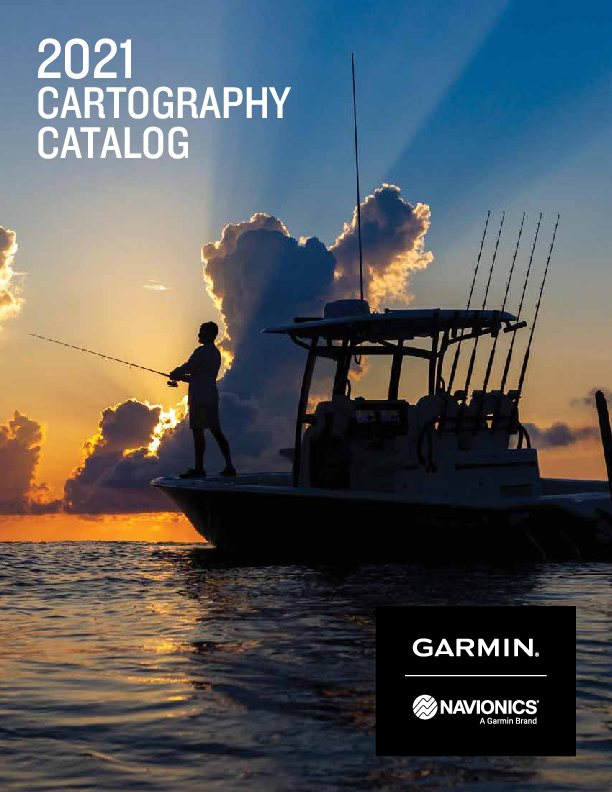
2021. CARTOGRAPHY CATALOG. ... Highly detailed charts with Navionics data help mariners guide their boats in and out of port with confidence. ... Start out from day one with up-to-date charts. An included one-year subsc…
Full PDF Document

If the inline viewer fails, it will open the original document in compatibility mode automatically. You can also open the file directly.
Extracted Text
2021
CARTOGRAPHY CATALOG

CONTENTS
BlueChart� Coastal Charts 04
LakeV� Inland Maps 06
Canada LakeV� G3 08
ActiveCaptain� App 09
New Chart Guarantee 10
How to Read Your Product ID Code 10
Inland Maps . . . . . . . . . . . . . . . . . . . . . . . . . . . . . . . . . . . . . . . . . . . . . . . . . . . . 12
Coastal Charts . . . . . . . . . . . . . . . . . . . . . . . . . . . . . . . . . . . . . . . . . . . . . . . . . . 16
United States 18 Canada . . . . . . . . . . . . . . . . . . . . . . . . . . . . . . . . . . . . . . . . . . . . . . . . . . . . . 24 Caribbean . . . . . . . . . . . . . . . . . . . . . . . . . . . . . . . . . . . . . . . . . . . . . . . . . . . 26 South America 27 Europe . . . . . . . . . . . . . . . . . . . . . . . . . . . . . . . . . . . . . . . . . . . . . . . . . . . . . 28 Africa . . . . . . . . . . . . . . . . . . . . . . . . . . . . . . . . . . . . . . . . . . . . . . . . . . . . . . 39 Asia . . . . . . . . . . . . . . . . . . . . . . . . . . . . . . . . . . . . . . . . . . . . . . . . . . . . . . . 40 Australia/New Zealand 42 Pacific Islands 45 Standard Mapping  46 Pricing . . . . . . . . . . . . . . . . . . . . . . . . . . . . . . . . . . . . . . . . . . . . . . . . . . . . . 48
Navionics� . . . . . . . . . . . . . . . . . . . . . . . . . . . . . . . . . . . . . . . . . . . . . . . . . . . . . 54
Navionics�+ Cartography 56
Platinum Cartography 57
North America 58 South America 63 Europe . . . . . . . . . . . . . . . . . . . . . . . . . . . . . . . . . . . . . . . . . . . . . . . . . . . . . 65 Middle East and Africa 70 Asia and Pacific 73 Australia and New Zealand 74 Pricing . . . . . . . . . . . . . . . . . . . . . . . . . . . . . . . . . . . . . . . . . . . . . . . . . . . . . 77

BLUECHART� COASTAL CHARTS

featuring

Worldwide coverage available

BLUECHART� G3
Experience unparalleled coverage and brilliant detail when you're on the water. BlueChart g3 coastal charts provide exceptional coverage, clarity and detail with integrated Garmin and Navionics� content. The charts also display suggested routes with Auto Guidance1.

ADVANCED CHART DETAIL

DETAILED CONTOURS

RASTER CARTOGRAPHY

BLUECHART� COASTAL CHARTS

Worldwide coverage available

featuring

HIGH-RESOLUTION RELIEF SHADING

BLUECHART� G3 VISION
BlueChart g3 Vision is our premium chart offering, which includes all the reliability, functionality and integrated Garmin and Navionics� content of BlueChart g3 while adding even more exceptional features such as high-resolution relief shading to help you along your journeys.

AERIAL PHOTOGRAPHY

HIGH-RESOLUTION SATELLITE IMAGERY

Highly detailed charts with Navionics data help mariners guide their boats in and out of port with confidence.

Up to 1' contours provide a more accurate depiction of bottom structure for improved fishing charts and enhanced detail in swamps, canals and port plans.

AUTO GUIDANCE

Download NOAA raster areas for free via the ActiveCaptain� app to your compatible smartphone to provide enhanced clarity and consistency.
DEPTH RANGE SHADING

Highly detailed shading combines color and shadow to provide an easy-to-interpret, clearer view of bottom structure than contour lines alone.
3-D VIEWS

Pictures show exceptional detail of many ports, harbors

High-resolution satellite imagery overlaid onto navigational

and marinas. This is ideal when entering unfamiliar areas. charts provides a realistic view of your surroundings.

SHALLOW WATER SHADING

Auto Guidance1 technology calculates a suggested route to your destination.

Select depth range shading for up to 10 depth ranges to view your target depth at a glance.

MarinersEye and FishEye views provide 3-D representations of the surrounding area above and below the waterline.

Shallow water shading for a user-defined depth gives a clear picture of shallow waters to avoid.

04

GARMIN.COM

1Auto Guidance is for planning purposes only and does not replace safe navigation operations. Not all chart features will display on all devices, particularly legacy devices. As engineering enhancements are ongoing, new features may not display on such legacy products as well.

1Auto Guidance is for planning purposes only and does not replace safe navigation operations

GARMIN.COM

05

LAKEV� INLAND MAPS
featuring

LAKEV� G3
LakeV� g3 inland maps provide exceptional coverage, clarity and detail with integrated Garmin and Navionics� content. The charts also display suggested routes with Auto Guidance1. You'll get coverage on more than 18,000 lakes with up to 1' contours.

1' CONTOURS

AUTO GUIDANCE

DEPTH RANGE/SHALLOW WATER SHADING

HIGH-RESOLUTION RELIEF SHADING

LAKEV� INLAND MAPS
featuring
LAKEV� G3 ULTRA
Our premium inland map collection, divided into East and West regions, includes all the exceptional features of LakeV� g3, while adding extra mapping features.

SONAR IMAGERY

DYNAMIC LAKE LEVEL

Up to 1' contours provide a detailed and clear view of the the lake floor so you can catch more fish and navigate with confidence.

Auto Guidance1 technology calculates a suggested route to your destination.

High-resolution depth range shading for up to 10 depth ranges and shallow water shading for a user-defined depth gives a clear picture of shallow waters to avoid.

Highly-detailed shading combines color and shadow to provide an easy-to-interpret, clearer view of bottom structure than contour lines alone.

The sonar imagery feature reveals changes to bottom hardness clearly and in bright color, highlighting both subtle and dramatic transition areas on 115 U.S. lakes.

Adjust your maps to the lake's current water levels to see if spots are accessible or too shallow to explore.

SURFACE PHOTOS

SIDE SCAN

Get a better sense of your surroundings above the waterline with photos of docks, boat ramps, bridges, dams, and more.

Check out submerged features such as fallen timber, fish attractors, wrecks, and more.

06

GARMIN.COM

1Auto Guidance is for planning purposes only and does not replace safe navigation operations

GARMIN.COM

07

CANADA LAKEV� G3
featuring
Canada LakeV� g3 gives you coverage on more than 13,000 total lakes, 4,800 of which are HD maps with up to 1' contours that provide clearer lake floor views, allowing you to catch more fish and navigate with confidence Auto Guidance feature shows the suggested route to a destination1 Depth Range Shading enables you to view your target depth at a glance for up to 10 depth ranges Shallow Water Shading lets you input and shade a minimum depth to help you avoid running aground Displays detailed shorelines and coastlines as well as underwater features such as riverbeds, fish attractors and potential hazards
CANADA LAKEV� G3 ULTRA
Our premium inland maps for Canada include everything available with Canada LakeV� g3 and more: High-resolution Relief Shading to make it easier to see contours and find fish holding structure Unique 3-D views such as MarinersEye and FishEye for additional perspective above and below the waterline Dynamic Lake Level adjusts the map based on current water levels
STANDARD MAPPING�
Standard Mapping cartography is compatible with select Garmin chartplotters and MFDs. These accessory cards provide highly detailed, locally sourced data with rich updated imagery to help you navigate your favorite areas with confidence. Available regions include Texas, Louisiana, Mississippi, Alabama and Florida. Choose from classic, premium or professional accessory cards.

08

GARMIN.COM

1Auto Guidance is for planning purposes only and does not replace safe navigation operations. Not all map features will display on all devices, particularly legacy devices. As engineering enhancements are ongoing, new features may not display on such legacy products.

ACTIVECAPTAIN� APP
Give yourself the advantages of the ultimate connected boating experience. Download the free all-in-one ActiveCaptain app to your compatible smartphone. It provides you with a powerful connection to your Garmin chartplotter, charts, maps and the community. Wherever you are, you can have unlimited access to your cartography, purchase new maps and charts, and access the Garmin QuickdrawTM Contours Community.

SPECIAL ACTIVECAPTAIN FEATURES
OneChartTM gives you access to all your charts and maps from your mobile device and lets you purchase new ones Receive smart notifications, such as calls and texts, on your chartplotter display when paired with the app Download software updates and notifications from the app directly to your Garmin devices Connect to fellow boaters with the ActiveCaptain community for up-to-date feedback on marinas and other points of interest Make, save and transfer routes and waypoints between the app and chartplotter -- with zero button presses1 Easily upload and download the latest Garmin QuickdrawTM Contours content from the community -- with zero button presses1 View and control your chartplotter from your smartphone or tablet Use with the OnDeckTM remote connectivity system to track, monitor and control up to 5 switches on your boat from virtually anywhere
�Zero button presses applies to GPSMAP� chartplotters

GARMIN.COM

09

NEW CHART GUARANTEE

NEW CHART GUARANTEE
Customers who purchase new preprogrammed Garmin BlueChart� g3 or BlueChart� g3 Vision microSDTM cards are entitled to one free update1 of the newest version of charts. If eligible, customers can update cards using our website. Updated charts will be for the same (or equivalent2) region as the original purchase.
DISCOUNTED CARD UPDATE PROGRAM
Customers may update their existing preprogrammed BlueChart g3 and BlueChart g3 Vision microSDTM card for a discounted price2. Updated charts will be for the same (or equivalent2) region as the original purchase.
HOW TO READ YOUR PRODUCT ID CODE

HXXXYYYZ VXXYYYZ

REGION

REGION NUMBER

BLUECHART G3 (HX) BLUECHART G3 VISION (V)

SIZE OF COVERAGE

REGION (XX) CODES INCLUDE:
AE = Asia, East (Japan, China, Indonesia, etc.) AF = Africa AW = Asia, West CA = Canada

EU = Europe (including all Mediterranean Sea)
PC = Pacific Ocean (Australia, New Zealand, etc.)
SA = South America
US = United States and the Caribbean

SIZE OF COVERAGE (Z) CODES INCLUDE:

X = X-Large

S = Small

L = Large

P = Petite

R = Regular

F = Fishing

10

GARMIN.COM

1Limit one free update per card. New Chart Guarantee valid within 12 months of purchase.
2Equivalent region to be determined at the sole discretion of Garmin. Customer will have an opportunity to view available coverage before purchasing and/or updating.

PRODUCT� NAME

GARMIN.COM

11

INLAND MAPS

UNITED STATES

CANADA

Region CA100F

Title Canada

UNITED STATES WEST

Region US100F US106F US107F

Title United States United States East United States West

14

GARMIN.COM

UNITED STATES EAST
LakeV� g3 ID Code LUS100F

LakeV� g3 Ultra ID Code
LVUS106F LVUS107F

LakeV� g3 ID Code LCA100F

LakeV� g3 Ultra ID Code LVCA100F

GARMIN.COM

15

COASTAL CHARTS

UNITED STATES

UNITED STATES ALL AND CANADIAN WEST COAST

Region US604X

Title US All and Canadian West Coast

BlueChart� g3 ID Code HXUS604X

18

GARMIN.COM

UNITED STATES WEST COAST

Region US021R US027R US037R

Title California-Mexico Hawaiian Islands-Mariana Islands Vancouver-San Diego

BlueChart� g3 ID Code HXUS021R HXUS027R

BlueChart� g3 Vision ID Code VUS021R VUS027R VUS037R

GARMIN.COM

19

GULF OF MEXICO

Region US011R US012R US013R US014R US515L

Title Southwest Florida Tampa-New Orleans Mobile-Lake Charles Morgan City-Brownsville Brownsville-Key Largo

20

GARMIN.COM

BlueChart� g3 Vision ID Code VUS011R VUS012R VUS013R VUS014R VUS515L

UNITED STATES SOUTHEAST COAST

Region US008R US009R US513L

Title Charleston-Jacksonville Jacksonville-Key West Jacksonville-Bahamas

BlueChart� g3 Vision ID Code VUS008R VUS009R VUS513L

GARMIN.COM

21

UNITED STATES NORTHEAST COAST AND BERMUDA

Region US001R US002R US003R US004R US007R US038R US048R US510L US511L US512L

Title North Maine South Maine Cape Cod New York Norfolk-Charleston New York-Chesapeake Bermuda St. John-Cape Cod Boston-Norfolk Mid-Atlantic

BlueChart� g3 ID Code HXUS048R

22

GARMIN.COM

BlueChart� g3 Vision ID Code VUS001R VUS002R VUS003R VUS004R VUS007R VUS038R VUS048R VUS510L VUS511L VUS512L

UNITED STATES ALASKA

Region US024R US025R US026R US033R US034R US035R US517L

Title Wrangell-Dixon Entrance Anchorage-Juneau Wrangell-Juneau-Sitka Bristol Bay-Kotzebue Snd. Aleutian Islands North Slope Alaska Alaska South

BlueChart� g3 Vision ID Code VUS024R VUS025R VUS026R VUS033R VUS034R VUS035R VUS517L

GARMIN.COM

23

CANADA

CANADA WEST

CANADA

Region CA600X US020R

Title Canada St. Lawrence Seaway

BlueChart� g3 ID Code HXCA600X

BlueChart� g3 Vision ID Code VUS020R

Region CA018R CA019R CA501L

Title Inside-Outside Passage Hecate Strait Puget Sound-Dixon Entrance

CANADA EAST

Region

Title

CA004R Bay of Fundy

BlueChart� g3 Vision ID Code
VCA004R

CA005R Halifax-Cape Breton

VCA005R

CA006R P.E.I.-Chaleur Bay

VCA006R

CA007R Les Mechins-St. George's Bay VCA007R

CA008R Newfoundland West

VCA008R

CA013R Labrador Coast

VCA013R

BlueChart� g3 Vision ID Code VCA018R VCA019R VCA501L

24

GARMIN.COM

GARMIN.COM

25

CARIBBEAN

SOUTH AMERICA

CARIBBEAN

Region US010R US029R US030R US031R US032R

Title Southeast Florida and Bahamas Southern Bahamas Southeast Caribbean Southwest Caribbean Southern Gulf of Mexico

26

GARMIN.COM

BlueChart� g3 ID Code
HXUS029R HXUS030R HXUS031R HXUS032R

BlueChart� g3 Vision ID Code VUS010R VUS029R VUS030R VUS031R VUS032R

SOUTH AMERICA

Region SA001R SA002R SA009R SA400S SA600X

Title South America East Coast South America West Coast Amazon River Rio de la Plata South America

BlueChart� g3 ID Code HXSA001R HXSA002R HXSA009R HXSA400S HXSA600X

BlueChart� g3 Vision ID Code VSA001R VSA002R VSA009R

GARMIN.COM

27

EUROPE

NORDICS ONE

Region EU054R EU721L

Title Vestfjd-Svalbard-Varanger Northern Europe

28

GARMIN.COM

BlueChart� g3 ID Code HXEU054R

BlueChart� g3 Vision ID Code VEU054R VEU721L

NORDICS TWO

Region EU018R EU019R EU021R EU041R EU042R EU046R EU047R EU050R EU051R EU052R EU053R EU055R

Title Benelux Offshore and Inland Waters Aalborg-Amsterdam Denmark East & Sweden SE Oslo-Skagerak-Haugesund Oslo-Trelleborg Sweden, South-East Gulf of Bothnia-Kalix-Grisslehamn Gulfs of Finland and Riga Lista-Sognefjorden Sognefjorden-Svefjorden Trondheim-Troms� Finnish Lakes

BlueChart� g3 ID Code HXEU018R HXEU019R HXEU021R HXEU041R HXEU042R HXEU046R HXEU047R HXEU050R HXEU051R HXEU052R HXEU053R HXEU055R

BlueChart� g3 Vision ID Code VEU018R VEU019R VEU021R VEU041R VEU042R VEU046R VEU047R VEU050R VEU051R VEU052R VEU053R VEU055R

GARMIN.COM

29

NORDICS THREE

Region EU469S EU471S EU472S EU473S EU488S EU489S EU491S EU492S

Title Stockholm and M�laren Gulf of Bothnia, South Gulf of Bothnia, Center Gulf of Bothnia, North Keitele-Paijanne-Tampere Kuopio-Lappeenranta Hanko-St. Petersburg-Tallinn Kristinestad-Hanko

30

GARMIN.COM

BlueChart� g3 Vision ID Code VEU469S VEU471S VEU472S VEU473S VEU488S VEU489S VEU491S VEU492S

NORDICS FOUR

Region EU458S EU459S EU065R EU468S EU469S EU470S EU474S EU507S EU508S

Title G�teborg-Fyn �rhus-Kiel-Koszalin Baltic Sea, East Coast Sodertalje-Trelleborg Stockholm & M�laren Stromstad-Halmstad Northern Denmark and the Eider Oslo-Mandal-Smogen Kristiansand-Haugesund-Ryfylke

BlueChart� g3 ID Code HXEU065R

BlueChart� g3 Vision ID Code VEU458S VEU459S VEU065R VEU468S VEU469S VEU470S VEU474S VEU507S VEU508S

GARMIN.COM

31

GREENLAND

Region EU043R EU064R

Title Iceland-Orkney Greenland

32

GARMIN.COM

BlueChart� g3 ID Code HXUE043R HXEU064R

BlueChart� g3 Vision ID Code VUE043R VEU064R

EUROPE ATLANTIC COAST ONE

Region EU001R EU002R EU003R EU004R EU005R EU006R EU008R EU009R EU060R EU061R EU722L

Title English Channel S/E England-Belux Inland Waters Great Britain, Northeast Coast Irish Sea Ireland, West Coast Scotland, West Coast Bay of Biscay Portugal and Northwest Spain Germany Inland Waters France Inland Waters Europe Atlantic Coast

BlueChart� g3 ID Code HXEU001R HXEU002R HXEU003R HXEU004R HXEU005R HXEU006R HXEU008R HXEU009R HXEU060R HXEU061R

BlueChart� g3 Vision ID Code VEU001R VEU002R VEU003R VEU004R VEU005R VEU006R VEU008R VEU009R VEU060R VEU061R VEU722L

GARMIN.COM

33

EUROPE ATLANTIC COAST TWO

Region
EU454S EU455S EU456S EU457S EU461S EU463S EU464S EU465S EU466S EU467S EU479S EU482S EU483S EU484S EU485S EU486S EU500S EU502S

Title
Barcelona and Valencia Alicante-Cabo de Sao Vicente English Channel, Central-East Bretagne Thames Estuary Bristol Channel & England S/W Penmarch-Les Sables d'Olonne La Baule-San Sebastian Golfe Du Lion-San Remo Blackpool-Cardiff Portugal Wexford-Dingle Bay Galway Bay-Cork Ireland North-West Fuenterrabia-Gijon Galicia and Asturias Blyth-Lowestoft Azores Islands

34

GARMIN.COM

BlueChart� g3 Vision ID Code
VEU454S VEU455S VEU456S VEU457S VEU461S VEU463S VEU464S VEU465S VEU466S VEU467S VEU479S VEU482S VEU483S VEU484S VEU485S VEU486S VEU500S VEU502S

BLACK SEA

Region EU509S EU510S EU063R

Title Danube River Dnieper River and Sea of Azov Black Sea and Sea of Azov

BlueChart� g3 ID Code HXEU063R

BlueChart� g3 Vision ID Code VEU509S VEU510S VEU063R

GARMIN.COM

35

MEDITERRANEAN

Region EU010R EU014R EU015R EU016R EU723L

Title Spain, Mediterranean Coast Italy, Adriatic Sea Aegean Sea & Sea of Marmara Mediterranean Southeast Southern Europe

36

GARMIN.COM

BlueChart� g3 ID Code HXEU010R HXEU014R HXEU015R HXEU016R

BlueChart� g3 Vision ID Code VEU010R VEU014R VEU015R VEU016R VEU723L

MEDITERRANEAN TWO

Region EU012R EU013R EU450S EU451S EU452S EU453S EU460S EU490S EU506S

Title Mediterranean Sea, Central West Italy Southwest & Tunisia Athens & Cyclades Ligurian Sea-Corsica & Sardinia Adriatic Sea, North Coast Adriatic Sea, South Coast Sicily-Lido di Ostia Greece West Coast & Athens Crete-Cyprus

BlueChart� g3 ID Code HXEU012R HXEU013R

BlueChart� g3 Vision ID Code VEU012R VEU013R VEU450S VEU451S VEU452S VEU453S VEU460S VEU490S VEU506S

GARMIN.COM

37

AFRICA

RUSSIA

Region EU062R EU068R EU069R EU070R

Title Russian Inland Waterways White Sea Caspian-Ulyanovsk-Orsk Baykal & Novosibirskoe

38

GARMIN.COM

BlueChart� g3 ID Code HXEU062R HXEU068R HXEU069R HXEU070R

AFRICA
Region AF001R AF002R AF003R AF450S AF451S AF452S AF453S

Title Eastern Africa South Africa Western Africa Madeira and Canary Islands Namibia-Knysna, SA Knysna, SA-Beira, MZ Mascarene Plateau and Madagascar

BlueChart� g3 ID Code HXAF001R HXAF002R HXAF003R

BlueChart� g3 Vision ID Code VAF001R AF002R AF003R VAF450S VAF451S VAF452S VAF453S

GARMIN.COM

39

ASIA

WESTERN ASIA

Region AW003R AW005R AW450S AW451S

Title Indian Subcontinent The Gulf & Red Sea The Gulf Red Sea

40

GARMIN.COM

BlueChart� g3 ID Code HXAW003R HXAW005R

BlueChart� g3 Vision ID Code VAW003R VAW005R VAW450S VAW451S

EASTERN ASIA

Region AE002R AE003R AE004R AE005R AE006R AE009R

Title Yellow Sea Taiwan South China Sea Philippines-Java-Mariana Is. Timor-Leste-New Guinea Singapore/Malaysia/Indonesia

BlueChart� g3 ID Code HXAE002R HXAE003R HXAE004R HXAE005R HXAE006R HXAE009R

BlueChart� g3 Vision ID Code VAE002R VAE003R VAE004R VAE005R VAE006R VAE009R

GARMIN.COM

41

AUSTRALIA/NEW ZEALAND

AUSTRALIA/NEW ZEALAND ONE

Region PC020R PC021R PC022R

Title Brisbane SW-Geraldton Mackay NW-Esperance East Coast Australia

42

GARMIN.COM

BlueChart� g3 Vision ID Code VPC020R VPC021R VPC022R

AUSTRALIA AND NEW ZEALAND

Region PC023R PC024R PC416S PC417S

Title New Zealand Australia & New Zealand New Zealand North New Zealand South

BlueChart� g3 ID Code HXPC023R HXPC024R HXPC416S HXPC417S

BlueChart� g3 Vision ID Code VPC023R
VPC416S VPC417S

GARMIN.COM

43

PACIFIC ISLANDS

AUSTRALIA

Region PC410S PC411S PC412S PC413S PC414S PC415S

Title Esperance-Exmouth Bay Geraldton-Darwin Admiralty Gulf WA-Cairns Mornington Island-Hervey Bay Mackay-Twofold Bay Port Stephens-Fowlers Bay

44

GARMIN.COM

BlueChart� g3 ID Code HXPC410S HXPC411S HXPC412S HXPC413S HXPC414S HXPC415S

BlueChart� g3 Vision ID Code VPC410S VPC411S VPC412S VPC413S VPC414S VPC415S

PACIFIC ISLANDS

Region PC018R PC019R

Title New Caledonia-Fiji Polynesia

BlueChart� g3 ID Code HXPC018R HXPC019R

BlueChart� g3 Vision ID Code VPC018R VPC019R

GARMIN.COM

45

STANDARD MAPPING
Available as an accessory card for Garmin marine chartplotters, Standard Mapping offers coastal aerial overlay and provides high-resolution imagery and local names of waterways and land features. Classic version offers high-resolution aerial imagery, high-definition offshore mapping and local names. Premium includes offshore field lease blocks, recommended routes and wildlife management areas. Professional adds oyster leases, artificial reefs, and state and federal offshore boundaries.

FLORIDA ONE

FLORIDA EAST PENINSULA FLORIDA KEYS

STANDARD MAPPING

MISSISSIPPI SOUND

LOUISIANA ONE

LOUISIANA EAST

LOUISIANA CENTRAL

LOUISIANA WEST

TEXAS ONE

FLORIDA WEST PENINSULA EMERALD COAST

46

GARMIN.COM

GULF COAST

TEXAS EAST

TEXAS WEST

GARMIN.COM

47

PRICING

Region US100F US106F US107F CA100F

Title United States United States East United States West Canada

ID Code LUS100F
LCA100F

LakeV� g3 Part Number 010-C1087-00
010-C1113-00

MSRP

ID Code

$149.99

LVUS106F

LVUS107F

$149.99 LVCA100F

LakeV� g3 Ultra Part Number

MSRP

010-C1204-00 010-C1205-00 010-C1114-00

$199.99 $199.99 $199.99

Region AE002R AE003R AE004R AE005R AE006R AE009R AE300P AF001R AF002R AF003R AF450S AF451S AF452S
AF453S
AW003R AW005R AW450S AW451S CA004R CA005R CA006R CA007R CA008R

Title

ID Code

Yellow Sea

HXAE002R

Taiwan

HXAE003R

South China Sea

HXAE004R

Philippines-Java-Mariana Is. HXAE005R

Timor Leste-New Guinea

HXAE006R

Sin/Mal/Indonesia

HXAE009R

Myanmar

HXAE300P

Eastern Africa

HXAF001R

South Africa

HXAF002R

Western Africa

HXAF003R

Madeira & Canary Islands

Namibia-Knysna, SA

Knysna, SA-Beira, MZ
Mascarene Plateau & Madagascar
Indian Subcontinent

HXAW003R

The Gulf & Red Sea

HXAW005R

The Gulf

Red Sea

Bay of Fundy

Halifax-Cape Breton

P.E.I.-Chaleur Bay

Les Mechins-St. George's Bay

Newfoundland West

BlueChart� g3 Part Number 010-C0877-20 010-C0878-20 010-C0879-20 010-C0880-20 010-C0881-20 010-C0884-20 010-C1120-20 010-C0747-20 010-C0748-20 010-C0749-20
010-C0755-20 010-C0924-20

MSRP

ID Code

$159.99 VAE002R

$159.99 VAE003R

$159.99 VAE004R

$159.99 VAE005R

$159.99 VAE006R

$159.99 VAE009R

$99.99

$129.99 VAF001R

$129.99 VAF002R

$129.99 VAF003R

VAF450S

VAF451S

VAF452S

BlueChart� g3 Vision

Part Number

MSRP

010-C0877-00

$349.99

010-C0878-00

$349.99

010-C0879-00

$349.99

010-C0880-00

$349.99

010-C0881-00

$349.99

010-C0884-00

$349.99

010-C0747-00 010-C0748-00 010-C0749-00 010-C0750-00 010-C0751-00 010-C0752-00

$249.99 $249.99 $249.99 $174.99 $174.99 $174.99

VAF453S

010-C1152-00

$174.99

$129.99 VAW003R $129.99 VAW005R
VAW450S VAW451S VCA004R VCA005R VCA006R VCA007R VCA008R

010-C0755-00 010-C0924-00 010-C0758-00 010-C0759-00 010-C0690-00 010-C0691-00 010-C0692-00 010-C0693-00 010-C0694-00

$249.99 $249.99 $174.99 $174.99 $349.99 $349.99 $349.99 $349.99 $349.99

48

GARMIN.COM

Region CA013R CA018R CA019R CA501L CA600X EU001R EU002R EU003R EU004R EU005R EU006R EU008R EU009R EU010R
EU012R
EU013R EU014R
EU015R
EU016R EU018R EU019R EU041R EU042R EU043R EU046R EU047R EU050R EU051R EU052R EU053R EU054R EU055R EU060R EU061R EU062R EU063R

Title

ID Code

Labrador Coast

Inside-Outside Passage

Hecate Strait

Puget Sound-Dixon Entrance

Canada

HXCA600X

English Channel

HXEU001R

S/E UK-Belux Inland Waters HXEU002R

Great Britain, Northeast Coast HXEU003R

Irish Sea

HXEU004R

Ireland, West Coast

HXEU005R

Scotland, West Coast

HXEU006R

Bay of Biscay

HXEU008R

Portugal & Northwest Spain HXEU009R

Spain, Mediterranean Coast
Mediterranean Sea, CentralWest
Italy Southwest & Tunisia

HXEU010R HXEU012R HXEU013R

Italy, Adriatic Sea
Aegean Sea & Sea of Marmara
Mediterranean Southeast

HXEU014R HXEU015R HXEU016R

Benelux Offshore and Inland HXEU018R

Alborg-Amsterdam

HXEU019R

Oslo-Skagerak-Haugesund HXEU041R

Oslo-Trelleborg

HXEU042R

Iceland to Orkney

HXEU043R

Sweden, South-East

HXEU046R

Gulf of Bothnia

HXEU047R

Gulfs of Finland and Riga

HXEU050R

Lista-Sognefjorden

HXEU051R

Sognefjorden-Svefjorden

HXEU052R

Trondheim-Tromso

HXEU053R

Vestfjd-Svalbard-Varanger

HXEU054R

Finnish Lakes

HXEU055R

Germany Inland Waters

HXEU060R

France Inland Waters

HXEU061R

Russian Inland Waterways HXEU062R

Black Sea & Azov Sea

HXEU063R

BlueChart� g3 Part Number
010-C1019-20 010-C0760-20 010-C0761-20 010-C0762-20 010-C0763-20 010-C0764-20 010-C0765-20 010-C0766-20 010-C0767-20 010-C0768-20 010-C0770-20 010-C0771-20 010-C0772-20 010-C0773-20 010-C0774-20 010-C0775-20 010-C0776-20 010-C0778-20 010-C0779-20 010-C0780-20 010-C0782-20 010-C0783-20 010-C0786-20 010-C0787-20 010-C0788-20 010-C0789-20 010-C0790-20 010-C0791-20 010-C1103-20 010-C1104-20 010-C1048-20 010-C1064-20

MSRP

ID Code

VCA013R

VCA018R

VCA019R

VCA501L

$219.99

$129.99 VEU001R

$129.99 VEU002R

$129.99 VEU003R

$129.99 VEU004R

$129.99 VEU005R

$129.99 VEU006R

$129.99 VEU008R

$129.99 VEU009R

$129.99 VEU010R

$129.99 VEU012R

$129.99 VEU013R $129.99 VEU014R

$129.99 VEU015R

$129.99 VEU016R $129.99 VEU018R $129.99 VEU019R $129.99 VEU041R $129.99 VEU042R $129.99 VEU043R $129.99 VEU046R $129.99 VEU047R $129.99 VEU050R $129.99 VEU051R $129.99 VEU052R $129.99 VEU053R $129.99 VEU054R $129.99 VEU055R $129.99 VEU060R $129.99 VEU061R $129.99 $129.99 VEU063R

BlueChart� g3 Vision

Part Number

MSRP

010-C0698-00

$349.99

010-C1105-00

$349.99

010-C1106-00

$349.99

010-C0701-00

$449.99

010-C0760-00 010-C0761-00 010-C0762-00 010-C0763-00 010-C0764-00 010-C0765-00 010-C0766-00 010-C0767-00 010-C0768-00 010-C0770-00 010-C0771-00 010-C0772-00 010-C0773-00 010-C0774-00 010-C0775-00 010-C0776-00 010-C0778-00 010-C0779-00 010-C0780-00 010-C0782-00 010-C0783-00 010-C0786-00 010-C0787-00 010-C0788-00 010-C0789-00 010-C0790-00 010-C0791-00 010-C1103-00 010-C1104-00

$249.99 $249.99 $249.99 $249.99 $249.99 $249.99 $249.99 $249.99 $249.99 $249.99 $249.99 $249.99 $249.99 $249.99 $249.99 $249.99 $249.99 $249.99 $249.99 $249.99 $249.99 $249.99 $249.99 $249.99 $249.99 $249.99 $249.99 $249.99 $249.99

010-C1064-00

$249.99

GARMIN.COM

49

Region EU064R EU065R EU066R EU067R EU068R EU069R EU070R EU450S EU451S EU452S EU453S EU454S EU455S EU456S EU457S EU460S EU461S EU463S
EU464S EU465S EU466S EU467S EU468S EU469S EU470S EU474S EU479S EU482S EU483S EU484S EU485S EU488S EU489S EU490S EU500S

Title

ID Code

Greenland

HXEU064R

Baltic Sea, East Coast

HXEU065R

Alpine Lakes

HXEU066R

Sweden Inland Waters

HXEU067R

White Sea

HXEU068R

Caspian-Ulyanovsk-Orsk

HXEU069R

Baykal & Novosibirskoe

HXEU070R

Athens & Cyclades
Ligurian Sea-Corsica & Sardinia
Adriatic Sea, North Coast

Adriatic Sea, South Coast

Barcelona & Valencia

Alicante-Cabo de Sao Vicente

English Channel, Central-East

Bretagne

Sicily-Lido de Ostia

Thames Estuary
Bristol Channel & England S/W Penmarch-Les Sables d'Olonne
La Baule-San Sebastian

Golfe Du Lion-San Remo

Blackpool-Cardiff

Sodertalje-Trelleborg

Stockholm & M�laren

Stromstad-Halmstad
Northern Denmark and the Eider
Portugal

Wexford-Dingle Bay

Galway Bay-Cork

Ireland North-West

Fuenterrabia-Gijon

Keitele-Paijanne-Tampere

Kuopia-Lappeenranta

Greece West Coast & Athens

Blyth-Lowestoft

BlueChart� g3 Part Number 010-C1001-20 010-C0849-20 010-C1208-20 010-C1209-20 010-C1210-20 010-C1211-20 010-C1212-20

MSRP

ID Code

$129.99 VEU064R

$129.99 VEU065R

$129.99

$129.99

$129.99

$129.99

$129.99

VEU450S

VEU451S

VEU452S VEU453S VEU454S VEU455S VEU456S VEU457S VEU460S VEU461S

VEU463S

BlueChart� g3 Vision

Part Number

MSRP

010-C1001-00

$249.99

010-C0849-00

$249.99

010-C0794-00 010-C0795-00 010-C0796-00 010-C0797-00 010-C0798-00 010-C0799-00 010-C0800-00 010-C0801-00 010-C0804-00 010-C0805-00 010-C0807-00

$174.99 $174.99 $174.99 $174.99 $174.99 $174.99 $174.99 $174.99 $174.99 $174.99 $174.99

VEU464S VEU465S VEU466S VEU467S VEU468S VEU469S VEU470S VEU474S VEU479S VEU482S VEU483S VEU484S VEU485S VEU488S VEU489S VEU490S VEU500S

010-C0808-00 010-C0809-00 010-C0810-00 010-C0811-00 010-C0812-00 010-C0813-00 010-C0814-00 010-C0818-00 010-C0823-00 010-C0826-00 010-C0827-00 010-C0828-00 010-C0829-00 010-C0832-00 010-C0833-00 010-C0834-00 010-C0844-00

$174.99 $174.99 $174.99 $174.99 $174.99 $174.99 $174.99 $174.99 $174.99 $174.99 $174.99 $174.99 $174.99 $174.99 $174.99 $174.99 $174.99

50

GARMIN.COM

Region EU502S EU506S EU507S
EU508S
EU509S EU510S EU722L EU723L PC018R PC019R PC020R PC021R PC022R PC023R PC024R PC410S PC411S PC412S PC413S PC414S PC415S PC416S PC417S SA001R SA002R SA009R SA400S SA600X US001R US002R US003R US004R US007R US008R US009R
US010R

Title Azores Islands Crete-Cyprus Oslo-Mandal-Smogen Kristiansand-HaugesundRyfylke Danube River Dnieper River and Azov Sea Europe Atlantic Coast Southern Europe New Caledonia-Fiji Polynesia Brisbane SW-Geraldton Mackay NW-Esperance East Coast Australia New Zealand Australia & New Zealand Esperance-Exmouth Bay Geraldton-Darwin Admiralty Gulf WA to Carins Mornington I.-Hervey Bay Mackay-Twofold Bay Port Stephens-Fowlers Bay New Zealand North New Zealand South South America East Coast South America West Coast Amazon River Rio de la Plata South America North Maine South Maine Cape Cod New York Norfolk-Charleston Charleston to Jacksonville Jacksonville to Key West South Florida and North Bahamas

ID Code
HXPC018R HXPC019R
HXPC024R HXPC410S HXPC411S HXPC412S HXPC413S HXPC414S HXPC415S HXPC416S HXPC417S HXSA001R HXSA002R HXSA009R HXSA400S HXSA600X

BlueChart� g3 Part Number
010-C0865-20 010-C0866-20
010-C1020-20 010-C0868-20 010-C0869-20 010-C0870-20 010-C0871-20 010-C0872-20 010-C0873-20 010-C0874-20 010-C0875-20 010-C1062-20 010-C1063-20 010-C1066-20 010-C1111-20 010-C1067-20

MSRP

ID Code VEU502S VEU506S VEU507S

VEU508S

VEU509S VEU510S VEU722L VEU723L $159.99 VPC018R $159.99 VPC019R VPC020R VPC021R VPC022R VPC023R $159.99 $84.99 VPC410S $84.99 VPC411S $84.99 VPC412S $84.99 VPC413S $84.99 VPC414S $84.99 VPC415S $84.99 VPC416S $84.99 VPC417S $149.99 VSA001R $149.99 VSA002R $149.99 VSA009R $119.99 $219.99 VUS001R VUS002R VUS003R VUS004R VUS007R VUS008R VUS009R

VUS010R

BlueChart� g3 Vision

Part Number

MSRP

010-C0846-00

$174.99

010-C0850-00

$174.99

010-C1069-00

$174.99

010-C1070-00

$174.99

010-C1127-00 010-C1128-00 010-C1156-00 010-C1157-00 010-C0865-00 010-C0866-00 010-C0753-00 010-C0754-00 010-C0756-00 010-C0757-00

$174.99 $174.99 $349.99 $349.99 $249.99 $249.99 $249.99 $249.99 $249.99 $249.99

010-C0868-00 010-C0869-00 010-C0870-00 010-C0871-00 010-C0872-00 010-C0873-00 010-C0874-00 010-C0875-00 010-C1062-00 010-C1063-00 010-C1066-00

$189.99 $189.99 $189.99 $189.99 $189.99 $189.99 $189.99 $189.99 $349.99 $349.99 $349.99

010-C0702-00 010-C0703-00 010-C0704-00 010-C0705-00 010-C0708-00 010-C0709-00 010-C0710-00 010-C0711-00

$349.99 $349.99 $349.99 $349.99 $349.99 $349.99 $349.99 $349.99

GARMIN.COM

51

Region US011R US012R US013R US014R US020R US021R US024R US025R US026R US027R US029R US030R US031R US032R US033R US034R US035R US037R US038R US048R US510L US511L US512L US513L US515L US517L
US604X
WW001G

Title Southwest Florida Tampa-New Orleans Mobile-Lake Charles Morgan City-Brownsville Saint Lawrence Seaway California-Mexico Wrangell-Dixon Entrance Anchorage-Juneau Wrangell-Juneau-Sitka Hawaiian Is.-Mariana Is. Southern Bahamas Southeast Caribbean Southwest Caribbean Southern Gulf of Mexico Bristol Bay-Kotzebue Snd. Aleutian Islands North Slope Alaska Vancouver-San Diego New York-Chesapeake Bermuda St. John-Cape Cod Boston-Norfolk Mid-Atlantic Jacksonville-Bahamas Brownsville-Key Largo Alaska South United States All and Canadian West Coast BlueChart WorldWide

ID Code
HXUS021R
HXUS027R HXUS029R HXUS030R HXUS031R HXUS032R
HXUS048R
HXUS604X HXWW001G

BlueChart� g3 Part Number
010-C0722-20
010-C0728-20 010-C0730-20 010-C0731-20 010-C0732-20 010-C1154-20
010-C1024-20
010-C1018-20 010-C1137-20

MSRP

ID Code

VUS011R

VUS012R

VUS013R

VUS014R

VUS020R

$149.99 VUS021R

VUS024R

VUS025R

VUS026R

$149.99 VUS027R

$149.99 VUS029R

$149.99 VUS030R

$149.99 VUS031R

$149.99 VUS032R

VUS033R

VUS034R

VUS035R

VUS037R

VUS038R

$149.99 VUS048R

VUS510L

VUS511L

VUS512L

VUS513L

VUS515L

VUS517L

$219.99

$1,999.99

BlueChart� g3 Vision

Part Number

MSRP

010-C0712-00

$349.99

010-C0713-00

$349.99

010-C0714-00

$349.99

010-C0715-00

$349.99

010-C0721-00

$349.99

010-C0722-00

$349.99

010-C0725-00

$349.99

010-C0726-00

$349.99

010-C0727-00

$349.99

010-C0728-00

$349.99

010-C0730-00

$349.99

010-C0731-00

$349.99

010-C0732-00

$349.99

010-C0733-00

$349.99

010-C0734-00

$349.99

010-C0735-00

$349.99

010-C0736-00

$349.99

010-C1003-00

$349.99

010-C1004-00

$349.99

010-C1024-00

$349.99

010-C0739-00

$449.99

010-C0740-00

$449.99

010-C0741-00

$449.99

010-C0742-00

$449.99

010-C0744-00

$449.99

010-C0887-00

$449.99

STANDARD MAPPING

Title Florida One Florida Keys Florida East Peninsula Florida West Peninsula Emerald Coast Gulf Coast Mississippi Sound Louisiana One Louisiana East Louisiana Central Louisiana West Texas One Texas East Texas West

Classic

Part Number

Price

010-C1192-00

010-C1196-00

010-C1198-00

010-C1177-00

010-C1189-00

010-C1186-00

010-C1183-00

010-C1162-00

010-C1165-00

010-C1168-00

010-C1171-00

010-C1174-00

010-C1180-00

010-C1177-00

Premium

Part Number

Price

$299.99 010-C1193-00

$199.99 010-C1196-00

$199.99 010-C1199-00

$199.99 010-C1178-00

$199.99 010-C1190-00

$299.99 010-C1187-00

$199.99 010-C1184-00

$299.99 010-C1140-20

$199.99 010-C1166-00

$199.99 010-C1169-00

$199.99 010-C1172-00

$299.99 010-C1175-00

$199.99 010-C1181-00

$199.99 010-C1178-00

Professional

Part Number

Price

$399.99 010-C1194-00

$499.99

$299.99 010-C1197-00

$399.99

$299.99 010-C1200-00

$399.99

$299.99 010-C1179-00

$399.99

$299.99 010-C1191-00

$399.99

$399.99 010-C1188-00

$499.99

$299.99 010-C1185-00

$399.99

$249.99 010-C1164-00

$499.99

$299.99 010-C1167-00

$399.99

$299.99 010-C1170-00

$399.99

$299.99 010-C1173-00

$399.99

$399.99 010-C1176-00

$499.99

$299.99 010-C1182-00

$399.99

$299.99 010-C1179-00

$399.99

52

GARMIN.COM

GARMIN.COM

53

NAVIONICS

NAVIONICS�+ CARTOGRAPHY

Since Garmin and Navionics came together, we have been combining the best of our data and technology to produce superior cartography products for boaters all over the world. Navionics cartography is available on microSDTM cards for a variety of hardware brands. Plus, the same detailed marine and

lake charts can go beyond the helm via the Navionics Boating app on your Apple� or AndroidTM mobile device.
Start out from day one with up-to-date charts. An included one-year subscription provides access to daily updates and advanced features.

NAVIONICS+
Provides complete inshore to offshore marine content, plus rivers, bays, and more than 40,000 lakes around the world. Available in very large coverage areas or more localized chart cuts.

MARINE CHARTS AND LAKE MAPS

NAUTICAL CHART

SONARCHARTTM

COMMUNITY EDITS

Essential cartographic reference detail for cruising, sailing and fishing: port plans, safety depth contours, marine services, tides and currents, and navigation aids.

An HD bathymetry map featuring extraordinary bottom contour detail for marine and lake areas. Great for increasing awareness of shallow waters and for locating fishing areas at any depth level.

All kinds of valuable local information is constantly enhanced by users of the Navionics Boating app, such as seasonal buoys, lights, rocks, moorings, boat ramps, points of interest, restaurants and provisioning shops.

ADVANCED FEATURES

DOCK-TO-DOCK AUTOROUTING1

SONARCHART LIVE

ADVANCED MAP OPTIONS

PLOTTER SYNC

Head to your next destination with Dock-to-dock Autorouting, which calculates a suggested route based on chart data and your own boat settings.

Create your own maps on the fly. Watch new 1 ft/0.5 m HD bathymetry maps develop in real time as your boat moves along the water.

Change the way you view Navionics charts and focus on the details that matter most to you. Highlight shallow areas, adjust contour density or select a fishing range.

Transfer routes and markers, update charts and more between your plotter card and mobile app -- wirelessly. You can even activate or renew your card's subscription and upload sonar logs.

56

NAVIONICS.COM

NOTE: Navionics cards are not compatible with Garmin GPS chartplotters 1Autorouting is for planning purposes only and does not replace safe navigation operations

PLATINUM CARTOGRAPHY

PLATINUM OVERLAYS AND FEATURES
Designed with the most demanding boaters and serious anglers in mind, all the marine content of Navionics+ is enhanced with additional viewing options that take your boating experience to the next level.

SONARCHARTTM SHADING

RELIEF SHADING

PLATINUM+
MARINE CHARTS
Comprehensive coastal charts deliver premium content on oceans, major rivers and seas. Choose from coverage areas worldwide.
HOTMAPS PLATINUM
LAKE MAPS
A dedicated lakes product available only in U.S. and Canada. Five huge regions cover more than 24,000 lakes, ponds and reservoirs.

Created from SonarChart 1' contour data, varying shades of blue reveal changes in depth such as channels and drop-offs to improve situational awareness and give clear, visual cues to fish-holding structure.

The Navionics relief shading feature brings bottom detail to life, from shallow flats to deep offshore canyons, in a vivid, colorful representation that helps boaters gain a better understanding of bottom topography.

PANORAMIC PHOTOS

3D VIEW

Heading into a new marina can be less stressful when you have an understanding of the layout that only a picture can provide.

Dynamic 3D View allows you to customize your chart to highlight key features for a better awareness of your surroundings.

BOATING APP

The Navionics Boating app provides content and features that go where you go, including new SonarChart Shading and relief shading overlays. As a companion to the chartplotter or on its own, the app also delivers incredibly useful functionality such as GPX file sharing, AIS traffic monitoring, weather forecasts and more. The Boating app is available as a separate purchase for Apple� and AndroidTM devices and offers a free trial before subscribing.

NOTE: Navionics cards are not compatible with Garmin GPS chartplotters 1Autorouting is for planning purposes only and does not replace safe navigation operations

NAVIONICS.COM

57

NORTH AMERICA

Navionics+ Large ID Code NAV+NI

58

NAVIONICS.COM

Title US & Canada

Navionics+ Regions ID Code NAV+CA NAV+EA NAV+NO NAV+SO NAV+WE

Title Canada and Alaska U.S. East U.S. North U.S. South U.S. West

NAVIONICS.COM

59

Platinum+ Large ID Code 900P+ 901P+ 902P-2 903P-2 904P+ 905P+ 906P+ 907P+ 908P-2 911P-2 912P+ 913P+ 914P-2 915P-2 916P-2

60

NAVIONICS.COM

Title West Great Lakes East Great Lakes Nova Scotia-St Lawrence River Nova Scotia-Newfoundland US Northeast and Canyons US Mid Atlantic and Canyons US Southeast-Bahamas Gulf of Mexico Caribbean and Bermuda Mexico-Central America US West Coast and Hawaii Vancouver Island North BC-Baranof Island South Alaska NW Alaska-Aleutians

644

Platinum+ Small ID Code 630P+ 632P+ 634P+ 635P+ 637P+ 638P+ 642P+ 643P+ 644P+ 645P+

Title East Gulf of Mexico Florida Chesapeake Bay West Gulf of Mexico New Jersey-Delaware Puget Sound S Carolina-N Florida California & Oregon California South-Baja and Hawaii North Carolina

Platinum+ Small ID Code 646P+ 647P+ 648P+ 649P+ 651P+ 652P+ 673P+ 674P+ 699P+

Title Lake Michigan Lake Superior Lake Ontario Lake Erie and Saint Clair Central Gulf of Mexico Lake Huron Maine Boston-New York N Bahamas

NAVIONICS.COM

61

SOUTH AMERICA

HotMaps Platinum ID Code HMPT-C6 HMPT-E6 HMPT-N6 HMPT-S6 HMPT-W6

62

NAVIONICS.COM

Title Canada U.S. East U.S. North U.S. South U.S. West

Navionics+ Large ID Code NAV+4XG NAV+5XG

Title Mexico, Caribbean to Brazil Chile, Argentina and Easter Island

NAVIONICS.COM

63

EUROPE

Platinum+ Large ID Code 909P-2 910P+

64

NAVIONICS.COM

Title South America East South America West

Navionics+ and Navionics Updates Large ID Code 20XG 28XG 43XG 44XG 45XG 46XG 49XG 52XG

Title Greenland and Iceland UK, Ireland and Holland Mediterranean and Black Sea Baltic Sea Skagerrak and Kattegat Central and West Europe Norway Russia West

NAVIONICS.COM

65

NAVIONICS+ SMALL

Navionics+ Small

ID Code

Title

5G005S

Paamiut

5G006S

Nuuk

5G007S

Sisimiut

5G008S

Amerdloq to Savik

5G009S

Ilulissat

5G010S

Thule

5G011S

Narsarsuaq

5G012S

Qaqortoq

5G013S

Schweizerland

5G036S

Caspian Sea

66

NAVIONICS.COM

Navionics+ Small

ID Code

Title

5G153S Gotland Island

5G191S Narvskiy Zaliv

5G221S Yumurtalik-Beyrouth

5G295S Sankt Peterburg

5G303S Kalix-Jakobstad

5G309S Norrbysk�r-Kalix

5G330S Saaremaa

5G332S West Latvia

5G333S Lettland

5G336S Litauen

Navionics+ Small

ID Code Title

5G337S 5G340S 5G356S2

Poland
Kolobrzeg to Poland Coastal Waters
Mallorca & Menorca

5G360S2 Istambul

5G362S2 Corfu to Patrai

5G365S 5G366S 5G367S 5G404S

Hiiumaa-West Estonia
Norway Lakes Including Byrknes to Roald Austria and Vltava & Labe Rivers
Poland Inland Waters

Navionics+ Small

ID Code

Title

5G430S

Jarfjorden to Soroya

5G482S2 Sweden East

5G483S2 Sweden West

5G515S2 Cyprus

5G516S2 5G517S2 5G519S2

Samandagi - Manavgat
Southwest Turkey & Dodecanese
Kikladhes

5G520S2 Aegean Sea & West Turkey

5G521S2 Aegean Sea North

5G522S2 Greece North East

5G523S2 Peloponnisos

5G524S2 Kefallinia - Ston

5G525S2 Croatia

5G528S2 Bari - P. Barricata

5G529S2 Puglia - Ionio

5G530S2 Calabria

5G531S2 Sicilia

5G532S2 Anzio - Amantea

5G533S2 San Vincenzo-Salerno

5G534S2 Liguria-P.ercole

5G535S2 Rapallo-Cavalaire

5G536S2 Corse - N. Sardegna

5G537S2 Sardegna

5G538S2 France Inland-Leman

5G539S2 Italy Lakes&River Po

5G540S2 Alassio-Pt St-Louis

5G541S2 Golfe Du Lion

5G542S2 Barcelona

5G543S2 Barcelona - Benidorm

5G548S2 Portugal North

5G549S2 Leixoes - Navia

5G550S2 Carino - Cap Breton

5G552S2 Bilbao - Olonne

5G553S2 Arcachon - Penerf

5G554S2 Olonne - Douarnenez

5G555S2 Lorient - Paimpol

Navionics+ Small

ID Code Title

5G556S2 Ile De Batz-Carentan

5G557S2 Jersey-Le Treport

5G558S2 St-Valery-Zeebrugge

5G576S2 Uk & Ireland Inland

5G577S2 Nieuwpoort-Den Oever

5G578S2 Holland Inland

5G579S2 Den Helder-Jadebusen

5G580S2 Delfzijl-Tuemlauer

5G581S2 Harlesiel - Mandoe

5G582S2 Husum - Hals

5G583S2 Voersaa - Fehmarn

5G584S2 Fehmarn-Swinoujscie

5G585S2 Darss - Kolobrzeg

5G587S2 Primorsk-Kalkstrand

5G588S2 Loviisa - Vestlax

5G589S2 Lango - Turku

5G590S2 Saha - Aland I.

5G591S2 Raisio - Moikipaeae

5G592S2 5G599S2 5G600S2

Storkors-Mansikka
Sweden Lakes Including Hamnskaer-Norrskaer
Gran I. - Oeregrund

5G601S2 Se Sweden

5G602S2 Sweden South

5G606S2 Sognefjorden To Haugesund

5G609S2 Inndyr - Senja

5G611S2 Danube Delta

5G612S2 Dnieper River

5G615S2 Portugal South

5G620S2 Dolgoprudny-Tver

5G621S2 Khimki - N. Novgorod

5G623S2 Dubna To Rybinsk

5G624S2 Vytegra-Rybinsk Res

5G625S2 Rybinsk to Lyskovo

5G627S2 N.novgorod-Sengiley

5G628S2 Ulyanovsk to Saratov

5G629S2 Elshanka - Volgagrad

Navionics+ Small

ID Code Title

5G630S2 Primorsk-Volga Delta

5G631S2 Volgagrad - Mariupol

5G632S2 Sea of Azov

5G633S2 Kazan to Ufa

5G634S2 Lake Onega

5G635S2 Lake Ladoga

5G636S2 Ufa to Solikamsk

5G763S Novosibirskoe

5G764S Krasnoyarskoe

5G765S Irkutskoe & Baikal

5G820S Fano-Sibenik

5G822S Portland to Walton-on-the-Naze

5G824S Ireland North, Scotland West

5G825S 5G826S 5G827S 5G828S

Waterford to Aran Island
Irish Sea and Scotland South West Scotland North and East, Faroe Islands
Littlehampton to Scarborough

5G829S Falmouth to Chichester

5G830S Liverpool to Exmouth

5G832S Flekkefjord-Oslo

5G833S Stord-Lindesnes

5G835S Froya-Sognefjorden

5G836S Tosenfjorden-Kristiansund

5G837S Bronnoysund-Bodo

5G838S Stokmarknes-Hasvik

5G849S Southend to Anstruther

5G868S Bulgaria

5G871S Turkey Igneada to Hoppa

5G872S Finnish Lakes

5G873S Germany Inland

5G874S White Sea

NAVIONICS.COM

67

Platinum+ Large ID Code 11P+ 12P+ 13P+ 14P+ 15P+ 16P+ 17P+ 25P+

Title Norway North-West Norway South-West Sweden East Coast Finland Oslo to Germany South Baltic Sweden South UK South-Hamburg

68

NAVIONICS.COM

Platinum+ Large ID Code 26P+ 28P+ 31P+ 32P+ 33P+ 34P+ 43P+

Title France UK & Ireland Iberia Mediterranean West Cen. Mediterranean Mediterranean East Red Sea-Arabian Gulf

Platinum+ Small ID Code Title 5P158XL Bay of Biscay - Spain 5P159XL Portugal to Azores 5P253XL Black Sea 5P268XL North Aegean Sea 5P269XL Mediterranean South East 5P270XL South Aegean Sea 5P271XL Adriatic Sea 5P272XL Central Mediterranean 5P273XL Tyrrenian Sea 5P274XL Mediterranean North West 5P275XL Mediterranean South West 5P391XL Strait of Dover 5P392XL English Channel

Platinum+ Small ID Code Title 5P393XL Irish Sea 5P394XL Ireland 5P396XL Scotland West 5P397XL Eastern UK 5P398XL Hamburg-Dunkerque 5P399XL Germany West-Denmark West 5P400XL Stockholm to �hus 5P403XL Northern Norway 5P404XL Estonia to Poland 5P405XL Gulf of Finland 5P406XL Gustavsvik-Aaland I. 5P407XL Swedish Lakes 5P409XL Bergen to Arendal

Platinum+ Small ID Code Title 5P410XL Skagerrak 5P411XL Gulf of Bothnia 5P412XL Kasko to Vormsi 5P413XL Kristiansund to Bergen 5P414XL Nesna to Smoela 5P415XL Ringvassoey to Nesna 5P416XL Iceland to Faroe I. 5P417XL Germany East/Sweden South 5P445XL Denmark East/Sweden West 5P446XL Finnish Lakes 5P538XL Central European Lakes

NAVIONICS.COM

69

MIDDLE EAST AND AFRICA

Navionics+ and Navionics Updates Large ID Code 30XG

70

NAVIONICS.COM

Title Africa and Middle East

Navionics+ Small

ID Code

Title

5G130S

Azores

5G193S

El Kala-Lampedusa I.

5G197S

Arzew/Dellys

5G199S

Bejaia - Tabarka

5G202S

Tobruch/Iskandariya

5G206S

Es Sider to Tobruch

5G208S

Suez C./Iskandariya

5G209S

Tartus-Ashqelon

Navionics+ Small

ID Code

Title

5G220S

Abu Kammash/Surt

5G324S

Hunays-Az-Zawiyah

5G518S2 Kriti Island

5G544S2 Valencia - Almerimar

5G545S2 Aguilas - Cadiz

5G546S2 Estepona-Sines

5G551S2 Canary Is. & Madeira

6G036S2 South West Africa

Navionics+ Small

ID Code

Title

6G037S2 South East Africa

6G051S

Nouadhibou-Abidjan

7G018S2 Arabian Gulf/Gulf of Oman

7G019S2 Red Sea/Gulf of Aden

7G020S2 Maldives

See additional coverage areas available for this region listed on page 67.

NAVIONICS.COM

71

ASIA AND PACIFIC

Platinum+ Small ID Code 6P027XL 6P035XL 7P016XL 7P017XL

72

NAVIONICS.COM

Title N. Madagascar-Somalia Africa S.E.-Madagascar Arabian Gulf/Oman Gulf Red Sea/Gulf of Aden

Navionics+ and Navionics Updates Large ID Code 31XG 34XG 35XG 50XG

Title Indian Ocean and South China Sea Pacific Islands China Sea Australia & New Zealand

NAVIONICS.COM

73

AUSTRALIA AND NEW ZEALAND

Navionics+ Regions ID Code 8G167S 8G168S 8G208S 8G209S

Title Western Australia South Australia Queensland New South Wales

74

NAVIONICS.COM

Navionics+ Regions ID Code 8G210S 8G211S 8G212S 8G217S

Title Victoria & Tasmania Northern Territory New Zealand New Caledonia

Platinum+ Large ID Code 60P+ 61P+ 62P+

Title Australia N and W Australia South Australia E and N

NAVIONICS.COM

75

Platinum+ Small ID Code 8P133XL 8P135XL 8P136XL 8P137XL 8P138XL 8P139XL 8P140XL 8P160XL

76

NAVIONICS.COM

Title Melbourne-Tasmania Brisbane to Sydney Queensland Australia Australia North East Northern Australia Beagle Bay to Perth Perth to Melbourne New Zealand

PRICING

ID Code

Navionics+

NAV+NI

4XG

5XG Navionics+

NAV+CA

NAV+EA

NAV+NO

NAV+SO

NAV+WE HotMaps Platinum

HMPT-C6

HMPT-E6

HMPT-N6

HMPT-S6

HMPT-W6 Platinum+

900P+

901P+

902P-2

903P-2

904P+

905P+

906P+

907P+

908P-2

909P-2

910P+

911P-2

912P+

913P+

914P-2

915P-2

916P-2

Platinum+

630P+

632P+

634P+

635P+

Title

North and South America

US & Canada Mexico, Caribbean to Brazil Chile, Argentina and Easter Island

Canada and Alaska U.S. East U.S. North U.S. South U.S. West

Part Number Large
MSD/NAV+NI MSD/NAV+4XG MSD/NAV+5XG
Regions MSD/NAV+CA MSD/NAV+EA MSD/NAV+NO MSD/NAV+SO MSD/NAV+WE

Canada U.S. East U.S. North U.S. South U.S. West
West Great Lakes East Great Lakes Nova Scotia-St Lawrence River Nova Scotia-Newfoundland US Northeast and Canyons US Mid Atlantic and Canyons US Southeast and N Bahamas Gulf of Mexico Caribbean and Bermuda South America East South America West Mexico-Central America US West Coast and Hawaii Vancouver Island North BC-Baranof Island South Alaska NW Alaska-Aleutians
East Gulf of Mexico Central & S Florida Chesapeake Bay West Gulf of Mexico

MSD/HMPT-C6 MSD/HMPT-E6 MSD/HMPT-N6 MSD/HMPT-S6 MSD/HMPT-W6
Large MSD/900P+ MSD/901P+ MSD/902P-2 MSD/903P-2 MSD/904P+ MSD/905P+ MSD/906P+ MSD/907P+ MSD/908P-2 MSD/909P-2 MSD/910P+ MSD/911P-2 MSD/912P+ MSD/913P+ MSD/914P-2 MSD/915P-2 MSD/916P-2
Small MSD/630P+ MSD/632P+ MSD/634P+ MSD/635P+

Price
$199.00 $199.00 $199.00
$149.00 $149.00 $149.00 $149.00 $149.00
$199.00 $199.00 $199.00 $199.00 $199.00
$399.00 $399.00 $399.00 $399.00 $399.00 $399.00 $399.00 $399.00 $399.00 $299.00 $299.00 $299.00 $399.00 $299.00 $299.00 $299.00 $299.00
$199.00 $199.00 $199.00 $199.00

NAVIONICS.COM

77

ID Code
637P+ 638P+ 642P+ 643P+ 644P+ 645P+ 646P+ 647P+ 648P+ 649P+ 651P+ 652P+ 673P+ 674P+ 699P+

Platinum+

Title

North and South America

New Jersey-Delaware Puget Sound South Carolina-Northern Florida California and Oregon California South-Baja and Hawaii North Carolina Lake Michigan Lake Superior Lake Ontario Lake Erie and Saint Clair Central Gulf of Mexico Lake Huron Maine Boston-New York S.E. Florida-Northern Bahamas

Part Number Small
MSD/637P+ MSD/638P+ MSD/642P+ MSD/643P+ MSD/644P+ MSD/645P+ MSD/646P+ MSD/647P+ MSD/648P+ MSD/649P+ MSD/651P+ MSD/652P+ MSD/673P+ MSD/674P+ MSD/699P+

Price
$199.00 $199.00 $199.00 $199.00 $199.00 $199.00 $199.00 $249.00 $249.00 $249.00 $199.00 $249.00 $199.00 $199.00 $199.00

ID Code
20XG 28XG 30XG 43XG 44XG 45XG 46XG 49XG 52XG NAV+W
5G005S 5G006S 5G007S 5G008S 5G009S 5G010S 5G011S 5G012S 5G013S 5G036S 5G130S 5G153S 5G191S 5G193S 5G197S

Title Navionics+
Greenland and Iceland UK, Ireland and Holland Africa and Middle East Mediterranean and Black Sea Baltic Sea Skagerrak and Kattegat Central and West Europe Norway Russia West World Regions
Navionics+ Paamiut Nuuk Sisimiut Amerdloq to Savik Ilulissat Thule Narsarsuaq Qaqortoq Schweizerland Caspian Sea Azores Gotland Island Narvskiy Zaliv El Kala-Lampedusa I. Arzew/Dellys

Europe, Middle East and Africa

Part Number Large

MSD/NAV+20XG

MSD/NAV+28XG

MSD/NAV+30XG

MSD/NAV+43XG

MSD/NAV+44XG

MSD/NAV+45XG

MSD/NAV+46XG

MSD/NAV+49XG

MSD/NAV+52XG

MSD/NAV+W

Small

MSD/5G005S

MSD/5G006S

MSD/5G007S

MSD/5G008S

MSD/5G009S

MSD/5G010S

MSD/5G011S

MSD/5G012S

MSD/5G013S

MSD/5G036S

MSD/5G130S

MSD/5G153S

MSD/5G191S

MSD/5G193S

MSD/5G197S

Price

Part Number Updates

$305.00 MSD/NAVU20XG

$305.00 MSD/NAVU28XG

$305.00 MSD/NAVU30XG

$305.00 MSD/NAVU43XG

$305.00 MSD/NAVU44XG

$305.00 MSD/NAVU45XG

$305.00 MSD/NAVU46XG

$305.00 MSD/NAVU49XG

$305.00 MSD/NAVU52XG

$249.00 MSD/NAVU-W

Price
$152.00 $152.00 $152.00 $152.00 $152.00 $152.00 $152.00 $152.00 $152.00 $129.00

$198.00 $198.00 $198.00 $198.00 $198.00 $198.00 $198.00 $198.00 $198.00 $198.00 $198.00 $198.00 $198.00 $198.00 $198.00

78

NAVIONICS.COM

ID Code
5G199S 5G202S 5G206S 5G208S 5G209S 5G220S 5G221S 5G295S 5G303S 5G309S 5G324S 5G330S 5G332S 5G333S 5G336S 5G337S 5G340S 5G356S2 5G360S2 5G362S2 5G365S 5G366S 5G367S 5G404S 5G430S 5G482S2 5G483S2 5G515S2 5G516S2 5G517S2 5G518S2 5G519S2 5G520S2 5G521S2 5G522S2 5G523S2 5G524S2 5G525S2 5G528S2 5G529S2 5G530S2 5G531S2 5G532S2 5G533S2 5G534S2 5G535S2

Europe, Middle East and Africa

Title

Navionics+

Bejaia - Tabarka

Tobruch/Iskandariya

Es Sider to Tobruch

Suez C./Iskandariya

Tartus-Ashqelon

Abu Kammash/Surt

Yumurtalik-Beyrouth

Saint Petersburg

Kalix-Jakobstad

Norrbysk�r Kalix

Hunays-Az-Zawiyah

Saaremaa

West Latvia

Lettland

Litauen

Poland

Kolobrzeg to Poland Coastal Waters

Mallorca & Menorca

Istanbul

Corfu to Patrai

Hiiumaa-West Estonia

Norway Lakes Including Byrknes to Roald

Austria and Vltava & Labe Rivers

Poland Inland Waters

Jarfjorden to Soroya

Sweden East

Sweden West

Cyprus

Samandagi - Manavgat

Southwest Turkey & Dodecanese

Kriti Island

Kikladhes

Aegean Sea & West Turkey

Aegean Sea North

Greece North East

Peloponnisos

Kefallinia - Ston

Croatia

Bari - P. Barricata

Puglia - Ionio

Calabria

Sicilia

Anzio - Amantea

San Vincenzo-Salerno

Liguria-P.ercole

Rapallo-Cavalaire

Part Number
MSD/5G199S MSD/5G202S MSD/5G206S MSD/5G208S MSD/5G209S MSD/5G220S MSD/5G221S MSD/5G295S MSD/5G303S MSD/5G309S MSD/5G324S MSD/5G330S MSD/5G332S MSD/5G333S MSD/5G336S MSD/5G337S MSD/5G340S MSD/5G356S2 MSD/5G360S2 MSD/5G362S2 MSD/5G365S MSD/5G366S MSD/5G367S MSD/5G404S MSD/5G430S MSD/5G482S2 MSD/5G483S2 MSD/5G515S2 MSD/5G516S2 MSD/5G517S2 MSD/5G518S2 MSD/5G519S2 MSD/5G520S2 MSD/5G521S2 MSD/5G522S2 MSD/5G523S2 MSD/5G524S2 MSD/5G525S2 MSD/5G528S2 MSD/5G529S2 MSD/5G530S2 MSD/5G531S2 MSD/5G532S2 MSD/5G533S2 MSD/5G534S2 MSD/5G535S2

Small

Price
$198.00 $198.00 $198.00 $198.00 $198.00 $198.00 $198.00 $198.00 $198.00 $198.00 $198.00 $198.00 $198.00 $198.00 $198.00 $198.00 $198.00 $198.00 $198.00 $198.00 $198.00 $198.00 $198.00 $198.00 $198.00 $198.00 $198.00 $198.00 $198.00 $198.00 $198.00 $198.00 $198.00 $198.00 $198.00 $198.00 $198.00 $198.00 $198.00 $198.00 $198.00 $198.00 $198.00 $198.00 $198.00 $198.00

NAVIONICS.COM

79

ID Code
5G536S2 5G537S2 5G538S2 5G539S2 5G540S2 5G541S2 5G542S2 5G543S2 5G544S2 5G545S2 5G546S2 5G548S2 5G549S2 5G550S2 5G551S2 5G552S2 5G553S2 5G554S2 5G555S2 5G556S2 5G557S2 5G558S2 5G576S2 5G577S2 5G578S2 5G579S2 5G580S2 5G581S2 5G582S2 5G583S2 5G584S2 5G585S2 5G587S2 5G588S2 5G589S2 5G590S2 5G591S2 5G592S2 5G599S2 5G600S2 5G601S2 5G602S2 5G606S2 5G609S2 5G611S2 5G612S2

Europe, Middle East and Africa

Title

Navionics+

Corse - N. Sardegna

Sardegna

France Lakes & Rivers, Leman, Zurichsee

Italy Lakes&River Po

Alassio-Pt St-Louis

Golfe Du Lion

Barcelona

Barcelona - Benidorm

Valencia - Almerimar

Aguilas - Cadiz

Estepona - Sines

Portugal North

Leixoes - Navia

Carino - Cap Breton

Canary Is. & Madeira

Bilbao - Olonne

Arcachon - Penerf

Olonne - Douarnenez

Lorient - Paimpol

Ile De Batz-Carentan

Jersey-Le Treport

Saint-Valery-Zeebrugge

Uk & Ireland Inland

Nieuwpoort-Den Oever

Holland Inland

Den Helder-Jadebusen

Delfzijl-Tuemlauer

Harlesiel - Mandoe

Husum - Hals

Voersaa - Fehmarn

Fehmarn-Swinoujscie

Darss - Kolobrzeg

Primorsk-Kalkstrand

Loviisa - Vestlax

Lango - Turku

Saha - Aland I.

Raisio - Moikipaeae

Storkors-Mansikka

Sweden Lakes Including Hamnskaer-Norrskaer

Gran I. - Oeregrund

SE Sweden

Sweden South

Sognefjorden to Haugesund

Inndyr - Senja

Danube Delta

Dnieper River

Part Number
MSD/5G536S2 MSD/5G537S2 MSD/5G538S2 MSD/5G539S2 MSD/5G540S2 MSD/5G541S2 MSD/5G542S2 MSD/5G543S2 MSD/5G544S2 MSD/5G545S2 MSD/5G546S2 MSD/5G548S2 MSD/5G549S2 MSD/5G550S2 MSD/5G551S2 MSD/5G552S2 MSD/5G553S2 MSD/5G554S2 MSD/5G555S2 MSD/5G556S2 MSD/5G557S2 MSD/5G558S2 MSD/5G576S2 MSD/5G577S2 MSD/5G578S2 MSD/5G579S2 MSD/5G580S2 MSD/5G581S2 MSD/5G582S2 MSD/5G583S2 MSD/5G584S2 MSD/5G585S2 MSD/5G587S2 MSD/5G588S2 MSD/5G589S2 MSD/5G590S2 MSD/5G591S2 MSD/5G592S2 MSD/5G599S2 MSD/5G600S2 MSD/5G601S2 MSD/5G602S2 MSD/5G606S2 MSD/5G609S2 MSD/5G611S2 MSD/5G612S2

Small

Price
$198.00 $198.00 $198.00 $198.00 $198.00 $198.00 $198.00 $198.00 $198.00 $198.00 $198.00 $198.00 $198.00 $198.00 $198.00 $198.00 $198.00 $198.00 $198.00 $198.00 $198.00 $198.00 $198.00 $198.00 $198.00 $198.00 $198.00 $198.00 $198.00 $198.00 $198.00 $198.00 $198.00 $198.00 $198.00 $198.00 $198.00 $198.00 $198.00 $198.00 $198.00 $198.00 $198.00 $198.00 $198.00 $198.00

80

NAVIONICS.COM

ID Code
5G615S2 5G620S2 5G621S2 5G623S2 5G624S2 5G625S2 5G627S2 5G628S2 5G629S2 5G630S2 5G631S2 5G632S2 5G633S2 5G634S2 5G635S2 5G636S2 5G763S 5G764S 5G765S 5G820S 5G822S 5G824S 5G825S 5G826S 5G827S 5G828S 5G829S 5G830S 5G832S 5G833S 5G835S 5G836S 5G837S 5G838S 5G849S 5G868S 5G871S 5G872S 5G873S 5G874S 6G036S2 6G037S2 6G051S 7G018S2 7G019S2 7G020S2

Europe, Middle East and Africa

Title

Navionics+

Portugal South

Dolgoprudny-Tver

Khimki - N. Novgorod

Dubna to Rybinsk

Vytegra-Rybinsk Res

Rybinsk to Lyskovo

N.Novgorod-Sengiley

Ulyanovsk to Saratov

Elshanka - Volgagrad

Primorsk-Volga Delta

Volgagrad - Mariupol

Sea of Azov

Kazan to Ufa

Lake Onega

Lake Ladoga

Ufa to Solikamsk

Novosibirskoe

Krasnoyarskoe

Irkutskoe

Fano-Sibenik

Portland to Walton-on-the-Naze

Ireland North, Scotland West

Waterford to Aran Island

Irish Sea and Scotland South West

Scotland North and East, Faroe Islands

Littlehampton to Scarborough

Falmouth to Chichester

Liverpool to Exmouth

Flekkefjord-Oslo

Stord-Lindesnes

Froya-Sognefjorden

Tosenfjorden-Kristiansund

Bronnoysund-Bodo

Stokmarknes-Hasvik

Southend to Anstruther

Bulgaria

Turkey Igneada to Hoppa

Finnish Lakes

Germany Inland

White Sea

South West Africa

South East Africa

Nouadhibou-Abidjan

Arabian Gulf/Gulf of Oman

Red Sea/Gulf of Aden

Maldives

Part Number
MSD/5G615S2 MSD/5G620S2 MSD/5G621S2 MSD/5G623S2 MSD/5G624S2 MSD/5G625S2 MSD/5G627S2 MSD/5G628S2 MSD/5G629S2 MSD/5G630S2 MSD/5G631S2 MSD/5G632S2 MSD/5G633S2 MSD/5G634S2 MSD/5G635S2 MSD/5G636S2 MSD/5G763S MSD/5G764S MSD/5G765S MSD/5G820S MSD/5G822S MSD/5G824S MSD/5G825S MSD/5G826S MSD/5G827S MSD/5G828S MSD/5G829S MSD/5G830S MSD/5G832S MSD/5G833S MSD/5G835S MSD/5G836S MSD/5G837S MSD/5G838S MSD/5G849S MSD/5G868S MSD/5G871S MSD/5G872S MSD/5G873S MSD/5G874S MSD/6G036S2 MSD/6G037S2 MSD/6G051S MSD/7G018S2 MSD/7G019S2 MSD/7G020S2

Small

Price
$198.00 $218.00 $218.00 $218.00 $218.00 $218.00 $218.00 $218.00 $218.00 $218.00 $218.00 $218.00 $218.00 $218.00 $218.00 $218.00 $218.00 $218.00 $218.00 $198.00 $198.00 $198.00 $198.00 $198.00 $198.00 $198.00 $198.00 $198.00 $198.00 $198.00 $198.00 $198.00 $198.00 $198.00 $198.00 $198.00 $198.00 $198.00 $198.00 $198.00 $198.00 $198.00 $198.00 $198.00 $198.00 $198.00

NAVIONICS.COM

81

ID Code
11P+ 12P+ 13P+ 14P+ 15P+ 16P+ 17P+ 25P+ 26P+ 28P+ 31P+ 32P+ 33P+ 34P+ 43P+
5P158XL 5P159XL 5P253XL 5P268XL 5P269XL 5P270XL 5P271XL 5P272XL 5P273XL 5P274XL 5P275XL 5P391XL 5P392XL 5P393XL 5P394XL 5P396XL 5P397XL 5P398XL 5P399XL 5P400XL 5P403XL 5P404XL 5P405XL 5P406XL 5P407XL 5P409XL 5P410XL 5P411XL 5P412XL

Title

Platinum+

Norway North-West

Norway South-West

Sweden East Coast

Finland

Oslo to Germany

South Baltic

Sweden South

UK South-Hamburg

France

UK & Ireland

Iberia

Mediterranean West

Cen. Mediterranean

Mediterranean East

Red Sea-Arabian Gulf Platinum+

Bay of Biscay - Spain

Portugal to Azores

Black Sea

North Aegean Sea

Mediterranean South East

South Aegean Sea

Adriatic Sea

Central Mediterranean

Tyrrenian Sea

Mediterranean North West

Mediterranean South West

Strait of Dover

English Channel

Irish Sea

Ireland

Scotland West

Eastern UK

Hamburg/Dunkerque

Germany West/Denmark West

Stockholm to Ahus

Northern Norway

Estonia to Poland

Gulf of Finland

Gustavsvik-�land I.

Swedish Lakes

Bergen to Arendal

Skagerrak

Gulf of Bothnia

Kasko to Vormsi

Europe, Middle East and Africa

Part Number
MSD/11P+ MSD/12P+ MSD/13P+ MSD/14P+ MSD/15P+ MSD/16P+ MSD/17P+ MSD/25P+ MSD/26P+ MSD/28P+ MSD/31P+ MSD/32P+ MSD/33P+ MSD/34P+ MSD/43P+
MSD/5P158XL MSD/5P159XL MSD/5P253XL MSD/5P268XL MSD/5P269XL MSD/5P270XL MSD/5P271XL MSD/5P272XL MSD/5P273XL MSD/5P274XL MSD/5P275XL MSD/5P391XL MSD/5P392XL MSD/5P393XL MSD/5P394XL MSD/5P396XL MSD/5P397XL MSD/5P398XL MSD/5P399XL MSD/5P400XL MSD/5P403XL MSD/5P404XL MSD/5P405XL MSD/5P406XL MSD/5P407XL MSD/5P409XL MSD/5P410XL MSD/5P411XL MSD/5P412XL

Large Small

Price
$459.00 $459.00 $459.00 $459.00 $459.00 $459.00 $459.00 $459.00 $459.00 $459.00 $459.00 $459.00 $459.00 $459.00 $459.00
$305.00 $305.00 $305.00 $305.00 $305.00 $305.00 $305.00 $305.00 $305.00 $305.00 $305.00 $305.00 $305.00 $305.00 $305.00 $305.00 $305.00 $305.00 $305.00 $305.00 $305.00 $305.00 $305.00 $305.00 $305.00 $305.00 $305.00 $305.00 $305.00

82

NAVIONICS.COM

ID Code
5P413XL 5P414XL 5P415XL 5P416XL 5P417XL 5P445XL 5P446XL 5P538XL 6P027XL 6P035XL 7P016XL 7P017XL

Title

Platinum+

Kristiansund to Bergen

Nesna to Smoela

Ringvassoey to Nesna

Iceland to Faroe I.

Germany E.-Sweden S.

Denmark E.-Sweden W.

Finnish Lakes

Central European Lakes

N. Madagascar-Somalia

Africa SE-Madagascar

Arabian Gulf/Oman Gulf

Red Sea/Gulf of Aden

Europe, Middle East and Africa

Part Number
MSD/5P413XL MSD/5P414XL MSD/5P415XL MSD/5P416XL MSD/5P417XL MSD/5P445XL MSD/5P446XL MSD/5P538XL MSD/6P027XL MSD/6P035XL MSD/7P016XL MSD/7P017XL

Small

Price
$305.00 $305.00 $305.00 $305.00 $305.00 $305.00 $305.00 $305.00 $305.00 $305.00 $305.00 $305.00

ID Code
31XG 34XG 35XG PLN50XG
8G167S 8G168S 8G208S 8G209S 8G210S 8G211S 8G212S 8G217S
60P+ 61P+ 62P+
8P133XL 8P135XL 8P136XL 8P137XL 8P138XL 8P139XL 8P140XL 8P160XL

Title Navionics+
Indian Ocean and South China Sea Pacific Islands China Sea Australia & New Zealand
Navionics+ Western Australia South Australia Queensland New South Wales Victoria & Tasmania Northern Territory New Zealand New Caledonia
Platinum+ Australia N and W Australia South Australia E and N
Platinum+ Melbourne-Tasmania Brisbane to Sydney Queensland Australia Australia North East Northern Australia Beagle Bay to Perth Perth to Melbourne New Zealand

Australia-Pacific

Part Number Large

MSD/NAV+31XG

MSD/NAV+34XG

MSD/NAV+35XG

MSD/PLN50XG Regions

MSD/8G167S

MSD/8G168S

MSD/8G208S

MSD/8G209S

MSD/8G210S

MSD/8G211S

MSD/8G212S

MSD/8G217S

Large

MSD/60P+

MSD/61P+

MSD/62P+

Small

MSD/8P133XL

MSD/8P135XL

MSD/8P136XL

MSD/8P137XL

MSD/8P138XL

MSD/8P139XL

MSD/8P140XL

MSD/8P160XL

Price

Part Number Updates

$305.00 NAVU31XG

$305.00 NAVU34XG

$305.00 NAVU35XG

$305.00 NAVU50XG

Price
$152.00 $152.00 $152.00 $152.00

$198.00 $198.00 $198.00 $198.00 $198.00 $198.00 $198.00 $198.00

$459.00 $459.00 $459.00

$305.00 $305.00 $305.00 $305.00 $305.00 $305.00 $305.00 $305.00

NAVIONICS.COM

83

BlueChart� g3 HD, g3 Vision� HD, g2 HD, g2 Vision� HD
GARMIN MAKES NO WARRANTY AS TO THE ACCURACY OR COMPLETENESS OF MAP DATA IN THIS PRODUCT AND DISCLAIMS ANY AND ALL EXPRESS, IMPLIED OR STATUTORY WARRANTIES, INCLUDING ANY IMPLIED WARRANTY OF MERCHANTABILITY OR FITNESS FOR A PARTICULAR PURPOSE. IT IS THE USER'S RESPONSIBILITY TO USE THIS PRODUCT PRUDENTLY. THIS PRODUCT IS INTENDED TO BE USED ONLY AS A TRAVEL AID AND MUST NOT BE USED FOR ANY PURPOSE REQUIRING PRECISE MEASUREMENT OF DIRECTION, DISTANCE, LOCATION OR TOPOGRAPHY.
WARNING:
GARMIN BLUECHART DATA AND BOTTOM INFORMATION ARE FOR NAVIGATION REFERENCE ONLY, AS BOTTOM CONDITIONS ARE CONTINUALLY CHANGING. THIS PRODUCT IS FOR GENERAL REFERENCE.
WARNINGS: The electronic chart is an aid to navigation designed to facilitate the use of authorized government charts, not to replace them. Only official government charts and notices to mariners contain all information needed for the safety of navigation, and as always, the captain is responsible for their prudent use.
ACKNOWLEDGEMENT OF THIRD-PARTY NOTICES AND COPYRIGHT LICENSES: This product may contain cartography and other data from one or more of the following third-party sources; to the extent that any such source is used, the relevant provisions below shall apply:
Refer to: https://www.garmin.com/en-US/legal/bluechart-g2-disclaimer
WARNING:
No national hydrographic office (HO), State Authority, and their licensors have verified the information in this product or quality assured it, and none accept liability for the accuracy of reproduction or any modifications made thereafter. No national hydrographic office and their licensors make any warranties or representations, express or implied, with respect to this product. No national hydrographic office warrants that the product satisfies national or international regulations regarding the use of the appropriate products for navigation or that it contains the latest hydrographic information available.
WARNING:
All charts are digitized directly from existing government and other official charts and should not be used solely for navigation. Digital charts are intended to be used as an aid to traditional navigational charts, not as a replacement. Only official government charts and notices to mariners and notices to shipping/NAVAREA broadcasts and written alerts contain all information needed for the safety of navigation, and as always, the captain is responsible for their prudent use. A prudent navigator never relies on any single source of navigational information. Garmin strives to provide its customers with the most economical, accurate and up-to-date chart data. However, features are continually changing, so the data may not reflect the latest modifications and/or additions in your area. Garmin makes no warranty as to the accuracy or completeness of the data.
WARNING:
Some of the information in this product may have been produced, in part or whole, from withdrawn national hydrographic office products. New charts and/or NTM corrections will render this product obsolete and inaccurate.
WARNING:
U.S. National Park Service/Department of the Interior (NPS) property ownership data is compiled from deeds, plats, surveys and other source data. These are not engineering quality drawings and should be used for administrative purposes only. The National Park Service shall not be held liable for improper or incorrect use of the data described and/or contained herein. These data and related graphics are not legal documents and are not intended to be used as such. The information contained in these data is dynamic and may change over time. The data are not better than the original sources from which they were derived. It is the responsibility of the data user to use the data appropriately and consistent within the limitations of geospatial data in general and these data in particular. The related graphics are intended to aid the data user in acquiring relevant data; it is not appropriate to use the related graphics as data. The National Park Service gives no warranty, expressed or implied, as to the accuracy, reliability, or completeness of these data. It is strongly recommended that these data are directly acquired from an NPS server and not indirectly through other sources which may have changed the data in some way. Although these data have been processed successfully on a computer system at the National Park Service, no warranty expressed or implied is made regarding the utility of the data on another system or for general or scientific purposes, nor shall the act of distribution constitute any such warranty. This disclaimer applies both to individual use of the data and aggregate use with other data. The data is intended for use as a tool for display and general GIS analysis purposes only. It is in no way intended for engineering or legal purposes. The data accuracy is checked against best available sources which may be dated. NPS assumes no liability for use of this data.
WARNING:
The Great Barrier Reef Marine Park Authority ("the Authority") does not check the information in this product and accepts no liability for the accuracy of copying or for any modifications that may have been made to the information which it has supplied. Use of and entry to the Great Barrier Reef Marine Park is controlled by the Great Barrier Reef Marine Park Act 1975 (Cth) ("the Act"). Penalties apply for use of or entry to a zone for a purpose other than for a purpose permitted under the Great Barrier Reef Marine Park Zoning Plan 2003 ("the Zoning Plan") prepared by the Authority pursuant to section 32 of the Act. This product does not contain all information concerning permitted use or entry under the Zoning Plan. For purposes of use of or entry to the Great Barrier Reef Marine Park, this product should only be used in conjunction with the Zoning Plan and the Great Barrier Reef Marine Park Regulations 1983 (Cth). For purposes of navigation, users should consult official navigation charts released by relevant government authorities.
WARNING:
The Department of Transportation does not check the information in this product and the Crown in right of the State of Western Australia accepts no liability for the accuracy of copying or for any modifications that may have been made to the information which it has supplied. Furthermore, the Crown in right of the State of Western Australian does not warrant the accuracy of any information contained in any of its charts, maps or data of whatsoever nature.
WARNING:
The open geographic data is provided 'as is' and the Danish Geodata Agency shall not be liable for content, origin, errors or omissions in the Data and shall not be liable for any loss or damage caused by its use.
CAUTION:
The bathymetric reactions contained in this product have been carried out with the standards in force at the time of their publication. No verification and/or validation by the Government of Quebec. Assumes no responsibility for the accuracy of the bathymetric data or data included in this product cannot be responsible for the conclusions obtained or damage suffered as a result of the use of this product. Bathymetric data from Quebec provide general representations and structures under the surface of the water. The bathymetric data of Quebec are not suitable for use to surface navigation. It may expect non-mapped obstacles.
DISCLAIMER:
This information is intended as a general guide to artificial reef sites off the Georgia coast and is not intended for use as a navigational guide for offshore and coastal waters. The Hawaii Artificial Reef data is provided "AS IS" and without warranties of any kind. The information may change without prior notice and may not be the latest update. Users of this data are therefore fully responsible for checking the accuracy, completeness, currency and suitability of content found in this data themselves. TPWD provides the Artificial Reefs Interactive Mapping Application as a public service in support of TPWD's mission to manage and conserve the natural and cultural resources of Texas and to provide hunting, fishing and outdoor recreation opportunities for the use and enjoyment of present and future generations. TPWD makes no representation or warranty, express or implied, regarding the accuracy, completeness, currency, or suitability of any information provided herein for any purpose. In consideration for using the Artificial Reefs Interactive Mapping Application all persons thereby release and hold harmless TPWD from and against any and all claims and/or damages that may result from use of the information contained or posted therein.
DISCLAIMER:
This product has been created by Garmin Ltd. and its subsidiaries, using data owned by and provided under license from the Province of British Columbia. Reproduction of this product or any such data by any means is prohibited. Also "DO NOT USE THESE MAPS FOR NAVIGATIONAL PURPOSES. These maps may not reflect current conditions. Uncharted hazards may exist."
84

DISCLAIMER: This data was produced by the Lower Colorado River Authority (LCRA) for its own use. Accordingly, certain information, features, or details may have been emphasized over others, or may have been left out. The LCRA does not warrant the accuracy of this data, either as to scale, accuracy or completeness. IN ADDITION, THE LCRA EXPRESSLY DISCLAIMS ANY AND ALL WARRANTIES, EXPRESSED OR IMPLIED, INCLUDING THE WARRANTIES OF MERCHANTABILITY AND FITNESS FOR PURPOSE. If this data is reproduced or displayed on a map, the reproducer shall insure that this disclaimer accompanies the map, and in the event the reproducer fails to include a copy of this disclaimer with the map or data, the reproducer hereby agrees to indemnify, defend, and hold harmless the LCRA and its directors, officers, and employees from and against any and all claims, demands, suits, or judgments, directly or indirectly arising out of reproducer's dissemination of the map or data to others. "This reproduction, partial or complete, of any National Geospatial-Intelligence Agency (NGA), National Imagery and Mapping Agency (NIMA) or Defense Mapping Agency (DMA) product, information or data is not approved, authorized or endorsed by the Secretary of Defense, the Director of National Intelligence, the Director, NGA or any other element of the US Government. The US Government and NGA accept no liability for the accuracy or quality of this reproduction or the use of any NGA, NIMA or DMA products, information or data." "This product has been produced by Navionics based on "Canadian Hydrographic Service (CHS)" data, following any minimum standards/guidelines that may have been established by CHS, pursuant to CHS Digital Value-Added Reseller Agreement No.2017-1114-1260-N. The incorporation of data sourced from CHS in this product shall not be construed as constituting an endorsement by CHS of this product. This product does not meet the requirements of the Charts and Nautical Publications Regulations,1995 under the Canada Shipping Act, 2001. Charts and publications issued by or on the authority of CHS must be used to meet the requirements of those regulations." "Contains information published by the Canadian Coast Guard and Department of Fisheries and Oceans licensed under the Canadian Coast Guard Open Information License. This information is available in its original format for free download on the Canadian Coast Guard website and the Monthly Edition of the Notices to Mariners (NOTMAR) website." "The bathymetric metadata and Digital Terrain Model data products have been derived from the EMODnet Hydrography portal - http://www.emodnet-hydrography.eu. -This portal was initiated by the European Commission as part of developing the European Marine Observation and Data Network (EMODNet). The overall objective of EMODnet is to create pilots to migrate fragmented and inaccessible marine data into interoperable, continuous and publicly available data streams for complete maritime basins. The Hydrography portal development started in June 2009 and now provides a range of options for freely browsing and downloading new Digital Terrain Models (DTM) for a large part of the European seas. The downloadable tiles are freely available in a number of formats. The EMODnet digital bathymetry has been produced from bathymetric survey data and aggregated bathymetry data sets collated from public and private organizations. These are processed and quality controlled. A further refinement and expansion is underway, by gathering additional survey data sets, expanding geographical coverage to all European sea regions and upgrading the DTM grid resolution, and will result in new releases in time. The portal also includes a metadata discovery service that gives clear information about the background survey data used for the DTMs, their access restrictions, originators and distributors." "State of Queensland, Department of Transport and Main Roads (Maritime Safety Queensland). When using the Beacon to Beacon Guide booklets and/or the maps contained therein for commercial or non-commercial purposes, the Department of Transport and Main Roads (Maritime Safety Queensland) gives no warranty of any kind whether express, implied, statutory or otherwise in respect to the availability, accuracy, currency, completeness, quality or reliability of the information or that the information will be fit for any particular purpose or will not infringe any third party Intellectual Property rights and the liability (including without limitation, liability in negligence, negligent misstatement and pure economic loss) of the Department of Transport and Main Roads (Maritime Safety Queensland) for any direct, indirect or consequential loss, damage, cost or expense howsoever resulting from the use of, or reliance on, the information is entirely excluded." "This Garmin electronic marine chart incorporates Data which is �Commonwealth of Australia ("Great Barrier Reef Marine Park Authority, 2019", Marine Parks from the "Department of the Environment and Energy, 2019"). The Data has been used in this Garmin electronic marine chart with the permission of the Commonwealth. The Commonwealth has not evaluated the Data as altered and incorporated within this Garmin electronic marine chart, and therefore gives no warranty regarding its accuracy, completeness, currency or suitability for any particular purpose." "The "Crown in Right of the State of Western Australia" accepts no liability for the accuracy of copying of information contained in this product and does not warrant that this product meets any regulations as an appropriate product for navigation." "Japan Coast Guard (JCG) Permission No 252509-A, NAVIONICSNAVIONICS,  , 252509WGS-84" LakeV�TM HD Ultra Lakes DEM data � 2012-2019 Intermap Technologies Inc. All rights reserved. Intermap, the Intermap logo, and NEXTmap is a registered trademark of Intermap Technologies, Inc. in the U.S. and other countries. Canadian shoreline information in this product is reproduced, in whole or part, courtesy of CanVec+ Government of Canada; � Department of Natural Resources Canada; Earth Sciences Sector; Canada Centre for Mapping and Earth Observation. All rights reserved. http://www.geogratis.gc.ca/geogratis/en/index.html. **Satellite imagery is included for many BlueChart g2 Vision HD products. BlueChart g2 Vision HD does not contain photos for all products. HERE road data is included for many BlueChart g2 Vision HD products. Not all products contain road data. � 1987-2019 HERE. All rights reserved. Use of the Map Data is subject to certain restrictions and/or requirements imposed by third party suppliers and/or governmental or regulatory authorities as further set forth at https://legal.here.com/terms/general-contentsupplier/terms-and-notices.html. Additional city point data is courtesy of National Highway Planning Network on behalf of Federal Highway Administration (FHWA), United States Department of Transportation. All above Companies, Institutions and Hydrographic Offices have not verified the product and do not accept liability for its accuracy. OTHER PARTNERS "Transform and Lighting, www.trasformandlighting.com", "Regione Toscana, Programma Operativo Regionale, Obiettivo Competitivit� Regionale e Occupazione (PORCReO) 2007-2013, Fondo Europeo di Sviluppo Regionale, Unione Europea" Copyright � 2021 Navionics NOTICE: Federal and State laws provide for the protection of certain archaeological and other cultural resources, including objects and sites that might be found in lakes and other bodies of water. It is your responsibility to know about and comply with these laws at all times. NOTICE: New Chart Guarantee ensures with this purchase you are entitled to the newest charts available. This product may be programmed on a recycled data card.
85

NOTES
86

NOTES
87

�2021 Garmin Ltd. or its subsidiaries. All rights reserved.
Please note that Garmin Ltd. or its subsidiaries reserves the right to modify the information in this catalogue as it sees fit without prior notice.

M01-00455-00 1120