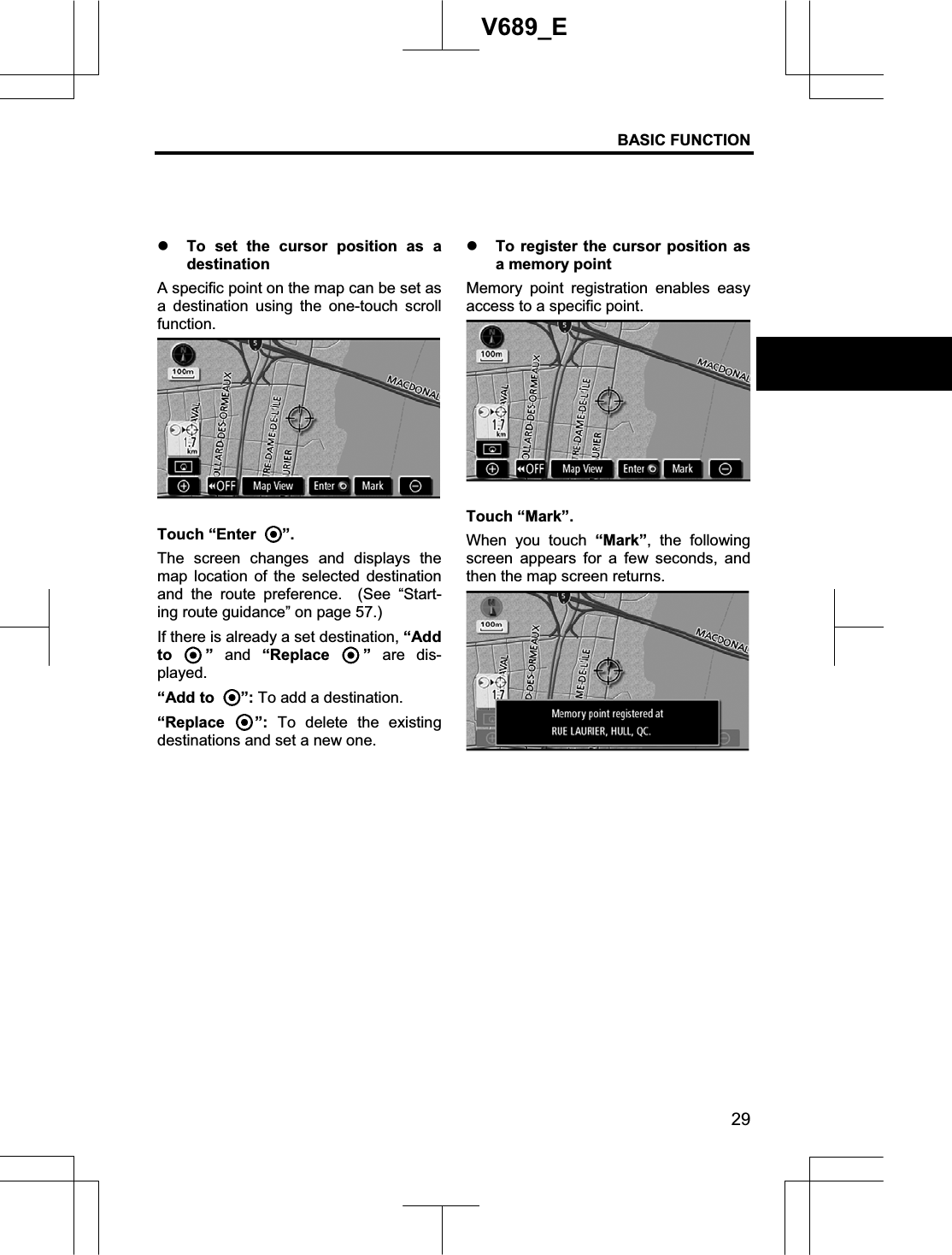
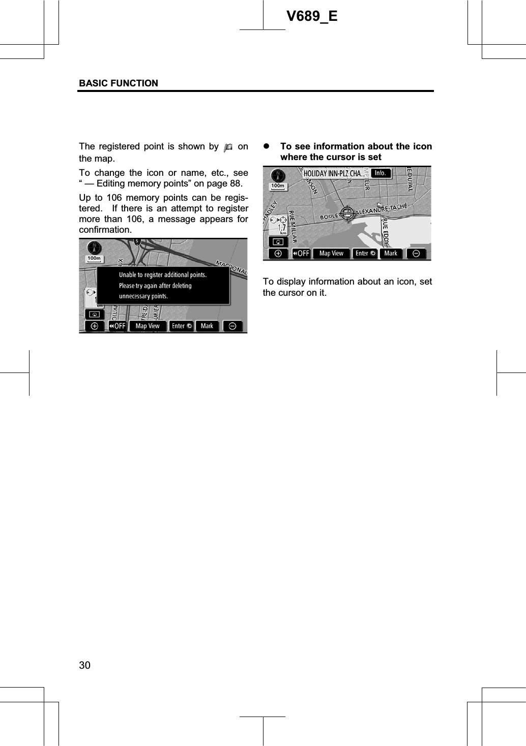
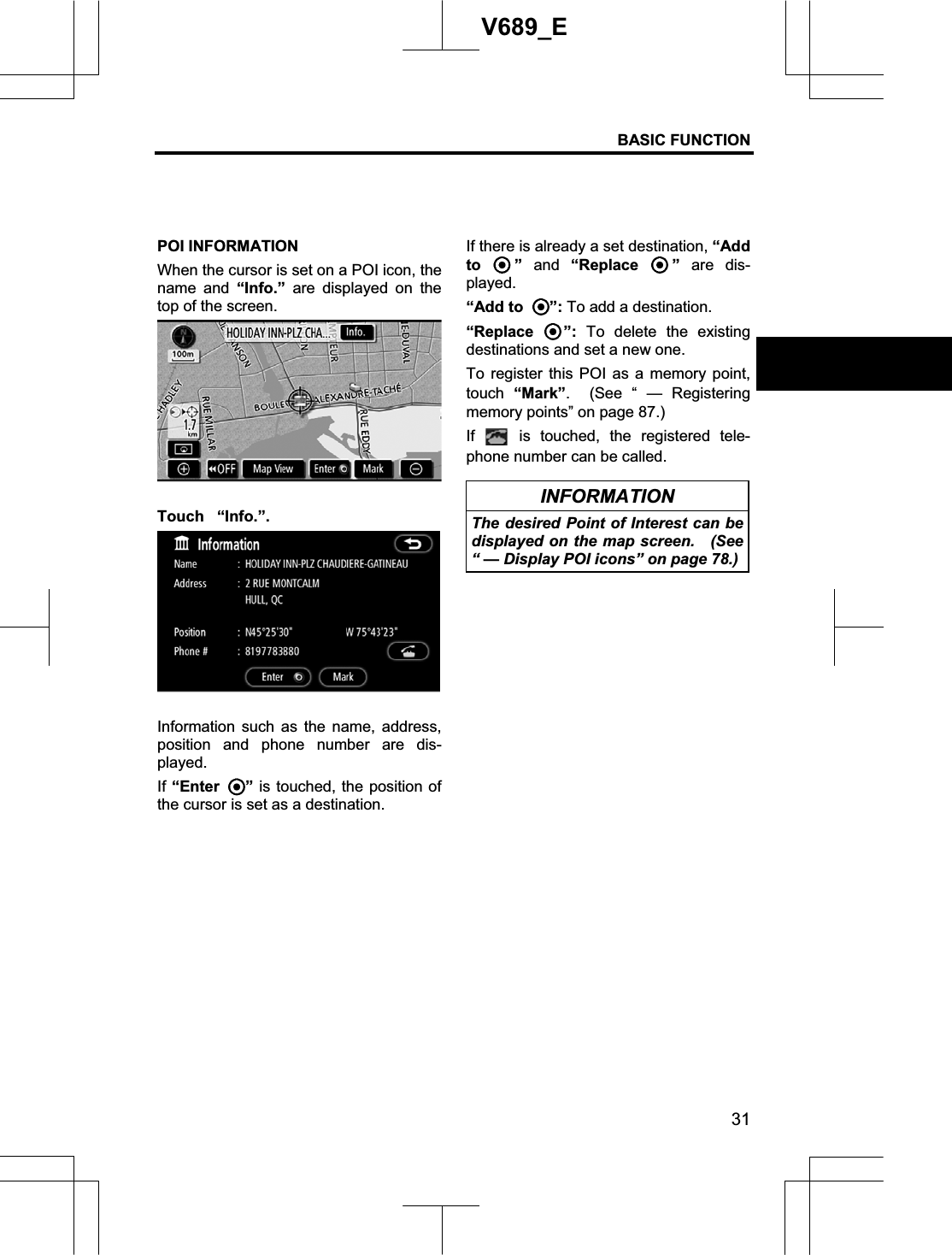
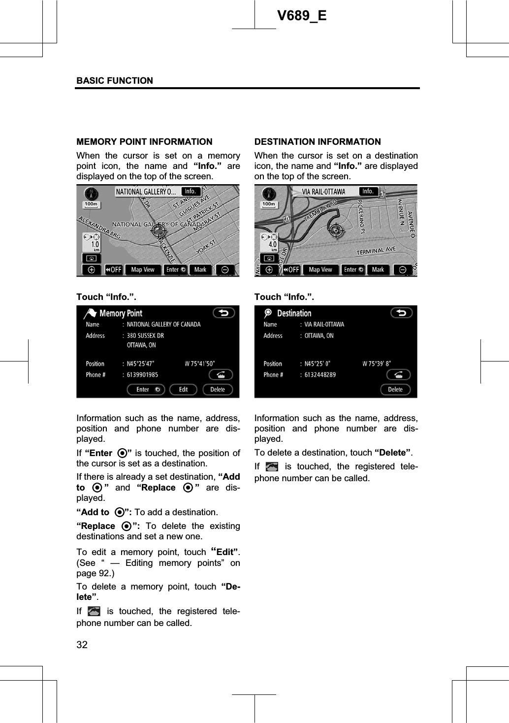
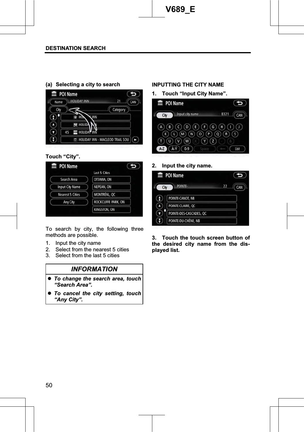
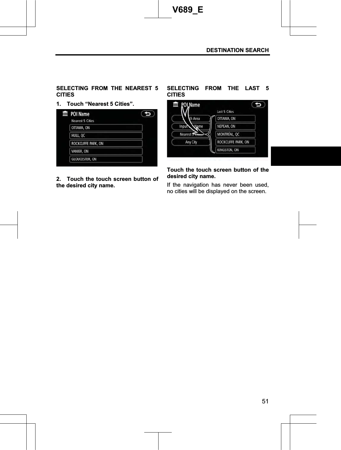
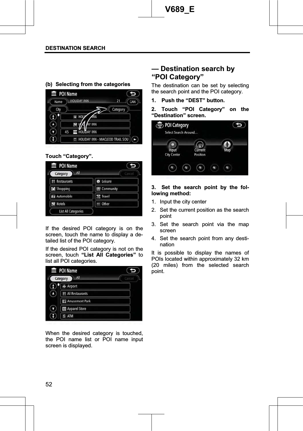
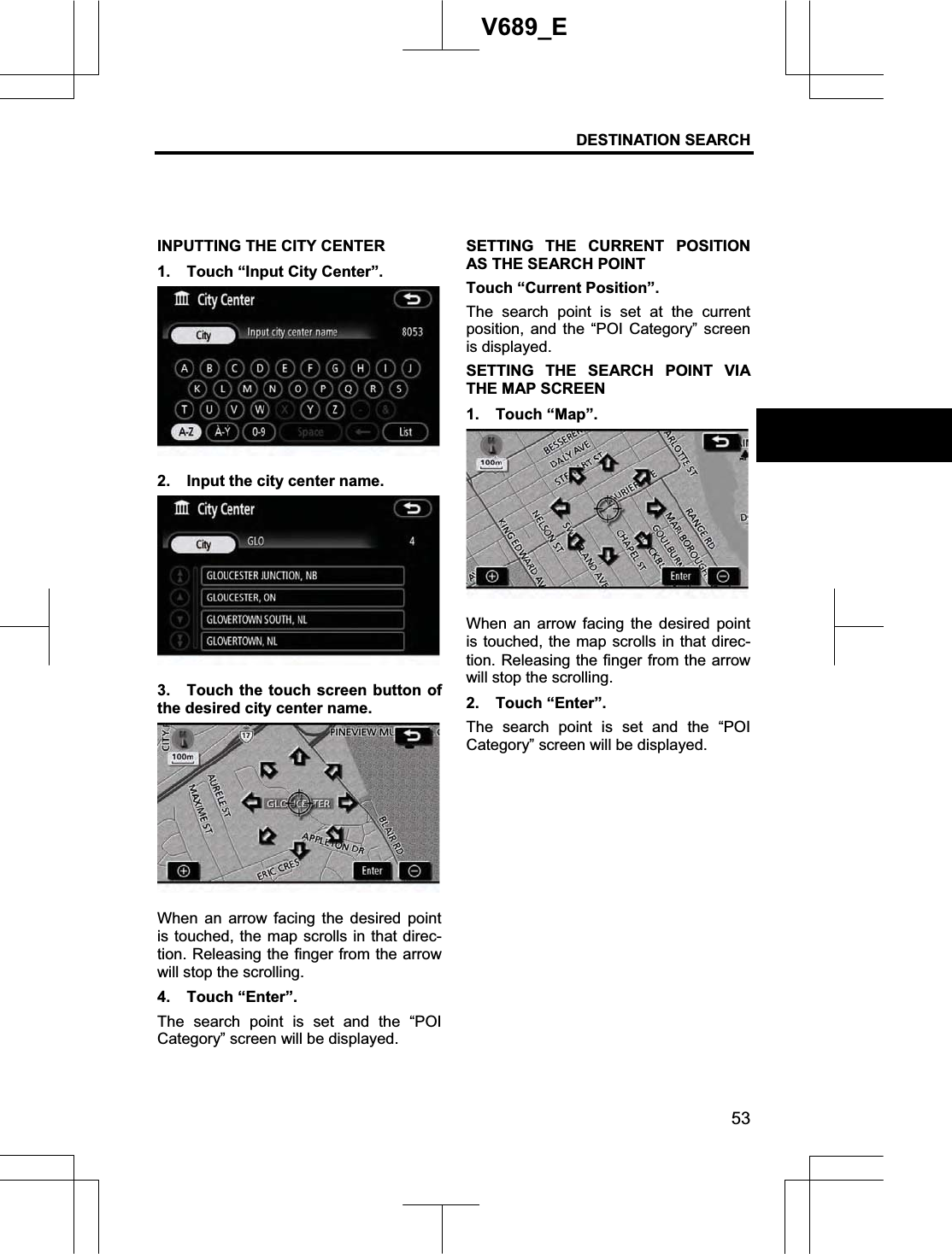
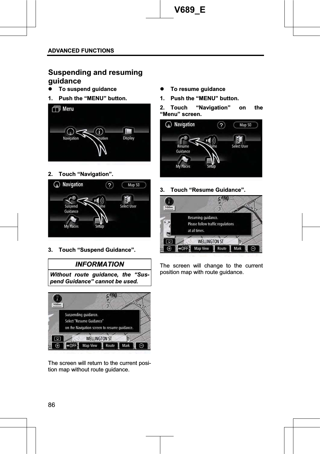
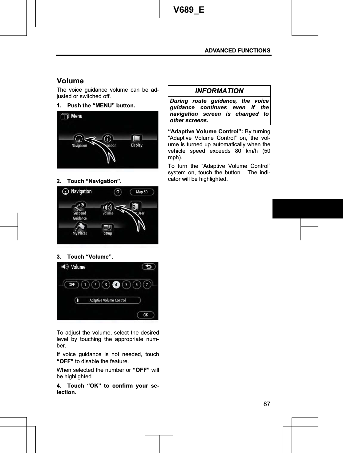
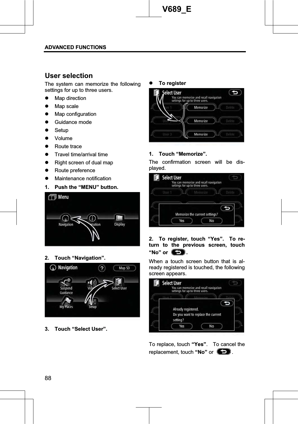
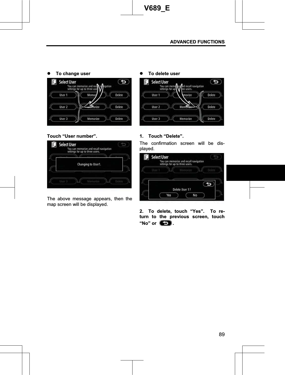
AISIN AW NA08A01 Car Navigation System with Bluetooth User Manual
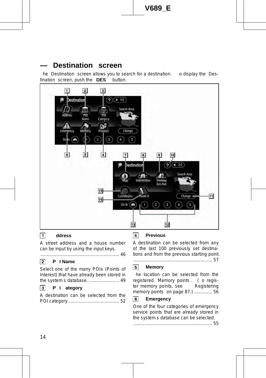
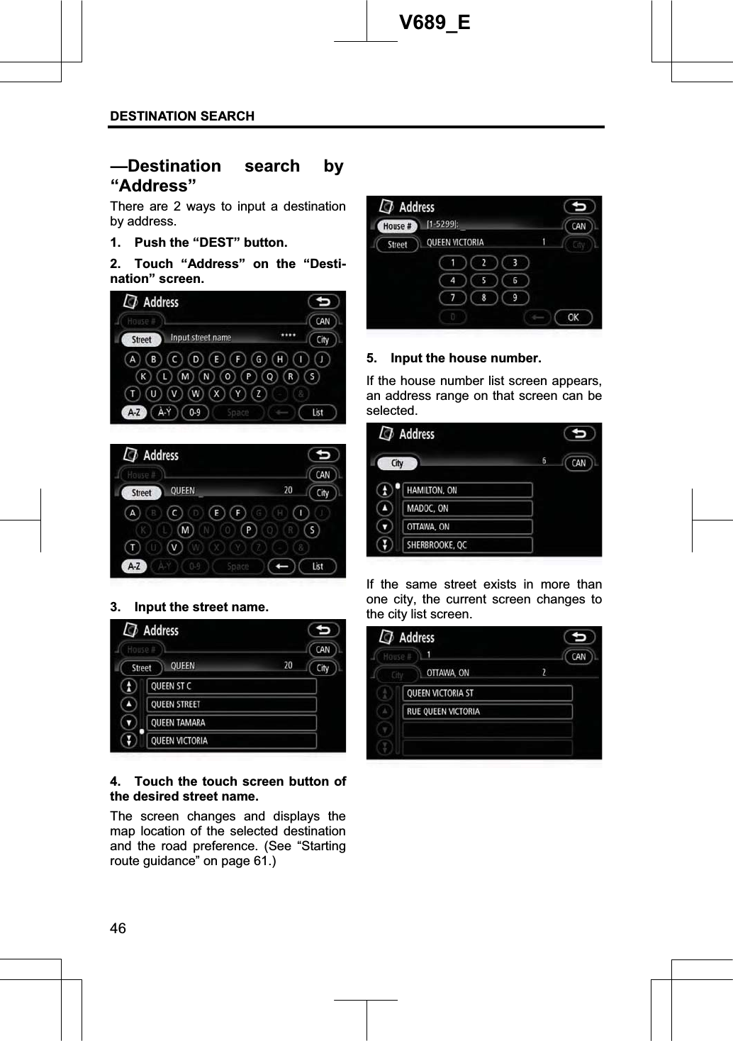
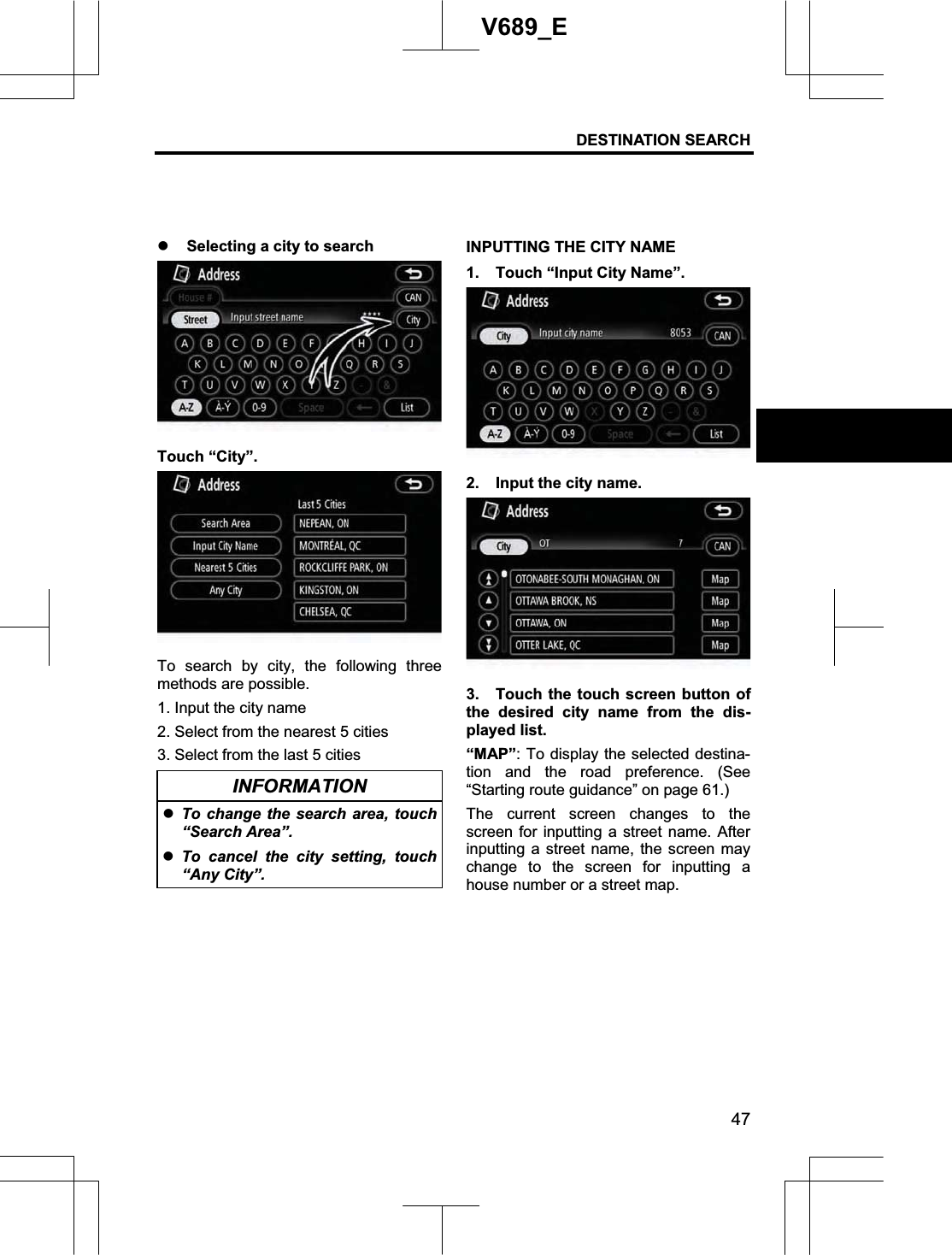
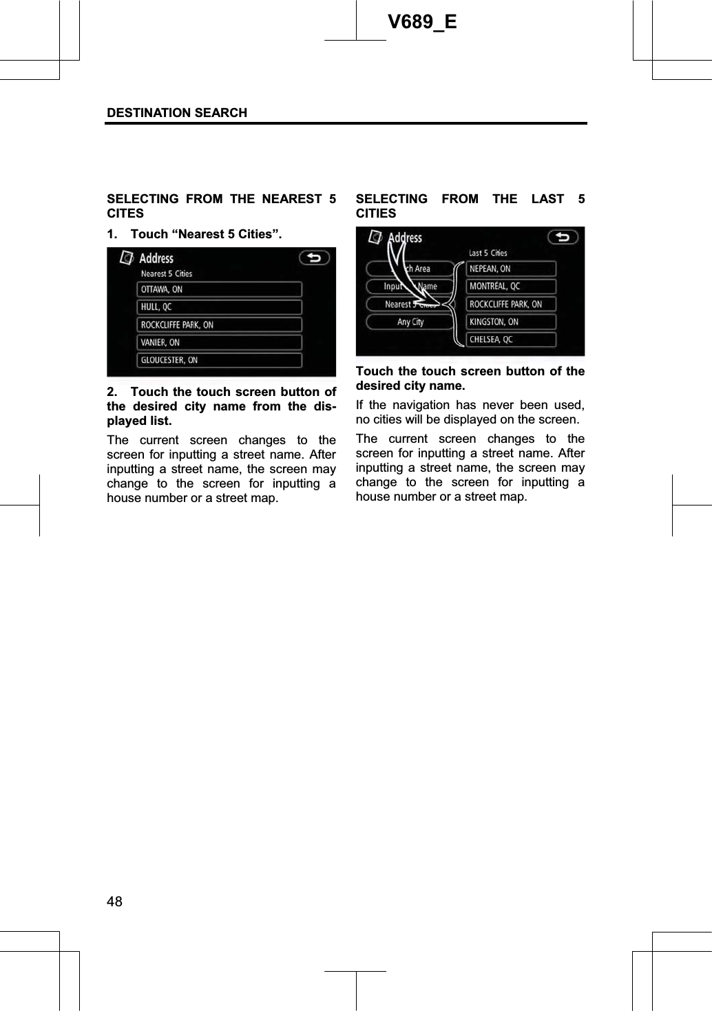
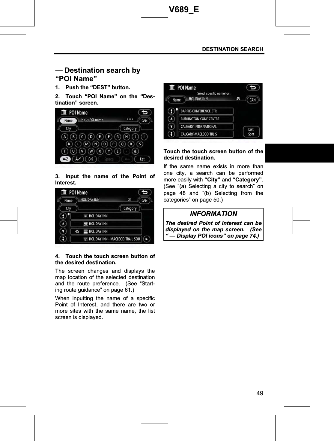
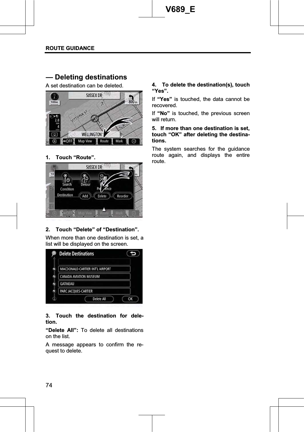
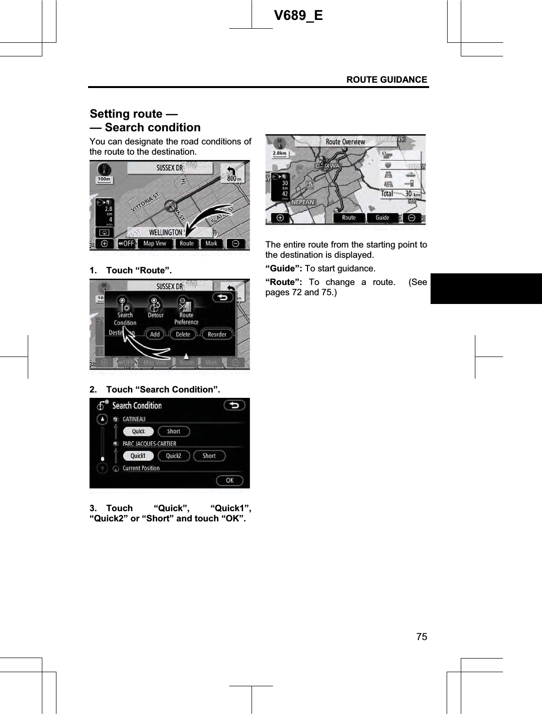
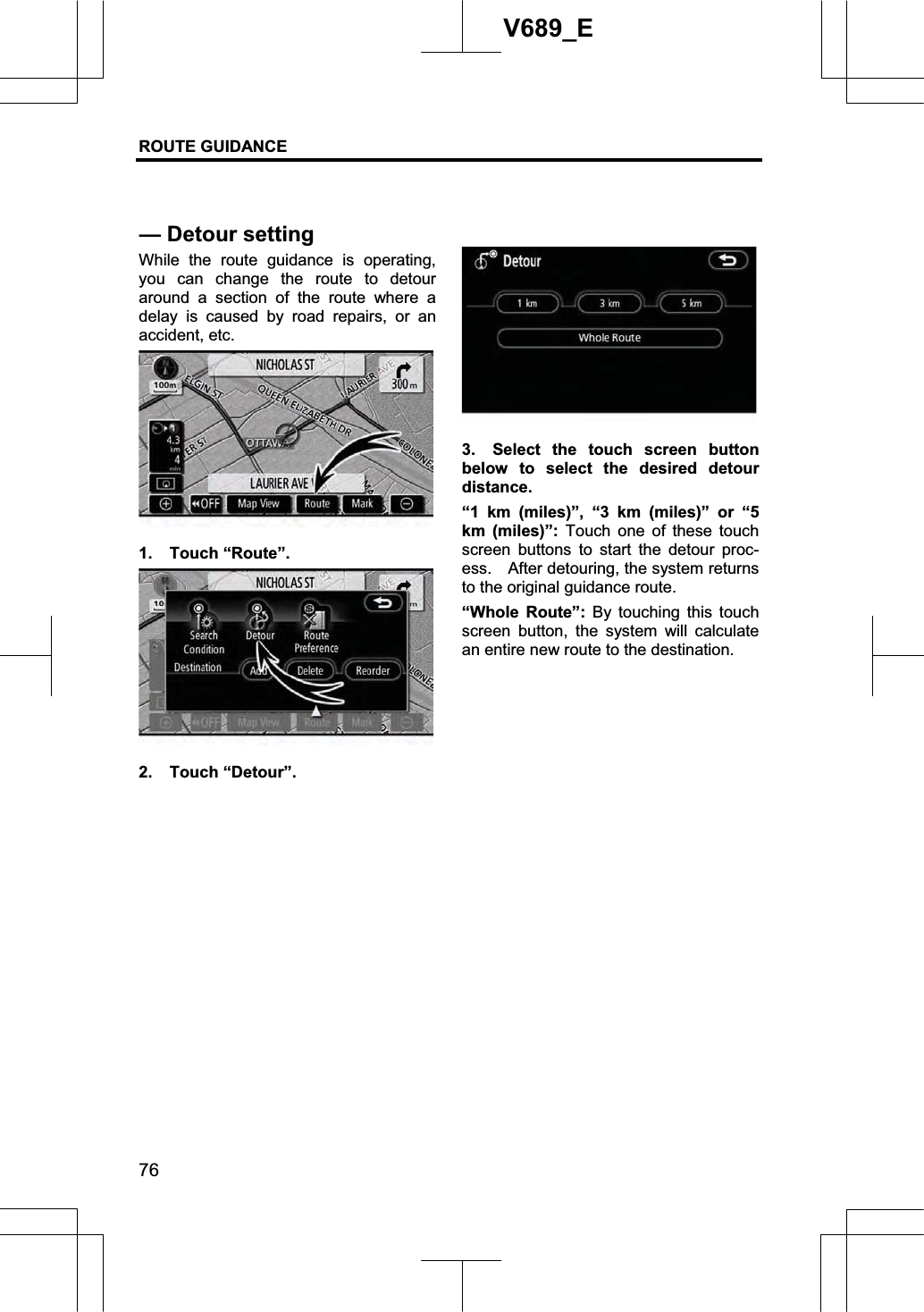
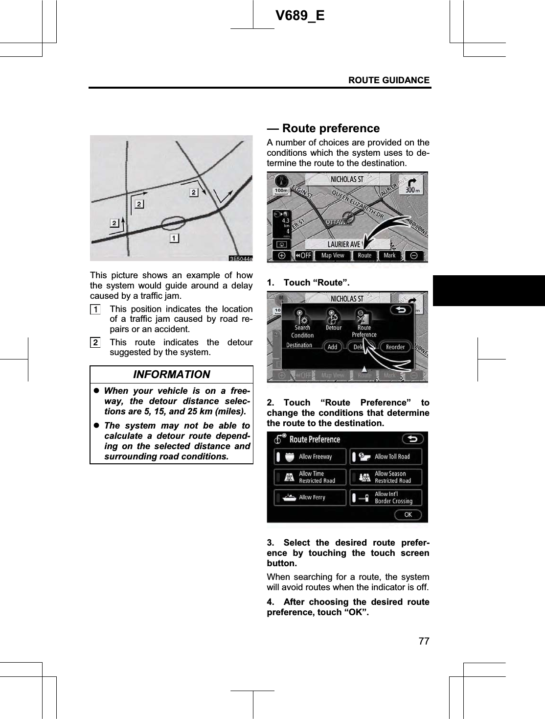
AISIN AW CO., LTD. Car Navigation System with Bluetooth
UserManual.wiki
>
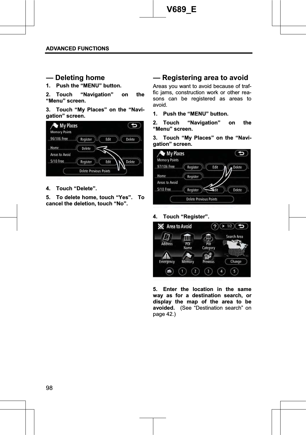
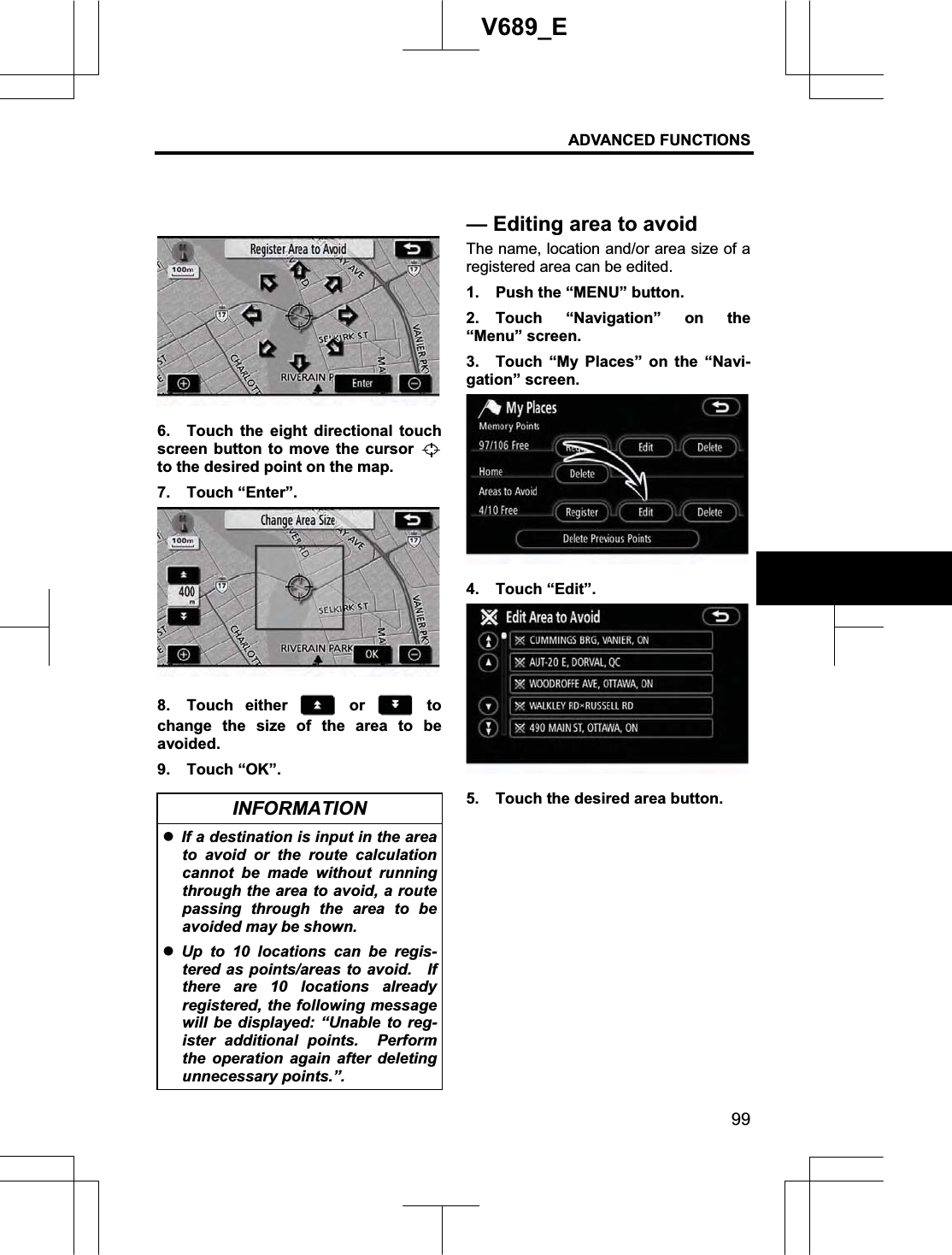
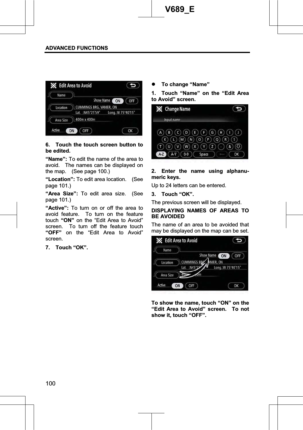
AISIN AW
>
NA08A01 User Manual
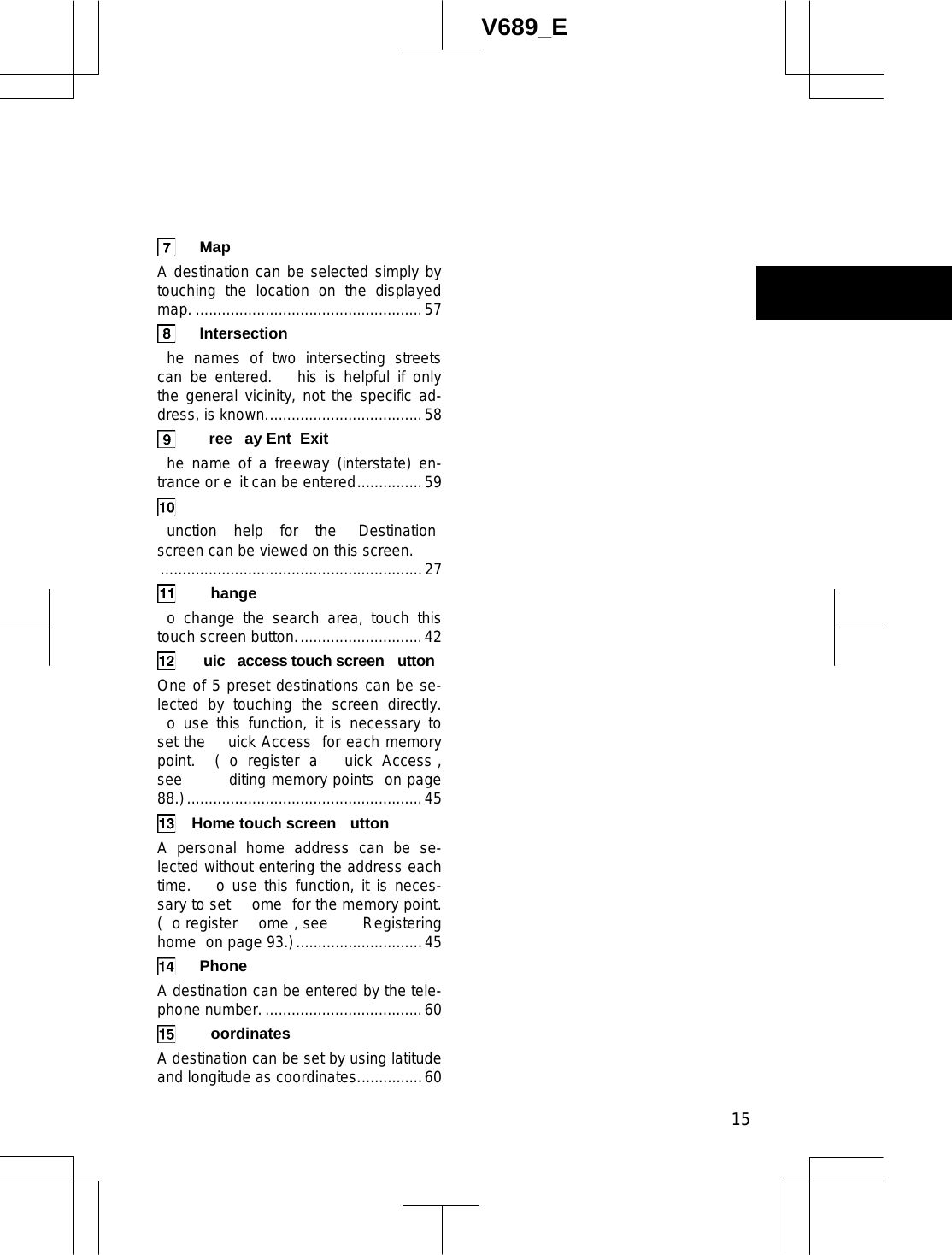
>
User Manual Part 1
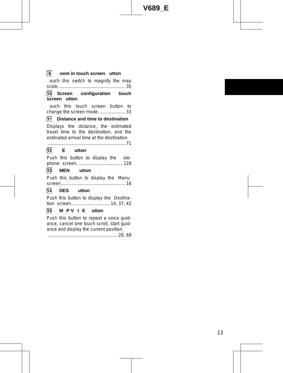
Contents
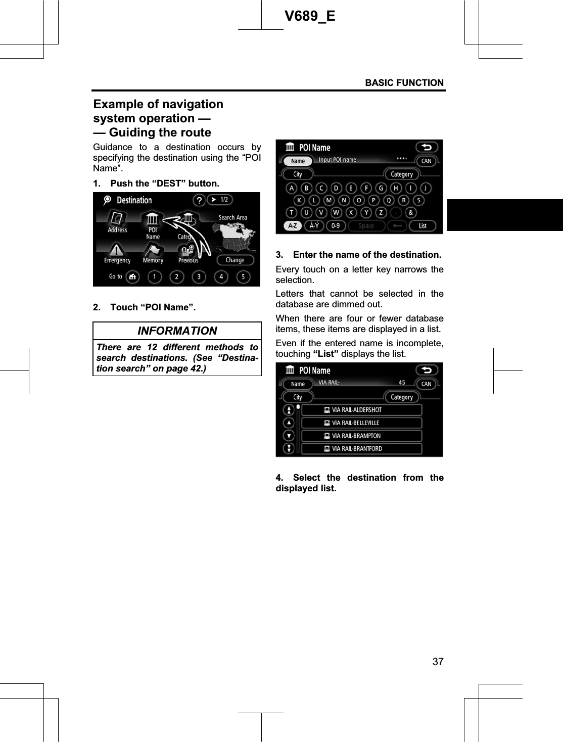
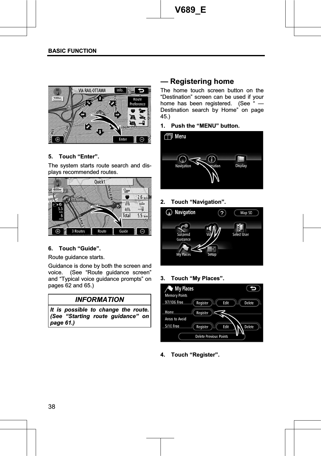
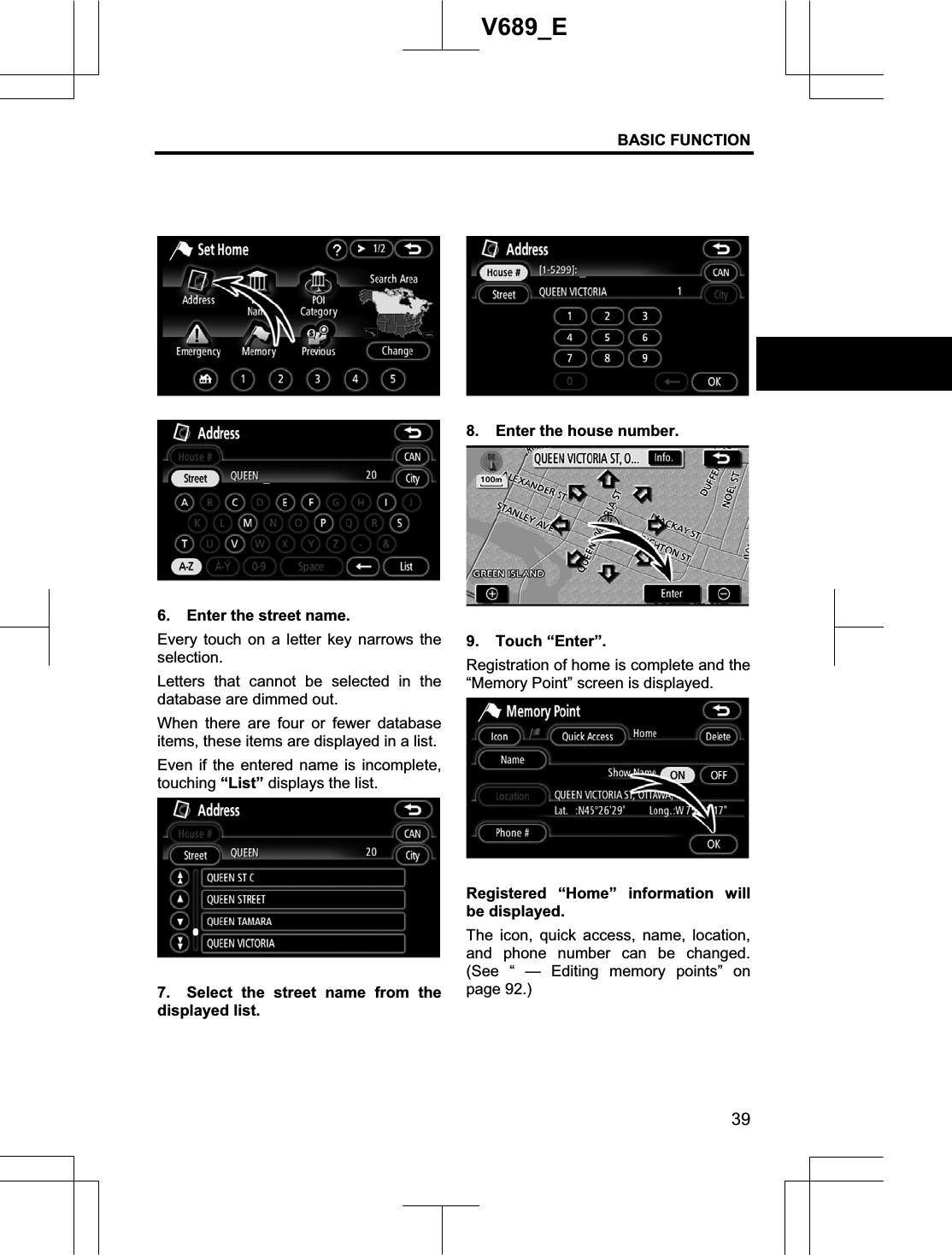
1.
User Manual Part 1
2.
User Manual Part 2
User Manual Part 1
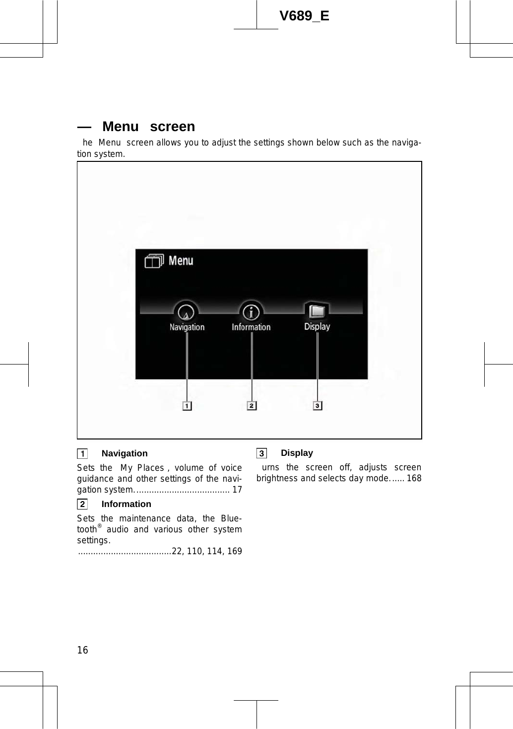
Navigation menu
Upload a User Manual
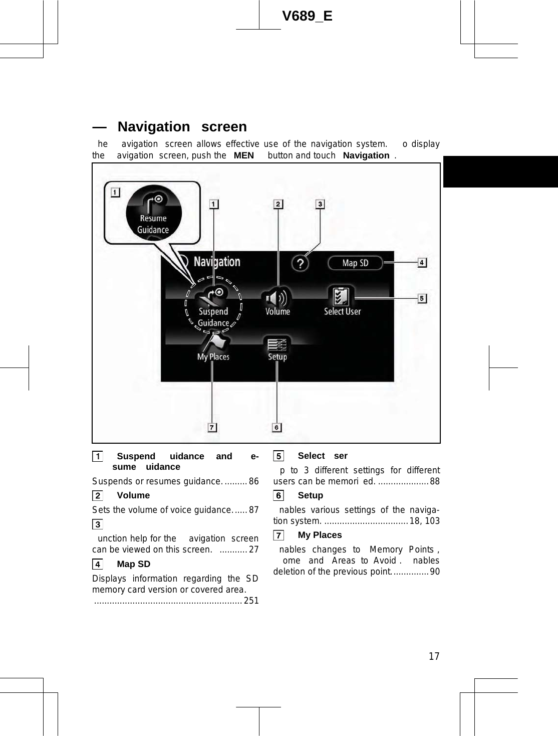
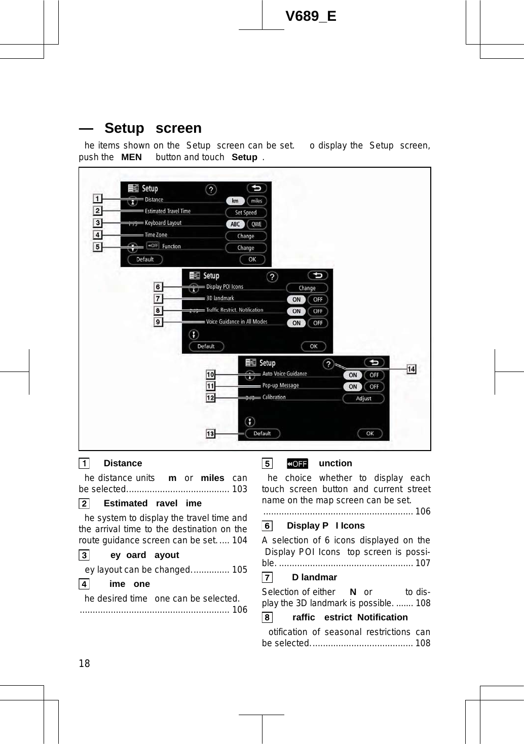
Namespaces
Wiki Guide
HTML
PDF
Info
Views
User Manual
Discussion / Help
Navigation