2017 Guide To The Gap
User Manual:
Open the PDF directly: View PDF ![]() .
.
Page Count: 24
Guide to the Gap
National Park Service
U.S. Department of the Interior
Summer 2017 - Spring 2018
Delaware Water Gap
National Recreation Area
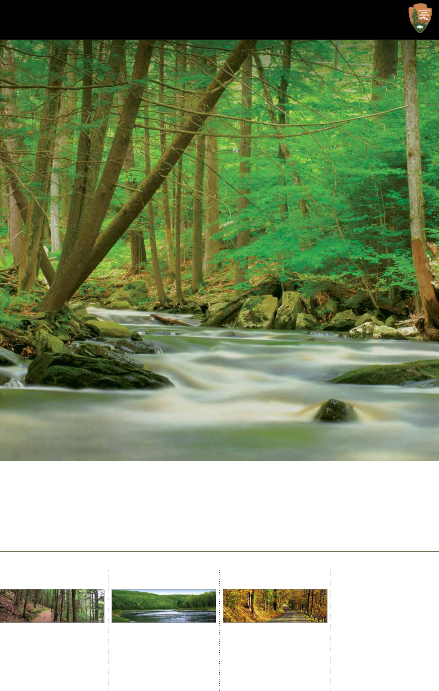
Millions of years of uplift, erosion, and glacial activity gave us a landscape
marked by hemlock- and rhododendron-laced ravines, rumbling waterfalls,
fertile floodplains, and the renowned Delaware Water Gap. Archeological
evidence suggests people have lived in this valley for 13,000 years. Europeans
began settling and farming the area in the mid-1600s and by the early 1900s,
the valley had become a popular resort area, offering a summer respite for
city-dwellers.
4
Today the river and its valley remain a major vacation destination. Many who
remember family trips, summer camp, or their honeymoon return to reminisce
at their favorite site in the park.
If this is your first visit, we invite you to discover the middle Delaware
River valley and start your own traditions in Delaware Water Gap National
Recreation Area.
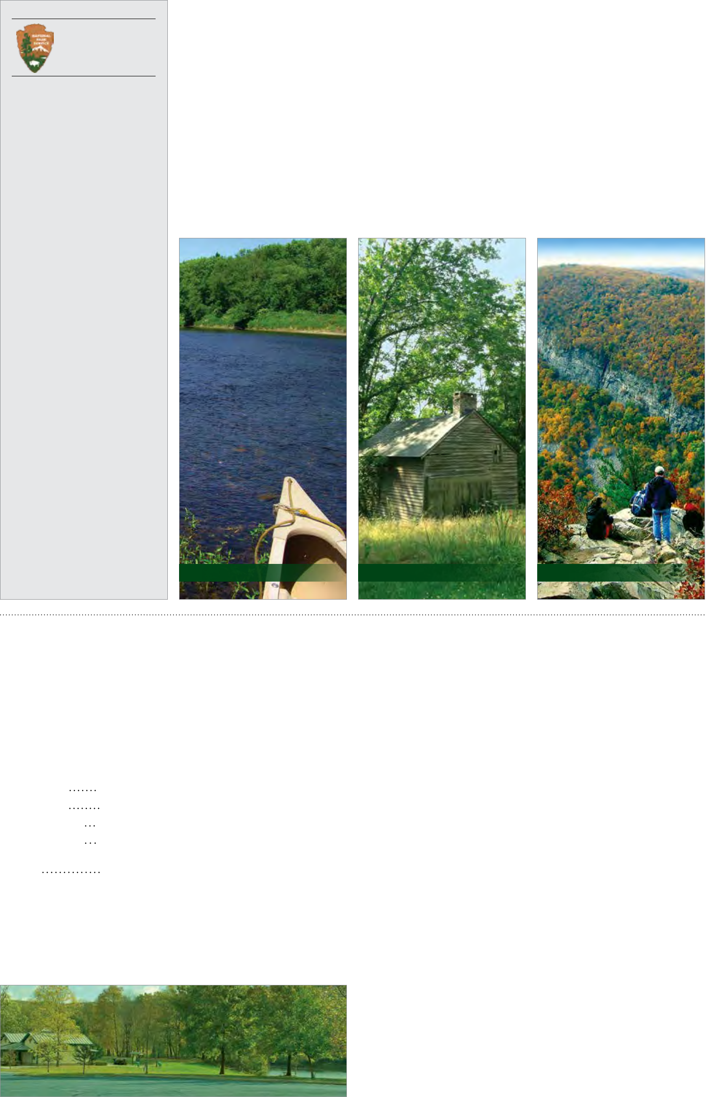
-11 Trails 14-15 River Activities 17-18 Auto Tours
From ridgetop to riverside, vistas to ravines,
and from easy to extreme, more than 100
miles of trail offer something for everyone.
Choose a trail for hiking, biking, horseback
riding, cross-country skiing, or boating to
enjoy the natural beauty and the historic
landscape of the river valley.
Delaware Water Gap National Recreation
Area includes nearly 40 miles of the free-
flowing Middle Delaware River Scenic and
Recreational River.
River-related activities, like swimming and
paddling, are some of the popular pastimes
on warm summer days.
Although the park is close to major cities,
tranquil drives invite exploration. More than
100 miles of road lead to wonderful scenic
places.
Explore the varied landscapes in the valley:
forests and fields, ridges and ravines, historic
houses and hamlets.
Fees and Passes.........................................2
Suggested Trip Itineraries ........................3
Weather in the Poconos...........................3
Park Map .................................................12
Visitor Centers ........................................12
People of the River Valley......................16
River Runner Shuttle Bus .......................16
The Delaware Water Gap.......................17
Millbrook Village ....................................19
Waterfalls................................................20
Activities and Events..............................21
Camping ..................................................21
Fishing & Hunting...................................22
Kid’s Page................................................ 23
Accessibility ............................................24
Park Store................................................24
Pets ..........................................................24
National Park Service
U.S. Department of the Interior
Delaware Water Gap
National Recreation Area
Located between the Pocono Plateau
and Kittatinny Ridge in close proximity
to the most densely populated region
of the nation, Delaware Water Gap
National Recreation Area and the
Middle Delaware National Scenic and
Recreational River preserve the natural,
cultural, and scenic resources and
values of the Delaware River valley and
provide opportunities for resource-based
recreation, education, and enjoyment.
Superintendent
John Donahue
Deputy Superintendent
Keith Farrar
Contact Information
Park Headquarters
1978 River Road
Bushkill, Pennsylvania 18324
DEWA_Interpretation@nps.gov
570 426-2452
Emergency - 800 543-4295
Website and Social Media
www.nps.gov/dewa
www.facebook.com/DelWaterGapNPS
www.twitter.com/DelWaterGapNPS
www.instagram.com/DelWaterGapNPS
The National Park Service cares
for the special places saved by the
American people so that all may
experience our heritage.
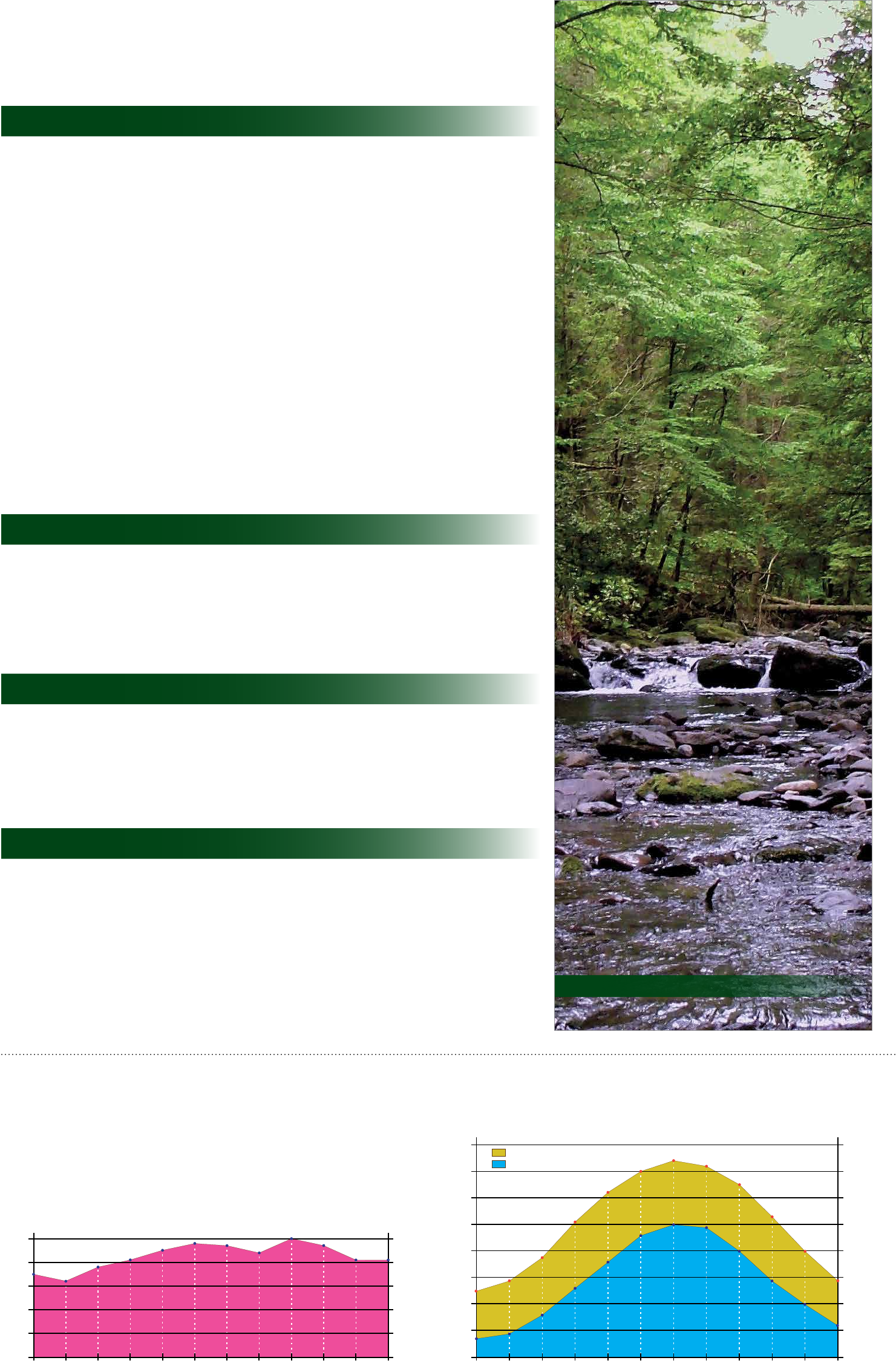
The River, the Valley, and You
Paddlers slip down the river between Millions of years of uplift, erosion, Agricultural fields still in cultivation
low, forested mountains; anglers wade and glacial activity gave us the ridges, help preserve the rural landscape
the cool streams; and hikers explore Delaware Water Gap, lakes, and streams predominate in the 18th century. In the
secluded places. This valley has attracted that flow through hemlock- and 1800s resorts flourished throughout the
people for 13,000 years. Abundant rhododendron-laced ravines, and the region where city dwellers arrived by
plant and wildlife sustained American waterfalls that pour off the Pocono carriage or rail, often spending the entire
Indians; floodplains nourished early Plateau. summer away from the urban heat. The
farmer’s crops; waterfalls drew Victorian Water Gap became a scenic wonder for
vacationers. Today, a 70,000-acre park Steeped in rich history, the trails, roads, fashionable travelers.
welcomes you to the enticing Delaware sites, and traces reveal reminders of
Water Gap National Recreation Area and times gone. The Minsi Path and Minisink Today the natural and cultural wonders
Middle Delaware National Scenic and Trail converged on a Delaware River provide abundant recreational
Recreational River. island that was once the centerpiece opportunities. This rural vacationland is
of a large American Indian settlement. yours to explore.
Delaware River Slateford Farm Mt. Tammany Overlook
Fees and Passes
Delaware Water Gap National Recreation Area collects Expanded Amenity Fees spring, summer,
and fall at select locations in the park. Fees collected are used to enhance visitor services, maintain
and repair park facilities, and to manage cultural and natural resources in the park.
The America the Beautiful Annual Pass and America the Beautiful Annual Pass for Active Military
are not accepted because the park does not collect a Standard Amenity Fee or an entrance fee.
Holders of the America the Beautiful Senior Pass or America the Beautiful Access Pass receive a
50% discount on Expanded Amenity Fees.
2017 Expanded Amenity Fee Schedule
• Private Vehicle $10.00 per vehicle (1-7 occupants) Sites where fees are collected:
• Smithfield Beach (PA)
• Private Vehicle $1.00 per person (8+ occupants) • Bushkill Access (PA)
• Seasonal Park Pass $45.00 per vehicle / year * • Dingmans Access (PA)
• Milford Beach (PA)
• Seasonal Park Pass $22.50 per vehicle / year * • Turtle Beach (NJ)
w/Senior or Access Pass • Watergate (NJ)
• Walk-in $1.00 per person / day
Pedestrian / bike
* Discount available for multiple passes purchased for the same address
Fees are not charged for persons 15 or younger. Seasonal park passes and America the Beautiful
passes are available for purchase at park headquarters.
America the Beautiful:
The National Parks and Federal Recreational Lands Pass Series
A pass is your ticket to more than 2,000 federal recreation sites. Each pass covers entrance
fees at national parks and national wildlife refuges as well as standard amenity fees at national
forests and grasslands, and at lands managed by the Bureau of Land Management and Bureau
of Reclamation. A pass covers entrance and standard amenity fees for a driver and all passengers
in a personal vehicle at per vehicle fee areas (or up to four adults at sites that charge per person).
Children age 15 or under are admitted free. The pass does not cover expanded amenity fees. The
following passes make up the series:
Annual Pass: $80 annual pass available to everyone
Annual Pass for U.S. Military: Free annual pass available to current U.S. military members and
dependents in the Army, Navy, Air Force, Marines and Coast Guard and also, Reserve and National
Guard members; must be obtained in person by showing a Common Access Card (CAC) or
Military ID (Form 1173)
Annual 4th Grade Pass: Free annual pass available to U.S. 4th graders with a valid Every Kid in a
Park paper pass; obtain paper pass at www.EveryKidInAPark.gov; digital version of the paper pass
(such as on smart phones or tablets) are not accepted to exchange for an Annual 4th Grade Pass.
See page 24 for more information.
Senior Pass: $10 lifetime pass available to U.S. citizen or permanent residents age 62 or over
(Note: the cost of this pass is expected to increase by October 1, 2017)
Access Pass: Free lifetime pass available to U.S. citizens or permanent residents with permanent
disabilities
Volunteer Pass: Free annual pass available to volunteers with 250 service hours with federal
agencies that participate in the Interagency Pass Program
The six agencies that participate in the Interagency Pass Program are:
• National Park Service
• U.S. Forest Service
• U.S. Fish and Wildlife Service
• Bureau of Land Management
• Bureau of Reclamation
• U.S. Army Corps of Engineers
Smithfield Beach
2 Guide to the Gap
Suggested Trip Itineraries
Delaware Water Gap National Recreation Area offers endless opportunities for exploration and discovery.
Depending on how much time you have to spend and your interests, the following are some itineraries to
consider.
If you have a few hours:
• Stop by a park visitor center, where park rangers can help you plan your adventure. Visitor center parking lots fill
quickly on summer weekends. To avoid the crowds, visit the area before 10:00 am or after 4:00 pm on weekends or
visit on a weekday. Page 12
• Hike the 1.1-mile George W. Childs Park Trail that follows a creek with three rushing waterfalls. The first 0.4 mile of
the trail is accessible. To avoid the crowds, visit the area before 10:00 am or after 4:00 pm on weekends or visit on a
weekday. Page 6
• View Silverthread and Dingmans waterfalls via the 0.3-mile accessible Dingmans Creek Trail. To avoid the crowds,
visit the area before 10:00 am or after 4:00 pm on weekends or visit on a weekday. Page 20
• Stop at Toms Creek for a picnic and a short hike along a peaceful mountain stream. This area is generally a good
place to avoid crowds on summer weekends. Page 9
• Walk a section of the McDade Recreational Trail, which extends most the length of the park in Pennsylvania and
presents some of the best views of the Delaware River, as well as views of charming streams, open farm fields, forests,
and historic landscapes. Page 8
• View Raymondskill Falls by hiking a short, but steep, trail. To avoid the crowds, visit the area before 10:00 am or
after 4:00 pm on weekends or visit on a weekday. Page 20
• Wander the quiet streets of Millbrook Village and learn about life in the 1800s. This area is generally a good place to
avoid crowds on summer weekends. Page 19
• Tour the Nelden-Roberts Stonehouse and the Foster-Armstrong House in Montague, NJ, on a summer Sunday
afternoon. This area is generally a good place to avoid crowds on summer weekends. Page 13
• Tour the Rosencrans House and the Van Campen Inn in Walpack Center, NJ, on a summer Sunday afternoon. This
area is generally a good place to avoid crowds on summer weekends. Page 13
• Stop at the three overlooks along PA 611 for stunning views of the Delaware Water Gap. Page 17
If you have half a day:
• Take a bike ride along the McDade Recreational Trail. Bring your own or rent a bike from a local outfitter. Page 8
• Enjoy a picnic at Hidden Lake and then take a stroll around the lake. This area is generally a good place to avoid
crowds on summer weekends. Page 11
• Enjoy a view of the Delaware River valley from several overlooks along the Cliff Trail. Page 6
• Enjoy a scenic drive along US 209.
• Choose a trail and enjoy a hike. Page 5
If you have all day:
• Drive the scenic Old Mine Road, stopping along the way to explore various historic and natural features. This area is
generally a good place to avoid crowds on summer weekends. Page 18
• Hike a stretch of the Appalachian National Scenic Trail. Page 10
• Canoe or kayak on the Delaware River. Page 14
• Enjoy a swim at one of the park’s lifeguarded beaches. Parking at the beaches generally fills to capacity by 11:00 am
on weekends. Consider visiting during the week to avoid crowds. Page 14
If you are staying multiple days:
Consider signing up for an in-park workshop offered by one of our partners.
• Peters Valley School of Craft offers 2-day to 5-day fine craft workshops. For more information, visit petersvalley.org.
• Appalachian Mountain Club’s Mohican Outdoor Center offers weekend outdoor getaways focusing on various
outdoor skills. For more information, visit outdoors.org/lodging-camping/Lodges/Mohican.
• Pocono Environmental Education Center offers weekend getaways and workshops for youth, families and adults.
For more information, visit peec.org.
Weather in the Poconos
Spring tends to have more breezy days and less humidity than other times of the year. During
the summer, humidity levels can be high, even near 100%, and afternoon thunderstorms are
common. In the fall, humidity can still be high, but temperatures are generally pleasant. Winter
days tend to be cloudy and the most snow falls in January and February, particularly along the
higher elevations of the Kittatinny Ridge.
Jan Feb Mar Apr May Jun Aug Sep Oct Nov DecJul
5 in
4 in
3 in
2 in
1 in
0 in
127 mm
102 mm
76 mm
50 mm
25 mm
0 mm
Average Precipitation
Average Temperature
90°F
80°F
70°F
60°F
50°F
40°F
30°F
20°F
10°F
High
Low
Jan Feb Mar Apr May Jun Jul Aug Sep Oct Nov Dec
32°C
27°C
21°C
16°C
10°C
4°C
-1°C
-7°C
-12°C
Toms Creek
3 Guide to the Gap
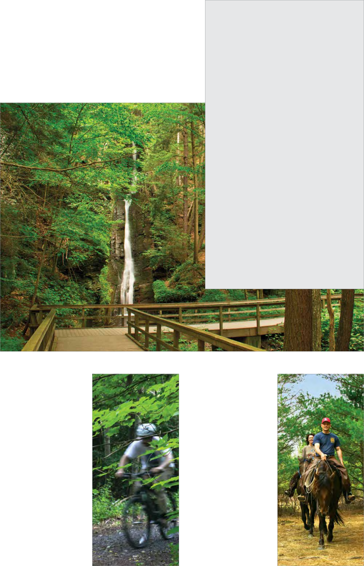
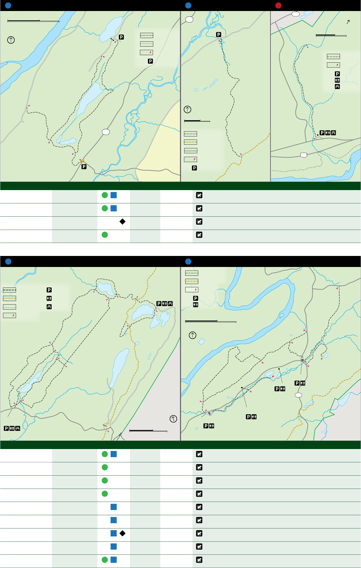
Hiking Trails
More than 100 miles of trails meander through the park, including nearly 26 miles of the
Appalachian National Scenic Trail. Hikers can enjoy the trails year-round; with each
season offering its own special reward. During winter, the absence of deciduous leaves
opens new vistas along trails and reveals stone walls, foundations, and other reminders
of past residents. Spring provides a weekly parade of wildflowers and flowering trees. In
summer, hikers can seek out cool retreats among the hemlock forests and follow rolling
streams to picturesque falls and cascades. Autumn hikers have crisp air to sharpen the
senses and a palette of fall colors to enjoy.
Choosing a trail can be a daunting task. What to see: Waterfalls? Historic landscapes?
Inspiring views? The following pages offer a simple guide to the many routes available.
Be Prepared for Your Visit
• Cell phone service is limited within the park.
• Carry (and drink) plenty of water; a leading cause of injuries on the trail is
dehydration.
• Protect yourself from the sun; wear a hat, sunglasses and sunscreen.
• Wear sturdy shoes.
• Protect yourself from ticks and insects; use insect repellant, check and
remove ticks when you return, and wear light-colored clothing to spot ticks
more easily.
• Stay alert for snakes; do not put your hands and feet into places you can’t
see.
• Be bear-aware; do not run if a bear approaches; make noise, wave your
arms, and look large.
• Trails are not regularly maintained or patrolled; travel carefully and at your
own risk.
• Wear bright orange (shirt, vest, or hat) during hunting season.
Key Regulations
• Stay on trails; taking shortcuts causes trail erosion, damages native plants,
and can be dangerous.
• Leave what you find; digging, collecting, or removing artifacts or plants is
prohibited.
• Do not feed or approach wildlife.
• Pets must be leashed at all times; additionally, pets are not permitted at
Milford, Turtle and Smithfield beaches and on the McDade Recreational
Trail between Hialeah and Smithfield Beach from late spring to early fall;
pets are not permitted anytime along the Dingmans Creek, Childs Park, and
Raymondskill Creek trails, at Watergate Recreational Site, and at Kittatinny
Point and Hialeah picnic areas.
• Pack out what you pack in; do not leave trash behind.
• Bicycles are only permitted on the McDade Recreational Trail and roadways
that are open to vehicle traffic.
• Horses are only permitted on the Conashaugh View (PA) and Upper Ridge
Road (NJ) trails. Hikers should be alert to riders and must yield to riders. If
horses approach, hikers should step off the trail.
• The use of drones is prohibited.
Silverthread Falls along the Dingmans Creek Trail
Biking
Cycling is a popular form of recreation in the
park. The McDade Recreational Trail (page 8),
a packed gravel path, parallels the Delaware
River on the Pennsylvania side of the park
for 32 miles and is perfect for mountain and
hybrid bikes. A section between White Pines
and Pittman Orchard trailheads is closed to
biking. Motorized vehicles are not permitted
on the McDade Recreational Trail.
For those who enjoy road biking, Old Mine
Road parallels the Delaware River on the New
Jersey side for 34 miles in the park (page
18). The route passes through lush forests,
past agricultural fields, and through historic
landscapes. Numerous opportunities exist to
stop and explore scenic and historic areas.
Road biking on US 209 in Pennsylvania is
not recommended due to heavy traffic. Road
biking on River Road in Pennsylvania is strongly
discouraged due to sharp, steep turns, blind
curves, and the lack of shoulders.
Riding
The Conashaugh View Trail in Pennsylvania and
the Upper Ridge Trail in New Jersey are open
to horse riding for those who have their own
horses. There are no horse rental liveries in the
park. These two trails are also open to hiking.
Hikers should be alert to riders and must yield
to riders by stepping off the trail and standing
quietly until they pass. Please protect the
environment by riding only on the marked
trails, and crossing streams only on bridges.
The Conashaugh View Trail (page 6) near
Milford, Pennsylvania, offers nine miles of
trail for horseback riders. The trail meanders
through forests in the lowland and upland
areas and passes by streams providing a serene
setting for a ride. Parking for trailers is along
Conashaugh View Road.
The Upper Ridge Trail (page 7) near Layton,
New Jersery, winds approximately five miles
(in and back) through quiet woods, open
fields and past isolated ponds. This trail is not
heavily used and can become overgrown in
the summer. Parking for trailers is along
Jager Road.
Riding along the McDade Recreational Trail Riding along the Conashaugh View Trail
4 Guide to the Gap
84
6
O
l
d
M
i
n
e
R
o
a
d
0
0
a
r
e
R
i
v
e
r
R
o
a
d
6
J
a
g
e
r
R
o
a
d
C
o
n
a
s
h
a
u
g
h
M
i
l
f
o
r
d
V
i
e
w
R
o
a
d
R
i
d
g
e
R
o
a
d
6
D
e
l
a
w
7
L
a
k
e
R
a
d
S
i
l
v
e
r
O
l
d
M
i
n
e
R
o
a
d
E
m
e
r
y
R
o
a
d
M
i
l
f
o
r
d
R
o
a
d
d
R
o
a
n
e
B
u
s
h
k
i
M
O
l
d
i
l
l
F
a
l
l
s
R
o
a
d
v
e
i
r
D
e
d
k
R
a
L
C
a
m
p
n
e
d
d
i
R
i
v
e
r
R
d
H
d
a
o
R
O
l
d
M
i
n
e
Park Trails
6
209 MILFORD
6 Trails
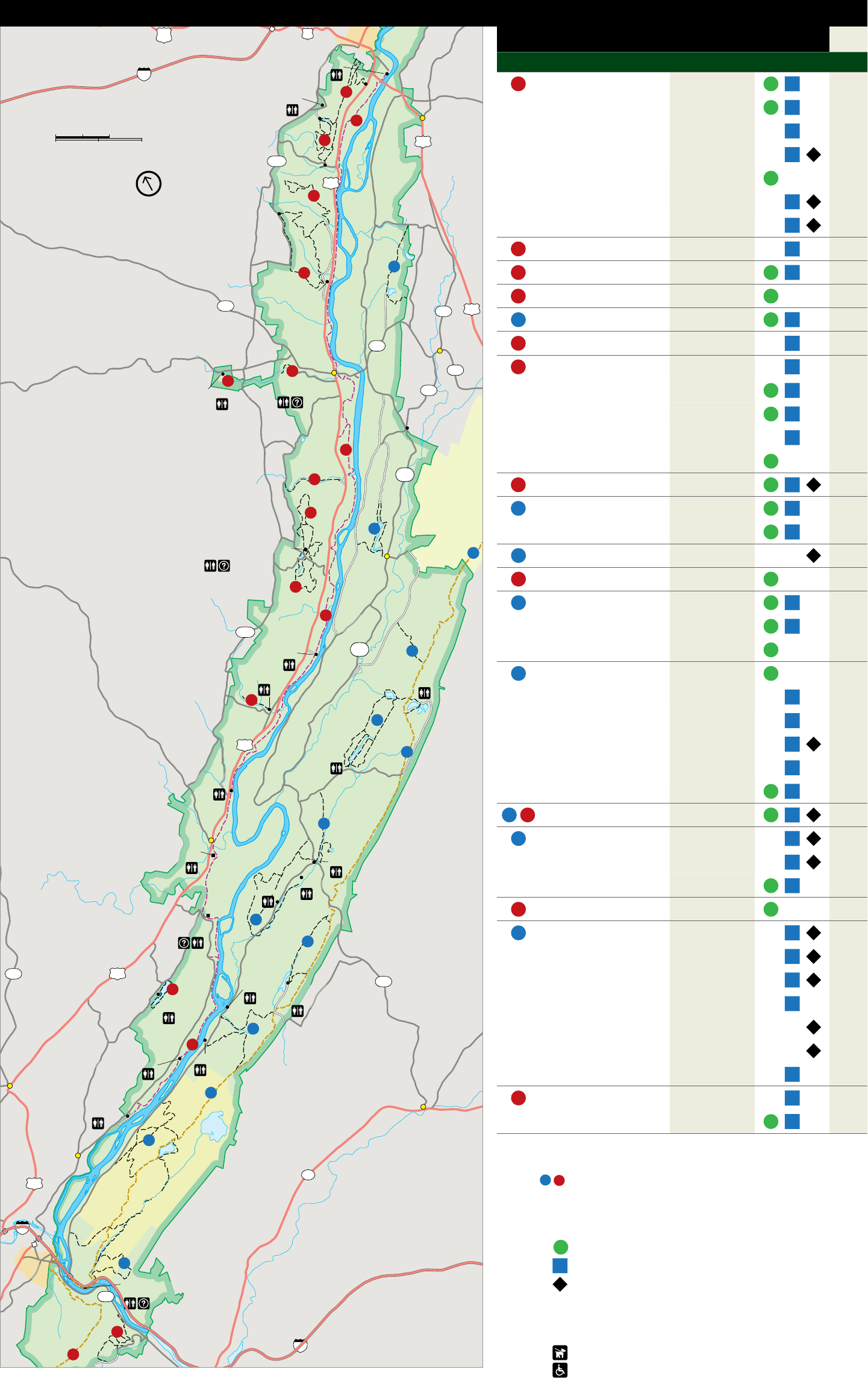
Milford Beach Map # Trail Name Distance Rating ‡ Pg #
1 Buchanan 1.1mi / 1.8km
Cliff Park Inn 1
Golf course
Cliff 2.8mi / 4.5km
8
o
Montague
8
Hackers 1.4mi / 2.3km
2 Kilometers
1 206
2 Miles
Milford Knob 1.3mi / 2.0km
2001
North
209 Pond Loop 0.7mi / 1.1km
2 Quarry Path 0.5 mi / 0.8km
Raymondskill Creek 0.3mi / 0.4km
2 Conashaugh View 8.7mi / 14km
5 3 George W. Childs Park 1.1mi / 1.8km
2
Marie 4 Dingmans Creek 0.4mi / 0.6km
Zimmermann
739 House 206
645
5 Upper Ridge Road 2.5mi / 4.0km 7
560 Layton 6 Hornbecks Creek 1.9mi / 3.0km 7
4 560 7 Fossil 1.0mi / 1.6km
3 Dingmans Falls
Visitor Center 640 Ridgeline 3.0mi / 4.8km
George W. Childs Park
Wilson
Hill Scenic Gorge 2.0mi / 3.2km
Road Peters Valley
School of Craft Tumbling Waters 2.8mi / 4.5km
8
Two Ponds 1.5mi / 2.4km
NPS
615 STOKES
6 8 McDade Recreational 32mi / 51.5km
STATE
9 Military Road 1.0mi / 1.6km
7 FOREST
9 Walpack Ridge 3.0mi / 4.8km
Pocono Environmental
Education Center 14 10 Buttermilk Falls 1.4mi / 2.3km 9
Walpack Center
11 Toms Creek 0.8mi / 1.3km 9
7
12 Blue Mountain Lakes 4.6mi / 7.4km 9
8 Pompey
Ridge
Road Crater Lake 1.6mi / 2.6km
2001
PENNSYLVANIA
Eshback NPS 10 Hemlock Pond 1.0mi / 1.6km
615
Access
Toms 13 Coventry Pond 0.9mi / 1.5km
Creek Crater Lake
Donkeys Corner 1.8mi / 2.9km
11
12 Hamilton Ridge 2.8mi / 4.5km
Blue Orchard 0.5mi / 0.8km
209 Mountain 14
Lakes
Pioneer 2.5mi / 4.0km
Bushkill
Access
NEW JERSEY
Van Campen Glen 1.5mi / 2.4km
14 14 Appalachian National Scenic 27.7mi / 44.6km
13
15 Coppermine 2.0mi / 3.2km
Bushkill
Bushkill
Meeting Center Millbrook Village Kaiser 2.0mi / 3.2km
Watergate Rattlesnake Swamp 2.6mi / 4.2km
Upper Glen
16 Hidden Lake 1.9mi / 3.0km
13
Park
Headquarters 17 Beulahland * 1.3mi / 2.0km
15
Blue Blaze * 1.7mi / 2.7km
402 209 Douglas * 1.6mi / 2.6km
Poxono 602
Mohican
16 Access Outdoor
Center
Hidden Dunnfield Creek * 3.5mi / 5.6km
Lake
15 Garvey Springs * 1.2mi / 1.9km
8 Red Dot * 1.2mi / 1.9km
Turtle Beach
Smithfield Beach
Rockcores * 2.7mi / 4.3km
Marshalls Creek 14 18 Arrow Island 0.9mi / 1.5km
Hialeah Blairstown Slateford Loop 2.5mi / 4.1km
Shawnee on
Delaware
Key:
94 1 1 Corresponds with map location
WORTHINGTON Blue numbered circles indicate trail is located in New Jersey;
STATE FOREST Red numbered circles indicate trail is located in Pennsylvania
80
17
DELAWARE
WATER GAP
Kittatinny Point
Visitor Center
611
18
80
14
‡ Trail difficulty rating:
= easy
= moderate
= difficult
* Trail is located in Worthington State Forest
For map tables on following pages:
Leashed pets permitted on trail
Trail is accessible or partially accessible
5 Gui de to the Gap
7
8
9
9
10
11
11
11
17
11
209
0
0
0.5 Kilometers
0.5 Miles
North
R
o
a
d
M
c
D
a
d
e
R
e
c
r
e
a
t
i
o
n
a
l
T
r
a
i
l
D
e
l
a
w
a
r
e
R
i
v
e
r
R
a
y
m
o
n
d
s
k
i
l
l
M
i
l
f
o
r
d
R
o
a
d
C
l
i
f
f
P
a
r
k
R
o
a
d
S
a
w
c
r
e
e
k
R
o
a
d
0.5mi
0.5mi
0.2mi
0.6mi
0.5mi
0.4mi
0.4mi
0.4mi
0.4mi
0.6mi
0.7mi
0.8mi
0.5mi
0.4mi
1.0mi
M
i
l
f
o
r
d
K
n
o
b
T
r
a
i
l
Q
u
a
r
r
y
P
a
t
h
T
r
a
i
l
C
l
i
f
f
T
r
a
i
l
B
u
c
h
a
n
a
n
T
r
a
i
l
L
o
g
g
e
r
P
a
t
h
P
o
n
d
L
o
o
p
H
a
c
k
e
r
s
T
r
a
i
l
Raymondskill
Falls
R
a
y
m
o
n
d
s
k
i
l
l
C
r
e
e
k
Hackers
Trailhead
To
Milford
To
Milford
H
a
c
k
e
r
s
T
r
a
i
l
C
l
i
f
f
T
r
a
i
l
C
l
i
f
f
T
r
a
i
l
B
u
c
h
a
n
a
n
T
r
a
i
l
Tristate
Overlook
Minisink
Overlook
Riverview
Overlook
Milford
Knob
Overlook
P
E
N
N
S
Y
L
V
A
N
I
A
N
E
W
J
E
R
S
E
Y
Hackers
Falls
I
n
n
P
a
t
h
Raymondskill
Creek
0.3mi
To
Dingmans
Ferry
209
2001
Cliff Park
Trailhead
Cliff Park
Golf course
209
Milford Knob
Trailhead
206
2001
Parking
Restroom
Trail at Cliff Park
Other hiking trail
Unpaved road
Distance
indicator
0.5mi
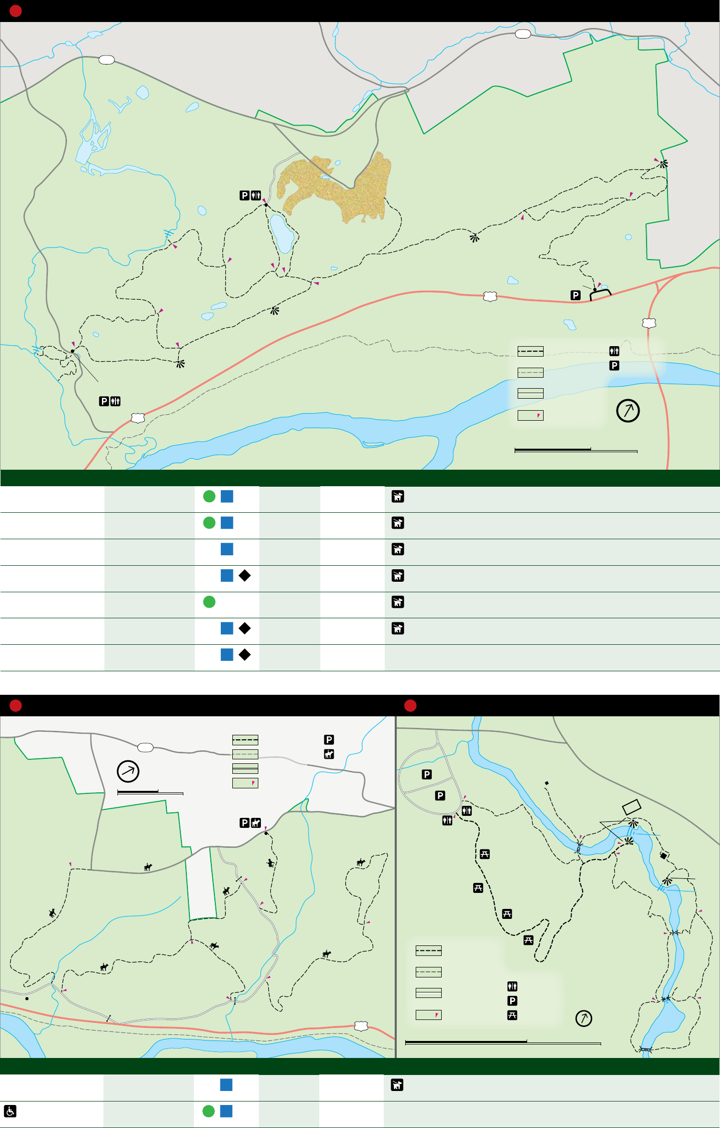
Trail Length Rating ‡ Blaze Elevation ∆ Highlights
Buchanan 1.1 mi
1.8 km
one-way Orange 124 feet Follows an old road trace through the forest
Cliff 2.8 mi
4.5 km
one-way White 390 feet Forested path along the ridge top with several overlooks into the Delaware Valley
below
Hackers 1.4 mi
2.3 km
one-way Yellow 330 feet Shaded trail with a small waterfall in a hemlock ravine
Milford Knob 1.3 mi
2.0 km
one-way Green 390 feet Steep climb to a vista overlooking the town of Milford
Pond Loop 0.8 mi
1.3 km
loop Blue 51 feet Shaded loop around a pond with opportunities to view wildlife
Quarry Path 0.5 mi
0.8 km
one-way Green-white 250 feet Connector trail featuring a vernal pool (seasonal wetland)
Raymondskill Creek 0.3 mi
0.4 km
loop none 178 feet Uneven path through hemlock forest to a three-tiered waterfall; spur trail to creek;
dogs not permitted on trail
1 Trails at Cliff Park, PA
M
i
l
f
o
r
d
R
o
a
d
C
o
n
a
s
h
a
u
g
h
V
i
e
w
R
o
a
d
1.0mi
1mi
0.8mi
0.7mi
0.9mi
0.3mi
1.4mi
1.3mi
1.5mi
M
c
D
a
d
e
R
e
c
r
e
a
t
i
o
n
a
l
T
r
a
i
l
Z
i
m
m
e
r
m
a
n
n
F
a
r
m
R
o
a
d
Z
i
m
m
e
r
m
a
n
n
R
o
a
d
L
o
n
g
M
e
a
d
o
w
R
o
a
d
D
r
y
B
r
o
o
k
C
o
n
a
s
h
a
u
g
h
C
r
e
e
k
0.3mi
To
Dingmans
Ferry
2001
Marie
Zimmermann
House
To
Dingmans
Ferry
Conashaugh View
Trailhead
To
Milford
To
Milford
209
D
e
l
a
w
a
r
e
R
i
ve
r
0
0
0.5 Kilometers
0.5 Miles
Parking for
horse trailers
Parking
Horse/hiking trail
Other hiking trail
Unpaved road
North
Distance
indicator
0.5mi
0
0
0.25 Kilometers
0.25 Miles
P
a
r
k
R
o
ad
S
i
lv
e
r
L
ake
R
o
a
d
D
i
n
g
m
a
n
s
C
r
e
e
k
0.1mi
0.3mi
0.1mi
0.1mi
0.2mi
0.1mi
0.2mi
Deer
Leep
Falls
Fulmer
Falls
Overlook
CCC Pavilion
Overlook
Factory
Falls
Woolen
Mill
Ruin
CCC Pump
Shelter
Parking
Restroom
Accessible trail
Hiking trail
Unpaved road
Picnic area North
Distance
indicator
0.5mi
Trail Length Rating ‡ Blaze Elevation ∆ Highlights
Conashaugh View 8.7 mi
14.0 km
loop -- 515 feet Meanders through upland and lowland forests; horses permitted on trail (horses not
permitted at the Marie Zimmermann house and farm)
George W.
Childs Park
1.1 mi
1.8 km
loop -- 193 feet Follows creek to three waterfalls; ruins of a woolen mill that opertated in the early
1800s; several Civilian Conservation Corps structures; dogs not permitted on trail
2 Conashaugh View Trail, PA 3 George W. Childs Park Trail, PA
6 Gui de to the Gap
e
Silverthread
Falls
Dingmans
Falls
D
i
n
g
m
a
n
s
C
r
e
e
k
0.3mi
0.1mi
Dingmans Falls
Visitor Center
Parking
Information
Restroom
Accessible
Trail
Hiking trail
North
Distance
indicator
0.5mi
0
0
0.25 Kilometer
0.25 Mile
Namanock
206
560
645
To
Layton
To
Layton
To
Dingmans Ferry
O
l
d
M
i
n
e
R
o
a
d
J
a
g
e
r
R
o
a
d
R
i
d
g
e
R
o
a
d
D
e
l
a
w
a
r
e
R
i
v
e
r
0.4
2.1
North
0
0
0.5 Kilometer
0.5 Mile
Parking for
horse trailers
Parking
Horse and
hiking trail
Unpaved road
Distance
indicator
0.5mi
Upper Indian
Ladders
Lower Indian
Ladders
1.9mi
E
m
e
r
y
R
o
a
d
C
h
e
s
t
n
u
t
H
i
l
l
R
o
a
d
D
e
c
k
e
r
C
r
e
e
k
H
o
r
n
b
c
k
s
C
r
e
e
k
209
To Milford
To
Bushkill
North
Parking
Hiking trail
Unpaved road
Distance
indicator
0.5mi
0
0
0.25 Kilometer
0.25 Mile
Trail Length Rating ‡ Blaze Elevation ∆ Highlights
Dingmans Creek 0.4 mi
0.6 km
one-way -- 59 feet Easy boardwalk trail that passes through a pristine hemlock forest, leading to two
waterfalls; trail accessible to lower Dingmans Falls; dogs not permitted on trail
Upper Ridge Road 2.5 mi
4.5 km
one-way -- 197 feet Follows an old road trace through the forest; horses permitted
Hornbecks Creek 1.9 mi
3.0 km
one-way -- 442 feet Shaded trail along side a stream, leading to two waterfalls
4 Dingmans Creek Trail, PA 5 Upper Ridge Road Trail, NJ 6 Hornbecks Creek Trail, PA
North
0
0
1 Kilometer
1 Mile
Parking
Information
Restroom
Trail at PEEC
Other hiking trail
Unpaved road
Distance
indicator
0.5mi
D
e
l
a
w
a
r
e
R
i
v
e
r
0.8mi
1.2mi
0.8mi
0.7mi
1.1mi
1.0mi
0.5mi
2.5mi
R
i
d
g
e
l
i
n
e
T
r
a
i
l
S
c
e
n
i
c
G
o
r
g
e
T
r
a
i
l
S
c
e
n
i
c
G
o
r
g
e
T
r
a
i
l
F
o
s
s
i
l
T
r
a
i
l
0.5mi
0.4mi
0.1mi
T
w
o
P
o
n
d
s
T
r
a
i
l
T
u
m
b
l
i
n
g
W
a
t
e
r
s
T
r
a
i
l
T
u
m
b
l
i
n
g
W
a
t
e
r
s
T
r
a
i
l
A
l
i
c
i
a
C
r
e
e
k
M
i
l
l
C
r
e
e
k
Tumbling
Waters
Pickeral
Pond Front
Pond
E
m
e
r
y
R
o
a
d
M
i
l
f
o
r
d
R
o
a
d
B
r
i
s
c
o
M
o
u
n
t
a
i
n
R
o
a
d
B
r
i
s
c
o
M
o
u
n
t
a
i
n
R
o
a
d
S
p
a
c
k
m
a
n
s
C
r
e
e
k
M
c
D
a
d
e
R
e
c
r
e
a
t
i
o
n
a
l
T
r
a
i
l
To
Bushkill
To Milford
209
2001
Pocono Environmental
Education Center
Sensory
Trail
0.3mi
T
r
a
i
l
F
o
r
E
v
e
r
y
o
n
e
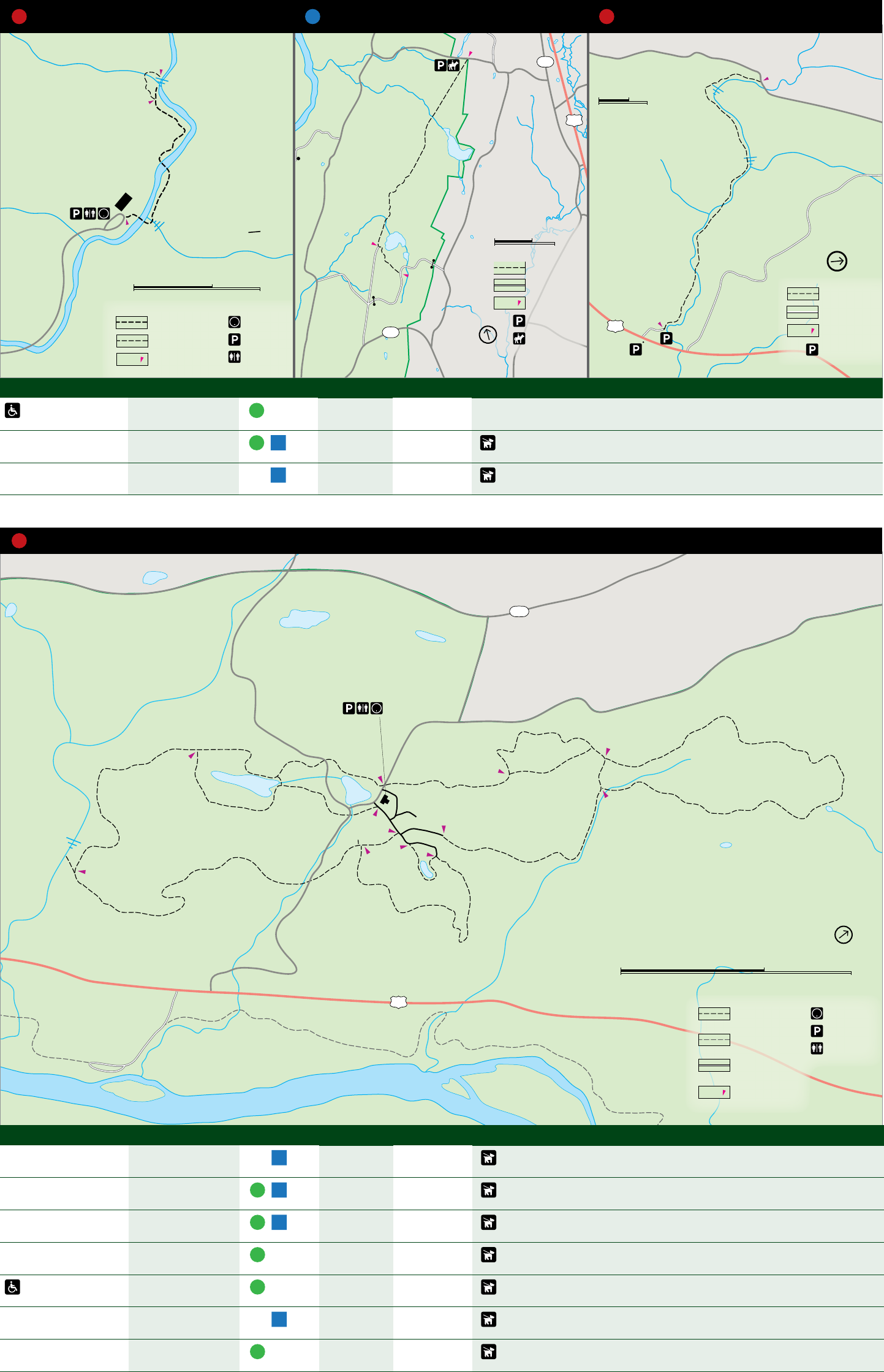
Trail Length Rating ‡ Blaze Elevation ∆ Highlights
Fossil 1.1 mi
1.8 km
loop Blue 237 feet Fossils of ancient marine life; collection of fossils and other objects prohibited
Ridgeline 3.0 mi
4.8 km
loop Yellow 220 feet Hilly terrain, featuring wetlands and forest
Scenic Gorge 2.0 mi
3.2 km
loop Red 220 feet Shaded trail through the forest, passing a small stream; can be muddy after a rain
Sensory Awareness -- -- -- To increase sensory awareness, a rope guides blindfolded users around a short loop
trail (blindfolds available at main office)
Trail for Everyone 0.3 mi
0.5 km
one-way purple -- Several benches provide observation points for wildlife and field, forest, and pond
ecosystems
Tumbling Waters 2.8 mi
4.5 km
loop Orange 254 feet Trail winds along a ridge, past a pond and wetland and into a ravine with a cascading
waterfall
Two Ponds 1.5 mi
2.4 km
loop White 67 feet Mostly shaded trail that passes two ponds and a wetland, offering excellent
opportunities for wildlife viewing
7 Trails at Pocono Environmental Education Center, PA
7 Guide to the Gap
8 McDade Recreational Trail, PA
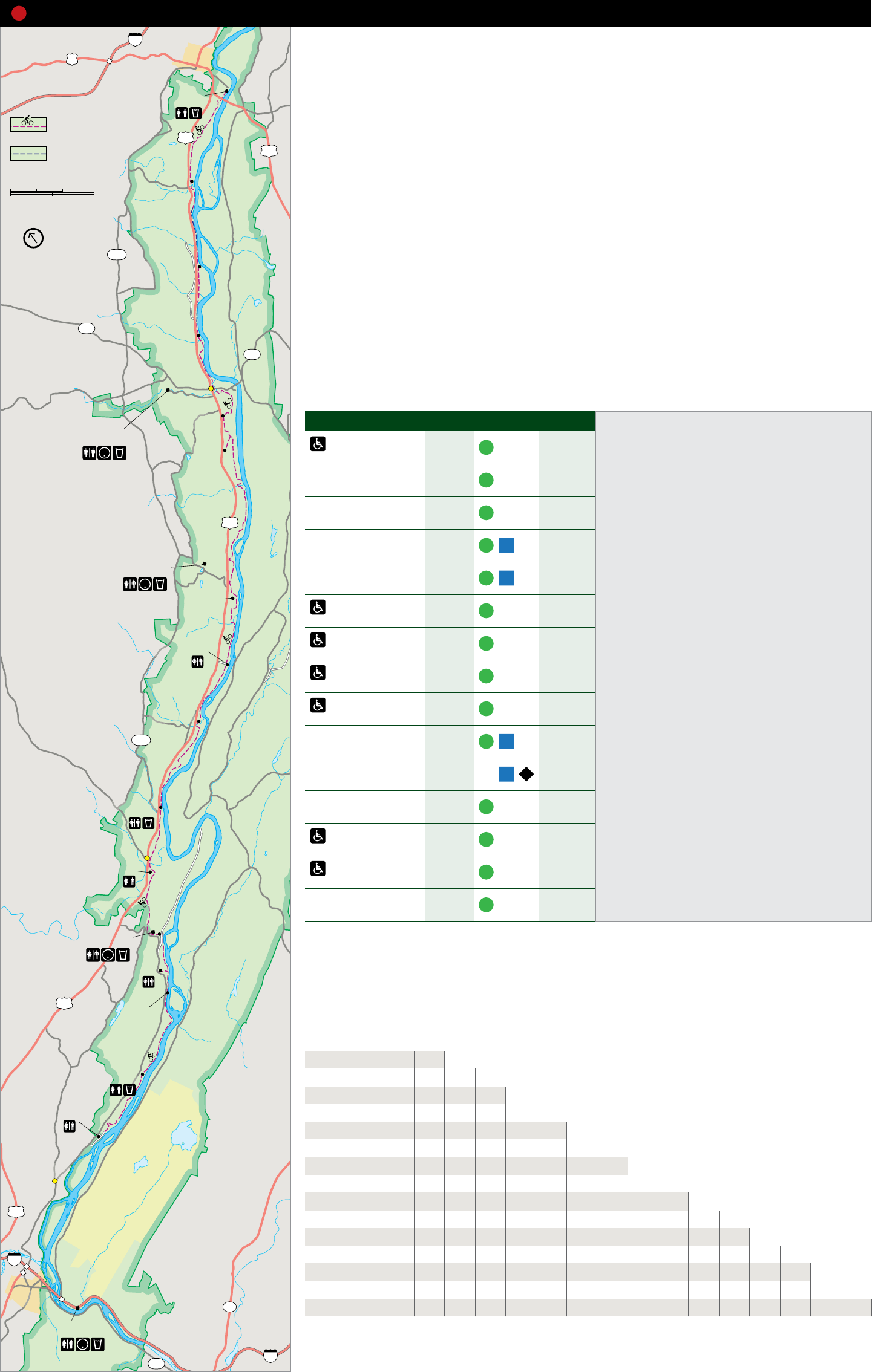
84 The McDade Recreational Trail extends most the length of the park in Pennsylvania and presents some of the best views of the
MILFORD
6 Delaware River, as wells as views of charming streams, open farm fields, forests, and historic landscapes. The trail is a wide,
packed gravel path without blazes and offers hikers, bikers, and cross-country skiers areas of varied difficulty, from easy to
Milford
R
o
a
d
moderately strenuous. With trailheads located one half to five miles apart, this trail offers a section for just about any visitor. Most
Beach
(Fee area) trailheads are along the park’s free bus route that operates on Saturdays and Sundays from Memorial Day Weekend to Labor Day
Joseph M. McDade Weekend.
Recreational Trail
i
l
f
o
r
d
(biking and hiking) 209
M
Joseph M. McDade 206 From the southern-most trailhead at Hialeah to Owens trailhead, the trail is mostly flat as it traverses former settlements and
Recreational Trail
(hiking only) Pittman
Orchard
farms. North from the Owens trailhead on Freeman Tract Road, the trail switchbacks sharply up the side of the ridge to the park’s
headquarters. Observation decks on the side of the headquarters facility provide wildlife viewing areas.
0 2 Kilometers
0 2 Miles Between park headquarters and Bushkill Access, the terrain becomes rolling hills. Numerous structures, foundations, and other
traces remain from the once thriving community of Bushkill.
v
e
r
i
R
North
North of Bushkill Access, the trail follows a narrow ribbon of land between US 209 and the river and then continues through
2001
D
e
l
a
w
a
r
e
Conashaugh nearly level agricultural fields and forests to the Schneider Farm trailhead.
Continuing north, the next several miles are dominated by the river to the east and the cliffs to the west, with the trail and US
209 squeezed between in places. From Raymondskill Creek to Milford Beach, the Raymondskill Cliff parallels the nearly flat trail.
Note: A section of the trail between White Pines and Conashaugh and another section of trail between Conashaugh and Pittman
739
White Pines Orchard are hiking only and closed to bike riding due to stairs and steep grade.
560
Dingmans
Campground
The northern terminus of the McDade Trail is Milford Beach, a popular recreation site for local residents since 1945. Whether you
start from Milford Beach, Hialeah, or a point in between, you are sure to find something to enjoy.
•
Trail Section Length Rating ‡ Elevation ∆
f
o
Dingmans Falls
Visitor Center Schneider Farm
209
Pocono Environmental
Education Center
Things to Know
Milford Beach to 2.2 mi 83 feet • Speed limit is 15 mph.
Pittman Orchard 3.5 km • Bikers must yield to hikers.
Pittman Orchard to 2.4 mi 62 feet • No motorized vehicles.
Conashaugh 3.9 km • Leashed pets are permitted along the trail except
Conashaugh to 1.8 mi at Milford and Smithfield beaches and between
71 feet
White Pines 2.9 km Smithfield Beach and Hialeah late spring to early fall.
White Pines to 4.1 mi 77 feet
Schneider Farm 6.6 km Biking Safely
• Go with the traffic flow; ride on right.
Schneider Farm to 4.9 mi 50 feet • Pass on left and give audible sound to alert others of
Jerry Lees 7.9 km
M
d
R
o
a
d
Jerry Lees
Eshback Access
Egypt Mills
intent.
Jerry Lees to 1.8 mi 25 feet • Obey all traffic laws.
Eshback Access 2.9 km • Yield to traffic and pedestrians.
Eshback Access to 1.8 mi • Be predictable; ride in a straight line and signal
30 feet
Egypt Mills 2.9 km moves.
Egypt Mills to 2.4 mi • Stay alert at all times.
39 feet
Bushkill Access 3.9 km • Look before turning.
• Walk bicycles on steep hills and stairs.
Bushkill Access to 1.7 mi 45 feet • Wear a bicycle helmet. Children 12 years old and
Bushkill Village 2.7 km younger must wear a bicycle helmet.
2001
B
u
s
h
k
i
l
l
F
a
l
l
s
R
o
a
d
Bushkill Access
(Fee area)
Bushkill Village to 2.0 mi 231 feet • Secure loose clothing to ensure it will not become
Park Headquarters 3.2 km entangled in bicycle gears.
Park Headquarters 0.7 mi • Adjust the bicycle to fit. The seat should be level
320 feet
to Owens 1.1 km front to back, and the height should be adjusted to
Owens to 1.2 mi allow a slight bend at the knee when the leg is fully
91 feet
Turn Farm 1.9 km extended. Handlebar height should be level with seat.
• Check your equipment before riding and ensure tires
Turn Farm to 0.5 mi 17 feet are properly inflated and that the brakes work.
Riverview 0.8 km
F
r
e
e
m
a
n
T
r
a
c
t
R
o
a
d
Bushkill
Bushkill Village
Park Owens
• Make yourself visible to others.
Riverview to 2.2 mi 34 feet • Control the bicycle by riding with two hands on the
Smithfield Beach 3.5 km handlebars, except when signaling a turn.
Smithfield Beach to 1.9 mi • Watch for and avoid hazards.
97 feet
Hialeah 3.1 km
Headquarters
Bike Rentals and Tours
Mileage between McDade Trailheads
Turn Farm Edge of the Woods Outdoor Outfitters
O
l
d
M
i
n
e
R
o
a
d
R
i
v
e
r
R
d
209
Riverview
Smithfield Beach
(Fee area)
Hialeah
Shawnee on
Delaware
WORTHINGTON
STATE FOREST
209
80
DELAWARE
Milford Beach
Pittman Orchard
Conashaugh
White Pines
Schneider Farm
Jerry Lees
Eshback Access
Egypt Mills
Bushkill Access
Bushkill Village
Park Headquarters
Owens
Turn Farm
Riverview
Smithfield Beach
110 Main Street
Delaware Water Gap, PA 18327
570 421-6681
Trailhead Name Shawnee River Trips at the Shawnee Inn
100 Shawnee Inn Drive
Pittman Orchard 2.5 Shawnee on Delaware, PA 18356
Conashaugh 5.0 2.5 800 742-9633 or 570 424-4000
White Pines 6.5 4.0 1.5
Schneider Farm 9.6 7.1 4.6 3.1
Jerry Lees 14.9 12.4 9.9 8.4 5.3
Eshback Access 16.7 14.2 11.7 10.2 7.1 1.8
Egypt Mills 18.5 16.0 13.5 12.0 8.9 3.6 1.8
Bushkill Access 20.9 18.4 15.9 14.4 11.3 6.0 4.2 2.4
Bushkill Village 22.6 20.1 17.6 16.1 13.0 7.7 5.9 4.1 1.7
Park Headquarters 24.4 21.9 19.4 17.9 14.8 9.5 7.7 5.9 3.5 1.8
Owens 25.1 22.6 20.1 18.6 15.5 10.2 8.4 6.6 4.2 2.5 0.7
Turn Farm 25.8 23.3 20.8 19.3 16.2 10.9 9.1 7.3 4.9 3.2 1.4 0.7
Riverview 26.4 23.9 21.4 19.9 16.8 11.5 9.7 7.9 5.5 3.8 2.0 1.3 0.6
Smithfield Beach 29.0 26.5 24.0 22.5 19.4 14.1 12.3 10.5 8.1 6.4 4.6 3.9 3.2 2.6
WATER GAP 94 Hialeah 31.0 28.5 26.0 24.5 21.4 16.1 14.3 12.5 10.1 8.4 6.6 5.9 5.2 4.6 2.0
Kittatinny Point
Visitor Center
80
611
i
l
r
8 Gui de to the Gap
d
i
e
0.5mi
B
i
g
F
l
a
t
B
r
o
o
k
Hemlock
Pond
Crater
Lake
Lake
Success
Long
Pine
Pond
Blue Mountain Lake
B
l
u
e
M
o
u
n
t
a
i
n
L
a
k
e
s
R
o
a
d
S
k
y
l
i
n
e
D
r
i
v
e
A
p
p
a
l
a
c
h
i
a
n
N
a
t
i
o
n
a
l
S
c
e
n
i
c
T
r
a
i
l
C
r
a
t
e
r
L
a
k
e
T
r
a
i
l
H
e
m
l
o
c
k
P
o
n
d
T
r
a
i
l
B
l
u
e
M
o
u
n
t
a
i
n
L
a
k
e
T
r
a
i
l
B
l
u
e
M
o
u
n
t
a
in
L
a
k
e
T
r
a
i
l
0.4mi
0.3mi
0.3mi
0.4mi
0.6mi
1.1mi
1.0mi
0.1mi
0.1mi
1.0mi
0.8mi
0.9mi
1.3mi
Crater Lake
Blue
Mountain
Lake
0.1mi
1.5mi
0.3mi
North
0
0
0.5 Kilometers
0.5 Miles
Unpaved Road
Distance
indicator
0.5mi
Appalachian Trail
Hiking Trail
Picnic area
Restroom
Parking
H
a
m
i
l
t
o
n
R
i
d
g
e
T
r
a
i
l
0.5mi
0.4mi
0.9mi
V
a
n
C
a
m
p
e
n
B
r
o
o
k
602
A
p
p
a
l
a
c
h
i
a
n
N
a
t
i
o
n
a
l
S
c
e
n
i
c
T
r
a
i
l
V
a
n
C
a
m
p
e
n
G
l
e
n
T
r
a
i
l
P
i
o
n
e
e
r
T
r
a
i
l
O
r
c
h
a
r
d
T
r
a
i
l
D
o
n
k
e
y
s
C
o
r
n
e
r
T
r
a
l
C
o
v
e
n
t
r
y
P
o
n
d
T
r
l
D
e
l
a
w
a
r
e
R
i
v
e
r
O
l
d
M
i
n
e
R
o
a
d
O
l
d
M
i
n
e
R
o
a
d
B
l
u
e
M
o
u
n
t
a
i
n
L
a
k
e
s
R
o
a
d
O
l
d
M
i
n
e
R
o
a
d
1.8mi
0.6mi
0.8mi
0.9mi
1.6mi
2.3mi
0.2mi
Millbrook
Village
Watergate
Lower Van
Campen Glen
Upper Van
Campen Glen
0
0
0.5 Kilometers
0.5 Miles
North
Restroom
Parking
Distance
indicator
0.5mi
Appalachian Trail
Hiking Trail
Trail Length Rating ‡ Blaze Elevation ∆ Highlights
Blue Mountain Lakes 4.6 mi
7.4 km
loop -- 259 feet Trail follows road traces from a former housing community, passing a clear lake; ideal
for cross-country skiing and snowshoeing
Crater Lake 1.6 mi
2.6 km
loop Orange 111 feet Shaded ridgetop trail loops around a natural glacial lake; a short, steep trail connects
to the Hemlock Pond Trail
Hemlock Pond 1.0 mi
1.6 km
one-way -- 68 feet An easy and shaded trail around a clear pond; accessed via the Crater Lake or Blue
Mountain Lake trails
Coventry Pond 0.9 mi
1.5 km
one-way -- 164 feet Trail follows a road trace that once led to the Coventry Gun Club; pond with
evidence of beaver activity
Donkeys Corner 1.8 mi
2.9 km
one-way -- 380 feet Trail follows the former Donkey Hollow Road that connects Millbrook Village to the
former site of Donkeys Corner
Hamilton Ridge 2.8 mi
4..5 km
one-way Blue 523 feet Trail follows a former road along a forested ridge
Orchard 0.5 mi
0.8 km
one-way -- 491 feet A short, but steep trail connects Millbrook Village to the Hamilton Ridge Trail
Pioneer 2.5 mi
4.0 km
one-way Orange 454 feet Trail passes an old farmstead, overgrown fields, stone fences, and an old lime kiln
Van Campen Glen 1.5 mi
2.4 km
one-way -- 195 feet Trail follows a clear trout stream in a hemlock ravine and passes a small waterfall
12 Trails at Blue Mountain Lake, NJ 13 Trails at Millbrook Village, NJ
M
o
u
n
t
a
i
n
R
o
a
d
NPS
615
B
i
g
F
l
a
t
B
r
o
o
k
B
u
t
t
r
m
i
l
k
F
a
l
l
s
T
r
a
i
l
A
p
p
a
l
a
c
h
i
a
n
N
a
t
i
o
n
a
l
S
c
e
n
i
c
T
r
a
i
l
1.4mi
To
Walpack
Center
Buttermilk Falls
Unpaved Road
Parking
North
0
0
0.25 Kilometer
0.25 Mile
Distance
indicator
0.5mi
Appalachian Trail
Hiking Trail
W
a
l
p
a
c
k
R
i
d
g
e
T
r
a
i
l
M
i
l
i
t
a
r
y
T
r
a
i
l
R
o
a
O
l
d
M
i
n
e
R
o
a
d
M
a
i
n
S
t
r
e
e
t
T
i
l
m
a
n
R
o
a
d
M
o
u
n
t
a
i
n
R
o
a
d
T
h
u
n
d
e
r
M
t
n
R
d
Van
Campen
Inn
Walpack Center
STOKES
ST A TE
FOREST
D
e
l
a
w
a
r
e
R
i
v
e
r
1.0mi
1.5mi
0.5mi
0.4mi
0.2mi
0.1mi
W
a
l
p
a
c
k
R
i
d
g
e
T
r
a
i
l
To
Peters Valley To
Peters Valley
To
Peters Valley
To
Millbrook Village To
Branchville
B
i
g
F
l
a
t
B
r
oo
k
NPS
615
Hiking Trail
Unpaved Road
Parking
North
0
0
0.5 Kilometers
0.5 Miles
Distance
indicator
0.5mi
0.8mi
Toms Creek
2001
L
i
t
t
l
e
E
g
y
p
t
R
o
a
d
M
i
l
f
o
r
d
R
o
a
d
T
o
m
s
C
r
e
e
k
T
r
a
i
l
T
o
m
s
C
r
e
e
k
M
c
D
a
d
e
R
e
c
r
e
a
t
i
o
n
a
l
T
r
a
i
l
L
i
t
t
l
e
E
g
y
p
t
R
o
a
d
209
Hiking Trail
North
0
0
0.25 Kilometer
0.25 Mile
Picnic area
Restroom
Parking
D
e
l
a
w
a
r
e
R
i
v
e
r
Distance
indicator
0.5mi
Trail Length Rating ‡ Blaze Elevation ∆ Highlights
Military Road 1.0 mi
1.6 km
one-way -- 226 feet Former road used by soldiers during the French and Indian War and American
Revolution; shaded trail passing remnants of old farmsteads
Walpack Ridge 3.0 mi
4.8 km
loop Red 137 feet Trail follows the ridge, offering scenic mountaintop ponds and mixed woodlands and
opportunities for wildlife viewing
Buttermilk Falls 1.4 mi
2.3 km
one-way Blue 1104 feet Forested trail climbs to the top of the Kittatinny Ridge, passes a steep, cascading
waterfall at the trailhead
Toms Creek 0.8 mi
1.3 km
one-way -- 96 feet An easy path following a cool, clear-flowing stream through a shaded hemlock
ravine
9 Trails at Walpack Center, NJ 10 Buttermilk Falls Trl, NJ 11 Toms Creek Trail, PA
9 Gui de to the Gap
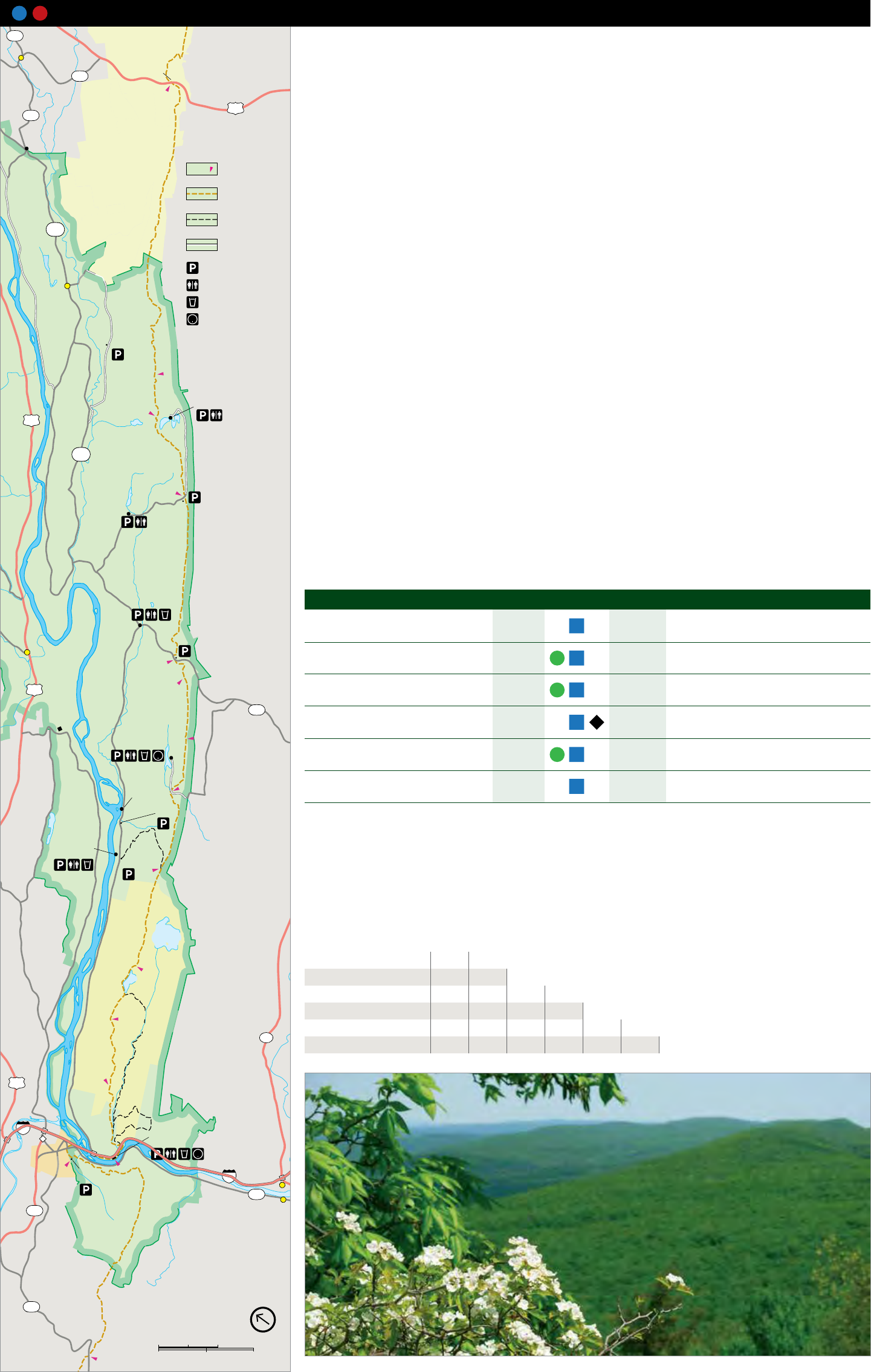
14 14 Appalachian National Scenic Trail, NJ and PA
O
l
d
M
i
n
e
R
o
a
To Milford
645
Layton
O
l
d
M
i
n
e
R
o
a
d
Culvers
Gap
560 To
Branchville
l
u
e
206
640
M
o
u
n
t
a
i
n
Peters Valley
7.2mi
School of Craft
A
p
p
a
l
a
c
h
i
a
n
L
a
N
a
t
i
o
n
a
l
S
c
e
n
i
c
T
r
a
i
l
Distance
STOKES 0.5mi
A
p
p
a
l
a
c
h
i
a
n
N
a
t
i
o
n
a
l
indicator
S
c
e
n
i
c
T
r
a
i
l
K
I
T
T
A
T
I
N
N
Y
ST A TE
S
k
y
l
i
n
D
r
i
e
Appalachian Trail
R
I
D
G
E
FOREST
Other hiking trail
NPS
615
Unpaved road
Parking
Walpack Center Restroom
Drinking water
Information
Buttermilk Falls
Crater Lake
209
2.0mi
NPS
615
k
e
s
R
o
a
d
Blue
Mountain
Lakes
B
The Appalachian National Scenic Trail (AT) traverses the wild Appalachian Mountain chain from central Maine to northern
Georgia, for a distance of approximately 2,180 miles. Nearly 26 miles of the trail straddle the Kittattiny Ridge through New Jersey
and Pennsylvania within Delaware Water Gap National Recreation Area. Numerous other trails connect with the AT and are
described on page 9 and 11 .
The AT is marked with white blazes. Side trails to water, scenic viewpoints, or shelters are marked with blue blazes. Appalachian
Mountain Club’s Mohican Outdoor Center at NJ mile 10.3 offers several self-service cabins, individual and group campsites,
and simple dining options. Numerous weekend hiking activities are offered throughout the year. For more information, contact
Mohican Outdoor Center at 908 362-5670 or visit their website at outdoors.org/lodging/lodges/mohican.
Things to know
• Carry sufficient water for the entire hike. Water along the trail may not be suitable for consumption. All water should be
chemically treated or boiled for five minutes.
• All human waste must be buried at least six inches deep and 100 feet or more from any stream, trail, unpaved road, or park
facility.
• Carry out all trash.
• Self-contained stoves are permitted; ground fires, charcoal stoves and grills are prohibited.
• Cutting, defacing, or removing any natural feature is prohibited.
• Pets must be on a 6-foot leash at all times.
• Horseback riding, biking, and all types of motorized vehicles (except authorized vehicles) are prohibited on the trail within
Delaware Water Gap National Recreation Area.
Camping Regulations
• Camping is restricted to through-hikers who are hiking for two or more consecutive days.
• Camping is limited to one night and ten persons per campsite.
• Self-contained stoves are permitted; ground fires, charcoal stoves and grills are prohibited.
Hikers may not camp:
• Within 100 feet of any stream or water source;
• Within 0.5 mile of an established roadway;
• Within 200 feet of another camping party; or
• From 0.5 mile south of Blue Mountain Lakes Road to a point one mile north of Crater Lake.
No trail shelters exist within the Delaware Water Gap National Recreation Area. The nearest shelters are Kirkridge Shelter in
Pennsylvania, 6.4 miles south of the Interstate 80 bridge, and Brink Road Shelter in New Jersey, 4 miles north of the Buttermilk
Trail spur. Mohican Outdoor Center offers lodging and camping at NJ mile 10.3 and the Worthington State Forest campground
can be reached via the 1.6-mile Douglas Trail at NJ mile 4.6.
1.5mi
2.3mi
1.9mi
C
a
m
p
R
d
1.5mi
3.6mi
1.4mi
R
I
D
G
E
G
a
i
s
l
e
r
R
o
a
d
Millbrook
Village
Bushkill
0.6mi
209
602
Park
Headquarters
Mohican
Outdoor
Center
Poxono
Access
Coppermine
Turtle Beach
(Fee area)
Kaiser
Upper
Yards Creek
Reservoir
Sunfish Pond
WORTHINGTON
STATE FOREST
US 206
Blue Mtn Lakes Road
Route 602
Mohican Outdoor Center
Trail Length Rating ‡
Kittatinny Point
Elevation ∆ Highlights
US 206 to Blue Mtn Lakes Road 10.1 mi Forested ridgetop through Stokes State
650 feet
16.5 km Forest and the park
Lake Lenape
Blue Mtn Lakes Road to Route 602 3.6 mi Forested ridgetop
290 feet
5.6 km
Route 602 to Mohican Outdoor Center 3.5 mi Forested ridgetop, passes Catfish Fire Tower
390 feet
5.6 km
Mohican Outdoor Center to 9.1 mi Forested ridgetop, decending into the
1220 feet
Kittatinny Point 14.6 km Delaware Water Gap, passes Sunfish Pond
Kittatinny Point to Lake Lenape 1.8 mi Through the Borough of Delaware Water
200 feet
2.9 km Gap, climbing to forested ridgetop
Lake Lenape to PA 191 7.2 mi Forested ridgetop
934 feet
11.6 km
Mileage between Appalachian Trailheads
Trailhead Name
Blue Mtn Lakes Road 10.1
Route 602 13.7 3.6
Mohican Outdoor Center 17.2 7.1 3.5
Kittatinny Point 26.3 16.2 12.6 9.1
Lake Lenape 28.1 18.0 14.4 10.9 1.8
O
l
d
M
i
n
e
R
o
a
d
1.6mi
K
I
T
T
A
T
I
N
N
Y
94
209
PA 191 35.3 25.2 21.6 18.1 9.0 7.2
C
h
e
r
r
y
V
a
l
l
e
y
o
a
d
R I D G
E
A
p
p
a
l
a
c
h
i
a
n
N
a
t
i
o
n
a
l
S
c
e
n
i
c
T
r
a
i
l
80
Kittatinny Point
1.8mi
Visitor Center
DELAWARE
WATER GAP Lake Columbia
Lenape 80
7.2mi
611
Portland
611
R
K
I T
T
A
T I N N Y
191 North
0 2 Kilometers
0 2 Miles
View from Raccoon Ridge along the Appalachian National Scenic Trail
d
1.8mi
0.9mi
v
e
10 Guide to the Gap
e
Hidden Lake T
S
l
a
t
e
f
o
r
d
T
r
a
i
l
80
611
S
l
a
t
e
f
o
r
d
C
r
e
e
k
N
a
t
i
o
n
a
l
P
a
r
k
D
r
i
v
e
N
a
t
i
o
n
a
l
P
a
r
k
D
r
i
v
e
Arrow Island
Point of Gap
A
r
r
o
w
I
s
l
a
n
d
T
r
a
i
l
0.9
0.4
0.1
0.3
0.3
0.1
0.2
0.2
1.4
D
e
l
a
w
a
r
e
R
i
v
e
r
To
Portland
To Delaware
Water Gap
To Delaware
Water Gap
To New
York
City
North
0
0 0.5 Mile
0.5 Kilometer
Hiking trail
Distance
indicator
0.5mi
Parking
Scenic View
80
80
611
611
209
447
M
i
n
s
i
F
i
r
e
R
o
a
d
B
u
t
t
e
r
m
i
l
k
F
a
l
l
s
R
d
R
i
v
e
r
R
o
a
d
R
i
v
e
r
R
o
a
d
H
o
l
l
o
w
R
o
a
d
Bro
a
d
R
d
C
h
e
r
r
y
V
a
l
l
e
y
R
d
M
o
u
n
t
a
i
n
R
o
a
d
O
l
d
M
i
n
e
R
o
a
d
Delaware River
1.5
1.4
0.6
Exit 1
0.2
1.2
C
r
e
e
k
T
r
a
i
l
H
o
l
l
y
S
p
r
g
B
e
u
l
a
h
l
a
n
d
T
r
l
D
u
n
n
fi
e
l
d
1.3
0.4
1.1
2.2
1.6
1.1
0.7
0.5
0.3
1.2
D
o
u
g
l
a
s
T
r
a
i
l
0.7
0.7
1.2
0.5
1.0
0.7
0.4
0.5
R
o
c
k
c
o
r
e
s
T
r
a
i
l
G
a
r
v
e
y
S
p
r
i
n
g
s
T
r
l
1.2
0.1
0.6
1.1
2
.
3
t
o
K
a
i
s
e
r
T
r
l
T
u
r
q
u
o
i
s
e
T
r
a
i
l
Sunfsh
Pond
Yards Creek
Upper Reservoir
M
o
u
n
t
T
a
m
m
a
n
y
F
i
r
e
R
o
a
d
2.9
0.3
PENNSYLVANIA
PENNSYLVANIA NEW JERSEY
NEW JERSEY
1.2
0.2
Mt Mohican
(Raccoon Ridge)
1580ft
482m
R
o
c
k
c
o
r
e
s
T
r
a
i
l
B
l
u
e
B
l
a
z
T
r
l
R
e
d
D
o
t
T
r
l
Mt Minsi
1463ft
446m
Point of Gap
Overlook
Lake
Lenape
Resort
Point
Overlook
Karamac
Farview
Dunnfield
Kittatinny Point
Visitor Center
Mt Tammany
1527ft
465m
Douglas
WORTHINGTON
STATE FOREST
North
0
0 0.5 Miles
0.5 Kilometers
Hiking trail
Distance
indicator
0.5mi
Appalachian Trail Restroom
Parking
Campground
Scenic View
Spring
Trail Length Rating ‡ Blaze Elevation ∆ Highlights
Garvey Springs * 1.2mi
1.9km
one-way Orange 1058 feet
Douglas * 1.6mi
2.6km
one-way Blue 994 feet
Rockcores * 2.7mi
4.3km
one-way Green 580 feet
Holly Springs * 2.7mi
4.3km
one-way Red 180 feet Short trail connecting the Appalachian National Scenic Trail to the Dunnfield Creek
Trail
Beulahland * 1.3mi
2.0km
one-way Yellow 560 feet
Turquoise * 1.1mi
1.8km
one-way Turquoise 160 feet
Dunnfield Creek * 3.5mi
5.6km
one-way Green 966 feet
Red Dot 1.2mi
1.9km
one-way Red 1201 feet
Blue Blaze 1.7mi
2.7km
one-way Blue 1201 feet One of two trails that lead to an outstanding view looking into the Delaware Water
Gap from Mt. Tammany
Arrow Island 0.9mi
1.5km
one-way -- 221 feet
Slateford Loop 2.5mi
4.1km
loop -- 144 feet
17 Trails at Worthington State Forest and Kittatinny Point, NJ 18 Trails at Slateford, PA
WORTHINGTON
STATE FOREST
C
o
p
p
e
r
m
i
n
e
T
r
a
i
l
K
a
i
s
e
r
T
r
a
i
l
Camp Road
Mohican Road
Gaisler Road
602
602
O
l
d
M
i
n
e
R
o
a
d
R
a
t
t
l
e
s
n
a
k
e
S
w
a
m
p
T
r
a
i
l
D
e
l
a
w
a
r
e
Catfsh
Pond
Turtle Beach
(fee area)
Poxono
To Blairstown
Mohican
Outdoor
Center
R
i
v
e
r
A
p
p
a
l
a
c
h
i
a
n
N
a
t
i
o
n
a
l
S
c
e
n
i
c
T
r
a
i
l
Catfsh
Fire Tower
Scenic
View
To Millbrook Village
To Millbrook Village
To 80
1.0mi
0.5mi
0.5mi
0.2
mi
0.4mi
1.1mi
0.7mi
1.9mi
1.5mi
0.5mi
1.4mi
2.1mi
0.6mi
0.2
mi
0
0 0.5 Mile
0.5 Kilometer
North
Hiking trail
Unpaved road
Distance
indicator
0.5mi
Restroom
Parking
Hidden
Lake
C
h
u
r
c
h
H
i
l
l
R
o
a
d
H
i
d
d
e
n
L
a
k
e
D
r
i
v
e
K
e
y
s
t
o
n
e
R
o
a
d
M
c
C
o
l
e
R
o
a
d
Hidden
Lake
H
i
d
d
e
n
L
a
k
e
T
r
a
i
l
1.9mi
0
0 0.5 Mile
0.5 Kilometer
Hiking trail
Unpaved road
Distance
indicator
0.5mi
Restroom
Parking
North
Trail Length Rating ‡ Blaze Elevation ∆ Highlights
Rattlesnake Swamp 2.6 mi
4.2 km
one-way Orange 312 feet Trail meanders through a swampy environment with a plethora of plant life and an
interesting contrast to the dry rocky environment seen elsewhere along the ridge
Coppermine 2.0 mi
3.2 km
one-way Red 846 feet Trail passes through a hemlock ravine and mixed hardwood forest, past two old
copper mines; trail also parallels a stream with a number of modest cascades
Kaiser 2.0 mi
3.2 km
one-way Blue 1040 feet Trail follows an old roadbed through a mixed hardwood forest as it climbs to the top
of the ridge
Hidden Lake 1.9 mi
3.0 km
loop -- 80 feet Trail loops through the forest around Hidden Lake, a peaceful area popular with
anglers
rail, Pennsylvania
15 Trails at Mohican Outdoor Center and Turtle Beach, NJ 16 Hidden Lake Trail, PA
Very steep trek to the top of the ridge; trail provides the shortest route to Sunfish
Pond, a natural glacial lake
Steep climb to the ridgetop; hiked by U.S. Supreme Court Justice William O. Douglas
in 1967 to protest expanding Sunfish Pond (a natural glacial lake) for water storage
Old road trace originally provided access for engineers to take rock core samples that
helped determine suitability of Tocks Island Dam; rock core remnants are still seen
Provides scenic views into Pennsylvania and passes several remnants of stonewalls
that once outlined fields cleared by early settlers
Connects the Appalachian National Scenic Trail at Sunfish Pond to the Mt. Tammany
fire road, where nice views of the valley below can be seen
Winds through a hemlock and mixed hardwood ravine with several stream crossings;
numerous small cascades along the creek; ends at Sunfish Pond, a natural glacial lake
One of two trails that lead to an outstanding view looking into the Delaware Water
Gap from Mt. Tammany, very steep trail
Highlights along the trail include the foundation of an early1900s casino and resort
and former farmland stone fence rows
Several short inner-connected trails make up the Slateford Loop Trail; trail meanders
past a former slate quarry and farm; good for cross-country skiing
* located within Worthington State Forest
11 Gui de to the Gap
.
R
k
N
e
v
e
r
s
i
n
N.Y.
e
r
v
i
N.J.
C
u
m
m
i
n
s
R
e
r
w
a
a
C
r
l
d
R
o
a
e
r
e
e
k
R
i
v
D
e
e
p
B
r
o
o
k
V
a
n
d
e
r
m
a
C
r
a
w
f
o
r
d
B
k
r
a
n
S
a
w
k
i
l
l
C
r
e
e
k
C
r
e
e
k
c
h
PA.
N.J.
S
h
i
m
e
r
s
B
r
o
o
k
Raymondskill
C
r
e
e
k
a
r
e
R
i
v
e
r
R
o
a
d
C
o
n
s
h
a
u
g
h
d
C
r
O
l
d
M
i
n
e
R
o
J
a
g
e
r
R
o
a
d
C
o
n
a
s
h
a
u
g
h
V
i
e
w
R
o
a
d
M
i
l
f
o
r
d
D
r
y
B
r
o
o
R
o
a
d
k
R
i
d
g
e
D
e
l
a
w
B
r
o
o
k
A
d
a
m
s
L
i
t
tl
e
F
l
a
t
C
r
e
e
k
L
a
k
e
R
o
a
d
o
o
k
S
i
l
v
e
r
B
r
a
t
l
E
F
G
g
i
I
T
T
A
T
I
N
N
Y
R
I
D
B
E
m
e
r
y
H
o
r
n
b
e
c
k
s
C
r
O
l
d
M
i
n
e
R
o
a
d
l
i
n
a
i
a
h
r
c
T
i
a
n
c
L
a
k
e
O
w
a
s
s
a
R
o
a
d
e
a
l
K
c
p
S
p
l
a
A
n
i
o
t
N
a
B
u
s
h
k
i
l
l
F
a
l
l
s
T
o
m
s
R
o
a
d
C
r
e
e
k
12 Gui de to the Gap
PORT
235 River mileage Appalachian Trail Ranger station Wheelchair accessible JERVIS
(Mile zero is at the 255
river’s mouth) Boat launch Picnic area
To Visitor Contact Facilities
Middletown
6
209
State Forest Other hiking trail MATAMORAS
6
National Park Service-Operated Facilities
Canoe launch Hiking trailhead 1
Unpaved road Joseph M. McDade Information Horse trail
Recreational Trail
(biking and hiking) Lifeguarded swim
53 23 Facility Operating Hours What’s Available
521
area (summer)
Joseph M. McDade
Area within the authorized Recreational Trail
National Recreation Area (hiking only) Park Headquarters Year-round Park information, wildlife viewing platform;
boundary also contains wild- 84
D
e
life management areas and
private land. Respect private
Bushkill, PA Mon-Fri 8:30a-4:30p accessible reception area
GPS: 41.070196,-75.017518 Closed Federal holidays
To
property. New York
City 570 426-2452
r
North 250
05 Kilometers Dingmans Falls Visitor Center May 26 - Sep 4, 2017 Park information, exhibits related to
0 5 Miles Dingmans Ferry, PA Wed - Sun 9a-5p Dingmans Ravine, bookstore, ranger-led
GPS: 41.229431,-74.887667 Closed Mon - Tue programs, Dingmans Creek trailhead;
To Honesdale 6 46
and Scranton
6HIGH 570 828-6125 accessible visitor center and accessible
209
trail to waterfalls
MILFORD POINT
Grey Towers Caddoo
National Historical Access Kittatinny Point Visitor Center May 26 - Sep 4, 2017 Park information, exhibits, bookstore, Red
Knob
Landmark Milford
Forest ServiceU.S. STATE Near Columbia, NJ Fri - Tue 9a-5p Dot and Blue Blaze trailhead, Appalachian
Milford Beach (Fee area) Foster-
Armstrong
House
North Contact Station
84 Toll
bridge
Cliff Park Inn Nelden-Roberts
GPS: 40.970202,-75.128278 Closed Wed - Thr National Scenic Trail access, canoe and boat
PARK 908 496-4458 launch; accessible visitor center
Golf course Millbrook Village May 27 - Sep 3, 2017 Park information, exhibits and demonstrations
Millbrook, NJ Sat & Sun 10a-4p related to 1800s lifeways, self-guided tour
245
Stonehouse
Montague
206 GPS: 41.073524,-74.963349 of select village buildings, several trailheads;
To Scranton 908 841-9531 grounds open daily dawn to dusk
Raymondskill
Falls
a
a
2001 Hainesville
739 209
Namanock
STOKES
STATE
FOREST
Marie
Zimmermann
House 645
240
560 Layton
Dingmans Falls
Dingmans Ferry
Access (Fee area)
DELAWARE Toll
George W. Childs Park bridge 640
Dingmans
Ferry 560
Dingmans Culvers
Campground
Dingmans Falls Wilson
Gap
Kittatinny
Lake
Branchville
STATE Visitor Center Hill
Road
Peters Valley
School of Craft Culvers
Lake
Loch
STILLWATER Lomond
Wild
NATURAL Acres
Lake
FOREST AREA To Dingmans Falls Visitor Center
Partner-Operated Facilities
NPS
615
235
Minks
Pond 521
Pocono Environmental
Education Center Van
Campen Walpack Center
Lake Facility Operating Hours What’s Available
Maskenozha Inn
Foster-Armstrong House Jun 25 - Aug 26, 2017 Park information, exhibits related to the
209
Montague, NJ Sun 1p-4p Montague area, public programs and tours;
DELAWARE WATER GAP GPS: 41.309053,-74.788919 depending on first floor of house partially accessible
Pompey
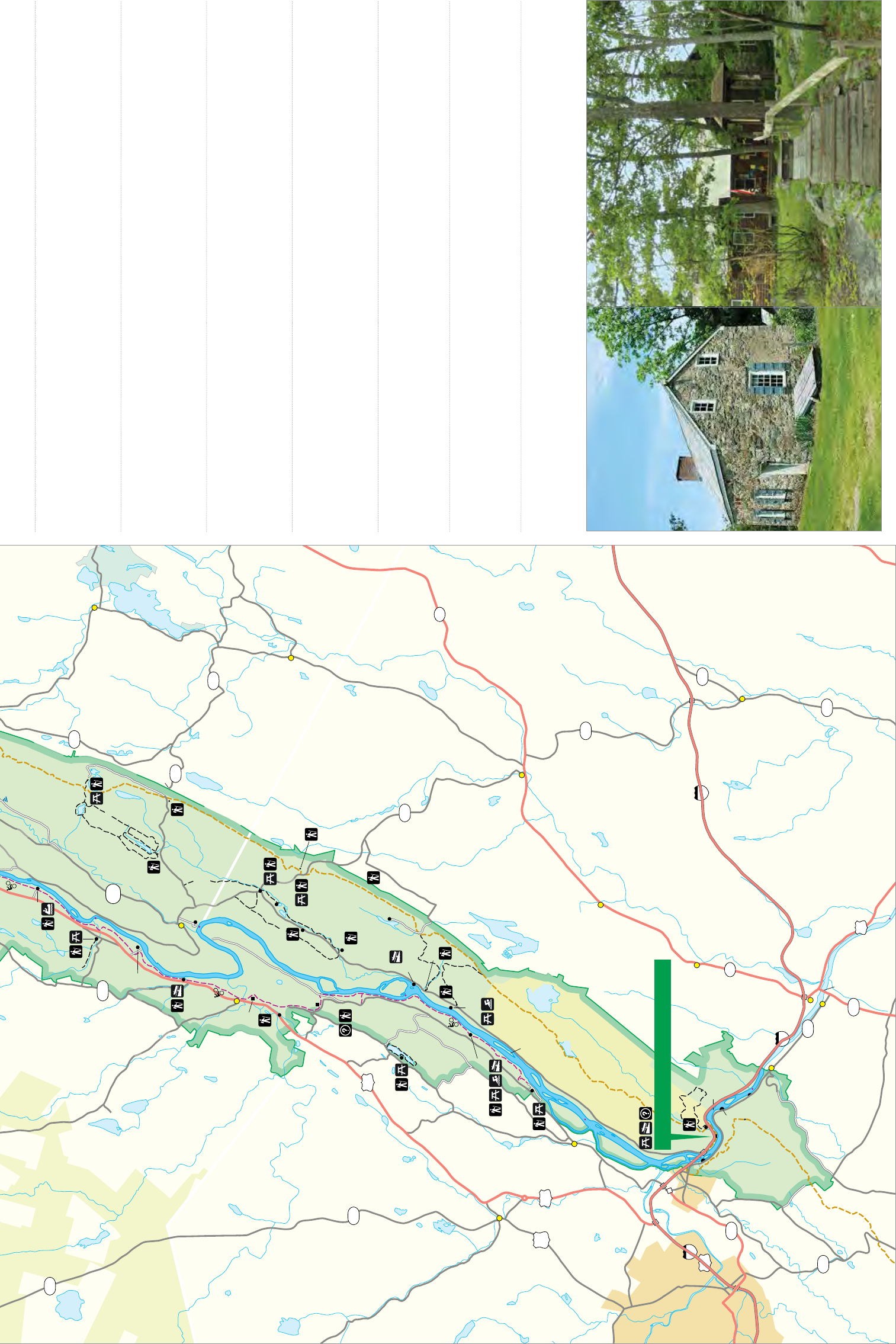
k
o
o
K
I
T
T
A
T
I
N
N
Y
R
I
D
G
E
L
i
t
M
i
l
f
o
r
d
R
o
a
d
B
r
t
l
e
a
d
B
u
s
h
R
o
n
e
i
l
l
i
ta
K
F
l
O
l
d
M
k
a
L
e
d
o
o
w
t
r
s
S
S
w
a
k
o
a
w
o
r
B
N
a
t
i
o
n
a
l
r
a
i
l
T
a
n
i
c
C
r
e
V
a
n
c
a
m
p
e
n
s
a
c
h
i
e
S
c
e
n
k
l
R
o
a
d
A
p
p
a
t
c
r
a
B
u
T
s
F
r
e
e
m
a
n
h
SUSSEX COUNTY
K
WARREN COUNTY
i
l
l
e
n
L
a
k
e
C
r
e
e
k
B
l
a
i
r
d
v
e
d
H
i
r
D
i
e
k
e
J
a
c
k
s
o
n
b
u
r
g
r
R
d
C
C
a
m
p
G
a
i
s
l
e
r
R
d
C
r
e
e
k
P
o
n
d
l
a
i
r
T
i
c
n
e
c
d
S
R
v
e
r
R
i
l
a
v
e
r
R
i
n
o
a
i
t
e
r
N
a
a
n
h
i
c
w
l
a
a
a
p
K
A
p
i
ll
e
l
D
d
E
o
D
a
G
R
R
I
M
e
i
P
a
u
l
i
n
s
n
e
k
e
Y
N
r
O
l
d
C
N
d
T
A
I
l
e
T
k
fi
T
n
I
n
B
r
o
K
u
D
y
n
S
t
o
C
a
l
e
d
o
n
i
a
C
r
e
e
k
D
G E R I
e
v
r
D
i
P
a
r
k
a
n
l
o
N
E
W
i
tN
a
J
e
v
E
R
P
E
N
N
S
S
E
Y
i
Y
M
t
D
r
L
V
A
N
I
A
402
PIKE COUNTY
MONROE COUNTY
M
a
r
s
h
a
l
l
s
C
r
e
e
k
C
r
e
e
k
d
a
h
o
e
d
r
B
d
E
T
o
t
t
s
G
a
p
R
d
R
y
e
G
a
l
l
DR
V
I
C
h
e
r
r
y
e
k
Y
e
C
r
E
y
R
d
D
F
R
l
a
r
V
a
l
l
e
y
G
O
C
h
e
r
r
o
p
.
O
C
P
.
C
O
Y
I
N
N
O
E
A
A
M
P
T
O
N
T
R
T
N
T
O
I
M
H
K
N
O
R
T
Pompey
Ridge
Road Buttermilk 973 293-3106 volunteer availability
Falls
NATIONAL
PENNSYLVANIA montaguehistory.org
Eshback Access
Crater 617
Lake
Mohican Outdoor Center Year-round Park information, Appalachian National Scenic
Near Blairstown, NJ Daily 9a-5p Trail access, year-round outdoor recreation-
GPS: 41.03488,-75.001404 based programs, basic lodging and camping
RECREATION
Toms Creek Hemlock
Pond
230 AREA To
Newton
Swartswood 908 362-5670 facilities
2001 SWARTSWOOD outdoors.org/lodging/lodges/mohican
STATE PARK
NPS
615
Crater Lake
Valley View Group Campsites
(permit)
Pond
Blue Long
Mountain Pine
Lakes Nelden-Roberts Stonehouse Jun 25 - Aug 26, 2017 Park information, exhibits related to the
Blue
Mountain
Lakes Dead end
Montague, NJ Sun 1p-4p Montague area, public programs and tours
Bushkill Access (Fee area)
Flatbrookville GPS: 41.29304,-74.791698 depending on
627
225 Rivers Bend
973 293-3106 volunteer availability
montaguehistory.org
(permit)
Fairview
Lake 617 Peters Valley School of Craft May - Dec, 2017 Park information, art gallery & store, artist
Group Campsites
Layton, NJ Daily 10a-6p demonstrations, self-guided village tours
Bushkill
Bushkill
Meeting Center GPS: 41.196328,-74.850985 (Jun - Aug, Thr 12-8p) on Sat & Sun, fine craft workshops during
Millbrook Village
Upper Glen
973 948-5200 Jan - Apr summer; store accessible
petersvalley.org Thr - Sun, 10a-5p
South Contact Station Watergate
(Fee area) Stillwater
Park
Headquarters
Pocono Environmental Education Center Year-round Park information, exhibits related to plants
Near Dingmans Ferry, PA Daily 9a-4:30p and animals, public, education, and group
Lower Glen GPS: 41.17116,-74.9142 programs, several trailheads, including a
570 828-2319 sensory trail and an accessible trail; main
peec.org facility accessible
209 Mohican
Outdoor
Catfish Center
Hidden Lake Pond Rosenkrans House May 28 - Sep 3, 2017 Park information, exhibits related to historic
602
220 Poxono
Access Walpack Center, NJ Sun 1a-4p Walpack Center; grounds open dawn to dusk
To Newton
GPS: 41.158867,-74.880463 depending on
Coppermine walpackhistory.org volunteer availability
94
Kaiser Van Campen Inn May 28 - Sep 3, 2017 Park information, house tours, Military Road
Turtle Beach
Smithfield Beach (Fee area)
(Fee area) Near Walpack Center, NJ Sun 1p-3p trailhead
GPS: 41.164648,-74.892164 depending on
Lower
Yards Creek walpackhistory.org volunteer availability
TOCKS
Reservoir
Hialeah ISLAND Upper Blairstown
Yards Creek
Reservoir
Sunfish Pond
WORTHINGTON
Shawnee on
Delaware
521
215 STATE FOREST Walnut Valley To
New York
City
NEW JERSEY
o
Kittatinny Point Visitor Center
Dunnfield
Toll
DELAWARE bridge 1527ft Hainesburg
465m
Resort 1 Mt Tammany
Point THE GAP
Overlook
80 519
Point of Gap 94
Overlook
Mt Minsi Hope
1463ft
446m 210
Arrow
Island
Overlook
Slateford 80
4
Totts Gap 611 Columbia
Portland
Toll
519
bridge
46
611
B
l
u
e
205 Neldon-Roberts Stonehouse Mohican Outdoor Center
402
Marshalls Creek
BUS
209 209
309
EAST
STROUDSBURG 310
80 WATER GAP
209
611
To Scranton,
Bethlehem,
and
Hazleton
191
13 Gui de to the Gap
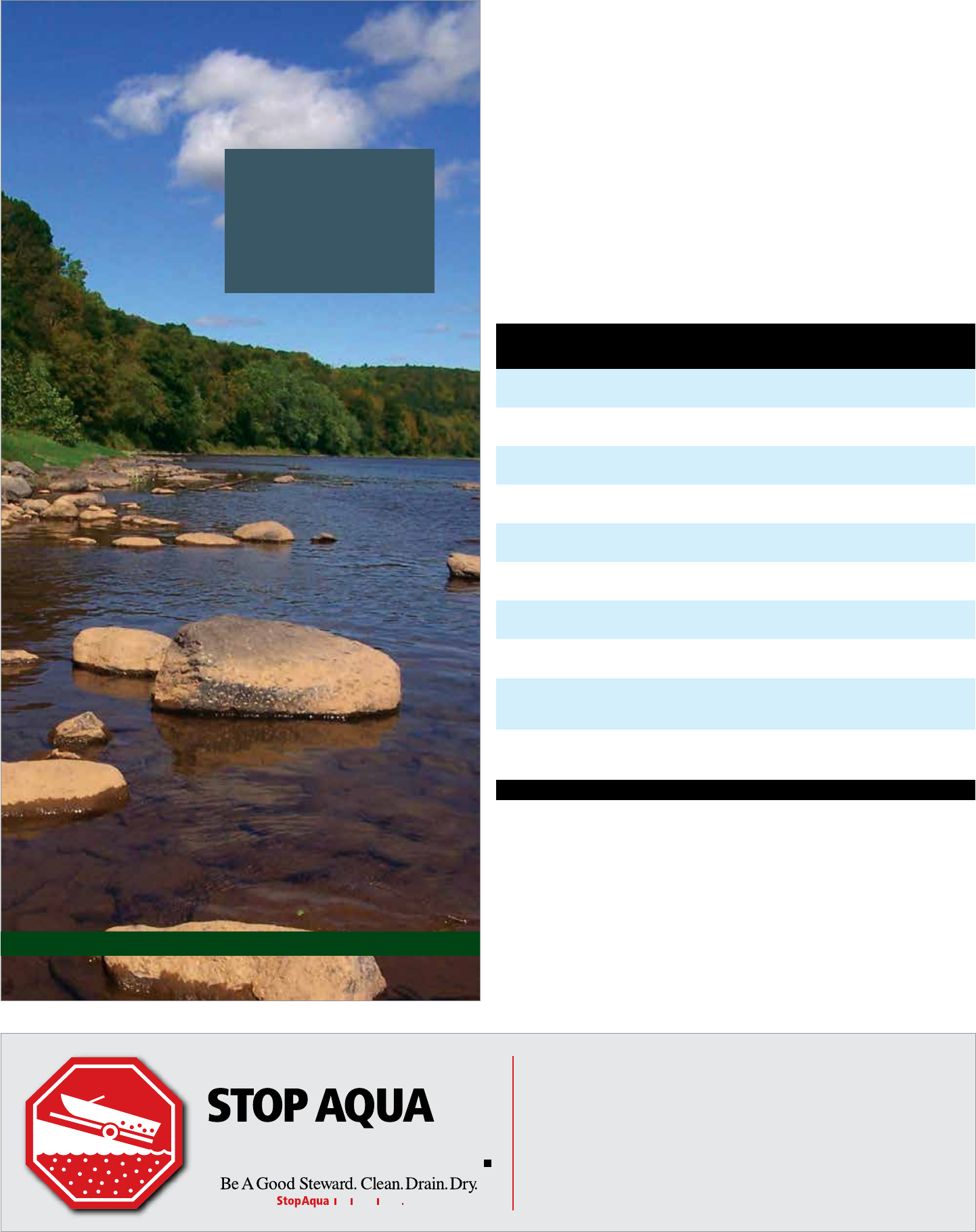
Authorized Canoe, Kayak, and Tube Liveries
Adventure Sports, Inc. 570 223-0505 adventuresport.com
Route 209, Marshalls Creek, PA 18335 800 487-2628
Chamberlain Canoes 570 421-0180 chamberlaincanoes.com
PO Box 555, Shawnee on Delaware, PA 18356 800 422-6631
Delaware Family Campground 908 475-4517 njcamping.com/delaware
100 Rt. 46, Delaware, NJ 07833 800 543-0271
Dingmans Campground 570 828-1551 dingmanscampground.com
1006 Rt. 209, Dingmans Ferry, PA 18328 877 828-1551
Edge of the Woods Outfitters 570 421-6681 watergapadventure.com
110 Main St., Delaware Water Gap, PA 18327
Indian Head Canoes and Rafts 800 874-2628 indianheadcanoes.com
3883 Rt. 97, Barryville, NY 12719
Kayak East 570 421-3432 kayakeast.com
PO Box 77, Columbia, NJ 07832 866 529-2532
Kittatinny Canoes 570 296-5890 kittatinny.com
2130 Rt. 739, Dingmans Ferry, PA 18328 800 356-2852
Mauka Nalu Stand-Up Paddleboards 570 420-1905 maukanalu.com
100 Shawnee Inn Drive
Shawnee on Delaware, PA 18356
Shawnee River Trips 570 424-4000 shawneeinn.com
100 Shawnee Inn Drive 800 SHAWNEE
Shawnee on Delaware, PA 18356
A Day on the Delaware River
Summer River Facts
Average Daily Temp. 64° F / 18° C
Average High Temp. 79° F / 26° C
Average Water Temp. 80° F / 27° C
Average Rainfall 13 in / 32 cm
Average Water Flow 2 mph / 3 kph
Average Depth 5 ft / 1 m
Maximum Depth 45 ft / 14 m
The Delaware River is the longest
undammed United States river east
of the Mississippi, extending 330
miles from Hancock, New York to the
Atlantic Ocean. The Delaware River
Water Trail extends nearly 200 miles
from Hancock, New York to Trenton,
New Jersey. Like a conventional trail,
a water trail is a recreational corridor,
but instead of hiking, it is traveled by
boat, such as canoe, kayak or small-
motorized watercraft.
The outstanding natural, cultural,
recreational and scenic resources of
the Delaware River within Delaware
Water Gap National Recreation Area
led it to be designated as the Middle
Delaware River National Scenic and
Recreational River in 1978. Within the
park, the river is a series of shallow
riffles and quiet pools, making
this section particularly good for
canoeing. Access points every eight
to ten miles allow for easy day trips.
Numerous primitive campsites allow
for longer trips.
While the Delaware River is easy
for boaters, do not be misled by its
calm appearance. Always follow
proper water safety precautions to
ensure you have a safe and enjoyable
experience.
River Camping
For extended boat trips (14 miles or more), free
primitive campsites along the river are available
first-come, first-serve. Additionally, six sites at
the Alosa Campsite are available by reservation
only. For Alosa Campsite reservations call
877 444-6777 or go online to recreation.gov
and search for Alosa. Service charges will apply
when making reservations either by phone or
the recreation.gov website.
Key Regulations
• Camping is limited to boaters on trips at
•
•
•
least 14 miles for one night, 26 miles for
two nights and 34 miles for three nights.
Camping along the river is permitted in
designated sites only.
Camping is limited to one night at each
location.
Campsites are limited to five tents per
campsite.
Swimming
Pack a swimsuit and a picnic and head to the beach - the river beach, that is.
Unlike the sandy beaches along the ocean, the beaches here have soft grass on
which to stretch out and enjoy the day.
Milford, Smithfield, and Turtle Beaches are designated swim areas. Lifeguards
monitor the beaches daily mid-June through Labor Day. Swimming in other
areas of the river is not recommended. This summer, enjoy a day at the beach!
Delaware River
• DRY equipment before launching watercraft into another body of water.
Stop the Transport of Invasive Species:
• CLEAN boots, gear, boat, trailer & vehicle of plants, fish, animals & mud.
• DRAIN bilge, ballast, wells, and buckets before you leave the area.
• Do not urinate or defecate within 100 feet
•
• Do not feed or approach wildlife.
• The use of drones is prohibited.
• Tents must be erected within 50 feet of
the campsite fire grate.
• Fires permitted in existing fire grates only.
• Self-contained stoves are permitted.
• Use dead and down wood only. Do not
cut standing trees.
• Pack out what you pack in, including food
scraps.
• Use soaps sparingly; even biodegradable
soap is a pollutant.
of any river or stream. Bury fecal material,
including pet waste, at least six inches
deep and at least 100 feet away from
water.
Leave what you find; digging, collecting,
or removing objects is prohibited.
14 Guide to the Gap
209
209
80
2001
245
240
235
230
215
210
220
250
225
Water Safety
6
209
84
640
560
560
739
6
206
602
94
209
209
611
2001
NPS
615
NPS
615
PENNSYL V ANIA
D
e
l
a
w
a
r
e
R
i
v
e
r
MILFORD
WORTHINGTON
STATE FOREST
DELAWARE
WATER GAP
Smithfield Beach
(Fee area) Turtle Beach
(Fee area)
Poxono
Access
Bushkill Access
(Fee area)
Rivers Bend
Group Campsites
(permit)
Valley View Group Campsites
(permit)
Eshback
Access
Park
Headquarters
Namanock
Milford Beach
(Fee area)
Caddoo
Access
M
i
l
f
o
r
d
R
o
a
d
M
i
l
f
o
r
d
R
o
a
d
O
l
d
M
i
n
e
R
o
a
d
B
u
s
h
k
i
l
l
F
a
l
l
s
R
o
a
d
R
i
v
e
r
R
o
a
d
Dingmans Ferry
Access (Fee area)
Dingmans
Campground
O
l
d
M
i
n
e
R
o
a
d
Kittatinny Point
Dingmans Falls
Visitor Center
(permit)
1
1
235
Lifeguarded swim
area (summer)
Boat launch
Picnic area
Canoe launch
Information
River mileage
(Mile zero is at the
river’s mouth)
Permit-only
campsite
River campsite
in PA (red)
River campsite
in NJ (blue)
North
0
0 1 Mile
1 Kilometer
13
9
11
12
10
8
7
6
5
4
3
2
1
14
NEW JERSEY
15 Gui de to the Gap
Planning a safe day at the river begins well before you get near
the water and does not end until you return home. Even though
the Delaware River appears calm in some areas, DO NOT be
misled! Moving water must be respected. The information
below will help you better understand how to safely and
comfortably enjoy the river.
In General:
• Always wear your life jacket.
• Alcoholic beverages are prohibited at Milford Beach,
Smithfield Beach, and Hialeah Picnic Area in Pennsylvania,
and Turtle Beach, Worthington State Forest, and Tocks and
Labar Islands in New Jersey. Alcoholic beverages are also
prohibited between Depew Island on the north and Depue
Island on the south.
• Do not drink during river activities.
• Wear shoes to protect your feet from sharp stones and
from glass.
• Protect yourself from the sun: wear sunscreen, a hat, light
clothing, and sunglasses.
• Stay hydrated. Bring and drink plenty of water. Don’t drink
river water unless it is boiled at least 10 minutes.
• Plan to be off the river before dark.
When Swimming:
• Wear your life jacket even when swimming; don’t
overestimate your swimming ability.
• Do not attempt to swim or wade across the river. The
Delaware River has strong currents and steep drop-offs.
Swimming becomes more difficult with increased current
and water depth. Even the strongest of swimmers should
be extremely cautious.
• Swim at designated beaches. Lifeguards are on duty at
Milford, Smithfield and Turtle beaches mid-June through
Labor Day.
First-Come/First-Serve River Campsites
NJ 41.334419 -74.761520 1 4 1
NJ 41.264988 -74.843964 4 6 14-17
NJ 41.248880 -74.855515 6 6 18-23
PA 41.185276 -74.880993 1 10 24
PA 41.178972 -74.885157 3 10 27-29
PA 41.153859 -74.908620 2 10 33-34
PA 41.151045 -74.911284 1 10 35
PA 41.127015 -74.948574 4 10 39-42
NJ 41.112459 -74.973252 3 6 52-54
PA 41.092099 -74.993005 1 10 55
NJ 41.093485 -74.989833 12 6 56-68
NJ 41.096138 -74.967613 7 6 73-79
PA 41.093276 -74.967570 2 10 82-83
# on Map River Campsite Name State GPS # Sites at
Location
# People
/ Site Site #
1 Mashipacong Island
2 Namanock Island
3 Sandyston
4 Dingmans Shallows
5 Hornbecks
6 Jerry Lees
7 Mill Creek
8 Toms Creek
9 Ratcliffs
10 Bushkill Creek
11 Peters
12 Quinns
13 Freeman Point
River Miles between River Accesses
Access Name
Dingmans, PA
Eshback, PA
Bushkill, PA
Poxono, NJ
Smithfield, PA
Worthington State Forest, NJ
Namanock, NJ 4
Dingmans, PA 8 4
Eshback, PA 14 10 6
Bushkill, PA 18 14 10 4
Poxono, NJ 26 22 18 12 8
Smithfield, PA 28 24 20 14 10 2
Worthington SF, NJ 30 26 22 16 12 4 2
Kittatinny Point, NJ 34 30 26 20 16 8 6 4
• Do not jump or dive from cliffs, rocks, or bridges into
the river; the water may be shallow and objects can be
submerged. Rivers are constantly changing, especially with
high water. Rocks can show up in places they never were
before.
• Do not swim alone - always stay with your group.
When Boating:
• Always wear your life jacket.
• Children 12 years of age and younger must WEAR a life
jacket on board a vessel.
• Life jackets must be worn in vessels less than 16 feet
between November 1 and April 30.
• Never stand in a canoe. For better balance, kneel in a
canoe when going through rapids.
• If you capsize, don’t panic. Stay with your boat; even an
overturned boat can support you. Keep upstream of your
boat to avoid being pinned against a rock or obstacle. Float
on your back with your feet pointed downstream. Use
your paddle to push away from rocks and other obstacles.
Retrieve boats and equipment only if it can be done safely.
• Be ready for changing weather and cold water. Bring rain
gear. To protect against hypothermia, bring clothing made
of wool, polypropylene, high-performance fleece, or a
wetsuit.
• Never try to stand in rapids. Your foot could become
trapped between submerged rocks. With a foot trapped,
the current can be strong enough to push you over and
hold you under, even if you are wearing a life jacket.
• Always tell someone where you are going and when you
expect to return. Arrange drop off and pick up points
before you leave. Leave emergency phone numbers and
vehicle description and tag numbers with someone who
can report that you are overdue.
• Bring a spare paddle, a throw line, and a first aid kit.
Reservable Campsites along the River
Name ST GPS
Dingmans Campground¹
(access by river or vehicle)
RV, tent, and group sites
PA 41.210694,
-74.873154
Valley View Group Campsites¹
(access by river or vehicle)
tent sites for groups up to 25
PA 41.115366,
-74.963938
Rivers Bend Group Campsites¹
(access by river or vehicle)
tent sites for groups up to 25
NJ 41.096118,
-74.966632
Alosa River Campsite2
(access by river only)
tent sites for groups up to 6 or 10
PA 41.083544
-74.97629
1 see page 21 for more information ² #14 on map
Below: A view of the Delaware Water Gap and Kittatinny
Ridge from a distance
Milford Beach, PA
Namanock, NJ

New
River Runner Schedule
Saturdays and Sundays, Memorial Day Weekend to Labor Day Weekend
Also: May 29 (Memorial Day), July 3, July 4 (Independence Day), and September 4 (Labor Day)
NORTHBOUND SCHEDULE SOUTHBOUND SCHEDULE
Kittatinny Point to Milford Milford to Kittatinny Point
Kittatinny Point
Visitor Center 7:00 9:00 10:00 11:00 12:00 1:00 2:00 4:00 Downtown Milford 9:00 11:00 12:00 1:00 2:00 3:00 4:00 6:00
Delaware Water Gap
Park and Ride 7:02 9:02 10:02 11:02 12:02 1:02 2:02 4:02 Milford Beach 9:05 11:05 12:05 1:05 2:05 3:05 4:05 6:05
Shawnee Inn 7:08 9:08 10:08 11:08 12:08 1:08 2:08 4:08 Dingmans Access 9:25 11:25 12:25 1:25 2:25 3:25 4:25 6:25
Smithfield Beach 7:23 9:23 10:23 11:23 12:23 1:23 2:23 4:23 Pocono Environmental
Education Center 9:35 - - - - - 4:35 -
Fernwood 7:38 9:38 10:38 11:38 12:38 1:38 2:38 4:38 Toms Creek Picnic Area 9:50 11:37 12:37 1:37 2:37 3:37 4:50 6:37
Bushkill Access 7:45 9:48 10:48 11:48 12:48 1:48 2:48 4:48 Bushkill Access 9:55 11:42 12:42 1:42 2:42 3:42 4:55 6:42
Toms Creek Picnic Area 7:50 9:50 10:50 11:50 12:50 1:50 2:50 4:50 Fernwood 10:00 11:47 12:47 1:47 2:47 3:47 5:00 6:47
Pocono Environmental
Education Center - 10:10 - - - - - 5:10 Smithfield Beach 10:20 12:07 1:07 2:07 3:07 4:07 5:20 7:07
Dingmans Access 8:05 10:25 11:05 12:05 1:05 2:05 3:05 5:25 Shawnee Inn 10:35 12:22 1:22 2:22 3:22 4:22 5:35 7:22
Milford Beach 8:25 10:45 11:25 12:25 1:25 2:25 3:25 5:45 Delaware Water Gap
Park and Ride 10:42 12:29 1:29 2:29 3:29 4:29 5:42 7:29
Downtown Milford 8:35 10:55 11:35 12:35 1:35 2:35 3:35 5:55 Kittatinny Point
Visitor Center 10:47 12:34 1:34 2:34 3:34 4:34 5:47 7:34
Black Numbers = AM Green Numbers = PM
16 Guide to the Gap
People of the Delaware River Valley
Human occupation in the Delaware River valley dates back
over 12,000 years when small family bands moved across the
landscape, hunting game, fishing the rivers and lakes and
gathering food from the forests and grasslands. About 8,000
years ago, groups began to travel less and relied on a variety of
foods found locally, such as acorns, nuts, fish, deer and turkey.
Families began farming about 2,000 years ago, leading to a more
settled lifestyle.
The Lenape (len-AH-pay) or Delaware lived in an area they
called “Lenapehoking,” which means “Land of the Lenape.”
Lenapehoking included eastern Pennsylvania, all of New Jersey,
southeastern New York, northern Delaware, and a small section
of southeastern Connecticut. While some Lenape lived in large
villages of about 200 people, most lived in groups of 50 to 75.
Left: Painting depicting William Penn entering into 1683 peace treaty.
Right: Tish-Co-Han, Lenape Chief in the 1700s
The arrival of Europeans in the mid-1500s meant drastic
changes for the Lenape. European explorers traded iron axes,
cloth, and copper kettles with the Lenape for valuable animal
furs. In addition to the rich natural resources, Europeans
also wanted land. Conflicts arose between the Lenape and
European colonists over land ownership. Additionally, the
introduction of diseases devastated the native population, who
had no immunities. By the mid-1700s, warfare and diseases
contributed to an estimated loss of 90% of the Lenape people.
During the 1700s, most Lenape people voluntarily moved
or were forcibly moved west, eventually settling in Canada,
Wisconsin, and Oklahoma.
Today, most Lenape decedents still live Canada, Wisconsin,
and Oklahoma. Their arts and oral traditions reflect their
culture and they continue to stay connected to their ancestral
homeland. Additionally, the Lenape legacy remains through
various place names in the park.
Places with Lenape Names
Kittatinny: from the Lenape word
Kitahtëne, which means “endless hill”
Minisink – “from the rocky land”
Pahaquarry: from the Lenape word
Pahaqualong, which means “the place
between the mountains beside the
waters”
Pocono: from the Lenape word
Poco-hanne, which means “a stream
between mountains”
Mount Tammany: named after the
Lenni Lenape Chief Tamanend
River Runner Shuttle Bus
The National Park Service has partnered with The River Runner Shuttle is a free service.
Monroe County Transit Authority (MCTA) Pick your boarding location and destination
to provide free public bus service along the using the schedule below. Be at the stop five
Pennsylvania side of the river and to Kittatinny to ten minutes prior to the schedule arrival
Point in NJ. MTCA provides a bus service on with your gear ready to load. In addition to
Saturdays and Sundays between Memorial passengers, MCTA can also transport bicycles,
Day and Labor Day weekends between canoes, kayaks, and leashed dogs. Passengers
Stroudsburg, PA and Milford, PA, with a stop are required to load and secure their own
at Kittatinny Point. Additionally, bus service is belongings and MCTA operators will check the
provided on May 29 (Memorial Day), July 3, equipment to ensure it is properly stowed.
July 4 (Independence Day), and September 4
(Labor Day).
Canada
New York
Pennsylvania
Maryland
Delaware
New
Jersey
Virginia
Atlantic
Ocean
Lenapehoking
Lake
Ontario
Vermont
Connecticut
Massachusetts
Hampshire
Loading and securing equipment takes some
time, so please be aware that there may be
times when the bus is late. For groups of ten or
more people, please contact MCTA in advance
to ensure they are properly prepared for your
large group.
Programs like the River Runner Shuttle are
just one way the park is working to lessen the
footprint we all leave on the planet. For more
information about the shuttle visit MCTA’s
website at gomcta.com.
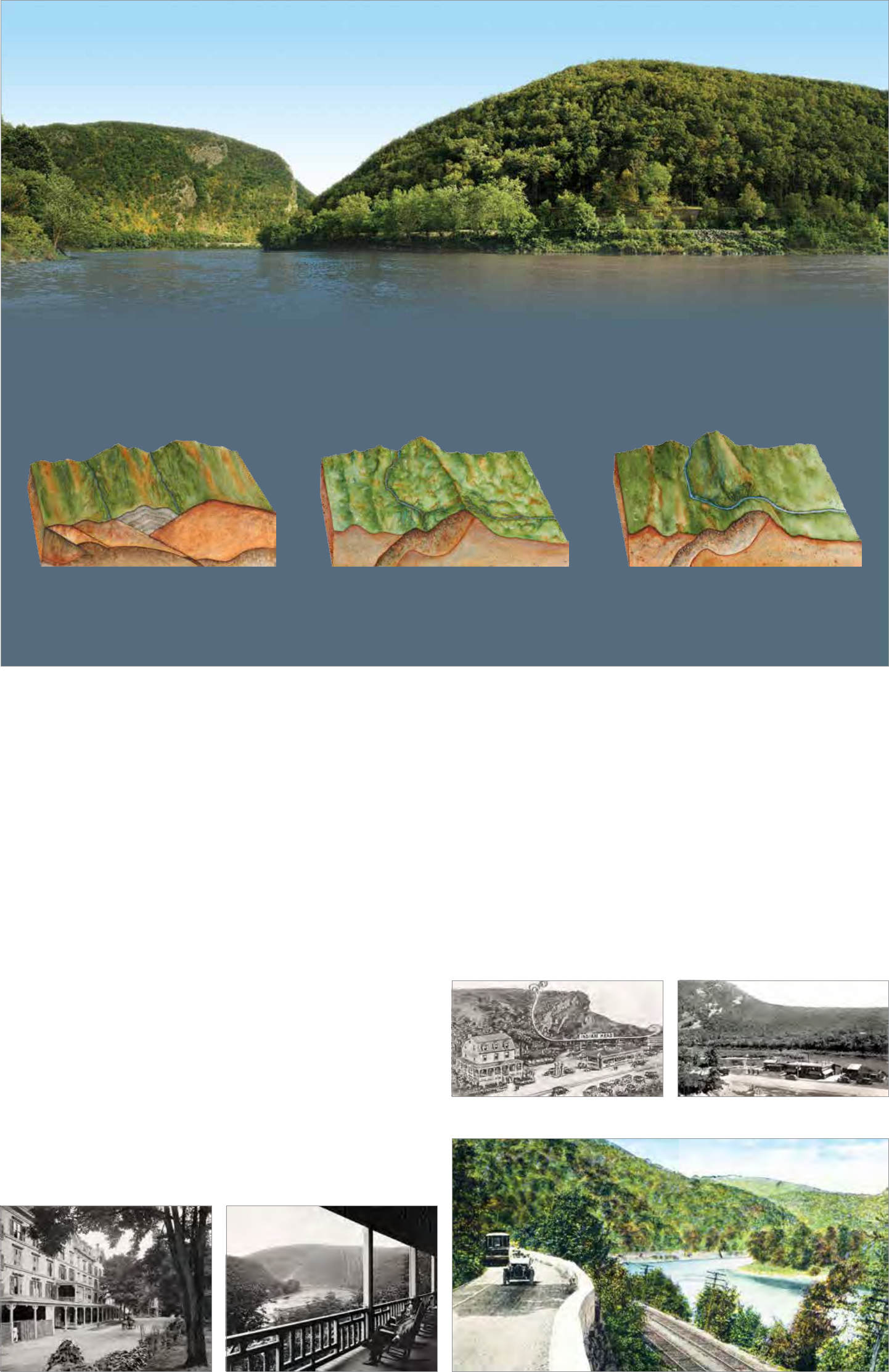
The Delaware Water Gap
A water gap is formed when water carves its way through a mountain top of Mt. Tammany to the top of Mt. Minsi. Sand and rock move with the
range. The Delaware Water Gap is known for its depth, width, and scenic river flow, continuing to scour out the riverbed and making the water gap
beauty. It is more than 1,200 feet from mountaintop to the river surface, larger over time.
nearly a quarter mile wide at river level and about a mile wide from the
Stage 1: Collision Stage 2: Erosion Stage 3: Capture
About 300 million years ago, the ancient continents
of North America and Africa collided. The impact
caused the Earth’s crust to fold and lift up, forming the
Appalachian Mountains including Kittatinny Ridge.
Streams flowed on both sides of Kittatinny Ridge. The
streams on the east side aggressively eroded layers of
rock and limestone. A few million years ago, they finally
carved their way through the mountains.
When the streams met, the one with the stronger
current captured the flow of the other. The second
stream changed course to flow through the water gap.
Overlooks in the Gap
Tourist attractions of all sorts once lined River Drive through the Delaware Water Gap, today’s
PA 611. Other than the stone guardrail lining the road, little remains of that historic past. The
stunning beauty of the water gap makes this short (2-mile) drive a must-do during your vacation.
Resort Point Overlook
The best known part of the recreation area is the water gap, a distinct notch, more than a mile
wide, cut through Kittatinny Ridge by the Delaware River. In the early 1820s, visitors rented rooms
with local families in order to enjoy the area’s beauty. In 1932, a 25-guest hotel overlooking the
Delaware River opened in the Delaware Water Gap. By 1860, the Kittatinny Hotel had expanded
to accommodate 250 guests.
Popularity of the area continued to grow and additional hotels opened to meet the lodging needs
of vacationers. Typically, vacationing families consisted of mothers and their children spending
the entire summer in one of the hotels, with the father joining them on the weekends. Visitors
occupied themselves by hiking, swimming, fishing, dancing, playing tennis and golf, visiting
amusement parks, shopping for souvenirs, and delighting in carriage, steamboat, and rowboat
rides. But according to the Kittatinny Hotel manager, “Perhaps the featuring asset of the Gap,
aside from its beautiful gorge, through which flows the placid Delaware, is its health giving
atmosphere, which permeates everywhere and which in itself has given the region much of its
charm and popularity.”
By the early 1900s, many people had private automobiles. Magazines and newspapers extensively
advertised various appealing destinations for city dwellers. At the same time improved roads
gave people a greater choice of holiday areas. Weekend excursions began replacing summer-
long holidays. The traditional resort business of the Delaware Water Gap began to decline. The
economic depression of the 1930s changed the nation’s way of life, and grand hotels could
not compete with the new, popularly-priced, year-round weekend resorts in the nearby Pocono
Mountains. A fire claimed the Kittatinny Hotel in 1931 and today, Resort Point Overlook preserves
the view from the location of the once grand hotel.
Point of Gap Overlook
This overlook is in the heart of the Delaware Water Gap, between Mt. Minsi in Pennsylvania and
Mt. Tammany in New Jersey. Just as it is a popular place for viewing today, this was also a popular
stop for the Victorian vacationer. A tourist attraction called the “Indian Head Lunch,” so called
for its view of the cliff across the river, offered meals and souvenirs and the Myrtle William’s Gap
Inn provided a place for picnicking and camping.
Arrow Island Overlook
Today, this overlook provides a wonderful view of the water gap and the trailhead for Arrow
Island Trail. However, in the early 1900s, this was a bustling tourist stop. Minsi Mountain Park
encompassed about 200 acres. A hotel was located on the hill overlooking the river, with a few
outlying cottages. Inventive owners marketed a nearby slate quarry as “the Grotto,” a romantic
enticement for guests, and clear waters from the “Minsi Health Spring.” In the location of today’s
parking area, the Bear Stop roadside attraction featured caged bears and deer for the tourists’
amusement.
Front view of the Kittatinny Hotel, c.1905 View from the back veranda of the Kittatinny
Hotel, c.1905
Postcard of Gap Inn and Indian Head Lunch, Bear Stop roadside attraction, c.1940
c.1920
Color enhanced postcard of River Drive in the Delaware Water Gap, c.1910
17 Guide to the Gap
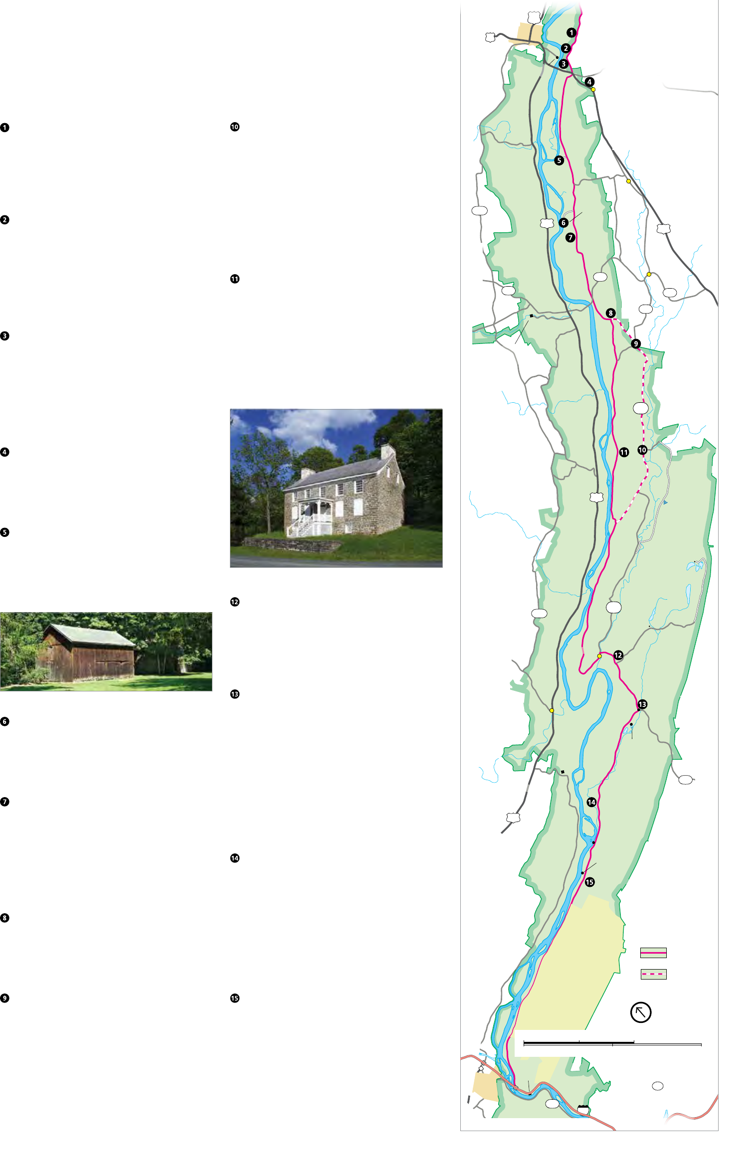
Touring Old Mine Road
Constructed in the mid-1600s, Old Mine Road connected the Hudson River and Philadelphia to the
Pahaquarry Mines and provided an important conduit for New Jersey farmers taking crops to area markets,
making it one of the oldest commercial roads in the country. Today, Old Mine Road stitches together
sections of several roads into the park’s main passage in New Jersey and still retains much of the flavor of
100 years ago, making it a popular driving and biking route.
Montague Grange
The National Grange, founded in 1867, is an organization
that advocates for rural America and agriculture. The local
Montague Grange was founded in 1904 and this hall was
built in 1906. The local group remains active and continues
to use the building.
Foster-Armstrong House
Owners of this home operated a ferry, sawmill, and
gristmill. The house was used as a tavern and inn for river
travelers. The house reflects the standard of living of a
prosperous family in the early 19th century. The Montague
Association for the Restoration of Community History
(MARCH) operates this historic house museum for tours
weekends and during special events. Page 13
Minisink Dutch Reformed Church
The Minisink Church was the heart, both spiritually and
geographically, of the four original Dutch Reformed
congregations established in the Upper Delaware Valley
in 1737. The present structure was built in 1899, and
tombstones in the cemetery date to 1805. Though it
remains small, the vibrant congregation is one of the
oldest in the country.
Nelden-Roberts Stonehouse
Built around 1820, this house’s construction is attributed
to George Nelden, who acquired the property in 1816. The
Roberts Family was the last owners of the house, along
with the farmstead located across US 206. Page 13
Westbrook-Bell House
Built by Johannis Westbrook, this is the oldest house
located in Delaware Water Gap National Recreation
Area, possibly predating 1730, and was lived in by nine
generations of the family until the acquisition of the
property by the federal government.
Barns next to the Westbrook-Bell house
Namanock
While nothing remains today, this was the site of Fort
Namanock during the French and Indian War (1754-1763).
Forts in this time and era were little more than a sturdy
house with a wooden defensive fence surrounding it.
Alonzo Depue House
As with other historic homes along Old Mine Road, the
landscape would have been quite different one hundred
years ago – open fields, a clear view to the river, and
several farm outbuildings. For 48 consecutive years,
Alonzo Depue recorded temperature and precipitation
readings for the U.S. Weather Service from a weather
station near the road without missing a day.
Bevans-Hellwig Kitchen
In the late 19th century, this little stone building was the
rear kitchen attached to a large farmhouse. Local tradition
holds that the original structure was used as a French and
Indian War fortification, known as Fort Carmer.
Peters Valley
Peter Van Nest, a land surveyor, laid out the roads in
the area and had them intersect outside of his home in
1867. Over the years, the hamlet’s name changed several
times, including Hen’s Foot Corner and Bevans, before
its current name of Peters Valley. Through a partnership
with the National Park Service, Peters Valley School of
Craft operates an active school of fine craft. Stop by the
Craft Store and Gallery to browse artisan’s wares, learn
about workshop offerings, and find out more about the
weekend self-guided tours of the village. Page 13
Walpack Center
Like other villages along the Old Mine Road, the Kittatinny
Ridge to the west and the highlands of New Jersey to the
north isolated the hamlet of Walpack Center. Area farmers
found what they needed at the village’s general store,
post office, blacksmith shop, church, and school. By the
early 20th century, however, automobiles and larger farms
proved to be too much competition and the village began
its decline. Today, the Walpack Historical Society operates
a museum in the First Rosenkrans House on summer
weekends.
Van Campen Inn
While it is called an “inn,” it is more accurately a “yaugh
house”—a rural residence in a remote area that was
licensed under colonial law to provide food and shelter to
travelers. During the French & Indian War (1754-1763),
the Van Campen Inn “provided a safe haven when settlers
fled for protection from Indian attack” and in November
1763, 150 settlers sought shelter in the “stout walls” of
the house. The Walpack Historical Society offers tours of
the house on most Sundays during the summer.
Van Campen Inn
Delaware View House
Constructed in the early 1800s, numerous changes over
the years enlarged this once small house. As the house
expanded, it also changed uses, including serving as the
Flatbrook Hotel hunting lodge, the Losey Boarding House,
and Salamovka – a summer retreat for Russian emigrants.
Millbrook Village
In 1832, Abram Garis built a grist mill along the
Van Campen Brook. The mill soon attracted other
businesses and by 1875, Millbrook was a thriving farm
village. By 1910, most businesses had closed their doors.
Today, only a handful of original Millbrook buildings
remain. Other buildings have been moved from other sites
or are newly built to help depict village life in the valley
during the late 19th and early 20th century. On summer
weekends and during special events, several buildings
are open and park staff and Millbrook Village Society
volunteers demonstrate folk ways of the 1800s. Page 19
Calno School
In the 19th century, schools were located in places that
would allow students to walk no more than four or five
miles to attend. In 1881, the Calno School District counted
48 school-age youth, but only 30 were on the school’s
register and the average daily attendance was only 15.
The poorly paid teachers boarded with local families and
seldom stayed more than a year or two. When this school
was in operation, there was also a school in Millbrook
Village, only five miles north.
Pahaquarry
The Coppermine Trail passes by the foundation of the
Pahaquarry Copper Mine processing mill and mineshafts.
Brief periods of mining attempted during the past
three centuries were never successful, despite improved
technology and mineral extraction methods. In 1925,
this area became the Pahaquarry Boy Scout Camp and
operated until 1971. It was just one of numerous scout
and church camps that once existed within the park
boundaries.
NOTE: Mineshafts are closed to protect critical bat habitat.
6
209
640
560
560
739
6
209
206
209
80
602
94
209
611
2001
NPS
615
NPS
615
2001
Bushkill
N
E
W
J
E
R
S
E
Y
P
E
N
N
S
Y
L
V
A
N
I
A
PA.
N.J.
Buttermilk
Falls
R
i
v
e
r
D
e
l
a
w
a
r
e
R
i
v
e
r
D
e
l
a
w
a
r
e
Flatbrookville
Layton
Hainesville
Montague
MILFORD
WORTHINGTON
STATE FOREST
Pompey
Ridge
Road
Turtle Beach
(Fee area)
Poxono
Access
Blue
Mountain
Lakes
Crater Lake
Watergate
(Fee area)
Park
Headquarters
Namanock
Milford Beach
(Fee area)
O
l
d
M
i
n
e
R
o
a
d
O
l
d
M
i
n
e
R
o
a
d
O
l
d
M
i
n
e
R
o
a
d
J
a
g
e
r
R
o
a
d
Peters Valley
O
l
d
M
i
n
e
R
o
a
d
Kittatinny Point
Visitor Center
DELAWARE
WATER GAP
Dingmans Falls
Visitor Center
Pahaquarry
Calno School
Millbrook
Village
Delaware
View House
Walpack Center
Van
Campen
Inn
Bevans-
Hellwig
Kitchen
Alonzo
Depue
House
Westbrook
Bell
House
Nelden-Roberts Stonehouse
Minisink Dutch Reformed Church
Foster-Armstrong House
Montague Grange
Old Mine Road
Alternate Route
to avoid gravel
road
North
0
0 5 Miles
5 Kilometers
18 Guide to the Gap
r
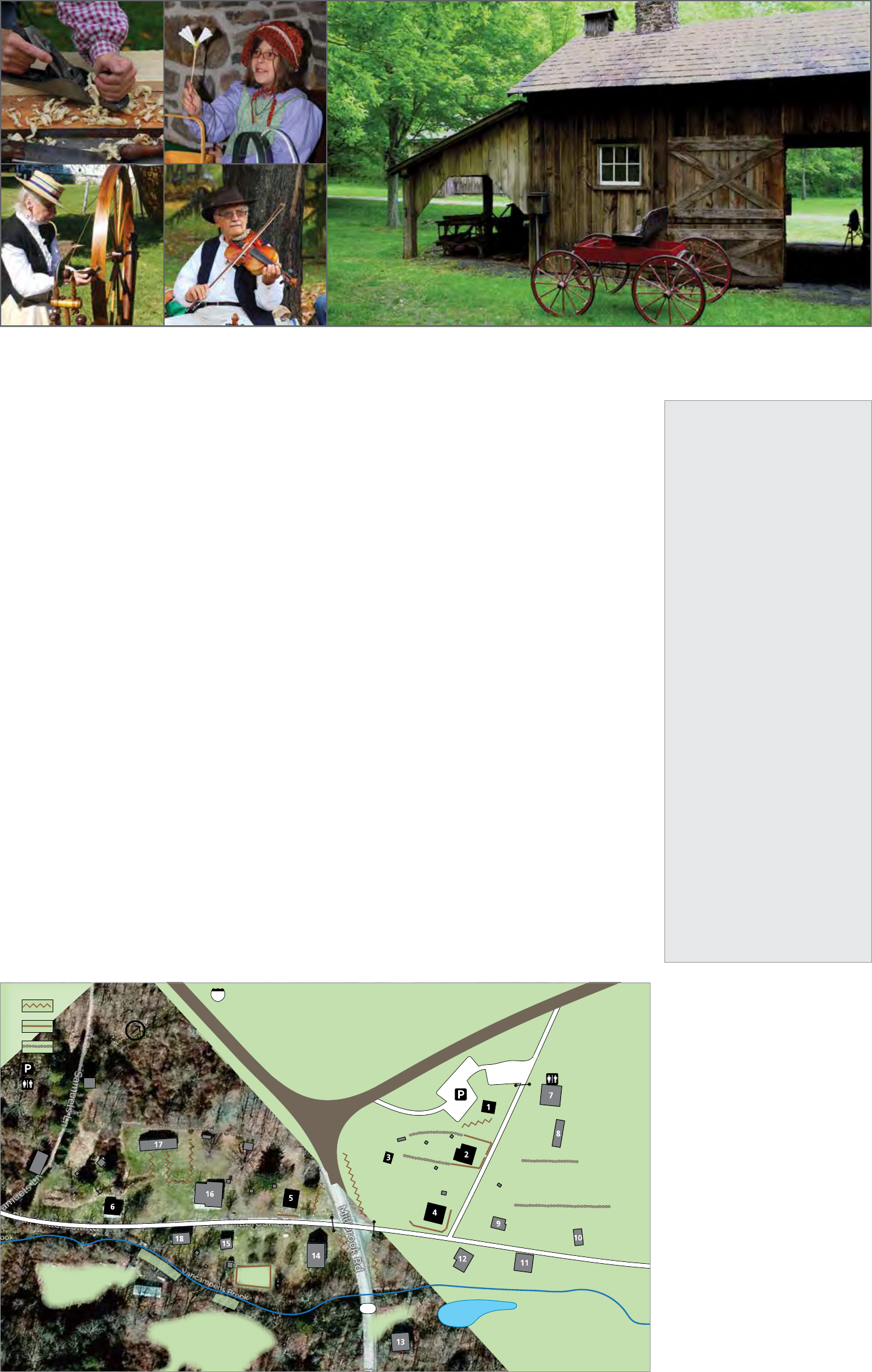
Millbrook Village: Immerse Yourself in the Past
Today’s Millbrook Village does not replicate the Millbrook of
1832 or 1875. Rather, it evokes the feeling of countryside hamlets
where most of this nation’s people lived until the end of the 19th
century, and provides a landscape for the demonstration of the
folkways of that era.
Village History
In 1832, local farmer Abram Garis built a grist (grain) mill along
the newly-finished Columbia-Walpack Turnpike where the
road crossed a stream known as “Van Campens Mill Brook.”
Since the nearest mill was in Flatbrookville, the Garis mill was
a welcome site for local farmers. Soon, a community began to
develop near the mill. A Methodist congregation organized
and built a small church in 1840 that included a school in the
basement. That same year, a store opened and a blacksmith
set up shop. Within a few decades, the village included a post
office, a boarding house that catered to farm workers and
served “spirits,” a cider mill for the less spirited, and a much-
expanded Methodist church. In time, the stream name was
shorted to Van Campens Brook and the area simply became
known as Millbrook.
By 1875, Millbrook had reached a peak of 75 inhabitants
and about 19 major buildings. Visitors passed through miles
of cultivated fields as they approached the village via the
Columbia-Walpack Turnpike.
From 1880 onward, Millbrook suffered the decline of rural
villages experienced throughout the country. Land values
dropped steeply after the Civil War. Industrialization of
farming made competition difficult for the independent small
farmer and isolation from railroad lines made produce from
the Millbrook area difficult to market. In addition, the lure of
cash wages for factory jobs in cities was drawing the young
away from the villages of their birth.
The Garis mill closed just after 1900, the store and hotel closed
1910, and by 1950, only the blacksmith was doing business
in town. In the 1950s, the Columbia-Walpack Turnpike was
realigned to accommodate a series of ponds constructed at
Watergate, and the crossroads in the heart of the village was
lost. Auto traffic bypassed the village, following the paved route
of today’s Old Mine Road. Millbrook had become the quiet
home for summer residents and retirees.
In the mid-1900s, a large dam was proposed in the Delaware
River valley to provide hydropower, flood control, and lake-
based recreation. This project, known as the Tocks Island Dam,
would have covered numerous historic structures located
throughout the valley. In the 1970s, the National Park Service,
with assistance from the Millbrook Village Society, moved
some structures threatened by the Tocks Island Dam project to
higher ground at Millbrook. Other buildings were constructed
from lumber reclaimed from demolished local buildings. The
buildings moved and constructed in Millbrook help create the
look of villages once common in the valley.
Visiting Today
Wander the quiet streets for an opportunity to immerse
yourself in a replicated landscape. On summer weekends
between Memorial Day and Labor Day weekends, park staff
and volunteers open select buildings for self-guided tours and
demonstrate various skills necessary for village life in the 1800s.
Additionally, special events throughout the year provide family
fun and insight into village life during the seasons. For more
information, visit the park website at nps.gov/dewa, stop by a
park visitor center, or call 908 841-9531.
2017 Events in
Millbrook Village
Spring Fling May 27, 10am to 3pm:
Celebrate spring with crafts and
demonstrations.
Old-Fashioned Independence Day
June 24, 10am to 3pm: Celebrate a
19th century-style Independence Day;
includes hands-on activities, crafts
demonstrations and a watermelon
eating contest.
Millbrook Days September 16-17,
10am to 4pm: Celebrate late 19th
century rural America; the village comes
alive with music, hands-on-activities,
and numerous demonstrations of
agricultural and domestic skills and
crafts.
Octivities October 28, 2 to 5pm & 6:30
to 8:30pm: Celebrate the bounties of
fall with hands-on activities during the
afternoon, and then see the darker side
of Millbrook Village through special
lantern tours during the evening.
Victorian Christmas December 2,
11 am to 4pm: Experience the village
decorated in mid to late 19th century
holiday style and enjoy playing with
period toys and creating Victorian crafts.
Christmas Carol Service December 3,
5 to 6pm: All are welcome to join in
singing traditional caroling songs.
Built at Millbrook in the 1800s
1. Lester Spangenburg Cabin: c. 1900, built
from pieces of an earlier cabin
2. George Trauger House: c. 1860
3. Trauger Barn: c. 1860, currently undergoing
significant restoration
4. Hotel (boarding house): c. 1850
5. Sylvester Hill House: c. 1850
6. Elias Garis House: c. 1850
Major Structures Added After 1970
7. Wagon Shop: moved here in 1980s;
restrooms added in 1988
8. Wagon Storage Shed: built in 2004
9. Blacksmith Shop: moved here in 1970s
10. Sugar Shack: built in 1970s
11. Cider Mill: moved here in 1980s
12. General Store/Post Office: moved here in
1973 to the site of the original store
13. Grist Mill: an 1948 mill moved here in 1990s
close to the site of the original mill
14. Methodist Episcopal Church: built in 1973
based on the plans of 1860 church
15. Depue Cabin: moved here in 1980s; structure
originally built prior to 1830
16. Van Campen Farmhouse: moved here in
1974; structure originally built in 1800
17. Van Campen Barn: moved here in 1985;
structure originally built in the late 1800s
18. Woodworking Shop: moved here in 1986
602
Ol
d
Mine Road
Ol
d
M
i
ne Road
V
a
n
c
a
m
p
e
n
s
B
r
o
o
k
Mill Pond
Garden
to
Flatbrookville
to 80
to
Blairstown
C
o
l
u
m
b
i
a
-
W
a
l
p
a
c
k
T
u
r
n
p
i
k
e
Donkeys Corner
Hiking Trail
Parking
Stone fence
Split rail fence
Picket fence
Restroom
North
Built prior to 1900
Moved or constructed
here after 1970
19 Guide to the Gap
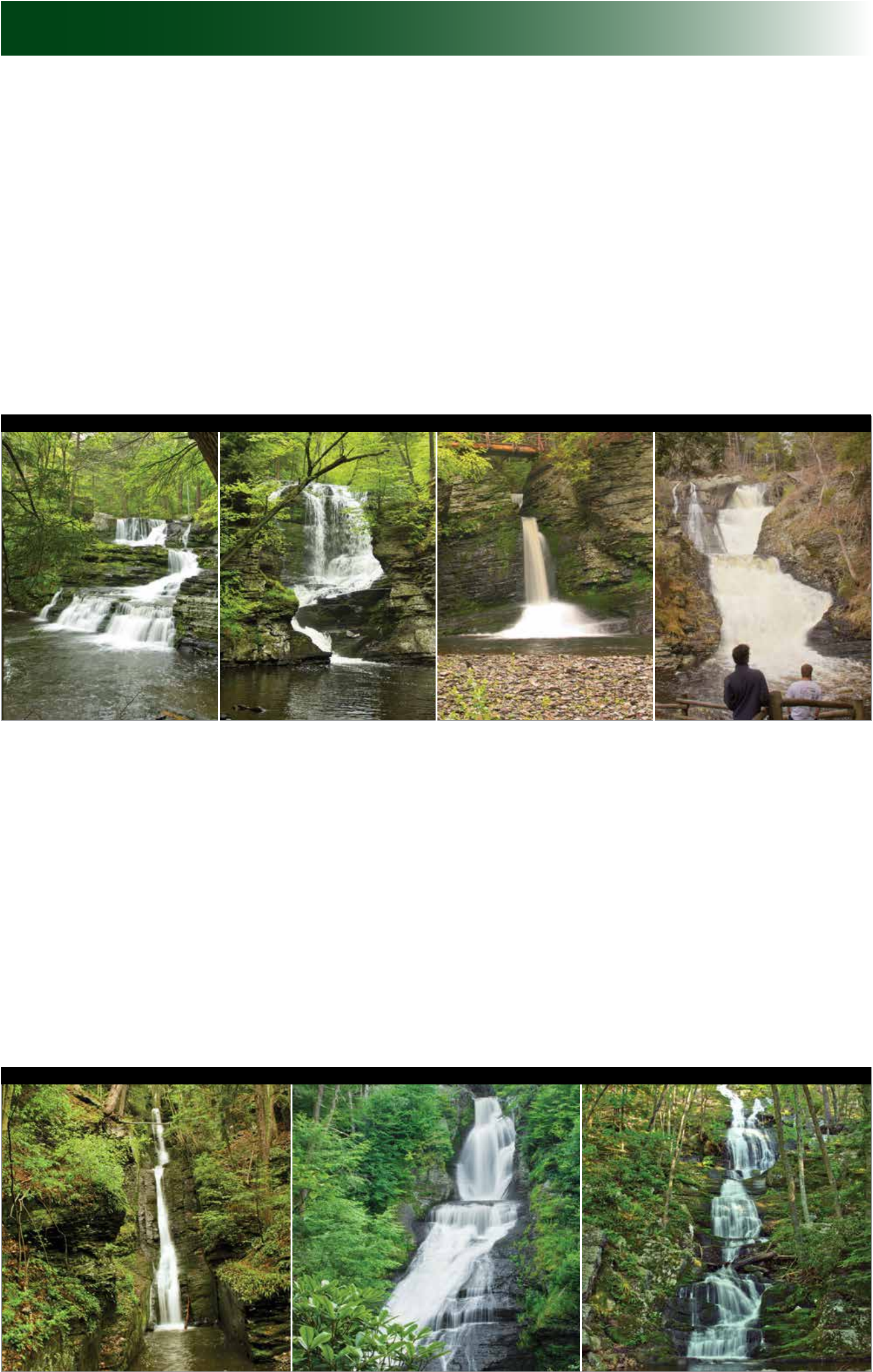
Waterfalls
Factory, Fulmer, and Deer Leap Falls
George W. Childs Park Trail, Pennsylvania
GPS 41.23733 -74.91916
The 1.1-mile George W. Childs Park Trail follows Dingmans Creek as it flows through a lush
ravine, over three rushing waterfalls, and adjacent to the ruins of a mill and several structures
built by the Civilian Conservation Corps. The trail is accessible to the Factory Falls overlooks, about
0.4 mile. Fulmer Falls is the second waterfall along the trail, and the tallest at about 55 feet. Deer
Leap is the third waterfall along the trail. Here, the water squeezes through a narrow cleft in the
rocks before plunging over the rocks. The trail winds through the hemlock ravine on both sides of
the creek, offering several views of the waterfalls. Trail map on page 8.
Things to Know:
• Pets are not permitted on the trail.
• Swimming and wading is not permitted in the creek and waterfalls.
• Stay on the designated trail.
• George W. Childs Park is a trash-free area. Carry out what you carry in.
• Fishing is not permitted in the George W. Childs Park area.
• Restrooms are located at the parking lot and picnic tables are located along the first quarter-
mile of the trail.
• The parking lot at George W. Childs Park fills quickly on summer weekends. To avoid the
crowds, visit the area before 10:00 am or after 4:00 pm on weekends or visit on a weekday.
Raymondskill Falls
Raymondskill Creek Trail, Pennsylvania
GPS 41.290231 -74.840853
The loop trail that leads to the waterfall is only 0.3 mile, but is steep. The three tiers of
Raymondskill Falls have a combined height of approximately 150 feet, making it the tallest
waterfall in Pennsylvania. If the drops from each tier are added together, the waterfall is only a
few feet shorter than Niagara Falls. The upper viewing area overlooks the upper pool and the
narrow chute of the first drop. The lower viewing area provides an outstanding view and photo
opportunity of the falls. A spur trail leads to the creek, but not to the bottom of the waterfall.
Trail map on page 8.
Things to Know:
• Pets are not permitted on the trail.
• Swimming and wading is not permitted in the creek and waterfalls.
• Stay on the designated trail.
• Restrooms are located at the parking lot.
• The parking lot at the trailhead fills quickly on summer weekends. To avoid the crowds, visit
the area before 10:00 am or after 4:00 pm on weekends or visit on a weekday.
Factory Falls Fulmer Falls Deer Leap Falls Raymondskill Falls
Dingmans and Silverthread Falls
Dingmans Creek Trail, Pennsylvania
GPS 41.229294 -74.887212
An accessible boardwalk trail meanders 0.3 mile through a pristine hemlock ravine. Shortly after
starting the trail, Silverthread Falls gracefully drops 80 feet in a thin ribbon of water through a
narrow geometric chute. The boardwalk continues through dense rhododendron shrubs and
ends at the base of Dingmans Falls, the second highest waterfall in Pennsylvania at 130 feet. A
wide rock ledge provides the backdrop for this cascading waterfall. The final tenth of a mile is a
staircase that leads to a birds-eye view from the top of the waterfall. Trail map on page 9.
Things to Know:
• Pets are not permitted on the trail.
• Swimming and wading is not permitted in the creek and waterfalls.
• Stay on the designated trail.
• Fishing is not permitted between Dingmans Falls and the trailhead parking area between
8:00 am and 5:00 pm.
• Restrooms and the Dingmans Falls Visitor Center are located at the trailhead.
• The parking lot fills quickly on summer weekends. To avoid the crowds, visit the area before
10:00 am or after 4:00 pm on weekends or visit on a weekday.
Buttermilk Falls
Buttermilk Falls Trail, New Jersey
GPS 41.137164 -74.888793
The waterfall is located at the trailhead for the Buttermilk Falls Trail, and, therefore, requires no
hiking to view. The cascading Buttermilk Falls is considered the highest waterfall in New Jersey at
approximately 200 feet. A set of stairs climbs the heavily forested hillside to a viewing platform at
the top of the waterfall. Trail map on page 11.
Things to Know:
• Swimming and wading is not permitted in the waterfall and the pool above and below the
waterfall.
• Stay on the designated trail.
• The drive to the waterfall is via a rural gravel road. Driving Mountain Road from Walpack
Center is the recommended route, since Mountain Road south of the Buttermilk Falls is very
rough.
20 Guide to the Gap
Silverthread Falls Dingmans Falls Buttermilk Falls

Activities and Events
DATE(s) TIME EVENT/ACTIVITY LOCATION DESCRIPTION
Join a ranger for an easy stroll to two spectacular
waterfalls and learn about the natural and cultural
history of the area.
(1 hour, ½ mile round-trip)
Learn about the varied natural, cultural and
recreational resources of the Delaware River valley.
(1 hour)
Celebrate spring in Millbrook Village with historic
crafts and demonstrations.
Stroll at your leisure through Millbrook Village.
Several buildings are open and staffed with rangers
and volunteers demonstrating traditional skills and
reminiscing about 1800s life in the village.
Walk along Dingmans Creek and use multiple
senses to explore the park in a new way.
(Reservations required ‡, 1 hour, ½ mile round-trip)
Experience Dingmans Ravine and waterfalls by the
soft glow of lantern light. (Reservations required ‡
,
1 hour, ½ mile round-trip)
Stop in for a tour of the home and learn more
about Marie Zimmermann, the artist who called
this place home.
Celebrate a 19th century-style Independence Day,
including hands-on activities, craft demonstrations
and a watermelon eating contest.
Watch meteors streak across the sky and learn
more about the night sky. Bring chairs or blankets,
insect repellent, and a flashlight.
Celebrate late 19th century rural America. Enjoy
music, hands-on-activities, and demonstrations of
agricultural and domestic skills and crafts.
Experience frontier life in the mid-1700s. Event
includes military reenactors, house tours, guided
cemetery walks, and a variety of demonstrations.
Celebrate the bounties of fall with hands-on
activities during the afternoon, and experience the
darker side of Millbrook Village through special
lantern tours during the evening. (Reservations
required for evening lantern tours ‡)
Experience the village decorated in mid to late 19th
century holiday style and enjoy playing with period
toys and creating Victorian crafts.
Celebrate and experience the Christmas traditions
and displays of a 19th century farming community.
Gather in the Millbrook Church to sing traditional
Christmas songs. All are welcome.
ADDTIONAL ACTIVITIES
Each month between June and
September, the Friends of Delaware Water
Gap National Recreation Area sponsor a
monthly lecture. For lecture information
and a complete list of activities and
events, visit the park calendar in the
Planning Your Visit section at
nps.gov/dewa.
Many park partners offer special public
programs, activities, and workshops.
Mohican Outdoor Center, operated by
the Appalachian Mountain Club, offers
outdoor recreation-based programs year-
round. For more information, visit
outdoors.org/lodging/lodges/Mohican.
Montague Association for the
Restoration of Community History
(MARCH) offers lectures about Montague
area history in the summer and fall.
For more information, visit
montaguehistory.org.
Peters Valley School of Craft offers
fine craft workshops and artist lectures
in the spring, summer, and fall. For more
information, visit petersvalley.org.
Pocono Environmental Education
Center (PEEC) offers youth, family and
adult programs and workshops year-
round. For more information, visit
peec.org.
Walpack Historical Society offers
lectures and guided walks about the
Walpack Valley in the spring, summer, and
fall. For more information, visit
walpackhistory.org.
‡ Reservations required; call 570 426-2452
Monday - Friday 8:30 am to 4:00 pm
Every Fri, Sat, Sun
May 26-Sep3
11 am &
2 pm
Waterfall Walk Dingmans Falls
Visitor Center
Every Sat
May 27-Sep 2
7 pm Campground Talk Dingmans
Campground
May 27 10 am to 3 pm Spring Fling Millbrook Village
Every Sat, Sun
May 27-Sep 3
10 am to 4 pm 1800s Village Life Millbrook Village
May 26 Jul 21
Jun 9 Aug 4
Jun 23 Aug 18
Jul 7 Sep 1
8:30 pm Dingmans After Dark:
Night Hike ‡
Dingmans Falls
Visitor Center
Jun 2 Jul 28
Jun 16 Aug 11
Jun 30 Aug 25
Jul 14
8:30 pm Dingmans After Dark:
Lantern Stroll ‡
Dingmans Falls
Visitor Center
Jun 17 10 am to 2 pm Marie Zimmermann
Open House
Marie Zimmermann
House
Jun 24 10 am to 3 pm Old-Fashioned
Independence Day
Millbrook Village
Aug 13 8:30 to 10:30 pm Perseid Meteor
Shower
Smithfield Beach
Sep 16 & 17 10 am to 4 pm Millbrook Days Millbrook Village
Oct 15 12 to 4 pm Van Campen Day Van Campen Inn
Oct 21 2 to 5 pm &
6:30 to 8:30 pm
Octivities Millbrook Village
Dec 2 11 am to 4 pm Victorian Christmas Millbrook Village
Dec 2 Dec 9
Dec 3 Dec 10
1 to 4 pm A Walpack Christmas Rosenkrans House,
Walpack Center
Dec 3 5 to 6pm Christmas Carol
Service
Millbrook Village
Camping
What better way to immerse yourself in an
environment of solitude, tranquil natural
landscapes, striking river valley scenery, and
a substantially undeveloped river corridor
than to go camping! Camping is a relatively
inexpensive way to create lasting memories.
Whether you enjoy the services available at a
campground or enjoy the solitude of hiking
a ways to pitch a tent away from people, the
park offers a campsite for you. The place you
park your RV or set up your tent becomes your
home away from home – make it a safe one.
•
Make sure there are no dead limbs or
trees in the vicinity of your campsite that
might come down during a strong wind.
•
Avoid drinking untreated water. Even
clear, spring water can contain harmful
bacteria.
•
If in a campground, lock food in your
vehicle. Bears and other wildlife have a
great sense of smell.
•
Keep your pet on a leash and never leave
a pet unattended.
•
Be sure you can identify poison ivy and
avoid it!
•
Bring a flashlight for when nature calls
after sunset.
Dingmans Campground
• Located near Dingmans Ferry, PA
• Sites for tent and RV (some with water
and electric hook-ups)
• Individual and group campsites
• Camp store
• Weekly activities
• More information: 877 828-1551 or
dingmanscampground.com
Mohican Outdoor Center
• Located along the Appalachian National
Scenic Trail near Blairstown, NJ
• Individual and group tent sites
• Self-service, bunk-style cabins
• Camp store
• Food service
• Weekly activities
• More information: 908 362-5670 or
outdoors.org/lodging/lodges/mohican
Valley View Group Campsites
• Located near Bushkill, PA
• Reservations required
• Primitive tent sites along the river
• River access for canoes and kayaks
• More information: 877 828-1551 or
dingmanscampground.com
Rivers Bend Group Campsites
• Located near Millbrook Village, NJ
• Reservations required
• Primitive tent sites along the river
• River access for canoes and kayaks
• More information: 570 426-2452 or
nps.gov/dewa
River Camping
• Available for extended boat trips
(14 miles or more)
• One night only per site
• Free primitive river sites
• First-come, first-serve
• EXCEPTION: Alosa river campsites (located
below the Walpack Bend in PA) are by
reservation only; reservations can be made
at recreation.gov; see pages 4 and 5 or
nps.gov/dewa for more information
Backpacking
• Only permitted along the
Appalachian National Scenic Trail
• Restricted to through-hikers who are
hiking for two or more consecutive days
• More information on page 10 or
nps.gov/dewa
Information about camping outside the park:
• In Pennsylvania, contact Pocono
Mountains Visitors Bureau at
800 762-6667 or poconomountains.com
• In New Jersey, contact New Jersey Tourism
at 800 847-4865 or visitnj.org
21 Guide to the Gap

Fishing
The area is home to both warm- and cold-water fish species. In the
spring, the Delaware River offers a chance to catch American shad, a
fish whose Latin name means “most savory herring.”
Huge numbers of American shad once migrated upstream in the
Delaware River, so many shad that the river was described as “black”
and “boiling.” Industrial pollution and overfishing drastically reduced
shad numbers in the Delaware River in the early 1900s. In the 1980s,
pollution control programs were put in place and shad numbers began
to rise again. American shad remain a favorite for anglers, putting up a
fight and showing multiple jumps when caught.
Numerous lakes and ponds are home to species like pickerel, catfish,
and panfish. Native and stocked trout inhabit the cold streams, offering
fly fishers a challenge. All waters within Delaware Water Gap National
Recreation Area are open to sport fishing unless otherwise noted.
Regulations
• A state fishing license is required for those 16 and older;
regulations are enforced.
• Holders of either a New Jersey or Pennsylvania license may fish on
the Delaware River and either of its banks. This does not apply to
the river’s tributaries.
• Special fishing regulations apply within the park. Refer to the
appropriate state regulations for waters within the park.
Fishing is not permitted at:
• Dingmans Creek within George W. Childs Park area, including foot
bridges and observation platforms
• Dingmans Creek from the top of the Dingmans Falls to the east end
of the Dingmans Falls Visitor Center parking lot from 8:00 am to
5:00 pm daily.
• Silverthread Falls in the pool at the base of the falls.
Places to Fish
Common and/or Sought-after Fish
State
Location
American Shad ¹
Brook Trout
Brown Trout
Catfish
Chain Pickerel
Largemouth Bass
Muskellunge
Sunfish ²
Rainbow Trout
Smallmouth Bass
Striped Bass
Walleye
Yellow Perch
PA Loch Lomond (Lake) – south of Dingmans Ferry;
wheelchair accessible X X S
PA “Front” Pond – Pocono Environmental Education
Center X X X X
PA Hidden Lake – hand launch and picnic area off
Hidden Lake Drive X X X S X
PA Dingmans Creek – between Deer Leap Falls and
Dingmans Falls; delayed harvest, artificial lures only S S
PA Toms Creek – from picnic area access upstream; catch
and release only W
PA Bush Kill – Bushkill, entire section within park S S S
PA Little Bushkill – Bushkill, entire section within park S S
PA Delaware River – Milford Beach & Boat Access* X X X X X
PA Delaware River – Dingmans Boat Access* X X X X X X
PA Delaware River – Eshback Canoe Access* X X X X X X
PA Delaware River – Bushkill Boat Access* X X X X X X X
PA Delaware River – Smithfield Beach & Boat Access* X X X X X X X
NJ Delaware River – Caddoo Canoe Access* X X X X X X X
NJ Delaware River – Poxono Access,* relatively shallow
backwater area X X X
NJ Delaware River – Turtle Beach* X X X X X
NJ Delaware River – Kittatinny Point,* off Interstate 80 X X X X X X X
NJ Vancampens Brook – headwaters downstream to
Millbrook Village W
NJ Vancampens Brook – downstream of Millbrook
Village to Upper Glen W S
NJ Vancampens Brook – from the Upper Glen
downstream to the mouth W
NJ Flat Brook – entire length within the park; accesses
along NPS Route 615 W X X
NJ Blue Mountain Lake – access by short trail from
parking area X X S X
NJ Catfish Pond – Mohican Outdoor Center, access from
NJ Route 602 X X X X
*Fishing is prohibited within 200 feet of designated boat launches and swim areas.
¹ The only time to catch adult American shad is from April to June, when the adults are migrating from the Atlantic Ocean.
² “Sunfish” includes bluegill, pumpkinseed, and redbreast sunfish, black crappie and rock bass.
X = Caught S = Stocked trout W = Wild trout
This table lists common game fish that can be
caught from places that are relatively easy to access.
For New Jersey state information, refer to the New Jersey Fish and
Wildlife Digest, available at sporting goods stores, or visit
state.nj.us/dep/fgw.
For Pennsylvania state information, refer to the Pennsylvania
Fishing Summary, or visit fish.state.pa.us. Pennsylvania licenses
are available on line at fishandboat.com/outdoorshop.htm.
Hunting
Hunting is permitted in most parts of the park. In addition to all
applicable state regulations, park-specific regulations are provided
below. Please note that you are in a national park; other outdoor
enthusiasts are using the same area in which you are hunting. Respect
private property located within the park boundaries.
Hunting Regulations
The possession of firearms on federally-owned land within Delaware
Water Gap National Recreation Area is permissible consistent with state
and federal laws, as outlined in the Digest of Pennsylvania Hunting
Regulations, New Jersey Fish and Wildlife Digest, the Delaware Water
Gap National Recreation Area Compendium of Regulations, and Title 36
of the Code of Federal Regulations. The Compendium of Regulations
for Delaware Water Gap National Recreation Area is available at park
headquarters in Bushkill, PA. All firearms must be unloaded and cased
or broken-down while in motor vehicles on roadways or shoulders;
bows must be cased. Wear fluorescent orange in compliance with state
regulations.
22 Guide to the Gap
Closed to Hunting
The following are prohibited: All areas within 450 feet of any regularly
• Trapping used or occupied structure, including:
• Spotlighting Pennsylvania
• Bow hunting on Sundays • Bushkill Meeting Center
• Hunting in closed area • Bushkill School
• Hunting in plowed and planted fields or in fields with unharvested • Cliff Park grounds and golf course
crops • Dingmans and Bushkill ranger stations
• Hunting from, along, or across roads, or from any kind of • Dingmans Campground and Valley View
motorized vehicle Group Campsites
• Dingmans Ferry, Eshback, and Bushkill
• Using artificial or natural bait
accesses
• Driving or pursuing an animal through closed areas with intention • Dingmans Maintenance Facility area
of killing it • George W. Childs Park area
• Screw-in foot pegs or attaching a stand to a tree with nails, spikes, • Hialeah Air Park
lag bolts, screws, or similar devices; tree stands must be free- • Milford and Smithfield beaches
standing and removable • Park Headquarters
• Releasing any animal or bird into the recreation area for the • Pocono Environmental Education Center
purpose of hunting or dog training • Raymondskill and Dingmans falls area
• Target practice • Slateford Farmhouse
• Off-road driving • Toms Creek, Hidden Lake, Loch
• Parking that blocks gates or access roads Lomond, and Hialeah picnic areas
• Backcountry camping and campfires New Jersey
• Rifles, handguns, and shotguns with shot larger than #4 shot in PA • Camp Ken-Etiwa-Pec are
between River Road and the Delaware River and from Shawnee to • Chado Maintenance Facility area
six miles north of Shawnee, except during the PA big game hunting • Kittatinny Point Visitor Center area
season when the use of rifles, handguns, shotguns, flintlocks, and • Millbrook Village
muzzleloaders is allowed (the use of a shotgun using steel or other • Minisink Reformed Dutch Church
• Mohican Outdoor Center area
approved nontoxic shot larger than #4 shot is permitted while • Peters Valley School of Craft
hunting waterfowl during established seasons) • Rivers Bend Group Campsites
• Turtle Beach
More Information • Van Campen Inn
PA Game Commission NJ Division of Delaware Water Gap • Walpack Center area
570 675-1143/5065 Fish & Wildlife Nat’l Recreation Area • Walpack Ridge Trail
pgc.state.pa.us 908 735-8240 Ranger Office • Watergate Recreation Site
state.nj.us/dep/fgw/ 570 828-2321 • Weygadt Facility area
hunting.htm nps.gov/dewa
Kid’s Corner
1 2 3 4 5
1 A B C D E
2 F G H I J
3 K L M N O
4 P Q R S T
5 U V W X Y
Example:
who once lived in the area or describe the natural features of the area.
The Lenape people lived here when European settlers moved in to the
Nifty Names! Some place names in the park are named for people
H A V E
area. Use the code breaker below to find out what the Lenape names
23 11 52 15
mean in English. K
1. The Appalachian National Scenic Trail passes along the top of the F U N
E
Kittatinny Ridge within the park. “Kittatinny” comes from the 21 15 34
Lenape word “Kitahtëne,” which means: Y
15 34 14 32 15 44 44
23 24 32 32
2. Pahaquarry is the name of a New Jersey township that once existed in the park. The
word “Pahaquarry” comes from the Lenape word “Pahaqualong,” which means:
45 23 15 41 32 11 13 15 12 15 45 53 15 15 34
45 23 15 33 35 51 34 45 11 24 34 44
12 15 44 24 14 15 45 23 15 53 11 45 15 43 44
P R K O O R B L L I M W Sensational Search! Find the words in green in the puzzle below.
A
G
U
W
C
E
C
R
E
A
W
R
P
A
R
K
T
O
R
C
C
R
G
L
I
A
V
I
V
P
N
B
T
V
F
O
Z
E
R
E
E
P
E
E
E
L
T
K
R
M
A
I
I
Y
N
H
A
B
F
P
Delaware Water Gap National Recreation Area is your park to explore! You can hike to the
top of Mt. Tammany, canoe on the river, bike on McDade Trail, see lots of waterfalls, swim
at a river beach, and so much more! You can also learn how people lived and about the things
they made at Millbrook Village. Stop by a visitor center to get a map and find out more about
the things to see and do in the park. Don’t forget to ask how you can be a Junior Ranger!
B T K E M A X G R G A N
X I E M L L N E C M M S
N O V L I A I H D Z M U
H N S I R W D N U V A R
W G K I F Q S F I K T V
S Y B M C D A D E P B D
Be a Junior Ranger!
Junior Rangers help to preserve national
parks; they learn about Delaware Water
Gap National Recreation Area, have fun,
and are our representatives to their friends,
families, and schoolmates back home. Stop
by a visitor center or park headquarters
and ask for your free book. Once you have
completed the number of activities for your
age group, bring it back to be sworn in
as a Junior Ranger and be presented with
your badge.
Free Passes for Fourth Graders
Delaware Water Gap National Recreation Area is inviting all fourth
graders to visit National Park Service sites for free this year as part
of the Every Kid in a Park program. The program gives fourth grade
students, and those accompanying them, free access to more than
2,000 federally managed lands and waters that charge entrance
fees. While Delaware Water Gap National Recreation Area charges
only expanded amenity fees and does not change entrance fees, the
Every Kid in a Park pass provides free access to places like Steamtown
National Historic Site in Scranton, Pennsylvania, and Morristown
National Historical Park in New Jersey.
Every Kid in a Park is part of the National Park Service’s commitment
to protect the nation’s unique outdoor spaces and ensure that every
American has the opportunity to visit and enjoy them. The program
is a call to action for children to experience America’s spectacular
outdoors, rich history and culture. The Every Kid in a Park pass is valid
September 1 to August 30 of the following year.
The Every Kid in a Park website, EveryKidinaPark.gov, has links
to educational activities, trip planning, field trip options, the
downloadable pass and additional information in both English and
Spanish. After completing an educational activity, the child can
download and print a pass. The paper pass can be traded for a more
durable pass at the park.
solutions on next page
23 Guide to the Gap

Accessibility
Service Animals
Service animals are allowed in all facilities, trails, and the River Runner shuttle, but must always be leashed.
Visitor Centers and Park Stores
Kittatinny Point and Dingmans Falls visitor centers and park headquarters are wheelchair accessible.
Trails
Dingmans Creek Trail (page 7) is a flat, quarter-mile boardwalk to the base of Silverthread and Dingmans falls that
is wheelchair accessible. George W. Childs Park Trail (page 6) is wheelchair accessible to the first waterfall overlook,
approximately a third of a mile, one-way. Trail for Everyone (page 7) is wheelchair accessible and has several benches along
the one-way, third of a mile route. The Sensory Trail (page 7) is a quarter-mile, rope-lined trail.
Historical Sites
Millbrook Village (page 19) has accessible restrooms and the path through the village is wheelchair accessible. However,
most buildings in the village are not accessible due to the narrow doorways in historic structures. Peters Valley (Bevans
Village) is operated by the Peters Valley School of Craft (page 13). The restrooms and first floor of the store are wheelchair
accessible. The Foster-Armstrong House and the Nelden-Roberts Stonehouse (page 15) are each wheelchair accessible on
the first floor.
Picnic Areas
Accessible restrooms and picnic sites are located at George W. Childs Park, Milford Beach, Toms Creek, Smithfield Beach,
Hialeah, Watergate, and Kittatinny Point.
Swim Beaches
Accessible restrooms and bathhouses are located at Milford and Smithfield beaches. Assistance is needed to the swimming
area at these sites.
River Runner Bus
On Saturdays, Sundays, and holidays between Memorial Day and Labor Day weekends, a free accessible shuttle bus
provides service between Kittatinny Point, NJ, and Milford, PA, stopping at numerous places along the way (page 16).
Park Store
Looking for more information about the park’s history? Need a
comprehensive map of park trails? Want to purchase a souvenir
to remind you of your visit to the park? A wide range of books,
maps, guides, souvenirs, and other items is available from the
park bookstores. Eastern National operates these stores at
Dingmans Falls Visitor Center, Kittatinny Point Visitor Center, and
park headquarters.
• Outerwear
• Nature-themed Jewelry
• Children’s Games and Toys
• Books
• Maps
• Pins, Magnets, Ornaments
• And more!
Purchases support the educational programs at
Delaware Water Gap National Recreation Area
Overlooks
Resort Point, Point of Gap, and Arrow Island overlooks along PA 611 offer wheelchair accessible views of the Delaware
Water Gap.
Boat Launch
A boat loading ramp is available at Smithfield
Beach. The ramp provides access to trailer-
mounted boats. Assistance is then needed to
lower the boat into the water.
Fishing Pier
A pier at Loch Lomond is wheelchair accessible.
Campgrounds
Dingmans Campground has wheelchair
accessible sites. The Dingmans Campground
store and bathhouse are accessible. Valley View
Group Campsite #1 is wheelchair accessible.
Audio Described Exhibits
Audio files for the Dingmans Falls Visitor
Center exhibits and many wayside exhibits
throughout the park are available for
download at the park’s website:
nps.gov/dewa/planyourvisit/accessibility.htm
Picnicking
Numerous idyllic spots in the park await you and a red-checkered
blanket. Grills are not provided anywhere in the park, but you are
welcome to bring your own, except to Kittatinny Point and George
W. Childs Park. Ground fires are prohibited throughout the park. Do
not bring wood from outside the park for any purpose; it may contain
invasive insects and other organisms that threaten the survival of
local plant and animal life. Collecting wood in the park for fires is also
expressly prohibited, since even the smallest twig may serve as a critical
habitat or food source for protected plant and animal life.
Pets
Pets are permitted in most areas of the park and must be on a 6-foot
leash at all times. Pets may not be tied to an object and left unattended
or left in a vehicle. Please clean up after your pet. Report lost pets to the
park communication center at 570 426-2457.
Pets are NOT permitted at the following sites:
In Pennsylvania:
• Smithfield Beach and Milford Beach between Memorial Day
weekend and Labor Day weekend
• Raymondskill Falls and Dingmans Falls
• George W. Childs Park (including parking lot, picnic area, and trail)
• Valley View Group Campsites
• Hialeah Picnic Area
• McDade Trail between milepost 1.0 and milepost 2.5 (from June 1
to September 8)
• Adams Creek
In New Jersey:
• Turtle Beach
• Rivers Bend Group Campsites
• Watergate Recreation Site
• Kittatinny Point picnic and visitor center areas
•
Picnic Areas in Pennsylvania
• Hialeah Picnic Area (pets not permitted from Memorial Day to
Labor Day weekends)
• Smithfield Beach (fee area; alcohol not permitted; pets not
permitted from Memorial Day to Labor Day weekends)
• Milford Beach (fee area; alcohol not permitted; pets not permitted
from Memorial Day to Labor Day weekends; group picnic area
available - call 570-426-2440 to reserve)
• George W. Childs Park (grills and pets not permitted)
• Toms Creek
• Bushkill Village
• Hidden Lake
• Loch Lomond
Picnic Areas in New Jersey
• Kittatinny Point (grills and alcohol are not
permitted)
• Millbrook Village
• Turtle Beach (fee area; alcohol and pets
not permitted)
• Namanock
• Watergate Recreation Site (fee area;
alcohol and pets not permitted)
• Crater Lake
•
Solutions to Kid’s Corner Activities
Nifty Names Sensational
Search
1. The Appalachian National Scenic Trail passes along
the top of the Kittatinny Ridge within the park. The
P
A
G
U
Lenape word “Kittatinny” means: “endless hill.” W
2. Pahaquarry is the name of a New Jersey township C
that once existed in the park. The word “Pahaquarry” B
comes from the Lenape word “Pahaqualong,” which X
means: “the place between the mountains beside the N
waters.” H
W
S
24 Guide to the Gap
R K O O R B L L I M W
E W K C A N O E L A H
C R T R V B Z P T I A
R P O G I T E E K I B
E A R L V V R E R Y F
A R C I P F E E M N P
T K E M A X G R G A N
I E M L L N E C M M S
O V L I A I H D Z M U
N S I R W D N U V A R
G K I F Q S F I K T V
Y B M C D A D E P B D
