Doc 9750 Global Air Navigation Plan For CNS/ATM Sytems PDF 2ed En
User Manual: 9750 PDF
Open the PDF directly: View PDF ![]() .
.
Page Count: 192 [warning: Documents this large are best viewed by clicking the View PDF Link!]

Global Air Navigation Plan
for CNS/ATM Systems
Second Edition — 2002
Doc 9750
AN/963
International Civil Aviation Organization
Approved by the Secretary General
and published under his authority

AMENDMENTS
The issue of amendments is announced regularly in the ICAO Journal and in the
monthly Supplement to the Catalogue of ICAO Publications and Audio-visual
Training Aids, which holders of this publication should consult. The space below
is provided to keep a record of such amendments.
RECORD OF AMENDMENTS AND CORRIGENDA
AMENDMENTS CORRIGENDA
No.
Date
of issue
Date
entered
Entered
by No.
Date
of issue
Date
entered
Entered
by
(ii)

CNS/ATM SYSTEMS
Definition
Strategic vision
Mission of implementation
Communications, navigation, and surveillance systems, employing digital
technologies, including satellite systems together with various levels of
automation, applied in support of a seamless global air traffic management
system.
To foster implementation of a seamless, global air traffic management
system that will enable aircraft operators to meet their planned times of
departure and arrival and adhere to their preferred flight profiles with
minimum constraints and without compromising agreed levels of safety.
To develop a seamless, globally coordinated system of air navigation
services that will cope with worldwide growth in air traffic demand while:
• improving upon the present levels of safety;
• improving upon the present levels of regularity;
• improving upon the overall efficiency and capacity of airspace and
airports
• improving operations allowing for capacity increase while minimizing
fuel consumption and aircraft engine emissions;
• increasing the availability of user-preferred flight schedules and
profiles; and
• minimizing differing equipment carriage requirements between
regions.

(v)
FOREWORD
Since the conclusion of the work of the Special Committee
on Future Air Navigation Systems (FANS) in October
1993, the International Civil Aviation Organization (ICAO)
has significantly progressed the development of material
necessary for the planning, implementation and operation
of communications, navigation, and surveillance/air traffic
management (CNS/ATM) systems. Today, Standards and
Recommended Practices (SARPs), Procedures for Air
Navigation Services (PANS) and guidance material on all
defined elements and aspects of CNS/ATM systems are
largely in place. Development of ICAO provisions will
continue in line with identified requirements.
As technology advances, new systems and concepts will
continue to emerge, offering potential improvements in
terms of safety, efficiency and/or economy of international
flights. This document, which is an updated and enhanced
version of the “Global Co-ordinated Plan for Transition to
the ICAO CNS/ATM Systems” contained in the Report of
the Fourth Meeting of the Special Committee for the Moni-
toring and Co-ordination of Development and Transition
Planning for the Future Air Navigation System (FANS
Phase II) (Doc 9623), has been produced to include
recently developed concepts and systems. The plan has also
been expanded beyond its technical scope to include
relevant economic, organizational, environmental, legal and
technical cooperation issues and also a global planning
methodology expected to guide regional planning groups in
their implementation planning work.
One of the objectives of this revised Global Plan is to
define and illustrate ICAO’s process for CNS/ATM systems
planning and implementation as a logical progression of the
work already accomplished. This includes an analysis of
the structured relationship between the global, regional and
national planning processes as well as the relationship
between the Global Plan and other ICAO planning activi-
ties. An inventory of materials, tools and documentation
now in existence, indicating where and how these can be
used, will provide a readily-available source of reference
material for planning purposes.
Recognizing that effective ATM is essential to ensuring
safety, regularity and efficiency of international civil
aviation and that implementation of available and emerging
technologies should fulfil the requirements for a global
ATM system, this plan broadly describes an ATM
operational concept being developed by ICAO, and reflects
the latest available information on ATM conceptual work.
This description and emerging concept offers a high-level
vision in order to assist in the determination of ATM
requirements that will guide the development of future
CNS/ATM system elements and their functionalities, there-
by allowing optimum benefits to be attained. This new
approach is designed to lead initially to improved har-
monization of air traffic services (ATS) and ultimately to a
globally integrated ATM system.
As work on the ATM operational concept is ongoing,
consensus on several emerging concepts have to be reached
(e.g. autonomy of flight*, separation assurance*, situational
awareness*, required total system performance (RTSP)*,
required communication performance (RCP)*, required
surveillance performance (RSP)*). The operational require-
ments and functional specifications of some technologies
(automatic dependent surveillance-broadcast (ADS-B)*)
also have to be developed. Where these issues and/or tech-
nologies are addressed in the Global Plan, they are
accompanied by a footnote indicating that work and
consensus is still to be achieved through the ICAO process.
The Global Plan offers background information on the
different elements and entities involved in CNS/ATM
systems planning and implementation with the goal of
creating, within one document, a nucleus of information
necessary to facilitate the move towards the next phase of
CNS/ATM planning and implementation. At the same time,
the Global Plan attempts to bring up to date, in a
consolidated format, the progress generally achieved by the
regions and illustrates, with appropriate time lines, the
work remaining, forming the implementation schedule for
the future. It also offers, under one cover, a global snapshot
of progress achieved and work remaining toward the
implementation of CNS/ATM systems, thereby serving as a
consolidated planning tool.
The Global Plan has a clear and functional relationship
to the regional air navigation plans (ANPs). This has been
* Emerging concept or technology — consensus still to be reached.

(vi) Global Air Navigation Plan for CNS/ATM Systems
accomplished by dividing the Global Plan into two parts:
the Operational Concept and General Planning Principles
(Part I), which provides guidance for the further develop-
ment of the Basic Operational Requirements and Planning
Criteria (BORPC) of the regional ANPs; and Part II, Facili-
ties and Services for the Implementation of the Global
Plan, which reflects more detailed material and relates to
the Facilities and Services Implementation Documents
(FASIDs) used in the regional planning process.
Parts I and II together provide the means for a
step-by-step approach, including an operational analysis, to
planning for implementation of global CNS/ATM systems.
To begin the process, several homogeneous ATM areas and
major international traffic flows have been identified in
Part I, Chapter 3. The tables in Part II were generated with
the purpose of assisting the planning and implementation
regional groups (PIRGs) in further identifying the inter-
regional CNS/ATM systems infrastructure necessary to
support the implementation of homogeneous ATM areas
and major international traffic flows.
Because of the relationship being established between
the updated Global Plan and the regional ANPs, it is necess-
ary for the Global Plan to have a clear association with all
aspects of traditional regional air navigation planning. This
will not only facilitate the work of the PIRGs, but is
considered a necessary aspect of successful implementation
of CNS/ATM systems. For this reason, the Global Plan
provides introductory material in the fields of meteorology
and aeronautical information services related to the im-
plementation of CNS/ATM systems. Aerodrome operations,
normally a part of regional air navigation planning, is not
addressed separately in this version of the Global Plan
because of the regional nature of this type of planning.
Relevant ATS aspects associated with aerodrome operations
in future environments are addressed within the context of
overall ATM planning, while specific ATM objectives
related to aerodrome operations are identified in the tables
in Part I, Chapter 4, and in Part II, Chapter 5 of the Global
Plan.
The emerging technologies will support a variety of
system designs and implementation options. The challenge
for the planner and designer is to develop an adequate
understanding of the costs, benefits and operational suit-
ability of these alternatives while considering the legal,
organizational, environmental and financial aspects; to
orchestrate a coordinated programme of ATM improve-
ments that takes into account the user’s needs, their
willingness to upgrade their capabilities to achieve oper-
ational benefits, and also to pay for the changes required by
ATM services providers. The Global Plan is intended to
guide the international aviation community toward meeting
this challenge and implementing CNS/ATM systems.
(vii)
TABLE OF CONTENTS
Page Page
LIST OF ACRONYMS . . . . . . . . . . . . . . . . . . . (xi)
PART I. OPERATIONAL CONCEPT AND
GENERAL PLANNING PRINCIPLES
Chapter 1. Introduction to CNS/ATM
Background . . . . . . . . . . . . . . . . . . . . . . . . . . . I-1-1
Shortcomings of conventional systems . . . . . I-1-3
A brief look at CNS/ATM . . . . . . . . . . . . . . I-1-3
Benefits of the new systems. . . . . . . . . . . . . . I-1-4
Cost-benefit studies. . . . . . . . . . . . . . . . . . . . . I-1-6
Organizational and financial issues . . . . . . . . I-1-8
Assistance requirements and technical
cooperation . . . . . . . . . . . . . . . . . . . . . . . . . I-1-8
Legal issues. . . . . . . . . . . . . . . . . . . . . . . . . . . I-1-9
Summary . . . . . . . . . . . . . . . . . . . . . . . . . . . . . I-1-9
Chapter 2. ICAO’S planning structure
for CNS/ATM
Introduction. . . . . . . . . . . . . . . . . . . . . . . . . . . I-2-1
The regional planning process . . . . . . . . . . . . I-2-2
The national planning process . . . . . . . . . . . . I-2-2
CNS/ATM partners and tools. . . . . . . . . . . . . I-2-3
Action programme . . . . . . . . . . . . . . . . . . . . . I-2-3
Relevant ICAO policies on CNS/ATM . . . . . I-2-3
ICAO’s role and responsibility. . . . . . . . . . . . I-2-5
APPENDIX A. Statement of ICAO policy
on CNS/ATM systems implementation
and operation . . . . . . . . . . . . . . . . . . . . . . . I-2-7
APPENDIX B Extract from the
Assembly Resolutions in force
(as of 2 October 1998) (Doc 9730)
Assembly Resolution A31-6 . . . . . . . . . . . I-2-9
APPENDIX C. Extract from the
Assembly Resolutions in force
(as of 2 October 1998) (Doc 9730)
Assembly Resolution A32-21 . . . . . . . . . . I-2-11
Chapter 3. Global planning methodology
Introduction. . . . . . . . . . . . . . . . . . . . . . . . . . . I-3-1
Homogeneous ATM areas and major
traffic flows. . . . . . . . . . . . . . . . . . . . . . . . . I-3-1
Statement of Basic Operational Requirements
and Planning Criteria for
Regional Air Navigation Planning . . . . . . . I-3-2
Planning methodology . . . . . . . . . . . . . . . . . . I-3-3
The operational analysis. . . . . . . . . . . . . . . . . I-3-4
Chapter 4. Air traffic management
Introduction. . . . . . . . . . . . . . . . . . . . . . . . . . . I-4-1
Limitation of the ATM systems
(Circa 2001) . . . . . . . . . . . . . . . . . . . . . . . . I-4-1
Global ATM . . . . . . . . . . . . . . . . . . . . . . . . . . I-4-2
Need for an ATM operational concept . . . . . I-4-3
ATM operational concept by phase
of flight . . . . . . . . . . . . . . . . . . . . . . . . . . . . I-4-10
Safety assessment and monitoring. . . . . . . . . I-4-12
Global ATM implementation . . . . . . . . . . . . . I-4-13
General transition issues . . . . . . . . . . . . . . . . I-4-14
APPENDIX A ATM operational
requirements in an RNP/RNAV
environment . . . . . . . . . . . . . . . . . . . . . . . . I-4-15
APPENDIX B. Guidelines for transition
to global air traffic management
systems . . . . . . . . . . . . . . . . . . . . . . . . . . . . I-4-18
Chapter 5. Communications systems
Function . . . . . . . . . . . . . . . . . . . . . . . . . . . . . I-5-1
Communications services envisaged . . . . . . . I-5-1
Main features of new communications
systems . . . . . . . . . . . . . . . . . . . . . . . . . . . . I-5-1
Air-ground communications. . . . . . . . . . . . . . I-5-2
Ground-ground communications . . . . . . . . . . I-5-3
Aeronautical telecommunication
network (ATN) . . . . . . . . . . . . . . . . . . . . . . I-5-3
Future trends. . . . . . . . . . . . . . . . . . . . . . . . . . I-5-3
Required communication performance
(RCP) . . . . . . . . . . . . . . . . . . . . . . . . . . . . . I-5-4
General transition issues . . . . . . . . . . . . . . . . I-5-4

(viii) Global Air Navigation Plan for CNS/ATM Systems
Page Page
APPENDIX A. Guidelines for transition to
communications systems . . . . . . . . . . . . . . I-5-6
Chapter 6. Navigation systems
Objectives . . . . . . . . . . . . . . . . . . . . . . . . . . . . I-6-1
Required navigation performance (RNP). . . . I-6-1
Global navigation satellite system (GNSS) . . I-6-1
GNSS augmentations . . . . . . . . . . . . . . . . . . . I-6-2
Avionics. . . . . . . . . . . . . . . . . . . . . . . . . . . . . . I-6-3
WGS-84 coordinate system and
aeronautical databases . . . . . . . . . . . . . . . . I-6-3
Evolutionary introduction . . . . . . . . . . . . . . . . I-6-3
Systems to support approach, landing and
departure operations . . . . . . . . . . . . . . . . . . I-6-3
General transition issues. . . . . . . . . . . . . . . . . I-6-4
APPENDIX A. Guidelines for transition to
navigation systems . . . . . . . . . . . . . . . . . . . I-6-5
Chapter 7. Surveillance systems
Current surveillance systems . . . . . . . . . . . . . I-7-1
Functional description . . . . . . . . . . . . . . . . . . I-7-1
Technical options overview . . . . . . . . . . . . . . I-7-2
ATM requirements for surveillance . . . . . . . . I-7-2
Airborne collision avoidance system (ACAS) . I-7-2
Required surveillance performance (RSP). . . I-7-3
Future trends . . . . . . . . . . . . . . . . . . . . . . . . . . I-7-3
General transition issues. . . . . . . . . . . . . . . . . I-7-3
APPENDIX A. Guidelines for transition to
surveillance systems . . . . . . . . . . . . . . . . . . I-7-4
Chapter 8. Meteorology
Introduction. . . . . . . . . . . . . . . . . . . . . . . . . . . I-8-1
Meteorological support to international
civil aviation . . . . . . . . . . . . . . . . . . . . . . . . I-8-1
Meteorological systems to support global
CNS/ATM . . . . . . . . . . . . . . . . . . . . . . . . . . I-8-2
Meteorological systems to support the
transition to the new global CNS/ATM
systems . . . . . . . . . . . . . . . . . . . . . . . . . . . . I-8-3
Planning and implementation of
meteorological systems. . . . . . . . . . . . . . . . I-8-3
Chapter 9. Aeronautical information services
Introduction. . . . . . . . . . . . . . . . . . . . . . . . . . . I-9-1
AIS and MAP support to international
civil aviation . . . . . . . . . . . . . . . . . . . . . . . . I-9-1
AIS and MAP services to support global
CNS/ATM systems . . . . . . . . . . . . . . . . . . . I-9-2
AIS/MAP systems to support the transition
to the new global CNS/ATM systems . . . . I-9-3
Chapter 10. Human resource development
and training needs
Introduction. . . . . . . . . . . . . . . . . . . . . . . . . . . I-10-1
Foundation training. . . . . . . . . . . . . . . . . . . . . I-10-2
CNS systems implementation planning —
training needs . . . . . . . . . . . . . . . . . . . . . . . I-10-2
ATM operational implementation planning —
training needs . . . . . . . . . . . . . . . . . . . . . . . I-10-2
A long-term strategy for CNS/ATM
job-specific training . . . . . . . . . . . . . . . . . . I-10-3
Regional human resource planning and
training needs . . . . . . . . . . . . . . . . . . . . . . . I-10-4
Sources of training . . . . . . . . . . . . . . . . . . . . . I-10-4
Human resource development during
transition . . . . . . . . . . . . . . . . . . . . . . . . . . . I-10-5
Chapter 11. Legal issues
Introduction. . . . . . . . . . . . . . . . . . . . . . . . . . . I-11-1
Fundamental principles of the GNSS
legal framework . . . . . . . . . . . . . . . . . . . . . I-11-1
Other legal issues . . . . . . . . . . . . . . . . . . . . . . I-11-4
APPENDIX A. A32-19: Charter on the
rights and obligations of States
relating to GNSS services . . . . . . . . . . . . . I-11-5
APPENDIX B. Recommendations
of LTEP. . . . . . . . . . . . . . . . . . . . . . . . . . . . I-11-7
APPENDIX C. A32-20: Development and
elaboration of an appropriate long-term
framework to govern the implementation
of GNSS . . . . . . . . . . . . . . . . . . . . . . . . . . . I-11-11
Chapter 12. Organizational and
international cooperative aspects
Introduction. . . . . . . . . . . . . . . . . . . . . . . . . . . I-12-1
Organizational forms at the national level. . . I-12-1
Specific operational and technical
organizational aspects. . . . . . . . . . . . . . . . . I-12-2
International cooperation . . . . . . . . . . . . . . . . I-12-4

Table of Contents (ix)
Page Page
Chapter 13. Cost-benefit and
economic impacts
General . . . . . . . . . . . . . . . . . . . . . . . . . . . . . . I-13-1
Cost-benefit methodology. . . . . . . . . . . . . . . . I-13-1
Interpretation of cost-benefit results . . . . . . . I-13-2
Risks for States. . . . . . . . . . . . . . . . . . . . . . . . I-13-3
Chapter 14. Financial aspects
Introduction. . . . . . . . . . . . . . . . . . . . . . . . . . . I-14-1
Cost-recovery . . . . . . . . . . . . . . . . . . . . . . . . . I-14-1
Financing. . . . . . . . . . . . . . . . . . . . . . . . . . . . . I-14-4
Chapter 15. Assistance requirements
and technical cooperation
Introduction. . . . . . . . . . . . . . . . . . . . . . . . . . . I-15-1
Assistance requirements of developing
ICAO Contracting States for CNS/ATM
planning and implementation . . . . . . . . . . . I-15-1
ICAO objectives implementation
mechanism . . . . . . . . . . . . . . . . . . . . . . . . . I-15-2
ICAO technical cooperation in CNS/ATM
implementation . . . . . . . . . . . . . . . . . . . . . . I-15-3
APPENDIX A. CNS/ATM assistance
requirements of developing ICAO
Contracting States, by PIRG . . . . . . . . . . . I-15-8
APPENDIX B. Indicated preferred
source of CNS/ATM assistance for
developing/least developed ICAO
Contracting States, by PIRG . . . . . . . . . . . I-15-9
Chapter 16. Environmental benefits
associated with CNS/ATM initiatives
Background . . . . . . . . . . . . . . . . . . . . . . . . . . . I-16-1
The parametric model. . . . . . . . . . . . . . . . . . . I-16-2
Future activities. . . . . . . . . . . . . . . . . . . . . . . . I-16-3
PART II. FACILITIES AND SERVICES
FOR THE IMPLEMENTATION
OF THE GLOBAL PLAN
Chapter 1. Introduction
General . . . . . . . . . . . . . . . . . . . . . . . . . . . . . . II-1-1
Part II of the Global Plan. . . . . . . . . . . . . . . . II-1-1
Chapter 2. Regional planning and
implementation
Introduction. . . . . . . . . . . . . . . . . . . . . . . . . . . II-2-1
Regional Offices and their associated
planning and implementation regional
groups (PIRGs) . . . . . . . . . . . . . . . . . . . . . . II-2-3
Regional planning groups and their areas
of responsibility . . . . . . . . . . . . . . . . . . . . . II-2-3
Current status of planning and
implementation of CNS/ATM systems . . . II-2-6
Chapter 3. Statistics
Forecasts of aircraft movements up to
the year 2005 . . . . . . . . . . . . . . . . . . . . . . . II-3-1
Summary of ICAO air traffic forecasts
for the year 2005 . . . . . . . . . . . . . . . . . . . . II-3-4
Chapter 4. Homogeneous ATM areas and
major international traffic flows
Planning parameters . . . . . . . . . . . . . . . . . . . . II-4-1
Homogeneous ATM area . . . . . . . . . . . . . . . . II-4-1
Major traffic flows . . . . . . . . . . . . . . . . . . . . . II-4-1
Forecasts . . . . . . . . . . . . . . . . . . . . . . . . . . . . . II-4-1
Identifying homogeneous ATM areas and
major traffic flows . . . . . . . . . . . . . . . . . . . II-4-1
Chapter 5. Air traffic management
Introduction. . . . . . . . . . . . . . . . . . . . . . . . . . . II-5-1
ATM objectives. . . . . . . . . . . . . . . . . . . . . . . . II-5-1
Implementation tables
Global air traffic management system
implementation objectives by region . . . . . II-5-2
Regional air traffic management system
implementation objectives by State . . . . . . II-5-10
Chapter 6. Communications
Introduction. . . . . . . . . . . . . . . . . . . . . . . . . . . II-6-1
Systems implementation. . . . . . . . . . . . . . . . . II-6-1
Implementation tables
Global communications system
implementation objectives by region . . . . . II-6-2
Regional communications system
implementation objectives by State . . . . . . II-6-4

(x) Global Air Navigation Plan for CNS/ATM Systems
Page Page
Chapter 7. Navigation
Introduction. . . . . . . . . . . . . . . . . . . . . . . . . . . II-7-1
Systems implementation. . . . . . . . . . . . . . . . . II-7-1
Implementation tables
Global navigation system implementation
objectives by region . . . . . . . . . . . . . . . . . . II-7-2
Regional navigation system
implementation objectives by State . . . . . . II-7-4
Chapter 8. Surveillance
Introduction. . . . . . . . . . . . . . . . . . . . . . . . . . . II-8-1
Systems implementation. . . . . . . . . . . . . . . . . II-8-1
Implementation tables
Global surveillance system
implementation objectives by region . . . . . II-8-2
Regional surveillance system
implementation objectives by State . . . . . . II-8-3

(xi)
LIST OF ACRONYMS
A-SMGCS Advanced SMGCS
AAC Aeronautical administrative
communications
AAIM Aircraft autonomous integrity
monitoring
ABAS Aircraft-based augmentation
ACARS Aircraft communication addressing
and reporting system
ACAS Airborne collision avoidance system
ACC Area control centre
ADS Automatic dependent surveillance
ADS-B* ADS-broadcast
AFS Aeronautical fixed service
AFTN Aeronautical fixed telecommunication
network
AIDC ATS inter-facility data communications
AIP Aeronautical information publication
AIS Aeronautical information service
ALLPIRG All Chairmen of the Planning and
Implementation Regional Groups
AMHS ATS message handling system
AMSS Aeronautical mobile-satellite service
ANC Air Navigation Commission
ANP Regional air navigation plan
ANS Air navigation service
ANSEP Air Navigation Services Economics
Panel
AOC Aeronautical operational control
APANPIRG Asia/Pacific Air Navigation Planning
and Implementation Regional Group
APC Aeronautical passenger
communications
APIRG Africa-Indian Ocean Planning and
Implementation Regional Group
ASDE Airport surface detection equipment
ASECNA Agency for the Safety of Air
Navigation in Africa and Madagascar
ASHTAM A special series NOTAM notifying by
means of a specific format change in
activity of a volcano, a volcanic
eruption and/or a volcanic ash cloud
that is of significance to aircraft
operations
ASM Airspace management
ATC Air traffic control
ATFM Air traffic flow management
ATIS Automatic terminal information service
ATM Air traffic management
ATMCP Air Traffic Management Operational
Concept Panel
ATN Aeronautical telecommunication
network
ATS Air traffic services
ATSC Air traffic services communications
BORPC Basic operational requirements and
planning criteria
CAA Civil aviation administration
CAEP Committee on Aviation Environmental
Protection
CASITAF CNS/ATM Systems Implementation
Tas k For ce
CATCs Civil aviation training centres
CDTI Cockpit display of traffic information
CNS Communications, navigation and
surveillance
CNS/ATM Communications, navigation, and
surveillance/air traffic management
COCESNA Central American Safety Services
Corporation
CPDLC Controller-pilot data link
communications
DARP Dynamic air route planning
D-ATIS Digital-automatic terminal information
service
DCPC Direct controller-pilot communications
EANPG European Air Navigation Planning
Group
EATMS European ATM System
ECAC European Civil Aviation Conference
EUROCONTROL European Organisation for the Safety
of Air Navigation
FANS Phase II Special Committee for the Monitoring
and Coordination of Development and
Transition Planning for the Future Air
Navigation System
FANS Special Committee on Future Air
Navigation Systems
FASID Facilities and services implementation
document
FDPS Flight data processing system
FESG Forecasting and Economic Analysis
Support Group
* Emerging concept or technology — consensus still to be reached.

(xii) Global Air Navigation Plan for CNS/ATM Systems
FIC Flight information centre
FIR Flight information region
FIS Flight information service
FMS Flight management system
FPL Flight plan
FUA Flexible use of airspace
GBAS Ground-based augmentation systems
GES Ground earth stations
GLONASS Global orbiting navigation satellite
system
GNE Gross navigation error
GNSS Global navigation satellite system
GPS Global positioning system
GREPECAS Caribbean/South American Regional
Planning and Implementation Group
HF High frequency
HMI Human-machine interface
IATA International Air Transport Association
IAVW International airways volcano watch
ICAO International Civil Aviation
Organization
IFR Instrument flight rules
ILS Instrument landing system
IMC Instrument meteorological conditions
INS Inertial navigation system
IPCC Intergovernmental Panel on Climate
Change
IRS Inertial reference system
ISO-OSI International Organization for
Standardization — Open Systems
Interconnection
JAA Joint Aviation Authorities
LTEP Panel of Legal and Technical Experts
on the Establishment of a Legal
Framework with Regard to GNSS
MAP Aeronautical charts
MASPS Minimum aircraft system performance
specifications
MET Meteorological services for air
navigation
MIDANPIRG Middle East Air Navigation Planning
and Implementation Regional Group
MLS Microwave landing system
MMR Multi-mode receiver
MNPS Minimum navigation performance
specifications
MNT Mach number technique
MWO Meteorological watch office
NAMPG North American Planning Group
NAT SPG North Atlantic Systems Planning
Group
NDB Non-directional radio beacon
NOTAM Notice to airmen
NPA Non-precision approach
NPV Net present value
OPMET Operational meteorological information
PA Precision approach
PANS Procedures for Air Navigation Services
PANS-ATM Procedures for Air Navigation Services
— Air Traffic Management (Doc 4444)
PAR Precision approach radar
PIRG Planning and implementation regional
group
PSR Primary surveillance radar
RAFC Regional area forecast centre
RAIM Receiver autonomous integrity
monitoring
RAs Resolution advisories
RCP* Required communication performance
RDT&D Research, development, trials and
demonstrations
RF Radio frequency
RFI RF interference
RGCSP Review of the General Concept of
Separation Panel
RNAV Area navigation
RNP Required navigation performance
RSP* Required surveillance performance
RTSP* Required total systems performance
RVSM Reduced vertical separation minimum
SADIS Satellite distribution system for
information relating to air navigation
SAR Search and rescue
SARPs Standards and Recommended Practices
SBAS Satellite-based augmentation
SCAR SADIS cost allocation and recovery
scheme
SIDs Standard instrument departures
SIGMET Information concerning en-route
weather phenomena which may affect
the safety of aircraft operations
SIGWX Significant weather
SMGCS Surface movement guidance and
control systems
SSR Secondary surveillance radar
STARs Standard instrument arrivals
STDMA Self-organizing time division multiple
access
STP Standardized training package
SUA Special use airspace
TCAC Tropical cyclone advisory centres
TCB Technical Co-operation Bureau
TCDC Technical cooperation amongst
developing countries
TDMA Time division multiple access
* Emerging concept or technology — consensus still to be reached.

List of Acronyms (xiii)
TDWR Terminal Doppler weather radar
TIS-B Traffic information service broadcast
TLS Target level of safety
TMA Terminal control area
UNFCCC United Nations Framework Convention
on Climate Change
UTC Coordinated universal time
VAAC Volcanic ash advisory centre
VDL VHF digital link
VFR Visual flight rules
VHF Very high frequency
VMC Visual meteorological conditions
VOLMET Meteorological information for aircraft
in flight
VOR VHF omnidirectional radio range
VSAT Very small aperture terminal
VSM Vertical separation minimum
WAFC World area forecast centre
WAFS World area forecast system
WGS-84 World Geodetic System — 1984
PART I
Operational Concept and General Planning Principles

I-1-1
Chapter 1
INTRODUCTION TO CNS/ATM
BACKGROUND
Air traffic environment
1.1 The air transport industry has grown more rapidly
than most other industries through the 1980s and 1990s.
Between 1985 and 1995, air passenger travel and air freight
on scheduled services grew at average annual rates of 5.0
and 7.6 per cent, respectively. Over this same period,
aircraft departures and aircraft-kilometres grew at average
rates of 3.7 per cent and 5.8 per cent, respectively. The
annual changes in scheduled aircraft movements are
illustrated in Figure I-1-1.
The FANS Committee
1.2 Having considered the steady growth of inter-
national civil aviation preceding 1983, taking into account
forecasts of traffic growth and perceiving that new tech-
nologies were on the horizon, the Council of ICAO at the
time, considered the future requirements of the civil
aviation community. It determined that a thorough analysis
and reassessment of the procedures and technologies that
had so successfully served international civil aviation over
the many years was needed. In further recognizing that the
systems and procedures supporting civil aviation had
reached their limits, the Council took an important decision
at a pivotal juncture and established the Special Committee
on Future Air Navigation Systems (FANS). The FANS
Committee was tasked with studying, identifying and
assessing new technologies, including the use of satellites,
and making recommendations for the future development
of air navigation for civil aviation over a period of the order
of 25 years.
1.3 The FANS Committee determined that it would be
necessary to develop new systems that would overcome
limitations of conventional systems and allow ATM to
develop on a global scale. The future systems would be
expected to evolve and become more responsive to the
needs of users whose economic health would be directly
related to the efficiency of these systems. The FANS Com-
mittee concluded that satellite technology offered a viable
solution to overcome the shortcomings of conventional
ground-based systems and to meet the future needs of the
international civil aviation community.*
1.4 The FANS Committee further recognized that the
evolution of ATM on a global scale using new systems
would require a multidisciplinary approach because of the
close interrelationship and interdependence of its many
elements. Understanding that coordination and institutional
issues could eventually arise with new concepts, and
realizing that planning would have to be carried out at the
worldwide level, the FANS Committee recommended to the
ICAO Council in its final report that a new committee be
established to advise on the overall monitoring, coordi-
nation of development and transition planning. This would
ensure that implementation of future CNS/ATM systems
would take place on a global basis in a cost-effective and
balanced manner, while still taking into account air
navigation systems and geographical areas.
1.5 In July 1989, the ICAO Council, acting on the
recommendation of the FANS Committee, established the
Special Committee for the Monitoring and Coordination of
Development and Transition Planning for the Future Air
Navigation System (FANS Phase II).
1.6 In October 1993, the FANS Phase II Committee
completed its work. The FANS Phase II Committee
recognized that implementation of related technologies and
expected benefits would not arrive overnight, but would
rather evolve over a period of time, depending upon the
present aviation infrastructures in the different States and
regions, and the overall requirements of the aviation
community.
1.7 The FANS Phase II Committee also agreed that
much of the technology they were considering was already
becoming available and that work should begin by gathering
information and, where possible, accruing early benefits
using available technologies.
* Since the FANS Committee concluded its work, several
alternative technologies have been identified, including
terrestrially-based systems, which are described in this version
of the Global Plan.

I-1-2 Global Air Navigation Plan for CNS/ATM Systems
The Tenth Air Navigation Conference
1.8 In September 1991, 450 representatives from
85 States and 13 international organizations gathered at
ICAO Headquarters in Montreal, Canada, at the Tenth Air
Navigation Conference, to consider and endorse the concept
for a future air navigation system as developed by the FANS
Committees, that would meet the needs of the civil aviation
community well into the next century. The FANS concept,
which became known as the communications, navigation,
surveillance/air traffic management (CNS/ATM) systems,
involves a complex and interrelated set of technologies,
dependent largely on satellites. CNS/ATM is the vision
developed by ICAO with the full cooperation of all sectors
of the aviation community to accommodate the future needs
of international air transport.
1.9 The result of the Conference encapsulated a set of
universally agreed upon recommendations covering the full
spectrum of CNS/ATM activities, which continue to offer
guidance and direction to the international civil aviation
community as they plan and implement the technical and
operational aspects of CNS/ATM systems.
1.10 The endorsement of the CNS/ATM systems
reached at the Tenth Air Navigation Conference signalled the
beginning of a new era for international civil aviation and
paved the way for the many activities related to the planning
and implementation of new systems around the world.
1.11 During the follow-up of the Tenth Air Navi-
gation Conference, the ICAO Council re-emphasized the
important role of regions and States with regard to the
planning, implementation and transition to CNS/ATM
systems and reiterated the need for a high degree of partici-
pation of the ICAO regional offices in their respective
planning and implementation roles.
1.12 Further to the work and recommendations of the
ICAO Council on CNS/ATM systems, the 29th ICAO
Assembly approved two resolutions, which were con-
solidated at the 31st ICAO Assembly (Appendix B to
Chapter 2 refers). These resolutions further endorse and
support speedy implementation of CNS/ATM systems.
Global planning
1.13 In order to progress implementation of
CNS/ATM systems, a plan of action was needed. The first
such effort towards developing a plan was the ICAO Global
Coordinated Plan for Transition to ICAO CNS/ATM Sys-
tems, which was included as an appendix to the Report of
the Fourth Meeting of the Special Committee for the
Monitoring and Co-ordination of Development and Tran-
sition Planning for the Future Air Navigation System
(FANS Phase II) (Doc 9623). In 1996, the ICAO Council
recognized that this plan had served its purpose well and
had made a significant contribution toward realizing the
Figure I-1-1. Annual changes in scheduled aircraft movements
WORLD AIRCRAFT MOVEMENTS
1970 75 80 85 90 95
0
5 000
10 0 0
15 0 0
20 0 0
Departures (thousands)
Aircraft-kilometres (millions)
Aircraft-kilometres and departures

Part I. Operational Concept and General Planning Principles
Chapter 1. Introduction to CNS/ATM I-1-3
vision established by the FANS Committees, while
educating the international community on CNS/ATM sys-
tems and associated implementation issues. The Council
concluded, however, that the CNS/ATM systems had
matured; therefore, a more concrete plan which would
include all developments, while putting focus on regional
implementation, was required.
1.14 In light of the above, the Council directed the
ICAO Secretariat to revise the Global Plan as a “living
document” comprising technical, operational, economic,
financial, legal and institutional elements, offering practical
guidance and advice to regional planning groups and States
on implementation and funding strategies, which should
include technical cooperation aspects. These aspects of
CNS/ATM systems are addressed in this revised edition of
the Global Plan.
SHORTCOMINGS OF
CONVENTIONAL SYSTEMS
1.15 The FANS Committee, early in its work,
recognized that for an ideal worldwide air navigation
system, the ultimate objective should be to provide a cost-
effective and efficient system adaptable to all types of
operations in as near four-dimensional freedom (space and
time) as their capability would permit. With this ideal in
mind, it was recognized that the existing overall air navi-
gation system and its subsystems suffered from a number of
shortcomings in terms of their technical, operational,
procedural, economic and implementation nature. After
close analyses, the FANS Committee ascertained that the
shortcomings of current systems (FANS I conducted its
work between 1983 and 1988) around the world amounted
to essentially three factors:
a) the propagation limitations of current line-of-sight
systems;
b) the difficulty, caused by a variety of reasons, to
implement current CNS systems and operate them in
a consistent manner in large parts of the world; and
c) the limitations of voice communications and the
lack of digital air-ground data interchange systems
to support automated systems in the air and on the
ground.
1.16 Although the effects of the limitations were not
the same for every part of the world, the FANS Committee
foresaw that one or more of these factors inhibited the
desired development of ATM almost everywhere. As the
limitations were inherent to the existing systems them-
selves, the FANS Committee realized that there was little
likelihood that the global ATS system of the time could be
substantially improved. New approaches were necessary by
which the limitations could be surmounted and which would
further permit ATS systems to evolve into an ATM system
more responsive to the needs of the users. CNS/ATM
systems therefore, would have to allow for a considerable
improvement in safety, efficiency and flexibility on a global
basis.
A BRIEF LOOK AT CNS/ATM
1.17 The four main elements of CNS/ATM systems
are summarized below and are dealt with in detail in later
chapters of the Global Plan.
Communications
1.18 In CNS/ATM systems, the transmission of voice
will, initially, continue to take place over existing very high
frequency (VHF) channels; however, these same VHF
channels will increasingly be used to transmit digital data.
Satellite data and voice communications, capable of global
coverage, are also being introduced along with data trans-
mission over high frequency (HF) channels. The secondary
surveillance radar (SSR) Mode S, which is increasingly
being used for surveillance in high-density airspace, has the
capability of transmitting digital data between air and
ground. An aeronautical telecommunication network (ATN)
will provide for the interchange of digital data between
end-users over dissimilar air-ground and ground-ground
communications subnetworks. The regular use of data
transmission for ATM purposes will introduce many
changes in the way that communications between air and
ground takes place, and at the same time offer many new
possibilities and opportunities.
1.19 The benefits expected from the future communi-
cations systems lie in the fact that they will allow more
direct and efficient linkages between ground and airborne
automated systems in conjunction with pilot/controller
communications. In fact, digital data link can be seen as the
key to the development of new ATM concepts leading to
the achievement of real benefits.
Navigation
1.20 Improvements in navigation include the pro-
gressive introduction of area navigation (RNAV) capabilities
along with the global navigation satellite system (GNSS).
These systems provide for worldwide navigational coverage

I-1-4 Global Air Navigation Plan for CNS/ATM Systems
and are being used for worldwide en-route navigation and
for non-precision approaches. With appropriate augmen-
tation systems and related procedures, it is expected that
these systems will also support most precision approaches.
1.21 GNSS, as specified in Annex 10, will provide a
high-integrity, high-accuracy and all-weather worldwide
navigation service. The successful implementation of
GNSS would enable aircraft to navigate in all types of
airspace, in any part of the world, offering the possibility
for many States to dismantle some or all of their existing
ground-based navigation infrastructure. However, the
removal of conventional radio navigation aids should be
considered with caution and after a safety assessment has
demonstrated that an acceptable level of safety can be met
and after consultation with users through the regional air
navigation planning process.
Surveillance
1.22 Traditional SSR modes will continue to be used,
along with the gradual introduction of Mode S in both
terminal areas and high-density continental airspace. The
major breakthrough, however, is with the implementation of
automatic dependent surveillance (ADS). ADS allows air-
craft to automatically transmit their position, and other
data, such as heading, speed and other useful information
contained in the flight management system (FMS), via
satellite or other communications links, to an air traffic
control (ATC) unit where the position of the aircraft is
displayed somewhat like that on a radar display. ADS can
also be seen as an application that represents the true
merging of communications and navigation technologies,
and, along with ground system automation enhancements,
will allow for the introduction of significant improvements
for ATM, especially in oceanic airspace. Software is
currently being developed that would allow this data to be
used directly by ground computers to detect and resolve
conflicts. Eventually, this could lead to clearances being
negotiated between airborne and ground-based computers
with little or no human intervention.
1.23 Benefits would be derived quickly through ADS
in oceanic and some continental areas that currently have
no radar coverage.
1.24 ADS-broadcast (ADS-B)* is another concept for
dissemination of aircraft position information. Using this
method, aircraft periodically broadcast their position to
other aircraft as well as to ground systems. Any user,
whether airborne or on the ground, within range of the
broadcast, receives and processes the information. All users
of the system have real-time access to precisely the same
data, via similar displays, allowing a vast improvement in
traffic situational awareness.
Air traffic management
1.25 In considering implementation of new com-
munications, navigation and surveillance systems and all of
the expected improvements, it can be seen that the overall
main beneficiary is likely to be ATM. More appropriately,
the advancements in CNS technologies will serve to support
ATM. When referring to ATM in the future concept, much
more than just air traffic control is meant. In fact, ATM
refers to a system’s concept of management on a much
broader scale, which includes ATS, air traffic flow manage-
ment (ATFM), airspace management (ASM) and the
ATM-related aspects of flight operations.
1.26 An integrated global ATM system should fully
exploit the introduction of new CNS technologies through
international harmonization of Standards and procedures.
Ultimately, this would enable the aircraft operators to
conduct their flights in accordance with their preferred
trajectories, dynamically adjusted, in the most optimum and
cost-efficient manner. Figure I-1-2 illustrates how the
utilization of CNS technologies will result in ATM benefits.
BENEFITS OF THE
NEW SYSTEMS
1.27 CNS/ATM systems will improve the handling
and transfer of information, extend surveillance using ADS
and improve navigational accuracy. This will lead, among
other things, to reductions in separation between aircraft,
allowing for an increase in airspace capacity.
1.28 Advanced CNS/ATM systems will also see the
implementation of ground-based computerized systems to
support increases in traffic. These ground-based systems
will exchange data directly with FMS aboard aircraft
through a data link. This will benefit the ATM provider and
airspace user by enabling improved conflict detection and
resolution through intelligent processing, providing for the
automatic generation and transmission of conflict-free
clearances, as well as offering the means to adapt quickly to
changing traffic requirements. As a result, the ATM system
will be better able to accommodate an aircraft’s preferred
flight profile and help aircraft operators to achieve reduced
* Emerging concept or technology — consensus still to be reached.

Part I. Operational Concept and General Planning Principles
Chapter 1. Introduction to CNS/ATM I-1-5
Figure I-1-2. A high-level view of expected benefits of the new systems
Air Traffic Management
• Enhanced safety
• Increased system capacity; optimized use of airport capacity
• Reduced delays
• Reduced flight operating costs
• Reduced fuel consumption and emissions
• More efficient use of airspace; more flexibility; reduced separations
• More dynamic flight planning; better accommodation of optimum
flight profiles
• Reduced controller workload/increased productivity
Communications Navigation Surveillance
• More direct and efficient
air-ground linkages
• Improved data handling
• Reduced channel congestion
• Reduced communications
errors
• Interoperability across
applications
• Reduced workload
• High-integrity, high-reliability,
all-weather navigation services
worldwide
• Improved four-dimensional
navigation accuracy
• Cost savings from reduction or
non-implementation of ground-
based navigation aids
• Better airport and runway
utilization
• Provision of non-precision
approach/precision approach
(NPA/PA) capabilities at
presently non-equipped
airports
• Reduced pilot workload
• Reduced error in position reports
• Surveillance in non-radar
airspace
• Cost savings
• Higher degree of controller
responsiveness to flight profile
changes
• Conformance monitoring
• Improved emergency assistance

I-1-6 Global Air Navigation Plan for CNS/ATM Systems
flight operating costs and delays. Table I-1-1 describes the
objectives and resulting benefits of CNS/ATM systems.
Benefits for the airlines
1.29 The benefits of CNS/ATM systems will ensue
through the formation of a more close-knit relationship,
allowing rapid and reliable transmission between ground
and airborne system elements. More accurate and reliable
navigation systems will also allow aircraft to navigate in all
types of airspace and operate closer together.
1.30 In anticipation of the advantages of CNS/ATM
systems, the airlines expect reduced separation standards
over oceanic airspace; increased access to remote areas; the
gradual introduction of 1 000 ft vertical separation above
29 000 ft; increased opportunities for more dynamic and
direct routings; and an overall enhancement of safety.
Benefits for the States that provide the
global air navigation infrastructure
1.31 For those States that provide and maintain exten-
sive ground infrastructures, a reduction in the overall cost
of operation and maintenance of facilities is expected as the
traditional ground systems become obsolete and satellite
technology is increasingly employed. They will also benefit
from enhanced safety.
1.32 CNS/ATM provides a timely opportunity for
developing States to enhance their infrastructures to handle
additional traffic with minimal investment. Many of these
States have large areas of available but unusable airspace,
mainly because of the expense involved in purchasing,
operating and maintaining the necessary ground infrastruc-
tures. CNS/ATM systems will afford them opportunities to
modernize inexpensively, which includes the provision of
precision and non-precision approaches.
Environmental benefits
1.33 As the aviation industry grows more and more
rapidly, the impact of air traffic operations on the global
atmosphere becomes increasingly important in addition to
the local effects of noise and air quality. Efforts to control
or reduce the environmental impact of air traffic have ident-
ified a range of options that might reduce the impact of
aircraft engine emissions. In particular, it is expected that
improvements in ATM could help reduce aviation fuel burn,
and thereby reduce the levels of aircraft engine emissions.
1.34 ICAO’s Committee on Aviation Environmental
Protection (CAEP) has developed a methodology and tool
for estimating global emissions and fuel usage and evalu-
ating the impact of various CNS/ATM enhancements, which
is described in more detail in Chapter 16.
General aviation
1.35 General aviation and utility aircraft will find
increasing access to avionics equipment that will allow
them to operate in flight conditions, into and out of airports,
that they would normally have been prohibited from using
because of the operating cost and associated requirements.
1.36 Furthermore, as a result of implementing
CNS/ATM systems, many remote areas that are currently
inaccessible to most general aviation aircraft because of
their inability to communicate or safely navigate over them,
would become accessible.
Indirect benefits
1.37 In addition to the direct benefits listed above,
there are also many indirect benefits, such as:
—lower fares and rates;
—passenger timesavings;
—transfer of high-technology skills;
—productivity improvements and industry
restructuring;
—stimulation of related industries;
—enhanced trade opportunities; and
—increased employment.
COST-BENEFIT STUDIES
1.38 To ensure the successful implementation of
CNS/ATM systems, the providers of air traffic services, the
users of these services, and financing organizations all need
to be advised of the financial implications and convinced of
the economic viability of new CNS/ATM systems. This can
be achieved through a comprehensive cost-benefit analysis,
(complemented by the development of business cases as
required), which includes the financial consequences

Part I. Operational Concept and General Planning Principles
Chapter 1. Introduction to CNS/ATM I-1-7
Table I-1-1. Objectives of CNS/ATM systems
* Emerging concept or technology — consensus still to be reached.
AIR TRAFFIC MANAGEMENT FLIGHT OPERATIONS
General
• ensure that all necessary information, including
information needed for dynamic flight planning, is
available to all ground and airborne systems
• enhance functional integration of ground systems
with airborne systems and the ATM-related aspects
of flight operations
• enhance the accuracy of conflict prediction and
resolution and the provision of real-time infor-
mation to controllers and operators
• enhance the accuracy of information related to
flight progress
• enhance functional integration of airborne systems
and flight operations with ground systems
• ensure the provision of accurate information
between airborne system elements and ground
system elements necessary for dynamic flight
planning
Safety
• ensure the provision of well-adapted and
harmonized safe procedures on a global basis
• ensure that separation between aircraft is main-
tained
• ensure that clearance between aircraft and obstacles
is maintained
• provide for enhanced contingency planning
• ensure that rapid alerting service is available
• ensure that safety levels are maintained as the use
of automation increases
• improve pilot situational awareness*
• ensure adequate clearance from terrain
• enable aircraft to maintain their own separation
under specific circumstances*
• ensure that safety levels are maintained as the use
of automation increases
• ensure integrity of database information
Regularity and
efficiency
• provide for the application of global ATM under
all operational conditions
• improve the application of tactical airspace
management through dynamic user involvement,
leading to more efficient airspace utilization
• improve strategic airspace management while
increasing tactical airspace flexibility
• ensure the provision of information necessary for
tactical and strategic ATFM
• enhance overall tactical and strategic ATFM so
that demand does not exceed capacity
• increase available capacity without increasing
controller workload
• ensure that aircraft can operate under all types of
weather conditions
• provide for the application of user-preferred flight
profiles
• ensure that the necessary infrastructure is available
to support gate-to-gate operations
• improve user capability to optimize flight planning
dynamically, in order to improve airspace capacity
through more flexible operations
• minimize aircraft operating cost penalties
• minimize differing equipment carriage require-
ments between regions
COMMUNICATIONS, NAVIGATION AND SURVEILLANCE
Communications • to enhance coverage, accessibility, capability, integrity, security and performance of aeronautical com-
munication systems in accordance with ATM requirements
Navigation
• to enhance coverage and allow for all weather navigation capability in all airspace, including approach and
landing, while maintaining or improving integrity, accuracy and performance in accordance with ATM
requirements
Surveillance • to enhance and extend effective surveillance to oceanic and remote areas while improving air traffic situational
awareness* in the cockpit in accordance with ATM requirements

I-1-8 Global Air Navigation Plan for CNS/ATM Systems
affecting all the partners involved in the implementation
process. In addition to the assessment of overall viability, it
is important to determine the separate impacts on State
administrations/organizations responsible for providing the
services, and on airlines and other aircraft operators who
use the services. For example, some State administrations/
organizations may find that the capital and operational costs
of a new system are greater than those at present. On the
other hand, any extra equipment and operational costs
borne by the airlines are likely to be more than offset by the
benefits they receive from more efficient flight paths made
possible by the new system. In these circumstances,
en-route charges may need to be adjusted to ensure that the
costs to the service providers are fully recovered. Business
case studies can give guidance on the scope and scale of
these adjustments.
1.39 There is a range of technical, operational and
institutional options for implementing CNS/ATM systems.
For example, air-ground communications in an airspace can
be established by aeronautical mobile-satellite service
(AMSS) (voice and data), VHF (voice and data), SSR
Mode S (data link), HF (voice/data) or any combination of
these. With regard to organizational options, a State might
independently supply services within its airspace or join
forces with other States under various possible arrange-
ments, such as the use of delegated intermediaries. Since
the costs and benefits associated with CNS/ATM systems
relate to the implementation plan, cost-benefit analysis can
help a State or a region to choose the implementation
option most appropriate to its needs and conditions.
1.40 A cost-benefit analysis can also provide guidance
on the appropriate timing for implementation of various
elements of a new system. The relative values of costs and
benefits associated with implementation are likely to vary
with the volume of traffic. For example, it is possible that
benefits from CNS/ATM systems will be more responsive
than costs to traffic growth, so that a new system will
become more economically attractive as traffic increases
over time. It is equally important to recognize that delays in
implementation may mean loss of benefits in the near term.
A cost-benefit analysis can take into account these facts, and
help identify the scheduling of investments that will yield
the greatest reward overall.
ORGANIZATIONAL AND
FINANCIAL ISSUES
1.41 A major challenge in the implementation process
of CNS/ATM systems relates to organizational and finan-
cial aspects. A characteristic of many CNS/ATM systems
elements is the multinational dimension; consequently,
international cooperation will be required to a great extent
throughout the implementation process and eventually in
the future operational environment. In many cases,
financing of basic system elements may need to be a joint
venture amongst the States involved at the regional or
global level. Financing at the national level would normally
be approached in a manner similar to that applied to
conventional air navigation systems. The establishment of
financially-autonomous authorities to operate air navigation
services (ANS) at the national level, and also at the inter-
national level, may facilitate solving the financing of
CNS/ATM systems.
ASSISTANCE REQUIREMENTS AND
TECHNICAL COOPERATION
1.42 While some States will be in a position to
develop their national CNS/ATM plans and implement sys-
tems using their own resources, the majority of States will
require some type of assistance in CNS/ATM planning and
implementation. Surveys carried out by ICAO through
questionnaires have identified States’ requirements for
assistance as follows:
a) needs assessments and project development;
b) familiarization and specialized seminars and work-
shops;
c) transition planning, including cost-benefit and cost-
recovery analyses;
d) donor mobilization and financing arrangements;
e) systems planning, specification, procurement, instal-
lation and commissioning; and
f) human resource planning and development.
1.43 The Statement of ICAO Policy on CNS/ATM
System Implementation and Operation includes, inter alia,
a stipulation that ICAO shall play its central role in coordi-
nating technical cooperation arrangements for CNS/ATM
systems implementation. The ICAO Objectives Implemen-
tation Mechanism was established by the 31st ICAO
Assembly (Assembly Resolution A31-14 refers) to, inter
alia, provide the technical assistance required by States in
national CNS/ATM systems planning and implementation
on a not-for-profit basis. Assistance in the establishment of
cooperative arrangements among States, under the auspices
of ICAO, e.g. to address common equipment or training
requirements, could also be provided.

Part I. Operational Concept and General Planning Principles
Chapter 1. Introduction to CNS/ATM I-1-9
LEGAL ISSUES
1.44 The legal framework for provision of air traffic
management services currently in place, the Chicago
Convention and its Annexes, governs the conduct of service
providers (including providers of elements of the services,
such as navigation aid positioning signals), and users
(including air operators). CNS/ATM systems will bring
significant benefits to States. It has been generally agreed
that there is no legal obstacle to the implementation of
CNS/ATM systems and that there is nothing inherent in
CNS/ATM systems which is inconsistent with the Chicago
Convention. The Panel of Legal and Technical Experts has
reached a number of conclusions:
1) GNSS shall be compatible with international law,
including the Chicago Convention, its Annexes and
the relevant rules applicable to outer space activities;
2) the integrity of any legal framework for the
implementation and operation of GNSS requires
observance of fundamental principles, which should
be established in a Charter; and
3) other legal issues should be further studied as long-
term GNSS is developed.
Accordingly, the Panel agreed on the text of a draft Charter
on the Rights and Obligations of States Relating to GNSS
Services and studied other legal issues related to GNSS.
The 32nd Session of the Assembly adopted the Charter (see
Appendix A to Chapter 11), which embodies the principles
applicable to the implementation and operation of GNSS,
including the safety of international civil aviation; universal
access to GNSS services without discrimination; preser-
vation of States’ sovereignty, authority and responsibility;
continuity, availability, integrity, accuracy and reliability of
GNSS services; compatibility of regional arrangements
with the global planning and implementation process, and
the principle of cooperation and mutual assistance. The
question on which neither the Council nor the Legal
Committee has achieved consensus is whether CNS/ATM
presents sufficiently problematic new features that a new
legal instrument or combination of instruments is required.
A more detailed discussion of the legal issues is set out in
Part I, Chapter 11.
SUMMARY
1.45 There are still a number of issues, in addition to
those described above, that will have to be dealt with and
overcome if all of the possible benefits of CNS/ATM sys-
tems are to be fully exploited. This will involve the
combined effort and goodwill of both ATM providers and
those that operate within the system and who will take
advantage of technologies.
1.46 Overall, the CNS/ATM systems are being viewed
upon favourably by those who have authority over, and
those who operate within, the air navigation system, who
realize that air traffic demand has already reached satur-
ation levels in many parts of the world. Early implemen-
tation of CNS/ATM systems is already taking place in order
to achieve early benefits.

I-2-1
Chapter 2
ICAO’S PLANNING STRUCTURE FOR CNS/ATM
INTRODUCTION
2.1 ICAO’s current forecast of the future growth in air
transport is depicted in Figure I-2-1. The increasing
demands on the global air navigation system can be
expressed in terms of aircraft movements at airports and in
the airspace. Aircraft departures and arrivals at airports are
expected to increase by nearly 30 per cent between 1995
and 2005. Aircraft-kilometres flown are expected to
increase by 55 per cent over the same period. Further
growth in these parameters is likely in the decade beyond.
As traffic volumes grow, the demands on the ATS provider
in an airspace increase. For given separation standards, the
number of flights unable to follow optimum flight paths
increases. This creates pressure to upgrade the level of ATS.
In the past, this may have required expenditures on
additional facilities such as VHF omnidirectional radio
range (VOR) and radar and communications equipment.
CNS/ATM systems, however, will provide for increased
capacity to meet such demands and will also produce
benefits in the way of more efficient flight profiles.
2.2 Although implementation of the new CNS/ATM
systems is well under way, the major challenge for ICAO
now is to guide the evolutionary development and im-
plementation of a seamless, global ATM system that will
enable aircraft operators to meet their planned times of
departure and arrival and adhere to their preferred flight
profiles with minimum constraints. The first version of the
Global Coordinated Plan for Transition to ICAO CNS/ATM
systems was an important milestone towards achieving this
goal. Transition and implementation remains as the
continuing challenge, which poses many difficult and
complex issues for those involved in the overall planning
and implementation process. Figure I-2-2 illustrates the
progression of the work of ICAO toward global ATM.
Figure I-2-1. Outlook for world aircraft movements
WORLD AIRCRAFT MOVEMENT FORECAST
1970 75 80 85 90 95 2000 2005
0
5 000
10 000
15 000
20 000
25 000
Departures (thousands)
Aircraft-kilometres
(millions)
ACTUAL FORECAST
Aircraft-kilometres and departures
I-2-2 Global Air Navigation Plan for CNS/ATM Systems
THE REGIONAL PLANNING PROCESS
2.3 The regional planning process is the principal
engine of ICAO’s planning and implementation work. It is
here that the top-down approach, comprising global guid-
ance and regional harmonization measures, converges with
the bottom-up approach constituted by States and aircraft
operators and their proposals for implementation options.
2.4 In its most basic form, the output from the
regional planning process should be a listing of air navi-
gation facilities and services, together with their achievable
time frames, necessary for CNS/ATM systems implemen-
tation. These listings are already, or will be, included in the
ANPs, which are produced by ICAO regional air navigation
meetings and maintained by the ICAO PIRGs with the
assistance of ICAO’s regional offices (Figure I-2-3 illus-
trates a hierarchical approach to the planning process in
support of global harmonization).
2.5 Traffic forecasts have a special role in planning
the implementation of CNS/ATM systems. The forecasts
represent the demand for future ATM. The PIRGs must
therefore base their work on well-developed traffic density
forecasts. The plans developed from this work then specify
the infrastructure and arrangements which will supply the
required level of ATS. A uniform strategy has been adopted
by ICAO for the purpose of preparing traffic forecasts in
support of the regional planning process. This involves the
establishment of a small group of forecasting experts in
each of the ICAO regions. Each traffic forecasting group
will provide the corresponding PIRG with forecasts of
aircraft movements within homogeneous ATM areas and
along major international traffic flows.
THE NATIONAL PLANNING PROCESS
2.6 ICAO has been addressing the planning strategy
for CNS/ATM systems at the global and regional levels,
leaving the responsibility for undertaking the task of
structuring national plans to Contracting States. There is a
need for integration and rationalization to ensure harmoniz-
ation of national planning with planning at other levels. A
national plan is required to improve the overall efficiency
and capacity of the State airspace infrastructure and to
address the requirements arising out of the growth in both
international and domestic air traffic. National planning,
which is formulated by each State, should be in accordance
Figure I-2-2. CNSM systems evolution
Worldwide CNS/ATM
Systems Implementation
Conference held
CNS/ATM Regional Planning
and Implementation
SARPs, PANS and
Guidance Material
1993
Global Coordinated Plan for
Transition to ICAO CNS/ATM
Systems completed
1992
Assembly endorsement of
CNS/ATM systems
1998
1998
Progressive
development
2010 and
beyond
1991
1988
1983
Global
ATM
Tenth Air Navigation
Conference endorsed
FANS concept
FANS concept developed
Implementation
Global ATM
operational concept
ALLPIRG Meetings
Development of SARPs
Regional Planning
FANS Committee
established
Global Air Navigation Plan
for CNS/ATM Systems
accepted by Council
Part I. Operational Concept and General Planning Principles
Chapter 2. ICAO’s Planning Structure for CNS/ATM I-2-3
with regional requirements and implementation guidelines.
It requires ongoing interaction with adjacent States, the
regional planning group, and subregional groups to ensure
harmonization and interoperability. The national plan
document, so structured, will direct the national work
programme for a progressive, cooperative and cost-effective
implementation of CNS/ATM systems.
CNS/ATM PARTNERS AND TOOLS
2.7 Planning for implementation of facilities and
services associated with CNS/ATM systems involves the
combined efforts of ICAO, States, users, service providers
and industry. These entities are more commonly known as
the CNS/ATM partners. The partners conduct their work at
several levels with the aim of developing planning docu-
mentation which, either directly or indirectly, forms the
foundation for development of the regional ANPs. ANPs
then list the requirements for facilities and services necess-
ary for the safe and efficient conduct of international civil
aviation, and also depict time lines. ICAO provides guidance
at the global level in order to ensure harmonization and
standardization of regional ANPs.
ACTION PROGRAMME
2.8 The actions required for transition to and
implementation of CNS/ATM systems are depicted in
Figure I-2-4, which includes guidelines and key activities for
the States/regions, users, service providers, manufacturers
and ICAO.
RELEVANT ICAO POLICIES
ON CNS/ATM
General
2.9 The ICAO Council, at the second meeting of its
141st Session, acting on recommendations contained in the
Report of the Fourth Meeting of the Special Committee for
the Monitoring and Co-ordination of Development and
Transition Planning for the Future Air Navigation System
(FANS Phase II) (Doc 9623), approved the Statement of
ICAO Policy on CNS/ATM Systems Implementation and
Operation (Appendix A to this chapter refers), which
stipulates principles of universal accessibility, sovereignty,
Figure I-2-3. ICAO’s planning process in support of global harmonization
Review and harmonize regional ANPs
National
plans
Regional
requirements
GLOBAL GUIDANCE
Global Plan for CNS/ATM systems,
SARPs, PANS, guidance material
APANPIRG
(ASIA/PAC)
APIRG
(AFI)
EANPG
(EUR)
GREPECAS
(CAR/SAM)
MIDANPIRG
(MID)
NATSPG
(NAT)
REGIONAL PLANNING GROUPS
Develop and maintain regional ANPs
Air traffic
forecasts
G
L
O
B
A
L
H
A
R
M
O
N
I
Z
A
T
I
O
N
COUNCIL ANC
ALLPIRG

I-2-4 Global Air Navigation Plan for CNS/ATM Systems
Users
• Install avionics
• Participate in development of
equipment standards
• Cooperate in planning toward the
transition
• Be involved in research, develop-
ment, test and demonstration
• Exploit applications in CNS/ATM
technology in accordance with
regional and global plans
• Participate in training activities
Service providers
• Develop and install the
necessary infrastructures
• Participate in Standards
development
• Be involved in research,
development, test and
demonstration
• Cooperate with each other and
with air traffic management
• Undertake safety assessments
Figure I-2-4. Action programme for CNS/ATM systems
Manufacturers
• Participate in Standards
development
• Participate in research, develop-
ment, test and demonstration
• Support transition planning
activities
• Assure the provision of adequate
logistics support and training for
new CNS equipment
ICAO
• Develop Standards and
Recommended Practices (SARPs)
and guidance material
• Assist States/regions in developing
plans in accordance with the Global
Plan
• Develop and assist in training
• Provide technical assistance,
including seminars, as needed
• Support continued allocation of
spectrum to meet requirements
• Provide assistance with
environmental aspects
States/regions
• Follow ICAO implementation
guidelines
• Develop ATM regional objectives
• Establish CNS requirements in
consultation with service providers
and users
• Develop and implement regional
plans
• Ensure safety
• Perform cost-benefit analysis
• Engage in research, development,
test and demonstration
• Consider the environmental benefits
• Select implementation options
• Remain in contact with service
providers
• Implement early applications
• Develop and conduct training
• Define procedures and practices
• Plan for decommissioning of
obsolete equipment
• Conduct certification, including RNP,
RCP and RSP airspace
• Promote international cooperation
CNS/ATM
systems

Part I. Operational Concept and General Planning Principles
Chapter 2. ICAO’s Planning Structure for CNS/ATM I-2-5
authority and responsibility of Contracting States of ICAO.
This statement also sets out the precepts concerning
technical cooperation, institutional arrangements, airspace
organization and utilization, continuity and quality of
service and cost-recovery.
Financial
2.10 As referred to in paragraph 9 of the Statement of
ICAO Policy on CNS/ATM Systems Implementation and
Operation, the basic policy established by ICAO in the area
of airport and air navigation services charges is expressed in
Article 15 — Airport and similar charges — of the Chicago
Convention. Additional and more detailed policy guidance
in the area of air navigation services charges is provided in
ICAO’s Policies on Charges for Airports and Air Navigation
Services (Doc 9082). The basic philosophy and principles
expressed in the Convention and the Statement on charges
for air navigation services are fairness and equity in the
determination and sharing of air navigation services costs.
The principles contained in the Council Statement address
such subjects as the cost basis for air navigation services
charges, allocation of air navigation services costs among
aeronautical users, air navigation services charging systems,
approach and aerodrome control charges, route air navi-
gation services charges, charges for air navigation services
used by aircraft when not over the Provider State, and
consultation with users regarding charges and air navigation
services planning. These principles, by applying to air
navigation services in general, thereby also apply to
CNS/ATM systems. Hence, no specific reference is made to
particular cost-recovery principles that apply exclusively to
these systems. CNS/ATM systems will, however, require
special considerations insofar as organizational, managerial
and cooperative aspects are concerned, as well as with
regard to financing, cost and cost-recovery mechanisms.
Technical cooperation
2.11 The 31st ICAO Assembly (Assembly Resolution
A32-21 refers) (see Appendix C to this chapter) established
the ICAO Objectives Implementation Mechanism as part of
the transition to a new policy on technical cooperation,
recognizing that the advisory role of ICAO to its Contracting
States should be complemented and strengthened at the State
and regional levels for the effective implementation of
SARPs and ANPs by the ICAO Technical Co-operation
Programme. The Council also assigned ICAO a central role
in coordinating technical cooperation arrangements for
CNS/ATM systems implementation and invited States to
provide funds and in-kind assistance where possible
(Appendix A to this chapter refers).
2.12 The Assembly encouraged States to make use of,
and contribute to, the ICAO Objectives Implementation
Mechanism, aimed at consolidating all other funding
mechanisms. The ICAO Council directed this new mechan-
ism to pay special attention to assistance requirements of
States in CNS/ATM and other areas.
Institutional guidelines and
guidelines for transition
2.13 Finally, in developing the original Global Plan
for transition to CNS/ATM systems, the FANS Phase II
Committee developed a set of institutional guidelines pro-
viding guidance for transition to and implementation of
CNS/ATM systems. Since the writing of the original Global
Plan, the original institutional guidelines have been duly
considered by ICAO bodies, overtaken by events or have
otherwise become obsolete. Many of these are embodied in
the Statement of ICAO Policy on CNS/ATM Systems
Implementation and Operation (Appendix A to this chapter
refers). Specific guidance on legal and institutional aspects
is provided in Part I, Chapter 11, while organizational and
international cooperative aspects are covered in Part I,
Chapter 12. Transition and implementation guidelines are
presented in their respective chapters.
ICAO’S ROLE AND RESPONSIBILITY
2.14 ICAO is the focal point for developing the
blueprint for CNS/ATM systems and is also the central
coordinating body for its implementation. ICAO has fulfilled
and continues to fulfil this role in the following ways:
a) In 1983, the ICAO Council gave the task of
studying, inter alia, civil applications of satellite
systems to the FANS Committee, which developed
an air navigation concept for the future;
b) The ICAO Air Navigation Commission, with the
support of its panels and the ICAO Secretariat, is
carrying out much of the technical work necessary
for international standardization, including the
development of an ATM operational concept;
c) The international SARPs are continuously reviewed,
updated and developed to take into account
CNS/ATM systems requirements;
d) PIRGs are developing the regional requirements for
facilities and services to be implemented by States;
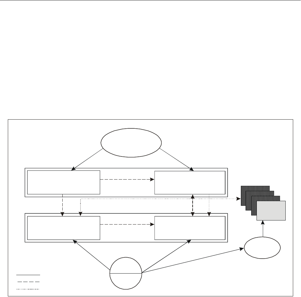
I-2-6 Global Air Navigation Plan for CNS/ATM Systems
e) Guidance material on economic and related organi-
zational and managerial issues has been developed;
f) A legal framework for GNSS is being studied; and
g) ICAO’s Technical Co-operation Programme is pro-
viding assistance to States with such requirements.
2.15 In accordance with its obligations under the
Chicago Convention, ICAO continues to carry out its
responsibility concerning the adoption and amendment of
relevant international SARPs and procedures. These SARPs
and procedures are continually being developed, reviewed
and updated developed to accommodate CNS/ATM systems
requirements. This continuing practice ensures the highest
possible degree of uniformity in all matters concerning
safety, regularity and efficiency of air navigation. Fig-
ure I-2-5 depicts the relationship between the Global Plan,
the regional ANPs and the national plans, and also the
interaction and relationship between the various ICAO
bodies and States.
Figure I-2-5. Relationship between the Global Plan,
regional ANPs and national plans
— — — — — — — — —
National
plans
Basic operational
requirements and planning
criteria (BORPC)
Facilities and services
implementation
documents (FASIDs)
GLOBAL PLAN
REGIONAL ANP
States
Action
Contribution line
Harmonization
* Planning and implementation
regional groups
Operational concept and
general planning
principles (Part I)
Facilities and services for
implementation of the
Global Plan (Part II)
the
ICAO
Headquarters
PIRGs*
ROs**
** Regional offices

Part I. Operational Concept and General Planning Principles
Chapter 2. ICAO’s Planning Structure for CNS/ATM I-2-7
APPENDIX A TO CHAPTER 2
STATEMENT OF ICAO POLICY ON CNS/ATM SYSTEMS
IMPLEMENTATION AND OPERATION
Approved by Council (C 141/13) on 9 March 1994
In continuing to fulfil its mandate under Article 44 of
the Convention on International Aviation by, inter alia,
developing the principles and techniques of international air
navigation and fostering the planning and development of
international air transport so as to ensure the safe and
orderly growth of international civil aviation throughout the
world, the International Civil Aviation Organization (ICAO),
recognizing the limitations of the present terrestrial-based
system, developed the ICAO communications, navigation
and surveillance/air traffic management (CNS/ATM) sys-
tems concept, utilizing satellite technology. ICAO considers
an early introduction of the new systems to be in the interest
of healthy growth of international civil aviation.
The implementation and operation of the new
CNS/ATM systems shall adhere to the following precepts:
1. UNIVERSAL ACCESSIBILITY
The principle of universal accessibility without discrimi-
nation shall govern the provision of all air navigation
services provided by way of the CNS/ATM systems.
2. SOVEREIGNTY, AUTHORITY AND
RESPONSIBILITY OF CONTRACTING STATES
Implementation and operation of CNS/ATM systems which
States have undertaken to provide in accordance with
Article 28 of the Convention shall neither infringe nor
impose restrictions upon States’ sovereignty, authority or
responsibility in the control of air navigation and the
promulgation and enforcement of safety regulations. States’
authority shall be preserved in the coordination and control
of communications and in the augmentation, as necessary,
of satellite navigation services.
3. RESPONSIBILITY AND ROLE OF ICAO
In accordance with Article 37 of the Convention, ICAO
shall continue to discharge the responsibility for the
adoption and amendment of Standards, Recommended
Practices and Procedures governing the CNS/ATM systems.
In order to secure the highest practicable degree of
uniformity in all matters concerned with the safety,
regularity and efficiency of air navigation, ICAO shall coor-
dinate and monitor the implementation of the CNS/ATM
systems on a global basis, in accordance with ICAO’s
regional air navigation plans and global coordinated
CNS/ATM systems plan. In addition, ICAO shall facilitate
the provision of assistance to States with regard to the tech-
nical, financial, managerial, legal and cooperative aspects
of implementation. ICAO’s role in the coordination and use
of frequency spectrum in respect of communications and
navigation in support of international civil aviation shall
continue to be recognized.
4. TECHNICAL COOPERATION
In the interest of globally coordinated, harmonious
implementation and early realization of benefits to States,
users and providers, ICAO recognizes the need for
technical cooperation in the implementation and efficient
operation of CNS/ATM systems. Towards this end, ICAO
shall play its central role in coordinating technical cooper-
ation arrangements for CNS/ATM systems implementation.
ICAO also invites States in a position to do so to provide
assistance with respect to technical, financial, managerial,
legal and cooperative aspects of implementation.
5. INSTITUTIONAL ARRANGEMENTS
AND IMPLEMENTATION
The CNS/ATM systems shall, as far as practicable, make
optimum use of existing organizational structure, modified
if necessary, and shall be operated in accordance with
existing institutional arrangements and legal regulations. In
the implementation of CNS/ATM systems, advantage shall
be taken, where appropriate, of rationalization, integration
and harmonization of systems. Implementation should be
sufficiently flexible to accommodate existing and future
services in an evolutionary manner. It is recognized that a
globally coordinated implementation, with full involve-
ment of States, users and service providers through, inter
alia, regional air navigation planning and implementation
groups, is the key to the realization of full benefits from the

I-2-8 Global Air Navigation Plan for CNS/ATM Systems
CNS/ATM systems. The associated institutional arrange-
ments shall not inhibit competition among service providers
complying with relevant ICAO Standards, Recommended
Practices and Procedures.
6. GLOBAL NAVIGATION SATELLITE
SYSTEM
The global navigation satellite system (GNSS) should be
implemented as an evolutionary progression from existing
global navigation satellite systems, including the United
States’ global positioning system (GPS) and the Russian
Federation’s global orbiting navigation satellite system
(GLONASS), towards an integrated GNSS over which
Contracting States exercise a sufficient level of control on
aspects related to its use by civil aviation. ICAO shall
continue to explore, in consultation with Contracting States,
airspace users and service providers, the feasibility of
achieving a civil internationally controlled GNSS.
7. AIRSPACE ORGANIZATION AND
UTILIZATION
The airspace shall be organized so as to provide for
efficiency of service. CNS/ATM systems shall be im-
plemented so as to overcome the limitations of the current
systems and to cater for evolving global air traffic demand
and user requirements for efficiency and economy while
maintaining or improving the existing levels of safety.
While no changes to the current flight information region
organization are required for implementation of the
CNS/ATM systems, States may achieve further efficiency
and economy through consolidation of facilities and
services.
8. CONTINUITY AND QUALITY
OF SERVICE
Continuous availability of service from the CNS/ATM
systems, including effective arrangements to minimize the
operational impact of unavoidable system malfunctions or
failure and achieve expeditious service recovery, shall be
assured. Quality of system service shall comply with ICAO
Standards of system integrity and be accorded the required
priority, security and protection from interference.
9. COST-RECOVERY
In order to achieve a reasonable cost allocation between all
users, any recovery of costs incurred in the provision of
CNS/ATM services shall be in accordance with Article 15
of the Convention and shall be based on the principles set
forth in ICAO’s Policies on Charges for Airports and Air
Navigation Services (Doc 9082), including the principle
that it shall neither inhibit nor discourage the use of the
satellite-based safety services. Cooperation amongst States
in their cost-recovery efforts is strongly recommended.
— — — — — — — — —

Part I. Operational Concept and General Planning Principles
Chapter 2. ICAO’s Planning Structure for CNS/ATM I-2-9
APPENDIX B TO CHAPTER 2
EXTRACT FROM THE ASSEMBLY RESOLUTIONS IN FORCE
(AS OF 2 OCTOBER 1998) (DOC 9730)
ASSEMBLY RESOLUTION A31-6
Whereas it is considered desirable to consolidate
Assembly resolutions on the Organization’s policies and
practices related to CNS/ATM in order to facilitate their
implementation and practical application by making their
text more readily available and logically organized;
The Assembly:
1. Resolves that the Appendices attached to this
resolution constitute the consolidated statement of continu-
ing ICAO policies and practices related to CNS/ATM, up to
date as these policies exist at the close of the 31st Session
of the Assembly;
2. Resolves to continue to adopt at each ordinary
session of the Assembly, for which a Technical Commission
is established, a consolidated statement of continuing ICAO
policies and practices related to CNS/ATM; and
3. Declares that this resolution supersedes A29-8 and
A29-9.
APPENDIX A (to Assembly Resolution A31-6)
General Policy
Whereas ICAO is the only international organization in
a position effectively to coordinate global CNS/ATM
activities;
Whereas the ICAO CNS/ATM systems should be
utilized to serve the interests and the objectives of civil
aviation throughout the world;
Whereas Contracting States should have equal rights to
benefit from global systems incorporated within the ICAO
CNS/ATM systems;
Considering the Statement of ICAO Policy on CNS/
ATM Systems Implementation and Operation developed
and adopted by the ICAO Council on 9 March 1994;
The Assembly:
1. Resolves that nothing should deprive a Contracting
State from its right to benefit from the ICAO CNS/ATM
systems or cause discrimination between provider and user
States;
2. Resolves that States’ sovereignty and borders
should not be affected by the ICAO CNS/ATM systems
implementation;
3. Urges that provisions and guidance material
relating to all aspects of the ICAO CNS/ATM systems
should be sought and developed through the convening of
adequate meetings, conferences, panels and workshops
with the participation of Contracting States; and
4. Urges that the proposed provisions covering all
aspects of the ICAO CNS/ATM systems be presented to all
Contracting States well in advance to give them enough
opportunity to prepare themselves as far as practicable.
APPENDIX B (to Assembly Resolution A31-6)
Harmonization of the implementation of the
ICAO CNS/ATM systems
Considering the international character of civil aviation
and the regional interactions of air navigation services;
Considering Recommendations 4/5, 6/2, 7/1, 8/4 and
8/5 of the Tenth Air Navigation Conference, Recommen-
dations 4/4 and 4/5 of the third meeting of the Special
Committee for the Monitoring and Coordination of
Development and Transition Planning for the Future Air
Navigation System (FANS Phase II) and Recommen-
dation 4/4 of the fourth meeting of the FANS (Phase II)
Committee;
Considering that these recommendations have been
noted or approved by the Council of ICAO, which has
A31-6: Consolidated statement of continuing
ICAO policies and practices related to
communications, navigation and
surveillance/air traffic management
(CNS/ATM) systems

I-2-10 Global Air Navigation Plan for CNS/ATM Systems
instructed the Secretary General of ICAO to take all
appropriate measures;
Recognizing the role which regions must play in the
planning and implementation of the ICAO CNS/ATM
systems;
Conscious of the delay which certain regions could
experience in the transition to these systems;
Noting with satisfaction the trials and demonstrations
programmes and the progress being achieved by certain
regions with regard to these systems;
Noting that it has not been possible in some areas to
initiate such trials and demonstrations programmes;
Believing that the contribution of all regions would
guarantee a better evaluation of the trials and would favour
the evolution of the ICAO CNS/ATM systems;
Noting that economic and institutional issues, in
particular cost/benefit analysis, and facility financing, cost
recovery and cooperative aspects, need to be addressed by
States individually and/or collectively;
Noting that for an early realization of benefits to users
and for globally coordinated and harmonious CNS/ATM
systems implementation certain States will require technical
and financial assistance and recognizing the statement
concerning the central role ICAO shall play in coordinating
technical cooperation arrangements as well as in facilitating
the provision of assistance to States with regard to the tech-
nical, financial, managerial, legal and cooperative aspects of
implementation;
The Assembly:
1. Calls upon States, in a position to do so, to spare no
effort in cooperating and facilitating the execution of the
research, development, trials and demonstrations (RDT&D)
programme in close cooperation with States with limited
resources;
2. Invites the cooperation of the international organi-
zations concerned, users and service providers for the
execution of the above-mentioned programme in favour of
States with limited resources;
3. Requests the Council, as a matter of high priority
within the budget adopted by the Assembly, to:
a) ensure that the resources necessary for the
implementation of the following recommendations
are made available:
1) Recommendations 4/5, 6/2, 7/1, 8/4 and 8/5 of
AN-CONF/10;
2) Recommendations 4/4 and 4/5 of FANS(II)/3;
3) Recommendation 4/4 of FANS(II)/4; and
b) ensure that adequate resources are made available
to the ICAO Regional Offices, particularly those
which are accredited to the developing States,
taking into account the increased support they will
be called upon to provide to the regional planning
and implementation groups, which are the main
bodies for the regional planning of the transition to
the ICAO CNS/ATM systems;
4. Further requests the Council to urge States,
international organizations and financial institutions to
mobilize resources in order to assist States requiring tech-
nical cooperation in the planning and implementation of the
ICAO CNS/ATM systems;
5. Urges the Council to continue considering without
delay the economic, institutional, legal and strategic aspects
related to the implementation of the ICAO CNS/ATM
systems.
— — — — — — — — —

Part I. Operational Concept and General Planning Principles
Chapter 2. ICAO’s Planning Structure for CNS/ATM I-2-11
APPENDIX C TO CHAPTER 2
EXTRACT FROM THE ASSEMBLY RESOLUTIONS IN FORCE
(AS OF 2 OCTOBER 1998) (DOC 9730)
ASSEMBLY RESOLUTION A32-21
Whereas the ICAO Technical Co-operation Programme
has been in operation since 1951 and has made invaluable
contributions to international civil aviation;
Whereas technical cooperation has been established as
a permanent priority activity of ICAO but should be further
integrated with the Organization’s other activities;
Whereas the growth and improvement of civil aviation
contributes significantly to the economic development of
States;
Whereas ICAO, through its Technical Co-operation
Programme, effectively assists States in advancing their
civil aviation;
Whereas the persistent decline of funding from the
United Nations Development Programme (UNDP) continues
to affect the Technical Co-operation Programme;
Whereas, prior to Resolution A29-20, ICAO’s Technical
Co-operation Programme did not have financial support from
the Regular Programme in the case of budget shortfalls;
Whereas the advisory/regulatory role of ICAO to
Contracting States should be complemented and strength-
ened at the country and regional levels for the effective
implementation by the Technical Co-operation Bureau of
ICAO SARPs and ANPs, as well as ICAO’s CNS/ATM and
Flight Safety Oversight Programme;
Whereas the 31st Session of the Assembly endorsed the
new policy on technical cooperation based on the pro-
gressive implementation of the core staff concept, the
progressive integration of the TCB into the organizational
structure, and the establishment of the ICAO Objectives
Implementation Funding Mechanism, as well as the
objectives of the new policy which emphasize the global
implementation of SARPs and ANPs and the development
of civil aviation master plans; and
Whereas the implementation of the elements of the new
policy on technical cooperation has already contributed and
will continue to contribute to minimize staff costs and
maximize the Technical Co-operation Programme and its
implementation, and substantially improve the financial
situation of the Technical Co-operation Bureau;
The Assembly:
1. Notes with satisfaction the progress made in the
progressive implementation of the core staff and the related
integration of the Technical Co-operation Bureau into the
Organization’s structure;
2. Urges the Secretary General to further promote
ICAO’s Technical Co-operation Bureau and its role in the
implementation of ICAO’s SARPs including the CNS/ATM
and Flight Safety Oversight Programmes; and
3. Encourages Contracting States to make use of the
Technical Co-operation Programme of ICAO and to con-
tribute to the ICAO Objectives Implementation Funding
Mechanism of which all funds are mainly intended for
SARPs implementation including the Flight Safety Oversight
and the CNS/ATM Programmes.
4. Approves the following transitional measures for
implementation during the 1999-2001 Triennium:
a) In case of a budget shortfall, the Regular Pro-
gramme budget will continue to augment the sup-
port cost income earned from projects to support
the Technical Co-operation Programme according
to the proposal contained in the Programme Budget
for the Organization for 1999, 2000 and 2001.
b) The Council and the Secretary General will further
implement the core staff concept by attrition,
restructuring and staff transfer.
A32-21:Transition to a new policy on Technical
Co-operation

I-2-12 Global Air Navigation Plan for CNS/ATM Systems
c) The Council and the Secretary General will adopt
further measures to integrate the Technical
Co-operation Bureau into the Organization’s
structure;
5. Directs the Council to report to the next ordinary
session of the Assembly regarding the plan for further
integration and the measures taken in the meantime, and to
prepare for its consideration a consolidated Resolution
regarding all technical cooperation activities and pro-
grammes; and
6. Decides that this Resolution replaces and supersedes
Resolution A31-14.

I-3-1
Chapter 3
GLOBAL PLANNING METHODOLOGY
INTRODUCTION
3.1 As traffic volumes grow worldwide, the demands
on the ATS provider in a given airspace increase, as do the
complexities of air traffic management. The number of
flights unable to follow optimum flight paths also increases
with an increase in traffic density. This creates pressure to
upgrade the level of ATS by, inter alia, reducing separation
minima.
3.2 Implementation of CNS/ATM systems will
enhance capacity to meet the increasing demand, while
producing additional benefits in the way of more efficient
flight profiles and increased levels of safety. The potential
for new technologies to significantly reduce service costs,
however, will require new arrangements in the provision of
services and changes in air traffic management procedures.
3.3 This chapter of the Global Plan provides
instructions on how to begin the process of identifying
ATM requirements, on the basis of identified homogeneous
ATM areas and major traffic flows and routing areas,
followed by the determination of regional and global CNS
system elements needed to meet the ATM requirements.
HOMOGENEOUS ATM AREAS AND
MAJOR TRAFFIC FLOWS
Homogeneous ATM area
3.4 Homogeneous ATM area. An airspace with a
common air traffic management interest, based on similar
characteristics of traffic density, complexity, air navigation
system infrastructure requirements or other specified con-
siderations wherein a common detailed plan will foster the
implementation of interoperable CNS/ATM systems.
Note.— Homogeneous ATM areas may extend over
States, specific portions of States, or groupings of States.
They may also extend over large oceanic and continental
areas. They are considered areas of shared interest and
requirements.
3.5 The method of identifying homogeneous ATM
areas involves consideration of the varying degrees of
complexity and diversity of the worldwide air navigation
infrastructure. Based on these considerations, it is considered
that planning could best be achieved, at the global level, if it
were organized based on ATM areas of common require-
ments and interest, taking into account traffic density and the
level of sophistication required (Figure I-3-1 offers several
examples).
Major traffic flows
3.6 Major traffic flow. A concentration of significant
volumes of air traffic on the same or proximate flight
trajectories.
Note.— Major traffic flows may cross several
homogeneous ATM areas with different characteristics.
3.7 Routing area. An area encompassing one or more
major traffic flows, defined for the purpose of developing a
detailed plan for the implementation of CNS/ATM systems
and procedures.
Note.— A routing area may cross several homogeneous
ATM areas with different characteristics. A routing area
specifies common interests and requirements among under-
lying homogeneous areas, for which a detailed plan for the
implementation of CNS/ATM systems and procedures either
for airspace or aircraft will be specified.
3.8 The basic planning parameter is the number of
aircraft movements that must be provided with ATM
REFERENCES
Statement of Basic Operational Requirements and
Planning Criteria for Regional Air Navigation
Planning (Regional Air Navigation Plans)
Air Traffic Services Planning Manual (Doc 9426)
Automatic Dependent Surveillance (Circular 226)
Methodology for the Derivation of Separation Minima
Applied to the Spacing between Parallel Tracks in
ATS Route Structures (Circular 120)

I-3-2 Global Air Navigation Plan for CNS/ATM Systems
services. Estimates and forecasts of annual aircraft move-
ments over the planning period are required for high-level
planning. Forecasts of aircraft movements in peak periods,
such as during a particularly busy hour, are needed for
detailed planning. Additionally, appropriate civil/military
coordination and consideration of special use airspace
(SUA) is required. This coordination should take place
during the planning stage to ensure a realistic chance of
implementation and in the tactical phase to allow for a
flexible use of airspace through the dynamic design and
activation of SUA. The principal data sources for current or
historic aircraft movements are the official airline guides:
World Airways Guide, ICAO’s Traffic by Flight Stage
Statistics and En-route Facility Statistics, and specific
statistical information for flight information regions, which
can be obtained from relevant area control centres (ACCs).
3.9 The ICAO Secretariat, in cooperation with the
International Air Transport Association (IATA), is progress-
ively developing estimates of current traffic volumes for
specific areas, which consist of major international route
groups. This information is being designed to assist with
planning at the global level. Additionally, traffic forecasting
groups are being established by ICAO in order to provide
the PIRGs with comprehensive databases and forecasts of
traffic flows for groups of routes for the detailed planning
process.
STATEMENT OF BASIC OPERATIONAL
REQUIREMENTS AND PLANNING CRITERIA
FOR REGIONAL AIR NAVIGATION PLANNING
3.10 While the Global Plan provides the framework to
be followed in the planning process, along with the latest
information and planning criteria for development of
emerging and future systems, the Statement of Basic
Figure I-3-1. Examples of major international traffic flows
Area of
routing
(AR) Traffic flows FIRs involved
Type of area
covered Remarks
Asia/Pacific (ASIA/PAC) Regions
ARx Asia/Australia and Africa Bangkok, Bombay,
Colombo, Jakarta, Kuala
Lumpur, Madras, Malé,
Melbourne, Singapore,
Yangon, [and African
FIR/UIRs]
Oceanic low
density
Major traffic flow
AFI/ASIA/MID
ARx Asia (Indonesia north to
China, Japan and the
Republic of Korea),
Australia/New Zealand
Auckland, Bali,
Bangkok, Beijing, Biak,
Brisbane, Guangzhou,
Hanoi, Ho-Chi-Minh,
Hong Kong, Honiara,
Jakarta, Kota Kinabalu,
Kuala Lumpur, Manila,
Melbourne, Nadi, Naha,
Nauru, Oakland, Phnom-
Penh, Port Moresby,
Shanghai, Singapore,
Taegu, Tai pei , Tokyo,
Ujung Pandang,
Vientiane, Wuhan,
Yangon
Oceanic high
density
Major traffic flow
ASIA/PAC
ARx Asia and North America
via the Russian Far East
and the Polar Tracks via
the Arctic Ocean and
Siberia
Anchorage, Beijing,
Guangzhou, Hong Kong,
Pyongyang, Russian Far
East of 80E, Shanghai,
Shenyang, Taegu, Tokyo,
Wuhan and Ulaanbaatar,
[and Canadian FIRs]
Continental low
density/
Continental high
density
Major traffic flow
ASIA/EUR/
NAM/NAT

Part I. Operational Concept and General Planning Principles
Chapter 3. Global Planning Methodology I-3-3
Operational Requirements and Planning Criteria for
Regional Air Navigation Planning (approved by the Air
Navigation Commission on 17 June 1999) provides the
necessary guidance on the preparation of the regional air
navigation plan for air navigation facilities, services and
procedures recommended for the area, to meet the require-
ments of all international civil aircraft operations during at
least the next five-year period, taking due account of the
long-term planning and implementation strategies regarding
CNS/ATM systems and as portrayed in the Global Plan,
and possible effects on adjacent regions.
PLANNING METHODOLOGY
3.11 The basis for developing a global, integrated
ATM system will be an agreed-to structure of homogeneous
ATM areas and major traffic flows/routing areas. These
areas and flows tie together the various elements of the
worldwide aviation infrastructure into a global system. The
Global Plan lists several of these. Further identification and
analyses of these areas and traffic flows are being carried
out by PIRGs in collaboration with the aircraft operators,
reflecting the latter’s requirements.
3.12 The planning process for any particular region
should begin with the identification of specific homogene-
ous ATM areas and major traffic flows, based on user
needs, followed by the development of an ATM plan for the
region and, eventually, for each State. Considering the com-
munications, navigation and surveillance elements of the
CNS/ATM systems infrastructure to support air traffic
management, it is necessary for each region or State to first
ascertain the ATM objectives for a given homogeneous
ATM area or major traffic flow/routing area. The ATM
operational concept, expected to be available by mid-2002,
will describe how the global ATM system should operate
and will help to determine the ATM objectives. An oper-
ational analysis should be performed in order to determine
which CNS and other technical and automation elements
are needed to fulfil the ATM objectives. The operational
analysis and the ATM operational concept therefore
complement each other. (An approach to conducting an
operational analysis is presented at paragraph 3.17.)
Finally, an assessment should be made of the technical
elements and implementation options that would most
appropriately and cost-effectively meet the ATM objectives
for that area or traffic flow/routing area.
3.13 Based on the above, PIRGs are responsible for
the integration and harmonization of CNS/ATM systems
plans for their various regions, while ICAO, through this
Global Plan, ALLPIRG meetings, worldwide conferences,
and an interregional coordination mechanism, carries out
interregional coordination to ensure global compatibility,
harmonization and seamlessness of the systems. At all
stages of the planning process, coordination with aircraft
operators must be carried out in order to fully address user
requirements.
3.14 Each regional planning group will develop its
own work structure for accomplishing the work associated
with the step-by-step approach listed hereunder. In some
cases, an already established working group or CNS/ATM
subgroup may be in a suitable position to accomplish the
work; in other cases, specific task forces or subgroups will
need to be established. Figure I-3-6 depicts a flow diagram,
illustrating the planning methodology contained in 3.15.
3.15 The step-by-step approach for planning ATM
requirements and CNS infrastructure is as follows:
Step 1. Identify homogeneous ATM areas and/or major
traffic flows.
Step 2. List the ICAO region(s), flight information
region(s) and State(s) involved in the homogeneous
ATM areas and/or major international traffic flows
(Figure I-3-1 refers).
Step 3. Carry out air traffic forecasts and ascertain airspace
user needs.
Step 4. Perform an operational analysis of the current
infrastructure for the areas identified in Step 2 in terms
of, inter alia:
a) ATM limitations and shortcomings;
b) separation standards; and
c) CNS availability.
Step 5. Determine the ATM objectives for the areas
identified in Step 2 in terms of the required total
systems performance (RTSP), using as the basis the
guidance material contained in the operational concept
document (operational analysis).
Step 6. Establish CNS and other technical and automation
requirements necessary to support the desired ATM
objectives identified in Step 5 (operational analysis).
Step 7. Analyse the benefits/improvements resulting from
Steps 5 and 6 in order to establish (operational analysis):

I-3-4 Global Air Navigation Plan for CNS/ATM Systems
a) costs/benefits;
b) relative priority;
c) expected performance improvements; and
d) implementation dates of the various ATM objectives
and CNS facilities for each of the homogeneous
ATM areas and major traffic flows/routing areas.
(Chapters 5, 6, 7 and 8, and Figures I-3-2 to I-3-5
of this chapter refer).
Step 8. Considering the many technical solutions and
implementation options available, repeat as necessary
Steps 5, 6 and 7 to determine the most appropriate
solution (operational analysis).
Step 9. Develop an ATM implementation plan based on
the outcome of steps 1 through 8 above using as the
basis the guidance material contained in the operational
concept document and the results of the operational
analysis. A safety assessment should demonstrate that
any new systems, or changes to the present systems,
will achieve an acceptable level of safety.
Step 10. Examine the possibilities of funding the
implementation of the CNS/ATM systems infrastructure
for States requiring financial assistance.
Step 11. Determine the means and methods of
cost-recovery.
Step 12. Establish a framework to interface with all the
CNS/ATM partners on a continuing basis to ensure the
harmonious and integrated implementation of CNS/ATM
systems in homogeneous areas and/or major international
traffic flows.
3.16 The FASIDs of the regional ANPs should be
developed with full consideration of the high-level guid-
ance provided in Part I and the step-by-step approach
described here and conceptualized in the tables in Part II of
the Global Plan. As the ATM operational concept and the
associated RCP*, required navigation performance (RNP),
RSP* and RTSP* mature, they should be integrated into the
planning process so that further development can take
place. Planning and implementation should therefore be
seen as a continuing, evolving and maturing process.
THE OPERATIONAL ANALYSIS
3.17 An operational analysis is a necessary part of
ATM implementation planning which leads to the selection
of solutions which will be the most effective in fulfilling the
ATM objectives. The ICAO global ATM operational concept
will describe how the global ATM system should operate
and will also help to identify the facilities and services
required to fulfil the global objectives. The operational
analysis and the ATM operational concept complement each
other. Steps 4 through 8 of the step-by-step approach to
planning described in 3.15 are centred on the operational
analysis outlined below.
3.18 Given the difficulty encountered in attempting to
define long-term operational requirements for various large
air navigation system projects, the development of oper-
ational requirements on the basis of an operational analysis
is not an exact science. Looking too far into the future and
attempting to incorporate definitive needs is difficult and
prone to error in light of the evolving nature of ATM sys-
tems and the rapidly changing technological solutions. It is
more appropriate, therefore, to address more immediate
requirements and ensure that a mechanism is available to
extend the implementation process into the future.
3.19 An analysis is appropriate when perceived
symptoms indicate a deficiency in the air traffic services
being provided; when additional demands from users require
such services to be expanded; or when circumstances
indicate that a need or opportunity exists to improve
effectiveness, efficiency or economy within the ATM system.
It is generally accepted that with the introduction of
CNS/ATM systems, new opportunities for improving ATM
have emerged and will continue to emerge. Therefore, a
thorough operational analysis should be carried out, followed
by the development of ATM implementation plans, prior to
implementing new ATM systems.
3.19.1 Getting started. The operational analysis
begins with the identification of a need, problem or oppor-
tunity by studying the existing set of circumstances.
3.19.2 Definition of the ATM role and objectives.
The role of ATM in the context of the systems or services
being studied is defined, and the ATS policies, objectives or
tasks that are pertinent to the analysis are specified.
3.19.3 Description of the current system. By
referring to air navigation system (ANS) documents for the
system under study, the role that the system is intended to
fulfil is outlined, along with the tasks it is intended to
support. A list of objectives that the system should sustain
by its currently specified performance capability is then
compiled.
* Emerging concept or technology — consensus still to be reached.

Part I. Operational Concept and General Planning Principles
Chapter 3. Global Planning Methodology I-3-5
3.19.3.1 The current system’s performance is estab-
lished in relation to its capability to satisfy the identified
needs.
3.19.3.2 The operational deficiencies that prevent the
resolution of problems are identified.
3.19.3.3 Performance limitations that constrain the
current system’s ability to take advantage of the existing
opportunity are detailed.
3.19.3.4 Interactions and interfaces between the
system under study and others are examined.
3.19.4 Evaluation: Current system against present
requirements. A comparison is made of the existing
system’s capability against the present requirements. The
following questions should be answered:
a) Does the current system do the present job
adequately?
b) Does its capability enable the allocation of additional
tasks to satisfy the identified needs?
3.19.4.1 If the answers are “yes”, longer-term analysis
can be undertaken. However, if either answer is “no”, it is
clear that the current system is deficient and should be
modified or replaced to remedy its shortcomings, if
possible. Any modification must address the changes
necessary to satisfy the needs, or to resolve the identified
problems and their causes, and should not merely attempt
to minimize or alleviate the associated symptoms.
3.19.5 Listing of future objectives and system
requirements. The future objectives and requirements that
must be addressed are then listed, and the operational
characteristics that a system must possess to support these
are derived. Section 4 of the operational concept document
describes future air traffic scenarios while Section 3
describes technical solutions which may be needed to fulfil
future requirements.
3.19.6 Evaluation: Current system against future
requirements. The capability of the existing system to
support the identified future objectives and to satisfy their
associated requirements is investigated, and the current
system’s capacity to perform the future job is determined.
3.19.6.1 If the current system has already been shown
to meet present requirements and has the ability to satisfy
future requirements, the analysis stops because there is no
need to satisfy, no problem to resolve, and no opportunity
will be missed.
3.19.6.2 Analysts must avoid the tendency to develop
a solution and then invent a need, problem or opportunity
to which the solution can be applied.
3.19.6.3 If the current system cannot satisfy the
present requirements and/or the future requirements, the
exercise continues.
3.19.7 Statement of operational requirements.
From the previous steps it becomes possible to prepare a
statement of operational requirements which describes, in
broad terms, the need for a new or modified system and
addresses the capability such a system must have.
3.19.7.1 An operational requirement may be defined as
a statement of the operational attributes of a system needed
for the effective and/or efficient provision of air traffic
services to users. An operational requirement is not a
description of “how” a need is to be met. Furthermore,
solutions to problems will not always be technical in nature.
It may be that the requirement will be met by appropriate
procedural, training or staffing actions. However, when
technical solutions are required, close coordination between
operational and technical experts is essential if the optimum
solution is to be found.
3.19.7.2 The described capability, which is expanded
upon below, is that which is necessary to satisfy the need,
to resolve the problem, or to take advantage of the oppor-
tunity which would support the objectives and ensure that
the role of ATS is fulfilled.
3.19.8 Establishing compliance criteria. Compliance
criteria, which are high-level “musts” describing the basic
operational characteristics of the system needed, are then
generated. These criteria outline essential performance capa-
bilities that proposed solutions must possess. Later,
alternatives will be rated against these operational absolutes.
For example, the communications systems performance
requirement parameters specified for ICAO ATS data link
applications state, “. . . the probability that a message will be
misdirected will be equal to or less than 10-7.”
3.19.9 Listing and describing alternatives. Next, all
reasonable alternatives are listed and described, including
procedural change and the possibility of doing nothing. At
this point descriptions need not be extremely detailed. For
example, if a potential solution stems from the same
equipment family as a primary radar system, it is necessary
only to describe in general terms how a primary radar
system operates and not how all the different types of
primary radar function.
3.19.9.1 This step will need to include a “market
search” of potential solutions available as commercial

I-3-6 Global Air Navigation Plan for CNS/ATM Systems
off-the-shelf (COTS) products which have been developed
in response to similar problems identified by other admini-
strations. In the past, the “custom-built” solution has
normally proven to be the better method; however, as the
harmonization of ATC systems across international bound-
aries increases due to improved cooperation, this may no
longer be the case.
3.19.10 Selection of preferred option. Each alternative
must be compared against each compliance criterion to
determine the preferred option. On the initial assessment, any
alternative must receive a “yes” [it satisfies each criterion], or
a qualified “yes” [it satisfies each criterion with certain
limitations], to be considered further.
3.19.10.1 If any alternative receives a “no” [it does
not satisfy a criterion], that choice is no longer considered
unless every other alternative fails, i.e. gets at least one
“no”. If this happens, the options may be reviewed to select
the option with the lowest “no” count. At this point the
chosen option will, of necessity, be a compromise. Any
alternative that does not satisfy all criteria cannot, by defi-
nition, fulfil the entire need, resolve the entire problem, or
take full advantage of the opportunity. Some undesirable
effects will continue. Therefore, the solution must be the
option which most effectively responds to the operational
issues being addressed.
3.19.10.2 During the operational analysis, alternatives
should not be evaluated based on costs. If the consideration
of money enters the decision-making process too soon, it
may cause a bias towards a less expensive solution which
may not attain the desired operational results. Costs will be
addressed during the cost-benefit analysis and during the
efficiency analysis when the best technical solution will be
found to address the operational concerns considering
technical, financial and other issues. It may become evident
that potential technical solutions need not be pursued as it
becomes apparent that the cost of implementation cannot be
supported.
3.19.10.3 Where COTS products appear to provide
possible solutions to the problems being addressed, the
option of developing a new system will usually carry a
lesser weight unless the cost of the COTS product is clearly
exorbitant. This should rarely be the case. However, the
costs of “modifying” COTS products to meet specific
requirements may ultimately cost more than the
build-from-scratch option.
3.19.11 Conclusions, recommendations, preferred
options. The conclusions and recommendations from all
previous steps, ending with the preferred options based on
operational effectiveness, are finally presented to the appro-
priate level of management for action. Senior management
must agree that a problem or opportunity exists, and
approve the resources to develop the detailed and accurate
costing data needed.
3.19.12 Development of operational performance
requirements. The final step in the analysis process is the
description of the complete operational capacity of the
proposed solution. For example, the description of a data
link system which will handle inter-facility messages must
include clear performance requirements for the definitions
of the types of messages to be exchanged, how many in a
given time period, at what times of the day, between which
agencies, internal and external, acceptable error rates, sys-
tem availability and reliability, etc. Later, these operational
performance requirements will be used to assist in evalu-
ating the operational acceptability of technical alternatives
proposed as candidates for meeting the operational need.
3.19.13 Prototyping and simulation. Prototyping and
simulation can prove extremely valuable at this point in the
analysis as a means of validating the operational concepts
being defined, ensuring the operational acceptability of
competing computer/human interfaces (CHI) operational
procedures, and clarifying the requirement in concrete
terms. This approach mitigates the possibility of technical
misinterpretations of the operational need and thus prevents
the final delivery of a system or component which does not
reflect the operational intent.
3.19.13.1 The cycle of analysis described above may
need to be repeated in an iterative fashion following the
choice of a proposed technical solution to a problem to
ensure that the operational needs are met prior to
embarking on the implementation phase.

Part I. Operational Concept and General Planning Principles
Chapter 3. Global Planning Methodology I-3-7
Figure I-3-2. Reproduction of tables from Part II
Figure I-3-3. Reproduction of tables from Part II
AIR TRAFFIC MANAGEMENT IMPLEMENTATION
Area of
routing Regions/States affected ATM objective 1998 1999 2000 2001 2002 2003 2004 2005 2006 2007 2008 2009 2010
AR ...
ICAO region Objective
States
AR ...
ICAO region Objective
States
AIR TRAFFIC MANAGEMENT REQUIREMENTS (COMMUNICATIONS)
Area of
routing Regions/States affected System elements 1998 1999 2000 2001 2002 2003 2004 2005 2006 2007 2008 2009 2010
AR ...
ICAO region Element
States
AR ...
ICAO region Element
States

I-3-8 Global Air Navigation Plan for CNS/ATM Systems
Figure I-3-4. Reproduction of tables from Part II
Figure I-3-5. Reproduction of tables from Part II
AIR TRAFFIC MANAGEMENT REQUIREMENTS (NAVIGATION)
Area of
routing Regions/States affected System elements 1998 1999 2000 2001 2002 2003 2004 2005 2006 2007 2008 2009 2010
AR ...
ICAO region Element
States
AR ...
ICAO region Element
States
AIR TRAFFIC MANAGEMENT REQUIREMENTS (SURVEILLANCE)
Area of
routing Regions/States affected System elements 1998 1999 2000 2001 2002 2003 2004 2005 2006 2007 2008 2009 2010
AR ...
ICAO region Element
States
AR ...
ICAO region Element
States
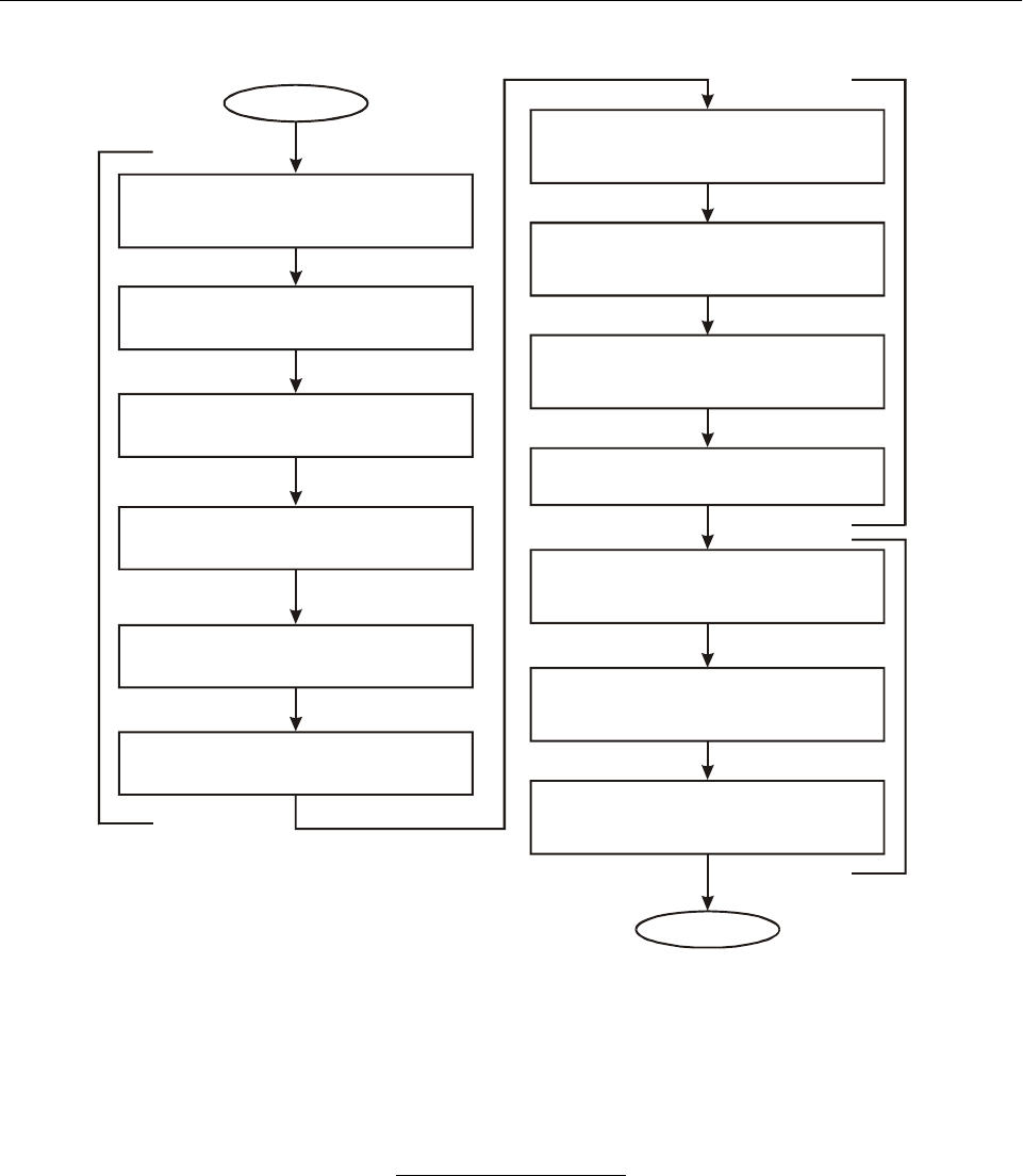
Part I. Operational Concept and General Planning Principles
Chapter 3. Global Planning Methodology I-3-9
Figure I-3-6. Planning methodology
Begin
Identify
Homogeneous ATM areas and major
traffic flows
List
ICAO region/States/FIRs
Survey
Present/future traffic/requirements
Perform
Operational analysis
Determine
ATM objectives
Establish
CNS support requirements
Planning Methodology
End
Perform
CBA analysis
Evaluate
Alternative solutions/options
Develop
Detailed CNS/ATM implementation
plan
Investigate
Financing options
Determine
Methods and means of cost-recovery
Harmonize
Integrate ATM systems
Business
Case
Survey
Planning
Validate safety

I-4-1
Chapter 4
AIR TRAFFIC MANAGEMENT
INTRODUCTION
4.1 Air traffic management is the aggregation of the
airborne functions and ground-based functions (air traffic
services, airspace management and air traffic flow manage-
ment) required to ensure the safe and efficient movement of
aircraft during all phases of operations.
LIMITATIONS OF THE ATM SYSTEM
(CIRCA 2001)
4.2 The conventional airspace organization of flight
information regions and their supporting infrastructure of
ATS routes and ground-based facilities and services has
been increasingly based on international requirements, due
in large part to the ICAO regional planning process. Where
this is not the case, fragmentation of the airspace and a
diversity of national systems prevents an optimum use of
the airspace. Additionally, there are limitations to the
amount of traffic that ATC systems can handle, especially
on rand om routings, without increasing levels of auto-
mation to assist with conflict detection and resolution. For
these reasons, aircraft must plan their flights along ATS
routes and be channelled, to a certain degree, in order for
ATC to keep aircraft safely separated from each other.
Limitations of the current approach to
ATM by phase of flight
En-route operations
4.3 The existing ATS route structure often involves
mileage penalties, compared to the most economic routes,
which may be great circle routes but which also take into
account wind, temperature and other factors such as weight
of the aircraft, charges and safety. This often results in a
concentration of traffic flows at major intersections, which
can lead to a reduction in the number of optimum flight
levels being available. A lack of uniformity in ATC pro-
cedures and separation minima around the world, due to
differences and limitations in ATC capabilities, places
additional constraints on the aircraft operators. Further-
more, aircraft are often unable to take advantage of
advanced on-board capabilities because the ATC system is
unable to support their use. A lack of coordination among
States in the development of ground ATM systems has
resulted in additional problems. Examples include inconsis-
tent separation minima in radar and non-radar airspace and
operation at less than optimum flight levels in oceanic
airspace due to communications deficiencies.
Terminal control area operations
4.4 Although terminal airspace is usually provided
with better surveillance and communications capabilities, it
differs from en-route airspace primarily because of the
higher traffic densities and greater complexity of traffic
flow. Arriving and departing aircraft share the terminal
REFERENCES
Annex 2 — Rules of the Air
Annex 11 — Air Traffic Services
Procedures for Air Navigation Services — Air Traffic
Management (PANS-ATM, Doc 4444)
Manual on Airspace Planning Methodology for the
Determination of Separation Minima (Doc 9689)
Manual on Required Navigation Performance (RNP)
(Doc 9613)
Manual of Air Traffic Services Data Link Applications
(Doc 9694)
Manual on Implementation of a 300 m (1 000 ft)
Vertical Separation Minimum Between FL 290
and FL 410 Inclusive (Doc 9574)
Air Traffic Services Planning Manual (Doc 9426)
Automatic Dependent Surveillance (Circular 226)
Simultaneous Operations on Parallel or Near-Parallel
Instrument Runways (SOIR) (Circular 207)
Methodology for the Derivation of Separation Minima
Applied to the Spacing between Parallel Tracks in
ATS Route Structures (Circular 120)
Human Factors Guidelines for Air Traffic Manage-
ment (ATM) Systems (Doc 9758)

I-4-2 Global Air Navigation Plan for CNS/ATM Systems
airspace, and also aircraft having widely differing per-
formance characteristics operate to the same or closely
spaced runways. Current separation requirements sometimes
prevent full use of available capacity at busy airports. Auto-
mation to manage departures and arrivals efficiently is not
always available, and on-board automation is therefore
under-utilized. Published arrival and departure routes are
sometimes inflexible and result in indirect routings. Noise
abatement and environmental procedures can impose further
restrictions on terminal area operations.
Airport surface movement area
4.5 The ground control of aircraft is conducted
through radar or visual means. Automation to support sur-
face movement guidance and control systems (SMGCS) of
aircraft and vehicles is lacking, and many major airports
operate in near gridlock conditions during periods of peak
demand. Coordination between ATM and ramp and taxi
areas will require standardization and harmonization for the
gate-to-gate operations* envisaged in future ATM systems.
In low-visibility conditions, movements are severely re-
stricted and there is increased risk of runway incursion or
violation of instrument landing system (ILS) critical or
sensitive areas.
GLOBAL ATM
4.6 The planning for implementation of CNS tech-
nologies is well under way in varying degrees in the ICAO
regions. It is necessary that the transition be focused with a
clear concept of how to integrate those elements into a
coherent and seamless global ATM system. The global
ATM system must be developed and organized to overcome
the limitations listed above and to accommodate future
growth, so as to offer the best possible service to all
airspace users and to provide adequate economic benefits to
the civil aviation community.
Implementation goals and
strategies of global ATM
4.7 The primary goal of an integrated, global ATM
system is to safely meet the expectations of the ATM
partners. For example, the ATM system should enable
aircraft operators to meet their planned times of departure
and arrival, to the extent possible, and adhere to their
preferred flight profiles with minimum constraints and no
compromise to safety. To accomplish this goal, the new
CNS technologies must be fully exploited through inter-
national harmonization of ATM Standards and procedures.
From the aircraft operator’s point of view, it is desirable to
equip aircraft operating internationally with a minimum set
of avionics usable everywhere. Additionally, many of the
expected service improvements cannot be meaningfully
implemented by one State, but must be implemented in
contiguous regions. Therefore, the ATM regional concept
of providing ATM over expanded areas must be pursued.
The goals of the future ATM system are summarized in
Figure I-4-1.
International scope
4.8 The emerging and future ATM system design
must meet the test of international acceptance and inter-
operability. It must allow for implementation at various
levels of sophistication to provide services tailored to
specific applications and regions. In this context, it is essen-
tial to ensure that adjacent systems and procedures are able
to interface in such a way that boundaries are transparent to
airspace users.
Evolutionary transition process
4.9 The development and implementation of the new
ATM system must be evolutionary. It is recognized that it is
impractical for this evolution to be completed in time frames
of less than several years. Such long transition periods place
a heavy burden on users and service providers when the new
systems replace in-service systems because the two must be
operated side by side during the transition period. Long
transitions also amplify the problem of aircraft having to
operate in a mixed environment where aircraft have differing
levels of CNS/ATM capability. Similarly, there will be a
need for an exchange of information between ATM service
providers with differing levels of information technology.
Furthermore, aircraft operators that have taken a decision to
invest at an early stage should achieve some corresponding
and appropriate benefits.
4.10 While change in the ATM system will be
evolutionary, the operational concept, ATM system archi-
tecture, and ATM system design and implementation must
provide a well-understood, manageable and cost-effective
sequence of improvements that keeps pace with users’
needs and culminates in a system meeting the ATM
partners’ expectations.
* Emerging concept or technology — consensus still to be reached.

Part I. Operational Concept and General Planning Principles
Chapter 4. Air Traffic Management I-4-3
Outline of the future ATM system
4.11 The ATM system must accommodate a broad
community of users and various levels of avionics equi-
page. A major design challenge in the development of ATM
procedures and techniques, using new technologies to
realize system improvements, centres on the roles of the
human operators. Information provided to the pilot and air
traffic controller and the tasks assigned must be consistent
with their management and control responsibilities as well
as the innate characteristics and capabilities of human
beings. As basic understanding of human factors improves
and facilities for testing the human factors aspects of
system designs become available, the design process will
become easier.
Benefits of global ATM
4.12 A large number of technologically related oppor-
tunities and benefits are now available for implementing a
worldwide ATM system that will improve ATM services to
better meet user requirements. The new technologies and
associated ATM procedures will also provide for an
improvement in controller productivity and overall
enhancement of the work environment. A summary of the
benefits expected from new ATM systems is depicted in
Figure I-4-2.
NEED FOR AN ATM
OPERATIONAL CONCEPT
4.13 Attaining the goal of an integrated, global ATM
system requires harmonization and standardization of
regional and national system elements and procedures.
ICAO is developing new SARPs as part of its work on
global ATM. States and industry will then use this material
as a guide toward the development and implementation of
ATM systems leading toward global harmonization.
4.14 The basis for developing the Standards necessary
for harmonization and integration is an ATM operational
concept for the emerging and future ATM system which is
under development by the Air Navigation Commission with
the assistance of the Air Traffic Management Operational
Concept Panel (ATMCP) established by the Commission
for this purpose. The ATM concept will clarify the expecta-
tions and benefits of these ATM systems and give States
and industry clear guidance for designing and implemen-
ting them. Work on the ATM concept is aimed at obtaining
consensus on several issues (i.e. separation assurance*,
situational awareness*, etc.).
* Emerging concept or technology — consensus still to be reached.
Figure I-4-1. Goals of a global ATM system
Goals of a global system
• To provide greater flexibility and efficiency by accommodating user-preferred
flight profiles.
• To improve the existing level of safety.
• To accommodate the full range of aircraft types and airborne capabilities.
• To improve the provision of information to users, including weather conditions,
the traffic situation, and the availability of facilities.
• To organize airspace in accordance with ATM provisions and procedures.
• To increase user involvement in ATM decision-making, including air-ground
computer dialogue for flight plan negotiation.
• To create, to the maximum extent possible, a single continuum of airspace
where boundaries are transparent to users.
• To increase capacity to meet future air traffic demand.

I-4-4 Global Air Navigation Plan for CNS/ATM Systems
4.15 The ATM operational concept will complement
the Global Plan and should guide the ATM partners, PIRGs
and States in further development of ATM systems. As part
of the overall CNS/ATM systems planning process, it will
be necessary to consider how the elements of the oper-
ational concept could be applied in a particular airspace. In
this light, the complete ATM operational concept will
consist of the concept developed, taking into consideration
the outcome of the step-by-step planning methodology and
the operational analysis described in Chapter 3 of the
Global Plan. The Air Navigation Commission, with the
assistance of the ATMCP, will propose amendments to
relevant parts of the Global Plan as appropriate; however, it
should be noted that the ATM Operational Concept by
Phase of Flight beginning at 4.25 was developed by the
ICAO Secretariat prior to the establishment of the ATMCP.
4.16 For the purposes of its development work and for
this Global Plan, the ATMCP has delineated an operational
concept as:
a) a high-level description of the set of ATM services
necessary to accommodate traffic at a given time
horizon;
b) a description of the anticipated level of performance
required from, and the interaction between, the
ATM services, as well as the objects they affect;
and
c) a description of the information to be provided
within the ATM system and how that information is
used for operational purposes.
4.17 In brief, the operational concept describes how
the ATM system will operate and identifies the services that
will be required. Identification of the specific technologies
to be implemented in delivering these services is defined by
an “architecture”, which itself should form part of a broader
ATM implementation plan. ATM implementation plans
should be developed by the PIRGs and by States in accord-
ance with Chapter 3 of the Global Plan. Thus, an oper-
ational concept drives the architecture. An ATM “concept
of use” is a more detailed description of how a particular
function or technology could be employed.
4.18 The ATM operational concept being developed
will be reached progressively through a series of discrete
changes from the current situation. The year 2025 was
Figure I-4-2. Benefits of a global ATM system
Benefits of a global ATM system
• The new ATM capabilities and more accurate data will make it possible to
enhance safety, reduce delays, and increase airspace and airport capacity.
• Future ATM operations will become much more flexible, resulting in a greater
capability to accommodate user-preferred trajectories. New capabilities will
make it possible to permit flexible routing, as well as dynamic modifications to
aircraft routes in response to changes in weather and traffic conditions.
• Improved flow management will prevent excessive levels of congestion.
• Data links will transmit a variety of information from appropriately equipped
aircraft to the ground and between ground units and provide enhanced
information to the cockpit. It will dramatically reduce workload, and reduce the
channel congestion and communications errors that characterize the current
voice environment.
• Terminal and en-route ATM functions will be integrated to provide smooth traffic
flows into and out of terminal areas.
• Air traffic controllers will be able to establish more efficient approach streams.
• The implementation of the global ATM system will provide an effective means
of reducing fuel burn and avoid unnecessary aircraft engine emissions, which
will help to minimize civil aviation’s environmental impact.

Part I. Operational Concept and General Planning Principles
Chapter 4. Air Traffic Management I-4-5
selected as the target date for meeting the majority of
expectations described in the global ATM operational
concept. Descriptions of intermediate stages will be pre-
sented using scenarios that combine elements of the current
global situations and target concepts.
4.19 With these descriptions as a basis, a vision of the
operational concept has taken shape. The goal is to achieve
a global ATM system for all users during all phases of
flight that meets agreed-to levels of safety and provides for
optimum economic operations. In addition, the system
envisaged would be environmentally sustainable and would
meet national security requirements.
4.20 The global ATM operational concept encompasses
two main time periods. The first period, up to 2015, allows
for the development of scenarios based on the more realistic
assumptions concerning applicability and technological
capabilities, and accommodates early implementation steps.
The second, from 2015 to 2025, addresses scenarios which
incorporate the more visionary options for air traffic
management.
Required total system performance (RTSP)*
4.21 ICAO has developed worldwide Standards for
many aspects of civil aviation; however, the current ATS
system has evolved without globally agreed-to criteria for
safety, regularity and efficiency of international civil avi-
ation having been established. A target level of safety has
been defined only for some airspaces, but not on a global
level. In the absence of agreed-to criteria for airspace/airport
capacity and for flexible use of airspace*, there is no
common basis for regularity and efficiency worldwide. As a
result, there is no assurance that the future traffic demand
and airspace users’ needs can be met.
4.22 In light of the above, the future system must be
viewed in its totality. The total system can be seen as the
totality of airspace, the ATM-related aspects of flight
operations, and the facilities and services provided.
4.23 RTSP* will specify criteria that should be met by
the entire ATM system. RTSP* will allow the ATM
providers and users of a given airspace to determine the
optimum usage level of an airspace. For example, lower
performance standards could be acceptable in a particular
airspace, for some or all system elements, if the users were
prepared to accept larger separation standards.
4.24 The RTSP* will offer guidance to the ICAO
PIRGs and States that carry out the actual planning of the
infrastructure that serves international civil aviation.
ATM OPERATIONAL CONCEPT BY PHASE
OF FLIGHT
Airport operations
4.25 Increased airport capacity is a major objective of
the future ATM system. The design of the future ATM
system will contribute to this goal by implementation of
techniques, procedures and technologies that fully utilize
scarce capacity resources, allowing a higher throughput of
traffic and maximizing both approach and departure
operating efficiencies. Sophisticated automation and an
air-ground digital data link will be required to make maxi-
mum use of capacity and to meet throughput requirements
by improving the identification and predicted movement of
all vehicles on the airport movement area, to include
conflict advisories. Additionally, increasing levels of
collaboration and information-sharing between users and
ATM providers will create a more realistic picture of airport
departure and arrival demand, allowing users to make
scheduling and flight planning decisions.
4.26 Advanced surface movement guidance and
control systems (A-SMGCS) will be used for routing,
guidance, surveillance and control of aircraft and vehicles
in order to maintain acceptable movement rates under all
weather conditions, while improving the required level of
safety. A-SMGCS* will also help to ensure that departing
aircraft arrive at the holding point of their assigned runway
in time to meet departure times required for ATFM.
4.27 A-SMGCS* will give ATM providers an enhanced
surveillance capability of the aerodrome surface and will
assist in taxi route planning and conflict detection/resolution.
Surface movement management will become automated with
aircraft/vehicle positional information being derived from
on-board systems such as automatic dependent surveillance
— broadcast (ADS-B)*. Cockpit and vehicle situational
displays will be updated by enhanced surveillance techniques
and provide pilots and vehicle drivers with more precise
ground manoeuvring guidance in low visibility and/or high
traffic density conditions.
Terminal and en-route operations
4.28 Independent IFR approaches to parallel runways
spaced as closely as 760 m (2 500 ft) or less might be
routinely based on high-data-rate-SSRs and other surveil-
lance techniques (e.g. ADS-B*) and on improved monitor
* Emerging concept or technology — consensus still to be reached.

I-4-6 Global Air Navigation Plan for CNS/ATM Systems
controller displays and cockpit display of traffic infor-
mation (CDTI) to the flight crew. This will provide capacity
increases in instrument meteorological conditions (IMC) at
locations with such runway configuration. In addition,
many communities may take advantage of this new capa-
bility by constructing closely spaced parallel runways that
conserve land.
4.29 Improved metering, sequencing and spacing of
arrival traffic using automated metering devices*, will
increase runway capacities in IMC to a level approaching
present runway capacities in visual meteorological con-
ditions (VMC). Automation tools will assist air traffic
managers in establishing efficient flows of approaching
aircraft for parallel and converging runway configurations.
4.30 The flow management process will monitor
capacity resources and demand at airports and in terminal
and en-route airspace. It will implement flow management
strategies, where required, to assure that excessive levels of
congestion do not develop. The tactical management pro-
cess will monitor aircraft movements to assure con-
formance with flight plans and to identify and resolve
problems such as imminent separation violations and air-
craft incursions into special use airspace. Clearances
involving position and time and the ATM data link interface
with flight management computers will be principal tools in
assuring that ATM constraints are met with minimum
deviation from user-preferred trajectories.
4.31 An increased ability to accommodate user-
preferred flight profiles and schedules will be gained
through improved decision support tools for conflict detec-
tion and resolution and for flow management. Terminal and
en-route ATM functions will be integrated to provide a
system in which traffic flows smoothly into and out of
terminal areas.
4.32 Automated and seamless coordination supported
by ATS inter-facility data communications (AIDC) will
present a transparent system to users. In addition, the data
link will also be used to transmit weather observations from
appropriately equipped aircraft and to provide a variety of
aviation information to the cockpit including weather
information and information on the status of facilities and
airports. Departure and arrival route structures will be
expanded to permit greater use of RNAV departure and
arrival routes based on RNP requirements.
Oceanic operations
4.33 Oceanic operations provide a full breadth of
opportunity to benefit from new technologies, allowing
these operations to experience significant improvements.
The overall goal is to make oceanic ATM operations as
flexible as reasonably possible in accommodating users’
preferred trajectories.
4.34 Future oceanic ATM operations will make
extensive use of ADS, HF and satellite-based digital com-
munications, GNSS, aviation weather system improvements
and collaborative decision-making. These new capabilities
will permit flexible routing and dynamic modifications to
aircraft routes in response to changes in weather and traffic
conditions.
4.35 Reduced vertical separation minimum (RVSM)
above FL 290 has been proven to increase capacity.
Furthermore, RNAV, based on established RNP values and
achieved using appropriate technology (e.g. GNSS on long
oceanic flights), will allow increased capacity through
reduced separation minima in the longitudinal and lateral
axes. More precise monitoring of aircraft, including various
conformance monitoring techniques, will allow separation
assurance* to be accomplished with the aid of decision
support systems and visual display systems.
Aircraft position and manoeuvre intent
4.36 The best use of airspace and airport capacity
requires an efficient airspace structure, which permits
collaborative planning between the aircraft and the ground
ATM system. The airspace structure should be capable of
dynamically adapting to changing circumstances and also
accommodating the capabilities and desires of the airspace
users, utilizing all available data. As in the past, the quality
of the process depends on the timeliness and quality of the
position and intent information available to the system and
the pilot. Accurate surveillance information will also
increasingly be required on the airport surface to support
the on-airport movement control process.
4.37 Alternative sources of position data, such as
automatic transmission of aircraft-derived position data, will
be used in certain areas. SSR, however, will most likely be
the standard for high-density traffic terminal area operations,
with an increasing use of ADS-B* as a possible complement
to SSR. Automated ATS ground systems will use ADS
position reports and other data to provide automated flight
following and cleared flight plan conformance monitoring.
Furthermore, appropriately equipped aircraft will be capable
of self-monitoring and automatic reporting of significant
* Emerging concept or technology — consensus still to be reached.

Part I. Operational Concept and General Planning Principles
Chapter 4. Air Traffic Management I-4-7
flight variances. This conformance monitoring capability
permits verification by the ground system, that the flight is
proceeding in accordance with its ATC clearance.
ATM automation
4.38 Automation is seen as one of many resources
available to the human operators — controllers and pilots
alike — who retain the responsibility for management and
direction of the overall ATM system. Additionally,
unexpected or unplanned events must be a required part of
planning and design when considering the systems that
would replace the cognitive and adaptive capabilities of
controllers or pilots.
4.39 The air traffic controller’s job consists of complex
tasks demanding a high degree of skill and active application
of unique cognitive abilities such as spatial perception,
information processing, reasoning and decision-making. The
controller must know where all of the aircraft under his/her
responsibility are, and determine how and when to take
action to ensure that they remain separated from each other,
while also seeing to their requests and needs for descent,
climb, take-off, departure, etc.
4.40 Although it is well accepted that the human
controller in the system has performed these tasks more
than adequately over the years, it is also accepted that
improvements could be made by using decision support
software tools. These tools are expected to assist the con-
troller to some degree with conflict prediction, detection,
advisory and resolution.
4.41 The expectation is that greater degrees of
accuracy could be achieved through the sophisticated data
processing associated with automation. Furthermore, con-
flict prediction and detection, based on advanced
computational methods, should allow more direct routings.
These systems will be introduced in an evolutionary
manner as the need arises.
4.42 There are several issues that need to be carefully
addressed when considering automation of this nature. The
most critical is based on the fact that aircraft do not always
do what they are expected to do. The human controller is
very flexible and adaptive and quite capable of compen-
sating and/or developing alternative plans. Based on this, it
is reasonable that computers and the associated software
will assist controllers in accomplishing, initially, a part of
their cognitive tasks. It is unrealistic to determine at this
early stage, that computers could effectively replace con-
trollers in the near term, mainly because of their uniqueness
in providing the aviation system a degree of flexibility.
Global ATM scenarios
4.43 Tables I-4-1 to I-4-5 depict the relationship
between ATM and CNS technologies and the benefits
expected to be derived. These tables illustrate current
common airspace types and are intended to indicate the
types of improvements that could be implemented.
4.44 The airspace types are:
— oceanic/continental en-route airspace with low-
density traffic;
— oceanic airspace with high-density traffic;
— continental airspace with high-density traffic;
— terminal area with high-density traffic;
— terminal area with low-density traffic.
4.45 These tables should be considered as presenting
possible scenarios rather than defining specific require-
ments. Furthermore, as global ATM planning is increasingly
being based on homogeneous ATM areas and major traffic
flows, these tables will be updated accordingly.
SAFETY ASSESSMENT AND
MONITORING
4.46 Because separation standards have significant
impact on the capacity and functioning of an integrated
ATM system, it is necessary to develop comprehensive,
reliable methods for determining separation standards
applicable to new technologies and procedures.
4.47 The ATM operational concept is based on the
requirements that planning of ATM systems should ensure
ATM system enhancements (e.g. implementing new tech-
nology to enable reductions in separation minima) are
applied on a subregional basis in accordance with relevant
ICAO SARPs, while meeting the requirements of regional
air navigation agreements. With regard to the specific issue
of reduction in an applied separation minima, they should
be selected from those found in the ICAO Procedures for
Air Navigation Services — Air Traffic Management
(PANS-ATM, Doc 4444) and the Regional Supplementary
Procedures (Doc 7030). These documents should also be
revised to meet changing requirements, based on tech-
nological and procedural opportunities.
4.48 A prerequisite to the implementation of any
reduction in separation minima is the maintenance of a level
of safety equal to or better than the present. This safety

I-4-8 Global Air Navigation Plan for CNS/ATM Systems
Table I-4-1. ATM — oceanic/continental airspace with low-density traffic
* Emerging concept or technology — consensus still to be reached.
Functions Technical elements Procedural aspects ATM benefits
Ground Air Structure Procedures
COM
• AMSS voice and
data
• HF voice and
data
• ATN connectivity to
AMSS, HF
• ATN end-systems
human-machine
interface (HMI)
• Voice AMSS, HF
• ATN connectivity to
AMSS and HF
avionics
• Voice AMSS, HF
• RCP* • Data link handling
procedures
• Message format
• Improved tactical
control
• Improved pilot/
controller
communications
• Facilitate ATC/FMS
dialogue
NAV
• GNSS • NIL • GNSS receiver
•FMS
• RNP
•Airspace
organization
• RNP certification/
approval
• Navigation
procedures
• Improved airspace
utilization
SUR
•ADS
•ADS-B*
• ATN connectivity to
AMSS and HF
• Situation display for
ADS and ADS-B*
• ATN connectivity
with ADS and
ADS-B* function
and situation
display
• ADS, ADS-B*
avionics
•Airspace
organization
•RSP*
• Surveillance
procedures
• Message format
• Reduction of
radiotelephony (R/T)
workload
• Improved situational
awareness*
AUTOMATION
• Decision
support systems
• Automated flight
data processing
• Conflict alert,
advisory, prediction
and resolution
software
•FMS •Airspace
organization
• Automation
procedures and
algorithm
development
• Message format
• Increase in direct
routings
• Improved conflict
prediction and
resolution

Part I. Operational Concept and General Planning Principles
Chapter 4. Air Traffic Management I-4-9
Table I-4-2. ATM — oceanic/airspace with high-density traffic
* Emerging concept or technology — consensus still to be reached.
Functions Technical elements Procedural aspects ATM benefits
Ground Air Structure Procedures
COM
• AMSS voice and
data
• HF voice and
data
• Extended VHF
voice and data
• ATN connectivity to
AMSS, HF,
extended VHF
• ATN end-systems
(HMI)
• Voice AMSS, HF,
extended VHF
• ATN connectivity to
AMSS, HF,
extended VHF
avionics
• Voice AMSS, HF,
extended VHF
• RCP* • Separation criteria
• Data link handling
procedures
• Message format
• Improved tactical
control
•Improved
pilot/controller
communications
• Facilitate ATC/FMS
dialogue
NAV
• GNSS • GNSS receiver
•FMS
• RNP
•Airspace
organization
including
separation criteria
• RNP certification/
approval
• Navigation
procedures
• Increase airspace
capacity by reduction
in separation minima
due to increased
positional accuracy
• Improved airspace
utilization
SUR
•ADS
•ADS-B*
• ATN connectivity to
AMSS, HF and
extended VHF
• Situation display for
ADS and ADS-B*
• ATN connectivity
with ADS and
ADS-B* function
and situation
display
• ADS and ADS-B*
avionics
•Airspace
organization
including
separation criteria
•RSP*
• Surveillance
procedures
• Message format
• Increased airspace
capacity by reduction
in separation minima
due to improved
conformance
monitoring
• Improved airspace
utilization
• Reduction of R/T
workload
• Improved situational
awareness*
AUTOMATION
• Decision
support systems
• Automated flight
data processing
• Conflict alert,
advisory, prediction
and resolution
software
•FMS •Airspace
organization
• Automation
procedures and
algorithm
development
• Message format
• Increase in direct
routings
• Increase in
user-preferred flight
profiles
• Increased capacity
• Improved traffic
planning
• Improved conflict
prediction and
resolution
• Improved trajectory
planning

I-4-10 Global Air Navigation Plan for CNS/ATM Systems
Table I-4-3. ATM — continental airspace with high-density traffic
* Emerging concept or technology — consensus still to be reached.
Functions Technical elements Procedural aspects ATM benefits
Ground Air Structure Procedures
COM
• AMSS voice and
data
• VHF voice and
data
•SSR Mode S
data link
• ATN connectivity to
SSR Mode S and
VHF
• ATN end-systems
(HMI)
• Voice VHF
• ATN connectivity to
VHF and SSR
Mode S avionics
• Voice VHF
• RCP* • Separation criteria
• Data link handling
• Message format
•Improved
pilot/controller
communications
• Facilitate ATC/FMS
dialogue
• Complement VHF
coverage
• Reduction of R/T
workload
NAV
• GNSS • Augmentation • GNSS receiver
•FMS
• Application of RNP
•Airspace
organization
including
separation criteria
• RNP certification/
approval
• Navigation
procedures
• Increased airspace
capacity by reduction
in separation minima
due to increased
positional accuracy
• Improved airspace
utilization
SUR
•ADS
•ADS-B*
•SSR
• ATN connectivity to
VHF, SSR Mode S
• Situation display for
ADS and ADS-B*
• ATN connectivity
with ADS and
ADS-B* function
and situation
display
• SSR Mode S
transponder
• ADS and ADS-B*
avionics
•Airspace
organization
including
separation criteria
• Application of RSP*
• Surveillance
procedures
• Increased airspace
capacity by reduction
in separation minima
due to improved
conformance
monitoring
• Improved airspace
utilization
• Reduction of R/T
workload
• Improved situational
awareness*
• (ADS, ADS-B*)
complement to and
possible back-up for
SSR
• Reduced need for
primary surveillance
radar (PSR)
AUTOMATION
• Decision
support systems
• Automated flight
data processing
• Conflict alert,
advisory, prediction
and resolution
software
•FMS •Airspace
organization
• Automation
procedures and
algorithm
development
• Message format
• Improved traffic
planning
• Improved conflict
prediction and
resolution
• Improved trajectory
planning
• Increase in direct
routings
• Increase in
user-preferred flight
profiles

Part I. Operational Concept and General Planning Principles
Chapter 4. Air Traffic Management I-4-11
Table I-4-4. ATM — terminal areas with high-density traffic
* Emerging concept or technology — consensus still to be reached.
Functions Technical elements Procedural aspects ATM benefits
Ground Air Structure Procedures
COM
• VHF voice and
data
•SSR Mode S
data link
• ATN connectivity to
VHF and SSR
Mode S
• ATN end-systems
(HMI)
• Voice VHF
• ATN connectivity to
VHF, SSR Mode S
avionics
• Voice VHF
•Airspace
organization
• Application of RCP*
• Separation criteria
• Message format
• Data link
procedures
•Improved
pilot/controller
communications
• Facilitate ATC/FMS
dialogue
• Complement VHF
coverage
• Reduction of R/T
workload
NAV
•GNSS
•ILS
•MLS
•ILS
•MLS
• Augmentation
systems
• GNSS receiver
•ILS
•MLS
•MMR
•FMS
• Application of RNP
•Airspace
organization
including
separation criteria
• RNP certification/
approval
• Approach
procedures
• Increased airspace
capacity by reduction
in separation minima
due to increased
positional accuracy
• Improved airspace
utilization
SUR
•ADS
•ADS-B*
•SSR
• ATN connectivity to
VHF and SSR
Mode S
• Situation display for
ADS and ADS-B*
• ATN connectivity
with ADS and
ADS-B* function
and situation
display
• SSR Mode S
transponder
• ADS and ADS-B*
avionics
•Airspace
organization
including
separation criteria
• Application of RSP*
• Surveillance
procedures
development
• Increased airspace
capacity by reduction
in separation minima
due to improved
conformance
monitoring
• Improved airspace
utilization
• Reduction of R/T
workload
• Improved situational
awareness*
• (ADS, ADS-B*)
complement to and
possible back-up for
SSR
• Reduced need for PSR
AUTOMATION
• Decision
support systems
• Automated flight
data processing
• Conflict alert,
advisory, prediction
and resolution
software
• Metering software
•FMS •Airspace
organization
• Automation
procedures and
algorithm
development
• Message format
• Increase in direct
routings
• Improved sequencing
and flight profiles
• Improved trajectory
planning
• Improved traffic
planning
• Improved conflict
prediction and
resolution

I-4-12 Global Air Navigation Plan for CNS/ATM Systems
Table I-4-5. ATM — terminal areas with low-density traffic
* Emerging concept or technology — consensus still to be reached.
Functions Technical elements Procedural aspects ATM benefits
Ground Air Structure Procedures
COM
• VHF voice and
data
• ATN connectivity for
VHF
• ATN end-systems
• Voice VHF
• ATN connectivity to
VHF avionics
• Voice VHF
• RCP* • Data link
procedures
• Message format
•Improved
pilot/controller
communications
• Facilitate ATC/FMS
dialogue
• Complement VHF
coverage
NAV
• GNSS • Augmentation
systems
• GNSS receiver • RNP certification
approval
• Approach
procedures
• Improved airspace
utilization
SUR
•ADS
•ADS-B*
•SSR
• ATN connectivity for
VHF
• Situation display for
ADS and ADS-B*
• ATN connectivity
with ADS and
ADS-B* function
and situation
display
• ADS, ADS-B*
avionics
• RSP* • Surveillance
procedures
• Improved airspace
utilization
• Improved situational
awareness*
• Reduced need for PSR
AUTOMATION
• Decision
support systems
• Situation display
• Automated flight
data processing
•FMS •Automation
procedures and
algorithm
development
• Message format
• Increase in
user-preferred flight
profiles
• Improved traffic
planning
• Improved conflict
prediction and
resolution

Part I. Operational Concept and General Planning Principles
Chapter 4. Air Traffic Management I-4-13
requirement must be taken into account in the development
of automated systems. Such systems should, to the extent
possible, be flexible with regard to separation minima par-
ameters. For example, a separation minimum of 7 minutes
in oceanic airspace may not meet the target level of safety
at a given point in time whereas 8 minutes may. Further-
more, flexibility must also be considered in the context of
the progression of planned reductions in separation minima.
4.49 Once the need to enhance operational efficiency
in a particular area has been identified, the potential bene-
fits to be gained, the costs to the user community and the
impact on air traffic operations must be investigated. Part of
this analysis will establish the capabilities necessary in the
ATM system, given the performance and capabilities of the
existing aircraft population, leading to an agreed safety level
for the operations desired. Within the context of the agreed
safety measure, a thorough analysis of operational safety,
including consideration of contingencies and environmental
conditions, should be conducted to establish the aircraft
requirements and to validate the ground system require-
ments. Once these requirements are understood, the need for
rule-making and a cost-benefit analysis must be determined.
Any operational procedures necessary to support the safety
constraints and contingencies or regulatory changes must be
identified and coordinated with the user community.
4.50 Planning and preparation for the changes should
be initiated using the results of a requirements assessment.
The effort can be divided into a number of activities, which
would be initiated by the development and coordination of
any necessary amendments to regional supplementary
procedures which would contain criteria to implement oper-
ational enhancements and/or reduced separation minima.
The result will lead to efforts to establish the State approval
process for aircraft and operators as well as a means for
investigating and tracking significant operational errors and
incidents.
4.51 A safety case will be completed whenever
necessary. There will also be a need to establish an ongoing
process to assess operational safety once the change takes
effect. A verification trial plan that will determine the tech-
nical and operational data necessary to gain confidence that
the requirements and methods to implement new Standards
are effective should be conducted in parallel with updates
of documentation.
4.52 With the analysis and planning complete, it will
be possible to begin operational implementation. During the
operational phase of implementation, it will be necessary to
ensure that appropriate organizations and States initiate
ongoing safety and performance monitoring programmes
and improvement processes. This analysis will involve
tracking errors, reviewing incidents that affect operational
safety and taking steps to mitigate against reoccurrence, and
assessing feedback from the user community on the safe and
effective use of operational procedures. The feedback
process may generate further initiatives.
GLOBAL ATM IMPLEMENTATION
4.53 The future ATM system must clearly be
compatible with ATM developments worldwide. It must be
possible to equip aircraft with a minimum set of avionics
usable everywhere. It is not acceptable to require one set of
avionics within one region and a different set in other
regions, each performing essentially the same functions.
Moreover, if international operators improve their on-board
capabilities to exploit ATM service improvements im-
plemented in one State, the return on their investment will
be enhanced if the same improvements are implemented in
other States. In oceanic areas, some service improvements
cannot be implemented meaningfully in only one FIR. For
example, to achieve the expected benefits, it is desirable that
reduction in separation be implemented in all contiguous
airspace through which a significant number of aircraft will
travel.
4.54 The ATM operational concept should assist and
guide airspace planners in airspace and systems design,
with the goal of providing for the safe and efficient
operations of aircraft for each of the phases of flight. This
includes navigation along the intended route of flight,
clearance from obstacles, support of separation minima and
added autonomy of flight*. The main interdependent
elements that affect the achievement of predetermined
levels of safety, efficiency and regularity are:
— nature of traffic;
— frequency of occurrence of potential conflict
situations;
— separation minima;
— controller’s intervention capability;
— communications performance;
— aircraft navigation performance; and
— surveillance performance.
* Emerging concept or technology — consensus still to be reached.

I-4-14 Global Air Navigation Plan for CNS/ATM Systems
4.55 After determining the ATM requirements of a
given area, a strategy should be developed to guide the
implementation of the CNS/ATM systems infrastructure,
taking into account the performance capabilities of the CNS
elements and the ATM objectives. These performance
capabilities are used to determine airspace design (e.g.
separation minima, route spacing, sectorization, instrument
procedures required and the capability for intervention by
the ground-based ATM service provider when required).
4.56 It is well understood that not everything that is
possible is also necessary and that a balance must therefore
be reached between the requirements first put forward for
the improvement of services and the cost involved in
implementation. An increase or decrease in the require-
ments for any single parameter or element may allow a
corresponding increase or decrease in some or all of the
other parameters. Seen from this light, technology is not an
end in itself.
4.57 When fully developed, the operational concept
will clarify the benefits of global ATM and will give ICAO
regional planning and implementation groups, States and
industry a clear objective for designing and implementing
ATM systems.
4.58 The process of planning for the implementation
of CNS/ATM systems should begin with the step-by-step
approach outlined in Part I, Chapter 3, in full consideration
of the guidance provided in this and other chapters of the
Global Plan, as well as of the SARPs so far developed and
other guidance material identified. Seen in this light, the
Global Plan itself forms the basis for the ATM operational
concept and can, in fact, be seen as part of that concept.
The planning work should be integrated with the substantial
work already accomplished by the planning and implemen-
tation regional groups. The Global Plan and the evolving
notion of the global ATM system requires an evolutionary
and flexible approach to planning and implementation.
GENERAL TRANSITION ISSUES
4.59 The transition from today’s ATM structure to one
of collaborative air traffic management enabled by the
global ATM system should be carefully planned to avoid
degradation in system performance. The level of safety
attainable today will need to be assured throughout the
transition. Careful planning will also be necessary to ensure
that aircraft are not unnecessarily burdened by the need to
carry a multiplicity of existing and new CNS equipment
during a long transition cycle.
4.60 For reasons of both economy and efficiency, it is
necessary to ensure that differences in the pace of develop-
ment around the world do not lead to incompatibility among
elements of the overall system. In particular, given the wide
coverage of satellite systems, worldwide coordination is
necessary.
4.61 It is recognized that there are major long-term
consequences of adopting new systems that will eventually
permit the elimination of a variety of current systems.
Decisions on whether particular systems can be removed
will depend on many factors. One essential factor is the
demonstrated capability of a new system. Moreover, a clear
and compelling case for transition to the global ATM
system must include consideration of the benefits perceived
by the aviation community.
4.62 Guidelines for transition to the future systems
encourage equipage by users for the earliest possible accrual
of systems benefits. Although a transition period of dual
equipage, both airborne and ground, is often necessary to
ensure the reliability and availability of a new system, the
guidelines are aimed at minimizing this period to the extent
practicable. Appendix B to this chapter lists the guidelines
that States, regions, users, service providers and manufac-
turers should consider when developing CNS/ATM systems
or planning for implementation of such systems.
— — — — — — — — —

Part I. Operational Concept and General Planning Principles
Chapter 4. Air Traffic Management I-4-15
APPENDIX A TO CHAPTER 4
ATM OPERATIONAL REQUIREMENTS IN AN RNP/RNAV ENVIRONMENT
Code
ATM operational
enhancements* Required functions — air Required services — ground Notes
AIR TRAFFIC SERVICES
1. Routings and required conventional functionalities
1A • fixed routes • RNAV capability • NAVAID infrastructure
1B • flexible routes • RNAV capability • NAVAID infrastructure
2. Routings and required CNS/ATM functionalities
2A • fixed routes • DCPC (voice/data)
• RNP/X approval/certification
•FMS
• DCPC (voice/data) • see Notes 1, 2 and 3
2B • flexible routes • DCPC (voice/data)
• RNP/X approval/certification
•FMS
• DCPC (voice/data) • see Notes 1, 2 and 3
2C • dynamic
user-preferred
re-route (e.g.
DARPs)
• DCPC (voice/data)
• RNP/X approval/certification
• Aeronautical operational control
(AOC) data link
• Direct flight plan uploads
•FMS
• DCPC (voice/data)
• AOC data link
• flight plan generation
• AOC/ATS data communications
• utilization dependent on airspace
complexity
• see Notes 1, 2 and 3
2D • autonomy of
flight** concept
• to be developed • to be developed • concept still undergoing definition
by ICAO
3. En-route vertical separation reductions
3A • 300 m (1 000 ft)
vertical separation
between FL 290
and FL 410
• RVSM certification/ operational
approval
• voice/data communications
• height monitoring sampling
• voice/data communications
• see ICAO
Regional
Supplementary Procedures
(Doc 7030) NAT/RAC
• sampling to verify that aircraft
population height-keeping
accuracy is in conformance with
appropriate Standards
4. En-route longitudinal separation reductions
4A • 80 NM (non-radar
environment)
• RNAV
• MNPS approval
• voice/data communications
• Mach number technique (MNT)
• 60-minute position reporting
• voice/data communications
• MNT may be required
• MNPS is used in a generic sense
and may not be required in all
cases
• see Note 1
4B • 50 NM (non-radar
environment)
• RNP 10 approval/certification
•FMS
• DCPC (voice/data)
• 30-minute position reporting
•MNT
• DCPC/voice/data
• final requirements to be
developed
• MNT may be required
• see Notes 1, 2 and 3
4C • 30 NM (non-radar
environment)
•FMS
• DCPC (voice/data)
• RNP 4 approval/certification
•ADS
• DCPC (voice/data)
•ADS
• final requirements to be
developed
• see Notes 1, 2, 3 and 4
4D • less than 30 NM
(non-radar
environment)
•FMS
• DCPC (voice/data)
• RNP/X approval/certification
•ADS
• DCPC (voice/data)
•ADS
• final requirements to be
developed
• see Notes 1, 2, 3 and 4
4E • 10 minutes
(non-radar
environment)
• RNAV
• voice/data communications
• MNT where prescribed
• voice/data communications
• RNAV capability may not be
required in all situations
• accurate time requirement/
common time reference
• see Note 1

I-4-16 Global Air Navigation Plan for CNS/ATM Systems
4F • 7 minutes
(non-radar
environment)
•FMS
• DCPC (voice/data)
• RNP 10 approval/certification
• DCPC (voice/data) • final requirements to be
developed
• accurate time requirement/
common time reference
• see Notes 1, 2 and 3
5. En-route lateral separation
5A • 60 NM (non-radar
environment)
• RNP 12.6 approval/certification
• voice/data communications
• voice/data communications
• pilot position reports
• presently implemented as MNPS
and AUSEP in the NAT and Asia
Pacific Regions respectively
• performance monitoring may be
required
• see Notes 1, 3 and 5
5B • 50 NM (non-radar
environment)
• RNP 10 approval/certification
• voice/data communications
• voice/data communications
• pilot position reports
• performance monitoring may be
required
• see Notes 1, 3 and 5
5C • 30 NM (non-radar
environment)
• RNP 4 approval/certification
• DCPC (voice/data)
• DCPC (voice/data) • final requirements to be
developed
• performance monitoring may be
required
• see Notes 1, 2, 3 and 5
5D • less than 30 NM
(non-radar
environment)
• DCPC (voice/data)
• RNP/X approval/certification
•ADS
• DCPC (voice/data)
•ADS
• final requirements to be
developed
• performance monitoring may be
required
• see Notes 1, 2, 3, 4 and 5
5E • 16.5 NM
(uni-directional)
(non-radar
environment)
• RNP 5 approval/certification
• DCPC voice
• DCPC voice • relates to VOR reference
system
• see Notes 3, 5, 6 and 7
5F • 18 NM
(bi-directional)
(non-radar
environment)
• RNP 5 approval/certification
• DCPC voice
• DCPC voice • relates to VOR reference
system
• see Notes 3, 5, 6 and 7
5G • 10 to 15 NM (radar
environment)
• RNP 5 approval/certification
• DCPC voice
• radar
• DCPC voice
• system safety evaluation
required
• see Notes 3, 5, 6 and 7
5H • 8 to 12 NM (radar
environment)
• RNP 4 approval/certification
• DCPC voice
• radar
• DCPC voice
• system safety evaluation
required
• see Notes 3, and 5
AIRSPACE MANAGEMENT
6A • airspace
integration and
flexible use of
airspace**
• to be provided to all aircraft • separate databases for:
— aircraft
—AOC
— military reserved airspace
— national security
— environmental
— aeronautical information
—airports
—weather
— traffic
—SAR
— rules of the air
• this provides the information that
is necessary to create flexible use
of airspace**
Code
ATM operational
enhancements* Required functions — air Required services — ground Notes

Part I. Operational Concept and General Planning Principles
Chapter 4. Air Traffic Management I-4-17
* For each particular operational enhancement, there will be a need for the airlines and the ATS providers to review existing procedures
to identify what new requirements are required prior to operational implementation.
** Emerging concept or technology — consensus still to be reached.
NOTES
1) When a data link is used for communications, voice communications must be available. Depending upon the separation
requirement, the voice requirement may be for direct voice.
2) Performance requirements of a data link depend upon the application for which it is being used.
3) The approval for RNP operations is specific for each RNP type.
4) The ADS requirement is associated with and related to the overall communications performance requirements for position
reporting.
5) Lateral route systems require regional safety assessments and agreement.
6) In some cases, the RNP requirement may be met without the use of RNAV; however, in future CNS/ATM systems, all
aircraft are expected to be RNAV-equipped.
— — — — — — — — —
AIR TRAFFIC FLOW MANAGEMENT
7A • integrated air traffic
flow management
• to be provided to all aircraft • separate databases for:
— aircraft
—AOC
— airspace requirements
— environmental
— aeronautical information
—airports
—weather
— traffic forecast
• integrated automation of database
management
•AOC interface
• ATC/ASM/ATFM interface
• purpose is to ensure an optimum
flow of air traffic by balancing
traffic demand and ATC capacity
Code
ATM operational
enhancements* Required functions — air Required services — ground Notes

I-4-18 Global Air Navigation Plan for CNS/ATM Systems
APPENDIX B TO CHAPTER 4
GUIDELINES FOR TRANSITION TO
GLOBAL AIR TRAFFIC MANAGEMENT SYSTEMS
GENERAL
• The ATM system should ensure the provision of safe,
uniform procedures on a global basis.
• The ATM system must improve upon the present,
agreed-to levels of safety.
• The ATM system should offer users maximum flexibility
and efficiency in airspace utilization, taking into account
their operational and economic needs, as well as the
ground system capabilities.
• The ATM system should facilitate a dynamic airspace
environment that allows aircraft operators to follow
preferred and flexible flight profiles with minimum
constraints.
• The ATM system must be capable of functional
compatibility of the data exchanged between the air-
borne and the ground elements, in order to ensure
global efficiency.
• The ATM system should allow for the sharing of
airspace between different categories of users, and the
airspace should be organized as flexibly as possible,
considering different levels of aircraft equipage.
• The various elements for the overall ATM system
should be designed to work together effectively to
ensure homogeneous, continuous and efficient service
to the user from pre-flight to post-flight.
• Pilots and air traffic controllers should be kept involved
in the ATC process, and automated systems should be
human-centred.
• The ATM system should be capable of working with a
wide variety of traffic densities, aircraft types, avionics
sophistication, etc.
• The ATM system should not be overly sensitive to
random disturbances, such as outages, emergencies and
errors in forecasting.
TRANSITION AND IMPLEMENTATION
• The development and implementation of the ATM
system should be evolutionary.
• The design of the ATM system should provide a
well-understood, manageable, cost-effective sequence
of improvements that keeps pace with the users’ needs
and culminates in a system meeting safety, capacity,
efficiency and environmental demands.
• The ATM system design should allow for implemen-
tation at various levels of sophistication to provide
services tailored to specific applications and regions.
• Future ATM systems should be implemented in a way
that allows adjacent systems to interface so that boun-
daries are transparent to airspace users.
• During the transition period to future ATM systems,
present levels of integrity, reliability and availability of
existing systems must be maintained.
AIRSPACE ORGANIZATION
AND MANAGEMENT
• In the design of the future airspace structure, airspace
boundaries and divisions should not prevent the efficient
use of automated conflict detection and resolution tech-
niques nor the exploitation of the advanced avionics of
modern aircraft.
• The aim of airspace sectorization should be to develop
an optimum airspace configuration, in combination
with the use of other suitable methods for increasing
ATM system capacity.
• Airspace use should be carefully coordinated and
monitored in order to cater for the conflicting legitimate
requirements of all users and to minimize any constraints
on operations.
• When it is unavoidable to segregate different categories
of traffic, the size, shape and regulation category of
airspace should be tailored to the minimum required to
protect the operations concerned.

Part I. Operational Concept and General Planning Principles
Chapter 4. Air Traffic Management I-4-19
• The permanent segregation of airspace should be
avoided in favour of flexible use of airspace*; however,
where it is necessary to cater for specific flight oper-
ations, e.g. military, reservation of airspace for such
events should be limited in time and space to the
minimum required.
• Efficient communications should be provided between
the entities providing services to air traffic, in order to
enhance civil-military coordination in real-time.
• Consideration should be given to combining flight
information services with available surveillance services
outside controlled airspace.
• To facilitate airspace design, planning should be based
on an area control concept rather than on a fixed-route
network whenever practicable/feasible.
• Random RNAV areas should be introduced whenever
practicable/feasible in order to enable aircraft to fly
their preferred routes.
• Fixed-route systems based on RNAV should only, if
necessary, be applied in high-traffic density airspace.
Such route systems shall be published and shall be
designed to enable air traffic to be separated systemati-
cally, while seeking to permit economical flight paths.
• Areas that should strive for the earliest and shortest
implementation are those where there are known con-
straints in today’s system; that is, where the users’ needs
are not met, or where the users’ benefits cannot be fully
realized.
AIR TRAFFIC SERVICES
• The implementation and application of automation and
other advanced technologies, while necessary to increase
efficiency and regularity, should maintain and, where
possible, improve the controller’s work environment.
• The implementation of an improved air navigation
system should be supported by improvements in the
communications, navigation and surveillance systems
and by advanced automation functions.
• Airspace capacity increases should not cause a
concurrent increase in controller workload.
• Automation aids such as conflict prediction and resol-
ution advisory functions should be introduced to assist
the controller where practicable. The accuracy of these
systems must be assured.
• Safety levels must be improved as the use of automation
increases.
• Automation aids that improve planning data accuracy
and reduce the necessity for controller interventions to
resolve conflicting situations must contain provisions
which allow for required controller awareness in relation
to the traffic situation.
• The ATM system will allow for a transfer of
responsibility of some separation functions from ground
to airborne systems under specific circumstances. The
trend may continue based on advancements in cockpit
situational awareness; however, the ground system
should remain as the overriding authority in all cases
where arbitration is required.
• The data link application should take place during an
early stage of the transition phase, based on the
availability of any of the foreseen data link systems.
• Application of the data link should aim for a reduction
of voice communications load and also for an improve-
ment in the provision of flight data (short-term intent
and four-dimensional profile data for the entire flight
route) by providing FMS data to the ground ATC
system.
• Communications networks between ATM facilities
within a State and ATM facilities in adjacent States
should be established if they do not already exist.
• States and/or regions should coordinate to ensure that
where ATC applications, supported by AMSS such as
ADS, are to be introduced, they be introduced simul-
taneously in adjacent flight information regions (FIRs)
through which there are major traffic flows.
• States should develop operational procedures, in
collaboration with neighbouring FIRs, for the im-
plementation of new systems such as ADS within
airspace under their control, where such an application
would be advantageous.
• Rules and procedures should facilitate the operation of
aircraft with different equipment in the same ATM
environment.
* Emerging concept or technology — consensus still to be reached.

I-4-20 Global Air Navigation Plan for CNS/ATM Systems
• States and/or regions may consider segregating traffic
according to CNS capability, and granting preferred
routes/flight levels to aircraft with improved capabilities.
• States and/or regions should coordinate to ensure that
separation standards and procedures for appropriately
equipped aircraft are introduced approximately simul-
taneously in each FIR through which major traffic
passes.
• Systems or other provisions must allow the controller to
ensure safe separation in the event of system failures.
• Implementation of new functions should maintain or
improve existing or basic functions rather than just
replace them and should relieve rather than worsen
controller functions.
• Rules and procedures should be developed to facilitate
the transfer of aircraft between adjacent systems which
provide different levels of services.
• Rules and procedures for sharing responsibility between
the ground ATC system and the flight management
system, in calculating and maintaining flight profiles,
should be clearly defined prior to implementation.
• All the future automation specifications for ATC systems
should provide for functional coherence between air
traffic flow management and air traffic control systems.
AIR TRAFFIC FLOW
MANAGEMENT (ATFM)
• Data on likely future demands should be collated from
historical information, planned development by airports
and airlines, aircraft manufacturers’ order books, plus
the macro-economic forecasts of trends in the home and
other State economies.
• A recognized and common methodology for the assess-
ment of the capacity of the current and planned ATM
system should be developed to include sector capacities
and, in particular, “choke” points.
• Regions should consider the introduction of a centra-
lized flow management unit.
• Where more than one flow management unit exists,
plans to harmonize procedures and practices with
adjacent units should be developed.
HUMAN FACTORS
• Planning and implementation of improved ATM
capabilities should include consideration of Human
Factors impacts and requirements. The goals listed for
the future ATM system should be qualified in relation
to human factors, at least in terms of the following
considerations:
a) the level of safety targeted for the future system
should be defined not only with reference to various
system statistics, but also with reference to error-
inducing mechanisms related to human capabilities
and limitations as well as important individual cases;
b) the definition of system and resource capacity
should include reference to the responsibilities,
capabilities and limitations of ATS personnel and
air crews who must retain situational awareness and
understanding in order to carry out all of their
responsibilities;
c) the dynamic accommodation of three- and four-
dimensional flight trajectories to provide user-
preferred routings, while an ultimate goal for users,
may initially be restricted by human capabilities
and the need to organize the flow of air traffic in an
orderly manner in order to provide separation. The
transition period will need careful research and
evaluation of Human Factors aspects;
d) the provision of large volumes of potentially
relevant information to users and ATS personnel
should be limited to that which is absolutely necess-
ary and be mediated by methods that effectively
package and manage such information to prevent
information overload, while providing information
pertinent to particular operational needs;
e) a single airspace continuum should be free of oper-
ational discontinuities and inconsistencies between
kinds of airspace and kinds of facilities that affect
the responsibilities and activities of air crews or
ATS personnel at functional boundaries;
f) the organization of airspace in accordance with
ATM procedures should also be readily learned,
recalled and, to the maximum practical extent,
intuitively understood by air crews and ATS
personnel; and
g) responsibilities of pilots, air traffic controllers and
system designers should be clearly defined prior to

Part I. Operational Concept and General Planning Principles
Chapter 4. Air Traffic Management I-4-21
the implementation of new automated systems and
tools (e.g. conflict resolution advisories, data link,
ADS, etc.).
AERODROME OPERATIONS
• Metering, sequencing, and spacing aids should be
introduced in areas where there are frequent delays for
aircraft arriving in all weather conditions.
• Simultaneous approaches to closely spaced parallel
runways should be implemented at locations where
technology and procedures have been developed that
permit such use.
• Alternative approach capabilities should be considered
for terminal applications where there are closely spaced
airports, closely spaced parallel runways, noise footprint
requirements, terrain/obstacle clearance requirements, or
limited real estate available for new runway construction.
• Data link communications should be considered at
airports to relieve air-ground voice communications
congestion, and thereby reduce errors or confusion
arising from voice communications.
• Automated surface movement guidance and control
systems, in conjunction with surface detection radar or
differential GNSS equipment, which associate call signs
with displayed surface locations and contain controller
alerting capabilities, should be provided where the traffic
density and/or local conditions warrant this.
• Lighting systems, positional display systems and other
devices that assist pilots and controllers in preventing
runway incursions should be introduced according to
local needs.

I-5-1
Chapter 5
COMMUNICATIONS SYSTEMS
FUNCTION
5.1 The communications element of CNS/ATM
systems provides for the exchange of aeronautical data and
messages between aeronautical users and/or automated
systems. Communications systems are also used in support
of specific navigation and surveillance functions.
COMMUNICATIONS SERVICES
ENVISAGED
5.2 There are basically two categories of aeronautical
communications:
a) safety-related communications requiring high integ-
rity and rapid response:
1) air traffic services communications (ATSC)
carried out among ATS units or between an ATS
unit and an aircraft for ATC, flight information,
alerting, etc;
2) AOC communications carried out by aircraft
operators on matters related to safety, regularity
and efficiency of flights; and
b) non-safety related communications:
1) aeronautical administrative communications
(AAC) carried out by aeronautical personnel
and/or organizations on administrative and
private matters; and
2) aeronautical passenger communications (APC).
5.3 In general, communication systems used in
CNS/ATM systems are capable of carrying both of the
above-mentioned categories. However, safety-related com-
munications shall always have priority over non-safety
related ones.
MAIN FEATURES OF NEW
COMMUNICATIONS SYSTEMS
5.4 There are some fundamental differences between
conventional aeronautical communications systems and
those which form part of the new CNS/ATM systems. Some
key features of the new systems, which significantly differ
from conventional ones, are as follows:
a) most routine communications are done by data
interchange;
b) voice communications are mainly used in
non-routine and emergency situations; and
c) there is emphasis on global connectivity and
operation.
Such features allow for better use of communication
channels and enable facilities to be shared among many
users.
REFERENCES
Annex 10 — Aeronautical Telecommunications
Manual on Mode S Specific Services (Doc 9688)
Manual on HF Data Link (Doc 9741)
Handbook on Radio Frequency Spectrum Require-
ments for Civil Aviation including Statement of
Approved ICAO Policies (Doc 9718)
Manual of Technical Provisions for the Aeronautical
Telecommunication Network (ATN) (Doc 9705)
Comprehensive Aeronautical Telecommunication
Network (ATN) Manual (Doc 9739)
A Planning Guide for the Evolutionary Development
of the Data Interchange Portion of the Aero-
nautical Fixed Service (Circular 261)
Manual of the Secondary Surveillance Radar (SSR)
Systems (Doc 9284)

I-5-2 Global Air Navigation Plan for CNS/ATM Systems
AIR-GROUND COMMUNICATIONS
5.5 It is envisaged that most routine air-ground
communications in the en-route phase of flight will be via
digital data interchange. For this purpose, the user often
selects a particular message from a pre-constructed set of
messages using a screen menu, adds some specific
parameters (or free text) and then sends it. Some data
transfers take place between automated airborne and
ground systems without the need for manual intervention.
Such data exchanges will greatly reduce the volume of
voice communications and therefore reduce the workload
of pilots and controllers. In busy terminal areas, however,
the use of voice communications will likely still be
preferred. For emergency or non-routine communications,
voice will remain as the primary means of air-ground
communications.
5.6 Transmission of air-ground messages is carried
out over one of the following radio links:
a) AMSS — Geostationary communications satellites,
designed specifically for mobile communications,
offer wide/near global coverage and both voice and
data communications channels. The use of AMSS is
particularly suited to aircraft flying in oceanic
and/or remote continental airspace;
b) VHF (Analog) — Existing VHF analog radios have
excellent operational reliability and will continue to
be used for voice communications in busy terminal
areas as well as for general non-routine communi-
cations in their areas of coverage. Where the
saturation of VHF frequency bands for aeronautical
communications may occur, provisions have been
made to reduce the channel spacing from 25 kHz to
8.33 kHz to increase the number of available
channels in that area;
c) HF (Analog) — Radio communications using the
HF band for long distance contacts have reliability
limitations imposed mainly by the variability of
propagation characteristics. It is envisaged that with
increased use of AMSS in oceanic/remote areas,
congestion on HF channels will be relieved. Until a
new satellite constellation suitable for aeronautical
use, covering the entire globe, is put in place for
flights over polar regions, HF will remain as the
only available means of communications in these
areas (e.g. polar areas);
d) VDL Mode 2 — This mode provides an air-ground,
ATN-compatible, data link and uses digital radio
techniques. The nominal data rate of 31.5 kbps is
compatible with the 25 kHz channel spacing used in
analog VHF radio and for VDL Mode 3 (integrated
voice and data). The modulation scheme used in
Mode 2 is capable of supporting ATN protocol
suites for different operational applications, thereby
greatly increasing the efficient use of the VHF
channel;
e) VDL Mode 3 — This mode uses a time division
multiple access (TDMA) technique and is capable
of integrating both voice and data communications
systems. The improved utilization of the VHF
spectrum is achieved through the provision of four
separate radio channels over one carrier (25 kHz
channel spacing);
f) VDL Mode 4 — This mode uses a self-organizing
time division multiple access (STDMA) technique
and is intended to be used for surveillance appli-
cations (e.g. ADS and ADS-B). This mode is being
considered for use in other air-ground data link
applications;
g) SSR Mode S data link — The SSR Mode S data link
provides surveillance capability and an air-ground
data link, which is specifically suitable for limited
data messaging in high-density areas. It is capable of
operating in an environment where different levels of
Mode S data link capabilities exist; and
h) HF data link — The HF data link provides an
air-ground data link which is ATN-compatible and
is primarily considered to complement AMSS in
oceanic/remote areas.
5.7 AMSS, VDL, SSR Mode S and HF data links use
different data transmission techniques, but as individual
networks, they all use the same network access protocol in
accordance with the International Organization for
Standardization (ISO) — Open Systems Interconnection
(OSI) reference model. This provides for their inter-
connection to other ground-based networks so that the
aircraft end of any of these data links can be connected to
any ground-based system by adopting common interface
services and protocols, also based on the ISO OSI reference
model. The communications service, which allows ground,
air-ground and avionics data subnetworks to interoperate for
the specified aeronautical applications, is the ATN. The
above-mentioned air-ground data links are ATN-compatible
and can therefore constitute ATN subnetworks. In an ATN
environment, subnetworks are connected to other sub-
networks through ATN routers, which select the “best” route
for transmission of each data message. As such, the choice of
the air-ground data link is often transparent to the end-user.

Part I. Operational Concept and General Planning Principles
Chapter 5. Communications Systems I-5-3
5.8 Radio links used for communications with aircraft
in flight are of extreme importance to the safety, regularity
and economy of flights. As such, the necessary technical
and institutional arrangements must be in place to:
a) ensure the availability of a sufficient radio frequency
(RF) spectrum for aeronautical services, noting
present and foreseen levels of traffic; and
b) prevent RF interference (RFI) into frequencies,
bands, services and users of aeronautical radio
systems; and
c) allow the provision of communications services by
commercial service providers.
GROUND-GROUND
COMMUNICATIONS
5.9 It is envisaged that most routine communications
between ground-based aeronautical users and systems will
be by data interchange. Such interchanges between entities
such as meteorology offices, NOTAM offices, aeronautical
data banks, ATS units, etc., may be in any of the following
forms:
a) free-text messages;
b) pre-selected data messages (with some manually
added parts); and
c) automated data interchange between computerized
systems.
5.10 A variety of ground networks, implemented by
States, a group of States or commercial service providers,
will continue to provide data communications services to
aeronautical users. However, only networks that use packet
switching techniques and are compatible with the ISO OSI
reference model will be able to use the internet working
services of the ATN. With gradual implementation of the
ATN, the use of the aeronautical fixed telecommunication
network (AFTN) will diminish. During the transition period,
however, interconnection of AFTN terminals to the ATN
will be possible via special gateways.
5.11 Voice communications between ATS units will
continue to be required for emergency or non-routine cases.
Considering the relatively low usage of voice communi-
cations, dedicated direct-speech circuits will gradually be
replaced with aeronautical switched networks capable of
handling both voice and data. There is also a trend to use
fully digital voice switching and signalling techniques as
more flexible and less costly digital leased lines become
widely available.
AERONAUTICAL TELECOMMUNICATION
NETWORK (ATN)
5.12 The ATN and its associated application pro-
cesses have been specifically designed to provide, in a
manner transparent to the end-user, a reliable end-to-end
communications service over dissimilar networks in support
of air traffic services. ATN can also carry other communi-
cations service types, such as AOC communications, AAC
and APC. Some other features of the ATN:
a) enhance data security;
b) are based on internationally recognized data
communications Standards;
c) accommodate differing services (e.g. preferred
air-ground subnetwork);
d) allow the integration of public/private networks;
and
e) make efficient use of bandwidth, which is a limited
resource in air-ground data links.
A diagram of the ATN architecture is given in Figure I-5-1.
FUTURE TRENDS
5.13 As a result of advancing technology, new com-
munications systems offer more, better and cheaper services.
The use of such new systems for international civil aviation
applications is being investigated. Some future communi-
cations systems that have the potential of providing the
necessary level of service to the aviation community are:
a) non-geostationary satellite systems (using lower
orbits), which cover the entire globe and have less
power requirements; and
b) new network technologies providing integrated
voice and data service.
5.14 The most important question to be asked when
considering a new system is whether it meets existing or
emerging operational and user requirements. Other factors

I-5-4 Global Air Navigation Plan for CNS/ATM Systems
to be considered are standardization, certification, har-
monious deployment by various users, and cost-benefit
considerations.
REQUIRED COMMUNICATION
PERFORMANCE (RCP)*
5.15 The emergence of several types of data links for
the conduct of air-ground data interchange, as well as for
the support of specific navigation, surveillance and other
functions, has raised the concern that the air navigation
system is becoming too complex. Obviously, it would have
been ideal to have a single air-ground communications
system capable of handling all communications, navigation
and surveillance requirements in all types of airspace and
for all phases of flight in a cost-effective manner. However,
as no such technological solution has yet been found to
meet all operational requirements, the aviation community
has to consider all available as well as emerging communi-
cations systems, though some may only perform a single
function or only serve a limited area.
5.16 The availability of several communications sys-
tems does provide a degree of flexibility to planning and
implementation in different types of airspace; however, the
proliferation of subnetworks will add to the complexity of
the operation and administration of the global ATN. For
example, if a large continental airspace is already covered
by VHF for aeronautical communications, perhaps VDL
would be the best choice for an air-ground data link since
most of the necessary infrastructure (buildings, towers,
power supplies, etc.) would already be in place. Similarly,
if an extensive network of SSR Mode S has already been
implemented in an area, data link capability could be added
with relatively small additional investment.
5.17 Although having the choice between several
types of communications systems has some advantages
from the implementation point of view, it does make the
regional planning for air navigation systems more complex,
especially when it comes to making contiguous FIRs
harmonious and synchronous from the communications
point of view. One solution to this problem is to do away
with the specification of individual systems and instead,
translate all relevant operational requirements in a certain
airspace and scenario into a series of communications
performance parameters. The term required communi-
cations performance (RCP)* therefore refers to a set of
well-quantified communications performance requirements,
such as capacity, availability, error rate, and transit delay.
Once RCP* has been specified for an operational scenario
in a given airspace, any single communications system, or
combination of systems meeting the set parameters, can be
considered as operationally acceptable.
GENERAL TRANSITION ISSUES
5.18 Guidelines for transition to the future systems
encourage equipage by users for the earliest possible
accrual of systems benefits. Although a transition period of
dual equipage, both airborne and ground, is often necessary
to ensure the reliability and availability of a new system,
the guidelines are aimed at minimizing this period to the
extent practicable. Appendix A to this chapter lists the
guidelines that States, regions, users, service providers and
manufacturers should consider when developing CNS/ATM
systems or planning for implementation of such systems.
* Emerging concept or technology — consensus still to be reached.
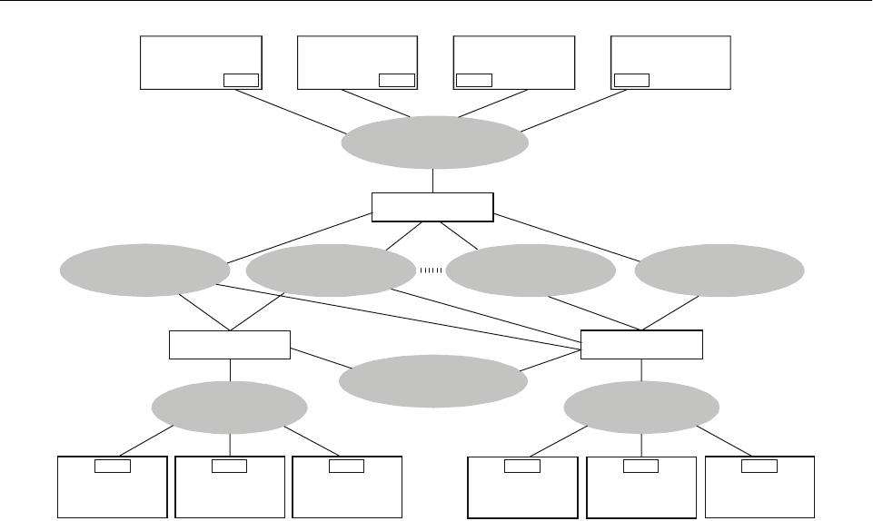
Part I. Operational Concept and General Planning Principles
Chapter 5. Communications Systems I-5-5
Figure I-5-1. ATN data communications environment
— — — — — — — — —
Avionics subnetwork
HF subnetwork
Mode S
subnetwork
VHF subnetwork Satellite
subnetwork
Airline ground
subnetwork
Aeronautical
operations
control
ATN ROUTER
ES ES ES ES ES
ES
Aeronautical
operations
database
Weather
database
CAA ground
subnetwork
FIS database
ATC Weather
database
ATN ROUTER
Service provider
ground subnetwork
Management
processor
ESES
Data entry
processor
Data display
processor
ES
ES
Management
processor
ATN ROUTER

I-5-6 Global Air Navigation Plan for CNS/ATM Systems
APPENDIX A TO CHAPTER 5
GUIDELINES FOR TRANSITION TO COMMUNICATIONS SYSTEMS
• States should begin to use data link systems as soon
as possible after they become available.
• Transition to AMSS should initially be in oceanic
airspace and in continental en-route airspace with
low-density traffic.
• States/regions should coordinate to ensure that where
ATC applications supported by AMSS are to be
introduced, they should be introduced simultaneously
in adjacent FIRs through which there are major
traffic flows.
• During the transition period after AMSS is intro-
duced, the current levels of integrity, reliability, and
availability of existing HF communications systems
must be maintained.
• Communications networks between ATC facilities
within a State and ATC facilities in adjacent
States should be established if they do not already
exist.
• The ATN should be implemented in phases.
• If new application message processors and data link
systems are implemented, they should support
code- and byte-independent data transmission
protocols in order to facilitate transition to the
AT N .
• States should establish procedures to ensure that
both the security and interoperability aspects of the
ATN are not compromised.

I-6-1
Chapter 6
NAVIGATION SYSTEMS
OBJECTIVES
6.1 The navigation element of CNS/ATM systems is
meant to provide accurate, reliable and seamless position
determination capability, worldwide, through introduction
of satellite-based aeronautical navigation.
REQUIRED NAVIGATION
PERFORMANCE (RNP)
6.2 Modern aircraft are increasingly equipped with
RNAV, the use of which facilitates a flexible route system.
Also, by using the concept of RNP, the need for selection
between competing systems can be avoided. However, inter-
national standardization of navigation techniques, which are
in wide use internationally, is still required.
6.3 The RNP concept for en-route operations has been
approved by ICAO (Annex 11, Chapter 2) and has been ex-
tended to cover approach, landing and departure operations.
6.4 RNP is a statement of navigation performance
accuracy within a defined airspace based on the com-
bination of the navigation sensor error, airborne receiver
error, display error and flight technical error.
6.5 RNP types for en-route operations are identified
by a single accuracy value defined as the minimum navi-
gation performance accuracy required within a specified
containment level. The en-route RNP types are described in
Doc 9613.
6.6 The RNP types for approach, landing and depar-
ture operations are defined in terms of required accuracy,
integrity, continuity and availability of navigation. While
some RNP types contain accuracy specification of lateral
performance only (i.e. similar to en-route), other types also
include lateral and vertical performance specifications. The
types similar to en-route specification are intended for
operations such as non-precision approach or departure.
Most RNP types for approach and landing operations do
require vertical containment based on navigation system
information.
GLOBAL NAVIGATION
SATELLITE SYSTEM (GNSS)
6.7 The GNSS is a worldwide position and time
determination system, which includes one or more satellite
constellations, aircraft receivers, and system integrity
monitoring, augmented as necessary to support the RNP for
the actual phase of operation.
6.8 The satellite navigation systems in operation are
the global positioning system (GPS) of the United States
and the global orbiting navigation satellite system
(GLONASS) of the Russian Federation. Both systems were
offered to ICAO as a means to support the evolutionary
development of GNSS. In 1994, the ICAO Council
accepted the United States’ offer of the GPS, and in 1996
it accepted the Russian Federation’s offer of GLONASS.
6.9 The GPS space segment is composed of twenty-
four satellites in six orbital planes. The satellites operate
near-circular 20 200 km (10 900 NM) orbits at an incli-
nation angle of 55 degrees to the equator, and each satellite
completes an orbit in approximately 12 hours.
6.10 The GLONASS space segment consists of
twenty-four operational satellites and several spares.
GLONASS satellites orbit at an altitude of 19 100 km with
an orbital period of 11 hours and 15 minutes. Eight evenly
spaced satellites are arranged in each of the three orbital
planes, inclined 64.8 degrees and spaced 120 degrees
apart.
REFERENCES
Annex 10 — Aeronautical Telecommunications
Guidelines for the Introduction and Operational Use
of the Global Navigation Satellite System (GNSS)
(Circular 267)
Manual on Required Navigation Performance (RNP)
(Doc 9613)
Annex 11 — Air Traffic Services

I-6-2 Global Air Navigation Plan for CNS/ATM Systems
GNSS AUGMENTATIONS
6.11 To overcome inherent system limitations and to
meet the performance requirements (accuracy, integrity,
availability and continuity of service) for all phases of
flight, GPS and GLONASS require varying degrees of
augmentation. Augmentations are classified in three broad
categories: aircraft-based, ground-based and satellite-based
(see Table I-6-1).
Aircraft-based augmentations
6.12 One type of aircraft-based augmentation (ABAS)
is called receiver autonomous integrity monitoring (RAIM),
which can be used if there are more than four satellites with
suitable geometry in view. With five satellites in view, five
independent positions can be computed. If these do not
match, it can be deduced that one or more of the satellites
are giving incorrect information. If there are six or more
satellites in view, more independent positions can be
calculated and a receiver may then be able to identify one
faulty satellite and exclude it from the position deter-
mination calculations.
6.13 Other aircraft-based augmentations can also be
implemented and are usually termed aircraft autonomous
integrity monitoring (AAIM). An inertial navigation system,
for example, can aid GNSS during short periods when the
satellite navigation antennas are shadowed by the aircraft
during manoeuvres or during periods when insufficient
satellites are in view. Augmentation techniques particularly
useful for improving availability of the navigation function
also include altimetry-aiding, more accurate time sources or
some combination of sensor inputs combined through
filtering techniques.
Ground-based augmentations
6.14 For ground-based augmentation systems (GBAS),
a monitor is located at or near the airport where precision
operations are desired. Signals are sent directly to the
aircraft in the vicinity (approximately 37 km (20 NM)).
These signals provide corrections to increase the position
accuracy locally along with satellite integrity information.
This capability requires data link(s) between the ground
and the aircraft.
Satellite-based augmentations
6.15 It is not practical to provide coverage with
ground-based systems for all phases of flight. One way to
provide augmentation coverage over large areas is to use
satellites to transmit augmentation information. This is
known as satellite-based augmentation (SBAS).
6.16 The provision of satellite-based augmentation by
geostationary satellites has certain limitations and therefore
Table I-6-1. Examples of GNSS (GPS and GLONASS) augmentation requirements
* Aircraft-based augmentation systems provide limited availability of service. This may lead to operational restrictions
based on prediction of one satellite constellation status before departure.
Operation/phase of flight RNP type
Generic augmentation architecture
Supplemental-means Primary-means Sole-means
En-route RNP 1 and above ABAS ABAS* ABAS* or
ABAS + SBAS
Initial or intermediate
approach; non-precision
approach, departure
RNP 0.3 ABAS ABAS* or
ABAS + SBAS
ABAS* or
ABAS + SBAS
Non-precision approach
(with vertical guidance)
RNP 0.3/125 ABAS ABAS* or
ABAS + SBAS
ABAS* or
ABAS + SBAS
Precision approach down
to 60 m (200 ft)
(Category I)
RNP 0.02/40 ABAS + SBAS ABAS + GBAS ABAS + GBAS

Part I. Operational Concept and General Planning Principles
Chapter 6. Navigation Systems I-6-3
cannot be expected to support all phases of flight, especially
precision approach and landing of higher categories. Since
these satellites orbit above the equator, their signals would
not be available in polar regions and may be masked by
aircraft structure or terrain. This suggests that other GNSS
augmentation satellite orbits and/or ground-based aug-
mentation might need to be considered to alleviate these
shortcomings.
AVIONICS
6.17 Simple GPS or GLONASS receivers that do not
include RAIM capability (or similar forms of integrity
monitoring) generally cannot meet the requirements for all
phases of flight.
6.18 Multi-sensor systems, using GNSS as one of the
sensors, are expected to be in use for the foreseeable future.
Such navigation systems generally exhibit better levels of
performance than the individual sensor or stand-alone
systems. Aircraft using multi-sensor navigation systems,
such as integrated GNSS/IRS or GNSS/IRS/FMS, may be
certified as meeting levels of RNP which could not be
obtained by use of GPS or GLONASS alone.
WGS-84 COORDINATE SYSTEM AND
AERONAUTICAL DATABASES
6.19 The successful global implementation of satellite
navigation is predicated on the existence of a coordinate
and procedures database of a very high quality. Accurate
satellite navigation is only possible when the ground-
derived coordinates, calculated coordinates, and the satellite
system-derived coordinates use the same geodetic reference
system.
6.20 In support of evolving satellite-based technology,
ICAO adopted WGS-84 as the common geodetic reference
datum for civil aviation with an applicability date of
1 January 1998 (Annex 15). Implementation of WGS-84
involves, among other things, the transformation of existing
coordinates and reference datums to WGS-84.
6.21 Aeronautical databases are built and updated
through the use of surveys of existing navigation aids,
position fixes and runway thresholds and through the
design of new routes or approach procedures. Systems are
to be in place to ensure the quality (accuracy, integrity and
resolution) of position data from the time of the survey, to
the submission of information to the next intended user.
Aeronautical databases must be updated on a regular basis.
EVOLUTIONARY INTRODUCTION
6.22 GNSS implementation will be carried out in an
evolutionary manner, allowing gradual system improve-
ments to be introduced. Near-term applications of GNSS are
intended to enable the early introduction of satellite-based
en-route navigation, using the existing satellite systems (GPS
and GLONASS) and primarily aircraft-based augmentations.
6.23 Medium-term applications will make use of
existing satellite navigation systems with any augmentation
or combination of augmentations required for operation in
a particular phase of flight. Longer-term applications will
apply to future GNSS.
6.24 Three levels are generally accepted for the
introduction of GNSS-based operations:
a) supplemental-means GNSS must meet accuracy and
integrity requirements for a given operation or
phase of flight; availability and continuity require-
ments may not be met. Other navigation systems
supporting a given operation or phase of flight must
be on board;
b) primary-means GNSS must meet accuracy and
integrity requirements, but need not meet full
availability and continuity of service requirements
for a given operation or phase of flight. Safety is
achieved by limiting operations to specific time
periods and through appropriate procedural restric-
tions. Other navigation systems can be retained on
board to support the primary-means GNSS;
c) sole-means GNSS must allow the aircraft to meet,
for a given operation or phase of flight, all four
requirements: accuracy, integrity, availability and
continuity of service.
SYSTEMS TO SUPPORT APPROACH,
LANDING AND DEPARTURE OPERATIONS
6.25 The standard non-visual aids for precision
approach and landing are defined in Annex 10, Volume I,
Chapter 2. It is intended that the introduction and appli-
cation of these non-visual aids will be in accordance with
the global strategy set forth in Annex 10, Volume I,
Attachment B. This strategy will:
a) continue ILS operations to the highest level of
service as long as operationally acceptable and
economically beneficial;

I-6-4 Global Air Navigation Plan for CNS/ATM Systems
b) implement MLS where operationally required and
economically beneficial;
c) promote the use of multi-mode receivers (MMR) or
equivalent airborne capability to maintain aircraft
interoperability;
d) validate the use of GNSS, with such augmentations
as required, to support approach and departure
operations, including Category I operations, and
implement GNSS for such operations as appropriate;
e) complete feasibility studies for Category II and III
operations, based on GNSS technology, with such
augmentations as required. If feasible, implement
GNSS for Category II and III operations where
operationally acceptable and economically bene-
ficial; and
f) enable each region to develop an implementation
strategy for future systems in line with the global
strategy.
6.26 The terminology in 6.24 applies to the required
state of avionics equipage and the ability of aircraft to meet
RNP requirements with, in case of “sole means”, no other
navigation equipment on board. It is also related to the
intended operation (or phase of flight). Operational
approvals for aircraft are therefore issued for particular
operations and normally identify specific conditions or
restrictions to be applied. To this end they may vary from
State to State.
6.27 GNSS sole-means approval is therefore a
necessary, but not sufficient, condition for termination of
present radio navigation services. A number of aircraft may
be approved for sole-means GNSS navigation for particular
operations or phases of flight. However, the air traffic
service provider must provide a navigation service to all
users to support all phases of flight. It is therefore necessary
to harmonize withdrawal of conventional navaids with the
introduction of GNSS navigation service. These consider-
ations are not applicable to airspace where present navaids
are not available and GNSS alone can be introduced to
benefit GNSS-equipped users.
6.28 When introducing GNSS-based services, each
State shall identify the elements of GNSS that are provided
(e.g. GPS, GLONASS, SBAS, GBAS) and develop an
implementation plan. Where navigation services such as
VOR, DME and ILS already exist, States could credit the
economic savings associated with the decommissioning of
ground-based navigational aids. The cost of implementing
SBAS and GBAS should be tied to the provision of user
benefits and increased airspace efficiency associated with
area navigation and the potential to support lower decision
altitude/height to more runways.
6.29 Advantages of GNSS services include the use of
GPS/ABAS for en-route and non-precision approach oper-
ations where the coverage of ground-based navigation aids
does not exist or is limited. In such an environment, GNSS
would become the only navigation service as soon as it is
introduced. SBAS-based precision approach capability to
runways that currently only have a non-precision approach
capability will provide further advantages in terms of
increased safety and operational efficiency.
6.30 Several technical concerns have been raised with
respect to the reliance on GNSS services. Principal among
them is the possibility for intentional interference, or
jamming, that has the potential to disrupt GNSS navigation
services over relatively large areas. States and air navi-
gation service providers should develop plans to reduce the
likelihood of such occurrences, to detect and eliminate
sources of interference and to ensure that aircraft can
continue to operate safely during periods when GNSS
signals are disrupted. Depending on the traffic density in a
given airspace and the degree of integration and automation
of the air navigation system, a safety assessment might
demonstrate the need for navigational information derived
from different independent sources to address certain threats
such as intentional jamming.
6.31 Other risk areas are expected to be mitigated as
GNSS continues to evolve to a more comprehensive
service, such as the introduction of additional signals for
aeronautical use on GPS and GLONASS satellites, aug-
mentation system improvements, and the introduction of
additional satellites and satellite systems. Each State will
have to evaluate the effectiveness of the mitigation tech-
niques applied in its airspace to determine if it is acceptable
to rely on GNSS alone for the provision of navigation
service.
GENERAL TRANSITION ISSUES
6.32 Guidelines for transition to the future systems
encourage equipage by users for the earliest possible accrual
of systems benefits. Provision and carriage of terrestrial and
satellite-based navigation equipment are required during the
transition period when the reliability and availability of a
new system must be proven. Appendix A to this chapter lists
the guidelines that States, regions, users, service providers
and manufacturers should consider when developing GNSS
or when planning for its implementation.

Part I. Operational Concept and General Planning Principles
Chapter 6. Navigation Systems I-6-5
APPENDIX A TO CHAPTER 6
GUIDELINES FOR TRANSITION TO NAVIGATION SYSTEMS
• GNSS should be introduced in an evolutionary manner
with increasing benefits commensurate with improve-
ments in navigation service. These benefits should
culminate in GNSS sole-means operations.
• The ground infrastructure for current navigation systems
must remain available during the transition period.
• States/regions should consider segregating traffic ac-
cording to navigation capability and granting preferred
routes to aircraft with better navigation performance.
• States/regions should coordinate to ensure that separation
standards and procedures for appropriately equipped
aircraft are introduced approximately simultaneously in
each FIR through which major traffic passes.
• In planning the transition to GNSS, the following issues
must be considered:
a) schedule for provision and/or adoption of a GNSS
service, including aircraft and operator approval
processes;
b) extent of existing ground-based radio navigation
services;
c) strategy for transition schedule to GNSS capability
(i.e. benefits-driven or mandatory);
d) appropriate level of user equipage with GNSS
capability;
e) provision of other air traffic services (i.e. surveil-
lance and communications);
f) density of traffic/frequency of operations; and
g) mitigation of risks associated with radio frequency
interference.

I-7-1
Chapter 7
SURVEILLANCE SYSTEMS
CURRENT SURVEILLANCE SYSTEMS
7.1 The surveillance systems presently in use can be
divided into two main types: dependent surveillance and
independent surveillance. In dependent surveillance sys-
tems, the aircraft position is determined on board and then
transmitted to ATC. The current voice position reporting is
a dependent surveillance system in which the position of the
aircraft is determined from on-board navigation equipment
and then conveyed by the pilot to ATC by radiotelephony.
Independent surveillance is a system that measures aircraft
position from the ground. Current surveillance is either
based on voice position reporting or based on radar PSR or
SSR, which measures range and azimuth of aircraft from the
ground station.
FUNCTIONAL DESCRIPTION
Voice position reporting
7.2 Surveillance through voice position reporting is
mainly used in oceanic airspace and aerodrome control
service or area control service outside radar coverage.
Pilots report their position using VHF and/or HF radios.
Primary surveillance radar (PSR)
7.3 The ground-based PSR system provides infor-
mation on the bearing and distance of the aircraft. PSR
does not require carriage of any equipment by aircraft and
is capable of detecting almost any moving target. With
increasing usage of more advanced surveillance systems,
the use of PSR for international air traffic management will
diminish. PSR will, however, continue to be used for
national applications. Primary radars are currently used for
surface movement detection as well as weather detection.
Precision approach radars (PARs) are primary radars used
for approach operations based on specific procedures for
the pilot and the controller; however, use of PARs for civil
applications is rapidly decreasing.
Secondary surveillance radar (SSR)
7.4 The SSR interrogates transponder equipment
installed in the aircraft. In Mode “A”, the aircraft trans-
ponder provides identification information, aircraft bearing
and distance and in Mode “C”, it provides pressure-altitude
information. The current SSR is in wide use in many parts
of the world where terrestrial line-of-sight surveillance
systems are appropriate. The accuracy, resolution and
overall performance of range and azimuth information are
significantly improved by the application of monopulse
(including large vertical aperture antennas) and other
advanced processing techniques. The beneficial role of SSR
for surveillance purposes can be enhanced through the use
of Mode S, which is a technique that uses a unique address
(the 24-bit address) for each aircraft. It permits the selective
interrogation of Mode S transponder-equipped aircraft and
therefore eliminates garbling. It also provides for a two-way
data link capability between Mode S ground stations and
Mode S transponders. SSR Mode S is the appropriate
surveillance tool in high-density traffic areas. The inter-
connection of ground stations in clusters provides an
enhanced surveillance and communications system.
Automatic dependent surveillance (ADS)
7.5 The introduction of air-ground data links, together
with sufficiently accurate and reliable aircraft navigation
systems, presents the opportunity to provide surveillance
services in areas that lack such services in the present
infrastructure, in particular, oceanic and other areas where
REFERENCES
Annex 10 — Aeronautical Telecommunications
Manual of the Secondary Surveillance Radar (SSR)
Systems (Doc 9684)
Manual on Mode S Specific Services (Doc 9688)
Manual on Testing of Radio Navigation Aids,
Volume III — Testing of Surveillance Radar
Systems (Doc 8071)

I-7-2 Global Air Navigation Plan for CNS/ATM Systems
the current systems prove difficult, uneconomic, or even
impossible to implement. ADS is an application for use by
ATS in which aircraft automatically transmit, via a data
link, data derived from on-board navigation systems. As a
minimum, the data include the four-dimensional position,
but additional data may be provided as appropriate. The
ADS data will be used by the automated ATC system to
present information to the controller. In addition to pro-
viding traffic position information in non-radar areas, ADS
will find beneficial applications in other areas, including
high-density areas, where ADS may serve as an adjunct
and/or back-up for SSR, thereby reducing the need for
primary radar. In some circumstances, it may even sub-
stitute for secondary radar. As with current surveillance
systems, the full benefit of ADS is obtained by supporting
complementary two-way pilot/controller data and/or voice
communications (voice for at least emergency and non-
routine communications).
ADS–broadcast (ADS-B*)
7.6 ADS-B* is an expansion of the ADS technique
that involves a broadcast of the position information to
multiple aircraft or multiple ATM units. Each ADS-B*-
equipped aircraft or ground vehicle periodically broadcasts
its position and other relevant data derived from on-board
equipment. Any user segment, either airborne or ground-
based, within range of this broadcast, can process the
information. ADS-B* is currently defined only for line-
of-sight operations (e.g. broadcast over VHF digital link or
by SSR Mode S extended squitter). ADS-B* is also
envisaged to be applied for surface movement, thus being
an alternative to surface radar such as airport surface
detection equipment (ASDE).
TECHNICAL OPTIONS OVERVIEW
7.7 Implementation of ADS requires:
a) position data supplied by the on-board navigational
equipment;
b) message time stamp within 1 second coordinated
universal time (UTC);
c) air-ground data link;
d) a ground infrastructure providing the information to
AT C ; a n d
e) appropriate air traffic services procedures.
7.8 In the case of ADS, a two-way air-ground data
link capability is required, whereas in the case of ADS-B*,
one-way data links will suffice because the information is
transmitted in a broadcast mode. In addition, synchronized
time, such as GNSS time, is highly recommended for the
operation of ADS and ADS-B*.
ATM REQUIREMENTS FOR
SURVEILLANCE
7.9 ATM requirements for surveillance will vary with
the airspace concerned and the traffic density and com-
plexity. The requirements can be defined as follows:
a) current surveillance systems shall provide updated
aircraft position reports so as to assure safe
separation;
1) for oceanic and low-density airspace including
remote areas, an update rate of 12 seconds is
adequate;
2) in high-density en-route/terminal environments,
an update rate of 4 seconds is more appropriate;
b) the accuracy of the surveillance system should
support the separation minima for the defined
airspace;
c) the surveillance system should enable the ATM to
provide the user with a choice of flight path
en route and to fully accommodate emergency
procedures; and
d) the surveillance system should assist search and
rescue operations.
AIRBORNE COLLISION
AVOIDANCE SYSTEM (ACAS)
7.10 The airborne collision avoidance system (ACAS)
is an aircraft system based on SSR transponder signals,
which operates independently of ground-based equipment
to provide advice to the pilot on potential conflicting
* Emerging concept or technology — consensus still to be reached.

Part I. Operational Concept and General Planning Principles
Chapter 7. Surveillance Systems I-7-3
aircraft that are equipped with SSR transponders (Mode C
or Mode S; ACAS cannot detect Mode A only trans-
ponders). ACAS I provides information as an aid to “see
and avoid” action but does not include the capability for
generating resolution advisories (RAs). ACAS II provides
vertical resolution advisories (RA) to the pilot. In the case
where both encountering aircraft are ACAS-equipped, the
manoeuvres can be coordinated automatically (ACAS
cross-link). ACAS II is presently being implemented in
several States or among groups of States. ACAS II
implementation must be considered in association with
pressure altitude reporting transponder carriage.
REQUIRED SURVEILLANCE
PERFORMANCE (RSP)*
7.11 The emergence of several types of surveillance
systems or procedures, in addition to existing surveillance
facilities to support ATM functions, has raised concern that
the air navigation system is becoming too complex. Admit-
tedly, it would have been ideal to have a single surveillance
system capable of meeting the surveillance requirements
for all phases of flights in all kinds of airspace. From a
cost-effective standpoint, however, surveillance systems
with different characteristics and capabilities are required to
handle traffic conditions that vary significantly from low-
density traffic areas to high-density terminal areas. Until
such time as one surveillance system is able to meet all
requirements, the aviation community has to consider all
options. While the availability of surveillance alternatives
provides flexibility during the planning process, it does
complicate the harmonization of the surveillance functions.
To facilitate the planning, one solution would be to translate
all relevant operational requirements into a series of sur-
veillance performance parameters. The term “required
surveillance performance (RSP)”* therefore refers to a set
of well-quantified surveillance performance requirements
such as capacity, availability, accuracy, and update rate.
Once RSP* has been specified for an operational scenario
in a given airspace, any single system or combination of
surveillance systems, meeting the set parameters, can be
considered operationally acceptable.
FUTURE TRENDS
7.12 ADS-B* has the potential to complement SSR in
terms of coverage (gap filler) and even to replace SSR for
low- to medium-traffic density. If aircraft are adequately
equipped, the ADS-B* information can also be used as a
basis for a cockpit display of traffic information (CDTI)*.
7.13 The level of equipage is expected to increase in
accordance with the global mandatory carriage of ACAS
and pressure-altitude SSR transponders.
7.14 Airborne separation assurance systems are being
developed that may enable the pilot to exercise responsi-
bility in certain circumstances for separation from other
aircraft. These systems may provide alert and protection
zones around aircraft, together with information to help the
pilot monitor and resolve potential conflicts. Other appli-
cations are being considered which may include traffic
information service-broadcast (TIS-B), ADS-B*, CDTI* and
conflict detection and resolution functionality.
7.15 Future surveillance may include an ACAS III*
system, which will provide both horizontal and vertical
resolution advisories.
GENERAL TRANSITION ISSUES
7.16 Guidelines for transition to the future systems
encourage equipage by users for the earliest possible
accrual of systems benefits. Although a transition period of
dual equipage, both airborne and ground, is often necessary
to ensure the reliability and availability of a new system,
the guidelines are aimed at minimizing this period to the
extent practicable. Appendix A to this chapter lists the
guidelines that States, regions, users, service providers and
manufacturers should consider when developing CNS/ATM
systems or planning for implementation of such systems.
— — — — — — — — —
* Emerging concept or technology — consensus still to be reached.

I-7-4 Global Air Navigation Plan for CNS/ATM Systems
APPENDIX A TO CHAPTER 7
GUIDELINES FOR TRANSITION TO SURVEILLANCE SYSTEMS
• States should, as necessary, develop operational
procedures in accordance with ICAO SARPs, pro-
cedures and guidelines, for the implementation of ADS
within airspace under their control.
• Transition to ADS should initially begin in oceanic
airspace and in continental en-route airspace with
low-density traffic.
• States and/or regions should ensure that ADS is
introduced in a coordinated fashion in adjacent FIRs
traversed by major traffic flows.
• Where different surveillance methods are employed in
adjacent FIRs, commonality or compatibility of the sys-
tems should be ensured to enable a service that is
transparent to the user.
• During the transition period in which ADS position
reporting is introduced, the current levels of integrity,
reliability and availability of existing position-reporting
systems must be maintained.
• States and/or regions should take action within the
ICAO framework to ensure that implementation of
changes due to ADS and other systems result in a more
efficient use of airspace.
• During the transition to ADS, suitably equipped aircraft
should be able to derive benefits from the use of pre-
ferred routes without penalizing non-ADS-equipped
aircraft.
• ADS should be introduced in incremental phases.
• ADS equipment should be implemented in accordance
with Standards and procedures in such a way as to per-
mit the use of ADS as a back-up for other surveillance
methods.

I-8-1
Chapter 8
METEOROLOGY
INTRODUCTION
8.1 This chapter describes how the provision of
meteorological information supports air traffic management
and the technological developments in meteorological sys-
tems, which will be required to facilitate the evolutionary
transition to new global ATM systems. It also addresses the
coordinated national, regional and global planning of
meteorological systems needed to realize the potential
benefits from improved meteorological information in the
new CNS/ATM systems.
METEOROLOGICAL SUPPORT
TO INTERNATIONAL
CIVIL AVIATION
8.2 Traditionally, the provision of meteorological in-
formation to support international civil aviation was based
primarily at the national level and organized hierarchically,
with a specific meteorological office designated to be
associated with each flight information centre (FIC)/area
control centre (ACC), approach control unit and air traffic
control tower. The associated meteorological offices sup-
plied selected meteorological information necessary to
enable each of the air traffic services units to meet its
various obligations.
8.3 The meteorological information provided was
related to an FIR and particular aerodromes required as
destinations and alternates in that FIR and in immediately
adjacent FIRs. Communication of this information beyond
the FIRs concerned was tightly controlled so as not to
overload the AFTN unnecessarily. The meteorological
information was provided to pilots, inter alia, in face-to-face
briefings in an airport meteorological office, using
controller/pilot voice communications and through the
automatic terminal information service (ATIS) and HF/VHF
meteorological information for aircraft in flight (VOLMET)
broadcasts.
8.4 It was inevitable, however, that the fundamental
changes in international civil aviation in the 1980s, such as
deregulation, increased air traffic and longer, direct flights,
and the increased associated costs of the provision of
facilities and services, which essentially prompted the
creation of CNS/ATM systems, would also drive a parallel
need for changes in the provision of meteorological
services for international civil aviation.
8.5 These changes in the provision of meteorological
services, which began in the early 1980s, comprised two
main elements. The first was the development of the ICAO
world area forecast system (WAFS) which, initially,
centralized the production of global upper wind and
temperature forecasts by two world area forecast centres
(WAFCs), along with the production of significant weather
(SIGWX) forecasts and the dissemination to States by
fifteen regional area forecast centres (RAFCs) of WAFC-
and RAFC-produced charts. The second element concerned
the gradual change in the content and format of the
meteorological information provided to pilots and a relax-
ation of the rules governing the exchange of operational
meteorological information (OPMET) messages to permit a
wider distribution.
8.6 In the recent past, changes which had generally
progressed steadily over the previous decade began to
accelerate markedly. This was not due to any sudden
change in the operational requirements — essentially these
were still being driven by the explosive growth in global air
traffic and the need for cost-effective means to satisfy the
attendant requirements — but by the technological develop-
ments in computing and telecommunications. These
developments made possible a complete rethinking of the
ways and means of providing the required meteorological
REFERENCES
Annex 3 — Meteorological Service for International
Air Navigation
Procedures for Air Navigation Services — Air Traffic
Management (PANS-ATM, Doc 4444)
Manual of Aeronautical Meteorological Practice
(Doc 8896)
Manual of Air Traffic Services Data Link Appli-
cations (Doc 9694)

I-8-2 Global Air Navigation Plan for CNS/ATM Systems
facilities and services in a cost-effective manner, while at
the same time improving safety. Taking advantage of these
technological developments so that aviation meteorology
contributes effectively to the smooth transition to global
CNS/ATM systems is the challenge facing the international
meteorological community today.
METEOROLOGICAL SYSTEMS TO
SUPPORT GLOBAL CNS/ATM
8.7 The need for aviation meteorology to think
increasingly in terms of global rather than regional or
national concepts had already been foreshadowed in the
development of the WAFS and in the changes made to the
content, format and exchange pattern of OPMET messages.
In fact, the original concept of the WAFS, as approved by
the ICAO Council, included a final phase in which all
WAFS data and products would be produced by computer at
the two WAFCs, with global dissemination of the infor-
mation direct from the WAFCs to States by satellite
broadcast. The rapid developments in computer technology
and associated forecasting techniques, and satellite broad-
casting technology have rendered it possible to plan for the
final phase of the WAFS much earlier than had hitherto been
anticipated. In parallel with these developments, the
introduction of a data link has permitted, for the first time,
the automated uplink of meteorological information direct to
the cockpit, either at the initiation of the ATM system or in
response to the pilot’s request, and the automated downlink
of data from the aircraft including wind and temperature,
turbulence and humidity.
8.8 Two other components of the global meteoro-
logical system are the ICAO international airways volcano
watch (IAVW) and the ICAO tropical cyclone warning
system, both of which are of particular importance for
international air navigation since volcanic ash and tropical
cyclones are the only weather phenomena which would
normally result in the cancellation of a flight at the
pre-flight planning stage. The IAVW was initially intro-
duced to be operated on a voluntary basis but has since
been consolidated into a well-structured global system
consisting of nine volcanic ash advisory centres (VAACs)
which issue volcanic ash advisories both in alphanumeric
and graphical formats to be used by MWOs for issuing
SIGMET messages, by international NOTAM offices for
the issuance of NOTAMs for volcanic ash and ASHTAMs,
by ATM for re-routing and activation of contingency
arrangements, and by operators for pre-flight and in-flight
planning. The ICAO tropical cyclone warning system was
established consisting of six tropical cyclone advisory
centres (TCACs) which issue tropical cyclone advisories to
be used by MWOs for issuing SIGMET messages, by ATM
for re-routing and activation of contingency arrangements,
and by operators for pre-flight and in-flight planning.
8.9 In a limited way, ATM is already employing
additional and enhanced meteorological information made
possible by the aforementioned technological advances in
meteorological systems. The application of these systems to
current operations is focused mainly on specific elements
of ATM, where it can be demonstrated that the provision of
enhanced or additional meteorological data and products is
either critical to the operation concerned or provides a cost-
benefit. An example of this is the provision of additional
and enhanced meteorological information to support the
following:
— the provision of medium-level SIGWX forecasts
and en-route diversion aerodrome reports and
forecasts for one-engine inoperative drift-down
procedures for extended range operations;
— the provision of the latest SIGMETs and upper
wind/temperature data from meteorological watch
offices (MWOs) and WAFCs respectively, direct to
ATC computers, for updating flight plans for
dynamic aircraft routing over the Pacific Ocean;
— the daily selection of the organized tracks over the
North Atlantic based upon upper wind fields
produced by the WAFCs; and
— the use of real-time information on hazardous en-
route and destination weather and updated upper
wind fields for air traffic flow control.
8.10 All of the examples provided in the previous
paragraphs concern pre-flight planning and en-route oper-
ations. These depend upon the WAFS, direct satellite
broadcasts, and the direct and preferably automated
provision of updated meteorological forecasts or real-time
data to ATC. But examples need not be restricted to en-route
operations. In the terminal area, the advent of data link has
already spurred the development of systems for the
automated provision of meteorological information direct to
aircraft, some examples of which are:
— uplink of reports from automatic weather observing
stations;
— uplink of wind shear/microburst warnings from
automated terminal Doppler weather radar
(TDWR); and
— automatic downlink of wind/temperature data from
aircraft on approach and during climb-out.

Part I. Operational Concept and General Planning Principles
Chapter 8. Meteorology I-8-3
METEOROLOGICAL SYSTEMS TO SUPPORT
THE TRANSITION TO THE NEW GLOBAL
CNS/ATM SYSTEMS
8.11 In order to support and facilitate the transition to
CNS/ATM systems, the meteorological systems described
in the foregoing paragraphs will have to be further
developed and more focused on global requirements, in
addition to national and regional requirements. These
developments must meet aeronautical requirements to
improve safety and provide an identifiable cost-benefit to
users. The systems must converge, as much as possible to
create a seamless and transparent global meteorological
system for the provision of meteorological service to
international civil aviation.
8.12 In many respects the WAFS and the ICAO direct
satellite broadcasts have already made the transition to a
seamless and transparent system, which, moreover, is also
converging with systems for the exchange of OPMET
messages. The global ATM system will require access to
global meteorological information on a far shorter timescale
than has been customary in the past. In many cases, virtual
“instant” access, including real-time data, will be required.
Such stringent requirements will dictate that as many of the
processes as possible, which the systems comprise, must be
automated. The meteorologists’ input will be increasingly
transferred to the beginning of the processes, even to the
extent of transferring knowledge and experience through
artificial intelligence to dedicated expert systems.
8.13 Development of the meteorological systems to
support a global ATM system will be required specifically
in the following areas:
a) rapid progress to the final phase of the WAFS with
two WAFCs producing automated global upper
winds/temperatures and SIGWX forecasts, which
may be input directly into ATC and airline
computers. The final phase is expected to be
implemented by 2002;
b) continued extension of the three ICAO direct
satellite broadcasts to exchange global OPMET
messages and, as necessary, other non-MET aero-
nautical information;
c) availability at ATC centres and airline centralized
operational control of background upper wind fields
for display, both in the form of WAFS global upper
wind forecasts and “real-time” wind fields derived
from the wind information reported automatically
from an aircraft in ADS messages; and reports and
forecasts of hazardous weather, particularly vol-
canic ash, thunderstorms, clear-air turbulence and
icing, to assist in tactical decision-making for air-
craft surveillance, air traffic flow management, and
updating flight plans for flexible/dynamic aircraft
routing;
d) automatic uplink of aerodrome weather observa-
tions to aircraft on approach or departure, including
D-ATIS and D-VOLMET to replace HF and VHF
VOLMET; and dedicated systems to detect hazard-
ous weather, such as automated terminal Doppler
weather radar (TDWR);
e) automatic downlink of meteorological information
derived from aircraft sensors (wind, temperature,
turbulence and humidity) to ATC computers to pro-
vide background upper wind fields, as described
above, and real-time descent wind profiles to assist
in the automatic sequencing of aircraft on approach
to maximize runway capacity; and relay of this
information to the two WAFCs for assimilation in
global numerical weather prediction models, thereby
improving the overall quality of subsequent global
forecasts;
f) use of meteorological sensors, including Doppler
radar, possibly providing input to expert systems,
which will provide automated runway wake vortex
reports and forecasts to assist in optimizing aircraft
separation, thereby maximizing runway capacity;
g) full implementation of the IAVW, which would
result in a reduction in the time-delay for volcanic
ash reports and advisories and associated SIGMETs
from volcano observatories, volcanic ash advisory
centres (VAACs) and meteorological watch offices
to reach area control centres and aircraft in flight by
employing more direct routing; and
h) harmonized common point of access to aeronautical
information services (AIS) and meteorological
services for air navigation meteorological infor-
mation to support combined automated AIS/MET
pre-flight briefing facilities.
PLANNING AND IMPLEMENTATION
OF METEOROLOGICAL SYSTEMS
8.14 All of the foregoing elements are either currently
in existence and being further developed or are the subject
of research and development by States. The implementation
of these elements to form a seamless global system will

I-8-4 Global Air Navigation Plan for CNS/ATM Systems
proceed step by step as aeronautical requirements for the
service are stated and reflected, as appropriate, in the
relevant ICAO SARPs. This is critical in order to indicate
clearly that the service is required by international civil
aviation to contribute to the maintenance or improvement in
air safety and/or provide a demonstrated cost-benefit to
users associated with global ATM. Once the requirements
are firmly established, standardization of the relevant
meteorological facilities and services will facilitate the
planning of a seamless and transparent meteorological
system to support the global ATM system.
8.15 In planning for the implementation of meteoro-
logical systems, account has to be taken of the existing
national, regional and global meteorological and telecom-
munications infrastructures and a determination made as to
which parts will be able to support the global ATM system
and which will need to be upgraded or replaced.
8.16 Clarification will be needed concerning the
optimum balance between the required meteorological
information being “pushed” to the aircraft from the ground
and being “pulled” to the aircraft by pilot request. How, in
which form and where the global meteorological infor-
mation will best be routed and concentrated will be very
much dependent upon receiving this clarification as early as
possible in the planning process. In general, it would seem
that, in the future, increasing emphasis will be placed on
“routine” meteorological information being accessible by
the pilot automatically upon demand, with directed or
broadcast transmissions being restricted mainly to safety-
related information. Making information accessible to the
pilot may be achieved in practice either by having it
uplinked and stored in the aircraft computers or stored on
the ground in OPMET databases and/or servers which can
be interrogated by the pilot. The optimum balance between
the meteorological information broadcast directed from the
ground to the aircraft, and meteorological information
obtained by pilots interrogating OPMET databases must
emerge from the development of the operational require-
ments, which will then be reflected in the pattern of global
OPMET exchange requirements.

I-9-1
Chapter 9
AERONAUTICAL INFORMATION SERVICES
INTRODUCTION
9.1 This chapter describes how aeronautical infor-
mation services (AIS) and aeronautical charts (MAP) have
traditionally been provided and the need for a new approach
to support global air traffic management systems and their
associated automation systems. This chapter also outlines
the necessary developments in AIS and MAP as well as the
ways and means of collecting, preparing, validating, organiz-
ing and distributing aeronautical information in support of
air traffic management.
AIS AND MAP SUPPORT TO
INTERNATIONAL CIVIL AVIATION
9.2 The major objective of AIS is to ensure the flow
of information necessary for the safety, regularity and
efficiency of international civil aviation. In that respect,
each Contracting State is required to provide this service
and is responsible for the information provided. Tradition-
ally, aeronautical information has been provided as hard-
copy documents in the form of the Integrated Aeronautical
Information Package, which contains information for the
entire territory and also areas outside the territory for which
a State is responsible for the provision of air traffic
services. The information must be provided in a suitable
form and must be of high quality, be timely and include, as
necessary, aeronautical information of other States. In
addition, pre-flight and in-flight information services must
be provided.
9.3 To satisfy the requirements of flight operations,
aeronautical information/data necessary for the safety,
regularity and efficiency of air navigation must be made
available to personnel, including flight crews and those
involved with flight planning, flight simulation and air
traffic services and to units responsible for flight infor-
mation services.
9.4 The role and importance of aeronautical
information/data has changed significantly with the im-
plementation of RNAV, RNP and airborne computer-based
navigation systems. These systems are all data-dependent,
and in that respect aeronautical data have become the
necessary critical components of the system. Consequently,
corrupt or erroneous aeronautical information/data can
potentially affect the safety of air navigation. In this
respect, as of 1 January 1998, each Contracting State must
take the necessary measures to introduce a properly organ-
ized quality system containing procedures, processes and
resources necessary to implement quality management at
each functional stage of the data process. Quality systems
must provide users with the assurance and confidence that
distributed aeronautical information/data satisfy established
requirements for data quality (accuracy, resolution and
integrity) and timeliness.
9.5 For the safe performance of air operations, it is
essential that current, comprehensive and authoritative navi-
gation data be available at all times, and that aeronautical
charts supply that information in a manageable and con-
densed manner. Considering that all segments of aviation
make reference to aeronautical charts for air traffic control,
planning and navigation purposes, it is of prime importance
to place current and accurate charts in the hands of users.
9.6 Current practices require Contracting States to
ensure the availability of specific charts either by producing
the charts themselves or arranging for their production by
another State, or by an agency which would then be pro-
vided with the necessary data. International specifications
are required in order to achieve the safety, regularity and
efficiency of international air navigation by specifying the
types of charts to be made available and by ensuring the
adequate uniformity of the charts. The increased speed of
aircraft, together with a greater range in operating altitudes
REFERENCES
Annex 4 — Aeronautical Charts
Annex 15 — Aeronautical Information Services
Procedures for Air Navigation Services — ICAO
Abbreviations and Codes (PANS-ABC, Doc 8400)
Aeronautical Chart Manual (Doc 8697)
Aeronautical Information Services Manual (Doc 8126)
World Geodetic System — 1984 (WGS-84) Manual
(Doc 9674)

I-9-2 Global Air Navigation Plan for CNS/ATM Systems
and route stages, and increasing air traffic congestion
impose requirements for rapid chart interpretation and
some latitude for improvements in chart design to meet
changing operational needs. In addition, the effective
functioning of AIS pre-flight information units is partly
dependent upon the availability of aeronautical charts for
flight planning. Finally, the aeronautical information
services are required to publish in their Aeronautical
Information Publications (AIPs) a description and list of
available aeronautical charts series, together with an
indication of their intended use.
9.7 The provision of aeronautical information and
aeronautical charts services to support international civil
aviation is primarily the responsibility of States. The
aeronautical information provided is related to the FIR and
aerodromes within a given region. This information is
provided to pilots in face-to-face briefings at the aerodrome
AIS unit or in flight, through air traffic control. Communi-
cation of the latest information to users is effected through
the aeronautical fixed telecommunication network (AFTN)
in the form of notices to airmen (NOTAM). So far,
automation of the AIS has been basically oriented toward
the NOTAM system, and planning has taken place at the
regional level. With the adoption of CNS/ATM systems by
international civil aviation, new requirements for aeronaut-
ical information and charts services have emerged. These
new requirements are driven by the growth in global air
traffic and the need for cost-effective solutions, as well as
the technological developments in computing and telecom-
munications. It is therefore essential that in the interest of
safety and efficiency of civil aviation, AIS and MAP
services contribute effectively to the transition to global
CNS/ATM systems by developing further specifications and
conditions to satisfy these new operational requirements.
AIS AND MAP SERVICES TO SUPPORT
GLOBAL CNS/ATM SYSTEMS
9.8 For CNS systems to operate and generate the full
benefits of their use through enhanced ATM, the support of
other services such as AIS and MAP is essential. In this
respect, the enhanced ATM system, along with the require-
ment for precise navigation capability, will require quality
aeronautical information so as to be able to provide
guidance for gate-to-gate operations* between origin and
destination. This will include the ability of aircraft to
navigate on the ground and en route, using on-board
navigation systems that can calculate desired tracks.
9.9 With the increased quantity of aeronautical infor-
mation and with the clearly defined operational requirement
for aeronautical data quality (accuracy, resolution and
integrity), emerging aeronautical databases are improving,
inter alia, the speed, efficiency and cost-effectiveness of
aeronautical information. For these reasons, many States
have begun or are planning to develop electronic aeronaut-
ical databases with the intent of using such data to prepare
and update their AIPs and/or to exchange electronic aero-
nautical information. It is therefore necessary to develop
new Annex 15 specifications related to the electronic
storage, provision and interrogation of aeronautical infor-
mation. These new specifications should provide neutral
international Standards on the basis of which an ICAO
Conceptual Information Data Model will be developed. To
satisfy the operational requirements for the exchange of
aeronautical data while taking into account the com-
patibility of different systems and formats, a new data
exchange model is also required.
9.10 The 1990s witnessed a revolution in the way
aeronautical information is processed, integrated and pre-
sented to pilots and other users. The technology is available
today to display a viable electronic chart in the cockpit,
thereby substantially reducing the need for paper charts.
The real need, however, is for more than just an electronic
page turner that replaces a paper chart book. The future
electronic chart must be intuitive and designed to simplify
the pilot’s interpretation tasks, while minimizing infor-
mation overload by reducing the amount of displayed data.
It must also provide pilots with the option of accessing only
the specific data required for a particular phase of flight. As
charted aeronautical information symbology is gradually
transferred from paper to electronic form, a degree of stan-
dardization of the symbology to be used in electronic chart
displays will be required. Some of these Standards have
already been developed and included in Annex 4; however,
further development is in progress.
9.11 In order to provide worldwide standardization of
the charting information necessary for aircraft to use
GNSS, some new charting specifications have also been
introduced into Annex 4, and the development of the
complete specifications continues.
9.12 It is important that terrain and obstacle infor-
mation be available and accurately presented on electronic
aeronautical charts. Users’ requirements for the quality and
format of electronic terrain and obstacle data must be taken
into account in addition to how this information can best be
* Emerging concept or technology — consensus still to be reached.

Part I. Operational Concept and General Planning Principles
Chapter 9. Aeronautical Information Services I-9-3
consolidated with aeronautical information and presented
on electronic charts. Annex 4 specifications are being
developed to ensure that they facilitate and standardize the
provision of electronic terrain and obstacle information,
which meets user requirements while taking into account
quality assurance.
9.13 New Annex 15 specifications dealing with the
exchange of electronic aeronautical data through the use of
available and new technological means are under develop-
ment as well. In addition, data link communications as
specified for CNS/ATM systems will replace most voice
communications of aeronautical information currently
disseminated by ATS. Once a sufficient number of aircraft
are capable of air-ground data link communications and
aeronautical databases are made available, pilots will be
able to access and interrogate those databases at various
stages of flight. Worldwide standardization of the communi-
cation and display of these data is deemed necessary, which
will include aspects of surface-to-surface as well as data
link communications to facilitate interrogation of aeronaut-
ical information from aircraft. New Annex 15 Standards
will also include procedures for aeronautical data transfer,
taking into account data formats and data protection during
the transfer.
9.14 The ICAO Training Manual, Part E-3 —
Aeronautical Information Services Personnel (Doc 7192) is
being updated, and an ICAO training programme for
AIS/MAP personnel is being developed. The programme
will include training curricula for AIS/MAP technical
officers and will establish uniform Standards for the quali-
fications and scope of knowledge that must be met by all
AIS/MAP technical officers worldwide. The material will
be based on the recently updated operational requirements
for the provision of quality aeronautical information
necessary for the safety, regularity and efficiency of
international air navigation. As a result of the increased
responsibility of AIS/MAP personnel to provide quality
aeronautical information, there may eventually be a need to
license certain AIS/MAP personnel.
AIS/MAP SYSTEMS TO SUPPORT
THE TRANSITION TO THE NEW
GLOBAL CNS/ATM SYSTEMS
9.15 In order to support and facilitate the transition to
new global CNS/ATM systems, the aeronautical infor-
mation and charts systems will be further developed and
oriented more towards global requirements, in addition to
national and regional requirements. This should be done in
such a way that would safely increase efficiency and cost-
effectiveness to users. The goal, as far as possible, is the
creation of a seamless and transparent global aeronautical
information system.
9.16 It is envisaged that the global ATM system will
require global aeronautical information of a required qual-
ity. The ultimate goal would be to provide on-line, in
real-time, quality aeronautical information to any user, any
time, anywhere. To achieve this high-level goal, aeronaut-
ical information must be provided and exchanged in
electronic form based on a conceptually standardized data
model. Strict quality principles must be in place to ensure
that aeronautical data are available, verified and validated in
order to give the end-user confidence in the correctness of
the information.
9.17 Development of aeronautical information sys-
tems to support global ATM is specifically required in the
following areas:
a) completion by States of implementation of the
World Geodetic System — 1984 (WGS-84)
common geodetic datum adopted for international
civil aviation;
b) implementation by States of a quality system for the
origination, production, maintenance and distribution
of aeronautical information;
c) development and introduction of an ICAO concep-
tual information data model for the storage, retrieval
and exchange of aeronautical data;
d) extension of the broadcast of aeronautical infor-
mation through satellites to enable exchange of
aeronautical data, in textual and graphical form, and
messages associated with the status of ground-based
databases;
e) development of specifications for the direct uplink of
aeronautical information (including charts) into air-
craft, along with the possibility for interrogation,
from the aircraft, of aeronautical databases on the
ground; and
f) implementation of a common point of access for
AIS, MET and flight plan (FPL) information to sup-
port combined automated AIS/MET/FPL pre-flight
and in-flight briefing facilities.

I-10-1
Chapter 10
HUMAN RESOURCE DEVELOPMENT AND TRAINING NEEDS
INTRODUCTION
10.1 A major goal of CNS/ATM systems is to create
a seamless global air navigation system. A seamless air
navigation environment will require an international team
that is prepared to perform their jobs in such an environ-
ment. To achieve this, it is essential that personnel who will
form this team receive a consistent, quality level of training
throughout the world.
10.2 The evolution of aviation technologies has been
gradual in the past, and trainers have, for the most part, been
able to meet the challenges associated with change even
though sophisticated training methodologies and tools have
not always been at their disposal. However, the new
CNS/ATM systems are based on many new concepts, and
their implementation presents a greater challenge to trainers.
10.3 ICAO undertook an initial study to assess the
training implications of CNS/ATM systems. The objective
of the study was to gain an early understanding of the
amount of training that would be required by analysing the
degree to which basic job disciplines in the aviation system
will change with the introduction of the new technologies.
While this was only a preliminary study, the results
indicated that:
a) many aviation disciplines will change as a result of
the introduction of CNS/ATM technologies, and it
is likely that re-training will be required for a
number of these disciplines. The most important
changes seem to result from an increased use of
computers, data communications and automation;
b) the change from ground to satellite-based tech-
nology will mean that several aviation disciplines
will no longer be needed. At the same time, new
aviation disciplines will emerge as a result of the
introduction of CNS/ATM systems. From a human
resource planning standpoint, there will be a need
for re-deployment and training of personnel; and
c) the need for training and course development will
be especially high during the transition phase. Not
only will a large number of personnel have to be
trained or re-trained on new technologies, equip-
ment and procedures, but a sufficient number of
qualified personnel will need to remain proficient in
the skills necessary to operate and maintain the
older systems.
10.4 CNS/ATM systems training needs can be seen as
falling into three primary categories.
a) Foundation training. Early training in the funda-
mentals of automation, digital communications,
satellite communications and computer networking
is needed to provide all civil aviation personnel
with the prerequisite skills prior to receiving job-
specific training;
b) Training for implementation planners. Training
is needed at a senior management level to provide
decision-makers with the basic information needed
to begin planning for implementation of CNS/ATM
systems. This type of training is needed for
managers who will plan the implementation of CNS
systems, as well as those managers who will be
responsible for planning the ATM operational
aspects of the systems; and
c) Job-specific training. The third category of training
needed is that necessary for personnel to manage,
operate and maintain the systems on an ongoing
basis. This category also represents the bulk of the
training needed and the most complex to design,
develop and implement. Taking this into consider-
ation, ICAO has developed a strategy for the
development of training programmes, as described
in this chapter.
10.5 The first two categories of training described
above should be implemented as soon as possible and are
REFERENCES
Report of the World-wide CNS/ATM Systems Implemen-
tation Conference (Doc 9719)

I-10-2 Global Air Navigation Plan for CNS/ATM Systems
described in more detail below. A long-term strategy for
development of the job-specific training needed to manage,
operate and maintain CNS/ATM systems on an ongoing
basis, is also outlined below.
FOUNDATION TRAINING
10.6 In addition to the usual subjects covered in
typical civil aviation training centres, some additional foun-
dation or prerequisite training will be necessary. This
training will ensure that all personnel who will be involved
with the planning, implementation, management, operation
and maintenance of the new systems have an appropriate
background in the base concepts and technologies. Such
foundation training should be developed so that it addresses
the specific needs of the technical and operational planners,
as well as all personnel that will eventually be involved in
the operation, maintenance and management of the new
systems. The training needs include the following general
areas:
a) CNS/ATM systems;
b) digital communications;
c) computer fundamentals;
d) computer communications, including local/wide area
networks;
e) ISO-OSI reference model;
f) satellite communications systems used for fixed and
mobile applications;
g) satellite navigation systems;
h) automation issues;
i) fundamentals of air traffic management; and
j) aeronautical databases.
CNS SYSTEMS IMPLEMENTATION
PLANNING — TRAINING NEEDS
10.7 The existing communications, navigation and
surveillance systems have mostly been planned, imple-
mented and operated by individual States. The new
CNS/ATM systems, however, are global in nature and as
such are usually planned and implemented at a regional or
global level. Regional implementation can be carried out by
collective regional entities or commercial service suppliers.
As a result, many States can simply buy CNS services with
a minimum of local implementation of the systems.
10.8 Given the modality for the implementation of the
technical systems, the technical management personnel of
civil aviation administrations (CAAs) will need to become
familiar with the major functions and features of CNS
systems, as well as the implementation, leasing and
purchasing options available. They should then examine
various options for systems implementation with their ATM
colleagues and jointly decide upon their transition strategy.
In this regard, training that provides an overview of the
following CNS systems should be provided for senior
technical management personnel:
a) communications: AMSS, VDL, SSR Mode S
datalink, HF datalink and ATN;
b) navigation: GNSS, including standard augmentation
systems;
c) surveillance: SSR Modes A, C and S, ADS,
ADS-B* and ASAS*; and
d) relevant organizational, economic, certification and
operational matters.
ATM OPERATIONAL IMPLEMENTATION
PLANNING — TRAINING NEEDS
10.9 Senior operational managers involved with
transition planning to the new systems will need an over-
view of the topics listed above. In addition, operational
managers should receive training in the following areas:
a) traffic forecasting and cost-benefit analysis
techniques;
b) air traffic management;
1) airspace planning;
2) ATFM systems and procedures;
* Emerging concept or technology — consensus still to be reached.

Part I. Operational Concept and General Planning Principles
Chapter 10. Human Resource Development and Training Needs I-10-3
3) ATS systems and procedures; and
4) ATM-related aspects of flight operations;
c) CNS/ATM transition and implementation project
planning;
d) human resource planning and training issues;
e) issues related to the increased use of automation in
the new systems; and
f) operational and quality control issues associated
with aeronautical databases.
10.10 Because the existing systems will be operated
in parallel with the new systems for a period of time,
human resource planning and training will be a major
challenge during the transition period.
10.11 CNS/ATM systems will result in a greater use
of automation in many of the air traffic control functions
that were previously performed manually. As a result,
interactions between controllers and flight crews will take
on a different dimension. Thus, it is important that the oper-
ational planners receive early training in these issues, inclu-
ding the full implications of automation, including backup
procedures to be used in the event of system malfunctions.
This area of training will also be important during the job-
specific training for anyone involved in the operation of
CNS/ATM systems.
A LONG-TERM STRATEGY FOR
CNS/ATM JOB-SPECIFIC TRAINING
10.12 The Standing Policy of ICAO on aviation
training, as contained in Assembly Resolution A31-5,
Appendix H, forms the basis for the long-term CNS/ATM
training strategy. The ICAO Aviation Training Policy is
governed by three basic principles. First, aviation training is
the responsibility of Contracting States. Second, the ICAO
Aviation Training Programme shall encourage mutual
assistance among Contracting States in the training of
aviation personnel. Finally, the Organization does not
directly participate in the operation of training institutions,
but encourages and advises the Contracting States operating
such facilities.
10.13 Much progress has been made in the
establishment and ongoing development of national and
regional civil aviation training centres. However, short-
comings in human resource planning and training are still
frequently cited as important reasons for the lack of
implementation of regional air navigation plans. It is
anticipated that this problem could be further exacerbated
with the implementation of CNS/ATM systems.
10.14 In the past, training programmes for the existing
air navigation systems were, for the most part, developed
and implemented independently by each State’s civil
aviation training institution. Given the magnitude of change
in civil aviation jobs and the resulting training requirements
(10.3 refers), it is anticipated that civil aviation training
institutions, working individually or on an ad hoc basis, will
not be able to develop all of the training programmes
necessary for timely implementation of CNS/ATM systems.
Independent development of the CNS/ATM course materials
would also tend to defeat the ICAO goal of standardizing the
curricula, methods and content of training. A coordinated
and cooperative approach towards CNS/ATM training
development would help to achieve both the goal of timely
training development and standardization, and would also be
more efficient insofar as it could help to prevent duplication
of effort that has occurred in the past. The strategy as
outlined below consists of three basic elements and is
designed to facilitate international cooperation in the
development of CNS/ATM training materials.
a) Early identification of CNS/ATM training needs
and priorities. Given the considerable amount of
training that will need to be developed for the new
systems, as well as the need for training standard-
ization, it is imperative that a plan be established for
the cooperative development of the required course
materials. However, an effective and cost-efficient
plan can only be formulated once CNS/ATM
training needs and priorities are clearly identified.
As in any systematic approach towards project
management, the tasks must first be defined and
prioritized before they can be effectively allocated
to the entities that will perform the work;
b) Coordination and planning of CNS/ATM train-
ing development at the regional level. The actual
planning and coordination in the development of
CNS/ATM course materials should be carried out at
a regional level. There are existing structures within
the regions that would be appropriate for this type of
coordination. Moreover, experience has already been
gained in this approach as it is being used, to some
extent, in several ICAO regions. While human
resource planning and training coordination have
improved as a result of existing regionally
coordinated efforts, there are still shortcomings in
this area. A high level of regional coordination and
planning is particularly important in the development

I-10-4 Global Air Navigation Plan for CNS/ATM Systems
of specialized courses where the number of trainees
does not justify the implementation of courses in
each State’s national training centre; and
c) Widest possible participation in the TRAINAIR
Programme by States. In 1990, ICAO established
the TRAINAIR Programme to enhance training in
civil aviation. The programme offers an existing
framework for global coordination and harmon-
ization in training development. The use of the
TRAINAIR standardized course development meth-
odology ensures that the training packages
developed by members will have the widest possible
global use. The Programme also has a well-
established and proven network for the cost-efficient
sharing of course materials produced by members.
The TRAINAIR Programme could further improve
the effectiveness and efficiency of CNS/ATM course
development through the use of its methodology and
by providing global coordination and harmoniza-
tion between the regions as they develop CNS/ATM
training materials.
10.15 The first two strategies described above will be
facilitated through an ICAO Air Navigation Commission
(ANC) task established during 1996 involving regional
human resource planning and training needs. An objective
of this task is to analyse the changes to civil aviation job
profiles as a result of new systems, and the consequential
human resource planning and training requirements. In
addition, the task will also develop a model for human
resource planning and training for use at the regional level,
as well as supporting guidance material.
REGIONAL HUMAN RESOURCE
PLANNING AND TRAINING NEEDS
10.16 ICAO is preparing guidance material that will
assist States in planning for the human resources and
training needed for CNS/ATM systems, as well as for
existing systems. Most of the ICAO regions already have
regional forums to discuss and plan for the regional training
needs. The outputs of this task will enhance the existing
regional planning processes by providing a consistent
approach for use by all regions.
10.17 It is expected that this ANC task will produce
two major outputs. The first output would be a human
resource planning manual for use by States. The manual
will include tables that will assist States in determining
current and projected personnel needs. The planning tables
will take into consideration the needs that emerge as a
result of the implementation of CNS/ATM systems and will
also allow for the insertion of variables so as to reflect local
policies.
10.18 The second major output would be a model for
planning regional training capabilities. The model would
provide a systematic methodology for analysing human
resources plans; determining the needs for national and/or
regional training capabilities; and documenting the results.
The resulting training plans could be stand-alone docu-
ments or incorporated into the regional ANPs. As a part of
ICAO’s work programme, a study group could then review
the appropriateness of including human resource and/or
training planning information in the regional ANPs.
SOURCES OF TRAINING
10.19 The regional human resource planning and
training needs task will provide a systematic approach
towards determining the need for national and/or regional
training capabilities. The results of this analysis may be
published as a stand-alone document or incorporated into
the regional ANPs. This document, whether stand-alone or
as part of an ANP, will provide States with the information
needed concerning current training capabilities planned
within their regions in CNS/ATM areas.
10.20 Training opportunities that are offered to inter-
national trainees on a global basis are already listed in the
ICAO Training Directory. Courses that provide training in
CNS/ATM systems are now identified within the course
descriptions by the statement “CNS/ATM Content.”
10.21 TRAINAIR member civil aviation training
centres are also developing courses that address CNS/ATM
systems training needs. As mentioned above, TRAINAIR
offers an existing framework for the global coordination
and harmonization of training development. Members share
the courses, or standardized training packages (STPs), that
they develop using the TRAINAIR training development
methodology. This system is very efficient as members can
acquire STPs prepared by other members at a cost that is
not to exceed the actual cost of reproduction and postage.
Almost all course materials are produced on the computer
and the members now share electronic versions of the
courses. This greatly reduces the cost of acquiring STPs
from other members. Members will also begin to share
STPs using the Internet, which will once again reduce cost
and allow easier access to the materials.
10.22 TRAINAIR membership is open to all
government-operated civil aviation training centres.

Part I. Operational Concept and General Planning Principles
Chapter 10. Human Resource Development and Training Needs I-10-5
Participation by other civil aviation training centres is under
review. One of the major requirements of TRAINAIR
membership is to establish and maintain a Course Develop-
ment Unit that is dedicated to preparing STPs to TRAINAIR
Standards. As a Course Development Unit’s start-up costs
typically exceed the resources available within a developing
State’s training centre’s budget, these costs are normally
funded through ICAO technical cooperation projects.
10.23 ICAO’s Technical Co-operation Programme can
also assist in the development of training capabilities and
the funding of fellowships for international training through
Technical Co-operation Projects. Additional information
concerning the ICAO Technical Co-operation Programme
is provided in Part I, Chapter 15.
HUMAN RESOURCE DEVELOPMENT
DURING TRANSITION
10.24 Human resource development is an area of
particular importance when considering transition to
CNS/ATM systems. The main function of human resource
development is to help organizations meet the challenges
created by change, to adapt to new requirements and to
achieve the levels of human performance needed. The
transition to CNS/ATM systems represents significant
change. As a result of this change, human resource
development managers will need to review organizational
structures, plan for the human resources needed, review
selection criteria for new staff and plan for the development
of new training programmes.
10.25 As an integral part of transition planning, each
service provider should include a review of its organiza-
tional structure. CNS/ATM systems are global in nature and
usually planned and implemented at a regional or global
level, in some cases by collective regional entities or
commercial service suppliers. This may mean that a State’s
service provider’s organizational structure may need to
change in order to adapt to these conditions. The changes
to job profiles, elimination of some types of jobs and
creation of new jobs as a result of the new technologies will
also cause changes that may need to be reflected in
organizational structures.
10.26 The aim of human resource planning is to
ensure that the operational organizations have the right
number of people at the right time and with the right skills.
As a result of technological changes and the lead time
required to train personnel, human resource planning is one
of the major challenges faced by civil aviation managers.
Human resource planning has a direct effect on training, as
one of its outputs is a training demand forecast. This
forecast is an essential element in the preparation of a
training programme. It provides an estimate of both the
number of staff to be trained and the broad types of training
required.
10.27 Planners will need to take the following human
resource planning factors into consideration:
a) there are several job disciplines that will no longer
be required once a State has fully implemented the
new systems;
b) there will be new job disciplines as a result of the
implementation of the new systems;
c) most of the existing jobs will require additional
training for the new systems;
d) there will be a period of time in which the old and
new systems will operate in parallel; and
e) much of the training will be in areas that involve a
greater use of automation.
10.28 Typically, human resource plans should project
needs for at least five years ahead. This period is normally
required to provide enough time to re-deploy staff and recruit
new staff to other jobs when needed and prepare training as
required. As outlined in 10.17, ICAO is developing a manual
to assist States in human resource planning. The manual will
assist States in projecting human resource requirements for
both new and existing technologies.
10.29 The human resource and training requirements
during the transition period should be a major focus of
CNS/ATM systems implementation planners. From a human
resource planning standpoint, the factors listed above can
create a complex planning problem. In particular, the need
to operate old and new systems in parallel, in combination
with an evolutionary transition in which some job disci-
plines will be eliminated while others will be created, will
require careful planning.
10.30 Existing personnel will be involved in much of
the training during the transition period. Their time spent in
training can have a profound effect on human resource
plans and should also be considered. While some of this
training can be done using distance learning techniques,
there is still a significant amount of training that will need
to be done in a training centre. It is expected that the

I-10-6 Global Air Navigation Plan for CNS/ATM Systems
amount of training will peak during the transition period.
Typically, staffing will have to be adjusted during this
period to account for personnel in training, as well as the
operational personnel that may be required to deliver
training that is conducted in a training centre and on-the-
job training that is conducted in the field.
10.31 It is recommended that States begin the process
of planning for the human resources and training needed to
implement the new systems as soon as possible. Much of
this will depend on regional and national CNS/ATM sys-
tems implementation plans. However, it is possible for
States to begin a preliminary study that can be used as the
basis for creating a human resource plan for the imple-
mentation of CNS/ATM systems. An audit of the current
staffing needs, as well as a projection for the next five years
in established posts, will form an important basis for the
formation of the future human resource plans. Most States
already perform this type of analysis on an ongoing basis.
However, if this analysis has not been done recently, it is
highly recommended that it be undertaken as soon as
possible. Typically, the analysis begins with an audit of
current staffing levels. A projection is then made in all
current job categories as to the need for staffing based upon
the current deficit or surplus of staff, projected retirements
and staff “wastage” over a five-year period. Wastage is
defined as staffing losses due to potential reductions in
staffing, premature retirements, resignations and deaths.
Typically, wastage will be expressed as a percentage and is
derived by analysing the historical data for each job
category. If historical data is not available, the use of
average wastage rate of three per cent per year may be
used. A methodology for the conduct of a human resource
audit is available from the ICAO Air Navigation Bureau’s
Personnel Licensing and Training Section.
10.32 Selection criteria for new staff in all jobs should
be reviewed as a part of each State’s transition planning for
the new systems. The introduction of new technologies,
especially those using higher levels of automation, will
require new sets of skills. To ensure that the majority of the
newly hired employees can succeed in training and eventu-
ally perform their jobs in a safe and efficient manner, it will
be important that they are recruited with appropriate
aptitudes, skills and previous education. If the selection
criteria are not adjusted to meet the changing needs of the
workplace, training then becomes the primary means for
selection. Those trainees without the required aptitudes and
who do not succeed during training are “screened out”.
While this approach can serve the same purpose as a selec-
tion, it is extremely expensive to maintain. This approach
may also make it very difficult to meet the demand for
skilled personnel on a timely basis.
10.33 The development of training for automated
systems is more difficult than for non-automated systems.
One of the primary challenges in developing training for
automated systems is to determine how much a trainee will
need to know about the underlying technologies in order to
use automation safely and efficiently. It is recommended
that task analysis techniques be used as the basis of the
design for training in automated systems. Course develop-
ment based on a task analysis can be somewhat more time-
consuming than traditional training development techniques.
However, typically the resulting training tends to be more
effective and ultimately more cost-efficient.
10.34 As mentioned above, some of the training for
the new systems could be implemented using distance
learning techniques. Implementation of this type of training
can be more efficient as it reduces the time spent at a
centralized training centre. Training technologies in this
area have, over the past few years, improved dramatically.
Computer-based training and training over the Internet are
becoming more effective and cost-efficient. The foundation
training needed to provide all civil aviation personnel with
the prerequisite skills for their job-specific training is one
area in which distance learning could be used very
effectively. Personnel could take this type of training while
at their workplaces and thereby reduce the overall amount
of time that may be required in a training centre.
10.35 Planners should also be aware that the
implementation of a higher level of automation represents a
great deal of change to many civil aviation personnel. The
training needed to introduce this change should begin as
soon as possible by providing a foundation in computers
and automation. Frequently, experienced personnel that are
learning new concepts related to automation can be resis-
tant to this type of change. The possible resistance to
change is another challenge that should be anticipated and
addressed by planners.

I-11-1
Chapter 11
LEGAL ISSUES
INTRODUCTION
11.1 It has been generally agreed that there is no legal
obstacle to the implementation of CNS/ATM systems and
that there is nothing inherent in CNS/ATM systems that is
inconsistent with the Chicago Convention. There is also a
consensus that GNSS shall be compatible with the Chicago
Convention, its Annexes and other principles of international
law.
11.2 Presently, the legal aspects of CNS/ATM systems
address issues mainly related to GNSS, which is a key
element of ICAO CNS/ATM systems.
11.3 The Council has been considering the question
of a legal framework for GNSS, in the form of a new legal
instrument, or several instruments of different types, for
some time, with the assistance of the Legal Committee, a
Panel of Legal and Technical Experts and a Secretariat
Study Group. Even though there is no consensus on the
form of any new instrument, there has been much
discussion on what features it might contain. The primary
legal issue considered to require new law is how to secure
accessibility and continuity of GNSS services. Correspond-
ing to this issue, the institutional aspects mainly relate to
the future operating structures for GNSS. Attention has
been devoted to both the legal considerations in respect of
the existing systems and to the elaboration of a more com-
plete and lasting legal framework for the long-term future.
11.4 The transitional arrangements with respect to the
existing satellite navigation systems are governed by the
Chicago Convention and relevant SARPs. In addition,
aspects relating to the provision of the GNSS signal-in-
space were the subject of the exchange of letters between
ICAO and the United States, dated 14 and 27 October 1994,
and ICAO and the Russian Federation, dated 4 June and
29 July 1996.
11.5 The Panel of Legal and Technical Experts on the
Establishment of a Legal Framework with Regard to GNSS
(LTEP), which was established by the ICAO Council on
6 December 1995, has been given the mandate, inter alia, to
consider the different types and forms of the long-term legal
framework for GNSS and to elaborate the legal framework
that would respond to certain fundamental principles. The
consideration of the legal framework has resulted in
consensus on the text of a draft Charter on the Rights and
Obligations of States Relating to GNSS Services, which
was adopted by the 32nd Session of the Assembly
(22 September to 2 October 1998) in the form of Resolution
A32-19. (the “Charter”, Appendix A to this chapter refers).
Consideration of other legal issues has led to 16 Rec-
ommendations (Appendix B to this chapter refers). The
material in this chapter is intended to assist States in
identifying relevant legal issues, which they may encounter
in the planning and implementation of CNS/ATM systems.
FUNDAMENTAL PRINCIPLES OF THE
GNSS LEGAL FRAMEWORK
11.6 The Charter embodies certain fundamental
principles applicable to the implementation and operation of
REFERENCES
Report of the 29th Session of the Legal Committee
(Montreal, 4 to 15 July 1994) (Doc 9630)
Report of the First Meeting of the Panel of Legal and
Technical Experts on the Establishment of a Legal
Framework with Regard to GNSS (Montreal, 25 to
30 November 1996)
Report of the Second Meeting of the Panel of Legal
and Technical Experts on the Establishment of
a Legal Framework with Regard to GNSS
(Montreal, 6 to 10 October 1997)
Report of the Third Meeting of the Panel of Legal and
Technical Experts on the Establishment of a Legal
Framework with Regard to GNSS (Montreal, 9 to
13 February 1997)
Resolution A32-19, Charter on the Rights and
Obligations of States Relating to GNSS Services
Resolution A32-20, Development and elaboration of
an appropriate long-term legal framework to
govern the implementation of GNSS

I-11-2 Global Air Navigation Plan for CNS/ATM Systems
GNSS. Some of these principles were derived from the
Statement of Policy on CNS/ATM Systems Implementation
and Operation, adopted by the Council on 9 March 1994
(“Council Statement of 1994”), as well as from the
exchange of letters between ICAO and the United States and
ICAO and the Russian Federation, respectively. Certain
other principles are essentially restatements and elabora-
tions of provisions of the Chicago Convention.
The safety of international civil aviation
11.7 The safety of international civil aviation is a
paramount principle embodied in the Preamble and
Article 44 (h) of the Chicago Convention. The Charter,
described above, provides for a specific reference to this
principle in its paragraph 1:
“States recognize that in the provision and use of
GNSS services, the safety of international civil
aviation shall be the paramount principle.”
Accordingly, the safety of international civil aviation
should be fully safeguarded at all times in the operation of
GNSS, including during modification to the system.
Universal accessibility without discrimination
11.8 The principle of universal accessibility without
discrimination, which is also embodied in the Chicago
Convention and ICAO practice, is of particular importance
with respect to navigation satellites as compared to com-
munication satellites. In the case of the latter, the existence
of multiple providers and commercial competition will pro-
vide a natural basis for guaranteed accessibility. In the event
of the lack of access to the services of one provider, the
users will simply switch to another provider. Furthermore,
the major commercial providers of satellite communications
services (e.g. Inmarsat) provide in their constitutional instru-
ments the legal guarantees for accessibility to the services
without discrimination.
11.9 The case of navigation satellites is somewhat
different. In certain cases, aircraft operators and providers
of air traffic services have, in the past, relied on navi-
gational signals generated by navigation aids outside their
territory and not under their direct control (e.g. Loran,
Omega, or shorter range navigation aids). GNSS will
intensify such reliance on foreign systems. For the majority
of user States, the existing GNSS facilities are controlled
and operated by one or several States. For the time being,
multiplicity of system providers and commercial com-
petition do not exist in this field. While some consider that
the existing systems do not require a separate legal frame-
work, there has been concern among some potential civil
users of GNSS and States with respect to the guaranteed
access to, and continuity of, such services. Accordingly, the
Council Statement of 1994 affirmed explicitly that the
principle of universal accessibility without discrimination
shall govern the provision of all air navigation services by
way of CNS/ATM systems. The principle, which restates
and elaborates principles already enshrined in the Chicago
Convention, has also been incorporated into the exchange
of letters between ICAO and the United States and ICAO
and the Russian Federation concerning the provision of
GPS and GLONASS.
11.10 The Charter mentioned above provides that
every State and aircraft of all States shall have access, on a
non-discriminatory basis and under uniform conditions, to
the use of GNSS services, including regional augmen-tation
systems within the area of coverage of such systems. The
term “aircraft” is included in order to ensure that the aircraft
of all States will have such access.
11.11 It may be concluded that the principle of
universal accessibility without discrimination is now well
accepted. The remaining issue is how to render it generally
applicable. States in the process of planning and imple-
mentation of CNS/ATM systems could, if necessary, provide
additional assurances through bilateral agreements or other
arrangements to safeguard their accessibility.
Continuity of services
11.12 Closely related to the issue of non-
discriminatory access is the issue of the continuity of
services. When GNSS becomes the primary means of air
navigation and the traditional terrestrial facilities for air
navigation will have become obsolete, the discontinuation of
GNSS services, if decided unilaterally by the provider State,
could theoretically force users to rely on redundant and
back-up systems that might not be convenient or economical
for an extended period. The provision of GNSS services will
always follow the principle of redundancy. GNSS will
consist of a menu of options. The options range from an
automatic switch to a back-up system on “standby”, which
will be part of the institutional arrangements, to an insti-
tutional guarantee by an international organization which
may make alternative services available. In the exchange of
letters with ICAO, the United States and the Russian
Federation have respectively committed to take all necessary
measures to maintain the integrity and reliability of the
services and each of them expects that it will be able to
provide at least six years’ notice prior to termination of its
services.

Part I. Operational Concept and General Planning Principles
Chapter 11. Legal Issues I-11-3
11.13 The Charter states that every State providing
GNSS services shall ensure the continuity, availability,
integrity, accuracy and reliability of its services, including
effective arrangements to minimize the operational impact of
system malfunctions or failure, and to achieve expeditious
service recovery. States providing services shall ensure that
the services are in accordance with ICAO Standards. States
shall provide, in due time, aeronautical information on any
modification of the GNSS services that may affect the
provision of the services.
11.14 The concept of continuity may be understood in
either a technical or a legal sense. In the narrower technical
sense, continuity may refer to effective arrangements to
minimize the operational impact of unavoidable system
malfunctions or failure and achieve expeditious service
recovery. In a wider legal sense, continuity may also mean
the principle that the services are not to be interrupted,
modified, altered or terminated for military, budgetary or
other non-technical reasons. It is recommended that States
provide adequate safeguards to the principle of continuity
in both the technical and legal meaning in the implemen-
tation and operation of CNS/ATM systems.
11.15 The Chicago Convention and its Annexes
already provide Standards for the integrity and reliability of
air traffic services, including navigation aids, and additional
SARPs for GNSS are being developed.
Respect of State sovereignty
11.16 The principle of complete and exclusive sover-
eignty of States over the airspace above their territory is a
cornerstone of customary international air law, which has
been recognized by the Chicago Convention, 1944. The
Council Statement of 1994 affirmed that implementation
and operation of CNS/ATM systems, which States have
undertaken to provide in accordance with Article 28 of the
Chicago Convention, shall neither infringe nor impose
restrictions upon State sovereignty, authority or responsi-
bility in the control of air navigation and the promulgation
and enforcement of safety regulations. The same principle
has also been reiterated in the exchange of letters between
ICAO and the United States and ICAO and the Russian
Federation, respectively. In providing the GPS and
GLONASS signals to other States and their operators, the
United States and the Russian Federation will not be
performing functions under Article 28 of the Chicago
Convention, but will only provide navigation aid signals for
use in aircraft positioning.
11.17 The implementation of CNS/ATM systems will
favour the concept of “seamless airspace” as opposed to
airspace divided by FIRs or territorial State boundaries. For
example, one ATM facility may cover an entire region,
replacing the work of many existing facilities. From a
pragmatic point of view, the implementation of GNSS
requires that a balance be struck between the need to
respect State sovereignty and the need to promote the use
of advanced air navigation and ATM technology. A
necessary compromise may involve a certain flexibility in
the exercise of certain sovereign rights, in particular by
entrusting tasks of signal provision and augmentation to
foreign States and/or joint agencies or operating structures,
in exchange for additional benefits flowing from the public
utility services of GNSS. Regional air traffic management
arrangements are already functioning, or are under develop-
ment, in a number of places, and functioning well.
Compatibility of regional arrangements
with the global planning and implementation
11.18 The planning and implementation of CNS/ATM
systems is a complex, multifaceted, progressive process,
which must be carefully monitored and coordinated at the
international level. Such a planning and implementation
process could not be successful without global coordina-
tion. The responsibility of ICAO in this respect has been
affirmed in the Council Statement of 1994 and described in
Part I, Chapter 2, Appendix A.
11.19 Paragraph 5, subparagraph 2 of the Charter
provides that States shall ensure that regional or subregional
arrangements are compatible with the principles and rules
set out in the Charter and with the global planning and
implementation process for GNSS. Since the implemen-
tation of CNS/ATM systems is a complex and far-reaching
project, it will require that two primary conditions be met:
the first is to devise and implement the systems according to
a very well-prepared plan; and the second is for all members
of the global community to cooperate fully in its realization.
Financial resources are limited and should ideally be used to
achieve optimum results. Duplication of efforts should be
minimized and mutual interference prevented. Regional or
subregional arrangements should therefore promote the
global integration of the system.
Cooperation and mutual assistance
11.20 Paragraph 7 of the Charter provides that with a
view to facilitating global planning and implemen-tation of
GNSS, States shall be guided by the principle of
cooperation and mutual assistance. Paragraph 8 provides
that every State shall conduct its GNSS activities with due
regard for the interests of other States.

I-11-4 Global Air Navigation Plan for CNS/ATM Systems
11.21 These proposed broad principles appear necess-
ary in view of ICAO’s objective to achieve a single,
integrated, global CNS/ATM system. Since the global
system will be a seamless one, with airspace boundaries
transparent to users, it will require an unprecedented degree
of cooperation among international organizations, States,
service providers and users at all levels; local, national,
regional and global.
11.22 In the event that the space segments of GNSS
encounter technical failure or malfunction, it might be
necessary for the owner or controlling entity of the seg-
ments to receive cooperation and assistance from other
States. ICAO has repeatedly emphasized that States should
be guided by the principle of cooperation and mutual
assistance.
11.23 For the above reasons, cooperation and mutual
assistance are essential in the planning, implementation and
operation of CNS/ATM systems. The forms of cooperation
may vary, depending upon the situation in particular States
or regions.
OTHER LEGAL ISSUES
11.24 In addition to the fundamental principles
incorporated into the Charter, there are other legal issues
under consideration, such as:
a) certification;
b) liability;
c) administration, financing and cost-recovery; and
d) future operating structures.
In considering these issues, LTEP put forward 16 Rec-
ommendations (Appendix B to this chapter refers) which,
along with the report on the work of the Panel, were
submitted to the 32nd Session of the Assembly of ICAO,
through the Legal Commission, for further guidance. In this
respect, the 32nd Session of the Assembly adopted
Resolution A32-20 (Appendix C to this chapter refers).
Certification
11.25 GNSS, like other air navigation facilities,
requires certification by the relevant authorities in order to
ensure that it complies with Standards related to the safety
of international civil aviation. Recommendations 1 to 8
adopted by LTEP address the issues related to certification
(see Appendix B to this chapter).
Liability
11.26 Similar to terrestrial air navigation facilities,
GNSS may, due to technical failure, inaccuracy or other
reasons, become a cause of damage to aircraft, persons or
goods on the ground or in flight. Issues relating to
liability have been the subject of detailed discussions in
LTEP and are reflected in Recommendations 9 to 11 (see
Appendix B to this chapter).
Administration, financing
and cost-recovery
11.27 Recommendations 12 to 14 put forward by
LTEP are related to the legal aspects of administration,
financing and cost-recovery of GNSS services. These
recommendations refer, inter alia, to GNSS services as an
international service for public use, identify the possible
options for administrative mechanisms for GNSS, and
consider the possible methods of financing GNSS (see
Appendix B to this chapter).
Future operating
structures for GNSS
11.28 The term “future operating structure” is related
to long-term GNSS, rather than the existing systems. It is
ICAO’s established policy that GNSS should be imple-
mented as an evolutionary progression from existing global
navigation satellite systems, including the United States’
GPS and the Russian Federation’s GLONASS, toward an
integrated GNSS over which Contracting States exercise a
sufficient level of control on aspects related to its use by civil
aviation. Recommendations 15 to 16 put forward by LTEP
address the related issues and identify certain possible fields
of international action (see Appendix B to this chapter).
— — — — — — — — —

Part I. Operational Concept and General Planning Principles
Chapter 11. Legal Issues I-11-5
APPENDIX A TO CHAPTER 11
A32-19: CHARTER ON THE RIGHTS AND OBLIGATIONS OF STATES
RELATING TO GNSS SERVICES
Whereas Article 44 of the Convention on International
Civil Aviation, signed on 7 December 1944 (the “Chicago
Convention”), mandates the International Civil Aviation
Organization (ICAO) to develop the principles and tech-
niques of international air navigation and to foster the
planning and development of international air transport;
Whereas the concept of the ICAO communications,
navigation and surveillance/air traffic management (CNS/
ATM) systems utilizing satellite-based technology was
endorsed by States and international organizations at the
ICAO Tenth Air Navigation Conference, and was approved
by the 29th Session of the Assembly as the ICAO
CNS/ATM systems;
Whereas the Global Navigation Satellite System
(GNSS), as an important element of the CNS/ATM sys-
tems, is intended to provide worldwide coverage and is to
be used for aircraft navigation;
Whereas GNSS shall be compatible with international
law, including the Chicago Convention, its Annexes and the
relevant rules applicable to outer space activities;
Whereas it is appropriate, taking into account current
State practice, to establish and affirm the fundamental legal
principles governing GNSS; and
Whereas the integrity of any legal framework for the
implementation and operation of GNSS requires observance
of fundamental principles, which should be established in a
Charter;
The Assembly:
Solemnly declares that the following principles of this
Charter on the Rights and Obligations of States Relating to
GNSS Services shall apply in the implementation and
operation of GNSS:
1. States recognize that in the provision and use of
GNSS services, the safety of international civil aviation
shall be the paramount principle.
2. Every State and aircraft of all States shall have
access, on a non-discriminatory basis under uniform
conditions, to the use of GNSS services, including regional
augmentation systems for aeronautical use within the area
of coverage of such systems.
3. a) Every State preserves its authority and responsi-
bility to control operations of aircraft and to
enforce safety and other regulations within its
sovereign airspace.
b) The implementation and operation of GNSS
shall neither infringe nor impose restrictions
upon States’ sovereignty, authority or responsi-
bility in the control of air navigation and the
promulgation and enforcement of safety regu-
lations. States’ authority shall also be preserved
in the coordination and control of communi-
cations and in the augmentation, as necessary,
of satellite-based air navigation services.
4. Every State providing GNSS services, including
signals, or under whose jurisdiction such services are
provided, shall ensure the continuity, availability, integrity,
accuracy and reliability of such services, including effective
arrangements to minimize the operational impact of system
malfunctions or failure, and to achieve expeditious service
recovery. Such State shall ensure that the services are in
accordance with ICAO Standards. States shall provide in due
time aeronautical information on any modification of the
GNSS services that may affect the provision of the services.
5. States shall cooperate to secure the highest
practicable degree of uniformity in the provision and
operation of GNSS services.
States shall ensure that regional or subregional
arrangements are compatible with the principles and rules
set out in this Charter and with the global planning and
implementation process for GNSS.
6. States recognize that any charges for GNSS
services shall be made in accordance with Article 15 of the
Chicago Convention.
7. With a view to facilitating global planning and
implementation of GNSS, States shall be guided by the
principle of cooperation and mutual assistance whether on
a bilateral or multilateral basis.

I-11-6 Global Air Navigation Plan for CNS/ATM Systems
8. Every State shall conduct its GNSS activities with
due regard for the interests of other States.
9. Nothing in this Charter shall prevent two or more
States from jointly providing GNSS services.
— — — — — — — — —

Part I. Operational Concept and General Planning Principles
Chapter 11. Legal Issues I-11-7
APPENDIX B TO CHAPTER 11
RECOMMENDATIONS OF LTEP
Certification
Recommendation 1
ICAO SARPs on GNSS should cover the system perform-
ance criteria of relevant satellite components, signal-in-
space, avionics, ground facilities, training and licensing
requirements, and the system as a whole.
Such ICAO SARPs should contain adequate system
performance and failure mode information to enable States
to reasonably determine the safety impact on their air traffic
service.
Recommendation 2
With respect to all ICAO SARPs on GNSS, signal-in-space
provider States and provider international organizations
should be involved in the proposed ICAO verification and
validation process so that SARPs and supporting ICAO
documentation will be of high integrity.
Recommendation 3
States providing signals-in-space, or under whose juris-
diction such signals are provided, shall certify the
signal-in-space by attesting that it is in conformity with
SARPs.
The State having jurisdiction under the Chicago
Convention should ensure that avionics, ground facilities
and training and licensing requirements comply with ICAO
SARPs.
Recommendation 4
States providing signals-in-space, or under whose jurisdic-
tion such signals are provided, should ensure application of
ongoing safety management processes, which demonstrate
continued compliance with signal-in-space SARPs.
Recommendation 5
States providing signals-in-space, or under whose jurisdic-
tion such signals are provided, should produce a safety
management system document using the ICAO forum
referred to in Recommendation 8 below. To the extent
possible, such document should be consistent as regards
format and content. ICAO should distribute such signal-in-
space safety management system documentation.
Recommendation 6
Each State should define and ensure the application of
safety regulations for the use of the signal-in-space as part
of air traffic services in its own airspace.
Recommendation 7
For the purpose of authorization by a State of the use of the
signal-in-space in its airspace, additional information,
which may be required for such authorization, should be
made available and distributed through ICAO. Other
sources for obtaining such information may be used, inclu-
ding, inter alia, bilateral and multilateral arrangements,
Safety Case and NOTAMs.
Recommendation 8
States recognize the central role of ICAO in coordinating
the global implementation of GNSS and, in particular:
a) establishing appropriate Standards, Recommended
Practices and procedures in accordance with
Article 37 of the Chicago Convention in the
implementation and operation of GNSS;
b) coordinating and monitoring the implementation of
GNSS on a global basis, in accordance with ICAO’s
regional air navigation plans and global coordinated
CNS/ATM systems plan;
c) facilitating the provision of assistance to States with
regard to the technical, financial, managerial, legal
and cooperative aspects of the implementation of
GNSS;
d) coordinating with other organizations in any matter
related to GNSS, including the use of frequency
spectrum bands in which GNSS constituent elements
operate in support of international civil aviation; and

I-11-8 Global Air Navigation Plan for CNS/ATM Systems
e) carrying out any other function related to GNSS
within the framework of the Chicago Convention,
including functions under Chapter XV of the
Convention.
More specifically, the ICAO forum for exchange of
information on GNSS certification could have the following
functions:
a) to provide liaison between State ATS providers,
regulatory authorities, and signal-in-space providers;
b) to provide liaison between signal-in-space providers
and other States with respect to the format and
content of safety management system documents;
c) to identify the failure modes of the signal-in-space
and their impact on the safety of air traffic services
nationally, and to refer them to an appropriate body
as determined by the Council;
d) to identify what States require from signal-in-space
providers in order to be confident that performance
and risks associated with the signal-in-space are
adequately managed over the life cycle of the
system;
e) to facilitate information-sharing between signal-in-
space providers and other States as to the continued
compliance with the relevant SARPs, in order to
maintain confidence in the reliability of the system.
Liability
Recommendation 9
The following concepts, among other matters, should be
considered in relation to the liability regime for GNSS
which should be further studied:
a) fair, prompt and adequate compensation;
b) disclaimer of liability;
c) sovereign immunity from jurisdiction;
d) physical damage, economic loss, and mental injury;
e) joint and several liability;
f) recourse action mechanism;
g) channelling of liability;
h) creation of an international fund (as an additional
possibility or an option);
i) the two-tier concept, namely strict liability up to a
limit to be defined, and fault liability above the
ceiling without numerical limits.
Recommendation 10
With regard to the fault liability portion, signals should be
recorded for purposes of evidence in accordance with ICAO
SARPs.
Recommendation 11
In conducting the studies on the liability regime for GNSS
referred to in Recommendation 9, the following matters
should, inter alia, be taken into account:
a) how liability provisions concerning the operation,
provision and use of GNSS services should ensure
that damage arising from such services will be
compensated in an equitable manner;
b) the vital role of the signal transmitted by navigation
satellites for the safety of international civil aviation
could raise the question whether disclaimers of
liability would be appropriate in the case of navi-
gation satellites, particularly in cases involving
accidental death or injury;
c) having due regard to Principles 3 and 4 on the Draft
Charter on the Rights and Obligations of States
Relating to GNSS Services, whether the doctrine of
sovereign immunity should be excluded in liability
claims based on GNSS so as to ensure adequate
allocation of liability;
d) the practical experience in the commercialization of
GNSS services as they develop;
e) appropriate methods of risk coverage should be
utilized so as to prevent the frustration of legitimate
claims;
f) whether and to what extent liability provisions
should reflect the joint liability of all parties
involved in the operation, provision and use of
GNSS services;

Part I. Operational Concept and General Planning Principles
Chapter 11. Legal Issues I-11-9
g) liability provisions should have due regard to and,
where necessary, should supplement existing prin-
ciples and rules of international law, including air
and space law.
Administration, Financing
and Cost-recovery
Recommendation 12
GNSS services should be considered as an international
service for public use with guarantees for accessibility,
continuity and quality of the services.
The principle of cooperation and mutual assistance, as
enunciated in the Draft Charter on the Rights and Obli-
gations of States Relating to GNSS Services, should be
applicable, a fortiori, to the cost-recovery of GNSS.
Recommendation 13
In the absence of a competitive environment regarding the
provision of GNSS services, consideration should be given
as to whether mechanisms should be desirable to prevent
abuse of monopoly power on the part of GNSS providers.
The administrative mechanisms for GNSS should be at
multilateral, regional and national levels. The Danish-
Icelandic Joint Financing Agreement could be a model but
this would not exclude the use of other types of mech-
anisms, including existing regional arrangements.
Cost-recovery schemes, if any, should ensure the
reasonable allocation of costs among civil aviation users
themselves and among civil aviation users and other system
users.
Recommendation 14
The aviation user charges, which may be considered as
possible methods for financing of GNSS, include the
following:
a) yearly subscription charges per using operator;
b) yearly subscription charges per using aircraft;
c) yearly/monthly licence fees;
d) charges per flight;
e) charges in respect of different phases of flight;
f) charges based on total passenger-kilometres and
tonne-kilometres;
g) regular en-route charges; or
h) a combination of the above.
The principles recommended in the ANSEP Report and
in the ICAO Guidelines should in any event be taken into
account.
Future Operating Structures
Recommendation 15
The future operating structures should include a coor-
dinating role for ICAO with respect to the future GNSS,
including the system providing the primary navigation
signals-in-space.
The future GNSS primary signals-in-space should be
civilian-controlled, with user States exercising an appropri-
ate level of control over the administration and regulation
of those aspects that relate to civil aviation.
To the extent practicable, the future systems should
make optimum use of existing organizational structures,
modified if necessary, and should be operated in accord-
ance with existing institutional arrangements and legal
regulations.
Recommendation 16
National and/or regional operating structures for GNSS
should be developed initially. A single centralized operating
structure does not appear to be needed at this stage but may
be the subject of future study.
International coordination can be achieved through
regional organizations operating under the umbrella of
ICAO.
Possible fields of international action include:
a) international audit;
b) monitoring of a seamless and universally accessible
worldwide GNSS network;

I-11-10 Global Air Navigation Plan for CNS/ATM Systems
c) monitoring of the stable provision of the inter-
national GNSS signals-in-space;
d) signal monitoring of the availability, continuity,
accuracy and integrity of the GNSS signals-in-space.
Text on 11 bis*
The Panel recommends to the Council that:
• it should encourage the study of the concept of
addressing liability through a chain of contracts
between GNSS actors as an approach, in particular,
at regional level;
• a model for the future contractual arrangements
should embody results of the work done in applying
Recommendations 9 and 11;
• the study and development, in the appropriate ICAO
forum, of an instrument of international law in the
context of the long-term legal and institutional
framework for GNSS should be initiated.
— — — — — — — — —
* This text was put to an indicative vote during the Third Meeting
of LTEP, resulting in fourteen in favour, seven against and one
abstention.

Part I. Operational Concept and General Planning Principles
Chapter 11. Legal Issues I-11-11
APPENDIX C TO CHAPTER 11
A32-20: DEVELOPMENT AND ELABORATION OF AN APPROPRIATE LONG-TERM
LEGAL FRAMEWORK TO GOVERN THE IMPLEMENTATION OF GNSS
Whereas the Global Navigation Satellite System
(GNSS), as an important element of the ICAO CNS/ATM
systems, is intended to provide safety-critical services for
aircraft navigation with worldwide coverage;
Whereas GNSS shall be compatible with international
law, including the Chicago Convention, its Annexes and the
relevant rules applicable to outer space activities;
Whereas the complex legal aspects of the implemen-
tation of CNS/ATM, including GNSS, require further work
by ICAO in order to develop and build mutual confidence
among States regarding CNS/ATM systems and to support
the implementation of CNS/ATM systems by Contracting
States;
Whereas the worldwide CNS/ATM systems implemen-
tation Conference in Rio de Janeiro in May 1998 rec-
ommended that a long-term legal framework for GNSS be
elaborated, including the consideration of an international
convention, while recognizing that regional developments
may contribute to the development of such a legal frame-
work; and
Whereas the recommendations adopted by the
worldwide CNS/ATM systems implementation Conference
in Rio de Janeiro in May 1998 as well as the recommen-
dations formulated by the Panel of Legal and Technical
Experts on GNSS (LTEP) provide important guidance for
the development and implementation of a global legal
framework for CNS/ATM and in particular GNSS;
The Assembly
1. Recognizes the importance of regional initiatives
regarding the development of the legal and institutional
aspects of GNSS;
2. Recognizes the urgent need for the elaboration,
both at a regional and global level, of the basic legal
principles that should govern the provision of GNSS;
3. Recognizes the need for an appropriate long-term
legal framework to govern the implementation of GNSS;
4. Recognizes the decision of the Council on
10 June 1998 authorizing the Secretary General to establish a
Study Group on Legal Aspects of CNS/ATM systems; and
5. Instructs the Council and the Secretary General,
within their respective competencies, and beginning with a
Secretariat Study Group, to:
a) ensure the expeditious follow-up of the recommen-
dations of the worldwide CNS/ATM Systems
Implementation Conference, as well as those for-
mulated by the LTEP, especially those concerning
institutional issues and questions of liability; and
b) consider the elaboration of an appropriate long-term
legal framework to govern the operation of GNSS
systems, including consideration of an international
Convention for this purpose, and to present proposals
for such a framework in time for their consideration
by the next ordinary Session of the Assembly.

I-12-1
Chapter 12
ORGANIZATIONAL AND INTERNATIONAL
COOPERATIVE ASPECTS
INTRODUCTION
12.1 Two important characteristics of major CNS/ATM
components are the capacity to serve a large number of
States, even regions of the world, and the major investments
involved in their implementation. This has organizational
implications because States will need to cooperate in order
to benefit from the efficiency CNS/ATM systems offer. The
structure of the international cooperative effort required
will differ depending on the implementation option chosen
for a specific systems component and the States involved.
At the national level, implementation of CNS/ATM systems
will be facilitated where financially autonomous bodies
have been established to operate air navigation services.
Such authorities may also operate airports or be in the form
of an autonomous civil aviation authority. Whether at the
national or international level, financing of CNS/ATM
systems components as well as other air navigation services
infrastructure will be enhanced where such autonomous
bodies are responsible for infrastructure provision and
operation.
ORGANIZATIONAL FORMS
AT THE NATIONAL LEVEL
12.2 There are three basic or core forms of
organization for providing air navigation services at the
national level. These are as follows:
a) a government department that is subject to
government accounting and treasury rules; its staff
are employed under civil service pay and conditions;
b) the autonomous public sector organization that is
separate from an executive arm of government;
however, the government has total ownership of the
organization; and
c) the private sector organization that is owned by
private interests either totally or with the government
holding a minority share.
12.3 The decisions made by individual States as to the
organizational form at the national level, under which their
air navigation services would operate, will depend on the
situation in the State concerned, the organization of air-
space and whether the provision of services is delegated to
other States or delegated under some other organizational
form. These decisions will often be strongly influenced by
government policy; however, each State would need to take
due account of the following factors:
a) the overall framework of government and system of
administration followed by the State;
b) the legal and administrative arrangements to ensure
that the State’s responsibilities to uphold the relevant
articles of the Chicago Convention are maintained;
c) forecast industry activity;
d) the sources and cost of funds required to meet
related infrastructure investment needs;
e) the requirement of the aviation industry, both
international and domestic, to promote increased
efficiency of operations by the safe and efficient
provision of air navigation services; and
f) the importance of civil aviation to the State’s
economic and social objectives and the extent to
which civil aviation has been developed to meet
those needs.
REFERENCES
ICAO’s Policies on Charges for Airports and Air
Navigation Services (Doc 9082)
Manual on Air Navigation Services Economics
(Doc 9161)
Report on Financial and Related Organizational
and Managerial Aspects of Global Navigation
Satellite System (GNSS) Provision and Operation
(Doc 9660)

I-12-2 Global Air Navigation Plan for CNS/ATM Systems
12.4 Whatever organizational form is selected, in
accordance with Article 28 of the Chicago Convention, the
State is ultimately responsible for the provision and oper-
ation of air navigation services. With autonomous entities
providing and operating air navigation services, it is recom-
mended (ICAO’s Policies on Charges in Doc 9082/6,
paragraph 15 refers) that States establish an independent
mechanism for the economic regulation of the services. The
States should, where necessary, stipulate as a condition for
its approval of a new autonomous body or entity, that it
observe all relevant obligations of the States specified in the
Convention on International Civil Aviation and its Annexes
as well as other ICAO policies and practices, such as those
contained in ICAO’s policies on charges. These include
recommendations for States to encourage their air navi-
gation services providers to develop and apply performance
parameters in order to improve the quality of services
provided and the application of principles of best commer-
cial practice in order to promote transparency, efficiency
and cost-effectiveness.
SPECIFIC OPERATIONAL AND TECHNICAL
ORGANIZATIONAL ASPECTS
General
12.5 Implementation of CNS/ATM systems will
require considerable investment in the area of ATM (e.g.
automation and support systems) as well as in communi-
cations and navigation infrastructure. The latter involves
space segment elements as well as associated ground-based
elements (e.g. satellites or satellite transponders, ground
earth stations, etc.). The magnitude of the investments
involved and the capacity that will be provided are often of
such an order that it will not be possible, feasible, nor
practical for a State to implement such systems for its sole
use.
12.6 When CNS/ATM systems are implemented on a
global scale, the need for States to provide and operate
conventional communications, navigation and surveillance
systems will be significantly reduced. Regional air navi-
gation plans (ANPs) should provide a schedule for the
phase-out of facilities made redundant by the provision of
CNS/ATM systems services. From an organizational point
of view, this will mean that some staff now required to
operate conventional systems would become redundant,
although some could be redirected towards work associated
with the provision of the new CNS/ATM-related services.
The extent of the redundancy would also be influenced by
the technical solution and implementation option chosen, as
described in the paragraphs below. Because of the centraliz-
ation inherent in satellite operations, redundancies would
occur in most States in staff and facilities previously
devoted to serving the conventional systems, if the
economies of CNS/ATM systems application are to be fully
realized.
Aeronautical Mobile Satellite Services
(AMSS) — implementation and
option selection
12.7 The satellite-based system serving CNS/ATM
systems communications needs will require an extensive
network of ground-based facilities, including ground earth
stations (GES) and associated communications links to air
traffic facilities. As there are different means of system
access, States will have different implementation options.
Depending on requirements and circumstances, a State or a
group of States may choose various options. Relevant to the
selection of an implementation option and the resulting
organizational structure are such economic factors as
achievable economies of scale, scope for competition and
requirements for economic regulation. It should be stressed,
however, that the specific framework a State or group of
States selects cannot be established, nor can the appropriate
legal instrument covering its establishment be written, until
the States concerned have themselves determined which
approach best meets their requirements.
12.8 While some States may operate some elements
of the ground-based facilities themselves (e.g. GES), access
to satellite services will be primarily through service pro-
viders that will provide satellite access either directly or by
acting as coordinators for satellite operators. From an
organizational point of view, however, a State has a number
of implementation options to choose from, or it can choose
a combination of options. These cover a wide range within
which a State can:
a) contract with certified service providers;
b) commission existing multilateral State organ-
izations such as ASECNA, COCESNA and
EUROCONTROL to act on its behalf in dealing
with service providers;
c) join other States to form a group of States or to
form a new international organization which would
negotiate for service; and/or
d) use a mechanism within ICAO (e.g. Joint Financing
Agreement) to act on behalf of States in dealing
with service providers.

Part I. Operational Concept and General Planning Principles
Chapter 12. Organizational and International Cooperative Aspects I-12-3
12.9 Autonomous civil aviation organizations may
prefer to establish direct technical and commercial relation-
ships with satellite service providers where this is possible
and feasible.
12.10 Further to the above, the selection of the
implementation option a State applies is likely to be strongly
influenced by at least two factors, namely, the cost-
effectiveness of the alternatives, and the extent to which the
State concerned will continue to maintain the control that it
may exercise over the provision of services to civil aviation.
The latter also includes the extent to which existing facilities
and personnel continue to be utilized in the provision of
CNS/ATM systems services, as opposed to being made
redundant by the implementation option(s) selected.
Global Navigation
Satellite System (GNSS)
12.11 The GNSS will initially be composed of a
satellite system that provides standard positioning service
and system augmentation, which may either have wide area
or local area coverage. System augmentation is required for
meeting certain performance criteria that may be imposed.
Positioning signals are being offered free of charge by the
two provider States concerned: at least up to the year 2010
by the Russian Federation (the GLONASS system) and, for
the foreseeable future, with six years’ advance notice of any
change to that policy, by the United States (the GPS
system). Both these systems are military systems, which are
being made available for civilian use. Until these systems
are replaced by (civilian) systems requiring financial
commitments from the civil establishment worldwide, the
provision, as opposed to the use, of the standard positioning
service does not appear to be dependent on organizational
issues needing to be addressed by States other than the two
provider States.
12.12 Systems augmentation gives rise to somewhat
different considerations. For example, wide area augmen-
tation could be provided by the same State(s) or entity that
operates a satellite constellation providing global standard
positioning service. However, a group of States or a regional
organization might also undertake to operate the augmen-
tation satellite service required, either by themselves or by
contracting with a commercial or government organization
to do so on their behalf. Thus, the same type of options as
outlined in 12.8 above apply. In each instance, costs would
be incurred that would presumably need to be recovered.
From an organizational point of view, such augmentation
would in fact be a multinational facility or service to which
the guidance material on the provision and operation of
multinational facilities and services, which is addressed later
in this chapter, could apply, as long as the augmentation is
primarily to serve civil aviation. On the other hand, if civil
aviation is only going to be a minority user of the augmen-
tation services provided, and the entity will provide augmen-
tation services worldwide, a joint concerted approach
through, for example, ICAO, a regional air navigation
services providers association, or an international aviation
user association, for dealing with the service provider, may
be the most appropriate.
12.13 Augmentation with local coverage would most
likely not require international involvement provided that
the facility meets the specifications and Standards required
for it to be listed as an international civil aviation facility.
The facility itself could be provided by the national or local
government or under contract by a commercial entity.
Air traffic management (ATM)
12.14 With regard to organizational aspects, im-
plementation of CNS/ATM systems has special relevance to
ATM. This is because the advanced communications,
navigation and surveillance technology offers the possi-
bility to expand the capacity of individual air traffic
facilities in many parts of the world and particularly those
handling traffic over the high seas. As a result, it will be
possible and technically and economically feasible to pro-
vide ATM over expanded areas into what could be termed
ATM regions, and correspondingly reduce the number of
air traffic facilities. However, it should be assumed that the
decision made by individual States whether or not to
proceed in this manner would not only be taken on
technical or economic grounds, but would also depend on
other issues in the State concerned that would often be
strongly influenced by government policy.
12.15 It should be added that even without an air
traffic facility, a State may still need to incur costs
associated with providing CNS/ATM systems services as
well as other air navigation services for overflying traffic
and during the en-route phase of flight for traffic landing on
or departing from its territory (e.g. participation in GNSS
augmentation schemes, aeronautical fixed service (AFS)
links with one or more ACCs, and MET costs). Under such
circumstances, such costs together with the costs of closing
an air traffic facility would continue to be recoverable by
the State(s) concerned. This would call for cooperation or
agreement between that State and the entity operating the
facility serving the ATM region covering the State con-
cerned. The entity could be an international or regional
body, a joint operation by a few States, or another State.
The agreement or scheme should call for all costs attribu-
table to the provision of air navigation services to air traffic

I-12-4 Global Air Navigation Plan for CNS/ATM Systems
during the en-route phase of flight, that would be borne by
the State which has closed its facility, to be included in the
cost base, and recovered through the charges levied,
through the facility serving the expanded ATM region.
CNS/ATM systems costs attributable to services provided
during the approach and/or departure phase of flight would,
like the costs of other air navigation services attributable to
this phase of operations, be recoverable through approach
and aerodrome control charges.
INTERNATIONAL COOPERATION
The multinational facility or service in the context
of CNS/ATM systems implementation
General
12.16 A multinational air navigation facility or ser-
vice has been defined as a facility or service included in an
ICAO regional air navigation plan, for the purpose of
serving international air navigation in airspace extending
beyond the airspace serviced by a single State, in
accordance with that regional air navigation plan.
12.17 CNS/ATM systems or individual elements of
these systems are probably the most significant multi-
national facilities or services the aviation community will
have access to in the immediate future. This applies to both
the service potential of the systems and the costs involved.
Where a CNS/ATM systems element is to be provided as a
multinational facility or service, the participating States
would need to formalize the terms under which that
element or multinational facility/service is to be provided in
an agreement. A primary aim of the agreement would be to
ensure that the costs involved are shared amongst the
participating States in a fair and equitable manner. It should
be added that any State sharing in the costs of operating a
multinational air navigation facility or service can include
the relevant costs involved in the cost base for charges, such
as air navigation services charges, that it levies.
Implications for States and
ICAO technical planning bodies
12.18 Because of the financial and managerial impli-
cations involved, the approach by technical planning bodies
to the possible implementation of multinational facilities
and services may be expected to differ from that applied to
facilities or services to be implemented by a single State.
Regarding the latter, technical planning bodies essentially
focus on the technical aspects of the facilities and services
the State concerned must implement to meet its obligations
under the respective regional air navigation plan, to serve
international civil air traffic within the airspace for which it
alone is responsible. Provided these facilities or services
meet international Standards, aspects relating to their
financing and management remain an internal matter for
that State.
12.19 A different approach, however, is required in the
case of multinational facilities and services, because the
primary reason for their establishment is to enable two or
more States to carry out, more efficiently, the services each
has accepted responsibility for under the regional plan, and
in a more cost-effective manner than each of them could
achieve on its own. Consequently, it is to be expected that
the States concerned will wish to evaluate, at least in broad
terms, the financial aspects of such facilities before agreeing
to their incorporation in the regional plan and before
committing themselves to utilizing them.
12.20 For this reason, basic financial implications will
need to be considered by the technical planning groups at a
stage in their deliberations when it is believed that the best
or only solution to a problem involves recommending the
establishment of a multinational facility or service. To
avoid basic financial implications until after these groups
have finalized their recommendations could lead to delays
if one or more of the States expected to participate in the
operation of the multinational facility concerned raises
objections, for example, to the financial share it would be
expected to pay for. Such delays in implementing technical
solutions could compromise safety or efficiency in the area
concerned while new solutions acceptable to all the States
involved are sought.
Equity aspects
12.21 Equity in the sharing of the costs of a multi-
national facility or service and in the recovery of the costs
through user-charges is important. A multinational facility
operated by one State, but providing services used by two
or more States, at costs considerably over and above those
that would be incurred to solely meet the require-ments of
the State operating that facility, may give rise to inequity in
two areas if some form of cost sharing is not arranged.
First, for the State providing and operating the facility,
there is inequity from having to defray capital and running
costs in excess of those that the State would otherwise incur
to meet its own requirements. Second, where that State
would seek to recover its costs through user charges, users
within the airspace for which this State is responsible
would be asked to pay for costs of services not properly
attributable to them. These users would thereby, in effect,

Part I. Operational Concept and General Planning Principles
Chapter 12. Organizational and International Cooperative Aspects I-12-5
be required to subsidize services provided for other traffic
by another State. This would be contrary to ICAO policy.
Basic provisions
12.22 The basic provisions that would normally have
to be covered in an agreement concerning the establishment
and provision of a multinational facility/service are outlined
and described in detail in the general guidelines on the
Establishment and Provision of a Multinational ICAO EUR
Air Navigation Facility/Service, which ICAO has already
developed and which forms part of the Introduction to the
Air Navigation Plan — European Region (Doc 7754) (also
reproduced in Appendix 5 of the Manual on Air Navigation
Services Economics Manual (Doc 9161)). The ICAO
Council has decided that such guidelines be developed and
included in all other ICAO regional air navigation plans.
The guidelines developed by ICAO do not constitute a draft
model agreement nor draft model clauses since circum-
stances related to the planning, implementation and oper-
ation of individual multinational facilities/services may
vary considerably.
Forms of international cooperation
General
12.23 As has been pointed out earlier, many
CNS/ATM systems elements may have to be implemented
as multinational facilities and services. The international
cooperation may take different forms. In its simplest form
there is a coordination and harmonization process initiated
as a subregional activity between a limited number of
States. There are significant synergies to be created and
savings to be made by coordinating the planning, im-
plementation and operation of CNS/ATM systems across
borders with neighbouring States. On a larger scale, a more
formal machinery may be established as an International
Operating Agency, a Joint Charges Collection Agency or an
ICAO Joint Financing Arrangement (see Figure I-12-1).
International operating agencies
12.24 An international operating agency is a separate
entity assigned the task of providing air navigation services,
principally route facilities and services, within a defined
area on behalf of two or more sovereign States. The
services provided by such an agency are usually in the
categories of air traffic services, aeronautical telecommuni-
cations, search and rescue (essentially rescue coordinating
centres) and aeronautical information services, but can
extend to meteorological services for air navigation as well.
These agencies are also responsible for the operation of
charges collection systems for the services provided.
Examples of such agencies are ASECNA (which operates
airports as well as air navigation services), COCESNA and
EUROCONTROL.
Joint charges collection agencies
12.25 Another effective but less encompassing means
for States to benefit from international cooperation in the
provision of air navigation services is to participate in the
operation of a charges collection agency. This is because
States individually operating route facilities and charging
for the services rendered will be involved in considerable
accounting work and may also encounter collection diffi-
culties where there is a substantial volume of overflying
traffic. In such circumstances, a group of adjoining States
might benefit significantly from the formation of a joint
charges collection agency.
12.26 This agency would collect route air navigation
services charges on behalf of all of the participating States,
including those that are overflown. Since the majority of
aircraft are likely to land in the territory of at least one of the
participating States, this would enable most of the route air
navigation services charges to be collected without difficulty.
The agency would then transfer, to each participating State,
the charges revenue collected on its behalf. Added to each
charge levied for each participating State would be a small
fee or percentage to cover the State’s share of the agency’s
costs. A joint charges collection agency should also benefit
the users because the collection costs attributable to each
participating State should be lower than that State would
otherwise incur itself and need to recover from the users.
Considering that route air navigation services charges are an
essential source of revenue, it is important that the States
themselves, individually or collectively, remain fully in
control of the charges collection function. Another factor to
be considered is the additional prospect of further economies
resulting from the employment of better trained staff and
improved procedures.
12.27 The ICAO Council recommends that States or
their delegated service providers consider participating in
joint charges collection agencies whenever this is advan-
tageous, taking into account the following: the importance
of States themselves controlling the collection of their
charges; the need for careful study of the terms under
which the collection service is to be provided; identification
and description of the costs of the services for which they
are being charged; and the requirement that any admini-
strative fee be included in the charge.

I-12-6 Global Air Navigation Plan for CNS/ATM Systems
Joint financing arrangements
12.28 Joint financing-type arrangements may lend
themselves well to the implementation of a number of
CNS/ATM systems elements in situations where it is, for
example, very costly for a State to act alone or where an
existing regional organization (ASECNA, COCESNA,
EUROCONTROL, etc.) does not act on its behalf. Such
elements include integrity monitoring and wide area aug-
mentation systems required in connection with GNSS, and
could also include GES and the shared use of communi-
cations satellite transponders. Agreements for the joint
financing of air navigation facilities and services are
administered by ICAO on behalf of the contracting govern-
ments concerned. The involvement by ICAO in these
agreements is provided for under Chapter XV of the
Convention on International Civil Aviation (the Chicago
Convention) where the basic principles for “joint support”
are laid down.
12.29 Under a joint financing-type arrangement,
actual provision and operation of the CNS/ATM systems
elements concerned could be carried out by one State on
behalf of other participating States or contracted to a
commercial operator or service provider. Alternatively, a
group of States could jointly operate and provide the
facilities and services concerned. In the first two instances,
ICAO’s role in joint financing would be similar to that
under the Danish and Icelandic Joint Financing Agree-
ments. Where a group of States would operate the facility
jointly, ICAO’s role could, however, be expanded, particu-
larly during the implementation phase, to include, inter alia,
organizing the recruitment of staff, involvement in planning
for construction as may be required, and various associated
activities. Regardless of who actually provides and operates
the facilities or services concerned, in all instances, the
participating States under each scheme would exercise full
control through a governing joint support-type committee to
whom the ICAO joint financing secretariat would report.
12.30 Under the Danish and Icelandic joint financing
agreements, the air navigation services are provided by
Denmark and Iceland and used by more than eighty States.
The arrangements are established in the form of multilateral
agreements, which regulate the operation, administration,
financing and related support aspects of the air navigation
services to be provided under the joint-support scheme. The
administration of the agreements is provided by a special
section of the ICAO Secretariat which reports to the ICAO
Council and its Joint Support Committee. It has its own
budget separate from the general ICAO budget. This type of
arrangement provides the required neutrality, continuity and
aviation-related know-how, while offering the necessary
flexibility required for the operation of such international
public utilities.
12.31 A related example of a joint financing-type
arrangement is the Satellite Distribution System (SADIS)
Cost Allocation and Recovery (SCAR) scheme developed
by ICAO, which also, upon request of the governments
concerned, provides administrative services for the SADIS
Cost Recovery Administrative Group. The Group audits the
costs of the SADIS service and assesses the annual
contribution to be made by each State participating in the
Figure I-12-1. International cooperation
Joint Financing Arrangements
International Operating Agency
INTERNATIONAL COOPERATION
Joint Charges Collection Agency

Part I. Operational Concept and General Planning Principles
Chapter 12. Organizational and International Cooperative Aspects I-12-7
scheme. The SADIS service involves the distribution of
certain aeronautical meteorological data. The United
Kingdom operates the SADIS which is presently financed
by the States receiving the service. The SADIS service is
received by more than 90 States in Europe, Africa, the
Middle East and Western Asia.
ICAO assistance
12.32 Various bodies have pointed out that because of
the expertise it possesses and the neutral advice it can
provide, ICAO is in a special position to serve States
seeking to establish joint ventures to provide air navigation
services or to collect charges and, if requested, to admini-
ster cost recovery schemes for a multinational facility or
service. ICAO could also assist in the preparation and
negotiation of loans and could provide routine assessments
of economic aspects of air navigation planning and oper-
ations. The costs of any such assistance provided by ICAO
can be included in the cost basis for charges levied for the
facility or service involved. ICAO’s role would not be that of
an operator on behalf of States but rather of an organizer or
coordinator for the States in implementing the joint-venture
project and bringing it to full operational status.

I-13-1
Chapter 13
COST-BENEFIT AND ECONOMIC IMPACTS
GENERAL
13.1 The decision by States on whether and when to
enter into the financial commitments necessary to im-
plement CNS/ATM systems in the FIRs for which they have
the responsibility to provide ATM should be preceded by
appropriate cost-benefit analysis, taking into account the
economic impacts on service providers, aircraft operators,
passengers and freight consigners. The reasons for cost-
benefit analysis were considered briefly in Part I, Chapter 1.
User participation in cost-benefit analysis is encouraged.
Additionally, each service provider or operator may carry
out its own business case or financial evaluation, which will
be closely related to the cost-benefit study. Finally, an
understanding of the broader economic implications of new
systems might be helpful in promoting their implemen-
tation.
COST-BENEFIT METHODOLOGY
13.2 A cost-benefit analysis is used to estimate the
economic viability of a planned investment project, i.e. the
extent to which the total benefit from the investment
exceeds its total cost. CNS/ATM systems are complex and
consist of a package of investments. Measures of the
viability of the new investment package (the project case)
are based on a comparison with the existing systems (the
base case). The existing systems are defined to include their
normal and expected maintenance and possible develop-
ment over the planning horizon. The new facilities replace
the existing facilities, and as the latter are phased out, their
costs can be regarded as benefits from installing the new
systems. The most important benefits of CNS/ATM systems
are the cost reductions from more efficient flight operations
and reduced flight times, which are expected to emerge as
CNS/ATM systems are implemented.
13.3 A rigorous approach to developing a measure of
the expected economic performance of an investment project
is the net present value (NPV) or life-cycle approach, which
focuses on the annual flows of costs and benefits (cash flows)
related to the project. The costs and benefits in cash flow
terms are not distributed evenly over time. Typically, there
are large capital expenditures in the early years of a new
project followed by many years of benefits, and also of
operating and maintenance costs. There could be significant
costs during the period of transition from the existing to the
new systems, and these must be included in the analysis. The
benefits will normally be in the form of cost savings. The net
benefit in each year is equal to the sum of all the benefit
items minus the sum of all the cost items expected in that
year. The NPV (i.e. current year capitalized value) of the
stream of net benefits (net cash flows) can be determined by
a process of discounting the future cash flows. This process
takes into account the effect of the rate of interest on the
present value of each future cash flow. (Figure I-13-1
summarizes this approach.)
13.4 Estimation of the future flows of the costs and
benefits, and hence the NPV associated with the implemen-
tation of satellite-based CNS/ATM systems in an airspace,
requires many assumptions about the prices and quantities
of communications, navigation and surveillance equipment
and services, and about the amount of potential savings in
aircraft operating costs. Therefore, there is an element of
uncertainty and risk in the NPV results. The financial risks
can be appreciated by studying the effects on the NPV
estimate resulting from changes in the assumptions. A
particularly important assumption is that the transition to
CNS/ATM systems by ATM providers and aircraft oper-
ators occurs in a coordinated fashion so that net benefits are
maximized.
13.5 Comprehensive guidance material to assist States
in carrying out cost-benefit studies of the implementation
of CNS/ATM systems in their own airspace is available in
Circular 257, Economics of Satellite-based Air Navigation
REFERENCES
Economics of Satellite-based Air Navigation Services
— Guidelines for cost/benefit analysis of
communications, navigation and surveillance/
air traffic management (CNS/ATM) systems
(Circular 257)
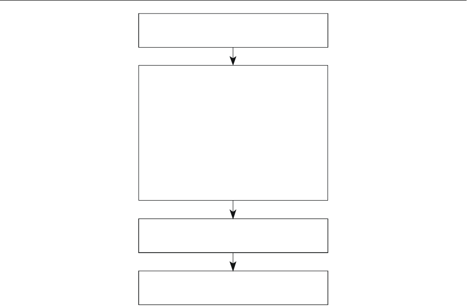
I-13-2 Global Air Navigation Plan for CNS/ATM Systems
Services — Guidelines for cost/benefit analysis of
communications, navigation and surveillance/air traffic
management (CNS/ATM) systems. This circular focuses on
the NPV methodology, which is widely recognized and
used by financial institutions such as those potentially
involved in funding CNS/ATM systems. The methodology
is presented using a step-by-step tabular approach, which
may be applied manually or through a computer spread-
sheet; formatted spreadsheets using Quattro Pro, Lotus or
Excel software are available to States from the ICAO
Secretariat.
INTERPRETATION OF
COST-BENEFIT RESULTS
13.6 The interest rate used for discounting future cash
flows should be the minimum rate of return required from
investment in the CNS/ATM systems project. If a rate of
7 per cent per annum (real) was used, then any NPV result
above zero would imply a forecast of a real rate of return
greater than 7 per cent per annum from the investment
project. More precisely, the project was expected to earn a
real rate of return of 7 per cent per annum plus a surplus
equal to the NPV value.
13.7 NPV calculations can be repeated for alternative
implementation plans in order to assess which particular
plan is the most cost-effective. For example, the NPV of an
implementation employing SSR Mode A/C and VDL for
surveillance and data communications can be compared
with the NPV of an implementation plan with Mode S for
both surveillance and data. As another example, the econ-
omic consequences of extending or shortening the period
during which services are provided by both the present
technology and the new technology systems (in parallel)
can be assessed in a similar way.
13.8 A cost-benefit analysis can be done for the
airspace of a State or group of States. It is recommended
that separate cost-benefit analyses be done for the ATM
provider or the relevant State authority and for the aircraft
operators. Where this is done, it is possible that the State
authorities may see only a modest net benefit (NPV) or
perhaps even a net financial cost associated with the
implementation of CNS/ATM systems. Any such net benefit
or net cost experienced by a service provider should be
Figure I-13-1. Overview of the net present
value (NPV) approach
TRAFFIC DEMAND, BY YEAR
CNS/ATM COSTS, BY YEAR
equipment
purchase of services
training
CNS/ATM BENEFITS, BY YEAR
avoided costs of present technology
savings to aircraft operators
passenger timesavings
NET BENEFITS, BY YEAR
NET PRESENT VALUE
!
!
!
!
!
!

Part I. Operational Concept and General Planning Principles
Chapter 13. Cost-Benefit and Economic Impacts I-13-3
accompanied by adjustments to air navigation charges so
that the organization earns a reasonable return on capital
invested. It is expected that the cost-benefit analysis for the
airlines should produce a large positive NPV, depending on
regions and traffic characteristics. Even if some of this net
benefit was needed to compensate the service provider,
through increased en-route charges, there should normally
be an overall surplus.
13.9 The resulting effect on the airlines’ net financial
benefit attributable to implementation of CNS/ATM systems
in a region or State must be examined. Figure I-13-2
illustrates the three options for using these benefits: by
compensating the service providers, if necessary, improving
airlines’ financial performance or reducing fares and rates.
13.10 Competitive market forces should ensure that
the airlines’ net benefit, which remains after compensating
the service providers, will be passed on by the airlines to
the passengers, both local residents and visitors, and freight
shippers, including exporters and importers, in the form of
lower fares and rates, in real terms. This represents the
main contribution of CNS/ATM systems to the economy of
States. In due course, lower fares should increase the
demand for air travel and tourism, and lower freight rates
should improve the cost structure of companies and
increase trade. The benefits associated with this extra
demand are expected to be much smaller than the benefits
received by the existing air traffic and are more difficult to
measure.
RISKS FOR STATES
13.11 There could be a financial risk for some States
associated with the diversion from their airspace of inter-
national overflight traffic as a result of the regional
implementation of CNS/ATM systems. From a regional
perspective, a redistribution of traffic flows associated with
CNS/ATM systems should contribute to the overall econ-
omic benefit of the new systems. However, from the
perspective of a single State, the impact of the redistri-
bution could be quite complex, with either positive or
negative consequences. For example, if the geographic
pattern of the traffic were such that the realignment of flight
paths reduced the traffic in the State’s airspace, the State
would have access to less revenue. The loss of revenue
might be even greater if the State did not convert to the new
systems.
13.12 The prospect of new flight patterns emphasizes
the importance of international cooperation, not only for
implementing the most efficient routes, but also for
achieving an acceptable distribution of benefits and for
reducing the financial risks faced by individual States.
Cost-benefit studies for regional State groupings have an
important role in the regional planning of CNS/ATM sys-
tems. The net economic impact may be more accurately
measured at the regional or subregional level, since it is at
this level, rather than at the State level, that some of the
costs will be incurred, and the benefits received. Because of
the long time frame of the studies, it may also be necessary
to update the validation, for example after five years of
operation of the new systems.
Business case evaluation
13.13 The development of a business case for the
implementation of CNS/ATM systems by a service provider
or an operator involves taking the financial cost-benefit
analysis a step further. In particular, changes in revenues
resulting from changes in the price of the product sold must
be taken into account. It is generally expected that
CNS/ATM systems will facilitate reduced operating costs
and a lower price for the service provided. From the point
of view of a specific organization, assessment of the net
financial impact, in present value terms, must include not
only the implementation cost and operating cost savings,
which are included in the cost-benefit analysis, but also
consequent changes in revenues.
13.14 For a service provider, a business case evalu-
ation must include the impact on revenues of changes in
route charges associated with the implementation of
CNS/ATM systems. Assuming that the ATM service
provider is an autonomous organization operating on a
commercial basis and is currently covering its costs with
the present technology systems, the basic issue is for the
service provider to be satisfied that the changes in revenues
expected from the planned changes to en-route charges will
match the net change in costs, measured by the cost-benefit
analysis. However, if the relationship between costs and
revenues is not being monitored (e.g. if costs are met from
the government budget and revenues are treated indepen-
dently as general government revenues), then the ATM
services are not being provided on a commercial basis.
Even in these circumstances it is recommended that a busi-
ness case evaluation be conducted to assess the financial
impact of the new systems on the service provider.
13.15 For an airline, a business case evaluation would
include, among other factors, assumptions about the impact
on its costs of expected changes in route charges and the
impact on revenues of changes in airline fares and rates,
where these changes are associated with the implemen-
tation of CNS/ATM systems. These impacts are in addition
to the direct investment costs and operating cost savings
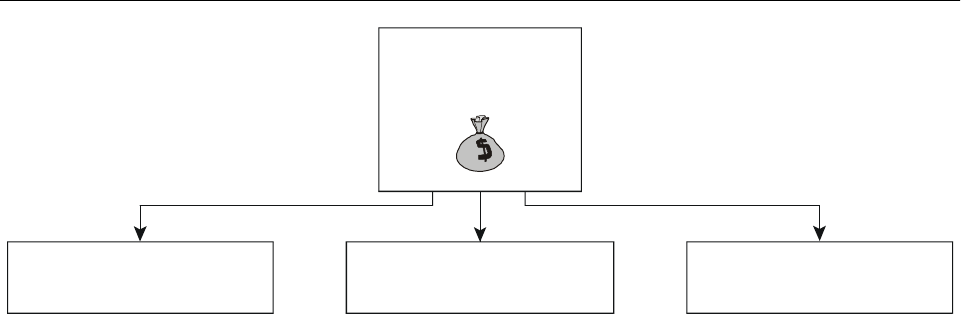
I-13-4 Global Air Navigation Plan for CNS/ATM Systems
attributable to the new systems and identified in the cost-
benefit analysis described above. The impact of route
charges will depend on the outcome of the policies and
evaluations of the service providers. Assumptions about
fares and rates will reflect competitive pressures in air
travel and freight markets.
Other economic effects of
CNS/ATM systems implementation
13.16 States may be interested in the broader
economic and social impact of CNS/ATM systems as well
as the financial viability of the new systems. For example,
implementation of the new systems should produce pas-
senger timesavings, improve safety, produce environmental
benefits and may also lead to some industry restructuring
and changes in skills required.
13.17 CNS improvements, which produce benefits for
ATM such as more direct flight paths and less delay from
airspace congestion, will reduce the passenger travel time
for a given journey. If passengers value these timesavings,
they represent an additional benefit. The evaluation of this
benefit is discussed in Circular 257.
13.18 CNS/ATM systems are expected to bring
environmental benefits because of reductions of nitrous
oxide and carbon emissions through more direct routing of
aircraft. These benefits will accrue to the global community
in general and are not limited to participants in the air
transport industry. Recognition of these benefits provides a
reason for subsidizing investment in CNS/ATM systems.
The increase in automation of ATM, the withdrawal of
some ground-based navigation aids, and the possible relo-
cation of some ATM facilities to fewer centralized locations
should result in labour productivity improvements, and
hence reductions in unit costs, over the long term. The
labour released by this process should, in most regions, be
absorbed by the requirement to service expanded traffic
volumes generated by general economic growth. However,
there may be situations where some redeployment of staff
to other economic sectors is necessary, with further
economic and social consequences.
13.19 The reduced costs and lower price of air
transport made possible by CNS/ATM systems, and the
resulting increased air traffic demand, could increase the
viability of investment in activities closely related to air
transport, not only accommodation and tourism, but also
those manufacturing and agricultural industries which ship
materials and products by air. These indirect benefits are
part of a dynamic process of economic growth and should
not be attributed entirely to CNS/ATM systems. They will
only be fully exploited provided the complementary
investment in the associated industries is undertaken. The
various economic effects are highlighted in Figure I-13-3.
13.20 An understanding of the contribution of air
transport to general economic activity can increase the
political commitment to the process of transition to
CNS/ATM systems. National accounting and industry data
and employment surveys may be used to determine the
share of air transport in total economic activity and its
importance as an employer. The input/output tables of a
State’s national accounts can illustrate the interrelationships
among the various elements of the air transport industry
and other industries and economic sectors. Other industries
purchase air transport services or supply products and
services to the air transport industry. From a national or
regional economic planning perspective, it is especially
important to appreciate the role of air transport in generat-
ing employment and incomes and in supporting other non-
aviation economic activities. This will put into perspective
the value of supporting and investing in state-of-the-art
national and regional air transport facilities.
Figure I-13-2. Distribution of airlines’ net benefits
Airlines’ net
benefits
Compensate
service provider
Improve financial
performance
Lower fares
and rates

Part I. Operational Concept and General Planning Principles
Chapter 13. Cost-Benefit and Economic Impacts I-13-5
Figure I-13-3. Summary of economic effects of CNS/ATM
ECONOMIC EFFECTS
• Financial benefits and lower fares and rates
• Improved safety
• Passenger timesavings
• Environmental benefits
• Transfer of high-tech skills
• Productivity improvements and industry restructuring
• Higher traffic and stimulation of related industries

I-14-1
Chapter 14
FINANCIAL ASPECTS
INTRODUCTION
14.1 Financing CNS/ATM systems elements, in par-
ticular at the national level, would normally be approached
in a manner similar to that applied to conventional air
navigation systems. However, a characteristic of most
CNS/ATM systems elements that differentiates these
systems from most conventional air navigation systems is
their multinational dimension. Consequently, and because
of the magnitude of the investments involved, financing of
basic systems elements may, in many cases, need to be a
joint venture by the States involved at the regional or global
level.
COST-RECOVERY
ICAO policy
14.2 Whatever approach is taken by a State or group
of States collectively to provide CNS/ATM systems
services within the airspace for which responsibility has
been assumed, the resultant cost-recovery through charges
must be in conformity with basic ICAO airport and air
navigation services cost-recovery policy. This policy is
contained in Article 15 of the Convention on International
Civil Aviation (Chicago Convention) and is supplemented
by ICAO’s Policies on Charges for Airports and Air
Navigation Services* (Doc 9082). The implementation of
CNS/ATM systems should not require any basic changes to
that policy.
14.3 The Statement of ICAO Policy on CNS/ATM
Systems Implementation and Operation, approved by the
ICAO Council in March 1994, addresses cost-recovery as
follows:
“In order to achieve a reasonable cost allocation
between all users, any recovery of costs incurred in
the provision of CNS/ATM services shall be in
accordance with Article 15 of the Convention and
shall be based on the principles set forth in the
Statements by the Council to Contracting States on
Charges for Airports and Air Navigation Services**
(Doc 9082), including the principle that it shall
neither inhibit nor discourage the use of the
satellite-based safety services. Cooperation among
States in their cost-recovery efforts is strongly
recommended.”
14.4 In ICAO’s policies set out in Doc 9082, the
following four general principles should particularly be
noted with regard to CNS/ATM systems:
a) in paragraph 36, “. . . as a general principle, where
air navigation services are provided for international
use, the providers may require the users to pay their
share of the related costs; at the same time,
international civil aviation should not be asked to
meet costs that are not properly allocable to it . . .”;
b) paragraph 38 i), “The cost to be shared is the full
cost of providing the air navigation services,
including appropriate amounts for cost of capital
REFERENCES
ICAO’s Policies on Charges for Airports and Air
Navigation Services (Doc 9082)
Manual on Air Navigation Services Economics
(Doc 9161)
Report on Financial and Related Organizational and
Managerial Aspects of Global Navigation
Satellite System (GNSS) Provision and Operation
(Doc 9660)
Manual on Air Traffic Forecasting (Doc 8991)
* Replacing Statements by the Council to Contracting States on
Charges for Airports and Air Navigation Services.
** Since retitled ICAO’s Policies on Charges for Airports and
Air Navigation Services (Doc 9082/6).

I-14-2 Global Air Navigation Plan for CNS/ATM Systems
and depreciation of assets, as well as the costs of
maintenance, operation, management and admini-
stration.”;
c) in paragraph 38 ii), “The costs to be taken into
account should be those assessed in relation to the
facilities and services, including satellite services,
provided for and implemented under the ICAO
Regional Air Navigation Plan(s) . . .”; and
d) in paragraph 47, “. . . the providers of air navigation
services for international use may require all users
to pay their share of the cost of providing them
regardless of whether or not the utilization takes
place over the territory of the provider State.”
14.5 Particular attention also needs to be given to the
following principle in paragraph 41 iii) of Doc 9082:
“Charges should be determined on the basis of
sound accounting principles and may reflect, as
required, other economic principles, provided that
these are in conformity with Article 15 of the
Convention on International Civil Aviation and
other principles in this document.”
The application of economic principles to setting charges
which are consistent with ICAO’s policy should emphasize
the need to recover costs in an efficient and equitable
manner from the users of air navigation services. Within an
economic context, charges should be set to recover costs,
provide a reasonable return on investment where appropriate
and provide additional capacity when justified.
14.6 In a situation where system operation takes place
outside the service provider State, that State nevertheless
must approve the use of the service within the airspace for
which it has accepted responsibility. It also must ensure and
stipulate that the service meets ICAO requirements.
Furthermore, if services are charged for, the charging
practices must be established in accordance with ICAO
recommended cost-recovery policy and practices.
14.7 In a recent review of ICAO cost recovery policy,
pre-funding of projects was given extensive consideration
and the following policy guidance was added in para-
graph 42 of Doc 9082:
“. . . notwithstanding the principles of cost-
relatedness for charges and of the protection of users
from being charged for facilities that do not exist or
are not provided (currently or in the future) that, after
having allowed for possible contributions from
non-aeronautical revenues, pre-funding of projects
may be accepted in specific circumstances where this
is the most appropriate means of financing long-term,
large-scale investment, provided that strict safeguards
are in place, including the following:
i) Effective and transparent economic regulation
of user charges and the related provision of
services, including performance auditing and
“bench-marking” (comparison of productivity
criteria against other similar enterprises).
ii) Comprehensive and transparent accounting, with
assurances that all aviation user charges are, and
will remain, earmarked for civil aviation services
or projects.
iii) Advance, transparent and substantive consul-
tation by providers and, to the greatest extent
possible, agreement with users regarding sig-
nificant projects.
iv) Application for a limited period of time, with
users benefitting from lower charges and from
smoother transition in changes to charges than
would otherwise have been the case once new
facilities or infrastructure are in place.”
Cost determination
Relevance of ICAO regional air navigation plans
in the context of CNS/ATM cost-recovery
14.8 As stated above, charges for CNS/ATM systems
services should not be imposed unless these services are
actually being provided according to the regional ANPs
concerned. Consequently, it is important that regional plans
be promptly amended to incorporate the relevant CNS/ATM
system element(s) once the States involved have agreed that
the element(s) should form part of the plan or plans
concerned.
14.9 Moreover, the regional ANPs should provide a
schedule for the phase-out of facilities made redundant by
the provision of CNS/ATM systems services. This is also of
major importance because significant financial benefits from
CNS/ATM systems implementation will not be realized if
the facilities and services made redundant, continue to be
listed in the regional plans and charged for.
14.10 As CNS/ATM systems components are im-
plemented, States should add the associated costs to their

Part I. Operational Concept and General Planning Principles
Chapter 14. Financial Aspects I-14-3
cost base for air navigation services charges. States sharing
the costs of a multinational air navigation facility or service
may include the costs involved in its cost base for charges.
CNS/ATM system trials and major research and develop-
ment work may be included as part of the capital invest-
ment, the subsequent annual depreciation of which could
then be included in the cost base for air navigation services
charges.
Determining CNS/ATM systems costs
14.11 The CNS/ATM systems services costs attribu-
table to en-route utilization could be included, together
with other air navigation services costs allocable to
en-route utilization, in the cost basis for, and recovered
through, route air navigation services charges levied by the
State concerned. However, as noted in Chapter 12, 12.16,
implementation of CNS/ATM systems offers the cost
saving potential of merging many FIRs and corres-
pondingly reducing the number of ATC facilities. Never-
theless, even without an en-route ATC facility such as an
ACC, a State would still need to incur costs associated with
providing CNS/ATM systems services as well as other air
navigation services to traffic during the en-route phase of
flight, e.g. costs associated with participation in and/or
provision of GNSS augmentation, provision of AFS links
with one or more ATC facilities, MET services, etc.
Recovery of these costs would require cooperation or
agreement between the State concerned and the entity oper-
ating the facility serving traffic in the expanded ATM area
wherein the State concerned would be located. The purpose
of such an approach would be for route air navigation
services costs to be included as an identifiable element in
the cost basis for, and recovered through, the charges levied
by the facility serving the expanded ATM area. The charges
share represented by these costs would then be transferred
to the State upon payment by the users.
14.12 The costs of air navigation services provided
during the approach and aerodrome control phase of air-
craft operations should be identified separately and could
either be included in any approach and aerodrome control
charges that might be levied on traffic at the airports con-
cerned or, alternatively, could be included in approach
and/or aerodrome control costs that would be charged by
the ATM provider to any of these airports. In the latter
instance, each airport could then include those costs, to-
gether with other air navigation services costs, in the cost
basis, and recover them through landing or similar charges.
14.13 From an organizational viewpoint, it is
important, with regard to cost-recovery, that where air
navigation services costs are to be recovered, the State
concerned should assign, to one entity, the responsibility
for ensuring that the costs attributable to the provision of air
navigation services by the different entities in the State are
included in the cost basis for any cost-recovery programme
or mechanism.
Allocation of CNS/ATM systems (GNSS) costs
to other than civil aviation users
14.14 Civil aviation users constitute a minor share of
navigation satellite users. More important than the magni-
tude of civil aviation’s usage in relative terms is that the
users should not pay for more than their fair share of the
costs of GNSS provision. Allocation of costs for systems
augmentation or other costs of GNSS service provision
attributable to users other than civil aviation, as well as civil
aviation, should therefore precede any cost-recovery from
civil aviation.
Allocation of CNS/ATM systems costs attributable
to civil aviation among user States
14.15 Costs, in the form of payments made by a State
to a service provider offering CNS/ATM systems services
to several States, will need to be allocated amongst the
different CNS/ATM systems user States involved. That, in
turn, will require an agreement between the parties con-
cerned as to how such an allocation should proceed.
Assuming a uniform level of service, such allocation could
be based on either distance flown or the number of flights
in the airspace for which each State has accepted re-
sponsibility. Both are viable options. Distance flown would
offer more precision while using number of flights as the
basis would be simpler to administer.
Allocation at the State level of CNS/ATM systems
costs attributable to civil aviation
14.16 Once the costs attributable to civil aviation have
been determined and cost-recovery from users is to be
pursued, consideration will need to be given to the
allocation of these costs between en-route, approach and
aerodrome control utilization. This in turn will determine
the extent to which route air navigation services charges, as
opposed to approach and aerodrome control charges, will
be affected. To ignore this issue when users are to be
charged directly would distort the principle of equity in
charging, since overflying traffic could be subsidizing
landing traffic or vice versa, depending on the accuracy of
the cost allocation.

I-14-4 Global Air Navigation Plan for CNS/ATM Systems
Cost-recovery during development
and implementation
14.17 One particular issue that needs to be addressed
in the implementation of CNS/ATM systems is the treat-
ment of costs and cost-recovery during the three stages of
systems implementation, i.e. development, transition and
CNS/ATM systems as the only systems. Paragraph 3.8 of
the Report on Financial and Related Organizational and
Managerial Aspects of Global Navigation Satellite System
(GNSS) Provision and Operation (Doc 9660) addresses this
particular issue in the specific context of GNSS.
14.18 The implementation of CNS/ATM systems
elements will, in many cases, lead to the retirement of
existing ground-based facilities before the end of their
economic life. In such circumstances, the balance of the
undepreciated portion of the facilities concerned could be
included in the cost basis for charges. The same procedure
could apply to such costs that may be incurred because of
premature retirement or training of personnel made redun-
dant by the implementation of the new systems. Such costs,
however, should be limited to termination settlements, costs
attributable to early retirement and costs of retraining
and/or relocation. These costs could be capitalized and
thereafter written off gradually, with the portion written off
each year being included in the cost basis for air navigation
service charges. These factors would need to be taken into
account in any related cost-benefit analysis or business case
study.
Compensation where revenues from
redundant facilities exceed costs
14.19 As a result of CNS/ATM systems implemen-
tation, some States may experience a net loss in revenue.
Compensation for loss of what is in essence profits should
be viewed with extreme caution, considering that there are
the broader socio-economic benefits generated by opening
up new or improved air services. Moreover, such com-
pensation, if included in the cost basis for charges, could in
fact be considered a royalty payment, which would be
contrary to the intent expressed in Article 15 of the Chicago
Convention.
Consultation with users
14.20 Particular attention should be drawn to
Doc 9082, paragraphs 49 to 51, and the emphasis placed on
consultation with users regarding increased or new air
navigation services charges; and also on users being
consulted as early as possible when major air navigation
services are being planned. This would call for such
consultations to be carried out when plans are being
developed for the implementation of CNS/ATM systems
elements, whether at the global, regional or national level.
FINANCING
General
14.21 The basic steps of financing include air traffic
forecasts, a financial and economic analysis, a financing
plan and sources of financing (see Figure I-14-1).
14.22 Direct financing of many basic components
may not involve aviation at all, particularly where aviation
is only a relatively minor, even if important, user of a
particular system, e.g. satellite navigation. In such situ-
ations, financing may be arranged by the system operator
with aeronautical users paying for access through leases or
charges, which would include an element to recover the
costs of financing and repayment of capital.
Air traffic forecasts
14.23 Sound traffic forecasts are essential to any air
navigation services infrastructure development project and
its financing. The main purpose of such forecasts is to
identify traffic developments and to establish the associated
capacity requirements of the air navigation facility or
service involved. These forecasts are also important for
carrying out financial and economic analyses and for
preparing revenue estimates from charges on air traffic. For
guidance on the preparation of traffic forecasts, reference is
made to the Manual on Air Traffic Forecasting (Doc 8991).
Financial and economic analysis
14.24 Every major investment decision taken by a
service provider should be supported by analyses to
demonstrate costs and benefits to service providers, users
and, as appropriate, the wider community. Such analyses
are important when choosing between options for the
implementation of CNS/ATM systems and when seeking
government or private financing. Three types of analyses
may be of interest:
1) cost-benefit analysis to demonstrate financial via-
bility and to identify the investment option that best
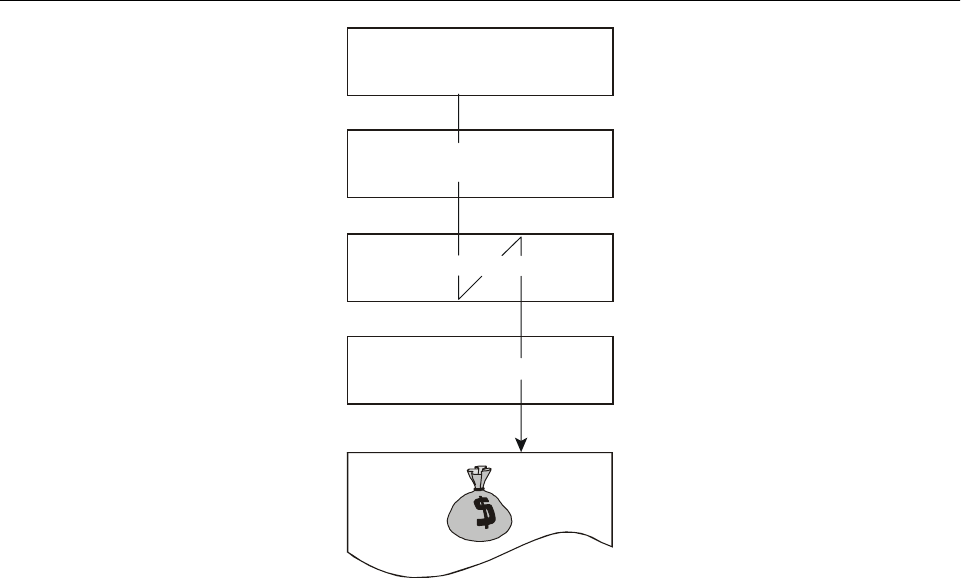
Part I. Operational Concept and General Planning Principles
Chapter 14. Financial Aspects I-14-5
conforms with the economic goal of maximizing
net benefits; and/or
2) business case study (financial evaluation) which
deals with the direct costs, revenues and sources of
funds and focuses on financial accounts and cash
flows to demonstrate to a service provider of capital
funds that loan obligations can be served;
3) economic impact study to assess the contribution
of air navigation services to the economy.
Note.— Financial and economic analysis are discussed
in more detail in Part I, Chapter 13.
Financing plan
14.25 The purpose of the financing plan is to provide
basic information as follows:
a) estimates of the element costs (labour, materials,
equipment, etc.) of each distinct part of the overall
project;
b) the funds required to make disbursements at various
stages in the project’s progress;
c) the currencies in which payments are to be made;
and
d) the sources from which the funds are to be forth-
coming, whether from:
1) sources generated by the entity providing air
navigation services from its operations, which
would primarily include user charges, and
possibly retained earnings, but could in some
circumstances also include contractual pay-
ments; or
2) other sources, including information on the
applicable conditions, i.e. interest rate, repay-
ment period, etc.
14.26 Also to be emphasized is the importance of the
availability of data showing the financial situation of the air
navigation services provider over recent years, as well as
anticipated developments over the period of debt repay-
ment. Of particular relevance is the recording of revenues
Figure I-14-1. The basic steps of financing
1. Air traffic forecasts
2. Financial and economic
analysis
3. Financing plan
4. Sources of financing
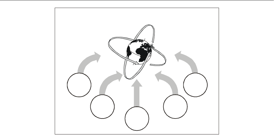
I-14-6 Global Air Navigation Plan for CNS/ATM Systems
and expenses by major item. Estimates regarding future
financial developments would emanate from budgets and
longer-term financial plans. In the absence of such financial
data, it would be much more difficult to decide whether or
not the loan or financing sought should be granted and, if
so, what terms should be offered.
Sources of financing
General
14.27 A survey of potential sources of funds and
which of them to approach should be done as early as
possible in the planning process. Potential sources of funds
will vary considerably from project to project and State to
State. The sources to be approached should be studied and
decided upon individually for each project and could be
grouped as follows: direct contributions from govern-
ment(s); loans or debt financing; internally generated
resources; equity financing; and leasing (see Figure I-14-2).
Direct contributions from governments
14.28 The extent to which direct contributions will be
required from the government depends on a number of
factors. Chief among these is the organizational form under
which CNS/ATM systems services will be provided, i.e.
will the government be directly involved, either alone, or in
a joint effort with other governments, or will it primarily
involve a commercial corporation? Another factor is the
type of CNS/ATM systems component involved, e.g. is
funding being required for satellite elements or “national”
ground-based facilities? Yet another factor is whether the
traffic volume within the airspace concerned is sufficient to
support the CNS/ATM systems component in financial
terms, including servicing debt. If such traffic is not
sufficient, as in a situation where, for example, a local
augmentation unit would service one or more airports with
very limited traffic, direct contributions from the govern-
ment may be the only realistic alternative.
14.29 For most States, particularly developing States,
the foreign sources of financing are principally government-
operated. Such foreign financing may be available from
foreign governments in the form of loans negotiated directly
with the government of the recipient country, or may other-
wise be facilitated by particular agencies of government,
which have been established for the primary purpose of
promoting the nation’s export trade. Of particular impor-
tance among the possible sources of foreign financing
available to developing States are the international banks
and funds that have been established to assist in the
financing and execution of projects promoting national
economic development.
14.30 Project costs payable in foreign funds constitute
a demand on the State’s reserves of foreign exchange and
as such their financing will usually have to be arranged
through or with the approval of the appropriate government
authorities. Nevertheless, foreign sources should always be
Figure I-14-2. Sources of financing
Sources of financing
Direct from
governments
Debt
financing
Internally
generated
resources
Equity
financing
Leasing

Part I. Operational Concept and General Planning Principles
Chapter 14. Financial Aspects I-14-7
explored as a matter of course, since financing may be
available from them on more favourable terms than those
obtainable from domestic institutions (e.g. lower interest
rate, repayment over a longer period, etc.). However, there
are also some risks involved in foreign exchange, such as
currency fluctuations.
Debt financing
14.31 The feasibility of debt financing will depend on
whether the traffic to be served by the CNS/ATM systems
component to be financed is of sufficient volume and
strength to service the debt, including interest and repayment
of capital. Where an international agency or corporate-type
entity would be providing basic CNS/ATM systems services,
its costs of financing could be reduced if the States for which
the basic services are being provided were to guarantee the
servicing and repayment of the loans concerned. This in turn
should reduce the costs to be recovered from these user
States.
Internally generated resources
14.32 Depreciation and retained profits from the
operation of air navigation services may become a sup-
plementary source of financing for CNS/ATM systems
facilities. However, with regard to profits, an important
qualification that needs to be recalled is the principle
outlined in Doc 9082, paragraph 38:
“Air navigation services may produce sufficient
revenues to exceed all direct and indirect operating
costs and so provide for a return on assets (before
tax and cost of capital) to contribute towards
necessary capital improvements.”
Reference should also be made to the text on pre-funding of
projects in 14.7 above.
Equity financing
14.33 Equity financing may be a viable alternative in
some instances. For example, if a CNS/ATM systems
component’s services were acquired under contract from a
commercial service provider, that operator could finance
the investment required partially or completely through
increased equity.
Leasing
14.34 Leasing rather than outright ownership could
become an important alternative in CNS/ATM systems
component provision. This could apply, for example, with
regard to GNSS integrity monitoring and wide-area aug-
mentation systems, where access may be effected in a less
time- and capital-consuming manner than if the State(s)
concerned were to operate these facilities itself (them-
selves). The possibility could also be explored of applying
leasing to local area augmentation units, possibly through
the establishment of leasing companies, which would oper-
ate in a manner similar to those purchasing and leasing out,
for example, computer systems, communications systems
and/or aircraft under long-term leases.

I-15-1
Chapter 15
ASSISTANCE REQUIREMENTS AND
TECHNICAL COOPERATION
INTRODUCTION
15.1 Planning and implementation of CNS/ATM
systems requires cooperation among all partners that have
a stake in its successful implementation. Assistance
requirements of developing States in particular, need to be
addressed. Technical and financial cooperation of the
aviation and development financing communities will be
required worldwide with the coordination of ICAO to
ensure harmony and safety.
15.2 ICAO has established the ICAO Objectives
Implementation Mechanism, inter alia, to foster early and
harmonious implementation of CNS/ATM systems and to
create an avenue for the planning and implementation of
CNS/ATM systems-related projects, for the ultimate benefit
of the recipient States and the users of the system.
ASSISTANCE REQUIREMENTS OF
DEVELOPING ICAO CONTRACTING STATES
FOR CNS/ATM PLANNING AND
IMPLEMENTATION
Summary of ICAO surveys
15.3 On behalf of the CNS/ATM Systems Implemen-
tation Task Force (CASITAF), which was comprised of rep-
resentatives from a wide range of States, international
organizations, industry and observers, convened by ICAO
in 1994, the Technical Co-operation Bureau (TCB) of
ICAO conducted an initial survey of States’ requirements
for assistance in CNS/ATM planning and implementation,
through a questionnaire involving seven ICAO Regional
Offices. The replies to that questionnaire indicated a sub-
stantial need for assistance and a preference for this
assistance to be provided through ICAO. Having considered
the results of the survey, and to ensure harmonization of
implementation and early benefits to users, CASITAF rec-
ommended that where assistance was required it should be
provided through ICAO.
15.4 The results of this survey were presented to the
ALLPIRG/Advisory Group, which is comprised of rep-
resentatives of the planning and implementation regional
groups (PIRGs), ICAO regional offices, international
organizations, industry and observers, at a meeting con-
vened by ICAO in April 1997. Another survey was carried
out by ICAO in the first half of 1997 to update and further
define the assistance requirements of the developing ICAO
Contracting States for CNS/ATM systems planning and
implementation. A breakdown of the results of the survey
into areas of assistance requirements and sources of assist-
ance is provided in Appendices A and B to this chapter,
respectively.
15.5 The results of the 1994 and 1997 ICAO surveys
and experience gained through initial ICAO technical
cooperation projects on the subject (described below)
confirm that, while some States will be in a position to
develop their national CNS/ATM systems plan and im-
plement it using their own resources, the majority of States
require external assistance. The surveys demonstrated that
developing States mainly require assistance with:
— needs assessments and project development;
— donor mobilization and financing arrangements;
— familiarization/specialized seminars and workshops;
— transition planning including cost-benefit and cost-
recovery analyses;
REFERENCES
ICAO Strategic Action Plan
Statement of ICAO Policy on CNS/ATM Systems
Implementation and Operation, ICAO Council, 1994
Criteria Governing the Provision of Technical Co-
operation, ICAO Council 1984

I-15-2 Global Air Navigation Plan for CNS/ATM Systems
— systems planning, specification, systems procure-
ment, installation, commissioning; and
— human resource planning and development.
15.6 The 1997 survey in particular provided an over-
view of the needs of developing States in the various PIRGs,
listed by areas of major assistance requirements (see
Appendix A to this chapter). Out of a total of 79 responses
received from developing States, 68 indicated that they were
in need of external assistance for CNS/ATM systems
planning and implementation in one or more areas listed
above. Furthermore, about 80 percent of the responses stated
a need for external assistance across the whole spectrum, i.e.
from a formal needs assessment survey, through implemen-
tation planning, including cost-benefit analysis and systems
procurement, to human resources planning and develop-
ment. Satisfying this need of developing States, not only
with regard to transfer of know-how but also for external
financing, is a major task for the international community.
This task requires urgent attention if globally harmonized
implementation of CNS/ATM systems is to be achieved and
early benefits are to be realized by users.
Sources of assistance and funding
15.7 The results of the 1997 survey also demonstrated
the desire of the majority of developing States to obtain
external technical assistance from ICAO for CNS/ATM
systems planning and implementation (see Appendix B to
this chapter). Out of the 68 responses received from
developing and least developed States, 83 per cent of
developing States and 97 per cent of least developed States
replied that they rely on ICAO to provide external
assistance, while 49 per cent of developing States and
48 per cent of least developed States also indicated the need
for assistance in specific areas, from other external sources.
15.8 To meet the needs of developing States for exter-
nal assistance and funding through or from ICAO, funding
will have to be made available by the international develop-
ment financing community.
15.9 It is anticipated that bilateral assistance, whether
through grants or loan arrangements, will be increasingly
made available to developing States requiring major
upgrading of civil aviation equipment. Transfer of know-
how through specialized expertise in CNS/ATM systems
planning and, in particular, human resource development,
will require the involvement of the aviation industry and the
development and financing communities, particularly
multilateral donors. Whereas interregional planning efforts,
including accompanying training, would be more suitable
for financial support from global development financing
partners, such as certain Bretton Woods organizations;
international organizations and associations; industry and
service providers as representative partners and regional
development banks, these may be joined by subregional
associations and States for regional, subregional and national
planning and implementation of CNS/ATM systems.
ICAO OBJECTIVES
IMPLEMENTATION MECHANISM
15.10 The following paragraphs describe the ICAO
mechanism established to assist, inter alia, in coordinating
the provision of assistance in CNS/ATM systems planning
and implementation, in which the above-mentioned develop-
ment partners, as well as States themselves, may find a
suitable channel to provide the necessary support.
Establishment
15.11 The ICAO Objectives Implementation Mech-
anism was established by the ICAO Assembly in 1995. The
Assembly endorsed a new policy on ICAO technical
cooperation, which included the establishment of a funding
mechanism, as well as the objectives of the new policy
emphasizing global implementation of SARPs and ANPs,
including, in particular, CNS/ATM. The Assembly
encouraged Contracting States “to make use of the Tech-
nical Co-operation Programme of ICAO and to contribute
to this new funding mechanism, aimed at consolidating all
other funding arrangements”. The first meeting of the
ALLPIRG/Advisory Group, held in April 1997, concluded
that ALLPIRG members, in order to ensure timely and
coordinated implementation of CNS/ATM systems, should
support ICAO and States in mobilizing funds for the ICAO
Objectives Implementation Mechanism of the ICAO
Technical Co-operation Programme in line with Assembly
resolutions. The Technical Co-operation Programme is
described in 15.16 to 15.20.
Objectives
15.12 The aims of the ICAO Objectives Implemen-
tation Mechanism are to provide additional resources to
ICAO for following up on ICAO’s Regular Programme
activities; resources which could be applied to technical
cooperation projects identified as required to support the
implementation of SARPs and the facilities and services
listed in the ANPs. The mechanism is strategically linked to
ICAO’s plans for the implementation of CNS/ATM systems.

Part I. Operational Concept and General Planning Principles
Chapter 15. Assistance Requirements and Technical Cooperation I-15-3
It stimulates ICAO’s action for initiating projects required
for the development of international civil aviation.
15.13 The mechanism gives priority and support to
technical cooperation activities in the field of SARPs and
ANPs implementation, CNS/ATM, safety oversight, avi-
ation security, civil aviation master planning, restructuring
of civil aviation departments/authorities and human resource
development.
Contributions to the mechanism
15.14 The ICAO Objectives Implementation Mech-
anism includes a variety of funding modalities to suit
particular donors’ needs and provides a framework for
flexible arrangements for the implementation of projects.
Donations are also welcome in the form of voluntary
contributions in kind, such as scholarships, fellowships,
training equipment and funds for training, from States and
other public or private sources.
15.15 Funding and operation of the mechanism has
been established, separately or in combination with each
other, in accordance with the following methods:
a) General fund. States or donors deposit funds in a
special account established for the mechanism.
These funds are used exclusively for the implemen-
tation of technical cooperation projects approved by
ICAO. The funds are not to be tied to projects for
any special area or purpose nor are they to be used
for the purchase of equipment in the donor country
or employment of its nationals, etc.
b) Specific ICAO project. States or donors indicate
their willingness to participate in the mechanism
and give an indication of the amount they expect to
donate for the year. Periodically during the year,
ICAO circulates descriptions of projects requiring
financing and States or donors indicate their will-
ingness to finance all or part of a particular project.
On advice from ICAO of the intent to proceed with
a project, the funds are deposited in the account
established for that project.
c) Specific State project. States or donors advise
ICAO of their desire to see a particular improvement
or development implemented and their willingness
to finance the project under the mechanism for tech-
nical cooperation. ICAO costs the project and
submits a preliminary budget to the States or donors.
On approval of the preliminary budget, a full project
document is developed for signature by the recipient
State, the donor and ICAO. The necessary funds are
then deposited with ICAO in an account established
for that project.
d) General but identified issue. A variation of the
method outlined in c) is for a State or donor to
make funds available for a particular issue, but to
leave it to ICAO to decide how the funds are to be
spent. For example, funds may be used for fellow-
ships or for advancing some specific technical
matter, such as CNS/ATM.
ICAO TECHNICAL COOPERATION IN
CNS/ATM IMPLEMENTATION
Mandate, objectives and role
15.16 ICAO offers technical cooperation in the civil
aviation field through its Technical Co-operation Bureau
(TCB), which was created in 1952. TCB carries out projects
funded by developing States themselves or by various
bilateral and multilateral funding institutions, including
UNDP.
15.17 The Criteria Governing the Provision of Tech-
nical Co-operation, approved by the ICAO Council in 1984,
define the objectives of ICAO technical cooperation as
follows:
“ICAO will cooperate with Governments in
providing assistance to civil aviation development in
any sector, international or domestic, when such
development will promote the economic and/or
social growth of the country concerned, or will
enhance the safety and efficiency of civil aviation
and implementation of the Regional Air Navigation
Plan.”
15.18 More specifically, with regard to CNS/ATM, in
1994 the ICAO Council “recognized, in the interest of
globally coordinated, harmonious implementation and early
realization of benefits to States, users and providers of
services, the need for technical cooperation in the
implementation and efficient operation of CNS/ATM
systems.” It decided that:
“Towards this end, ICAO shall play its central role
in coordinating technical cooperation arrangements
for CNS/ATM systems implementation. ICAO also
invites States in a position to do so to provide
assistance with respect to technical, financial,

I-15-4 Global Air Navigation Plan for CNS/ATM Systems
managerial, legal and cooperative aspects of
implementation . . . In addition, ICAO shall facili-
tate the provision of assistance to States with regard
to the technical, financial, managerial, legal and
cooperative aspects of implementation.”
15.19 The Council, in defining the ICAO policy on
CNS/ATM systems implementation, stressed the need for
the ICAO Technical Co-operation Programme to assist
States in the transition to CNS/ATM systems and stated
“that, on a priority basis, ICAO undertake to take action to
encourage multilateral and bilateral agreements and/or to
secure the necessary funds to support technical cooperation
programmes . . ., and encourage States and stakeholders to
provide staff or other resources to support ICAO free of
charge . . .”
15.20 The Technical Co-operation Programme is
implemented through projects that typically provide assist-
ance to the recipient administration through three means:
experts are assigned, either individually or through sub-
contracted consultant firms, to provide technical advice and
transfer of know-how; national staff are trained abroad
through the award of fellowship training programmes;
equipment is procured, installed and commissioned.
Special features of
ICAO Technical Cooperation
Recipient States of technical cooperation
15.21 The ICAO Assembly has urged “Contracting
States to give high priority to civil aviation development
and, when seeking external assistance for this purpose, to
stipulate to funding organizations, through an appropriate
level of government, that they wish ICAO to be associated
as the executing agency with civil aviation projects that
may be funded.”
15.22 Based on ICAO’s status as a United Nations
Specialized Agency, certain important privileges may be
applicable to civil aviation authorities purchasing equip-
ment through ICAO, in accordance with the UNDP
Standard Basic Assistance Agreement, in place in most
recipient States where funding is provided under a UNDP
project.
15.23 Governments with insufficient financial re-
sources may be assisted by ICAO in identifying suitable
donors for their projects and in the negotiations with these
donors of convenient funding arrangements, which could
include loans taken to finance technical cooperation inputs.
This is consistent with the established ICAO policy that the
costs for improvements in civil aviation services and
facilities in developing States, which benefit first the users
of these facilities, can be included in the cost basis for
charges after implementation has been completed. Conse-
quently, user charges can be applied to service loans (i.e. to
repay capital and interest) which finance specific facilities
and services provided for, and implemented under, the
ICAO regional air navigation plans.
Donors and funding organizations
15.24 The ICAO Assembly has recommended
“Contracting States with bilateral or other government-
sponsored aid programmes to consider the value of using
the ICAO Technical Assistance organization in helping to
implement their programmes of assistance to civil
aviation”. It also “recommends to these funding organiz-
ations, wherever appropriate, to give preference to ICAO
for the identification, formulation, analysis, implementation
and evaluation of civil aviation projects in the field of
technical assistance.”
15.25 ICAO can assist governments in the selection of
equipment, equipment manufacturers (through international
tender calls), individual consultants and consultancy
companies as well as existing training establishments, to
meet project goals in the most cost-effective manner. In this
respect, ICAO’s neutrality allows for the selection of
suppliers on a worldwide basis, where required.
15.26 Unless donors and funding organizations
specifically ask ICAO not to do so, recipient countries will
be informed about the funding sources in order to achieve
visibility for the donor/funding organization. Furthermore,
contributions received may, in particular cases, be published
in the ICAO Journal for worldwide distribution. Funds are
therefore not anonymous, unless the donor/funding organiz-
ation chooses to make arrangements to that effect.
15.27 Furthermore, ICAO will implement projects in
close coordination with donors and funding organizations,
and in accordance with the conditions defined by the
donor/funding organization for the use of funds made
available, such as limitations on the geographical area for
equipment purchases, expert selection and utilization of
training institutions. At the same time, ICAO will take
responsibility for legally acceptable, technically satisfactory
and cost-effective project implementation through com-
prehensive project monitoring, support, evaluation and
reporting.
15.28 Funding organizations such as regional and
interregional development banks are responsible for the

Part I. Operational Concept and General Planning Principles
Chapter 15. Assistance Requirements and Technical Cooperation I-15-5
most cost-effective investments of the funds entrusted to
them. It is, therefore, in the interest of these funding
organizations to entrust the implementation of civil aviation
projects to ICAO, or to at least consult or associate the
Organization prior to investing in such projects. This will
ensure compatibility with global civil aviation Standards,
Recommended Practices and Procedures and achieve an
adequate return on the investment for both the contributors
and the recipient States.
Strategies for ICAO technical
cooperation in CNS/ATM
implementation
15.29 Initial assistance for CNS/ATM has been
provided to several States from multilateral and bilateral
sources, including ICAO, focusing mainly on familiar-
ization, initial transition planning and setting up of pilot
projects.
15.30 CNS/ATM familiarization projects were
implemented by ICAO in the Asia/Pacific and Latin
America Regions in 1995–1996, confirming the require-
ments and expectations of States for assistance and support
through ICAO with their CNS/ATM systems transition and
implementation planning and implementation. Additional
CNS/ATM familiarization seminars were conducted by
ICAO in 1996–1997, either on a subregional basis or at the
request of specific States. States have been assisted by
ICAO in carrying out cost-benefit analyses for national
CNS/ATM systems implementation, based upon ICAO’s
cost-benefit analysis guidelines. National civil aviation
master plans, prepared by ICAO for numerous States, now
regularly address phased CNS/ATM systems implemen-
tation and training requirements.
15.31 ICAO assistance is currently focused on
assisting States and users in deriving early benefits from
CNS/ATM through the planning for, and immediate appli-
cation of, satellite-based systems, such as through WGS-84
surveys and training, GPS, ADS/CPDLC and ATN pro-
cedures development and training, as well as providing the
basic infrastructure necessary to implement CNS/ATM
systems. Providing that technical cooperation in these target
areas meets with States’ and donors’ expectations, it can be
assured that financing from States’ or donors’ funding
allocations meets required priorities. ICAO projects are also
assisting States in procuring equipment to set up the basic
infrastructure necessary to implement CNS/ATM systems.
15.32 In addition, human resources development
requirements, commensurate with CNS/ATM systems
implementation are being addressed at the national as well
as at the regional level through efforts to introduce or
expand CNS/ATM-related training courses at national Civil
Aviation Training Centres (CATCs). The ICAO TRAINAIR
training resource sharing network is proposed as the meth-
odology and vehicle for standardized needs-based and
curriculum-driven training introduced at the CATCs, with
more basic training carried out through nationally oriented
courses and advanced training proposed for regional
training courses at regionally oriented CATCs. Highly tech-
nical, managerial, institutional, organizational, legal and
financial subjects will continue to be dealt with in regional
or national seminars led by specialized ICAO staff.
15.33 Cooperative arrangements among Contracting
States in a subregion or region, managed by ICAO, con-
cerning a homogeneous ATM area or major international
traffic flow, as described in Part I, Chapter 3, similar to
cooperative arrangements under implementation, inter alia,
in ICAO’s Universal Safety Oversight Audit Programme and
proposed under its Aviation Security and TRAINAIR
Programmes, will allow participating States to closely col-
laborate in planning as well as in systems procurement and
training. Cooperative, multinational arrangements, provided
these are priority-endorsed by the participating States as
well as subregional organizations, where applicable, should
fall into line with the latest development focus of at least
some multilateral development partners, possibly even with
bilateral donors. These cooperative arrangements are conse-
quently proving to be avenues for cost-sharing arrangements
of interest to, and suitable for, States as well as a variety of
donors, funding organizations and the aviation industry.
They have, therefore, potential for substantial application for
CNS/ATM systems where inter-State cooperation is essen-
tial for cost-effective and harmonious implementation.
Additionally, cooperative projects provide a vehicle for tech-
nical cooperation among developing countries (TCDC), and
regional capacity-building. Recognizing the importance of
proper cost-benefit analysis for CNS/ATM planning and
implementation, on a country-specific as well as regional
basis, TCB continues to participate in an ICAO project team
establishing guidelines for CNS/ATM-related business case
development.
15.34 The ICAO Strategic Action Plan, based upon
the Chicago Convention and adopted in 1997, aims at
furthering the safety, security and efficiency of international
civil aviation, by developing a vision for harmonious
development of international civil aviation on a national
and regional basis and reflecting this vision in global plan-
ning. The Plan advocates for the Organization to ensure the
currency, coordination and implementation of regional
ANPs and to provide the framework for efficient implemen-
tation of new air navigation systems. To this end, it stresses,

I-15-6 Global Air Navigation Plan for CNS/ATM Systems
inter alia, ICAO through its Technical Co-operation Pro-
gramme assisting States in the mobilization of human,
technical and financial resources for civil aviation facilities
and services.
15.35 Satellite-based air traffic management, including
its supporting communications, navigation and surveillance
services, is essentially a global undertaking of air navigation
systems’ evolution, requiring supporting regional and
national infrastructures and human resources. Development
and implementation of SARPs for CNS/ATM systems by
ICAO are therefore of crucial importance to the international
aviation community and in particular to States. While cer-
tain States will be in a position to address their CNS/ATM
systems development needs using their own resources,
external assistance will be required by the vast majority of
developing States for providing the infrastructures and
qualified human resources needed, as substantiated by the
two ICAO surveys briefly described in 15.3 to 15.9. The
surveys prove that, if harmonized implementation is to be
effected worldwide and efforts are to be made for early
benefits to be gained from the new systems, as mandated by
the ICAO Assembly, major efforts must be made by the
international aviation and development financing com-
munities to put in place the required regional and national
infrastructures, and commensurately developed human
resources, and secure the required funding.
15.36 The ICAO Technical Co-operation Programme
has traditionally assisted Contracting States in the estab-
lishment and/or upgrading of civil aviation facilities and
services in accordance with States’ requirements and the
regional ANPs. As part of the ICAO Strategic Action Plan,
this Programme must place enhanced emphasis upon the
implementation of ICAO’s SARPs to the greatest possible
extent worldwide. Since a substantial part of future SARPs
are being geared towards CNS/ATM systems, the ICAO
Technical Co-operation Programme will have to play an
increasing role in the implementation of these new air
navigation systems, including associated facilities, services
and related human resource planning and development.
15.37 ICAO will perform its function in CNS/ATM
technical cooperation effectively, as mandated by its
Assembly (i.e. its 187 Contracting States), and as requested
by other international organizations, industry and users
through CASITAF and ALLPIRG/Advisory Group meetings
and reinforced by its Strategic Action Plan. Recognizing the
limited resources of the Technical Co-operation Bureau of
ICAO, however, and the continuing restriction of zero growth
for ICAO’s regular budget, an effective ICAO CNS/ATM
Technical Co-operation Programme will require substantial
additional external resources, particularly funding, to enable
it to perform the functions and to implement projects relating
to the requirements identified in the surveys carried out.
15.38 For the ICAO CNS/ATM Technical Co-
operation Programme to fulfil this mandate and the stra-
tegic functions envisaged, it will focus on activities that are
at the core of States’ and users’ interests, and for which
funding consequently can be assured. While harmonized —
“seamless” — implementation of CNS/ATM systems
worldwide is the main concern of the international aviation
community, initial areas to be focused upon will necessarily
be those which generate early benefits to users and, hence,
have the added attraction of economic value, i.e. an
immediate return on investments made.
15.39 To be in a position to better respond to States’
and users’ requirements, the ICAO Technical Co-operation
Programme — being a non-commercial entity and tradi-
tionally assisting its developing Contracting States mainly
through governments — has therefore embarked upon the
expansion of its resource base by focusing on non-traditional
development partners and funding sources. These non-
traditional development partners and funding sources
include not-for-profit interregional and regional development
banks and financing institutions, international organizations
and associations and, to a limited extent, industry and
service providers. Entities operating in civil aviation on a
purely commercial basis are, so far, not in a position to
collaborate with ICAO contractually, other than as
subcontractors.
15.40 With this aim of expansion of its resource base,
the ICAO TCB will continue to present to development and
financing partners its capabilities and experience in the
implementation of civil aviation projects worldwide. In
particular, emphasis has been placed on the presentation of
the unique values it can contribute to projects aimed at the
upgrading of civil aviation facilities and services as part of
CNS/ATM systems implementation planning worldwide.
Resource mobilization will, therefore, continue to be one of
the main activities of TCB. Funding sources, such as
Bretton Woods institutions, regional development banks
and industry will be approached to fund the projects.
15.41 Results of initial projects carried out with
non-traditional development and financing partners are
encouraging because they underscore large areas of
common interest where ICAO is in a unique position to
contribute the required technical and managerial expertise
and experience in an objective manner, thus ensuring the
provision of balanced advice, in the ultimate interest of the
recipient States. In addition, ICAO, being a not-for-profit
development partner, is able to provide cost-effective

Part I. Operational Concept and General Planning Principles
Chapter 15. Assistance Requirements and Technical Cooperation I-15-7
services, thereby assisting financing partners and recipients
in conserving scarce resources. These initial projects, how-
ever, also underscore the necessity for sufficient funding to
carry out, through the ICAO Technical Co-operation
Programme, project development activities expected by
States.
15.42 As ICAO’s most prominent goal is to provide
its Contracting States with assistance in the implementation
of SARPs worldwide, ICAO’s Technical Co-operation
Programme will associate itself with as many CNS/ATM-
related civil aviation development efforts as possible, in the
ultimate interest of States, as this would contribute to
ensuring harmonized and technically acceptable implemen-
tation. Financing of a healthy, relevant and effective ICAO
Technical Co-operation Programme, particularly for
CNS/ATM is, therefore, in the interest of all ICAO
Contracting States, inasmuch as harmonized and SARPs-
compliant CNS/ATM implementation results in substan-
tially enhanced safety and efficiency of civil aviation
worldwide, eventually bringing multi-billion dollar savings
to service providers, industry and users.
— — — — — — — — —

I-15-8 Global Air Navigation Plan for CNS/ATM Systems
APPENDIX A TO CHAPTER 15
CNS/ATM ASSISTANCE REQUIREMENTS OF
DEVELOPING ICAO CONTRACTING STATES, BY PIRG
— — — — — — — — —
ICAO PIRGs
Assistance
needs
assessment
Implementation
planning
including
cost-benefit
analyses
Systems
procurement/
installation/
commissioning
Human
resources
planning/
development Seminars/
workshops Seminars/workshops
(No. of States) (No. of States) (No. of States) (No. of States) (No. of States) (Subjects/numbers)
APANPIRG 22 20 19 21 18 GNSS/42
ATN/43
RNP/37
WGS/34
OWN/29
ECON/37
GPS/23
AMSS/32
ADS/39
LEG/36
INST/33
OTH/6
APIRG 2624222622GNSS/17
ATN/23
RNP/18
WGS/19
OWN/20
ECON/19
GPS/26
AMSS/16
ADS/23
LEG/18
INST/18
OTH/16
EANPG000000
GREPECAS 16 14 14 13 13 GNSS/22
ATN/16
RNP/15
WGS/13
OWN/11
ECON/10
GPS/19
AMSS/15
ADS/19
LEG/11
INST/12
OTH/1
MIDANPIRG43443GNSS/3
ATN/3
RNP/2
WGS/3
OWN/1
ECON/2
GPS/3
AMSS/3
ADS/3
LEG/1
INST/1
TOTAL 6861595456GNSS/84
ATN/85
RNP/72
WGS/69
OWN/61
ECON/68
GPS/71
AMSS/66
ADS/84
LEG/66
INST/64
OTH/23

Part I. Operational Concept and General Planning Principles
Chapter 15. Assistance Requirements and Technical Cooperation I-15-9
APPENDIX B TO CHAPTER 15
INDICATED PREFERRED SOURCE OF CNS/ATM ASSISTANCE FOR
DEVELOPING/LEAST DEVELOPED ICAO CONTRACTING STATES, BY PIRG
ICAO PIRGs
No. of questionnaires
sent to
developing/least
developed*
countries
No. of replies
received from
developing/least
developed countries
No. of replies
received from
developing/least
developed countries
requiring assistance
Percentage of
developing/least
developed countries
requiring assistance
from ICAO
Percentage of
developing/least
developed countries
requiring assistance
from other sources** in
certain specific areas
APANPIRG DCs:
LDCs: 19
10 DCs:
LDCs: 18
7DCs:
LDCs: 15
7DCs:
LDCs: 66%
100% DCs:
LDCs: 13%
57%
APIRG DCs:
LDCs: 18
31 DCs:
LDCs: 10
17 DCs:
LDCs: 9
17 DCs:
LDCs: 90%
88% DCs:
LDCs: 80%
35%
EANPG DCs:
LDCs: 2
0DCs: 2 0
GREPECAS DCs:
LDCs: 28
1DCs:
LDCs: 17
1DCs:
LDCs: 15
1DCs:
LDCs: 100%
100% DCs:
LDCs: 53%
0
MIDANPIRG DCs:
LDCs: 15
2DCs:
LDCs: 6
1DCs:
LDCs: 3
1DCs:
LDCs: 75%
100% DCs:
LDCs: 50%
100%
TOTAL DCs:
LDCs: 82
44 DCs:
LDCs: 53
26 DCs:
LDCs: 42
26 DCs:
LDCs: 83%
97% DCs:
LDCs: 49%
48%
Total responses received from developing/least developed ICAO Contracting States by the end of April 1997: 79.
* Developing country: DC, least developed country: LDC: According to classification by the United Nations in developing and least
developed countries.
** Some responses indicated assistance requirements from ICAO and from other sources.
I-16-1
Chapter 16
ENVIRONMENTAL BENEFITS ASSOCIATED
WITH CNS/ATM INITIATIVES
BACKGROUND
Aviation and the environment
16.1 Against a background of increasing concern
regarding the impact of aircraft engine emissions on the
environment, ICAO has been considering what steps could
be taken by the international aviation community to control
emissions.
16.2 Aircraft engines burn fuel, producing emissions
that are similar to other emissions resulting from fossil fuel
combustion. However, aircraft emissions are unusual in that
to a significant degree they are emitted at altitude. These
emissions give rise to important environmental concerns
regarding their global impact and their effect on local air
quality.
16.3 At a global level, the principal concern is
aviation’s contribution to climate change. The Kyoto
Protocol to the United Nations Framework Convention on
Climate Change (UNFCCC) requires developed countries
to reduce their collective emissions of greenhouse gases by
approximately 5 per cent by the period 2008–2012,
compared to 1990. These targets do not apply to emissions
from international aviation. Instead, Article 2, paragraph 2
of the Kyoto Protocol states that the responsibility for
limiting or reducing emissions from international aviation
shall fall to the UNFCCC parties, working through ICAO.
16.4 Future concerns about aviation’s role in both
climate change and local air quality are largely due to the
projected continued growth in this sector. While past
technological improvements have reduced the growth rate of
emissions and this progress is expected to continue in the
future, total emissions will nevertheless continue to increase.
For example, the Intergovernmental Panel on Climate
Change (IPCC)’s report projects growth in the sector of 5 per
cent per year between 1990 and 2015 with CO2 emissions
growing at 3 per cent annually over the same period.
16.5 Against this background, ICAO’s Committee on
Aviation Environmental Protection (CAEP) has been
studying possible means to reduce aircraft engine emissions
including the reduction at source, through operational
measures or using market-based options.
16.6 In addressing concerns associated with aircraft
engine emissions, CAEP is guided by the following
principles:
a) measures to address emissions should take into
account environmental need, technical feasibility
and economic reasonableness;
b) measures to address emissions should also take into
account any potential implications for safety, which
must not be compromised, and for aircraft noise.
Measures aimed at one type of emission (for
example, CO2) or one emission-related problem (for
example, climate change) should take into account
any potential implications for other types of
emissions or for other emission-related problems;
c) measures to address emissions should be developed
on a harmonized worldwide basis, wherever possible.
Reducing fuel burn through improved
operational measures
16.7 Currently, aircraft operations often involve
indirect routings, non-optimal flight profiles, congestion
resulting in airborne holding and queuing, delay and other
factors that may contribute to increased or unnecessary fuel
burn and associated emissions. CAEP is undertaking an
initial analysis of the impact on aircraft emissions from the
planned CNS/ATM systems enhancements and will make
the results available to those involved in planning future air
traffic improvements at the regional level.
The initial CNS/ATM study and the extension
for a global analysis
16.8 At the direction of the Council, CAEP’s Working
Group 4, Emissions — Operational Issues, initiated a study

I-16-2 Global Air Navigation Plan for CNS/ATM Systems
of the environmental benefits made possible through the
implementation of CNS/ATM systems. This work is driven
in part by the IPCC Special Report on Aviation and Global
Atmosphere (1999), which concluded: “As the aviation
industry grows more and more rapidly, the impact of air
traffic operations on the global atmosphere becomes
increasingly important. Efforts to control or reduce the
environmental impact of air traffic have identified a range
of options that might reduce the impact of aviation
emissions. In particular, it is expected that improvements in
air traffic management (ATM) and other enhanced oper-
ational procedures for air traffic systems could help reduce
aviation fuel burn, and thereby reduce the levels of aviation
emissions.”
16.9 The terms of reference (TOR) of Working
Group 4 established by the CAEP are to “quantify and
ensure that relevant environmental impacts of aviation
emissions are taken into account in the global and regional
planning of CNS/ATM and incorporated into airport
planning.” In response to the TOR, CAEP directed Working
Group 4 to “evaluate the potential impact of CNS/ATM
systems enhancements and recommended actions to
facilitate implementation on a regional and global basis.”
16.10 The data from the first analysis were presented
to the CAEP in January 2001 with preliminary results
referring to the benefits of implementation of CNS/ATM
systems in two regions of the world. These regions have
been used for developing a parametric model. The actual
TOR established that Working Group 4 would expand this
model to the rest of the world in cooperation with the
PIRGs and the ICAO Secretariat.
16.11 Potential benefits from CNS/ATM systems for
this initial study were based on planned implementation
strategies for Europe and the United States.
THE PARAMETRIC MODEL
Basis of the model
16.12 Implementation of CNS/ATM systems will
generally have benefits in three areas: improved airport
capacity that reduces delays at congested airports, shorter
cruise times through the use of more direct routes, and an
increase of unimpeded taxi times. The model looks at many
types of CNS/ATM systems enhancements, e.g. route
network optimization through reduced separations, airspace
management and civil/military coordination, collaborative
flight planning and re-routing, strategic capacity manage-
ment, reduced vertical separation minima (RVSM) and
wind-optimized direct routes resulting in shorter cruise
times.
Summary of the methodology
16.13 The scope of the study included baseline and
optimized scenarios for the years 1999, 2007, 2010 and
2015. A baseline scenario was established that showed the
case without CNS/ATM initiatives, but with non-CNS/ATM
measures such as an additional runway or aircraft engine
improvements included. Then, an optimized scenario was
developed that incorporated planned CNS/ATM measures
as well as the non-CNS/ATM measures included in the
baseline scenario.
16.14 In the parametric model, the following variables
that directly influence fuel consumption were identified for
use in the model:
a) phase of flight;
— surface (taxi-in and taxi-out)
— take-off
— initial climb below 3 000 ft (914.4 m)
— cruise, phase of flight occurring above 3 000 ft
(914.4 m)
— final approach below 3 000 ft (914.4 m)
— aircraft type and engine
b) airborne delays;
c) ground delays (taxi-in and taxi-out delays);
d) approach delays (air holds in the “last tier” due to
congestion at the destination airports);
e) demand (the number of current and forecasted
flights between city-pairs);
f) traffic growth rate (using the Forecasting and
Economic Analysis Support Group’s (FESG)
annual growth rate); and
g) rate of improvement in aircraft performance and
fleet mix changes (using FESG’s assumption of a
20 per cent total reduction in fuel burn rates in the
next 20 years).
16.15 Other variables, such as airport capacity and
weather conditions, can impact upon one of the direct

Part I. Operational Concept and General Planning Principles
Chapter 16. Environmental Benefits Associated with CNS/ATM Initiatives I-16-3
variables described above. For example, demand growth
and airport capacities can affect ground and arrival delays.
CNS/ATM measures may increase airport capacities.
Queuing theory approximations are used to estimate the
percentage change in delay caused by capacity or demand
increases. Similarly, airport capacities under visual flight
rules (VFR) and instrument flight rules (IFR) conditions are
estimated for the baseline and optimized scenarios.
Model input
16.16 The following summarizes the input needed by
the model to assess the potential fuel savings from any
CNS/ATM systems implementation plan. Some of the data
is universal (i.e. specific aircraft fuel burn rates) while some
of it is specific and unique to each region. To expand the
study to other ICAO regions, and to develop a truly global
assessment, specific or unique data would need to be
gathered from each region based on regional CNS/ATM
implementation plans. Where region-specific data are not
available, global assumptions or other available data can be
used. The model uses the following input:
a) planned CNS/ATM enhancements;
b) fuel burn rates (lbs/min) for phase of flight; idle,
take-off, climb (up to 3 000 ft (914.4 m)) and
approach;
c) minimum take-off, climb and approach times;
d) “cruise” phase median, low and high fuel burn rate
(lbs/min) for existing aircraft types using all flights,
and flights between city-pairs of less than 500 miles
great circle distance;
e) identification of aircraft types (regional fleet mix),
and future fleet mix forecast;
f) the amount of delay on the ground (taxi) and on
approach (arrival delay due to congestion at the
airport) for major airports in the region;
g) current and future airport capacities and improve-
ments expected to result from airport capacity
changes, physical and procedural, and from
CNS/ATM initiatives;
h) identification of capacity-constrained airports;
i) unimpeded taxi times for major airports;
j) airport weather information (average VFR and IFR);
k) future growth forecast;
l) estimated approach delays;
m) estimated taxi-out and taxi-in delays; and
n) current routes for baseline scenarios.
Initial findings of the study
16.17 Within the time frame under consideration
(1999–2015), global air traffic is expected to increase by
approximately 61 per cent (source: FESG). In the same
time period, fuel consumption and CO2 emissions are
projected to increase by just 37 per cent.
16.18 Fuel burn and CO2 emissions are growing less
quickly than traffic because of the introduction of more
efficient engine technology, aircraft retirement and fleet
expansion. This reflects the already strong commitment of
the aviation industry to fuel conservation and the
consequent emission reductions.
16.19 The preliminary results of this study show that
by 2015 there will be an additional benefit of approxi-
mately 5 per cent fuel burn and CO2 emission savings due
to the introduction of planned CNS/ATM systems im-
plementation measures within the United States and
Europe. This table shows a summary of the annual fuel and
CO2 savings for 2015 from CNS/ATM systems improve-
ments for both the United States (CONUS) and the Europe
Civil Aviation Conference (ECAC) States of the European
Region. The results are displayed by flight segment.
Preliminary results show savings of a similar order of
magnitude for oxide of nitrogen (NOX), unburned hydro-
carbon (HC) and carbon monoxide (CO), but the work is
subject to further analysis, verification and validation.
FUTURE ACTIVITIES
16.20 The model can be improved to encompass on a
more comprehensive basis all regions of the world and to
become more user-friendly. After subsequent steps are
Flight segment CONUS ECAC
Above 3 000 ft (914.4 m) 5% 4%
Below 3 000 ft (914.4 m) 5% 7%
Surface 11% 3%
Whole flight 5% 5%

I-16-4 Global Air Navigation Plan for CNS/ATM Systems
achieved and the material matures, the Global Plan will be
updated accordingly. Future work will focus on the
following activities:
a) gathering information on CNS/ATM systems
initiatives in other regions of the world to expand
the model in order to represent a worldwide result;
b) performing additional simulations to estimate the
impact of specific technology enhancements on
flight efficiency which result in changes to fuel
usage and emissions. A more detailed examination
of the effect of altitude on the emissions and fuel
usage will be performed;
c) enhancing the parametric model as new information
becomes available. Various parameters will be
calibrated to better represent different regions of the
world; and
d) enhancing the user interface of the parametric model
so any decision-maker can use it easily to perform
sensitivity analyses. This would enable the decision-
maker, for example, to change the forecast demand
input and compare the resulting fuel savings due to
CNS/ATM initiatives or to change the schedule or
the impact of one or several CNS/ATM initiatives
and compare the resulting fuel savings.
Regional planning considerations
16.21 Regional planning groups should take environ-
mental factors into consideration when developing
CNS/ATM systems implementation plans. Although future
plans could include developing a user-friendly, stand-alone
modelling capability, the current model is run under the
auspices of ICAO/CAEP’s Working Group 4. Rep-
resentatives of the PIRGs are encouraged to contact the
ICAO Secretariat to initiate the process to evaluate the
environmental benefits of planned CNS/ATM systems
enhancements.
16.22 After initial contact with the Secretariat,
arrangements will be made to gather the appropriate model-
ling data for a particular region to begin the modelling
effort. The data as described above can be collected from
existing databases, from direct interviews between rep-
resentatives from the regional planning groups and the
modellers, or by the development of regional-specific
assumptions.
16.23 The results of the model can be useful in pro-
viding national decision-makers within the various regions
with information upon which to base airspace architecture
decisions and in providing the international climate change
body with information on what the aviation industry is
doing now to protect the environment in the future.
PART II
Facilities and Services for the
Implementation of the Global Plan

II-1-1
Chapter 1
INTRODUCTION
GENERAL
1.1 The Global Air Navigation Plan for CNS/ATM
Systems (Global Plan) has a clear and functional relation-
ship to the regional air navigation plans (ANPs). This has
been accomplished by dividing the Global Plan into two
parts: the Operational Concept and General Planning
Principles (Part I) and the Facilities and Services for the
Implementation of the Global Plan (Part II). Part I provides
guidance for the further development of the basic oper-
ational requirements and planning criteria (BORPC) of the
regional ANPs. It also provides the global guidance needed
to plan for the facilities and services required to support the
implementation of CNS/ATM systems at the regional level.
These facilities and services are then identified in the
facilities and services implementation documents (FASIDs)
of the regional plans and subsequently reflected in Part II of
the Global Plan. Part II of the Global Plan has a corollary
and ongoing interrelationship with the FASIDs of the
regional ANPs.
PART II OF THE GLOBAL PLAN
1.2 Part II of the Global Plan depicts the facilities and
services to be provided to satisfy the requirements for
implementation of global CNS/ATM systems. It will be
amended as necessary to reflect changes in facilities and/or
services emanating from regional type air navigation
meetings or through the amendment procedure described in
the regional ANPs. The information in this part, therefore,
largely reflects what has been agreed to through the normal
regional planning processes, and as such, requires no
separate, formal approval process.
1.3 Part II will serve the purpose of clearly identifying
the inter-regional CNS/ATM systems infrastructure, which
is necessary to support the implementation of global
CNS/ATM systems. It will also serve as an executive
register of the progress achieved by the PIRGs and of the
work remaining.
1.4 Parts I and II of the Global Plan together provide the
means for a step-by-step approach to planning for implemen-
tation of global CNS/ATM systems. To begin the process,
several homogeneous ATM areas and major international
traffic flows have been identified in Part II, Chapter 4.
1.5 As the ATM operational concept and the
associated concepts of required communication perform-
ance (RCP)*, required navigation performance (RNP),
required surveillance performance (RSP)* and required
total system performance (RTSP)* mature, they should be
integrated into the planning process so that further develop-
ment can take place. Planning and implementation should
therefore be seen as a continuing, evolving and maturing
process.
1.6 Based on the above, PIRGs are responsible for the
integration and harmonization of CNS/ATM systems plans
for their various regions, while ICAO, through this Global
Plan, ALLPIRG meetings, worldwide conferences, and an
inter-regional coordination mechanism, will carry out the
inter-regional coordination to ensure global compatibility,
harmonization and seamlessness amongst the systems.
1.7 The tables in this part, when completed, will form
the framework to guide the implementation of CNS/ATM
systems on a global basis, using the traditional regional
planning processes, leading to a global, integrated ATM
system.
* Emerging concept or technology — consensus still to be reached.
II-2-1
Chapter 2
REGIONAL PLANNING AND IMPLEMENTATION
INTRODUCTION
2.1 The planning and implementation of CNS/ATM
systems takes place primarily at the regional level. The
following material is intended to support the regional
process. It forms the basic structure for regional CNS/ATM
systems plans and their transition.
Organizational structure
2.2 In each ICAO region, the development and
updating of the regional ANP is a primary responsibility
of the planning and implementation regional group
(PIRG). The PIRG should therefore be considered as an
effective vehicle for the development of a regional plan for
the planning and implementation of CNS/ATM systems. A
separate expert subgroup may be established by the PIRG
to specifically address the planning and implementation of
CNS/ATM systems. Such a subgroup should include the
States of the region, user representatives and service pro-
viders of CNS/ATM systems. The terms of reference of
the subgroup should consist of at least the following
elements:
— review, monitor, and identify any shortcomings or
deficiencies in the present CNS/ATM systems in the
region;
— develop a regional plan for the implementation of
CNS/ATM systems based on the Global Air Navi-
gation Plan for CNS/ATM Systems (Global Plan)
and, in particular, the global planning methodology
identified in Chapter 3 of Part I;
— coordinate the updating, on a regular basis, of the
regional CNS/ATM systems implementation plan;
— update, on a regular basis, Chapter 1 and the tables
in Part II of the Global Plan;
— monitor research and development, and trials and
demonstrations within the region;
— monitor information received from other regions;
— coordinate State, international organization, airline
and industry plans for the implementation of the
regional CNS/ATM systems implementation plan;
— provide a forum for the active exchange of infor-
mation among States in order to resolve planning
and implementation problems as they arise; and
— facilitate the transfer of CNS/ATM systems exper-
tise, equipment, trials, data, etc. among States.
Process description
2.3 The PIRG should review the objectives and
functions of the Global Plan, and the Statement of ICAO
Policy on CNS/ATM Systems Implementation and Oper-
ation with respect to each particular region. Figure II-2-1
illustrates the approach to planning for CNS/ATM systems
based on homogeneous ATM areas and/or major inter-
national traffic flows.
2.4 Based on specific features of a geographical
nature, traffic flows, airspace structure, essential facilities
and services, traffic density and the level of sophistication
required, the region should be divided, if necessary, into a
number of homogeneous areas, taking into account the
priority structure of CNS systems elements and areas of
applicability with regard to implementation (3.4 of Part I
refers). Major international traffic flows should be ident-
ified wherein it is logical to specify a detailed plan for the
implementation of CNS/ATM systems (3.6 of Part I refers).
An evaluation of present CNS/ATM systems in the homo-
geneous areas and/or major traffic flows should be made
and any shortcomings identified.
2.5 For the homogeneous ATM areas or major
international traffic flows, an air traffic forecast of the
growth of air transport, including commuter and general
aviation, should be developed. Based on this forecast, a
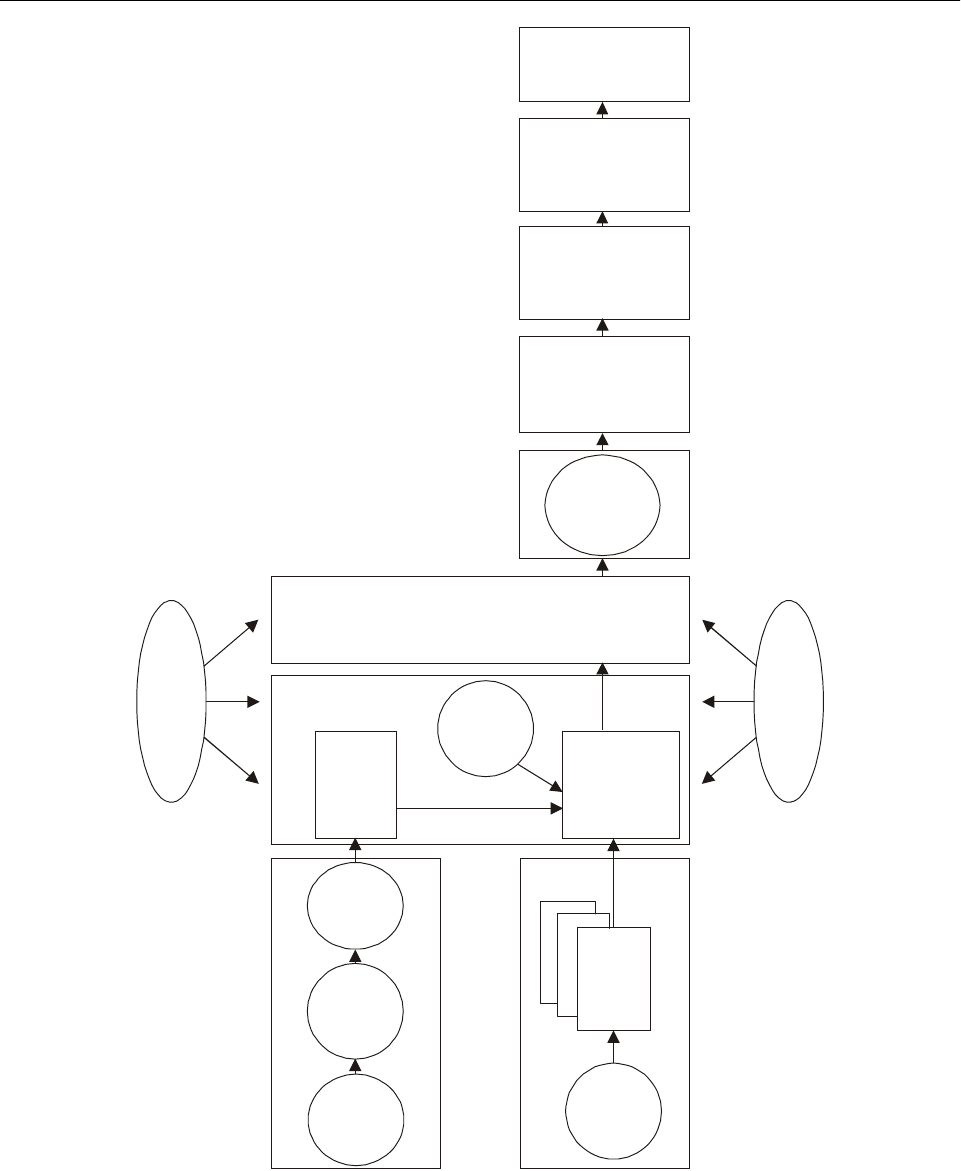
II-2-2 Global Air Navigation Plan for CNS/ATM Systems
Figure II-2-1. Approach to planning for CNS/ATM systems on the basis of homogeneous ATM
areas and/or major international traffic flows
Implement
CNS/ATM
systems
Establish a
framework to
interface with
CNS/ATM
partners
Determine
means and
methods of
cost-recovery
Examine the
possibilities of
funding
Prepare a
detailed
implementation
plan report
List
the current
infrastructure
Evaluate
current system
CNS
ATM
Regional
planning and
implementation
group
Identify
homogeneous
ATM areas and/
or international
traffic flows
List ICAO
regions/FIRs/
States
Carry out
air traffic
forecasts
Iterations
Analyse
benefits/
improvements
Determine ATM
objectives/
establish
corresponding
CNS facilities
Scenarios
Ascertain
airspace user
needs

Part II. Facilities and Services for the Implementation of the Global Plan
Chapter 2. Regional Planning and Implementation II-2-3
specific ATM plan should be developed. During the process,
the specific needs of the users and service providers should
be taken into account.
2.6 Subsequent to the development of ATM plans,
ATM objectives and CNS requirements should be deter-
mined. After an analysis, decisions on technical and
operational systems implementation time lines should be
reflected in regional implementation tables and in the tables
of Part II of the Global Plan.
2.7 Priorities should be established in terms of time-
scales and in response to identified constraints and the
requirements of States as to the systems and areas of
applicability whereby the most immediate benefits could be
provided or where early implementation may be most
likely. The planning methodology in 3.15 of Part I of the
Global Plan provides a step-by-step approach for PIRGs to
follow. The establishment of milestones should take into
account the following key events relative to each system:
a) completion of pertinent tasks by relevant ICAO
groups, including the adoption of SARPs;
b) adoption of relevant avionics Standards;
c) completion of relevant research and development,
and application developments;
d) availability of sufficient satellite capacity;
e) availability of avionics;
f) completion of pre-operational trials and the vali-
dation process;
g) availability of suitable procedures;
h) availability of ground infrastructure;
i) completion of training;
j) effective date for mandatory carriage, where appro-
priate; and
k) withdrawal of obsolete systems elements (airborne
and ground).
2.8 The regional CNS/ATM systems plan, when final-
ized, should reflect technical and operational requirements.
To facilitate implementation, regional planning should take
into account each element of the CNS systems (tables of
Chapters 6, 7 and 8 of Part II refer) and relevant objectives
of the ATM as identified in the table in Chapter 4 of Part II.
REGIONAL OFFICES AND THEIR
ASSOCIATED PLANNING AND IMPLEMENTATION
REGIONAL GROUPS (PIRGs)
ICAO Bangkok — ASIA/PAC Air Navigation Planning and
Implementation Regional Group (APANPIRG)
ICAO Cairo — Middle East Air Navigation Planning and
Implementation Regional Group (MIDANPIRG)
ICAO Lima/Mexico — CAR/SAM Regional Planning and
Implementation Group (GREPECAS)
ICAO Mexico — North American Planning Group
(NAMPG)
ICAO Dakar/Nairobi — AFI Planning and Implementation
Regional Group (APIRG)
ICAO Paris — North Atlantic Systems Planning Group
(NAT SPG); European Air Navigation Planning Group
(EANPG)
REGIONAL PLANNING GROUPS AND THEIR
AREAS OF RESPONSIBILITY
Asia/Pacific Air Navigation Planning and
Implementation Regional Group (APANPIRG)
Chairman of APANPIRG: Mr. H.S. Khola (India)
Secretary: Mr. L.B. Shah (ICAO Regional Director,
Bangkok)
Chairman of CNS/ATM IC Subgroup: Rodney Bracefield
(New Zealand)
2.9 The ICAO Council established the APANPIRG in
1991. Its membership consists of fifteen States: Australia,
Bangladesh, China, Fiji, France, India, Indonesia, Japan,
Malaysia, New Zealand, Pakistan, the Republic of Korea,
Singapore, Thailand and the United States. The CNS/ATM
Subgroup was set up in the same year to produce the
CNS/ATM plan for the ASIA/PAC Regions. The broad plan

II-2-4 Global Air Navigation Plan for CNS/ATM Systems
was produced in 1994 and contains traffic forecasts, a
description of the CNS/ATM system, transition guidelines,
trials and developments and an implementation summary.
The plan is updated annually to keep pace with the progress
of developments.
2.10 In 1994, the CNS/ATM Subgroup was re-formed
to become the CNS/ATM Implementation Coordination
Subgroup in order to emphasize that implementation was
being carried out and was being coordinated on a regional
basis.
Middle East Air Navigation Planning and
Implementation Regional Group (MIDANPIRG)
Chairman of MIDANPIRG: Mr. A. Al-Harthy (Oman)
Secretary: Mr. A. Zerhouni (ICAO Regional Director,
Cairo)
Chairman of CNS/ATM Subgroup: Mr. M. Al Alawi (Saudi
Arabia)
2.11 The ICAO Council established the MIDANPIRG
in 1993. Its membership is drawn from Bahrain, Egypt, Iran
(Islamic Republic of), Jordan, Lebanon, Oman, Saudi
Arabia and the United Arab Emirates.
2.12 MIDANPIRG was tasked with ensuring the
continuous and coherent development of the Middle East
Regional Air Navigation Plan as a whole and in relation to
those of adjacent regions.
2.13 The first meeting of the CNS/ATM Subgroup,
established to structure the planning and implementation of
CNS/ATM systems within the Middle East Region, was
held in January 1995. In 1997, the group developed a draft
regional plan for CNS/ATM systems. The MIDANPIRG, in
September 2000, adopted the first edition (2000) of the
CNS/ATM implementation plan for the MID region, which
will be subject to ongoing updates.
Africa-Indian Ocean Planning and
Implementation Regional Group (APIRG)
Chairman of APIRG: Mr. Mohamed Cherif (Tunisia)
Secretary: Mr. A. Cheiffou (ICAO Regional Director, Dakar)
Chairman of CNS/ATM/Implementation Coordination Sub-
group: Mr. G. Elefteriou (Côte d’Ivoire)
2.14 The APIRG was set up by the ICAO Council in
1980. This group is composed of members from States in
the Africa-Indian Ocean Region, ensuring a balanced
representation of the region as a whole. The current
membership (twenty-nine Member States) of APIRG
includes Angola, Algeria, Cameroon, Congo, Côte d’Ivoire,
Democratic Republic of the Congo, Egypt, Eritrea, Ethiopia,
France, Gabon, Ghana, Guinea, Kenya, Lesotho, Malawi
(also representing Zimbabwe), Mali, Mauritania, Morocco,
Niger, Nigeria, Senegal (also representing Gambia), South
Africa, Spain, Togo, Tunisia, Uganda, United Republic of
Tanzania and Zambia, and three international organizations.
2.15 The Africa-Indian Ocean implementation plan
for CNS/ATM systems, as developed by the CNS/ATM
Subgroup, was adopted by APIRG at its tenth meeting, held
in June 1996, and was endorsed by the Seventh Africa-
Indian Ocean Regional Air Navigation Meeting (AFI/7),
held in Abuja, Nigeria, in May 1997. This implementation
plan is being reviewed and updated periodically by APIRG,
based on input from States and international organizations.
North Atlantic Systems
Planning Group (NAT SPG)
Co-chairpersons of NAT SPG: Vacant
Secretary: Mr. C. Eigl (ICAO Regional Director, Paris)
CNS/ATM Subgroup: No subgroup at this time (fully
integrated into NAT SPG)
2.16 The ICAO Council established the NAT SPG in
1965 as the first regional planning group covering the North
Atlantic Region. Canada, Denmark, France, Iceland,
Ireland, Norway, Portugal, the United Kingdom and the
United States are members, while the Russian Federation,
Spain, the International Mobile Satellite Organization
(Inmarsat) and several international associations and
organizations are observers.
2.17 In 1992, the group was tasked with developing
proposals for CNS/ATM systems implementation, as well
as proposals for institutional arrangements. In 1994, the
North Atlantic Implementation Management Group (NAT
IMG) was created to coordinate and manage — on behalf
of the NAT SPG — the North Atlantic implementation
plan.
2.18 The NAT IMG has taken a number of important
initiatives since its creation. These include a cost-

Part II. Facilities and Services for the Implementation of the Global Plan
Chapter 2. Regional Planning and Implementation II-2-5
effectiveness programme, the establishment of a project
coordination office and, on 27 March 1997, the introduction
of reduced vertical separation minima (RVSM).
North American Planning Group (NAMPG)
Co-chairpersons of Group:
Mr. Ken Moody (Canada)
Mr. Jaime Zapiain (Mexico)
Ms. Carey Fagan (United States)
Secretary: Mr. R. Ybarra (ICAO Regional Director, Mexico)
2.19 In 1994, the Directors of Civil Aviation of
Canada, Mexico and the United States agreed to form the
North American Planning Group, comprised of these three
States, which was established under the auspices of the
North American Free Trade Agreement (NAFTA). This
group serves as the focal point for the planning and
implementation of CNS/ATM systems in the North
American Region. Although Mexico is geographically
located in the ICAO Caribbean Region, the Directors of
Civil Aviation of all three States agreed that, because of
common borders, Mexico is more homogeneous, consistent
and coherent with the North American Region. Mexico’s
CNS/ATM plans are also included in the GREPECAS
planning process. The ICAO NACC Office provides the
necessary coordination support for the group.
2.20 The group formulated the CNS/ATM systems
plan for the region at its first meeting, held in June 1995.
The plan has been reviewed and updated annually and in
February 1999, the plan was reformatted using the ICAO
Global Plan as the model. The plan now includes the Gulf
of Mexico airspace as a homogeneous area and was sub-
mitted to ICAO in April 1999 for consideration. The
nomination of Canada’s Northern and Arctic Domestic
Airspace as a homogeneous ATM area is also under con-
sideration by Canada. In 2001, the group plans to update
the North American Air Navigation Plan and submit a
proposal for amendment.
2.21 The United States Federal Aviation Admini-
stration (FAA) formed the Gulf of Mexico Work Group
(GOMWG) in early 1999 to address capacity limitations
and to improve safety in the Gulf of Mexico airspace.
2.22 The GOMWG is co-chaired by the United States
(FAA), Mexico (SENEAM) and the Air Transport
Association (ATA). The work group is supported by a
steering committee and two subgroups. The Steering Com-
mittee provides technical support and guidance to the entire
body. The Communications, Navigation, Surveillance,
Weather and Automation Subgroup (CNSWA) focuses on
recommending solutions that address communications,
navigation, surveillance, weather collection and distribution,
and automation shortcomings. The Airspace and Procedures
Subgroup seeks to recommend solutions that involve
airspace allocation and procedural issues.
Caribbean/South American Regional Planning and
Implementation Group (GREPECAS)
Chairman of GREPECAS: Mr. J.P. Sánchez Dañino
(Mexico)
Secretary: Mr. Raymond Ybarra (ICAO Regional Director,
Mexico)
Chairman of ATM/CNS Subgroup: To be determined
2.23 The ICAO Council established the GREPECAS
in 1990. As a result of the great emphasis placed on
activities related to CNS/ATM systems, the CNS/ATM
Subgroup was formed. This subgroup proceeded to develop
a regional implementation plan, which was approved by
GREPECAS at its sixth meeting, held in 1996. At the same
time, the subgroup was re-formed to become the CNS/ATM
Implementation Coordination Subgroup, which developed
an action plan for the implementation of CNS/ATM sys-
tems. During the GREPECAS/9 Meeting (August 2000) a
restructuring of GREPECAS was made by which means the
CNS/ATM Subgroup was disbanded, creating instead the
ATM/CNS Subgroup, composed of the ATM and CNS
Committees, which will have as an objective, among others,
to promote and follow up the implementation of the
CNS/ATM system required in the CAR/SAM ANP.
2.24 The membership of GREPECAS comprises
Antigua and Barbuda (representing Dominica, Grenada,
Saint Kitts and Nevis, Saint Lucia, and Saint Vincent and
the Grenadines), Argentina, Barbados, Brazil, Chile,
Colombia, Costa Rica, Cuba, Ecuador (in rotation with
Panama, Guyana and Suriname every two years), France,
Mexico, Paraguay (in rotation with Bolivia and Uruguay
every two years), Peru, Trinidad and Tobago, the United
Kingdom, the United States and Venezuela.
European Air Navigation
Planning Group (EANPG)
Chairman of EANPG: Mr. Karsten Theil (Denmark)

II-2-6 Global Air Navigation Plan for CNS/ATM Systems
Secretary: Mr. C. Eigl (ICAO Regional Director, Paris)
CNS/ATM Subgroup: Established by EANPG/42 (4 to
7 December 2000)
2.25 The ICAO Council established the EANPG in
1972. In order to meet the new challenges, the EANPG
Programme Coordination Group (COG) was created in
1995 to assist the EANPG Chairman and the ICAO
Secretariat in facilitating and coordinating the work of the
EANPG between meetings, thus maintaining a dialogue
with other regions and avoiding duplication of work. The
EANPG directly monitors progress made with the
implementation of CNS/ATM systems in the European
Region.
2.26 The EANPG is comprised of representatives
from Baltic States (Estonia, Latvia and Lithuania),
Belarus, Benelux States (Belgium, Luxembourg and the
Netherlands), Caucasian States (Armenia, Azerbaijan and
Georgia), Central Asian States (Kazakhstan, Krygyzstan,
Tajikistan, Turkmenistan and Uzbekistan), Croatia (also on
behalf of the former Yugoslav Republic of Macedonia),
the Czech Republic, Finland, France, Germany (also
representing Austria), Greece, Italy, Portugal, the Russian
Federation, Scandinavian States (Denmark, Norway and
Sweden), Spain, Switzerland, Turkey, Ukraine and the
United Kingdom.
CURRENT STATUS OF PLANNING AND
IMPLEMENTATION OF CNS/ATM SYSTEMS
ASIA/PAC Air Navigation Planning and
Implementation Regional Group (APANPIRG)
Air traffic management — current status
and regional strategy
2.27 The present ATM system in the Asia/Pacific
Regions suffers from the following shortcomings:
a) lack of surveillance facilities over large areas of the
regions which require relief from congestion;
b) air-route availability constrained by point-source-
navigation-aids resulting in choke-points;
c) dissimilar ATS procedures and separation standards
causing flight information region (FIR) boundary
changes to flight profiles;
d) the uncoordinated provision of present CNS
systems resulting in duplication of resources and
services;
e) a lack of appropriate parallel ATS route structures
that relieve route congestion; and
f) poor-quality communications facilities and language
difficulties.
2.28 Adequate surveillance, appropriate parallel ATS
route structures, and optimum flight profiles are required in
order to overcome the present limitations and to better cope
with growth. Language difficulties and coordination pro-
cedure problems can be largely resolved by automated data
processes. Efficient coordination between adjacent FIRs,
and common navigation standards and procedures are also
essential to ensure a transparent transfer of ATS responsi-
bility. Due to the large oceanic areas of the Asia/Pacific
Regions, only satellite technology can efficiently provide
the necessary seamless and flexible regional interface
necessary.
General remarks
2.29 As new CNS systems provide for closer inter-
action between ground systems and airspace users before
and during flight, improvements to ATM will permit more
flexible and efficient use of the airspace and will enhance
traffic safety and regularity of flight. ATM may be viewed
as the principal beneficiary of the CNS improvements, i.e.
it is the resultant benefits to ATM that constitute the
rationale for incurring the costs of CNS improvements. In
turn, improvements in ATM will ultimately benefit all
airspace users.
2.30 The following changes in ATM are envisaged in
the Asia/Pacific Regions and are to be supported by future
CNS systems:
a) improved handling and transfer of information
between operators, aircraft, and ATS units;
b) extended surveillance by using aircraft positions
derived from airborne systems (i.e. automatic
dependent surveillance);
c) advanced ground-based data processing systems,
allowing for:
1) the ability to take advantage of the navigation
accuracy, in four dimensions, of modern aircraft;

Part II. Facilities and Services for the Implementation of the Global Plan
Chapter 2. Regional Planning and Implementation II-2-7
2) improved accommodation of user-preferred
flight profiles in all phases of flight, based on
the operator’s objectives; and
3) improvement in conflict detection and resol-
ution, automated generation and transition of
conflict-free clearances and rapid adaptation to
changing traffic conditions;
d) these three aims of development, together with
improved planning, will allow more dynamic air-
space and ATM, particularly in high-density
airspace.
Communications — current status
and regional strategy
2.31 The Asia/Pacific Regions are characterized by
the use of:
a) data and voice communications for direct satellite/
aircraft links in some parts of the regions. High
frequency (HF) voice is being maintained during
the transition period;
b) very high frequency (VHF) for voice and data
communications in many continental and terminal
areas;
c) SSR Mode S data link, in the near future, in some
parts of the regions for air traffic services (ATS)
purposes in some high-density airspace; and
d) ATN, in the future, for the interchange of digital
data over dissimilar ground-to-ground and air-
ground communications links between end systems.
General remarks
2.32 The Asia/Pacific Regions contain large expanses
of ocean where the CNS systems, which could be used, are
severely limited. Thus, air-ground communications have
been limited to high frequency (HF), often with the need
for intermediate communicators. Surveillance has been
limited to pilot reports of position via HF communications.
These limitations have resulted in the large separations that
apply in oceanic airspace. For these reasons, the
Asia/Pacific Regions have been quick to embrace the new
CNS/ATM systems, particularly controller-pilot data link
communications (CPDLC) and automatic dependent
surveillance (ADS).
Navigation — current status
and regional strategy
2.33 The Asia/Pacific Regions are characterized by the:
a) progressive introduction of area navigation (RNAV)
capability in compliance with required navigation
performance (RNP) criteria;
b) use of global navigation satellite system(s) (GNSS)
for aircraft navigation;
c) use of instrument landing systems (ILS), GNSS and
microwave landing systems (MLS) for approach
and landing guidance systems in accordance with
the regional strategy adopted by APANPIRG; and
d) progressive withdrawal of current navigation aids
(NDB, VOR, DME).
Surveillance — current status
and regional strategy
2.34 The Asia/Pacific Regions are characterized by:
a) the use of SSR Mode A, C and, in the near future,
Mode S in some terminal areas and high-density
continental airspace;
b) the use of ADS in some parts of the regions; and
c) the diminishing use of primary radar.
Middle East Air Navigation Planning and
Implementation Regional Group (MIDANPIRG)
Air traffic management — current status
and regional strategy
2.35 While there are some remote and less developed
areas without radar coverage, the MID Region is, in
general, well covered by radar. Current air traffic control
procedures are therefore mostly based on the use of radar
control. There are a small number of fixed RNAV routes in
the region. On the majority of routes outside radar coverage
within the region, 10 minutes longitudinal separation is
applied.
2.36 The CNS/ATM Subgroup has determined the
major traffic flows and divided the region into two

II-2-8 Global Air Navigation Plan for CNS/ATM Systems
geographic areas based on these traffic flows. The determi-
nation of the overall ATM objectives is ongoing. Regional
timescales for the introduction of the various ATM
elements of the overall CNS/ATM system have, never-
theless, been produced. The CNS/ATM Subgroup has also
established a task force to examine the introduction of RNP
and RNAV routes in more detail. Because the development
of ATM objectives is not yet complete, and the plans for
introductions of RNP and RNAV routes are not finalized,
the current timescales could be subject to change as the
development work continues.
Communications — current status
and regional strategy
2.37 At present, air-ground communications in the
region are provided by VHF voice. However, in some parts
of the region, air-ground communications are limited to HF.
In ground-to-ground communications, the existing low-
speed aeronautical fixed telecommunication network
(AFTN) system in some parts of the region is not capable
of fully supporting the efficient exchange of data required
by the present ATS system. Furthermore, ground-ground
communications between area control centres (ACCs) are
adversely affected by the lack of full implementation of
direct-speech circuits.
2.38 Very high frequency (VHF) will remain in use for
air-ground voice and data communications in most contin-
ental and terminal areas. The SSR Mode S data link will be
used for ATS purposes in high-density airspace. The aero-
nautical telecommunication network (ATN) will provide the
interchange of digital packet data between end-users over
various air-ground communications subnetworks.
Navigation — current status
and regional strategy
2.39 The present infrastructure of NAVAIDs within
the MID Region is considered adequate to service the
foreseeable navigation requirements of the region.
2.40 RNAV capability, in compliance with RNP
criteria, will be progressively introduced. GNSS will pro-
vide worldwide coverage and will be used for aircraft
navigation and for non-precision-type approaches and, with
appropriate augmentation, for Category I approaches.
Surveillance — current status
and regional strategy
2.41 Radar coverage in the Middle East is available in
most areas, but not in all areas where it is necessary for the
provision of efficient ATC and where its provision would
be physically possible. For some oceanic or remote areas,
surveillance is still limited to pilot reports of position via
HF communications resulting in the application of large
separation minima.
2.42 In the future, SSR Modes A/C will be used in
terminal areas and high-density continental airspace. ADS
will be used over oceans/continental airspace and possibly
as a back-up to SSR in high-density traffic areas. The use
of primary radar will diminish.
AFI Planning and Implementation
Regional Group (APIRG)
Air traffic management — current status
and regional strategies
2.43 In accordance with the guiding principles
adopted in the AFI CNS/ATM Implementation Plan
(Doc 003), the implementation of CNS/ATM in the region
is gaining momentum. Fully conscious of the implemen-
tation goals and strategies of the global ATM, the APIRG
and its relevant subgroups (ATS, CNS/ATM and COM
Subgroups) have already laid down the necessary frame-
work for the evolutionary implementation of CNS/ATM in
the region. The implementation strategy is aimed at taking
advantage, in a timely manner, of those individual elements
of the CNS/ATM systems for which positive benefits have
been identified. Since effective implementation of the
CNS/ATM Plan will be highly dependent on Human
Factors (man-machine interface), the need to maintain
quality assurance/proficiency checks for ATS personnel has
been identified.
2.44 However, there are many shortcomings and
deficiencies in the region, which impede the smooth
transition towards new systems; consequently substantial
resources are dedicated to the elimination of these inad-
equacies. The major challenge still remains in the field of
communications; although significant improvements have
been noted through the use of VSAT technology, reliable
means of communications (HF, VHF and ATS/DS) and
proper coordination still remain a major requirement in the
region.
2.45 The implementation coordination groups (ICGs)
which have been established for the 10 homogeneous areas
of routing (AR-1 to AR-10) based on traffic affinities have
already met on various occasions, and implementation is
being carried out in a coordinated and coherent manner.

Part II. Facilities and Services for the Implementation of the Global Plan
Chapter 2. Regional Planning and Implementation II-2-9
2.46 Emphasis is being put on the implementation of
the following elements:
— reduction of longitudinal separation to 10 minutes;
— implementation of RNP 10 and RNP 5 along major
traffic flows;
— implementation of random routing areas;
— planning for the implementation of reduced vertical
separation minimum between FL 290 and 410
inclusive;
— progressive introduction of ATC automation;
— reduction of lateral separation from 100 NM to 50
(in RNP 10 environment) and eventually to 30 NM
(in RNP 4 environment) in selected airspace;
— progressive introduction of longitudinal RNAV/RNP
separation minima of 10 minutes and/or 80 NM
RNAV-derived distance, in selected airspace from
2001 onwards;
— progressive introduction of automatic dependent
surveillance (ADS) in selected airspace from 2000
onwards; and
— completion of implementation of WGS-84-based
coordinates to be pursued as a matter of high
priority to facilitate introduction of GNSS.
2.47 The need for inter-regional cooperation for the
harmonization of systems and procedures cannot be
over-emphasized.
Airspace management
2.48 In fostering the implementation of the CNS/ATM
Plan, the concept of a cooperative approach to airspace
management has been emphasized. Several regional bodies
have already agreed to establish a common upper airspace
ATM system in their areas.
Communications — current status
and regional strategy
2.49 Aeronautical mobile service (AMS) is mainly
provided by HF voice within most of the FIRs, and by VHF
voice within terminal areas. Efforts will continue on the
implementation of remote and extended range VHF.
2.50 The aeronautical fixed telecommunication net-
work (AFTN) is characterized by analog and low-speed
circuits which do not meet the requirements for efficient
support of data exchange in the present ATS system.
ATS/DS communications between ATS units are also
adversely affected by shortcomings and deficiencies. In an
endeavour to remedy this situation, full implementation of
the AFS plans and the upgrade of AFTN circuits are being
pursued vigorously. The transition to the ATN will be
initiated by migrating to the ATS Message Handling
System (AMHS).
2.51 Very high frequency (VHF) voice will remain the
main form of pilot-controller communications throughout
the region within the time frame envisaged in the first stage
of the CNS/ATM implementation plan. Meanwhile, the
early introduction of data link communications is supported
and encouraged with the initial main objective of reducing
air-to-ground communications workload.
Navigation — current status
and regional strategy
2.52 Since the present infrastructure of navigational
aids is not considered adequate to service the foreseeable
navigation requirements of the AFI Region, RNAV
capability, in compliance with RNP criteria, will be
progressively introduced.
2.53 Terminal areas. As a general principle, navi-
gation facilities in TMAs must allow for navigation during
departure, holding and approach with the required degree of
accuracy. For the time frame encompassed by the first
stage, the standard navigation aid in TMAs is envisaged to
remain the VOR/DME. GNSS may initially be used as
supplemental navigation means in the TMAs. NDBs may
continue to be used in TMAs on a case-by-case basis when
there is an agreed requirement.
2.54 En route. VOR will continue to be the agreed
en-route navigation aid in the AFI Region along conven-
tional ATS routes. In case a requirement exists for a new
route or for a higher level of navigation performance along
an existing route, primary consideration should be given to
meeting the requirement by the implementation of an
RNAV route. NDBs will not normally be provided for
en-route navigation unless there is an operational require-
ment which cannot be satisfied by any other means. GNSS

II-2-10 Global Air Navigation Plan for CNS/ATM Systems
will be used as a supplemental en-route navigation means
and as the primary en-route means in designated airspace.
Surveillance — current status
and regional strategy
2.55 Since radar has not been a requirement in the
region, the present surveillance system is characterized by
very limited radar coverage in most of the FIRs. In fact, the
surveillance system is mainly procedural-based, i.e. limited
to pilot reports of position via HF communications, resulting
in the application of large separation minima.
2.56 Terminal areas. Secondary surveillance radar
(SSR) should be used within busy TMAs meeting criteria
defined by APIRG. Primary radar may continue to be used
in those TMAs where there is a mix of transponder-
equipped and non-transponder-equipped aircraft and the
number of non-transponder-equipped aircraft is sufficiently
large to justify the requirement. ADS may be introduced,
initially on a trial basis and eventually in broadcast mode
(ADS-B) which is still under development.
2.57 En-route. En-route surveillance will mostly
continue to be based on present procedural methods, but
with improved pilot-controller communications in terms of
reliability and transit times. This improvement will come
about mostly as a result of enhanced mobile communi-
cations and of the fixed communications between adjacent
ATS centres. Where a requirement for en-route surveillance
has been identified, this shall rely essentially on SSR, and
on ADS particularly for low-density, remote and oceanic
airspace outside SSR coverage. There is no requirement for
primary radar for en-route surveillance in the region. Those
already in place should be progressively phased out.
European Air Navigation
Planning Group (EANPG)
2.58 The regional strategy for planning and
implementation of CNS/ATM systems in the European
Region is carried out by the European Air Navigation
Planning Group (EANPG) through the management of the
European Air Navigation Plan. This planning applies to a
large number of States (49), covering an area which extends
from the North Atlantic Region to the Asia/Pacific Regions.
2.59 The geographic characteristics and density of air
traffic vary considerably across the region. For this reason,
the Special European Regional Air Navigation Meeting
(SP EUR RAN, Vienna, September 1994) agreed that,
considering the complexity and diversity of the region, air
navigation planning could best be achieved if it was
organized in homogeneous areas of common requirements
and interests, taking into account traffic density and the
level of sophistication required.
2.60 For the above reasons, the western part of the
region, an area of high traffic density, has seen its planning
and implementation deeply influenced by the collective
actions of States under the umbrella of the European
Organisation for the Safety of Air Navigation
(EUROCONTROL), whilst other States of the region
(mainly States of the former Soviet Union) are assisted more
directly by ICAO in their planning efforts. In addition, other
State groupings such as the European Civil Aviation
Conference (ECAC), the Joint Aviation Authorities (JAA)
and others are also involved in air navigation planning,
within their respective geographical coverage areas and
under their own remits. However, coordination of planning
activities is required by the EANPG in order to ensure that
they all remain within the framework of the Global Plan,
whilst respecting the integrity and compatibility of
CNS/ATM systems among each other.
2.61 The ICAO European Regional planning
machinery and the depth of its involvement in im-
plementation and coordination aspects has evolved much
further than required by the Chicago Convention. ICAO,
at the regional level, has always provided a forum for
States in which purely air navigation planning was
combined with, and expanded to include, detailed
implementation planning.
2.62 With respect to the remaining part of the region,
work is in progress through the Group for Air Traffic
Management in the Eastern part of the ICAO EUR Region,
including Middle Asia (GATE) a subgroup of EANPG, to
keep pace with developments and to ensure coherent
planning and implementation of CNS/ATM systems, taking
into account the interfaces between subregions and other
ICAO regions.
2.63 Planning of a number of air navigation domains
for the western part of the region was progressed through
the European Air Traffic Control Harmonization and
Integration Programme (EATCHIP) and its successor, the
European Air Traffic Management Programme (EATMP),
managed by EUROCONTROL. Details pertinent to the
harmonization and integration process applicable to ECAC
States are contained in the Convergence and Implemen-
tation (CIP) Document of EUROCONTROL. (Time lines

Part II. Facilities and Services for the Implementation of the Global Plan
Chapter 2. Regional Planning and Implementation II-2-11
indicated in the templates represent system implementation
forecast information based on the CIP and/or information
available to the Secretariat).
Air traffic management — current status
and regional strategy
2.64 Present ATM systems in the European Region
suffer shortcomings which include:
a) a non-effective use of EUR Region airspace, not
sufficiently flexible and constrained by national
boundaries;
b) in some areas of the EUR Region, and particularly
in the “core area”, despite efforts made by States
through national measures and EATCHIP, ATC
systems are reaching their capacity limits, causing
an unacceptable number and level of delays;
c) in other parts of the EUR Region, although the need
for more capacity is less acute throughout the
region, the lack of a seamless approach to en-route
and airport operations continues to prevent the
optimization of resources;
d) lack of surveillance facilities mainly over large
areas in the eastern part of the EUR Region;
e) dissimilar ATS procedures and separation standards
causing flight information region (FIR) boundary
changes to flight profiles;
f) the under-coordinated provision of present CNS
systems resulting in duplication of resources and
services;
g) poor-quality communications facilities and language
difficulties in the eastern part of the region.
2.65 To overcome the present limitations and cope
with growth, overall surveillance, appropriate ATS route
structures and optimum flight profiles are required.
Language difficulties and coordination procedure problems
can be largely resolved by automated data processes.
Efficient coordination between adjacent FIRs and common
navigation standards and procedures are also essential to
ensure that a transparent transfer of ATS responsibility is
provided.
General remarks
2.66 As new CNS systems will provide for closer
interaction between ground systems and airspace users
before and during flight, improvements to ATM will permit
a more flexible and efficient use of the airspace and will
enhance traffic safety and regularity of flight. ATM may be
viewed as the principal beneficiary of CNS improvements,
i.e. it is the resultant benefits to ATM which constitute the
rationale for incurring the costs of CNS improvements. In
turn, improvements in ATM will ultimately benefit all
airspace users.
2.67 The goals for the future ATM system can be
summarized as follows:
a) maintenance of or increase in the existing level of
safety;
b) increased system capacity and full utilization of
capacity resources as required to meet traffic
demand;
c) dynamic accommodation of user-preferred four-
dimensional flight trajectories;
d) accommodation of full-range aircraft types and
airborne capabilities;
e) improved provision of information to users, such as
weather conditions, traffic situation and availability
of facilities;
f) improved navigation and landing capabilities to
support advanced approach and departure
procedures;
g) increased user involvement in ATM decision-
making including air-ground computer dialogue for
flight negotiation;
h) creation, to the maximum extent possible, of a
single continuum of airspace, where boundaries are
transparent to users;
i) organization of airspace in accordance with ATM
provisions and procedures;
j) minimization of airborne delays and holding,
coupled with adjustment of flight-track schedules to
achieve efficient traffic flows as well as efficient
airspace and airport usage; and
k) improved ATS strategic planning to minimize future
aircraft conflict and tactical conflict-resolution
manoeuvring by the ATS system.

II-2-12 Global Air Navigation Plan for CNS/ATM Systems
2.68 The following directions of change in ATM are
envisaged in the European Region and are to be supported
by future CNS systems:
a) improved handling and transfer of information
between operators, aircraft and ATS units;
b) extended surveillance by using aircraft positions
derived from airborne systems (i.e. automatic
dependent surveillance);
c) advanced ground-based data processing systems,
allowing for:
1) the ability to take advantage of the navigation
accuracy, in four dimensions, of modern aircraft;
2) improved accommodation of user-preferred
flight profiles in all phases of flight, based on
the operator’s objectives; and
3) improvement in conflict detection and resol-
ution, automated generation and transition of
conflict-free clearances and rapid adaptation to
changing traffic conditions;
These three aims of development, together with improved
planning, will allow more dynamic airspace and ATM,
particularly in high-density airspace.
2.69 A comprehensive assessment and analysis of the
characteristics and the capabilities of the present system
and of their implementation in various parts of the world
ascertained that the shortcomings of the present CNS
systems amount to essentially three factors:
a) the propagation limitations of current line-of-sight
systems and/or accuracy and reliability limitations
imposed by the variability of propagation charac-
teristics of other systems;
b) the difficulty, caused by a variety of reasons, to
implement present CNS systems and operate them
in a consistent manner in large parts of the world;
and
c) the limitations of voice communications and the
lack of digital air-ground data interchange systems
to support automated systems in the air and on the
ground.
2.70 The limitations summarized in 2.69 are intrinsic
to the systems themselves. Although their effects are not
the same for every part of the world, it is evident that one
or more of these factors inhibits the further development of
air navigation almost everywhere. New CNS systems
should surmount these limitations to allow ATM, on a
global scale, to evolve and become more responsive to
users’ needs.
2.71 The present ground communications system, the
aeronautical fixed telecommunication network (AFTN), is
limited in throughput, data integrity, and the ability to
handle bit-oriented message and data exchanges. The
communications path will evolve to full aeronautical tele-
communication network (ATN) capability through the
deployment of ATN ground-ground routers. The ATN
ground-ground router capability will be used to establish
ATN routing domains. By implementing AFTN/ATN gate-
ways over the ATN (bit-oriented) networks interconnected
by ATN ground-ground routers, ground communications
system resolves the shortcomings of AFTN, and will finally
evolve into the ATS Message Handling System (AMHS).
Some ground ATN networks are used for the ground
portion of air-ground data interchange by deploying ATN
air-ground router situated at the ground end of air-ground
data link, connected to ground network and exclusively
used for air-ground data interchanges.
2.72 On-going projects:
Communications — current status
and regional strategy
2.73 The European Region is characterized by the use
of:
a) very high frequency (VHF) for voice and data
communications in many continental and terminal
areas; a shortage in the number of available VHF
frequencies imposed the implementation of the
EUROCONTROL “8.33 kHz Channel Spacing
Project” in the so-called European core area;
Project Organization
ACAS — Airborne collision
avoidance system
EUROCONTROL
RVSM — Reduced vertical
separation minimum in Europe
ICAO EUR/NAT
+ EUROCONTROL
URD — ATM user
requirement document
EUROCONTROL

Part II. Facilities and Services for the Implementation of the Global Plan
Chapter 2. Regional Planning and Implementation II-2-13
b) data and voice communications for direct satellite/
aircraft links in some parts of the region;
c) SSR Mode S data link, in the near future, in some
parts of the region for air traffic services (ATS)
purposes in some high-density airspace; and
d) ATN, in the future, for the interchange of digital
data over dissimilar ground-to-ground and air-
ground communication links between end systems.
2.74 The users of end systems include aircrew, air
traffic controllers, aircraft operators, and others. The ATN,
which is based on the International Organization for
Standardization (ISO) open systems interconnection (OSI)
reference model, will provide the inter-networking of
aeronautical “subnetworks” in OSI terminology. User
access to the ATN is via one or more subnetworks, which
are connected by ATN routers. ATN routers may be either
mobile (aircraft) or fixed (ground-based). The ATN router
selects a path via aeronautical subnetworks based on
user-specified communications parameters and subnetwork
availability. This action is transparent to the end systems
user who, therefore, does not need to know the area of
coverage of particular subnetworks nor to change com-
munications procedures depending upon the subnetworks in
use.
2.75 An opportunity offered to enable early use of
current technology by the application of ARINC Specifi-
cation 622 over character-based data communications
systems such as aircraft communications addressing and
reporting system (ACARS) may provide for significant
benefits in ATM. Several States are proceeding with
implementation of ATS ground facilities that take early
advantage of aircraft CNS packages, both of which are
based on the ARINC Specification 622. The implemen-
tation plans recognize that eventual transition to the ATN is
an objective and that ARINC Specification 622 is an
interim step designed to gain early CNS/ATM benefits from
existing technology.
General remarks
2.76 The European Region contains large expanses of
sparsely populated, low traffic density continental area
(Russian Federation) where the CNS systems which could
be used are severely limited. Thus air-ground communi-
cations have been limited to high frequency (HF), often
with the need for intermediate communicators. Surveillance
has been limited to pilot reports of position via HF
communications. These limitations have resulted in the
large separations. For these reasons that area has been quick
to embrace the new CNS/ATM systems, particularly
controller-pilot data link communications (CPDLC) and
automatic dependent surveillance (ADS).
2.77 On-going projects:
Navigation — current status
and regional strategy
2.78 The European Region is characterized by:
a) the progressive expansion of area navigation
(RNAV) in conjunction with the ICAO required
navigation performance (RNP) Standards; B-RNAV
(RNP 5) was introduced starting in January 1998 in
the entire ATS route network in the ECAC area;
b) in addition to RNAV and INS, the use of global
navigation satellite system(s) (GNSS) for aircraft
navigation;
c) WGS-84 implementation in large areas of the EUR
Region; implementation in the whole area is
ongoing;
d) the use of instrument landing systems (ILS) and a
limited number of microwave landing systems
(MLS) for approach and landing in accordance with
the ICAO strategy; and
Project Organization
ODIAC — Operational
requirements for ATM air-ground
data communications services
EUROCONTROL
Link 2000+ — Implementation of
operational air-ground data link
services in Europe (VDL Mode 2
and ATN)
EUROCONTROL
ASTERIX — All-purpose structured
EUROCONTROL radar information
exchange
EUROCONTROL
8.33 kHz — 8.33 kHz channel
spacing
ICAO EUR/NAT
+ EUROCONTROL
PETAL II — Preliminary
EUROCONTROL test of air-ground
data link
EUROCONTROL
WACS — Wireless airport
communications system
EUROCONTROL
MODE-S EUROCONTROL

II-2-14 Global Air Navigation Plan for CNS/ATM Systems
e) the progressive withdrawal of current navigation
aids (NDB/VOR/DME) in use.
2.79 Aircraft are increasingly being equipped to
utilize RNAV techniques, which is appropriate and inevi-
table because these techniques facilitate a flexible route
system. Therefore, the future navigation system is based
on the availability of airborne RNAV capability. The new
concept called RNP has been developed to complement the
RNAV system. RNP is broadly defined as the maximum
deviation from assigned track within which the aircraft can
be expected to remain with a given degree of probability.
This concept eliminates the need for ICAO selection
between competing navigation systems from the outset;
however, it will not prevent ICAO from dealing with navi-
gation techniques, which are in wide use internationally.
2.80 GNSS systems provide independent navigation,
where the user performs on-board position determination
from information received from broadcast transmissions by
a number of satellites. GNSS provides highly reliable,
highly accurate, high-integrity global coverage indepen-
dently. Although the RNP concept allows for more than one
satellite navigation system to be in use simultaneously,
from an aircraft equipment point of view, maximum inter-
operability is essential as it would significantly simplify
avionics and thereby reduce cost. It would also be attractive
if satellite navigation systems could serve as complemen-
tary to and/or in a back-up role for each other.
2.81 On-going projects:
Surveillance — current status
and regional strategy
2.82 The European Region is characterized by:
a) the use of SSR Modes A and C and, in the near
future, Mode S in some terminal and high-density
continental airspace;
b) the use of ADS in some parts of the region; and
c) the diminishing use of primary radar.
2.83 Automatic dependent surveillance (ADS) is
becoming available over the North Sea and continental
airspace of the Russian Federation. SSR (augmented as
necessary by Mode S) will continue to be used in terminal
areas and in some high-density airspace. The use of
primary radar will diminish.
2.84 The introduction of air-ground data links,
together with sufficiently accurate and reliable aircraft
navigation systems, presents the opportunity to provide
surveillance services in areas which lack such services in
the present infrastructure and in areas where the current
systems prove difficult, uneconomical or even impossible,
to implement. ADS is a function for use by ATS in which
aircraft automatically transmit, via a data link, data derived
from on-board navigation systems. As a minimum, the data
should include the four-dimensional position. Additional
data may be provided as appropriate. The ADS data would
be used by the automated ATC system to present infor-
mation to the controller. In addition to areas which are at
present devoid of traffic position information other than
pilot-provided position reports, ADS will find beneficial
application in other areas, including high-density areas,
where it may serve as an adjunct to and/or back-up for
secondary surveillance radar and thereby reduce the need
for primary radar. Also, in some circumstances, it may even
substitute for secondary radar in the future. As with current
surveillance systems, the full benefit of ADS requires
supporting complementary two-way pilot-controller data
and/or voice communications (voice for at least emergency
and non-routine communications).
2.85 On-going projects:
Project Organization
WGS-84 — World geodetic
system 1984
ICAO EUR/NAT +
EUROCONTROL
B-RNAV — Basic RNAV ICAO EUR/NAT +
EUROCONTROL
P-RNAV — Precision RNAV ICAO EUR/NAT +
EUROCONTROL
EGNOS — European geostationary
navigation overlay service
EU + others
GALILEO — European GNSS
system
EU + others
Project Organization
ARTAS — ATM surveillance
tracker and server system
EUROCONTROL
MODE-S ICAO EUR/NAT +
EUROCONTROL
ADS — Automatic dependent
surveillance
EUROCONTROL
ADS-B — Automatic dependent
surveillance broadcast
Russian Federation

Part II. Facilities and Services for the Implementation of the Global Plan
Chapter 2. Regional Planning and Implementation II-2-15
CNS systems evolution
2.86 The new CNS concept is very flexible in that
each State has the choice of implementing specific system
elements to meet its individual requirement for forming a
complete, operable CNS/ATM system. Thus, the communi-
cations elements can be implemented using any or all
combinations of satellite, VHF or SSR Mode S. States with
high traffic density airspace would probably use all of
these, but small States with continental airspace could
implement the communications aspect of CNS/ATM and
ADS using VHF alone.
CAR/SAM Regional Planning and Implementation
Group (GREPECAS)
Air traffic management — current status
and regional strategy
2.87 The tasks of planning the transition to
CNS/ATM systems in the CAR/SAM Regions and
developing a CNS/ATM Systems Implementation Plan
were delegated to the new ATM/CNS Subgroup of the
GREPECAS that has the responsibility of coordinating and
harmonizing the work of the ATM and CNS Committees
with regard to CNS/ATM matters.
2.88 In spite of the fact that much progress has been
achieved, which has improved the provision of ATS in the
CAR/SAM Regions since the Third CAR/SAM Regional
Air Navigation Meeting (RAN CAR/SAM/3, Buenos Aires,
1999), there are still a number of significant deficiencies to
overcome. These are expected to be solved through the
implementation of ICAO CNS/ATM systems.
2.89 These deficiencies include the users’ difficulties
in utilizing the most optimum flight profiles in some areas
of the CAR/SAM Regions, and the lack of ground system
capacity to fully satisfy the users’ needs and requirements.
2.90 Even though no persistent problems exist in the
CAR/SAM Regions with regard to aircraft departure
delays, on the basis of studies carried out by GREPECAS,
some congested ATS routes and/or areas have been
identified, especially during peak hours and/or during
holiday periods. Likewise, there is a lack of flexibility in
some parts of the airspace, which hinders accommodation
of the users’ needs, thereby under-utilizing the capacity of
modern aircraft navigation systems.
2.91 The ATS route network in the CAR/SAM
Regions should be improved through implementation of a
greater number of RNAV routes, which would join pairs of
cities with high volumes of traffic. Likewise, and due
mainly to difficulties with the implementation of current
surveillance systems, large areas exist that do not have the
appropriate level of radar surveillance, especially over
oceanic and remote airspace.
2.92 The regional strategy for the implementation of
the CNS/ATM systems is being developed on the basis of
the aforementioned deficiencies. The progressive evolution
of ATM in the CAR/SAM Regions requires identifying
homogeneous areas and associated air traffic flows. The
ATM strategy and requirements would then be developed
on the basis of such traffic flows. The timescales associated
with these areas will therefore be refined over time. RNAV
trials and demonstrations were initiated in two flows:
Miami-Santiago and Miami-Rio de Janeiro/São Paulo.
Communications — current status
and regional strategy
2.93 The CAR/SAM/3 RAN Meeting, in revising the
air-ground communications requirements, formulated a
new plan for the AM(R)S for voice and data communi-
cations considering ATN-compatible air-ground subnet-
works such as VDL, HFDL and AMSS to meet digital data
communications as per the CNS/ATM systems concept. In
relation to voice communications, it should be noted that in
certain areas VHF communications still suffer from
coverage gaps and HF is used especially in oceanic and
remote areas. However it should also be noted that HF
communications services provided from some HF aero-
nautical stations need to be improved. Efforts are being
made to eliminate as much as possible the HF and VHF
voice communications deficiencies, and plans are being
carried out to implement air-ground data links. In this
regard FANS-1/A-equipped aircraft are being used to
conduct CPDLC/ADS tests in order to gain pre-operational
experience. Following the tendency of aviation industry
developments, the implementation of VDL Mode 2 and
ACARS over VDL Mode 2 (AOA) would be studied to
support CPDLC applications. Tests on HFDL are being
conducted.
2.94 In relation to ground-ground voice communi-
cations, plans in this respect formulated by the
CAR/SAM/3 RAN Meeting show the tendency to im-
plement voice communications using digital technology,
and several digital networks integrating voice and data are
operating or under development. In this regard continuous
improvements are being made in relation to the elimi-
nation of voice communications problems associated with
reliability and efficiency as well as the elimination of

II-2-16 Global Air Navigation Plan for CNS/ATM Systems
shortcomings from the air navigation plan. Plans for
implementation of AIDC data communications are being
studied.
2.95 The current AFTN meets operational require-
ments. The CAR/SAM/3 RAN Meeting developed new
plans for message and data transmission. The current AFTN
is being progressively improved by implementing
AFTN/X.25 circuits and increasing the circuits’ modulation
rates. The implementation of digital networks would
facilitate the introduction of highly reliable and efficient
circuits to link AFTN communications centres as well as to
deploy the regional ATN backbone. Plans for the implemen-
tation of the AMHS are being studied as the first ATN
ground-ground application in order to initiate transition
from the AFTN to the ATN internet services.
Navigation — current status
and regional strategy
2.96 The radio navigation services in the CAR/SAM
Regions are currently being provided by conventional
ground-based navigation aids and most of the required
facilities have already been implemented. The non-
directional radio beacons (NDBs) are gradually being
replaced by VHF omnidirectional radio range (VORs) and
UHF distance measuring equipment (DME). The instru-
ment landing system (ILS), Cat I or Cat II, has been used
at many airports of the regions for precision instrument
approach and landing, and use of the microwave landing
system (MLS) is not foreseen in the CAR/SAM Regions.
2.97 Based on the regional ATM evolution, the
CAR/SAM Regions have a plan for the evolutionary intro-
duction of the global navigation satellite system (GNSS),
which includes the satellite-based augmentation system
(SBAS) and ground-based augmentation system (GBAS). It
was particularly noted that, according to the above-
mentioned plan, with the gradual introduction of the GNSS,
ground-based navigation aids are expected to be gradually
withdrawn. The CAR/SAM Regions have made progress on
GNSS implementation namely in the introduction of the
use of GPS as a supplementary navigation means, antici-
pating in the near future its extension as a primary
navigation system in oceanic and remote continental areas.
A SBAS test based on the United States’ wide area aug-
mentation system (WAAS) is currently being carried out.
Surveillance — current status
and regional strategy
2.98 Surveillance is normally conducted by voice
pilot reports and SSR/PSR facilities. These radar facilities
provide services in most of the areas with dense air traffic.
The CAR/SAM/3 RAN Meeting developed the first plan
for surveillance facilities and services. SSR Modes A and C
are being used, and plans for SSR Mode S are being
considered for the long term. It is envisaged that the use of
PSR will diminish. ADS is foreseen for oceanic and remote
areas, especially in airspace with higher traffic flows.
North American Planning Group (NAMPG)
Air traffic management — current status
and regional strategy
2.99 The main limitations in Canada, Mexico and the
United States are related to deficiencies in the infrastructure
supporting the ATM parts of the subsystems. The most
salient aspects of ATM limitations in the region are as
follows:
a) obsolete ATS infrastructure in some cases;
b) deficiencies in the professional updating process of
ATC personnel;
c) limited implementation of RNAV routes in the ATS
route network;
d) communications systems shortcomings in some
areas; and
e) limited or non-existent radar surveillance in some
areas.
2.100 The evolution of ATM in Canada, Mexico and
the United States has been planned on the basis of an
integrated regional ATM system, considering that the most
advantageous approach would be the implementation of
CNS/ATM systems in defined homogeneous areas. The
homogeneous areas within Canada, Mexico and the United
States were defined considering the various degrees of
complexity and diversity of the air navigation infra-
structure, as well as the type of airspace in question.
Consequently, the domestic airspace in Canada, Mexico
and the United States has been defined as one homo-
geneous area, while the Gulf of Mexico airspace, because
of its special characteristics, is defined as a separate
homogeneous area. The implementation of air traffic flow
management units in Canada and the United States has
proven to be successful.
2.101 The Gulf of Mexico Work Group is investigating
the possible near-term implementation of RNP 4 and RVSM

Part II. Facilities and Services for the Implementation of the Global Plan
Chapter 2. Regional Planning and Implementation II-2-17
in the Gulf of Mexico airspace. Three phases of a four-phase
restructuring of the ATS route network in the Gulf of
Mexico were completed in 1997, and the implementation of
10-minutes longitudinal separation minimum using the
Mach number technique was implemented in 1996.
2.102 The CNS/ATM Plan being developed by the
CAN/MEX/USA Working Group follows the guidance
contained in the ICAO Global Plan, and implementation
dates of the new CNS/ATM systems still require further
coordination between the States involved.
Communications — current status
and regional strategy
2.103 VHF adequately covers air-ground communi-
cations over continental areas with the heaviest traffic
density in Canada, Mexico and the United States. However,
there is only partial VHF coverage, for the most part, in
oceanic and remote continental areas, where air-ground
communications tend to be based on HF systems.
2.104 There are new plans for the AMS for voice and
data communications regarding ATN-compatible subnet-
works such as VDL, HFDL and AMSS. Work is being
carried out to implement air-ground data links such as VDL
Mode 2 and ACARS over Mode 2 (AOA) implemented to
support controller-pilot data link communications (CPDLC)
applications. CPDLC will provide a second communications
channel for use by pilots and controllers. It will augment the
current voice communications capability, not replace it.
Procedures on the flight deck and in the ATC unit will be
developed to meet the demands of the new environment
being created by implementation of HFDL.
2.105 Switched network systems and point-to-point
links cover voice ground-to-ground communications (ATS
speech circuits) for ATS coordination between ACC pairs.
The ATN ground-ground subnetworks using the existing
NADIN PSN and international network and its related
applications have made progress from the test and
development/validation phases to the current operational
implementation. This testing will validate the AMHS sys-
tem, the AFTN/AMHS Gateway, as well the ground-ground
routers. Applications such as the AMHS have been
identified as ATN applications that will offer significant
operational benefits.
Navigation — current status
and regional strategy
2.106 En-route navigation rests basically on conven-
tional radio aid systems. The regional ATS route network is,
consequently, a system of fixed tracks whose very structure
keeps it from adjusting to user needs. The present navigation
system is a limiting factor for ATM and requires improve-
ment both in terms of eliminating inadequate paths on some
of its routes and implementing a larger number of fixed and
random RNAV routes to link pairs of airports or TMAs with
heavy traffic densities. This would make it possible to take
advantage of both the RNAV capacity of the most modern
aircraft and the new GNSS navigation methods connected
with the RNP concept to achieve optimum traffic circulation
with the consequent benefit to users.
2.107 Much progress has been made in GNSS
planning and implementation, including the satellite-based
augmentation system (SBAS) and ground-based augmen-
tation system (GBAS); namely, in the introduction of the
use of GPS as a supplementary navigation means, antici-
pating, in the near future, its extension as a primary
navigation system in oceanic and remote continental areas.
A massive GNSS approach implementation programme has
been initiated by all three States and GNSS augmentation
system agreements have been completed for the future
expansion of the GNSS concept.
Surveillance — current status
and regional strategy
2.108 Recent years have seen substantial improve-
ments in en-route surveillance, with the implementation
and modernization of radar systems in a large part of the
airspace of Canada, Mexico and the United States. Never-
theless, in several areas of the Gulf of Mexico and northern
Canada, surveillance has been restricted to position reports
sent by pilots via air-ground communications. These limi-
tations have given rise to the less than optimum separation
minima that are applied in these parts of the airspace,
thereby limiting capacity and affecting efficiency.
2.109 With the introduction of air-ground data links,
together with the availability of more accurate airborne
navigation systems, all States agreed to move towards the
implementation of automatic dependent surveillance (ADS)
for oceanic or remote areas; however, further review is
needed for continental domestic airspace areas.
North Atlantic Systems Planning Group
(NAT SPG)
Air traffic management — current status
and regional strategy
2.110 The major shortcomings affecting the vast
majority of the region are the lack of real-time surveillance

II-2-18 Global Air Navigation Plan for CNS/ATM Systems
and direct controller-pilot communications, which severely
limits airspace capacity and imposes significant constraints
on aircraft flight profiles; meanwhile, aircraft movements
are expected to at least double by the year 2010, as
compared to 1988.
2.111 Two major axes dominate NAT traffic. First,
there is the axis linking Europe (and the Middle East) to
North America (excluding Alaska). Second, there is the
axis linking the Eastern seaboard of North America with
the Caribbean, South America and Bermuda. The major
traffic flow between Europe and North America takes place
in two distinct surges during each 24-hour period due to
passenger preference, time zone differences and the
imposition of night-time noise curfews at major airports.
2.112 Although a number of fixed tracks exist in the
West Atlantic Route System (WATRS), the bulk of traffic
operates on tracks that vary from day to day depending on
meteorological conditions. The variability of the wind pat-
terns would make a fixed-track system unnecessarily
penalizing in terms of flight time and consequent fuel usage.
Nevertheless, the volume of traffic along the core routes is
such that a complete absence of any designated tracks (i.e.
a free flow system) would be unworkable given the need to
maintain procedural separation minima in airspace largely
without radar surveillance.
General remarks
2.113 An initial concept was developed in 1992 and
incorporated into the NAT Air Navigation Plan and
Facilities and Services Implementation Document, by the
Limited NAT Regional Air Navigation Meeting (Cascais,
3–18 November 1992). This concept has been refined
taking into account the latest changes. These changes,
however, have not affected the contents of the ANP. In
general, the concept is benefit-driven and consists of logical
and pragmatic sequences of phased changes from reduced
vertical separation minimum, improved ATC flexibility to
free flight. Technological and other requirements, such as
safety analysis and cost-benefit studies, are mapped onto
each change.
Communications — current status
and regional strategy
2.114 Current communications are via HF voice
although VHF data links are being used for some appli-
cations, such as oceanic clearance delivery. The current HF
network is saturated and it is difficult to obtain additional
families. Because of this saturation, it is not always
possible to provide the level of service requested by the
users. The NAT concept uses controller-pilot data link
communications (CPDLC) as the primary means of com-
munications for routine communications. The concept is
independent of the medium.
General remarks
2.115 Although the concept requires the aeronautical
telecommunications network (ATN) as an end-state, pro-
visions have been made to accommodate FANS 1/A.
However, no decisions have been made regarding the level
of service that will be provided to FANS 1/A-equipped
aircraft.
Navigation — current status
and regional strategy
2.116 Aircraft operating in the minimum navigation
performance specifications (MNPS) airspace must meet
certain equipment requirements and must achieve a navi-
gation performance of RNP 12.6 to sustain the current
lateral separation minimum of 60 NM. Longitudinal
separation is normally achieved by using the Mach number
technique. Navigation performance in MNPS airspace is
monitored to ensure that the risk in the system does not
exceed the target level of safety (TLS). The concept requires
improved navigation accuracy in order to maintain current
separation minima let alone implementing reductions in
horizontal separation.
Surveillance — current status
and regional strategy
2.117 Surveillance in most of the NAT Region,
especially MNPS airspace, is via position reports delivered
using HF voice through a third party at approximately every
10° of latitude. This does not permit ATC to detect gross
navigation errors (GNE), the major contributing factor to
the erosion of the TLS. Improved surveillance is a pre-
requisite to ensure the current safety levels are met, despite
the expected doubling of traffic, as well as to sustain future
reductions in horizontal separation. To achieve this, the
concept specifies automatic dependent surveillance (ADS)
over the ATN. Nevertheless, provisions are being made to
accommodate FANS 1/A-equipped aircraft.
II-3-1
Chapter 3
STATISTICS
FORECASTS OF AIRCRAFT MOVEMENTS
UP TO THE YEAR 2005
Factors affecting aircraft movements
3.1 The planning of aviation facilities and the
development of aviation policies require assessment of
future trends in aircraft movements as well as of passenger
and freight traffic flows. This is becoming increasingly
important because of concerns over airport and airspace
congestion in some regions. Aircraft movements have
grown quite rapidly for most of the past decade, increasing
the pressure on airport and air traffic control facilities.
3.2 The primary factor affecting the number of aircraft
movements is the demand for passenger travel. Passenger
traffic forecasts are therefore key inputs to the aircraft
movement forecasts.
3.3 When passenger demand increases, air carriers
can respond by scheduling extra flights, by using larger
aircraft, or by managing higher load factors. During the
1970s, air carriers accommodated most of the growth in
demand by introducing larger aircraft. As a result of both
increasing aircraft size and improving load factors, the
growth in aircraft movements was quite small in the 1970s
despite rapid growth in passenger traffic. From the early
1980s, the trend in average aircraft size has levelled out,
and the growth rate in aircraft movements has approached
the growth rate for passenger traffic. Past trends in average
aircraft size and average load factor for total world
scheduled services (excluding the Commonwealth of
Independent States) are illustrated in Figure II-3-1.
3.4 Gradual improvements in average load factors
have resulted from marketing initiatives and yield manage-
ment programmes, but there is evidence that the rate of
improvement in load factors is slowing down. This is
expected as the industry gradually approaches upper limits
for load factors, which are partially determined by periodic
and random variations in demand. Nevertheless, it is
expected that the world average scheduled passenger load
factor, which increased from 63 per cent in 1985 to 67 per
cent in 1995, will rise to about 70 per cent by 2005.
3.5 The services provided by carriers to meet demand
result from a large number of decisions concerning network
structure, aircraft type and service frequency. These
decisions depend on factors such as the availability of
traffic rights, the characteristics of alternative aircraft, and
consumer preferences and trade-offs between price and
service quality. Despite the complexity of this process, it is
possible to discern several key factors which are, in part,
responsible for the observed change in the trend in average
aircraft size and hence the relationship between traffic
demand and aircraft movements.
3.6 The first of these factors is the trend towards
liberalization or deregulation in some important markets.
Deregulation in the United States domestic airline markets
began in 1978, and the evolution of competitive strategies
and market structures has continued since then. Adequate
frequency and convenient interline and on-line connections,
as well as low price, became important competitive tools. A
more liberal regulatory environment also began to gradually
emerge in other domestic markets and in international
markets. The consequent increased priority given to
frequency and direct service has tended to increase the
number of aircraft movements required to satisfy a given
level of demand.
3.7 The second factor is the arrival of new, mid-sized,
high-technology aircraft. The 1970s saw B-747, DC-10 and
L-1011 aircraft absorbed into airline fleets. These aircraft
had favourable range and unit cost characteristics and were
at the top end of the size spectrum. In contrast, the new
aircraft of the 1980s, such as the B-757, B-767, MD-80 and
A-310, were in the mid-size bracket. The economics of
fleet replacement and expansion, therefore, encouraged a
much smaller change in the average aircraft size during the
1980s than during the 1970s.
3.8 The North Atlantic is an example of a route group
where, in recent years, regulatory developments and the
characteristics of new aircraft types have encouraged the
deployment of smaller aircraft. For example, extended
range B-767 aircraft were able to service some secondary
markets with direct transatlantic service after 1984. This
resulted in a proliferation of direct transatlantic services
between North America and Europe. The transpacific
market also experienced an increase in the number of
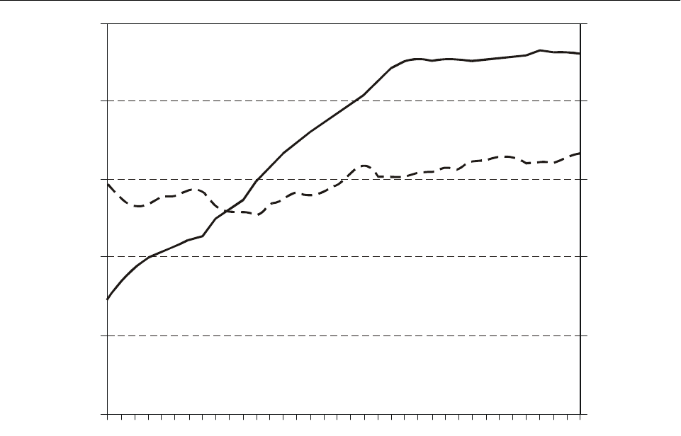
II-3-2 Global Air Navigation Plan for CNS/ATM Systems
city-pairs with direct services, but the penetration of B-767
services was more limited than on the North Atlantic, with
a correspondingly reduced impact on the trend.
3.9 The regulatory and technological factors described
above are likely to continue. However, more liberal regulat-
ory environment and competitive forces are encouraging
consolidation and alliances among airlines that might
eventually reduce or reverse the pressures to increase flight
frequency at the expense of aircraft size. The build-up of
airport and airspace congestion over the next decade is
another factor that would favour larger aircraft. Further-
more, the new technology aircraft penetrating the fleets in
the next decade include the B-777, A-330 and A-340, which
are larger than the new aircraft of the 1980s. For these
reasons, it is assumed that the world average aircraft size
will begin to increase again and could reach almost
200 seats by 2005 compared with 184 seats in 1995.
Measures of aircraft movements
3.10 Aircraft movements can be measured in terms of
the number of aircraft-kilometres (or aircraft hours) flown
in the airspace or the number of aircraft departures from
airports. While each measure is relevant for determining the
demand for air traffic control facilities, aircraft departures
are the key parameter for airport planning.
3.11 The link between the two measures is the
average aircraft stage length. The trend in the average stage
length is illustrated in Figure II-3-2. In the 1960s, average
stage length for scheduled services increased by more than
4 per cent per annum, thus aircraft kilometres grew 4 to
5 per cent per annum faster than aircraft departures. In the
past 20 years, the growth in average stage length has been
around 1 or 2 per cent per annum. The increase in stage
length reflects the changing pattern of demand, with growth
Source.— ICAO Reporting Form A-1.
Note 1.— Excluding all-freight operations.
Note 2.— Excluding the Commonwealth of Independent States (CIS).
Figure II-3-1. Average aircraft size and load factor
(passenger aircraft on scheduled services)
Aircraft size
Load factor
200
160
120
80
40
0
1960 65 70 75 80 85 90 95
100
80
60
40
20
0
Aircraft size (seats)
Load factor (%)

Part II. Facilities and Services for the Implementation of the Global Plan
Chapter 3. Statistics II-3-3
in passenger and freight traffic being greater for long-haul
routes than for short-haul routes. Another factor has been
increases in the length-of-haul capabilities of new aircraft
types progressively introduced into fleets. This was
especially important in the 1960s with the introduction of
jet aircraft. Over the forecast period (1995 to 2005), the
average stage length is assumed to grow at about 2 per cent
per annum.
Forecasting methodology
3.12 The forecasting process began with the forecasts
of passenger traffic and incorporated assumptions for future
load factors and aircraft size, which were together
translated into forecasts of aircraft movements. The
specification of the model used in this process is given in
Appendix 2 of Circular 270.
3.13 The forecast in terms of global aircraft-
kilometres was based on passenger-kilometre forecasts and
assumptions from average passenger load factors and
aircraft size (measured by number of seats). Since
all-freight aircraft services account for less than 4 per cent
of total services, their impact on the overall trend is very
small. The forecast of global aircraft departures is derived
from the forecast of aircraft-kilometres and expectations for
the future trend in average aircraft stage length. The main
assumptions for growth in world scheduled passenger
traffic and trends in load factors, aircraft size and aircraft
stage length over the period 1995 to 2005 are given below:
a) a growth in passenger-kilometres of 5.5 per cent per
annum;
b) an increase in average load factor from 67 to 70 per
cent;
c) a growth in average passenger aircraft size (in terms
of seats) of 0.8 per cent per annum;
d) a growth in average aircraft stage length of 2.0 per
cent per annum.
Source.— ICAO Reporting Form A-1.
Note.— Excluding the Commonwealth of Independent States (CIS).
Figure II-3-2. Average aircraft stage length (scheduled services)
1960 65 70 75 80 85 90 95
0
International services
All services
Kilometres
2 000
1 500
500
1 000

II-3-4 Global Air Navigation Plan for CNS/ATM Systems
(Because of data constraints, all assumptions and forecasts
exclude the Commonwealth of Independent States.)
Forecasts of world scheduled
aircraft movements
3.14 The above analyses led to the forecast of average
world annual growth rates of nearly 4.5 per cent for
aircraft-kilometres and 2.5 per cent for aircraft departures
over the period 1995 to 2005.
3.15 The growth rate for aircraft-kilometres is below
the growth rate for passenger-kilometres by one percentage
point per annum because of the increases in load factor and
aircraft size. Growth in aircraft departures is below the
growth in aircraft-kilometres by 2 per cent per annum,
which is equal to the growth in stage length.
3.16 In Table II-3-1, the forecasts for aircraft move-
ments are compared with actual past movements. The rates
of growth reported in the table are average measures over
the relevant 10-year periods; the rates over shorter periods
may vary. Despite lower traffic growth, the growth in
aircraft movements between 1985 and 1995 was relatively
buoyant when compared with the growth between 1975 and
1985. This was a consequence of slower growth in average
aircraft size and load factor.
3.17 Traffic growth in the 1980s placed increasing
demands on the aviation infrastructure. Although there was
an easing of demand pressures in the early 1990s, the
forecasts imply an increase of about 55 per cent in aircraft-
kilometres and 28 per cent in aircraft departures between
1995 and 2005. In absolute terms, the increase in aircraft-
kilometres between 1995 and 2005 is expected to be only a
little smaller than the increase that occurred between 1985
and 1995. The absolute increase in aircraft departures is
forecast to be about 4.6 million between 1995 and 2005
compared with 4.8 million between 1985 and 1995. Overall
increases of this magnitude could result in serious conges-
tion of certain already hard-pressed airport and airspace
facilities. It is important to recognize that in arriving at these
forecasts, no allowance has been made for the effect that
potential supply constraints might have on traffic volumes.
In other words, if the supply of air traffic control and airport
services does not keep pace with demand in the same way
that it has in the past, then actual traffic flows may be sup-
pressed below the levels of demand that are forecasted here.
SUMMARY OF ICAO AIR TRAFFIC
FORECASTS FOR THE YEAR 2005
3.18 Tables II-3-2, II-3-3 and II-3-4 provide sum-
maries of worldwide, regional and route-group forecasts,
respectively.
Table II-3-1. ICAO scheduled aircraft movements* forecast for the year 2005
Actual
1975
Actual
1985
Actual
1995
Forecast
2005
Average annual growth rate
(per cent)
1975–1985 1985–1995 1995–2005
Aircraft-kilometres
(millions)
7 516 10 598 18 279 28 400 3.5 5.6 4.5
Aircraft departures
(thousands)
9 683 11 953 16 754 21 400 2.1 3.4 2.5
* Includes all-freight movements; excludes operations of aircraft registered in the Commonwealth of Independent States (CIS).

Part II. Facilities and Services for the Implementation of the Global Plan
Chapter 3. Statistics II-3-5
Table II-3-2. Summary of ICAO air traffic forecasts for the year 2005 (worldwide)
Actual
1985
Actual
1995
Forecast
2005
Average annual growth
rate (per cent)
1985–1995 1995–2005*
TOTAL SCHEDULED SERVICES
Passenger-kilometres (billions) 1 367 2 228 3 807 5.0 5.5
Freight tonne-kilometres (millions) 39 797 83 082 163 950 7.6 7.0
Passengers carried (millions) 899 1 285 2 010 3.6 4.5
Freight tonnes carried (thousands) 13 742 21 488 34 600 4.6 5.0
Aircraft-kilometres (millions)** 10 598 18 279 28 400 5.6 4.5
Aircraft departures (thousands)** 11 953 16 754 21 400 3.4 2.5
INTERNATIONAL SCHEDULED SERVICES
Passenger-kilometres (billions) 590 1 241 2 395 7.7 7.0
Freight tonne-kilometres (millions) 29 384 70 273 145 720 9.1 7.5
Passengers carried (millions) 194 373 680 6.8 6.0
Freight tonnes carried (thousands) 5 884 12 982 24 400 8.2 6.5
* Rounded to the nearest 0.5 percentage point.
** Excludes the Commonwealth of Independent States (CIS).

II-3-6 Global Air Navigation Plan for CNS/ATM Systems
Table II-3-3. Summary of ICAO air traffic forecasts for the year 2005
(by region of airline registration)
Actual
1985
Actual
1995
Forecast
2005
Average annual growth
rate (per cent)
1985–1995 1995–2005*
TOTAL SCHEDULED SERVICES
Passenger-kilometres (billions)
Africa 36.7 51.0 77 3.3 4.0
Asia/Pacific 222.3 549.7 1 260 9.5 8.5
Europe 428.2 549.3 870 2.5 4.5
Middle East 42.7 67.0 115 4.6 5.5
North America 569.2 902.7 1 310 4.7 4.0
Latin America and the Caribbean 68.3 107.9 175 4.7 5.0
Freight tonne-kilometres (millions)
Africa 1 163 1 418 2 050 2.0 4.0
Asia/Pacific 9 605 28 346 71 000 11.4 9.5
Europe 14 422 24 607 40 900 5.5 5.0
Middle East 1 880 3 775 6 800 7.2 6.0
North America 10 622 21 253 36 200 7.2 5.5
Latin America and the Caribbean 2 105 3 683 7 000 5.8 6.5
INTERNATIONAL SCHEDULED SERVICES
Passenger-kilometres (billions)
Africa 28.6 42.1 65 3.9 4.5
Asia/Pacific 150.2 372.9 870 9.5 9.0
Europe 202.7 426.8 735 7.7 5.5
Middle East 35.2 57.1 100 5.0 6.0
North America 125.3 271.7 495 8.0 6.0
Latin America and the Caribbean 36.5 70.3 130 6.8 6.5
Freight tonne-kilometres (millions)
Africa 1 070 1 320 1 920 2.1 4.0
Asia/Pacific 8 589 26 243 66 900 11.8 10.0
Europe 11 589 23 815 40 000 7.5 5.5
Middle East 1 807 3 694 6 700 7.4 6.0
North America 4 842 12 162 24 000 9.6 7.0
Latin America and the Caribbean 1 487 3 039 6 200 7.4 7.5
*Rounded to the nearest 0.5 percentage point.

Part II. Facilities and Services for the Implementation of the Global Plan
Chapter 3. Statistics II-3-7
Table II-3-4. Summary of ICAO air traffic forecasts for the year 2005
(by international route group)
Passengers carried (thousands)
Average annual growth
rate (per cent)
Actual
1985
Actual
1995
Forecast
2005 1985–1995 1995–2005*
North Atlantic 20 964 38 100 59 168 6.2 4.5
Mid-Atlantic 1 471 2 570 4 186 5.7 5.0
South Atlantic 1 244 3 260 5 838 10.1 6.0
Transpacific 8 028 19 213 37 795 9.1 7.0
Between Europe and Asia/Pacific 5 870 20 400 42 045 13.3 7.5
Between Europe and Africa 9 280 11 000 14 783 1.7 3.0
Between Europe and Middle East 3 920 7 080 9 987 6.1 3.5
Between North America and South America 2 622 7 445 14 100 11.0 6.5
Between North America and Central
America/Caribbean
15 562 24 684 38 333 4.7 4.5
Total above routes 68 961 133 752 226 237 6.8 5.5
Other routes 124 974 239 007 453 763 6.7 6.5
Total world 193 935 372 759 680 000 6.8 6.0
*Rounded to the nearest 0.5 percentage point.
II-4-1
Chapter 4
HOMOGENEOUS ATM AREAS AND
MAJOR INTERNATIONAL TRAFFIC FLOWS
PLANNING PARAMETERS
4.1 The basis for development of a global, integrated
ATM system is an agreed-to structure of homogeneous
ATM areas and/or major international traffic flows. These
areas and/or flows link together the various elements of the
worldwide aviation infrastructure into a global system. The
Global Plan lists several of these areas and/or traffic flows.
Further updating and identification of these areas and/or
traffic flows should be carried out by PIRGs in collabor-
ation with the aircraft operators, reflecting the latter’s
requirements. “Feeder” routes may also have to be
determined as part of the work effort toward identification
of ATM requirements.
HOMOGENEOUS ATM AREA
4.2 In order to be consistent with worldwide growth
and to support the economy of operations globally,
requirements must be adapted to distinct areas with specific
traffic flows. For this reason, the planning process for any
particular region must begin with the identification of
specific homogeneous ATM areas and/or major inter-
national traffic flows, based on user needs, followed by the
development of an ATM plan for the region. See definition
in 3.4 of Part I.
MAJOR TRAFFIC FLOWS
4.3 A major traffic flow is a concentration of
significant volumes of air traffic on the same or proximate
flight trajectories (see definition in 3.6 of Part I).
4.4 The basic planning parameter is the number of
aircraft movements that must be provided with ATM
services. Estimates and forecasts of annual aircraft move-
ments over the planning period are required for high-level
planning (Part II, Chapter 1 refers).
FORECASTS
4.5 Forecasts of aircraft movements in peak periods,
such as during a particularly busy hour, are needed for
detailed planning. Additionally, the establishment of major
international traffic flows will require appropriate civil/
military coordination and consideration of special use
airspace (SUA) requirements. The coordination should take
place during the planning stage so that major traffic flows
will have a realistic chance of implementation. The princi-
pal data sources for current or historic aircraft movements
are the official airline guides, i.e. World Airways Guide,
ICAO’s Traffic by Flight Stage Statistics and En-route
Facility Statistics, and specific statistical information for
flight information regions (FIRs), which can be obtained
from relevant area control centres (ACCs).
4.6 The ICAO Secretariat, in cooperation with IATA,
is progressively developing estimates of current traffic
volumes for specific areas, which consist of major inter-
national route groups. This information is being designed to
assist with planning at the global level. Additionally, traffic
forecasting groups are being established by ICAO in order
to provide the PIRGs with comprehensive databases and
forecasts of traffic flows for groups of routes for the
detailed planning process.
IDENTIFYING HOMOGENEOUS ATM AREAS
AND MAJOR TRAFFIC FLOWS
4.7 Each regional planning group will develop its own
work structure for accomplishing the work associated with
the step-by-step approach identified in Chapter 3 of Part I.
In some cases, an already established working group or
CNS/ATM Subgroup may be in a suitable position to
accomplish the work; in other cases, specific task forces or
subgroups will need to be established.
4.8 To complete the work associated with the tables in
this chapter, the following steps from the step-by-step
approach will need to be considered:

II-4-2 Global Air Navigation Plan for CNS/ATM Systems
Step 1. Identify homogeneous ATM areas and/or
major traffic flows.
Step 2. List the ICAO region(s), flight information
region(s) and State(s) involved in the homogeneous
ATM areas and/or major international traffic flows.
Step 3. Carry out air traffic forecasts and ascertain
airspace user needs.

Part II. Facilities and Services for the Implementation of the Global Plan
Chapter 4. Homogeneous ATM Areas and Major International Traffic Flows II-4-3
Table II-4-1. Homogeneous ATM areas and major traffic flows/routing areas
Areas
(AR)
Homogeneous ATM areas
and major traffic
flows/routing areas FIRs involved Type of area covered Remarks
Africa-Indian Ocean (AFI) Region
AR1 Europe — South America
(EUR/SAM) (oceanic)
Canarias
Casablanca
Dakar Oceanic
Recife
Sal Oceanic
Oceanic low density Major traffic flow
EUR/SAM
AR2 Atlantic Ocean interface
between the AFI, NAT and
SAM Regions
Accra
Dakar
Johannesburg Oceanic
Luanda
Sal
Oceanic low density Homogeneous ATM area
AFI/NAT/SAM
AR3 Europe — Eastern Africa
routes including the area of
the Indian Ocean
Addis Ababa
Antananarivo
Asmara
Cairo
Dar es-Salaam
Entebbe
Khartoum
Mauritius
Mogadishu
Nairobi
Seychelles
Tripoli
Continental/oceanic
low density
Major traffic flow
AFI/EUR
AR4 Europe to Southern Africa Alger
Brazzaville
Gaborone
Johannesburg
Kano
Kinshasa
Luanda
Lusaka
N’Djamena
Niamey
Tunis
Continental low
density
Major traffic flow
AFI/EUR
AR5 Coastal routes over the
Gulf of Guinea
Accra
Brazzaville
Dakar
Kano
Roberts
Continental low
density
Homogeneous ATM area
AFI
AR6 Iberian Peninsula to
Canaries
Canarias
Casablanca
Lisbon
Oceanic high density Major traffic flow
AFI/EUR
AR7 North Africa coastal area Alger
Cairo
Casablanca
Tripoli
Tunis
Continental/oceanic
low density
Homogeneous ATM area
AFI/EUR

II-4-4 Global Air Navigation Plan for CNS/ATM Systems
AR8 Continental Southern Africa Beira
Bloemfontein
Cape Town
Dar es-Salaam
Durban
Gaborone
Harare
Johannesburg
Lilongwe
Luanda
Lusaka
Port Elizabeth
Windhoek
Continental low
density
Homogeneous ATM area
AFI
AR9 Trans-Sahelian Asmara
Dakar
Kano
Khartoum
N’Djamena
Niamey
Continental low
density
Homogeneous ATM area
AFI
AR10 Trans-Indian Ocean area
interfacing with the ASIA/
PAC Regions
Antananarivo
Johannesburg Oceanic
Mauritius
Perth
Seychelles
Oceanic high
density
Homogeneous ATM area
AFI/ASIA
Asia/Pacific (ASIA/PAC) Regions
AR1 Asia/Australia and Africa Bangkok, Bombay, Colombo,
Jakarta, Kuala Lumpur,
Madras, Malé, Melbourne,
Singapore, Yangon, [and
African FIR/UIRs]
Oceanic low
density
Major traffic flow
AFI/ASIA/MID
AR2 Asia (Indonesia north to
China, Japan and the
Republic of Korea),
Australia/New Zealand
Auckland, Bali, Bangkok,
Beijing, Biak, Brisbane,
Guangzhou, Hanoi, Ho-Chi-
Minh, Hong Kong, Honiara,
Jakarta, Kota Kinabalu,
Kuala Lumpur, Manila,
Melbourne, Nadi, Naha,
Nauru, Oakland, Phnom-
Penh, Port Moresby,
Shanghai, Singapore, Taegu,
Taipe i, Tokyo , Ujung
Pandang, Vientiane, Wuhan,
Yangon
Oceanic high
density
Major traffic flow
ASIA/PAC
AR3 Asia and Europe via north
of the Himalayas
Almaty, Bangkok, Beijing,
Guangzhou, Hanoi, Ho-Chi-
Minh, Hong Kong,
Kathmandu, Kunming,
Lanzhou, Naha, Phnom-
Penh, Pyongyang, Shanghai,
Shenyang, Taegu, Taipei,
Tokyo, Ulaanbaatar, Urumqi,
Vientiane, Wuhan, Yangon,
[and Russian Federation
FIRs, and European FIRs]
Continental high
density/continental low
density
Major traffic flow
ASIA/EUR/MID
Areas
(AR)
Homogeneous ATM areas
and major traffic
flows/routing areas FIRs involved Type of area covered Remarks

Part II. Facilities and Services for the Implementation of the Global Plan
Chapter 4. Homogeneous ATM Areas and Major International Traffic Flows II-4-5
AR4 Asia and Europe via south of
the Himalayas
Bali, Bangkok, Bombay,
Calcutta, Colombo, Delhi,
Dhaka, Hanoi, Ho-Chi-Minh,
Hong Kong, Jakarta, Karachi,
Kathmandu, Kota Kinabalu,
Kuala Lumpur, Kunming,
Lahore, Madras, Manila,
Phnom-Penh, Singapore,
Ujung Pandang, Vientiane,
Yangon, [and Middle
East/European FIR/UIRs]
Continental low
density
Major traffic flow
ASIA/EUR/MID
AR5 Asia and North America via
the Russian Far East and the
Polar Tracks via the Arctic
Ocean and Siberia
Anchorage, Beijing,
Canadian FIRs, Guangzhou,
Hong Kong, Pyongyang,
Russian Far East of 80E,
Shanghai, Shenyang, Taegu,
Tokyo, Wuhan and
Ulaanbaatar
Continental low
density/continental
high density
Major traffic flow
ASIA/EUR/NAM/NAT
AR6 Asia and North America
(including Hawaii) via the
Central and North Pacific
Anchorage, Hong Kong and
Naha, Manila, Oakland (at
and north of a line drawn by
LAX-HNL-Guam-MNL),
Taipe i, Tokyo , Vancouver
Oceanic low
density
Major traffic flow
ASIA/NAM/PAC
AR7 New Zealand/Australia and
South America
Auckland, Brisbane, Nadi,
Tahiti, [and South America
FIR/UIRs]
Oceanic low
density
Major traffic flow
ASIA/PAC/SAM
AR8 Australia/New Zealand, the
South Pacific Islands and
North America
Auckland, Brisbane and Port
Moresby, Honiara, Nadi,
Nauru, Oakland (southern
region), Tahiti
Oceanic low
density
Major traffic flow
ASIA/NAM/PAC
AR9 South-East Asia and China,
Republic of Korea, and Japan
Bali, Bangkok, Beijing,
Guangzhou, Hanoi, Ho-Chi-
Minh, Hong Kong, Jakarta,
Kota Kinabalu, Kuala
Lumpur, Kunming, Manila,
Naha, Phnom-Penh,
Pyongyang, Shanghai,
Shenyang, Singapore, Taegu,
Taipe i, Tokyo , Ujung
Pandang, Vientiane, Wuhan,
Yangon
Oceanic high
density
Major traffic flow
ASIA
Caribbean/South American (CAR/SAM) Regions
AR1 Buenos Aires — Santiago
de Chile
Ezeiza, Mendoza, Santiago Continental low density SAM intra-regional
major traffic flow
Buenos Aires — São
Paulo/Rio de Janeiro
Ezeiza, Montevideo,
Curitiba, Brasilia
Continental low density SAM intra-regional
major traffic flow
Santiago de Chile — São
Paulo/Rio de Janeiro
Santiago, Mendoza,
Cordoba, Resistencia,
Asunción, Curitiba, Brasilia
Continental low density SAM intra-regional
major traffic flow
São Paulo/Rio de Janeiro —
Europe
Brasilia, Recife Continental/oceanic low
density
SAM/AFI/EUR inter-regional
major traffic flow
AR2 São Paulo/Rio de Janeiro —
Miami
Brasilia, Manaus, Maiquetía,
Curaçao, Kingston, Santo
Domingo, Port-au-Prince,
Habana, Miami
Continental/oceanic low
density
CAR/SAM/NAM inter- and
intra-regional major traffic flow
Areas
(AR)
Homogeneous ATM areas
and major traffic
flows/routing areas FIRs involved Type of area covered Remarks

II-4-6 Global Air Navigation Plan for CNS/ATM Systems
São Paulo/Rio de Janeiro —
New York
Brasilia, Belem, Paramaribo,
Georgetown, Piarco,
Rochambeau, San Juan
(New York)
Continental/oceanic low
density
CAR/SAM/NAM/NAT
inter- and intra-regional major
traffic flow
AR3 São Paulo/Rio de Janeiro —
Lima
Brasilia, Curitiba, La Paz,
Lima
Continental low density SAM intra-regional major
traffic flow
São Paulo/Rio de Janeiro —
Los Angeles
Brasilia, Porto Velho,
Bogotá, Barranquilla,
Panama, Central America,
Mérida, México, Mazatlan
(Los Angeles)
Continental low density CAR/SAM/NAM
inter- and intra-regional major
traffic flow
Mexico — North America Mexico, Monterrey,
Houston, Miami
Continental/oceanic
low density
CAR/NAM inter-regional
major traffic flow
AR4 Santiago — Lima — Miami Santiago, Antofagasta,
Lima, Guayaquil, Bogotá,
Barranquilla, Panama,
Kingston, Habana, Miami
Continental/oceanic
low density
CAR/SAM/NAM
inter- and intra-regional major
traffic flow
Buenos Aires — New York Ezeiza, Resistencia,
Asunción, La Paz, Porto
Velho, Manaus, Maiquetía,
Curaçao, Santo Domingo,
Miami (New York)
Continental/oceanic
low density
CAR/SAM/NAM/NAT
inter- and intra-regional major
traffic flow
Buenos Aires — Miami Ezeza, Resistencia, Cordoba,
La Paz, Porto Velho, Bogotá,
Barranquilla, Kingston,
Habana, Miami
Continental/oceanic
low density
CAR/SAM/NAM
intra- and inter-regional major
traffic flow
AR5 North of South America —
Europe
Guayaquil, Bogotá,
Maiquetía, Piarco
(NAT-EUR)
Continental/oceanic
low density
SAM/NAT/EUR inter-regional
major traffic flow
AR6 Mexico — Europe México, Mérida, Habana,
Miami (NAT-EUR)
Continental/oceanic
low density
CAR/NAM/NAT/EUR
inter-regional major
traffic flow
Central America — Europe Central America, Panama,
Kingston, Port-au-Prince,
Curaçao, Santo Domingo,
San Juan (EUR)
Oceanic low density CAR/NAT/EUR
intra- and inter-regional major
traffic flow
AR7 Santiago — Lima — Los
Angeles
Santiago, Antofagasta,
Lima, Guayaquil, Central
America, Mérida, México,
Mazatlan
Oceanic low density CAR/SAM/NAM
intra- and inter-regional major
traffic flow
AR8 South America — South
Africa
Ezeiza, Montevideo,
Brasilia, Johannesburg (AFI)
Oceanic low density SAM/AFI inter-regional
major traffic flow
Santiago de Chile — Easter
Island — Papeete (PAC)
Santiago, Easter, Tahiti Oceanic low density SAM/PAC inter-regional
major traffic flow
European (EUR) Region
AR1 Within Western Europe Wien, Bruxelles, Paris,
Marseille, Reims, Bremen,
Dusseldorf, Frankfurt,
München, Milano, Genève,
Zurich, London, Amsterdam
Continental very high
density
Core area, homogeneous ATM
area
EUR
AR2 Western and Central Europe ECAC States Continental high density Homogeneous ATM area
Areas
(AR)
Homogeneous ATM areas
and major traffic
flows/routing areas FIRs involved Type of area covered Remarks

Part II. Facilities and Services for the Implementation of the Global Plan
Chapter 4. Homogeneous ATM Areas and Major International Traffic Flows II-4-7
AR2 Europe to North America Europe (TBD), UK
(London, Scottish), Ireland
(Shannon), France (Paris,
Reims, Brest)
Continental high density Major traffic flow linking
Europe to North America via
North Atlantic
AR3 Western Europe to Far East
Asia via trans-polar transit
routes
Core Area, Norway (Bodø,
Oslo, Stavenger,
Trondheim), Finland
(Tampere, Rovaniemi),
Russian Federation (TBD),
Japan
Continental high
density/continental
low density
Major traffic flow via ATS route
A333 and all routes north of it
AR4 Western Europe to Far East
Asia via trans-Siberian transit
routes
Core Area, Poland
(Warszawa), Baltic States
(Tallinn, Riga, Vilnius),
Finland (Tampere,
Rovaniemi), Russian
Federation (TBD), Japan
Continental high
density/continental
low density
Major traffic flow via ATS
routes south of A333
(excluding), up to and including
the ATS route R211
AR5 North America to Eastern
Europe and Asia via
cross-polar transit routes
Denmark (Søndrestrøm),
Russian Federation (TBD),
USA, Canada, Mongolia,
China
Continental low
density/oceanic low
density
Major traffic flow via ATS
routes linking North America
with Eastern Europe and Asia
through the airspace of the
Russian Federation east of the
ATS routes G476 and A74 up to
the ATS route A218 (excluding)
AR6 North America to Southeast
Asia via trans-eastern transit
routes
Russian Federation (TBD),
USA, Canada, China
Continental low
density/oceanic low
density
Major traffic flow via ATS
routes linking North America
with Southeast Asia through the
airspace of the Russian
Federation including ATS route
A218 and all routes east of it
AR7 Europe to Central and
Southeast Asia via trans-Asian
transit routes
Baltic States (Tallinn, Riga,
Vilnius), Finland (Tampere,
Rovaniemi), Kazakhstan
(TBD), Russian Federation
(TBD), Mongolia, China
Continental low density Major traffic flow via ATS
routes linking European States
with Central and Southeast
Asia, aligned south of ATS
routes B159, A222, B200 and
A310, including ATS route G3
AR8 Europe to Middle Asia via
Asian transit routes
Ukraine (TBD),
Turkmenistan (TBD),
Kazakhstan (TBD), Turkey,
Armenia (Yerevan), Georgia
(Tbilisi, Sukhumi),
Azerbaijan (Baku),
Uzbekistan (Samarkand,
Tashkent, Nukus), Russian
Federation (TBD), Iran,
Afghanistan
Continental low density Major traffic flow via ATS
routes linking European States
with Middle Asia, south of ATS
route G3
ARx Western/Central Europe —
Asia (trans-Siberia)
(to be developed) Continental low
density/continental
high density
Major traffic flow
ASIA/EUR/MID
ARx Eastern Europe — Middle
Asia
(to be developed) Continental low
density
Major traffic flow
ASIA/EUR/MID
ARx Europe — Central Asia/Pacific (to be developed) Continental low
density
Major traffic flow
ASIA/EUR/MID/PAC
ARx Western Europe — Eastern
Europe
(to be developed) Continental low
density/continental
high density
Homogeneous ATM area EUR
Areas
(AR)
Homogeneous ATM areas
and major traffic
flows/routing areas FIRs involved Type of area covered Remarks

II-4-8 Global Air Navigation Plan for CNS/ATM Systems
North Atlantic (NAT) Region
ARx North America —
Western/Central Europe
Bodø, Gander, New York,
Reykjavik, Santa Maria,
Shanwick, Søndrestrøm
Oceanic high
density/continental
high density
Major traffic flow
EUR/NAM/NAT
MNPS airspace
ARx North America — Caribbean New York Oceanic high density Major traffic flow
West Atlantic route system
Middle East (MID) Region
AR1 Asia and Europe, Asia and the
Middle East, Europe and the
Middle East, via the northern
Arabian Peninsula and Eastern
Mediterranean
Amman, Baghdad, Bahrain,
Beirut, Cairo, Damascus,
Emirates, Jeddah, Kuwait,
Muscat, Tel Aviv
Continental high density Mainly intra-regional and MID
to/from ASIA and EUR. Some
overflying EUR/ASIA traffic
AR2 Egypt and the southern
Arabian Peninsula to/from
Europe, Africa and Asia
Cairo, Bahrain, Emirates,
Jeddah, Muscat, Sana’a
Remote continental and
oceanic low density (but
seasonally high density)
Major traffic flow
Mainly landing and departing
the MID region. Some
EUR/AFI traffic.
Seasonal pilgrim flights to and
from Africa, Central, South and
South-East Asia
AR3 Asia and Europe, Asia and
the Middle East, Europe
and the Middle East, north
of the Gulf
Teheran, Kabul Continental high density Major traffic flow
ASIA/EUR
North America (NAM) Region
NA-14 North America/
polar tracks
Domestic US FIRs
(Chicago, Seattle, Cleveland,
New York, Boston,
Minneapolis, Salt Lake),
Canadian FIRs (Montreal,
Toronto, Winnipeg,
Edmonton, Vancouver),
Anchorage, Beijing,
Guangzhou, Hong Kong,
Pyongyang, Russian Far
East FIRs, Shanghai,
Shenyang, Taegu, Tokyo,
Wuhan, and Ulaanbaatar
Continental/oceanic low
density
Major traffic flow
One-directional flow
ASIA/EUR/NAM/NAT
NA-15 Toronto — Cleveland,
Chicago
Toronto, Cleveland, Chicago Continental high density
Major traffic flow
CAN-US
East-west route
Toronto — New York,
Philadelphia, Washington
Toronto, Cleveland, New
Yo r k , Wa s h i ng t o n
Continental high density
Major traffic flow
CAN-US
North-south route
Montreal — New York Montreal, Boston,
New York
Continental high density
Major traffic flow
CAN-US
North-south route
Anchorage, Vancouver —
Seattle — San Francisco —
Los Angeles
Anchorage, Vancouver,
Seattle, Oakland, Los
Angeles
Continental high density
Major traffic flow
CAN-US
North-south route
Areas
(AR)
Homogeneous ATM areas
and major traffic
flows/routing areas FIRs involved Type of area covered Remarks

Part II. Facilities and Services for the Implementation of the Global Plan
Chapter 4. Homogeneous ATM Areas and Major International Traffic Flows II-4-9
NA-16
Canada
East-
west
flows
Toronto — Winnipeg —
Calgary — Regina —
Va n c o u v e r
Winnipeg, Edmonton,
Vancouver
Continental high density
Major traffic flow
Major traffic flows in Canadian
southern domestic airspace
Toronto — Ottawa —
Montreal — Halifax
Toronto, Montreal, Moncton
Vancouver — Edmonton Vancouver, Edmonton
Edmonton — Calgary Edmonton
Winnipeg — Regina Winnipeg
NA-17
US
East-
west
flows
Boston/New York/Chicago —
Seattle
Boston, New York,
Cleveland, Indianapolis,
Chicago, Minneapolis, Salt
Lake, Seattle
Continental high density
Major traffic flow
Major traffic flows in domestic
US airspace
Boston/New York/Washington
DC/Denver — San Francisco
Boston, New York,
Cleveland, Indianapolis,
Chicago, Kansas City, Salt
Lake, Oakland
Boston/New York/Washington
DC/Denver — Los Angeles
Boston, New York,
Cleveland, Indianapolis,
Chicago, Kansas City,
Albuquerque, Los Angeles
Atlanta/Dallas/
Phoenix — Los Angeles
Atlanta, Memphis, Fort
Worth, Albuquerque, Los
Angeles
NA-17
US
East-
west
flows
Atlanta/Dallas/
Phoenix — San Diego
Atlanta, Memphis, Fort
Worth, Albuquerque, Los
Angeles
Miami/Houston/
Dallas/Phoenix — San Diego
Miami, Houston, Fort
Worth, Albuquerque, Los
Angeles
Miami/Houston/
Dallas/Phoenix — Los
Angeles
Miami, Houston, Dallas,
Albuquerque, Los Angeles
GM-1 Mexico — North America Mexico, Houston, Miami;
Mexico, Albuquerque;
Mexico, Los Angeles
Continental/oceanic low
density
Major traffic flow
CAR/NAM inter-regional
traffic flow
GM-2 Mexico — Europe Mexico, Havana, Miami
(NAT-EUR)
Continental/oceanic low
density
Major traffic flow
CAR/NAM/NAT/EUR
inter-regional traffic flow
Areas
(AR)
Homogeneous ATM areas
and major traffic
flows/routing areas FIRs involved Type of area covered Remarks

II-5-1
Chapter 5
AIR TRAFFIC MANAGEMENT
INTRODUCTION
5.1 The material contained in this chapter complements
that contained in Chapter 4 of Part I and in the ATM sections
of the FASIDs of the regional ANPs. This chapter is kept
under review by the PIRGs and should be periodically
updated to reflect the information contained in the ATM
sections of the regional FASIDs.
ATM OBJECTIVES
5.2 Each regional planning group will develop its own
work structure for accomplishing the work associated with
the step-by-step approach identified in Chapter 3 of Part I. In
some cases, an already established working group or CNS/
ATM Subgroup may be in a suitable position to accomplish
the work; in other cases, specific task forces or subgroups
will need to be established.
5.3 To complete the tables in this chapter, the following
steps from the global planning methodology outlined in
Chapter 3 of Part I will need to be considered:
Step 4. Perform an operational analysis of the current
infrastructure for the areas identified in terms of:
a) ATM limitations and shortcomings;
b) separation standards; and
c) CNS availability.
Step 5. Determine the ATM objectives for the areas
identified in Step 2 using as the basis the guidance material
contained in the operational concept document (operational
analysis) (Appendices A and B to Chapter 4 of Part I refer).

II-5-2 Global Air Navigation Plan for CNS/ATM Systems
1. To be developed
GLOBAL AIR TRAFFIC MANAGEMENT
SYSTEM IMPLEMENTATION OBJECTIVES BY REGION
GLOBAL AIR TRAFFIC MANAGEMENT SYSTEM IMPLEMENTATION BY REGION
1994 1995 1996 1997 1998 1999 2000 2001 2002 2003 2004 2005 2006 2007 2008 2009 2010
Development
of SARPs
R
T
S
P
Global ATM
Functional integration of flight OPS/ATM
ATM requirements for CNS
Separation between aircraft
AIDC
ATFM procedures and systems
Aircraft
equipage/
flight operations
RNP certification/approval
Functional integration of airborne systems with
ground systems
Implementation and operational use
REGIONAL ATM OPERATIONAL CONCEPT
Global Determination of major traffic flows
Regions AFI
ASIA/PAC
CAR/SAM
EUR
MID
NAM1
NAT
Identification of ATM objectives based on these
traffic flows
Global
Regions AFI
ASIA/PAC
CAR/SAM
EUR
MID
NAM1
NAT
Global Development of regional strategic airspace CNS
infrastructure plan based on ATM requirements
Regions AFI
ASIA/PAC
CAR/SAM
EUR
MID
NAM1
NAT

Part II. Facilities and Services for the Implementation of the Global Plan
Chapter 5. Air Traffic Management II-5-3
GLOBAL AIR TRAFFIC MANAGEMENT SYSTEM IMPLEMENTATION BY REGION
1994 1995 1996 1997 1998 1999 2000 2001 2002 2003 2004 2005 2006 2007 2008 2009 2010
1. To be developed
AIRSPACE MANAGEMENT
Global Optimized sectorization
Regions AFI
ASIA/PAC
CAR/SAM
EUR
MID
NAM
NAT1
Global Fixed RNAV ATS routes
Regions AFI
ASIA/PAC
CAR/SAM
EUR
MID
NAM
NAT
Global Contingency RNAV routes
Regions AFI
ASIA/PAC
CAR/SAM1
EUR
MID
NAM1
NAT1
Global Random RNAV routes
Regions AFI
ASIA/PAC
CAR/SAM
EUR
MID1
NAM1
NAT1

II-5-4 Global Air Navigation Plan for CNS/ATM Systems
GLOBAL AIR TRAFFIC MANAGEMENT SYSTEM IMPLEMENTATION BY REGION
1994 1995 1996 1997 1998 1999 2000 2001 2002 2003 2004 2005 2006 2007 2008 2009 2010
1. To be developed.
2. Emerging concept or technology — consensus still to be reached.
Global Airspace desegregation/flexible use of airspace2
Regions AFI
ASIA/PAC
CAR/SAM1
EUR
MID
NAM
NAT1
Global Application of RNP
Regions AFI
ASIA/PAC
CAR/SAM
EUR
MID
NAM
NAT
Global Application of RCP2
Regions AFI1
ASIA/PAC1
CAR/SAM1
EUR1
MID1
NAM1
NAT1
Global Application of RSP2
Regions AFI1
ASIA/PAC1
CAR/SAM1
EUR1
MID1
NAM1
NAT1

Part II. Facilities and Services for the Implementation of the Global Plan
Chapter 5. Air Traffic Management II-5-5
GLOBAL AIR TRAFFIC MANAGEMENT SYSTEM IMPLEMENTATION BY REGION
1994 1995 1996 1997 1998 1999 2000 2001 2002 2003 2004 2005 2006 2007 2008 2009 2010
1. To be developed.
2. Emerging concept or technology — consensus still to be reached.
AIR TRAFFIC SERVICES
Global Trajectory conformance monitoring
Regions AFI
ASIA/PAC
CAR/SAM1
EUR
MID
NAM1
NAT
Global Minimum safe altitude warning
Regions AFI
ASIA/PAC
CAR/SAM
EUR
MID
NAM
NAT1
Global Conflict prediction
Regions AFI
ASIA/PAC
CAR/SAM1
EUR
MID
NAM
NAT
Global Conflict alert
Regions AFI
ASIA/PAC
CAR/SAM1
EUR
MID
NAM
NAT
Global Conflict resolution advice2
Regions AFI
ASIA/PAC
CAR/SAM1
EUR1
MID
NAM1
NAT

II-5-6 Global Air Navigation Plan for CNS/ATM Systems
GLOBAL AIR TRAFFIC MANAGEMENT SYSTEM IMPLEMENTATION BY REGION
1994 1995 1996 1997 1998 1999 2000 2001 2002 2003 2004 2005 2006 2007 2008 2009 2010
1. To be developed.
2. Emerging concept or technology — consensus still to be reached.
Global Functional integration of ground systems with
airborne systems
Regions AFI1
ASIA/PAC1
CAR/SAM1
EUR1
MID1
NAM1
NAT1
Global Dynamic accommodation of user-preferred flight
profiles2
Regions AFI
ASIA/PAC
CAR/SAM1
EUR
MID1
NAM
NAT1
Global Reduced vertical separation
Regions AFI
ASIA/PAC
CAR/SAM
EUR
MID
NAM
NAT
Global Reduced longitudinal separation
Regions AFI
ASIA/PAC
CAR/SAM
EUR
MID
NAM
NAT1
Global Reduced lateral separation
Regions AFI
ASIA/PAC
CAR/SAM
EUR
MID
NAM
NAT1

Part II. Facilities and Services for the Implementation of the Global Plan
Chapter 5. Air Traffic Management II-5-7
GLOBAL AIR TRAFFIC MANAGEMENT SYSTEM IMPLEMENTATION BY REGION
1994 1995 1996 1997 1998 1999 2000 2001 2002 2003 2004 2005 2006 2007 2008 2009 2010
1. To be developed.
2. Emerging concept or technology — consensus still to be reached.
Global Independent IFR approaches to closely spaced
runways
Regions AFI1
ASIA/PAC
CAR/SAM1
EUR
MID1
NAM1
NAT1
Global RNAV SIDs and STARs
Regions AFI
ASIA/PAC
CAR/SAM
EUR
MID
NAM1
NAT1
Global Curved and segmented approaches
Regions AFI1
ASIA/PAC1
CAR/SAM1
EUR1
MID1
NAM1
NAT1
Global Arrival metering, sequencing and spacing2
Regions AFI1
ASIA/PAC1
CAR/SAM1
EUR
MID1
NAM1
NAT1
Global A-SMGCS2
Regions AFI1
ASIA/PAC1
CAR/SAM1
EUR
MID1
NAM1
NAT1

II-5-8 Global Air Navigation Plan for CNS/ATM Systems
GLOBAL AIR TRAFFIC MANAGEMENT SYSTEM IMPLEMENTATION BY REGION
1994 1995 1996 1997 1998 1999 2000 2001 2002 2003 2004 2005 2006 2007 2008 2009 2010
1. To be developed
Global ATS inter-facility data (AIDC) communications
Regions AFI
ASIA/PAC
CAR/SAM
EUR
MID
NAM
NAT
Global Application of data link
Regions AFI
ASIA/PAC
CAR/SAM
EUR
MID
NAM
NAT
AIR TRAFFIC FLOW MANAGEMENT
Global Centralized ATFM
Regions AFI1
ASIA/PAC1
CAR/SAM1
EUR
MID1
NAM1
NAT1
Global Inter-regional cooperative ATFM
Regions AFI1
ASIA/PAC1
CAR/SAM1
EUR1
MID1
NAM1
NAT1
Global Establishment of ATFM databases
Regions AFI1
ASIA/PAC1
CAR/SAM1
EUR
MID1
NAM
NAT

Part II. Facilities and Services for the Implementation of the Global Plan
Chapter 5. Air Traffic Management II-5-9
GLOBAL AIR TRAFFIC MANAGEMENT SYSTEM IMPLEMENTATION BY REGION
1994 1995 1996 1997 1998 1999 2000 2001 2002 2003 2004 2005 2006 2007 2008 2009 2010
1. To be developed.
Global Application of strategic ATFM planning
Regions AFI1
ASIA/PAC1
CAR/SAM1
EUR
MID1
NAM
NAT1
Global Application of pre-tactical ATFM planning
Regions AFI1
ASIA/PAC1
CAR/SAM1
EUR
MID1
NAM
NAT1
Global Application of tactical ATFM planning
Regions AFI1
ASIA/PAC1
CAR/SAM1
EUR
MID1
NAM
NAT1

II-5-10 Global Air Navigation Plan for CNS/ATM Systems
REGIONAL AIR TRAFFIC MANAGEMENT
SYSTEM IMPLEMENTATION OBJECTIVES BY STATE
REGIONAL AIR TRAFFIC MANAGEMENT SYSTEM IMPLEMENTATION BY STATE
Area of
routing Regions/States ATM objective 1994 1995 1996 1997 1998 1999 2000 2001 2002 2003 2004 2005 2006 2007 2008 2009 2010
ARx
. . . Region
Objective (e.g. reduced
vertical separation
minimum)
State . . .
State . . .
State . . .
State . . .
State . . .
State . . . TO BE DEVELOPED
State . . .
State . . .
State . . .
State . . .
State . . .
. . . Region
Objective (e.g. reduced
lateral separation
minimum)
ARx
State . . .
State . . .
State . . .
State . . .
State . . .
State . . . TO BE DEVELOPED
State . . .
State . . .
State . . .
State . . .
State . . .
ARx
. . . Region Objective (e.g.
application of RNP)
State . . .
State . . .
State . . .
State . . .
State . . .
State . . . TO BE DEVELOPED
State . . .
State . . .
State . . .
State . . .
State . . .

II-6-1
Chapter 6
COMMUNICATIONS
INTRODUCTION
6.1 The material contained in this chapter complements
that contained in Chapter 5 of Part I and in the communi-
cations sections of the FASIDs of the regional ANPs. This
chapter is kept under review by the PIRGs and should be
periodically updated to reflect the information contained in
the communications sections of the regional FASIDs.
6.2 Considering the communications elements of the
CNS/ATM systems infrastructure that support air traffic
management, it is necessary to consider the ATM objectives
for a given homogeneous ATM area and/or major inter-
national traffic flow as identified in Chapter 3 of Part I,
followed by an assessment of the technical elements and
implementation options that would most appropriately and
cost-effectively meet the ATM objectives for that area and/or
traffic flow.
SYSTEMS IMPLEMENTATION
6.3 Each regional planning group will develop its own
work structure for accomplishing the work associated with
the step-by-step approach identified in Chapter 3 of Part I. In
some cases, an already established working group or CNS/
ATM Subgroup may be in a suitable position to accomplish
the work; in other cases, specific task forces or subgroups
will need to be established.
6.4 To complete the tables in this chapter, the follow-
ing steps from the global planning methodology outlined in
Chapter 3 of Part I will need to be considered:
Step 6. Establish CNS and other technical and auto-
mation requirements necessary to support the desired ATM
objectives identified in Step 5 (operational analysis).
Step 7. Analyse the benefits/improvements resulting
from Steps 5 and 6 in order to establish (operational
analysis):
a) costs-benefits;
b) relative priority;
c) expected performance improvements; and
d) implementation dates of the various ATM objectives
and CNS facilities for each of the homogeneous ATM
areas and/or major traffic flows/routing areas (Chap-
ters 5, 6, 7 and 8 of Part I, and Figures I-3-2 to I-3-5 of
Chapter 3 of Part I refer).
Step 8. Considering the many technical solutions and
implementation options available, repeat as necessary
Steps 5, 6 and 7 to determine the most appropriate solution
(operational analysis).
Proceed to Steps 9 through 12.

II-6-2 Global Air Navigation Plan for CNS/ATM Systems
GLOBAL COMMUNICATIONS
SYSTEM IMPLEMENTATION OBJECTIVES BY REGION
GLOBAL COMMUNICATIONS SYSTEM IMPLEMENTATION BY REGION
1994 1995 1996 1997 1998 1999 2000 2001 2002 2003 2004 2005 2006 2007 2008 2009 2010
Development
of SARPs
R
C
P
AMSS
HF data
VHF data
SSR Mode S
ATN
Aircraft
equipage
AMSS
HF data
VHF data
SSR Mode S
ATN
FANS 1 or equivalent
IMPLEMENTATION AND OPERATIONAL USE
Global AMSS
Regions AFI
ASIA/PAC
CAR/SAM
EUR
MID
NAM
NAT
Global HF data
Regions AFI
ASIA/PAC
CAR/SAM
EUR
MID
NAM
NAT

Part II. Facilities and Services for the Implementation of the Global Plan
Chapter 6. Communications II-6-3
GLOBAL COMMUNICATIONS SYSTEM IMPLEMENTATION BY REGION
1994 1995 1996 1997 1998 1999 2000 2001 2002 2003 2004 2005 2006 2007 2008 2009 2010
1. To be developed
Global VHF data
Regions AFI
ASIA/PAC
CAR/SAM
EUR
MID
NAM
NAT
Global SSR Mode S
Regions AFI
ASIA/PAC
CAR/SAM1
EUR
MID
NAM
NAT1
Global ATN
Regions AFI1
ASIA/PAC
CAR/SAM
EUR
MID
NAM
NAT1

II-6-4 Global Air Navigation Plan for CNS/ATM Systems
REGIONAL COMMUNICATIONS
SYSTEM IMPLEMENTATION OBJECTIVES BY STATE
REGIONAL AIR TRAFFIC MANAGEMENT SYSTEM IMPLEMENTATION BY STATE — COMMUNICATIONS COMPONENTS
Area of
routing
Regions/States
affected System components 1994 1995 1996 1997 1998 1999 2000 2001 2002 2003 2004 2005 2006 2007 2008 2009 2010
ARx
. . . Region Component
(e.g. ATN)
State . . .
State . . .
State . . .
State . . .
State . . .
State . . . TO BE DEVELOPED
State . . .
State . . .
State . . .
State . . .
State . . .
. . . Region Component
(e.g. VHF data)
ARx
State . . .
State . . .
State . . .
State . . .
State . . .
State . . . TO BE DEVELOPED
State . . .
State . . .
State . . .
State . . .
State . . .
ARx
. . . Region Component
(e.g. AMSS)
State . . .
State . . .
State . . .
State . . .
State . . .
State . . . TO BE DEVELOPED
State . . .
State . . .
State . . .
State . . .
State . . .

II-7-1
Chapter 7
NAVIGATION
INTRODUCTION
7.1 The material contained in this chapter complements
that contained in Chapter 6 of Part I and in the navigation
sections of the FASIDs of the regional ANPs. This chapter is
kept under review by the PIRGs and should be periodically
updated to reflect the information contained in the navigation
sections of the regional FASIDs.
7.2 Considering the navigation elements of the
CNS/ATM systems infrastructure that support air traffic
management, it is necessary to consider the ATM objectives
for a given homogeneous ATM area and/or major inter-
national traffic flow as identified in Chapter 3 of Part I,
followed by an assessment of the technical elements and
implementation options that would most appropriately and
cost-effectively meet the ATM objectives for that area and/or
traffic flow.
SYSTEMS IMPLEMENTATION
7.3 Each regional planning group will develop its own
work structure for accomplishing the work associated with
the step-by-step approach identified in Chapter 3 of Part I. In
some cases, an already established working group or CNS/
ATM Subgroup may be in a suitable position to accomplish
the work; in other cases, specific task forces or subgroups
will need to be established.
7.4 To complete the tables in this chapter, the follow-
ing steps from the global planning methodology outlined in
Chapter 3 of Part I will need to be considered:
Step 6. Establish CNS and other technical and auto-
mation requirements necessary to support the desired ATM
objectives identified in Step 5 (operational analysis).
Step 7. Analyse the benefits/improvements resulting
from Steps 5 and 6 in order to establish (operational
analysis):
a) costs-benefits;
b) relative priority;
c) expected performance improvements; and
d) implementation dates of the various ATM objectives
and CNS facilities for each of the homogeneous ATM
areas and major traffic flows/routing areas (Chapters 5,
6, 7 and 8 of Part I; and Figures I-3-2 to I-3-5 of
Chapter 3 of Part I refer).
Step 8. Considering the many technical solutions and
implementation options available, repeat as necessary
Steps 5, 6 and 7 to determine the most appropriate solution
(operational analysis).
Proceed to Steps 9 through 12.

II-7-2 Global Air Navigation Plan for CNS/ATM Systems
1. To be developed
2. GPS has been approved as a long-range navigation aid to meet MNPS requirements.
3. Emerging concept or technology — consensus still to be reached.
GLOBAL NAVIGATION
SYSTEM IMPLEMENTATION OBJECTIVES BY REGION
GLOBAL NAVIGATION SYSTEM IMPLEMENTATION BY REGION
1994 1995 1996 1997 1998 1999 2000 2001 2002 2003 2004 2005 2006 2007 2008 2009 2010
R
N
P
Development
of SARPs
En-route
Terminal/NPA
Precision approach
G
N
S
S
GNSS performance criteria to support
operational requirements
Development of GNSS procedures
Use of GNSS with augmentations systems
Long GNSS
Availability
GPS
GLONASS
Inmarsat overlay
SBAS
GBAS
Aircraft
equipage
GNSS + ABAS
GNSS + ABAS/SBAS/GBAS
IMPLEMENTATION AND OPERATIONAL USE
Global (all regions) WGS-84
Global En-route
Regions AFI
ASIA/PAC
CAR/SAM
EUR
MID
NAM
NAT2
Global Terminal/NPA
Regions AFI
ASIA/PAC
CAR/SAM
EUR1
MID
NAM
NAT1,3

Part II. Facilities and Services for the Implementation of the Global Plan
Chapter 7. Navigation II-7-3
GLOBAL NAVIGATION SYSTEM IMPLEMENTATION BY REGION
1994 1995 1996 1997 1998 1999 2000 2001 2002 2003 2004 2005 2006 2007 2008 2009 2010
1. To be developed
Global Precision approach
Regions AFI1
ASIA/PAC
CAR/SAM1
EUR1
MID1
NAM1
NAT1

II-7-4 Global Air Navigation Plan for CNS/ATM Systems
REGIONAL NAVIGATION SYSTEM IMPLEMENTATION OBJECTIVES BY STATE
REGIONAL AIR TRAFFIC MANAGEMENT SYSTEM IMPLEMENTATION BY STATE — NAVIGATION COMPONENTS
Area of
routing Regions/States System 1994 1995 1996 1997 1998 1999 2000 2001 2002 2003 2004 2005 2006 2007 2008 2009 2010
ARx
. . . Region Component
(e.g. GNSS)
State . . .
State . . .
State . . .
State . . .
State . . .
State . . . TO BE DEVELOPED
State . . .
State . . .
State . . .
State . . .
State . . .
. . . Region Component
(e.g. WGS-84)
ARx
State . . .
State . . .
State . . .
State . . .
State . . .
State . . . TO BE DEVELOPED
State . . .
State . . .
State . . .
State . . .
State . . .
ARx
. . . Region Component (e.g.
Precision approach)
State . . .
State . . .
State . . .
State . . .
State . . .
State . . . TO BE DEVELOPED
State . . .
State . . .
State . . .
State . . .
State . . .

II-8-1
Chapter 8
SURVEILLANCE
INTRODUCTION
8.1 The material contained in this chapter complements
that contained in Chapter 7 of Part I and in the surveillance
sections of the FASIDs of the regional ANPs. This chapter is
kept under review by the PIRGs and should be periodically
updated to reflect the information contained in the
surveillance sections of the regional FASIDs.
8.2 Considering the surveillance elements of the
CNS/ATM systems infrastructure that support air traffic
management, it is necessary to consider the ATM objectives
for a given homogeneous ATM area and/or major inter-
national traffic flow as identified in Chapter 3 of Part I,
followed by an assessment of the technical elements and
implementation options that would most appropriately and
cost-effectively meet the ATM objectives for that area or
traffic flow.
SYSTEMS IMPLEMENTATION
8.3 Each regional planning group will develop its own
work structure for accomplishing the work associated with
the step-by-step approach identified in Chapter 3 of Part I. In
some cases, an already established working group or CNS/
ATM Subgroup may be in a suitable position to accomplish
the work; in other cases, specific task forces or subgroups
will need to be established.
8.4 To complete the tables in this chapter, the fol-
lowing steps from the global planning methodology outlined
in Chapter 3 of Part I will need to be considered:
Step 6. Establish CNS and other technical and
automation requirements necessary to support the desired
ATM objectives identified in Step 5 (operational analysis).
Step 7. Analyse the benefits/improvements resulting
from Steps 5 and 6 in order to establish (operational
analysis):
a) costs-benefits;
b) relative priority;
c) expected performance improvements; and
d) implementation dates of the various ATM objectives
and CNS facilities for each of the homogeneous ATM
areas and major traffic flows/routing areas (Chapters 5,
6, 7 and 8 of Part I; and Figures I-3-2 to I-3-5 of
Chapter 3 of Part I refer).
Step 8. Considering the many technical solutions and
implementation options available, repeat as necessary
Steps 5, 6 and 7 to determine the most appropriate solution
(operational analysis).
Proceed to Steps 9 through 12.

II-8-2 Global Air Navigation Plan for CNS/ATM Systems
1. Emerging concept or technology — consensus still to be reached.
2. To be developed.
GLOBAL SURVEILLANCE
SYSTEM IMPLEMENTATION OBJECTIVES BY REGION
GLOBAL SURVEILLANCE SYSTEM IMPLEMENTATION BY REGION
1994 1995 1996 1997 1998 1999 2000 2001 2002 2003 2004 2005 2006 2007 2008 2009 2010
Development
of SARPs
R
S
P
ADS
ADS-B1
SSR Mode S
Aircraft
equipage
ADS
ADS-B1
SSR Mode S
IMPLEMENTATION AND OPERATIONAL USE
Global ADS
Regions AFI
ASIA/PAC
CAR/SAM
EUR
MID
NAM
NAT
Global ADS-B1
Regions AFI2
ASIA/PAC2
CAR/SAM2
EUR2
MID2
NAM2
NAT2
Global SSR (Mode S)
Regions AFI
ASIA/PAC
CAR/SAM2
EUR
MID
NAM
NAT2

Part II. Facilities and Services for the Implementation of the Global Plan
Chapter 8. Surveillance II-8-3
REGIONAL SURVEILLANCE SYSTEM IMPLEMENTATION
OBJECTIVES BY STATE
REGIONAL AIR TRAFFIC MANAGEMENT SYSTEM IMPLEMENTATION BY STATE — SURVEILLANCE COMPONENTS
Area of
routing
Regions/States
affected System components 1994 1995 1996 1997 1998 1999 2000 2001 2002 2003 2004 2005 2006 2007 2008 2009 2010
ARx
. . . Region Component
(e.g. ADS)
State . . .
State . . .
State . . .
State . . .
State . . .
State . . . TO BE DEVELOPED
State . . .
State . . .
State . . .
State . . .
State . . .
. . . Region Component
(e.g. SSR Mode S)
ARx
State . . .
State . . .
State . . .
State . . .
State . . .
State . . . TO BE DEVELOPED
State . . .
State . . .
State . . .
State . . .
State . . .
ARx
. . . Region Component
(ADS-B)
State . . .
State . . .
State . . .
State . . .
State . . .
State . . . TO BE DEVELOPED
State . . .
State . . .
State . . .
State . . .
State . . .
— END —
