CTS User Guide Android
User Manual:
Open the PDF directly: View PDF ![]() .
.
Page Count: 28

Coupon Test Station
User Guide For Androids
ArcGIS Collector
and Survey123

Overviews and Tutorials ............................................ 3
How to Open ArcGIS ............................................................................... 4
How to Open Survey123………………………………………………………………………….5
How to Open CTS Locations Map…………………………………………………………….6
Home Screen Menu ................................................................................ 7
Map Library ........................................................................................... 9
Map Layers and Basemaps. ................................................................. 11
Location Search ...................................................................................12
Upload and Sync Offline Maps ................................. 13
Collecting Data with Collector .................................. 17
Symbols ...............................................................................................18
Editing Data .......................................................................................... 19
Inspectors Only - Collecting Data with Survey123. ... 22
Inspectors Only - Collecting Data ........................................................... 23
Inspectors Only - Sending Data (online)………………………………………………….24
Inspectors Only - Sending Data (offline)………………………………………………….25
General Workflow. .................................................. 26
Links and Resources ................................................. 27
Table of Contents
Collector by ArcGIS Online
Overviews and Tutorials
ArcGIS Collector and Survey123
09.2018
Basema
pLibrar
y
Summary
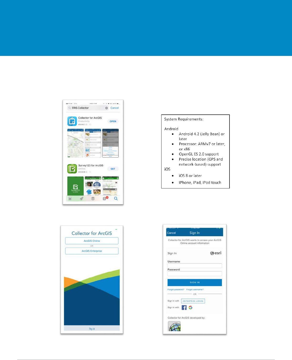
Below are step-by-step instructions for downloading, signing-in, and launching the ArcGIS Online app.
1.
If needed, download Collector App by searching ESRI Collector in the App Store.
2.
Start Collector App and sign in to ArcGIS Online.
Select ArcGIS Online Sign-in
How to Open ArcGIS Online
Overview
09.2018
Summary
Below are step-by-step instructions for downloading, signing-in, and launching the Survey123 app.
1. If needed, download the Survey123 App by searching Survey123 in the App Store.
2. Start the Survey123 App and sign in 3. Select Pipe Inspection Form
- Note: Surveys are device specific.
How to Open Survey123
Overview
09.2018
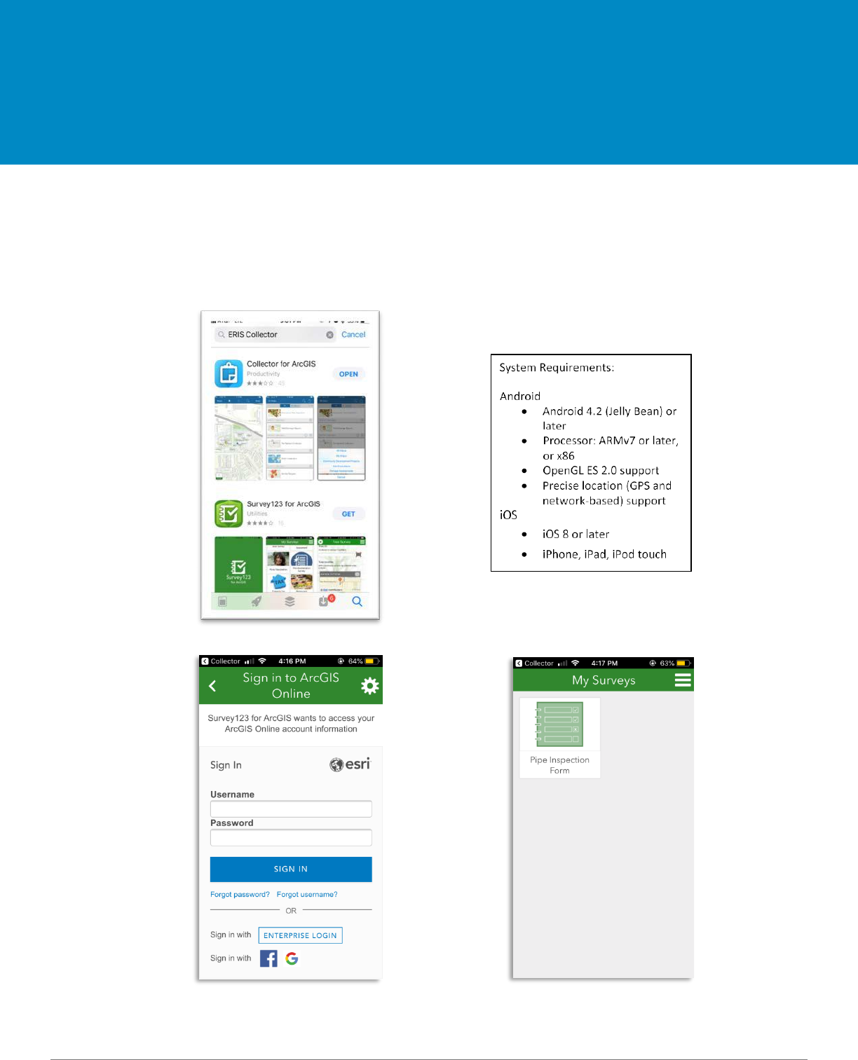
1. Search and open CTS Locations 2. The map will open and center on your location.
GPS On
When the ‘Current Location’ icon is
highlighted white, the GPS finder is on.
GPS Off
When the icon is not highlighted white,
the GPS tracker is off.
How to Open CTS Locations Map
Overview
09.2018
Summary
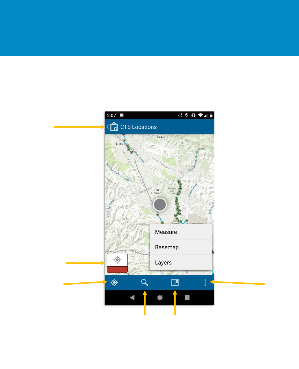
This is an overview of the ArcGIS Online for mobile interface.
Home Screen Menu
Overview
Map Gallery
Location Accuracy
Current Location Overflow
Search Bookmark
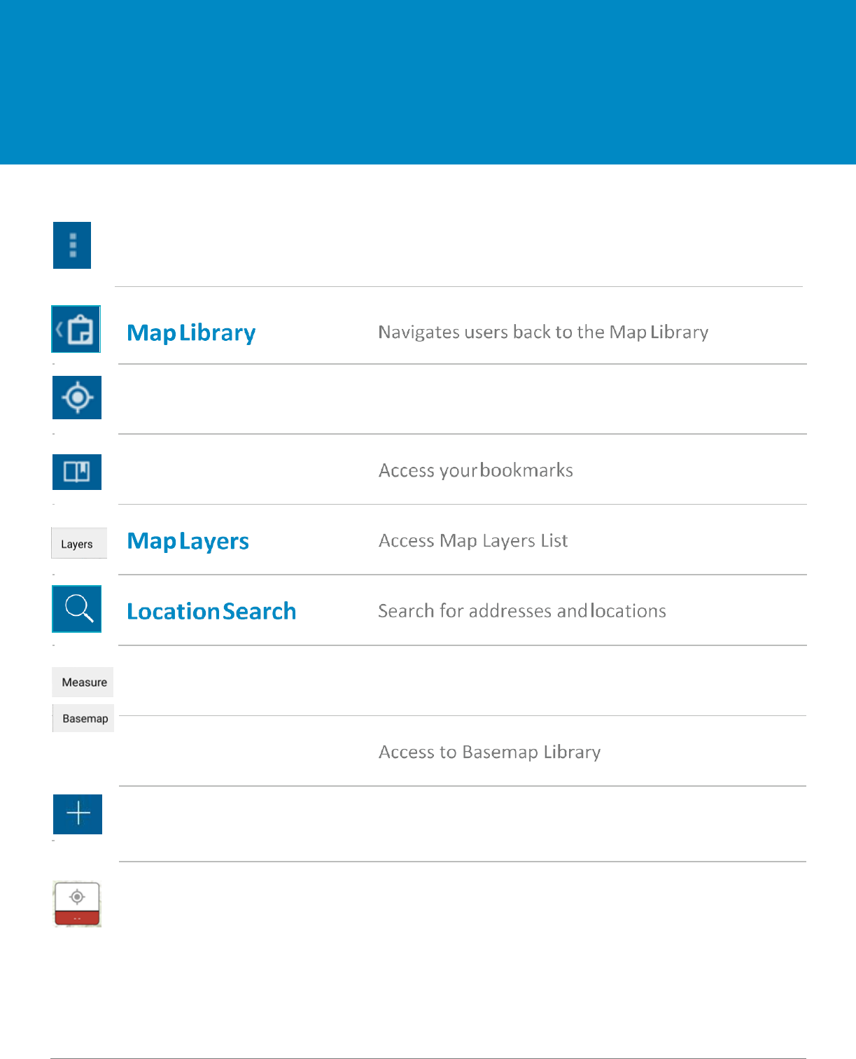
09.2018
Overflow Expands toolbar and shows the additional tools
Add a feature Create new point, polygon, or line
Accuracy Integration Horizontal and Vertical Accuracy
Measuring Tool
Access Measurement Toolkit
Basemaps
Home Screen Menu
Overview
Current Location
Center map on your current location
Bookmarks
09.2018
Map Library
Overview
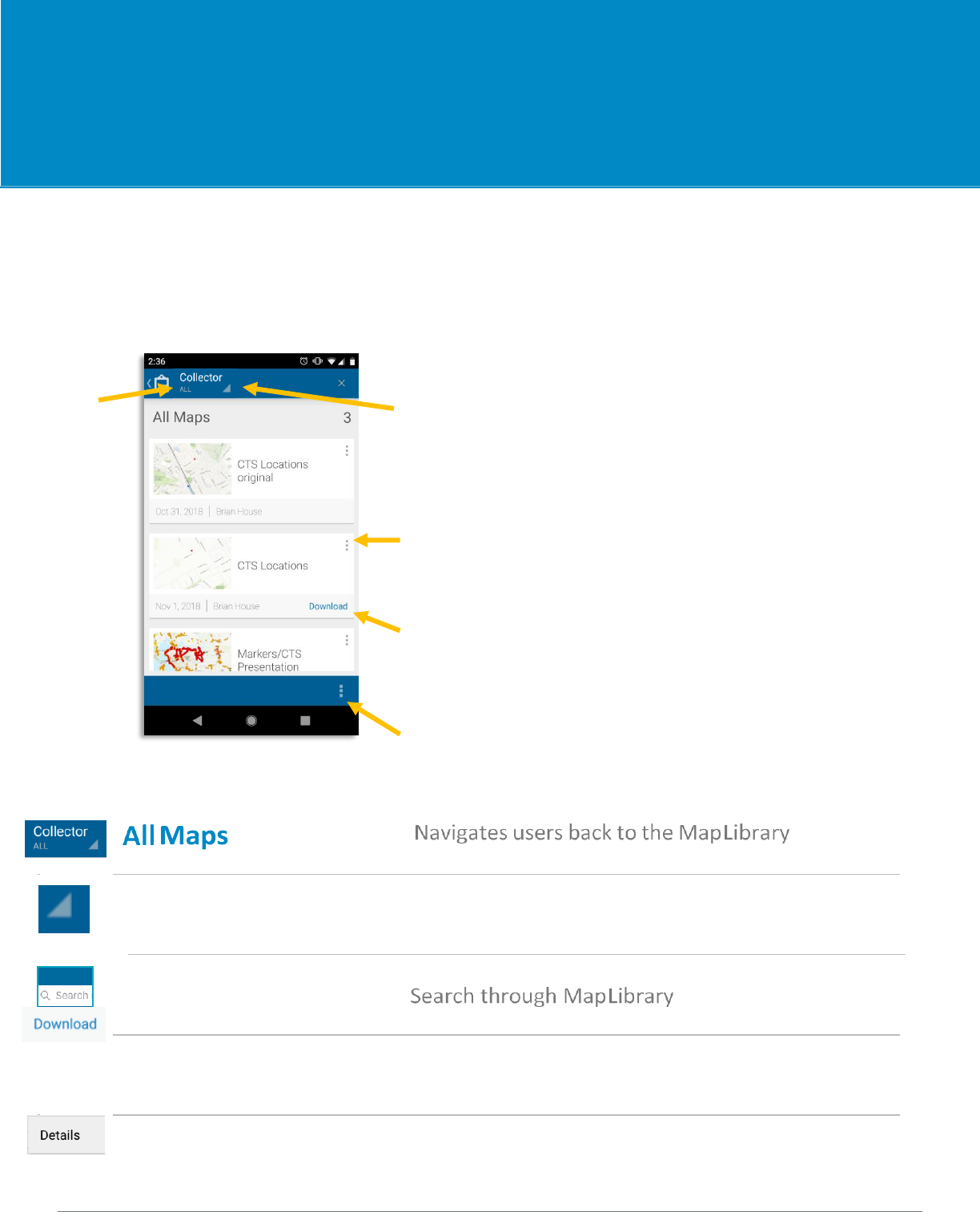
Summary
This is where all your maps are stored. You’ll have the option to store the map on your device.
Map Library Toolbar
All Maps Stored Maps
Map Details
Download
Overflow/Account Settings
Map Details View map and survey details
Stored Maps
Toggle between Cloud-Based and On Device
Search Maps
Download to Device
Store Maps on Device for ‘offline use’
Map Library
Overview

09.2018
• Syncing of offline data should be
available via wifi or cellular data.
• These can be configured in
settings on the home screen.
• Open Settings and scroll
down to General
• Select Maps Downloads
and Sync
• Select Wifi or Cellular
Map Library
Overview

09.2018
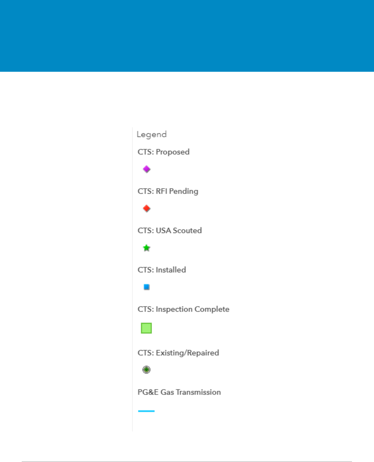
The available layers to view are CTS: Proposed, CTS: RFI Pending,
CTS: USA Scouted, CTS: Installed, CTS: Inspection Complete, CTS:
Existing/Repaired, ETS, PG&E Gas Transmission, City County
Boundaries, and Parcels. If the blue circle to the left of the layer
option is checked and blue, the layer is turned-on and will appear
on the map.
If connected to WIFI or mobile data (not working ‘On Device’) you
can access any ESRI basemap at any time. While connected to WIFI
or mobile data, you can store basemaps to be used when working
‘On Device’. This is where you can change the display type of the
map that appears on your screen.
Online/On
Device Toggle
Map Layers and Basemaps
Overview
09.2018
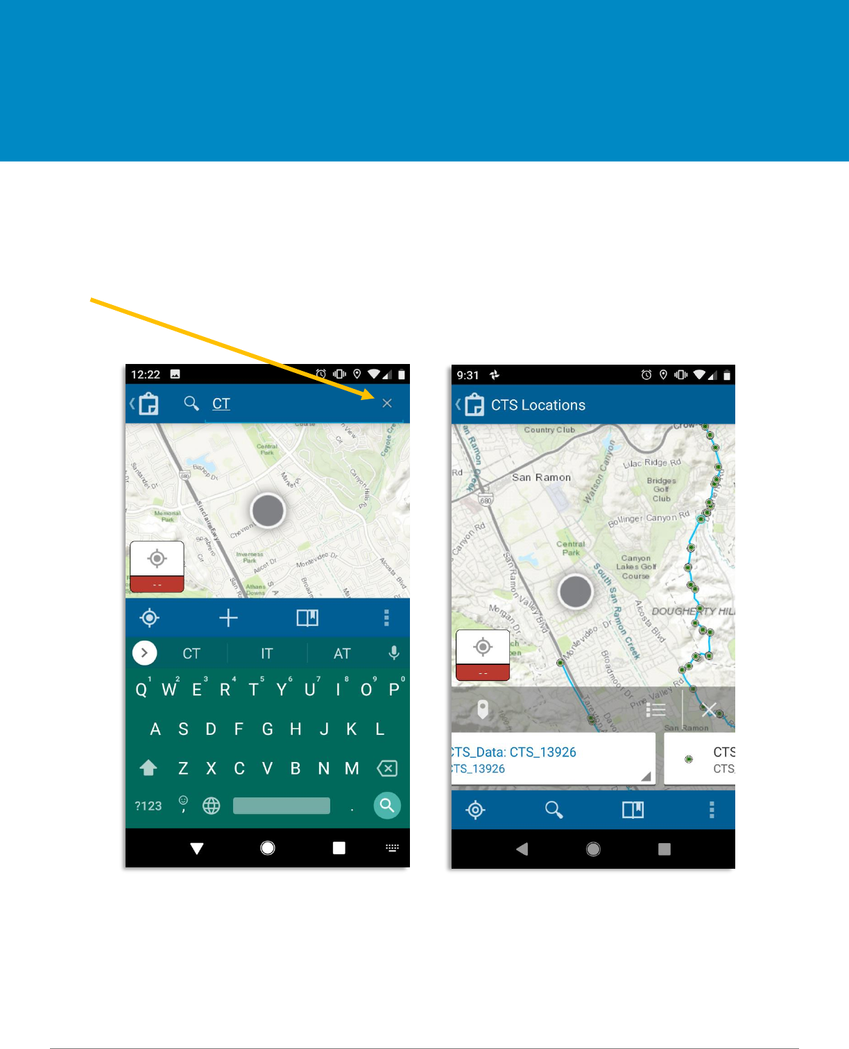
Summary
This is where you can search for places, addresses, or specific CTS locations. Once you enter the place or
address you would like to locate, the map will adjust accordingly. The search can be removed by selecting
the ‘x’ mark within the search bar.
Location Search
Overview

09.2018
Upload and Sync
Offline Maps
ArcGIS Collector
09.2018
Summary
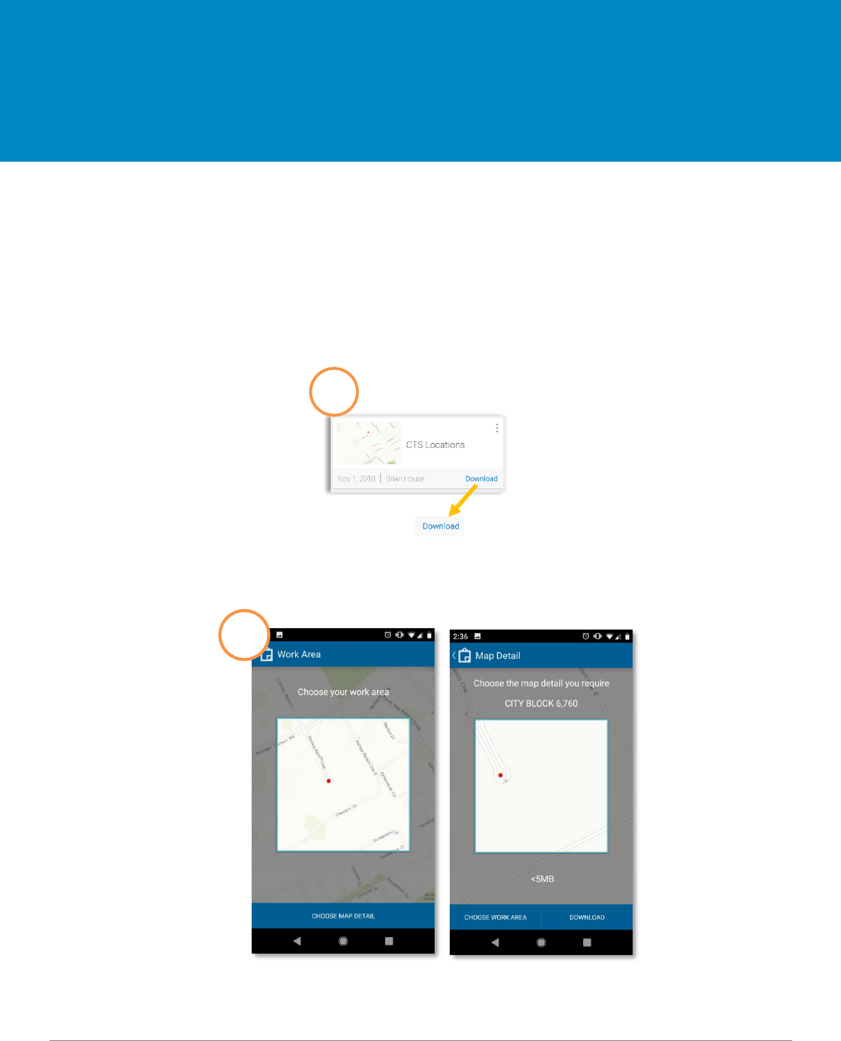
If you are working in a remote area with limited cellular service, you can download a map to work offline to
work ‘On Device’. If offline or working ‘On Device’, after you have re-established cellular service, you will
need to go back to the ‘Maps’ menu under ‘On Device’ and click ‘sync’ these features to ArcGIS Online.
This requires cellular data or WIFI connection.
Downloading a map for offline use
Click on the icon to
download the map.
1
2
Upload/Sync Offline Maps
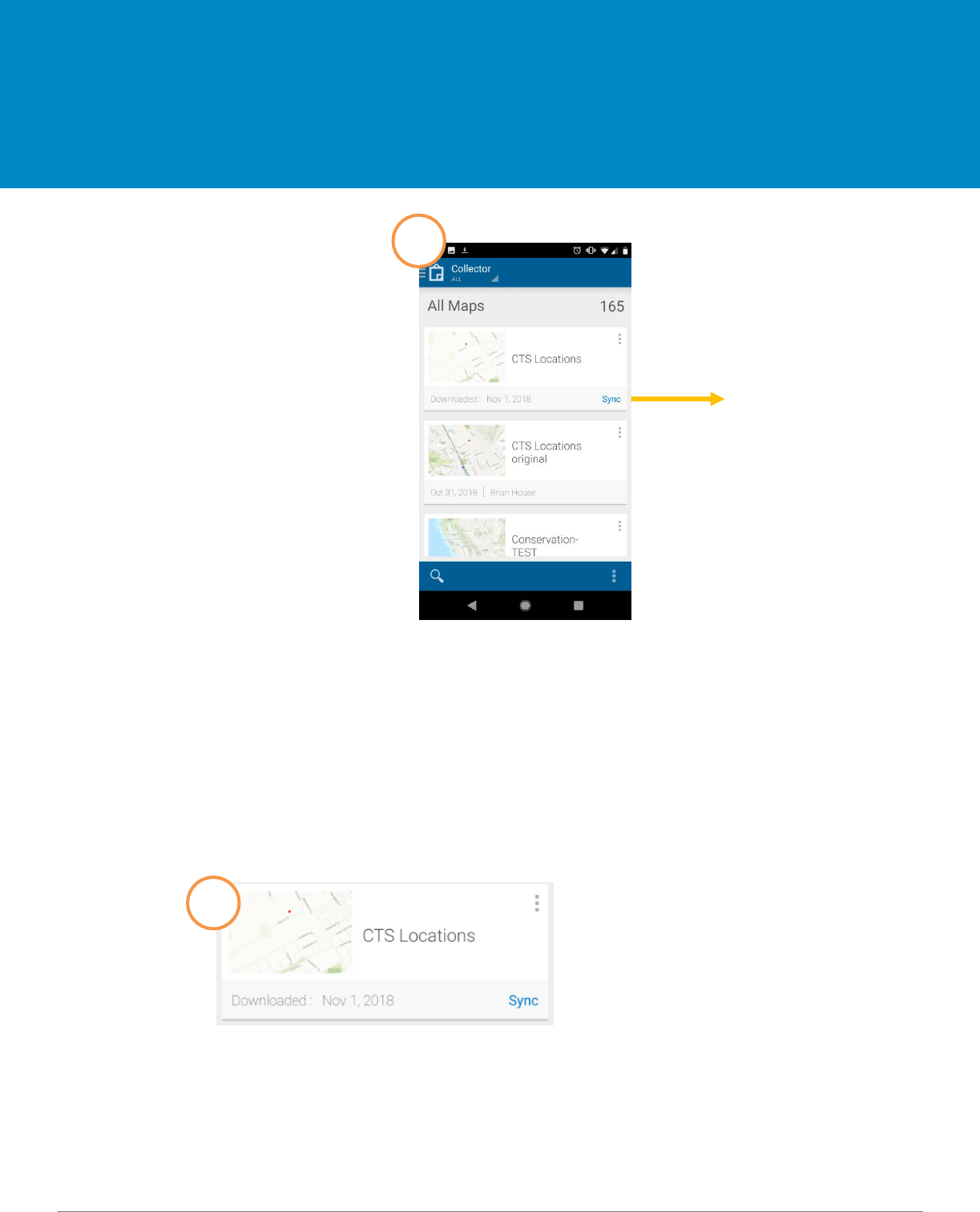
09.2018
Sync means the
map is now
downloaded
onto your device
and is ready to
sync
Syncing your offline activity
If you are working offline or ‘On Device’, be sure to sync your data once you have re-established either
cellular service or have a WiFi connection. Once you have finished syncing all your offline maps, you can
delete the saved maps from your device.
Select Sync
submit the
features added
offline to
ArcGIS Online.
Upload/Sync Offline Maps
3
1

09.2018
If you are working online, connected to ArcGIS
Online with WiFi or cellular data, you do not need
to sync because it is done every time you select
submit.
2
Click here and
select “On
Device” to delete
the map off of
your device once
you have
completed
synced to ArcGIS
3
4
Select “Remove”
Select Overflow and then
Manage.
Select “Remove
features and
basemap” to delete
the map from your
device
NOTE: DO NOT REMOVE DOWNLOADED MAP
UNTIL ALL DATA IS UPDATED AND SENT IN
SURVEY123.
Upload/Sync Offline Maps

09.2018
Collecting
Data
ArcGIS Collector
09.2018
Summary
Below are the meanings of the symbols and colors that are seen throughout the map as you input the
information for each layer.
Symbols
Legend
09.2018
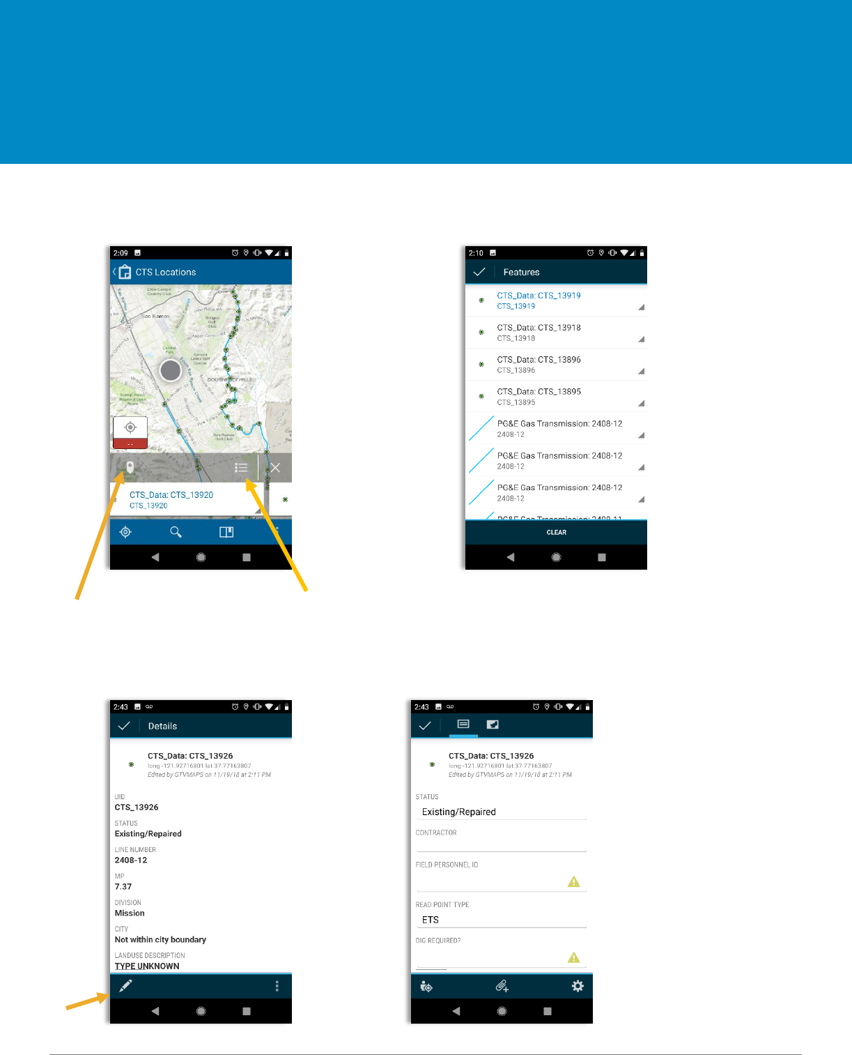
1. Search for specific CTS Location 2. Select the Pin icon or List to identify the specific
CTS location that needs to be edited
Pin Icon List
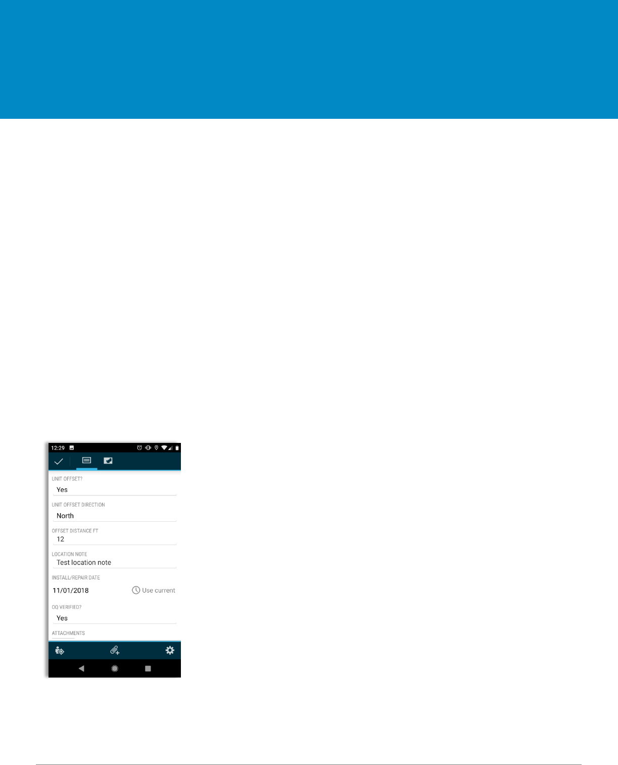
3. Select specific CTS Location to 4. Fill out all the pertinent data within collector
open details and select edit
Edit
Editing Data
Map Layers
09.2018
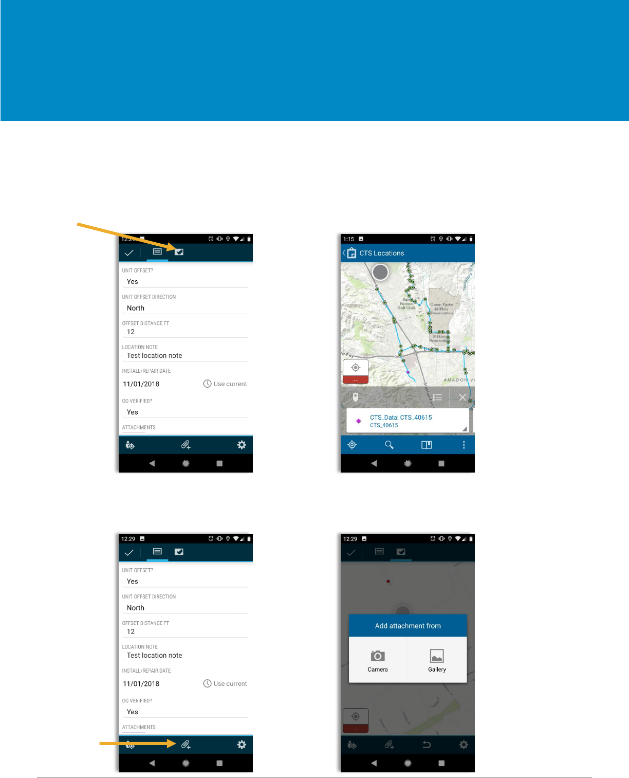
5. If a CTS location is incorrect and needs to be moved:
- Select map icon (this will highlight the CTS point)
- Hold finger down on the screen in order to move the CTS location to the correct area
Map Icon
6. Select the camera button 7. Select camera, take photo (do not choose from gallery),
to take a photo click on photo and rename, and select checkmark
Camera Button
Editing Data
Map Layers
09.2018
8. Types of photos to be included:
- Pre-construction: This will be a picture of the site before any disturbance has occurred
- TOP prep: this will be a picture of the site before any disturbance has occurred
- Cad-weld or Pin Braze: this label will depend on which applications were used
and self-explanatory.
- Handi cap or Hot wax: this label will depend on which application was used and
self-explanatory.
- AC measurement
- DC measurement
- CTS Terminated: this is a picture of the wires terminated in the post head
- Restoration: this is a picture of the area restored and completed
- Pre-dig
- Project documents: (Optional) any other documents that may be pertinent to the install
JSA, Hot work, excavation report, Asbestos chain of custody, coating report if Hot wax was
used, etc.
9. Once all edits are complete, select checkmark
Editing Data
Map Layers

09.2018
Inspectors
Only -
Collecting
Data
Survey123
09.2018
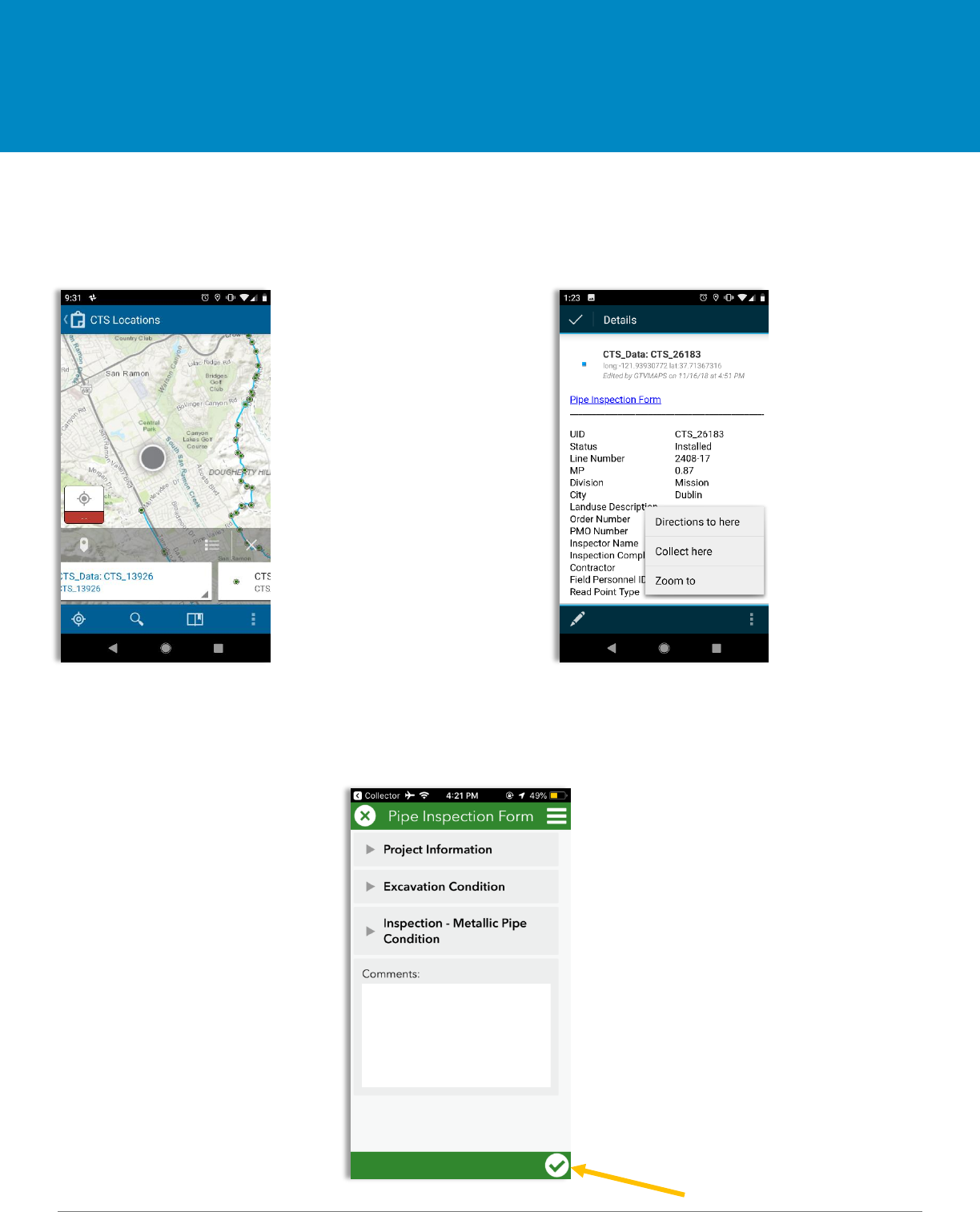
1. Within Collector, select Pin or List Icon 2. Select Pipe Inspection Form hyperlink
and select specific CTS Location from the Details page in Collector in
order to open Survey123
2. Fill out all information. There 3. Select checkmark when complete.
shouldn’t be any blank fields.
Checkmark
Inspectors Only - Collecting Data Survey123
09.2018
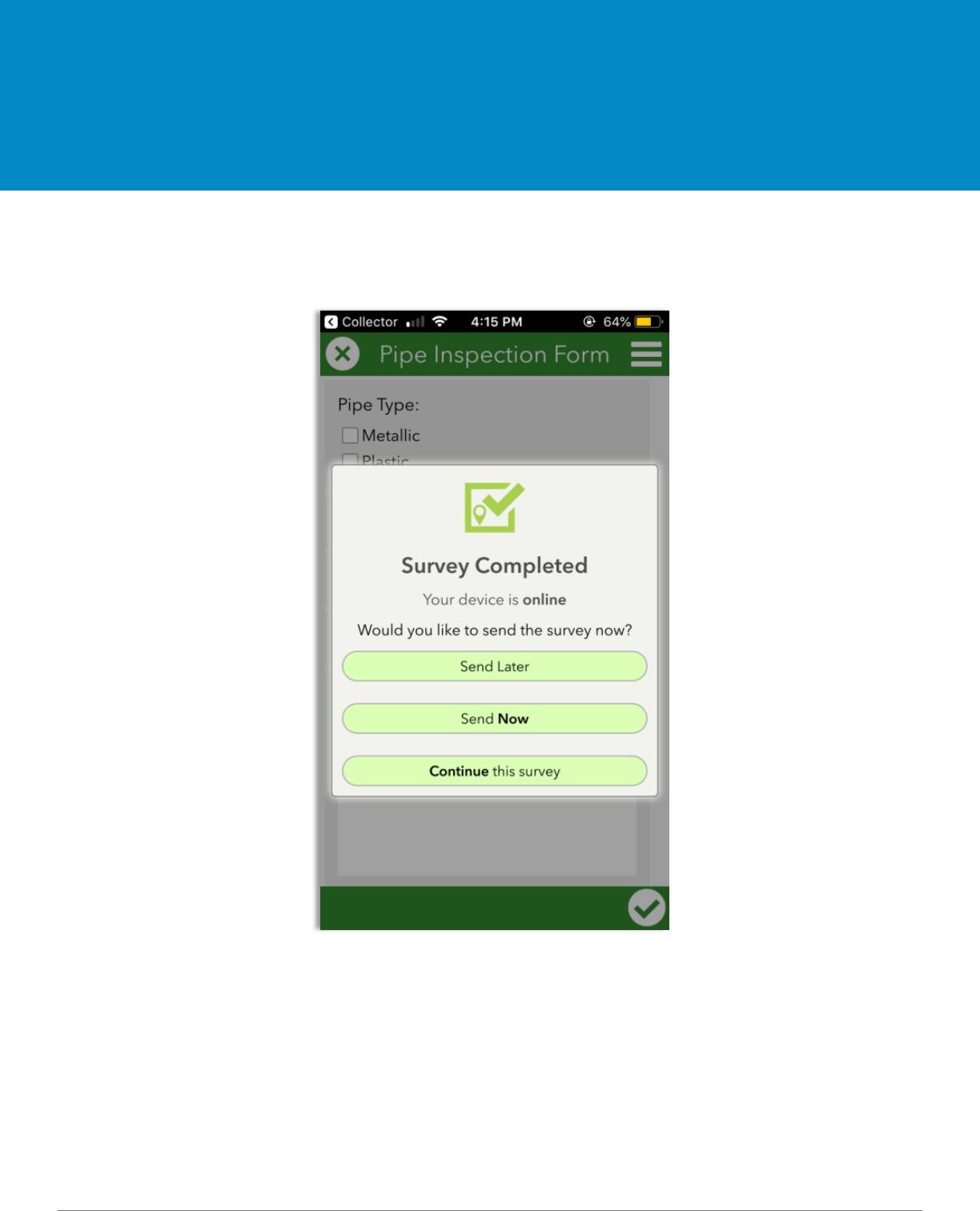
1. Select ‘Send Now’
Inspectors Only - Sending Data (online)
Survey 123
09.2018
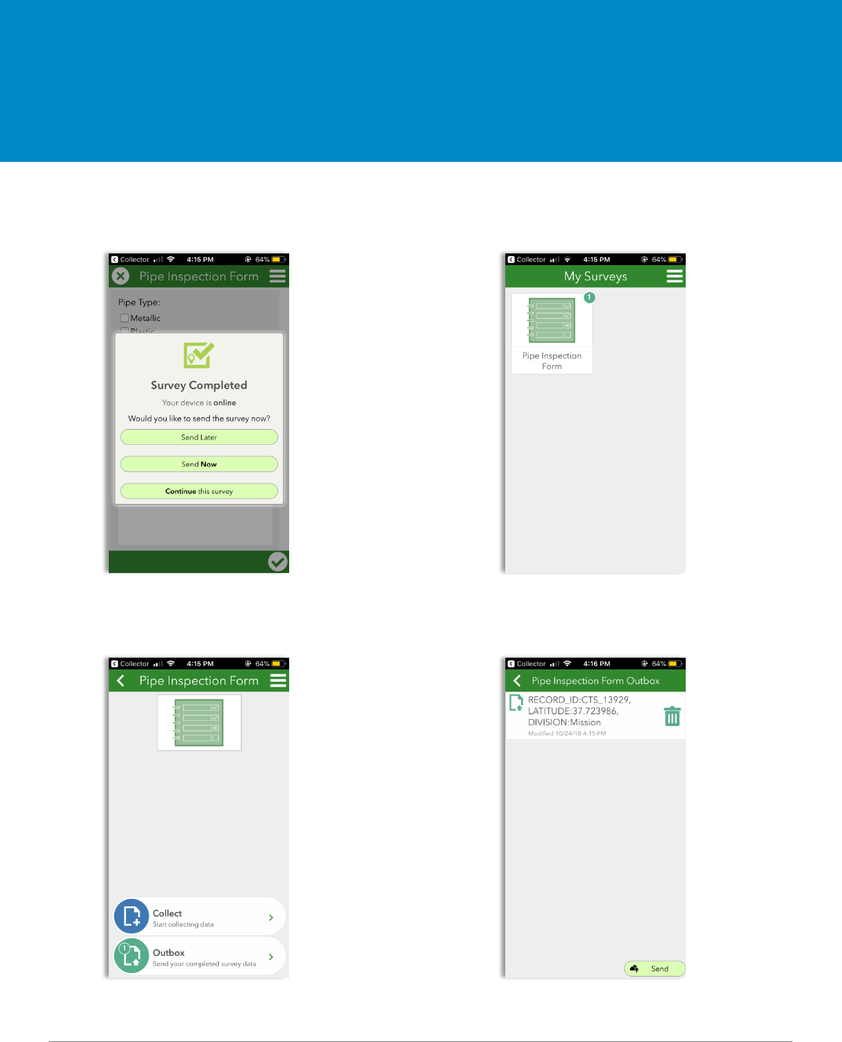
1. Select ‘Send Later’ 2. Once you’re back in service, go to
My Surveys and select Pipe Inspection
Form. There should be a ‘1’ in the corner.
3. Select Outbox 4. Select Send
Inspectors Only - Sending Data (offline)
Survey 123

09.2018
1. Crews will use the web map titled “CTS Locations” to collect data. If the work site is in a location
outside of cellular service, the map area must be downloaded to a device prior to being offline.
2. Within the “CTS Locations” web map, crew will navigate to appropriate CTS data point and begin
collecting data
-All editable fields should be collected
3. If RFI is needed, the crew sets status of point to “RFI Pending” and moves the location of the
point to where the actual install will take place
4. Record the reason for the RFI in comment section
5. Construction Manager will assess the “RFI Pending” point and change the status to “Proposed”
once it is approved on the Shovel Ready Report
6. Crew will collect the following photos and attach to the point data in collector
- Pre-construction: This will be a picture of the site before any disturbance has occurred
- TOP prep: this will be a picture of the site before any disturbance has occurred
- Cad-weld or Pin Braze: this label will depend on which applications were used
and self-explanatory.
- Handi cap or Hot wax: this label will depend on which application was used and
self-explanatory.
- AC measurement
- DC measurement
- CTS Terminated: this is a picture of the wires terminated in the post head
- Restoration: this is a picture of the area restored and completed
- Pre-dig
- Project documents: (Optional) any other documents that may be pertinent to the install
JSA, Hot work, excavation report, Asbestos chain of custody, coating report if Hot wax was
used, etc.
7. Inspector will use the web map titled “CTS Locations – Inspector” to collect data and access the
pipe inspection form.
- Within this map, the inspector will fill out the “Inspector Name” and “Inspection Complete”
fields
8. Inspector will follow “Pipe Inspection Form” hyperlink to fill out/submit the Survey123 Form
General Workflow

09.2018
Links and Resources
ArcGIS Collector
and Survey123