GeoServer Spatial Extension Geo Server WPS 1.0 User Manual En V.1.la
User Manual:
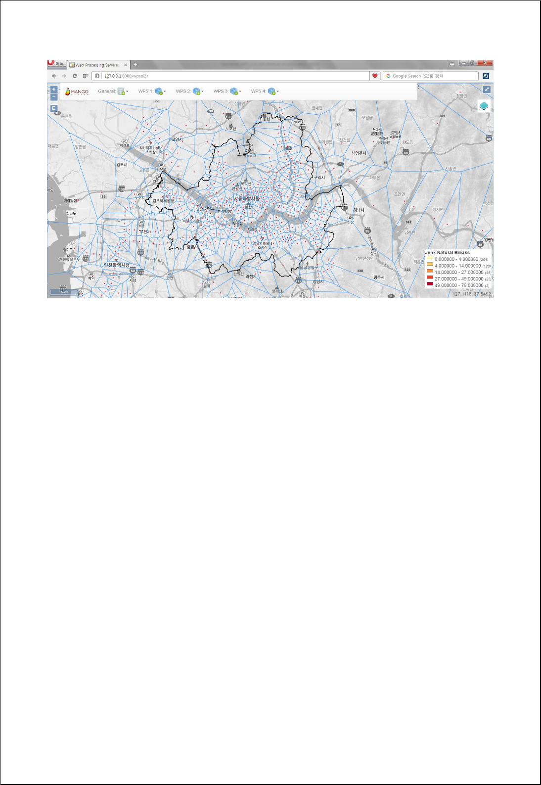
Open the PDF directly: View PDF ![]() .
.
Page Count: 397 [warning: Documents this large are best viewed by clicking the View PDF Link!]


Spatial Extension for GeoServer WPS v1.0 User Manual (TBD)
This manual is supported by Ministry of Land Infrastructure Transport (R&D 14NSIP-B080144-
01).
9 August 2016. 1st edition published
1 October 2017. 2nd edition published.
Author: Minpa Lee, Jihyun Kim
Reviewer: TBD
Cover Design: TBD
Editor: TBD
Copyright: Mangosystem(ltd.)
Publisher: Gia3D(ltd.)
Address: TBD
Tel: 042-330-0400
Fax: 042-330-0410
Publication Code: 2012-000016
ISBN: 978-89-969532-6-5(95000)
NOTICE: It is not for sale.

Copyright Notice
Copyright ⓒ 2016 MangoSystem Inc. All Rights Reserved.
Address: 2307-ho, Pyengchon O'biztower, 126, Beolmal-ro, Dongan-gu, Anyang-si, Gyeonggi-do,
431-060 South Korea
Tel: 82-31-450-3411 Fax: 82-31-450-3414
E-mail: master.mangosystem@gmail.com
Homepage: http://www.mangosystem.com
Online Documentation: http://gxt.mangosystem.com
Restricted Rights Legend
TBD
Trademarks
MangoSystem Spatial Extension for GeoServer WPS ® is belong to MangoSystem Inc. TBD.
Open Source Software Notice
TDB. It respects OSSL of “GeoTools”, “GeoServer”.
- GeoTools: http://www.geotools.org
- GeoServer: http://geoserver.org
User Manual Information
Title: User Manual of Spatial Extension for GeoServer WPS
Issue Date: 2016-12-31
SW Version: Spatial Extension for GeoServer WPS 1.0
User Manual Version: 1.0

목 차
1 Web Processing Service .............................................................................................................................. 6
2 Installation ......................................................................................................................................................... 6
3 Quick Start ......................................................................................................................................................... 6
4 WPS Processes for Spatial Analysis ........................................................................................................ 7
4.1. Spatial Analysis Processes ........................................................................................................ 7
4.2. Vector Analysis Processes ...................................................................................................... 11
4.2.1. Spatial Unit Creation ....................................................................................................... 11
4.2.2. Calculation ........................................................................................................................... 35
4.2.3. Extract .................................................................................................................................... 54
4.2.4. Overlay................................................................................................................................... 65
4.2.5. Proximity ............................................................................................................................... 82
4.2.6. Aggregation ...................................................................................................................... 107
4.2.7. Generalization .................................................................................................................. 138
4.2.8. Editing .................................................................................................................................. 153
4.2.9. Feature Tools .................................................................................................................... 169
4.3. Raster Analysis .......................................................................................................................... 232
4.3.1. Descriptive ......................................................................................................................... 232
4.3.2. Conversion ......................................................................................................................... 238
4.3.3. Distance .............................................................................................................................. 254
4.3.4. Math ..................................................................................................................................... 258
4.3.5. Classification ..................................................................................................................... 264

4.3.6. Extraction ............................................................................................................................ 267
4.3.7. Density ................................................................................................................................. 281
4.3.8. Interpolation ..................................................................................................................... 291
4.3.9. Surface Analysis ............................................................................................................... 298
4.3.10. Zonal..................................................................................................................................... 310
4.3.11. Projection ........................................................................................................................... 314
4.4. Spatial Statistics Analysis ..................................................................................................... 321
4.4.1. Descriptive ......................................................................................................................... 321
4.4.2. Distributions ...................................................................................................................... 333
4.4.3. Point Pattern Analysis ................................................................................................... 350
4.4.4. Global Spatial Auto-Correlation ............................................................................... 361
4.4.5. Local Spatial Auto-Correlation .................................................................................. 379
4.4.6. Global Spatial Modeling .............................................................................................. 394

1 Web Processing Service -- TBD
2 Installation -- TBD
3 Quick Start -- TBD

4 WPS Processes for Spatial Analysis
4.1. Spatial Analysis Processes
A full list of spatial analysis processes provided in Oct. 2017 is as follows.
Main
category
Subcategory
Process
Vector
Analysis
Spatial Unit Creation
Fishnet Grids by Count
Fishnet Grids by Size
Hexagonal Grids
Triangular Grids
Circular Grids
Thiessen Polygon
Delaunay Triangulation polygon
Random Points
Random Points per Features
Calculation
Calculate XY Coordinate
Calculate Area
Calculate Length
Calculate Field
Calculate Count
Sum Polygon Areas
Extract Values to Points
Extract
Select Features
Clip with Geometry
Clip with Features
Merge Features
Overlay
Union
Intersect
Symmetrical Difference
Difference
Identity
Update
Proximity
Buffer Features using Expression
Single Sided Buffer
Multiple Ring Buffer
Wedge Buffer

Near
Nearest Neighbor Count
Polar Grids from Geometry
Polar Grids from Features
Aggregation
Point Statistics
Aggregate Polygons
Collect Events
Spatial Join
Attribute Join
Buffer Point Statistics
Sum Line Lengths
Hexagonal Binning
Rectangular Binning
Circular Binning
Spatial Clump Map
Generalization
Dissolve
Remove Polygon Holes
Remove Polygon Part
Simplify
Densify
Eliminate
Editing
Reverse Line Direction
Offset Features
Snap Points To Lines
Extend Line
Trim Line
Delete Duplicated Geometries
Feature Tools
Feature to Point
Singlepart to Multipart
Multipart to Singlepart
Feature Envelope to Polygon
Points to Line
Ring Maps
Wind Rose Maps
Hub Lines by ID
Hub Lines by Nearest Distance
Feature To Line
Feature To Polygon

Feature Vertices To Points
Repair Geometry
Create Points along Line
Split Line At Point
Split Line At Vertices
Split Line By Distance Expression
Intersection Points from Lines
Feature To Octagonal Envelope
Feature To Minimum Rectangle
Feature To ConvexHull
Feature To Minimum Bounding Circle
Create Flow Map from Line Features
Raster
Analysis
Descriptive
Basic Statistics
Histogram
Conversion
Features To Coverage
Points To Coverage
Geometry To Coverage
GridCoverage To Point
GridCoverage To Polygon
GridCoverage To Image
Classification
Reclass
Extract
Extract by Attributes
Conditional Expression
Extract by Geometry
Extract by Extent
Extract by Circle
Raster Conditional Expression
Density
Kernel Density
Point Density
Line Density
Distance
Euclidean Distance
Math
Math
Interpolation
Inverse Distance Weighted
Thin Plate Spline
Zonal
Zonal Statistics
Projection
Resample
Redefine Projection
Reproject

Surface Analysis
Raster Profile
Radial Line Of Sight
Linear Line Of Sight
Find Highest/Lowest Points
Spatial
Statistics
Descriptive
Basic Statistics
Pearson Correlation Coefficient
Standardized Score of Dissimilarity
Focal Location Quotients
Distributions
Mean Center
Median Center
Central Feature
Standard Distance
Standard Deviational Mean
Linear Directional Mean
Point Pattern Analysis
Nearest Neighbor Statistic
K-Nearest Neighbor Map
Quadrat Method
K-Means Clustering
Global Spatial Auto-Correlation
Join Count Statistic
Moran’s I
Geary’s c
Getis-Ord’s General G
Lee’s S
Lee’s L
Local Spatial Auto-Correlation
Local Moran’s I
Local Geary’s c
Local G(Gi*)
Lee’s Si
Lee’s Li
Global Spatial Modeling
Ordinary Least Squares (OLS)
Note: It will be updated continuously.

4.2. Vector Analysis Processes
These processes are for vector data analysis and processing.
4.2.1. Spatial Unit Creation
These processes are for creating various spatial analysis units like grid, hexagon,
triangular, circle, and Thissen Polygon.
4.2.1.1.
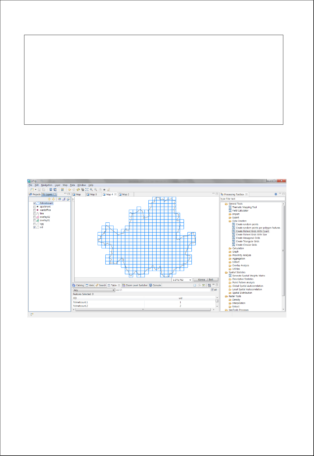
Fishnet Grid by Count
Creates a Fishnet Grid based on the specified spatial extent (extent) and the number of
columns and rows (columns, rows).
Syntax
FishnetCount (ReferencedEnvelope extent, SimpleFeatureCollection boundsSource,
Boolean boundaryInside, Integer columns, Integer rows): SimpleFeatureCollection
Parameters
Data Inputs
Identifier
Description
Type
Required
extent
The extent of the grids.
Complex
boundsSource
Bounds Source Features.
Complex
-
boundaryInside
Bounds Inside.
Literal
-
columns
Number of columns.
Literal
rows
Number of Rows.
Literal
Process Outputs
Identifier
Description
Type
Required
result
Output features.
Complex
Constraints
- If the boundsSource parameter is set, creates a fishnet grid only intersecting with
the boundary of boundsSource.

- If the boundsSource parameter is set and the boundaryInside parameter is set to
True, creates only a fishnet grid contained within the boundary of boundsSource.
Request Examples
<?xml version="1.0" encoding="UTF-8"?><wps:Execute version="1.0.0" service="WPS"
xmlns:xsi="http://www.w3.org/2001/XMLSchema-instance" xmlns="http://www.opengis.net/wps/1.0.0"
xmlns:wfs="http://www.opengis.net/wfs" xmlns:wps="http://www.opengis.net/wps/1.0.0"
xmlns:ows="http://www.opengis.net/ows/1.1" xmlns:gml="http://www.opengis.net/gml"
xmlns:ogc="http://www.opengis.net/ogc" xmlns:wcs="http://www.opengis.net/wcs/1.1.1"
xmlns:xlink="http://www.w3.org/1999/xlink" xsi:schemaLocation="http://www.opengis.net/wps/1.0.0
http://schemas.opengis.net/wps/1.0.0/wpsAll.xsd">
<ows:Identifier>statistics:FishnetCount</ows:Identifier>
<wps:DataInputs>
<wps:Input>
<ows:Identifier>extent</ows:Identifier>
<wps:Data>
<wps:BoundingBoxData crs="EPSG:3857" dimensions="2">
<ows:LowerCorner>1.4111357E7 4498975.0</ows:LowerCorner>
<ows:UpperCorner>1.4158036E7 4537337.0</ows:UpperCorner>
</wps:BoundingBoxData>
</wps:Data>
</wps:Input>
<wps:Input>
<ows:Identifier>boundsSource</ows:Identifier>
<wps:Reference mimeType="text/xml" xlink:href="http://geoserver/wfs" method="POST">
<wps:Body>
<wfs:GetFeature service=“WFS” version=“1.1.0” outputFormat=“GML3”
xmlns:foss="http://www.opengeospatial.net/foss">
<wfs:Query typeName="foss:sid"/>
</wfs:GetFeature>
</wps:Body>
</wps:Reference>
</wps:Input>
<wps:Input>
<ows:Identifier>columns</ows:Identifier>
<wps:Data>
<wps:LiteralData>25</wps:LiteralData>
</wps:Data>
</wps:Input>
<wps:Input>
<ows:Identifier>rows</ows:Identifier>
<wps:Data>
<wps:LiteralData>25</wps:LiteralData>
</wps:Data>
</wps:Input>
</wps:DataInputs>
<wps:ResponseForm>
<wps:RawDataOutput mimeType=“text/xml; subtype=wfs-collection/1.1”>
<ows:Identifier>result</ows:Identifier>
</wps:RawDataOutput>
</wps:ResponseForm>
</wps:Execute>
Response
The following figure shows an example of creating a 25 by 25 fishnet grid based on the
administrative boudary.

4.2.1.2.
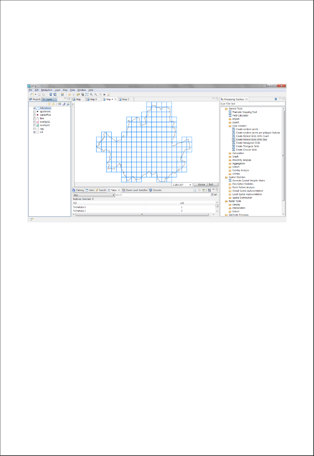
Fishnet Grids by Size
Creates a Fishnet Grid based on the specified spatial extent (extent) and the cell size
(width, height).
Syntax
FishnetSize (ReferencedEnvelope extent, SimpleFeatureCollection boundsSource, Boolean
boundaryInside, Double width, Double height): SimpleFeatureCollection
Parameters
Data Inputs
Identifier
Description
Type
Required
extent
The extent of the grids.
Complex
boundsSource
Bounds Source Features.
Complex
-
boundaryInside
Bounds Inside.
Literal
-
width
Width of Each Cell.
Literal
height
Height of Each Cell.
Literal
Process Outputs
Identifier
Description
Type
Required
result
Output features.
Complex
Constraints
- If the boundsSource parameter is set, creates a fishnet grid only intersecting with
the boundary of boundsSource.
- If the boundsSource parameter is set and the boundaryInside parameter is set to
True, creates only a fishnet grid contained within the boundary of boundsSource.
Request Examples
<?xml version="1.0" encoding="UTF-8"?><wps:Execute version="1.0.0" service="WPS"
xmlns:xsi="http://www.w3.org/2001/XMLSchema-instance" xmlns="http://www.opengis.net/wps/1.0.0"
xmlns:wfs="http://www.opengis.net/wfs" xmlns:wps="http://www.opengis.net/wps/1.0.0"
xmlns:ows="http://www.opengis.net/ows/1.1" xmlns:gml="http://www.opengis.net/gml"
xmlns:ogc="http://www.opengis.net/ogc" xmlns:wcs="http://www.opengis.net/wcs/1.1.1"

xmlns:xlink="http://www.w3.org/1999/xlink" xsi:schemaLocation="http://www.opengis.net/wps/1.0.0
http://schemas.opengis.net/wps/1.0.0/wpsAll.xsd">
<ows:Identifier>statistics:FishnetSize</ows:Identifier>
<wps:DataInputs>
<wps:Input>
<ows:Identifier>extent</ows:Identifier>
<wps:Data>
<wps:BoundingBoxData crs="EPSG:3857" dimensions="2">
<ows:LowerCorner>1.4111357E7 4498975.0</ows:LowerCorner>
<ows:UpperCorner>1.4158036E7 4537337.0</ows:UpperCorner>
</wps:BoundingBoxData>
</wps:Data>
</wps:Input>
<wps:Input>
<ows:Identifier>boundsSource</ows:Identifier>
<wps:Reference mimeType="text/xml" xlink:href="http://geoserver/wfs" method="POST">
<wps:Body>
<wfs:GetFeature service=“WFS” version=“1.1.0” outputFormat=“GML3”
xmlns:foss="http://www.opengeospatial.net/foss">
<wfs:Query typeName="foss:sid"/>
</wfs:GetFeature>
</wps:Body>
</wps:Reference>
</wps:Input>
<wps:Input>
<ows:Identifier>width</ows:Identifier>
<wps:Data>
<wps:LiteralData>2500</wps:LiteralData>
</wps:Data>
</wps:Input>
<wps:Input>
<ows:Identifier>height</ows:Identifier>
<wps:Data>
<wps:LiteralData>2500</wps:LiteralData>
</wps:Data>
</wps:Input>
</wps:DataInputs>
<wps:ResponseForm>
<wps:RawDataOutput mimeType=“text/xml; subtype=wfs-collection/1.1”>
<ows:Identifier>result</ows:Identifier>
</wps:RawDataOutput>
</wps:ResponseForm>
</wps:Execute>
Response
The following figure shows an example of creating a fishnet grid of 2500×2500 meters
based on the administrative boundary (Si-Do).

4.2.1.3.
Hexagonal Grids
Creates a Hexagonal Grid based on the specified spatial extent (extent) and the cell size
(sideLen).
Syntax
Hexagon (ReferencedEnvelope extent, SimpleFeatureCollection boundsSource, Double
sideLen, HexagonOrientation orientation): SimpleFeatureCollection
Parameters
Data Inputs
Identifier
Description
Type
Required
extent
The extent of the grids.
Complex
boundsSource
Bounds Source Features.
Complex
-
sideLen
Side length, radius.
Literal
orientation
Hexagon Orientation: FLAT (default), ANGLED.
Literal
-
Process Outputs
Identifier
Description
Type
Required
result
Output features.
Complex
Constraints
- If the boundsSource parameter is set, creates hexagons only intersecting with the
boundary of the boundsSource.
- The sideLen parameter defines the distance from the hexagon’s center to its edge.
Request Examples
<?xml version="1.0" encoding="UTF-8"?><wps:Execute version="1.0.0" service="WPS"
xmlns:xsi="http://www.w3.org/2001/XMLSchema-instance" xmlns="http://www.opengis.net/wps/1.0.0"
xmlns:wfs="http://www.opengis.net/wfs" xmlns:wps="http://www.opengis.net/wps/1.0.0"
xmlns:ows="http://www.opengis.net/ows/1.1" xmlns:gml="http://www.opengis.net/gml"
xmlns:ogc="http://www.opengis.net/ogc" xmlns:wcs="http://www.opengis.net/wcs/1.1.1"
xmlns:xlink="http://www.w3.org/1999/xlink" xsi:schemaLocation="http://www.opengis.net/wps/1.0.0
http://schemas.opengis.net/wps/1.0.0/wpsAll.xsd">

<ows:Identifier>statistics:Hexagon</ows:Identifier>
<wps:DataInputs>
<wps:Input>
<ows:Identifier>extent</ows:Identifier>
<wps:Data>
<wps:BoundingBoxData crs="EPSG:3857" dimensions="2">
<ows:LowerCorner>1.4111357E7 4498975.0</ows:LowerCorner>
<ows:UpperCorner>1.4158036E7 4537337.0</ows:UpperCorner>
</wps:BoundingBoxData>
</wps:Data>
</wps:Input>
<wps:Input>
<ows:Identifier>boundsSource</ows:Identifier>
<wps:Reference mimeType="text/xml" xlink:href="http://geoserver/wfs" method="POST">
<wps:Body>
<wfs:GetFeature service=“WFS” version=“1.1.0” outputFormat=“GML3”
xmlns:foss="http://www.opengeospatial.net/foss">
<wfs:Query typeName="foss:sid"/>
</wfs:GetFeature>
</wps:Body>
</wps:Reference>
</wps:Input>
<wps:Input>
<ows:Identifier>sideLen</ows:Identifier>
<wps:Data>
<wps:LiteralData>1500</wps:LiteralData>
</wps:Data>
</wps:Input>
</wps:DataInputs>
<wps:ResponseForm>
<wps:RawDataOutput mimeType=“text/xml; subtype=wfs-collection/1.1”>
<ows:Identifier>result</ows:Identifier>
</wps:RawDataOutput>
</wps:ResponseForm>
</wps:Execute>
Response
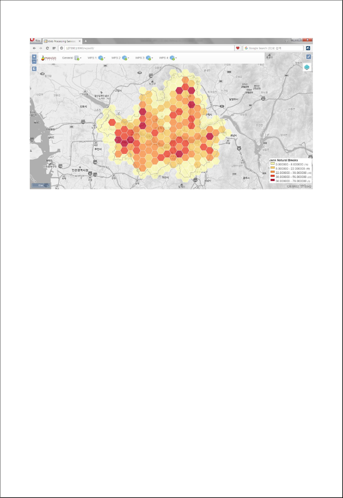
The following figure shows an example of the choropleth map of the apartment density
calculated on the hexagonal grid with the hexagon size of 1500 meters based on the
administrative boundary.

4.2.1.4.
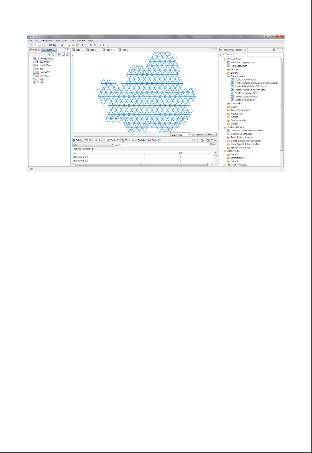
Triangular Grids
Create a Triangular Grid based on the specified extent (extent) and the cell size (size).
Syntax
TriangularGrid (ReferencedEnvelope extent, SimpleFeatureCollection boundsSource,
Double size, HexagonOrientation orientation): SimpleFeatureCollection
Parameters
Data Inputs
Identifier
Description
Type
Required
extent
The extent of the grids.
Complex
boundsSource
Bounds Source Features.
Complex
-
size
Grid Size.
Literal
orientation
Orientation: FLAT (default), ANGLED.
Literal
-
Process Outputs
Identifier
Description
Type
Required
result
Output features.
Complex
Constraints
- If the boundsSource parameter is set, creates triangular only intersecting with the
boundary of the boundsSource.
Request Examples
<?xml version="1.0" encoding="UTF-8"?><wps:Execute version="1.0.0" service="WPS"
xmlns:xsi="http://www.w3.org/2001/XMLSchema-instance" xmlns="http://www.opengis.net/wps/1.0.0"
xmlns:wfs="http://www.opengis.net/wfs" xmlns:wps="http://www.opengis.net/wps/1.0.0"
xmlns:ows="http://www.opengis.net/ows/1.1" xmlns:gml="http://www.opengis.net/gml"
xmlns:ogc="http://www.opengis.net/ogc" xmlns:wcs="http://www.opengis.net/wcs/1.1.1"
xmlns:xlink="http://www.w3.org/1999/xlink" xsi:schemaLocation="http://www.opengis.net/wps/1.0.0
http://schemas.opengis.net/wps/1.0.0/wpsAll.xsd">
<ows:Identifier>statistics:TriangularGrid</ows:Identifier>
<wps:DataInputs>
<wps:Input>
<ows:Identifier>extent</ows:Identifier>

<wps:Data>
<wps:BoundingBoxData crs="EPSG:3857" dimensions="2">
<ows:LowerCorner>1.4111357E7 4498975.0</ows:LowerCorner>
<ows:UpperCorner>1.4158036E7 4537337.0</ows:UpperCorner>
</wps:BoundingBoxData>
</wps:Data>
</wps:Input>
<wps:Input>
<ows:Identifier>boundsSource</ows:Identifier>
<wps:Reference mimeType="text/xml" xlink:href="http://geoserver/wfs" method="POST">
<wps:Body>
<wfs:GetFeature service=“WFS” version=“1.1.0” outputFormat=“GML3”
xmlns:foss="http://www.opengeospatial.net/foss">
<wfs:Query typeName="foss:sid"/>
</wfs:GetFeature>
</wps:Body>
</wps:Reference>
</wps:Input>
<wps:Input>
<ows:Identifier>size</ows:Identifier>
<wps:Data>
<wps:LiteralData>2500</wps:LiteralData>
</wps:Data>
</wps:Input>
</wps:DataInputs>
<wps:ResponseForm>
<wps:RawDataOutput mimeType=“text/xml; subtype=wfs-collection/1.1”>
<ows:Identifier>result</ows:Identifier>
</wps:RawDataOutput>
</wps:ResponseForm>
</wps:Execute>
Response
The following figure shows an example of creating a Triangular grid with a side length
of 2500 meter based on administrative boundary (Si-Do).

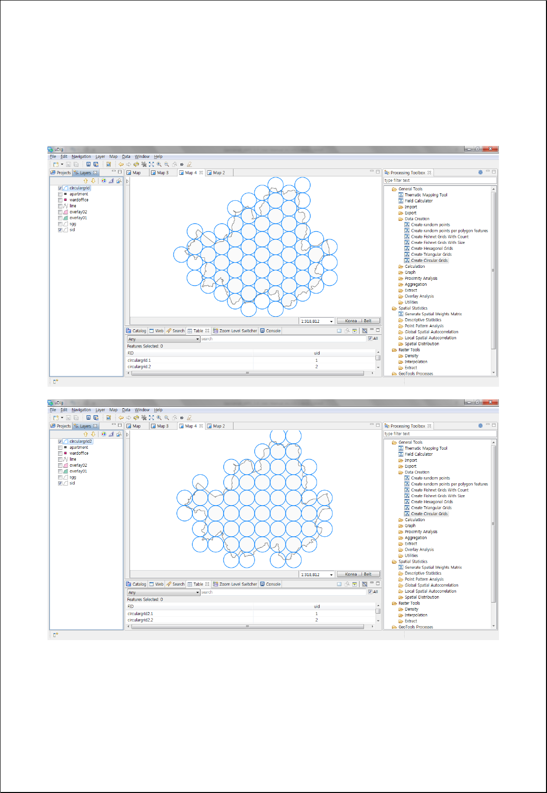
4.2.1.5.
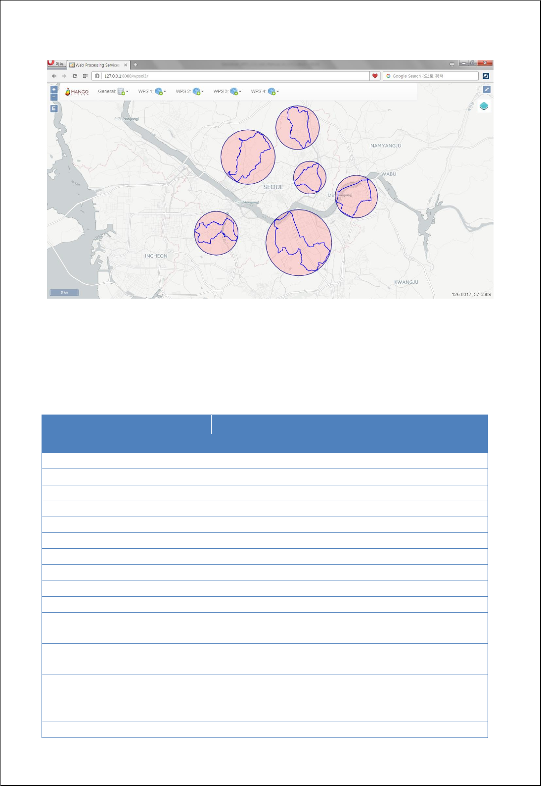
Circular Grids
Creates a Circular grid based on the specified extent (extent) and the cell size
(radius).
Syntax
CircularGrid (ReferencedEnvelope extent, SimpleFeatureCollection boundsSource, Double
radius, CircularType circularType): SimpleFeatureCollection
Parameters
Data Inputs
Identifier
Description
Type
Required
extent
The extent of the grids.
Complex
boundsSource
Bounds Source Features.
Complex
-
radius
Radius of the circle.
Literal
circularType
Circular Type: Grid (default), Hex.
Literal
-
Process Outputs
Identifier
Description
Type
Required
result
Output features.
Complex
Constraints
- If the boundsSource parameter is set, creates circular intersecting with the
boundary of the boundsSource.
- If the circularType is Grid, the rules of creating circular in grid follows the rules of
creating hexagons when the circularType is Hex.
Request Examples
<?xml version="1.0" encoding="UTF-8"?><wps:Execute version="1.0.0" service="WPS"
xmlns:xsi="http://www.w3.org/2001/XMLSchema-instance" xmlns="http://www.opengis.net/wps/1.0.0"
xmlns:wfs="http://www.opengis.net/wfs" xmlns:wps="http://www.opengis.net/wps/1.0.0"
xmlns:ows="http://www.opengis.net/ows/1.1" xmlns:gml="http://www.opengis.net/gml"
xmlns:ogc="http://www.opengis.net/ogc" xmlns:wcs="http://www.opengis.net/wcs/1.1.1"
xmlns:xlink="http://www.w3.org/1999/xlink" xsi:schemaLocation="http://www.opengis.net/wps/1.0.0

http://schemas.opengis.net/wps/1.0.0/wpsAll.xsd">
<ows:Identifier>statistics:CircularGrid</ows:Identifier>
<wps:DataInputs>
<wps:Input>
<ows:Identifier>extent</ows:Identifier>
<wps:Data>
<wps:BoundingBoxData crs="EPSG:3857" dimensions="2">
<ows:LowerCorner>1.4111357E7 4498975.0</ows:LowerCorner>
<ows:UpperCorner>1.4158036E7 4537337.0</ows:UpperCorner>
</wps:BoundingBoxData>
</wps:Data>
</wps:Input>
<wps:Input>
<ows:Identifier>boundsSource</ows:Identifier>
<wps:Reference mimeType="text/xml" xlink:href="http://geoserver/wfs" method="POST">
<wps:Body>
<wfs:GetFeature service=“WFS” version=“1.1.0” outputFormat=“GML3”
xmlns:foss="http://www.opengeospatial.net/foss">
<wfs:Query typeName="foss:sid"/>
</wfs:GetFeature>
</wps:Body>
</wps:Reference>
</wps:Input>
<wps:Input>
<ows:Identifier>radius</ows:Identifier>
<wps:Data>
<wps:LiteralData>2500</wps:LiteralData>
</wps:Data>
</wps:Input>
<wps:Input>
<ows:Identifier>circularType</ows:Identifier>
<wps:Data>
<wps:LiteralData>Hex</wps:LiteralData>
</wps:Data>
</wps:Input>
</wps:DataInputs>
<wps:ResponseForm>
<wps:RawDataOutput mimeType=“text/xml; subtype=wfs-collection/1.1”>
<ows:Identifier>result</ows:Identifier>
</wps:RawDataOutput>
</wps:ResponseForm>
</wps:Execute>
Response
The following figure shows an example of creating a Circular grid with a radius of 2500
meter in both Hexagon and Grid options based on the administrative boundary (Si-Do).

4.2.1.6.
Thiessen Polygon
Creates Thiessen polygon using input feature layers (inputFeatures).
Syntax
ThiessenPolygon (SimpleFeatureCollection inputFeatures, ThiessenAttributeMode
attributes, Geometry clipArea): SimpleFeatureCollection
Parameters
Data Inputs
Identifier
Description
Type
Required
inputFeatures
The point input features from which thiessen
polygons will be generated.
Complex
attributes
Attribute mode: ONLY_FID (default), ALL (retain input
feature’s attribute).
Literal
-
clipArea
The clip area polygon geometry.
Complex
-
Process Outputs
Identifier
Description
Type
Required
result
Output features.
Complex
Constraints
- Though the inputFeatures can be points, lines and polygons, Thissen polygon will
be output after creating gravity center.
- If the attributes parameter is All, maintains all attribute value of inputFeatures.
- If the clipArea parameter is given, returns clipped polygons in the relevant areas.
Request Examples
<?xml version="1.0" encoding="UTF-8"?><wps:Execute version="1.0.0" service="WPS"
xmlns:xsi="http://www.w3.org/2001/XMLSchema-instance" xmlns="http://www.opengis.net/wps/1.0.0"
xmlns:wfs="http://www.opengis.net/wfs" xmlns:wps="http://www.opengis.net/wps/1.0.0"
xmlns:ows="http://www.opengis.net/ows/1.1" xmlns:gml="http://www.opengis.net/gml"
xmlns:ogc="http://www.opengis.net/ogc" xmlns:wcs="http://www.opengis.net/wcs/1.1.1"
xmlns:xlink="http://www.w3.org/1999/xlink" xsi:schemaLocation="http://www.opengis.net/wps/1.0.0

http://schemas.opengis.net/wps/1.0.0/wpsAll.xsd">
<ows:Identifier>statistics:ThiessenPolygon</ows:Identifier>
<wps:DataInputs>
<wps:Input>
<ows:Identifier>inputFeatures</ows:Identifier>
<wps:Reference mimeType="text/xml" xlink:href="http://geoserver/wfs" method="POST">
<wps:Body>
<wfs:GetFeature service=“WFS” version=“1.1.0” outputFormat=“GML3”
xmlns:foss="http://www.opengeospatial.net/foss">
<wfs:Query typeName="foss:stores"/>
</wfs:GetFeature>
</wps:Body>
</wps:Reference>
</wps:Input>
<wps:Input>
<ows:Identifier>attributes</ows:Identifier>
<wps:Data>
<wps:LiteralData>ALL</wps:LiteralData>
</wps:Data>
</wps:Input>
</wps:DataInputs>
<wps:ResponseForm>
<wps:RawDataOutput mimeType=“text/xml; subtype=wfs-collection/1.1”>
<ows:Identifier>result</ows:Identifier>
</wps:RawDataOutput>
</wps:ResponseForm>
</wps:Execute>
Response
The following figure showsan example of creating Thiessen Polygon within current map
boundary based on national train/subway stations.

4.2.1.7.
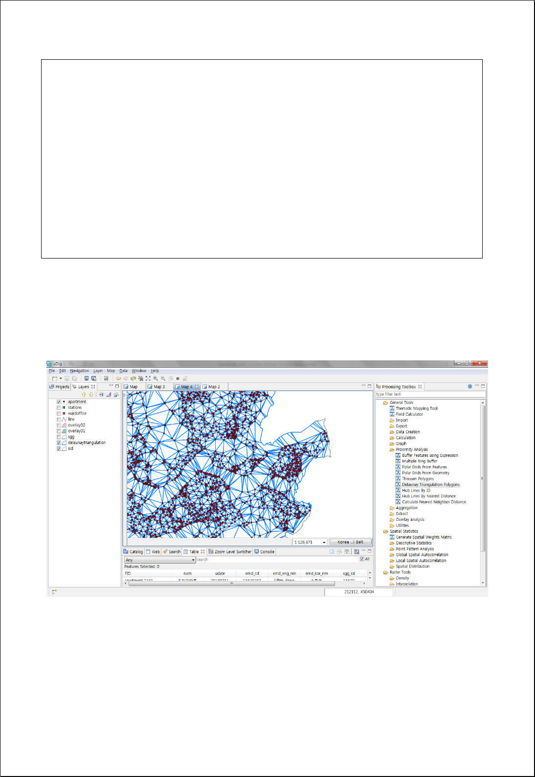
Delaunay Triangulation Polygons
Creates Delaunay Triangulation polygons using input point feature layers (inputFeatures).
Syntax
DelaunayTriangulation (SimpleFeatureCollection inputFeatures, Geometry clipArea):
SimpleFeatureCollection
Parameters
Data Inputs
Identifier
Description
Type
Required
inputFeatures
The point input features from which delaunay
triangulations will be generated.
Complex
clipArea
Clip area polygon.
Complex
-
Process Outputs
Identifier
Description
Type
Required
result
Output features.
Complex
Constraints
- If the clipArea parameter is given, returns clipped polygons in relevant areas.
Request Examples
<?xml version="1.0" encoding="UTF-8"?><wps:Execute version="1.0.0" service="WPS"
xmlns:xsi="http://www.w3.org/2001/XMLSchema-instance" xmlns="http://www.opengis.net/wps/1.0.0"
xmlns:wfs="http://www.opengis.net/wfs" xmlns:wps="http://www.opengis.net/wps/1.0.0"
xmlns:ows="http://www.opengis.net/ows/1.1" xmlns:gml="http://www.opengis.net/gml"
xmlns:ogc="http://www.opengis.net/ogc" xmlns:wcs="http://www.opengis.net/wcs/1.1.1"
xmlns:xlink="http://www.w3.org/1999/xlink" xsi:schemaLocation="http://www.opengis.net/wps/1.0.0
http://schemas.opengis.net/wps/1.0.0/wpsAll.xsd">
<ows:Identifier>statistics:DelaunayTriangulation</ows:Identifier>
<wps:DataInputs>
<wps:Input>
<ows:Identifier>inputFeatures</ows:Identifier>
<wps:Reference mimeType="text/xml" xlink:href="http://geoserver/wfs" method="POST">
<wps:Body>
<wfs:GetFeature service=“WFS” version=“1.1.0” outputFormat=“GML3”
xmlns:foss="http://www.opengeospatial.net/foss">
<wfs:Query typeName="foss:apartment"/>
</wfs:GetFeature>
</wps:Body>
</wps:Reference>
</wps:Input>
</wps:DataInputs>
<wps:ResponseForm>
<wps:RawDataOutput mimeType=“text/xml; subtype=wfs-collection/1.1”>
<ows:Identifier>result</ows:Identifier>
</wps:RawDataOutput>
</wps:ResponseForm>
</wps:Execute>
Response
The following figure showsan example of creating Delaunay Triangulation Polygon using
points within some specified boundary such as the administrative boundary (Si-Do).

4.2.1.8.
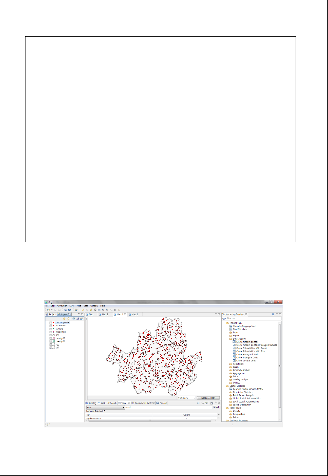
Random Points
Creates random points according to settings using boundary of polygon features
(polygonFeatures) or the specified Extent (extent).
Syntax
RandomPoints (ReferenceEnvelope extent, SimpleFeatureCollection polygonFeatures,
Integer pointCount): SimpleFeatureCollection
Parameters
Data Inputs
Identifier
Description
Type
Required
extent
Random points will be generated inside the extent.
Complex
-
polygonFeatures
The features which contains the features into which
the random points will be placed.
Complex
-
pointCount
The number of points to be randomly generated.
Literal
Process Outputs
Identifier
Description
Type
Required
result
Output features.
Complex
Constraints
- BoundingBox or polygon layers can be used as basic layers.
Request Examples
<?xml version="1.0" encoding="UTF-8"?><wps:Execute version="1.0.0" service="WPS"
xmlns:xsi="http://www.w3.org/2001/XMLSchema-instance" xmlns="http://www.opengis.net/wps/1.0.0"
xmlns:wfs="http://www.opengis.net/wfs" xmlns:wps="http://www.opengis.net/wps/1.0.0"
xmlns:ows="http://www.opengis.net/ows/1.1" xmlns:gml="http://www.opengis.net/gml"
xmlns:ogc="http://www.opengis.net/ogc" xmlns:wcs="http://www.opengis.net/wcs/1.1.1"
xmlns:xlink="http://www.w3.org/1999/xlink" xsi:schemaLocation="http://www.opengis.net/wps/1.0.0
http://schemas.opengis.net/wps/1.0.0/wpsAll.xsd">
<ows:Identifier>statistics:RandomPoints</ows:Identifier>
<wps:DataInputs>
<wps:Input>
<ows:Identifier>polygonFeatures</ows:Identifier>
<wps:Reference mimeType="text/xml" xlink:href="http://geoserver/wfs" method="POST">
<wps:Body>
<wfs:GetFeature service=“WFS” version=“1.1.0” outputFormat=“GML3”
xmlns:foss="http://www.opengeospatial.net/foss">
<wfs:Query typeName="foss:sid"/>
</wfs:GetFeature>
</wps:Body>
</wps:Reference>
</wps:Input>
<wps:Input>
<ows:Identifier>pointCount</ows:Identifier>
<wps:Data>
<wps:LiteralData>1000</wps:LiteralData>
</wps:Data>
</wps:Input>
</wps:DataInputs>
<wps:ResponseForm>
<wps:RawDataOutput mimeType=“text/xml; subtype=wfs-collection/1.1”>
<ows:Identifier>result</ows:Identifier>
</wps:RawDataOutput>
</wps:ResponseForm>
</wps:Execute>
Response
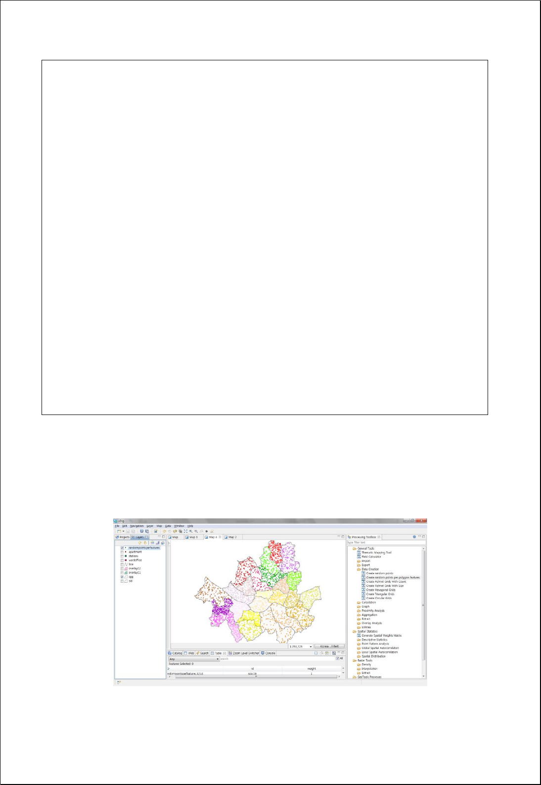
The following figure showsan example of creating 1000 random points based on the
administrative boundary (Si-Do).

4.2.1.9.
Random Points per Features
Creates random point of every feature using polygon feature layers (polygonFeatures)
and expression formula (expression).
Syntax
RandomPointsPerFeatures (SimpleFeatureCollection polygonFeatures, Expression
expression): SimpleFeatureCollection
Parameters
Data Inputs
Identifier
Description
Type
Required
polygonFeatures
The features which contains the features into which
the random points will be placed.
Complex
expression
Field or Expression representing Number of Points.
Literal
-
Process Outputs
Identifier
Description
Type
Required
result
Output features.
Complex
Constraints
- Expression parameter can be input in numbers, fields or formulas (arithmetic
operation association between spatial and attribute fields)
Request Examples
<?xml version="1.0" encoding="UTF-8"?><wps:Execute version="1.0.0" service="WPS"
xmlns:xsi="http://www.w3.org/2001/XMLSchema-instance" xmlns="http://www.opengis.net/wps/1.0.0"
xmlns:wfs="http://www.opengis.net/wfs" xmlns:wps="http://www.opengis.net/wps/1.0.0"
xmlns:ows="http://www.opengis.net/ows/1.1" xmlns:gml="http://www.opengis.net/gml"
xmlns:ogc="http://www.opengis.net/ogc" xmlns:wcs="http://www.opengis.net/wcs/1.1.1"
xmlns:xlink="http://www.w3.org/1999/xlink" xsi:schemaLocation="http://www.opengis.net/wps/1.0.0
http://schemas.opengis.net/wps/1.0.0/wpsAll.xsd">
<ows:Identifier>statistics:RandomPointsPerFeatures</ows:Identifier>
<wps:DataInputs>
<wps:Input>
<ows:Identifier>polygonFeatures</ows:Identifier>
<wps:Reference mimeType="text/xml" xlink:href="http://geoserver/wfs" method="POST">
<wps:Body>
<wfs:GetFeature service=“WFS” version=“1.1.0” outputFormat=“GML3”
xmlns:foss="http://www.opengeospatial.net/foss">
<wfs:Query typeName="foss:sgg"/>
</wfs:GetFeature>
</wps:Body>
</wps:Reference>
</wps:Input>
<wps:Input>
<ows:Identifier>expression</ows:Identifier>
<wps:Data>
<wps:LiteralData>[pop_den] / 100</wps:LiteralData>
</wps:Data>
</wps:Input>
</wps:DataInputs>
<wps:ResponseForm>
<wps:RawDataOutput mimeType=“text/xml; subtype=wfs-collection/1.1”>
<ows:Identifier>result</ows:Identifier>
</wps:RawDataOutput>
</wps:ResponseForm>
</wps:Execute>
Response
The following figure showsan example of creating random points using attribute
information of population density in the administrative boundary (Si-Gun-Gu).

4.2.2. Calculation
These processes are for calculating new values using Geometry or attribute value of
fields.
4.2.2.1.
Calculate XY Coordinate
Adds X (xField) and Y (yField) field and calculates values of coordinate systems set by
users for each feature (inputFeatures).
Syntax
CalculateXYCoordinate (SimpleFeatureCollection inputFeatures, String xField, String yField,
Boolean inside, CoordinateReferenceSystem targetCRS): SimpleFeatureCollection
Parameters
Data Inputs
Identifier
Description
Type
Required
inputFeatures
The input features to be calculated.
Complex
xField
X coordinate field that will be calculated.
Literal
-
yField
Y coordinate field that will be calculated.
Literal
-
inside
Centroid(False, Default), Inside(True)
Literal
-
targetCRS
The target coordinate reference system to use for
reprojection. Ex)epsg:4326
Literal
-
Process Outputs
Identifier
Description
Type
Required
result
Output features.
Complex
Constraints
- The inputFeatures can be points, lines, and polygons.
- If the inputFeatures is polygon and the inside is set to True, center points must be
included inside the polygon.
- If the targetCSR is Null, returns to coordinate value of original data, otherwise to
coordinate conversion value.

Request Examples
This is the result of returning to GML3 by loading foss:stores layer of GeoServer through
WFS and calculating values of EPSG:4326(WGS84 latitude and longitude) coordinate
system in xcoord, ycoord field.
If the inputFeatures is polygon due to the inside value is set to True, adjusted X, Y value
of the center point will be returned in order to place within the polygon.
<?xml version="1.0" encoding="utf-8"?>
<wps:Execute version="1.0.0" service="WPS" xmlns:xsi="http://www.w3.org/2001/XMLSchema-instance"
xmlns="http://www.opengis.net/wps/1.0.0" xmlns:wfs="http://www.opengis.net/wfs"
xmlns:wps="http://www.opengis.net/wps/1.0.0" xmlns:ows="http://www.opengis.net/ows/1.1"
xmlns:gml="http://www.opengis.net/gml" xmlns:ogc="http://www.opengis.net/ogc"
xmlns:wcs="http://www.opengis.net/wcs/1.1.1" xmlns:xlink="http://www.w3.org/1999/xlink"
xsi:schemaLocation="http://www.opengis.net/wps/1.0.0 http://schemas.opengis.net/wps/1.0.0/wpsAll.xsd">
<ows:Identifier>statistics:CalculateXYCoordinate</ows:Identifier>
<wps:DataInputs>
<wps:Input>
<ows:Identifier>inputFeatures</ows:Identifier>
<wps:Reference mimeType="text/xml" xlink:href="http://geoserver/wfs" method="POST">
<wps:Body>
<wfs:GetFeature service="WFS" version="1.1.0" outputFormat="GML3"
xmlns:foss="http://www.opengeospatial.net/foss">
<wfs:Query typeName="foss:stores" />
</wfs:GetFeature>
</wps:Body>
</wps:Reference>
</wps:Input>
<wps:Input>
<ows:Identifier>xField</ows:Identifier>
<wps:Data>
<wps:LiteralData>xcoord</wps:LiteralData>
</wps:Data>
</wps:Input>
<wps:Input>
<ows:Identifier>yField</ows:Identifier>
<wps:Data>
<wps:LiteralData>ycoord</wps:LiteralData>
</wps:Data>
</wps:Input>
<wps:Input>
<ows:Identifier>inside</ows:Identifier>
<wps:Data>
<wps:LiteralData>True</wps:LiteralData>
</wps:Data>
</wps:Input>
<wps:Input>
<ows:Identifier>targetCRS</ows:Identifier>
<wps:Data>
<wps:LiteralData>EPSG:4326</wps:LiteralData>
</wps:Data>
</wps:Input>
</wps:DataInputs>
<wps:ResponseForm>
<wps:RawDataOutput mimeType="text/xml; subtype=wfs-collection/1.1">
<ows:Identifier>result</ows:Identifier>
</wps:RawDataOutput>
</wps:ResponseForm>
</wps:Execute>
Response
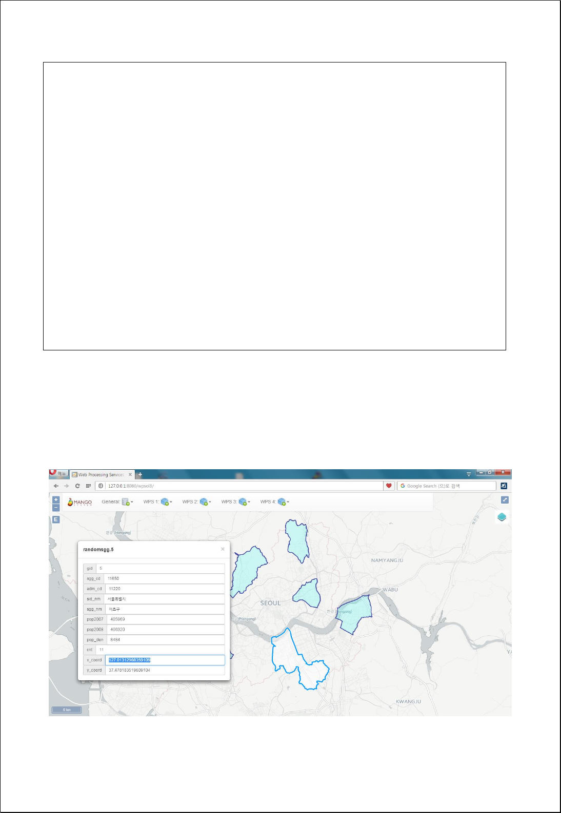
The following figure showsan example of calculating xcoord, ycoord values to
EPSG:4326(WGS84 latitude and longitude) coordinate value based on the center value of
the polygon layer.

4.2.2.2.
Calculate Area
Calculates area (areaField) and perimeter (perimeterField) of polygon feature layers
(inputFeatures).
Syntax
CalculateArea (SimpleFeatureCollection inputFeatures, String areaField, String
perimeterField): SimpleFeatureCollection
Parameters
Data Inputs
Identifier
Description
Type
Required
inputFeatures
The input polygon features to be calculated.
Complex
areaField
The area field that will be calculated.
geom_area is a default.
Literal
-
perimeterField
The perimeter field that will be calculated.
Literal
-
Process Outputs
Identifier
Description
Type
Required
result
Output features.
Complex
Constraints
- InputFeatures must be polygons.
- Unit of area and perimeter calculation is consistent with that of coordinate system
of inputFeatures.
Request Examples
This is the result of returning to GML format after loading foss:randomsgg layer of WFS and
calculating area and perimeter.
<?xml version="1.0" encoding="utf-8"?>
<wps:Execute version="1.0.0" service="WPS" xmlns:xsi="http://www.w3.org/2001/XMLSchema-instance"
xmlns="http://www.opengis.net/wps/1.0.0" xmlns:wfs="http://www.opengis.net/wfs"
xmlns:wps="http://www.opengis.net/wps/1.0.0" xmlns:ows="http://www.opengis.net/ows/1.1"

xmlns:gml="http://www.opengis.net/gml" xmlns:ogc="http://www.opengis.net/ogc"
xmlns:wcs="http://www.opengis.net/wcs/1.1.1" xmlns:xlink="http://www.w3.org/1999/xlink"
xsi:schemaLocation="http://www.opengis.net/wps/1.0.0 http://schemas.opengis.net/wps/1.0.0/wpsAll.xsd">
<ows:Identifier>statistics:CalculateArea</ows:Identifier>
<wps:DataInputs>
<wps:Input>
<ows:Identifier>inputFeatures</ows:Identifier>
<wps:Reference mimeType="text/xml" xlink:href="http://geoserver/wfs" method="POST">
<wps:Body>
<wfs:GetFeature service="WFS" version="1.1.0" outputFormat="GML3"
xmlns:foss="http://www.opengeospatial.net/foss">
<wfs:Query typeName="foss:randomsgg" />
</wfs:GetFeature>
</wps:Body>
</wps:Reference>
</wps:Input>
<wps:Input>
<ows:Identifier>areaField</ows:Identifier>
<wps:Data>
<wps:LiteralData>area</wps:LiteralData>
</wps:Data>
</wps:Input>
<wps:Input>
<ows:Identifier>perimeterField</ows:Identifier>
<wps:Data>
<wps:LiteralData>perimeter</wps:LiteralData>
</wps:Data>
</wps:Input>
</wps:DataInputs>
<wps:ResponseForm>
<wps:RawDataOutput mimeType=“text/xml; subtype=wfs-collection/1.1”>
<ows:Identifier>result</ows:Identifier>
</wps:RawDataOutput>
</wps:ResponseForm>
</wps:Execute>
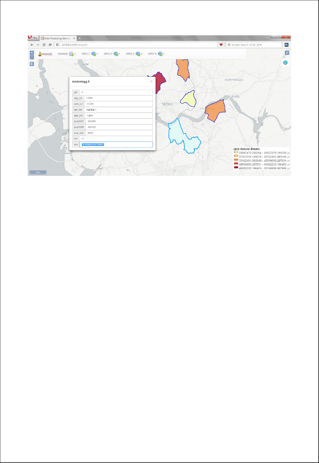
Response
The following figure showsresult of calculating polygon areas in areaFeild.

4.2.2.3.
Calculate Length
Adds fields to polygon or line feature layers and calculates the length (lenghFeild).
Syntax
CalculateLength (SimpleFeatureCollection inputFeatures, String lengthField):
SimpleFeatureCollection
Parameters
Data Inputs
Identifier
Description
Type
Required
inputFeatures
The input line or polygon features to be calculated.
Complex
lengthField
The length field that will be calculated.
geom_len is a default.
Literal
-
Process Outputs
Identifier
Description
Type
Required
result
Output features.
Complex
Constraints
- Parameter of inputFeatures must be polygon or line types.
- Unit of perimeter calculation value follows that of the coordinate system.
Request Examples
This is the result of returning in GML formate after loading foss:line layer of WFS and
calculating len (length of Geometry).
<?xml version="1.0" encoding="utf-8"?>
<wps:Execute version="1.0.0" service="WPS" xmlns:xsi="http://www.w3.org/2001/XMLSchema-instance"
xmlns="http://www.opengis.net/wps/1.0.0" xmlns:wfs="http://www.opengis.net/wfs"
xmlns:wps="http://www.opengis.net/wps/1.0.0" xmlns:ows="http://www.opengis.net/ows/1.1"
xmlns:gml="http://www.opengis.net/gml" xmlns:ogc="http://www.opengis.net/ogc"
xmlns:wcs="http://www.opengis.net/wcs/1.1.1" xmlns:xlink="http://www.w3.org/1999/xlink"
xsi:schemaLocation="http://www.opengis.net/wps/1.0.0 http://schemas.opengis.net/wps/1.0.0/wpsAll.xsd">
<ows:Identifier>statistics:CalculateLength</ows:Identifier>
<wps:DataInputs>
<wps:Input>
<ows:Identifier>inputFeatures</ows:Identifier>
<wps:Reference mimeType="text/xml" xlink:href="http://geoserver/wfs" method="POST">
<wps:Body>
<wfs:GetFeature service="WFS" version="1.1.0" outputFormat="GML3"
xmlns:foss="http://www.opengeospatial.net/foss">
<wfs:Query typeName="foss:line" />
</wfs:GetFeature>
</wps:Body>
</wps:Reference>
</wps:Input>
<wps:Input>
<ows:Identifier>lengthField</ows:Identifier>
<wps:Data>
<wps:LiteralData>len</wps:LiteralData>
</wps:Data>
</wps:Input>
</wps:DataInputs>
<wps:ResponseForm>
<wps:RawDataOutput mimeType="text/xml; subtype=wfs-collection/1.1">
<ows:Identifier>result</ows:Identifier>
</wps:RawDataOutput>
</wps:ResponseForm>
</wps:Execute>
Response
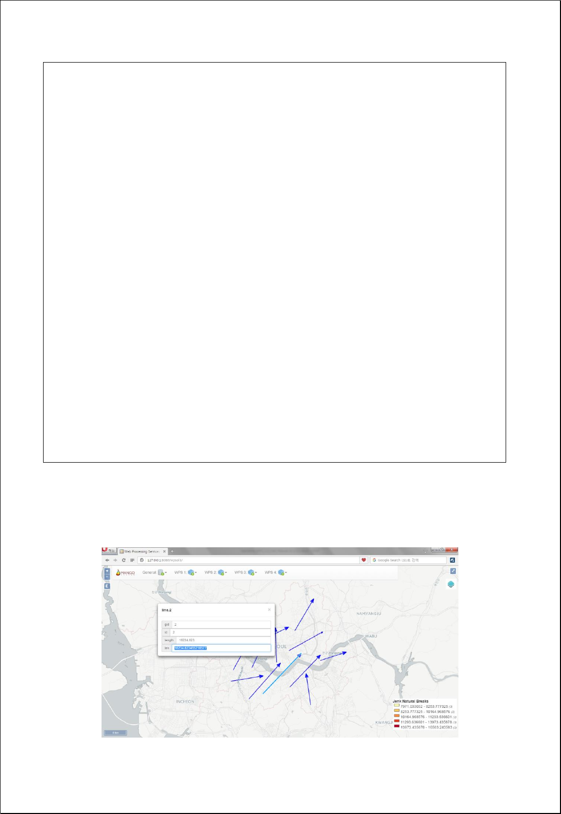
The following figure shows the result of calculating line length in len field.

4.2.2.4.
Calculate Field
Calculates new field values or changes Geometry Type by using user-set expression
formula (expression).
Syntax
CalculateField (SimpleFeatureCollection inputFeatures, Expression expression, String
fieldName): SimpleFeatureCollection
Parameters
Data Inputs
Identifier
Description
Type
Required
inputFeatures
The Input features to be calculated.
Complex
expression
The simple calculation expression used to create a
value that will populate the selected rows.
ex) [population] / ([geom_area] / 1000000)
Literal
-
fieldName
The field that will be updated with the new
calculation. Evaluated is a default.
Literal
-
Process Outputs
Identifier
Description
Type
Required
result
Output features.
Complex
Constraints
- If returned value through expression is Geometry, filedName is ignored and
Geometry value of returned data is applied.
Request Examples
This is the result of returning in GLM formate after calculating field value of pop_den by
loading foss:randomsgg layer of WFS and calculating population density using pop2008 (population) and
area (area([geom])).
<?xml version="1.0" encoding="utf-8"?>
<wps:Execute version="1.0.0" service="WPS" xmlns:xsi="http://www.w3.org/2001/XMLSchema-instance"
xmlns="http://www.opengis.net/wps/1.0.0" xmlns:wfs="http://www.opengis.net/wfs"

xmlns:wps="http://www.opengis.net/wps/1.0.0" xmlns:ows="http://www.opengis.net/ows/1.1"
xmlns:gml="http://www.opengis.net/gml" xmlns:ogc="http://www.opengis.net/ogc"
xmlns:wcs="http://www.opengis.net/wcs/1.1.1" xmlns:xlink="http://www.w3.org/1999/xlink"
xsi:schemaLocation="http://www.opengis.net/wps/1.0.0 http://schemas.opengis.net/wps/1.0.0/wpsAll.xsd">
<ows:Identifier>statistics:CalculateField</ows:Identifier>
<wps:DataInputs>
<wps:Input>
<ows:Identifier>inputFeatures</ows:Identifier>
<wps:Reference mimeType="text/xml" xlink:href="http://geoserver/wfs" method="POST">
<wps:Body>
<wfs:GetFeature service=“WFS” version=“1.1.0” outputFormat=“GML3”
xmlns:foss="http://www.opengeospatial.net/foss">
<wfs:Query typeName="foss:randomsgg" />
</wfs:GetFeature>
</wps:Body>
</wps:Reference>
</wps:Input>
<wps:Input>
<ows:Identifier>expression</ows:Identifier>
<wps:Data>
<wps:LiteralData>round([pop2008] / (area( [geom] ) / 1000000))</wps:LiteralData>
</wps:Data>
</wps:Input>
<wps:Input>
<ows:Identifier>fieldName</ows:Identifier>
<wps:Data>
<wps:LiteralData>pop_den</wps:LiteralData>
</wps:Data>
</wps:Input>
</wps:DataInputs>
<wps:ResponseForm>
<wps:RawDataOutput mimeType="text/xml; subtype=wfs-collection/1.1">
<ows:Identifier>result</ows:Identifier>
</wps:RawDataOutput>
</wps:ResponseForm>
</wps:Execute>
Response
The following figure shows an example of processing mincircle ([geom]). Not only such
attribute value calculation using field arithmetic operation is possible, process of
Geometry change is also possible.
Advanced Expression
The followings are the diverse applications of expression parameter. [geom] is Geometry
field name of PostGIS, Shapefile etc.
Identifier
Expression
Return
Value
General Formula
round([pop2008] / (area( [geom] ) / 1000000))
Numeric
Area
area( [geom] )
Numeric
Perimeter/Length
geomLength( [geom] )
Numeric
X of center point
getX( centroid( [geom]))
Numeric
Polygons to lines
boundary( [geom] )
Geometry
Buffer
bufferWithSegments( [geom], 250, 16)
Polygon
Center points of gravity
centroid( [geom])
Point
Points contained within polygons
interiorPoint( [geom] )
Point
Start points of polygons or lines
startPoint( [geom] )
Point
End points of polygons or lines
endPoint( [geom])
Point
Convex Hull Convex Hull of polygons,
lines and multipoint
convexHull( [geom] )
Polygon
Minimum circle around polygons,
lines and multipoint
mincircle( [geom] )
Polygon
Minimum radius line of the area
containing polygons, lines and
multipoint
minimumdiameter( [geom] )
Line
Minimum radius region containing
minrectangle( [geom] )
Polygon

polygons, lines and multipoint
Least octagonal area containing
polygons, lines and multipoint
octagonalenvelope( [geom] )
Polygon
Mover by x offset, y offset
offset( [geom], 4000, 3000)
Geometry

4.2.2.5.
Calculate Count
Calculates feature numbers using feature layers (inputFeatures) and filters (filter).
Syntax
CountFeatures (SimpleFeatureCollection inputFeatures, Filter filter): Integer
Parameters
Data Inputs
Identifier
Description
Type
Required
inputFeatures
Input features to be calculated.
Complex
filter
The filter to apply
Complex
-
Process Outputs
Identifier
Description
Type
Required
result
The number of features.
Literal
Constraints
- Calculates feature numbers using layers and filters and then returns them.
Request Examples
<?xml version="1.0" encoding="utf-8"?>
<wps:Execute version="1.0.0" service="WPS" xmlns:xsi="http://www.w3.org/2001/XMLSchema-instance"
xmlns="http://www.opengis.net/wps/1.0.0" xmlns:wfs="http://www.opengis.net/wfs"
xmlns:wps="http://www.opengis.net/wps/1.0.0" xmlns:ows="http://www.opengis.net/ows/1.1"
xmlns:gml="http://www.opengis.net/gml" xmlns:ogc="http://www.opengis.net/ogc"
xmlns:wcs="http://www.opengis.net/wcs/1.1.1" xmlns:xlink="http://www.w3.org/1999/xlink"
xsi:schemaLocation="http://www.opengis.net/wps/1.0.0 http://schemas.opengis.net/wps/1.0.0/wpsAll.xsd">
<ows:Identifier>statistics:CountFeatures</ows:Identifier>
<wps:DataInputs>
<wps:Input>
<ows:Identifier>inputFeatures</ows:Identifier>
<wps:Reference mimeType="text/xml" xlink:href="http://geoserver/wfs" method="POST">
<wps:Body>
<wfs:GetFeature service=“WFS” version=“1.1.0” outputFormat=“GML3”
xmlns:foss="http://www.opengeospatial.net/foss">
<wfs:Query typeName="foss:emd" />

</wfs:GetFeature>
</wps:Body>
</wps:Reference>
</wps:Input>
<wps:Input>
<ows:Identifier>filter</ows:Identifier>
<wps:Data>
<wps:ComplexData mimeType="text/plain; subtype=cql"><![CDATA[sgg_nm =
'강남구']]></wps:ComplexData>
</wps:Data>
</wps:Input>
</wps:DataInputs>
<wps:ResponseForm>
<wps:RawDataOutput>
<ows:Identifier>result</ows:Identifier>
</wps:RawDataOutput>
</wps:ResponseForm>
</wps:Execute>
Response
Feature numbers are returned in Integer values.
4.2.2.6.
Sum Polygon Areas
Calculates the sum of area of all polygon features using polygon feature layers
(inputFeatures) and filters (filter).
Syntax
SumAreas (SimpleFeatureCollection inputFeatures, Filter filter): Double
Parameters
Data Inputs
Identifier
Description
Type
Required
inputFeatures
Polygon features.
Complex
filter
The filter to apply
Complex
-

Process Outputs
Identifier
Description
Type
Required
result
The area of features.
Literal
Constraints
- Returns to the sum of Geometry area of features using polygon layers and filters.
Request Examples
<?xml version="1.0" encoding="utf-8"?>
<wps:Execute version="1.0.0" service="WPS" xmlns:xsi="http://www.w3.org/2001/XMLSchema-instance"
xmlns="http://www.opengis.net/wps/1.0.0" xmlns:wfs="http://www.opengis.net/wfs"
xmlns:wps="http://www.opengis.net/wps/1.0.0" xmlns:ows="http://www.opengis.net/ows/1.1"
xmlns:gml="http://www.opengis.net/gml" xmlns:ogc="http://www.opengis.net/ogc"
xmlns:wcs="http://www.opengis.net/wcs/1.1.1" xmlns:xlink="http://www.w3.org/1999/xlink"
xsi:schemaLocation="http://www.opengis.net/wps/1.0.0 http://schemas.opengis.net/wps/1.0.0/wpsAll.xsd">
<ows:Identifier>statistics:SumAreas</ows:Identifier>
<wps:DataInputs>
<wps:Input>
<ows:Identifier>inputFeatures</ows:Identifier>
<wps:Reference mimeType="text/xml" xlink:href="http://geoserver/wfs" method="POST">
<wps:Body>
<wfs:GetFeature service=“WFS” version=“1.1.0” outputFormat=“GML3”
xmlns:foss="http://www.opengeospatial.net/foss">
<wfs:Query typeName="foss:emd" />
</wfs:GetFeature>
</wps:Body>
</wps:Reference>
</wps:Input>
<wps:Input>
<ows:Identifier>filter</ows:Identifier>
<wps:Data>
<wps:ComplexData mimeType="text/plain; subtype=cql"><![CDATA[sgg_nm =
'강남구']]></wps:ComplexData>
</wps:Data>
</wps:Input>
</wps:DataInputs>
<wps:ResponseForm>
<wps:RawDataOutput>

<ows:Identifier>result</ows:Identifier>
</wps:RawDataOutput>
</wps:ResponseForm>
</wps:Execute>
Response
Areas of polygon features are returned in Double values.

4.2.2.7.
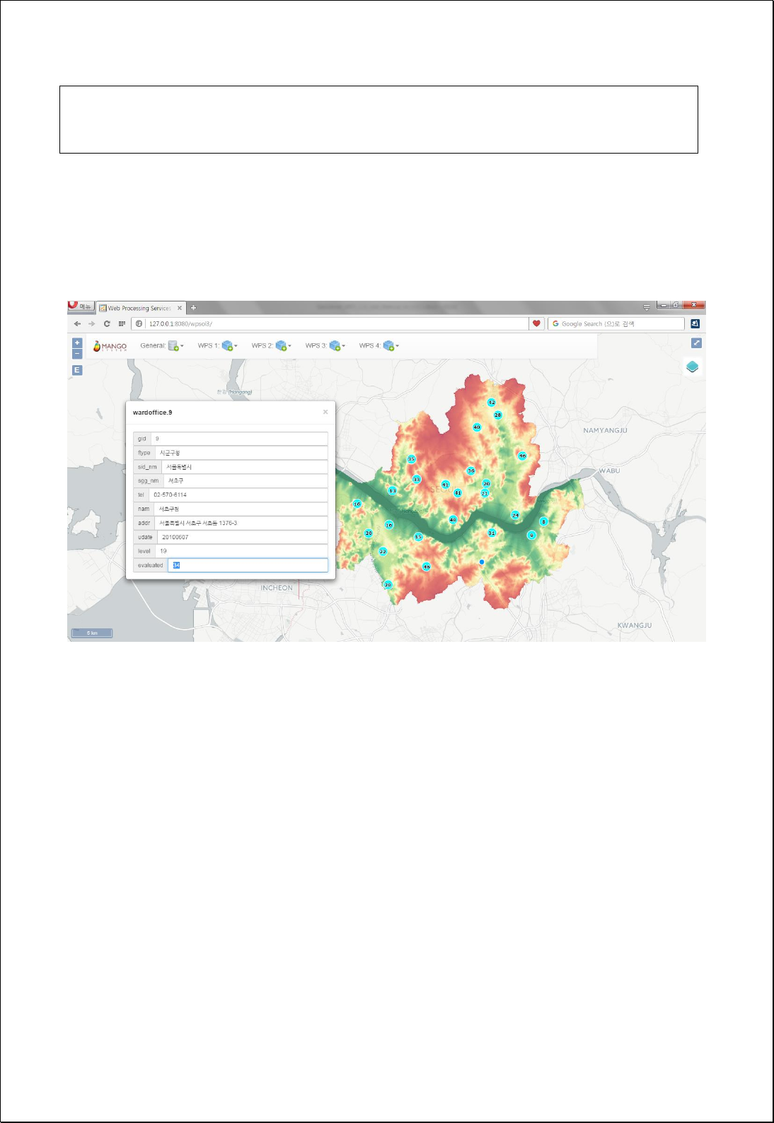
Extract Values to Points
Calculates cell’s digital values (valueField) of raster layers in attribute fields of points by
overlapping point features (pointFeatures) and raster layers.
Syntax
ExtractValuesToPoints (SimpleFeatureCollection pointFeatures, String valueField,
GridCoverage2D valueCoverage, ExtractionType valueType): SimpleFeatureCollection
Parameters
Data Inputs
Identifier
Description
Type
Required
pointFeatures
The input point features defining the locations.
Complex
valueField
The value field to be calculated.
Literal
-
valueCoverage
The gridcoverage whose values will be extracted.
Complex
valueType
Extraction type: Default, SlopeAsDegree,
SlopeAsPercentrise, Aspect.
Literal
-
Process Outputs
Identifier
Description
Type
Required
result
Output features.
Complex
Constraints
- If the valueField is set to Null, uses the name of evaluated field
- If valueType parameter is set to Null, returns in original cell value of GridCoverage.
- If valueCoverage is DEM, valueType can use SlopeAsDegree, SlopeAsPercentrise,
Aspect options.
Request Examples
<?xml version="1.0" encoding="utf-8"?>
<wps:Execute version="1.0.0" service="WPS" xmlns:xsi="http://www.w3.org/2001/XMLSchema-instance"
xmlns="http://www.opengis.net/wps/1.0.0" xmlns:wfs="http://www.opengis.net/wfs"
xmlns:wps="http://www.opengis.net/wps/1.0.0" xmlns:ows="http://www.opengis.net/ows/1.1"

xmlns:gml="http://www.opengis.net/gml" xmlns:ogc="http://www.opengis.net/ogc"
xmlns:wcs="http://www.opengis.net/wcs/1.1.1" xmlns:xlink="http://www.w3.org/1999/xlink"
xsi:schemaLocation="http://www.opengis.net/wps/1.0.0 http://schemas.opengis.net/wps/1.0.0/wpsAll.xsd">
<ows:Identifier>statistics:ExtractValuesToPoints</ows:Identifier>
<wps:DataInputs>
<wps:Input>
<ows:Identifier>pointFeatures</ows:Identifier>
<wps:Reference mimeType="text/xml" xlink:href="http://geoserver/wfs" method="POST">
<wps:Body>
<wfs:GetFeature service=“WFS” version=“1.1.0” outputFormat=“GML3”
xmlns:foss="http://www.opengeospatial.net/foss">
<wfs:Query typeName="foss:wardoffice" />
</wfs:GetFeature>
</wps:Body>
</wps:Reference>
</wps:Input>
<wps:Input>
<ows:Identifier>valueField</ows:Identifier>
<wps:Data>
<wps:LiteralData>evaluated</wps:LiteralData>
</wps:Data>
</wps:Input>
<wps:Input>
<ows:Identifier>valueCoverage</ows:Identifier>
<wps:Reference mimeType="image/tiff" xlink:href="http://geoserver/wcs" method="POST">
<wps:Body>
<wcs:GetCoverage service="WCS" version="1.1.1">
<ows:Identifier>foss:seoul_dem30</ows:Identifier>
<wcs:DomainSubset>
<gml:BoundingBox crs="http://www.opengis.net/gml/srs/epsg.xml#5181">
<ows:LowerCorner>179171.39881047895 436569.3290600816</ows:LowerCorner>
<ows:UpperCorner>216221.0981287582 466869.08315843146</ows:UpperCorner>
</gml:BoundingBox>
</wcs:DomainSubset>
<wcs:Output format="image/tiff" />
</wcs:GetCoverage>
</wps:Body>
</wps:Reference>
</wps:Input>
</wps:DataInputs>
<wps:ResponseForm>
<wps:RawDataOutput mimeType=“text/xml; subtype=wfs-collection/1.1”>
<ows:Identifier>result</ows:Identifier>
</wps:RawDataOutput>
</wps:ResponseForm>
</wps:Execute>
Response
The following figure shows the result off calculating DEM elevation values of point data
of municipal offices.

4.2.3. Extract
These processes are for selecting or cutting features using filter or geometry.
4.2.3.1.
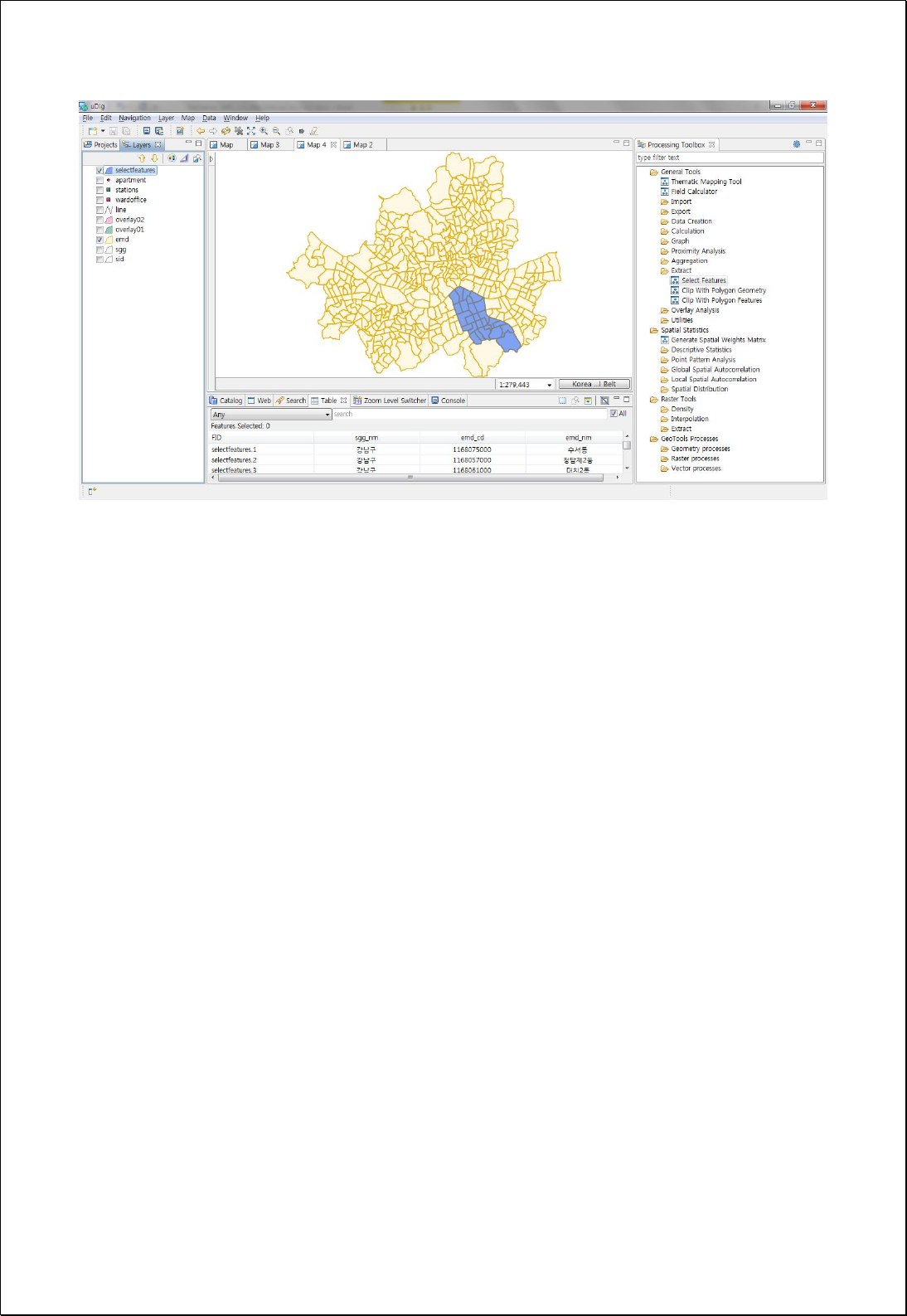
Select Features (Query & Retype)
Selecting features by setting catalogs of fields and spatial or attributable filters (filter).
Syntax
SelectFeatures (SimpleFeatureCollection inputFeatures, Filter filter, String attributes):
SimpleFeatureCollection
Parameters
Data Inputs
Identifier
Description
Type
Required
inputFeatures
Input features to be queried.
Complex
filter
The filter to apply.
Complex
-
attributes
The comma separated fields list to include in output.
Literal
-
Process Outputs
Identifier
Description
Type
Required
result
Output features.
Complex
Constraints
- Only feature meeting specified criteria can be selected using filter.
- You can select some attribute information or change the field order by setting a
comma-separated field.
Request Examples
<?xml version="1.0" encoding="utf-8"?>
<wps:Execute version="1.0.0" service="WPS" xmlns:xsi="http://www.w3.org/2001/XMLSchema-instance"
xmlns="http://www.opengis.net/wps/1.0.0" xmlns:wfs="http://www.opengis.net/wfs"
xmlns:wps="http://www.opengis.net/wps/1.0.0" xmlns:ows="http://www.opengis.net/ows/1.1"
xmlns:gml="http://www.opengis.net/gml" xmlns:ogc="http://www.opengis.net/ogc"
xmlns:wcs="http://www.opengis.net/wcs/1.1.1" xmlns:xlink="http://www.w3.org/1999/xlink"

xsi:schemaLocation="http://www.opengis.net/wps/1.0.0 http://schemas.opengis.net/wps/1.0.0/wpsAll.xsd">
<ows:Identifier>statistics:SelectFeatures</ows:Identifier>
<wps:DataInputs>
<wps:Input>
<ows:Identifier>inputFeatures</ows:Identifier>
<wps:Reference mimeType="text/xml" xlink:href="http://geoserver/wfs" method="POST">
<wps:Body>
<wfs:GetFeature service=“WFS” version=“1.1.0” outputFormat=“GML3”
xmlns:foss="http://www.opengeospatial.net/foss">
<wfs:Query typeName="foss:emd" />
</wfs:GetFeature>
</wps:Body>
</wps:Reference>
</wps:Input>
<wps:Input>
<ows:Identifier>filter</ows:Identifier>
<wps:Data>
<wps:ComplexData mimeType="text/plain; subtype=cql"><![CDATA[sgg_nm =
'강남구']]></wps:ComplexData>
</wps:Data>
</wps:Input>
<wps:Input>
<ows:Identifier>attributes</ows:Identifier>
<wps:Data>
<wps:LiteralData>gid, geom, sgg_nm, emd_cd, emd_nm</wps:LiteralData>
</wps:Data>
</wps:Input>
</wps:DataInputs>
<wps:ResponseForm>
<wps:RawDataOutput mimeType=“text/xml; subtype=wfs-collection/1.1”>
<ows:Identifier>result</ows:Identifier>
</wps:RawDataOutput>
</wps:ResponseForm>
</wps:Execute>
Response
The following figure shows the result of selecting Gangnam-Gu in Eup-Myeon-Dong
administrative boundary data and extracting geom, sgg_nm, emd_cd, emd_nm fields.

4.2.3.2.
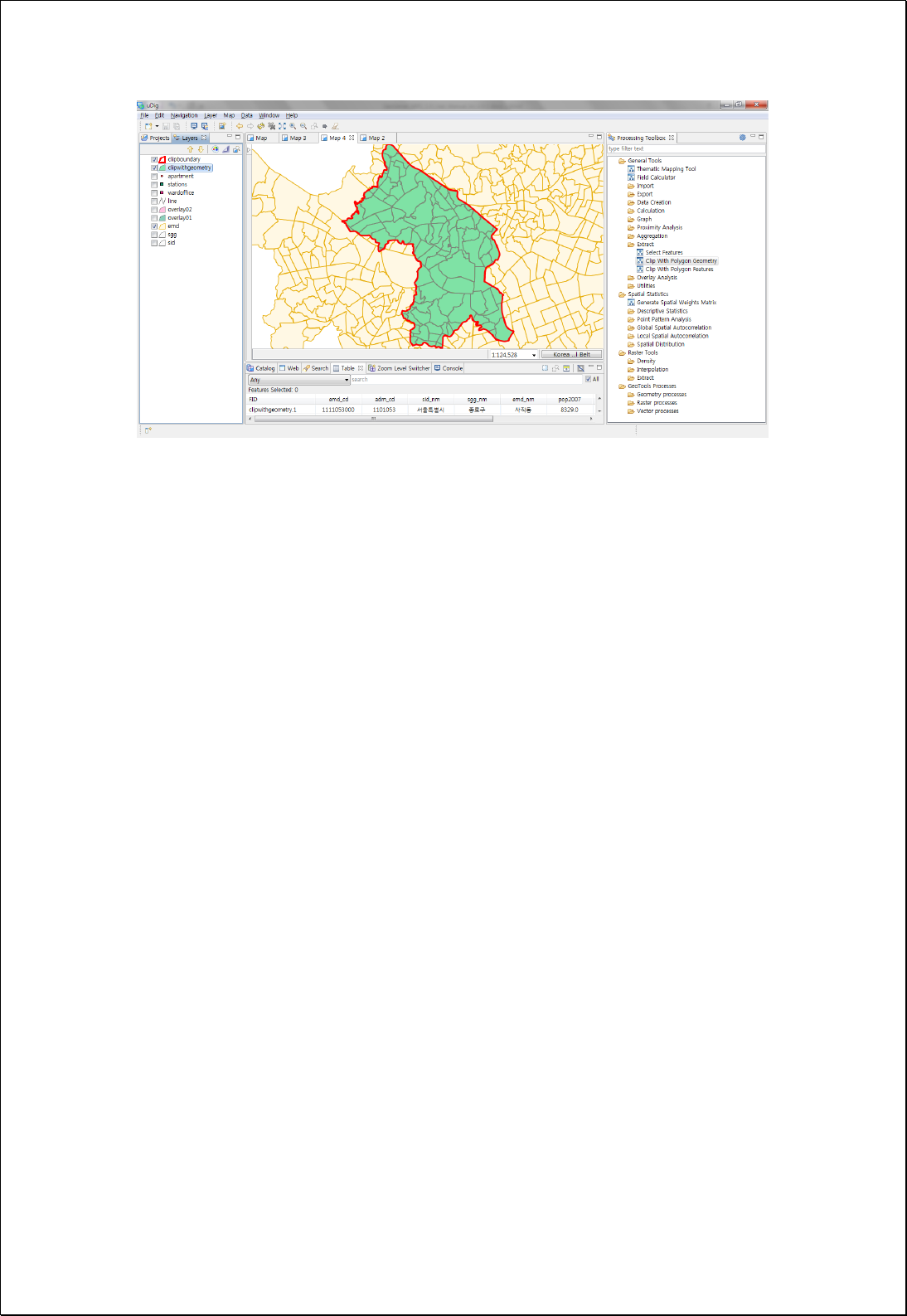
Clip with Geometry
Sets geometry (clipGeometry) of polygons to be cut and then cuts the feature layers.
Syntax
ClipWithGeometry (SimpleFeatureCollection inputFeatures, Geometry clipGeometry):
SimpleFeatureCollection
Parameters
Data Inputs
Identifier
Description
Type
Required
inputFeatures
The features to be clipped.
Complex
clipGeometry
The polygon geometry used to clip the input
features.
Complex
Process Outputs
Identifier
Description
Type
Required
result
Output features.
Complex
Constraints
- ClipGeometry must be Polygon or Multipolygon.
Request Examples
<?xml version="1.0" encoding="utf-8"?>
<wps:Execute version="1.0.0" service="WPS" xmlns:xsi="http://www.w3.org/2001/XMLSchema-instance"
xmlns="http://www.opengis.net/wps/1.0.0" xmlns:wfs="http://www.opengis.net/wfs"
xmlns:wps="http://www.opengis.net/wps/1.0.0" xmlns:ows="http://www.opengis.net/ows/1.1"
xmlns:gml="http://www.opengis.net/gml" xmlns:ogc="http://www.opengis.net/ogc"
xmlns:wcs="http://www.opengis.net/wcs/1.1.1" xmlns:xlink="http://www.w3.org/1999/xlink"
xsi:schemaLocation="http://www.opengis.net/wps/1.0.0 http://schemas.opengis.net/wps/1.0.0/wpsAll.xsd">
<ows:Identifier>statistics:ClipWithGeometry</ows:Identifier>
<wps:DataInputs>
<wps:Input>
<ows:Identifier>inputFeatures</ows:Identifier>

<wps:Reference mimeType="text/xml" xlink:href="http://geoserver/wfs" method="POST">
<wps:Body>
<wfs:GetFeature service=“WFS” version=“1.1.0” outputFormat=“GML3”
xmlns:foss="http://www.opengeospatial.net/foss">
<wfs:Query typeName="foss:emd" />
</wfs:GetFeature>
</wps:Body>
</wps:Reference>
</wps:Input>
<wps:Input>
<ows:Identifier>clipGeometry</ows:Identifier>
<wps:Data>
<wps:ComplexData mimeType="application/wkt"><![CDATA[POLYGON ((14123807 4505796,
14139276 4505796, 14139276 4524167.5, 14123807 4524167.5, 14123807
4505796))]]></wps:ComplexData>
</wps:Data>
</wps:Input>
</wps:DataInputs>
<wps:ResponseForm>
<wps:RawDataOutput mimeType=“text/xml; subtype=wfs-collection/1.1”>
<ows:Identifier>result</ows:Identifier>
</wps:RawDataOutput>
</wps:ResponseForm>
</wps:Execute>
Response
The following figure shows the result of clipping the specified region (Geometry) in the
administrative boundary (Eup-Myeon-Dong).

4.2.3.3.
Clip with Features
Sets polygon feature layers to be clipped (inputFeature) and then clips the feature layers.
Syntax
ClipWithFeatures (SimpleFeatureCollection inputFeatures, SimpleFeatureCollection
clipFeatures): SimpleFeatureCollection
Parameters
Data Inputs
Identifier
Description
Type
Required
inputFeatures
The features to be clipped.
Complex
clipFeatures
The features used to clip the input features.
Complex
Process Outputs
Identifier
Description
Type
Required
result
Output features.
Complex
Constraints
- ClipGeometry must be Polygon or Multipolygon.
Request Examples
<?xml version="1.0" encoding="utf-8"?>
<wps:Execute version="1.0.0" service="WPS" xmlns:xsi="http://www.w3.org/2001/XMLSchema-instance"
xmlns="http://www.opengis.net/wps/1.0.0" xmlns:wfs="http://www.opengis.net/wfs"
xmlns:wps="http://www.opengis.net/wps/1.0.0" xmlns:ows="http://www.opengis.net/ows/1.1"
xmlns:gml="http://www.opengis.net/gml" xmlns:ogc="http://www.opengis.net/ogc"
xmlns:wcs="http://www.opengis.net/wcs/1.1.1" xmlns:xlink="http://www.w3.org/1999/xlink"
xsi:schemaLocation="http://www.opengis.net/wps/1.0.0 http://schemas.opengis.net/wps/1.0.0/wpsAll.xsd">
<ows:Identifier>statistics:ClipWithFeatures</ows:Identifier>
<wps:DataInputs>
<wps:Input>
<ows:Identifier>inputFeatures</ows:Identifier>
<wps:Reference mimeType="text/xml" xlink:href="http://geoserver/wfs" method="POST">
<wps:Body>
<wfs:GetFeature service=“WFS” version=“1.1.0” outputFormat=“GML3”
xmlns:foss="http://www.opengeospatial.net/foss">
<wfs:Query typeName="foss:emd" />
</wfs:GetFeature>
</wps:Body>
</wps:Reference>
</wps:Input>
<wps:Input>
<ows:Identifier>clipFeatures</ows:Identifier>
<wps:Reference mimeType="text/xml" xlink:href="http://geoserver/wfs" method="POST">
<wps:Body>
<wfs:GetFeature service=“WFS” version=“1.1.0” outputFormat=“GML3”
xmlns:foss="http://www.opengeospatial.net/foss">
<wfs:Query typeName="foss:overlay02" />
</wfs:GetFeature>
</wps:Body>
</wps:Reference>
</wps:Input>
</wps:DataInputs>
<wps:ResponseForm>
<wps:RawDataOutput mimeType=“text/xml; subtype=wfs-collection/1.1”>
<ows:Identifier>result</ows:Identifier>
</wps:RawDataOutput>
</wps:ResponseForm>
</wps:Execute>
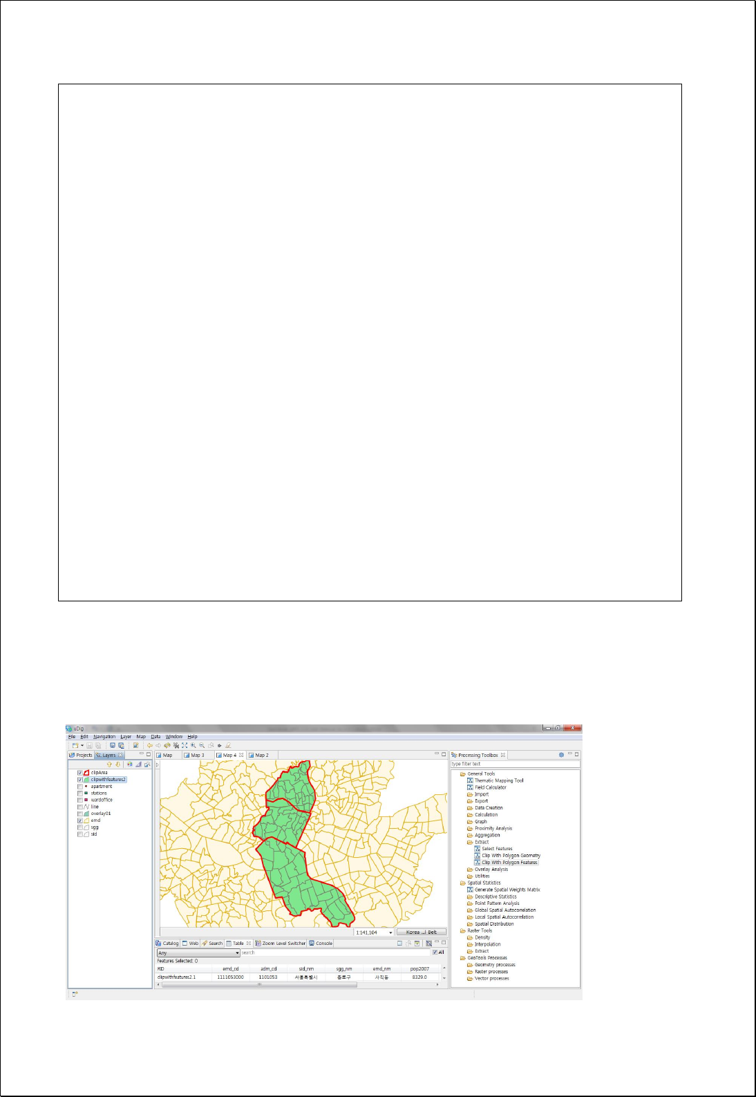
Response
The following figure shows an example of clipping Eup-Meyon-Dong administrative
district polygon layer using random polygon layer.

4.2.3.4.
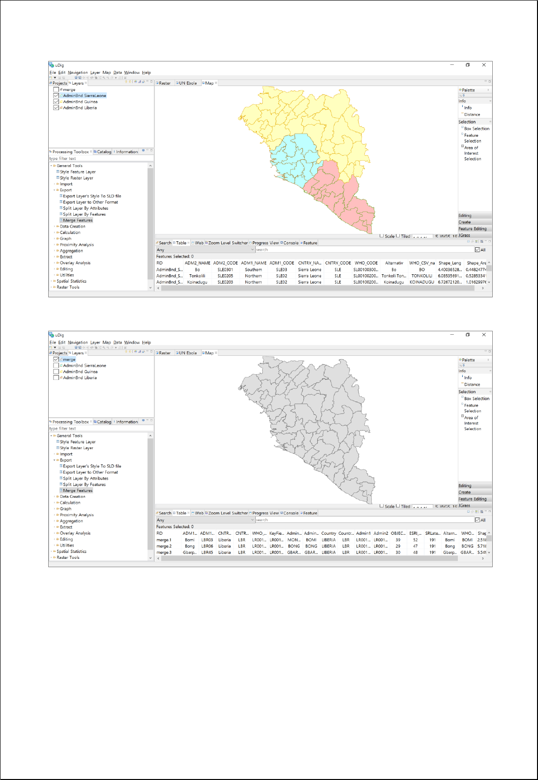
Merge Features
A few layers with the same feature type (features) merge as one layer.
Syntax
MergeFeatures (List<SimpleFeatureCollection> features): SimpleFeatureCollection
Parameters
Data Inputs
Identifier
Description
Type
Required
features
Input feature collections to be merge.
Complex
Process Outputs
Identifier
Description
Type
Required
result
Output features.
Complex
Constraints
- Features parameter must be the same feature type.
- Since the features parameter is collection type, there is more than 1 feature layer
available and the request below is referred.
- Shema of output layer is different with schema of the first layer of features
parameter.
Request Examples
<?xml version="1.0" encoding="UTF-8"?><wps:Execute version="1.0.0" service="WPS"
xmlns:xsi="http://www.w3.org/2001/XMLSchema-instance" xmlns="http://www.opengis.net/wps/1.0.0"
xmlns:wfs="http://www.opengis.net/wfs" xmlns:wps="http://www.opengis.net/wps/1.0.0"
xmlns:ows="http://www.opengis.net/ows/1.1" xmlns:gml="http://www.opengis.net/gml"
xmlns:ogc="http://www.opengis.net/ogc" xmlns:wcs="http://www.opengis.net/wcs/1.1.1"
xmlns:xlink="http://www.w3.org/1999/xlink" xsi:schemaLocation="http://www.opengis.net/wps/1.0.0
http://schemas.opengis.net/wps/1.0.0/wpsAll.xsd">
<ows:Identifier>statistics:MergeFeatures</ows:Identifier>

<wps:DataInputs>
<wps:Input>
<ows:Identifier>features</ows:Identifier>
<wps:Reference mimeType="text/xml" xlink:href="http://geoserver/wfs" method="POST">
<wps:Body>
<wfs:GetFeature service="WFS" version="1.0.0" outputFormat="GML2"
xmlns:foss="http://www.opengeospatial.net/foss">
<wfs:Query typeName="foss:sgga"/>
</wfs:GetFeature>
</wps:Body>
</wps:Reference>
</wps:Input>
<wps:Input>
<ows:Identifier>features</ows:Identifier>
<wps:Reference mimeType="text/xml" xlink:href="http://geoserver/wfs" method="POST">
<wps:Body>
<wfs:GetFeature service="WFS" version="1.0.0" outputFormat="GML2"
xmlns:foss="http://www.opengeospatial.net/foss">
<wfs:Query typeName="foss:sggb"/>
</wfs:GetFeature>
</wps:Body>
</wps:Reference>
</wps:Input>
</wps:DataInputs>
<wps:ResponseForm>
<wps:RawDataOutput mimeType="text/xml; subtype=wfs-collection/1.0">
<ows:Identifier>result</ows:Identifier>
</wps:RawDataOutput>
</wps:ResponseForm>
</wps:Execute>
Response
This is the result of mering 3 polygon layers into 1 layer.

4.2.4. Overlay
These processes are for overlay analysis between two layers such as Union, Intersect,
Symmetrical Difference, Difference, Identity, Update etc.
4.2.4.1.
Union
Conducts Union Overlay analysis between two input feature layers (inputFeatures).
Output layer retains all attribute values of two features.
Syntax
Union (SimpleFeatureCollection inputFeatures, SimpleFeatureCollection overlayFeatures):
SimpleFeatureCollection
Parameters
Data Inputs
Identifier
Description
Type
Required
inputFeatures
Input features.
Complex
overlayFeatures
Overlay features.
Complex
Process Outputs
Identifier
Description
Type
Required
result
Output features.
Complex
Constraints
- Input feature layer can be points, lines and polygons, and feature type of output
layer is the same with inputFeatures layer
- Output layers contain all attribute values of inputFeatures, and overlayFeatures.
Request Examples
<?xml version="1.0" encoding="utf-8"?>
<wps:Execute version="1.0.0" service="WPS" xmlns:xsi="http://www.w3.org/2001/XMLSchema-instance"

xmlns="http://www.opengis.net/wps/1.0.0" xmlns:wfs="http://www.opengis.net/wfs"
xmlns:wps="http://www.opengis.net/wps/1.0.0" xmlns:ows="http://www.opengis.net/ows/1.1"
xmlns:gml="http://www.opengis.net/gml" xmlns:ogc="http://www.opengis.net/ogc"
xmlns:wcs="http://www.opengis.net/wcs/1.1.1" xmlns:xlink="http://www.w3.org/1999/xlink"
xsi:schemaLocation="http://www.opengis.net/wps/1.0.0 http://schemas.opengis.net/wps/1.0.0/wpsAll.xsd">
<ows:Identifier>statistics:Union</ows:Identifier>
<wps:DataInputs>
<wps:Input>
<ows:Identifier>inputFeatures</ows:Identifier>
<wps:Reference mimeType="text/xml" xlink:href="http://geoserver/wfs" method="POST">
<wps:Body>
<wfs:GetFeature service=“WFS” version=“1.1.0” outputFormat=“GML3”
xmlns:foss="http://www.opengeospatial.net/foss">
<wfs:Query typeName="foss:overlay01" />
</wfs:GetFeature>
</wps:Body>
</wps:Reference>
</wps:Input>
<wps:Input>
<ows:Identifier>overlayFeatures</ows:Identifier>
<wps:Reference mimeType="text/xml" xlink:href="http://geoserver/wfs" method="POST">
<wps:Body>
<wfs:GetFeature service=“WFS” version=“1.1.0” outputFormat=“GML3”
xmlns:foss="http://www.opengeospatial.net/foss">
<wfs:Query typeName="foss:overlay02" />
</wfs:GetFeature>
</wps:Body>
</wps:Reference>
</wps:Input>
</wps:DataInputs>
<wps:ResponseForm>
<wps:RawDataOutput mimeType=“text/xml; subtype=wfs-collection/1.1”>
<ows:Identifier>result</ows:Identifier>
</wps:RawDataOutput>
</wps:ResponseForm>
</wps:Execute>
Response
The following figure shows the result of Union Overlay analysis between two polygon
layers. Attribute values of two layers are all contained.

4.2.4.2.
Intersect
Conducts Intersect Overlay analysis between two input feature layers (inputFeatures).
Output layer retains all attribute values of two features.
Syntax
Intersect (SimpleFeatureCollection inputFeatures, SimpleFeatureCollection
overlayFeatures): SimpleFeatureCollection
Parameters
Data Inputs
Identifier
Description
Type
Required
inputFeatures
Input features.
Complex
overlayFeatures
Overlay features.
Complex
Process Outputs
Identifier
Description
Type
Required
result
Output features.
Complex
Constraints
- Input feature layers can be points, lines and polygons, and feature type of output
layer is the same with inputFeatures layer.
- Output layers contains all attribute value of inputFeatures, and overlayFeatures.
Request Examples
<?xml version="1.0" encoding="utf-8"?>
<wps:Execute version="1.0.0" service="WPS" xmlns:xsi="http://www.w3.org/2001/XMLSchema-instance"
xmlns="http://www.opengis.net/wps/1.0.0" xmlns:wfs="http://www.opengis.net/wfs"
xmlns:wps="http://www.opengis.net/wps/1.0.0" xmlns:ows="http://www.opengis.net/ows/1.1"
xmlns:gml="http://www.opengis.net/gml" xmlns:ogc="http://www.opengis.net/ogc"
xmlns:wcs="http://www.opengis.net/wcs/1.1.1" xmlns:xlink="http://www.w3.org/1999/xlink"
xsi:schemaLocation="http://www.opengis.net/wps/1.0.0 http://schemas.opengis.net/wps/1.0.0/wpsAll.xsd">

<ows:Identifier>statistics:Intersect</ows:Identifier>
<wps:DataInputs>
<wps:Input>
<ows:Identifier>inputFeatures</ows:Identifier>
<wps:Reference mimeType="text/xml" xlink:href="http://geoserver/wfs" method="POST">
<wps:Body>
<wfs:GetFeature service=“WFS” version=“1.1.0” outputFormat=“GML3”
xmlns:foss="http://www.opengeospatial.net/foss">
<wfs:Query typeName="foss:overlay01" />
</wfs:GetFeature>
</wps:Body>
</wps:Reference>
</wps:Input>
<wps:Input>
<ows:Identifier>overlayFeatures</ows:Identifier>
<wps:Reference mimeType="text/xml" xlink:href="http://geoserver/wfs" method="POST">
<wps:Body>
<wfs:GetFeature service=“WFS” version=“1.1.0” outputFormat=“GML3”
xmlns:foss="http://www.opengeospatial.net/foss">
<wfs:Query typeName="foss:overlay02" />
</wfs:GetFeature>
</wps:Body>
</wps:Reference>
</wps:Input>
</wps:DataInputs>
<wps:ResponseForm>
<wps:RawDataOutput mimeType=“text/xml; subtype=wfs-collection/1.1”>
<ows:Identifier>result</ows:Identifier>
</wps:RawDataOutput>
</wps:ResponseForm>
</wps:Execute>
Response
The following figure shows the result of Intersect Overlay analysis between two polygon
layers. Attribute values of two layers are all contained.

4.2.4.3.
Difference
Conducts Difference Overlay analysis between two polygon feature layers
(inputFeatures).
Syntax
Difference (SimpleFeatureCollection inputFeatures, SimpleFeatureCollection
differenceFeatures): SimpleFeatureCollection
Parameters
Data Inputs
Identifier
Description
Type
Required
inputFeatures
Input features.
Complex
differenceFeatures
Difference features.
Complex
Process Outputs
Identifier
Description
Type
Required
result
Output features.
Complex
Constraints
- Feature type of input layer is the same with inputFeatures layer.
Request Examples
<?xml version="1.0" encoding="utf-8"?>
<wps:Execute version="1.0.0" service="WPS" xmlns:xsi="http://www.w3.org/2001/XMLSchema-instance"
xmlns="http://www.opengis.net/wps/1.0.0" xmlns:wfs="http://www.opengis.net/wfs"
xmlns:wps="http://www.opengis.net/wps/1.0.0" xmlns:ows="http://www.opengis.net/ows/1.1"
xmlns:gml="http://www.opengis.net/gml" xmlns:ogc="http://www.opengis.net/ogc"
xmlns:wcs="http://www.opengis.net/wcs/1.1.1" xmlns:xlink="http://www.w3.org/1999/xlink"
xsi:schemaLocation="http://www.opengis.net/wps/1.0.0 http://schemas.opengis.net/wps/1.0.0/wpsAll.xsd">
<ows:Identifier>statistics:Difference</ows:Identifier>
<wps:DataInputs>
<wps:Input>
<ows:Identifier>inputFeatures</ows:Identifier>
<wps:Reference mimeType="text/xml" xlink:href="http://geoserver/wfs" method="POST">
<wps:Body>
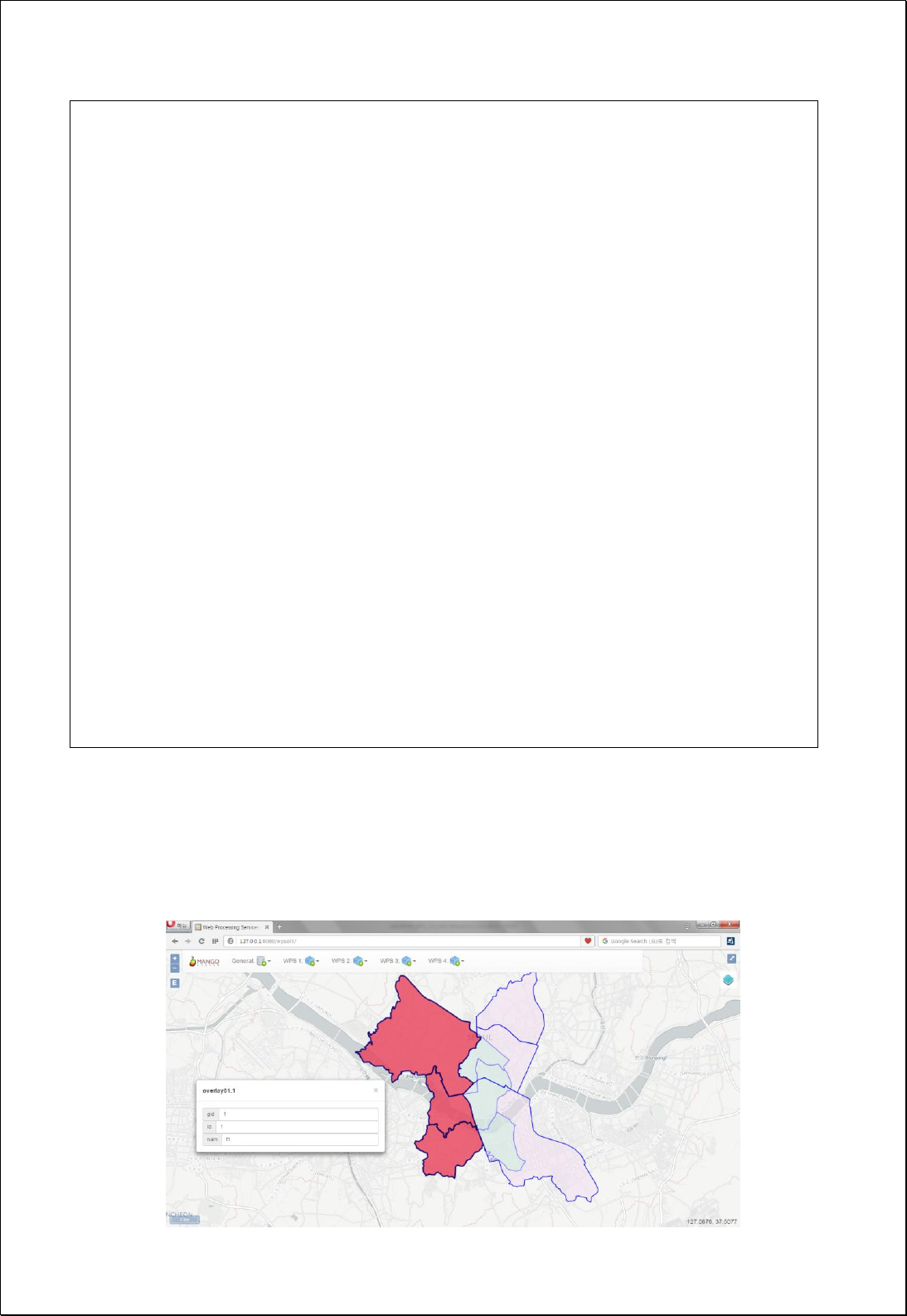
<wfs:GetFeature service=“WFS” version=“1.1.0” outputFormat=“GML3”
xmlns:foss="http://www.opengeospatial.net/foss">
<wfs:Query typeName="foss:overlay01" />
</wfs:GetFeature>
</wps:Body>
</wps:Reference>
</wps:Input>
<wps:Input>
<ows:Identifier>differenceFeatures</ows:Identifier>
<wps:Reference mimeType="text/xml" xlink:href="http://geoserver/wfs" method="POST">
<wps:Body>
<wfs:GetFeature service=“WFS” version=“1.1.0” outputFormat=“GML3”
xmlns:foss="http://www.opengeospatial.net/foss">
<wfs:Query typeName="foss:overlay02" />
</wfs:GetFeature>
</wps:Body>
</wps:Reference>
</wps:Input>
</wps:DataInputs>
<wps:ResponseForm>
<wps:RawDataOutput mimeType=“text/xml; subtype=wfs-collection/1.1”>
<ows:Identifier>result</ows:Identifier>
</wps:RawDataOutput>
</wps:ResponseForm>
</wps:Execute>
Response
The following figure shows the result of Difference Overlay analysis between two
polygon layers.

4.2.4.4.
Symmetrical Difference
Conducts Symmetrical Difference Overlay analysis between two polygon feature layers
(inputFeatures). Output layer retains all attribute values of two features.
Syntax
SymDifference (SimpleFeatureCollection inputFeatures, SimpleFeatureCollection
differenceFeatures): SimpleFeatureCollection
Parameters
Data Inputs
Identifier
Description
Type
Required
inputFeatures
Input features.
Complex
differenceFeatures
Difference features.
Complex
Process Outputs
Identifier
Description
Type
Required
result
Output features.
Complex
Constraints
- Input layers must be polygon feature types, and the feature type of output layer is
the same with inputFeatures layer.
- Output layers contains all attribute value of inputFeatures, and overlayFeatures.
Request Examples
<?xml version="1.0" encoding="utf-8"?>
<wps:Execute version="1.0.0" service="WPS" xmlns:xsi="http://www.w3.org/2001/XMLSchema-instance"
xmlns="http://www.opengis.net/wps/1.0.0" xmlns:wfs="http://www.opengis.net/wfs"
xmlns:wps="http://www.opengis.net/wps/1.0.0" xmlns:ows="http://www.opengis.net/ows/1.1"
xmlns:gml="http://www.opengis.net/gml" xmlns:ogc="http://www.opengis.net/ogc"
xmlns:wcs="http://www.opengis.net/wcs/1.1.1" xmlns:xlink="http://www.w3.org/1999/xlink"
xsi:schemaLocation="http://www.opengis.net/wps/1.0.0 http://schemas.opengis.net/wps/1.0.0/wpsAll.xsd">
<ows:Identifier>statistics:SymDifference</ows:Identifier>
<wps:DataInputs>

<wps:Input>
<ows:Identifier>inputFeatures</ows:Identifier>
<wps:Reference mimeType="text/xml" xlink:href="http://geoserver/wfs" method="POST">
<wps:Body>
<wfs:GetFeature service=“WFS” version=“1.1.0” outputFormat=“GML3”
xmlns:foss="http://www.opengeospatial.net/foss">
<wfs:Query typeName="foss:overlay01" />
</wfs:GetFeature>
</wps:Body>
</wps:Reference>
</wps:Input>
<wps:Input>
<ows:Identifier>differenceFeatures</ows:Identifier>
<wps:Reference mimeType="text/xml" xlink:href="http://geoserver/wfs" method="POST">
<wps:Body>
<wfs:GetFeature service=“WFS” version=“1.1.0” outputFormat=“GML3”
xmlns:foss="http://www.opengeospatial.net/foss">
<wfs:Query typeName="foss:overlay02" />
</wfs:GetFeature>
</wps:Body>
</wps:Reference>
</wps:Input>
</wps:DataInputs>
<wps:ResponseForm>
<wps:RawDataOutput mimeType=“text/xml; subtype=wfs-collection/1.1”>
<ows:Identifier>result</ows:Identifier>
</wps:RawDataOutput>
</wps:ResponseForm>
</wps:Execute>
Response
The following figure shows the result of Symmetrical Difference Overlay analysis between
two polygon layers. Attribute values of two layers are all contained.
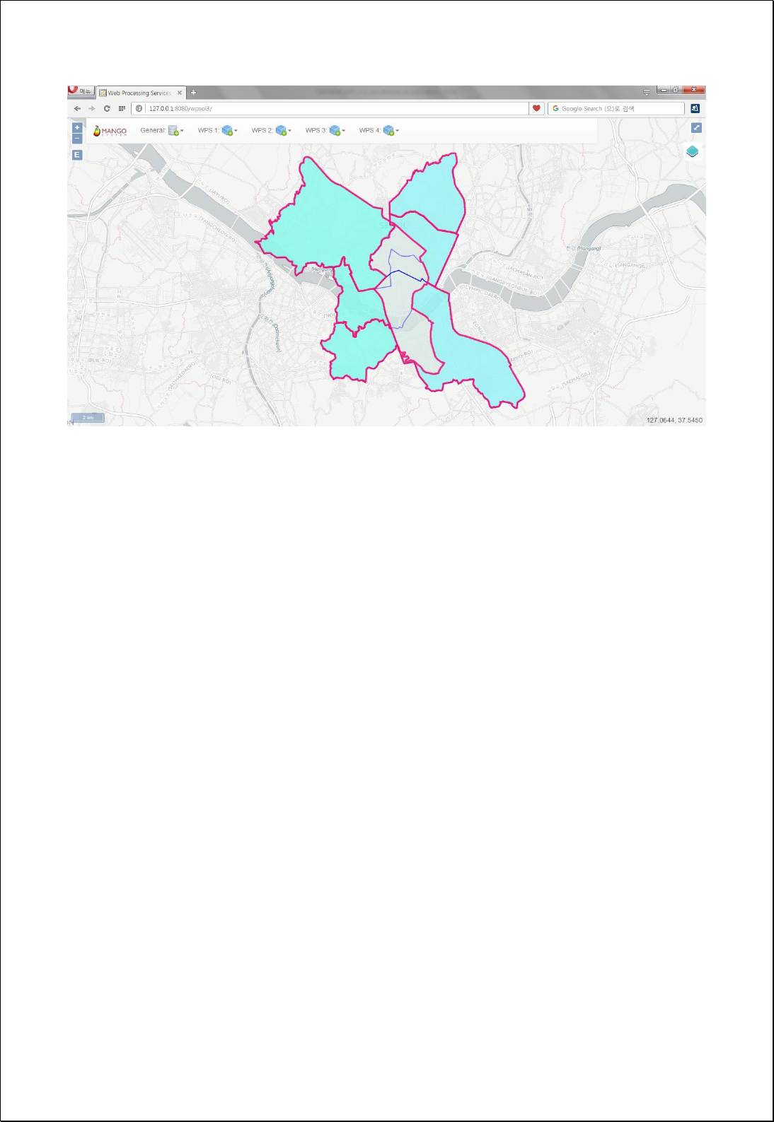

4.2.4.5.
Identity
Conducts Difference Overlay analysis between two polygon feature layers
(inputFeatures).
Syntax
Identity (SimpleFeatureCollection inputFeatures, SimpleFeatureCollection identityFeatures):
SimpleFeatureCollection
Parameters
Data Inputs
Identifier
Description
Type
Required
inputFeatures
Input features.
Complex
identityFeatures
Identity features.
Complex
Process Outputs
Identifier
Description
Type
Required
result
Output features.
Complex
Constraints
- InputFeatures, and identityFeatures must be Polygon or MultiPolygon feature types.
- Output layers contain all attribute values of inputFeatures, and overlayFeatures.
Request Examples
<?xml version="1.0" encoding="utf-8"?>
<wps:Execute version="1.0.0" service="WPS" xmlns:xsi="http://www.w3.org/2001/XMLSchema-instance"
xmlns="http://www.opengis.net/wps/1.0.0" xmlns:wfs="http://www.opengis.net/wfs"
xmlns:wps="http://www.opengis.net/wps/1.0.0" xmlns:ows="http://www.opengis.net/ows/1.1"
xmlns:gml="http://www.opengis.net/gml" xmlns:ogc="http://www.opengis.net/ogc"
xmlns:wcs="http://www.opengis.net/wcs/1.1.1" xmlns:xlink="http://www.w3.org/1999/xlink"
xsi:schemaLocation="http://www.opengis.net/wps/1.0.0 http://schemas.opengis.net/wps/1.0.0/wpsAll.xsd">
<ows:Identifier>statistics:Identity</ows:Identifier>
<wps:DataInputs>
<wps:Input>
<ows:Identifier>inputFeatures</ows:Identifier>

<wps:Reference mimeType="text/xml" xlink:href="http://geoserver/wfs" method="POST">
<wps:Body>
<wfs:GetFeature service=“WFS” version=“1.1.0” outputFormat=“GML3”
xmlns:foss="http://www.opengeospatial.net/foss">
<wfs:Query typeName="foss:overlay01" />
</wfs:GetFeature>
</wps:Body>
</wps:Reference>
</wps:Input>
<wps:Input>
<ows:Identifier>identityFeatures</ows:Identifier>
<wps:Reference mimeType="text/xml" xlink:href="http://geoserver/wfs" method="POST">
<wps:Body>
<wfs:GetFeature service=“WFS” version=“1.1.0” outputFormat=“GML3”
xmlns:foss="http://www.opengeospatial.net/foss">
<wfs:Query typeName="foss:overlay02" />
</wfs:GetFeature>
</wps:Body>
</wps:Reference>
</wps:Input>
</wps:DataInputs>
<wps:ResponseForm>
<wps:RawDataOutput mimeType=“text/xml; subtype=wfs-collection/1.1”>
<ows:Identifier>result</ows:Identifier>
</wps:RawDataOutput>
</wps:ResponseForm>
</wps:Execute>
Response
The following figure shows the result of Identity Overlay analysis between two polygon
layers.
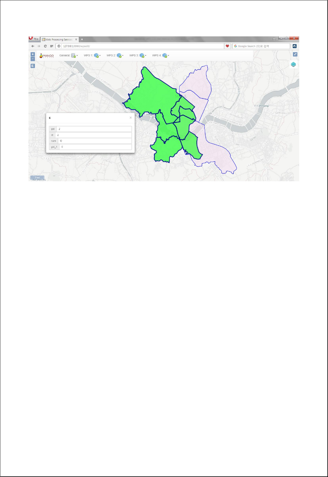

4.2.4.6.
Update
Conducts Update Overlay analysis between two polygon feature layers (inputFeatures).
Syntax
Update (SimpleFeatureCollection inputFeatures, SimpleFeatureCollection updateFeatures):
SimpleFeatureCollection
Parameters
Data Inputs
Identifier
Description
Type
Required
inputFeatures
Input features.
Complex
updateFeatures
Update features.
Complex
Process Outputs
Identifier
Description
Type
Required
result
Output features.
Complex
Constraints
- InputFeatures, and identityFeatures must be Polygon or MultiPolygon feature types.
- Output layers contain all attribute values of inputFeatures, and overlayFeatures.
Request Examples
<?xml version="1.0" encoding="utf-8"?>
<wps:Execute version="1.0.0" service="WPS" xmlns:xsi="http://www.w3.org/2001/XMLSchema-instance"
xmlns="http://www.opengis.net/wps/1.0.0" xmlns:wfs="http://www.opengis.net/wfs"
xmlns:wps="http://www.opengis.net/wps/1.0.0" xmlns:ows="http://www.opengis.net/ows/1.1"
xmlns:gml="http://www.opengis.net/gml" xmlns:ogc="http://www.opengis.net/ogc"
xmlns:wcs="http://www.opengis.net/wcs/1.1.1" xmlns:xlink="http://www.w3.org/1999/xlink"
xsi:schemaLocation="http://www.opengis.net/wps/1.0.0 http://schemas.opengis.net/wps/1.0.0/wpsAll.xsd">
<ows:Identifier>statistics:Update</ows:Identifier>
<wps:DataInputs>
<wps:Input>
<ows:Identifier>inputFeatures</ows:Identifier>
<wps:Reference mimeType="text/xml" xlink:href="http://geoserver/wfs" method="POST">

<wps:Body>
<wfs:GetFeature service=“WFS” version=“1.1.0” outputFormat=“GML3”
xmlns:foss="http://www.opengeospatial.net/foss">
<wfs:Query typeName="foss:sgg" />
</wfs:GetFeature>
</wps:Body>
</wps:Reference>
</wps:Input>
<wps:Input>
<ows:Identifier>updateFeatures</ows:Identifier>
<wps:Reference mimeType="text/xml" xlink:href="http://geoserver/wfs" method="POST">
<wps:Body>
<wfs:GetFeature service=“WFS” version=“1.1.0” outputFormat=“GML3”
xmlns:foss="http://www.opengeospatial.net/foss">
<wfs:Query typeName="foss:overlay01" />
</wfs:GetFeature>
</wps:Body>
</wps:Reference>
</wps:Input>
</wps:DataInputs>
<wps:ResponseForm>
<wps:RawDataOutput mimeType=“text/xml; subtype=wfs-collection/1.1”>
<ows:Identifier>result</ows:Identifier>
</wps:RawDataOutput>
</wps:ResponseForm>
</wps:Execute>
Response
The following figure shows the result of Identity Overlay analysis between two polygon
layers. Overlap region of Input layer and Update layer is replaced by the features of
Update layer.
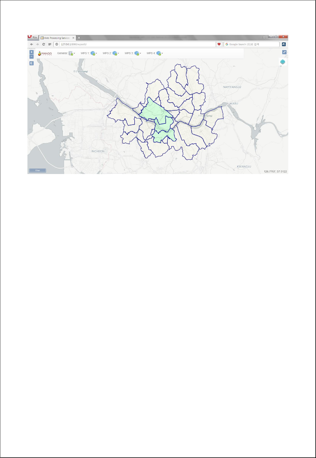

4.2.5. Proximity
These processes are for distance calculation and analysis such as buffer.
4.2.5.1.
Buffer Features using Expression
Conducts Buffer analysis using user-defined buffer distance (distance), buffer field or
buffer expression formula.
Syntax
BufferFeatures (SimpleFeatureCollection inputFeatures, Expression distance, int
quadrantSegments): SimpleFeatureCollection
Parameters
Data Inputs
Identifier
Description
Type
Required
inputFeatures
The input features to be buffered.
Complex
distance
The distance expression used to create distance.
Ex) 1000 or [field] or [field] * 0.5 etc...
Literal
quadrantSegments
The number of line segments used to represent a
quadrant of a circle. Default is 8.
Literal
-
Process Outputs
Identifier
Description
Type
Required
result
Output features.
Complex
Constraints
- InputFeatures can be points, lines and polygons.
- Distance expression can be numbers, and functions
1
returned by number.
Request Examples
1
http://docs.geoserver.org/stable/en/user/filter/function_reference.html 참조

<?xml version="1.0" encoding="utf-8"?>
<wps:Execute version="1.0.0" service="WPS" xmlns:xsi="http://www.w3.org/2001/XMLSchema-instance"
xmlns="http://www.opengis.net/wps/1.0.0" xmlns:wfs="http://www.opengis.net/wfs"
xmlns:wps="http://www.opengis.net/wps/1.0.0" xmlns:ows="http://www.opengis.net/ows/1.1"
xmlns:gml="http://www.opengis.net/gml" xmlns:ogc="http://www.opengis.net/ogc"
xmlns:wcs="http://www.opengis.net/wcs/1.1.1" xmlns:xlink="http://www.w3.org/1999/xlink"
xsi:schemaLocation="http://www.opengis.net/wps/1.0.0 http://schemas.opengis.net/wps/1.0.0/wpsAll.xsd">
<ows:Identifier>statistics:BufferFeatures</ows:Identifier>
<wps:DataInputs>
<wps:Input>
<ows:Identifier>inputFeatures</ows:Identifier>
<wps:Reference mimeType="text/xml" xlink:href="http://geoserver/wfs" method="POST">
<wps:Body>
<wfs:GetFeature service=“WFS” version=“1.1.0” outputFormat=“GML3”
xmlns:foss="http://www.opengeospatial.net/foss">
<wfs:Query typeName="foss:randomsgg" />
</wfs:GetFeature>
</wps:Body>
</wps:Reference>
</wps:Input>
<wps:Input>
<ows:Identifier>distance</ows:Identifier>
<wps:Data>
<wps:LiteralData>[pop_den] / 2.0) * 0.5</wps:LiteralData>
</wps:Data>
</wps:Input>
</wps:DataInputs>
<wps:ResponseForm>
<wps:RawDataOutput mimeType=“text/xml; subtype=wfs-collection/1.1”>
<ows:Identifier>result</ows:Identifier>
</wps:RawDataOutput>
</wps:ResponseForm>
</wps:Execute>
Response
The following figure shows the result of conducting buffer by using attribute values of
polygon layers and displaying the buffer distance as Expression ([pop_den] / 2.0) * 0.5).
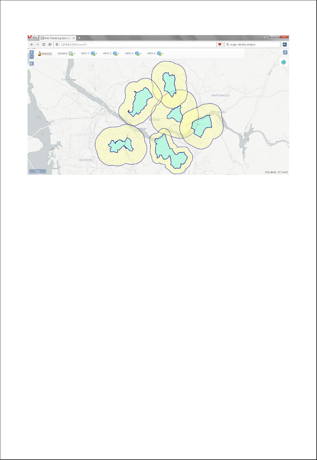

4.2.5.2.
Single Sided Buffer
Conducts One-direction Buffer analysis using user-defined buffer distance (distance),
buffer field or buffer expression formula.
Syntax
SingleSidedBuffer (SimpleFeatureCollection inputFeatures, Expression distance, Integer
quadrantSegments): SimpleFeatureCollection
Parameters
Data Inputs
Identifier
Description
Type
Required
inputFeatures
The input features to be buffered.
Complex
distance
The distance expression used to create distance.
Ex) 1000 or [field] or [field] * 0.5 etc...
Literal
quadrantSegments
The number of line segments used to represent a
quadrant of a circle. Default is 8.
Literal
-
Process Outputs
Identifier
Description
Type
Required
result
Output features.
Complex
Constraints
- InputFeatures must be lines.
- Distance expression can be numbers, and functions
2
returned by number.
- Buffer will be created on the left of line progression direction if the distance
parameter value is positive, or right if the distance parameter value is negative.
Request Examples
2
http://docs.geoserver.org/stable/en/user/filter/function_reference.html 참조

<?xml version="1.0" encoding="UTF-8"?><wps:Execute version="1.0.0" service="WPS"
xmlns:xsi="http://www.w3.org/2001/XMLSchema-instance" xmlns="http://www.opengis.net/wps/1.0.0"
xmlns:wfs="http://www.opengis.net/wfs" xmlns:wps="http://www.opengis.net/wps/1.0.0"
xmlns:ows="http://www.opengis.net/ows/1.1" xmlns:gml="http://www.opengis.net/gml"
xmlns:ogc="http://www.opengis.net/ogc" xmlns:wcs="http://www.opengis.net/wcs/1.1.1"
xmlns:xlink="http://www.w3.org/1999/xlink" xsi:schemaLocation="http://www.opengis.net/wps/1.0.0
http://schemas.opengis.net/wps/1.0.0/wpsAll.xsd">
<ows:Identifier>statistics:SingleSidedBuffer</ows:Identifier>
<wps:DataInputs>
<wps:Input>
<ows:Identifier>inputFeatures</ows:Identifier>
<wps:Reference mimeType="text/xml" xlink:href="http://geoserver/wfs" method="POST">
<wps:Body>
<wfs:GetFeature service="WFS" version="1.0.0" outputFormat="GML2"
xmlns:foss="http://www.opengeospatial.net/foss">
<wfs:Query typeName="foss:line"/>
</wfs:GetFeature>
</wps:Body>
</wps:Reference>
</wps:Input>
<wps:Input>
<ows:Identifier>distance</ows:Identifier>
<wps:Data>
<wps:LiteralData>250</wps:LiteralData>
</wps:Data>
</wps:Input>
</wps:DataInputs>
<wps:ResponseForm>
<wps:RawDataOutput mimeType="text/xml; subtype=wfs-collection/1.0">
<ows:Identifier>result</ows:Identifier>
</wps:RawDataOutput>
</wps:ResponseForm>
</wps:Execute>
Response
If the buffer distance value is positive as following, creates buffer on the left of the line
progression direction
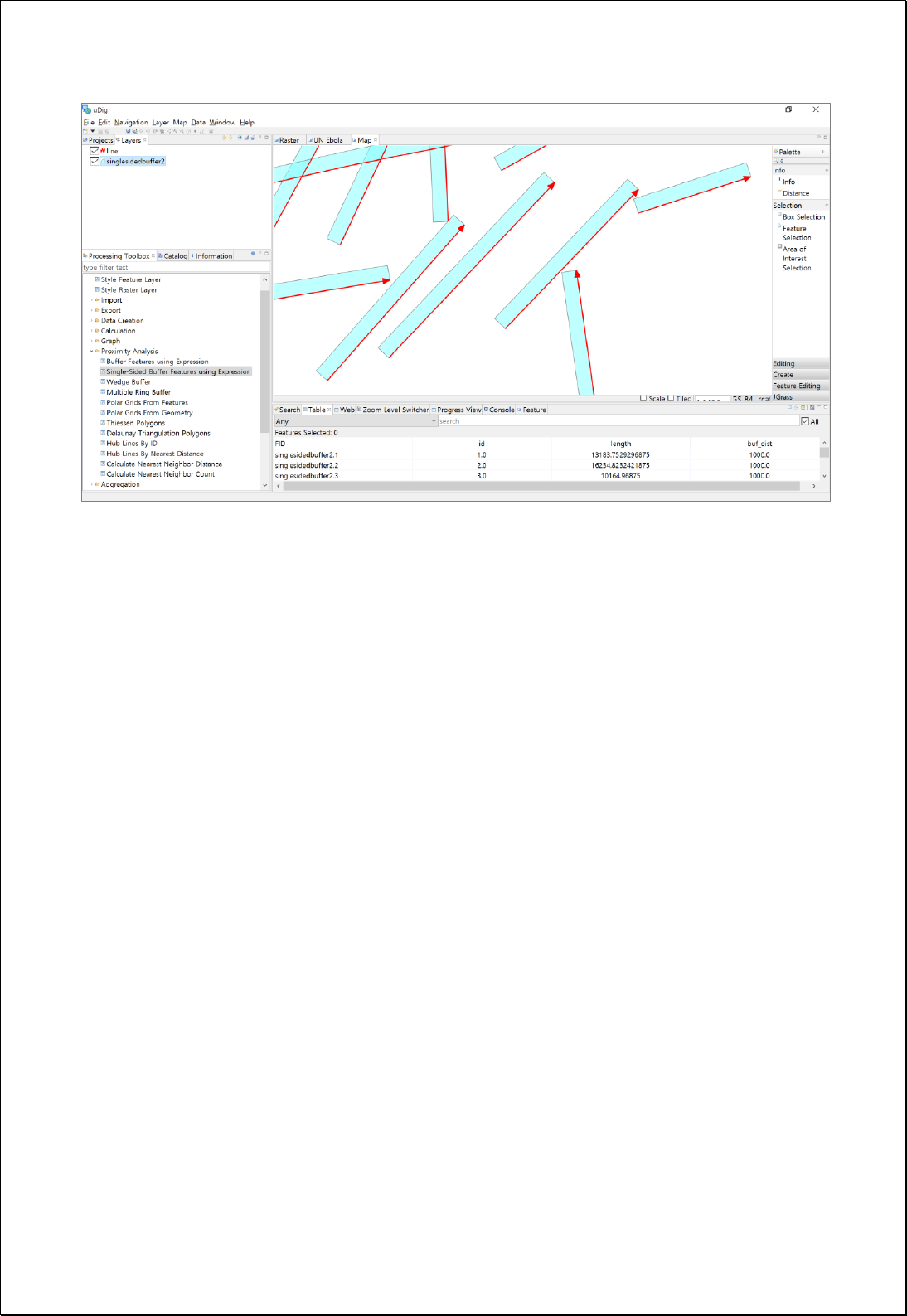

4.2.5.3.
Multiple Ring Buffer
Conducts Buffer analysis based on comma-separated buffer distance (distances).
Syntax
MultipleRingBuffer (SimpleFeatureCollection inputFeatures, String distances, Boolean
outsideOnly, Boolean dissolve): SimpleFeatureCollection
Parameters
Data Inputs
Identifier
Description
Type
Required
inputFeatures
The input features to be buffered.
Complex
distances
The comma separated list of buffer distances.
Ex) 250,500,750,1000
Literal
outsideOnly
The area inside of the input polygon features will
excluded from the resulting buffer. Default is True.
Literal
-
dissolve
Determines if buffers will be dissolved to resemble
rings around the input features. Default is False.
Literal
-
Process Outputs
Identifier
Description
Type
Required
result
Output features.
Complex
Constraints
- InputFeatures can be points, lines and polygons.
- Unit of distance is the same with that of inputFeatures coordinate system.
- If Dissolve parameter is true, attribute value of inputFeatures isignored and only
distance value is retained. If Dissolve parameter is false, attribute value of
inputFeatures is retained.
Request Examples
<?xml version="1.0" encoding="UTF-8"?><wps:Execute version="1.0.0" service="WPS"
xmlns:xsi="http://www.w3.org/2001/XMLSchema-instance" xmlns="http://www.opengis.net/wps/1.0.0"

xmlns:wfs="http://www.opengis.net/wfs" xmlns:wps="http://www.opengis.net/wps/1.0.0"
xmlns:ows="http://www.opengis.net/ows/1.1" xmlns:gml="http://www.opengis.net/gml"
xmlns:ogc="http://www.opengis.net/ogc" xmlns:wcs="http://www.opengis.net/wcs/1.1.1"
xmlns:xlink="http://www.w3.org/1999/xlink" xsi:schemaLocation="http://www.opengis.net/wps/1.0.0
http://schemas.opengis.net/wps/1.0.0/wpsAll.xsd">
<ows:Identifier>statistics:MultipleRingBuffer</ows:Identifier>
<wps:DataInputs>
<wps:Input>
<ows:Identifier>inputFeatures</ows:Identifier>
<wps:Reference mimeType="text/xml" xlink:href="http://geoserver/wfs" method="POST">
<wps:Body>
<wfs:GetFeature service=“WFS” version=“1.1.0” outputFormat=“GML3”
xmlns:foss="http://www.opengeospatial.net/foss">
<wfs:Query typeName="foss:wardoffice"/>
</wfs:GetFeature>
</wps:Body>
</wps:Reference>
</wps:Input>
<wps:Input>
<ows:Identifier>distances</ows:Identifier>
<wps:Data>
<wps:LiteralData>250,500,750,1000,1250,1500</wps:LiteralData>
</wps:Data>
</wps:Input>
<wps:Input>
<ows:Identifier>outsideOnly</ows:Identifier>
<wps:Data>
<wps:LiteralData>True</wps:LiteralData>
</wps:Data>
</wps:Input>
</wps:DataInputs>
<wps:ResponseForm>
<wps:RawDataOutput mimeType=“text/xml; subtype=wfs-collection/1.1”>
<ows:Identifier>result</ows:Identifier>
</wps:RawDataOutput>
</wps:ResponseForm>
</wps:Execute>
Response
The following figure shows the result of processing buffer analysis with a radius of
250,500,750,1000,1250,1500 meters from municipal office point.
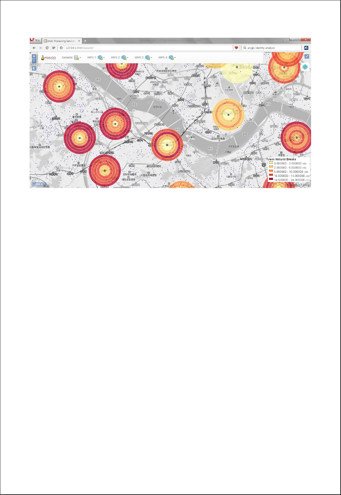

4.2.5.4.
Wedge Buffer
Conducts Wedge Buffer analysis using point layer (pointFeatures) and attributes such as
azimuth, wedgeAngle and radius (innerRadius, outerRadius).
Syntax
WedgeBuffer (SimpleFeatureCollection pointFeatures, Expression azimuth, Expression
wedgeAngle, Expression innerRadius, Expression outerRadius): SimpleFeatureCollection
Parameters
Data Inputs
Identifier
Description
Type
Required
pointFeatures
The point features.
Complex
azimuth
The azimuth (compass direction) expression.
Ex) 45 or [field] or [field] * 0.5 etc...
Literal
wedgeAngle
The wedge angle expression.
Ex) 45 or [field] or [field] * 0.5 etc...
Literal
innerRadius
The inner radius expression. The default is 0.
Ex) 25 or [field] or [field] * 0.5 etc...
Literal
-
outerRadius
The outer radius expression.
Ex) 100 or [field] or [field] * 0.5 etc...
Literal
Process Outputs
Identifier
Description
Type
Required
result
Output features.
Complex
Constraints
- PointFeatures must be point types.
- Azimuth, wedgeAngle, innerRadius, outerRadius expressions can be numbers, and
functions
3
returned by number.
3
http://docs.geoserver.org/stable/en/user/filter/function_reference.html 참조
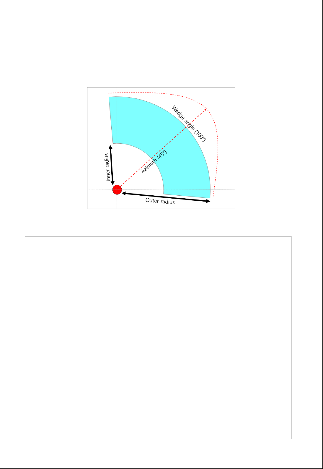
- Lager value between innerRadius, outerRadius parameter value is used as
outerRadius value. At least one of the two values should be greater than 0.
- Parameter value will be explained next.
Request Examples
<?xml version="1.0" encoding="UTF-8"?><wps:Execute version="1.0.0" service="WPS"
xmlns:xsi="http://www.w3.org/2001/XMLSchema-instance" xmlns="http://www.opengis.net/wps/1.0.0"
xmlns:wfs="http://www.opengis.net/wfs" xmlns:wps="http://www.opengis.net/wps/1.0.0"
xmlns:ows="http://www.opengis.net/ows/1.1" xmlns:gml="http://www.opengis.net/gml"
xmlns:ogc="http://www.opengis.net/ogc" xmlns:wcs="http://www.opengis.net/wcs/1.1.1"
xmlns:xlink="http://www.w3.org/1999/xlink" xsi:schemaLocation="http://www.opengis.net/wps/1.0.0
http://schemas.opengis.net/wps/1.0.0/wpsAll.xsd">
<ows:Identifier>statistics:WedgeBuffer</ows:Identifier>
<wps:DataInputs>
<wps:Input>
<ows:Identifier>pointFeatures</ows:Identifier>
<wps:Reference mimeType="text/xml" xlink:href="http://geoserver/wfs" method="POST">
<wps:Body>
<wfs:GetFeature service="WFS" version="1.0.0" outputFormat="GML2"
xmlns:foss="http://www.opengeospatial.net/foss">
<wfs:Query typeName="foss:anglepoint"/>
</wfs:GetFeature>
</wps:Body>
</wps:Reference>
</wps:Input>
<wps:Input>
<ows:Identifier>azimuth</ows:Identifier>

<wps:Data>
<wps:LiteralData>azimuth</wps:LiteralData>
</wps:Data>
</wps:Input>
<wps:Input>
<ows:Identifier>wedgeAngle</ows:Identifier>
<wps:Data>
<wps:LiteralData>wedgeangle</wps:LiteralData>
</wps:Data>
</wps:Input>
<wps:Input>
<ows:Identifier>innerRadius</ows:Identifier>
<wps:Data>
<wps:LiteralData>radius1</wps:LiteralData>
</wps:Data>
</wps:Input>
<wps:Input>
<ows:Identifier>outerRadius</ows:Identifier>
<wps:Data>
<wps:LiteralData>radius2</wps:LiteralData>
</wps:Data>
</wps:Input>
</wps:DataInputs>
<wps:ResponseForm>
<wps:RawDataOutput mimeType="text/xml; subtype=wfs-collection/1.0">
<ows:Identifier>result</ows:Identifier>
</wps:RawDataOutput>
</wps:ResponseForm>
</wps:Execute>
Response
The following figure shows the result of processing Wedge buffer using attributes of
point layer.
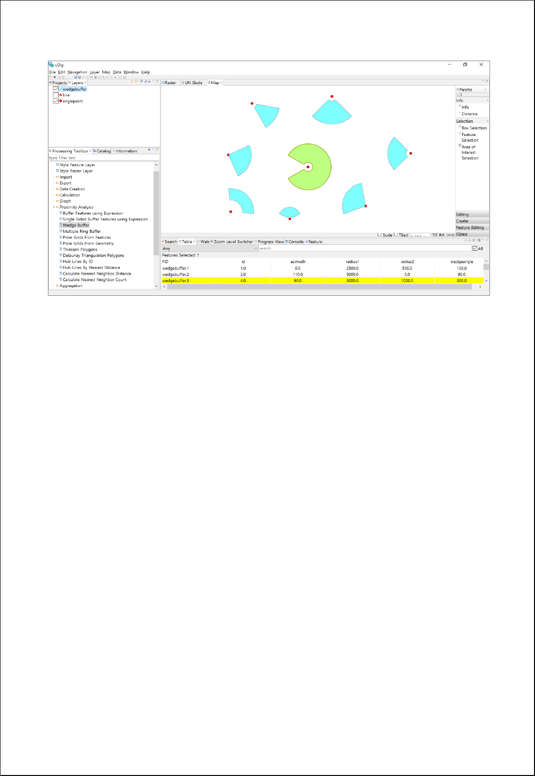

4.2.5.5.
Near (Nearest Distance & Attributes)
Calculates distances and attribute values of the neareast near features (nearFeatures) of
input feature layer (inputFeatures).
Syntax
Near (SimpleFeatureCollection inputFeatures, SimpleFeatureCollection nearFeatures,
String nearIdField, Double maximumDistance): SimpleFeatureCollection
Parameters
Data Inputs
Identifier
Description
Type
Required
inputFeatures
Input Features.
Complex
nearFeatures
Near Features.
Complex
nearIdField
Near ID field.
Literal
-
maximumDistance
Maximum distance.
Literal
-
Process Outputs
Identifier
Description
Type
Required
result
Output features.
Complex
Constraints
- Unless setting nearIdField, uses inside ID of feature.
- InputFeatures, nearFeatures can be points, lines and polygons, and the nearest
distance between two Geometry is calculated.
- MaximumDistance is set and Null value is input when there is no feature within the
set distance.
Request Examples
<?xml version="1.0" encoding="UTF-8"?><wps:Execute version="1.0.0" service="WPS"
xmlns:xsi="http://www.w3.org/2001/XMLSchema-instance" xmlns="http://www.opengis.net/wps/1.0.0"
xmlns:wfs="http://www.opengis.net/wfs" xmlns:wps="http://www.opengis.net/wps/1.0.0"
xmlns:ows="http://www.opengis.net/ows/1.1" xmlns:gml="http://www.opengis.net/gml"

xmlns:ogc="http://www.opengis.net/ogc" xmlns:wcs="http://www.opengis.net/wcs/1.1.1"
xmlns:xlink="http://www.w3.org/1999/xlink" xsi:schemaLocation="http://www.opengis.net/wps/1.0.0
http://schemas.opengis.net/wps/1.0.0/wpsAll.xsd">
<ows:Identifier>statistics:Near</ows:Identifier>
<wps:DataInputs>
<wps:Input>
<ows:Identifier>inputFeatures</ows:Identifier>
<wps:Reference mimeType="text/xml" xlink:href="http://geoserver/wfs" method="POST">
<wps:Body>
<wfs:GetFeature service=“WFS” version=“1.1.0” outputFormat=“GML3”
xmlns:foss="http://www.opengeospatial.net/foss">
<wfs:Query typeName="foss:apartment"/>
</wfs:GetFeature>
</wps:Body>
</wps:Reference>
</wps:Input>
<wps:Input>
<ows:Identifier>nearFeatures</ows:Identifier>
<wps:Reference mimeType="text/xml" xlink:href="http://geoserver/wfs" method="POST">
<wps:Body>
<wfs:GetFeature service=“WFS” version=“1.1.0” outputFormat=“GML3”
xmlns:foss="http://www.opengeospatial.net/foss">
<wfs:Query typeName="foss:wardoffice"/>
</wfs:GetFeature>
</wps:Body>
</wps:Reference>
</wps:Input>
</wps:DataInputs>
<wps:ResponseForm>
<wps:RawDataOutput mimeType=“text/xml; subtype=wfs-collection/1.1”>
<ows:Identifier>result</ows:Identifier>
</wps:RawDataOutput>
</wps:ResponseForm>
</wps:Execute>
Response
The following figure shows the result of processing Near analysis between apartments
and municipal offices. It is calculated using the nearest distance.
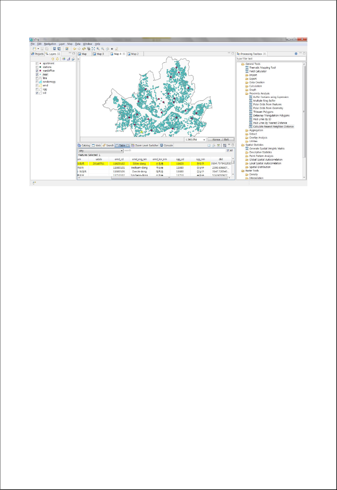

4.2.5.6.
Nearest Neighbor Count
Calculates number of near features (nearFeatures) inside the radius based on the input
feature layers (inputFeatures).
Syntax
NearestNeighborCount (SimpleFeatureCollection inputFeatures, String countField,
SimpleFeatureCollection nearFeatures, Double searchRadius): SimpleFeatureCollection
Parameters
Data Inputs
Identifier
Description
Type
Required
inputFeatures
Input Features.
Complex
countField
Count field. The default is count.
Literal
-
nearFeatures
Near Features.
Complex
searchRadius
Search radius. Search radius must be greater than 0.
Literal
Process Outputs
Identifier
Description
Type
Required
result
Output features.
Complex
Constraints
- InputFeatures, nearFeatures can be points, lines and polygons, and the nearest
distance between two Geometry is calculated.
- Unit of searchRadius parameter is the same with distance unit of inputFeatures,
which must be greater than 0.
Request Examples
<?xml version="1.0" encoding="UTF-8"?><wps:Execute version="1.0.0" service="WPS"
xmlns:xsi="http://www.w3.org/2001/XMLSchema-instance" xmlns="http://www.opengis.net/wps/1.0.0"
xmlns:wfs="http://www.opengis.net/wfs" xmlns:wps="http://www.opengis.net/wps/1.0.0"
xmlns:ows="http://www.opengis.net/ows/1.1" xmlns:gml="http://www.opengis.net/gml"
xmlns:ogc="http://www.opengis.net/ogc" xmlns:wcs="http://www.opengis.net/wcs/1.1.1"
xmlns:xlink="http://www.w3.org/1999/xlink" xsi:schemaLocation="http://www.opengis.net/wps/1.0.0

http://schemas.opengis.net/wps/1.0.0/wpsAll.xsd">
<ows:Identifier>statistics:NearestNeighborCount</ows:Identifier>
<wps:DataInputs>
<wps:Input>
<ows:Identifier>inputFeatures</ows:Identifier>
<wps:Reference mimeType="text/xml" xlink:href="http://geoserver/wfs" method="POST">
<wps:Body>
<wfs:GetFeature service="WFS" version="1.0.0" outputFormat="GML2"
xmlns:foss="http://www.opengeospatial.net/foss">
<wfs:Query typeName="foss:road"/>
</wfs:GetFeature>
</wps:Body>
</wps:Reference>
</wps:Input>
<wps:Input>
<ows:Identifier>countField</ows:Identifier>
<wps:Data>
<wps:LiteralData>pub_cnt</wps:LiteralData>
</wps:Data>
</wps:Input>
<wps:Input>
<ows:Identifier>nearFeatures</ows:Identifier>
<wps:Reference mimeType="text/xml" xlink:href="http://geoserver/wfs" method="POST">
<wps:Body>
<wfs:GetFeature service="WFS" version="1.0.0" outputFormat="GML2"
xmlns:foss="http://www.opengeospatial.net/foss">
<wfs:Query typeName="foss:pubs"/>
</wfs:GetFeature>
</wps:Body>
</wps:Reference>
</wps:Input>
<wps:Input>
<ows:Identifier>searchRadius</ows:Identifier>
<wps:Data>
<wps:LiteralData>500</wps:LiteralData>
</wps:Data>
</wps:Input>
</wps:DataInputs>
<wps:ResponseForm>
<wps:RawDataOutput mimeType="text/xml; subtype=wfs-collection/1.0">
<ows:Identifier>result</ows:Identifier>
</wps:RawDataOutput>
</wps:ResponseForm>
</wps:Execute>
Response
The following figure shows the result of graduated symbol representing the number of
points within a 500-meter radius from the main roads.

4.2.5.7.
Polar Grids from Geometry
Creates polar grid based on the reference Geometry and a comma-separated radius
(radius).
Syntax
PolarGridsFromGeometry (Geometry origin, String radius, RadialType radialType, Integer
sides): SimpleFeatureCollection
Parameters
Data Inputs
Identifier
Description
Type
Required
origin
The center features of polar grids.
Complex
radius
The list of radius(unit:data unit):
Ex) 200, 300, 400, 500.
Literal
radialType
Radial Type: Polar (Default), Base.
Literal
-
sides
The number of sides. Default is 8
Literal
-
Process Outputs
Identifier
Description
Type
Required
result
Output features.
Complex
Constraints
- Values of angle and radius of each cell in input layers are calculated.
- If default value of sides parameter (8) is used, adds azimuth field, and calculates
direction value of NE, N, NW, W, SW, S, SE, E.
Request Examples
<?xml version="1.0" encoding="UTF-8"?><wps:Execute version="1.0.0" service="WPS"
xmlns:xsi="http://www.w3.org/2001/XMLSchema-instance" xmlns="http://www.opengis.net/wps/1.0.0"
xmlns:wfs="http://www.opengis.net/wfs" xmlns:wps="http://www.opengis.net/wps/1.0.0"
xmlns:ows="http://www.opengis.net/ows/1.1" xmlns:gml="http://www.opengis.net/gml"
xmlns:ogc="http://www.opengis.net/ogc" xmlns:wcs="http://www.opengis.net/wcs/1.1.1"
xmlns:xlink="http://www.w3.org/1999/xlink" xsi:schemaLocation="http://www.opengis.net/wps/1.0.0

http://schemas.opengis.net/wps/1.0.0/wpsAll.xsd">
<ows:Identifier>statistics:PolarGridsFromGeometry</ows:Identifier>
<wps:DataInputs>
<wps:Input>
<ows:Identifier>origin</ows:Identifier>
<wps:Data>
<wps:ComplexData mimeType="application/wkt"><![CDATA[POINT (14136522.58319524
4513573.676204068)]]></wps:ComplexData>
</wps:Data>
</wps:Input>
<wps:Input>
<ows:Identifier>radius</ows:Identifier>
<wps:Data>
<wps:LiteralData>500, 1000, 1500, 2000, 2500</wps:LiteralData>
</wps:Data>
</wps:Input>
<wps:Input>
<ows:Identifier>radialType</ows:Identifier>
<wps:Data>
<wps:LiteralData>Polar</wps:LiteralData>
</wps:Data>
</wps:Input>
</wps:DataInputs>
<wps:ResponseForm>
<wps:RawDataOutput mimeType=“text/xml; subtype=wfs-collection/1.1”>
<ows:Identifier>result</ows:Identifier>
</wps:RawDataOutput>
</wps:ResponseForm>
</wps:Execute>
Response
The following figure shows the result of creating Polar Grid with intervals of 500, 1000,
1500, 2000, 2500 meters with point (POINT (14136522.58319524 4513573.676204068)) as
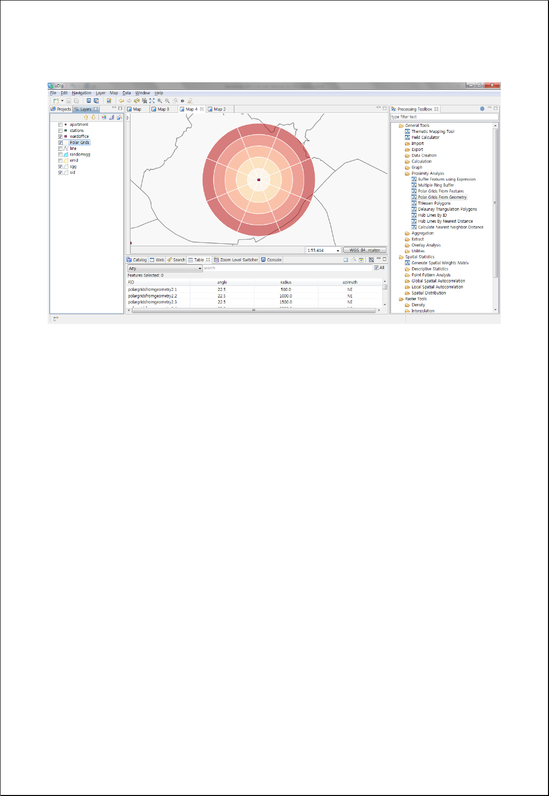
the center.

4.2.5.8.
Polar Grids from Features
Creates Polar grid based on the several Geometry of reference feature layers and a
comma-separated radius (radius).
Syntax
PolarGridsFromFeatures (SimpleFeatureCollection origin, String radius, RadialType
radialType, Integer sides): SimpleFeatureCollection
Parameters
Data Inputs
Identifier
Description
Type
Required
origin
The center features of polar grids.
Complex
radius
The list of radius(unit:data unit):
Ex) 200, 300, 400, 500.
Literal
radialType
Radial Type: Polar (Default), Base.
Literal
-
sides
The number of sides.
Literal
-
Process Outputs
Identifier
Description
Type
Required
result
Output features.
Complex
Constraints
- Values of angle and radius of each cell in input layers are calculated.
- If default value of sides parameter (8) is used, adds azimuth field, and calculates
direction value of NE, N, NW, W, SW, S, SE, E.
Request Examples
<?xml version="1.0" encoding="UTF-8"?><wps:Execute version="1.0.0" service="WPS"
xmlns:xsi="http://www.w3.org/2001/XMLSchema-instance" xmlns="http://www.opengis.net/wps/1.0.0"
xmlns:wfs="http://www.opengis.net/wfs" xmlns:wps="http://www.opengis.net/wps/1.0.0"
xmlns:ows="http://www.opengis.net/ows/1.1" xmlns:gml="http://www.opengis.net/gml"
xmlns:ogc="http://www.opengis.net/ogc" xmlns:wcs="http://www.opengis.net/wcs/1.1.1"
xmlns:xlink="http://www.w3.org/1999/xlink" xsi:schemaLocation="http://www.opengis.net/wps/1.0.0

http://schemas.opengis.net/wps/1.0.0/wpsAll.xsd">
<ows:Identifier>statistics:PolarGridsFromFeatures</ows:Identifier>
<wps:DataInputs>
<wps:Input>
<ows:Identifier>origin</ows:Identifier>
<wps:Reference mimeType="text/xml" xlink:href="http://geoserver/wfs" method="POST">
<wps:Body>
<wfs:GetFeature service=“WFS” version=“1.1.0” outputFormat=“GML3”
xmlns:foss="http://www.opengeospatial.net/foss">
<wfs:Query typeName="foss:wardoffice"/>
</wfs:GetFeature>
</wps:Body>
</wps:Reference>
</wps:Input>
<wps:Input>
<ows:Identifier>radius</ows:Identifier>
<wps:Data>
<wps:LiteralData>500, 1000, 1500, 2000</wps:LiteralData>
</wps:Data>
</wps:Input>
<wps:Input>
<ows:Identifier>radialType</ows:Identifier>
<wps:Data>
<wps:LiteralData>Polar</wps:LiteralData>
</wps:Data>
</wps:Input>
</wps:DataInputs>
<wps:ResponseForm>
<wps:RawDataOutput mimeType=“text/xml; subtype=wfs-collection/1.1”>
<ows:Identifier>result</ows:Identifier>
</wps:RawDataOutput>
</wps:ResponseForm>
</wps:Execute>
Response
The following figure shows the result of creating 8-directional Polar Grids with radius of
250,500,750,1000,1250,1500 meters from municipal offices, then calculating the number
of apartments in every cell, and mapping out.
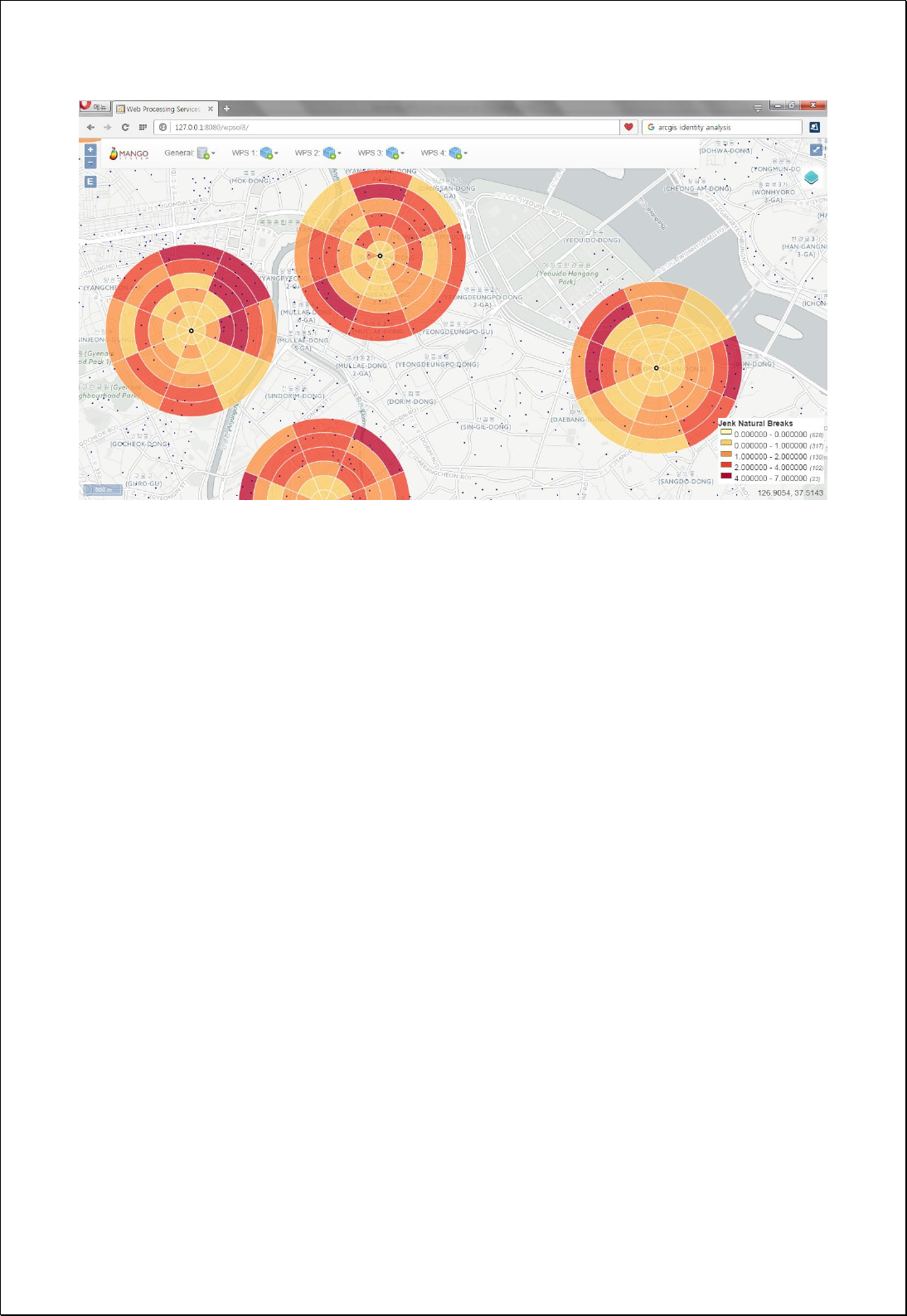

4.2.6. Aggregation
These processes are for overlapping one or more data and calculating new values.
4.2.6.1.
Point Statistics
Calculates the numbers or descriptive statistics of point layers (pointFeatures)
intersecting with the polygon layers (inputFeatures).
Syntax
PointStatistics (SimpleFeatureCollection inputFeatures, SimpleFeatureCollection
pointFeatures, String countField, String statisticsFields): SimpleFeatureCollection
Parameters
Data Inputs
Identifier
Description
Type
Required
inputFeatures
The polygon features to be calculated.
Complex
pointFeatures
The point features to be calculated.
Complex
countField
The count field. count is a default
Literal
-
statisticsFields
Centroid(False, Default), Inside(True)
Literal
-
Process Outputs
Identifier
Description
Type
Required
result
Output features.
Complex
Constraints
- InputFeatures must be polygon types, and pointFeatures must be point types.
- CountField stores the number of points contained within the polygons. The default
value is count.
- StatisticsFields are input as [Function name, Field name] structure as follows, and
the available functions are as follows. For example, Sum.pop, Mean.pop
Input
Return field name
First: String field, Dissolve object Feature’s first value
FST_Field name

Last: String field, Dissolve object Feature’s last value
Sum: Numeric field, Dissolve object Feature’s sum value
Mean: Numeric field, Dissolve object Feature’s mean value
Min: Numeric field, Dissolve object Feature’s minimum value
Max: Numeric field, Dissolve object Feature’s maximum value
Std: Numeric field, Dissolve object Feature’s standard deviation value
Var: Numeric field, Dissolve object Feature’s variance
Range: Numeric field, Dissolve object Feature’s range
Count: Dissolve object Feature’s number
LST_ Field name
SUM_ Field name
AVG_ Field name
MIN_ Field name
MAX_ Field name
STD_ Field name
VAR_Field name
RNG_ Field name
CNT_ Field name
Request Examples
<?xml version="1.0" encoding="UTF-8"?><wps:Execute version="1.0.0" service="WPS"
xmlns:xsi="http://www.w3.org/2001/XMLSchema-instance" xmlns="http://www.opengis.net/wps/1.0.0"
xmlns:wfs="http://www.opengis.net/wfs" xmlns:wps="http://www.opengis.net/wps/1.0.0"
xmlns:ows="http://www.opengis.net/ows/1.1" xmlns:gml="http://www.opengis.net/gml"
xmlns:ogc="http://www.opengis.net/ogc" xmlns:wcs="http://www.opengis.net/wcs/1.1.1"
xmlns:xlink="http://www.w3.org/1999/xlink" xsi:schemaLocation="http://www.opengis.net/wps/1.0.0
http://schemas.opengis.net/wps/1.0.0/wpsAll.xsd">
<ows:Identifier>statistics:PointStatistics</ows:Identifier>
<wps:DataInputs>
<wps:Input>
<ows:Identifier>polygonFeatures</ows:Identifier>
<wps:Reference mimeType="text/xml" xlink:href="http://geoserver/wfs" method="POST">
<wps:Body>
<wfs:GetFeature service=“WFS” version=“1.1.0” outputFormat=“GML3”
xmlns:foss="http://www.opengeospatial.net/foss">
<wfs:Query typeName="foss:sgg"/>
</wfs:GetFeature>
</wps:Body>
</wps:Reference>
</wps:Input>
<wps:Input>
<ows:Identifier>pointFeatures</ows:Identifier>
<wps:Reference mimeType="text/xml" xlink:href="http://geoserver/wfs" method="POST">
<wps:Body>
<wfs:GetFeature service=“WFS” version=“1.1.0” outputFormat=“GML3”
xmlns:foss="http://www.opengeospatial.net/foss">
<wfs:Query typeName="foss:gasstation"/>
</wfs:GetFeature>
</wps:Body>
</wps:Reference>
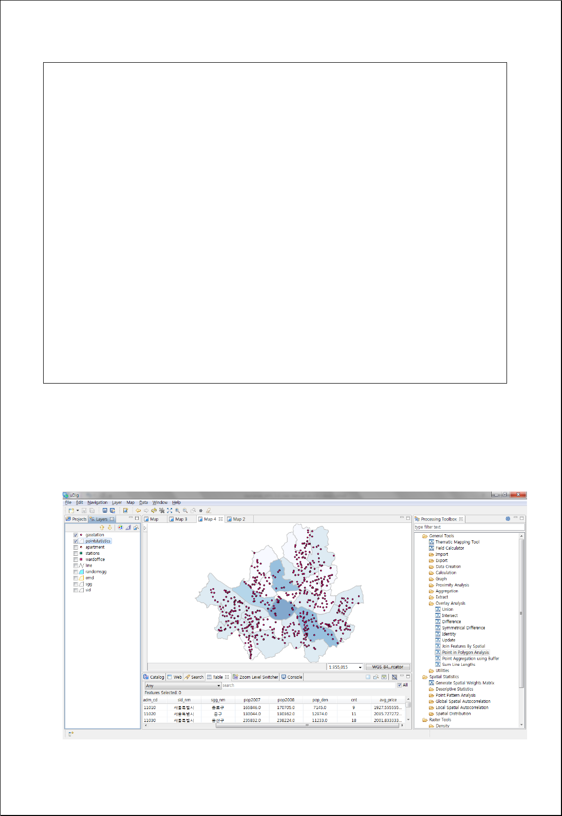
</wps:Input>
<wps:Input>
<ows:Identifier>countField</ows:Identifier>
<wps:Data>
<wps:LiteralData>cnt</wps:LiteralData>
</wps:Data>
</wps:Input>
<wps:Input>
<ows:Identifier>statisticsFields</ows:Identifier>
<wps:Data>
<wps:LiteralData>Mean.price</wps:LiteralData>
</wps:Data>
</wps:Input>
</wps:DataInputs>
<wps:ResponseForm>
<wps:RawDataOutput mimeType=“text/xml; subtype=wfs-collection/1.1”>
<ows:Identifier>result</ows:Identifier>
</wps:RawDataOutput>
</wps:ResponseForm>
</wps:Execute>
Response
The following figure shows the result of calculating and mapping the average price of
gas stations in the administrative boundary (Si-Gun-Gu).

4.2.6.2.
Aggregate (Union) Polygons
Dissolves the input polygon features (polygonFeatures) and creates one polygon feature
layer.
Syntax
UnionPolygon (SimpleFeatureCollection polygonFeatures, Boolean preserveHole):
SimpleFeatureCollection
Parameters
Data Inputs
Identifier
Description
Type
Required
polygonFeatures
The polygon features to be processed.
Complex
preserveHole
Preserve or remove hole (interior ring).
Literal
-
Process Outputs
Identifier
Description
Type
Required
result
Output features.
Complex
Constraints
- If preserveHole parameter is set to false, all interior rings are returned to polygons
eliminated.
Request Examples
<?xml version="1.0" encoding="UTF-8"?><wps:Execute version="1.0.0" service="WPS"
xmlns:xsi="http://www.w3.org/2001/XMLSchema-instance" xmlns="http://www.opengis.net/wps/1.0.0"
xmlns:wfs="http://www.opengis.net/wfs" xmlns:wps="http://www.opengis.net/wps/1.0.0"
xmlns:ows="http://www.opengis.net/ows/1.1" xmlns:gml="http://www.opengis.net/gml"
xmlns:ogc="http://www.opengis.net/ogc" xmlns:wcs="http://www.opengis.net/wcs/1.1.1"
xmlns:xlink="http://www.w3.org/1999/xlink" xsi:schemaLocation="http://www.opengis.net/wps/1.0.0
http://schemas.opengis.net/wps/1.0.0/wpsAll.xsd">
<ows:Identifier>statistics:UnionPolygon</ows:Identifier>
<wps:DataInputs>
<wps:Input>
<ows:Identifier>polygonFeatures</ows:Identifier>
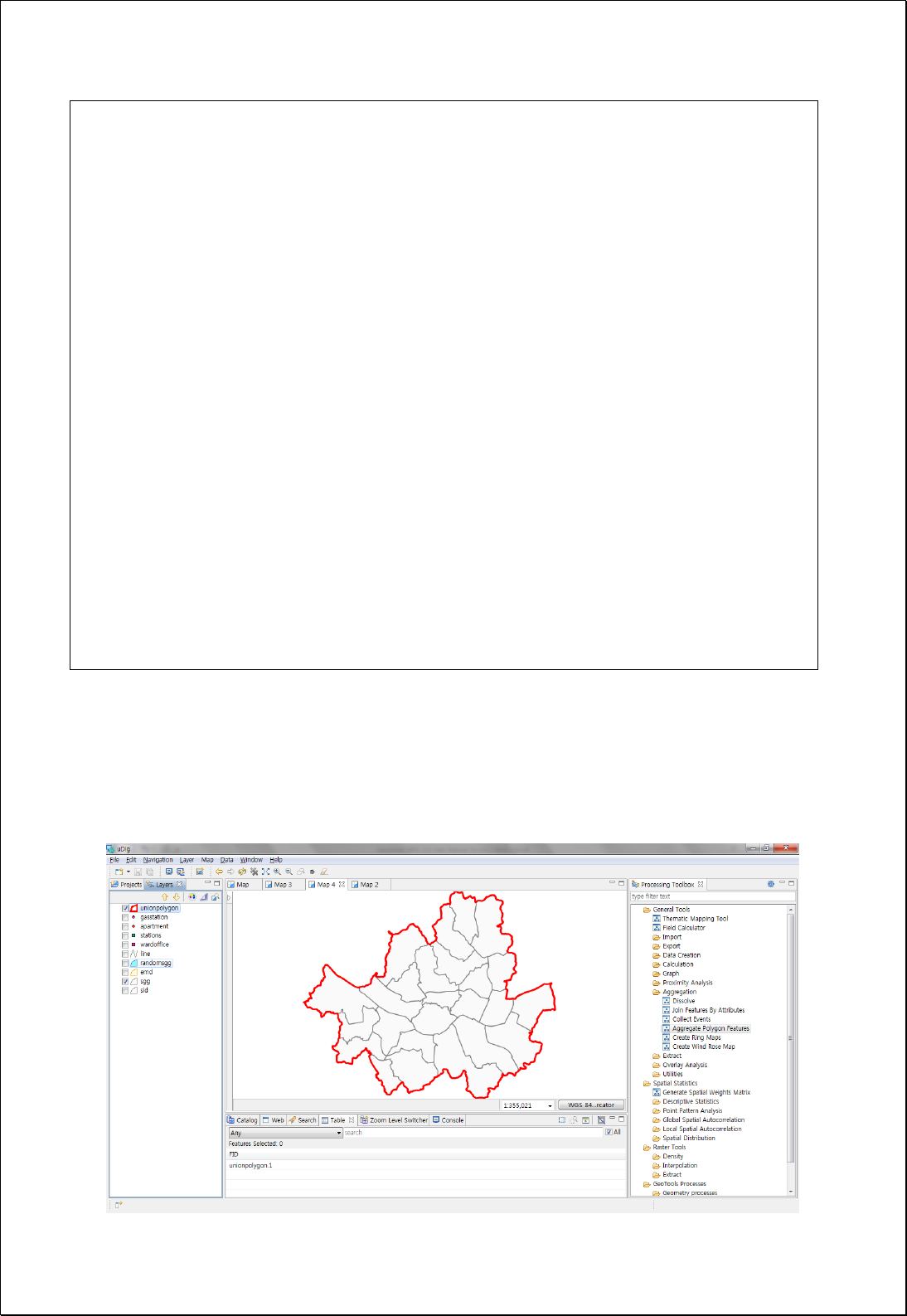
<wps:Reference mimeType="text/xml" xlink:href="http://geoserver/wfs" method="POST">
<wps:Body>
<wfs:GetFeature service=“WFS” version=“1.1.0” outputFormat=“GML3”
xmlns:foss="http://www.opengeospatial.net/foss">
<wfs:Query typeName="foss:sgg"/>
</wfs:GetFeature>
</wps:Body>
</wps:Reference>
</wps:Input>
<wps:Input>
<ows:Identifier>preserveHole</ows:Identifier>
<wps:Data>
<wps:LiteralData>False</wps:LiteralData>
</wps:Data>
</wps:Input>
</wps:DataInputs>
<wps:ResponseForm>
<wps:RawDataOutput mimeType=“text/xml; subtype=wfs-collection/1.1”>
<ows:Identifier>result</ows:Identifier>
</wps:RawDataOutput>
</wps:ResponseForm>
</wps:Execute>
Response
If there is any InteriorRing(Hole) due to the preserveHole parameter is false, eliminates
interior rings(Hole).

4.2.6.3.
Collect Events
If points have the same locations, or they are contained within a specified radius, merges
them into one feature.
Syntax
CollectEvents (SimpleFeatureCollection inputFeatures, String countField, Double tolerance):
SimpleFeatureCollection
Parameters
Data Inputs
Identifier
Description
Type
Required
inputFeatures
The features representing event or incident data.
Complex
countField
The field to be calculated coincident points count.
icount (Default).
Literal
-
tolerance
The tolerance distance for considering two points
equal.
Literal
-
Process Outputs
Identifier
Description
Type
Required
result
Output features.
Complex
Constraints
- Unless setting countField, uses default value of countField.
- If the tolerance value is 0, considers exactly matching points. If the tolerance value
is greater than 0, the features within the tolerance distance are regarded as the
same.
Request Examples
<?xml version="1.0" encoding="UTF-8"?><wps:Execute version="1.0.0" service="WPS"
xmlns:xsi="http://www.w3.org/2001/XMLSchema-instance" xmlns="http://www.opengis.net/wps/1.0.0"
xmlns:wfs="http://www.opengis.net/wfs" xmlns:wps="http://www.opengis.net/wps/1.0.0"
xmlns:ows="http://www.opengis.net/ows/1.1" xmlns:gml="http://www.opengis.net/gml"
xmlns:ogc="http://www.opengis.net/ogc" xmlns:wcs="http://www.opengis.net/wcs/1.1.1"

xmlns:xlink="http://www.w3.org/1999/xlink" xsi:schemaLocation="http://www.opengis.net/wps/1.0.0
http://schemas.opengis.net/wps/1.0.0/wpsAll.xsd">
<ows:Identifier>statistics:CollectEvents</ows:Identifier>
<wps:DataInputs>
<wps:Input>
<ows:Identifier>inputFeatures</ows:Identifier>
<wps:Reference mimeType="text/xml" xlink:href="http://geoserver/wfs" method="POST">
<wps:Body>
<wfs:GetFeature service=“WFS” version=“1.1.0” outputFormat=“GML3”
xmlns:foss="http://www.opengeospatial.net/foss">
<wfs:Query typeName="foss:checkins"/>
</wfs:GetFeature>
</wps:Body>
</wps:Reference>
</wps:Input>
<wps:Input>
<ows:Identifier>countField</ows:Identifier>
<wps:Data>
<wps:LiteralData>icount</wps:LiteralData>
</wps:Data>
</wps:Input>
<wps:Input>
<ows:Identifier>tolerance</ows:Identifier>
<wps:Data>
<wps:LiteralData>5</wps:LiteralData>
</wps:Data>
</wps:Input>
</wps:DataInputs>
<wps:ResponseForm>
<wps:RawDataOutput mimeType=“text/xml; subtype=wfs-collection/1.1”>
<ows:Identifier>result</ows:Identifier>
</wps:RawDataOutput>
</wps:ResponseForm>
</wps:Execute>
Response
The following figure shows the result of joining all the points within a set distance into
one feature.
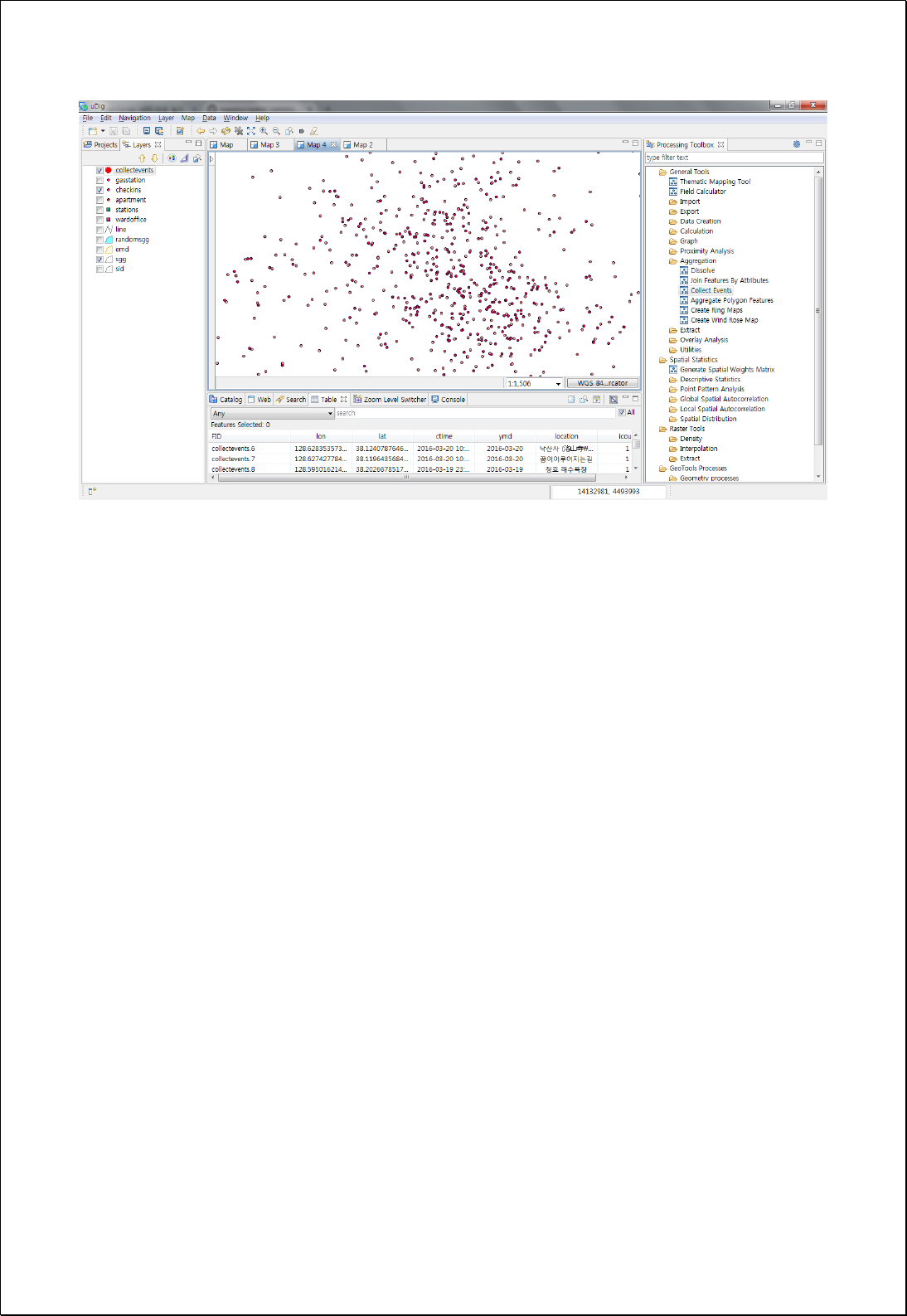

4.2.6.4.
Spatial Join
Performs spatial join of two features based on spatial relationships. All attribute values of
two feature layers are contained.
Syntax
SpatialJoin (SimpleFeatureCollection inputFeatures, SimpleFeatureCollection joinFeatures,
SpatialJoinType joinType, Double searchRadius): SimpleFeatureCollection
Parameters
Data Inputs
Identifier
Description
Type
Required
inputFeatures
Input features.
Complex
joinFeatures
Join features.
Complex
joinType
Join Type. KeepAllRecord, OnlyMatchingRecord
Literal
-
searchRadius
Search Radius.
Literal
-
Process Outputs
Identifier
Description
Type
Required
result
Output features.
Complex
Constraints
- If joinType parameter value is set to KeepAllRecord, returns all features of
inputFeatures that have not been spatial joined.
- If provides searchRdius parameter, performs join with features contained within
searchRadius.
Request Examples
<?xml version="1.0" encoding="UTF-8"?><wps:Execute version="1.0.0" service="WPS"
xmlns:xsi="http://www.w3.org/2001/XMLSchema-instance" xmlns="http://www.opengis.net/wps/1.0.0"
xmlns:wfs="http://www.opengis.net/wfs" xmlns:wps="http://www.opengis.net/wps/1.0.0"
xmlns:ows="http://www.opengis.net/ows/1.1" xmlns:gml="http://www.opengis.net/gml"
xmlns:ogc="http://www.opengis.net/ogc" xmlns:wcs="http://www.opengis.net/wcs/1.1.1"
xmlns:xlink="http://www.w3.org/1999/xlink" xsi:schemaLocation="http://www.opengis.net/wps/1.0.0

http://schemas.opengis.net/wps/1.0.0/wpsAll.xsd">
<ows:Identifier>statistics:SpatialJoin</ows:Identifier>
<wps:DataInputs>
<wps:Input>
<ows:Identifier>inputFeatures</ows:Identifier>
<wps:Reference mimeType="text/xml" xlink:href="http://geoserver/wfs" method="POST">
<wps:Body>
<wfs:GetFeature service=“WFS” version=“1.1.0” outputFormat=“GML3”
xmlns:foss="http://www.opengeospatial.net/foss">
<wfs:Query typeName="foss:stores"/>
</wfs:GetFeature>
</wps:Body>
</wps:Reference>
</wps:Input>
<wps:Input>
<ows:Identifier>joinFeatures</ows:Identifier>
<wps:Reference mimeType="text/xml" xlink:href="http://geoserver/wfs" method="POST">
<wps:Body>
<wfs:GetFeature service=“WFS” version=“1.1.0” outputFormat=“GML3”
xmlns:foss="http://www.opengeospatial.net/foss">
<wfs:Query typeName="foss:sgg"/>
</wfs:GetFeature>
</wps:Body>
</wps:Reference>
</wps:Input>
<wps:Input>
<ows:Identifier>joinType</ows:Identifier>
<wps:Data>
<wps:LiteralData>KeepAllRecord</wps:LiteralData>
</wps:Data>
</wps:Input>
</wps:DataInputs>
<wps:ResponseForm>
<wps:RawDataOutput mimeType=“text/xml; subtype=wfs-collection/1.1”>
<ows:Identifier>result</ows:Identifier>
</wps:RawDataOutput>
</wps:ResponseForm>
</wps:Execute>
Response
The following figure showsthe result of Spatial Join of information of the administrative
boundary (Si-Gun-Gu) layer containing point layer of larger markets. For point or line
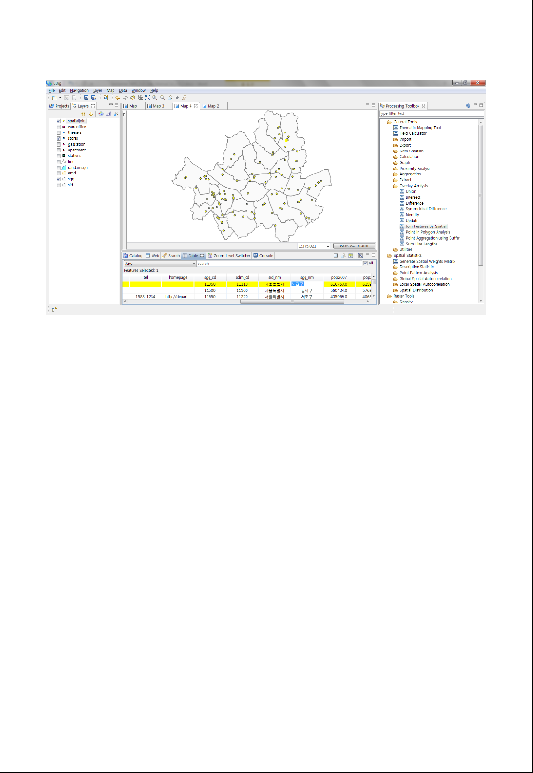
layers, you can set the search radius to get the properties of nearby features.

4.2.6.5.
Attribute Join
Performs join using two feature layers (inputFeatures) and join fields. All attribute values
of two feature layers are contained.
Syntax
AttributeJoin (SimpleFeatureCollection inputFeatures, String primaryKey,
SimpleFeatureCollection joinFeatures, String foreignKey, Join.Type joinType):
SimpleFeatureCollection
Parameters
Data Inputs
Identifier
Description
Type
Required
inputFeatures
Input features.
Complex
primaryKey
Primary key field.
Literal
joinFeatures
Join features.
Complex
foreignKey
Foreign key field.
Literal
joinType
Join type. INNER, OUTER
Literal
-
Process Outputs
Identifier
Description
Type
Required
result
Output features.
Complex
Constraints
- If joinType is set to INNER, returns joined features of inputFeatures.
Request Examples
<?xml version="1.0" encoding="UTF-8"?><wps:Execute version="1.0.0" service="WPS"
xmlns:xsi="http://www.w3.org/2001/XMLSchema-instance" xmlns="http://www.opengis.net/wps/1.0.0"
xmlns:wfs="http://www.opengis.net/wfs" xmlns:wps="http://www.opengis.net/wps/1.0.0"
xmlns:ows="http://www.opengis.net/ows/1.1" xmlns:gml="http://www.opengis.net/gml"
xmlns:ogc="http://www.opengis.net/ogc" xmlns:wcs="http://www.opengis.net/wcs/1.1.1"
xmlns:xlink="http://www.w3.org/1999/xlink" xsi:schemaLocation="http://www.opengis.net/wps/1.0.0
http://schemas.opengis.net/wps/1.0.0/wpsAll.xsd">
<ows:Identifier>statistics:AttributeJoin</ows:Identifier>

<wps:DataInputs>
<wps:Input>
<ows:Identifier>inputFeatures</ows:Identifier>
<wps:Reference mimeType="text/xml" xlink:href="http://geoserver/wfs" method="POST">
<wps:Body>
<wfs:GetFeature service=“WFS” version=“1.1.0” outputFormat=“GML3”
xmlns:foss="http://www.opengeospatial.net/foss">
<wfs:Query typeName="foss:stores"/>
</wfs:GetFeature>
</wps:Body>
</wps:Reference>
</wps:Input>
<wps:Input>
<ows:Identifier>primaryKey</ows:Identifier>
<wps:Data>
<wps:LiteralData>sgg_cd</wps:LiteralData>
</wps:Data>
</wps:Input>
<wps:Input>
<ows:Identifier>joinFeatures</ows:Identifier>
<wps:Reference mimeType="text/xml" xlink:href="http://geoserver/wfs" method="POST">
<wps:Body>
<wfs:GetFeature service=“WFS” version=“1.1.0” outputFormat=“GML3”
xmlns:foss="http://www.opengeospatial.net/foss">
<wfs:Query typeName="foss:sgg"/>
</wfs:GetFeature>
</wps:Body>
</wps:Reference>
</wps:Input>
<wps:Input>
<ows:Identifier>foreignKey</ows:Identifier>
<wps:Data>
<wps:LiteralData>sgg_cd</wps:LiteralData>
</wps:Data>
</wps:Input>
<wps:Input>
<ows:Identifier>joinType</ows:Identifier>
<wps:Data>
<wps:LiteralData>OUTER</wps:LiteralData>
</wps:Data>
</wps:Input>
</wps:DataInputs>
<wps:ResponseForm>
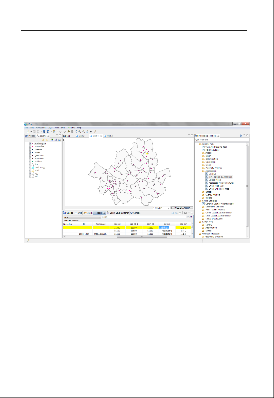
<wps:RawDataOutput mimeType=“text/xml; subtype=wfs-collection/1.1”>
<ows:Identifier>result</ows:Identifier>
</wps:RawDataOutput>
</wps:ResponseForm>
</wps:Execute>
Response
The following figure shows the result of joining large markets with join field of code of
the administrative district (Si-Gun-Gu).

4.2.6.6.
Buffer Point Statistics
Inputs radius and calculates the numbers or statistics (Sum, Max, Min, Mean etc.) of
attribute information of points within the radius.
Syntax
BufferPointStatistics (SimpleFeatureCollection inputFeatures, Double distance,
SimpleFeatureCollection pointFeatures, String countField, String statisticsFields):
SimpleFeatureCollection
Parameters
Data Inputs
Identifier
Description
Type
Required
inputFeatures
Input features.
Complex
distance
Search distance.
Literal
pointFeatures
Point features.
Complex
countField
Count field. Default is count.
Literal
-
statisticsFields
Statistics Fields:
Function.PropertyName(First, Last, Sum, Mean, Min,
Max, Std, Count)
Literal
-
Process Outputs
Identifier
Description
Type
Required
result
Output features.
Complex
Constraints
- CountField stores the number of points contained in the polygons. The default
value is count.
- StatisticsFields are input as [Function name, Field name] structure as follows, and
the available functions are as follows. For example, Sum.pop, Mean.pop
Input
Return feild
First: String field, Dissolve object Feature’s first value
Last: String field, Dissolve object Feature’s last value
FST_Field Name
LST_ Field Name

Sum: Numeric field, Dissolve object Feature’s sum
Mean: Numeric field, Dissolve object Feature’s mean value
Min: Numeric field, Dissolve object Feature’s minimum value
Max: Numeric field, Dissolve object Feature’s maximum value
Std: Numeric field, Dissolve object Feature’s standard deviation
Var: Numeric field, Dissolve object Feature’s variance
Range: Numeric field, Dissolve object Feature’s range
Count: Dissolve object Feature’s number
SUM_Field Name
AVG_ Field Name
MIN_ Field Name
MAX_ Field Name
STD_ Field Name
VAR_ Field Name
RNG_ Field Name
CNT_ Field Name
Request Examples
<?xml version="1.0" encoding="UTF-8"?><wps:Execute version="1.0.0" service="WPS"
xmlns:xsi="http://www.w3.org/2001/XMLSchema-instance" xmlns="http://www.opengis.net/wps/1.0.0"
xmlns:wfs="http://www.opengis.net/wfs" xmlns:wps="http://www.opengis.net/wps/1.0.0"
xmlns:ows="http://www.opengis.net/ows/1.1" xmlns:gml="http://www.opengis.net/gml"
xmlns:ogc="http://www.opengis.net/ogc" xmlns:wcs="http://www.opengis.net/wcs/1.1.1"
xmlns:xlink="http://www.w3.org/1999/xlink" xsi:schemaLocation="http://www.opengis.net/wps/1.0.0
http://schemas.opengis.net/wps/1.0.0/wpsAll.xsd">
<ows:Identifier>statistics:BufferPointStatistics</ows:Identifier>
<wps:DataInputs>
<wps:Input>
<ows:Identifier>inputFeatures</ows:Identifier>
<wps:Reference mimeType="text/xml" xlink:href="http://geoserver/wfs" method="POST">
<wps:Body>
<wfs:GetFeature service=“WFS” version=“1.1.0” outputFormat=“GML3”
xmlns:foss="http://www.opengeospatial.net/foss">
<wfs:Query typeName="foss:wardoffice"/>
</wfs:GetFeature>
</wps:Body>
</wps:Reference>
</wps:Input>
<wps:Input>
<ows:Identifier>distance</ows:Identifier>
<wps:Data>
<wps:LiteralData>2000</wps:LiteralData>
</wps:Data>
</wps:Input>
<wps:Input>
<ows:Identifier>pointFeatures</ows:Identifier>
<wps:Reference mimeType="text/xml" xlink:href="http://geoserver/wfs" method="POST">
<wps:Body>
<wfs:GetFeature service=“WFS” version=“1.1.0” outputFormat=“GML3”
xmlns:foss="http://www.opengeospatial.net/foss">
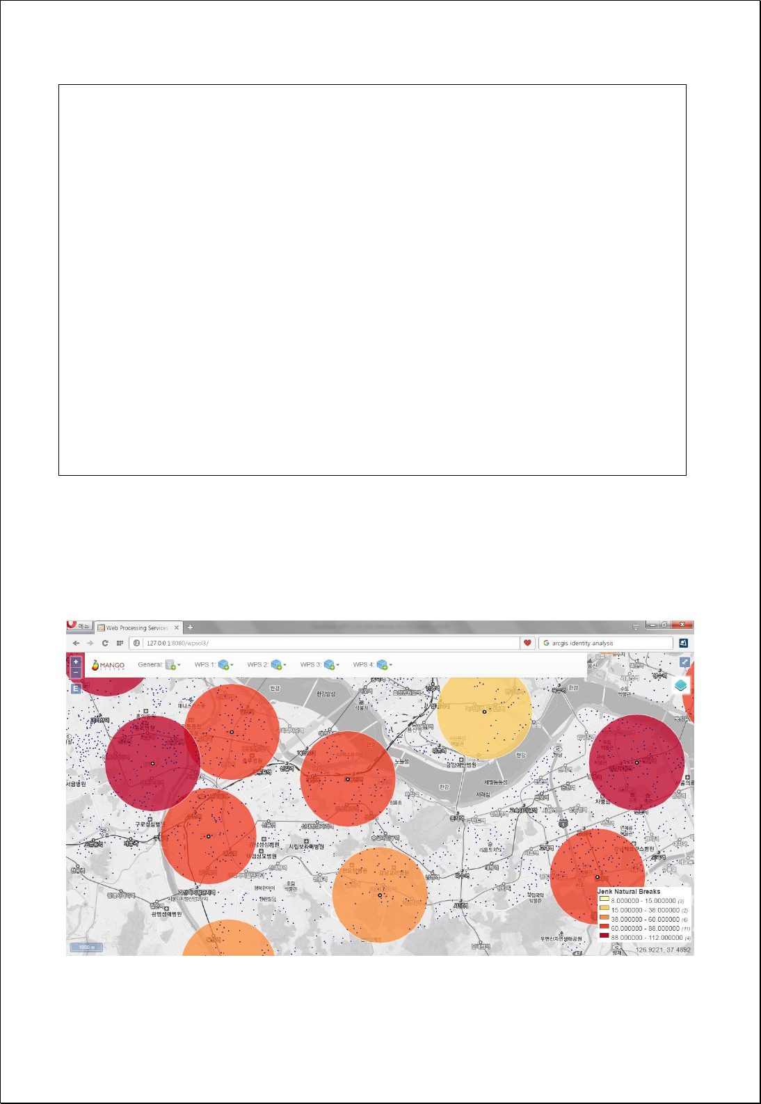
<wfs:Query typeName="foss:apartment"/>
</wfs:GetFeature>
</wps:Body>
</wps:Reference>
</wps:Input>
<wps:Input>
<ows:Identifier>countField</ows:Identifier>
<wps:Data>
<wps:LiteralData>cnt</wps:LiteralData>
</wps:Data>
</wps:Input>
</wps:DataInputs>
<wps:ResponseForm>
<wps:RawDataOutput mimeType=“text/xml; subtype=wfs-collection/1.1”>
<ows:Identifier>result</ows:Identifier>
</wps:RawDataOutput>
</wps:ResponseForm>
</wps:Execute>
Response
The following figure shows the result of calculating and mapping the number of
apartments within 2000 meter of municipal office.

4.2.6.7.
Sum Line Lengths
Clips the line feature layers intersecting with the polygon features (polygons) and
calculates numbers of intersecting line features and the sum of length.
Syntax
SumLineLength (SimpleFeatureCollection polygons, String lengthField, String countField,
SimpleFeatureCollection lines): SimpleFeatureCollection
Parameters
Data Inputs
Identifier
Description
Type
Required
polygons
The polygon features that will be calculated.
Complex
lengthField
The length field that will be calculated. sum_len is
default.
Literal
countField
The count field that will be calculated. line_cnt is
default.
Literal
-
lines
The line features that will be calculated.
Complex
Process Outputs
Identifier
Description
Type
Required
result
Output features.
Complex
Constraints
- LengthField stores sum of cut length of lines intersecting with polygon features. The
default value is sum_len.
- CountField stores the numbers of lines contained within the polygons. The default
value is line_cnt.
Request Examples
<?xml version="1.0" encoding="UTF-8"?><wps:Execute version="1.0.0" service="WPS"
xmlns:xsi="http://www.w3.org/2001/XMLSchema-instance" xmlns="http://www.opengis.net/wps/1.0.0"
xmlns:wfs="http://www.opengis.net/wfs" xmlns:wps="http://www.opengis.net/wps/1.0.0"
xmlns:ows="http://www.opengis.net/ows/1.1" xmlns:gml="http://www.opengis.net/gml"

xmlns:ogc="http://www.opengis.net/ogc" xmlns:wcs="http://www.opengis.net/wcs/1.1.1"
xmlns:xlink="http://www.w3.org/1999/xlink" xsi:schemaLocation="http://www.opengis.net/wps/1.0.0
http://schemas.opengis.net/wps/1.0.0/wpsAll.xsd">
<ows:Identifier>statistics:SumLineLength</ows:Identifier>
<wps:DataInputs>
<wps:Input>
<ows:Identifier>polygons</ows:Identifier>
<wps:Reference mimeType="text/xml" xlink:href="http://geoserver/wfs" method="POST">
<wps:Body>
<wfs:GetFeature service=“WFS” version=“1.1.0” outputFormat=“GML3”
xmlns:foss="http://www.opengeospatial.net/foss">
<wfs:Query typeName="foss:emd"/>
</wfs:GetFeature>
</wps:Body>
</wps:Reference>
</wps:Input>
<wps:Input>
<ows:Identifier>lengthField</ows:Identifier>
<wps:Data>
<wps:LiteralData>len</wps:LiteralData>
</wps:Data>
</wps:Input>
<wps:Input>
<ows:Identifier>lines</ows:Identifier>
<wps:Reference mimeType="text/xml" xlink:href="http://geoserver/wfs" method="POST">
<wps:Body>
<wfs:GetFeature service=“WFS” version=“1.1.0” outputFormat=“GML3”
xmlns:foss="http://www.opengeospatial.net/foss">
<wfs:Query typeName="foss:road"/>
</wfs:GetFeature>
</wps:Body>
</wps:Reference>
</wps:Input>
</wps:DataInputs>
<wps:ResponseForm>
<wps:RawDataOutput mimeType=“text/xml; subtype=wfs-collection/1.1”>
<ows:Identifier>result</ows:Identifier>
</wps:RawDataOutput>
</wps:ResponseForm>
</wps:Execute>
Response
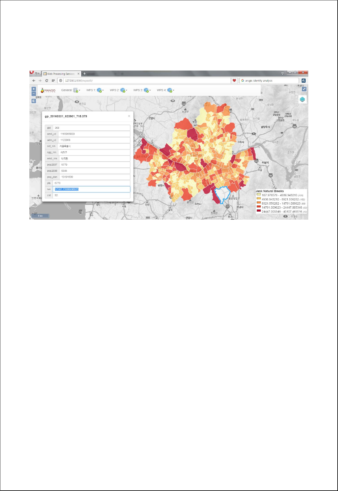
The following figure showsthe result of calculating and mapping of the extension of
main roads inthe administrative boundary (Eup-Myeon-Dong).

4.2.6.8.
Spatial Clump Map
Creates Spatial Clump Map using point features (inputFeatures) and radius expressions
(radious).
Syntax
SpatialClumpMap (SimpleFeatureCollection inputFeatures, Expression radius, Integer
quadrantSegments): SimpleFeatureCollection
Parameters
Data Inputs
Identifier
Description
Type
Required
inputFeatures
Input features to be buffered.
Complex
radius
The radius expression used to create distance. Ex)
1000 or [field] or [field] * 0.5 etc...
Literal
quadrantSegments
The number of line segments used to represent a
quadrant of a circle. Default is 8.
Literal
-
Process Outputs
Identifier
Description
Type
Required
result
Output features.
Complex
Constraints
- The default value of quatrantSegments parameter is 8.
Request Examples
<?xml version="1.0" encoding="utf-8"?>
<wps:Execute version="1.0.0" service="WPS" xmlns:xsi="http://www.w3.org/2001/XMLSchema-instance"
xmlns="http://www.opengis.net/wps/1.0.0" xmlns:wfs="http://www.opengis.net/wfs"
xmlns:wps="http://www.opengis.net/wps/1.0.0" xmlns:ows="http://www.opengis.net/ows/1.1"
xmlns:gml="http://www.opengis.net/gml" xmlns:ogc="http://www.opengis.net/ogc"
xmlns:wcs="http://www.opengis.net/wcs/1.1.1" xmlns:xlink="http://www.w3.org/1999/xlink"
xsi:schemaLocation="http://www.opengis.net/wps/1.0.0 http://schemas.opengis.net/wps/1.0.0/wpsAll.xsd">
<ows:Identifier>statistics:SpatialClumpMap</ows:Identifier>
<wps:DataInputs>
<wps:Input>
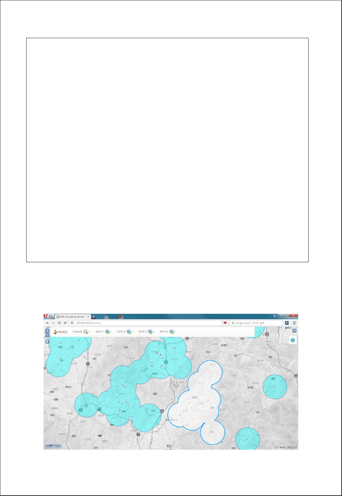
<ows:Identifier>inputFeatures</ows:Identifier>
<wps:Reference mimeType="text/xml" xlink:href="http://geoserver/wfs" method="POST">
<wps:Body>
<wfs:GetFeature service="WFS" version="1.0.0" outputFormat="GML2"
xmlns:foss="http://www.opengeospatial.net/foss">
<wfs:Query typeName="foss:outbreak" />
</wfs:GetFeature>
</wps:Body>
</wps:Reference>
</wps:Input>
<wps:Input>
<ows:Identifier>radius</ows:Identifier>
<wps:Data>
<wps:LiteralData>5000</wps:LiteralData>
</wps:Data>
</wps:Input>
</wps:DataInputs>
<wps:ResponseForm>
<wps:RawDataOutput mimeType="text/xml; subtype=wfs-collection/1.0">
<ows:Identifier>result</ows:Identifier>
</wps:RawDataOutput>
</wps:ResponseForm>
</wps:Execute>
Response
The following figure showsthe result of Spatial Clump Map by setting the radius as 5Km.

4.2.6.9.
Hexagonal Binning
Creates Hexagon grid using point features (features), extents, and radius and then
creates polygon features counting for the numbers of points in each cell.
Syntax
HexagonalBinning (SimpleFeatureCollection features, Expression weight,
ReferencedEnvelope bbox, Double size, Boolean validGrid): SimpleFeatureCollection
Parameters
Data Inputs
Identifier
Description
Type
Required
features
Input point features to be aggregated.
Complex
weight
The numeric field or expression used to weight
values. Ex) [field] or [field] * 0.5 etc...
Literal
-
bbox
The extent of the grids.
Complex
-
size
Size of the grids.
Literal
validGrid
Returns only valid grid. Default is True.
Literal
-
Process Outputs
Identifier
Description
Type
Required
result
Output features.
Complex
Constraints
- If bbox is set to Null, extent of feature data is used.
- If gives weight expression, accumulates weight values.
- Size must be greater than 0.
- Default value of validGrid parameter is true, and only the grid of which number is
more than 0 is returned.
Request Examples
<?xml version="1.0" encoding="UTF-8"?>

<wps:Execute version="1.0.0" service="WPS" xmlns:xsi="http://www.w3.org/2001/XMLSchema-instance"
xmlns="http://www.opengis.net/wps/1.0.0" xmlns:wfs="http://www.opengis.net/wfs"
xmlns:wps="http://www.opengis.net/wps/1.0.0" xmlns:ows="http://www.opengis.net/ows/1.1"
xmlns:gml="http://www.opengis.net/gml" xmlns:ogc="http://www.opengis.net/ogc"
xmlns:wcs="http://www.opengis.net/wcs/1.1.1" xmlns:xlink="http://www.w3.org/1999/xlink"
xsi:schemaLocation="http://www.opengis.net/wps/1.0.0 http://schemas.opengis.net/wps/1.0.0/wpsAll.xsd">
<ows:Identifier>statistics:HexagonalBinning</ows:Identifier>
<wps:DataInputs>
<wps:Input>
<ows:Identifier>features</ows:Identifier>
<wps:Reference mimeType="text/xml" xlink:href="http://geoserver/wfs" method="POST">
<wps:Body>
<wfs:GetFeature service="WFS" version="1.0.0" outputFormat="GML2"
xmlns:foss="http://www.opengeospatial.net/foss">
<wfs:Query typeName="foss:apartment"/>
</wfs:GetFeature>
</wps:Body>
</wps:Reference>
</wps:Input>
<wps:Input>
<ows:Identifier>size</ows:Identifier>
<wps:Data>
<wps:LiteralData>1500</wps:LiteralData>
</wps:Data>
</wps:Input>
</wps:DataInputs>
<wps:ResponseForm>
<wps:RawDataOutput mimeType="text/xml; subtype=wfs-collection/1.0">
<ows:Identifier>result</ows:Identifier>
</wps:RawDataOutput>
</wps:ResponseForm>
</wps:Execute>
Response
The following figure showsthe result of creating and visualizing of hexagons with a size
of 1000 meters created from apartment point data of Seoul.
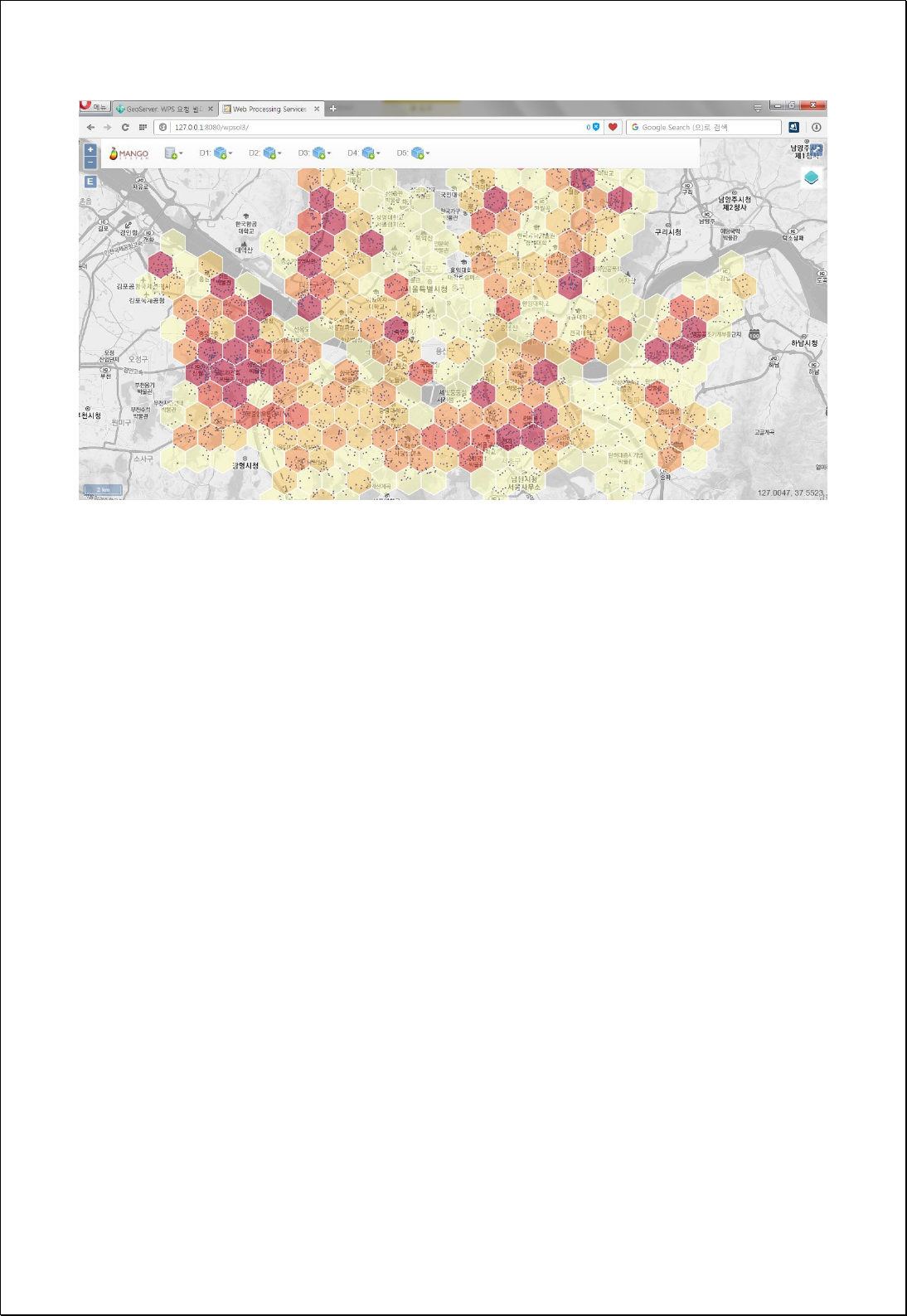

4.2.6.10.
Rectangular Binning
Creates rectangle grids using point features (features), extent (bbox), and radius (width,
height) and then creates polygon features counting for the number of points in each cell.
Syntax
RectangularBinning (SimpleFeatureCollection features, Expression weight,
ReferencedEnvelope bbox, Double width, Double height, Boolean validGrid):
SimpleFeatureCollection
Parameters
Data Inputs
Identifier
Description
Type
Required
features
Input point features to be aggregated.
Complex
weight
The numeric field or expression used to weight
values. Ex) [field] or [field] * 0.5 etc...
Literal
-
bbox
The extent of the grids.
Complex
-
width
Width of the grids.
Literal
height
Height of the grids.
Literal
validGrid
Returns only valid grid. Default is True.
Literal
-
Process Outputs
Identifier
Description
Type
Required
result
Output features.
Complex
Constraints
- If bbox is set to Null, uses extent of feature data.
- If gives weight expression, accumulates weight values.
- Width, height must be greater than 0.
- Default value of validGrid parameter is true, and only the grids of which number is
more than 0 are returned.

Request Examples
<?xml version="1.0" encoding="UTF-8"?>
<wps:Execute version="1.0.0" service="WPS" xmlns:xsi="http://www.w3.org/2001/XMLSchema-instance"
xmlns="http://www.opengis.net/wps/1.0.0" xmlns:wfs="http://www.opengis.net/wfs"
xmlns:wps="http://www.opengis.net/wps/1.0.0" xmlns:ows="http://www.opengis.net/ows/1.1"
xmlns:gml="http://www.opengis.net/gml" xmlns:ogc="http://www.opengis.net/ogc"
xmlns:wcs="http://www.opengis.net/wcs/1.1.1" xmlns:xlink="http://www.w3.org/1999/xlink"
xsi:schemaLocation="http://www.opengis.net/wps/1.0.0 http://schemas.opengis.net/wps/1.0.0/wpsAll.xsd">
<ows:Identifier>statistics:RectangularBinning</ows:Identifier>
<wps:DataInputs>
<wps:Input>
<ows:Identifier>features</ows:Identifier>
<wps:Reference mimeType="text/xml" xlink:href="http://geoserver/wfs" method="POST">
<wps:Body>
<wfs:GetFeature service="WFS" version="1.0.0" outputFormat="GML2"
xmlns:foss="http://www.opengeospatial.net/foss">
<wfs:Query typeName="foss:apartment"/>
</wfs:GetFeature>
</wps:Body>
</wps:Reference>
</wps:Input>
<wps:Input>
<ows:Identifier>width</ows:Identifier>
<wps:Data>
<wps:LiteralData>1500</wps:LiteralData>
</wps:Data>
</wps:Input>
<wps:Input>
<ows:Identifier>height</ows:Identifier>
<wps:Data>
<wps:LiteralData>1500</wps:LiteralData>
</wps:Data>
</wps:Input>
</wps:DataInputs>
<wps:ResponseForm>
<wps:RawDataOutput mimeType="text/xml; subtype=wfs-collection/1.0">
<ows:Identifier>result</ows:Identifier>
</wps:RawDataOutput>
</wps:ResponseForm>
</wps:Execute>
Response
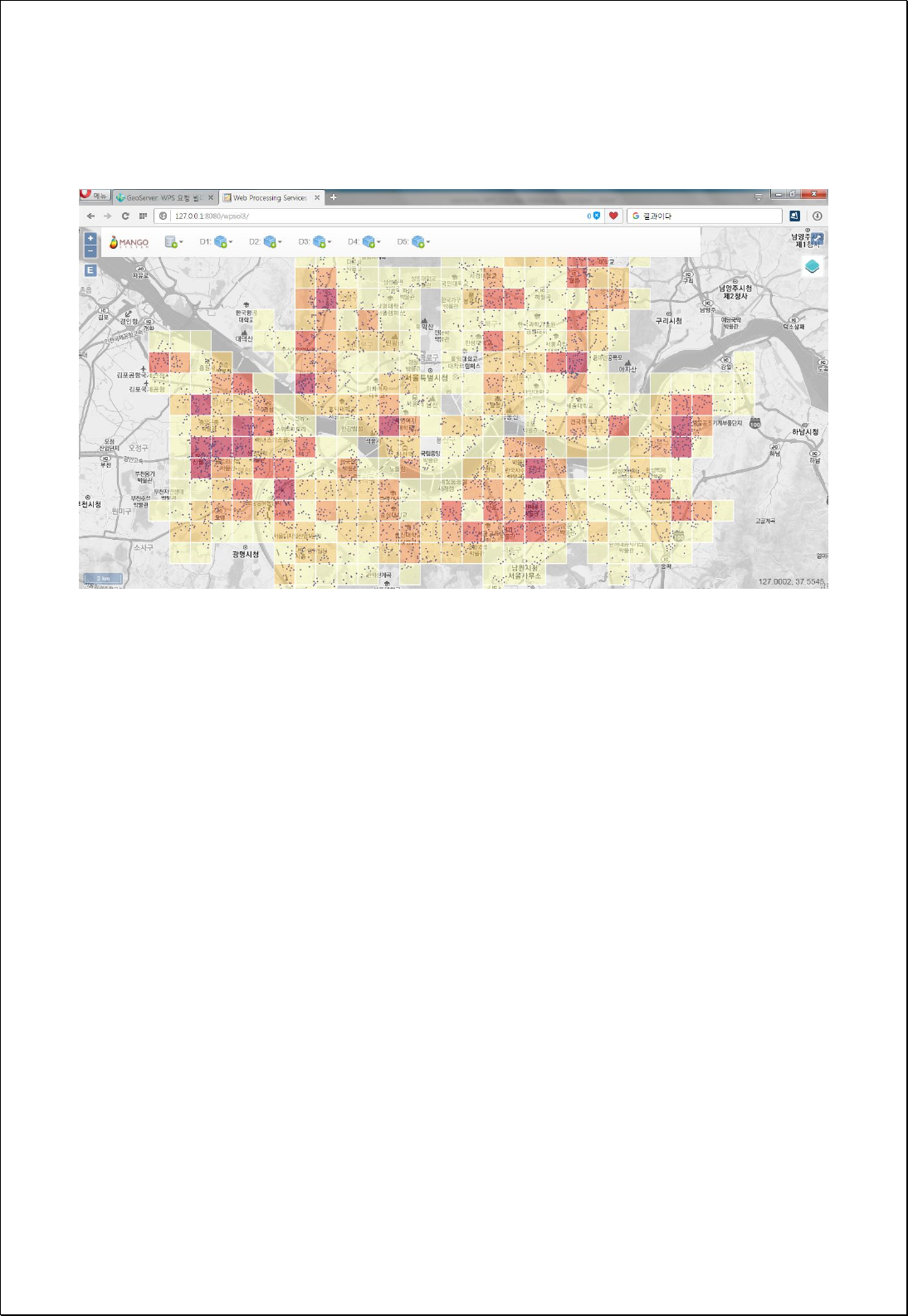
The following figure shows the result of creating and visualizing of rectangles with a
side length of 1500 meters created from apartment point data of Seoul.

4.2.6.11.
Circular Binning
Creates circle grids using point features (features), extent (bbox), radius (radius) and
then creates polygon features counting for the number of points in each cell.
Syntax
CircularBinning (SimpleFeatureCollection features, Expression weight, ReferencedEnvelope
bbox, Double radius, Boolean validGrid): SimpleFeatureCollection
Parameters
Data Inputs
Identifier
Description
Type
Required
features
Input point features to be aggregated.
Complex
weight
The numeric field or expression used to weight
values. Ex) [field] or [field] * 0.5 etc...
Literal
-
bbox
The extent of the grids.
Complex
-
radius
Radiuss of the grids.
Literal
validGrid
Returns only valid grid. Default is True.
Literal
-
Process Outputs
Identifier
Description
Type
Required
result
Output features.
Complex
Constraints
- If bbox is set to Null, uses extent of feature data.
- If gives weight expression, accumulates weight values.
- Radius must be greater than 0.
- Default value of validGrid parameter is true, and only the grids of which numbers
are more than 0 are returned.
Request Examples
<?xml version="1.0" encoding="UTF-8"?>

<wps:Execute version="1.0.0" service="WPS" xmlns:xsi="http://www.w3.org/2001/XMLSchema-instance"
xmlns="http://www.opengis.net/wps/1.0.0" xmlns:wfs="http://www.opengis.net/wfs"
xmlns:wps="http://www.opengis.net/wps/1.0.0" xmlns:ows="http://www.opengis.net/ows/1.1"
xmlns:gml="http://www.opengis.net/gml" xmlns:ogc="http://www.opengis.net/ogc"
xmlns:wcs="http://www.opengis.net/wcs/1.1.1" xmlns:xlink="http://www.w3.org/1999/xlink"
xsi:schemaLocation="http://www.opengis.net/wps/1.0.0 http://schemas.opengis.net/wps/1.0.0/wpsAll.xsd">
<ows:Identifier>statistics:CircularBinning</ows:Identifier>
<wps:DataInputs>
<wps:Input>
<ows:Identifier>features</ows:Identifier>
<wps:Reference mimeType="text/xml" xlink:href="http://geoserver/wfs" method="POST">
<wps:Body>
<wfs:GetFeature service="WFS" version="1.0.0" outputFormat="GML2"
xmlns:foss="http://www.opengeospatial.net/foss">
<wfs:Query typeName="foss:apartment"/>
</wfs:GetFeature>
</wps:Body>
</wps:Reference>
</wps:Input>
<wps:Input>
<ows:Identifier>radius</ows:Identifier>
<wps:Data>
<wps:LiteralData>750</wps:LiteralData>
</wps:Data>
</wps:Input>
</wps:DataInputs>
<wps:ResponseForm>
<wps:RawDataOutput mimeType="text/xml; subtype=wfs-collection/1.0">
<ows:Identifier>result</ows:Identifier>
</wps:RawDataOutput>
</wps:ResponseForm>
</wps:Execute>
Response
The following figure showsthe result of creating and visualizing of circles with a radius of
750 meters created from apartment point data of Seoul.
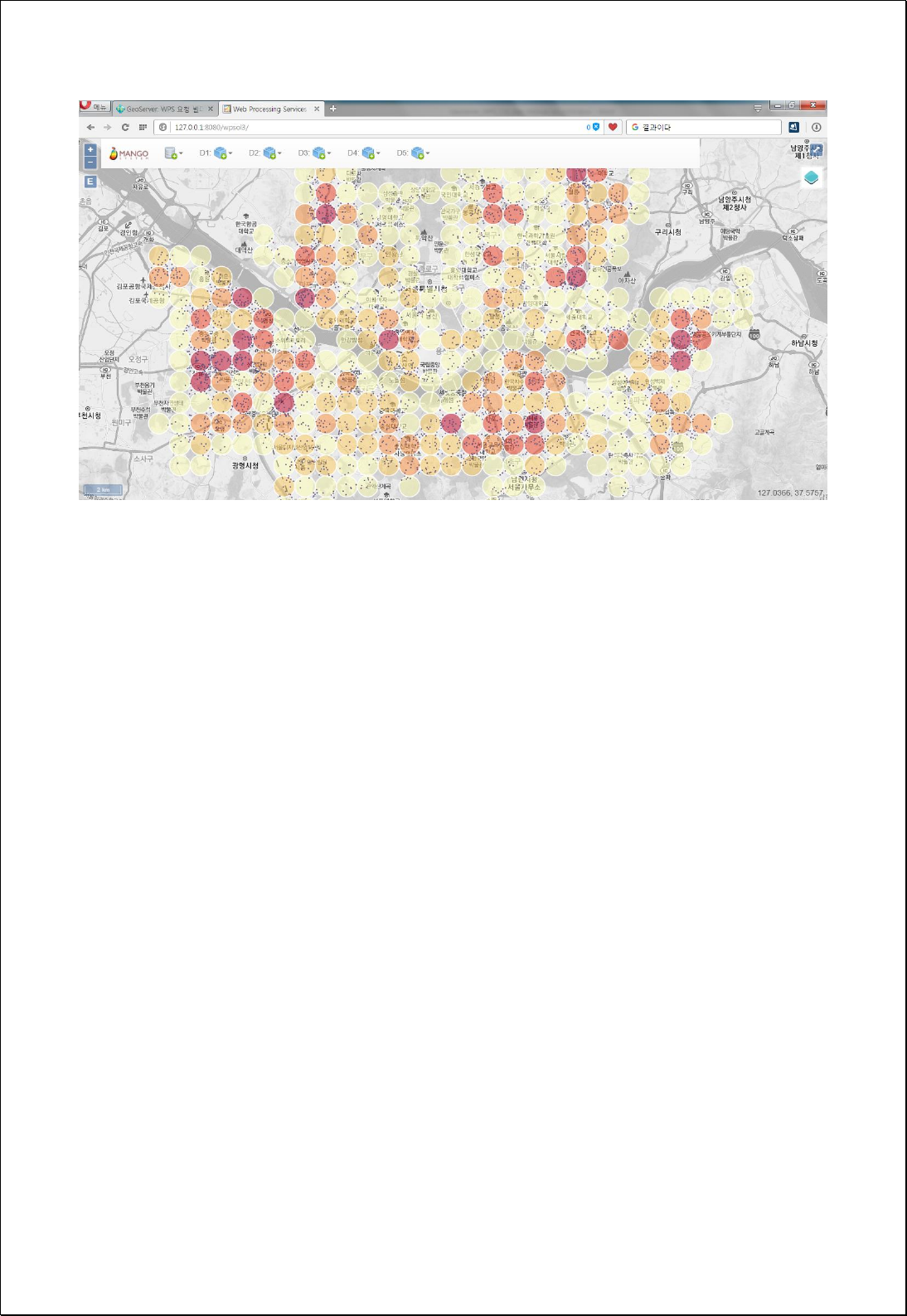

4.2.7. Generalization
These processes are for generalization such as Dissolve, Simplification etc.
4.2.7.1.
Dissolve
Performs Dissolve analysis using attribute fields of feature layers (inputFeatures) and
aggregate functions.
Syntax
Dissolve (SimpleFeatureCollection inputFeatures, String dissolveField, String
statisticsFields, Boolean useMultiPart): SimpleFeatureCollection
Parameters
Data Inputs
Identifier
Description
Type
Required
inputFeatures
Input features.
Complex
dissolveField
The field on which to dissolve features.
Literal
statisticsFields
The fields and statistics with which to summarize
attributes.
Statistics fields(Function.PropertyName): First, Last,
Sum, Mean, Min, Max, Std, Count.
Literal
-
useMultiPart
Specifies whether multipart features are allowed in
the output features.
Literal
-
Process Outputs
Identifier
Description
Type
Required
result
Output features.
Complex
Constraints
- If useMultiPart is set to False, converts and returns dissolved features in Single Part.
- StatisticsFields are input as [Function name, Field name] structure as follows, and
the available functions are as follows. For example, Sum.pop, Mean.pop
Input
Return feild

First: String field, Dissolve object Feature’s first value
Last: String field, Dissolve object Feature’s last value
Sum: Numeric field, Dissolve object Feature’s sum
Mean: Numeric field, Dissolve object Feature’s mean value
Min: Numeric field, Dissolve object Feature’s minimum value
Max: Numeric field, Dissolve object Feature’s maximum value
Std: Numeric field, Dissolve object Feature’s standard deviation
Var: Numeric field, Dissolve object Feature’s variance
Range: Numeric field, Dissolve object Feature’s range
Count: Dissolve object Feature’s number
FST_Field Name
LST_ Field Name
SUM_Field Name
AVG_ Field Name
MIN_ Field Name
MAX_ Field Name
STD_ Field Name
VAR_ Field Name
RNG_ Field Name
CNT_ Field Name
Request Examples
<?xml version="1.0" encoding="UTF-8"?><wps:Execute version="1.0.0" service="WPS"
xmlns:xsi="http://www.w3.org/2001/XMLSchema-instance" xmlns="http://www.opengis.net/wps/1.0.0"
xmlns:wfs="http://www.opengis.net/wfs" xmlns:wps="http://www.opengis.net/wps/1.0.0"
xmlns:ows="http://www.opengis.net/ows/1.1" xmlns:gml="http://www.opengis.net/gml"
xmlns:ogc="http://www.opengis.net/ogc" xmlns:wcs="http://www.opengis.net/wcs/1.1.1"
xmlns:xlink="http://www.w3.org/1999/xlink" xsi:schemaLocation="http://www.opengis.net/wps/1.0.0
http://schemas.opengis.net/wps/1.0.0/wpsAll.xsd">
<ows:Identifier>statistics:Dissolve</ows:Identifier>
<wps:DataInputs>
<wps:Input>
<ows:Identifier>inputFeatures</ows:Identifier>
<wps:Reference mimeType="text/xml" xlink:href="http://geoserver/wfs" method="POST">
<wps:Body>
<wfs:GetFeature service=“WFS” version=“1.1.0” outputFormat=“GML3”
xmlns:foss="http://www.opengeospatial.net/foss">
<wfs:Query typeName="foss:emd"/>
</wfs:GetFeature>
</wps:Body>
</wps:Reference>
</wps:Input>
<wps:Input>
<ows:Identifier>dissolveField</ows:Identifier>
<wps:Data>
<wps:LiteralData>sgg_nm</wps:LiteralData>
</wps:Data>
</wps:Input>
<wps:Input>
<ows:Identifier>statisticsFields</ows:Identifier>
<wps:Data>
<wps:LiteralData>fst.sid_nm,sum.pop2007,sum.pop2008,sum.pts</wps:LiteralData>

</wps:Data>
</wps:Input>
</wps:DataInputs>
<wps:ResponseForm>
<wps:RawDataOutput mimeType=“text/xml; subtype=wfs-collection/1.1”>
<ows:Identifier>result</ows:Identifier>
</wps:RawDataOutput>
</wps:ResponseForm>
</wps:Execute>
Response
The following figure shows the result of setting Si-Gun-Gu name (sgg_nm) fields of the
administrative boundary (Eup-Myeon-Dong) and aggregated fields of fst.sid_nm,
sum.pop2007, sum.pop2008, sum.pts and then conducting Dissolve.

4.2.7.2.
Remove Polygon Holes
Eliminates all holes (Interior Rings) of polygon feature layers (inputFeatures) or holes
smaller than the set size (minimumArea).
Syntax
RemoveHoles (SimpleFeatureCollection inputFeatures, Expression minimumArea):
SimpleFeatureCollection
Parameters
Data Inputs
Identifier
Description
Type
Required
inputFeatures
The polygon features to be removed.
Complex
minimumArea
Remove holes smaller than this area expression.
Ex) 10.0 or filter expression.
Literal
-
Process Outputs
Identifier
Description
Type
Required
result
Output features.
Complex
Constraints
- MinimumArea combines numbers or field values and expressions of returning in
numbers are available.
- If minimumArea parameter value is set to 0, eliminates all holes (Interior Ring) of
polygons, and if the value is greater than 0, eliminates Hole with area smaller than
the set values.
Request Examples
<?xml version="1.0" encoding="UTF-8"?><wps:Execute version="1.0.0" service="WPS"
xmlns:xsi="http://www.w3.org/2001/XMLSchema-instance" xmlns="http://www.opengis.net/wps/1.0.0"
xmlns:wfs="http://www.opengis.net/wfs" xmlns:wps="http://www.opengis.net/wps/1.0.0"
xmlns:ows="http://www.opengis.net/ows/1.1" xmlns:gml="http://www.opengis.net/gml"
xmlns:ogc="http://www.opengis.net/ogc" xmlns:wcs="http://www.opengis.net/wcs/1.1.1"

xmlns:xlink="http://www.w3.org/1999/xlink" xsi:schemaLocation="http://www.opengis.net/wps/1.0.0
http://schemas.opengis.net/wps/1.0.0/wpsAll.xsd">
<ows:Identifier>statistics:RemoveHoles</ows:Identifier>
<wps:DataInputs>
<wps:Input>
<ows:Identifier>inputFeatures</ows:Identifier>
<wps:Reference mimeType="text/xml" xlink:href="http://geoserver/wfs" method="POST">
<wps:Body>
<wfs:GetFeature service=“WFS” version=“1.1.0” outputFormat=“GML3”
xmlns:foss="http://www.opengeospatial.net/foss">
<wfs:Query typeName="foss:overlay01"/>
</wfs:GetFeature>
</wps:Body>
</wps:Reference>
</wps:Input>
<wps:Input>
<ows:Identifier>minimumArea</ows:Identifier>
<wps:Data>
<wps:LiteralData>1000</wps:LiteralData>
</wps:Data>
</wps:Input>
</wps:DataInputs>
<wps:ResponseForm>
<wps:RawDataOutput mimeType=“text/xml; subtype=wfs-collection/1.1”>
<ows:Identifier>result</ows:Identifier>
</wps:RawDataOutput>
</wps:ResponseForm>
</wps:Execute>
Response
The following figure showsan example of eliminating holes from polygons with Interior
Ring (Hole).
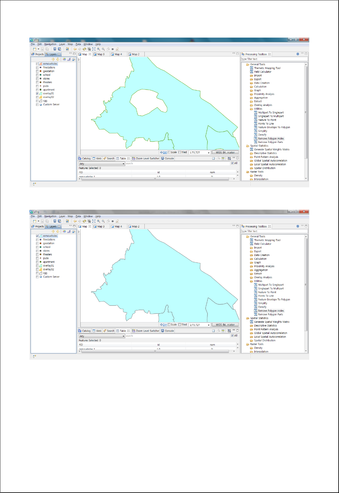

4.2.7.3.
Remove Polygon Part
Leaves only the parts smaller than the set size or the parts with the largest area with
removing all others in the polygon feature layers consisting of Multipart Geometry.
Syntax
RemoveParts (SimpleFeatureCollection inputFeatures, Expression minimumArea):
SimpleFeatureCollection
Parameters
Data Inputs
Identifier
Description
Type
Required
inputFeatures
The polygon features to be removed.
Complex
minimumArea
Remove polygon parts smaller than this area
expression.
ex) 10.0 or filter expression.
Literal
-
Process Outputs
Identifier
Description
Type
Required
result
Output features.
Complex
Constraints
- MinimumArea combines numbers or field values and expressions of returning in
numbers are available.
- If minimumArea parameter value is set to 0, eliminates all holes (Interior Ring) of
polygons, and if the value is greater than 0, eliminates holes with area smaller than
the set value.
Request Examples
<?xml version="1.0" encoding="UTF-8"?><wps:Execute version="1.0.0" service="WPS"
xmlns:xsi="http://www.w3.org/2001/XMLSchema-instance" xmlns="http://www.opengis.net/wps/1.0.0"
xmlns:wfs="http://www.opengis.net/wfs" xmlns:wps="http://www.opengis.net/wps/1.0.0"
xmlns:ows="http://www.opengis.net/ows/1.1" xmlns:gml="http://www.opengis.net/gml"
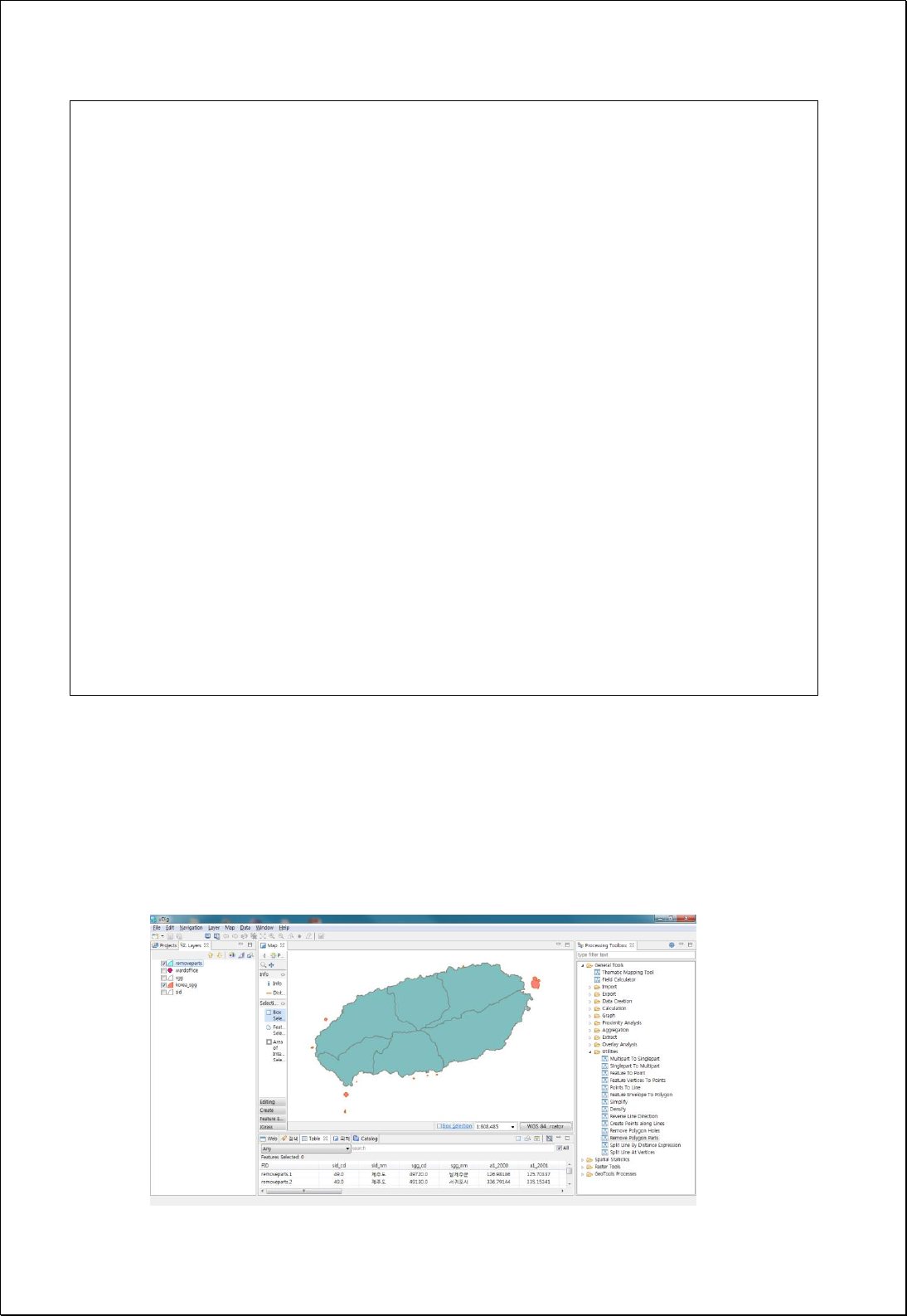
xmlns:ogc="http://www.opengis.net/ogc" xmlns:wcs="http://www.opengis.net/wcs/1.1.1"
xmlns:xlink="http://www.w3.org/1999/xlink" xsi:schemaLocation="http://www.opengis.net/wps/1.0.0
http://schemas.opengis.net/wps/1.0.0/wpsAll.xsd">
<ows:Identifier>statistics:RemoveParts</ows:Identifier>
<wps:DataInputs>
<wps:Input>
<ows:Identifier>inputFeatures</ows:Identifier>
<wps:Reference mimeType="text/xml" xlink:href="http://geoserver/wfs" method="POST">
<wps:Body>
<wfs:GetFeature service=“WFS” version=“1.1.0” outputFormat=“GML3”
xmlns:foss="http://www.opengeospatial.net/foss">
<wfs:Query typeName="foss:korea_sgg"/>
</wfs:GetFeature>
</wps:Body>
</wps:Reference>
</wps:Input>
</wps:DataInputs>
<wps:ResponseForm>
<wps:RawDataOutput mimeType=“text/xml; subtype=wfs-collection/1.1”>
<ows:Identifier>result</ows:Identifier>
</wps:RawDataOutput>
</wps:ResponseForm>
</wps:Execute>
Response
The following figure shows an example of eliminating polygons less than the specified
area in MultiPolygon. All of the islands with small areas are eliminated, as shown in
figure.

4.2.7.4.
Simplify
Simplifies polygon or line features using Douglas-Peucker simplifying algorithm.
Syntax
Simplify (SimpleFeatureCollection inputFeatures, Expression tolerance, Boolean
preserveTopology): SimpleFeatureCollection
Parameters
Data Inputs
Identifier
Description
Type
Required
inputFeatures
The input line or polygon features to be simplified.
Complex
tolerance
Distance tolerance to simplify ex) 10.0 or filter
expression.
Literal
preserveTopology
If True, ensures that simplified features are
topologically valid. Default is True
Literal
-
Process Outputs
Identifier
Description
Type
Required
result
Output features.
Complex
Constraints
- Tolerance parameter can use numbers and functions, and Douglas–Peucker
algorithm is used.
- If the preserveTopology parameter is set to True, maintains minimum topology rule
regardless of the Tolerance value.
Request Examples
<?xml version="1.0" encoding="UTF-8"?><wps:Execute version="1.0.0" service="WPS"
xmlns:xsi="http://www.w3.org/2001/XMLSchema-instance" xmlns="http://www.opengis.net/wps/1.0.0"
xmlns:wfs="http://www.opengis.net/wfs" xmlns:wps="http://www.opengis.net/wps/1.0.0"
xmlns:ows="http://www.opengis.net/ows/1.1" xmlns:gml="http://www.opengis.net/gml"
xmlns:ogc="http://www.opengis.net/ogc" xmlns:wcs="http://www.opengis.net/wcs/1.1.1"
xmlns:xlink="http://www.w3.org/1999/xlink" xsi:schemaLocation="http://www.opengis.net/wps/1.0.0
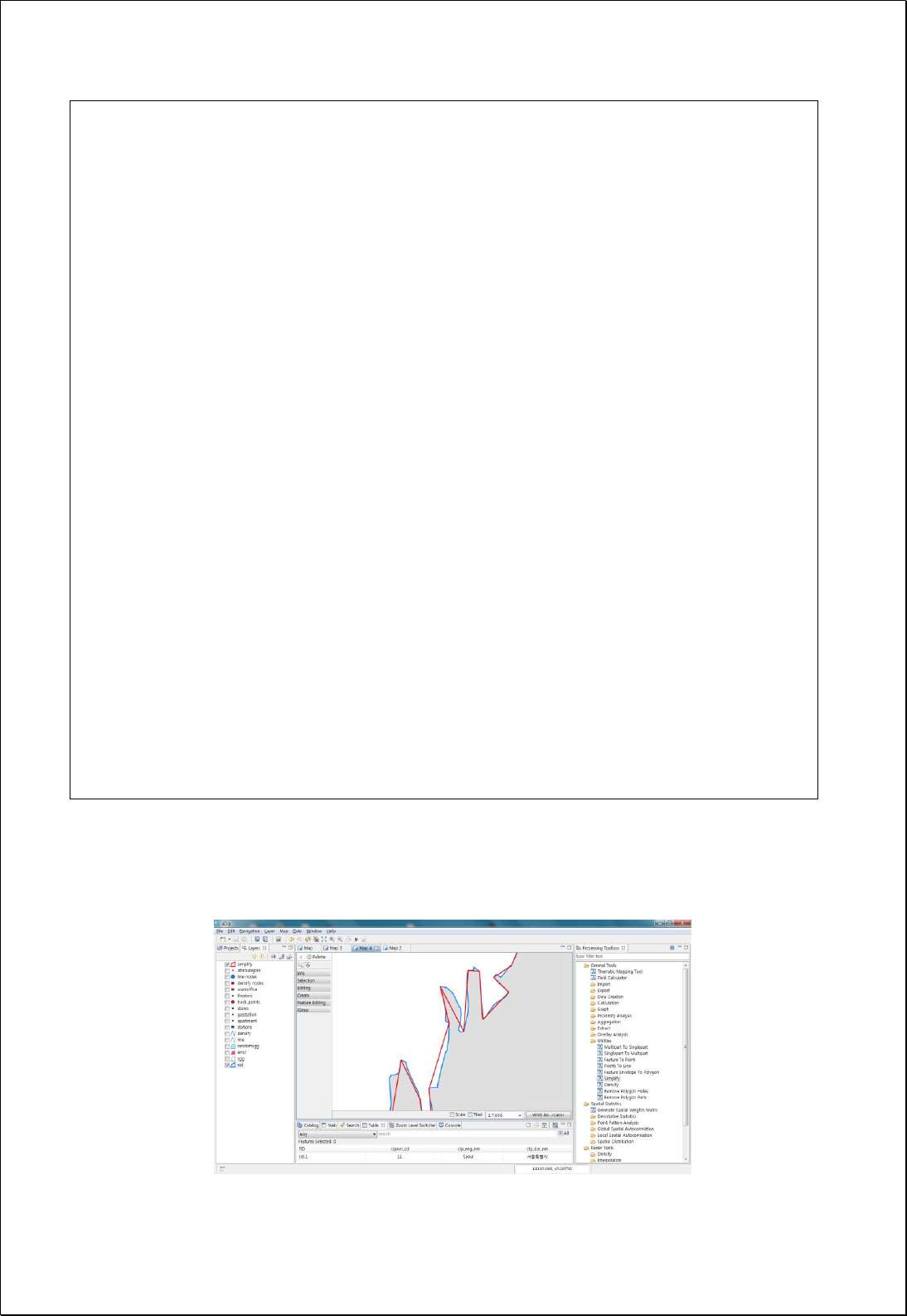
http://schemas.opengis.net/wps/1.0.0/wpsAll.xsd">
<ows:Identifier>statistics:Simplify</ows:Identifier>
<wps:DataInputs>
<wps:Input>
<ows:Identifier>inputFeatures</ows:Identifier>
<wps:Reference mimeType="text/xml" xlink:href="http://geoserver/wfs" method="POST">
<wps:Body>
<wfs:GetFeature service=“WFS” version=“1.1.0” outputFormat=“GML3”
xmlns:foss="http://www.opengeospatial.net/foss">
<wfs:Query typeName="foss:road"/>
</wfs:GetFeature>
</wps:Body>
</wps:Reference>
</wps:Input>
<wps:Input>
<ows:Identifier>tolerance</ows:Identifier>
<wps:Data>
<wps:LiteralData>5</wps:LiteralData>
</wps:Data>
</wps:Input>
</wps:DataInputs>
<wps:ResponseForm>
<wps:RawDataOutput mimeType=“text/xml; subtype=wfs-collection/1.1”>
<ows:Identifier>result</ows:Identifier>
</wps:RawDataOutput>
</wps:ResponseForm>
</wps:Execute>
Response
The blue line is the original, and the red line is the result of Simplifying.

4.2.7.5.
Densify
Adds vertices with set tolerance (tolerance) interval in every line segment of polygon or
line features.
Syntax
Densify (SimpleFeatureCollection inputFeatures, Expression tolerance):
SimpleFeatureCollection
Parameters
Data Inputs
Identifier
Description
Type
Required
inputFeatures
The input line or polygon features to be calculated.
Complex
tolerance
Distance tolerance to densify ex) 10.0 or filter
expression.
Literal
Process Outputs
Identifier
Description
Type
Required
result
Output features.
Complex
Constraints
- Tolerance parameter can use numbers and functions.
Request Examples
<?xml version="1.0" encoding="UTF-8"?><wps:Execute version="1.0.0" service="WPS"
xmlns:xsi="http://www.w3.org/2001/XMLSchema-instance" xmlns="http://www.opengis.net/wps/1.0.0"
xmlns:wfs="http://www.opengis.net/wfs" xmlns:wps="http://www.opengis.net/wps/1.0.0"
xmlns:ows="http://www.opengis.net/ows/1.1" xmlns:gml="http://www.opengis.net/gml"
xmlns:ogc="http://www.opengis.net/ogc" xmlns:wcs="http://www.opengis.net/wcs/1.1.1"
xmlns:xlink="http://www.w3.org/1999/xlink" xsi:schemaLocation="http://www.opengis.net/wps/1.0.0
http://schemas.opengis.net/wps/1.0.0/wpsAll.xsd">
<ows:Identifier>statistics:Densify</ows:Identifier>
<wps:DataInputs>
<wps:Input>
<ows:Identifier>inputFeatures</ows:Identifier>
<wps:Reference mimeType="text/xml" xlink:href="http://geoserver/wfs" method="POST">
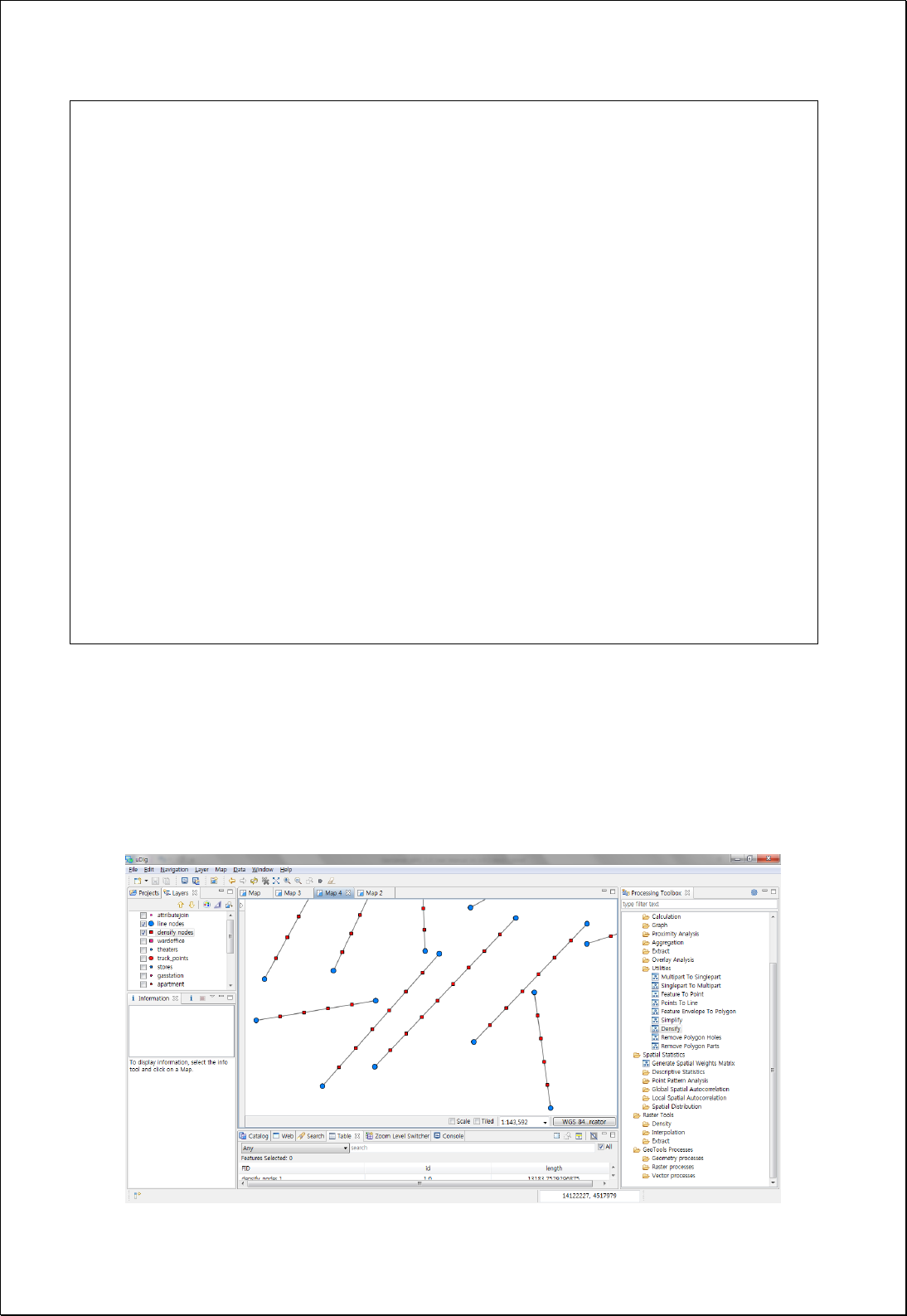
<wps:Body>
<wfs:GetFeature service=“WFS” version=“1.1.0” outputFormat=“GML3”
xmlns:foss="http://www.opengeospatial.net/foss">
<wfs:Query typeName="foss:line"/>
</wfs:GetFeature>
</wps:Body>
</wps:Reference>
</wps:Input>
<wps:Input>
<ows:Identifier>tolerance</ows:Identifier>
<wps:Data>
<wps:LiteralData>250</wps:LiteralData>
</wps:Data>
</wps:Input>
</wps:DataInputs>
<wps:ResponseForm>
<wps:RawDataOutput mimeType=“text/xml; subtype=wfs-collection/1.1”>
<ows:Identifier>result</ows:Identifier>
</wps:RawDataOutput>
</wps:ResponseForm>
</wps:Execute>
Response
The following figure shows the result of conducting Densify with a 250-meter interval in
the original lines composed with start points and end points. The blue ones are the
original vertices, and the red ones are the added vertices.

4.2.7.6.
Eliminate
Removes the Sliver polygon based on the shared area or length of the neighbor
polygons.
Syntax
Eliminate (SimpleFeatureCollection inputFeatures, EliminateOption option, Filter
exception): SimpleFeatureCollection
Parameters
Data Inputs
Identifier
Description
Type
Required
inputFeatures
The layer whose polygons will be merged into
neighboring polygons.
Complex
option
The options specify which method will be used for
eliminating features.
Literal
-
exception
The exception filter used to identify features that will
not be altered.
Literal
-
Process Outputs
Identifier
Description
Type
Required
result
Output features.
Complex
Constraints
- InputFeatures layers must be polygon types.
- The option parameter incorporates the Sliver polygons with the largest shared
length (Length), the largest area (SmallArea), or the smallest neighbor (SmallArea)
based on the basis of eliminating Sliver polygons..
- Exception parameter sets features excluded from processing as filters.
Request Examples
<?xml version="1.0" encoding="UTF-8"?><wps:Execute version="1.0.0" service="WPS"
xmlns:xsi="http://www.w3.org/2001/XMLSchema-instance" xmlns="http://www.opengis.net/wps/1.0.0"

xmlns:wfs="http://www.opengis.net/wfs" xmlns:wps="http://www.opengis.net/wps/1.0.0"
xmlns:ows="http://www.opengis.net/ows/1.1" xmlns:gml="http://www.opengis.net/gml"
xmlns:ogc="http://www.opengis.net/ogc" xmlns:wcs="http://www.opengis.net/wcs/1.1.1"
xmlns:xlink="http://www.w3.org/1999/xlink" xsi:schemaLocation="http://www.opengis.net/wps/1.0.0
http://schemas.opengis.net/wps/1.0.0/wpsAll.xsd">
<ows:Identifier>statistics:Eliminate</ows:Identifier>
<wps:DataInputs>
<wps:Input>
<ows:Identifier>inputFeatures</ows:Identifier>
<wps:Reference mimeType="text/xml" xlink:href="http://geoserver/wfs" method="POST">
<wps:Body>
<wfs:GetFeature service="WFS" version="1.0.0" outputFormat="GML2"
xmlns:foss="http://www.opengeospatial.net/foss">
<wfs:Query typeName="foss:seoul_series"/>
</wfs:GetFeature>
</wps:Body>
</wps:Reference>
</wps:Input>
<wps:Input>
<ows:Identifier>option</ows:Identifier>
<wps:Data>
<wps:LiteralData>Length</wps:LiteralData>
</wps:Data>
</wps:Input>
</wps:DataInputs>
<wps:ResponseForm>
<wps:RawDataOutput mimeType="text/xml; subtype=wfs-collection/1.0">
<ows:Identifier>result</ows:Identifier>
</wps:RawDataOutput>
</wps:ResponseForm>
</wps:Execute>
Response
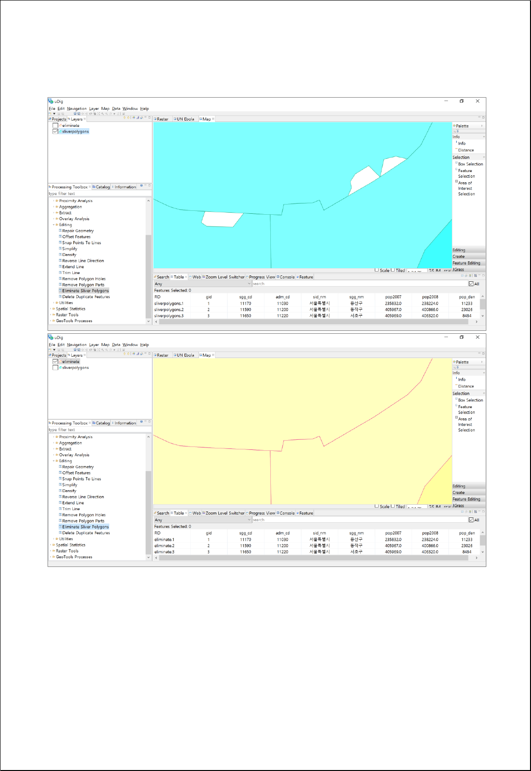
The following figure shows the original feature and result of eliminating Sliver polygon
based on the shared length in the origin layer containing Sliver polygon.

4.2.8. Editing
These processes are for simplification such as Dissolve, Simplification etc.
4.2.8.1.
Reverse Line Direction
- Changes the vertex order of line feature layers (lineFeatures).
Syntax
FlipLine (SimpleFeatureCollection lineFeatures): SimpleFeatureCollection
Parameters
Data Inputs
Identifier
Description
Type
Required
lineFeatures
The input line features.
Complex
Process Outputs
Identifier
Description
Type
Required
result
Output features.
Complex
Constraints
- LineFeature parameter must be line layer.
Request Examples
<?xml version="1.0" encoding="utf-8"?>
<wps:Execute version="1.0.0" service="WPS" xmlns:xsi="http://www.w3.org/2001/XMLSchema-instance"
xmlns="http://www.opengis.net/wps/1.0.0" xmlns:wfs="http://www.opengis.net/wfs"
xmlns:wps="http://www.opengis.net/wps/1.0.0" xmlns:ows="http://www.opengis.net/ows/1.1"
xmlns:gml="http://www.opengis.net/gml" xmlns:ogc="http://www.opengis.net/ogc"
xmlns:wcs="http://www.opengis.net/wcs/1.1.1" xmlns:xlink="http://www.w3.org/1999/xlink"
xsi:schemaLocation="http://www.opengis.net/wps/1.0.0 http://schemas.opengis.net/wps/1.0.0/wpsAll.xsd">
<ows:Identifier>statistics:FlipLine</ows:Identifier>
<wps:DataInputs>
<wps:Input>
<ows:Identifier>lineFeatures</ows:Identifier>
<wps:Reference mimeType="text/xml" xlink:href="http://geoserver/wfs" method="POST">
<wps:Body>
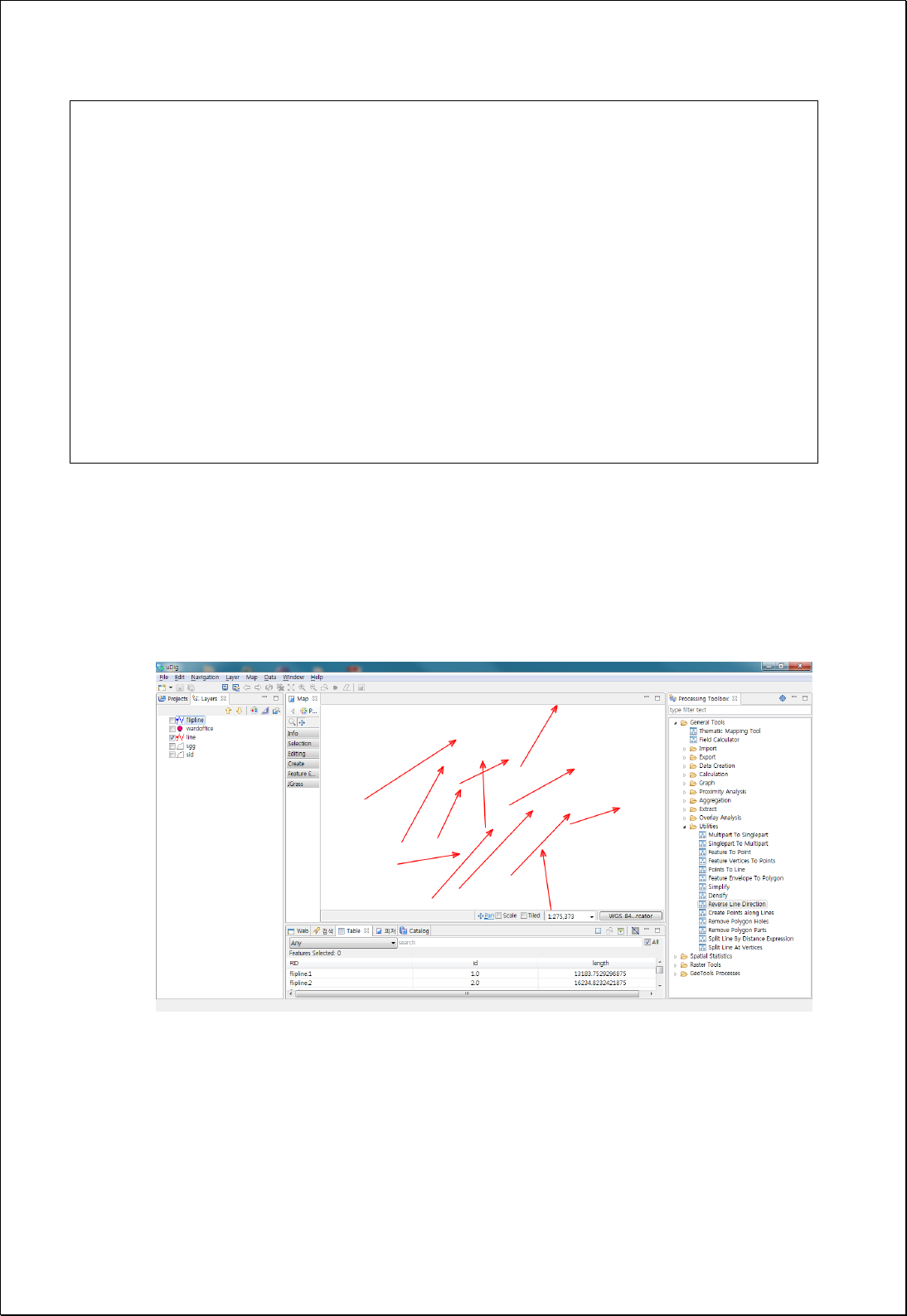
<wfs:GetFeature service="WFS" version="1.0.0" outputFormat="GML2"
xmlns:foss="http://www.opengeospatial.net/foss">
<wfs:Query typeName="foss:line" />
</wfs:GetFeature>
</wps:Body>
</wps:Reference>
</wps:Input>
</wps:DataInputs>
<wps:ResponseForm>
<wps:RawDataOutput mimeType="text/xml; subtype=wfs-collection/1.0">
<ows:Identifier>result</ows:Identifier>
</wps:RawDataOutput>
</wps:ResponseForm>
</wps:Execute>
Response
The following figure shows the original (red) line data and converted result (blue) data.
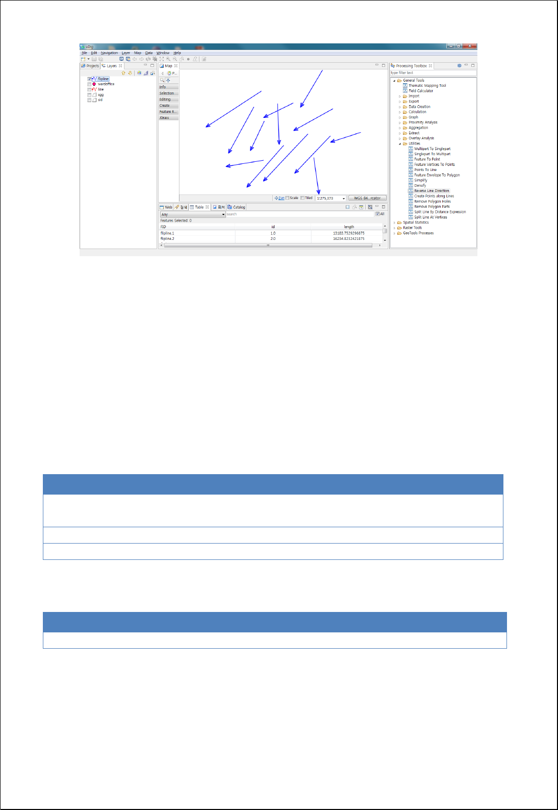
4.2.8.2.
Offset Features
Moves all features of feature layers (inputFeatures) by x, y offsets (offsetX, offsetY).
Syntax
OffsetFeatures (SimpleFeatureCollection inputFeatures, Double offsetX, Double offsetY):
SimpleFeatureCollection
Parameters
Data Inputs
Identifier
Description
Type
Required
inputFeatures
Input features that can be multipoint, line, and
polygon.
Complex
offsetX
X offset.
Literal
-
offsetY
Y offset.
Literal
-
Process Outputs
Identifier
Description
Type
Required
result
Output features.
Complex
Constraints
- Based on the original locations, moves to right if offsetX is positive, left if negative,
up if offsetY value is positive, and down if negative.

Request Examples
<?xml version="1.0" encoding="UTF-8"?><wps:Execute version="1.0.0" service="WPS"
xmlns:xsi="http://www.w3.org/2001/XMLSchema-instance" xmlns="http://www.opengis.net/wps/1.0.0"
xmlns:wfs="http://www.opengis.net/wfs" xmlns:wps="http://www.opengis.net/wps/1.0.0"
xmlns:ows="http://www.opengis.net/ows/1.1" xmlns:gml="http://www.opengis.net/gml"
xmlns:ogc="http://www.opengis.net/ogc" xmlns:wcs="http://www.opengis.net/wcs/1.1.1"
xmlns:xlink="http://www.w3.org/1999/xlink" xsi:schemaLocation="http://www.opengis.net/wps/1.0.0
http://schemas.opengis.net/wps/1.0.0/wpsAll.xsd">
<ows:Identifier>statistics:OffsetFeatures</ows:Identifier>
<wps:DataInputs>
<wps:Input>
<ows:Identifier>inputFeatures</ows:Identifier>
<wps:Reference mimeType="text/xml" xlink:href="http://geoserver/wfs" method="POST">
<wps:Body>
<wfs:GetFeature service="WFS" version="1.0.0" outputFormat="GML2"
xmlns:foss="http://www.opengeospatial.net/foss">
<wfs:Query typeName="foss:randomsgg"/>
</wfs:GetFeature>
</wps:Body>
</wps:Reference>
</wps:Input>
<wps:Input>
<ows:Identifier>offsetX</ows:Identifier>
<wps:Data>
<wps:LiteralData>500</wps:LiteralData>
</wps:Data>
</wps:Input>
<wps:Input>
<ows:Identifier>offsetY</ows:Identifier>
<wps:Data>
<wps:LiteralData>500</wps:LiteralData>
</wps:Data>
</wps:Input>
</wps:DataInputs>
<wps:ResponseForm>
<wps:RawDataOutput mimeType="text/xml; subtype=wfs-collection/1.0">
<ows:Identifier>result</ows:Identifier>
</wps:RawDataOutput>
</wps:ResponseForm>
</wps:Execute>
Response
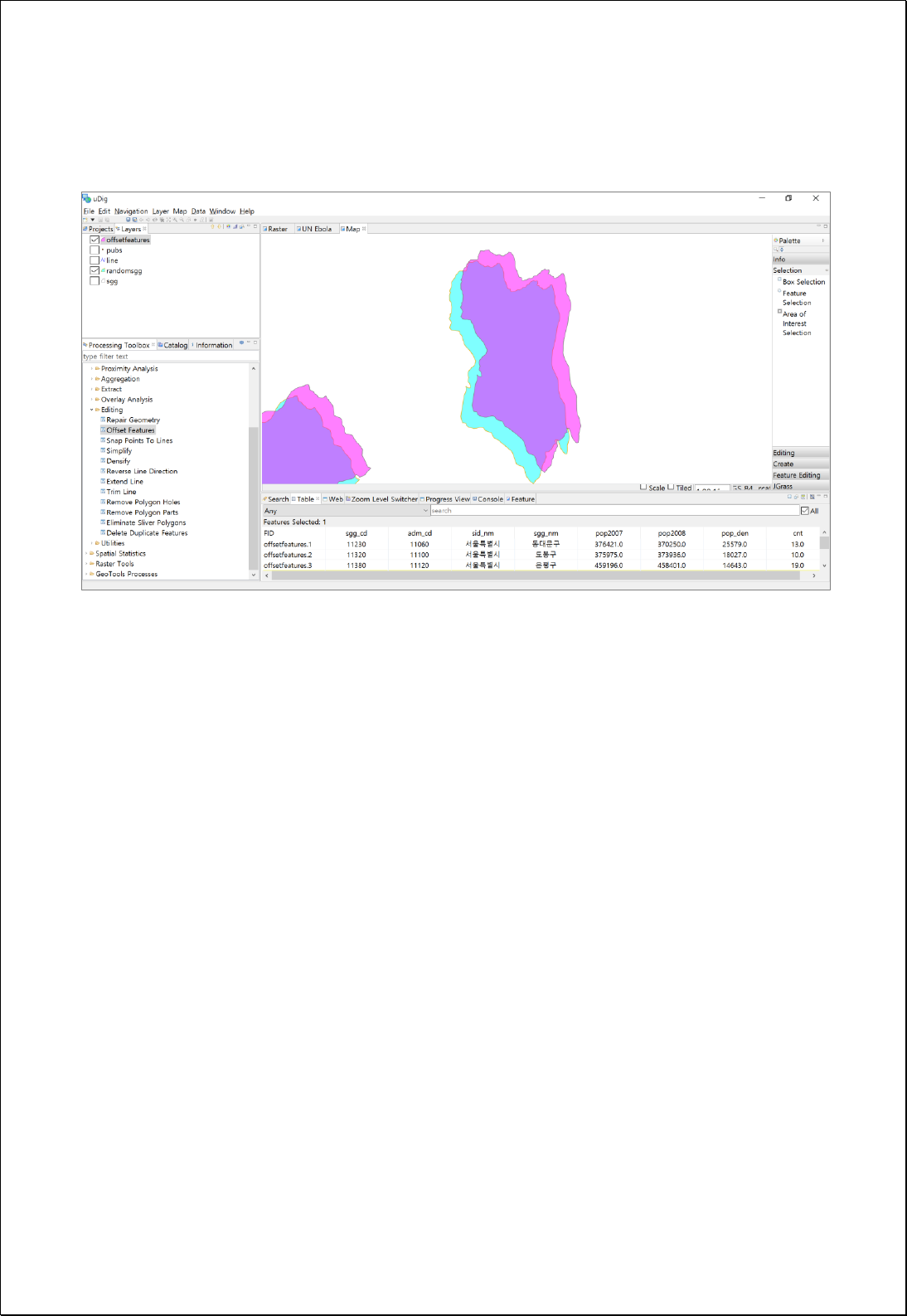
The following figure shows the result of moving the original layer by 500 meters on the
X axis and 500 meters on the Y axis.

4.2.8.3.
Snap Points To Lines
Moves to the nearest line or polygon boundaries (lineFeatures) based on the feature
snap distance of the point layers (pointFeatures).
Syntax
SnapPointsToLines (SimpleFeatureCollection pointFeatures, SimpleFeatureCollection
lineFeatures, Double tolerance): SimpleFeatureCollection
Parameters
Data Inputs
Identifier
Description
Type
Required
pointFeatures
Point features to be snapped.
Complex
lineFeatures
Line features that can be Line or polygon boundary.
Complex
tolerance
Snap tolerance. If tolerance is 0, nearest line feature
will be used.
Literal
-
Process Outputs
Identifier
Description
Type
Required
result
Output features.
Complex
Constraints
- LineFeatures layers must be line or polygon types.
- If tolerance parameter is 0, moves to the nearest line features, anduses the distance
unit of pointFeatures.
Request Examples
<?xml version="1.0" encoding="UTF-8"?><wps:Execute version="1.0.0" service="WPS"
xmlns:xsi="http://www.w3.org/2001/XMLSchema-instance" xmlns="http://www.opengis.net/wps/1.0.0"
xmlns:wfs="http://www.opengis.net/wfs" xmlns:wps="http://www.opengis.net/wps/1.0.0"
xmlns:ows="http://www.opengis.net/ows/1.1" xmlns:gml="http://www.opengis.net/gml"
xmlns:ogc="http://www.opengis.net/ogc" xmlns:wcs="http://www.opengis.net/wcs/1.1.1"
xmlns:xlink="http://www.w3.org/1999/xlink" xsi:schemaLocation="http://www.opengis.net/wps/1.0.0
http://schemas.opengis.net/wps/1.0.0/wpsAll.xsd">

<ows:Identifier>statistics:SnapPointsToLines</ows:Identifier>
<wps:DataInputs>
<wps:Input>
<ows:Identifier>pointFeatures</ows:Identifier>
<wps:Reference mimeType="text/xml" xlink:href="http://geoserver/wfs" method="POST">
<wps:Body>
<wfs:GetFeature service="WFS" version="1.0.0" outputFormat="GML2"
xmlns:foss="http://www.opengeospatial.net/foss">
<wfs:Query typeName="foss:pubs"/>
</wfs:GetFeature>
</wps:Body>
</wps:Reference>
</wps:Input>
<wps:Input>
<ows:Identifier>lineFeatures</ows:Identifier>
<wps:Reference mimeType="text/xml" xlink:href="http://geoserver/wfs" method="POST">
<wps:Body>
<wfs:GetFeature service="WFS" version="1.0.0" outputFormat="GML2"
xmlns:foss="http://www.opengeospatial.net/foss">
<wfs:Query typeName="foss:road"/>
</wfs:GetFeature>
</wps:Body>
</wps:Reference>
</wps:Input>
</wps:DataInputs>
<wps:ResponseForm>
<wps:RawDataOutput mimeType="text/xml; subtype=wfs-collection/1.0">
<ows:Identifier>result</ows:Identifier>
</wps:RawDataOutput>
</wps:ResponseForm>
</wps:Execute>
Response
The following figure shows the result of snapping points near roads to the nearest roads
(line).
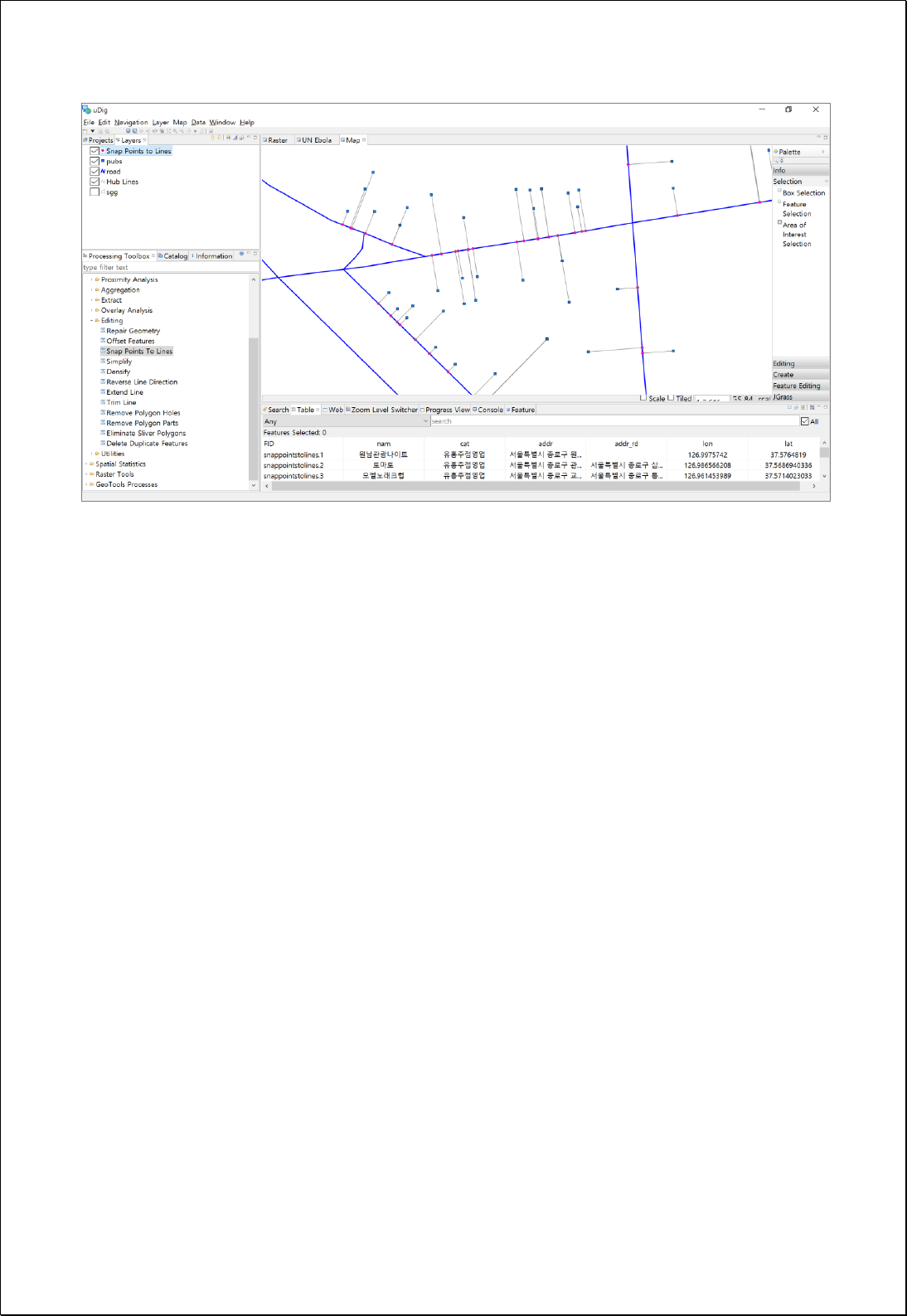

4.2.8.4.
Extend Line
Extends the features of the line layers (lineFeatures) to the intersection of the first
intersecting line within a specified distance (length).
Syntax
ExtendLine (SimpleFeatureCollection lineFeatures, Double length, Boolean extendTo):
SimpleFeatureCollection
Parameters
Data Inputs
Identifier
Description
Type
Required
lineFeatures
The line features to be extended.
Complex
length
The maximum distance a line segment can be
extended to an intersecting feature.
Literal
extendTo
Controls whether line segments can be extended to
other extended line segments within the specified
extend length.
Literal
-
Process Outputs
Identifier
Description
Type
Required
result
Output features.
Complex
Constraints
- LineFeatures layer must be line type.
- Length parameter is the maximum distance that a line segment can extend to, and
uses the distance units of lineFeatures.
- If the extendTo parameter is set to True, extends all segments by length.
Request Examples
<?xml version="1.0" encoding="UTF-8"?><wps:Execute version="1.0.0" service="WPS"
xmlns:xsi="http://www.w3.org/2001/XMLSchema-instance" xmlns="http://www.opengis.net/wps/1.0.0"
xmlns:wfs="http://www.opengis.net/wfs" xmlns:wps="http://www.opengis.net/wps/1.0.0"

xmlns:ows="http://www.opengis.net/ows/1.1" xmlns:gml="http://www.opengis.net/gml"
xmlns:ogc="http://www.opengis.net/ogc" xmlns:wcs="http://www.opengis.net/wcs/1.1.1"
xmlns:xlink="http://www.w3.org/1999/xlink" xsi:schemaLocation="http://www.opengis.net/wps/1.0.0
http://schemas.opengis.net/wps/1.0.0/wpsAll.xsd">
<ows:Identifier>statistics:ExtendLine</ows:Identifier>
<wps:DataInputs>
<wps:Input>
<ows:Identifier>lineFeatures</ows:Identifier>
<wps:Reference mimeType="text/xml" xlink:href="http://geoserver/wfs" method="POST">
<wps:Body>
<wfs:GetFeature service="WFS" version="1.0.0" outputFormat="GML2"
xmlns:foss="http://www.opengeospatial.net/foss">
<wfs:Query typeName="foss:line"/>
</wfs:GetFeature>
</wps:Body>
</wps:Reference>
</wps:Input>
<wps:Input>
<ows:Identifier>length</ows:Identifier>
<wps:Data>
<wps:LiteralData>2000</wps:LiteralData>
</wps:Data>
</wps:Input>
<wps:Input>
<ows:Identifier>extendTo</ows:Identifier>
<wps:Data>
<wps:LiteralData>True</wps:LiteralData>
</wps:Data>
</wps:Input>
</wps:DataInputs>
<wps:ResponseForm>
<wps:RawDataOutput mimeType="text/xml; subtype=wfs-collection/1.0">
<ows:Identifier>result</ows:Identifier>
</wps:RawDataOutput>
</wps:ResponseForm>
</wps:Execute>
Response
The following figures shows the result of extending line by specified distance.
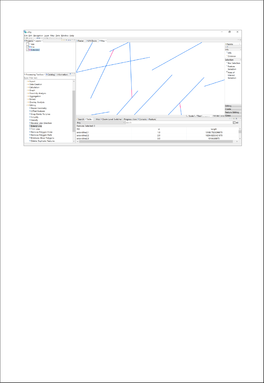

4.2.8.5.
Trim Line
Trims the features in the line layers (lineFeatures) that is shorter than a specified length
(dangleLength) and do not intersect with other lines at start/end points.
Syntax
TrimLine (SimpleFeatureCollection lineFeatures, Double dangleLength, Boolean
deleteShort): SimpleFeatureCollection
Parameters
Data Inputs
Identifier
Description
Type
Required
lineFeatures
The line features to be trimmed.
Complex
dangleLength
Line segments that are shorter than the specified
Dangle Length and do not touch another line at
both endpoints (dangles) will be trimmed.
Literal
deleteShort
Controls whether line segments which are less than
the dangle length and are free-standing will be
deleted. Default is True.
Literal
-
Process Outputs
Identifier
Description
Type
Required
result
Output features.
Complex
Constraints
- LineFeatures layer must be line type.
- If deleteShort parameter is set to True and the length of an independent line not
intersecting with other lines at start/end points is less than the length of
dangleLength, eliminates this line.
Request Examples
<?xml version="1.0" encoding="UTF-8"?><wps:Execute version="1.0.0" service="WPS"
xmlns:xsi="http://www.w3.org/2001/XMLSchema-instance" xmlns="http://www.opengis.net/wps/1.0.0"
xmlns:wfs="http://www.opengis.net/wfs" xmlns:wps="http://www.opengis.net/wps/1.0.0"

xmlns:ows="http://www.opengis.net/ows/1.1" xmlns:gml="http://www.opengis.net/gml"
xmlns:ogc="http://www.opengis.net/ogc" xmlns:wcs="http://www.opengis.net/wcs/1.1.1"
xmlns:xlink="http://www.w3.org/1999/xlink" xsi:schemaLocation="http://www.opengis.net/wps/1.0.0
http://schemas.opengis.net/wps/1.0.0/wpsAll.xsd">
<ows:Identifier>statistics:TrimLine</ows:Identifier>
<wps:DataInputs>
<wps:Input>
<ows:Identifier>lineFeatures</ows:Identifier>
<wps:Reference mimeType="text/xml" xlink:href="http://geoserver/wfs" method="POST">
<wps:Body>
<wfs:GetFeature service="WFS" version="1.0.0" outputFormat="GML2"
xmlns:foss="http://www.opengeospatial.net/foss">
<wfs:Query typeName="foss:line"/>
</wfs:GetFeature>
</wps:Body>
</wps:Reference>
</wps:Input>
<wps:Input>
<ows:Identifier>dangleLength</ows:Identifier>
<wps:Data>
<wps:LiteralData>1700</wps:LiteralData>
</wps:Data>
</wps:Input>
<wps:Input>
<ows:Identifier>deleteShort</ows:Identifier>
<wps:Data>
<wps:LiteralData>True</wps:LiteralData>
</wps:Data>
</wps:Input>
</wps:DataInputs>
<wps:ResponseForm>
<wps:RawDataOutput mimeType="text/xml; subtype=wfs-collection/1.0">
<ows:Identifier>result</ows:Identifier>
</wps:RawDataOutput>
</wps:ResponseForm>
</wps:Execute>
Response
The following figure shows the result of trimming segment smaller than specified
length.
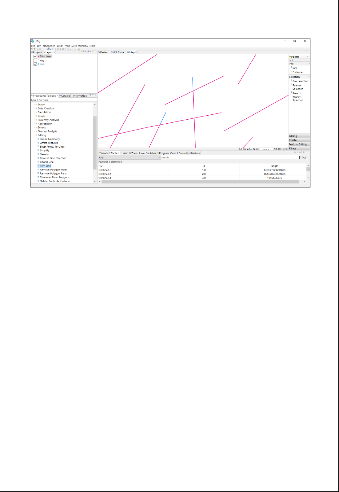

4.2.8.6.
Delete Duplicated Features
Leaves only one feature with the same Geometry in the feature layers (inputFeatures)
and deletes others.
Syntax
DeleteDuplicates (inputFeatures SimpleFeatureCollection): SimpleFeatureCollection
Parameters
Data Inputs
Identifier
Description
Type
Required
inputFeatures
The input features to be processed.
Complex
Process Outputs
Identifier
Description
Type
Required
result
Output features.
Complex
Constraints
- InputFeatures can be points, lines and polygons. Only features with the same
Geometry are seen as duplicated.
Request Examples
<?xml version="1.0" encoding="UTF-8"?><wps:Execute version="1.0.0" service="WPS"
xmlns:xsi="http://www.w3.org/2001/XMLSchema-instance" xmlns="http://www.opengis.net/wps/1.0.0"
xmlns:wfs="http://www.opengis.net/wfs" xmlns:wps="http://www.opengis.net/wps/1.0.0"
xmlns:ows="http://www.opengis.net/ows/1.1" xmlns:gml="http://www.opengis.net/gml"
xmlns:ogc="http://www.opengis.net/ogc" xmlns:wcs="http://www.opengis.net/wcs/1.1.1"
xmlns:xlink="http://www.w3.org/1999/xlink" xsi:schemaLocation="http://www.opengis.net/wps/1.0.0
http://schemas.opengis.net/wps/1.0.0/wpsAll.xsd">
<ows:Identifier>statistics:DeleteDuplicates</ows:Identifier>
<wps:DataInputs>
<wps:Input>
<ows:Identifier>inputFeatures</ows:Identifier>
<wps:Reference mimeType="text/xml" xlink:href="http://geoserver/wfs" method="POST">
<wps:Body>
<wfs:GetFeature service="WFS" version="1.0.0" outputFormat="GML2"
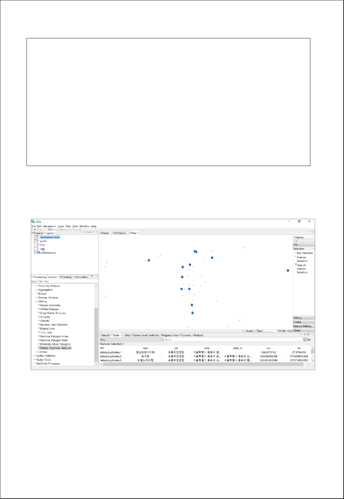
xmlns:foss="http://www.opengeospatial.net/foss">
<wfs:Query typeName="foss:pubs"/>
</wfs:GetFeature>
</wps:Body>
</wps:Reference>
</wps:Input>
</wps:DataInputs>
<wps:ResponseForm>
<wps:RawDataOutput mimeType="text/xml; subtype=wfs-collection/1.0">
<ows:Identifier>result</ows:Identifier>
</wps:RawDataOutput>
</wps:ResponseForm>
</wps:Execute>
Response
Among duplicated points, only one feature is stored, as shown as follows.

4.2.9. Feature Tools
These processes are for conversions such as Geometry type conversion, and format
conversion.
4.2.9.1.
Feature to Point
Converts feature layers (inputFeatures) into point feature layers such as center points
and so on.
Syntax
FeatureToPoint (SimpleFeatureCollection inputFeatures, Boolean inside, Boolean
singlePart): SimpleFeatureCollection
Parameters
Data Inputs
Identifier
Description
Type
Required
inputFeatures
The input features that can be multipoint, line,
polygon.
Complex
inside
Centroid(False), Inside(True, Default)
Literal
-
singlePart
Centroid of each part. Default is False
Literal
-
Process Outputs
Identifier
Description
Type
Required
result
Output features.
Complex
Constraints
- InputFeatures can be points, lines and polygons.
- If the inputFeatures is polygon and inside is set to True, the center point is
contained within the polygon.
- If singlePart is set to True and geometry is MultiPart, converts geometry of all parts
into cenert points.
Request Examples

<?xml version="1.0" encoding="UTF-8"?><wps:Execute version="1.0.0" service="WPS"
xmlns:xsi="http://www.w3.org/2001/XMLSchema-instance" xmlns="http://www.opengis.net/wps/1.0.0"
xmlns:wfs="http://www.opengis.net/wfs" xmlns:wps="http://www.opengis.net/wps/1.0.0"
xmlns:ows="http://www.opengis.net/ows/1.1" xmlns:gml="http://www.opengis.net/gml"
xmlns:ogc="http://www.opengis.net/ogc" xmlns:wcs="http://www.opengis.net/wcs/1.1.1"
xmlns:xlink="http://www.w3.org/1999/xlink" xsi:schemaLocation="http://www.opengis.net/wps/1.0.0
http://schemas.opengis.net/wps/1.0.0/wpsAll.xsd">
<ows:Identifier>statistics:FeatureToPoint</ows:Identifier>
<wps:DataInputs>
<wps:Input>
<ows:Identifier>inputFeatures</ows:Identifier>
<wps:Reference mimeType="text/xml" xlink:href="http://geoserver/wfs" method="POST">
<wps:Body>
<wfs:GetFeature service=“WFS” version=“1.1.0” outputFormat=“GML3”
xmlns:foss="http://www.opengeospatial.net/foss">
<wfs:Query typeName="foss:korea_sgg"/>
</wfs:GetFeature>
</wps:Body>
</wps:Reference>
</wps:Input>
<wps:Input>
<ows:Identifier>inside</ows:Identifier>
<wps:Data>
<wps:LiteralData>True</wps:LiteralData>
</wps:Data>
</wps:Input>
<wps:Input>
<ows:Identifier>singlePart</ows:Identifier>
<wps:Data>
<wps:LiteralData>False</wps:LiteralData>
</wps:Data>
</wps:Input>
</wps:DataInputs>
<wps:ResponseForm>
<wps:RawDataOutput mimeType=“text/xml; subtype=wfs-collection/1.1”>
<ows:Identifier>result</ows:Identifier>
</wps:RawDataOutput>
</wps:ResponseForm>
</wps:Execute>
Response
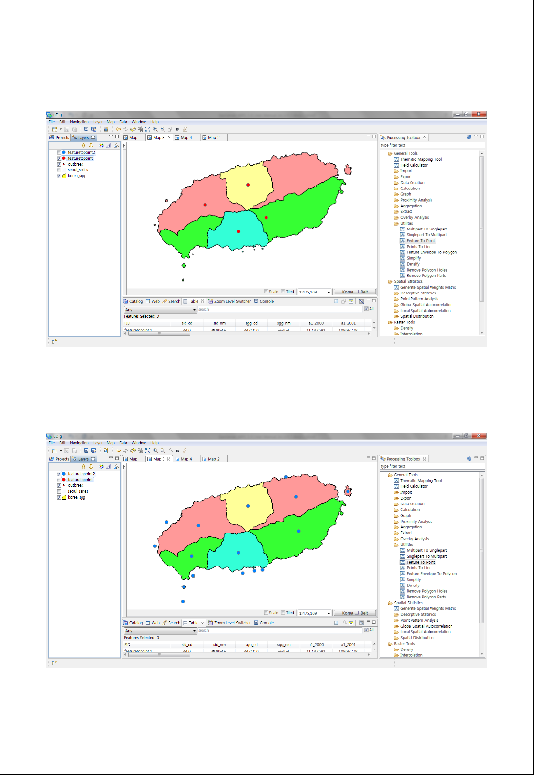
The following figure shows the situation that the inside parameter is True and singlePart
parameter is True. If it is MultiPolygon, it is converted into one center point.
This is the situation that inside parameter is set to True and singlePart parameter is set
to False. If it is MultiPolygon, it is converted into center points by the number of
polygons.
4.2.9.2.
Multipart to Singlepart
Converts feature layers (inputFeatures) that configured with MultiPart into that with
SinglePart.
Syntax
MultipartToSinglepart (SimpleFeatureCollection inputFeatures): SimpleFeatureCollection
Parameters
Data Inputs
Identifier
Description
Type
Required
inputFeatures
Input features that can be any feature type.
Complex
Process Outputs
Identifier
Description
Type
Required
result
Output features.
Complex
Constraints
- InputFeatures parameter must be Multipart (MultiPoint, MultiLineString,
MultiPolygon) feature types.
Request Examples
<?xml version="1.0" encoding="UTF-8"?><wps:Execute version="1.0.0" service="WPS"
xmlns:xsi="http://www.w3.org/2001/XMLSchema-instance" xmlns="http://www.opengis.net/wps/1.0.0"
xmlns:wfs="http://www.opengis.net/wfs" xmlns:wps="http://www.opengis.net/wps/1.0.0"
xmlns:ows="http://www.opengis.net/ows/1.1" xmlns:gml="http://www.opengis.net/gml"
xmlns:ogc="http://www.opengis.net/ogc" xmlns:wcs="http://www.opengis.net/wcs/1.1.1"
xmlns:xlink="http://www.w3.org/1999/xlink" xsi:schemaLocation="http://www.opengis.net/wps/1.0.0
http://schemas.opengis.net/wps/1.0.0/wpsAll.xsd">
<ows:Identifier>statistics:MultipartToSinglepart</ows:Identifier>
<wps:DataInputs>
<wps:Input>
<ows:Identifier>inputFeatures</ows:Identifier>
<wps:Reference mimeType="text/xml" xlink:href="http://geoserver/wfs" method="POST">
<wps:Body>
<wfs:GetFeature service=“WFS” version=“1.1.0” outputFormat=“GML3”
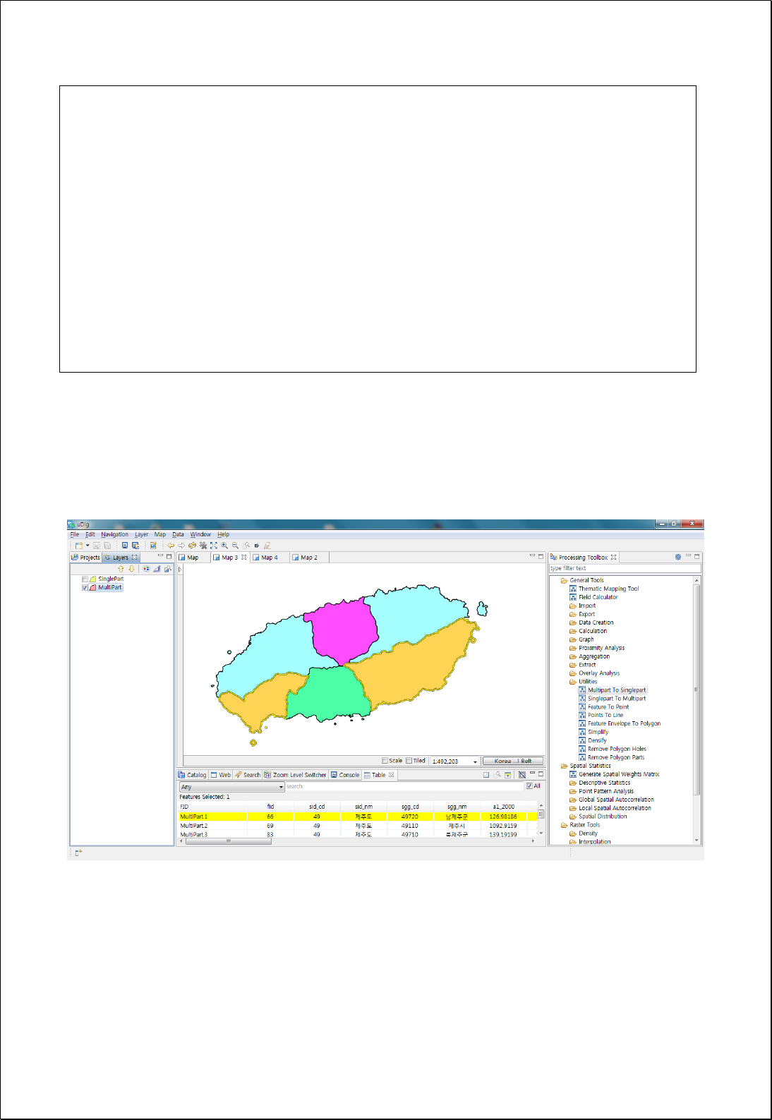
xmlns:foss="http://www.opengeospatial.net/foss">
<wfs:Query typeName="foss:korea_sgg"/>
</wfs:GetFeature>
</wps:Body>
</wps:Reference>
</wps:Input>
</wps:DataInputs>
<wps:ResponseForm>
<wps:RawDataOutput mimeType=“text/xml; subtype=wfs-collection/1.1”>
<ows:Identifier>result</ows:Identifier>
</wps:RawDataOutput>
</wps:ResponseForm>
</wps:Execute>
Response
The following figure shows the result of converting MultiPolygon configured with more
than 2 polygons into single polygon.
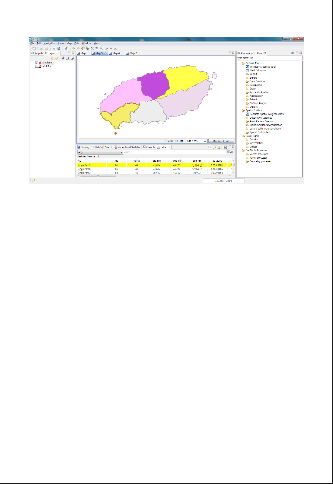

4.2.9.3.
Singlepart to Multipart
Converts feature layers (inputFeatures) that configured with SinglePart into that with
MultiPart based on attribute values.
Syntax
SinglepartToMultipart (SimpleFeatureCollection inputFeatures, String caseField, Boolean
dissolve): SimpleFeatureCollection
Parameters
Data Inputs
Identifier
Description
Type
Required
inputFeatures
Input features that can be point, line, polygon.
Complex
caseField
The field on which to aggregate features.
Literal
dissolve
If true, neighborhood features are dissolved. Default
is False
Literal
-
Process Outputs
Identifier
Description
Type
Required
result
Output features.
Complex
Constraints
- If dissolve parameter is set to True, returns in geometry that dissolves the adjacent
polygons or lines.
Request Examples
<?xml version="1.0" encoding="UTF-8"?><wps:Execute version="1.0.0" service="WPS"
xmlns:xsi="http://www.w3.org/2001/XMLSchema-instance" xmlns="http://www.opengis.net/wps/1.0.0"
xmlns:wfs="http://www.opengis.net/wfs" xmlns:wps="http://www.opengis.net/wps/1.0.0"
xmlns:ows="http://www.opengis.net/ows/1.1" xmlns:gml="http://www.opengis.net/gml"
xmlns:ogc="http://www.opengis.net/ogc" xmlns:wcs="http://www.opengis.net/wcs/1.1.1"
xmlns:xlink="http://www.w3.org/1999/xlink" xsi:schemaLocation="http://www.opengis.net/wps/1.0.0
http://schemas.opengis.net/wps/1.0.0/wpsAll.xsd">
<ows:Identifier>statistics:SinglepartToMultipart</ows:Identifier>
<wps:DataInputs>

<wps:Input>
<ows:Identifier>inputFeatures</ows:Identifier>
<wps:Reference mimeType="text/xml" xlink:href="http://geoserver/wfs" method="POST">
<wps:Body>
<wfs:GetFeature service=“WFS” version=“1.1.0” outputFormat=“GML3”
xmlns:foss="http://www.opengeospatial.net/foss">
<wfs:Query typeName="foss:emd"/>
</wfs:GetFeature>
</wps:Body>
</wps:Reference>
</wps:Input>
<wps:Input>
<ows:Identifier>caseField</ows:Identifier>
<wps:Data>
<wps:LiteralData>sgg_nm</wps:LiteralData>
</wps:Data>
</wps:Input>
</wps:DataInputs>
<wps:ResponseForm>
<wps:RawDataOutput mimeType=“text/xml; subtype=wfs-collection/1.1”>
<ows:Identifier>result</ows:Identifier>
</wps:RawDataOutput>
</wps:ResponseForm>
</wps:Execute>
Response
The following figure shows an example of converting layer configured with single
polygon back into MultiPolygon based on the name of the administrative doundary (Si-
Gun-Gu).
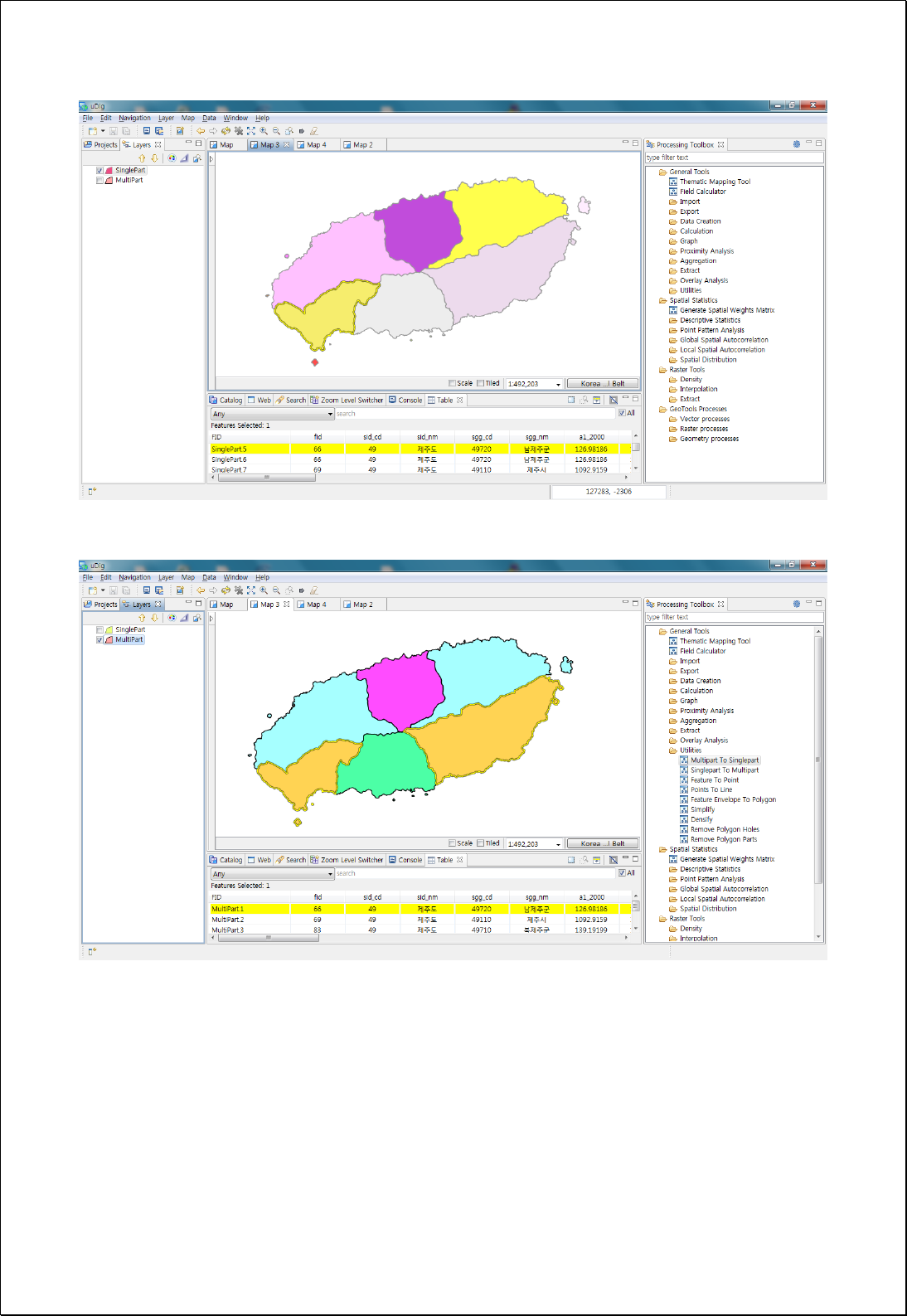

4.2.9.4.
Feature Envelope to Polygon
Converts the minimum boundary area for each feature in the feature layer to a polygon
feature layer.
Syntax
FeatureEnvelopeToPolygon (SimpleFeatureCollection inputFeatures, Boolean
singleEnvelope): SimpleFeatureCollection
Parameters
Data Inputs
Identifier
Description
Type
Required
inputFeatures
Input features that can be multipoint, line, polygon.
Complex
singleEnvelope
Specifies whether to use one envelope for each entire
multipart feature or one envelope per part of a
multipart feature. Default is True
Literal
-
Process Outputs
Identifier
Description
Type
Required
result
Output features.
Complex
Constraints
- If singleEnvelope is set to False and the geometry of each feature is MultiLineString
or MultiPolygon, converts to Single Part and returns Envelope polygon for each
geometry.
Request Examples
<?xml version="1.0" encoding="UTF-8"?><wps:Execute version="1.0.0" service="WPS"
xmlns:xsi="http://www.w3.org/2001/XMLSchema-instance" xmlns="http://www.opengis.net/wps/1.0.0"
xmlns:wfs="http://www.opengis.net/wfs" xmlns:wps="http://www.opengis.net/wps/1.0.0"
xmlns:ows="http://www.opengis.net/ows/1.1" xmlns:gml="http://www.opengis.net/gml"
xmlns:ogc="http://www.opengis.net/ogc" xmlns:wcs="http://www.opengis.net/wcs/1.1.1"
xmlns:xlink="http://www.w3.org/1999/xlink" xsi:schemaLocation="http://www.opengis.net/wps/1.0.0
http://schemas.opengis.net/wps/1.0.0/wpsAll.xsd">
<ows:Identifier>statistics:FeatureEnvelopeToPolygon</ows:Identifier>

<wps:DataInputs>
<wps:Input>
<ows:Identifier>inputFeatures</ows:Identifier>
<wps:Reference mimeType="text/xml" xlink:href="http://geoserver/wfs" method="POST">
<wps:Body>
<wfs:GetFeature service=“WFS” version=“1.1.0” outputFormat=“GML3”
xmlns:foss="http://www.opengeospatial.net/foss">
<wfs:Query typeName="foss:korea_sgg"/>
</wfs:GetFeature>
</wps:Body>
</wps:Reference>
</wps:Input>
<wps:Input>
<ows:Identifier>singleEnvelope</ows:Identifier>
<wps:Data>
<wps:LiteralData>False</wps:LiteralData>
</wps:Data>
</wps:Input>
</wps:DataInputs>
<wps:ResponseForm>
<wps:RawDataOutput mimeType=“text/xml; subtype=wfs-collection/1.1”>
<ows:Identifier>result</ows:Identifier>
</wps:RawDataOutput>
</wps:ResponseForm>
</wps:Execute>
Response
The following figure showsthe result of converting Envelopes of polygon feature
geometry to polygons.
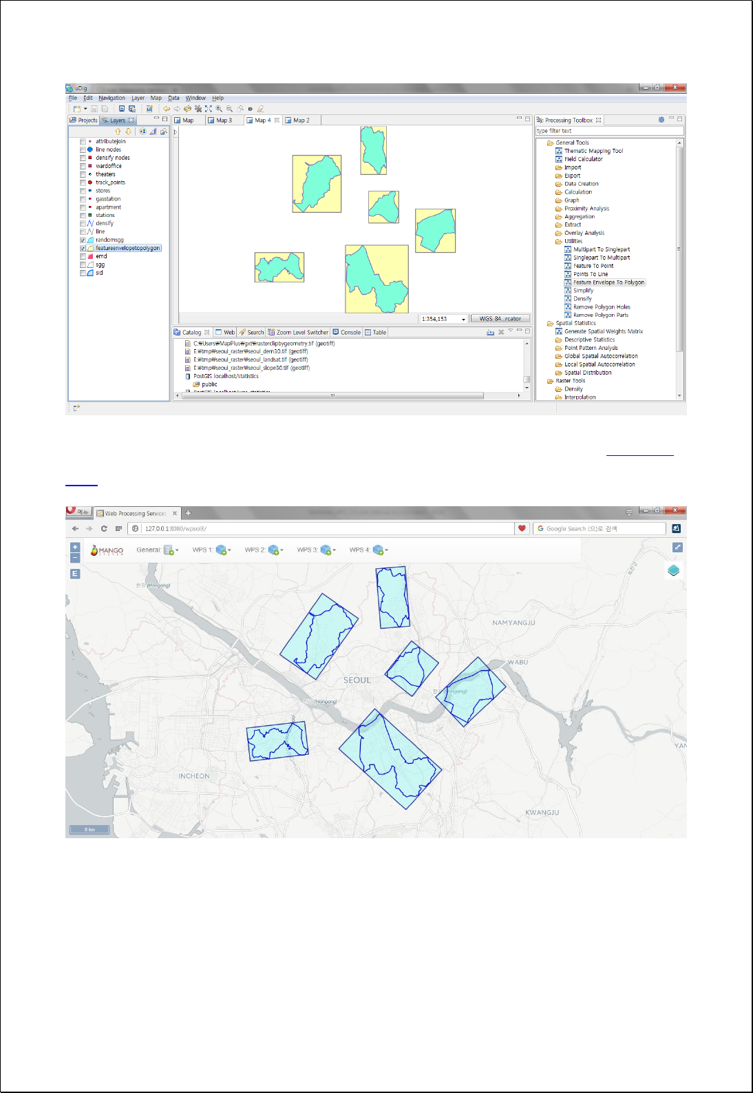
Minimum bounding Envelope surrounding the polygon can be get using the [Calculate
Field] function.

4.2.9.5.
Points to Line
Sets line field (lineField) and aligned field value in the point feature layer (inputField)
and converts into line or polygon layers.
Syntax
PointsToLine (SimpleFeatureCollection inputFeatures, String lineField, String sortField,
Boolean closeLine): SimpleFeatureCollection
Parameters
Data Inputs
Identifier
Description
Type
Required
inputFeatures
The point features to be converted into lines.
Complex
lineField
Each feature in the output will be based on unique
values in the Line Field.
Literal
-
sortField
By default, points used to create each output line
feature will be used in the order they are found. If a
different order is desired, specify a Sort Field.
Literal
-
closeLine
Specifies whether output line features should be
closed. Default is False.
Literal
Process Outputs
Identifier
Description
Type
Required
result
Output features.
Complex
Constraints
- If sets lineField parameter, lines are created separately according to the unique
value of lineField.
- If sets sortField parameter, lines are created using points aligned to sortField.
- If the closeLine parameter is set to True, creates polygons by linking the start point
with the end point.
Request Examples

<?xml version="1.0" encoding="UTF-8"?><wps:Execute version="1.0.0" service="WPS"
xmlns:xsi="http://www.w3.org/2001/XMLSchema-instance" xmlns="http://www.opengis.net/wps/1.0.0"
xmlns:wfs="http://www.opengis.net/wfs" xmlns:wps="http://www.opengis.net/wps/1.0.0"
xmlns:ows="http://www.opengis.net/ows/1.1" xmlns:gml="http://www.opengis.net/gml"
xmlns:ogc="http://www.opengis.net/ogc" xmlns:wcs="http://www.opengis.net/wcs/1.1.1"
xmlns:xlink="http://www.w3.org/1999/xlink" xsi:schemaLocation="http://www.opengis.net/wps/1.0.0
http://schemas.opengis.net/wps/1.0.0/wpsAll.xsd">
<ows:Identifier>statistics:PointsToLine</ows:Identifier>
<wps:DataInputs>
<wps:Input>
<ows:Identifier>inputFeatures</ows:Identifier>
<wps:Reference mimeType="text/xml" xlink:href="http://geoserver/wfs" method="POST">
<wps:Body>
<wfs:GetFeature service=“WFS” version=“1.1.0” outputFormat=“GML3”
xmlns:foss="http://www.opengeospatial.net/foss">
<wfs:Query typeName="foss:track_points"/>
</wfs:GetFeature>
</wps:Body>
</wps:Reference>
</wps:Input>
<wps:Input>
<ows:Identifier>lineField</ows:Identifier>
<wps:Data>
<wps:LiteralData>cat</wps:LiteralData>
</wps:Data>
</wps:Input>
<wps:Input>
<ows:Identifier>sortField</ows:Identifier>
<wps:Data>
<wps:LiteralData>id</wps:LiteralData>
</wps:Data>
</wps:Input>
<wps:Input>
<ows:Identifier>closeLine</ows:Identifier>
<wps:Data>
<wps:LiteralData>False</wps:LiteralData>
</wps:Data>
</wps:Input>
</wps:DataInputs>
<wps:ResponseForm>
<wps:RawDataOutput mimeType=“text/xml; subtype=wfs-collection/1.1”>
<ows:Identifier>result</ows:Identifier>
</wps:RawDataOutput>
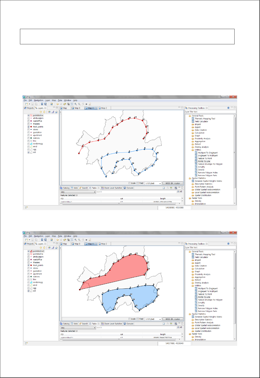
</wps:ResponseForm>
</wps:Execute>
Response
The following figure shows the result of converting all points including the category and
serial number to lines. The lines are created according to the serial number sequence
and consist of two categories.
Polygon is created when closeLine is set to True in the example above.

4.2.9.6.
Ring Maps
Creates a Ring Map by setting the property fields (fields) or the numbers of rings
separated by a comma of the feature layers (inputFeatures).
Syntax
RingMap (SimpleFeatureCollection inputFeatures, String fields, String targetField, Integer
ringGap): [SimpleFeatureCollection, SimpleFeatureCollection]
Parameters
Data Inputs
Identifier
Description
Type
Required
inputFeatures
Input features that can be point, line, and polygon.
Complex
fields
Comma separated field or ring count.
Literal
targetField
Output ring value field. ring_val is default.
Literal
-
ringGap
Gap of rings.
Literal
-
Process Outputs
Identifier
Description
Type
Required
anchor
Anchor features.
Complex
ringmap
Ring map features.
Complex
Constraints
- The fields parameter uses the number of consecutive fields or numbers of rings,
such as a comma-separated yearly time series field.
- If targetField is set to Null, Ring_val field is the default value.
- RingGap parameter ranges from 1~9, and 1 is the default value.
- Output returns to two layers of ringmap polygons that created by the anchor line
and the ring map displaying the leader lines.
Request Examples

<?xml version="1.0" encoding="UTF-8"?><wps:Execute version="1.0.0" service="WPS"
xmlns:xsi="http://www.w3.org/2001/XMLSchema-instance" xmlns="http://www.opengis.net/wps/1.0.0"
xmlns:wfs="http://www.opengis.net/wfs" xmlns:wps="http://www.opengis.net/wps/1.0.0"
xmlns:ows="http://www.opengis.net/ows/1.1" xmlns:gml="http://www.opengis.net/gml"
xmlns:ogc="http://www.opengis.net/ogc" xmlns:wcs="http://www.opengis.net/wcs/1.1.1"
xmlns:xlink="http://www.w3.org/1999/xlink" xsi:schemaLocation="http://www.opengis.net/wps/1.0.0
http://schemas.opengis.net/wps/1.0.0/wpsAll.xsd">
<ows:Identifier>statistics:RingMap</ows:Identifier>
<wps:DataInputs>
<wps:Input>
<ows:Identifier>inputFeatures</ows:Identifier>
<wps:Reference mimeType="text/xml" xlink:href="http://geoserver/wfs" method="POST">
<wps:Body>
<wfs:GetFeature service=“WFS” version=“1.1.0” outputFormat=“GML3”
xmlns:foss="http://www.opengeospatial.net/foss">
<wfs:Query typeName="foss:seoul_series"/>
</wfs:GetFeature>
</wps:Body>
</wps:Reference>
</wps:Input>
<wps:Input>
<ows:Identifier>fields</ows:Identifier>
<wps:Data>
<wps:LiteralData>a3_2000,a3_2001,a3_2002,a3_2003,a3_2004,a3_2005</wps:LiteralData>
</wps:Data>
</wps:Input>
<wps:Input>
<ows:Identifier>targetField</ows:Identifier>
<wps:Data>
<wps:LiteralData>ring_val</wps:LiteralData>
</wps:Data>
</wps:Input>
</wps:DataInputs>
<wps:ResponseForm>
<wps:ResponseDocument>
<wps:Output mimeType="text/xml; subtype=wfs-collection/1.0">
<ows:Identifier>anchor</ows:Identifier>
</wps:Output>
<wps:Output mimeType="text/xml; subtype=wfs-collection/1.0">
<ows:Identifier>ringmap</ows:Identifier>
</wps:Output>
</wps:ResponseDocument>
</wps:ResponseForm>
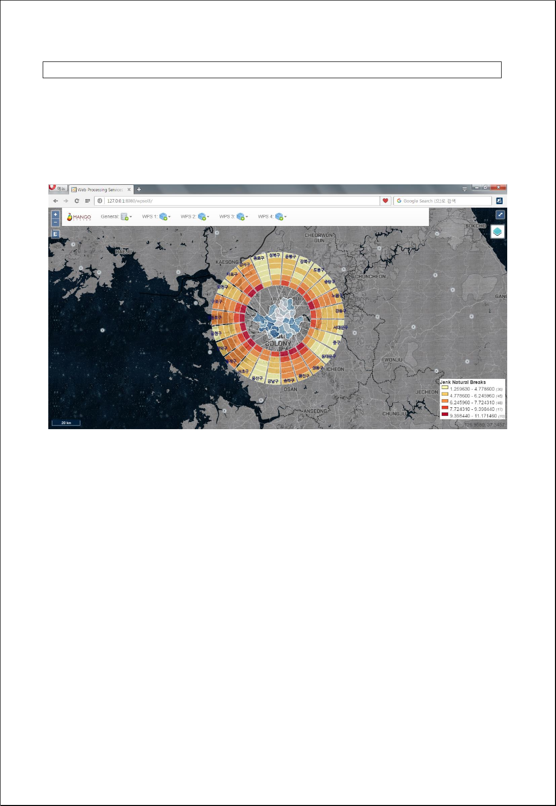
</wps:Execute>
Response
The following figure showsthe result of creating the Ring Map using the natural
population growth rate from 2000 to 2005 in Seoul.

4.2.9.7.
Wind Rose Maps
Creates a Wind Rose Map by setting the point feature layer and center point.
Syntax
WindRoseMap (SimpleFeatureCollection inputFeatures, String weightField, Geometry
center): SimpleFeatureCollection
Parameters
Data Inputs
Identifier
Description
Type
Required
inputFeatures
Input features that can be point, line, and polygon.
Complex
weightField
Weight field.
Literal
-
center
Center (geometry) of wind rose.
Complex
-
Process Outputs
Identifier
Description
Type
Required
anchor
anchor features.
Complex
windRose
Wind rose features.
Complex
Constraints
- The weightField parameter must be a Numeric field. If sets the parameter, the sum
of these field values is reflected in the result, otherwise the number of features is
reflected.
- Output returns the anchor line and the windrose polygon layers to display the
leader lines.
Request Examples
<?xml version="1.0" encoding="UTF-8"?><wps:Execute version="1.0.0" service="WPS"
xmlns:xsi="http://www.w3.org/2001/XMLSchema-instance" xmlns="http://www.opengis.net/wps/1.0.0"
xmlns:wfs="http://www.opengis.net/wfs" xmlns:wps="http://www.opengis.net/wps/1.0.0"
xmlns:ows="http://www.opengis.net/ows/1.1" xmlns:gml="http://www.opengis.net/gml"
xmlns:ogc="http://www.opengis.net/ogc" xmlns:wcs="http://www.opengis.net/wcs/1.1.1"

xmlns:xlink="http://www.w3.org/1999/xlink" xsi:schemaLocation="http://www.opengis.net/wps/1.0.0
http://schemas.opengis.net/wps/1.0.0/wpsAll.xsd">
<ows:Identifier>statistics:WindRoseMap</ows:Identifier>
<wps:DataInputs>
<wps:Input>
<ows:Identifier>inputFeatures</ows:Identifier>
<wps:Reference mimeType="text/xml" xlink:href="http://geoserver/wfs" method="POST">
<wps:Body>
<wfs:GetFeature service=“WFS” version=“1.1.0” outputFormat=“GML3”
xmlns:foss="http://www.opengeospatial.net/foss">
<wfs:Query typeName="foss:apartment"/>
</wfs:GetFeature>
</wps:Body>
</wps:Reference>
</wps:Input>
<wps:Input>
<ows:Identifier>center</ows:Identifier>
<wps:Data>
<wps:ComplexData mimeType="application/wkt"><![CDATA[POINT(14135161.941
4518394.452)]]></wps:ComplexData>
</wps:Data>
</wps:Input>
</wps:DataInputs>
<wps:ResponseForm>
<wps:ResponseDocument>
<wps:Output mimeType="text/xml; subtype=wfs-collection/1.0">
<ows:Identifier>anchor</ows:Identifier>
</wps:Output>
<wps:Output mimeType="text/xml; subtype=wfs-collection/1.0">
<ows:Identifier>windRose</ows:Identifier>
</wps:Output>
</wps:ResponseDocument>
</wps:ResponseForm>
</wps:Execute>
Response
The following figure showsthe result of creating Wind Rose Map using distribution of
apartments with Seoul City Hall as the center.
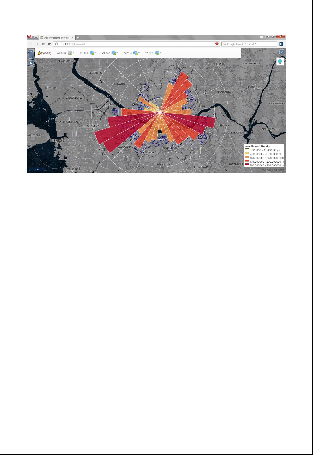

4.2.9.8.
Hub Lines by ID
Creates a shortest distance of Hub line feature layers (hubFeatures) using the Join field
of the Hub feature layers (hubIdFeild) and the Spoke feature layers (spokeIdFeild).
Syntax
HubLinesByID (SimpleFeatureCollection hubFeatures, String hubIdField,
SimpleFeatureCollection spokeFeatures, String spokeIdField, Boolean preserveAttributes,
Boolean useCentroid, Boolean useBezierCurve, Double maximumDistance):
SimpleFeatureCollection
Parameters
Data Inputs
Identifier
Description
Type
Required
hubFeatures
Hub Features.
Complex
hubIdField
Hub id field.
Literal
spokeFeatures
Spoke Features.
Complex
spokeIdField
Spoke id field.
Literal
preserveAttributes
Preserve spoke feature's attributes. Default is True
Literal
-
useCentroid
Use centroid of feature. Default is True
Literal
-
useBezierCurve
Use Bezier Curve. Defautl is False.
Literal
-
maximumDistance
Maximum distance.
Literal
-
Process Outputs
Identifier
Description
Type
Required
result
Output features.
Complex
Constraints
- If the useCentroid parameter is set to True and the geometry feature types of
hubFeatures, spokeFeatures are line or polygon layers, creates the hub line using
centroid of geometry.
- If the useBezierCurve parameter is set to True, creates the Bezier curve with the
shortest line between the two features.

- If the maximumDistance parameter is greater than 0, creates a hub line only for
features within this distance
Request Examples
<?xml version="1.0" encoding="UTF-8"?><wps:Execute version="1.0.0" service="WPS"
xmlns:xsi="http://www.w3.org/2001/XMLSchema-instance" xmlns="http://www.opengis.net/wps/1.0.0"
xmlns:wfs="http://www.opengis.net/wfs" xmlns:wps="http://www.opengis.net/wps/1.0.0"
xmlns:ows="http://www.opengis.net/ows/1.1" xmlns:gml="http://www.opengis.net/gml"
xmlns:ogc="http://www.opengis.net/ogc" xmlns:wcs="http://www.opengis.net/wcs/1.1.1"
xmlns:xlink="http://www.w3.org/1999/xlink" xsi:schemaLocation="http://www.opengis.net/wps/1.0.0
http://schemas.opengis.net/wps/1.0.0/wpsAll.xsd">
<ows:Identifier>statistics:HubLinesByID</ows:Identifier>
<wps:DataInputs>
<wps:Input>
<ows:Identifier>hubFeatures</ows:Identifier>
<wps:Reference mimeType="text/xml" xlink:href="http://geoserver/wfs" method="POST">
<wps:Body>
<wfs:GetFeature service=“WFS” version=“1.1.0” outputFormat=“GML3”
xmlns:foss="http://www.opengeospatial.net/foss">
<wfs:Query typeName="foss:wardoffice"/>
</wfs:GetFeature>
</wps:Body>
</wps:Reference>
</wps:Input>
<wps:Input>
<ows:Identifier>hubIdField</ows:Identifier>
<wps:Data>
<wps:LiteralData>sgg_nm</wps:LiteralData>
</wps:Data>
</wps:Input>
<wps:Input>
<ows:Identifier>spokeFeatures</ows:Identifier>
<wps:Reference mimeType="text/xml" xlink:href="http://geoserver/wfs" method="POST">
<wps:Body>
<wfs:GetFeature service=“WFS” version=“1.1.0” outputFormat=“GML3”
xmlns:foss="http://www.opengeospatial.net/foss">
<wfs:Query typeName="foss:emd"/>
</wfs:GetFeature>
</wps:Body>
</wps:Reference>
</wps:Input>

<wps:Input>
<ows:Identifier>spokeIdField</ows:Identifier>
<wps:Data>
<wps:LiteralData>sgg_nm</wps:LiteralData>
</wps:Data>
</wps:Input>
<wps:Input>
<ows:Identifier>preserveAttributes</ows:Identifier>
<wps:Data>
<wps:LiteralData>True</wps:LiteralData>
</wps:Data>
</wps:Input>
<wps:Input>
<ows:Identifier>useCentroid</ows:Identifier>
<wps:Data>
<wps:LiteralData>True</wps:LiteralData>
</wps:Data>
</wps:Input>
</wps:DataInputs>
<wps:ResponseForm>
<wps:RawDataOutput mimeType=“text/xml; subtype=wfs-collection/1.1”>
<ows:Identifier>result</ows:Identifier>
</wps:RawDataOutput>
</wps:ResponseForm>
</wps:Execute>
Response
The following figure showsthe result of setting the city municipal offices as the hubs,
setting the Eup-Myeon-Dong district polygon as a spoke layer, and creating the hub
lines based on the Si-Gun-Gu administrative district code.
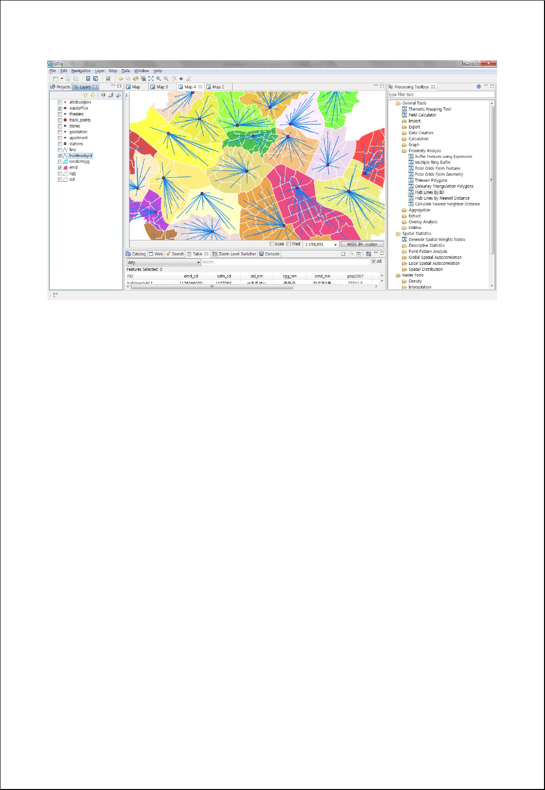

4.2.9.9.
Hub Lines by Nearest Distance
Creates a hub line feature layer between the closest hub features (hubFeatures) in the
spoke features (spokeFeatures), using the hub feature layers and the spoke feature
layers.
Syntax
HubLinesByDistance (SimpleFeatureCollection spokeFeatures, SimpleFeatureCollection
hubFeatures, String hubIdField, Boolean preserveAttributes, Boolean useCentroid, Boolean
useBezierCurve, Double maximumDistance): SimpleFeatureCollection
Parameters
Data Inputs
Identifier
Description
Type
Required
spokeFeatures
Spoke Features.
Complex
hubFeatures
Hub Features.
Literal
hubIdField
Hub id field.
Literal
-
preserveAttributes
Preserve spoke feature's attributes. Default is True
Literal
-
useCentroid
Use centroid of feature. Default is True
Literal
-
useBezierCurve
Use Bezier Curve. Defautl is False.
Literal
-
maximumDistance
Maximum distance.
Literal
-
Process Outputs
Identifier
Description
Type
Required
result
Output features.
Complex
Constraints
- If the useCentroid parameter is set to True and the geometry feature types of
hubFeatures, spokeFeatures are lines or polygons, creates the hub lines using
centroid of geometry.
- If the useBezierCurve parameter is set to True, creates the Bezier curve with the
shortest line between the two features.

- If the maximumDistance parameter is greater than 0, creates a hub line only for
features within set distance
Request Examples
<?xml version="1.0" encoding="UTF-8"?><wps:Execute version="1.0.0" service="WPS"
xmlns:xsi="http://www.w3.org/2001/XMLSchema-instance" xmlns="http://www.opengis.net/wps/1.0.0"
xmlns:wfs="http://www.opengis.net/wfs" xmlns:wps="http://www.opengis.net/wps/1.0.0"
xmlns:ows="http://www.opengis.net/ows/1.1" xmlns:gml="http://www.opengis.net/gml"
xmlns:ogc="http://www.opengis.net/ogc" xmlns:wcs="http://www.opengis.net/wcs/1.1.1"
xmlns:xlink="http://www.w3.org/1999/xlink" xsi:schemaLocation="http://www.opengis.net/wps/1.0.0
http://schemas.opengis.net/wps/1.0.0/wpsAll.xsd">
<ows:Identifier>statistics:HubLinesByDistance</ows:Identifier>
<wps:DataInputs>
<wps:Input>
<ows:Identifier>spokeFeatures</ows:Identifier>
<wps:Reference mimeType="text/xml" xlink:href="http://geoserver/wfs" method="POST">
<wps:Body>
<wfs:GetFeature service=“WFS” version=“1.1.0” outputFormat=“GML3”
xmlns:foss="http://www.opengeospatial.net/foss">
<wfs:Query typeName="foss:wardoffice"/>
</wfs:GetFeature>
</wps:Body>
</wps:Reference>
</wps:Input>
<wps:Input>
<ows:Identifier>hubFeatures</ows:Identifier>
<wps:Reference mimeType="text/xml" xlink:href="http://geoserver/wfs" method="POST">
<wps:Body>
<wfs:GetFeature service=“WFS” version=“1.1.0” outputFormat=“GML3”
xmlns:foss="http://www.opengeospatial.net/foss">
<wfs:Query typeName="foss:apartment"/>
</wfs:GetFeature>
</wps:Body>
</wps:Reference>
</wps:Input>
<wps:Input>
<ows:Identifier>preserveAttributes</ows:Identifier>
<wps:Data>
<wps:LiteralData>True</wps:LiteralData>
</wps:Data>
</wps:Input>
<wps:Input>
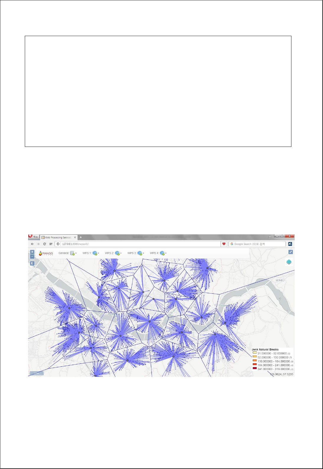
<ows:Identifier>useCentroid</ows:Identifier>
<wps:Data>
<wps:LiteralData>True</wps:LiteralData>
</wps:Data>
</wps:Input>
</wps:DataInputs>
<wps:ResponseForm>
<wps:RawDataOutput mimeType=“text/xml; subtype=wfs-collection/1.1”>
<ows:Identifier>result</ows:Identifier>
</wps:RawDataOutput>
</wps:ResponseForm>
</wps:Execute>
Response
The following figure showsthe result of connecting the nearest apartments of the
municipal offices by setting the municipal offices as the hubs and the apartment
distribution as the spoke. It will be placed in the same area as Thiessen Polygon as
shown in the following figure.
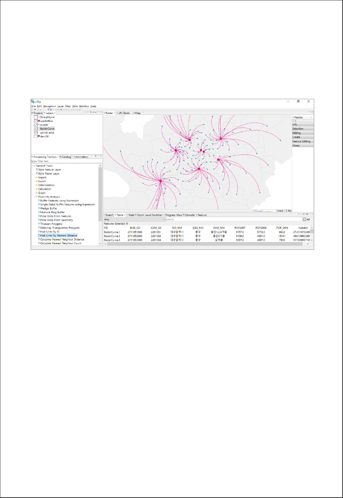
If uses the Bezier curve option, creates line layers as curves as follows.

4.2.9.10.
Feature To Line
Creates line layers divided by the nodes that intersect with the polygon or line layers.
Syntax
FeatureToLine (SimpleFeatureCollection inputFeatures, Boolean preserveAttributes):
SimpleFeatureCollection
Parameters
Data Inputs
Identifier
Description
Type
Required
inputFeatures
The input features that can be line or polygon.
Complex
preserveAttributes
Specifies whether to preserve or omit the input
attributes in the output features. Default is True.
Literal
-
Process Outputs
Identifier
Description
Type
Required
result
Output features.
Complex
Constraints
- The inputFeature layers must be line or polygon types.
- Default value of the preserveAttributes parameter is True, and if it is set to true,
retains the property values of the original features.
Request Examples
<?xml version="1.0" encoding="UTF-8"?><wps:Execute version="1.0.0" service="WPS"
xmlns:xsi="http://www.w3.org/2001/XMLSchema-instance" xmlns="http://www.opengis.net/wps/1.0.0"
xmlns:wfs="http://www.opengis.net/wfs" xmlns:wps="http://www.opengis.net/wps/1.0.0"
xmlns:ows="http://www.opengis.net/ows/1.1" xmlns:gml="http://www.opengis.net/gml"
xmlns:ogc="http://www.opengis.net/ogc" xmlns:wcs="http://www.opengis.net/wcs/1.1.1"
xmlns:xlink="http://www.w3.org/1999/xlink" xsi:schemaLocation="http://www.opengis.net/wps/1.0.0
http://schemas.opengis.net/wps/1.0.0/wpsAll.xsd">
<ows:Identifier>statistics:FeatureToLine</ows:Identifier>
<wps:DataInputs>
<wps:Input>

<ows:Identifier>inputFeatures</ows:Identifier>
<wps:Reference mimeType="text/xml" xlink:href="http://geoserver/wfs" method="POST">
<wps:Body>
<wfs:GetFeature service="WFS" version="1.0.0" outputFormat="GML2"
xmlns:foss="http://www.opengeospatial.net/foss">
<wfs:Query typeName="foss:sgg"/>
</wfs:GetFeature>
</wps:Body>
</wps:Reference>
</wps:Input>
<wps:Input>
<ows:Identifier>preserveAttributes</ows:Identifier>
<wps:Data>
<wps:LiteralData>True</wps:LiteralData>
</wps:Data>
</wps:Input>
</wps:DataInputs>
<wps:ResponseForm>
<wps:RawDataOutput mimeType="text/xml; subtype=wfs-collection/1.0">
<ows:Identifier>result</ows:Identifier>
</wps:RawDataOutput>
</wps:ResponseForm>
</wps:Execute>
Response
The following figure shows the result of converting the polygon layers to line layers.
The converted lines are divided into segments that share polygons as shown in the
following figure.
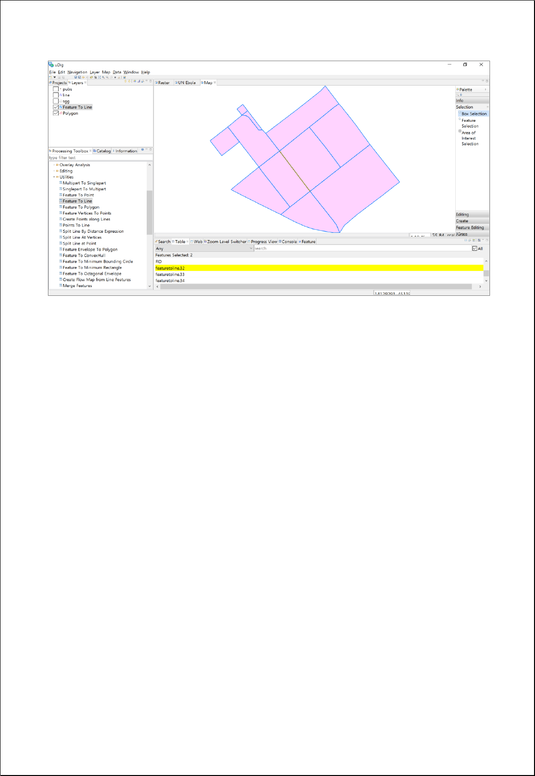

4.2.9.11.
Feature To Polygon
Creates polygon layers using polygon or line layers (inputFeatures).
Syntax
FeatureToPolygon (SimpleFeatureCollection inputFeatures, Double tolerance,
SimpleFeatureCollection labelFeatures): SimpleFeatureCollection
Parameters
Data Inputs
Identifier
Description
Type
Required
inputFeatures
The input features that can be line or polygon.
Complex
tolerance
Tolerance. The default is 0.001 feature unit.
Literal
-
labelFeatures
The optional input point features that hold the
attributes to be transferred to the output polygon
features.
Complex
-
Process Outputs
Identifier
Description
Type
Required
result
Output features.
Complex
Constraints
- The inputFeatures layers must be line or polygon layer types.
- Default value of the tolerance parameter is 0.001, and the units of the inputFeatures
coordinate system.
- The labelFeatures layers must be point layer types.
- If the labelFeatures parameter is not Null, uses this schema and assign the attribute
values of the labelFeatures points contained in the polygon after polygon
generation.
Request Examples

<?xml version="1.0" encoding="UTF-8"?><wps:Execute version="1.0.0" service="WPS"
xmlns:xsi="http://www.w3.org/2001/XMLSchema-instance" xmlns="http://www.opengis.net/wps/1.0.0"
xmlns:wfs="http://www.opengis.net/wfs" xmlns:wps="http://www.opengis.net/wps/1.0.0"
xmlns:ows="http://www.opengis.net/ows/1.1" xmlns:gml="http://www.opengis.net/gml"
xmlns:ogc="http://www.opengis.net/ogc" xmlns:wcs="http://www.opengis.net/wcs/1.1.1"
xmlns:xlink="http://www.w3.org/1999/xlink" xsi:schemaLocation="http://www.opengis.net/wps/1.0.0
http://schemas.opengis.net/wps/1.0.0/wpsAll.xsd">
<ows:Identifier>statistics:FeatureToPolygon</ows:Identifier>
<wps:DataInputs>
<wps:Input>
<ows:Identifier>inputFeatures</ows:Identifier>
<wps:Reference mimeType="text/xml" xlink:href="http://geoserver/wfs" method="POST">
<wps:Body>
<wfs:GetFeature service="WFS" version="1.0.0" outputFormat="GML2"
xmlns:foss="http://www.opengeospatial.net/foss">
<wfs:Query typeName="foss:line"/>
</wfs:GetFeature>
</wps:Body>
</wps:Reference>
</wps:Input>
<wps:Input>
<ows:Identifier>tolerance</ows:Identifier>
<wps:Data>
<wps:LiteralData>0.001</wps:LiteralData>
</wps:Data>
</wps:Input>
</wps:DataInputs>
<wps:ResponseForm>
<wps:RawDataOutput mimeType="text/xml; subtype=wfs-collection/1.0">
<ows:Identifier>result</ows:Identifier>
</wps:RawDataOutput>
</wps:ResponseForm>
</wps:Execute>
Response
The following figure shows the result of converting the line layers to polygon layers.
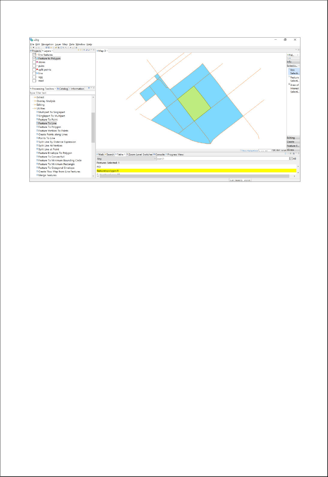

4.2.9.12.
Feature Vertices to Points
Creates point feature layers based on the set vertex position (location)using polygon or
line data (inputFeatures).
Syntax
VerticesToPoints (SimpleFeatureCollection inputFeatures, PointLocationType location):
SimpleFeatureCollection
Parameters
Data Inputs
Identifier
Description
Type
Required
inputFeatures
The input features that can be line or polygon.
Complex
location
Specifies where an output point will be created.
Default is All
Literal
-
Process Outputs
Identifier
Description
Type
Required
result
Output features.
Complex
Constraints
- The inputFeatures parameter must be line or polygon layers.
- The location parameter has the following five options.
Options
Description
All
All vertices of line or polygon geometry, Default value.
Mid
Midpoint of line or polygon geometry .
Start
Starting point of line or polygon geometry.
End
Endpoint of line or polygon geometry.
BothEnds
Starting and ending points of the line or polygon geometry.
Request Examples
<?xml version="1.0" encoding="utf-8"?>
<wps:Execute version="1.0.0" service="WPS" xmlns:xsi="http://www.w3.org/2001/XMLSchema-instance"

xmlns="http://www.opengis.net/wps/1.0.0" xmlns:wfs="http://www.opengis.net/wfs"
xmlns:wps="http://www.opengis.net/wps/1.0.0" xmlns:ows="http://www.opengis.net/ows/1.1"
xmlns:gml="http://www.opengis.net/gml" xmlns:ogc="http://www.opengis.net/ogc"
xmlns:wcs="http://www.opengis.net/wcs/1.1.1" xmlns:xlink="http://www.w3.org/1999/xlink"
xsi:schemaLocation="http://www.opengis.net/wps/1.0.0 http://schemas.opengis.net/wps/1.0.0/wpsAll.xsd">
<ows:Identifier>statistics:VerticesToPoints</ows:Identifier>
<wps:DataInputs>
<wps:Input>
<ows:Identifier>inputFeatures</ows:Identifier>
<wps:Reference mimeType="text/xml" xlink:href="http://geoserver/wfs" method="POST">
<wps:Body>
<wfs:GetFeature service="WFS" version="1.0.0" outputFormat="GML2"
xmlns:foss="http://www.opengeospatial.net/foss">
<wfs:Query typeName="foss:line" />
</wfs:GetFeature>
</wps:Body>
</wps:Reference>
</wps:Input>
<wps:Input>
<ows:Identifier>location</ows:Identifier>
<wps:Data>
<wps:LiteralData>Mid</wps:LiteralData>
</wps:Data>
</wps:Input>
</wps:DataInputs>
<wps:ResponseForm>
<wps:RawDataOutput mimeType="text/xml; subtype=wfs-collection/1.1">
<ows:Identifier>result</ows:Identifier>
</wps:RawDataOutput>
</wps:ResponseForm>
</wps:Execute>
Response
The following figure showsthe result of converting the Mid(midpoint) of the line features
to points.
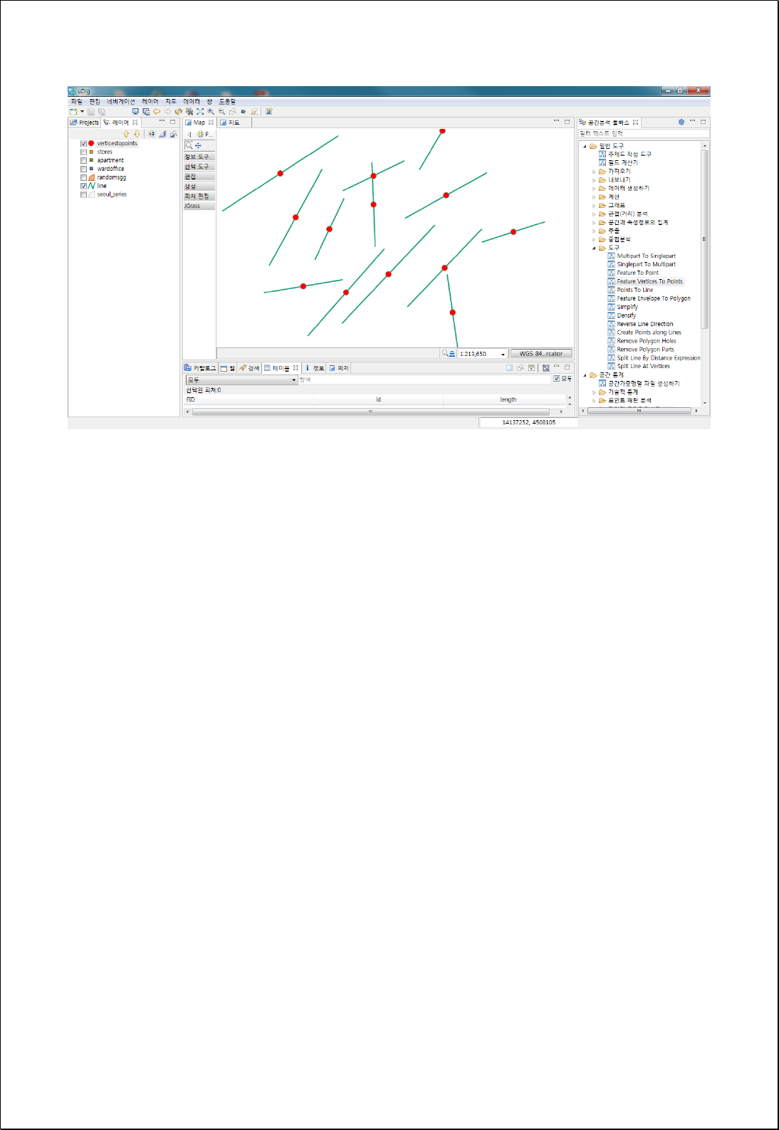
4.2.9.13.
Repair Geometry
Modifies the errors after validating the geometry of each feature in the feature layers
(inputFeatures).
Syntax
RepairGeometry (inputFeatures SimpleFeatureCollection): SimpleFeatureCollection
Parameters
Data Inputs
Identifier
Description
Type
Required
inputFeatures
Input features that will be repaired.
Complex
Process Outputs
Identifier
Description
Type
Required
result
Output features.
Complex
Constraints
- Checks null geometry and self-intersection
- Validates coordinates
- Removes empty shell/holes and duplicated vertices/points
Request Examples
<?xml version="1.0" encoding="UTF-8"?><wps:Execute version="1.0.0" service="WPS"
xmlns:xsi="http://www.w3.org/2001/XMLSchema-instance" xmlns="http://www.opengis.net/wps/1.0.0"
xmlns:wfs="http://www.opengis.net/wfs" xmlns:wps="http://www.opengis.net/wps/1.0.0"
xmlns:ows="http://www.opengis.net/ows/1.1" xmlns:gml="http://www.opengis.net/gml"
xmlns:ogc="http://www.opengis.net/ogc" xmlns:wcs="http://www.opengis.net/wcs/1.1.1"
xmlns:xlink="http://www.w3.org/1999/xlink" xsi:schemaLocation="http://www.opengis.net/wps/1.0.0
http://schemas.opengis.net/wps/1.0.0/wpsAll.xsd">
<ows:Identifier>statistics:RepairGeometry</ows:Identifier>
<wps:DataInputs>
<wps:Input>
<ows:Identifier>inputFeatures</ows:Identifier>

<wps:Reference mimeType="text/xml" xlink:href="http://geoserver/wfs" method="POST">
<wps:Body>
<wfs:GetFeature service="WFS" version="1.0.0" outputFormat="GML2"
xmlns:foss="http://www.opengeospatial.net/foss">
<wfs:Query typeName="foss:seoul_series"/>
</wfs:GetFeature>
</wps:Body>
</wps:Reference>
</wps:Input>
</wps:DataInputs>
<wps:ResponseForm>
<wps:RawDataOutput mimeType="text/xml; subtype=wfs-collection/1.0">
<ows:Identifier>result</ows:Identifier>
</wps:RawDataOutput>
</wps:ResponseForm>
</wps:Execute>
Response
- None

4.2.9.14.
Create Points along Line
Creating point feature layers with a constant distance (distance) as interval using
polygon or line data (lineFeatures).
Syntax
PointsAlongLines (SimpleFeatureCollection lineFeatures, Expression distance):
SimpleFeatureCollection
Parameters
Data Inputs
Identifier
Description
Type
Required
lineFeatures
The line or polygon features to be converted into
points.
Complex
distance
Field or Expression representing distance.
Literal
Process Outputs
Identifier
Description
Type
Required
result
Output point features.
Complex
Constraints
- The inputFeatures parameter must be line or polygon layers.
- The distance parameter can use the fields or the Function Expression formula.
Request Examples
<?xml version="1.0" encoding="utf-8"?>
<wps:Execute version="1.0.0" service="WPS" xmlns:xsi="http://www.w3.org/2001/XMLSchema-instance"
xmlns="http://www.opengis.net/wps/1.0.0" xmlns:wfs="http://www.opengis.net/wfs"
xmlns:wps="http://www.opengis.net/wps/1.0.0" xmlns:ows="http://www.opengis.net/ows/1.1"
xmlns:gml="http://www.opengis.net/gml" xmlns:ogc="http://www.opengis.net/ogc"
xmlns:wcs="http://www.opengis.net/wcs/1.1.1" xmlns:xlink="http://www.w3.org/1999/xlink"
xsi:schemaLocation="http://www.opengis.net/wps/1.0.0 http://schemas.opengis.net/wps/1.0.0/wpsAll.xsd">
<ows:Identifier>statistics:PointsAlongLines</ows:Identifier>
<wps:DataInputs>
<wps:Input>
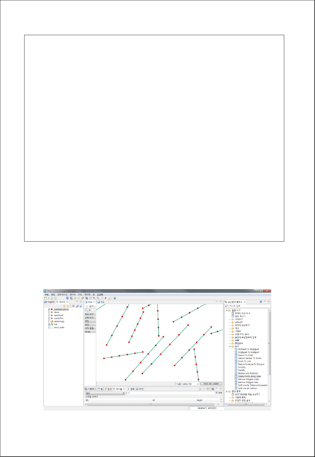
<ows:Identifier>lineFeatures</ows:Identifier>
<wps:Reference mimeType="text/xml" xlink:href="http://geoserver/wfs" method="POST">
<wps:Body>
<wfs:GetFeature service="WFS" version="1.0.0" outputFormat="GML2"
xmlns:foss="http://www.opengeospatial.net/foss">
<wfs:Query typeName="foss:line" />
</wfs:GetFeature>
</wps:Body>
</wps:Reference>
</wps:Input>
<wps:Input>
<ows:Identifier>distance</ows:Identifier>
<wps:Data>
<wps:LiteralData>geomLength( [geom] ) / 5</wps:LiteralData>
</wps:Data>
</wps:Input>
</wps:DataInputs>
<wps:ResponseForm>
<wps:RawDataOutput mimeType="text/xml; subtype=wfs-collection/1.1">
<ows:Identifier>result</ows:Identifier>
</wps:RawDataOutput>
</wps:ResponseForm>
</wps:Execute>
Response
The following figure shows the result of creating points at 1/5 of the line length.

4.2.9.15.
Split Line at Point
Splits the line feature layers (lineFeatures) into point feature layers (pointFeatures).
Syntax
SplitLineAtPoint (SimpleFeatureCollection lineFeatures, SimpleFeatureCollection
pointFeatures, Double tolerance): SimpleFeatureCollection
Parameters
Data Inputs
Identifier
Description
Type
Required
lineFeatures
The line features to be splitted.
Complex
pointFeatures
The point features whose locations will be used to
split the line features.
Complex
tolerance
Search radius. If tolerance is 0, the nearest point will
be used to split the line feature.
Literal
-
Process Outputs
Identifier
Description
Type
Required
result
Output line features.
Complex
Constraints
- The inputFeatures parameter must be line feature types.
- If the tolerance parameter is 0, all points that intersect with each line feature are
used; if there are no intersecting point features, the closest point feature is used for
line splitting.
- If the tolerance parameter is greater than or equal to 0, all point features within the
search radius are used for partitioning.
Request Examples
<?xml version="1.0" encoding="UTF-8"?><wps:Execute version="1.0.0" service="WPS"
xmlns:xsi="http://www.w3.org/2001/XMLSchema-instance" xmlns="http://www.opengis.net/wps/1.0.0"
xmlns:wfs="http://www.opengis.net/wfs" xmlns:wps="http://www.opengis.net/wps/1.0.0"

xmlns:ows="http://www.opengis.net/ows/1.1" xmlns:gml="http://www.opengis.net/gml"
xmlns:ogc="http://www.opengis.net/ogc" xmlns:wcs="http://www.opengis.net/wcs/1.1.1"
xmlns:xlink="http://www.w3.org/1999/xlink" xsi:schemaLocation="http://www.opengis.net/wps/1.0.0
http://schemas.opengis.net/wps/1.0.0/wpsAll.xsd">
<ows:Identifier>statistics:SplitLineAtPoint</ows:Identifier>
<wps:DataInputs>
<wps:Input>
<ows:Identifier>lineFeatures</ows:Identifier>
<wps:Reference mimeType="text/xml" xlink:href="http://geoserver/wfs" method="POST">
<wps:Body>
<wfs:GetFeature service="WFS" version="1.0.0" outputFormat="GML2"
xmlns:foss="http://www.opengeospatial.net/foss">
<wfs:Query typeName="foss:line"/>
</wfs:GetFeature>
</wps:Body>
</wps:Reference>
</wps:Input>
<wps:Input>
<ows:Identifier>pointFeatures</ows:Identifier>
<wps:Reference mimeType="text/xml" xlink:href="http://geoserver/wfs" method="POST">
<wps:Body>
<wfs:GetFeature service="WFS" version="1.0.0" outputFormat="GML2"
xmlns:foss="http://www.opengeospatial.net/foss">
<wfs:Query typeName="foss:stores"/>
</wfs:GetFeature>
</wps:Body>
</wps:Reference>
</wps:Input>
<wps:Input>
<ows:Identifier>tolerance</ows:Identifier>
<wps:Data>
<wps:LiteralData>50</wps:LiteralData>
</wps:Data>
</wps:Input>
</wps:DataInputs>
<wps:ResponseForm>
<wps:RawDataOutput mimeType="text/xml; subtype=wfs-collection/1.0">
<ows:Identifier>result</ows:Identifier>
</wps:RawDataOutput>
</wps:ResponseForm>
</wps:Execute>
Response
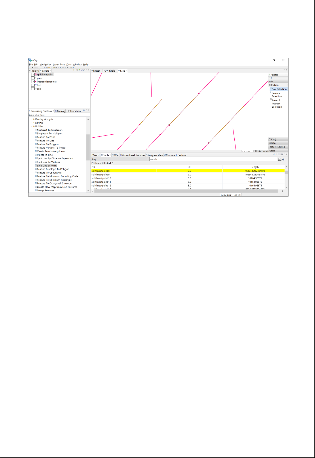
The following figure shows the result of splitting the line layers into point layers.

4.2.9.16.
Split Line at Vertices
Creates line feature layers (lineFeatures) divided by vertices.
Syntax
SplitLineAtVertices (SimpleFeatureCollection lineFeatures): SimpleFeatureCollection
Parameters
Data Inputs
Identifier
Description
Type
Required
lineFeatures
The line or polygon features that will be splitted.
Complex
Process Outputs
Identifier
Description
Type
Required
result
Output line features.
Complex
Constraints
- The inputFeatures parameter must be line or polygon layer types.
Request Examples
<?xml version="1.0" encoding="utf-8"?>
<wps:Execute version="1.0.0" service="WPS" xmlns:xsi="http://www.w3.org/2001/XMLSchema-instance"
xmlns="http://www.opengis.net/wps/1.0.0" xmlns:wfs="http://www.opengis.net/wfs"
xmlns:wps="http://www.opengis.net/wps/1.0.0" xmlns:ows="http://www.opengis.net/ows/1.1"
xmlns:gml="http://www.opengis.net/gml" xmlns:ogc="http://www.opengis.net/ogc"
xmlns:wcs="http://www.opengis.net/wcs/1.1.1" xmlns:xlink="http://www.w3.org/1999/xlink"
xsi:schemaLocation="http://www.opengis.net/wps/1.0.0 http://schemas.opengis.net/wps/1.0.0/wpsAll.xsd">
<ows:Identifier>statistics:SplitLineAtVertices</ows:Identifier>
<wps:DataInputs>
<wps:Input>
<ows:Identifier>lineFeatures</ows:Identifier>
<wps:Reference mimeType="text/xml" xlink:href="http://geoserver/wfs" method="POST">
<wps:Body>
<wfs:GetFeature service="WFS" version="1.0.0" outputFormat="GML2"
xmlns:foss="http://www.opengeospatial.net/foss">
<wfs:Query typeName="foss:randomsgg" />
</wfs:GetFeature>
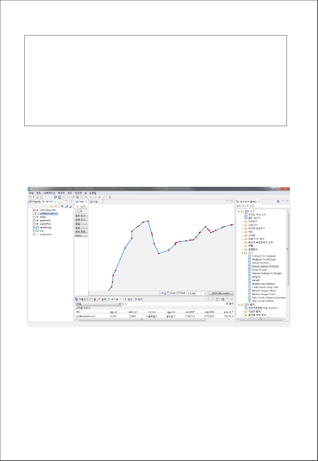
</wps:Body>
</wps:Reference>
</wps:Input>
</wps:DataInputs>
<wps:ResponseForm>
<wps:RawDataOutput mimeType="text/xml; subtype=wfs-collection/1.1">
<ows:Identifier>result</ows:Identifier>
</wps:RawDataOutput>
</wps:ResponseForm>
</wps:Execute>
Response
The following figure showsthe result of converting the boundary of polygon features to
the line feature vertex by vertex.

4.2.9.17.
Split Line by Distance Expression
Creates line feature layers (lineFeatures) divided by the set distance (distance).
Syntax
SplitLineByDistance (SimpleFeatureCollection lineFeatures, Expression distance):
SimpleFeatureCollection
Parameters
Data Inputs
Identifier
Description
Type
Required
lineFeatures
The line features that will be splitted.
Complex
distance
Field or Expression representing distance.
Literal
Process Outputs
Identifier
Description
Type
Required
result
Output line features.
Complex
Constraints
- The inputFeatures parameter must be line or polygon layer types.
- The distance parameter can use the fields or function expression formula.
Request Examples
<?xml version="1.0" encoding="utf-8"?>
<wps:Execute version="1.0.0" service="WPS" xmlns:xsi="http://www.w3.org/2001/XMLSchema-instance"
xmlns="http://www.opengis.net/wps/1.0.0" xmlns:wfs="http://www.opengis.net/wfs"
xmlns:wps="http://www.opengis.net/wps/1.0.0" xmlns:ows="http://www.opengis.net/ows/1.1"
xmlns:gml="http://www.opengis.net/gml" xmlns:ogc="http://www.opengis.net/ogc"
xmlns:wcs="http://www.opengis.net/wcs/1.1.1" xmlns:xlink="http://www.w3.org/1999/xlink"
xsi:schemaLocation="http://www.opengis.net/wps/1.0.0 http://schemas.opengis.net/wps/1.0.0/wpsAll.xsd">
<ows:Identifier>statistics:SplitLineByDistance</ows:Identifier>
<wps:DataInputs>
<wps:Input>
<ows:Identifier>lineFeatures</ows:Identifier>
<wps:Reference mimeType="text/xml" xlink:href="http://geoserver/wfs" method="POST">
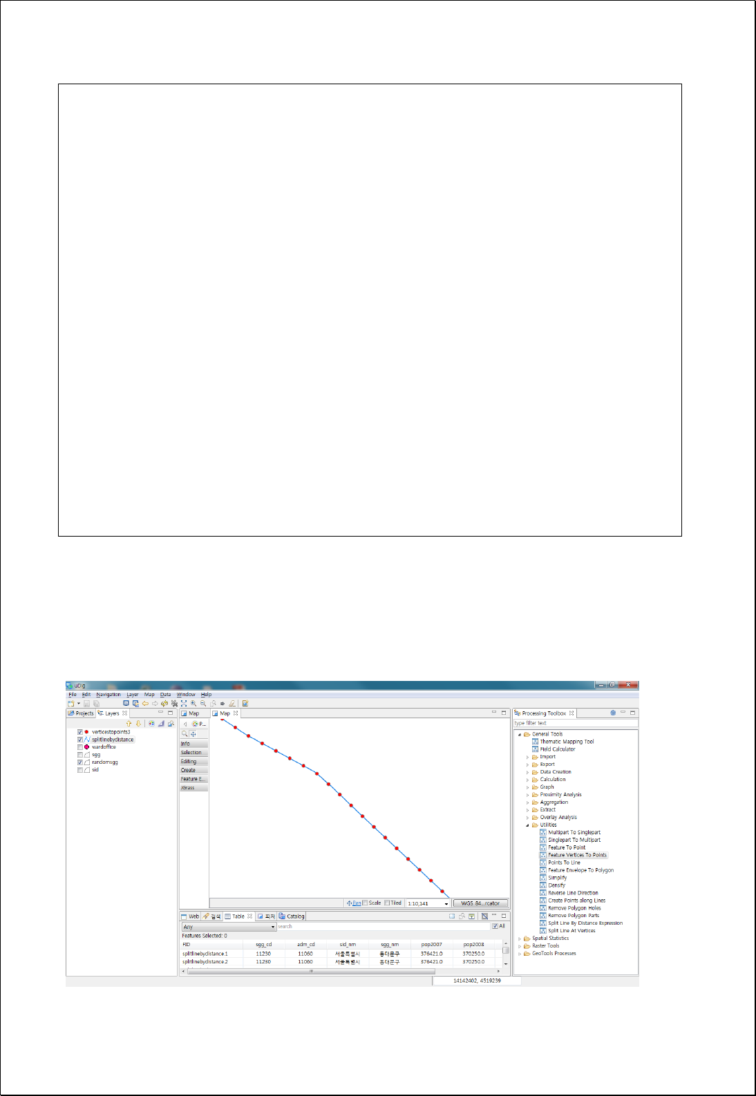
<wps:Body>
<wfs:GetFeature service="WFS" version="1.0.0" outputFormat="GML2"
xmlns:foss="http://www.opengeospatial.net/foss">
<wfs:Query typeName="foss:randomsgg" />
</wfs:GetFeature>
</wps:Body>
</wps:Reference>
</wps:Input>
<wps:Input>
<ows:Identifier>distance</ows:Identifier>
<wps:Data>
<wps:LiteralData>100</wps:LiteralData>
</wps:Data>
</wps:Input>
</wps:DataInputs>
<wps:ResponseForm>
<wps:RawDataOutput mimeType="text/xml; subtype=wfs-collection/1.1">
<ows:Identifier>result</ows:Identifier>
</wps:RawDataOutput>
</wps:ResponseForm>
</wps:Execute>
Response
The following figure showsthe result of dividing boundaries of polygon features into lines
with an interval of 100 meters.

4.2.9.18.
Intersection Points from Lines
Converts the nodes (intersectFeatures) where each line intersects in the two input
polygon or line feature layers (inputFeatures) to points.
Syntax
IntersectionPoints (SimpleFeatureCollection inputFeatures, SimpleFeatureCollection
intersectFeatures, String intersectIDField): SimpleFeatureCollection
Parameters
Data Inputs
Identifier
Description
Type
Required
inputFeatures
Input features that can be line or polygon type.
Complex
intersectFeatures
Intersect that can be line or polygon type.
Complex
intersectIDField
Intersect id field.
Literal
-
Process Outputs
Identifier
Description
Type
Required
result
Output features.
Complex
Constraints
- InputFeatures and intersectFeatures feature layers can be set both line and
polygon.
- The output layers contain all field values of inputFeatures. If intersectIDField is set,
adds the value of intersectFearures.
Request Examples
<?xml version="1.0" encoding="UTF-8"?><wps:Execute version="1.0.0" service="WPS"
xmlns:xsi="http://www.w3.org/2001/XMLSchema-instance" xmlns="http://www.opengis.net/wps/1.0.0"
xmlns:wfs="http://www.opengis.net/wfs" xmlns:wps="http://www.opengis.net/wps/1.0.0"
xmlns:ows="http://www.opengis.net/ows/1.1" xmlns:gml="http://www.opengis.net/gml"
xmlns:ogc="http://www.opengis.net/ogc" xmlns:wcs="http://www.opengis.net/wcs/1.1.1"
xmlns:xlink="http://www.w3.org/1999/xlink" xsi:schemaLocation="http://www.opengis.net/wps/1.0.0
http://schemas.opengis.net/wps/1.0.0/wpsAll.xsd">

<ows:Identifier>statistics:IntersectionPoints</ows:Identifier>
<wps:DataInputs>
<wps:Input>
<ows:Identifier>inputFeatures</ows:Identifier>
<wps:Reference mimeType="text/xml" xlink:href="http://geoserver/wfs" method="POST">
<wps:Body>
<wfs:GetFeature service="WFS" version="1.0.0" outputFormat="GML2"
xmlns:foss="http://www.opengeospatial.net/foss">
<wfs:Query typeName="foss:randomsgg"/>
</wfs:GetFeature>
</wps:Body>
</wps:Reference>
</wps:Input>
<wps:Input>
<ows:Identifier>intersectFeatures</ows:Identifier>
<wps:Reference mimeType="text/xml" xlink:href="http://geoserver/wfs" method="POST">
<wps:Body>
<wfs:GetFeature service="WFS" version="1.0.0" outputFormat="GML2"
xmlns:foss="http://www.opengeospatial.net/foss">
<wfs:Query typeName="foss:line"/>
</wfs:GetFeature>
</wps:Body>
</wps:Reference>
</wps:Input>
</wps:DataInputs>
<wps:ResponseForm>
<wps:RawDataOutput mimeType="text/xml; subtype=wfs-collection/1.0">
<ows:Identifier>result</ows:Identifier>
</wps:RawDataOutput>
</wps:ResponseForm>
</wps:Execute>
Response
The following figure showsthe result of analysis between polygon and line feature layers.
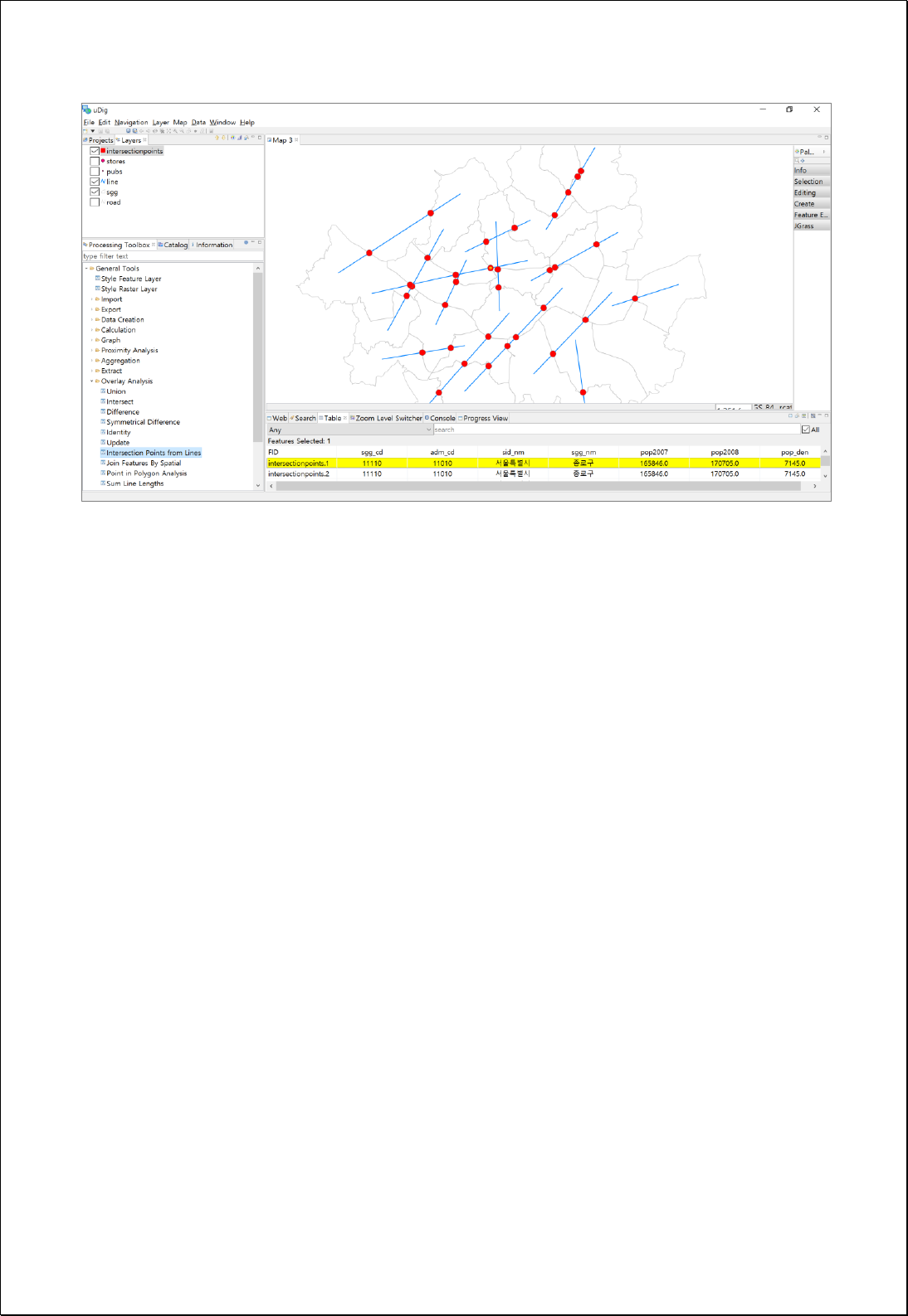

4.2.9.19.
Create Flow Map from Line Features
Creates Polygon Flow Map feature layers using line feature layers (lineFeatures)
consisting of Origin-Destination and attribute values (odValue, doValue) of it.
Syntax
FlowMap (SimpleFeatureCollection lineFeatures, Expression odValue, Expression doValue,
Double maxSize): SimpleFeatureCollection
Parameters
Data Inputs
Identifier
Description
Type
Required
lineFeatures
The input line features.
Complex
odValue
The o-d value expression.
Ex) [field] or [field] * 0.5 etc...
Literal
doValue
The d-o value expression.
Ex) [field] or [field] * 0.5 etc...
Literal
-
maxSize
The maximum arrow size.
Literal
-
Process Outputs
Identifier
Description
Type
Required
result
Output polygon features.
Complex
Constraints
- The lineFeatures parameter must be line layers.
- If the maxSize parameter is Null or 0, uses the value of dividing the smaller one
between the width and height of the extents of the lineFeatures by 20.
Request Examples
<?xml version="1.0" encoding="UTF-8"?>
<wps:Execute version="1.0.0" service="WPS" xmlns:xsi="http://www.w3.org/2001/XMLSchema-instance"
xmlns="http://www.opengis.net/wps/1.0.0" xmlns:wfs="http://www.opengis.net/wfs"
xmlns:wps="http://www.opengis.net/wps/1.0.0" xmlns:ows="http://www.opengis.net/ows/1.1"
xmlns:gml="http://www.opengis.net/gml" xmlns:ogc="http://www.opengis.net/ogc"

xmlns:wcs="http://www.opengis.net/wcs/1.1.1" xmlns:xlink="http://www.w3.org/1999/xlink"
xsi:schemaLocation="http://www.opengis.net/wps/1.0.0 http://schemas.opengis.net/wps/1.0.0/wpsAll.xsd">
<ows:Identifier>statistics:FlowMap</ows:Identifier>
<wps:DataInputs>
<wps:Input>
<ows:Identifier>lineFeatures</ows:Identifier>
<wps:Reference mimeType="text/xml" xlink:href="http://geoserver/wfs" method="POST">
<wps:Body>
<wfs:GetFeature service="WFS" version="1.0.0" outputFormat="GML2"
xmlns:foss="http://www.opengeospatial.net/foss">
<wfs:Query typeName="foss:od_flow"/>
</wfs:GetFeature>
</wps:Body>
</wps:Reference>
</wps:Input>
<wps:Input>
<ows:Identifier>odValue</ows:Identifier>
<wps:Data>
<wps:LiteralData>o_d</wps:LiteralData>
</wps:Data>
</wps:Input>
<wps:Input>
<ows:Identifier>maxSize</ows:Identifier>
<wps:Data>
<wps:LiteralData>2500</wps:LiteralData>
</wps:Data>
</wps:Input>
</wps:DataInputs>
<wps:ResponseForm>
<wps:RawDataOutput mimeType="text/xml; subtype=wfs-collection/1.0">
<ows:Identifier>result</ows:Identifier>
</wps:RawDataOutput>
</wps:ResponseForm>
</wps:Execute>
Response
The following figure shows the result of generating the Flow Map using the population
moving data of Seoul Gu-administrative district.
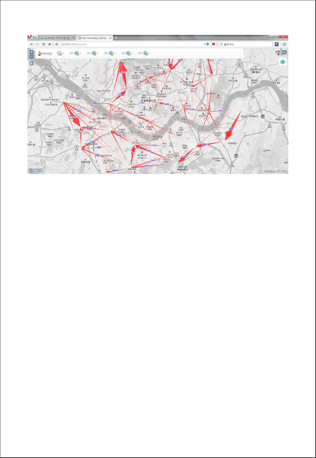

4.2.9.20.
Feature To Octagonal Envelope
Converts each feature into the minimum bounding octagonal polygon that surrounds
each feature in the feature layers (inputFeatures).
Syntax
FeatureToOctagonalEnvelope (SimpleFeatureCollection inputFeatures, Boolean singlePart):
SimpleFeatureCollection
Parameters
Data Inputs
Identifier
Description
Type
Required
inputFeatures
The input features that can be multipoint, line,
polygon.
Complex
singlePart
Specifies whether to use one circle for each entire
multipart feature or one circle per part of a multipart
feature.
Literal
-
Process Outputs
Identifier
Description
Type
Required
result
Output features.
Complex
Constraints
- The inputFeatures can be points, lines, and polygons.
- If singlePart is set to True and the geometry is MultiPart, converts the geometry of
all parts.
Request Examples
<?xml version="1.0" encoding="UTF-8"?><wps:Execute version="1.0.0" service="WPS"
xmlns:xsi="http://www.w3.org/2001/XMLSchema-instance" xmlns="http://www.opengis.net/wps/1.0.0"
xmlns:wfs="http://www.opengis.net/wfs" xmlns:wps="http://www.opengis.net/wps/1.0.0"
xmlns:ows="http://www.opengis.net/ows/1.1" xmlns:gml="http://www.opengis.net/gml"
xmlns:ogc="http://www.opengis.net/ogc" xmlns:wcs="http://www.opengis.net/wcs/1.1.1"
xmlns:xlink="http://www.w3.org/1999/xlink" xsi:schemaLocation="http://www.opengis.net/wps/1.0.0
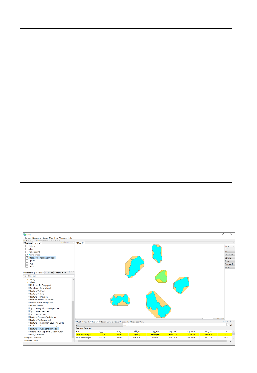
http://schemas.opengis.net/wps/1.0.0/wpsAll.xsd">
<ows:Identifier>statistics: FeatureToOctagonalEnvelope</ows:Identifier>
<wps:DataInputs>
<wps:Input>
<ows:Identifier>inputFeatures</ows:Identifier>
<wps:Reference mimeType="text/xml" xlink:href="http://geoserver/wfs" method="POST">
<wps:Body>
<wfs:GetFeature service="WFS" version="1.0.0" outputFormat="GML2"
xmlns:foss="http://www.opengeospatial.net/foss">
<wfs:Query typeName="foss:sgg"/>
</wfs:GetFeature>
</wps:Body>
</wps:Reference>
</wps:Input>
</wps:DataInputs>
<wps:ResponseForm>
<wps:RawDataOutput mimeType="text/xml; subtype=wfs-collection/1.0">
<ows:Identifier>result</ows:Identifier>
</wps:RawDataOutput>
</wps:ResponseForm>
</wps:Execute>
Response
The following figure shows the result of converting the polygon features to the minimum
bounding octagonal polygons.

4.2.9.21.
Feature To Minimum Rectangle
Converts each feature into the minimum bounding rectangle polygon that surrounds
each feature in the feature layers (inputFeatures).
Syntax
FeatureToMinimumRectangle (SimpleFeatureCollection inputFeatures, Boolean singlePart):
SimpleFeatureCollection
Parameters
Data Inputs
Identifier
Description
Type
Required
inputFeatures
The input features that can be multipoint, line,
polygon.
Complex
singlePart
Specifies whether to use one circle for each entire
multipart feature or one circle per part of a multipart
feature.
Literal
-
Process Outputs
Identifier
Description
Type
Required
result
Output features.
Complex
Constraints
- The inputFeatures can be points, lines, and polygons.
- If singlePart is set to True and the geometry is MultiPart, converts the geometry of
all parts.
Request Examples
<?xml version="1.0" encoding="UTF-8"?><wps:Execute version="1.0.0" service="WPS"
xmlns:xsi="http://www.w3.org/2001/XMLSchema-instance" xmlns="http://www.opengis.net/wps/1.0.0"
xmlns:wfs="http://www.opengis.net/wfs" xmlns:wps="http://www.opengis.net/wps/1.0.0"
xmlns:ows="http://www.opengis.net/ows/1.1" xmlns:gml="http://www.opengis.net/gml"
xmlns:ogc="http://www.opengis.net/ogc" xmlns:wcs="http://www.opengis.net/wcs/1.1.1"
xmlns:xlink="http://www.w3.org/1999/xlink" xsi:schemaLocation="http://www.opengis.net/wps/1.0.0
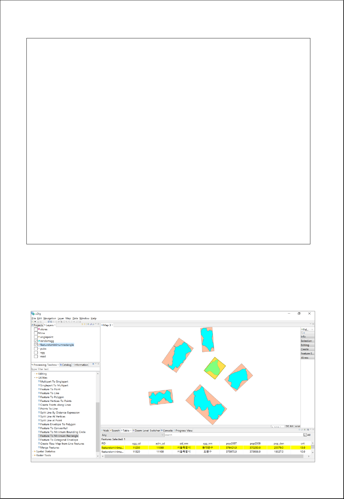
http://schemas.opengis.net/wps/1.0.0/wpsAll.xsd">
<ows:Identifier>statistics: FeatureToMinimumRectangle</ows:Identifier>
<wps:DataInputs>
<wps:Input>
<ows:Identifier>inputFeatures</ows:Identifier>
<wps:Reference mimeType="text/xml" xlink:href="http://geoserver/wfs" method="POST">
<wps:Body>
<wfs:GetFeature service="WFS" version="1.0.0" outputFormat="GML2"
xmlns:foss="http://www.opengeospatial.net/foss">
<wfs:Query typeName="foss:sgg"/>
</wfs:GetFeature>
</wps:Body>
</wps:Reference>
</wps:Input>
</wps:DataInputs>
<wps:ResponseForm>
<wps:RawDataOutput mimeType="text/xml; subtype=wfs-collection/1.0">
<ows:Identifier>result</ows:Identifier>
</wps:RawDataOutput>
</wps:ResponseForm>
</wps:Execute>
Response
The following figure shows the result of converting the polygon features to the minimum
bounding rectangles.

4.2.9.22.
Feature To ConvexHull
Converts each feature into a convex hull polygon that surrounds the featurein the feature
layers (inputFeatures).
Syntax
FeatureToConvexHull (SimpleFeatureCollection inputFeatures, Boolean singlePart):
SimpleFeatureCollection
Parameters
Data Inputs
Identifier
Description
Type
Required
inputFeatures
The input features that can be multipoint, line,
polygon.
Complex
singlePart
Specifies whether to use one circle for each entire
multipart feature or one circle per part of a multipart
feature.
Literal
-
Process Outputs
Identifier
Description
Type
Required
result
Output features.
Complex
Constraints
- The inputFeatures can be points, lines, and polygons.
- If singlePart is set to True and the geometry is MultiPart, converts the geometry of
all parts.
Request Examples
<?xml version="1.0" encoding="UTF-8"?><wps:Execute version="1.0.0" service="WPS"
xmlns:xsi="http://www.w3.org/2001/XMLSchema-instance" xmlns="http://www.opengis.net/wps/1.0.0"
xmlns:wfs="http://www.opengis.net/wfs" xmlns:wps="http://www.opengis.net/wps/1.0.0"
xmlns:ows="http://www.opengis.net/ows/1.1" xmlns:gml="http://www.opengis.net/gml"
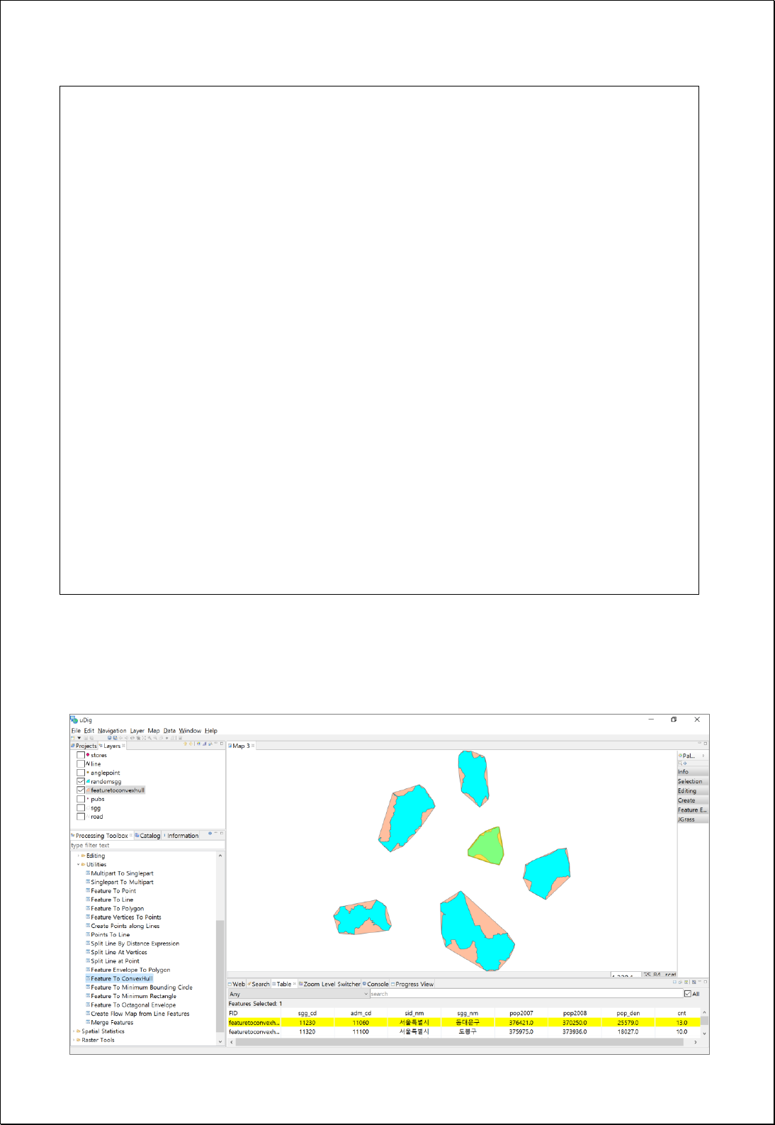
xmlns:ogc="http://www.opengis.net/ogc" xmlns:wcs="http://www.opengis.net/wcs/1.1.1"
xmlns:xlink="http://www.w3.org/1999/xlink" xsi:schemaLocation="http://www.opengis.net/wps/1.0.0
http://schemas.opengis.net/wps/1.0.0/wpsAll.xsd">
<ows:Identifier>statistics: FeatureToConvexHull</ows:Identifier>
<wps:DataInputs>
<wps:Input>
<ows:Identifier>inputFeatures</ows:Identifier>
<wps:Reference mimeType="text/xml" xlink:href="http://geoserver/wfs" method="POST">
<wps:Body>
<wfs:GetFeature service="WFS" version="1.0.0" outputFormat="GML2"
xmlns:foss="http://www.opengeospatial.net/foss">
<wfs:Query typeName="foss:sgg"/>
</wfs:GetFeature>
</wps:Body>
</wps:Reference>
</wps:Input>
</wps:DataInputs>
<wps:ResponseForm>
<wps:RawDataOutput mimeType="text/xml; subtype=wfs-collection/1.0">
<ows:Identifier>result</ows:Identifier>
</wps:RawDataOutput>
</wps:ResponseForm>
</wps:Execute>
Response
The following figure showsthe result of converting the polygon features to ConvexHull.

4.2.9.23.
Feature To Minimum Bounding Circle
Converts each feature into the minimum bounding circle that surrounds each feature in
the feature layers (inputFeatures).
Syntax
FeatureToMinimumBoundingCircle (SimpleFeatureCollection inputFeatures, Boolean
singlePart): SimpleFeatureCollection
Parameters
Data Inputs
Identifier
Description
Type
Required
inputFeatures
The input features that can be multipoint, line,
polygon.
Complex
singlePart
Specifies whether to use one circle for each entire
multipart feature or one circle per part of a multipart
feature.
Literal
-
Process Outputs
Identifier
Description
Type
Required
result
Output features.
Complex
Constraints
- The inputFeatures can be points, lines, and polygons.
- If singlePart is set to True and the geometry is MultiPart, converts the geometry of
all parts.
Request Examples
<?xml version="1.0" encoding="UTF-8"?><wps:Execute version="1.0.0" service="WPS"
xmlns:xsi="http://www.w3.org/2001/XMLSchema-instance" xmlns="http://www.opengis.net/wps/1.0.0"
xmlns:wfs="http://www.opengis.net/wfs" xmlns:wps="http://www.opengis.net/wps/1.0.0"
xmlns:ows="http://www.opengis.net/ows/1.1" xmlns:gml="http://www.opengis.net/gml"
xmlns:ogc="http://www.opengis.net/ogc" xmlns:wcs="http://www.opengis.net/wcs/1.1.1"
xmlns:xlink="http://www.w3.org/1999/xlink" xsi:schemaLocation="http://www.opengis.net/wps/1.0.0
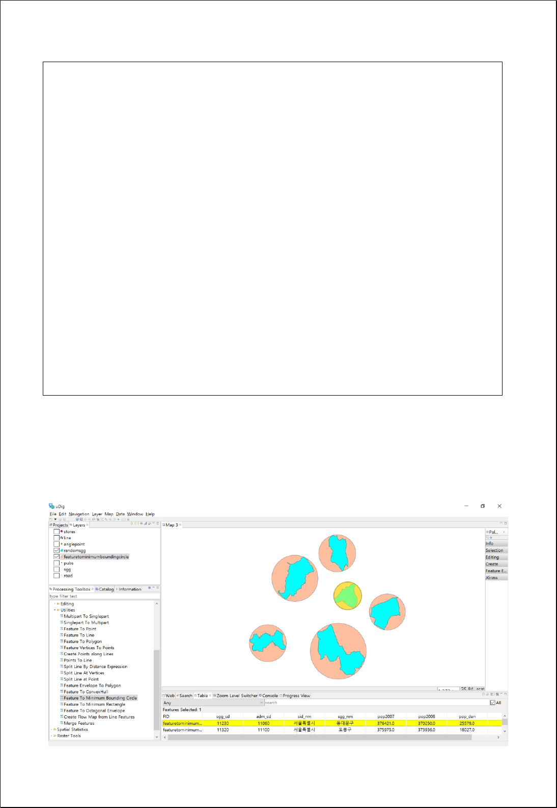
http://schemas.opengis.net/wps/1.0.0/wpsAll.xsd">
<ows:Identifier>statistics:FeatureToMinimumBoundingCircle</ows:Identifier>
<wps:DataInputs>
<wps:Input>
<ows:Identifier>inputFeatures</ows:Identifier>
<wps:Reference mimeType="text/xml" xlink:href="http://geoserver/wfs" method="POST">
<wps:Body>
<wfs:GetFeature service="WFS" version="1.0.0" outputFormat="GML2"
xmlns:foss="http://www.opengeospatial.net/foss">
<wfs:Query typeName="foss:sgg"/>
</wfs:GetFeature>
</wps:Body>
</wps:Reference>
</wps:Input>
</wps:DataInputs>
<wps:ResponseForm>
<wps:RawDataOutput mimeType="text/xml; subtype=wfs-collection/1.0">
<ows:Identifier>result</ows:Identifier>
</wps:RawDataOutput>
</wps:ResponseForm>
</wps:Execute>
Response
The following figure showsthe result of converting the polygon features to the minimum
bounding circles.

4.3. Raster Analysis
These process groups are associated with raster analysis and processing.
4.3.1. Descriptive
These processes are for calculating the basic statistics for raster's property values.
4.3.1.1.
Basic Statistics
Sets raster layers and specific areas to analyze basic statistics (Sum, Minimum, Maximum,
Mean, Standard Deviation, etc.) for raster cell values contained in the area.
Syntax
StatisticsGridCoverage (GridCoverage2D inputCoverage, Geometry cropShape, Integer
bandIndex): DataStatisticsResult
Parameters
Data Inputs
Identifier
Description
Type
Required
inputCoverage
The input gridcoverage to be calculated.
Complex
cropShape
The Polygon or MultiPolygon to crop gridcoverage.
Complex
-
bandIndex
The zero-based band index, default index is a 0.
Literal
-
Process Outputs
Identifier
Description
Type
Required
result
Result Statistics.
Complex
Constraints
- If cropShape is set to Null, creates statistics for all cells in the input raster.
- The geometry type of cropShape must be Polygon or MultiPolygon.
- The bandIndex is zero-base and 0 is default value.
- Output is returned in XML format.

Request Examples
<?xml version="1.0" encoding="UTF-8"?><wps:Execute version="1.0.0" service="WPS"
xmlns:xsi="http://www.w3.org/2001/XMLSchema-instance" xmlns="http://www.opengis.net/wps/1.0.0"
xmlns:wfs="http://www.opengis.net/wfs" xmlns:wps="http://www.opengis.net/wps/1.0.0"
xmlns:ows="http://www.opengis.net/ows/1.1" xmlns:gml="http://www.opengis.net/gml"
xmlns:ogc="http://www.opengis.net/ogc" xmlns:wcs="http://www.opengis.net/wcs/1.1.1"
xmlns:xlink="http://www.w3.org/1999/xlink" xsi:schemaLocation="http://www.opengis.net/wps/1.0.0
http://schemas.opengis.net/wps/1.0.0/wpsAll.xsd">
<ows:Identifier>statistics:StatisticsGridCoverage</ows:Identifier>
<wps:DataInputs>
<wps:Input>
<ows:Identifier>inputCoverage</ows:Identifier>
<wps:Reference mimeType="image/tiff" xlink:href="http://geoserver/wcs" method="POST">
<wps:Body>
<wcs:GetCoverage service="WCS" version="1.1.1">
<ows:Identifier>foss:seoul_dem30</ows:Identifier>
<wcs:DomainSubset>
<gml:BoundingBox crs="http://www.opengis.net/gml/srs/epsg.xml#5181">
<ows:LowerCorner>179171.39881047895 436569.3290600816</ows:LowerCorner>
<ows:UpperCorner>216221.0981287582 466869.08315843146</ows:UpperCorner>
</gml:BoundingBox>
</wcs:DomainSubset>
<wcs:Output format="image/tiff"/>
</wcs:GetCoverage>
</wps:Body>
</wps:Reference>
</wps:Input>
<wps:Input>
<ows:Identifier>cropShape</ows:Identifier>
<wps:Data>
<wps:ComplexData mimeType="application/wkt"><![CDATA[POLYGON
((……………………………………))]]></wps:ComplexData>
</wps:Data>
</wps:Input>
</wps:DataInputs>
<wps:ResponseForm>
<wps:RawDataOutput mimeType="text/xml">
<ows:Identifier>result</ows:Identifier>
</wps:RawDataOutput>
</wps:ResponseForm>
</wps:Execute>

Response
<?xml version="1.0" encoding="utf-8"?>
<DataStatistics>
<Item>
<TypeName>dem</TypeName>
<PropertyName>Value</PropertyName>
<Count>678064</Count>
<InvalidCount>0</InvalidCount>
<Minimum>1.0</Minimum>
<Maximum>754.0</Maximum>
<Range>753.0</Range>
<Ranges>1.0 - 754.0</Ranges>
<Sum>4.2785658E7</Sum>
<Mean>63.09973394841785</Mean>
<Variance>7285.154424054373</Variance>
<StandardDeviation>85.35311607700315</StandardDeviation>
<CoefficientOfVariance>1.3526699834705607</CoefficientOfVariance>
<NoData class="double">-9999</NoData>
</Item>
</DataStatistics>

4.3.1.2.
Histogram
Sets raster layers and specific regions to extract unique values and frequencies of raster
cells contained within the regions.
Syntax
HistogramGridCoverage (GridCoverage2D inputCoverage, Geometry cropShape, Integer
bandIndex): GridCoverage2D
Parameters
Data Inputs
Identifier
Description
Type
Required
inputCoverage
The input gridcoverage to be calculated.
Complex
cropShape
The Polygon or MultiPolygon to crop gridcoverage.
Complex
-
bandIndex
The zero-based band index, default index is a 0.
Literal
-
Process Outputs
Identifier
Description
Type
Required
result
Result Statistics.
Complex
Constraints
- The geometry type of cropShape must be Polygon or MultiPolygon tpye.
- The bandIndex is zero-base and 0 is the default value.
- Output is returned in XML format.
Request Examples
<?xml version="1.0" encoding="UTF-8"?><wps:Execute version="1.0.0" service="WPS"
xmlns:xsi="http://www.w3.org/2001/XMLSchema-instance" xmlns="http://www.opengis.net/wps/1.0.0"
xmlns:wfs="http://www.opengis.net/wfs" xmlns:wps="http://www.opengis.net/wps/1.0.0"
xmlns:ows="http://www.opengis.net/ows/1.1" xmlns:gml="http://www.opengis.net/gml"
xmlns:ogc="http://www.opengis.net/ogc" xmlns:wcs="http://www.opengis.net/wcs/1.1.1"
xmlns:xlink="http://www.w3.org/1999/xlink" xsi:schemaLocation="http://www.opengis.net/wps/1.0.0
http://schemas.opengis.net/wps/1.0.0/wpsAll.xsd">

<ows:Identifier>statistics:HistogramGridCoverage</ows:Identifier>
<wps:DataInputs>
<wps:Input>
<ows:Identifier>inputCoverage</ows:Identifier>
<wps:Reference mimeType="image/tiff" xlink:href="http://geoserver/wcs" method="POST">
<wps:Body>
<wcs:GetCoverage service="WCS" version="1.1.1">
<ows:Identifier>foss:landuse</ows:Identifier>
<wcs:DomainSubset>
<gml:BoundingBox crs="http://www.opengis.net/gml/srs/epsg.xml#5181">
<ows:LowerCorner>179171.39881047895 436569.3290600816</ows:LowerCorner>
<ows:UpperCorner>216221.0981287582 466869.08315843146</ows:UpperCorner>
</gml:BoundingBox>
</wcs:DomainSubset>
<wcs:Output format="image/tiff"/>
</wcs:GetCoverage>
</wps:Body>
</wps:Reference>
</wps:Input>
<wps:Input>
<ows:Identifier>cropShape</ows:Identifier>
<wps:Data>
<wps:ComplexData mimeType="application/wkt"><![CDATA[MULTIPOLYGON
(((202045.8134286803 451170.87479061395, 202045.8134286803 456372.83051287895,
206947.46547550958 456372.83051287895, 206947.46547550958 451170.87479061395,
202045.8134286803 451170.87479061395)))]]></wps:ComplexData>
</wps:Data>
</wps:Input>
</wps:DataInputs>
<wps:ResponseForm>
<wps:RawDataOutput mimeType="text/xml">
<ows:Identifier>result</ows:Identifier>
</wps:RawDataOutput>
</wps:ResponseForm>
</wps:Execute>
Response
The following figure shows the result of creating a statistic by clipping a specific area of
raster layers with the same grade in the Environmental Conservation Value Assessment
Map(ECVAM). Since the number of cells for each value is returned, multiplying by one
cell area (CellSize * CellSize) yields the area by grade.

<?xml version="1.0" encoding="utf-8"?>
<Histogram>
<TypeName>landuse</TypeName>
<PropertyName>Value</PropertyName>
<Area>25498176.913556</Area>
<CellSize>30.0</CellSize>
<HistogramItem>
<Value>1</Value>
<Frequency>876</Frequency>
</HistogramItem>
<HistogramItem>
<Value>2</Value>
<Frequency>543</Frequency>
</HistogramItem>
<HistogramItem>
<Value>3</Value>
<Frequency>292</Frequency>
</HistogramItem>
<HistogramItem>
<Value>4</Value>
<Frequency>1345</Frequency>
</HistogramItem>
<HistogramItem>
<Value>5</Value>
<Frequency>765</Frequency>
</HistogramItem>
</Histogram>

4.3.2. Conversion
These processes are for conversion between vector data and raster data.
4.3.2.1.
Features To Raster
Converts point, line, and polygon feature layers (inputFeatures) to raster.
Syntax
FeaturesToRaster (SimpleFeatureCollection inputFeatures, String inputField, Double
cellSize, ReferencedEnvelope extent): GridCoverage2D
Parameters
Data Inputs
Identifier
Description
Type
Required
inputFeatures
The input feature dataset to be converted to a
raster.
Complex
inputField
The field used to assign values to the output raster.
Literal
-
cellSize
The cell size for the output raster.
Literal
-
extent
The extent for the output raster.
Complex
-
Process Outputs
Identifier
Description
Type
Required
result
Output Raster.
Complex
Constraints
- The inputField parameter must be a numeric field or a constant value.
- Unless sets the extent parameter, uses the range of inputFeatures.
- Unless sets the cellSize parameter, the smaller one between width and height of the
extent is divided by 250.
Request Examples
<?xml version="1.0" encoding="UTF-8"?><wps:Execute version="1.0.0" service="WPS"
xmlns:xsi="http://www.w3.org/2001/XMLSchema-instance" xmlns="http://www.opengis.net/wps/1.0.0"

xmlns:wfs="http://www.opengis.net/wfs" xmlns:wps="http://www.opengis.net/wps/1.0.0"
xmlns:ows="http://www.opengis.net/ows/1.1" xmlns:gml="http://www.opengis.net/gml"
xmlns:ogc="http://www.opengis.net/ogc" xmlns:wcs="http://www.opengis.net/wcs/1.1.1"
xmlns:xlink="http://www.w3.org/1999/xlink" xsi:schemaLocation="http://www.opengis.net/wps/1.0.0
http://schemas.opengis.net/wps/1.0.0/wpsAll.xsd">
<ows:Identifier>statistics:FeaturesToRaster</ows:Identifier>
<wps:DataInputs>
<wps:Input>
<ows:Identifier>inputFeatures</ows:Identifier>
<wps:Reference mimeType="text/xml" xlink:href="http://geoserver/wfs" method="POST">
<wps:Body>
<wfs:GetFeature service="WFS" version="1.0.0" outputFormat="GML2"
xmlns:foss="http://www.opengeospatial.net/foss">
<wfs:Query typeName="foss:sgg"/>
</wfs:GetFeature>
</wps:Body>
</wps:Reference>
</wps:Input>
<wps:Input>
<ows:Identifier>inputField</ows:Identifier>
<wps:Data>
<wps:LiteralData>pop_den</wps:LiteralData>
</wps:Data>
</wps:Input>
<wps:Input>
<ows:Identifier>cellSize</ows:Identifier>
<wps:Data>
<wps:LiteralData>30</wps:LiteralData>
</wps:Data>
</wps:Input>
</wps:DataInputs>
<wps:ResponseForm>
<wps:RawDataOutput mimeType="image/tiff">
<ows:Identifier>result</ows:Identifier>
</wps:RawDataOutput>
</wps:ResponseForm>
</wps:Execute>
Response
The following figure shows the result of the converting the polygon geometry to raster
data.
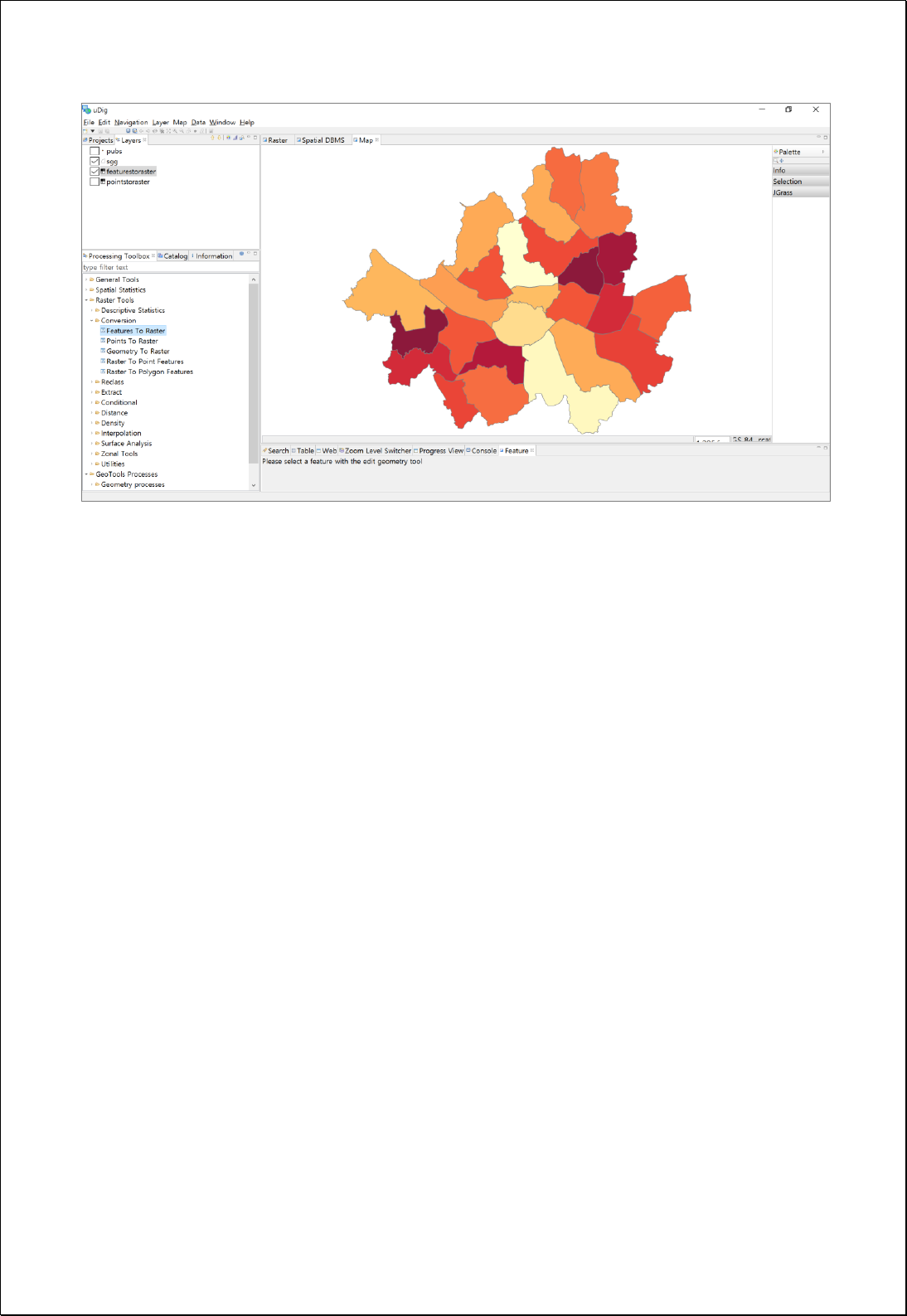

4.3.2.2.
Points To Raster
Converts the point feature layers (inputFeatures) into raster using the cell value
assignment method.
Syntax
PointsToRaster (SimpleFeatureCollection inputFeatures, String inputField,
PointAssignmentType cellAssignment, Double cellSize, ReferencedEnvelope extent):
GridCoverage2D
Parameters
Data Inputs
Identifier
Description
Type
Required
inputFeatures
The point or multipoint input feature dataset to be
converted to a raster.
Complex
inputField
The field used to assign values to the output raster.
Literal
cellAssignment
The method to determine how the cell will be
assigned a value when more than one feature falls
within a cell.
Literal
-
cellSize
The cell size for the output raster.
Literal
-
extent
The extent for the output raster.
Complex
-
Process Outputs
Identifier
Description
Type
Required
result
Output Raster.
Complex
Constraints
- The inputFeatures parameter must be point or multiPoint feature types.
- The inputField parameter must be numeric fields or values(constant value).
- Unless sets the extent parameter, uses the range of the inputGeometry.
- Unless sets the cellAssignment parameter, chooses the smaller value between
extent's width and height, and divides it by 250.

- The cellAssignment parameter defines how to assign cell values when more than
one point is nested in a cell, and following options can be used.
Option
Desciption
MostFrequent
Sum
Mean
Maximum
Minimum
Range
Count
Frequency, If the frequency is the same, it arranged by the features order
Sum
Mean
Maximum
Minimum
Range
The number of points, Force assignment even if not a numeric field
Request Examples
<?xml version="1.0" encoding="UTF-8"?><wps:Execute version="1.0.0" service="WPS"
xmlns:xsi="http://www.w3.org/2001/XMLSchema-instance" xmlns="http://www.opengis.net/wps/1.0.0"
xmlns:wfs="http://www.opengis.net/wfs" xmlns:wps="http://www.opengis.net/wps/1.0.0"
xmlns:ows="http://www.opengis.net/ows/1.1" xmlns:gml="http://www.opengis.net/gml"
xmlns:ogc="http://www.opengis.net/ogc" xmlns:wcs="http://www.opengis.net/wcs/1.1.1"
xmlns:xlink="http://www.w3.org/1999/xlink" xsi:schemaLocation="http://www.opengis.net/wps/1.0.0
http://schemas.opengis.net/wps/1.0.0/wpsAll.xsd">
<ows:Identifier>statistics:PointsToRaster</ows:Identifier>
<wps:DataInputs>
<wps:Input>
<ows:Identifier>inputFeatures</ows:Identifier>
<wps:Reference mimeType="text/xml" xlink:href="http://geoserver/wfs" method="POST">
<wps:Body>
<wfs:GetFeature service="WFS" version="1.0.0" outputFormat="GML2"
xmlns:foss="http://www.opengeospatial.net/foss">
<wfs:Query typeName="foss:pubs"/>
</wfs:GetFeature>
</wps:Body>
</wps:Reference>
</wps:Input>
<wps:Input>
<ows:Identifier>inputField</ows:Identifier>
<wps:Data>
<wps:LiteralData>gid</wps:LiteralData>
</wps:Data>
</wps:Input>
<wps:Input>
<ows:Identifier>cellAssignment</ows:Identifier>
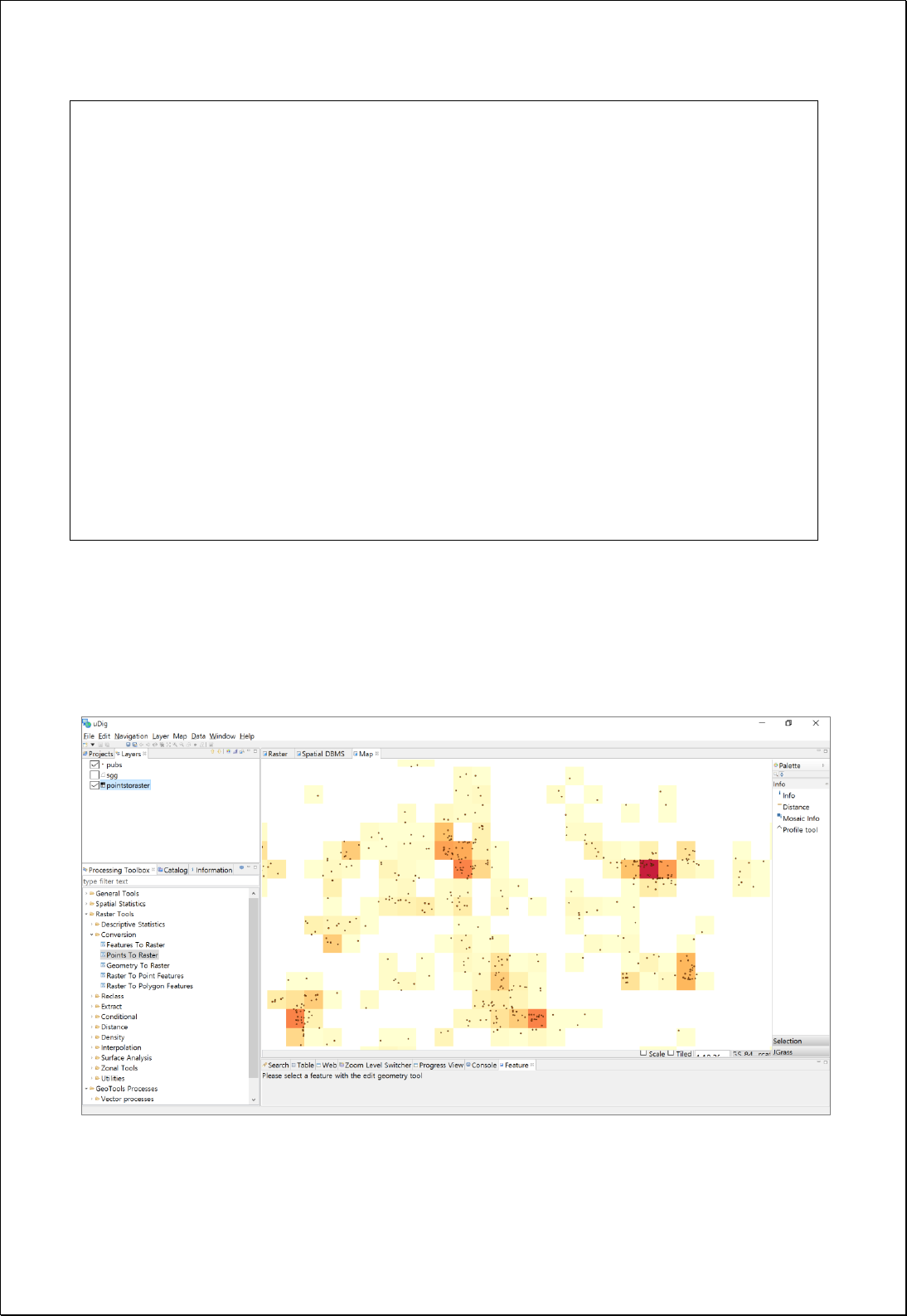
<wps:Data>
<wps:LiteralData>Count</wps:LiteralData>
</wps:Data>
</wps:Input>
<wps:Input>
<ows:Identifier>cellSize</ows:Identifier>
<wps:Data>
<wps:LiteralData>30</wps:LiteralData>
</wps:Data>
</wps:Input>
</wps:DataInputs>
<wps:ResponseForm>
<wps:RawDataOutput mimeType="image/tiff">
<ows:Identifier>result</ows:Identifier>
</wps:RawDataOutput>
</wps:ResponseForm>
</wps:Execute>
Response
The following figure shows the result of converting the polygon geometry to raster
data.
4.3.2.3.
Geometry To Raster
Converts geometry (inputGeometry) to raster.

Syntax
GeometryToRaster (Geometry inputGeometry, CoordinateReferenceSystem forcedCRS,
Number defaultValue, RasterPixelType pixelType, Double cellSize, ReferencedEnvelope
extent): GridCoverage2D
Parameters
Data Inputs
Identifier
Description
Type
Required
inputGeometry
The input geometry to be converted to a raster
dataset.
Complex
forcedCRS
Coordinate reference system to use for input
geometry.
Literal
-
defaultValue
The default value for the output pixel: 1(default).
Literal
-
pixelType
The pixel type for the output raster.
Literal
-
cellSize
The cell size for the output raster.
Literal
-
extent
The extent for the output raster.
Complex
-
Process Outputs
Identifier
Description
Type
Required
result
Output Raster.
Complex
Constraints
- If the forcedCRS parameter is set to Null, uses CRS value of inputGeometry, and
CRS of inputGeometry must be set.
- If the defaultValue parameter is set to Null, the default value is 1(Integer).
- If the pixelType parameter is set to Null, uses Integer as the default value.
- The pixelType parameter can use BYTE, SHORT, INTEGER, FLOAT, and DOUBLE
values.
- Unless sets the extent parameter, uses the range of the inputGeometry.

- Unless sets the cellSize parameter, chooses the smaller value between extent's width
and height, and divides it by 250.
Request Examples
<?xml version="1.0" encoding="UTF-8"?><wps:Execute version="1.0.0" service="WPS"
xmlns:xsi="http://www.w3.org/2001/XMLSchema-instance" xmlns="http://www.opengis.net/wps/1.0.0"
xmlns:wfs="http://www.opengis.net/wfs" xmlns:wps="http://www.opengis.net/wps/1.0.0"
xmlns:ows="http://www.opengis.net/ows/1.1" xmlns:gml="http://www.opengis.net/gml"
xmlns:ogc="http://www.opengis.net/ogc" xmlns:wcs="http://www.opengis.net/wcs/1.1.1"
xmlns:xlink="http://www.w3.org/1999/xlink" xsi:schemaLocation="http://www.opengis.net/wps/1.0.0
http://schemas.opengis.net/wps/1.0.0/wpsAll.xsd">
<ows:Identifier>statistics:GeometryToRaster</ows:Identifier>
<wps:DataInputs>
<wps:Input>
<ows:Identifier>inputGeometry</ows:Identifier>
<wps:Data>
<wps:ComplexData mimeType="application/wkt"><![CDATA[POLYGON ((14134957.759521019
4527300.782425176, ... 14134957.759521019 4527300.782425176))]]></wps:ComplexData>
</wps:Data>
</wps:Input>
<wps:Input>
<ows:Identifier>forcedCRS</ows:Identifier>
<wps:Data>
<wps:LiteralData>EPSG:3857</wps:LiteralData>
</wps:Data>
</wps:Input>
<wps:Input>
<ows:Identifier>defaultValue</ows:Identifier>
<wps:Data>
<wps:LiteralData>1</wps:LiteralData>
</wps:Data>
</wps:Input>
<wps:Input>
<ows:Identifier>pixelType</ows:Identifier>
<wps:Data>
<wps:LiteralData>INTEGER</wps:LiteralData>
</wps:Data>
</wps:Input>
<wps:Input>
<ows:Identifier>cellSize</ows:Identifier>
<wps:Data>
<wps:LiteralData>50</wps:LiteralData>
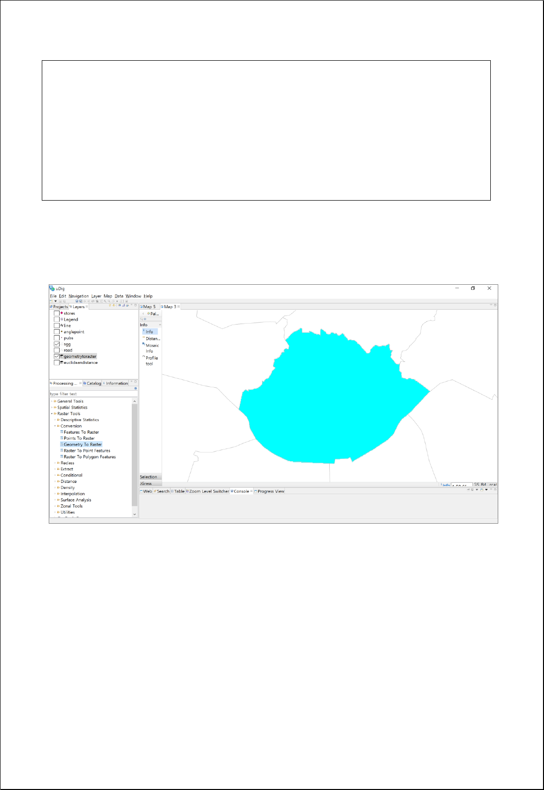
</wps:Data>
</wps:Input>
</wps:DataInputs>
<wps:ResponseForm>
<wps:RawDataOutput mimeType="image/tiff">
<ows:Identifier>result</ows:Identifier>
</wps:RawDataOutput>
</wps:ResponseForm>
</wps:Execute>
Response
The following figure showsthe result of converting the polygon geometry to raster data.

4.3.2.4.
Raster To Point
Converts raster layers (inputCoverage) to point layers.
Syntax
RasterToPoint (GridCoverage2D inputCoverage, Integer bandIndex, String valueField):
SimpleFeatureCollection
Parameters
Data Inputs
Identifier
Description
Type
Required
inputCoverage
The input gridcoverage to be converted.
Complex
bandIndex
The zero-based band index, default index is 0.
Literal
-
valueField
The field used to assign values from the cells.
Default is value.
Literal
-
Process Outputs
Identifier
Description
Type
Required
result
Output Raster.
Complex
Constraints
- If valueField is set to Null, uses the fields of value names by default.
Request Examples
<?xml version="1.0" encoding="UTF-8"?><wps:Execute version="1.0.0" service="WPS"
xmlns:xsi="http://www.w3.org/2001/XMLSchema-instance" xmlns="http://www.opengis.net/wps/1.0.0"
xmlns:wfs="http://www.opengis.net/wfs" xmlns:wps="http://www.opengis.net/wps/1.0.0"
xmlns:ows="http://www.opengis.net/ows/1.1" xmlns:gml="http://www.opengis.net/gml"
xmlns:ogc="http://www.opengis.net/ogc" xmlns:wcs="http://www.opengis.net/wcs/1.1.1"
xmlns:xlink="http://www.w3.org/1999/xlink" xsi:schemaLocation="http://www.opengis.net/wps/1.0.0
http://schemas.opengis.net/wps/1.0.0/wpsAll.xsd">
<ows:Identifier>statistics:RasterToPoint</ows:Identifier>
<wps:DataInputs>
<wps:Input>
<ows:Identifier>inputCoverage</ows:Identifier>
<wps:Reference mimeType="image/tiff" xlink:href="http://geoserver/wcs" method="POST">
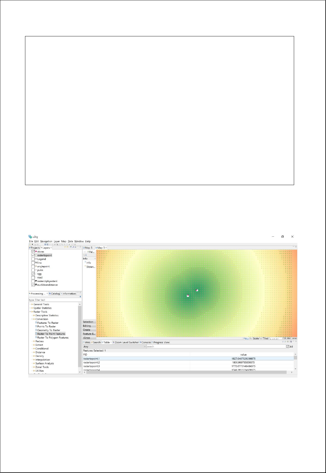
<wps:Body/>
</wps:Reference>
</wps:Input>
<wps:Input>
<ows:Identifier>valueField</ows:Identifier>
<wps:Data>
<wps:LiteralData>val</wps:LiteralData>
</wps:Data>
</wps:Input>
</wps:DataInputs>
<wps:ResponseForm>
<wps:RawDataOutput mimeType="text/xml; subtype=wfs-collection/1.0">
<ows:Identifier>result</ows:Identifier>
</wps:RawDataOutput>
</wps:ResponseForm>
</wps:Execute>
Response
The following figure showsthe result of converting raster data to points.

4.3.2.5.
Raster to Polygon
Converts raster layers (inputCoverage) to polygon layers.
Syntax
RasterToPolygon (GridCoverage2D inputCoverage, Integer bandIndex, Boolean weeding,
String valueField): SimpleFeatureCollection
Parameters
Data Inputs
Identifier
Description
Type
Required
inputCoverage
The input gridcoverage to be converted.
Complex
bandIndex
The zero-based band index, default index is 0.
Literal
-
weeding
Determines if the output polygons will be smoothed
into simpler shapes. Default is False.
Literal
-
valueField
The field used to assign values from the cells.
Default is value.
Literal
-
Process Outputs
Identifier
Description
Type
Required
result
Output Raster.
Complex
Constraints
- If weeding is set to True, simplifies it using the Douglas-Puecker algorithm. The
tolerance is sqrt(0.5) * cell size.
- If valueField is set to Null, uses the fields of value names by default.
Request Examples
<?xml version="1.0" encoding="UTF-8"?>
<wps:Execute version="1.0.0" service="WPS" xmlns:xsi="http://www.w3.org/2001/XMLSchema-instance"
xmlns="http://www.opengis.net/wps/1.0.0" xmlns:wfs="http://www.opengis.net/wfs"
xmlns:wps="http://www.opengis.net/wps/1.0.0" xmlns:ows="http://www.opengis.net/ows/1.1"
xmlns:gml="http://www.opengis.net/gml" xmlns:ogc="http://www.opengis.net/ogc"
xmlns:wcs="http://www.opengis.net/wcs/1.1.1" xmlns:xlink="http://www.w3.org/1999/xlink"
xsi:schemaLocation="http://www.opengis.net/wps/1.0.0 http://schemas.opengis.net/wps/1.0.0/wpsAll.xsd">

<ows:Identifier>statistics:RasterToPolygon</ows:Identifier>
<wps:DataInputs>
<wps:Input>
<ows:Identifier>inputCoverage</ows:Identifier>
<wps:Reference mimeType="image/tiff" xlink:href="http://geoserver/wcs" method="POST">
<wps:Body>
<wcs:GetCoverage service="WCS" version="1.1.1">
<ows:Identifier>foss:seoul_dem30</ows:Identifier>
<wcs:DomainSubset>
<ows:BoundingBox crs="http://www.opengis.net/gml/srs/epsg.xml#3857">
<ows:LowerCorner>1.4111343323506365E7 4498971.750719266</ows:LowerCorner>
<ows:UpperCorner>1.4158021303411832E7 4537343.6431004135</ows:UpperCorner>
</ows:BoundingBox>
</wcs:DomainSubset>
<wcs:Output format="image/tiff"/>
</wcs:GetCoverage>
</wps:Body>
</wps:Reference>
</wps:Input>
<wps:Input>
<ows:Identifier>weeding</ows:Identifier>
<wps:Data>
<wps:LiteralData>True</wps:LiteralData>
</wps:Data>
</wps:Input>
</wps:DataInputs>
<wps:ResponseForm>
<wps:RawDataOutput mimeType="text/xml; subtype=wfs-collection/1.0">
<ows:Identifier>result</ows:Identifier>
</wps:RawDataOutput>
</wps:ResponseForm>
</wps:Execute>
Response
The following figure showsthe result of converting the DEM layer to polygon layers after
extracting features with elevation larger than 250 meters above sea level from DEM.
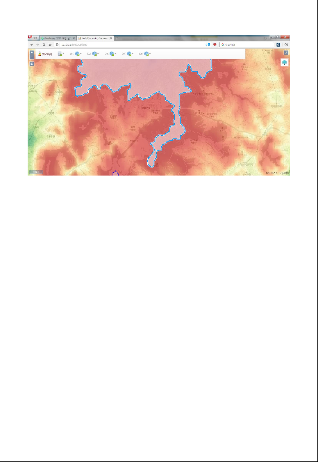

4.3.2.6.
Raster to Image
Converts a raster layer (coverage) to an image using WMS parameter.
Syntax
RasterToImage (GridCoverage2D coverage, String bbox, CoordinateReferenceSystem crs,
Style style, Integer width, Integer height, String format, Boolean transparent, String
bgColor): Image
Parameters
Data Inputs
Identifier
Description
Type
Required
coverage
The input gridcoverage to be converted.
Complex
bbox
Bounding box corners (lower left, upper right): minx,
miny, maxx, maxy.
Literal
-
crs
CRS for Bounding Box. Ex) EPSG:3857
Literal
-
style
Styled Layer Descriptor (SLD) style containing a
raster symbolizer.
Complex
-
width
Image width in pixels of resulting map.
Literal
height
Image height in pixels of resulting map.
Literal
format
Output format of map. Valid values are image/jpeg,
image/png (Default), and image/gif.
Literal
-
transparent
Map background transparency. Default is True.
Literal
-
bgColor
Hexidecimal red-blue-green color value for the map
background color. Default is 0xFFFFFF (white).
Literal
-
Process Outputs
Identifier
Description
Type
Required
result
Output image.
Complex
Constraints
- If the bbox and crs parameter are set to Null, uses the extents and coordinate
system of the coverage.
- If the style parameter is set to Null, applies the Equal Interval Style using the
minimum / maximum value.

Request Examples
<?xml version="1.0" encoding="UTF-8"?>
<wps:Execute version="1.0.0" service="WPS" xmlns:xsi="http://www.w3.org/2001/XMLSchema-instance"
xmlns="http://www.opengis.net/wps/1.0.0" xmlns:wfs="http://www.opengis.net/wfs"
xmlns:wps="http://www.opengis.net/wps/1.0.0" xmlns:ows="http://www.opengis.net/ows/1.1"
xmlns:gml="http://www.opengis.net/gml" xmlns:ogc="http://www.opengis.net/ogc"
xmlns:wcs="http://www.opengis.net/wcs/1.1.1" xmlns:xlink="http://www.w3.org/1999/xlink"
xsi:schemaLocation="http://www.opengis.net/wps/1.0.0 http://schemas.opengis.net/wps/1.0.0/wpsAll.xsd">
<ows:Identifier>statistics:RasterToImage</ows:Identifier>
<wps:DataInputs>
<wps:Input>
<ows:Identifier>coverage</ows:Identifier>
<wps:Reference mimeType="image/tiff" xlink:href="http://geoserver/wcs" method="POST">
<wps:Body>
<wcs:GetCoverage service="WCS" version="1.1.1">
<ows:Identifier>foss:seoul_dem30</ows:Identifier>
<wcs:DomainSubset>
<ows:BoundingBox crs="http://www.opengis.net/gml/srs/epsg.xml#3857">
<ows:LowerCorner>1.4111343323506365E7 4498971.750719266</ows:LowerCorner>
<ows:UpperCorner>1.4158021303411832E7 4537343.6431004135</ows:UpperCorner>
</ows:BoundingBox>
</wcs:DomainSubset>
<wcs:Output format="image/tiff"/>
</wcs:GetCoverage>
</wps:Body>
</wps:Reference>
</wps:Input>
<wps:Input>
<ows:Identifier>width</ows:Identifier>
<wps:Data>
<wps:LiteralData>500</wps:LiteralData>
</wps:Data>
</wps:Input>
<wps:Input>
<ows:Identifier>height</ows:Identifier>
<wps:Data>
<wps:LiteralData>400</wps:LiteralData>
</wps:Data>
</wps:Input>
<wps:Input>
<ows:Identifier>format</ows:Identifier>
<wps:Data>
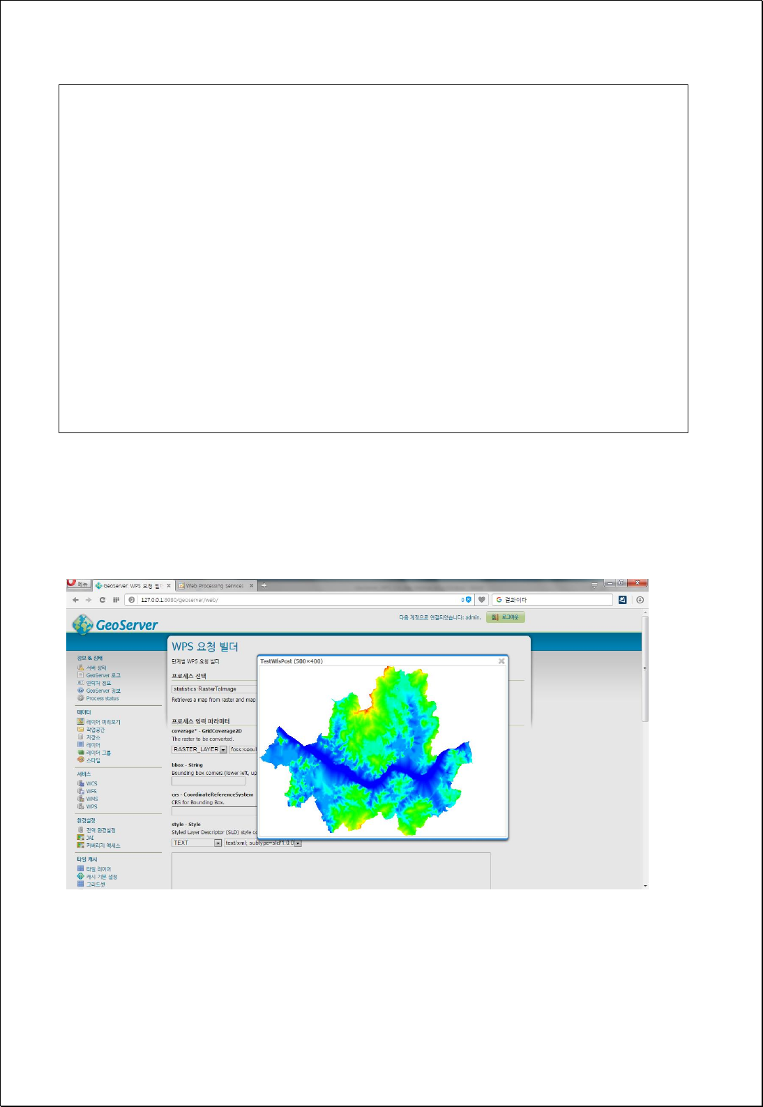
<wps:LiteralData>image/png</wps:LiteralData>
</wps:Data>
</wps:Input>
<wps:Input>
<ows:Identifier>transparent</ows:Identifier>
<wps:Data>
<wps:LiteralData>True.</wps:LiteralData>
</wps:Data>
</wps:Input>
</wps:DataInputs>
<wps:ResponseForm>
<wps:RawDataOutput mimeType="image/png">
<ows:Identifier>result</ows:Identifier>
</wps:RawDataOutput>
</wps:ResponseForm>
</wps:Execute>
Response
The following figure showsthe result of requesting the Seoul DEM layer to an image (500
by 400 pixels). The requested result can be added to the image layer in OpenLayers.
4.3.3. Distance
Analysis the distance and adjacency of vector and raster data.

4.3.3.1. Euclidean Distance
Creates a raster dataset based on Euclidean distance between each cell and feature.
Syntax
EuclideanDistance (SimpleFeatureCollection inputFeatures, Double maximumDistance,
Double cellSize, ReferencedEnvelope extent): GridCoverage2D
Parameters
Data Inputs
Identifier
Description
Type
Required
inputFeatures
The input features for which to calculate the
distance.
Complex
maximumDistance
Defines the threshold that the accumulative distance
values cannot exceed.
Literal
-
cellSize
The cell size for the output raster.
Literal
-
extent
The extent for the output raster.
Complex
-
Process Outputs
Identifier
Description
Type
Required
result
Output Raster.
Complex
Constraints
- If set the maximumDistance parameter, areas above the specified distance will be
assigned the No Data value.
- Unless set the extent parameter, use the range of the inputFeatures layer.
- Unless set the cellSize parameter, choose the smaller value between Extent's Width
and Height, and divide it by 250.
Request Examples
<?xml version="1.0" encoding="UTF-8"?><wps:Execute version="1.0.0" service="WPS"
xmlns:xsi="http://www.w3.org/2001/XMLSchema-instance" xmlns="http://www.opengis.net/wps/1.0.0"
xmlns:wfs="http://www.opengis.net/wfs" xmlns:wps="http://www.opengis.net/wps/1.0.0"

xmlns:ows="http://www.opengis.net/ows/1.1" xmlns:gml="http://www.opengis.net/gml"
xmlns:ogc="http://www.opengis.net/ogc" xmlns:wcs="http://www.opengis.net/wcs/1.1.1"
xmlns:xlink="http://www.w3.org/1999/xlink" xsi:schemaLocation="http://www.opengis.net/wps/1.0.0
http://schemas.opengis.net/wps/1.0.0/wpsAll.xsd">
<ows:Identifier>statistics:EuclideanDistance</ows:Identifier>
<wps:DataInputs>
<wps:Input>
<ows:Identifier>inputFeatures</ows:Identifier>
<wps:Reference mimeType="text/xml" xlink:href="http://geoserver/wfs" method="POST">
<wps:Body>
<wfs:GetFeature service="WFS" version="1.0.0" outputFormat="GML2"
xmlns:foss="http://www.opengeospatial.net/foss">
<wfs:Query typeName="foss:stores"/>
</wfs:GetFeature>
</wps:Body>
</wps:Reference>
</wps:Input>
<wps:Input>
<ows:Identifier>maximumDistance</ows:Identifier>
<wps:Data>
<wps:LiteralData>2500</wps:LiteralData>
</wps:Data>
</wps:Input>
<wps:Input>
<ows:Identifier>cellSize</ows:Identifier>
<wps:Data>
<wps:LiteralData>30</wps:LiteralData>
</wps:Data>
</wps:Input>
</wps:DataInputs>
<wps:ResponseForm>
<wps:RawDataOutput mimeType="image/tiff">
<ows:Identifier>result</ows:Identifier>
</wps:RawDataOutput>
</wps:ResponseForm>
</wps:Execute>
Response
The following figure shows the result of Euclidean Distance analysis with maximum
distance of 2.5km and cell size of 30m, using Seoul big store point data.
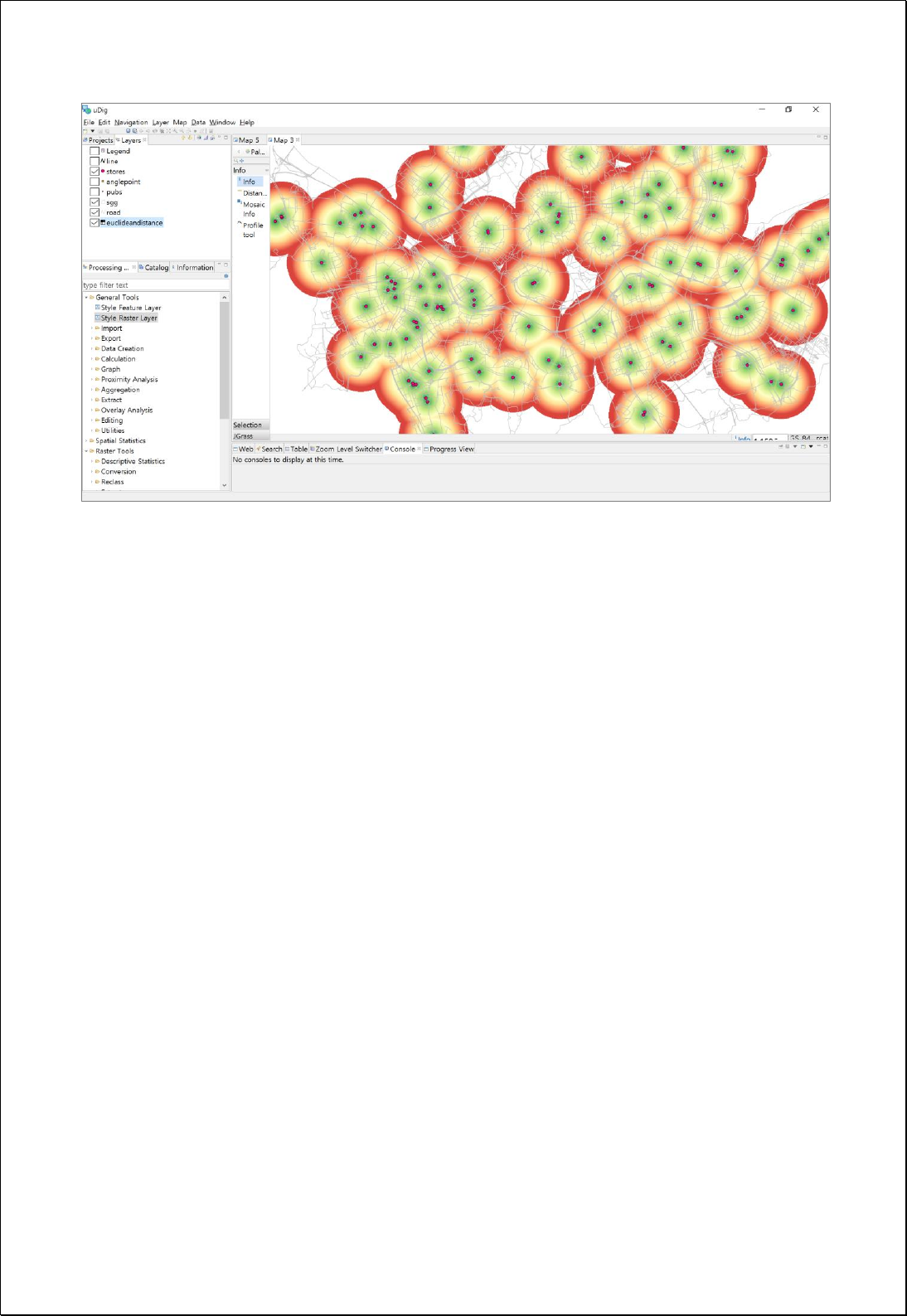

4.3.4. Math
Createsthe new raster using a filter or formula.
4.3.4.1.
Math Operation
Use the formula to create a new raster.
Syntax
RasterMath (GridCoverage2D inputCoverage, Integer bandIndex, Expression expression):
GridCoverage2D
Parameters
Data Inputs
Identifier
Description
Type
Required
inputCoverage
The input raster to be calculated.
Complex
bandIndex
The zero-based band index, default index is a 0.
Literal
-
expression
A mathematical expression that evaluates raster cells.
Ex> log(Value * 250)
Literal
Process Outputs
Identifier
Description
Type
Required
result
Output Raster.
Complex
Constraints
- The functions available in the expression parameter use the Filter Function
4
of
GeoTools.
Request Examples
<?xml version="1.0" encoding="UTF-8"?><wps:Execute version="1.0.0" service="WPS"
xmlns:xsi="http://www.w3.org/2001/XMLSchema-instance" xmlns="http://www.opengis.net/wps/1.0.0"
xmlns:wfs="http://www.opengis.net/wfs" xmlns:wps="http://www.opengis.net/wps/1.0.0"
4
http://docs.geoserver.org/stable/en/user/filter/function_reference.html

xmlns:ows="http://www.opengis.net/ows/1.1" xmlns:gml="http://www.opengis.net/gml"
xmlns:ogc="http://www.opengis.net/ogc" xmlns:wcs="http://www.opengis.net/wcs/1.1.1"
xmlns:xlink="http://www.w3.org/1999/xlink" xsi:schemaLocation="http://www.opengis.net/wps/1.0.0
http://schemas.opengis.net/wps/1.0.0/wpsAll.xsd">
<ows:Identifier>statistics:RasterMath</ows:Identifier>
<wps:DataInputs>
<wps:Input>
<ows:Identifier>inputCoverage</ows:Identifier>
<wps:Reference mimeType="image/tiff" xlink:href="http://geoserver/wcs" method="POST">
<wps:Body>
<wcs:GetCoverage service="WCS" version="1.1.1">
<ows:Identifier>cite:dem05</ows:Identifier>
<wcs:DomainSubset>
<ows:BoundingBox crs="http://www.opengis.net/gml/srs/epsg.xml#5181">
<ows:LowerCorner>321541.5348100797 235208.86605789233</ows:LowerCorner>
<ows:UpperCorner>359950.1365611528 281299.18815918005</ows:UpperCorner>
</ows:BoundingBox>
</wcs:DomainSubset>
<wcs:Output format="image/tiff"/>
</wcs:GetCoverage>
</wps:Body>
</wps:Reference>
</wps:Input>
<wps:Input>
<ows:Identifier>bandIndex</ows:Identifier>
<wps:Data>
<wps:LiteralData>0</wps:LiteralData>
</wps:Data>
</wps:Input>
<wps:Input>
<ows:Identifier>expression</ows:Identifier>
<wps:Data>
<wps:LiteralData>log(Value * 250)</wps:LiteralData>
</wps:Data>
</wps:Input>
</wps:DataInputs>
<wps:ResponseForm>
<wps:RawDataOutput mimeType="image/tiff">
<ows:Identifier>result</ows:Identifier>
</wps:RawDataOutput>
</wps:ResponseForm>
</wps:Execute>
Response
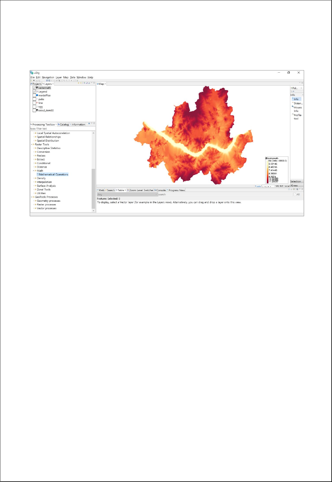
The following figure shows result of applying log(Value * 250) calculation formula in
Seoul DEM raster data.

4.3.4.2.
Set Null
Converts the cell value that corresponds to the filter condition to a NoData value, or
replaces the existing NoData value with another value.
Syntax
RasterSetNull (GridCoverage2D inputCoverage, Integer bandIndex, Filter filter, Boolean
replaceNoData, Double newValue): GridCoverage2D
Parameters
Data Inputs
Identifier
Description
Type
Required
inputCoverage
The input raster to be evaluated.
Complex
bandIndex
The zero-based band index, default index is a 0.
Literal
-
filter
A logical expression that determines which of the
input cells are to be nodata. ex> Value > 250
Literal
replaceNoData
If true, nodata value will be replaced as a newValue
parameter. Default is False.
Literal
newValue
The new valid value to replace nodata.
Literal
-
Process Outputs
Identifier
Description
Type
Required
result
Output Raster.
Complex
Constraints
- The field name of the filter parameter must be Value.
- If the value of the replaceNoData parameter is True, replace the existing NoData
value with the value of the newValue parameter.
Request Examples
<?xml version="1.0" encoding="UTF-8"?><wps:Execute version="1.0.0" service="WPS"
xmlns:xsi="http://www.w3.org/2001/XMLSchema-instance" xmlns="http://www.opengis.net/wps/1.0.0"
xmlns:wfs="http://www.opengis.net/wfs" xmlns:wps="http://www.opengis.net/wps/1.0.0"
xmlns:ows="http://www.opengis.net/ows/1.1" xmlns:gml="http://www.opengis.net/gml"

xmlns:ogc="http://www.opengis.net/ogc" xmlns:wcs="http://www.opengis.net/wcs/1.1.1"
xmlns:xlink="http://www.w3.org/1999/xlink" xsi:schemaLocation="http://www.opengis.net/wps/1.0.0
http://schemas.opengis.net/wps/1.0.0/wpsAll.xsd">
<ows:Identifier>statistics:RasterSetNull</ows:Identifier>
<wps:DataInputs>
<wps:Input>
<ows:Identifier>inputCoverage</ows:Identifier>
<wps:Reference mimeType="image/tiff" xlink:href="http://geoserver/wcs" method="POST">
<wps:Body>
<wcs:GetCoverage service="WCS" version="1.1.1">
<ows:Identifier>cite:dem30</ows:Identifier>
<wcs:DomainSubset>
<ows:BoundingBox crs="http://www.opengis.net/gml/srs/epsg.xml#5181">
<ows:LowerCorner>322223.9108718962 235108.16003333713</ows:LowerCorner>
<ows:UpperCorner>360624.44972726464 281188.51233892346</ows:UpperCorner>
</ows:BoundingBox>
</wcs:DomainSubset>
<wcs:Output format="image/tiff"/>
</wcs:GetCoverage>
</wps:Body>
</wps:Reference>
</wps:Input>
<wps:Input>
<ows:Identifier>bandIndex</ows:Identifier>
<wps:Data>
<wps:LiteralData>0</wps:LiteralData>
</wps:Data>
</wps:Input>
<wps:Input>
<ows:Identifier>filter</ows:Identifier>
<wps:Data>
<wps:ComplexData mimeType="text/plain; subtype=cql"><![CDATA[Value >
250]]></wps:ComplexData>
</wps:Data>
</wps:Input>
</wps:DataInputs>
<wps:ResponseForm>
<wps:RawDataOutput mimeType="image/tiff">
<ows:Identifier>result</ows:Identifier>
</wps:RawDataOutput>
</wps:ResponseForm>
</wps:Execute>
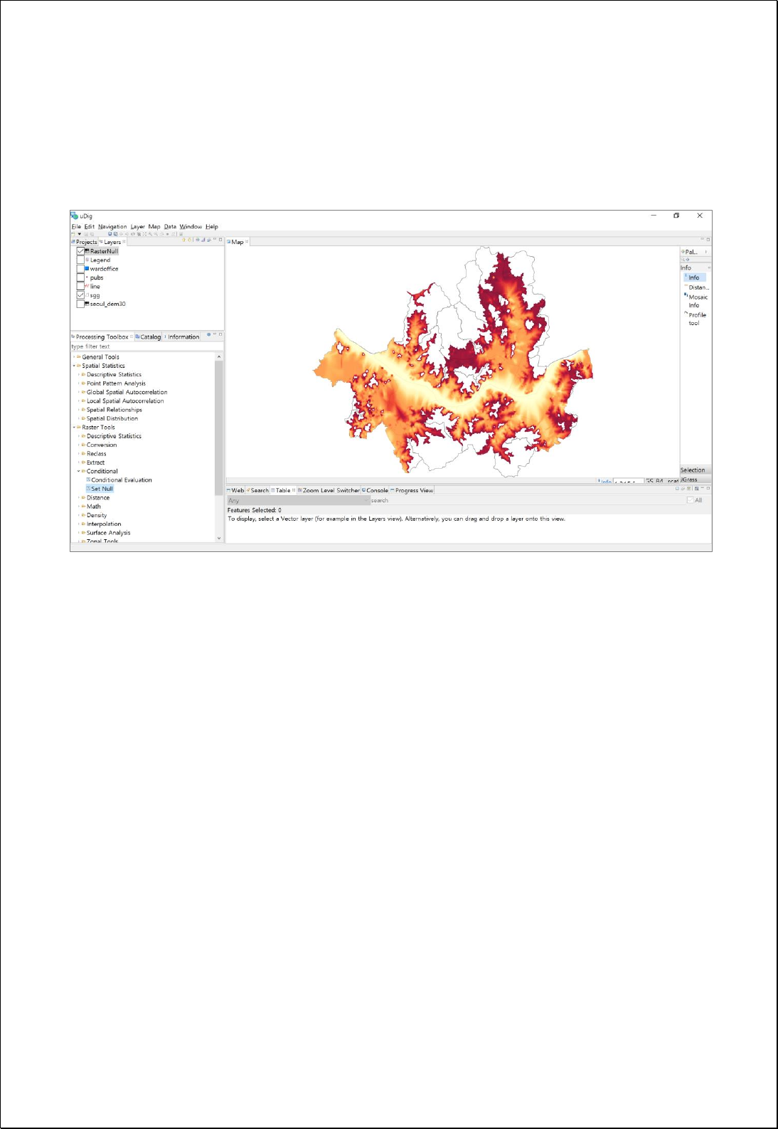
Response
The following figure shows the result of processing NoData areas, where the value is
more than 50 in the Seoul DEM raster data.

4.3.5. Classification
Reclass the raster values to a specific range of values.
4.3.5.1.
Reclass
Reclass the raster data to the given range and the assigned value of each range.
Syntax
RasterReclass (GridCoverage2D inputCoverage, Integer bandIndex, String ranges):
GridCoverage2D
Parameters
Data Inputs
Identifier
Description
Type
Required
inputCoverage
The input raster to be reclassified.
Complex
bandIndex
The zero-based band index, default index is a 0.
Literal
-
ranges
Ranges that defines how the values will be
reclassified. ex) 0.0 30.0 1; 30.0 270.0 2; 270.0 365.0 3
Literal
Process Outputs
Identifier
Description
Type
Required
result
Output Raster.
Complex
Constraints
- The values in the ranges parameter treated as NoData values.
Request Examples
<?xml version="1.0" encoding="UTF-8"?>
<wps:Execute version="1.0.0" service="WPS" xmlns:xsi="http://www.w3.org/2001/XMLSchema-instance"
xmlns="http://www.opengis.net/wps/1.0.0" xmlns:wfs="http://www.opengis.net/wfs"
xmlns:wps="http://www.opengis.net/wps/1.0.0" xmlns:ows="http://www.opengis.net/ows/1.1"
xmlns:gml="http://www.opengis.net/gml" xmlns:ogc="http://www.opengis.net/ogc"
xmlns:wcs="http://www.opengis.net/wcs/1.1.1" xmlns:xlink="http://www.w3.org/1999/xlink"
xsi:schemaLocation="http://www.opengis.net/wps/1.0.0 http://schemas.opengis.net/wps/1.0.0/wpsAll.xsd">
<ows:Identifier>statistics:RasterReclass</ows:Identifier>
<wps:DataInputs>

<wps:Input>
<ows:Identifier>inputCoverage</ows:Identifier>
<wps:Reference mimeType="image/tiff" xlink:href="http://geoserver/wcs" method="POST">
<wps:Body>
<wcs:GetCoverage service="WCS" version="1.1.1">
<ows:Identifier>foss:seoul_dem30</ows:Identifier>
<wcs:DomainSubset>
<ows:BoundingBox crs="http://www.opengis.net/gml/srs/epsg.xml#3857">
<ows:LowerCorner>1.4111343323506365E7 4498971.750719266</ows:LowerCorner>
<ows:UpperCorner>1.4158021303411832E7 4537343.6431004135</ows:UpperCorner>
</ows:BoundingBox>
</wcs:DomainSubset>
<wcs:Output format="image/tiff"/>
</wcs:GetCoverage>
</wps:Body>
</wps:Reference>
</wps:Input>
<wps:Input>
<ows:Identifier>ranges</ows:Identifier>
<wps:Data>
<wps:LiteralData>0.1 30.0 1; 30.0 200.0 2; 200.0 500.0 3</wps:LiteralData>
</wps:Data>
</wps:Input>
</wps:DataInputs>
<wps:ResponseForm>
<wps:RawDataOutput mimeType="image/tiff">
<ows:Identifier>result</ows:Identifier>
</wps:RawDataOutput>
</wps:ResponseForm>
</wps:Execute>
Response
The following figure shows the result of Reclass the Seoul DEM layer, 0.1 ~ 30.0 is 1
value, 30.0 ~ 200.0 is 2 value, and 200.0 ~ 500.0 is 3 value.
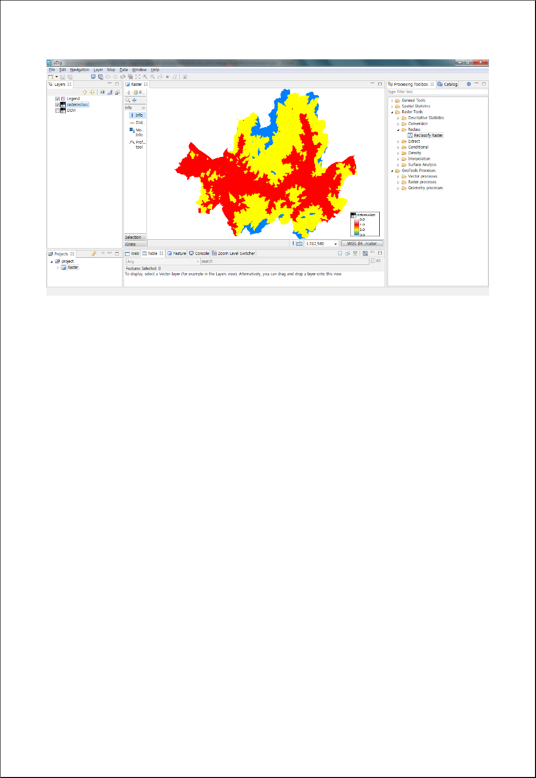

4.3.6. Extraction
Extract the raster that matches a space or attribute filter condition.
4.3.6.1.
Extract by Attributes
Extract the raster that matches a space or attribute filter condition.
Syntax
RasterExtraction (GridCoverage2D inputCoverage, Integer bandIndex, Filter filter):
GridCoverage2D
Parameters
Data Inputs
Identifier
Description
Type
Required
inputCoverage
The input raster from which cells will be extracted.
Complex
bandIndex
The zero-based band index, default index is a 0.
Literal
-
filter
A logical expression that selects a subset of raster
cells. ex> Value > 250
Complex
Process Outputs
Identifier
Description
Type
Required
result
Output Raster.
Complex
Constraints
- The field name of the filter parameter must be Value.
- The filter parameter can use a spatial filter.
Request Examples
<?xml version="1.0" encoding="UTF-8"?><wps:Execute version="1.0.0" service="WPS"
xmlns:xsi="http://www.w3.org/2001/XMLSchema-instance" xmlns="http://www.opengis.net/wps/1.0.0"
xmlns:wfs="http://www.opengis.net/wfs" xmlns:wps="http://www.opengis.net/wps/1.0.0"
xmlns:ows="http://www.opengis.net/ows/1.1" xmlns:gml="http://www.opengis.net/gml"
xmlns:ogc="http://www.opengis.net/ogc" xmlns:wcs="http://www.opengis.net/wcs/1.1.1"

xmlns:xlink="http://www.w3.org/1999/xlink" xsi:schemaLocation="http://www.opengis.net/wps/1.0.0
http://schemas.opengis.net/wps/1.0.0/wpsAll.xsd">
<ows:Identifier>statistics:RasterExtraction</ows:Identifier>
<wps:DataInputs>
<wps:Input>
<ows:Identifier>inputCoverage</ows:Identifier>
<wps:Reference mimeType="image/tiff" xlink:href="http://geoserver/wcs" method="POST">
<wps:Body/>
</wps:Reference>
</wps:Input>
<wps:Input>
<ows:Identifier>filter</ows:Identifier>
<wps:Data>
<wps:ComplexData mimeType="text/xml; subtype=filter/1.0"><![CDATA[Value >
250]]></wps:ComplexData>
</wps:Data>
</wps:Input>
</wps:DataInputs>
<wps:ResponseForm>
<wps:RawDataOutput mimeType="image/tiff">
<ows:Identifier>result</ows:Identifier>
</wps:RawDataOutput>
</wps:ResponseForm>
</wps:Execute>
Response
The following figure shows the result of extracting the area where the cell value is 250 or
more(value >= 250) from the raster data.
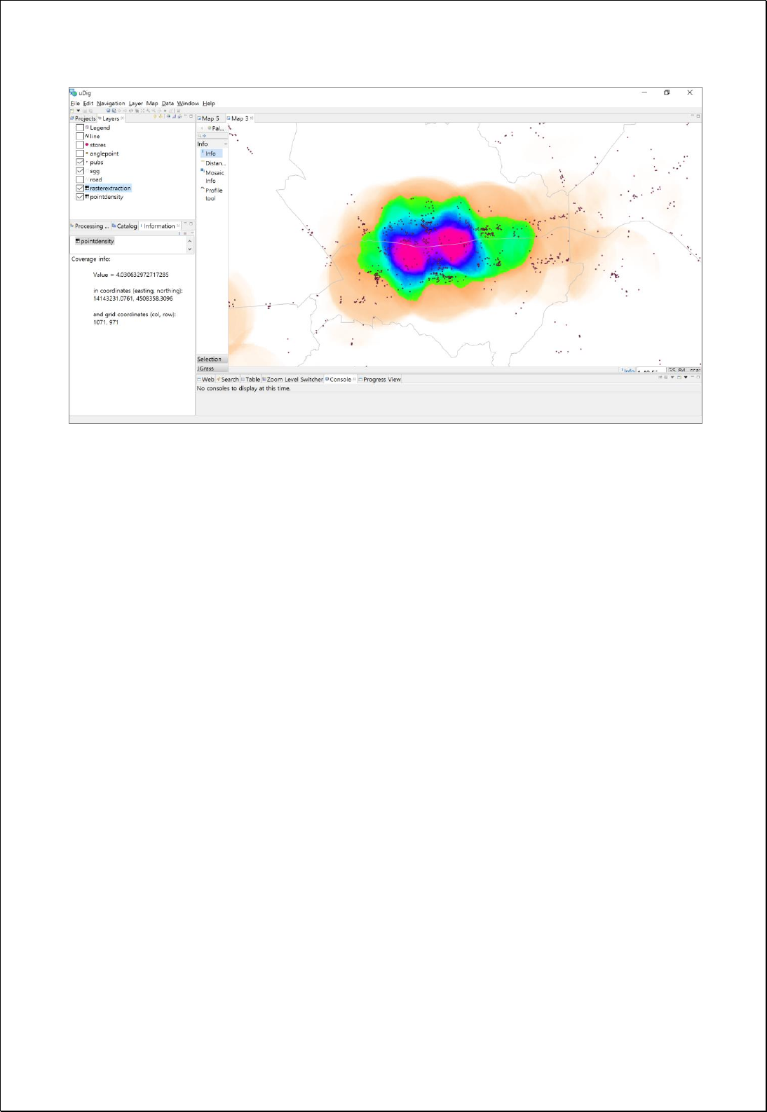

4.3.6.2.
Extract by Extent
Extract the intersecting raster data.
Syntax
RasterClipByExtent (GridCoverage2D inputCoverage, ReferencedEnvelope extent):
GridCoverage2D
Parameters
Data Inputs
Identifier
Description
Type
Required
inputCoverage
The input gridcoverage to be clipped.
Complex
extent
The Reference envelope to clip gridcoverage.
Complex
Process Outputs
Identifier
Description
Type
Required
result
Output Raster.
Complex
Constraints
- The extent parameter is of type BoundingBoxData and consists of crs, dimensions,
LowerCorner, UpperCorner as follows.
<wps:Data>
<wps:BoundingBoxData crs="EPSG:3857" dimensions="2">
<ows:LowerCorner>0.0 0.0</ows:LowerCorner>
<ows:UpperCorner>1.0 1.0</ows:UpperCorner>
</wps:BoundingBoxData>
</wps:Data>
Request Examples
<?xml version="1.0" encoding="UTF-8"?><wps:Execute version="1.0.0" service="WPS"
xmlns:xsi="http://www.w3.org/2001/XMLSchema-instance" xmlns="http://www.opengis.net/wps/1.0.0"
xmlns:wfs="http://www.opengis.net/wfs" xmlns:wps="http://www.opengis.net/wps/1.0.0"
xmlns:ows="http://www.opengis.net/ows/1.1" xmlns:gml="http://www.opengis.net/gml"

xmlns:ogc="http://www.opengis.net/ogc" xmlns:wcs="http://www.opengis.net/wcs/1.1.1"
xmlns:xlink="http://www.w3.org/1999/xlink" xsi:schemaLocation="http://www.opengis.net/wps/1.0.0
http://schemas.opengis.net/wps/1.0.0/wpsAll.xsd">
<ows:Identifier>statistics:RasterClipByExtent</ows:Identifier>
<wps:DataInputs>
<wps:Input>
<ows:Identifier>inputCoverage</ows:Identifier>
<wps:Reference mimeType="image/tiff" xlink:href="http://geoserver/wcs" method="POST">
<wps:Body>
<wcs:GetCoverage service="WCS" version="1.1.1">
<ows:Identifier>foss:seoul_dem30</ows:Identifier>
<wcs:DomainSubset>
<gml:BoundingBox crs="http://www.opengis.net/gml/srs/epsg.xml#5181">
<ows:LowerCorner>179171.39881047895 436569.3290600816</ows:LowerCorner>
<ows:UpperCorner>216221.0981287582 466869.08315843146</ows:UpperCorner>
</gml:BoundingBox>
</wcs:DomainSubset>
<wcs:Output format="image/tiff"/>
</wcs:GetCoverage>
</wps:Body>
</wps:Reference>
</wps:Input>
<wps:Input>
<ows:Identifier>cropShape</ows:Identifier>
<wps:Data>
<wps:BoundingBoxData crs="EPSG:5181" dimensions="2">
<ows:LowerCorner>196200.93382496 446742.832084541</ows:LowerCorner>
<ows:UpperCorner>200948.405261965 450277.401141511</ows:UpperCorner>
</wps:BoundingBoxData>
</wps:Data>
</wps:Input>
</wps:DataInputs>
<wps:ResponseForm>
<wps:RawDataOutput mimeType="image/tiff">
<ows:Identifier>result</ows:Identifier>
</wps:RawDataOutput>
</wps:ResponseForm>
</wps:Execute>
Response
The following figure shows the result of extracting the raster data by setting
BoundingBox(MinX, MinY, MaxX, MaxY, CRS) area.
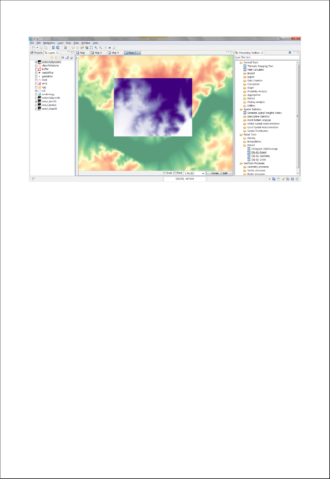

4.3.6.3.
Extract by Geometry
Extract the intersecting raster data by setting Polygon Geometry.
Syntax
RasterClipByGeometry (GridCoverage2D inputCoverage, Geometry cropShape):
GridCoverage2D
Parameters
Data Inputs
Identifier
Description
Type
Required
inputCoverage
The input gridcoverage to be clipped.
Complex
cropShape
The Polygon or MultiPolygon to clip gridcoverage.
Complex
Process Outputs
Identifier
Description
Type
Required
result
Output Raster.
Complex
Constraints
- The geometry type of cropShape must be Polygon or MultiPolygon features.
Request Examples
<?xml version="1.0" encoding="UTF-8"?><wps:Execute version="1.0.0" service="WPS"
xmlns:xsi="http://www.w3.org/2001/XMLSchema-instance" xmlns="http://www.opengis.net/wps/1.0.0"
xmlns:wfs="http://www.opengis.net/wfs" xmlns:wps="http://www.opengis.net/wps/1.0.0"
xmlns:ows="http://www.opengis.net/ows/1.1" xmlns:gml="http://www.opengis.net/gml"
xmlns:ogc="http://www.opengis.net/ogc" xmlns:wcs="http://www.opengis.net/wcs/1.1.1"
xmlns:xlink="http://www.w3.org/1999/xlink" xsi:schemaLocation="http://www.opengis.net/wps/1.0.0
http://schemas.opengis.net/wps/1.0.0/wpsAll.xsd">
<ows:Identifier>statistics:RasterClipByGeometry</ows:Identifier>
<wps:DataInputs>
<wps:Input>
<ows:Identifier>inputCoverage</ows:Identifier>
<wps:Reference mimeType="image/tiff" xlink:href="http://geoserver/wcs" method="POST">
<wps:Body>
<wcs:GetCoverage service="WCS" version="1.1.1">

<ows:Identifier>foss:seoul_dem30</ows:Identifier>
<wcs:DomainSubset>
<gml:BoundingBox crs="http://www.opengis.net/gml/srs/epsg.xml#5181">
<ows:LowerCorner>179171.39881047895 436569.3290600816</ows:LowerCorner>
<ows:UpperCorner>216221.0981287582 466869.08315843146</ows:UpperCorner>
</gml:BoundingBox>
</wcs:DomainSubset>
<wcs:Output format="image/tiff"/>
</wcs:GetCoverage>
</wps:Body>
</wps:Reference>
</wps:Input>
<wps:Input>
<ows:Identifier>cropShape</ows:Identifier>
<wps:Data>
<wps:ComplexData mimeType="application/wkt"><![CDATA[MULTIPOLYGON (((206338 456264,
………….., 206338 456264)))]]></wps:ComplexData>
</wps:Data>
</wps:Input>
</wps:DataInputs>
<wps:ResponseForm>
<wps:RawDataOutput mimeType="image/tiff">
<ows:Identifier>result</ows:Identifier>
</wps:RawDataOutput>
</wps:ResponseForm>
</wps:Execute>
Response
The following figure shows the result of extracting the raster data, set by the Polygon or
MultiPolygon Geometry.
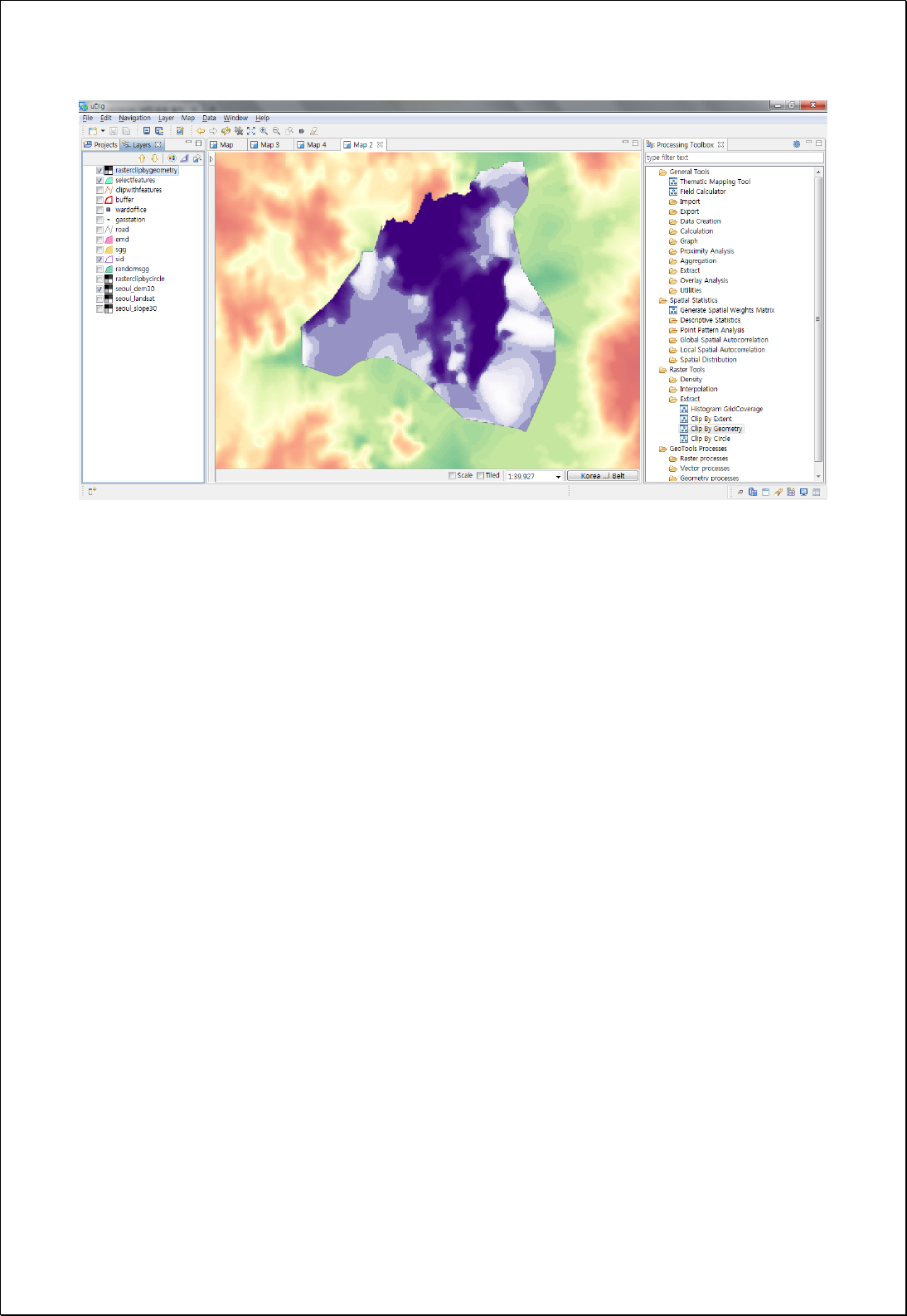

4.3.6.4.
Extract by Circle
Set the circle based on the center point and radius, extract it by the intersecting raster
data.
Syntax
RasterClipByCircle (GridCoverage2D inputCoverage, Geometry center, Double radius,
Boolean inside): GridCoverage2D
Parameters
Data Inputs
Identifier
Description
Type
Required
inputCoverage
The input gridcoverage to be clipped.
Complex
center
The center point of the circle defining the area to be
extracted.
Complex
radius
Radius of the circle defining the area to be extracted.
Literal
inside
Default is True
Literal
-
Process Outputs
Identifier
Description
Type
Required
result
Output Raster.
Complex
Constraints
- If the inside parameter is False, return the area excluding the circle.
Request Examples
<?xml version="1.0" encoding="UTF-8"?><wps:Execute version="1.0.0" service="WPS"
xmlns:xsi="http://www.w3.org/2001/XMLSchema-instance" xmlns="http://www.opengis.net/wps/1.0.0"
xmlns:wfs="http://www.opengis.net/wfs" xmlns:wps="http://www.opengis.net/wps/1.0.0"
xmlns:ows="http://www.opengis.net/ows/1.1" xmlns:gml="http://www.opengis.net/gml"
xmlns:ogc="http://www.opengis.net/ogc" xmlns:wcs="http://www.opengis.net/wcs/1.1.1"
xmlns:xlink="http://www.w3.org/1999/xlink" xsi:schemaLocation="http://www.opengis.net/wps/1.0.0
http://schemas.opengis.net/wps/1.0.0/wpsAll.xsd">
<ows:Identifier>statistics:RasterClipByCircle</ows:Identifier>
<wps:DataInputs>
<wps:Input>

<ows:Identifier>inputCoverage</ows:Identifier>
<wps:Reference mimeType="image/tiff" xlink:href="http://geoserver/wcs" method="POST">
<wps:Body>
<wcs:GetCoverage service="WCS" version="1.1.1">
<ows:Identifier>foss:seoul_dem30</ows:Identifier>
<wcs:DomainSubset>
<gml:BoundingBox crs="http://www.opengis.net/gml/srs/epsg.xml#5181">
<ows:LowerCorner>179171.39881047895 436569.3290600816</ows:LowerCorner>
<ows:UpperCorner>216221.0981287582 466869.08315843146</ows:UpperCorner>
</gml:BoundingBox>
</wcs:DomainSubset>
<wcs:Output format="image/tiff"/>
</wcs:GetCoverage>
</wps:Body>
</wps:Reference>
</wps:Input>
<wps:Input>
<ows:Identifier>center</ows:Identifier>
<wps:Data>
<wps:ComplexData mimeType="application/wkt"><![CDATA[POINT(197598
451746)]]></wps:ComplexData>
</wps:Data>
</wps:Input>
<wps:Input>
<ows:Identifier>radius</ows:Identifier>
<wps:Data>
<wps:LiteralData>1500</wps:LiteralData>
</wps:Data>
</wps:Input>
</wps:DataInputs>
<wps:ResponseForm>
<wps:RawDataOutput mimeType="image/tiff">
<ows:Identifier>result</ows:Identifier>
</wps:RawDataOutput>
</wps:ResponseForm>
</wps:Execute>
Response
The following figure shows the result of extracting the raster data, corresponding to a
circle with a radius of 1500 meters around a certain point.
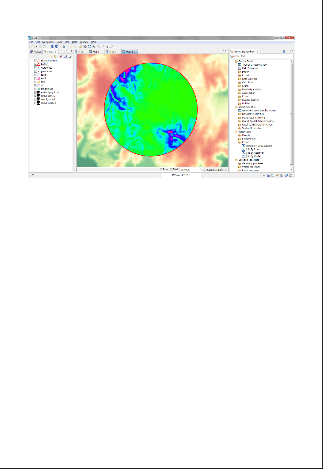

4.3.6.5.
Conditional Expression
Converts the raster's cell value to a True or False value according to the filter conditions.
Syntax
RasterCon (GridCoverage2D inputCoverage, Integer bandIndex, Filter filter, Integer
trueValue, Integer falseValue): GridCoverage2D
Parameters
Data Inputs
Identifier
Description
Type
Required
inputCoverage
The input gridcoverage to be clipped.
Complex
bandIndex
The zero-based band index, default index is a 0.
Literal
-
filter
A logical expression that determines which of the
input cells are to be true or false. ex> Value > 250
Complex
trueValue
The input whose values will be used as the output
cell values if the condition is true.
Literal
falseValue
The input whose values will be used as the output
cell values if the condition is false. Default is NoData.
Literal
-
Process Outputs
Identifier
Description
Type
Required
result
Output Raster.
Complex
Constraints
- The field name of the filter parameter must be Value.
- The trueValue and falseValue parameter must be Integer values.
- If the falseValue parameter value is Null, apply the NoData value.
Request Examples
<?xml version="1.0" encoding="UTF-8"?>
<wps:Execute version="1.0.0" service="WPS" xmlns:xsi="http://www.w3.org/2001/XMLSchema-instance"
xmlns="http://www.opengis.net/wps/1.0.0" xmlns:wfs="http://www.opengis.net/wfs"
xmlns:wps="http://www.opengis.net/wps/1.0.0" xmlns:ows="http://www.opengis.net/ows/1.1"

xmlns:gml="http://www.opengis.net/gml" xmlns:ogc="http://www.opengis.net/ogc"
xmlns:wcs="http://www.opengis.net/wcs/1.1.1" xmlns:xlink="http://www.w3.org/1999/xlink"
xsi:schemaLocation="http://www.opengis.net/wps/1.0.0 http://schemas.opengis.net/wps/1.0.0/wpsAll.xsd">
<ows:Identifier>statistics:RasterCon</ows:Identifier>
<wps:DataInputs>
<wps:Input>
<ows:Identifier>inputCoverage</ows:Identifier>
<wps:Reference mimeType="image/tiff" xlink:href="http://geoserver/wcs" method="POST">
<wps:Body>
<wcs:GetCoverage service="WCS" version="1.1.1">
<ows:Identifier>foss:seoul_dem30</ows:Identifier>
<wcs:DomainSubset>
<ows:BoundingBox crs="http://www.opengis.net/gml/srs/epsg.xml#3857">
<ows:LowerCorner>1.4111343323506365E7 4498971.750719266</ows:LowerCorner>
<ows:UpperCorner>1.4158021303411832E7 4537343.6431004135</ows:UpperCorner>
</ows:BoundingBox>
</wcs:DomainSubset>
<wcs:Output format="image/tiff"/>
</wcs:GetCoverage>
</wps:Body>
</wps:Reference>
</wps:Input>
<wps:Input>
<ows:Identifier>filter</ows:Identifier>
<wps:Data>
<wps:ComplexData mimeType="text/plain; subtype=cql"><![CDATA[Value >
250]]></wps:ComplexData>
</wps:Data>
</wps:Input>
<wps:Input>
<ows:Identifier>trueValue</ows:Identifier>
<wps:Data>
<wps:LiteralData>1</wps:LiteralData>
</wps:Data>
</wps:Input>
</wps:DataInputs>
<wps:ResponseForm>
<wps:RawDataOutput mimeType="image/tiff">
<ows:Identifier>result</ows:Identifier>
</wps:RawDataOutput>
</wps:ResponseForm>
</wps:Execute>
Response
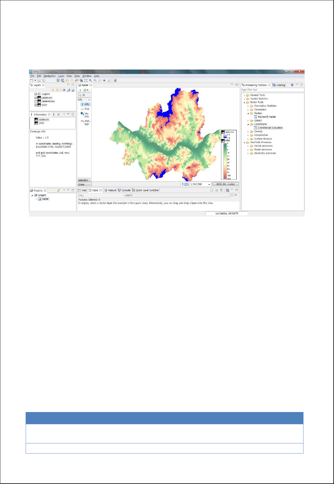
The following figure shows the result of extracting the raster data, corresponding to a
circle with a radius of 1500 meters around a certain point.
4.3.7. Density
Perform density analysis of the raster.
4.3.7.1.
Kernel Density
Perform Kernel Density analysis based on point features and various kernel functions.
Syntax
KernelDensity (SimpleFeatureCollection inputFeatures, KernelType kernelType, String
populationField, Double searchRadius, Double cellSize, ReferencedEnvelope extent):
GridCoverage2D
Parameters
Data Inputs
Identifier
Description
Type
Required
inputFeatures
The input point features for which to calculate the
density.
Complex
kernelType
Kernel functions.
Literal
-

populationField
The field denoting population values for each feature.
Literal
-
searchRadius
The search radius within which to calculate density.
Literal
-
cellSize
The cell size for the output raster.
Literal
-
extent
The extent for the output raster.
Complex
-
Process Outputs
Identifier
Description
Type
Required
result
Output Raster.
Complex
Constraints
- Kernel Type
5
consists of BINARY, COSINE, DISTANCE, EPANECHNIKOV, GAUSSIAN,
INVERSE_DISTANCE, QUADRATIC, QUARTIC, TRIANGULAR, TRIWEIGHT, TRICUBE.
- Unless set the extent parameter, use the range of the inputFeatures layer.
- Unless set the cellSize parameter, choose the smaller value between Extent's Width
and Height, and divide it by 250.
- Unless set the searchRadius parameter, choose the smaller value between Extent's
Width and Height, and divide it by 30.
Request Examples
<?xml version="1.0" encoding="UTF-8"?><wps:Execute version="1.0.0" service="WPS"
xmlns:xsi="http://www.w3.org/2001/XMLSchema-instance" xmlns="http://www.opengis.net/wps/1.0.0"
xmlns:wfs="http://www.opengis.net/wfs" xmlns:wps="http://www.opengis.net/wps/1.0.0"
xmlns:ows="http://www.opengis.net/ows/1.1" xmlns:gml="http://www.opengis.net/gml"
xmlns:ogc="http://www.opengis.net/ogc" xmlns:wcs="http://www.opengis.net/wcs/1.1.1"
xmlns:xlink="http://www.w3.org/1999/xlink" xsi:schemaLocation="http://www.opengis.net/wps/1.0.0
http://schemas.opengis.net/wps/1.0.0/wpsAll.xsd">
<ows:Identifier>statistics:KernelDensity</ows:Identifier>
<wps:DataInputs>
<wps:Input>
<ows:Identifier>inputFeatures</ows:Identifier>
<wps:Reference mimeType="text/xml" xlink:href="http://geoserver/wfs" method="POST">
5
https://en.wikipedia.org/wiki/Kernel_%28statistics%29

<wps:Body>
<wfs:GetFeature service=“WFS” version=“1.1.0” outputFormat=“GML3”
xmlns:foss="http://www.opengeospatial.net/foss">
<wfs:Query typeName="foss:gasstation"/>
</wfs:GetFeature>
</wps:Body>
</wps:Reference>
</wps:Input>
<wps:Input>
<ows:Identifier>kernelType</ows:Identifier>
<wps:Data>
<wps:LiteralData>QUADRATIC</wps:LiteralData>
</wps:Data>
</wps:Input>
<wps:Input>
<ows:Identifier>cellSize</ows:Identifier>
<wps:Data>
<wps:LiteralData>30</wps:LiteralData>
</wps:Data>
</wps:Input>
<wps:Input>
<ows:Identifier>extent</ows:Identifier>
<wps:Data>
<wps:BoundingBoxData crs="EPSG:3857" dimensions="2">
<ows:LowerCorner>1.4111357E7 4498975.0</ows:LowerCorner>
<ows:UpperCorner>1.4158036E7 4537337.0</ows:UpperCorner>
</wps:BoundingBoxData>
</wps:Data>
</wps:Input>
</wps:DataInputs>
<wps:ResponseForm>
<wps:RawDataOutput mimeType="image/tiff">
<ows:Identifier>result</ows:Identifier>
</wps:RawDataOutput>
</wps:ResponseForm>
</wps:Execute>
Response
The following figure shows the result of Kernel Density analysis of 30 meters cell size
based on Seoul gas station data.
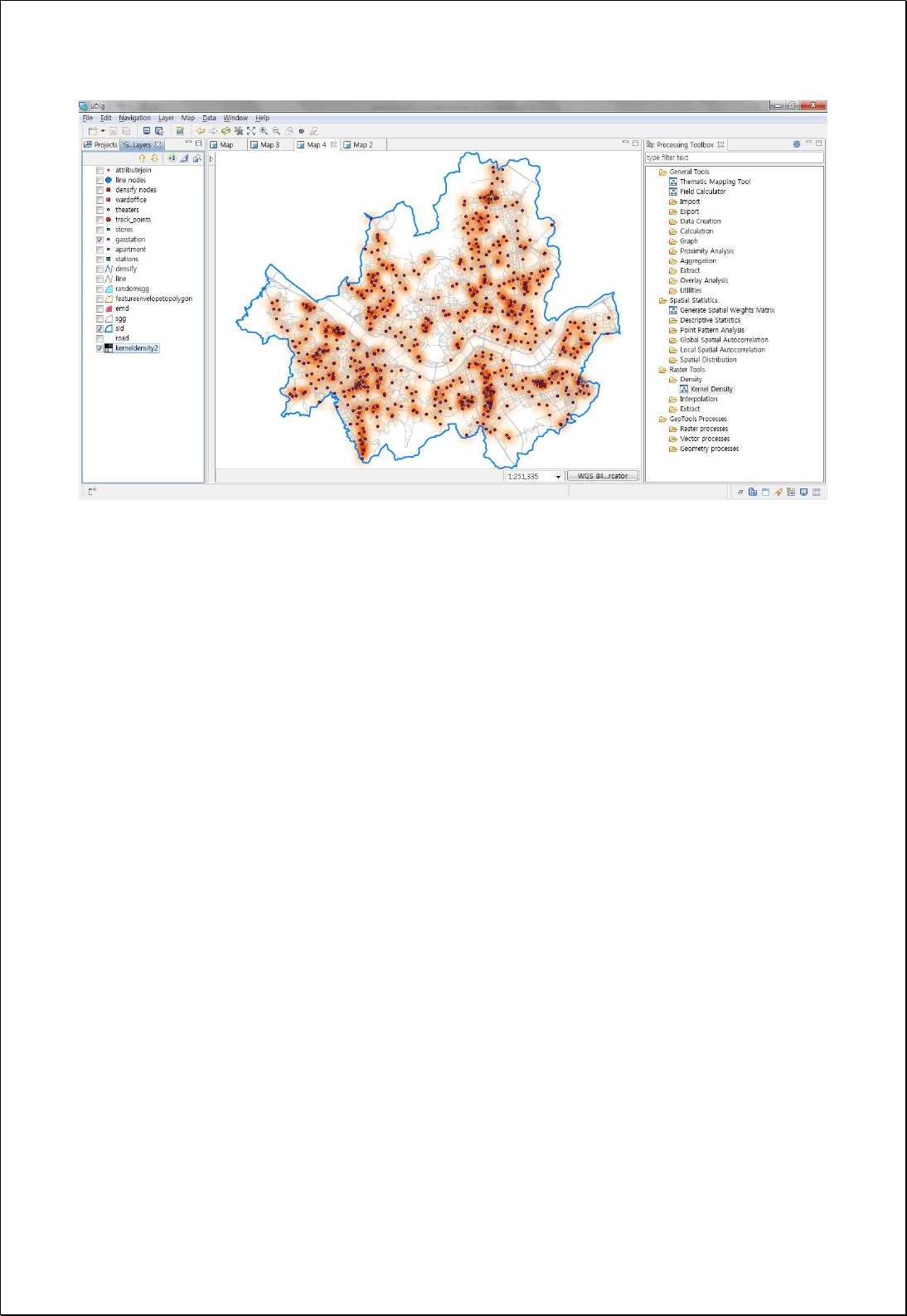

4.3.7.2.
Point Density
Perform density analysis by setting point features and neighbors.
Syntax
PointDensity (SimpleFeatureCollection inputFeatures, String populationField, String
neighborhood, Double cellSize, ReferencedEnvelope extent): GridCoverage2D
Parameters
Data Inputs
Identifier
Description
Type
Required
inputFeatures
The input point features for which to calculate the
density.
Complex
populationField
The field denoting population values for each
feature.
Literal
-
neighborhood
Neighborhood:
Ex> Circle + Radius
Ex> Rectangle + width + height
Literal
-
cellSize
The cell size for the output raster.
Literal
-
extent
The extent for the output raster.
Complex
-
Process Outputs
Identifier
Description
Type
Required
result
Output Raster.
Complex
Constraints
- Unless set the neighborhood parameter, use the Circle + radius (the width and
height of the extent of inPutFeatures, whichever is smaller, divided by 30).
- Unless set the extent parameter, use the range of the inputFeatures layer.
- Unless set the cellSize parameter, choose the smaller value between Extent's Width
and Height, and divide it by 250.
Request Examples

<?xml version="1.0" encoding="UTF-8"?><wps:Execute version="1.0.0" service="WPS"
xmlns:xsi="http://www.w3.org/2001/XMLSchema-instance" xmlns="http://www.opengis.net/wps/1.0.0"
xmlns:wfs="http://www.opengis.net/wfs" xmlns:wps="http://www.opengis.net/wps/1.0.0"
xmlns:ows="http://www.opengis.net/ows/1.1" xmlns:gml="http://www.opengis.net/gml"
xmlns:ogc="http://www.opengis.net/ogc" xmlns:wcs="http://www.opengis.net/wcs/1.1.1"
xmlns:xlink="http://www.w3.org/1999/xlink" xsi:schemaLocation="http://www.opengis.net/wps/1.0.0
http://schemas.opengis.net/wps/1.0.0/wpsAll.xsd">
<ows:Identifier>statistics:PointDensity</ows:Identifier>
<wps:DataInputs>
<wps:Input>
<ows:Identifier>inputFeatures</ows:Identifier>
<wps:Reference mimeType="text/xml" xlink:href="http://geoserver/wfs" method="POST">
<wps:Body>
<wfs:GetFeature service="WFS" version="1.0.0" outputFormat="GML2"
xmlns:foss="http://www.opengeospatial.net/foss">
<wfs:Query typeName="foss:pubs"/>
</wfs:GetFeature>
</wps:Body>
</wps:Reference>
</wps:Input>
<wps:Input>
<ows:Identifier>cellSize</ows:Identifier>
<wps:Data>
<wps:LiteralData>30</wps:LiteralData>
</wps:Data>
</wps:Input>
</wps:DataInputs>
<wps:ResponseForm>
<wps:RawDataOutput mimeType="image/tiff">
<ows:Identifier>result</ows:Identifier>
</wps:RawDataOutput>
</wps:ResponseForm>
</wps:Execute>
Response
The following figure shows the result of Kernel Density analysis of 30 meters cell size
based on Seoul point data.
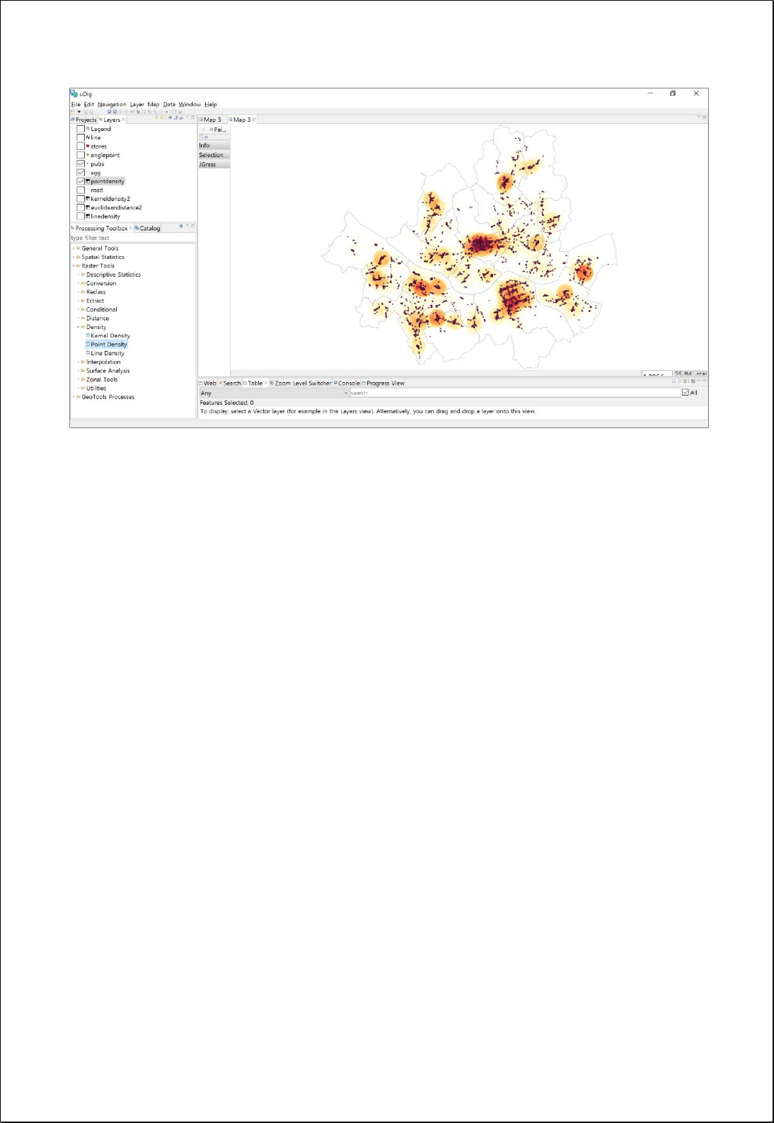

4.3.7.3.
Line Density
Performs line density analysis using line features and search radius.
Syntax
LineDensity (SimpleFeatureCollection inputFeatures, String populationField, Double
searchRadius, Double cellSize, ReferencedEnvelope extent): GridCoverage2D
Parameters
Data Inputs
Identifier
Description
Type
Required
inputFeatures
The input line features for which to calculate the
density.
Complex
populationField
The field denoting population values for each
feature.
Literal
-
searchRadius
The search radius within which to calculate density.
Literal
-
cellSize
The cell size for the output raster.
Literal
-
extent
The extent for the output raster.
Complex
-
Process Outputs
Identifier
Description
Type
Required
result
Output Raster.
Complex
Constraints
- Unless set the searchRadius parameter, choose the smaller value between Extent's
Width and Height, and divide it by 30.
- Unless set the extent parameter, use the range of the inputFeatures layer.
- Unless set the cellSize parameter, choose the smaller value between Extent's Width
and Height, and divide it by 250.
Request Examples
<?xml version="1.0" encoding="UTF-8"?><wps:Execute version="1.0.0" service="WPS"
xmlns:xsi="http://www.w3.org/2001/XMLSchema-instance" xmlns="http://www.opengis.net/wps/1.0.0"

xmlns:wfs="http://www.opengis.net/wfs" xmlns:wps="http://www.opengis.net/wps/1.0.0"
xmlns:ows="http://www.opengis.net/ows/1.1" xmlns:gml="http://www.opengis.net/gml"
xmlns:ogc="http://www.opengis.net/ogc" xmlns:wcs="http://www.opengis.net/wcs/1.1.1"
xmlns:xlink="http://www.w3.org/1999/xlink" xsi:schemaLocation="http://www.opengis.net/wps/1.0.0
http://schemas.opengis.net/wps/1.0.0/wpsAll.xsd">
<ows:Identifier>statistics:LineDensity</ows:Identifier>
<wps:DataInputs>
<wps:Input>
<ows:Identifier>inputFeatures</ows:Identifier>
<wps:Reference mimeType="text/xml" xlink:href="http://geoserver/wfs" method="POST">
<wps:Body>
<wfs:GetFeature service="WFS" version="1.0.0" outputFormat="GML2"
xmlns:foss="http://www.opengeospatial.net/foss">
<wfs:Query typeName="foss:road"/>
</wfs:GetFeature>
</wps:Body>
</wps:Reference>
</wps:Input>
<wps:Input>
<ows:Identifier>cellSize</ows:Identifier>
<wps:Data>
<wps:LiteralData>30</wps:LiteralData>
</wps:Data>
</wps:Input>
</wps:DataInputs>
<wps:ResponseForm>
<wps:RawDataOutput mimeType="image/tiff">
<ows:Identifier>result</ows:Identifier>
</wps:RawDataOutput>
</wps:ResponseForm>
</wps:Execute>
Response
The following figure shows the result of Line Density analysis of 30 meters cell size based
on Seoul major road data.
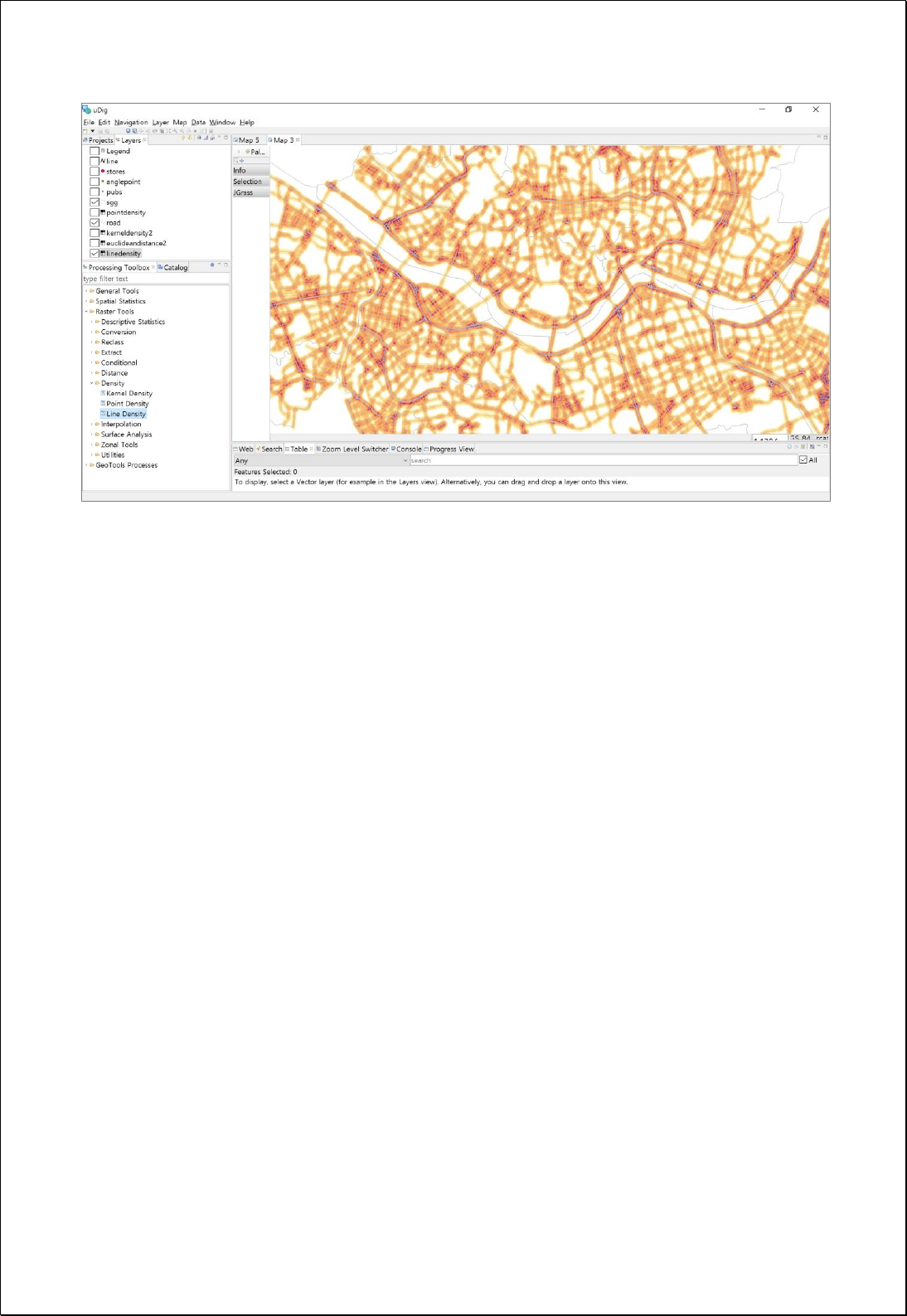

4.3.8. Interpolation
Perform interpolation analysis, using points and attribute values.
4.3.8.1.
IDW (Inverse Distance Weighted)
Perform the Inverse Distance Weighted(IDW) Interpolation analysis using the point
feature layers.
Syntax
IDW (SimpleFeatureCollection inputFeatures, String inputField, Double power, RadiusType
radiusType, Integer numberOfPoints, Double distance, Double cellSize,
ReferencedEnvelope extent): GridCoverage2D
Parameters
Data Inputs
Identifier
Description
Type
Required
inputFeatures
The input point features for which to calculate the
density.
Complex
inputField
The field that holds a height or magnitude value for
each point.
Literal
power
The exponent (default 2.0) of distance.
Literal
-
radiusType
The search radius type Variable, Fixed
Literal
-
numberOfPoints
The numberOfPoints is an integer value specifying
the number of nearest input sample points to be
used to perform the interpolation.
Literal
-
distance
The distance specifies the distance, in map units, by
which to limit the search for the nearest input sample
points.
Literal
-
cellSize
The cell size for the output raster.
Literal
-
extent
The extent for the output raster.
Complex
-
Process Outputs
Identifier
Description
Type
Required
result
Output Raster.
Complex
Constraints

- Unless set the Extent parameter, use the range of the inputFeatures layer.
- Unless set the cellSize parameter, choose the smaller value between Extent's Width
and Height, and divide it by 250.
Request Examples
<?xml version="1.0" encoding="UTF-8"?><wps:Execute version="1.0.0" service="WPS"
xmlns:xsi="http://www.w3.org/2001/XMLSchema-instance" xmlns="http://www.opengis.net/wps/1.0.0"
xmlns:wfs="http://www.opengis.net/wfs" xmlns:wps="http://www.opengis.net/wps/1.0.0"
xmlns:ows="http://www.opengis.net/ows/1.1" xmlns:gml="http://www.opengis.net/gml"
xmlns:ogc="http://www.opengis.net/ogc" xmlns:wcs="http://www.opengis.net/wcs/1.1.1"
xmlns:xlink="http://www.w3.org/1999/xlink" xsi:schemaLocation="http://www.opengis.net/wps/1.0.0
http://schemas.opengis.net/wps/1.0.0/wpsAll.xsd">
<ows:Identifier>statistics:IDW</ows:Identifier>
<wps:DataInputs>
<wps:Input>
<ows:Identifier>inputFeatures</ows:Identifier>
<wps:Reference mimeType="text/xml" xlink:href="http://geoserver/wfs" method="POST">
<wps:Body>
<wfs:GetFeature service=“WFS” version=“1.1.0” outputFormat=“GML3”
xmlns:foss="http://www.opengeospatial.net/foss">
<wfs:Query typeName="foss:gasstation"/>
</wfs:GetFeature>
</wps:Body>
</wps:Reference>
</wps:Input>
<wps:Input>
<ows:Identifier>inputField</ows:Identifier>
<wps:Data>
<wps:LiteralData>price</wps:LiteralData>
</wps:Data>
</wps:Input>
<wps:Input>
<ows:Identifier>power</ows:Identifier>
<wps:Data>
<wps:LiteralData>2.0</wps:LiteralData>
</wps:Data>
</wps:Input>
<wps:Input>
<ows:Identifier>radiusType</ows:Identifier>
<wps:Data>
<wps:LiteralData>Variable</wps:LiteralData>

</wps:Data>
</wps:Input>
<wps:Input>
<ows:Identifier>numberOfPoints</ows:Identifier>
<wps:Data>
<wps:LiteralData>24</wps:LiteralData>
</wps:Data>
</wps:Input>
<wps:Input>
<ows:Identifier>cellSize</ows:Identifier>
<wps:Data>
<wps:LiteralData>30</wps:LiteralData>
</wps:Data>
</wps:Input>
<wps:Input>
<ows:Identifier>extent</ows:Identifier>
<wps:Data>
<wps:BoundingBoxData crs="EPSG:3857" dimensions="2">
<ows:LowerCorner>1.4111357E7 4498975.0</ows:LowerCorner>
<ows:UpperCorner>1.4158036E7 4537337.0</ows:UpperCorner>
</wps:BoundingBoxData>
</wps:Data>
</wps:Input>
</wps:DataInputs>
<wps:ResponseForm>
<wps:RawDataOutput mimeType="image/tiff">
<ows:Identifier>result</ows:Identifier>
</wps:RawDataOutput>
</wps:ResponseForm>
</wps:Execute>
Response
The following figure shows the result of Inverse Distance Weighted(IDW) analysis of 30
meter cell size based on oil price information of Seoul gas station.
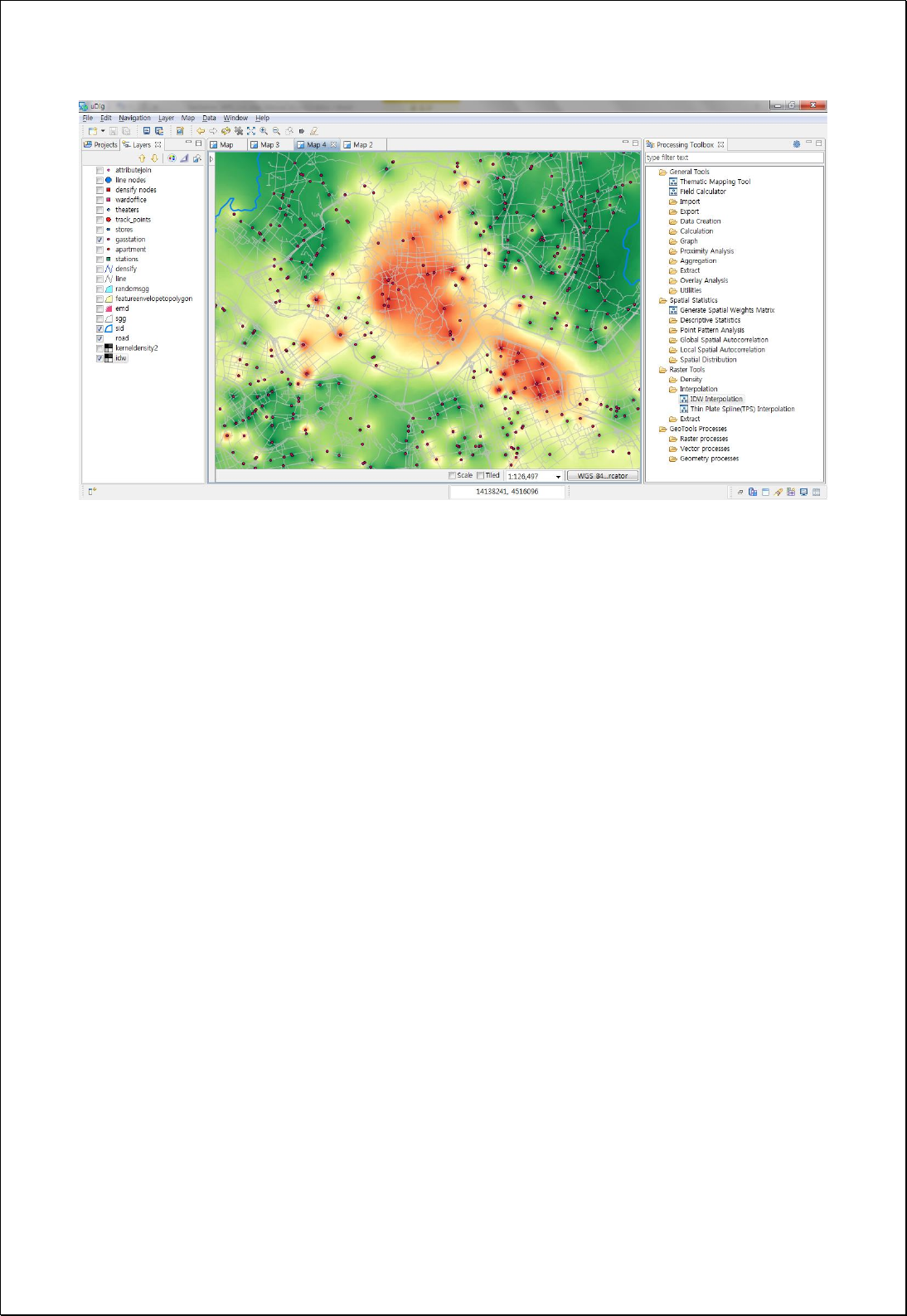

4.3.8.2.
TPS (Thin Plate Spline)
Performs Thin Plate Spline(TPS) interpolation analysis using the point feature layers.
Syntax
TPS (SimpleFeatureCollection inputFeatures, String inputField, Double cellSize,
ReferencedEnvelope extent): GridCoverage2D
Parameters
Data Inputs
Identifier
Description
Type
Required
inputFeatures
The input point features for which to calculate the
density.
Complex
inputField
The field that holds a height or magnitude value for
each point.
Literal
cellSize
The cell size for the output raster.
Literal
-
extent
The extent for the output raster.
Complex
-
Process Outputs
Identifier
Description
Type
Required
result
Output Raster.
Complex
Constraints
- Unless set the extent parameter, use the range of the inputFeatures layer.
- Unless set the cellSize parameter, choose the smaller value between Extent's Width
and Height, and divide it by 250.
Request Examples
<?xml version="1.0" encoding="UTF-8"?><wps:Execute version="1.0.0" service="WPS"
xmlns:xsi="http://www.w3.org/2001/XMLSchema-instance" xmlns="http://www.opengis.net/wps/1.0.0"
xmlns:wfs="http://www.opengis.net/wfs" xmlns:wps="http://www.opengis.net/wps/1.0.0"
xmlns:ows="http://www.opengis.net/ows/1.1" xmlns:gml="http://www.opengis.net/gml"
xmlns:ogc="http://www.opengis.net/ogc" xmlns:wcs="http://www.opengis.net/wcs/1.1.1"
xmlns:xlink="http://www.w3.org/1999/xlink" xsi:schemaLocation="http://www.opengis.net/wps/1.0.0
http://schemas.opengis.net/wps/1.0.0/wpsAll.xsd">

<ows:Identifier>statistics:TPS</ows:Identifier>
<wps:DataInputs>
<wps:Input>
<ows:Identifier>inputFeatures</ows:Identifier>
<wps:Reference mimeType="text/xml" xlink:href="http://geoserver/wfs" method="POST">
<wps:Body>
<wfs:GetFeature service=“WFS” version=“1.1.0” outputFormat=“GML3”
xmlns:foss="http://www.opengeospatial.net/foss">
<wfs:Query typeName="foss:gasstation"/>
</wfs:GetFeature>
</wps:Body>
</wps:Reference>
</wps:Input>
<wps:Input>
<ows:Identifier>inputField</ows:Identifier>
<wps:Data>
<wps:LiteralData>price</wps:LiteralData>
</wps:Data>
</wps:Input>
<wps:Input>
<ows:Identifier>cellSize</ows:Identifier>
<wps:Data>
<wps:LiteralData>30</wps:LiteralData>
</wps:Data>
</wps:Input>
<wps:Input>
<ows:Identifier>extent</ows:Identifier>
<wps:Data>
<wps:BoundingBoxData crs="EPSG:3857" dimensions="2">
<ows:LowerCorner>1.4111357E7 4498975.0</ows:LowerCorner>
<ows:UpperCorner>1.4158036E7 4537337.0</ows:UpperCorner>
</wps:BoundingBoxData>
</wps:Data>
</wps:Input>
</wps:DataInputs>
<wps:ResponseForm>
<wps:RawDataOutput mimeType="image/tiff">
<ows:Identifier>result</ows:Identifier>
</wps:RawDataOutput>
</wps:ResponseForm>
</wps:Execute>
Response
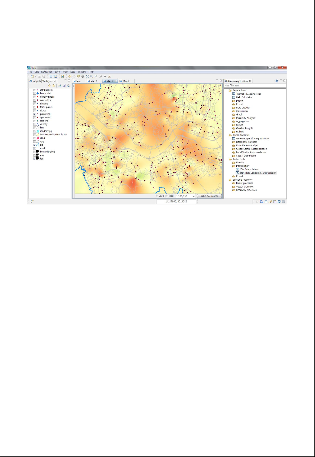
The following figure shows the result of Thin Plate Spline(TPS) analysis of 30 meter cell
size based on oil price information of Seoul gas station.

4.3.9. Surface Analysis
Perform the terrain analysis.
4.3.9.1.
Raster Profile
Converts the raster data such as DEM and line layers to point data after longitudinal
section(Profile) analysis.
Syntax
RasterProfile (GridCoverage2D inputCoverage, Geometry userLine, Double interval):
SimpleFeatureCollection
Parameters
Data Inputs
Identifier
Description
Type
Required
inputCoverage
The input surface raster.
Complex
userLine
LineString or MultiLineString geometry.
Literal
interval
The interval of distance. Default = length of
geometry / 20.
Literal
-
Process Outputs
Identifier
Description
Type
Required
result
Output line features.
Complex
Constraints
- Unless set the interval parameter, apply the value that divided the userLine length
by 20.
- The Output point layers contain the distance(cumulative distance) and value (cell
value of the raster, such as height value) field.

Request Examples
<?xml version="1.0" encoding="UTF-8"?>
<wps:Execute version="1.0.0" service="WPS" xmlns:xsi="http://www.w3.org/2001/XMLSchema-instance"
xmlns="http://www.opengis.net/wps/1.0.0" xmlns:wfs="http://www.opengis.net/wfs"
xmlns:wps="http://www.opengis.net/wps/1.0.0" xmlns:ows="http://www.opengis.net/ows/1.1"
xmlns:gml="http://www.opengis.net/gml" xmlns:ogc="http://www.opengis.net/ogc"
xmlns:wcs="http://www.opengis.net/wcs/1.1.1" xmlns:xlink="http://www.w3.org/1999/xlink"
xsi:schemaLocation="http://www.opengis.net/wps/1.0.0 http://schemas.opengis.net/wps/1.0.0/wpsAll.xsd">
<ows:Identifier>statistics:RasterProfile</ows:Identifier>
<wps:DataInputs>
<wps:Input>
<ows:Identifier>inputCoverage</ows:Identifier>
<wps:Reference mimeType="image/tiff" xlink:href="http://geoserver/wcs" method="POST">
<wps:Body>
<wcs:GetCoverage service="WCS" version="1.1.1">
<ows:Identifier>foss:seoul_dem30</ows:Identifier>
<wcs:DomainSubset>
<ows:BoundingBox crs="http://www.opengis.net/gml/srs/epsg.xml#3857">
<ows:LowerCorner>1.4111343323506365E7 4498971.750719266</ows:LowerCorner>
<ows:UpperCorner>1.4158021303411832E7 4537343.6431004135</ows:UpperCorner>
</ows:BoundingBox>
</wcs:DomainSubset>
<wcs:Output format="image/tiff"/>
</wcs:GetCoverage>
</wps:Body>
</wps:Reference>
</wps:Input>
<wps:Input>
<ows:Identifier>userLine</ows:Identifier>
<wps:Data>
<wps:ComplexData mimeType="application/wkt"><![CDATA[LineString(14130049 4513932,
14144040 4531525)]]></wps:ComplexData>
</wps:Data>
</wps:Input>
</wps:DataInputs>
<wps:ResponseForm>
<wps:RawDataOutput mimeType="text/xml; subtype=wfs-collection/1.0">
<ows:Identifier>result</ows:Identifier>
</wps:RawDataOutput>
</wps:ResponseForm>
</wps:Execute>
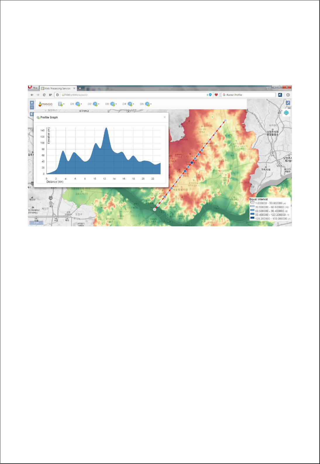
Response
The following figure shows the result of Profile analysis as point layers and graph using
Seoul DEM.

4.3.9.2.
Radial Line Of Sight
Perform Radial Line Of Sight analysis using observation points and radius using DEM
raster data.
Syntax
RadialLineOfSight (GridCoverage2D inputCoverage, Geometry observerPoint, Double
observerOffset, Double radius, Integer sides, Boolean useCurvature, Boolean
useRefraction, Double refractionFactor): SimpleFeatureCollection
Parameters
Data Inputs
Identifier
Description
Type
Required
inputFeatures
The input surface raster.
Complex
observerPoint
The observer's coordinate.
Complex
observerOffset
The observer's offset above the surface rater. The
default is 0.0 units.
Literal
radius
The radius from the observer point, for which the
radial visibility will be calculated.
Literal
sides
The number of sides. The default sides is 180.
Literal
-
useCurvature
Indicates whether the earth's curvature should be
taken into consideration for the line-of-sight analysis.
Default is False.
Literal
-
useRefraction
Indicates whether atmospheric refraction should be
taken into consideration when generating a line of
sight from a functional surface. Default is False.
Literal
-
refractionFactor
The refraction factor. The default refraction factor is
0.13.
Literal
-
Process Outputs
Identifier
Description
Type
Required
result
Output Raster.
Complex
Constraints
- The useRefraction and refractionFactor parameter are only applied if the
useCurvature parameter is True.

- If the useCurvature parameter is True and the useRefraction parameter is False,
then refractionFactor applies a value of 0.13.
- The output line layers includes the Angle, Visible field, the visible field if the Visible
field value is 1, and the invisible area if it is 0.
Request Examples
<?xml version="1.0" encoding="UTF-8"?>
<wps:Execute version="1.0.0" service="WPS" xmlns:xsi="http://www.w3.org/2001/XMLSchema-instance"
xmlns="http://www.opengis.net/wps/1.0.0" xmlns:wfs="http://www.opengis.net/wfs"
xmlns:wps="http://www.opengis.net/wps/1.0.0" xmlns:ows="http://www.opengis.net/ows/1.1"
xmlns:gml="http://www.opengis.net/gml" xmlns:ogc="http://www.opengis.net/ogc"
xmlns:wcs="http://www.opengis.net/wcs/1.1.1" xmlns:xlink="http://www.w3.org/1999/xlink"
xsi:schemaLocation="http://www.opengis.net/wps/1.0.0 http://schemas.opengis.net/wps/1.0.0/wpsAll.xsd">
<ows:Identifier>statistics:RadialLineOfSight</ows:Identifier>
<wps:DataInputs>
<wps:Input>
<ows:Identifier>inputCoverage</ows:Identifier>
<wps:Reference mimeType="image/tiff" xlink:href="http://geoserver/wcs" method="POST">
<wps:Body>
<wcs:GetCoverage service="WCS" version="1.1.1">
<ows:Identifier>foss:seoul_dem30</ows:Identifier>
<wcs:DomainSubset>
<ows:BoundingBox crs="http://www.opengis.net/gml/srs/epsg.xml#3857">
<ows:LowerCorner>1.4111343323506365E7 4498971.750719266</ows:LowerCorner>
<ows:UpperCorner>1.4158021303411832E7 4537343.6431004135</ows:UpperCorner>
</ows:BoundingBox>
</wcs:DomainSubset>
<wcs:Output format="image/tiff"/>
</wcs:GetCoverage>
</wps:Body>
</wps:Reference>
</wps:Input>
<wps:Input>
<ows:Identifier>observerPoint</ows:Identifier>
<wps:Data>
<wps:ComplexData mimeType="application/wkt"><![CDATA[POINT(14136287.706512472
4516237.6022168035)]]></wps:ComplexData>
</wps:Data>
</wps:Input>
<wps:Input>
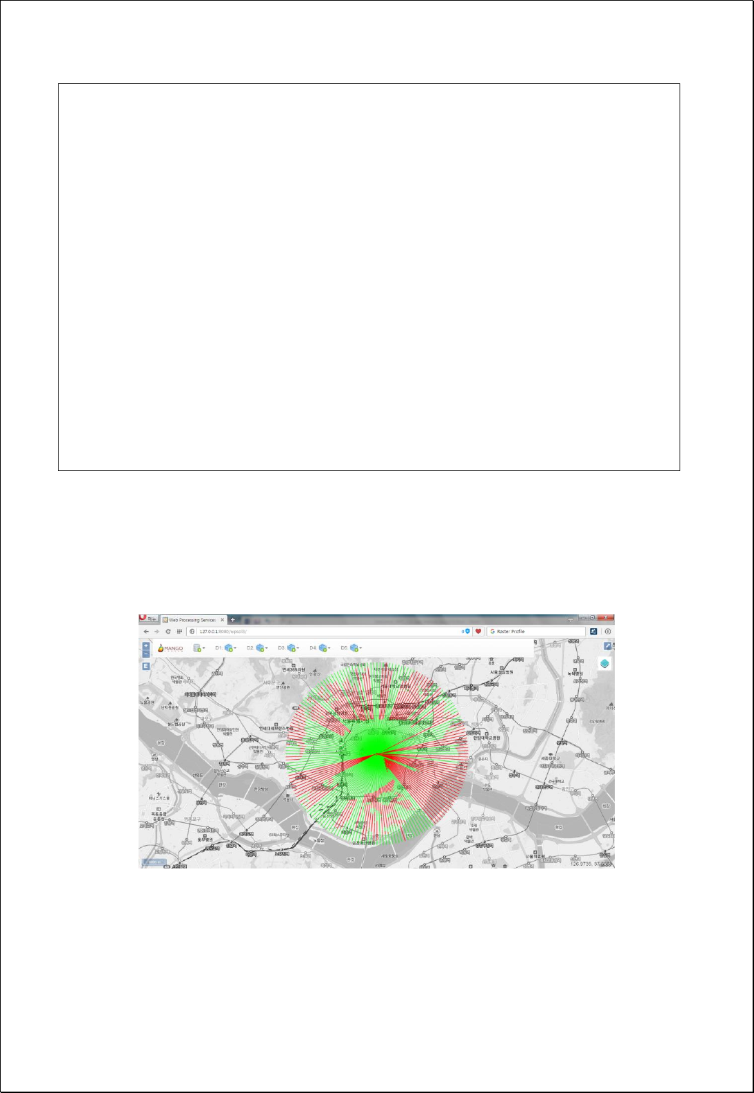
<ows:Identifier>observerOffset</ows:Identifier>
<wps:Data>
<wps:LiteralData>1.8</wps:LiteralData>
</wps:Data>
</wps:Input>
<wps:Input>
<ows:Identifier>radius</ows:Identifier>
<wps:Data>
<wps:LiteralData>5000</wps:LiteralData>
</wps:Data>
</wps:Input>
</wps:DataInputs>
<wps:ResponseForm>
<wps:RawDataOutput mimeType="text/xml; subtype=wfs-collection/1.0">
<ows:Identifier>result</ows:Identifier>
</wps:RawDataOutput>
</wps:ResponseForm>
</wps:Execute>
Response
The following figure shows the result of visible area analysis of 5000m radius based on
Namsan of Seoul DEM.

4.3.9.3.
Linear Line Of Sight
Performs Linear Line Of Sight analysis using observation points and target points using
DEM raster data.
Syntax
LinearLineOfSight (GridCoverage2D inputCoverage, Geometry observerPoint, Double
observerOffset, Geometry targetPoint, Boolean useCurvature, Boolean useRefraction,
Double refractionFactor): SimpleFeatureCollection
Parameters
Data Inputs
Identifier
Description
Type
Required
inputCoverage
The input surface raster.
Complex
observerPoint
The observer's coordinate.
Complex
observerOffset
The observer's offset above the surface rater. The
default is 0.0 units.
Literal
targetPoint
The target's coordinate.
Complex
useCurvature
Indicates whether the earth's curvature should be
taken into consideration for the line-of-sight
analysis. Default is False.
Literal
-
useRefraction
Indicates whether atmospheric refraction should be
taken into consideration when generating a line of
sight from a functional surface. Default is False.
Literal
-
refractionFactor
The refraction factor. The default refraction factor is
0.13.
Literal
-
Process Outputs
Identifier
Description
Type
Required
result
Output Raster.
Complex
Constraints
- If the useCurvature parameter is True, the useRefraction and refractionFactor
parameter are only applied.

- If the useCurvature parameter is True and the useRefraction parameter is False,
then refractionFactor applies a value of 0.13.
- The output line layers include a visible field, a visible area when the Visible field
value is 1, and a non-visible area when the value is 0.
Request Examples
<?xml version="1.0" encoding="UTF-8"?>
<wps:Execute version="1.0.0" service="WPS" xmlns:xsi="http://www.w3.org/2001/XMLSchema-instance"
xmlns="http://www.opengis.net/wps/1.0.0" xmlns:wfs="http://www.opengis.net/wfs"
xmlns:wps="http://www.opengis.net/wps/1.0.0" xmlns:ows="http://www.opengis.net/ows/1.1"
xmlns:gml="http://www.opengis.net/gml" xmlns:ogc="http://www.opengis.net/ogc"
xmlns:wcs="http://www.opengis.net/wcs/1.1.1" xmlns:xlink="http://www.w3.org/1999/xlink"
xsi:schemaLocation="http://www.opengis.net/wps/1.0.0 http://schemas.opengis.net/wps/1.0.0/wpsAll.xsd">
<ows:Identifier>statistics:LinearLineOfSight</ows:Identifier>
<wps:DataInputs>
<wps:Input>
<ows:Identifier>inputCoverage</ows:Identifier>
<wps:Reference mimeType="image/tiff" xlink:href="http://geoserver/wcs" method="POST">
<wps:Body>
<wcs:GetCoverage service="WCS" version="1.1.1">
<ows:Identifier>foss:seoul_dem30</ows:Identifier>
<wcs:DomainSubset>
<ows:BoundingBox crs="http://www.opengis.net/gml/srs/epsg.xml#3857">
<ows:LowerCorner>1.4111343323506365E7 4498971.750719266</ows:LowerCorner>
<ows:UpperCorner>1.4158021303411832E7 4537343.6431004135</ows:UpperCorner>
</ows:BoundingBox>
</wcs:DomainSubset>
<wcs:Output format="image/tiff"/>
</wcs:GetCoverage>
</wps:Body>
</wps:Reference>
</wps:Input>
<wps:Input>
<ows:Identifier>observerPoint</ows:Identifier>
<wps:Data>
<wps:ComplexData mimeType="application/wkt"><![CDATA[POINT(14136291.5572
4516245.7128)]]></wps:ComplexData>
</wps:Data>
</wps:Input>
<wps:Input>
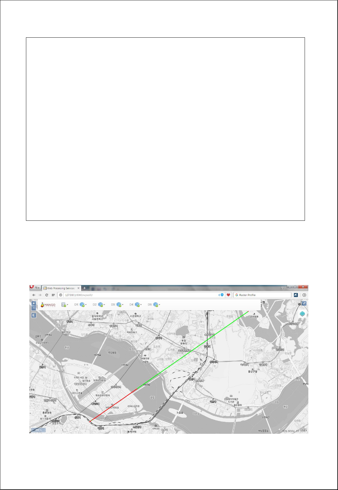
<ows:Identifier>observerOffset</ows:Identifier>
<wps:Data>
<wps:LiteralData>1.8</wps:LiteralData>
</wps:Data>
</wps:Input>
<wps:Input>
<ows:Identifier>targetPoint</ows:Identifier>
<wps:Data>
<wps:ComplexData mimeType="application/wkt"><![CDATA[POINT(14128854.8064
4511075.0345)]]></wps:ComplexData>
</wps:Data>
</wps:Input>
</wps:DataInputs>
<wps:ResponseForm>
<wps:RawDataOutput mimeType="text/xml; subtype=wfs-collection/1.0">
<ows:Identifier>result</ows:Identifier>
</wps:RawDataOutput>
</wps:ResponseForm>
</wps:Execute>
Response
The following figure shows the result of analyzing the line of sight of Yeouido, based on
Namsan of Seoul DEM.

4.3.9.4.
Find Highest/Lowest Points
Find the highest and lowest positions in a specific area of raster data, such as DEM, and
return to the point.
Syntax
RasterHighLowPoints (GridCoverage2D inputCoverage, Integer bandIndex, Geometry
cropShape, HighLowType valueType): SimpleFeatureCollection
Parameters
Data Inputs
Identifier
Description
Type
Required
inputCoverage
The input gridcoverage to be processed.
Complex
bandIndex
The zero-based band index, default index is a 0.
Literal
-
cropShape
The Polygon or MultiPolygon to clip gridcoverage.
Complex
-
valueType
Value Type (Both, High, Low). Default is High.
Literal
-
Process Outputs
Identifier
Description
Type
Required
result
Output Raster.
Complex
Constraints
- The cropShape parameter must be Polygon or MultiPolygon.
- The valueType parameter uses the values of Both, High, and Low.
Request Examples
<?xml version="1.0" encoding="UTF-8"?>
<wps:Execute version="1.0.0" service="WPS" xmlns:xsi="http://www.w3.org/2001/XMLSchema-instance"
xmlns="http://www.opengis.net/wps/1.0.0" xmlns:wfs="http://www.opengis.net/wfs"
xmlns:wps="http://www.opengis.net/wps/1.0.0" xmlns:ows="http://www.opengis.net/ows/1.1"
xmlns:gml="http://www.opengis.net/gml" xmlns:ogc="http://www.opengis.net/ogc"
xmlns:wcs="http://www.opengis.net/wcs/1.1.1" xmlns:xlink="http://www.w3.org/1999/xlink"
xsi:schemaLocation="http://www.opengis.net/wps/1.0.0 http://schemas.opengis.net/wps/1.0.0/wpsAll.xsd">
<ows:Identifier>statistics:RasterHighLowPoints</ows:Identifier>
<wps:DataInputs>

<wps:Input>
<ows:Identifier>inputCoverage</ows:Identifier>
<wps:Reference mimeType="image/tiff" xlink:href="http://geoserver/wcs" method="POST">
<wps:Body>
<wcs:GetCoverage service="WCS" version="1.1.1">
<ows:Identifier>foss:seoul_dem30</ows:Identifier>
<wcs:DomainSubset>
<ows:BoundingBox crs="http://www.opengis.net/gml/srs/epsg.xml#3857">
<ows:LowerCorner>1.4111343323506365E7 4498971.750719266</ows:LowerCorner>
<ows:UpperCorner>1.4158021303411832E7 4537343.6431004135</ows:UpperCorner>
</ows:BoundingBox>
</wcs:DomainSubset>
<wcs:Output format="image/tiff"/>
</wcs:GetCoverage>
</wps:Body>
</wps:Reference>
</wps:Input>
<wps:Input>
<ows:Identifier>valueType</ows:Identifier>
<wps:Data>
<wps:LiteralData>Both</wps:LiteralData>
</wps:Data>
</wps:Input>
</wps:DataInputs>
<wps:ResponseForm>
<wps:RawDataOutput mimeType="text/xml; subtype=wfs-collection/1.0">
<ows:Identifier>result</ows:Identifier>
</wps:RawDataOutput>
</wps:ResponseForm>
</wps:Execute>
Response
The following figure shows the analysis result of the highest point based on the current
map range of Seoul DEM.
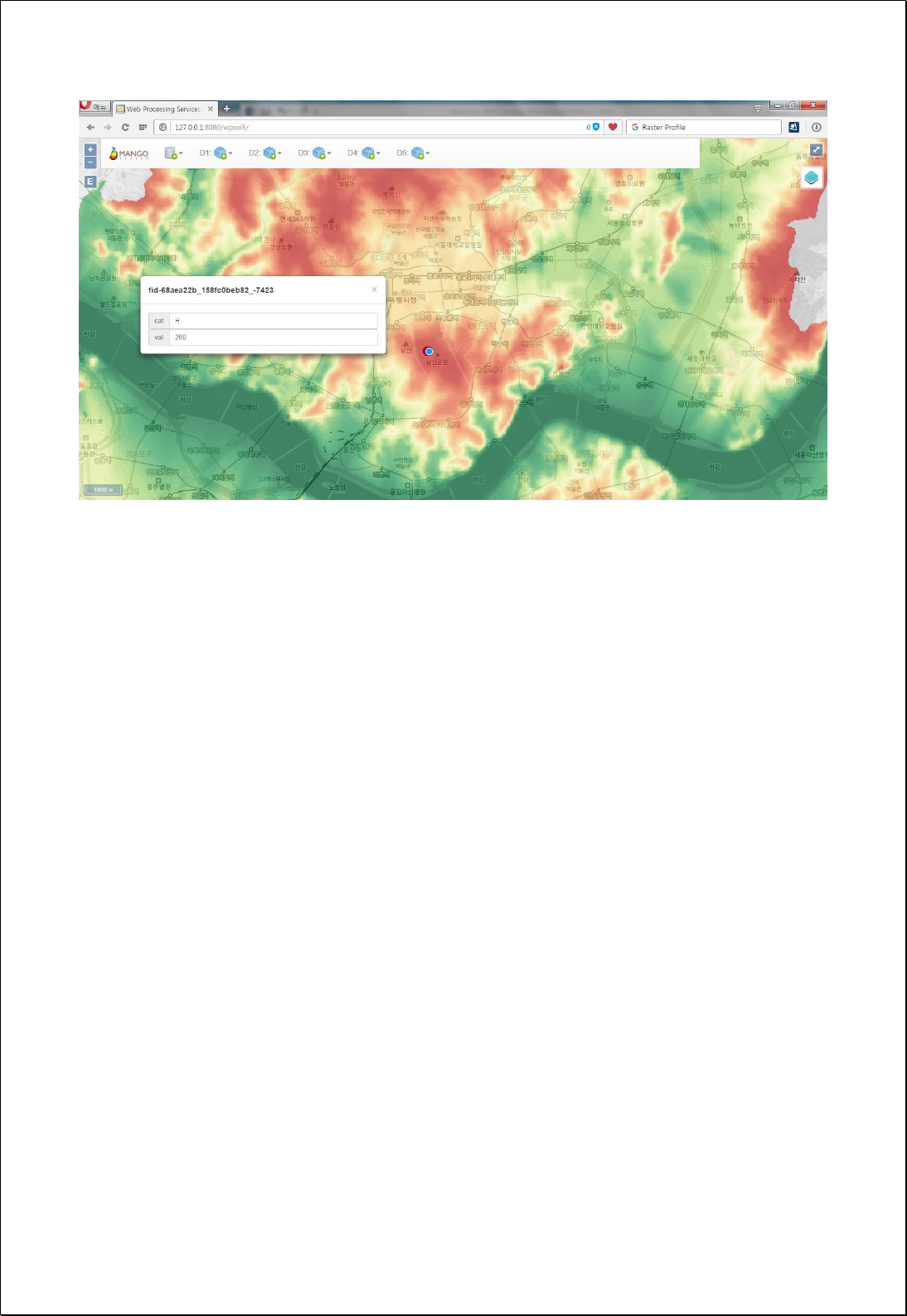

4.3.10. Zonal
Performs the zonal statistics.
4.3.10.1.
Zonal Statistics
Calculates statistics on the values of raster data for each area of section data.
Syntax
ZonalStatistics (SimpleFeatureCollection zoneFeatures, GridCoverage2D inputCoverage,
Integer bandIndex): SimpleFeatureCollection
Parameters
Data Inputs
Identifier
Description
Type
Required
zoneFeatures
The Dataset (polygon features) that defines the
zones.
Complex
targetField
The output field to be calculated.
Literal
-
valueCoverage
The Raster that contains the values on which to
calculate a statistic.
Complex
bandIndex
The zero-based band index, default index is a 0.
Literal
-
statisticsType
Zonal statisticx type to be calculated.
Literal
-
Process Outputs
Identifier
Description
Type
Required
result
Output features.
Complex
Constraints
- The zoneFeatures parameter must be Polygon or MultiPolygon type.
- Unless set the targetField parameter, use val value as default.
- If there are multiple raster bands, the bandIndex uses 0 value as default.
- The statisticsType parameter can use the following options.

Option
Description
Count
Sum
Mean
Minimum
Maximum
Range
StdDev
Number of cells
Sum of cells
Mean of cells (Default)
Minimum of cells
Maximum of cells
Range of cells
Stard deviation
Request Examples
<?xml version="1.0" encoding="UTF-8"?><wps:Execute version="1.0.0" service="WPS"
xmlns:xsi="http://www.w3.org/2001/XMLSchema-instance" xmlns="http://www.opengis.net/wps/1.0.0"
xmlns:wfs="http://www.opengis.net/wfs" xmlns:wps="http://www.opengis.net/wps/1.0.0"
xmlns:ows="http://www.opengis.net/ows/1.1" xmlns:gml="http://www.opengis.net/gml"
xmlns:ogc="http://www.opengis.net/ogc" xmlns:wcs="http://www.opengis.net/wcs/1.1.1"
xmlns:xlink="http://www.w3.org/1999/xlink" xsi:schemaLocation="http://www.opengis.net/wps/1.0.0
http://schemas.opengis.net/wps/1.0.0/wpsAll.xsd">
<ows:Identifier>statistics:ZonalStatistics</ows:Identifier>
<wps:DataInputs>
<wps:Input>
<ows:Identifier>zoneFeatures</ows:Identifier>
<wps:Reference mimeType="text/xml" xlink:href="http://geoserver/wfs" method="POST">
<wps:Body>
<wfs:GetFeature service="WFS" version="1.0.0" outputFormat="GML2"
xmlns:foss="http://www.opengeospatial.net/foss">
<wfs:Query typeName="foss:sgg"/>
</wfs:GetFeature>
</wps:Body>
</wps:Reference>
</wps:Input>
<wps:Input>
<ows:Identifier>targetField</ows:Identifier>
<wps:Data>
<wps:LiteralData>h_mean</wps:LiteralData>
</wps:Data>
</wps:Input>
<wps:Input>
<ows:Identifier>valueCoverage</ows:Identifier>
<wps:Reference mimeType="image/tiff" xlink:href="http://geoserver/wcs" method="POST">
<wps:Body>
<wcs:GetCoverage service="WCS" version="1.1.1">
<ows:Identifier>foss:seoul_dem30</ows:Identifier>

<wcs:DomainSubset>
<ows:BoundingBox crs="http://www.opengis.net/gml/srs/epsg.xml#3857">
<ows:LowerCorner>1.4111343323506365E7 4498971.750719266</ows:LowerCorner>
<ows:UpperCorner>1.4158021303411832E7 4537343.6431004135</ows:UpperCorner>
</ows:BoundingBox>
</wcs:DomainSubset>
<wcs:Output format="image/tiff"/>
</wcs:GetCoverage>
</wps:Body>
</wps:Reference>
</wps:Input>
<wps:Input>
<ows:Identifier>bandIndex</ows:Identifier>
<wps:Data>
<wps:LiteralData>0</wps:LiteralData>
</wps:Data>
</wps:Input>
<wps:Input>
<ows:Identifier>statisticsType</ows:Identifier>
<wps:Data>
<wps:LiteralData>Mean</wps:LiteralData>
</wps:Data>
</wps:Input>
</wps:DataInputs>
<wps:ResponseForm>
<wps:RawDataOutput mimeType="text/xml; subtype=wfs-collection/1.0">
<ows:Identifier>result</ows:Identifier>
</wps:RawDataOutput>
</wps:ResponseForm>
</wps:Execute>
Response
The following figure shows the analysis result of average elevation by administrative
boundary(Si-Gun-Gu) using Seoul DEM.
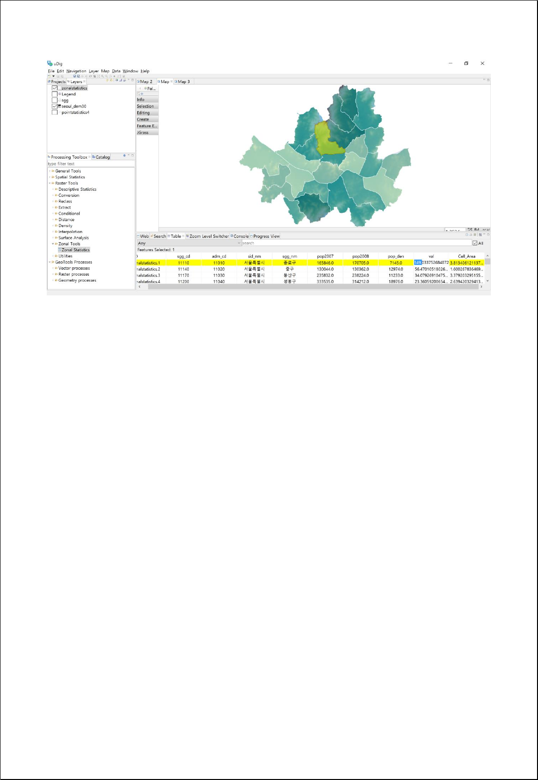

4.3.11. Projection
Define the coordinate system, transforming and changing cell size, of raster data.
4.3.11.1.
Resample
Change the resolution (cell size) of the raster data.
Syntax
RasterResample (GridCoverage2D inputCoverage, Double cellSize, ResampleType
resamplingType): GridCoverage2D
Parameters
Data Inputs
Identifier
Description
Type
Required
inputCoverage
The raster dataset for which you want to change the
spatial resolution.
Complex
cellSize
The cell size for the output raster.
Literal
resamplingType
The resampling algorithm to be used.
Ex> NEAREST (default), BILINEAR, BICUBIC.
Complex
-
Process Outputs
Identifier
Description
Type
Required
result
Output raster.
Complex
Constraints
- The resamplingType parameter can use the NEAREST(default), BILINEAR, and
BICUBIC options.
Request Examples
<?xml version="1.0" encoding="UTF-8"?><wps:Execute version="1.0.0" service="WPS"
xmlns:xsi="http://www.w3.org/2001/XMLSchema-instance" xmlns="http://www.opengis.net/wps/1.0.0"
xmlns:wfs="http://www.opengis.net/wfs" xmlns:wps="http://www.opengis.net/wps/1.0.0"
xmlns:ows="http://www.opengis.net/ows/1.1" xmlns:gml="http://www.opengis.net/gml"
xmlns:ogc="http://www.opengis.net/ogc" xmlns:wcs="http://www.opengis.net/wcs/1.1.1"

xmlns:xlink="http://www.w3.org/1999/xlink" xsi:schemaLocation="http://www.opengis.net/wps/1.0.0
http://schemas.opengis.net/wps/1.0.0/wpsAll.xsd">
<ows:Identifier>statistics:RasterResample</ows:Identifier>
<wps:DataInputs>
<wps:Input>
<ows:Identifier>inputCoverage</ows:Identifier>
<wps:Reference mimeType="image/tiff" xlink:href="http://geoserver/wcs" method="POST">
<wps:Body>
<wcs:GetCoverage service="WCS" version="1.1.1">
<ows:Identifier>foss:seoul_dem30</ows:Identifier>
<wcs:DomainSubset>
<ows:BoundingBox crs="http://www.opengis.net/gml/srs/epsg.xml#3857">
<ows:LowerCorner>1.4111343323506365E7 4498971.750719266</ows:LowerCorner>
<ows:UpperCorner>1.4158021303411832E7 4537343.6431004135</ows:UpperCorner>
</ows:BoundingBox>
</wcs:DomainSubset>
<wcs:Output format="image/tiff"/>
</wcs:GetCoverage>
</wps:Body>
</wps:Reference>
</wps:Input>
<wps:Input>
<ows:Identifier>cellSize</ows:Identifier>
<wps:Data>
<wps:LiteralData>50</wps:LiteralData>
</wps:Data>
</wps:Input>
<wps:Input>
<ows:Identifier>resamplingType</ows:Identifier>
<wps:Data>
<wps:LiteralData>NEAREST</wps:LiteralData>
</wps:Data>
</wps:Input>
</wps:DataInputs>
<wps:ResponseForm>
<wps:RawDataOutput mimeType="image/tiff">
<ows:Identifier>result</ows:Identifier>
</wps:RawDataOutput>
</wps:ResponseForm>
</wps:Execute>

4.3.11.2.
Redefine Projection
Define or redefine the coordinate system of the raster data with a new coordinate
system.
Syntax
RasterForceCRS (GridCoverage2D inputCoverage, CoordinateReferenceSystem forcedCRS):
GridCoverage2D
Parameters
Data Inputs
Identifier
Description
Type
Required
inputCoverage
The raster dataset for which you want to redefine
the coordinate reference system.
Complex
forcedCRS
Coordinate reference system to use for input raster
dataset.
Literal
Process Outputs
Identifier
Description
Type
Required
Result
Output raster.
Complex
Constraints
- The forcedCRS parameter must be in the [EPSG: code number] format.
Request Examples
<?xml version="1.0" encoding="UTF-8"?><wps:Execute version="1.0.0" service="WPS"
xmlns:xsi="http://www.w3.org/2001/XMLSchema-instance" xmlns="http://www.opengis.net/wps/1.0.0"
xmlns:wfs="http://www.opengis.net/wfs" xmlns:wps="http://www.opengis.net/wps/1.0.0"
xmlns:ows="http://www.opengis.net/ows/1.1" xmlns:gml="http://www.opengis.net/gml"
xmlns:ogc="http://www.opengis.net/ogc" xmlns:wcs="http://www.opengis.net/wcs/1.1.1"
xmlns:xlink="http://www.w3.org/1999/xlink" xsi:schemaLocation="http://www.opengis.net/wps/1.0.0
http://schemas.opengis.net/wps/1.0.0/wpsAll.xsd">
<ows:Identifier>statistics:RasterForceCRS</ows:Identifier>
<wps:DataInputs>

<wps:Input>
<ows:Identifier>inputCoverage</ows:Identifier>
<wps:Reference mimeType="image/tiff" xlink:href="http://geoserver/wcs" method="POST">
<wps:Body>
<wcs:GetCoverage service="WCS" version="1.1.1">
<ows:Identifier>foss:seoul_dem30</ows:Identifier>
<wcs:DomainSubset>
<ows:BoundingBox crs="http://www.opengis.net/gml/srs/epsg.xml#3857">
<ows:LowerCorner>1.4111343323506365E7 4498971.750719266</ows:LowerCorner>
<ows:UpperCorner>1.4158021303411832E7 4537343.6431004135</ows:UpperCorner>
</ows:BoundingBox>
</wcs:DomainSubset>
<wcs:Output format="image/tiff"/>
</wcs:GetCoverage>
</wps:Body>
</wps:Reference>
</wps:Input>
<wps:Input>
<ows:Identifier>forcedCRS</ows:Identifier>
<wps:Data>
<wps:LiteralData>EPSG:5181</wps:LiteralData>
</wps:Data>
</wps:Input>
</wps:DataInputs>
<wps:ResponseForm>
<wps:RawDataOutput mimeType="image/tiff">
<ows:Identifier>result</ows:Identifier>
</wps:RawDataOutput>
</wps:ResponseForm>
</wps:Execute>
Response
The following figure shows the result of redefining the original Daegu EPSG:5181 DEM as
EPSG:5186.
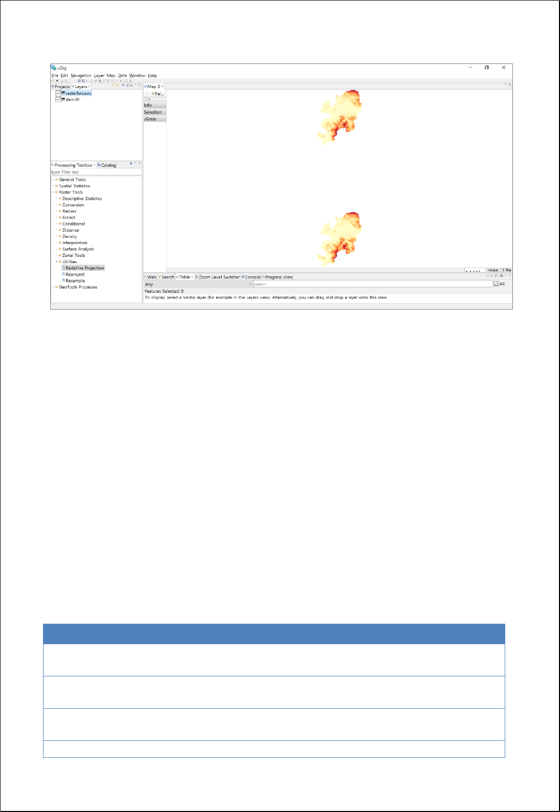
4.3.11.3.
Reproject
Converts the coordinate system of raster data.
Syntax
RasterReproject (GridCoverage2D inputCoverage, CoordinateReferenceSystem targetCRS,
ResampleType resamplingType, Double cellSize, CoordinateReferenceSystem forcedCRS):
GridCoverage2D
Parameters
Data Inputs
Identifier
Description
Type
Required
inputCoverage
The raster dataset for which you want to change the
spatial reference system.
Complex
targetCRS
Target coordinate reference system to use for
reprojection.
Literal
resamplingType
The resampling algorithm to be used. NEAREST
(default), BILINEAR, BICUBIC.
Literal
-
cellSize
The cell size for the output raster.
Literal
-

forcedCRS
Coordinate reference system to use for input raster
dataset.
Literal
-
Process Outputs
Identifier
Description
Type
Required
result
Output raster.
Complex
Constraints
- The targetCRS and forcedCRS parameter must be [EPSG: code number] format.
- The resamplingType parameter can use the NEAREST (default), BILINEAR, BICUBIC
options.
- Unless set the cellSize parameter, the original cell size is used. If converting from
the geographic coordinate system to the projection coordinate system, the
converted cell size is applied.
- If the forcedCRS parameter is set, converting the original raster data to the defined
coordinate system.
Request Examples
<?xml version="1.0" encoding="UTF-8"?><wps:Execute version="1.0.0" service="WPS"
xmlns:xsi="http://www.w3.org/2001/XMLSchema-instance" xmlns="http://www.opengis.net/wps/1.0.0"
xmlns:wfs="http://www.opengis.net/wfs" xmlns:wps="http://www.opengis.net/wps/1.0.0"
xmlns:ows="http://www.opengis.net/ows/1.1" xmlns:gml="http://www.opengis.net/gml"
xmlns:ogc="http://www.opengis.net/ogc" xmlns:wcs="http://www.opengis.net/wcs/1.1.1"
xmlns:xlink="http://www.w3.org/1999/xlink" xsi:schemaLocation="http://www.opengis.net/wps/1.0.0
http://schemas.opengis.net/wps/1.0.0/wpsAll.xsd">
<ows:Identifier>statistics:RasterReproject</ows:Identifier>
<wps:DataInputs>
<wps:Input>
<ows:Identifier>inputCoverage</ows:Identifier>
<wps:Reference mimeType="image/tiff" xlink:href="http://geoserver/wcs" method="POST">
<wps:Body>
<wcs:GetCoverage service="WCS" version="1.1.1">
<ows:Identifier>foss:seoul_dem30</ows:Identifier>

<wcs:DomainSubset>
<ows:BoundingBox crs="http://www.opengis.net/gml/srs/epsg.xml#3857">
<ows:LowerCorner>1.4111343323506365E7 4498971.750719266</ows:LowerCorner>
<ows:UpperCorner>1.4158021303411832E7 4537343.6431004135</ows:UpperCorner>
</ows:BoundingBox>
</wcs:DomainSubset>
<wcs:Output format="image/tiff"/>
</wcs:GetCoverage>
</wps:Body>
</wps:Reference>
</wps:Input>
<wps:Input>
<ows:Identifier>targetCRS</ows:Identifier>
<wps:Data>
<wps:LiteralData>EPSG:5181</wps:LiteralData>
</wps:Data>
</wps:Input>
<wps:Input>
<ows:Identifier>resamplingType</ows:Identifier>
<wps:Data>
<wps:LiteralData>NEAREST</wps:LiteralData>
</wps:Data>
</wps:Input>
<wps:Input>
<ows:Identifier>cellSize</ows:Identifier>
<wps:Data>
<wps:LiteralData>50</wps:LiteralData>
</wps:Data>
</wps:Input>
</wps:DataInputs>
<wps:ResponseForm>
<wps:RawDataOutput mimeType="image/tiff">
<ows:Identifier>result</ows:Identifier>
</wps:RawDataOutput>
</wps:ResponseForm>
</wps:Execute>

4.4. Spatial Statistics Analysis
A process group associated with spatial statistical analysis.
4.4.1. Descriptive
Calculates the statistical information using Geometry or attribute value of field.
4.4.1.1.
Basic Statistics
Perform basic statistical analysis based on field values in the feature layers.
Syntax
StatisticsFeatures (SimpleFeatureCollection inputFeatures, String inputFields, String
caseField): DataStatisticsResult
Parameters
Data Inputs
Identifier
Description
Type
Required
inputFeatures
The input features containing the field(s) that will be
used to calculate statistics.
Complex
inputFields
Single field or comma (,) separated numeric field(s)
containing attribute values used to calculate the
specified statistic.
Literal
caseField
The field used to group features for separate
statistics calculations.
Literal
-
Process Outputs
Identifier
Description
Type
Required
result
Output Statistics.
Complex
Constraints
- If the caseField parameter is set, statistical information is generated for each unique
value of the caseField.
- Output is returned in XML format.

Request Examples
<?xml version="1.0" encoding="UTF-8"?><wps:Execute version="1.0.0" service="WPS"
xmlns:xsi="http://www.w3.org/2001/XMLSchema-instance" xmlns="http://www.opengis.net/wps/1.0.0"
xmlns:wfs="http://www.opengis.net/wfs" xmlns:wps="http://www.opengis.net/wps/1.0.0"
xmlns:ows="http://www.opengis.net/ows/1.1" xmlns:gml="http://www.opengis.net/gml"
xmlns:ogc="http://www.opengis.net/ogc" xmlns:wcs="http://www.opengis.net/wcs/1.1.1"
xmlns:xlink="http://www.w3.org/1999/xlink" xsi:schemaLocation="http://www.opengis.net/wps/1.0.0
http://schemas.opengis.net/wps/1.0.0/wpsAll.xsd">
<ows:Identifier>statistics:StatisticsFeatures</ows:Identifier>
<wps:DataInputs>
<wps:Input>
<ows:Identifier>inputFeatures</ows:Identifier>
<wps:Reference mimeType="text/xml" xlink:href="http://geoserver/wfs" method="POST">
<wps:Body>
<wfs:GetFeature service=“WFS” version=“1.1.0” outputFormat=“GML3”
xmlns:foss="http://www.opengeospatial.net/foss">
<wfs:Query typeName="foss:korea_sgg"/>
</wfs:GetFeature>
</wps:Body>
</wps:Reference>
</wps:Input>
<wps:Input>
<ows:Identifier>inputFields</ows:Identifier>
<wps:Data>
<wps:LiteralData>a3_2005</wps:LiteralData>
</wps:Data>
</wps:Input>
<wps:Input>
<ows:Identifier>caseField</ows:Identifier>
<wps:Data>
<wps:LiteralData>sid_nm</wps:LiteralData>
</wps:Data>
</wps:Input>
</wps:DataInputs>
<wps:ResponseForm>
<wps:RawDataOutput mimeType="text/xml">
<ows:Identifier>result</ows:Identifier>
</wps:RawDataOutput>
</wps:ResponseForm>
</wps:Execute>
Response

This is the result of analyzed basic statistic by administrative boundary(Si-Gun-Gu) using
the a3_2000 field value of the national Si-Gun-Gu administrative district is converted XML
format.
<?xml version="1.0" encoding="utf-8"?>
<DataStatistics>
<Item>
<TypeName>korea_sgg</TypeName>
<CaseValue>강원도</CaseValue>
<PropertyName>a3_2000</PropertyName>
<Count>18</Count>
<InvalidCount>0</InvalidCount>
<Minimum>0.24774</Minimum>
<Maximum>7.81668</Maximum>
<Range>7.56894</Range>
<Ranges>0.24774 - 7.81668</Ranges>
<Sum>79.64533043000002</Sum>
<Mean>4.424740579444445</Mean>
<Variance>6.976857255428096</Variance>
<StandardDeviation>2.641374122578643</StandardDeviation>
<CoefficientOfVariance>0.5969557028607279</CoefficientOfVariance>
</Item>
<Item>
<TypeName>korea_sgg</TypeName>
<CaseValue>경기도</CaseValue>
<PropertyName>a3_2000</PropertyName>
<Count>31</Count>
<InvalidCount>0</InvalidCount>
<Minimum>0.0</Minimum>
<Maximum>15.46253</Maximum>
<Range>15.46253</Range>
<Ranges>0.0 - 15.46253</Ranges>
<Sum>271.03358996</Sum>
<Mean>8.74301903096774</Mean>
<Variance>21.209124717119646</Variance>
<StandardDeviation>4.605336547649872</StandardDeviation>
<CoefficientOfVariance>0.5267444267635456</CoefficientOfVariance>
</Item>
</DataStatistics>

4.4.1.2.
Pearson Correlation Coefficient
Calculates the Pearson's Correlation Coefficient using two or more attribute fields.
Syntax
Pearson (SimpleFeatureCollection inputFeatures, String inputFields): PearsonResult
Parameters
Data Inputs
Identifier
Description
Type
Required
inputFeatures
Input features to be calculated.
Complex
inputFields
The comma separated numeric field(s) containing
attribute values used to calculate the specified
statistic.
Literal
Process Outputs
Identifier
Description
Type
Required
result
Result Pearson Correlation Coefficient.
Complex
Constraints
- Output is returned in XML format.
Request Examples
<?xml version="1.0" encoding="UTF-8"?><wps:Execute version="1.0.0" service="WPS"
xmlns:xsi="http://www.w3.org/2001/XMLSchema-instance" xmlns="http://www.opengis.net/wps/1.0.0"
xmlns:wfs="http://www.opengis.net/wfs" xmlns:wps="http://www.opengis.net/wps/1.0.0"
xmlns:ows="http://www.opengis.net/ows/1.1" xmlns:gml="http://www.opengis.net/gml"
xmlns:ogc="http://www.opengis.net/ogc" xmlns:wcs="http://www.opengis.net/wcs/1.1.1"
xmlns:xlink="http://www.w3.org/1999/xlink" xsi:schemaLocation="http://www.opengis.net/wps/1.0.0
http://schemas.opengis.net/wps/1.0.0/wpsAll.xsd">
<ows:Identifier>statistics:Pearson</ows:Identifier>
<wps:DataInputs>
<wps:Input>
<ows:Identifier>inputFeatures</ows:Identifier>
<wps:Reference mimeType="text/xml" xlink:href="http://geoserver/wfs" method="POST">
<wps:Body>

<wfs:GetFeature service=“WFS” version=“1.1.0” outputFormat=“GML3”
xmlns:foss="http://www.opengeospatial.net/foss">
<wfs:Query typeName="foss:korea_sgg"/>
</wfs:GetFeature>
</wps:Body>
</wps:Reference>
</wps:Input>
<wps:Input>
<ows:Identifier>inputFields</ows:Identifier>
<wps:Data>
<wps:LiteralData>pop2008, pop_den</wps:LiteralData>
</wps:Data>
</wps:Input>
</wps:DataInputs>
<wps:ResponseForm>
<wps:RawDataOutput mimeType="text/xml">
<ows:Identifier>result</ows:Identifier>
</wps:RawDataOutput>
</wps:ResponseForm>
</wps:Execute>
Response
This is the result of analyzing Pearson correlation, using two fields of the administrative
boundary(Si-Gun-Gu). Ouput is converted XML format.
<?xml version="1.0" encoding="utf-8"?>
<PearsonResult>
<PropertyName Name="pop2008">
<Item Name="pop2008">
<Value>1.0</Value>
</Item>
<Item Name="pop_den">
<Value>0.3002549407911261</Value>
</Item>
</PropertyName>
<PropertyName Name="pop_den">
<Item Name="pop2008">
<Value>0.3002549407911261</Value>
</Item>
<Item Name="pop_den">
<Value>1.0</Value>
</Item>

</PropertyName>
</PearsonResult>

4.4.1.3.
Standardized Score of Dissimilarity
Calculates the standardized score of dissimilarity(SSD, degree of concentration), using the
two attribute field values.
Syntax
StandardizedScores (SimpleFeatureCollection inputFeatures, Expression xField, Expression
yField, String targetField): SimpleFeatureCollection
Parameters
Data Inputs
Identifier
Description
Type
Required
inputFeatures
The features for which the standardized score of
dissimilarity will be calculated.
Complex
xField
X Value Field.
Literal
yField
Y Value Field.
Literal
targetField
Target Field. std_scr is default.
Literal
-
Process Outputs
Identifier
Description
Type
Required
result
Output features.
Complex
Constraints
- Unless set the targetField parameter, the std_scr is default,.
Request Examples
<?xml version="1.0" encoding="UTF-8"?><wps:Execute version="1.0.0" service="WPS"
xmlns:xsi="http://www.w3.org/2001/XMLSchema-instance" xmlns="http://www.opengis.net/wps/1.0.0"
xmlns:wfs="http://www.opengis.net/wfs" xmlns:wps="http://www.opengis.net/wps/1.0.0"
xmlns:ows="http://www.opengis.net/ows/1.1" xmlns:gml="http://www.opengis.net/gml"
xmlns:ogc="http://www.opengis.net/ogc" xmlns:wcs="http://www.opengis.net/wcs/1.1.1"
xmlns:xlink="http://www.w3.org/1999/xlink" xsi:schemaLocation="http://www.opengis.net/wps/1.0.0
http://schemas.opengis.net/wps/1.0.0/wpsAll.xsd">
<ows:Identifier>statistics:StandardizedScores</ows:Identifier>
<wps:DataInputs>
<wps:Input>
<ows:Identifier>inputFeatures</ows:Identifier>
<wps:Reference mimeType="text/xml" xlink:href="http://geoserver/wfs" method="POST">
<wps:Body>

<wfs:GetFeature service=“WFS” version=“1.1.0” outputFormat=“GML3”
xmlns:foss="http://www.opengeospatial.net/foss">
<wfs:Query typeName="foss:korea_sgg"/>
</wfs:GetFeature>
</wps:Body>
</wps:Reference>
</wps:Input>
<wps:Input>
<ows:Identifier>xField</ows:Identifier>
<wps:Data>
<wps:LiteralData>a0_2005</wps:LiteralData>
</wps:Data>
</wps:Input>
<wps:Input>
<ows:Identifier>yField</ows:Identifier>
<wps:Data>
<wps:LiteralData>a3_2005</wps:LiteralData>
</wps:Data>
</wps:Input>
<wps:Input>
<ows:Identifier>targetField</ows:Identifier>
<wps:Data>
<wps:LiteralData>std_scr</wps:LiteralData>
</wps:Data>
</wps:Input>
</wps:DataInputs>
<wps:ResponseForm>
<wps:RawDataOutput mimeType=“text/xml; subtype=wfs-collection/1.1”>
<ows:Identifier>result</ows:Identifier>
</wps:RawDataOutput>
</wps:ResponseForm>
</wps:Execute>
Response
The following figure shows the result of the SSD analysis using the two fields of the
administrative boundary(Si-Gun-Gu). Using the property values of targetField, visualize
the SSD.
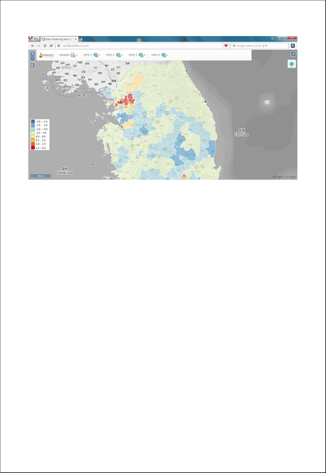

4.4.1.4.
Focal Location Quotients
Calculates the Focal Location Quotients(FLQ, degree of specialization) using two attribute
field values.
Syntax
FocalLQ (SimpleFeatureCollection inputFeatures, String fieldName1, String fieldName2,
Double searchDistance): SimpleFeatureCollection
Parameters
Data Inputs
Identifier
Description
Type
Required
inputFeatures
The features for which the focal LQ will be calculated.
Complex
fieldName1
X Value Field.
Literal
fieldName2
Y Value Field.
Literal
searchDistance
The maximun search distance.
Literal
-
Process Outputs
Identifier
Description
Type
Required
result
Output features.
Complex
Constraints
- The fields of the Output layer return values of flq, flqd, and fz.
Request Examples
<?xml version="1.0" encoding="UTF-8"?><wps:Execute version="1.0.0" service="WPS"
xmlns:xsi="http://www.w3.org/2001/XMLSchema-instance" xmlns="http://www.opengis.net/wps/1.0.0"
xmlns:wfs="http://www.opengis.net/wfs" xmlns:wps="http://www.opengis.net/wps/1.0.0"
xmlns:ows="http://www.opengis.net/ows/1.1" xmlns:gml="http://www.opengis.net/gml"
xmlns:ogc="http://www.opengis.net/ogc" xmlns:wcs="http://www.opengis.net/wcs/1.1.1"
xmlns:xlink="http://www.w3.org/1999/xlink" xsi:schemaLocation="http://www.opengis.net/wps/1.0.0
http://schemas.opengis.net/wps/1.0.0/wpsAll.xsd">
<ows:Identifier>statistics:FocalLQ</ows:Identifier>
<wps:DataInputs>
<wps:Input>
<ows:Identifier>inputFeatures</ows:Identifier>

<wps:Reference mimeType="text/xml" xlink:href="http://geoserver/wfs" method="POST">
<wps:Body>
<wfs:GetFeature service=“WFS” version=“1.1.0” outputFormat=“GML3”
xmlns:foss="http://www.opengeospatial.net/foss">
<wfs:Query typeName="foss:korea_sgg"/>
</wfs:GetFeature>
</wps:Body>
</wps:Reference>
</wps:Input>
<wps:Input>
<ows:Identifier>xField</ows:Identifier>
<wps:Data>
<wps:LiteralData>a0_2005</wps:LiteralData>
</wps:Data>
</wps:Input>
<wps:Input>
<ows:Identifier>yField</ows:Identifier>
<wps:Data>
<wps:LiteralData>a3_2005</wps:LiteralData>
</wps:Data>
</wps:Input>
</wps:DataInputs>
<wps:ResponseForm>
<wps:RawDataOutput mimeType=“text/xml; subtype=wfs-collection/1.1”>
<ows:Identifier>result</ows:Identifier>
</wps:RawDataOutput>
</wps:ResponseForm>
</wps:Execute>
Response
The following figure shows the visualized result of analyzing the FLQ, using the two fields
of the administrative boundary(Si-Gun-Gu).
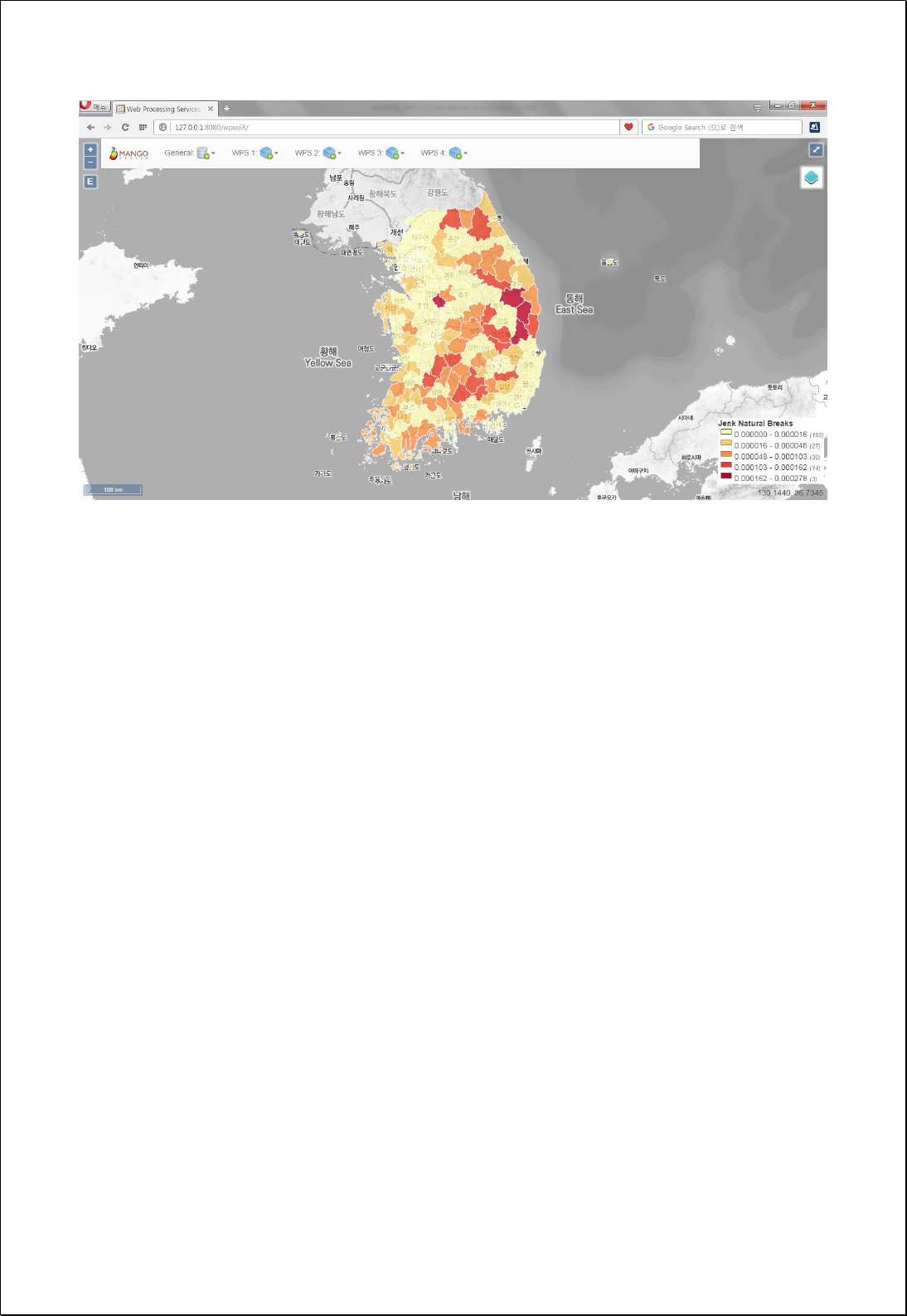

4.4.2. Distributions
Analyze the distribution of vector data patterns.
4.4.2.1.
Mean Center
Returns the geographic center or center of concentration for all features in the feature
layer.
Syntax
MeanCenter (SimpleFeatureCollection inputFeatures, String weightField, String caseField,
String dimensionField): SimpleFeatureCollection
Parameters
Data Inputs
Identifier
Description
Type
Required
inputFeatures
A features for which the mean center will be
calculated.
Complex
weightField
The numeric field used to create a weighted mean
center.
Literal
-
caseField
The field used to group features for separate mean
center calculations.
Literal
-
dimensionField
A numeric field containing attribute values from
which an average value will be calculated.
Literal
-
Process Outputs
Identifier
Description
Type
Required
result
Output features.
Complex
Constraints
- Calculates using Centroid of inputFeatures.
Request Examples
<?xml version="1.0" encoding="UTF-8"?><wps:Execute version="1.0.0" service="WPS"
xmlns:xsi="http://www.w3.org/2001/XMLSchema-instance" xmlns="http://www.opengis.net/wps/1.0.0"
xmlns:wfs="http://www.opengis.net/wfs" xmlns:wps="http://www.opengis.net/wps/1.0.0"

xmlns:ows="http://www.opengis.net/ows/1.1" xmlns:gml="http://www.opengis.net/gml"
xmlns:ogc="http://www.opengis.net/ogc" xmlns:wcs="http://www.opengis.net/wcs/1.1.1"
xmlns:xlink="http://www.w3.org/1999/xlink" xsi:schemaLocation="http://www.opengis.net/wps/1.0.0
http://schemas.opengis.net/wps/1.0.0/wpsAll.xsd">
<ows:Identifier>statistics:MeanCenter</ows:Identifier>
<wps:DataInputs>
<wps:Input>
<ows:Identifier>inputFeatures</ows:Identifier>
<wps:Reference mimeType="text/xml" xlink:href="http://geoserver/wfs" method="POST">
<wps:Body>
<wfs:GetFeature service=“WFS” version=“1.1.0” outputFormat=“GML3”
xmlns:foss="http://www.opengeospatial.net/foss">
<wfs:Query typeName="foss:apartment"/>
</wfs:GetFeature>
</wps:Body>
</wps:Reference>
</wps:Input>
<wps:Input>
<ows:Identifier>caseField</ows:Identifier>
<wps:Data>
<wps:LiteralData>sgg_nm</wps:LiteralData>
</wps:Data>
</wps:Input>
</wps:DataInputs>
<wps:ResponseForm>
<wps:RawDataOutput mimeType=“text/xml; subtype=wfs-collection/1.1”>
<ows:Identifier>result</ows:Identifier>
</wps:RawDataOutput>
</wps:ResponseForm>
</wps:Execute>
Response
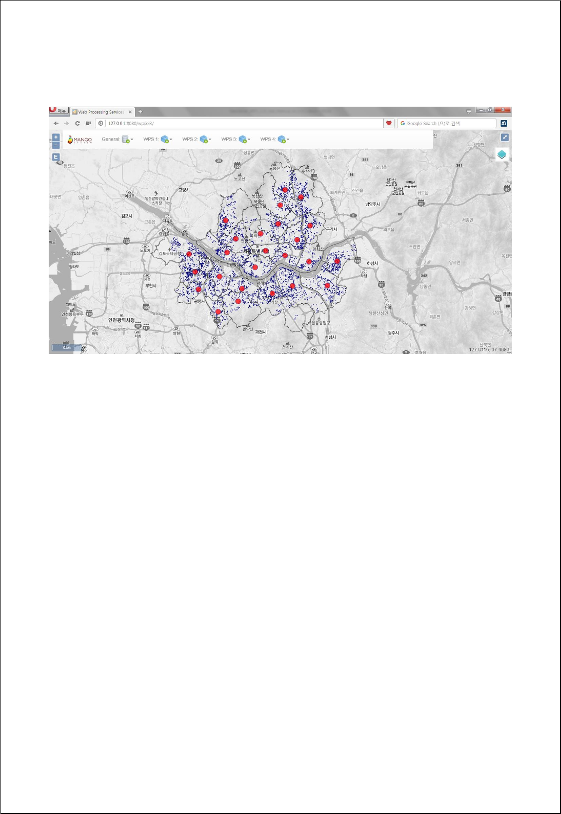
The following figure shows the result of analyzing the Mean Center about the
distribution of Seoul apartment by administrative boundary(Si-Gun-Gu).

4.4.2.2.
Median Center
Returns the point at which the sum of the total distances is the smallest(Median Center)
for all features in the feature layers.
Syntax
MedianCenter (SimpleFeatureCollection inputFeatures, String weightField, String caseField,
String attributeFields): SimpleFeatureCollection
Parameters
Data Inputs
Identifier
Description
Type
Required
inputFeatures
A features for which the median center will be
calculated.
Complex
weightField
The numeric field used to create a weighted median
center.
Literal
-
caseField
The field used to group features for separate median
center calculations.
Literal
-
attributeFields
(Comma separated) Numeric field(s) for which the
data median value will be computed.
Literal
-
Process Outputs
Identifier
Description
Type
Required
result
Output features.
Complex
Constraints
- Calculate using Centroid of inputFeatures.
Request Examples
<?xml version="1.0" encoding="UTF-8"?><wps:Execute version="1.0.0" service="WPS"
xmlns:xsi="http://www.w3.org/2001/XMLSchema-instance" xmlns="http://www.opengis.net/wps/1.0.0"
xmlns:wfs="http://www.opengis.net/wfs" xmlns:wps="http://www.opengis.net/wps/1.0.0"
xmlns:ows="http://www.opengis.net/ows/1.1" xmlns:gml="http://www.opengis.net/gml"
xmlns:ogc="http://www.opengis.net/ogc" xmlns:wcs="http://www.opengis.net/wcs/1.1.1"
xmlns:xlink="http://www.w3.org/1999/xlink" xsi:schemaLocation="http://www.opengis.net/wps/1.0.0
http://schemas.opengis.net/wps/1.0.0/wpsAll.xsd">

<ows:Identifier>statistics:MedianCenter</ows:Identifier>
<wps:DataInputs>
<wps:Input>
<ows:Identifier>inputFeatures</ows:Identifier>
<wps:Reference mimeType="text/xml" xlink:href="http://geoserver/wfs" method="POST">
<wps:Body>
<wfs:GetFeature service=“WFS” version=“1.1.0” outputFormat=“GML3”
xmlns:foss="http://www.opengeospatial.net/foss">
<wfs:Query typeName="foss:apartment"/>
</wfs:GetFeature>
</wps:Body>
</wps:Reference>
</wps:Input>
<wps:Input>
<ows:Identifier>caseField</ows:Identifier>
<wps:Data>
<wps:LiteralData>sgg_nm</wps:LiteralData>
</wps:Data>
</wps:Input>
</wps:DataInputs>
<wps:ResponseForm>
<wps:RawDataOutput mimeType=“text/xml; subtype=wfs-collection/1.1”>
<ows:Identifier>result</ows:Identifier>
</wps:RawDataOutput>
</wps:ResponseForm>
</wps:Execute>
Response
The following figure shows the result of analyzing the Median Center about the
distribution of Seoul apartment by administrative boundary(Si-Gun-Gu)..
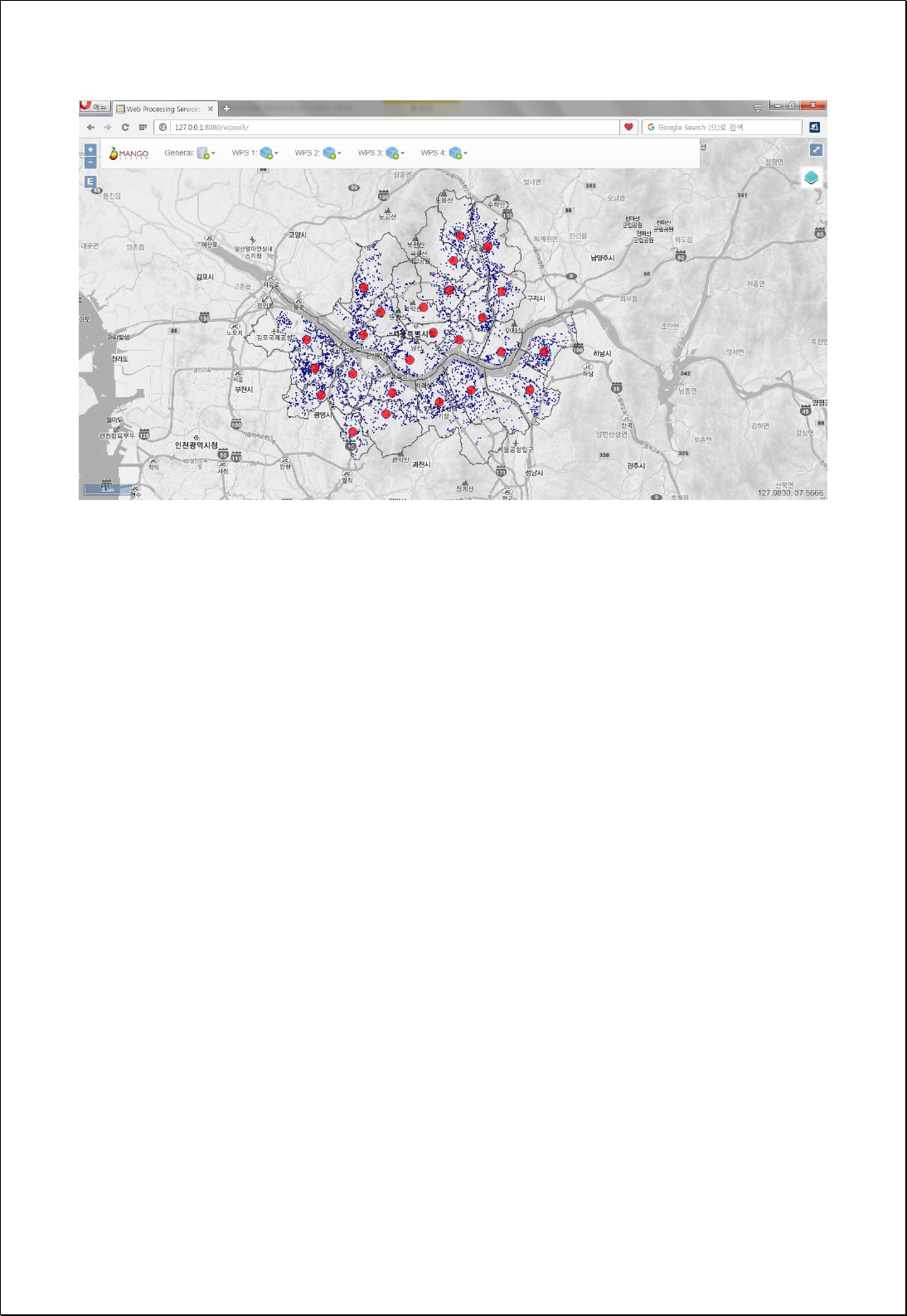

4.4.2.3.
Central Feature
Returns the Central Feature with the smallest sum of the total distances for all features in
the feature layer.
Syntax
CentralFeature (SimpleFeatureCollection inputFeatures, DistanceMethod distanceMethod,
String weightField, String selfPotentialWeightField, String caseField):
SimpleFeatureCollection
Parameters
Data Inputs
Identifier
Description
Type
Required
inputFeatures
The features containing a distribution of features
from which to identify the most centrally located
feature.
Complex
distanceMethod
Specifies how distances are calculated from each
feature to neighboring features. Euclidean (default) or
Manhattan.
Literal
-
weightField
The numeric field used to weight distances in the
origin-destination distance matrix.
Literal
-
selfPotentialWeightField
The field representing self-potential. The distance or
weight between a feature and itself.
Literal
-
caseField
The field used to group features for separate central
feature computations.
Literal
-
Process Outputs
Identifier
Description
Type
Required
result
Output features.
Complex
Constraints
- Calculates using Centroid of inputFeatures.
Request Examples
<?xml version="1.0" encoding="UTF-8"?><wps:Execute version="1.0.0" service="WPS"

xmlns:xsi="http://www.w3.org/2001/XMLSchema-instance" xmlns="http://www.opengis.net/wps/1.0.0"
xmlns:wfs="http://www.opengis.net/wfs" xmlns:wps="http://www.opengis.net/wps/1.0.0"
xmlns:ows="http://www.opengis.net/ows/1.1" xmlns:gml="http://www.opengis.net/gml"
xmlns:ogc="http://www.opengis.net/ogc" xmlns:wcs="http://www.opengis.net/wcs/1.1.1"
xmlns:xlink="http://www.w3.org/1999/xlink" xsi:schemaLocation="http://www.opengis.net/wps/1.0.0
http://schemas.opengis.net/wps/1.0.0/wpsAll.xsd">
<ows:Identifier>statistics:CentralFeature</ows:Identifier>
<wps:DataInputs>
<wps:Input>
<ows:Identifier>inputFeatures</ows:Identifier>
<wps:Reference mimeType="text/xml" xlink:href="http://geoserver/wfs" method="POST">
<wps:Body>
<wfs:GetFeature service=“WFS” version=“1.1.0” outputFormat=“GML3”
xmlns:foss="http://www.opengeospatial.net/foss">
<wfs:Query typeName="foss:apartment"/>
</wfs:GetFeature>
</wps:Body>
</wps:Reference>
</wps:Input>
<wps:Input>
<ows:Identifier>distanceMethod</ows:Identifier>
<wps:Data>
<wps:LiteralData>Euclidean</wps:LiteralData>
</wps:Data>
</wps:Input>
<wps:Input>
<ows:Identifier>caseField</ows:Identifier>
<wps:Data>
<wps:LiteralData>sgg_nm</wps:LiteralData>
</wps:Data>
</wps:Input>
</wps:DataInputs>
<wps:ResponseForm>
<wps:RawDataOutput mimeType=“text/xml; subtype=wfs-collection/1.1”>
<ows:Identifier>result</ows:Identifier>
</wps:RawDataOutput>
</wps:ResponseForm>
</wps:Execute>
Response
The following figure shows the result of analyzing the Central Feature about the
distribution of Seoul apartment by administrative boundary(Si-Gun-Gu).
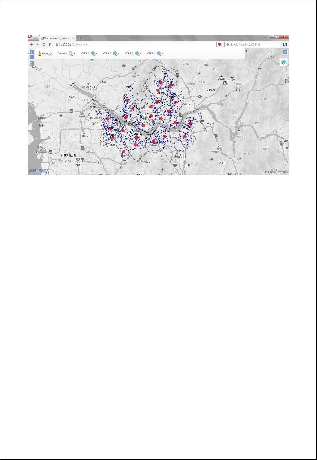

4.4.2.4.
Standard Distance
Measures the extent to which all features in the feature layers are centered or scattered
by the Mean Center.
Syntax
StandardDistance (SimpleFeatureCollection inputFeatures, String circleSize, String
weightField, String caseField): SimpleFeatureCollection
Parameters
Data Inputs
Identifier
Description
Type
Required
inputFeatures
The features containing a distribution of features for
which the standard deviational ellipse will be
calculated.
Complex
circleSize
The size (1, 2, 3) of output circles in standard
deviations.
Literal
-
weightField
The numeric field used to weight locations according
to their relative importance.
Literal
-
caseField
The field used to group features for separate
standard distance calculations.
Literal
-
Process Outputs
Identifier
Description
Type
Required
result
Output features.
Complex
Constraints
- Calculate using Centroid of inputFeatures.
- The Circle generally includes features of 68% for 1_Standard_Deviation, 95% for
2_Standard_Deviation, and 99% for 3_Standard_Deviation.
Request Examples
<?xml version="1.0" encoding="UTF-8"?><wps:Execute version="1.0.0" service="WPS"
xmlns:xsi="http://www.w3.org/2001/XMLSchema-instance" xmlns="http://www.opengis.net/wps/1.0.0"

xmlns:wfs="http://www.opengis.net/wfs" xmlns:wps="http://www.opengis.net/wps/1.0.0"
xmlns:ows="http://www.opengis.net/ows/1.1" xmlns:gml="http://www.opengis.net/gml"
xmlns:ogc="http://www.opengis.net/ogc" xmlns:wcs="http://www.opengis.net/wcs/1.1.1"
xmlns:xlink="http://www.w3.org/1999/xlink" xsi:schemaLocation="http://www.opengis.net/wps/1.0.0
http://schemas.opengis.net/wps/1.0.0/wpsAll.xsd">
<ows:Identifier>statistics:StandardDistance</ows:Identifier>
<wps:DataInputs>
<wps:Input>
<ows:Identifier>inputFeatures</ows:Identifier>
<wps:Reference mimeType="text/xml" xlink:href="http://geoserver/wfs" method="POST">
<wps:Body>
<wfs:GetFeature service=“WFS” version=“1.1.0” outputFormat=“GML3”
xmlns:foss="http://www.opengeospatial.net/foss">
<wfs:Query typeName="foss:apartment"/>
</wfs:GetFeature>
</wps:Body>
</wps:Reference>
</wps:Input>
<wps:Input>
<ows:Identifier>circleSize</ows:Identifier>
<wps:Data>
<wps:LiteralData>1_Standard_Deviation</wps:LiteralData>
</wps:Data>
</wps:Input>
<wps:Input>
<ows:Identifier>caseField</ows:Identifier>
<wps:Data>
<wps:LiteralData>sgg_nm</wps:LiteralData>
</wps:Data>
</wps:Input>
</wps:DataInputs>
<wps:ResponseForm>
<wps:RawDataOutput mimeType=“text/xml; subtype=wfs-collection/1.1”>
<ows:Identifier>result</ows:Identifier>
</wps:RawDataOutput>
</wps:ResponseForm>
</wps:Execute>
Response
The following figure shows the result of analyzing the Standard Distance about the
distribution of Seoul apartment by administrative boundary(SiGun-Gu).
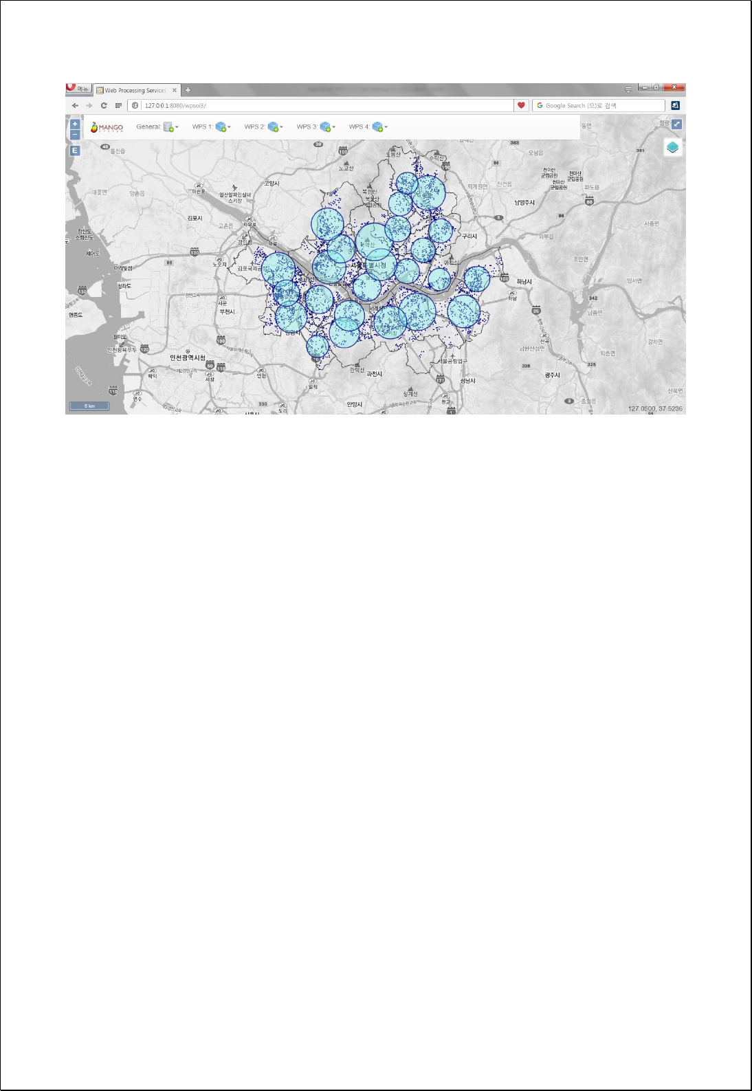

4.4.2.5.
Standard Deviational Ellipse
Measures the degree which all features of the feature layer are concentrated or centered
by the Mean Center and the orientation of the distribution.
Syntax
StandardDeviationalEllipse (SimpleFeatureCollection inputFeatures, String ellipseSize,
String weightField, String caseField): SimpleFeatureCollection
Parameters
Data Inputs
Identifier
Description
Type
Required
inputFeatures
The features containing a distribution of features for
which the standard deviational ellipse will be
calculated.
Complex
ellipseSize
The size (1, 2, 3) of output ellipses in standard
deviations.
Literal
-
weightField
The numeric field used to weight locations according
to their relative importance.
Literal
-
caseField
The field used to group features for separate
directional distribution calculations.
Literal
-
Process Outputs
Identifier
Description
Type
Required
result
Output features.
Complex
Constraints
- Calculates using Centroid of inputFeatures.
- The Ellipse typically includes features of 68% for 1_Standard_Deviation, 95% for
2_Standard_Deviation, and 99% for 3_Standard_Deviation.
Request Examples
<?xml version="1.0" encoding="UTF-8"?><wps:Execute version="1.0.0" service="WPS"
xmlns:xsi="http://www.w3.org/2001/XMLSchema-instance" xmlns="http://www.opengis.net/wps/1.0.0"

xmlns:wfs="http://www.opengis.net/wfs" xmlns:wps="http://www.opengis.net/wps/1.0.0"
xmlns:ows="http://www.opengis.net/ows/1.1" xmlns:gml="http://www.opengis.net/gml"
xmlns:ogc="http://www.opengis.net/ogc" xmlns:wcs="http://www.opengis.net/wcs/1.1.1"
xmlns:xlink="http://www.w3.org/1999/xlink" xsi:schemaLocation="http://www.opengis.net/wps/1.0.0
http://schemas.opengis.net/wps/1.0.0/wpsAll.xsd">
<ows:Identifier>statistics:StandardDeviationalEllipse</ows:Identifier>
<wps:DataInputs>
<wps:Input>
<ows:Identifier>inputFeatures</ows:Identifier>
<wps:Reference mimeType="text/xml" xlink:href="http://geoserver/wfs" method="POST">
<wps:Body>
<wfs:GetFeature service=“WFS” version=“1.1.0” outputFormat=“GML3”
xmlns:foss="http://www.opengeospatial.net/foss">
<wfs:Query typeName="foss:apartment"/>
</wfs:GetFeature>
</wps:Body>
</wps:Reference>
</wps:Input>
<wps:Input>
<ows:Identifier>ellipseSize</ows:Identifier>
<wps:Data>
<wps:LiteralData>1_Standard_Deviation</wps:LiteralData>
</wps:Data>
</wps:Input>
<wps:Input>
<ows:Identifier>caseField</ows:Identifier>
<wps:Data>
<wps:LiteralData>sgg_nm</wps:LiteralData>
</wps:Data>
</wps:Input>
</wps:DataInputs>
<wps:ResponseForm>
<wps:RawDataOutput mimeType=“text/xml; subtype=wfs-collection/1.1”>
<ows:Identifier>result</ows:Identifier>
</wps:RawDataOutput>
</wps:ResponseForm>
</wps:Execute>
Response
The following figure shows the result of analyzing the Standard Deviational Ecclipse
about the distribution of Seoul apartment by administrative boundary(Si-Gun-Gu)district.
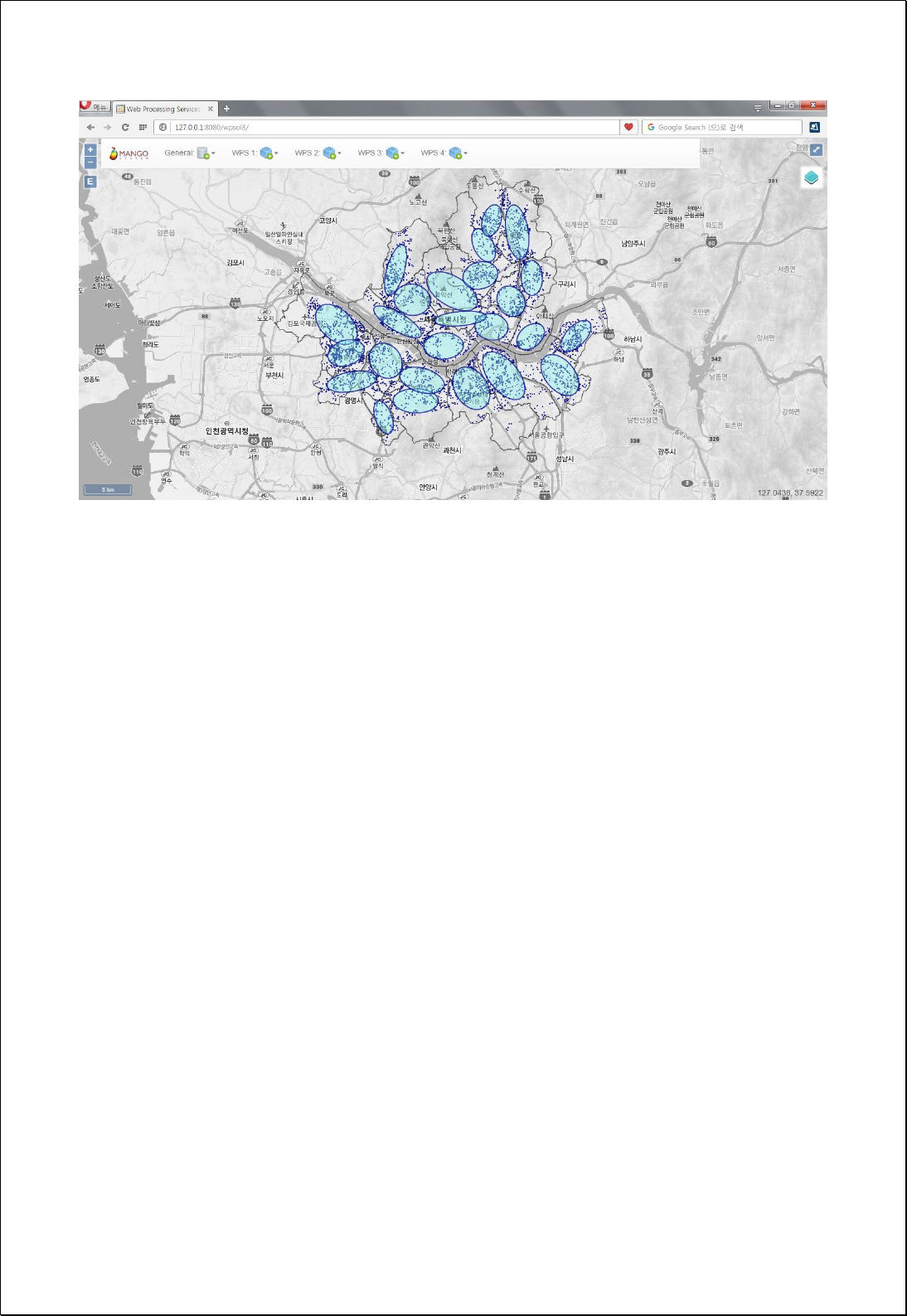

4.4.2.6.
Linear Directional Mean
Identify the geographic center, the average length, and the direction for all features of
line feature layers.
Syntax
LinearDirectionalMean (SimpleFeatureCollection inputFeatures, Boolean orientationOnly,
String caseField): SimpleFeatureCollection
Parameters
Data Inputs
Identifier
Description
Type
Required
inputFeatures
The line features containing vectors for which the
mean direction will be calculated.
Complex
orientationOnly
The From and To nodes are utilized in calculating the
mean.
Literal
-
caseField
The field used to group features for separate
directional mean calculations.
Literal
-
Process Outputs
Identifier
Description
Type
Required
result
Output features.
Complex
Constraints
- The inputFeatures must be line features type.
Request Examples
<?xml version="1.0" encoding="UTF-8"?><wps:Execute version="1.0.0" service="WPS"
xmlns:xsi="http://www.w3.org/2001/XMLSchema-instance" xmlns="http://www.opengis.net/wps/1.0.0"
xmlns:wfs="http://www.opengis.net/wfs" xmlns:wps="http://www.opengis.net/wps/1.0.0"
xmlns:ows="http://www.opengis.net/ows/1.1" xmlns:gml="http://www.opengis.net/gml"
xmlns:ogc="http://www.opengis.net/ogc" xmlns:wcs="http://www.opengis.net/wcs/1.1.1"
xmlns:xlink="http://www.w3.org/1999/xlink" xsi:schemaLocation="http://www.opengis.net/wps/1.0.0
http://schemas.opengis.net/wps/1.0.0/wpsAll.xsd">
<ows:Identifier>statistics:LinearDirectionalMean</ows:Identifier>
<wps:DataInputs>
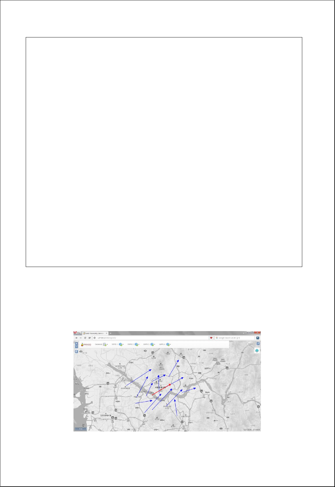
<wps:Input>
<ows:Identifier>inputFeatures</ows:Identifier>
<wps:Reference mimeType="text/xml" xlink:href="http://geoserver/wfs" method="POST">
<wps:Body>
<wfs:GetFeature service=“WFS” version=“1.1.0” outputFormat=“GML3”
xmlns:foss="http://www.opengeospatial.net/foss">
<wfs:Query typeName="foss:line"/>
</wfs:GetFeature>
</wps:Body>
</wps:Reference>
</wps:Input>
<wps:Input>
<ows:Identifier>orientationOnly</ows:Identifier>
<wps:Data>
<wps:LiteralData>True</wps:LiteralData>
</wps:Data>
</wps:Input>
</wps:DataInputs>
<wps:ResponseForm>
<wps:RawDataOutput mimeType=“text/xml; subtype=wfs-collection/1.1”>
<ows:Identifier>result</ows:Identifier>
</wps:RawDataOutput>
</wps:ResponseForm>
</wps:Execute>
Response
The following figure shows the result of Linear Directional Mean analysis for line layers
with length and directionality.

4.4.3. Point Pattern Analysis
Analyze the pattern of the point data.
4.4.3.1.
Nearest Neighbor Statistic
Calculates the Nearest Neighbor Index based on the average distance from the feature
closest to each feature in the feature layer.
Syntax
NearestNeighborIndex (SimpleFeatureCollection inputFeatures, DistanceMethod
distanceMethod, Double area): NearestNeighborResult
Parameters
Data Inputs
Identifier
Description
Type
Required
inputFeatures
Input features.
Complex
distanceMethod
Specifies how distances are calculated from each
feature to neighboring features: Euclidean (default) or
Manhattan.
Literal
-
area
A numeric value representing the study area.
Literal
-
Process Outputs
Identifier
Description
Type
Required
result
Result Nearest Neighbor Index
Complex
Constraints
- Calculates using Centroid of inputFeatures.
- Unless set the area parameter, use the Convex Hull Polygon area for Centroid in
inputFeatures.
- The output is returned in XML format. If the returned Nearest Neighbor Ratio value
is 1, Random, if it is larger than 1, it is distributed. If it is smaller than 1, it is
concentrated.

Request Examples
<?xml version="1.0" encoding="utf-8"?>
<wps:Execute version="1.0.0" service="WPS" xmlns:xsi="http://www.w3.org/2001/XMLSchema-instance"
xmlns="http://www.opengis.net/wps/1.0.0" xmlns:wfs="http://www.opengis.net/wfs"
xmlns:wps="http://www.opengis.net/wps/1.0.0" xmlns:ows="http://www.opengis.net/ows/1.1"
xmlns:gml="http://www.opengis.net/gml" xmlns:ogc="http://www.opengis.net/ogc"
xmlns:wcs="http://www.opengis.net/wcs/1.1.1" xmlns:xlink="http://www.w3.org/1999/xlink"
xsi:schemaLocation="http://www.opengis.net/wps/1.0.0 http://schemas.opengis.net/wps/1.0.0/wpsAll.xsd">
<ows:Identifier>statistics:NearestNeighborIndex</ows:Identifier>
<wps:DataInputs>
<wps:Input>
<ows:Identifier>inputFeatures</ows:Identifier>
<wps:Reference mimeType="text/xml" xlink:href="http://geoserver/wfs" method="POST">
<wps:Body>
<wfs:GetFeature service="WFS" version="1.0.0" outputFormat="GML2"
xmlns:foss="http://www.opengeospatial.net/foss">
<wfs:Query typeName="foss:apartment" />
</wfs:GetFeature>
</wps:Body>
</wps:Reference>
</wps:Input>
<wps:Input>
<ows:Identifier>distanceMethod</ows:Identifier>
<wps:Data>
<wps:LiteralData>Euclidean</wps:LiteralData>
</wps:Data>
</wps:Input>
</wps:DataInputs>
<wps:ResponseForm>
<wps:RawDataOutput mimeType="text/xml">
<ows:Identifier>result</ows:Identifier>
</wps:RawDataOutput>
</wps:ResponseForm>
</wps:Execute>
Response
This is the result of analyzing Average Nearest Neighbor for the distribution of
apartments in Seoul and is returned in XML format. Since the Nearest Neighbor Ratio is
less than 1, it can explain Cluster.

<?xml version="1.0" encoding="utf-8"?>
<NearestNeighborIndex>
<TypeName>apartment</TypeName>
<Observed_Point_Count>4052</Observed_Point_Count>
<Study_Area>1.047557075141607E9</Study_Area>
<Observed_Mean_Distance>200.00446</Observed_Mean_Distance>
<Expected_Mean_Distance>254.22844</Expected_Mean_Distance>
<Nearest_Neighbor_Ratio>0.786712</Nearest_Neighbor_Ratio>
<Z_Score>-25.973484</Z_Score>
<P_Value>0.0</P_Value>
<Standard_Error>2.087667</Standard_Error>
</NearestNeighborIndex>

4.4.3.2.
Quadrat Method
Analyze the point pattern using Quadrat analysis method.
Syntax
QuadratAnalysis (SimpleFeatureCollection inputFeatures, Double cellSize): QuadratResult
Parameters
Data Inputs
Identifier
Description
Type
Required
inputFeatures
The point features to be calculated.
Complex
cellSize
The size of the grid cell.
Literal
-
Process Outputs
Identifier
Description
Type
Required
result
The Result of quadrat analysis
Complex
Constraints
- Calculates using Centroid of inputFeatures.
- If you do not set the cellSize parameter, use the following formula to calculate the
cell size. Math.sqrt ((BBOX area of inputFeatures * 2) / number of points).
Request Examples
<?xml version="1.0" encoding="utf-8"?>
<wps:Execute version="1.0.0" service="WPS" xmlns:xsi="http://www.w3.org/2001/XMLSchema-instance"
xmlns="http://www.opengis.net/wps/1.0.0" xmlns:wfs="http://www.opengis.net/wfs"
xmlns:wps="http://www.opengis.net/wps/1.0.0" xmlns:ows="http://www.opengis.net/ows/1.1"
xmlns:gml="http://www.opengis.net/gml" xmlns:ogc="http://www.opengis.net/ogc"
xmlns:wcs="http://www.opengis.net/wcs/1.1.1" xmlns:xlink="http://www.w3.org/1999/xlink"
xsi:schemaLocation="http://www.opengis.net/wps/1.0.0 http://schemas.opengis.net/wps/1.0.0/wpsAll.xsd">
<ows:Identifier>statistics:QuadratAnalysis</ows:Identifier>
<wps:DataInputs>
<wps:Input>
<ows:Identifier>inputFeatures</ows:Identifier>
<wps:Reference mimeType="text/xml" xlink:href="http://geoserver/wfs" method="POST">

<wps:Body>
<wfs:GetFeature service="WFS" version="1.0.0" outputFormat="GML2"
xmlns:foss="http://www.opengeospatial.net/foss">
<wfs:Query typeName="foss:gasstation" />
</wfs:GetFeature>
</wps:Body>
</wps:Reference>
</wps:Input>
</wps:DataInputs>
<wps:ResponseForm>
<wps:RawDataOutput mimeType="text/xml">
<ows:Identifier>result</ows:Identifier>
</wps:RawDataOutput>
</wps:ResponseForm>
</wps:Execute>
Response
This is the result of analyzing the Quadrate Method for the distribution of gas stations in
Seoul and is returned in XML format.
<?xml version="1.0" encoding="utf-8"?>
<QuadratAnalysis>
<TypeName>gasstation</TypeName>
<FeatureCount>587</FeatureCount>
<Area>1.4406602767217913E9</Area>
<CellSize>2215.5254234488443</CellSize>
<Columns>19</Columns>
<Rows>16</Rows>
<Number_of_Quadrats>304</Number_of_Quadrats>
<Mean>1.930921052631579</Mean>
<Variance>5.643254414819944</Variance>
<Variance_Mean_Ratio>2.9225712812696134</Variance_Mean_Ratio>
<Kolmogorov_Smirnov_Test>0.32209069225598863</Kolmogorov_Smirnov_Test>
<Critical_Value_at_5percent>0.078001349515991</Critical_Value_at_5percent>
</QuadratAnalysis>

4.4.3.3.
K-Nearest Neighbor Map
Creates line feature layers that connects the k-th nearest feature from all features in the
feature layer.
Syntax
KNearestNeighborMap (SimpleFeatureCollection inputFeatures, Integer neighbor, Boolean
convexHull): SimpleFeatureCollection
Parameters
Data Inputs
Identifier
Description
Type
Required
inputFeatures
Input features that can be point, line, polygon.
Complex
neighbor
Number of Neighbors. Default is 1.
Literal
convexHull
Add convex hull boundary to the output features.
Default is True.
Literal
-
Process Outputs
Identifier
Description
Type
Required
result
Output features.
Complex
Constraints
- The Neighbor parameter must be greater than or equal to 1 and defaults to 1.
- The Output layer is the line feature type.
Request Examples
<?xml version="1.0" encoding="UTF-8"?><wps:Execute version="1.0.0" service="WPS"
xmlns:xsi="http://www.w3.org/2001/XMLSchema-instance" xmlns="http://www.opengis.net/wps/1.0.0"
xmlns:wfs="http://www.opengis.net/wfs" xmlns:wps="http://www.opengis.net/wps/1.0.0"
xmlns:ows="http://www.opengis.net/ows/1.1" xmlns:gml="http://www.opengis.net/gml"
xmlns:ogc="http://www.opengis.net/ogc" xmlns:wcs="http://www.opengis.net/wcs/1.1.1"
xmlns:xlink="http://www.w3.org/1999/xlink" xsi:schemaLocation="http://www.opengis.net/wps/1.0.0
http://schemas.opengis.net/wps/1.0.0/wpsAll.xsd">
<ows:Identifier>statistics:KNearestNeighborMap</ows:Identifier>
<wps:DataInputs>

<wps:Input>
<ows:Identifier>inputFeatures</ows:Identifier>
<wps:Reference mimeType="text/xml" xlink:href="http://geoserver/wfs" method="POST">
<wps:Body>
<wfs:GetFeature service=“WFS” version=“1.1.0” outputFormat=“GML3”
xmlns:foss="http://www.opengeospatial.net/foss">
<wfs:Query typeName="foss:checkins"/>
</wfs:GetFeature>
</wps:Body>
</wps:Reference>
</wps:Input>
<wps:Input>
<ows:Identifier>neighbor</ows:Identifier>
<wps:Data>
<wps:LiteralData>2</wps:LiteralData>
</wps:Data>
</wps:Input>
<wps:Input>
<ows:Identifier>convexHull</ows:Identifier>
<wps:Data>
<wps:LiteralData>False</wps:LiteralData>
</wps:Data>
</wps:Input>
</wps:DataInputs>
<wps:ResponseForm>
<wps:RawDataOutput mimeType=“text/xml; subtype=wfs-collection/1.1”>
<ows:Identifier>result</ows:Identifier>
</wps:RawDataOutput>
</wps:ResponseForm>
</wps:Execute>
Response
The following figure shows the result of the K-Nearest Neighbor with the Neighbor
parameter set to 2.
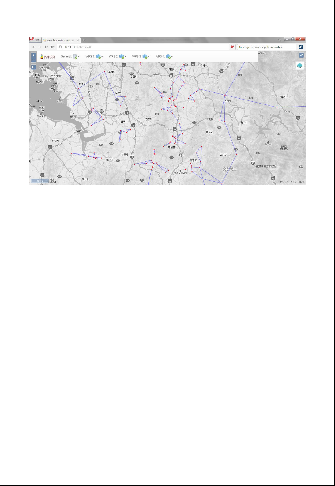

4.4.3.4.
K-Means Clustering
All features in the feature layer are grouped into K clusters using the K-Means Clustering
algorithm.
Syntax
KMeansClustering (SimpleFeatureCollection inputFeatures, String targetField, Integer
numberOfClusters): SimpleFeatureCollection
Parameters
Data Inputs
Identifier
Description
Type
Required
inputFeatures
Input features to be clustered.
Complex
targetField
The numeric cluster id field to be calculated. Default
is cluster
Literal
numberOfClusters
The number of clusters to be grouped. Default is 5.
Literal
Process Outputs
Identifier
Description
Type
Required
result
Output features.
Complex
Constraints
- Unless set the targetField parameter, use default cluster field,
- Unless set the numberOfClusters parameter, use default value of 5.
Request Examples
<?xml version="1.0" encoding="UTF-8"?><wps:Execute version="1.0.0" service="WPS"
xmlns:xsi="http://www.w3.org/2001/XMLSchema-instance" xmlns="http://www.opengis.net/wps/1.0.0"
xmlns:wfs="http://www.opengis.net/wfs" xmlns:wps="http://www.opengis.net/wps/1.0.0"
xmlns:ows="http://www.opengis.net/ows/1.1" xmlns:gml="http://www.opengis.net/gml"
xmlns:ogc="http://www.opengis.net/ogc" xmlns:wcs="http://www.opengis.net/wcs/1.1.1"
xmlns:xlink="http://www.w3.org/1999/xlink" xsi:schemaLocation="http://www.opengis.net/wps/1.0.0
http://schemas.opengis.net/wps/1.0.0/wpsAll.xsd">
<ows:Identifier>statistics:KMeansClustering</ows:Identifier>
<wps:DataInputs>

<wps:Input>
<ows:Identifier>inputFeatures</ows:Identifier>
<wps:Reference mimeType="text/xml" xlink:href="http://geoserver/wfs" method="POST">
<wps:Body>
<wfs:GetFeature service=“WFS” version=“1.1.0” outputFormat=“GML3”
xmlns:foss="http://www.opengeospatial.net/foss">
<wfs:Query typeName="foss:apartment"/>
</wfs:GetFeature>
</wps:Body>
</wps:Reference>
</wps:Input>
<wps:Input>
<ows:Identifier>targetField</ows:Identifier>
<wps:Data>
<wps:LiteralData>cluster</wps:LiteralData>
</wps:Data>
</wps:Input>
<wps:Input>
<ows:Identifier>numberOfClusters</ows:Identifier>
<wps:Data>
<wps:LiteralData>5</wps:LiteralData>
</wps:Data>
</wps:Input>
</wps:DataInputs>
<wps:ResponseForm>
<wps:RawDataOutput mimeType=“text/xml; subtype=wfs-collection/1.1”>
<ows:Identifier>result</ows:Identifier>
</wps:RawDataOutput>
</wps:ResponseForm>
</wps:Execute>
Response
The following figure shows the result of point layers Clusters with the set 5.
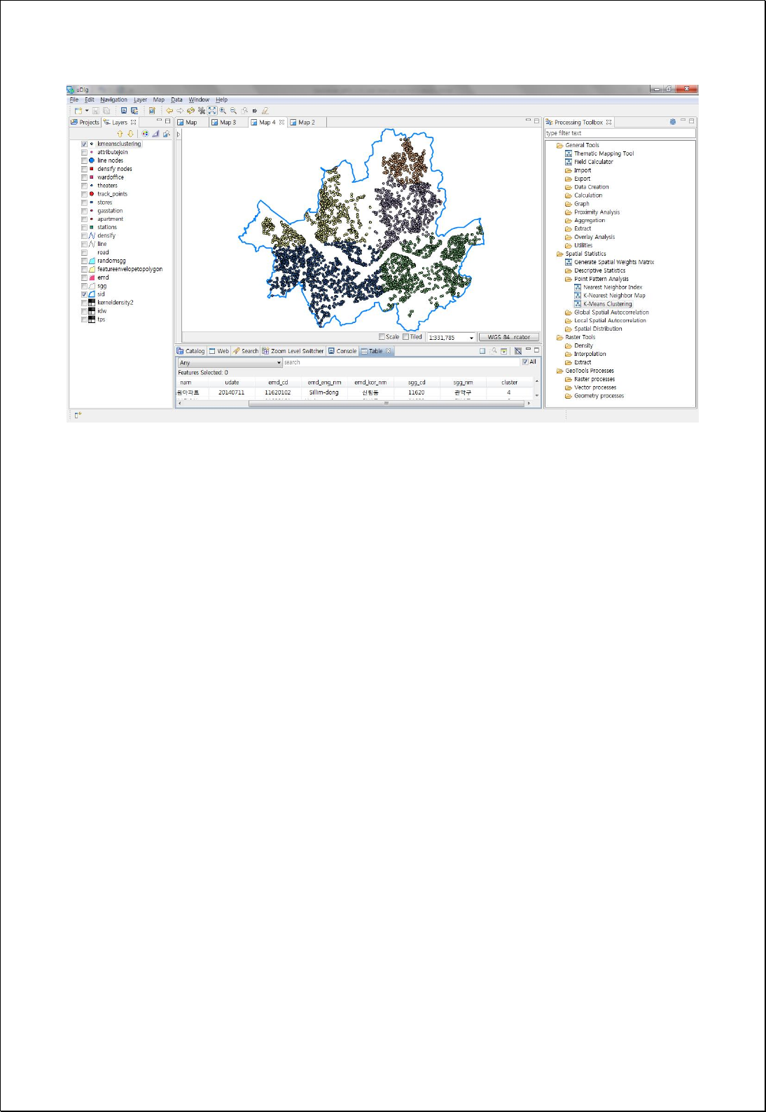

4.4.4. Global Spatial Auto-Correlation
It consists of processes for analyzing global spatial autocorrelation.
4.4.4.1.
Join Count Statistic
Measure the global spatial autocorrelation of binary data (such as 1 or Black, 0 or White)
based on the field values of the feature layer.
Syntax
JoinCount (SimpleFeatureCollection inputFeatures, Filter blackExpression, ContiguityType
contiguityType): JoinCountProcessResult
Parameters
Data Inputs
Identifier
Description
Type
Required
inputFeatures
The features for which join count statistics will be
performed.
Complex
blackExpression
Black Expression for 1 or True (for Black) value ex)
[pop] > 1500.
Complex
contiguityType
Contiguity Type(Queen, Rook, Bishops). Default is
Queen.
Literal
-
Process Outputs
Identifier
Description
Type
Required
result
Join Count Statistics.
Complex
Constraints
- Both field and combination formula of fields can be the blackExpression parameter.
- Output is returned in XML format.
Request Examples
<?xml version="1.0" encoding="utf-8"?>
<wps:Execute version="1.0.0" service="WPS" xmlns:xsi="http://www.w3.org/2001/XMLSchema-instance"
xmlns="http://www.opengis.net/wps/1.0.0" xmlns:wfs="http://www.opengis.net/wfs"

xmlns:wps="http://www.opengis.net/wps/1.0.0" xmlns:ows="http://www.opengis.net/ows/1.1"
xmlns:gml="http://www.opengis.net/gml" xmlns:ogc="http://www.opengis.net/ogc"
xmlns:wcs="http://www.opengis.net/wcs/1.1.1" xmlns:xlink="http://www.w3.org/1999/xlink"
xsi:schemaLocation="http://www.opengis.net/wps/1.0.0 http://schemas.opengis.net/wps/1.0.0/wpsAll.xsd">
<ows:Identifier>statistics:JoinCount</ows:Identifier>
<wps:DataInputs>
<wps:Input>
<ows:Identifier>inputFeatures</ows:Identifier>
<wps:Reference mimeType="text/xml" xlink:href="http://geoserver/wfs" method="POST">
<wps:Body>
<wfs:GetFeature service=“WFS” version=“1.1.0” outputFormat=“GML3”
xmlns:foss="http://www.opengeospatial.net/foss">
<wfs:Query typeName="foss:sgg" />
</wfs:GetFeature>
</wps:Body>
</wps:Reference>
</wps:Input>
<wps:Input>
<ows:Identifier>blackExpression</ows:Identifier>
<wps:Data>
<wps:ComplexData mimeType="text/plain; subtype=cql"><![CDATA[pop_den >
18890]]></wps:ComplexData>
</wps:Data>
</wps:Input>
<wps:Input>
<ows:Identifier>contiguityType</ows:Identifier>
<wps:Data>
<wps:LiteralData>Queen</wps:LiteralData>
</wps:Data>
</wps:Input>
</wps:DataInputs>
<wps:ResponseForm>
<wps:RawDataOutput mimeType="text/xml">
<ows:Identifier>result</ows:Identifier>
</wps:RawDataOutput>
</wps:ResponseForm>
</wps:Execute>
Response
This is the result of analyzing the Join Count statistic by the method of the Queen, and it
returns in the XML format.

<?xml version="1.0" encoding="utf-8"?>
<JoinCountStatistics>
<TypeName>sgg</TypeName>
<ContiguityType>Queen</ContiguityType>
<FeatureCount>25</FeatureCount>
<BlackCount>11</BlackCount>
<WhiteCount>14</WhiteCount>
<NumberOfJoins>56</NumberOfJoins>
<ObservedBB>11</ObservedBB>
<ObservedWW>18</ObservedWW>
<ObservedBW>27</ObservedBW>
<ExpectedBB>10.8416</ExpectedBB>
<ExpectedWW>17.561600000000002</ExpectedWW>
<ExpectedBW>27.5968</ExpectedBW>
<StdDevBB>5.487588556005269</StdDevBB>
<StdDevWW>6.831669500202715</StdDevWW>
<StdDevBW>3.9479960283667954</StdDevBW>
<ZScoreBB>0.028865137825731742</ZScoreBB>
<ZScoreWW>0.06417172259094052</ZScoreWW>
<ZScoreBW>-0.15116529898002093</ZScoreBW>
</JoinCountStatistics>

4.4.4.2.
Moran’s I
Measures the global Moran's
I
spatial autocorrelation based on the location and attribute
values of the feature layer.
Syntax
GlobalMoransI (SimpleFeatureCollection inputFeatures, String inputField, SpatialConcept
spatialConcept, DistanceMethod distanceMethod, StandardizationMethod standardization,
Double searchDistance): MoransI
Parameters
Data Inputs
Identifier
Description
Type
Required
inputFeatures
The features for which spatial autocorrelation will be
calculated.
Complex
inputField
The numeric field used in assessing spatial
autocorrelation.
Literal
spatialConcept
Specifies how spatial relationships among features
are conceptualized. Default is InverseDistance
Literal
-
distanceMethod
Specifies how distances are calculated from each
feature to neighboring features. Default is Euclidean
Literal
-
standardization
Row standardization. Default is None
Literal
-
searchDistance
Specifies a cutoff distance for Inverse Distance and
Fixed Distance options.
Literal
-
Process Outputs
Identifier
Description
Type
Required
result
Output XML.
Complex
Constraints
- Output is returned in XML format.
Request Examples
<?xml version="1.0" encoding="UTF-8"?><wps:Execute version="1.0.0" service="WPS"
xmlns:xsi="http://www.w3.org/2001/XMLSchema-instance" xmlns="http://www.opengis.net/wps/1.0.0"

xmlns:wfs="http://www.opengis.net/wfs" xmlns:wps="http://www.opengis.net/wps/1.0.0"
xmlns:ows="http://www.opengis.net/ows/1.1" xmlns:gml="http://www.opengis.net/gml"
xmlns:ogc="http://www.opengis.net/ogc" xmlns:wcs="http://www.opengis.net/wcs/1.1.1"
xmlns:xlink="http://www.w3.org/1999/xlink" xsi:schemaLocation="http://www.opengis.net/wps/1.0.0
http://schemas.opengis.net/wps/1.0.0/wpsAll.xsd">
<ows:Identifier>statistics:GlobalMoransI</ows:Identifier>
<wps:DataInputs>
<wps:Input>
<ows:Identifier>inputFeatures</ows:Identifier>
<wps:Reference mimeType="text/xml" xlink:href="http://geoserver/wfs" method="POST">
<wps:Body>
<wfs:GetFeature service=“WFS” version=“1.1.0” outputFormat=“GML3”
xmlns:foss="http://www.opengeospatial.net/foss">
<wfs:Query typeName="foss:korea_sgg"/>
</wfs:GetFeature>
</wps:Body>
</wps:Reference>
</wps:Input>
<wps:Input>
<ows:Identifier>inputField</ows:Identifier>
<wps:Data>
<wps:LiteralData>a3_2005</wps:LiteralData>
</wps:Data>
</wps:Input>
<wps:Input>
<ows:Identifier>spatialConcept</ows:Identifier>
<wps:Data>
<wps:LiteralData>InverseDistance</wps:LiteralData>
</wps:Data>
</wps:Input>
<wps:Input>
<ows:Identifier>distanceMethod</ows:Identifier>
<wps:Data>
<wps:LiteralData>Euclidean</wps:LiteralData>
</wps:Data>
</wps:Input>
<wps:Input>
<ows:Identifier>standardization</ows:Identifier>
<wps:Data>
<wps:LiteralData>Row</wps:LiteralData>
</wps:Data>
</wps:Input>
</wps:DataInputs>

<wps:ResponseForm>
<wps:RawDataOutput mimeType="text/xml">
<ows:Identifier>result</ows:Identifier>
</wps:RawDataOutput>
</wps:ResponseForm>
</wps:Execute>
Response
<?xml version="1.0" encoding="utf-8"?>
<MoransI>
<TypeName>korea_sgg</TypeName>
<PropertyName>a3_2005</PropertyName>
<Observed_Index>0.070175</Observed_Index>
<Expected_Index>-0.004292</Expected_Index>
<Variance>0.000203</Variance>
<Z_Score>5.230945</Z_Score>
<P_Value>0</P_Value>
<Conceptualization>InverseDistance</Conceptualization>
<DistanceMethod>Euclidean</DistanceMethod>
<RowStandardization>Row</RowStandardization>
<DistanceThreshold>191807.950591</DistanceThreshold>
</MoransI>

4.4.4.3.
Geary’s c
Measures the global Geary's
c
spatial autocorrelation based on the location and attribute
values of the feature layer.
Syntax
GlobalGearysC (SimpleFeatureCollection inputFeatures, String inputField, SpatialConcept
spatialConcept, DistanceMethod distanceMethod, StandardizationMethod standardization,
Double searchDistance): GearysC
Parameters
Data Inputs
Identifier
Description
Type
Required
inputFeatures
The features for which spatial autocorrelation will be
calculated.
Complex
inputField
The numeric field used in assessing spatial
autocorrelation.
Literal
spatialConcept
Specifies how spatial relationships among features
are conceptualized. Default is InverseDistance
Literal
-
distanceMethod
Specifies how distances are calculated from each
feature to neighboring features. Default is Euclidean
Literal
-
standardization
Row standardization. Default is None
Literal
-
searchDistance
Specifies a cutoff distance for Inverse Distance and
Fixed Distance options.
Literal
-
Process Outputs
Identifier
Description
Type
Required
result
Output XML.
Complex
Constraints
- Output is returned in XML format.
Request Examples
<?xml version="1.0" encoding="UTF-8"?><wps:Execute version="1.0.0" service="WPS"
xmlns:xsi="http://www.w3.org/2001/XMLSchema-instance" xmlns="http://www.opengis.net/wps/1.0.0"

xmlns:wfs="http://www.opengis.net/wfs" xmlns:wps="http://www.opengis.net/wps/1.0.0"
xmlns:ows="http://www.opengis.net/ows/1.1" xmlns:gml="http://www.opengis.net/gml"
xmlns:ogc="http://www.opengis.net/ogc" xmlns:wcs="http://www.opengis.net/wcs/1.1.1"
xmlns:xlink="http://www.w3.org/1999/xlink" xsi:schemaLocation="http://www.opengis.net/wps/1.0.0
http://schemas.opengis.net/wps/1.0.0/wpsAll.xsd">
<ows:Identifier>statistics:GlobalGearysC</ows:Identifier>
<wps:DataInputs>
<wps:Input>
<ows:Identifier>inputFeatures</ows:Identifier>
<wps:Reference mimeType="text/xml" xlink:href="http://geoserver/wfs" method="POST">
<wps:Body>
<wfs:GetFeature service=“WFS” version=“1.1.0” outputFormat=“GML3”
xmlns:foss="http://www.opengeospatial.net/foss">
<wfs:Query typeName="foss:korea_sgg"/>
</wfs:GetFeature>
</wps:Body>
</wps:Reference>
</wps:Input>
<wps:Input>
<ows:Identifier>inputField</ows:Identifier>
<wps:Data>
<wps:LiteralData>a3_2005</wps:LiteralData>
</wps:Data>
</wps:Input>
<wps:Input>
<ows:Identifier>spatialConcept</ows:Identifier>
<wps:Data>
<wps:LiteralData>InverseDistance</wps:LiteralData>
</wps:Data>
</wps:Input>
<wps:Input>
<ows:Identifier>distanceMethod</ows:Identifier>
<wps:Data>
<wps:LiteralData>Euclidean</wps:LiteralData>
</wps:Data>
</wps:Input>
<wps:Input>
<ows:Identifier>standardization</ows:Identifier>
<wps:Data>
<wps:LiteralData>Row</wps:LiteralData>
</wps:Data>
</wps:Input>
</wps:DataInputs>

<wps:ResponseForm>
<wps:RawDataOutput mimeType="text/xml">
<ows:Identifier>result</ows:Identifier>
</wps:RawDataOutput>
</wps:ResponseForm>
</wps:Execute>
Response
<?xml version="1.0" encoding="utf-8"?>
<GlobalGearysC>
<TypeName>korea_sgg</TypeName>
<PropertyName>a3_2005</PropertyName>
<Observed_Index>0.908981</Observed_Index>
<Expected_Index>1</Expected_Index>
<Variance>0.00029</Variance>
<Z_Score>-5.341097</Z_Score>
<P_Value>0</P_Value>
<Conceptualization>InverseDistance</Conceptualization>
<DistanceMethod>Euclidean</DistanceMethod>
<RowStandardization>Row</RowStandardization>
<DistanceThreshold>191807.950591</DistanceThreshold>
</GlobalGearysC>

4.4.4.4.
Getis-Ord’s General G
Measures the global Getis-Ord General
G
spatial autocorrelation based on the location
and attribute values of the feature layer.
Syntax
GlobalGStatistics (SimpleFeatureCollection inputFeatures, String inputField,
SpatialConcept spatialConcept, DistanceMethod distanceMethod, StandardizationMethod
standardization, Double searchDistance): GeneralG
Parameters
Data Inputs
Identifier
Description
Type
Required
inputFeatures
The features for which spatial autocorrelation will be
calculated.
Complex
inputField
The numeric field used in assessing spatial
autocorrelation.
Literal
spatialConcept
Specifies how spatial relationships among features
are conceptualized. Default is InverseDistance
Literal
-
distanceMethod
Specifies how distances are calculated from each
feature to neighboring features. Default is Euclidean
Literal
-
standardization
Row standardization. Default is None
Literal
-
searchDistance
Specifies a cutoff distance for Inverse Distance and
Fixed Distance options.
Literal
-
Process Outputs
Identifier
Description
Type
Required
result
Output XML.
Complex
Constraints
- Output is returned in XML format.
Request Examples
<?xml version="1.0" encoding="UTF-8"?><wps:Execute version="1.0.0" service="WPS"
xmlns:xsi="http://www.w3.org/2001/XMLSchema-instance" xmlns="http://www.opengis.net/wps/1.0.0"

xmlns:wfs="http://www.opengis.net/wfs" xmlns:wps="http://www.opengis.net/wps/1.0.0"
xmlns:ows="http://www.opengis.net/ows/1.1" xmlns:gml="http://www.opengis.net/gml"
xmlns:ogc="http://www.opengis.net/ogc" xmlns:wcs="http://www.opengis.net/wcs/1.1.1"
xmlns:xlink="http://www.w3.org/1999/xlink" xsi:schemaLocation="http://www.opengis.net/wps/1.0.0
http://schemas.opengis.net/wps/1.0.0/wpsAll.xsd">
<ows:Identifier>statistics:GlobalGStatistics</ows:Identifier>
<wps:DataInputs>
<wps:Input>
<ows:Identifier>inputFeatures</ows:Identifier>
<wps:Reference mimeType="text/xml" xlink:href="http://geoserver/wfs" method="POST">
<wps:Body>
<wfs:GetFeature service=“WFS” version=“1.1.0” outputFormat=“GML3”
xmlns:foss="http://www.opengeospatial.net/foss">
<wfs:Query typeName="foss:korea_sgg"/>
</wfs:GetFeature>
</wps:Body>
</wps:Reference>
</wps:Input>
<wps:Input>
<ows:Identifier>inputField</ows:Identifier>
<wps:Data>
<wps:LiteralData>a3_2005</wps:LiteralData>
</wps:Data>
</wps:Input>
<wps:Input>
<ows:Identifier>spatialConcept</ows:Identifier>
<wps:Data>
<wps:LiteralData>InverseDistance</wps:LiteralData>
</wps:Data>
</wps:Input>
<wps:Input>
<ows:Identifier>distanceMethod</ows:Identifier>
<wps:Data>
<wps:LiteralData>Euclidean</wps:LiteralData>
</wps:Data>
</wps:Input>
<wps:Input>
<ows:Identifier>standardization</ows:Identifier>
<wps:Data>
<wps:LiteralData>Row</wps:LiteralData>
</wps:Data>
</wps:Input>
</wps:DataInputs>

<wps:ResponseForm>
<wps:RawDataOutput mimeType="text/xml">
<ows:Identifier>result</ows:Identifier>
</wps:RawDataOutput>
</wps:ResponseForm>
</wps:Execute>
Response
<?xml version="1.0" encoding="utf-8"?>
<GStatistics>
<TypeName>korea_sgg</TypeName>
<PropertyName>a3_2005</PropertyName>
<Observed_Index>0.004492</Observed_Index>
<Expected_Index>0.004292</Expected_Index>
<Variance>0</Variance>
<Z_Score>4.275913</Z_Score>
<P_Value>0.000019</P_Value>
<Conceptualization>InverseDistance</Conceptualization>
<DistanceMethod>Euclidean</DistanceMethod>
<RowStandardization>Row</RowStandardization>
<DistanceThreshold>191807.950591</DistanceThreshold>
</GStatistics>

4.4.4.5.
Lee's S
Measures the global Lee's
S
spatial autocorrelation based on the location and attribute
values of the feature layer.
Syntax
GlobalLeesS (SimpleFeatureCollection inputFeatures, String inputField, SpatialConcept
spatialConcept, DistanceMethod distanceMethod, StandardizationMethod standardization,
Double searchDistance): LeesS
Parameters
Data Inputs
Identifier
Description
Type
Required
inputFeatures
The features for which spatial autocorrelation will be
calculated.
Complex
inputField
The numeric field used in assessing spatial
autocorrelation.
Literal
spatialConcept
Specifies how spatial relationships among features
are conceptualized. Default is InverseDistance
Literal
-
distanceMethod
Specifies how distances are calculated from each
feature to neighboring features. Default is Euclidean
Literal
-
standardization
Row standardization. Default is None
Literal
-
searchDistance
Specifies a cutoff distance for Inverse Distance and
Fixed Distance options.
Literal
-
Process Outputs
Identifier
Description
Type
Required
result
Output XML.
Complex
Constraints
- Output is returned in XML format.
Request Examples
<?xml version="1.0" encoding="UTF-8"?><wps:Execute version="1.0.0" service="WPS"
xmlns:xsi="http://www.w3.org/2001/XMLSchema-instance" xmlns="http://www.opengis.net/wps/1.0.0"

xmlns:wfs="http://www.opengis.net/wfs" xmlns:wps="http://www.opengis.net/wps/1.0.0"
xmlns:ows="http://www.opengis.net/ows/1.1" xmlns:gml="http://www.opengis.net/gml"
xmlns:ogc="http://www.opengis.net/ogc" xmlns:wcs="http://www.opengis.net/wcs/1.1.1"
xmlns:xlink="http://www.w3.org/1999/xlink" xsi:schemaLocation="http://www.opengis.net/wps/1.0.0
http://schemas.opengis.net/wps/1.0.0/wpsAll.xsd">
<ows:Identifier>statistics:GlobalLeesS</ows:Identifier>
<wps:DataInputs>
<wps:Input>
<ows:Identifier>inputFeatures</ows:Identifier>
<wps:Reference mimeType="text/xml" xlink:href="http://geoserver/wfs" method="POST">
<wps:Body>
<wfs:GetFeature service=“WFS” version=“1.1.0” outputFormat=“GML3”
xmlns:foss="http://www.opengeospatial.net/foss">
<wfs:Query typeName="foss:korea_sgg"/>
</wfs:GetFeature>
</wps:Body>
</wps:Reference>
</wps:Input>
<wps:Input>
<ows:Identifier>inputField</ows:Identifier>
<wps:Data>
<wps:LiteralData>a3_2005</wps:LiteralData>
</wps:Data>
</wps:Input>
<wps:Input>
<ows:Identifier>spatialConcept</ows:Identifier>
<wps:Data>
<wps:LiteralData>InverseDistance</wps:LiteralData>
</wps:Data>
</wps:Input>
<wps:Input>
<ows:Identifier>distanceMethod</ows:Identifier>
<wps:Data>
<wps:LiteralData>Euclidean</wps:LiteralData>
</wps:Data>
</wps:Input>
<wps:Input>
<ows:Identifier>standardization</ows:Identifier>
<wps:Data>
<wps:LiteralData>Row</wps:LiteralData>
</wps:Data>
</wps:Input>
</wps:DataInputs>

<wps:ResponseForm>
<wps:RawDataOutput mimeType="text/xml">
<ows:Identifier>result</ows:Identifier>
</wps:RawDataOutput>
</wps:ResponseForm>
</wps:Execute>
Response
<?xml version="1.0" encoding="utf-8"?>
<GlobalLeesS>
<TypeName>korea_sgg</TypeName>
<PropertyName>a3_2005</PropertyName>
<Observed_Index>0.065413</Observed_Index>
<Expected_Index>0.090566</Expected_Index>
<Variance>0</Variance>
<Z_Score>0</Z_Score>
<P_Value>1</P_Value>
<Conceptualization>InverseDistance</Conceptualization>
<DistanceMethod>Euclidean</DistanceMethod>
<RowStandardization>Row</RowStandardization>
<DistanceThreshold>191807.950591</DistanceThreshold>
</GlobalLeesS>

4.4.4.6.
Lee's L
Measures the global Lee's
L
spatial autocorrelation based on the location and two
attribute values of the feature layer.
Syntax
GlobalLeesL (SimpleFeatureCollection inputFeatures, String xField, String yField,
SpatialConcept spatialConcept, DistanceMethod distanceMethod, StandardizationMethod
standardization, Double searchDistance): LeesL
Parameters
Data Inputs
Identifier
Description
Type
Required
inputFeatures
The features for which spatial autocorrelation will be
calculated.
Complex
xField
The numeric x field used in assessing spatial
autocorrelation.
Literal
yField
The numeric y field used in assessing spatial
autocorrelation.
Literal
spatialConcept
Specifies how spatial relationships among features
are conceptualized. Default is InverseDistance
Literal
-
distanceMethod
Specifies how distances are calculated from each
feature to neighboring features. Default is Euclidean
Literal
-
standardization
Row standardization. Default is None
Literal
-
searchDistance
Specifies a cutoff distance for Inverse Distance and
Fixed Distance options.
Literal
-
Process Outputs
Identifier
Description
Type
Required
result
Output XML.
Complex
Constraints
- Output is returned in XML format.
Request Examples

<?xml version="1.0" encoding="UTF-8"?><wps:Execute version="1.0.0" service="WPS"
xmlns:xsi="http://www.w3.org/2001/XMLSchema-instance" xmlns="http://www.opengis.net/wps/1.0.0"
xmlns:wfs="http://www.opengis.net/wfs" xmlns:wps="http://www.opengis.net/wps/1.0.0"
xmlns:ows="http://www.opengis.net/ows/1.1" xmlns:gml="http://www.opengis.net/gml"
xmlns:ogc="http://www.opengis.net/ogc" xmlns:wcs="http://www.opengis.net/wcs/1.1.1"
xmlns:xlink="http://www.w3.org/1999/xlink" xsi:schemaLocation="http://www.opengis.net/wps/1.0.0
http://schemas.opengis.net/wps/1.0.0/wpsAll.xsd">
<ows:Identifier>statistics:GlobalLeesL</ows:Identifier>
<wps:DataInputs>
<wps:Input>
<ows:Identifier>inputFeatures</ows:Identifier>
<wps:Reference mimeType="text/xml" xlink:href="http://geoserver/wfs" method="POST">
<wps:Body>
<wfs:GetFeature service=“WFS” version=“1.1.0” outputFormat=“GML3”
xmlns:foss="http://www.opengeospatial.net/foss">
<wfs:Query typeName="foss:korea_sgg"/>
</wfs:GetFeature>
</wps:Body>
</wps:Reference>
</wps:Input>
<wps:Input>
<ows:Identifier>inputField</ows:Identifier>
<wps:Data>
<wps:LiteralData>a3_2005</wps:LiteralData>
</wps:Data>
</wps:Input>
<wps:Input>
<ows:Identifier>spatialConcept</ows:Identifier>
<wps:Data>
<wps:LiteralData>InverseDistance</wps:LiteralData>
</wps:Data>
</wps:Input>
<wps:Input>
<ows:Identifier>distanceMethod</ows:Identifier>
<wps:Data>
<wps:LiteralData>Euclidean</wps:LiteralData>
</wps:Data>
</wps:Input>
<wps:Input>
<ows:Identifier>standardization</ows:Identifier>
<wps:Data>
<wps:LiteralData>Row</wps:LiteralData>
</wps:Data>

</wps:Input>
</wps:DataInputs>
<wps:ResponseForm>
<wps:RawDataOutput mimeType="text/xml">
<ows:Identifier>result</ows:Identifier>
</wps:RawDataOutput>
</wps:ResponseForm>
</wps:Execute>
Response
<?xml version="1.0" encoding="utf-8"?>
<GlobalLeesL>
<TypeName>korea_sgg</TypeName>
<PropertyName>a + b</PropertyName>
<Observed_Index>0.42206509</Observed_Index>
<Expected_Index>0.090566</Expected_Index>
<Variance>0</Variance>
<Z_Score>0</Z_Score>
<P_Value>1</P_Value>
<Conceptualization>0.42206509</Conceptualization>
<DistanceMethod>Euclidean</DistanceMethod>
<RowStandardization>Row</RowStandardization>
<DistanceThreshold>0</DistanceThreshold>
</GlobalLeesL>

4.4.5. Local Spatial Auto-Correlation
It consists of processes for analyzing local spatial autocorrelation.
4.4.5.1.
Local Moran’s I
Using the Anselin’s local Moran’s
I
statistics from the feature layers, identify statistically
significant hot spot, cold spot and spatial outliers.
Syntax
LocalMoransI (SimpleFeatureCollection inputFeatures, String inputField, SpatialConcept
spatialConcept, DistanceMethod distanceMethod, StandardizationMethod standardization,
Double searchDistance): SimpleFeatureCollection
Parameters
Data Inputs
Identifier
Description
Type
Required
inputFeatures
The features for which spatial autocorrelation will be
calculated.
Complex
inputField
The numeric field used in assessing spatial
autocorrelation.
Literal
spatialConcept
Specifies how spatial relationships among features
are conceptualized. Default is InverseDistance
Literal
-
distanceMethod
Specifies how distances are calculated from each
feature to neighboring features. Default is Euclidean
Literal
-
standardization
Row standardization. Default is None
Literal
-
searchDistance
Specifies a cutoff distance for Inverse Distance and
Fixed Distance options.
Literal
-
Process Outputs
Identifier
Description
Type
Required
result
Output features.
Complex
Constraints
- The Output layer contains all the fields of inputFeatures, with the field of LMiIndex,
LMiZScore, LMiPValue, LMizValue, LMiwzValue, and COType added.

Request Examples
<?xml version="1.0" encoding="UTF-8"?><wps:Execute version="1.0.0" service="WPS"
xmlns:xsi="http://www.w3.org/2001/XMLSchema-instance" xmlns="http://www.opengis.net/wps/1.0.0"
xmlns:wfs="http://www.opengis.net/wfs" xmlns:wps="http://www.opengis.net/wps/1.0.0"
xmlns:ows="http://www.opengis.net/ows/1.1" xmlns:gml="http://www.opengis.net/gml"
xmlns:ogc="http://www.opengis.net/ogc" xmlns:wcs="http://www.opengis.net/wcs/1.1.1"
xmlns:xlink="http://www.w3.org/1999/xlink" xsi:schemaLocation="http://www.opengis.net/wps/1.0.0
http://schemas.opengis.net/wps/1.0.0/wpsAll.xsd">
<ows:Identifier>statistics:LocalMoransI</ows:Identifier>
<wps:DataInputs>
<wps:Input>
<ows:Identifier>inputFeatures</ows:Identifier>
<wps:Reference mimeType="text/xml" xlink:href="http://geoserver/wfs" method="POST">
<wps:Body>
<wfs:GetFeature service=“WFS” version=“1.1.0” outputFormat=“GML3”
xmlns:foss="http://www.opengeospatial.net/foss">
<wfs:Query typeName="foss:korea_sgg"/>
</wfs:GetFeature>
</wps:Body>
</wps:Reference>
</wps:Input>
<wps:Input>
<ows:Identifier>inputField</ows:Identifier>
<wps:Data>
<wps:LiteralData>a3_2005</wps:LiteralData>
</wps:Data>
</wps:Input>
<wps:Input>
<ows:Identifier>spatialConcept</ows:Identifier>
<wps:Data>
<wps:LiteralData>InverseDistance</wps:LiteralData>
</wps:Data>
</wps:Input>
<wps:Input>
<ows:Identifier>distanceMethod</ows:Identifier>
<wps:Data>
<wps:LiteralData>Euclidean</wps:LiteralData>
</wps:Data>
</wps:Input>
<wps:Input>
<ows:Identifier>standardization</ows:Identifier>
<wps:Data>
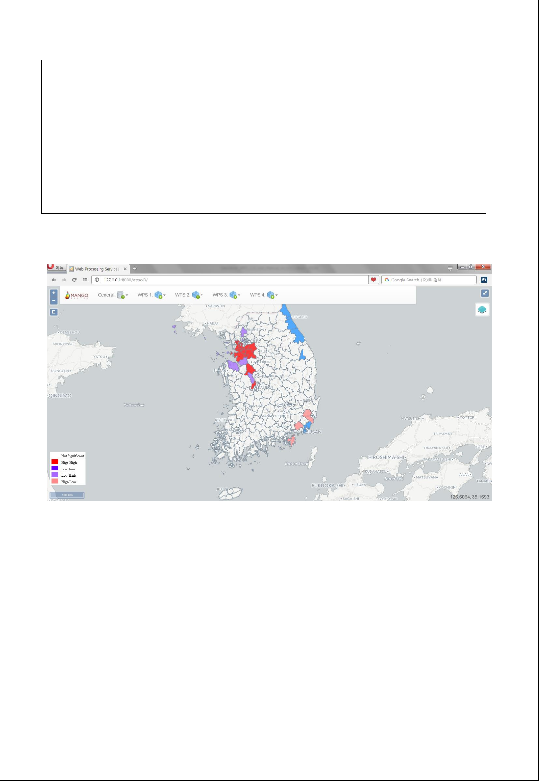
<wps:LiteralData>Row</wps:LiteralData>
</wps:Data>
</wps:Input>
</wps:DataInputs>
<wps:ResponseForm>
<wps:RawDataOutput mimeType=“text/xml; subtype=wfs-collection/1.1”>
<ows:Identifier>result</ows:Identifier>
</wps:RawDataOutput>
</wps:ResponseForm>
</wps:Execute>
Response

4.4.5.2.
Local G (Gi*)
Identify statistically significant hot spots and cold spots using the local Getis-Ord
Gi*
statistic from the feature layer.
Syntax
LocalGStatistics (SimpleFeatureCollection inputFeatures, String inputField, SpatialConcept
spatialConcept, DistanceMethod distanceMethod, StandardizationMethod standardization,
Double searchDistance): SimpleFeatureCollection
Parameters
Data Inputs
Identifier
Description
Type
Required
inputFeatures
The features for which spatial autocorrelation will be
calculated.
Complex
inputField
The numeric field used in assessing spatial
autocorrelation.
Literal
spatialConcept
Specifies how spatial relationships among features
are conceptualized. Default is InverseDistance
Literal
-
distanceMethod
Specifies how distances are calculated from each
feature to neighboring features. Default is Euclidean
Literal
-
standardization
Row standardization. Default is None
Literal
-
searchDistance
Specifies a cutoff distance for Inverse Distance and
Fixed Distance options.
Literal
-
Process Outputs
Identifier
Description
Type
Required
result
Output features.
Complex
Constraints
- The Output layer contains all the fields of inputFeatures, with the fields of GiZScore,
GiMean, GiVar, and GiPValue added.
Request Examples
<?xml version="1.0" encoding="UTF-8"?><wps:Execute version="1.0.0" service="WPS"

xmlns:xsi="http://www.w3.org/2001/XMLSchema-instance" xmlns="http://www.opengis.net/wps/1.0.0"
xmlns:wfs="http://www.opengis.net/wfs" xmlns:wps="http://www.opengis.net/wps/1.0.0"
xmlns:ows="http://www.opengis.net/ows/1.1" xmlns:gml="http://www.opengis.net/gml"
xmlns:ogc="http://www.opengis.net/ogc" xmlns:wcs="http://www.opengis.net/wcs/1.1.1"
xmlns:xlink="http://www.w3.org/1999/xlink" xsi:schemaLocation="http://www.opengis.net/wps/1.0.0
http://schemas.opengis.net/wps/1.0.0/wpsAll.xsd">
<ows:Identifier>statistics:LocalGStatistics</ows:Identifier>
<wps:DataInputs>
<wps:Input>
<ows:Identifier>inputFeatures</ows:Identifier>
<wps:Reference mimeType="text/xml" xlink:href="http://geoserver/wfs" method="POST">
<wps:Body>
<wfs:GetFeature service=“WFS” version=“1.1.0” outputFormat=“GML3”
xmlns:foss="http://www.opengeospatial.net/foss">
<wfs:Query typeName="foss:emd"/>
</wfs:GetFeature>
</wps:Body>
</wps:Reference>
</wps:Input>
<wps:Input>
<ows:Identifier>inputField</ows:Identifier>
<wps:Data>
<wps:LiteralData>pts</wps:LiteralData>
</wps:Data>
</wps:Input>
<wps:Input>
<ows:Identifier>spatialConcept</ows:Identifier>
<wps:Data>
<wps:LiteralData>InverseDistance</wps:LiteralData>
</wps:Data>
</wps:Input>
<wps:Input>
<ows:Identifier>distanceMethod</ows:Identifier>
<wps:Data>
<wps:LiteralData>Euclidean</wps:LiteralData>
</wps:Data>
</wps:Input>
<wps:Input>
<ows:Identifier>standardization</ows:Identifier>
<wps:Data>
<wps:LiteralData>Row</wps:LiteralData>
</wps:Data>
</wps:Input>
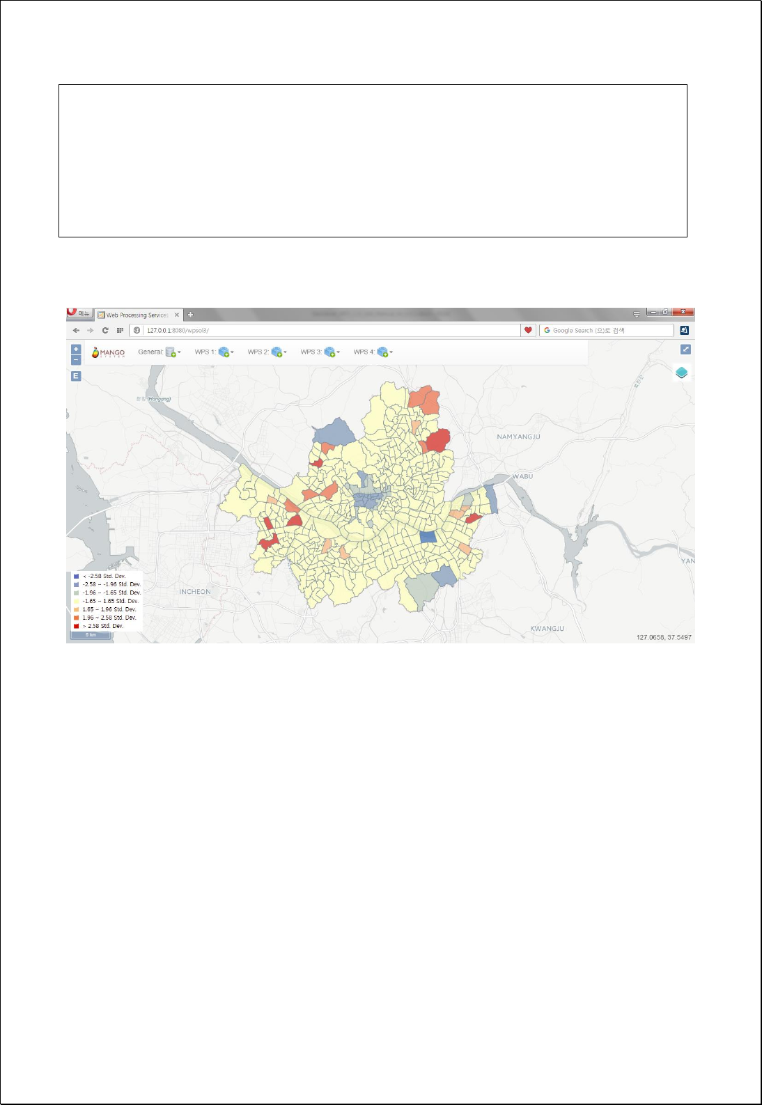
</wps:DataInputs>
<wps:ResponseForm>
<wps:RawDataOutput mimeType=“text/xml; subtype=wfs-collection/1.1”>
<ows:Identifier>result</ows:Identifier>
</wps:RawDataOutput>
</wps:ResponseForm>
</wps:Execute>
Response

4.4.5.3.
Local Geary’s c
Calculates the local Geary's
c
statistic from the feature layer
Syntax
LocalGearysC (SimpleFeatureCollection inputFeatures, String inputField, SpatialConcept
spatialConcept, DistanceMethod distanceMethod, StandardizationMethod standardization,
Double searchDistance): SimpleFeatureCollection
Parameters
Data Inputs
Identifier
Description
Type
Required
inputFeatures
The features for which spatial autocorrelation will be
calculated.
Complex
inputField
The numeric field used in assessing spatial
autocorrelation.
Literal
spatialConcept
Specifies how spatial relationships among features
are conceptualized. Default is InverseDistance
Literal
-
distanceMethod
Specifies how distances are calculated from each
feature to neighboring features. Default is Euclidean
Literal
-
standardization
Row standardization. Default is None
Literal
-
searchDistance
Specifies a cutoff distance for Inverse Distance and
Fixed Distance options.
Literal
-
Process Outputs
Identifier
Description
Type
Required
result
Output features.
Complex
Constraints
- The Output layer contains all the fields of inputFeatures, with the fields of LGcIndex,
LGcZScore, and LGcPValue added.
Request Examples
<?xml version="1.0" encoding="UTF-8"?><wps:Execute version="1.0.0" service="WPS"
xmlns:xsi="http://www.w3.org/2001/XMLSchema-instance" xmlns="http://www.opengis.net/wps/1.0.0"

xmlns:wfs="http://www.opengis.net/wfs" xmlns:wps="http://www.opengis.net/wps/1.0.0"
xmlns:ows="http://www.opengis.net/ows/1.1" xmlns:gml="http://www.opengis.net/gml"
xmlns:ogc="http://www.opengis.net/ogc" xmlns:wcs="http://www.opengis.net/wcs/1.1.1"
xmlns:xlink="http://www.w3.org/1999/xlink" xsi:schemaLocation="http://www.opengis.net/wps/1.0.0
http://schemas.opengis.net/wps/1.0.0/wpsAll.xsd">
<ows:Identifier>statistics:LocalGearysC</ows:Identifier>
<wps:DataInputs>
<wps:Input>
<ows:Identifier>inputFeatures</ows:Identifier>
<wps:Reference mimeType="text/xml" xlink:href="http://geoserver/wfs" method="POST">
<wps:Body>
<wfs:GetFeature service=“WFS” version=“1.1.0” outputFormat=“GML3”
xmlns:foss="http://www.opengeospatial.net/foss">
<wfs:Query typeName="foss:korea_sgg"/>
</wfs:GetFeature>
</wps:Body>
</wps:Reference>
</wps:Input>
<wps:Input>
<ows:Identifier>inputField</ows:Identifier>
<wps:Data>
<wps:LiteralData>a3_2005</wps:LiteralData>
</wps:Data>
</wps:Input>
<wps:Input>
<ows:Identifier>spatialConcept</ows:Identifier>
<wps:Data>
<wps:LiteralData>InverseDistance</wps:LiteralData>
</wps:Data>
</wps:Input>
<wps:Input>
<ows:Identifier>distanceMethod</ows:Identifier>
<wps:Data>
<wps:LiteralData>Euclidean</wps:LiteralData>
</wps:Data>
</wps:Input>
<wps:Input>
<ows:Identifier>standardization</ows:Identifier>
<wps:Data>
<wps:LiteralData>Row</wps:LiteralData>
</wps:Data>
</wps:Input>
</wps:DataInputs>
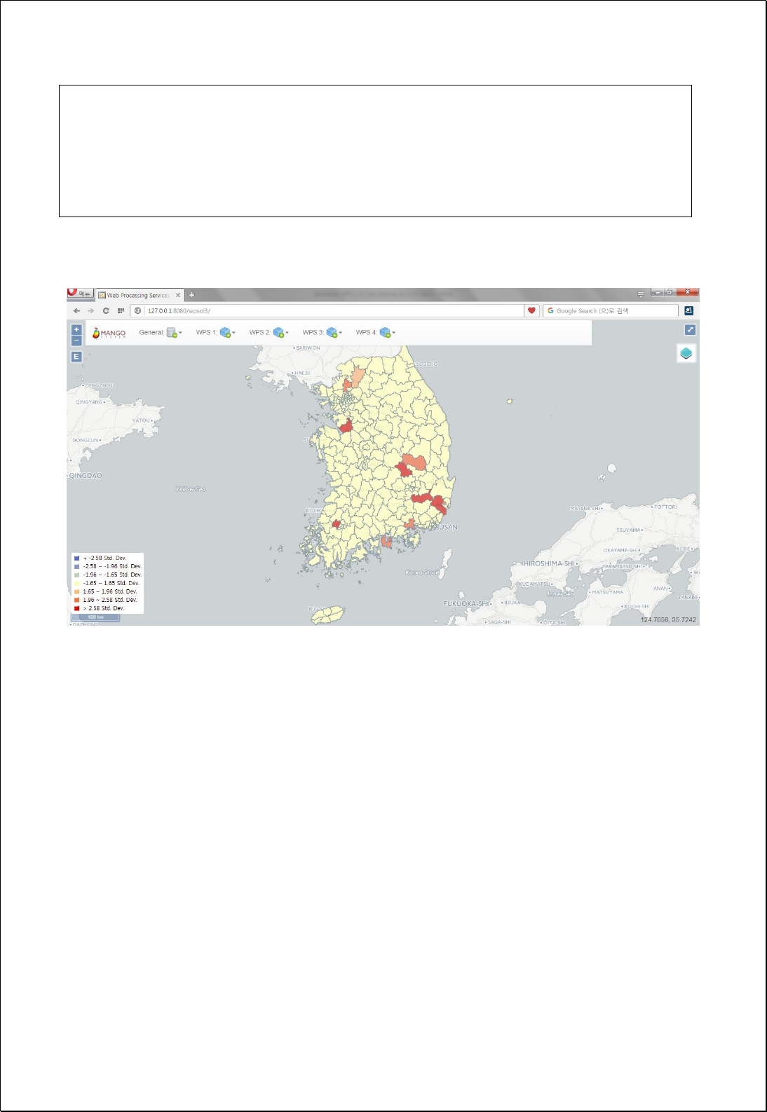
<wps:ResponseForm>
<wps:RawDataOutput mimeType=“text/xml; subtype=wfs-collection/1.1”>
<ows:Identifier>result</ows:Identifier>
</wps:RawDataOutput>
</wps:ResponseForm>
</wps:Execute>
Response

4.4.5.4.
Lee's Si
Calculates the local Lee’s
Si
statistics from the feature layer.
Syntax
LocalLeesS (SimpleFeatureCollection inputFeatures, String inputField, SpatialConcept
spatialConcept, DistanceMethod distanceMethod, StandardizationMethod standardization,
Double searchDistance): SimpleFeatureCollection
Parameters
Data Inputs
Identifier
Description
Type
Required
inputFeatures
The features for which spatial autocorrelation will be
calculated.
Complex
inputField
The numeric field used in assessing spatial
autocorrelation.
Literal
spatialConcept
Specifies how spatial relationships among features
are conceptualized. Default is InverseDistance
Literal
-
distanceMethod
Specifies how distances are calculated from each
feature to neighboring features. Default is Euclidean
Literal
-
standardization
Row standardization. Default is None
Literal
-
searchDistance
Specifies a cutoff distance for Inverse Distance and
Fixed Distance options.
Literal
-
Process Outputs
Identifier
Description
Type
Required
result
Output features.
Complex
Constraints
- The Output layer contains all the fields of inputFeatures, with the fields of LLsIndex,
LLsZScore and LLsPValue added.
Request Examples
<?xml version="1.0" encoding="UTF-8"?><wps:Execute version="1.0.0" service="WPS"
xmlns:xsi="http://www.w3.org/2001/XMLSchema-instance" xmlns="http://www.opengis.net/wps/1.0.0"

xmlns:wfs="http://www.opengis.net/wfs" xmlns:wps="http://www.opengis.net/wps/1.0.0"
xmlns:ows="http://www.opengis.net/ows/1.1" xmlns:gml="http://www.opengis.net/gml"
xmlns:ogc="http://www.opengis.net/ogc" xmlns:wcs="http://www.opengis.net/wcs/1.1.1"
xmlns:xlink="http://www.w3.org/1999/xlink" xsi:schemaLocation="http://www.opengis.net/wps/1.0.0
http://schemas.opengis.net/wps/1.0.0/wpsAll.xsd">
<ows:Identifier>statistics:LocalLeesS</ows:Identifier>
<wps:DataInputs>
<wps:Input>
<ows:Identifier>inputFeatures</ows:Identifier>
<wps:Reference mimeType="text/xml" xlink:href="http://geoserver/wfs" method="POST">
<wps:Body>
<wfs:GetFeature service=“WFS” version=“1.1.0” outputFormat=“GML3”
xmlns:foss="http://www.opengeospatial.net/foss">
<wfs:Query typeName="foss:emd"/>
</wfs:GetFeature>
</wps:Body>
</wps:Reference>
</wps:Input>
<wps:Input>
<ows:Identifier>inputField</ows:Identifier>
<wps:Data>
<wps:LiteralData>pts</wps:LiteralData>
</wps:Data>
</wps:Input>
<wps:Input>
<ows:Identifier>spatialConcept</ows:Identifier>
<wps:Data>
<wps:LiteralData>InverseDistance</wps:LiteralData>
</wps:Data>
</wps:Input>
<wps:Input>
<ows:Identifier>distanceMethod</ows:Identifier>
<wps:Data>
<wps:LiteralData>Euclidean</wps:LiteralData>
</wps:Data>
</wps:Input>
<wps:Input>
<ows:Identifier>standardization</ows:Identifier>
<wps:Data>
<wps:LiteralData>Row</wps:LiteralData>
</wps:Data>
</wps:Input>
</wps:DataInputs>
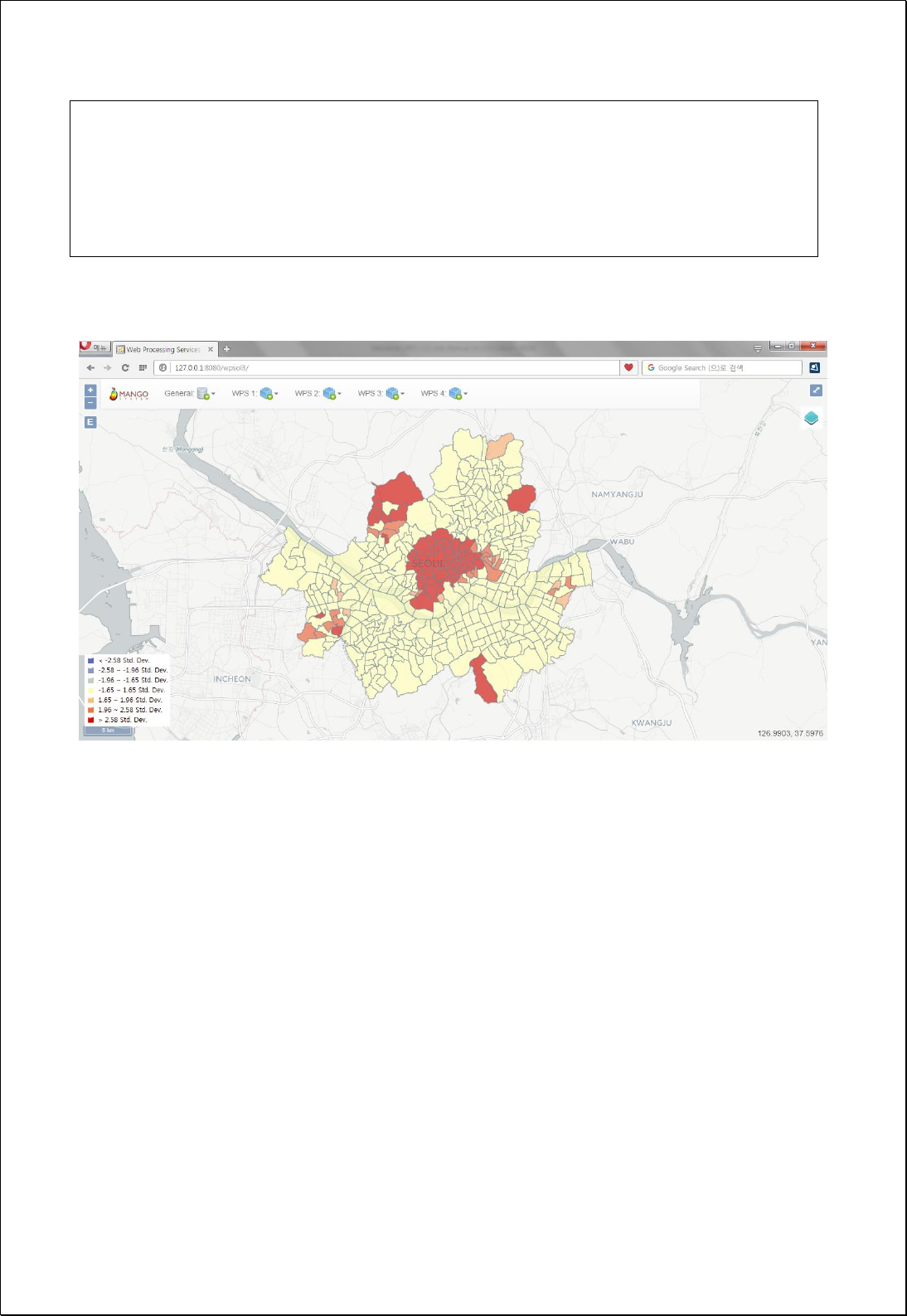
<wps:ResponseForm>
<wps:RawDataOutput mimeType=“text/xml; subtype=wfs-collection/1.1”>
<ows:Identifier>result</ows:Identifier>
</wps:RawDataOutput>
</wps:ResponseForm>
</wps:Execute>
Response

4.4.5.5.
Lee's Li
Calculates the local Lee's
Li
statistic from the feature layer and two attribute values.
Syntax
LocalLeesL (SimpleFeatureCollection inputFeatures, String xField, String yField,
SpatialConcept spatialConcept, DistanceMethod distanceMethod, StandardizationMethod
standardization, Double searchDistance): SimpleFeatureCollection
Parameters
Data Inputs
Identifier
Description
Type
Required
inputFeatures
The features for which spatial autocorrelation will be
calculated.
Complex
xField
The numeric x field used in assessing spatial
autocorrelation.
Literal
yField
The numeric y field used in assessing spatial
autocorrelation.
Literal
spatialConcept
Specifies how spatial relationships among features
are conceptualized. Default is InverseDistance
Literal
-
distanceMethod
Specifies how distances are calculated from each
feature to neighboring features. Default is Euclidean
Literal
-
standardization
Row standardization. Default is None
Literal
-
searchDistance
Specifies a cutoff distance for Inverse Distance and
Fixed Distance options.
Literal
-
Process Outputs
Identifier
Description
Type
Required
result
Output features.
Complex
Constraints
- The Output layer contains all the fields of inputFeatures, with the fields of LLlIndex,
LLlZScore, and LLlPValue fields added.
Request Examples

<?xml version="1.0" encoding="UTF-8"?><wps:Execute version="1.0.0" service="WPS"
xmlns:xsi="http://www.w3.org/2001/XMLSchema-instance" xmlns="http://www.opengis.net/wps/1.0.0"
xmlns:wfs="http://www.opengis.net/wfs" xmlns:wps="http://www.opengis.net/wps/1.0.0"
xmlns:ows="http://www.opengis.net/ows/1.1" xmlns:gml="http://www.opengis.net/gml"
xmlns:ogc="http://www.opengis.net/ogc" xmlns:wcs="http://www.opengis.net/wcs/1.1.1"
xmlns:xlink="http://www.w3.org/1999/xlink" xsi:schemaLocation="http://www.opengis.net/wps/1.0.0
http://schemas.opengis.net/wps/1.0.0/wpsAll.xsd">
<ows:Identifier>statistics:LocalLeesL</ows:Identifier>
<wps:DataInputs>
<wps:Input>
<ows:Identifier>inputFeatures</ows:Identifier>
<wps:Reference mimeType="text/xml" xlink:href="http://geoserver/wfs" method="POST">
<wps:Body>
<wfs:GetFeature service=“WFS” version=“1.1.0” outputFormat=“GML3”
xmlns:foss="http://www.opengeospatial.net/foss">
<wfs:Query typeName="foss:hexa2009"/>
</wfs:GetFeature>
</wps:Body>
</wps:Reference>
</wps:Input>
<wps:Input>
<ows:Identifier>xField</ows:Identifier>
<wps:Data>
<wps:LiteralData>a2009</wps:LiteralData>
</wps:Data>
</wps:Input>
<wps:Input>
<ows:Identifier>yField</ows:Identifier>
<wps:Data>
<wps:LiteralData>b2009</wps:LiteralData>
</wps:Data>
</wps:Input>
<wps:Input>
<ows:Identifier>spatialConcept</ows:Identifier>
<wps:Data>
<wps:LiteralData>ContiguityEdgesNodes</wps:LiteralData>
</wps:Data>
</wps:Input>
<wps:Input>
<ows:Identifier>distanceMethod</ows:Identifier>
<wps:Data>
<wps:LiteralData>Euclidean</wps:LiteralData>
</wps:Data>
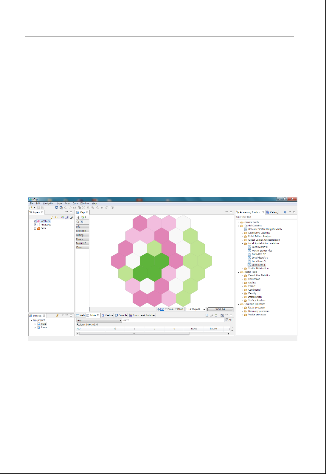
</wps:Input>
<wps:Input>
<ows:Identifier>standardization</ows:Identifier>
<wps:Data>
<wps:LiteralData>Row</wps:LiteralData>
</wps:Data>
</wps:Input>
</wps:DataInputs>
<wps:ResponseForm>
<wps:RawDataOutput mimeType=“text/xml; subtype=wfs-collection/1.1”>
<ows:Identifier>result</ows:Identifier>
</wps:RawDataOutput>
</wps:ResponseForm>
</wps:Execute>
Response

4.4.6. Global Spatial Modeling
It consists of processes that analyze global spatial modeling and spatial relationships.
4.4.6.1.
Ordinary Least Squares (OLS)
Performs global Ordinary Least Squares(OLS) linear regression.
Syntax
OrdinaryLeastSquares (SimpleFeatureCollection inputFeatures, String dependentVariable,
String explanatoryVariables): SimpleFeatureCollection
Parameters
Data Inputs
Identifier
Description
Type
Required
inputFeatures
The features containing the dependent and
independent variables for analysis.
Complex
dependentVariable
The numeric field containing values for what you are
trying to model.
Literal
explanatoryVariables
The comma separated fields representing
explanatory variables in your regression model.
Literal
Process Outputs
Identifier
Description
Type
Required
olsFeatures
The output features to receive dependent variable
estimates and residuals.
Complex
report
Output OLS results.
Complex
Constraints
- The olsFeatures layer contains all the fields of inputFeatures, with the fields of
Estimated, Residual, StdResid, and StdResid2 added.
- Output is returned in XML format.
Request Examples
<?xml version="1.0" encoding="UTF-8"?><wps:Execute version="1.0.0" service="WPS"
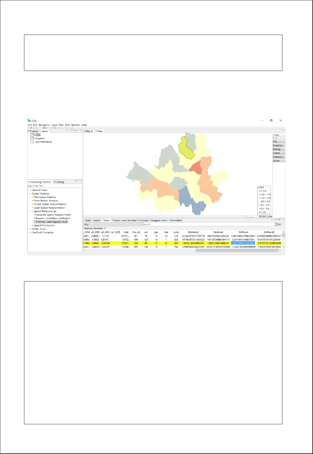
xmlns:xsi="http://www.w3.org/2001/XMLSchema-instance" xmlns="http://www.opengis.net/wps/1.0.0"
xmlns:wfs="http://www.opengis.net/wfs" xmlns:wps="http://www.opengis.net/wps/1.0.0" xmlns:
>
<wps:Data></wps:Execute>
Response
- Map
- XML
<?xml version="1.0" encoding="utf-8"?>
<OrdinaryLeastSquares>
<Diagnostics>
<R>0.6101560399292024</R>
<RSquared>0.3722903930620865</RSquared>
<AdjustedRSquared>0.3290000753422304</AdjustedRSquared>
<StandardError>12.933848555707566</StandardError>
<NumberOfObservations>63</NumberOfObservations>
<AIC>508.1174991231418</AIC>
<AICc>509.6174991231418</AICc>
</Diagnostics>
<Variance>
<Regression>
<DegreesOfFreedom>4</DegreesOfFreedom>
<SumOfSquare>5754.486696189348</SumOfSquare>
<SquareMean>1438.621674047337</SquareMean>

<FStatistic>8.599853562435902</FStatistic>
<FProbability>1.609736408525464E-5</FProbability>
</Regression>
<Residual>
<DegreesOfFreedom>58</DegreesOfFreedom>
<SumOfSquare>9702.497430794765</SumOfSquare>
<SquareMean>167.2844384619787</SquareMean>
</Residual>
<Sum>
<DegreesOfFreedom>62</DegreesOfFreedom>
<SumOfSquare>15456.984126984113</SumOfSquare>
</Sum>
</Variance>
<Variables>
<Item>
<Variable>Intercept</Variable>
<Coefficient>1.8149624761790997</Coefficient>
<StdError>2.256350184412793</StdError>
<TStatistic>0.8043797849806887</TStatistic>
<Probability>0.42445922884684884</Probability>
</Item>
<Item>
<Variable>etc</Variable>
<Coefficient>6.922393697035605</Coefficient>
<StdError>1.217664912349127</StdError>
<TStatistic>5.684974270697246</TStatistic>
<Probability>5.13680658710916E-7</Probability>
</Item>
<Item>
<Variable>ccc</Variable>
<Coefficient>-0.2585330201573057</Coefficient>
<StdError>0.4672538188264545</StdError>
<TStatistic>-0.5533031721530541</TStatistic>
<Probability>0.5821837017619861</Probability>
</Item>
<Item>
<Variable>mlbflb</Variable>
<Coefficient>-0.04321817419824479</Coefficient>
<StdError>2.571603704239341</StdError>
<TStatistic>-0.01680592313932304</TStatistic>
<Probability>0.9866481737384326</Probability>
</Item>
<Item>

<Variable>airport</Variable>
<Coefficient>-2.3644517041718496</Coefficient>
<StdError>2.64338529816144</StdError>
<TStatistic>-0.8944786466870351</TStatistic>
<Probability>0.3747591210649666</Probability>
</Item>
</Variables>
</OrdinaryLeastSquares>
