HEL Determinations Instructions
User Manual:
Open the PDF directly: View PDF ![]() .
.
Page Count: 11
HEL/PHEL DETERMINATION -- GIS TOOL
March 14, 2016 Page 1 of 11
The following tool was developed to facilitate the 1026 determination and documentation process for
HEL using GIS.
HEL Tool will
1- Summarize HEL for a given tract, field(s).
2- Compute if a field is HEL or NHEL
3- Compute PHEL based on LiDAR derived slope percent and length
4- Output automated 026e and letters
Save the Zip to C:\temp\. Unzip directly to C:\ so that you have C:\HEL\
Prior ArcMap Setup
Open ArcMap or your County Template.
Select >> >>
Set Workspace to a local folder such as c:\temp
Select >> >>
Select >> >> and for the transect tool
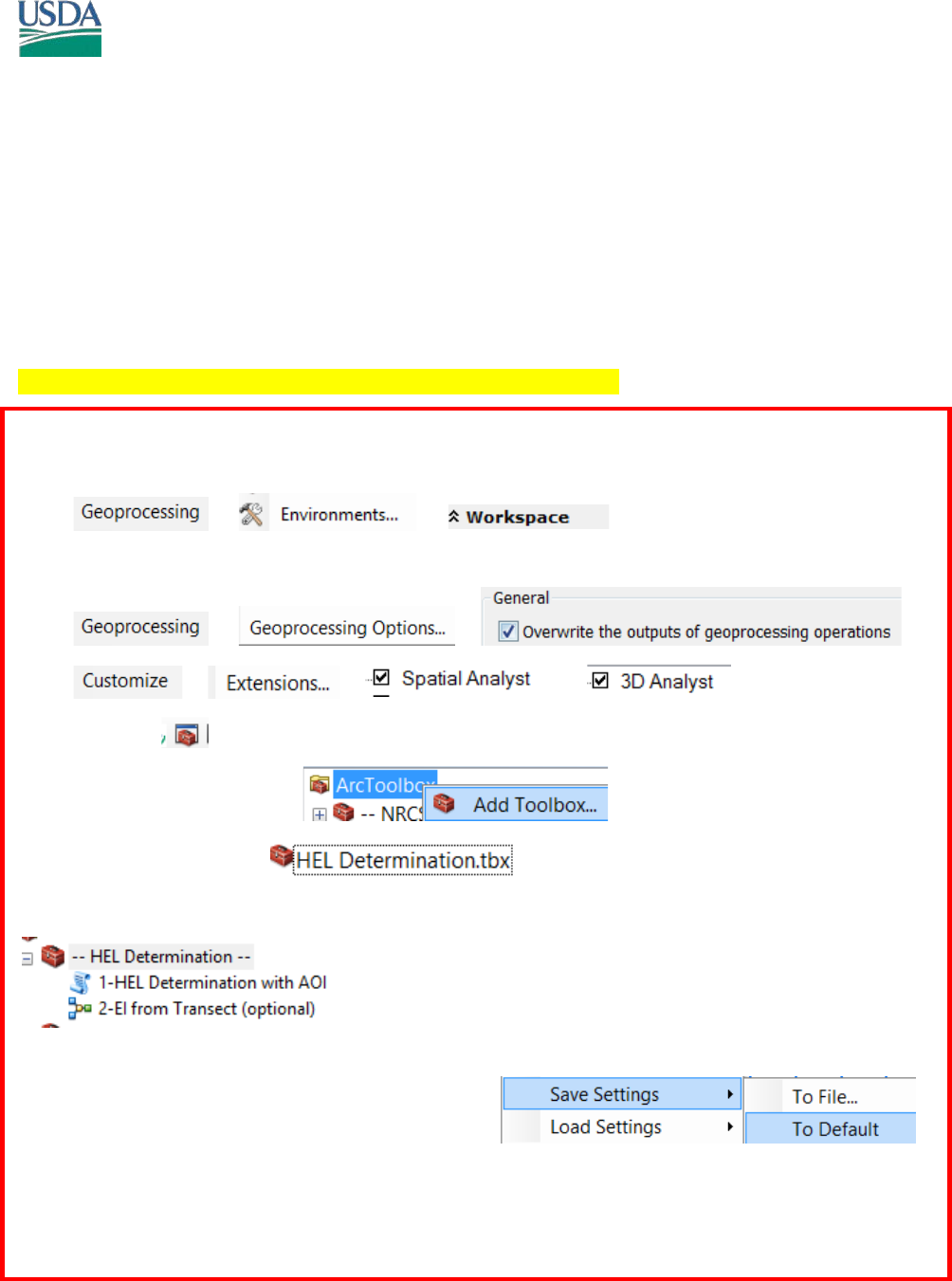
Turn on Toolbox
Right click ArcToolbox Select Add
Browse to C:\HEL\ and Select
Your toolbox should now have
Right click in the Toolbox Area and Save to Default
Save your template as well.
HEL/PHEL DETERMINATION -- GIS TOOL
March 14, 2016 Page 2 of 11
ArcMap Layer Requirements
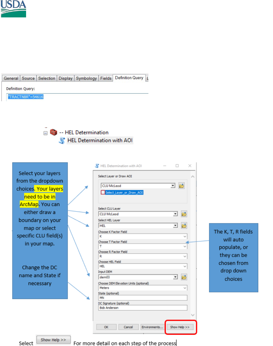
Make sure a CLU; HEL; Soils; and DEM layers are loaded.
Zoom to your Tract and select your field(s). Use a Definition Query (optional) for your tract. This also
ensures you print FOIA compliant maps.
Running HEL Tools
Open Model 1.
Note: Your State GIS Specialist will have set the correct parameters for your tool. You will get errors If the
tool parameters are not set to recognize the fields HEL, T, K, R.
HEL/PHEL DETERMINATION -- GIS TOOL
March 14, 2016 Page 3 of 11
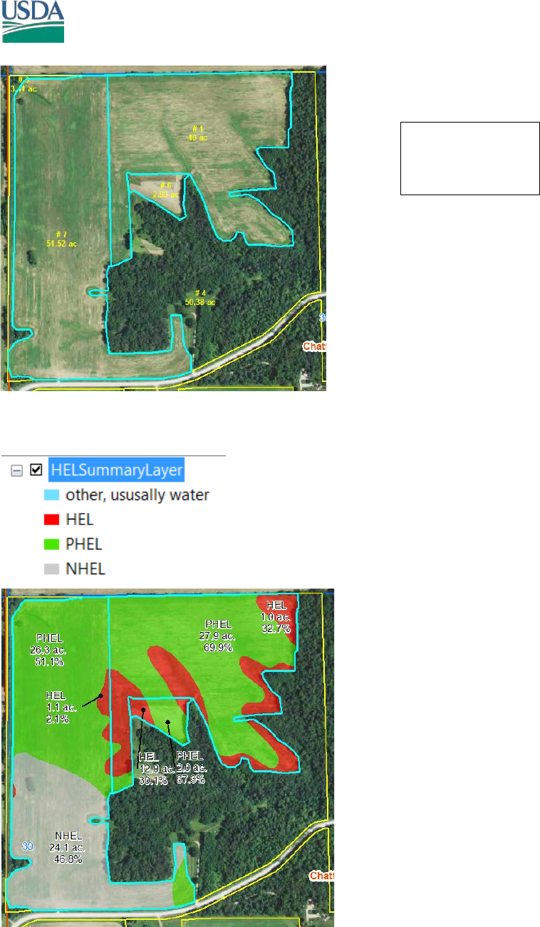
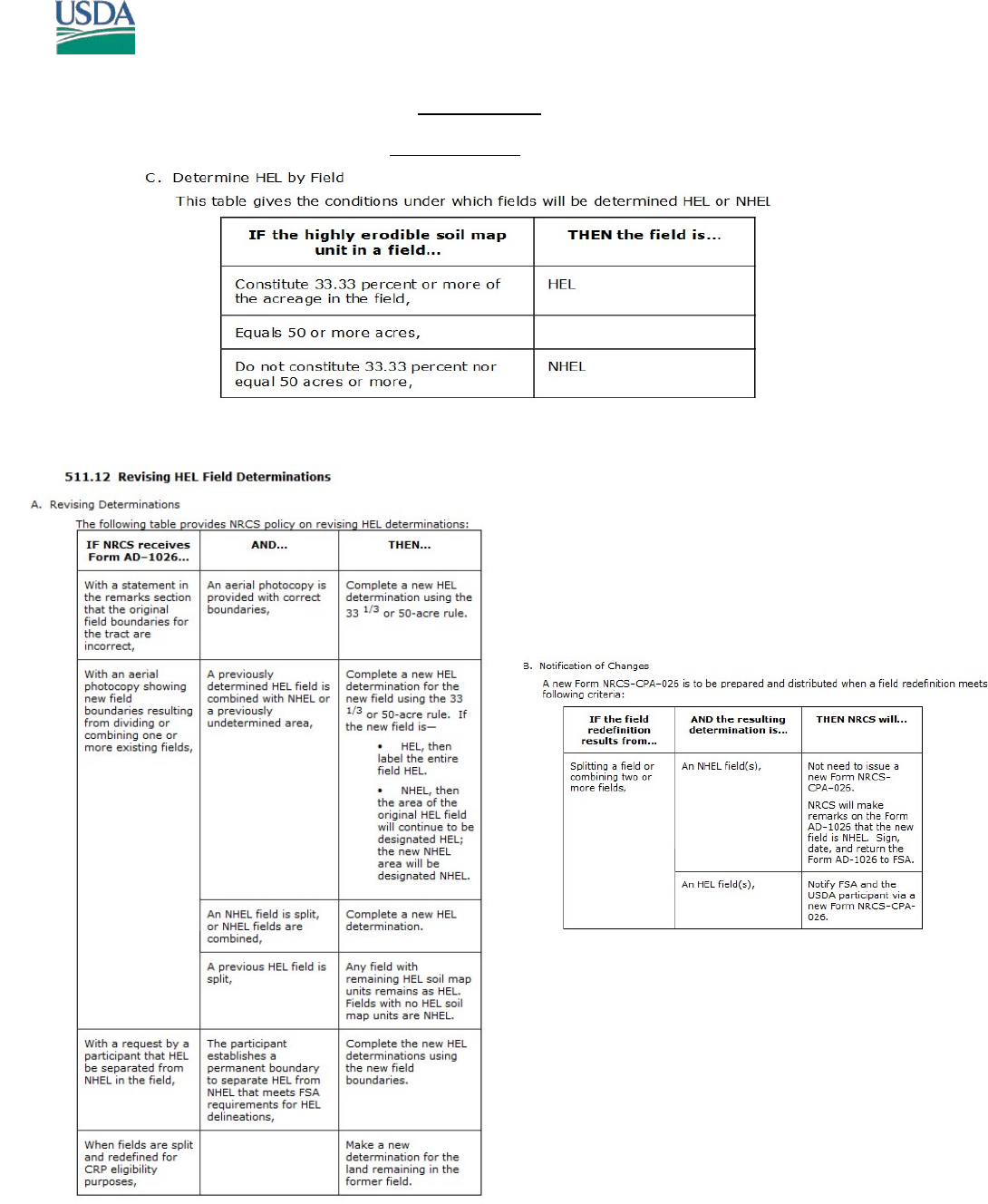
Your first output layer will provide total Acres and total Percent for HEL, NHEL or PHEL for each field. In
all 3 fields, evaluating PHEL will determine if the field is HEL or NHEL.
The 1026 requires
a Determination
on field 1, 6, 7.
HEL/PHEL DETERMINATION -- GIS TOOL
March 14, 2016 Page 4 of 11
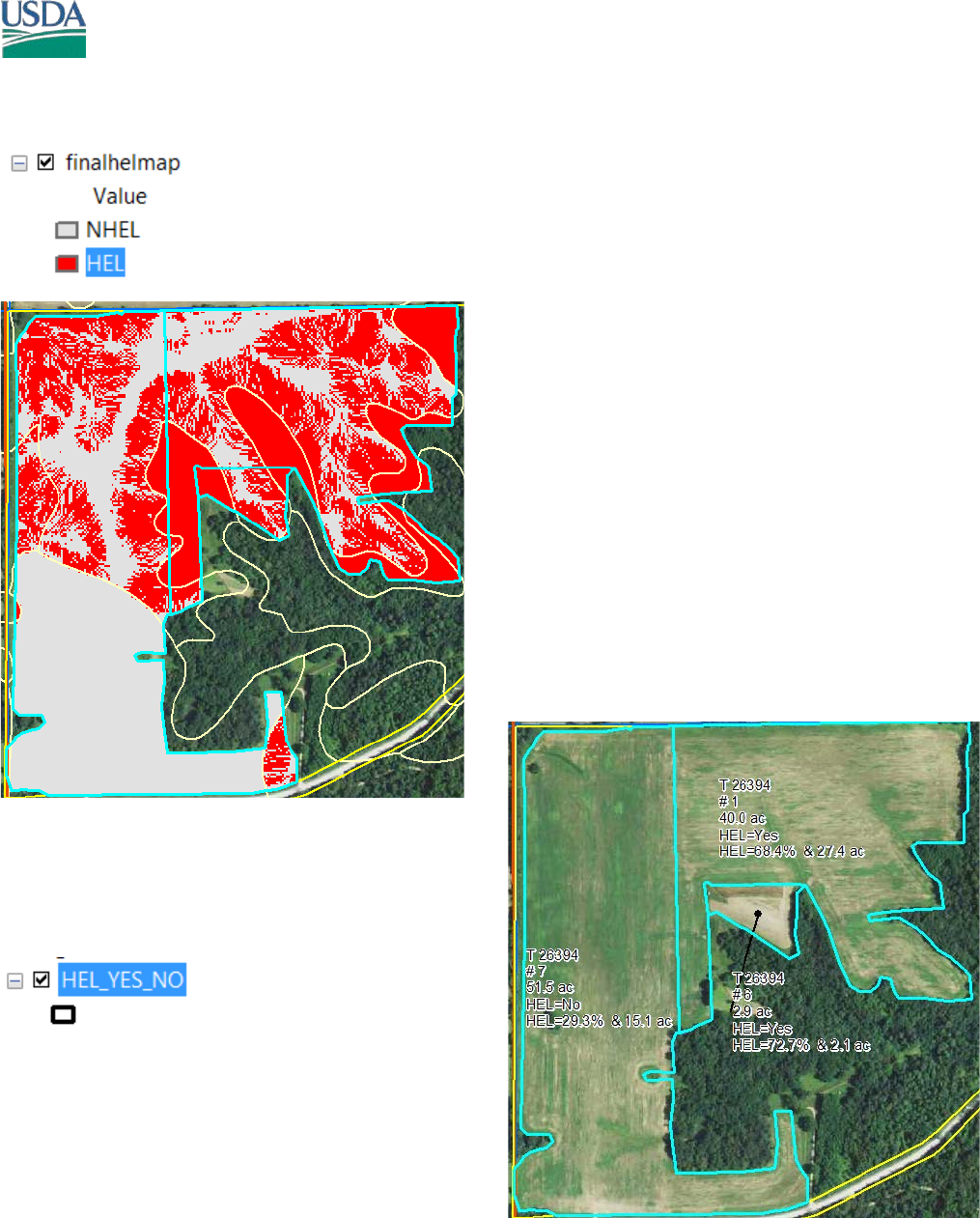
The Second Output provides PHEL mapunit EI determination. The soils that are originally HEL will be all
red. Those that were originally NHEL will be all grey. PHEL map units are a combination of HEL/NHEL
The Third Output will summarize the PHEL areas that are
HEL/NHEL and compute total HEL percent and area for
the field.
HEL/PHEL DETERMINATION -- GIS TOOL
March 14, 2016 Page 5 of 11
Select Ok. There are no variables to change. The Model adds the required information to create the 026e
and the letters.
MS Access will open. You can also open MS Access from the c:\HEL\ folder manually
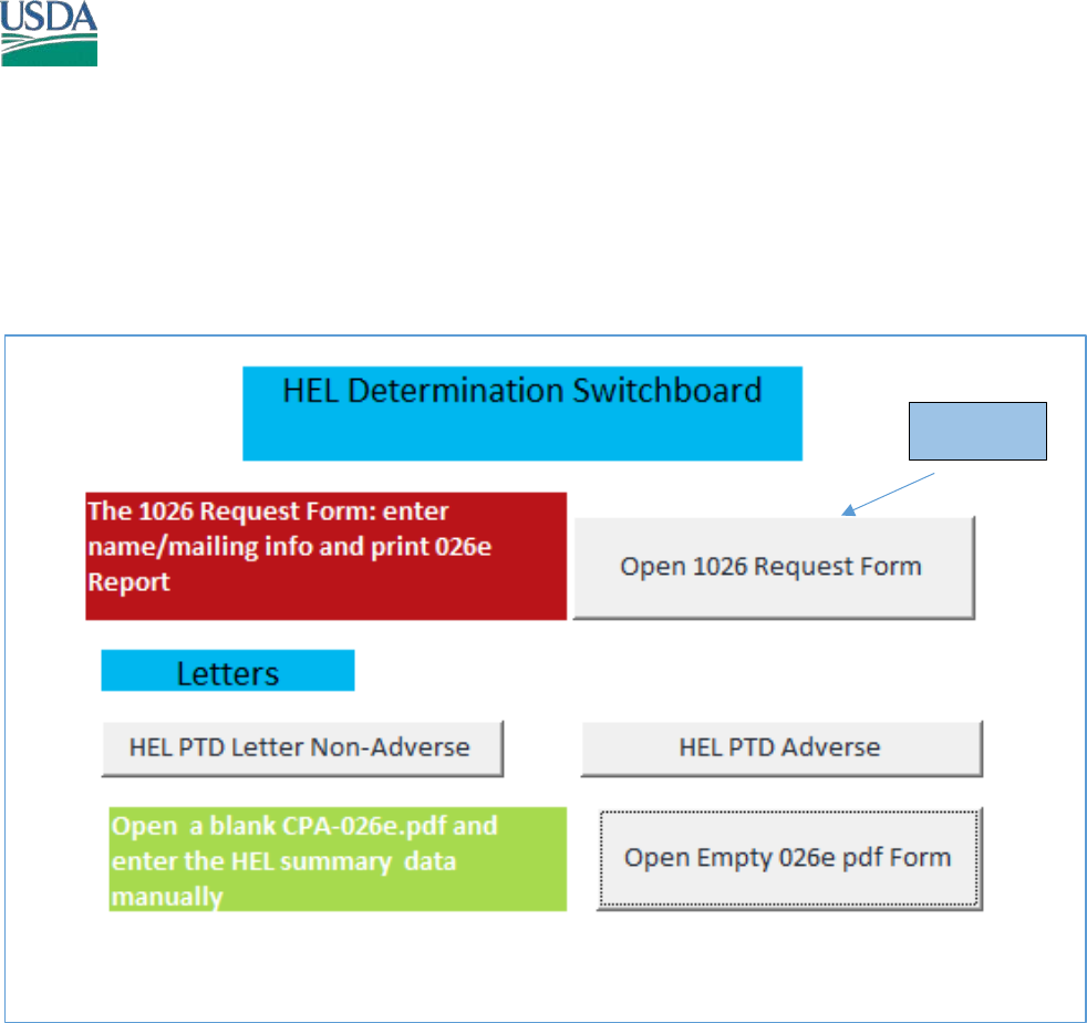
Start Here
HEL/PHEL DETERMINATION -- GIS TOOL
March 14, 2016 Page 6 of 11
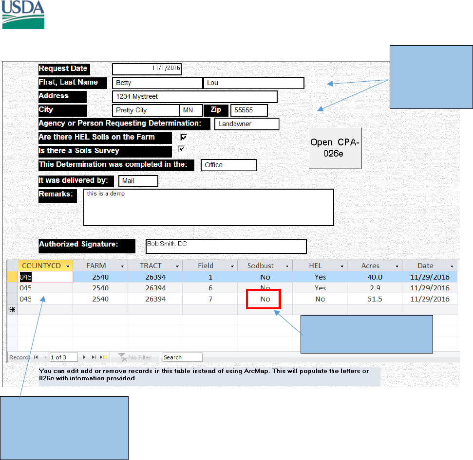
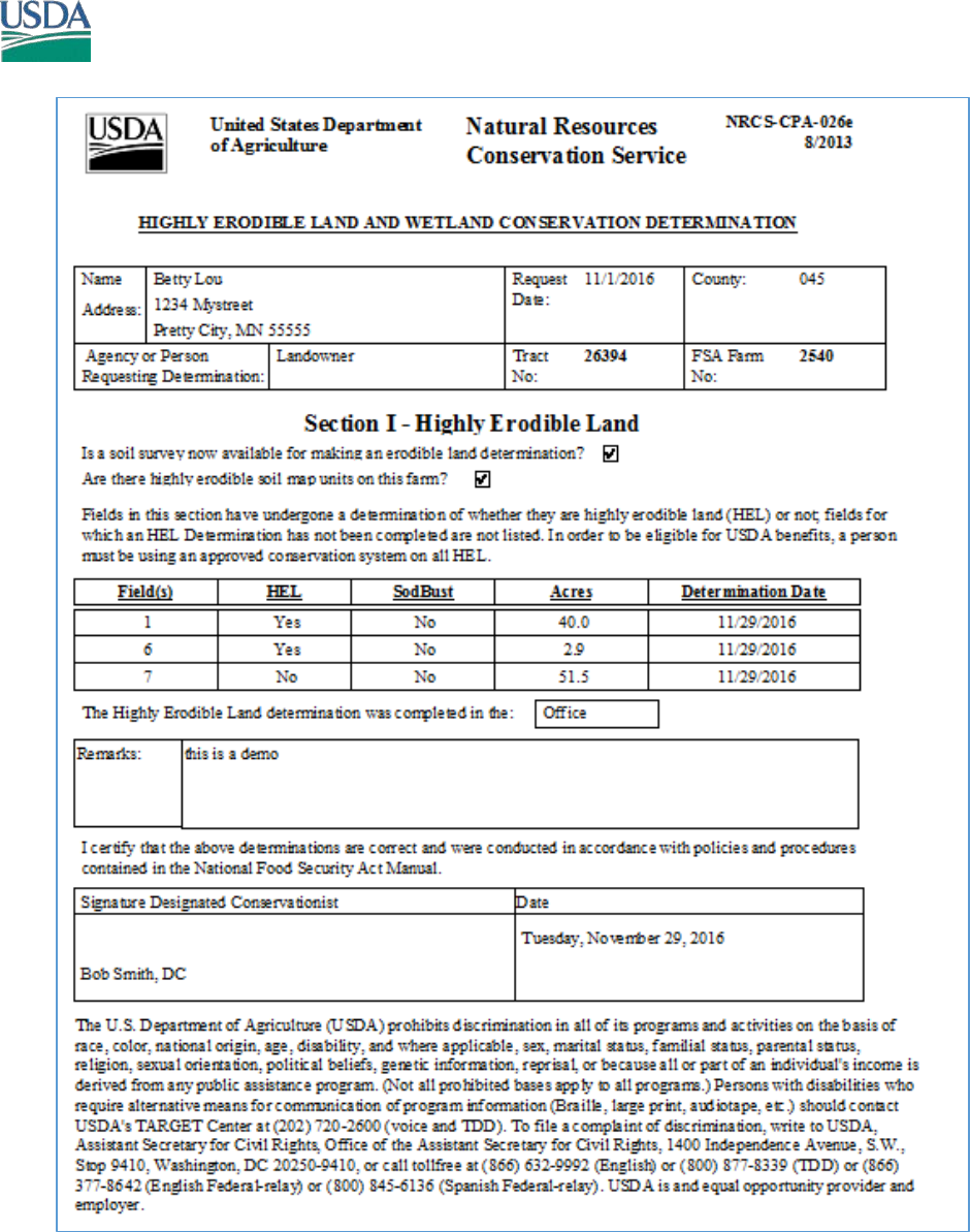
When you have finished entering data, click the Open CPA-026e button
Enter the Info
for the 026e
The county code will
determine the NRCS
mailing address in the
Footer
If a field is sodbusted,
manually update to Yes
HEL/PHEL DETERMINATION -- GIS TOOL
March 14, 2016 Page 7 of 11
HEL/PHEL DETERMINATION -- GIS TOOL
March 14, 2016 Page 8 of 11
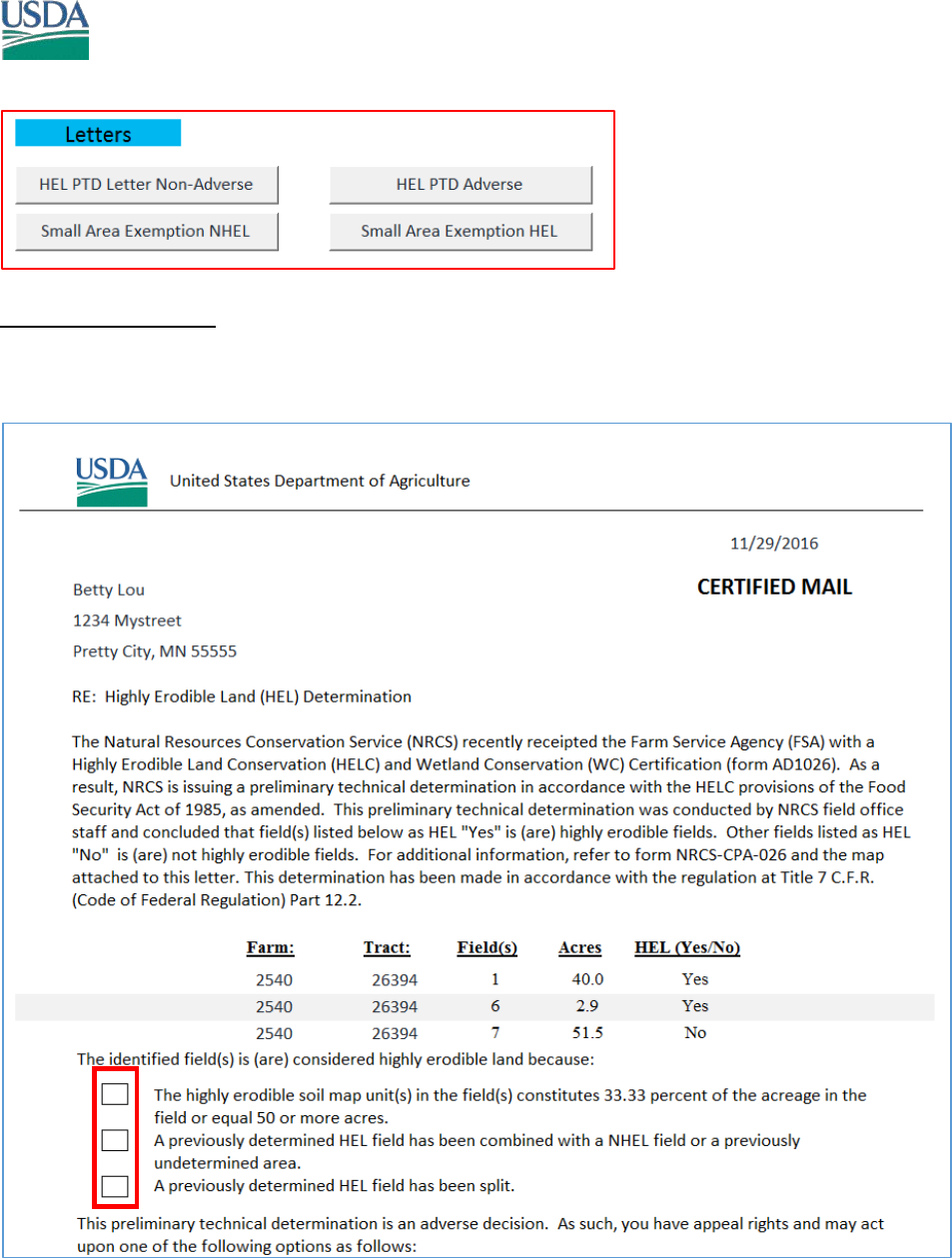
Use the letter provided by your state, these may differ from this example.
HEL PTD Adverse Letter.
The checkbox can be checked after printing.
All letters use the output from ArcMap to indicate what each field determination is.
HEL/PHEL DETERMINATION -- GIS TOOL
March 14, 2016 Page 9 of 11
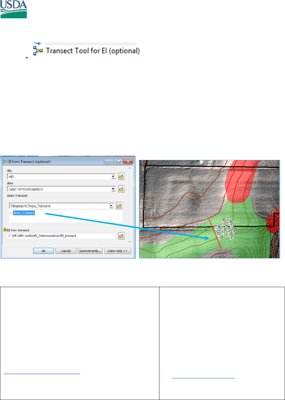
Model 2.
The Model will extract from your DEM the slope percent and slope length from a line drawn on the map.
It is not linked to any other process, and is for display and reference purpose. For example, if field
calculations were requested during the Preliminary appeal process. The Transect could be verified
against the LiDAR data.
For the purpose of calculating Slope length, a transect can extend beyond a mapunit and beyond a field
edge (see policy). The tool will use the frozen T,K,R values from the Soil Mapunit that lies in the Center
of the transect in the event a transect would cross multiple mapunits.
You can draw as many transects as you wish, and they do not need to be straight.
Please provide any changes, improvements to this Tool.
Kevin Godsey, Soil Scientist
Missouri NRCS MLRA Soil Survey, Marble office
PO BOX 199, 406 East Main St.
Marble Hill, MO 63764
OFFICE 573-741-3033
FAX 855-835-0067
kevin.godsey@mo.usda.gov
Christiane Roy
SE MN Regional GIS Specialist
USDA - NRCS
1485 Industrial Drive #102, Rochester,
MN 555901
:office (507) 405-3580 cell (507)-951-
2256
: christiane.roy@mn.usda.gov

HEL/PHEL DETERMINATION -- GIS TOOL
March 14, 2016 Page 11 of 11
