1 Utilities Power
Utilities - Power Utilities - Power
User Manual: Utilities - Power
Open the PDF directly: View PDF ![]() .
.
Page Count: 2

Applications:
• Geo Mapping Application
• Asset Tracking
• Audit Documentation
• Safety Back-up Documentation
• Inventory Location Tracking
• Installation Documentation
• Repair Confirmation
Documentation
• Wireless upload workflow
Utilities
• Simplify Workflow
• Reduce Human Error
• Simple, Secure, Reliable
Data Processing
• Speed up Work Process
• Easily Retrievable Back
Up Database Format
www.ricohdc.com
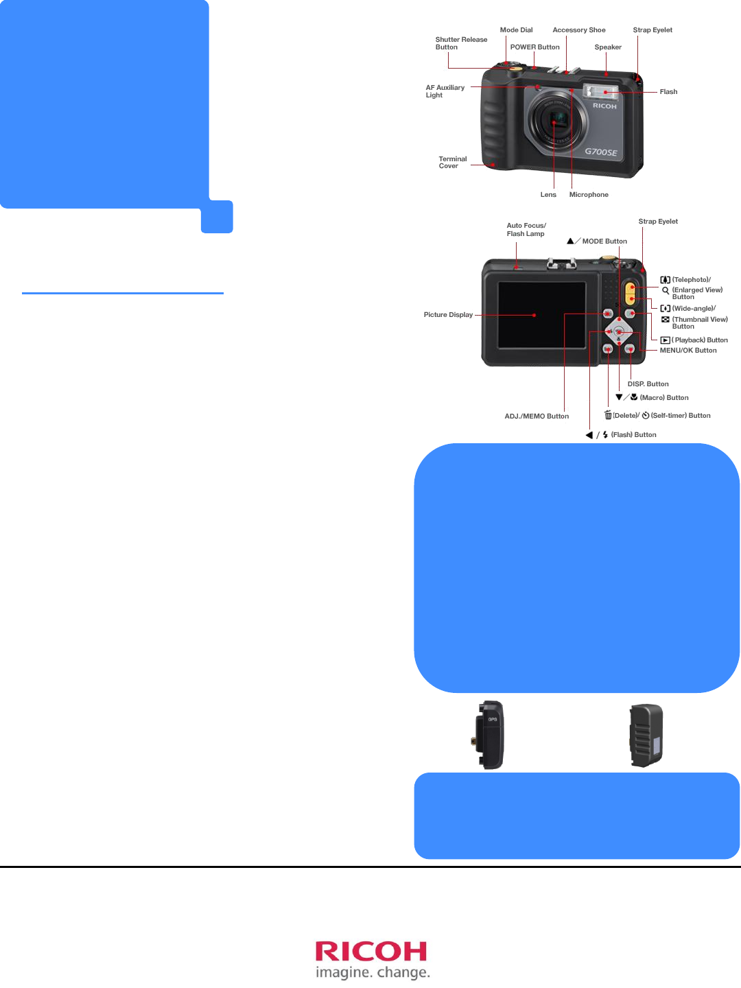
Ricoh G700SE with GP-1 or SE-7
GPS Unit
Dynamic Capture
Capture images and data in
a rugged environment -
documented with simplified
workflows.
• GPS accessory
• Rangefinder compatible
• Expanded Memo Data
• Barcode reader
• Wireless capability
Back up documentation for
Government compliance
and regulation.
• Daily routine
documentation of
equipment and work sites
• Safety image data of
equipment (Including Geo
mapping applications)

• 12 million effective pixels
• 3.0“LCDviewingscreen
• Compatible with commercially
available 37 mm lens filters
• Powerful built-in flash
• Electronic vibration correction
• Large buttons and dials
• 1cm macro photography
• 5x internal optical zoom
• Rechargeable battery
G700SE Specifications:
G700SE’sAdvantages:
GP-1
• GPS accurate to approx. 5m
• Compass accurate to +/- 6⁰
• Water and Dust resistant
•WAAS enabled
• Data capturing embedded to images
• When images are uploaded, Memo Data
is embedded. Additional information is
available for viewing.
• Security enabled password protected
• Prohibiting unauthorized use
• Data protection
•JIS/IEC waterproof grade 8
• Waterproof build, able to withstand
depths of 5 meters. (approx 15ft)
• JIS/IEC dustproof grade 6
• 2m impact-resistant
• Tough, durable design ideal for rugged
environments
• Shock Proof
• Chemical resistance (Ethanol or
Sodium hypochlorite)
• Disinfect and clean the camera
• GP-1 + WAAS
• Enables location accuracy to
within 5m
• Laser rangefinder compatible
• Wireless Capability
• Internal CCD Barcode reader
RICOH Dynamic Capture
www.ricohdc.com
The G700SE
provides
unmatched
simplicity and
durability to
streamline your
workflow.
SE-7
• GPS accurate to approx. 1-5m
• Simultaneous input from Laser
Range Finders.
• WAAS enabled