Garmin A4AMGB00 Low Power Transmitter (2400-2483.5 MHz) User Manual USERS MANUAL 1 OF 2
Garmin International Inc Low Power Transmitter (2400-2483.5 MHz) USERS MANUAL 1 OF 2
Garmin >
Contents
- 1. USERS MANUAL 1 OF 2
- 2. USERS MANUAL 2 OF 2
USERS MANUAL 1 OF 2

zūmo®
Owner’s Manual
February 2014 190-01706-00_0A Printed in Taiwan
DRAFT

All rights reserved. Under the copyright laws, this manual may not be copied, in whole or in part, without the written consent of Garmin. Garmin reserves the
right to change or improve its products and to make changes in the content of this manual without obligation to notify any person or organization of such
changes or improvements. Go to www.garmin.com for current updates and supplemental information concerning the use of this product.
DRAFT
Getting Started
WARNING
See the Important Safety and Product Information guide in the
product box for product warnings and other important
information.
Installing the Battery
1Rotate the battery cover D-ring counter-clockwise and
remove the battery cover.
2Locate the lithium-ion battery in the product box.
3If ne
4Insert the battery with its cable on top.
5Insert the battery connector Á into the battery port Â.
6Close the battery cover and secure the battery cover D-ring.
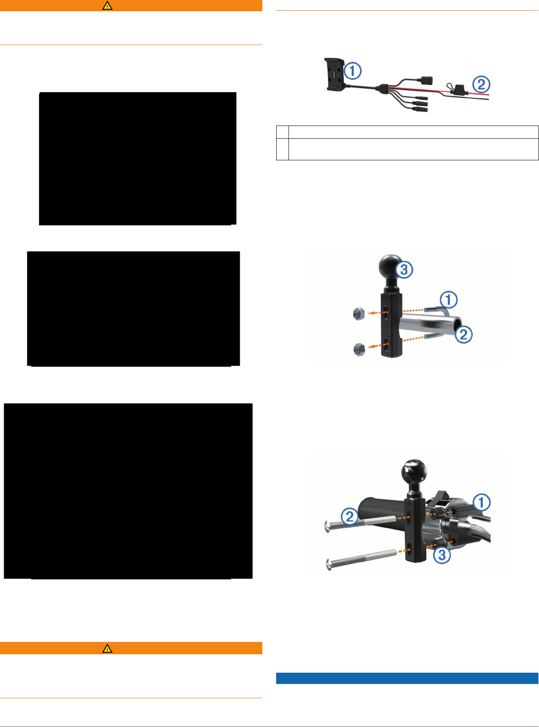
Mounting Your Device in a Motorcycle
About the Powered Mount Cables
WARNING
Garmin® strongly recommends having an experienced installer
with the proper knowledge of electrical systems install the
device. Incorrectly wiring the power cable can result in damage
to the vehicle or the battery and can cause bodily injury.
See the Important Safety and Product Information guide in the
product box for product warnings and other important
information.
The device must be mounted in a suitable and secure location
on your motorcycle, based on available power sources and safe
cable routing.
ÀMotorcycle cradle
ÁBare wires with inline fuse for power connection (to motorcycle
power)
Installing the Handlebar Base
The device includes parts for two handlebar installation
solutions. Custom mounts can require additional hardware
(http://www.ram-mount.com).
Installing the U-bolt and Handlebar Base
1Place the U-bolt À around the handlebar Á, and thread the
ends through the handlebar base Â.
2Tighten the nuts to secure the base.
NOTE: The recommended torque is 50 lbf-in (5.65 N-m). Do
not exceed torque of 80 lbf-in (9.04 N-m).
Installing the Handlebar Base to the Clutch-Clamp or Brake-
Clamp Brackets
1Remove the two factory bolts on your clutch-clamp or brake-
clamp bracket À.
NOTE: Both 1/4 in. standard and M6 bolts are included.
Match the size of the factory bolts on your clutch-clamp or
brake-clamp bracket.
2Thread the new bolts Á through the handlebar base, spacers
Â, and clutch-clamp or brake-clamp bracket.
3Tighten the bolts to secure the base.
Attaching the Base Plate to the Motorcycle Mount
NOTICE
Direct, sustained contact with the base plate, or any part of the
motorcycle, may damage the mount over time. To prevent this
kind of damage, you must place the mounting spacers between
Getting Started 1
DRAFT

the mount and base plate, and make sure that no part of the
device or mount touches the motorcycle.
1Thread the M4 x 40 mm panhead screws À through the
washers Á, cradle, spacers Â, and base plate Ã.
2Tighten the nuts to secure the base plate.
Attaching the Base Plate to the Handlebar Base
1Align the ball of the handlebar base À and the ball of the
base plate Á with each end of the double-socket arm Â.
2Insert each ball into the double-socket arm.
3Tighten the knob slightly.
4Adjust for optimal viewing and operation.
5Tighten the knob to secure the mount.
Installing Your Device in the Motorcycle Mount
1Fit the bottom of your device into the cradle.
2Tilt the device back until it snaps into place.
3If the latch on top of the mount stays up after you insert the
device, press it down.
Mounting Your Device in an Automobile
NOTICE
Before mounting the device, check the local laws pertaining to
windshield mounting.
WARNING
This product contains a lithium-ion battery. To prevent the
possibility of personal injury or product damage caused by
battery exposure to extreme heat, store the device out of direct
sunlight.
Do not use the suction cup mount on a motorcycle.
See the Important Safety and Product Information guide in the
product box for product warnings and other important
information.
1Plug the automotive power cable À into the connector Á on
the mount.
2Remove the clear plastic from the suction cup.
3Clean and dry your windshield and the suction cup with a
lint-free cloth.
4Press the suction cup  to the windshield, and flip the lever
à back toward the windshield.
5Snap the cradle Ä onto the suction cup arm.
6Fit the bottom of your device into the cradle.
7Tilt the device back until it snaps into place.
8Plug the other end of the automotive power cable into a
power outlet.
Removing Your Device from the Motorcycle
Mount
1Press the release button on the side of the mount.
2Lift out the device.
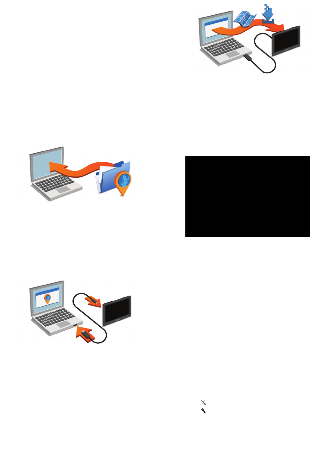
Support and Updates
Garmin Express™ provides easy access to these services for
Garmin devices. Some services may not be available for your
device.
• Product registration
• Product manuals
• Software updates
• Map updates
• Vehicles, voices, and other extras
Setting Up Garmin Express
1Connect the device to your computer using a USB cable.
2Go to www.garmin.com/express.
3Follow the on-screen instructions.
2 Getting Started
DRAFT
nüMaps Guarantee™
Your device may be eligible for a free map update within 90
days of first acquiring satellites while driving. Go to
www.garmin.com/numaps for terms and conditions.
About nüMaps Lifetime™
Models with "LM" after the model number include subscriptions
to nüMaps Lifetime, which provides quarterly map updates for
the life of your device. For terms and conditions, go to
http://www.garmin.com/numapslifetime.
NOTE: If your device does not include a subscription to nüMaps
Lifetime, you can purchase one at http://www.garmin.com
/numapslifetime.
Updating Maps and Software with Garmin Express
You can use Garmin Express software to download and install
the latest map and software updates for your device. Map
updates provide the latest available mapping data to ensure
your device continues to calculate accurate and efficient routes
to your destinations. Garmin Express is available for Windows®
and Mac® computers.
1On your computer, go to www.garmin.com/express.
2Select an option:
• To install on a Windows computer, select Download for
Windows.
• To install on a Mac computer, select Mac Version.
3Open the downloaded file, and follow the on-screen
instructions to complete the installation.
4Start Garmin Express.
5Connect your Garmin device to your computer using a USB
cable.
The Garmin Express software detects your device.
6Enter an email address for product registration (optional).
7Click save device.
8Click check for updates.
A list of available map and software updates appears.
9Select the updates to install.
10Click Install Now.
The Garmin Express software downloads and installs the
updates onto your device. Map updates are very large, and this
process may take a long time on slower Internet connections.
Entering and Exiting Sleep Mode
You can use sleep mode to conserve battery power when your
device is not in use. While in sleep mode, your device uses very
little power and can wake instantly for use.
TIP: You can charge your device faster by putting it in sleep
mode while charging the battery.
Press the power key À.
Turning Off the Device
1Hold the power key until a prompt appears on the screen.
The prompt appears after five seconds. If you release the
power key before the prompt appears, the device enters
sleep mode.
2Select Off.
Resetting the Device
You can reset your device if it stops functioning.
Hold the power key for 12 seconds.
Adjusting the Screen Brightness
1Select Settings > Display > Brightness.
2Use the slider bar to adjust the brightness.
Adjusting the Volume
Before you can adjust the volume, you must connect your
device to a powered mount or a headset using Bluetooth®
wireless technology.
1Select Volume.
2Select an option:
• Use the slider bar to adjust the volume.
• Select to mute the device.
• Select for additional options.
Status Bar Icons
The status bar is located at the top of the main menu. The
status bar icons display information about features on the
Getting Started 3
DRAFT
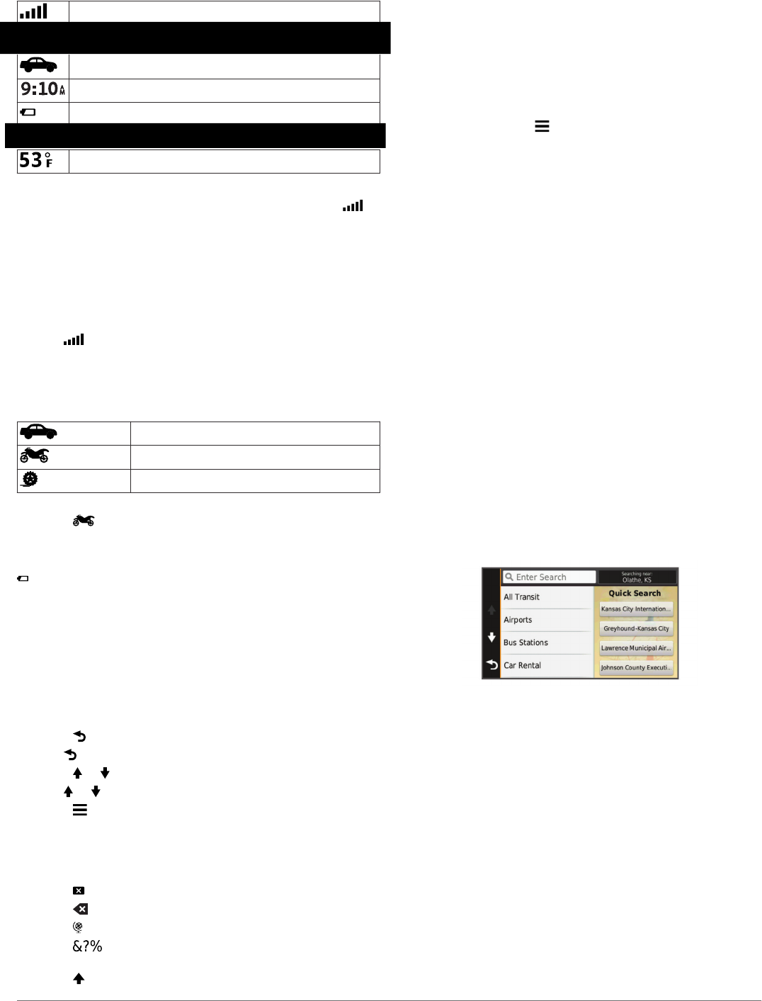
device. You can select some icons to change settings or view
additional information.
GPS signal status
Transportation mode indicator
Current time
Battery status
Temperature
Acquiring GPS Signals
To navigate with your device, you must acquire satellites. in
the status bar indicates the satellite signal strength. Acquiring
satellites can take several minutes.
1Turn on the device.
2Wait while the device locates satellites.
3If necessary, go outdoors to an open area, away from tall
buildings and trees.
Viewing GPS Signal Status
Hold for three seconds.
Transportation Modes
Routing and navigation are calculated differently based on your
transportation mode. The current transportation mode is
indicated by an icon in the status bar.
Automobile mode
Motorcycle mode
Off-road mode
Choosing a Transportation Mode
Select .
Battery Information
After the device is connected to power, it begins to charge.
in the status bar indicates the status of the internal battery.
Setting the Time
1From the main menu, select the time.
2Select an option:
• To set the time automatically using GPS information,
select Automatic.
• To set the time manually, drag the numbers up or down.
Using the On-Screen Buttons
• Select to return to the previous menu screen.
• Hold to quickly return to the main menu.
• Select or to see more choices.
• Hold or to scroll faster.
• Select to see a menu of options for the current screen.
Using the On-Screen Keyboard
See "Language and Keyboard Settings" to change the keyboard
layout (Language and Keyboard Settings).
• Select to delete a search entry.
• Select to delete a character.
• Select to change the keyboard language mode.
• Select to enter special characters, such as punctuation
marks.
• Select to change character capitalization.
About Shortcuts
Adding a Shortcut
You can add shortcuts to the Where To? menu. A shortcut can
point to a location, a category, or a search tool.
The Where To? menu can contain up to 36 shortcut icons.
1Select Where To? > Add Shortcut.
2Select an item.
Removing a Shortcut
1Select Where To? > > Remove Shortcut(s).
2Select the shortcut to remove.
3Select the shortcut again to confirm.
Finding Locations
Locations
The detailed maps loaded in your device contain locations, such
as restaurants, hotels, auto services, and detailed street
information. You can use categories to browse for nearby
businesses and attractions. You can also search for addresses,
coordinates, cities, and intersections.
Finding a Location by Category
1Select Where To?.
2Select a category, or select Categories.
3If necessary, select a subcategory.
4Select a location.
Searching Within a Category
After you have performed a search for a point of interest, certain
categories may display a Quick Search list that shows the last
four destinations you selected.
1Select Where To?.
2Select a category, or select Categories.
3Select a category.
4If applicable, select a destination from the Quick Search list.
5If necessary, select the appropriate destination.
Finding a Location Using the Search Bar
You can use the search bar to search for locations by entering a
category, brand name, address, or city name.
1Select Where To?.
2Select Enter Search in the search bar.
3Enter all or part of the search term.
Suggested search terms appear below the search bar.
4Select an option:
• To search for a type of business, enter a category name
(for example, "movie theaters").
• To search for a business name, enter all or part of the
name.
• To search for an address near you, enter the street
number and street name.
• To search for an address in another city, enter the street
number, street name, city, and state.
4 Finding Locations
DRAFT

• To search for a city, enter the city and state.
• To search for coordinates, enter latitude and longitude
coordinates.
5Select an option:
• To search using a suggested search term, select the
term.
• To search using the text you entered, select .
6If necessary, select a location.
Changing the Search Area
1From the main menu, select Where To?.
2Select Searching Near.
3Select an option.
Search Tools
Search tools allow you to search for specific types of locations
by responding to on-screen prompts.
Finding an Address
NOTE: The order of the steps may change depending on the
map data loaded on your device.
1Select Where To? > Address.
2Enter the address number, and select Done.
3Enter the street name, and select Next.
4If necessary, select Searching Near to change the city,
state, or province.
5If necessary, select the city, the state, or the province.
6If necessary, select the address.
Finding an Intersection
1Select Where To? > Categories > Intersections.
2Select an option:
• Select a state or province.
• To change the country, state, or province, select State or
Country, and enter a name.
3Enter the first street name, and select Next.
4If necessary, select the street.
5Enter the second street name, and select Next.
6If necessary, select the street.
7If necessary, select the intersection.
Finding a City
1Select Where To? > Categories > Cities.
2Select Enter Search.
3Enter a city name, and select .
4Select a city.
Finding a Location Using Coordinates
You can find a location using latitude and longitude coordinates.
This can be helpful when geocaching.
1Select Where To? > Categories > Coordinates.
2If necessary, select , and change the coordinate format or
datum.
3Select the latitude coordinate.
4Enter the new coordinate, and select Done.
5Select the longitude coordinate.
6Enter the new coordinate, and select Done.
7Select View on Map.
Finding a Location by Browsing the Map
Before you can find places included in the map data, such as
restaurants, hospitals, and fuel stations, you must enable the
map layer for places along the road (Customizing the Map
Layers).
1Select View Map.
2Drag and zoom the map to display the area to search.
3If necessary, select , and select a category icon to view
only a specific category of places.
Location markers ( or a blue dot) appear on the map.
4Select an option:
• Select a location marker.
• Select a point, such as a street, intersection, or address
location.
5If necessary, select the location description to view additional
information.
Saving a Home Location
You can set your home location for the location you return to
most often.
1Select Where To? > > Set Home Location.
2Select Enter My Address, Use Current Location, or
Recently Found.
The location is saved as "Home" in the Saved menu.
Going Home
Select Where To? > Go Home.
Editing Your Home Location Information
1Select Where To? > Saved > Home.
2Select .
3Select > Edit.
4Enter your changes.
5Select Done.
Finding Recently Found Destinations
Your device stores the last 50 destinations you have found.
1Select Where To? > Recent.
2Select a location.
Clearing the List of Recently Found Locations
Select Where To? > Recent > > Clear > Yes.
Finding Parking
1Select Where To? > Categories > Parking.
2Select a parking location.
Setting a Simulated Location
If you are indoors or not receiving satellite signals, you can use
the GPS to set a simulated location.
1Select Settings > Navigation > GPS Simulator.
2From the main menu, select View Map.
3Tap the map twice to select an area.
The address of the location appears at the bottom of the
screen.
4Select the location description.
5Select Set Location.
Saving Locations
Saving a Location
1Search for a location (Finding a Location by Category).
2From the search results, select a location.
3Select .
4Select Save.
Finding Locations 5
DRAFT

5If necessary, enter a name, and select Done.
Saving Your Current Location
1From the map, select the vehicle icon.
2Select Save.
3Enter a name, and select Done.
4Select OK.
Starting a Route to a Saved Location
1Select Where To? > Saved.
2If necessary, select a category, or select All Saved Places.
3Select a location.
4Select Go!.
Editing a Saved Location
1Select Where To? > Saved.
2If necessary, select a category.
3Select a location.
4Select .
5Select > Edit.
6Select an option:
• Select Name.
• Select Phone Number.
• Select Categories to assign categories to the saved
location.
• Select Change Map Symbol to change the symbol used
to mark the saved location on a map.
7Edit the information.
8Select Done.
Assigning Categories to a Saved Location
You can add custom categories to organize your saved
locations.
NOTE: Categories appear in the saved locations menu after
you have saved at least 12 locations.
1Select Where To? > Saved.
2Select a location.
3Select .
4Select > Edit > Categories.
5Enter one or more category names, separated by commas.
6If necessary, select a suggested category.
7Select Done.
Sharing a Saved Location
If you save the location of a business that is not in the map
data, you can share the location with Garmin so that it can be
added to future map updates and shared with the Garmin
community.
1Select Where To? > Saved.
2If necessary, select a category.
3Select a location.
4Select .
5Select > Share.
Sending a Location to the Device
You can send locations to your device from various online
sources, including http://connect.garmin.com.
1Connect your device to your computer (Connecting the
Device to Your Computer).
2If necessary, install the Garmin Communicator Plugin.
NOTE: Go to www.garmin.com/communicator for more
information.
3On your computer, find a location on a supported website.
4From the website, select Send to GPS.
NOTE: Some websites may use a different button or link.
5Follow the on-screen instructions.
Deleting a Saved Location
NOTE: Deleted locations cannot be recovered.
1Select Where To? > Saved.
2Select > Delete Saved Places.
3Select the box next to the saved locations to delete, and
select Delete.
Navigation
Starting a Route
1Search for a location (Locations).
2Select a location.
3Select Go!.
Changing the Route Calculation Mode
The route calculation is based on road speeds and vehicle
acceleration data for a given route. The calculation mode affects
only automobile routes.
1Select Settings > Navigation > Calculation Mode.
2Select an option:
• Select Faster Time to calculate routes that are faster to
drive but can be longer in distance.
• Select Off Road to calculate point-to-point routes (without
roads).
• Select Shorter Distance to calculate routes that are
shorter in distance but can take more time to drive.
Previewing Multiple Routes
1Search for a location (Finding a Location by Category).
2From the search results, select a location.
3Select Routes.
4Select a route.
Starting a Route to a Saved Location
1Select Where To? > Saved.
2If necessary, select a category, or select All Saved Places.
3Select a location.
4Select Go!.
Your Route on the Map
NOTICE
The speed limit feature is for information only and does not
replace your responsibility to abide by all posted speed limit
signs and to use safe driving judgment at all times. Garmin will
6 Navigation
DRAFT

not be responsible for any traffic fines or citations you receive
for failing to follow all applicable traffic laws and signs.
The route is marked with a magenta line. A checkered flag
marks your destination.
As you travel, the device guides you to the destination with
voice prompts, arrows on the map, and directions at the top of
the map. If you depart from the original route, the device
recalculates the route and provides new directions.
A data field displaying the current speed limit may appear as
you travel on major roadways.
Using the Map
1Select View Map.
2Select anywhere on the map.
3Select an option:
• To zoom in or out, select or .
• To switch between North Up and 3-D views, select .
• To view specific categories, select .
Adding a Point to a Route
Before you can add a point, you must be navigating a route.
1From the map, select > Where To?.
2Search for a location.
3Select a location.
4Select Go!.
5Select Add to Active Route.
Skipping a Point in Your Route
If you decide not to go to the next point in your route, you can
skip the point. This prevents the device from attempting to route
you back to the missed point. This feature is not available if the
next point is your final destination.
From the map, select > Change Route > Skip
Destination.
Taking a Detour
Before you can take a detour, you must be navigating a route
and you must add the change route tool to the map tools menu
(Customizing the Map Tools).
You can take a detour for a specified distance along your route
or detour around specific roads. This is useful if you encounter
construction zones, closed roads, or poor road conditions.
1From the map, select > Change Route.
2Select an option:
• To detour your route for a specific distance, select Detour
by Distance.
• To detour around a specific road on the route, select
Detour by Road.
Stopping the Route
From the map, select > .
Using Suggested Routes
Before you can use this feature, you must save at least one
location and enable the travel history feature (Device and
Privacy Settings).
Using the myTrends™ feature, your device predicts your
destination based on your travel history, the day of the week,
and the time of day. After you have driven to a saved location
several times, the location may appear in the navigation bar on
the map, along with the estimated time of travel, and traffic
information.
Select the navigation bar to view a suggested route to the
location.
About Up Ahead
You can view upcoming businesses and services along your
route or the road on which you are traveling.
Services are listed under tabs by category.
Gas
Food
Lodging
Restrooms
Parking
Banks and ATMs
Finding Upcoming Points of Interest
1From the map, select > Up Ahead.
2Select a tab.
3Select a point of interest.
Avoiding Road Features
1Select Settings > Navigation > Avoidances.
2Select the road features to avoid on your routes, and select
Save.
About Custom Avoidances
Custom avoidances allow you to avoid specific areas and
sections of road. You can enable and disable custom
avoidances as needed.
Avoiding an Area
1Select Settings > Navigation > Custom Avoidances.
2If necessary, select Add Avoidance.
3Select Add Avoid Area.
4Select the upper-left corner of the area to avoid, and select
Next.
5Select the lower-right corner of the area to avoid, and select
Next.
The selected area is shaded on the map.
6Select Done.
Avoiding a Road
1Select Settings > Navigation > Custom Avoidances.
2Select Add Avoid Road.
3Select the starting point of the section of road to avoid, and
select Next.
4Select the ending point of the road section, and select Next.
5Select Done.
Disabling a Custom Avoidance
You can disable a custom avoidance without deleting it.
1Select Settings > Navigation > Custom Avoidances.
2Select an avoidance.
3Select > Disable.
Navigation 7
DRAFT

Deleting Custom Avoidances
1Select Settings > Navigation > Custom Avoidances.
2Select an option:
• To delete all custom avoidances, select .
• To delete one custom avoidance, select the avoidance,
and select > Delete.
Navigating Off Road
If you are not following roadways as you navigate, you can use
Off Road mode.
1Select Settings > Navigation.
2Select Calculation Mode > Off Road > Save.
The next route will be calculated as a straight line to the
location.
Map Pages
Customizing the Map
Customizing the Map Layers
You can customize which data appear on the map, such as
icons for points of interest and road conditions.
1Select Settings > Map & Vehicle > Map Layers.
2Select the layers to include on the map, and select Save.
Viewing the Trip Log
Your device keeps a trip log, which is a record of the path you
have traveled.
1Select Settings > Map & Vehicle > Map Layers.
2Select the Trip Log check box.
Changing the Map Data Field
1From the map, select a data field.
NOTE: You cannot customize Speed.
2Select a type of data to display.
3Select Save.
Changing the Map Perspective
1Select Settings > Map & Vehicle > Driving Map View.
2Select an option:
• Select Track Up to display the map in two dimensions (2-
D), with your direction of travel at the top.
• Select North Up to display the map in 2-D with north at
the top.
• Select 3-D to display the map in three dimensions.
Viewing Route Activity
Viewing a List of Turns
While navigating a route, you can view all of the turns and
maneuvers for your entire route and the distance between turns.
1While navigating a route, select the text bar on the top of the
map.
2Select a turn.
The details for the turn appear. If available, an image of the
junction appears for junctions on major roadways.
Viewing the Entire Route on the Map
1While navigating a route, select the navigation bar at the top
of the map.
2Select > Map.
Viewing the Next Turn
While navigating a route, a preview of the next turn, lane
change, or other maneuver appears in the upper-left corner of
the map.
The preview includes the distance to the turn or maneuver and
the lane in which you should be traveling, if available.
From the map, select to view the next turn on the map.
Viewing Junctions
While navigating a route, you can view the junctions on major
roadways. When you approach a junction in a route, the image
of that junction appears briefly, if available.
From the map, select to view the junction, if available.
Viewing Traffic Alerts
While navigating a route, a traffic alert may appear in the
navigation bar.
Select the alert to view more information.
Viewing the Trip Information Page
The trip information page displays your present speed and
provides statistics about your trip.
NOTE: If you make frequent stops, leave the device turned on,
so it can accurately measure elapsed time during the trip.
From the map, select Speed.
Resetting Trip Information
1From the map, select Speed .
2Select > Reset Field(s).
3Select an option:
• When not navigating a route, select Select All to reset
every data field except the speedometer, on the first
page.
• Select Reset Trip Data to reset the information on the trip
computer.
• Select Reset Max. Speed to reset the maximum speed.
8 Map Pages
DRAFT

• Select Reset Trip B to reset the odometer.
Viewing Current Location Information
You can use the Where Am I? page to view information about
your current location. This feature is helpful if you need to tell
emergency personnel your location.
From the map, select the vehicle.
Finding Nearby Services
You can use the Where Am I? page to find nearby services,
such as fuel, hospitals or police stations.
1From the map, select the vehicle.
2Select a category.
Getting Directions to Your Current Location
If you need to tell another person how to get to your current
location, your device can give you a list of directions.
1From the map, select the vehicle.
2Select > Directions to Me.
3Select a starting location.
4Select Select.
Hands-Free Features 9
DRAFT

Using the Apps
Using Help
Select Apps > Help to view information about using the
device.
Searching Help Topics
Select Apps > Help > .
Planning a Trip
You can use the trip planner to create and save a trip with
multiple destinations.
1Select Apps > Trip Planner.
2Select New Trip.
3Select Select Start Location.
4Search for a location (Finding a Location by Category).
5Select Select.
6To add additional locations, select .
7Select Next.
8Select Save.
9Enter a name, and select Done.
Scheduling a Trip
You can use the trip planner to create and save a trip with
multiple destinations.
1Select Apps > Trip Planner.
2Select a trip.
3Select a location.
10 Using the Apps
DRAFT

4Select an option:
• Select Departure Time.
• Select Arrival Time.
5Select a date and time, and select Save.
6Select Duration.
7Select the amount of time you will spend at the location, and
select Save.
8If necessary, repeat steps 3–7 for each location.
Changing Transportation Modes in a Trip
You can change the transportation modes used to travel in a
saved trip.
1Select Apps > Trip Planner.
2Select a trip.
3Select > Transportation Mode.
4Select a transportation mode.
5Select Save.
Navigating to a Saved Trip
1Select Apps > Trip Planner.
2Select a saved trip.
3Select Go!.
4Select your next destination, and select Start.
Editing a Saved Trip
1Select Apps > Trip Planner.
2Select a saved trip.
3Select .
4Select an option:
• Select Rename Trip.
• Select Edit Destinations to add and delete a location, or
to change the order of locations.
• Select Delete Trip.
• Select Optimize Order to arrange the stops on your trip
Tracks
A track is a recording of your path. The track log contains
information about the recorded path, including time, location,
and elevation information.
Viewing Track Information
1Select Apps > Tracks > Active.
2Select a track.
The track is displayed on the map.
Using the Apps 11
DRAFT

3Select .
4Select an option:
• To save the track, select Save Track.
• To save the track as a trip, select Save as Trip.
• To view an elevation plot of the track, select Elevation
Profile.
TracBack®
Following Your Recent Track
The TracBack feature records a track of your recent movement.
You can retrace your recent track back to where you started.
1Select Apps > TracBack.
Your recent track appears on the map.
2Select Go!.
Saving Your Recent Track as a Trip
You can save your recent track as a trip, which you can
navigate later using the trip planner (Navigating to a Saved
Trip).
1Select TracBack.
Your recent track appears on the map.
2Select > Save as Trip.
3Enter a name, and select Done.
12 Using the Apps
DRAFT

Using the Compass
NOTE: You must be moving for the compass to determine your
direction.
You can navigate using a GPS compass.
Select Apps > Compass.
Finding Your Last Parking Spot
When you disconnect the device from vehicle power while the
device is on, your current location is saved as a parking spot.
Select Apps > Last Spot.
Viewing Previous Routes and Destinations
Before you can use this feature, you must enable the travel
history feature (Device and Privacy Settings).
You can view your previous routes and places you have
stopped on the map.
Select Apps > Where I've Been.
Logging Service History
You can log the date and odometer reading when service or
maintenance is performed on your vehicle. The device provides
several service categories, and you can add custom categories
(Adding Service Categories).
1Select Apps > Service History.
2Select a service category.
3Select Add Record.
4Enter the odometer reading, and select Next.
5Enter a comment (optional).
6Select Done.
Adding Service Categories
1Select Apps > Service History.
2Select > Add Category.
3Enter a category name, and select Done.
Deleting Service Categories
When you delete a service category, all service records in the
category are also deleted.
1Select Apps > Service History.
2Select > Delete Categories.
3Select the service categories to delete.
4Select Delete.
Renaming Service Categories
1Select Apps > Service History.
2Select the category to be renamed.
3Select > Rename Category.
4Enter a name, and select Done.
Deleting Service Records
1Select Apps > Service History.
2Select a service category.
3Select > Delete Records.
4Select the service records to be deleted.
5Select Delete.
Editing a Service Record
You can edit the comment, odometer reading, and date of a
service record.
1Select Apps > Service History.
2Select a category.
3Select a field.
4Enter the new information, and select Done.
Viewing the Weather Forecast
Before you can use this feature, your device must be connected
to a supported phone running Smartphone Link (Connecting to
Smartphone Link). This feature is not available in all areas.
1Select Apps > Weather.
2Select a day.
The detailed forecast for that day appears.
Viewing Weather Near a Different City
1Select Apps > Weather > Current Location.
2Select an option:
• To view weather for a favorite city, select a city in the list.
• To add a favorite city, select Add City, and enter a city
name.
Using the Apps 13
DRAFT

Traffic
NOTICE
Garmin is not responsible for the accuracy or timeliness of the
traffic information.
Traffic information may not be available in all areas or countries.
For information about traffic and coverage areas, go to
www.garmin.com/traffic.
• Traffic alerts appear on the map when there are traffic
incidents along your route or in your area.
Traffic on Your Route
When a traffic delay occurs on your route, an alert appears on
the map, and the device calculates an alternate route to avoid
the delay. You can choose whether to use alternate routes
automatically, or upon request. See Traffic Settings for more
information (Traffic Settings). Your device may route you
through a traffic delay if a better alternative route does not exist.
The delay time is added into your estimated time of arrival
automatically.
Viewing Upcoming Traffic
You can view traffic incidents coming up along your route or
along the road on which you are traveling.
1While navigating a route, select > Traffic.
The nearest upcoming traffic incident appears in a panel on
the right side of the map.
2Select the traffic incident to view additional details.
Manually Avoiding Traffic on Your Route
1From the map, select .
2Select Traffic on Route.
3If necessary, use the arrows to view other traffic delays on
your route.
4Select > Avoid.
Taking an Alternate Route
If you do not have your device set to use alternate routes
automatically, you can manually start an alternate route to avoid
a traffic delay.
1While navigating a route, select > Traffic.
2Select Alternate Route.
3Select Go!.
Viewing Traffic on the Map
The traffic map shows color-coded traffic flow and delays on
nearby roads.
1From the main menu, select Apps > Traffic.
2If necessary, select > Legend to view the legend for the
traffic map.
Traffic in Your Area
Searching for Traffic Incidents
1From the main menu, select Apps > Traffic.
2Select > Incidents.
3Select an item in the list.
4If there is more than one incident, use the arrows to view
additional incidents.
Viewing a Traffic Incident on the Map
1From the traffic map, select .
2Select an incident.
Understanding Traffic Data
The traffic legend explains the icons and colors used on the
traffic map.
1From the map, select > Traffic.
2Select Legend.
14 Traffic
DRAFT

trafficTrends™
When the trafficTrends feature is enabled, your device uses
historic traffic data to calculate more-efficient routes.
NOTE: Different routes may be calculated based on traffic
trends for the day of the week or the time of day.
Disabling trafficTrends
To prevent your device from recording or sharing traffic data,
you must disable trafficTrends.
Select Settings > Traffic > trafficTrends.
Enabling Traffic
You can enable or disable traffic data. When traffic data is
disabled, the device does not receive traffic data, but it still
avoids potentially congested areas in routes using the
trafficTrends feature, if enabled (trafficTrends™).
1Select Settings > Traffic.
2Select the Traffic check box.
Data Management
Data Management
You can store files on your device. The device has a memory
card slot for additional data storage.
NOTE: The device is not compatible with Windows 95, 98, Me,
Windows NT®, and Mac OS 10.3 and earlier.
File Types
The device supports these file types.
• Maps and GPX waypoint files from myGarmin™ mapping
software, including MapSource® and BaseCamp™ (Custom
Points of Interest).
• GPI custom POI files from Garmin POI Loader (Installing POI
Loader).
• MP3 audio files.
About Memory Cards
You can purchase memory cards from an electronics supplier,
or purchase pre-loaded Garmin mapping software
(www.garmin.com). In addition to map and data storage, the
memory card can be used to store files such as maps, images,
geocaches, routes, waypoints, and custom POIs.
Installing a Memory Card
NOTE: The device supports microSD, microSDHC, and
microSDXC memory cards. It does not support exFAT. Memory
cards must be formatted as FAT32.
1Remove the back cover and the battery from the device.
2Insert a memory card into the slot on the device.
3Press it in until it clicks.
Connecting the Device to Your Computer
You can connect the device to your computer using a USB
cable.
1Plug the small end of the USB cable into the port on the
device.
2Plug the larger end of the USB cable into a port on your
computer.
A picture of your device connected to a computer appears on
the device screen.
Depending on your computer operating system, the device
appears as either a portable device, a removable drive, or a
removable volume.
Transferring Data From Your Computer
1Connect the device to your computer (Connecting the Device
to Your Computer).
Depending on your computer operating system, the device
appears as either a portable device, a removable drive, or a
removable volume.
2On your computer, open the file browser.
3Select a file.
4Select Edit > Copy.
5Browse to a folder on the device.
NOTE: For a removable drive or volume, you should not
place files in the Garmin folder.
6Select Edit > Paste.
Disconnecting the USB Cable
If your device is connected to your computer as a removable
drive or volume, you must safely disconnect your device from
your computer to avoid data loss. If your device is connected to
your Windows computer as a portable device, it is not
necessary to safely disconnect.
1Complete an action:
• For Windows computers, select the Safely Remove
Hardware icon in the system tray, and select your device.
• For Mac computers, drag the volume icon to the trash.
2Disconnect the cable from your computer.
Deleting Files
NOTICE
If you do not know the purpose of a file, do not delete it. Your
device memory contains important system files that should not
be deleted.
1Open the Garmin drive or volume.
2If necessary, open a folder or volume.
3Select a file.
4Press the Delete key on your keyboard.
Customizing the Device
Map and Vehicle Settings
To open the Map and Vehicle settings, from the main menu,
select Settings > Map & Vehicle.
Vehicle: Changes the icon to represent your position on the
map. Go to www.garmingarage.com for more icons.
Driving Map View: Sets the perspective on the map.
Map Detail: Sets the level of detail on the map. More detail may
cause the map to draw slower.
Map Theme: Changes the color of the map data.
Map Tools: Selects the shortcuts that appear in the map tools
menu.
Map Layers: Sets the data that appears on the map page
(Customizing the Map Layers).
Auto Zoom: Automatically selects the appropriate zoom level
for optimal use on your map. When disabled, you must zoom
in or out manually.
myMaps: Sets which installed maps the device uses.
Enabling Maps
You can enable map products installed on your device.
TIP: To purchase additional map products, go to
http://buy.garmin.com.
1Select Settings > Map & Vehicle > myMaps.
Data Management 15
DRAFT

2Select a map.
Customizing the Map Tools
You can select the shortcuts that appear in the map tools menu.
1Select Settings > Map & Vehicle > Map Tools.
2Select the map tools to include in the menu.
3Select Save.
Navigation Settings
To open the Navigation settings page, from the main menu,
select Settings > Navigation.
Calculation Mode: Sets route preference.
Avoidances: Sets road features to avoid on a route.
Custom Avoidances: Allows you to avoid specific roads or
areas.
Safe Mode: Disables all functions that require significant
operator attention and could become a distraction while
driving.
GPS Simulator: Stops the device from receiving a GPS signal,
and saves battery power.
Calculation Mode Settings
Select Settings > Navigation > Calculation Mode.
The route calculation is based on road speeds and vehicle
acceleration data for a given route.
Faster Time: Calculates routes that are faster to drive but can
be longer in distance.
Shorter Distance: Calculates routes that are shorter in distance
but can take more time to drive.
Off Road: Calculates a direct line from your location to your
destination.
Display Settings
To open the Display settings page, from the main menu, select
Settings > Display.
Orientation: Sets the display to portrait (vertical) or landscape
(horizontal).
Color Mode: Sets the device to display day or night colors. You
can select Auto to allow the device to automatically set day
or night colors based on the time of day.
Brightness: Adjusts the display brightness.
Display Timeout: Sets the amount of idle time before your
device enters sleep mode.
Screenshot: Allows you to take a picture of the device screen.
Screenshots are saved in the Screenshot folder of the device
storage.
Traffic Settings
To open the traffic settings page, from the main menu, select
Settings > Traffic.
Traffic: Enables traffic. Smartphone Link is required.
trafficTrends: Enables the trafficTrends feature
(trafficTrends™).
Units and Time Settings
To open the Units and Time settings page, from the main menu,
select Settings > Units & Time.
Current Time: Sets the device time.
Time Format: Allows you to select a 12-hour, 24-hour, or UTC
display time.
Units: Sets the unit of measure used for distances.
Position Format: Sets the coordinate format and datum used
for geographical coordinates.
Language and Keyboard Settings
To open the Language and Keyboard settings, from the main
menu, select Settings > Language & Keyboard.
Voice Language: Sets the language for voice prompts.
Text Language: Sets all on-screen text to the selected
language.
NOTE: Changing the text language does not change the
language of user-entered data or map data, such as street
names.
Keyboard Language: Enables keyboard languages.
Device and Privacy Settings
To open the Device settings page, from the main menu, select
Settings > Device.
About: Displays the software version number, the unit ID
number, and information on several other software features.
EULAs: Displays the end-user license agreements that apply to
your choice.
NOTE: You need this information when you update the
system software or purchase additional map data.
Travel History: Allows the device to record information for the
myTrends, Where I’ve Been, and Trip Log features.
Clear Travel History: Clears your travel history for the
myTrends, Where I’ve Been, and Trip Log features.
Proximity Alerts Settings
Select Settings > Proximity Alerts.
Audio: Sets the style of alert that plays when you approach
proximity points.
Alerts: Sets the type of proximity points for which alerts are
played.
Restoring Settings
You can restore a category of settings or all settings to the
factory default values.
1Select Settings.
2If necessary, select a settings category.
3Select > Restore.
Appendix
Power Cables
Your device can be powered various ways.
• Vehicle power cable
16 Appendix
DRAFT
• USB cable
• AC adapter (optional accessory)
Charging the Device
NOTE: This Class III product shall be powered by an LPS
power supply.
You can charge the battery in the device using any of these
methods.
• Connect the device to the vehicle power cable.
• Connect the device to a computer using a USB cable.
The device may charge slowly when connected to a
computer. Some portable computers may not charge the
device.
• Connect the device to an optional power adapter accessory,
such as a wall power adapter.
You can purchase an approved Garmin AC-DC adapter
suitable for home or office use from a Garmin dealer or
www.garmin.com.
Device Care
NOTICE
Avoid dropping your device.
Do not store the device where prolonged exposure to extreme
temperatures can occur, because it can cause permanent
damage.
Never use a hard or sharp object to operate the touchscreen, or
damage may result.
Cleaning the Outer Casing
NOTICE
Avoid chemical cleaners and solvents that can damage plastic
components.
1Clean the outer casing of the device (not the touchscreen)
using a cloth dampened with a mild detergent solution.
2Wipe the device dry.
Cleaning the Touchscreen
1Use a soft, clean, lint-free cloth.
2If necessary, lightly dampen the cloth with water.
3If using a dampened cloth, turn off the device and disconnect
the device from power.
4Gently wipe the screen with the cloth.
Avoiding Theft
• Remove the device and mount from sight when not in use.
• Remove the residue left on the windshield by the suction
cup.
• Do not keep your unit in the glove compartment.
• Register your device at http://my.garmin.com.
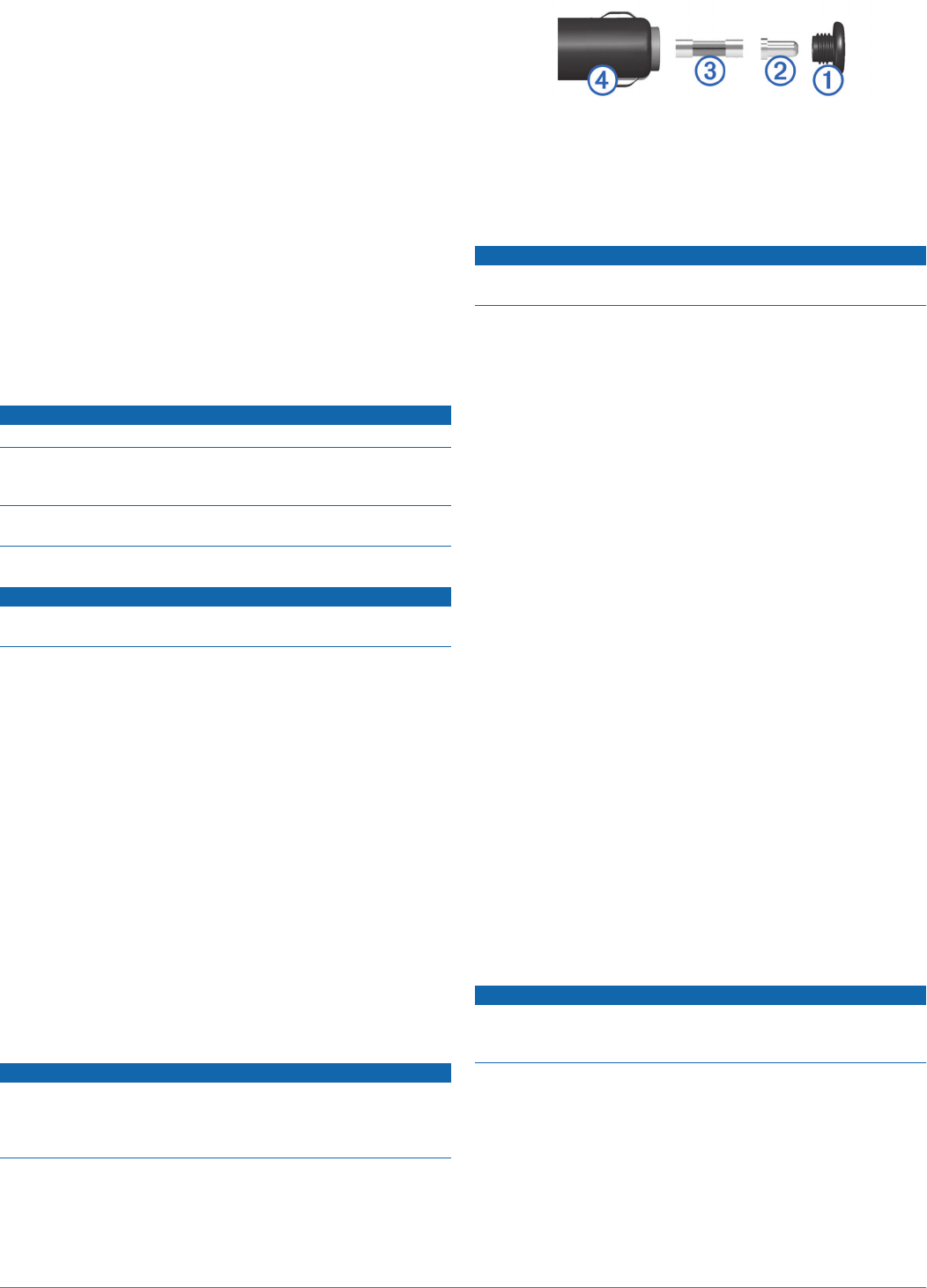
Changing the Fuse in the Vehicle Power
Cable
NOTICE
When replacing the fuse, do not lose any of the small pieces
and make sure they are put back in the proper position. The
vehicle power cable does not work unless it is assembled
correctly.
If your device does not charge in your vehicle, you may need to
replace the fuse located at the tip of the vehicle adapter.
1Unscrew the end piece À.
2Remove the end piece, the silver tip Á, and the fuse Â.
3Insert a new 3 A fast-blow fuse.
4Place the silver tip in the end piece.
5Screw the end piece back into the vehicle power cable Ã.
Mounting on Your Dashboard
NOTICE
The permanent mounting adhesive is extremely difficult to
remove after it is installed.
You can use an optional mounting disk to mount your device to
the dashboard and comply with certain state regulations. See
www.garmin.com for more information.
1Clean and dry the dashboard where you are placing the disk.
2Remove the backing from the adhesive on the bottom of the
disk.
3Place the disk on the dashboard.
4Remove the clear plastic cover from the top of the disk.
5Place the suction cup mount on top of the disk.
6Flip the lever down (toward the disk).
Removing the Device, Mount, and Suction
Cup
Removing the Device from the Mount
1Press the release tab or button on the mount.
2Tilt the device forward.
Removing the Mount from the Suction Cup
1Turn the device mount to the right or left.
2Apply pressure until the socket on the mount releases the
ball on the suction cup.
Removing the Suction Cup from the Windshield
1Flip the lever on the suction cup toward you.
2Pull the tab on the suction cup toward you.
Purchasing Additional Maps
1Go to your device product page at (www.garmin.com).
2Click the Maps tab.
3Follow the on-screen instructions.
Safety Cameras
NOTICE
Garmin is not responsible for the accuracy of or the
consequences of using a custom point of interest or a safety
camera database.
Information about safety camera locations and speed limits is
available in some areas. Go to www.garmin.com/safetycameras
to check availability or to purchase a subscription or one-time
update. You can purchase a new region or extend an existing
subscription at any time.
You can update safety cameras for an existing safety camera
subscription by going to http://my.garmin.com. You should
update your device frequently to receive the most up-to-date
safety camera information.
Appendix 17
DRAFT

For some devices and regions, basic safety camera data may
be included with your device. Included data does not include
updates or a subscription.
Custom Points of Interest
Custom POIs are customized points on the map. They can
contain alerts that let you know if you are near a designated
point or if you are traveling faster than a specified speed.
Installing POI Loader
You can create or download custom POI lists on your computer
and install them on your device using POI Loader software.
1Go to www.garmin.com/poiloader.
2Follow the on-screen instructions.
Using the POI Loader Help Files
For more information on the POI loader, refer to the Help file.
With the POI loader open, click Help.
Finding Custom POIs
Before you can find custom POIs, you must load custom POIs
on your device using the POI Loader software (Installing POI
Loader).
1Select Where To? > Categories.
2Scroll to the Other Categories section, and select a category.
Purchasing Accessories
Go to http://buy.garmin.com.
Device Information
Specifications
Water resistance IEC 60529 IPX7
Operating temperature
range
-4° to 131°F (-20° to 55°C)
Charging temperature
range
32° to 113°F (0° to 45°C)
Power input (CLA,
motorcycle, or external
power)
8–28 Vdc
Power input (USB) 5 V ±0.25 V
Battery life Up to 4 hours, depending on usage and
settings
Battery type User-replaceable lithium-ion battery
Battery voltage range 3.5 V–4.1 V
Troubleshooting
My device is not acquiring satellite signals
• Verify the GPS simulator is turned off (Navigation Settings).
• Take your device out of parking garages and away from tall
buildings and trees.
• Remain stationary for several minutes.
The device does not charge in my vehicle
• Check the fuse in the vehicle power cable (Changing the
Fuse in the Vehicle Power Cable).
• Verify the vehicle is turned on and is supplying power to the
power outlet.
• Verify the interior temperature of the vehicle is between 32°
and 113°F (between 0° and 45°C).
• Verify that the fuse is not broken in the vehicle power outlet.
My battery does not stay charged for very
long
• Decrease the screen brightness (Display Settings).
• Shorten the display timeout (Display Settings).
• Decrease the volume (Adjusting the Volume).
• Put the device in sleep mode when not in use (Entering and
Exiting Sleep Mode).
• Keep your device away from extreme temperatures.
• Do not leave your device in direct sunlight.
The battery gauge does not seem accurate
1Allow the device to fully discharge.
2Fully charge the device without interrupting the charge cycle.
My device does not appear as a removable
drive on my computer
On most Windows computers, the device connects using Media
Transfer Protocol (MTP). In MTP mode, the device appears as
a portable device and not as a removable drive. MTP mode is
supported by Windows 7, Windows Vista®, and Windows XP
Service Pack 3 with Windows Media Player 10.
My device does not appear as a portable
device on my computer
On Mac computers and some Windows computers, the device
connects using USB mass storage mode. In USB mass storage
mode, the device appears as a removable drive or volume, and
not as a portable device. Windows versions prior to Windows
XP Service Pack 3 use USB mass storage mode.
My device does not appear as either a
portable device or a removable drive or
volume on my computer
1Disconnect the USB cable from your computer.
2Turn off the device.
3Plug the USB cable into a USB port on your computer and
into your device.
TIP: Your device should be connected directly to a USB port
on your computer and not to a USB hub.
The device automatically turns on and goes into MTP mode or
USB mass storage mode. A picture of the device connected to a
computer appears on the device screen.
18 Device Information
DRAFT
DRAFT

www.garmin.com/support
913-397-8200
1-800-800-1020
0808 238 0000
+44 (0) 870 8501242
1-866-429-9296 +43 (0) 820 220230
+ 32 2 672 52 54 +385 1 5508 272
+385 1 5508 271
+420 221 985466
+420 221 985465 + 45 4810 5050
+ 358 9 6937 9758 + 331 55 69 33 99
+ 39 02 36 699699 (+52) 001-855-792-7671
0800 0233937 +47 815 69 555
00800 4412 454
+44 2380 662 915 (+35) 1214 447 460
+386 4 27 92 500 0861 GARMIN (427 646)
+27 (0)11 251 9999
+34 93 275 44 97 +49 (0)180 6 427646
20 ct./Anruf. a. d.
deutschen Festnetz,
Mobilfunk max. 60 ct./Anruf
+ 46 7744 52020
Garmin International, Inc.
1200 East 151st Street
Olathe, Kansas 66062, USA
Garmin (Europe) Ltd.
Liberty House, Hounsdown Business Park
Southampton, Hampshire, SO40 9LR UK
Garmin Corporation
No. 68, Zhangshu 2nd Road, Xizhi Dist.
New Taipei City, 221, Taiwan (R.O.C.) © 2014 Garmin Ltd. or its subsidiaries
DRAFT