Geophysical Survey Systems HANDYSCAN User Manual HandyScan
Geophysical Survey Systems, Inc. HandyScan
UserManual.wiki
>
Geophysical Survey Systems
>
HANDYSCAN User Manual
Revised manual
Navigation menu
Upload a User Manual
Namespaces
Wiki Guide
HTML
PDF
Info
Views
User Manual
Discussion / Help
Navigation
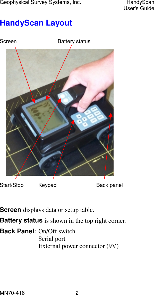
![Geophysical Survey Systems, Inc. HandyScan User's Guide MN70-416 3 HandyScan Operation 1. Install a charged battery. 2. Turn power On (switch is located on the back panel). 3. Wait until data screen appears (about 15 sec). 4. Check battery indicator (top right corner of the screen). 5. If a low battery is indicated, turn system off and replace. Using Setup Table: 1. Press Set on the keypad to display setup table, then: • Up/down arrows to select a parameter, • Left/right arrows to change it. Disp. Direction: normal / invert Disp. Mode : B / AB Amplitude : abs / offset X-axis : distance / time Depth : ns / -3 to 3 Contrast : (number) Date/time : 05/10/2001 Data_No. : 1 Dist adj. : +0 [0.00m] Output : printer / computer Baud rate : 57600 Default : NO](https://usermanual.wiki/Geophysical-Survey-Systems/HANDYSCAN/User-Guide-304145-Page-6.png)