GlobalSat WorldCom BT359 Bluetooth GPS Receiver User Manual
GlobalSat WorldCom Corporation Bluetooth GPS Receiver
UserManual.wiki
>
GlobalSat WorldCom
>
BT359 User Manual
User Manual
Navigation menu
Upload a User Manual
Namespaces
Wiki Guide
HTML
PDF
Info
Views
User Manual
Discussion / Help
Navigation
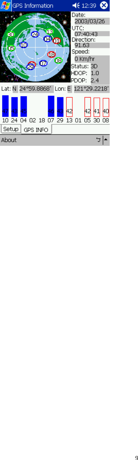
![85. How to test your Bluetooth GPS Receiver? The testing program only supports the Microsoft Windows CE & Pocket PC based PDA platform. 1. Run the “GPSinfo.exe” to execute the installation procedure of testing program (via PC and ActiveSync). 2. Run the “GPS Information” program from “Start → Program files” of PDA. Here is the description of “GPS Information” testing program: User must select COM port, Baud Rate (38400) and click the [Star GPS] button to start receiving GPS data. Note: The Bluetooth device in most of the applications have an “auto-detect” feature that you do not need to select the Baud Rate.](https://usermanual.wiki/GlobalSat-WorldCom/BT359/User-Guide-664057-Page-8.png)