LG Electronics USA 9QK-LN790 Mini Hometheater User Manual LAN B470N43 AA1ULLK ENG
LG Electronics USA Mini Hometheater LAN B470N43 AA1ULLK ENG
UserManual.wiki
>
LG Electronics USA
>
9QK-LN790 User Manual
>
User Manual 2
Contents
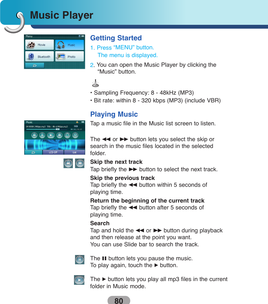
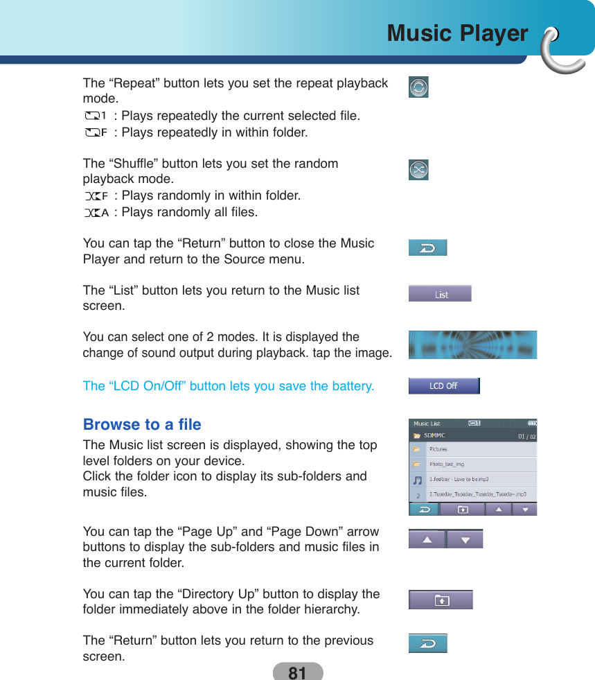
1.
User Manual 1
2.
User Manual 2
User Manual 2
Navigation menu
Upload a User Manual
Namespaces
Wiki Guide
HTML
PDF
Info
Views
User Manual
Discussion / Help
Navigation
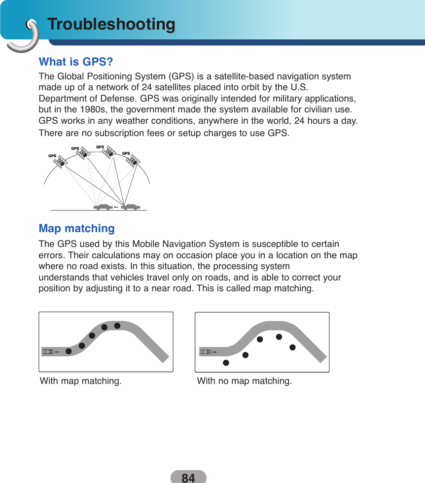
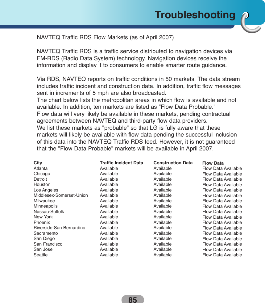
![71Using softwareIf maps from a previous version is located on yourcomputer, the following message is displayed:"Existing maps data found. Do you want to keep it?"Clicking “Yes” lets you install maps from previous versions.The following message appears when you haveselected an installed map and clicked the Actions button:"Selected maps shall be removed from your device.Are you sure you wish to continue?"If you close the PC Portal while install Navigator software, a map, importing or exporting a Favoritelocation, or backing up data. the following messageappears. : “if you will close the PC Portal now, the[process] shall not be completed. Are you sure youwish to close?”.If stored data is located on your computer, the following message appears:"Navigator Backup data found. Do you want to keepit?" It is recommended to keep backup data.Previous mapsRemove mapsBackup DataData Transfer](https://usermanual.wiki/LG-Electronics-USA/9QK-LN790.User-Manual-2/User-Guide-804549-Page-27.png)