Instructions For Use Of Raster
User Manual: Pdf
Open the PDF directly: View PDF ![]() .
.
Page Count: 3
Instructions for use of RasterModel.R
Program prepared for Dr. Amy Hurtford, Memorial University of Newfoundland, by Kevin
Bell as part of the MUCEP program.
The program required R packages rgdal and raster to operate. Its purpose is to take
shapefile exported from the government of Canada’s GeoGratis website and convert
them into raster files. A probability distribution is then calculated and overlaid on top of
the original raster map. The coordinates and cell values of the combined raster file is
then exported as a .CSV file and plotted using R base function.
Instructions for use:
1. Go to https://www.nrcan.gc.ca/earth-sciences/geography/topographic-
information/free-data-geogratis/11042 and click on the “Geospatial Data
Extraction” link
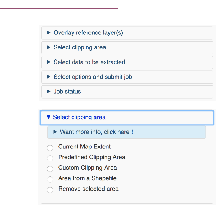
2. Click on the “Select clipping area”
3. Then select “Custom Clipping Area”
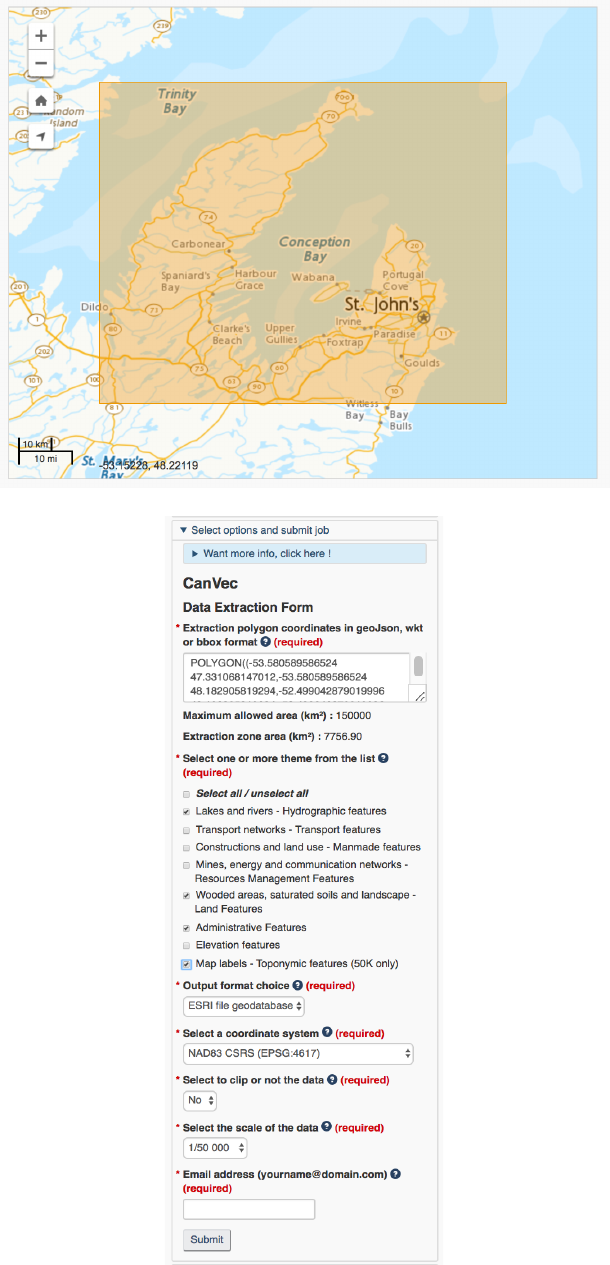
4. From here you can drag a rectangle over the area to be included in the shapefile
5. Then select the following options and add your email
6. An email will be sent to you with a link to the shapefile download URL. Open this
link and unzip the file that is downloaded. Be sure to put the file in your working
directory.
7. Open the R script and add the path to the shapefile to the dsn argument of the
function in line 47 and the name “shoreline_1” to the layer argument
shp = readOGR(dsn="/Users/kevinbell/Desktop/School/R Coding/Practice
Directory/Shoreline shp",layer="shoreline_1")
After these steps are completed the script will function. If you already have a raster file
that you want to added the distribution to comment out lines 47 and 49 and be sure to
name the raster: “rastermap”.
