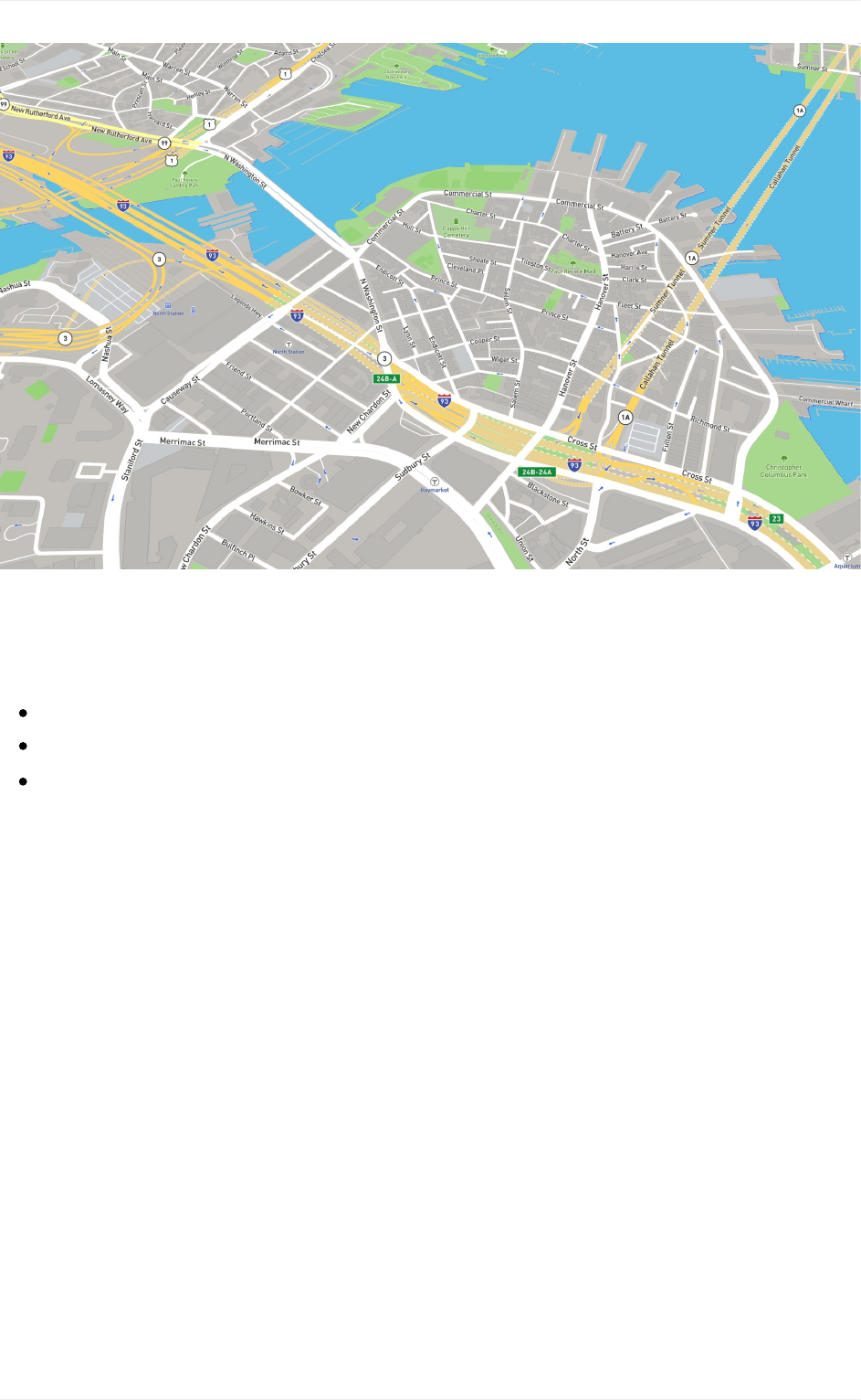
Cartography Guide To Map Design Part 1
guide-to-map-design-part-1
guide-to-map-design-part-1
guide-to-map-design-part-1
User Manual: Pdf
Open the PDF directly: View PDF ![]() .
.
Page Count: 80
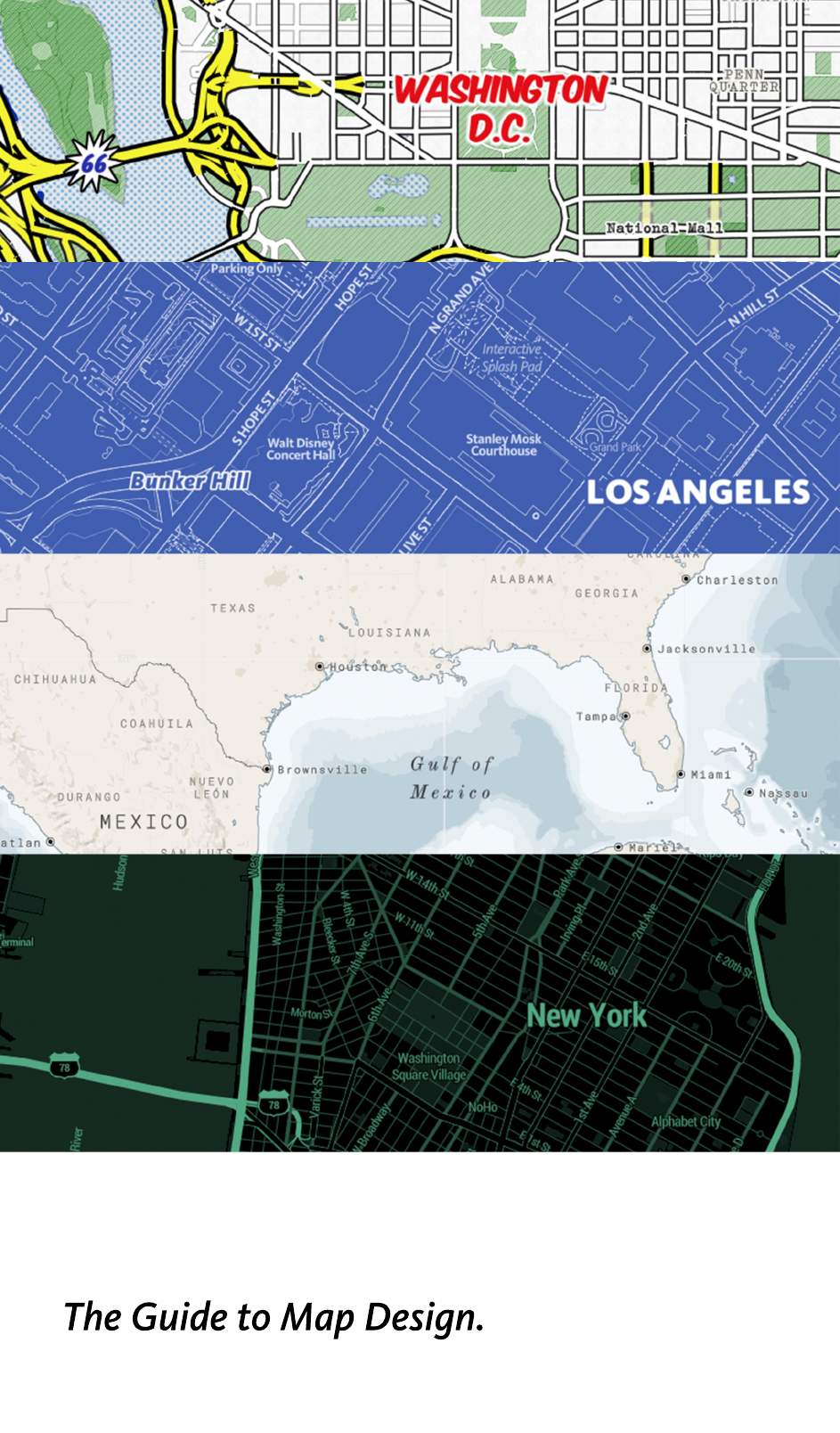
The Guide to Map Design.

3
4
5
8
9
10
14
22
25
29
30
33
38
42
45
46
48
50
53
54
58
59
60
61
64
66
70
73
75
79
TableofContents
Introduction
Howtousethisguide
Howvectormapswork
Bestpractices:Mapdesign
Designelements
Color
Typography
Iconography
Texture
Designprinciples
Contrast
Hierarchy
Density
Legibility
Specialconsiderations
Mapsformobile
Mapsfornavigation
Mapsfordatavisualization
GettingstartedwithMapboxmaps
Mapbox-providedtilesets
MapboxStreets
MapboxTerrain
MapboxTraffic
Mapbox-providedmapstyles
Basic/Bright
Streets
Outdoors
Dark/Light
Satellite/SatelliteStreets
AbouttheAuthor
1

2
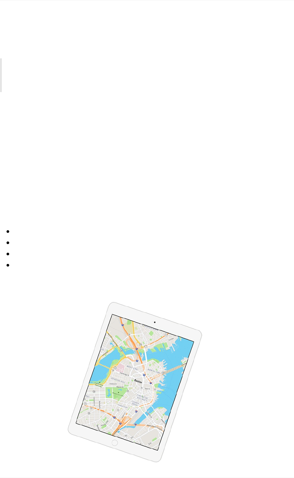
TheGuidetoMapDesign
Cartographyisadesignanddatasynthesisthatbalancesinformation,color,readability,
andaccuracy.Theessentialsofgoodvisualcommunicationarekeytomakingamap
thatguideswhileencouragingvisualexplorationandquickcomprehension.
Modernmappingtoolsandtechnologiesallowproductownerstoarchitectelegant,
consideredmappingexperiencesfortheirproductsandendusers.ToolslikeMapboxStudio
andMapboxGLJS,giveproductownerscontrolnotonlyoverthelookandfeeloftheir
maps,butalsooverthemap'sresponsivenesstouserinputs,environments,
andother factors.
Whydesigncustommaps?
Asyounavigatetheworldit’simportanttoknowwhereyouareinrelationshiptowhereyou
aregoing.It’salsoimportanttounderstandcontextalongtheway—whatwillyoufindonthe
wayfromheretothere?Designingacustommapforyourbrandorproductallowsyouto:
Keepusersvisuallyconnectedtoyourbrandandinyourappastheyusethemap.
Highlightordownplayinformationasnecessarytoyourmap'susecase.
Designabasemapforyourdataandproductnarrativetobuildinteractionsupon.
Integrateuserinputsandenvironmentsintotheirexperiencewithyourbrand
inreal-time.
Introduction
3

Howtousethisguide
Designingacustommapstyleforyourproductorbrandstartswithcontextand
intention.Beginyourjourneybyanswering,"Howwillthismapdesignreinforcethe
informationandexperiencemybrandorproductaimstoconvey?"
Thisguidewillleadyouthroughtheprocessofdefininganddesigningyourcustommap
style.Itwill:
Explainhowvectormapswork
Illustratesomebestpracticesinmapdesign,suchas:
Customizabledesignelements:color,typography,texture,andiconography
Principlesofgoodmapdesign:visualcontrast,hierarchy,density,andlegibility
Specialconsiderationsfordesignmapsfornavigation,mobile,anddatavisualization
GetyoustartedwithMapboxmaps
Definetheglobalcoverageandzoomlevelsprovidedwithwebmaps
DescribeMapbox-providedmapstylesandwhentousethem
DescribeMapbox-providedvectortiles(data)andwhatitcovers
Let'sgetstarted!
Howtousethisguide
4

Howvectormapswork
Beforedesigningasingleroad,waterway,orcitylabel,it’simportanttounderstandhow
vectormapsfunction.
Vectormapsareanadvancedapproachtomappingwheremapdataisdeliveredand
preciselyrenderedinreal-time.Theyaredeliveredtothebrowserormobiledeviceusing
WebGLorOpenGLwhichdynamicallydrawsdatawiththespeedandsmoothnessofa
videogame.Theresultfastinteractivemaps.
Sincethemapisliterallybeingdrawninbrowserordevice,youcandynamicallychange
styledelementsduringruntime.Lightenordarkenthemapbasedonthetimeofday,
personalizeiconsandthecolorsbasedonuseractivity,switchlanguagesonthefly,or
bump labelsizesbasedonuserpreferencestoimprovelegibility,allinrealtime.
Avectormapsconsistofthreeworkingparts:1)therenderer,2)thevectortiles,and3)
the stylerules.
Howvectormapswork
5
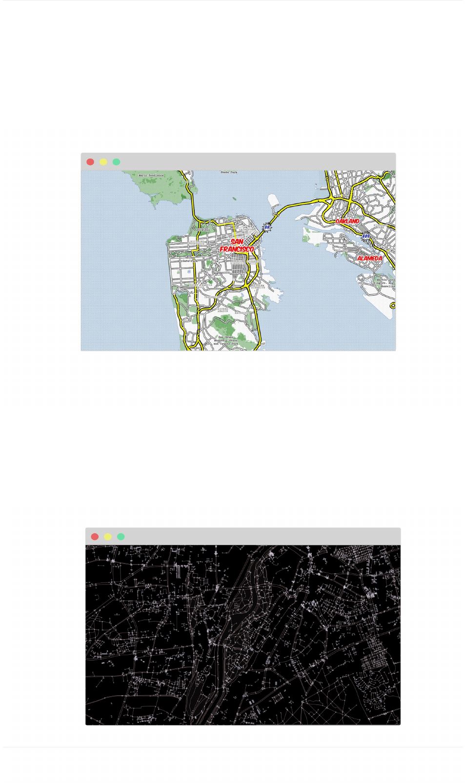
2) Thevectortiles
Thevectortilesetisasetofpoints,lines,andpolygonsthatrepresentnaturalandmanmade
featuresacrosstheglobe.Vectortilesetsdescribethegeometryofeachfeature,wherethey
belong in the world, and other key properties. They do not include any inherent style
properties. This data is optimized in vector tile format which renders the data lightweight and
ready for delivery on mobile or web platforms.
Howvectormapswork
6
1) Therenderer
VectormapsarerenderedwithMapboxGL.MapboxGLusesthepowerofWebGLto
combinevectordataandstyleinstructionsanddrawthemintheclient.Todisplayamapin
webbrowsers,usetheJavascriptlibraryMapboxGLJSwhichdrawsthemapandallowsfor
motion and interactivity to be incorporated with code. For maps in native applications such as
Mapbox iOS and Android SDKs, use Mapbox GL Native.
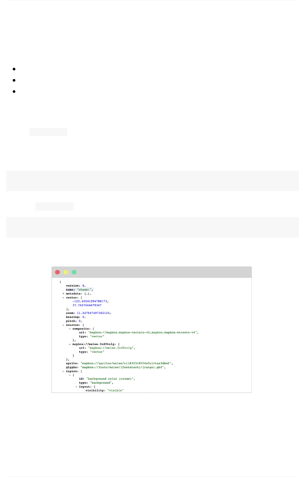
3) Thestylerules
ThemapstyleitselfiswrittenasruleswhichdefineitsvisualappearanceusingtheMapbox
GLStyleSpecification.Itspecifies:
Whatdatatodraw
Whatordertodrawthedatain
Howtostylethedatawhendrawingit
Don'tworryyoudon'thavetotouchalineofcode.MapboxStudio'sstyleeditorprovidesthe
userinterfacewhereyoucandefineyourmapstyle.Behindthescenes,Studiocreatesthis
filethe style.jsonandhostsitontheMapboxStylesAPIwhenpublished.Thisstyleis
thenaccessibleviaendpointtoaddtoyourmobileorwebapp.
ViewtheliveversionofmapstylehostedontheMapboxStylesAPIataurllike:
https://api.mapbox.com/styles/v1/mapbox/streets-v9.html?<access-token>#0/0/0
Viewthe style.jsonstylerulesdocumentataurllike:
https://api.mapbox.com/styles/v1/mapbox/streets-v9?<access-token>#0/0/0
Howvectormapswork
7

Bestpractices:Mapdesign
Mapdesignisessentiallyadesignproblemthatrequiresdesignthinking,planningand
vision.(Thisisthefunpart.)
Inthissection,wewilllookatthedesignelementsinyourmapstylethatshouldbe
customizedtoreflectyourproductorbrand'sdesignaesthetic.Youhavecompletecontrol
overyourmapstyle—infact,anyfeaturecanbecustomized.Werecommendyoubegin
designingthefollowingelements:color,typography,iconography,andtexture.
Next,wewillintroducesomedesignprinciplesimportanttocartography.Adheretothese
principlesasyoudesigntoensurethevisualrelationshipismaintained.Theseprinciplesare
nottobeappliedinisolation,butinsteadarecomplementary.Collectively,theyhelp
cartographersandmapdesignerscreatemapsthatsuccessfullycommunicategeographic
information.
Bestpractices:Mapdesign
8
Designelements
Considerthefollowingelementstobethecustomizablepartsofyourmap.Thebestplaceto
identifythedesignelementsforyourmapisinyourproductorbrand'sstyleguide.This
styleguideshouldcontainfonts,colors,imagery,etc.specifictoyourbrandandhelpyou
makedecisionsaboutyourmap'scustomization.
Typically,youwantyourmaptomatchyourbrandortocomplementyourbrand'suser
interface.Let'srevieweachdesignelementindetailtoseetheimpacttheyhaveonyour
mapstyle.
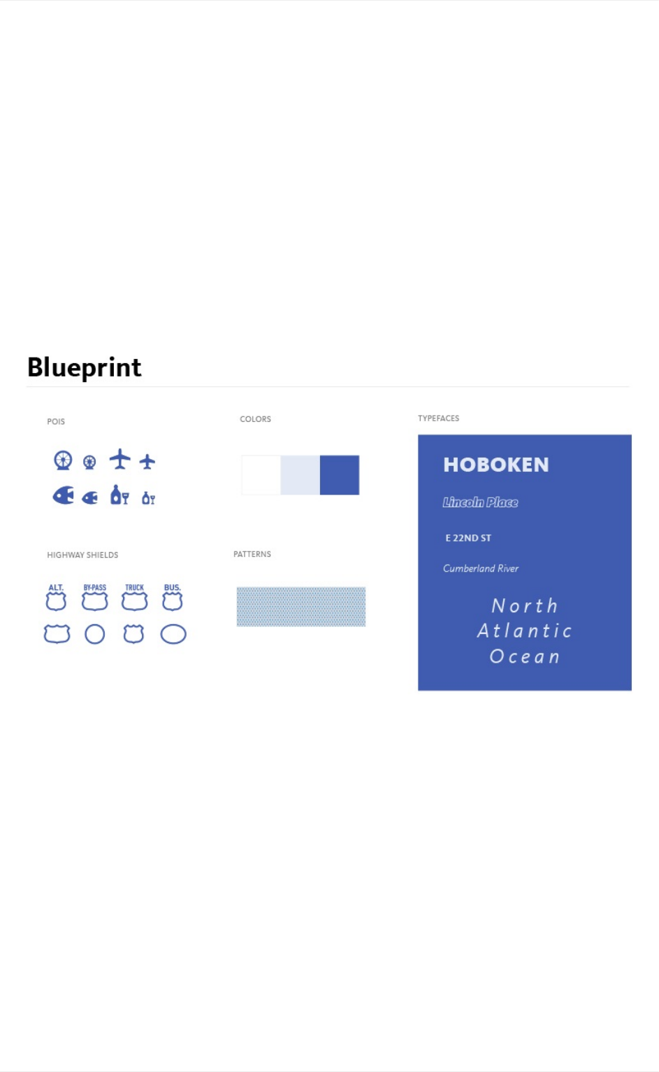
StyleguidefromtheBlueprintmapstyle.
Designelements
9
Color
Colorisusedindesigntoattractattention,groupsimilarelements,showmeaning,and
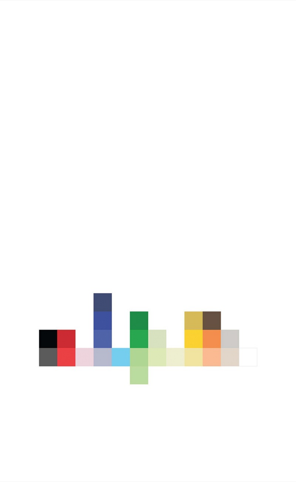
enhanceaesthetics.Wetypicallybeginthedesignprocesswithacolorpaletteforeachmap,
comprisedofacohesivegroupofprimaryandaccentcolors.Thisisaniterativeprocess.
Colorswillmostlikelygrowandmorphonceyoustartdesigningandseeingwhatworks
togetheronyourmap.Justmakesureyourfinalmapandpaletteareconsistentandwork
harmoniouslytogether.Belowareafewthingstoconsiderasyoudefinethecolorpalettefor
yourcustommap.
NumberofColors
Usecolorconservatively.Theeyecanonlyprocesssomuchatatime,soalimitedcolor
paletteisbest.Dependingonthecomplexityofyourmapdesign,between10-12colorsis
prettystandardforafull-bodycolorpalette.Alsoconsiderasignificantportionofthe
populationhaslimitedcolorvision,sostyleaccordingly.
BothMapboxStreetsandMapboxOutdoorsusearoundadozenuniquecolors,butavariety
ofshadesandtints.
Manyconceptuallysimilarfeaturessharethesamehuevalue,toreinforcetheirmeaningand
createamorecohesivemap.
Color
10
MapboxStreetcolorvariety
Limitingyourcolorswillalsohelpwithvisualharmony.Forexample,manyfeaturesrelated
tonavigationandtransportationsharethesamebluehue:raillabels,highwayshields,ferry
routes,andevenroadcasingsforthispurpose.
MapboxStreetsbluetransiticons
Color
11
ColorConsistency
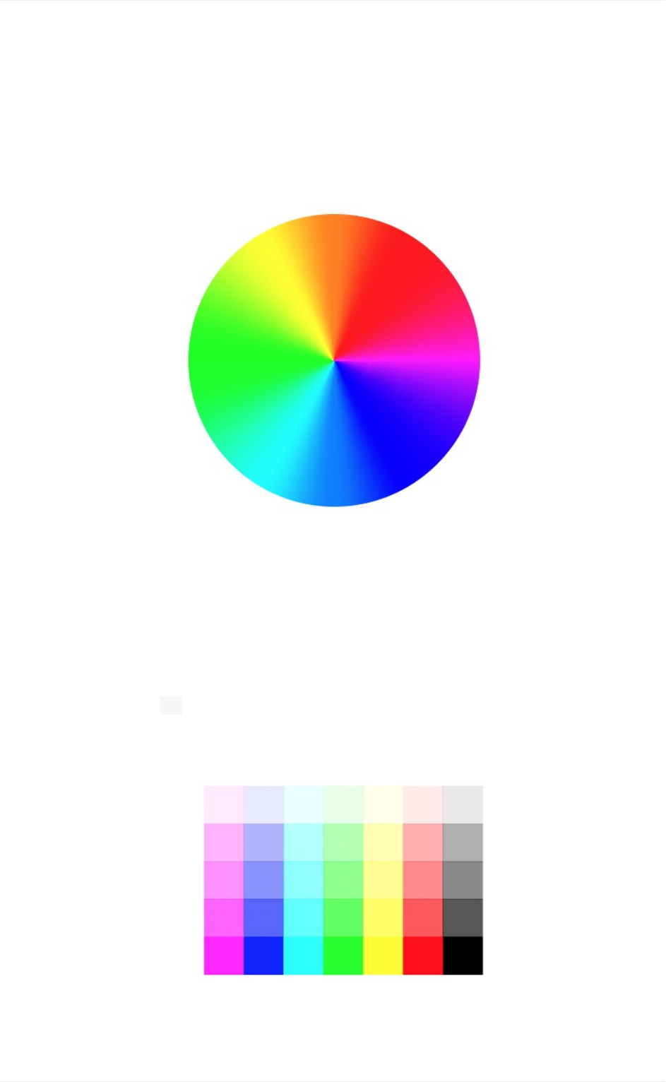
Youcanmakesubtleadjustmentstoyourcolorpalettewhilemaintainingvisualharmonyby
usingthesamehuebutalteringthecolor'ssaturationorvaluelevels.Thehuevaluesimply
representsthecolorofaniteminthecolorwheel.
Saturation
Saturationrepresentsthelevelofintensityinthecolororthecolor'sdominance.Asyou
decreasethesaturation,thehuewebecomeslessvibrantandthecolordominateslessand
less.Whenyoureach 0saturation,nohuedominatesandyouendupwithadullgray
color.
Color
12
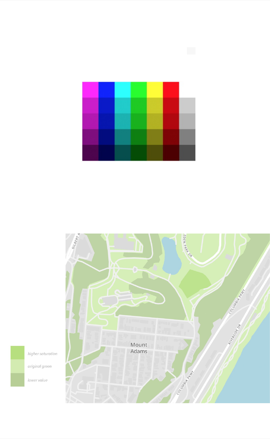
Valueisthedimensionoflightness/darknessdescribingtheoverallintensityoflightinthe
hue.Asyoudecreasethevalue,thehuebecomesdarkerandat0becomescompletely
black.
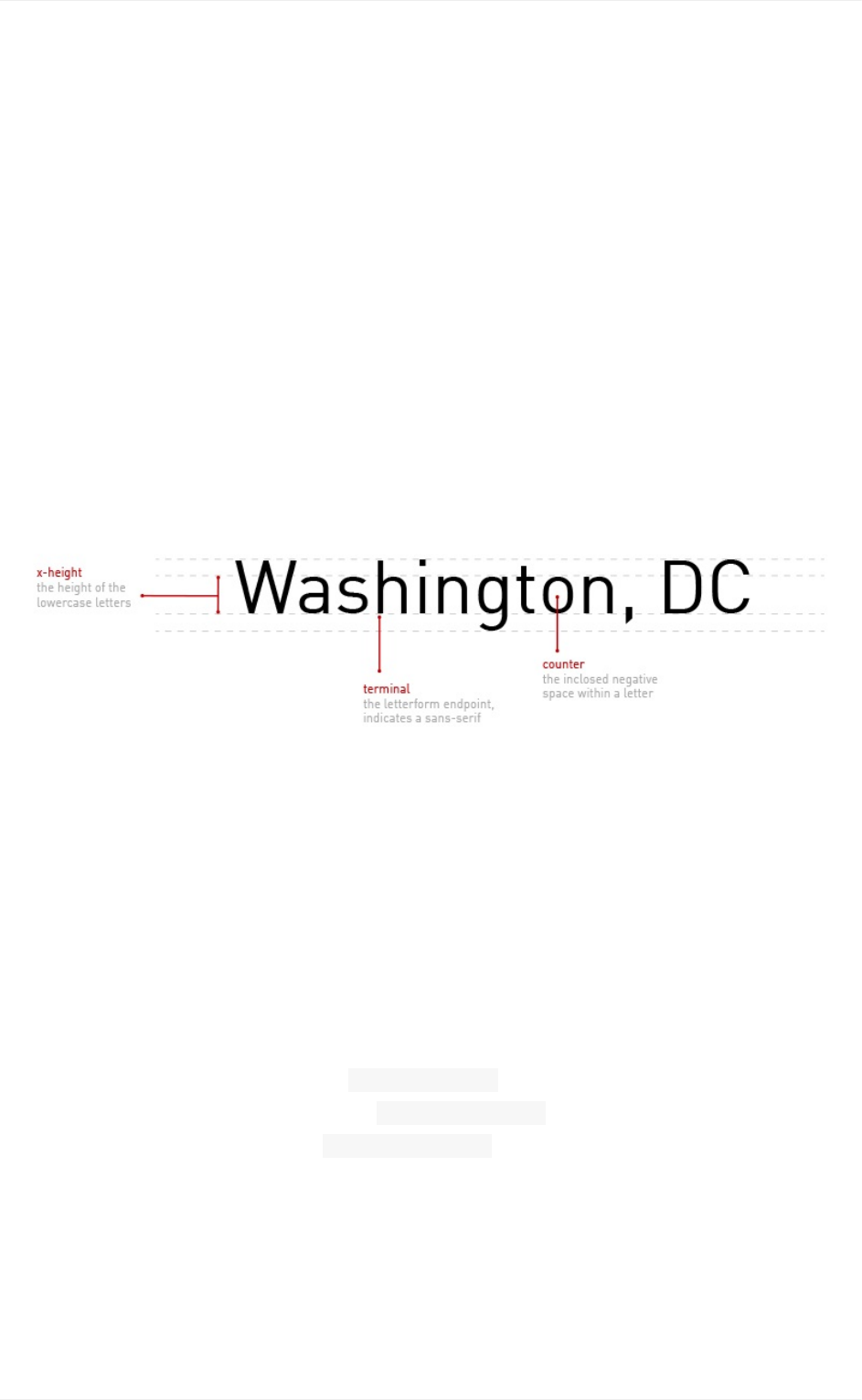
Let'ssayyoustartwithapalegreenfromyourcolorpalettetousetostyleparkpolygons.
Thendecideyouwanttodifferentiatebetweenwoodedareasandgrass.Takingtheoriginal
green(shownbelow),I'vecreatetwonewcolorsbyloweringthevalueforadarkergreen
andthenaddingsaturationforabrighter.Resultinginthreecolorvariationswithinthesame
hueandharmoniously.
Color
13
Value
Typography
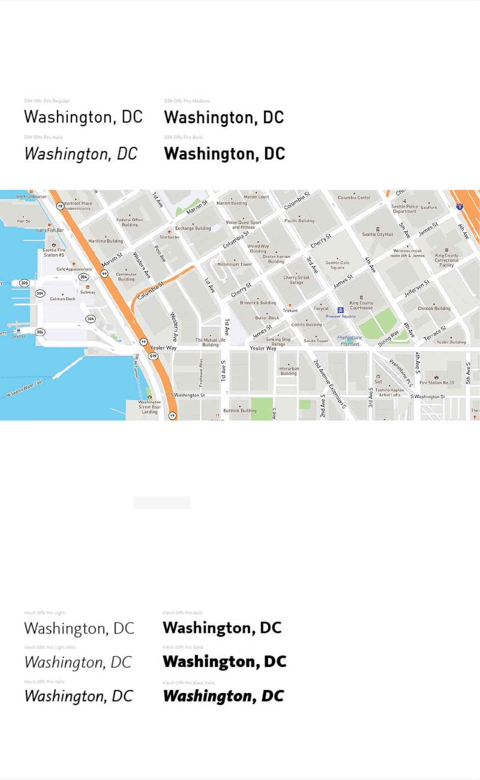
Typographyisoneofthemostimportantdesignelementsofyourmapandcanmakeor
breakthereadabilityofyourmap.Labels,whichrepresentmostofthetextyoufindinmaps,
areoftenonlyonetothreewordslongandaredisplayedatverysmallsizes.Withthis
constraintfontswithtallerx-heights,opencounters,andnoserifsusuallyworkbeston
maps.
Yourbrand'sfontmayormaynotworkforyoumapstyle.Inthatcase,chooseafontdirectly
fromStudiothatbothworksforyourbrand.Considerthefont'squality,readability,and
personality.
Quality
Highqualityfontsofferavarietyofstyles:Italics,Caps,CapsItalic,andSmallCaps,
weights:UltraLighttoUltraBlackandeverythinginbetween,andwidths:Condensed,
Narrow,Normal,Mono,andExpanded,justtonameafew.Youcanleveragethisvarietyto
easilydifferentiatebetweenlabelsandshowhierarchyinyourmapstyles.
TheprimaryfontforMapboxmapsis DinOfficeProformapstylesusedintheMedium,
Italic,Regular,andBoldvariety.Weuse ArialUnicodeMSasourfallbackfonttomakesure
yourmaphascompletelanguage. ArialUnicodeMSismappedtothestandardUniversal
CharacterSetwhichsupportsawiderangeofgloballanguages.1Mostprofessionalfontsdo
notcreatecharactertosupportalllanguages,soaunicodefallbackisnecessarytoensure
globalcoverage.
Typography
14
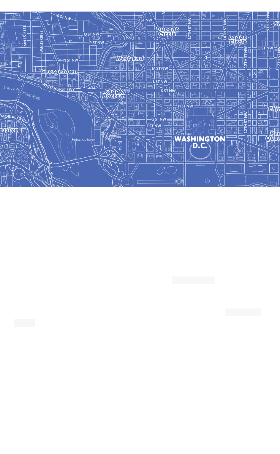
Blueprint
TheBlueprintstyleisveryminimalistandisprimarilydrivenbyonehueandonesuperfamily
typeface.Thetypefaceis FFKievitatypefacethatexploresthesynthesisofthesansserif
formtothestructureandproportionsofatraditionalseriffont.Thefamilyspansnineweights
andincludessmallcaps,trueitalics,andmultiplefiguresets–everythingnecessaryfor
creatingsophisticatedtypographicsystems. ThistypefaceshipswithStudioandonly
employedLight,LightItalic,Italic,Bold,Black,andBlackItalicvariations.
2
Typography
15
Mapbox Streets
Readability
Readabilityisaboutarrangingwordsinawaythatallowsthereaderseyetoaccessthe
contenteasilyandintelligibly.Thisskilltakestimetohoned,buthereareafewstellarways
togreatlyenhancethereadabilityofyourmaps:
1. Diversityoflabelclassifications.Designdistinctionintotheclassificationsand
propertiesavailableinyourlabeldata.Forexample,placelabelsofferclassifications
ofcities,towns,villages,neighborhoods,andmore.Createasystemoftreatmentto
distinguishthisdiversity.
2. Diversityoflabelcolors.Thiscanbesubtlyenforcedbyalteringthesaturationor
valueofthesamehueasshownintheColorsection.Thisworksparticularlyforstyling
pointsofinterest(POIs)togivedistinctiontocategoriesofpoints,likecafesorschools
havingdistinctcolors.Butkeepitmoderate.
3. Controlthespacing.Letterspacing(oftencalledtracking)adjuststhespacingbetween
allthelettersinapieceoftext.Thiscanhelptomakeyourlabelslookmoreopenand
inviting.Tinytypeismademorereadablebyopeningtheletterspacingabit.Aswith
everything,usecautiontrackingisoftenwildlyoverdone.Alsomonitoryourlabelwidth,
thisdetermineshowmanylettersfitononerowbeforealine-breakoccurs.Something
tobemindfulofwhenworkingwithBold,Blackorjustmoreheavilytypefaces.
Typography
16
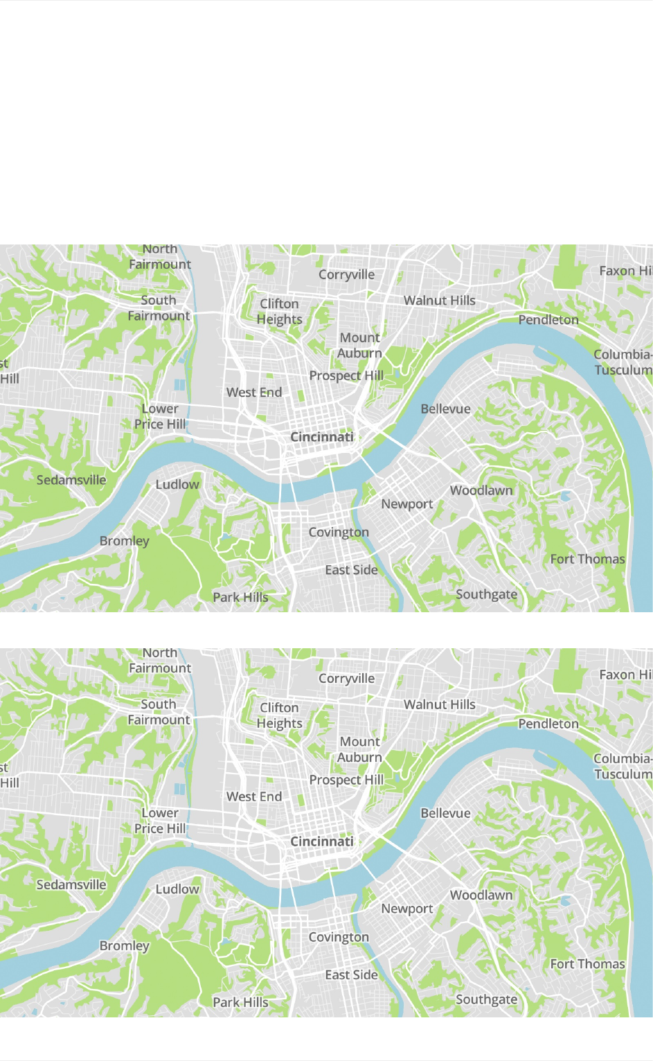
Texthalosbringyourlabelstotheforegroundvisuallyandhelppreventbackground
elements,suchasroads,waterways,etc.,fromdilutingthecomprehensionofyourlabels.
Thespecifictreatmentherewillvaryfromdesigntodesignbutyouwanttopullyourlabelsto
theforegroundwithoutmakingthehalosobvious.
Takealookatthebeforeandafterbelowshowingasmallhaloeffect.Noticehowmuch
easieritistoreadthetextafterapplyingasmalltouchofhalo.
Before:Notexthaloappliedtolabels
After:Withtexthaloapplied.
Typography
17
Texthalos

Personality
Thepersonalityofatypefacespeakstothevoiceandenergyitexudes.Majortypeface
stylesaresansserif,serif,andscripthoweversansseriffontsarepopularontheweband
mobilebecauseofthelowerDPI(dotsperinch)onscreens.Threemaintypesofsansserif
fonts:humanist,transitionalandgeometric.Humanistsans-seriftypefacesmimic
handwritingandevokeafeelingofwarmthandpersonality.Transitionalsansseriftypefaces
havestrongstrokesandaremoreuprightanduniform.Theytypicallyhaveanunassuming,
authoritarianandmodernpersonality.GeometricSansSeriftypefacesusegeometricshapes
toformthebackbonesoftheletters,whichcreatesastrict,objective,anduniversalfeel.
Thefactisthedetailsofatypeface–suchascontrast,proportionsandangles–canhavea
bigeffectonitsemotionalcharacteristics.Tohelpyoudecide,herearefivequestionsyou
shouldaskofanytypefaceyou’reconsidering…
Purposeandmood?
Seriforsansserif?
Collaborativeorcontrast?
Creativeorclassic?
Takealookatsomepersonalityofthesefontsusedinafewofourdesignermapstyles.
Typography
18
Typography
19
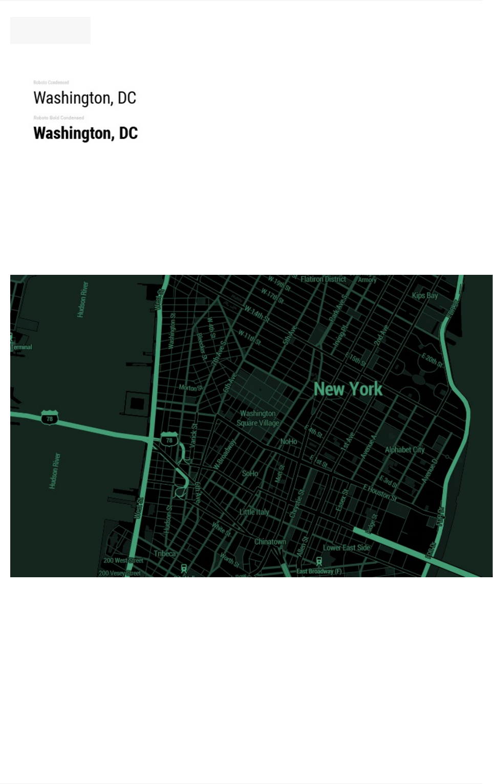
Roboto:Modernyetapproachable
DecimalusesRobotoCondensedandRobotoBoldCondensedto achieve this modern
yet approachable feeling for it's dark but vibrant map style. GoogledescribesRobotoas
"modern,yetapproachable"and"emotional".Condensedfontsgrabyourattentiondueto
theirslender,high-reachingverticalrealestate.Thisfontpairsverynicelywithsuchan
extremecolorpaletteandfeeloverlytechnicalwiththeterminal,computerwhiztheme.
Typography
20
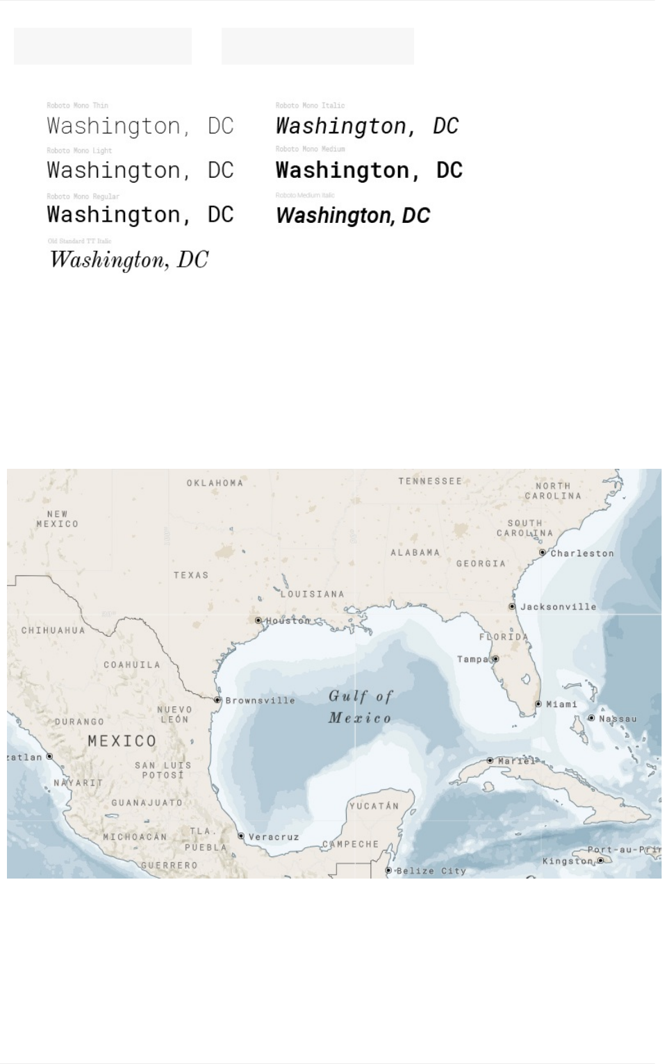
RobotoMono& OldStandard:Modernclassic
NorthStarusesRobotoMonoinavarietyofweightsandstyles.While"modern,yet
approachable"themonospaceformatwhichhavethelettersandcharactersoccupythe
sameamountofhorizontalspacesimilartotheletteringthatwouldcomefromanold-
fashionedtypewriter.NorthStarpairsthisfontwithgentletouchesofOldStandardTT.
Anothermodern,yetclassiciststylefontbutwithserifevokinganolder,classicfeelingofthe
late19thcentury.Thiscombinationspromotestheoldmodernmixofthismapstyle.
https://en.wikipedia.org/wiki/Unicode_font
https://www.fontshop.com/families/ff-kievit
1
2
Typography
21
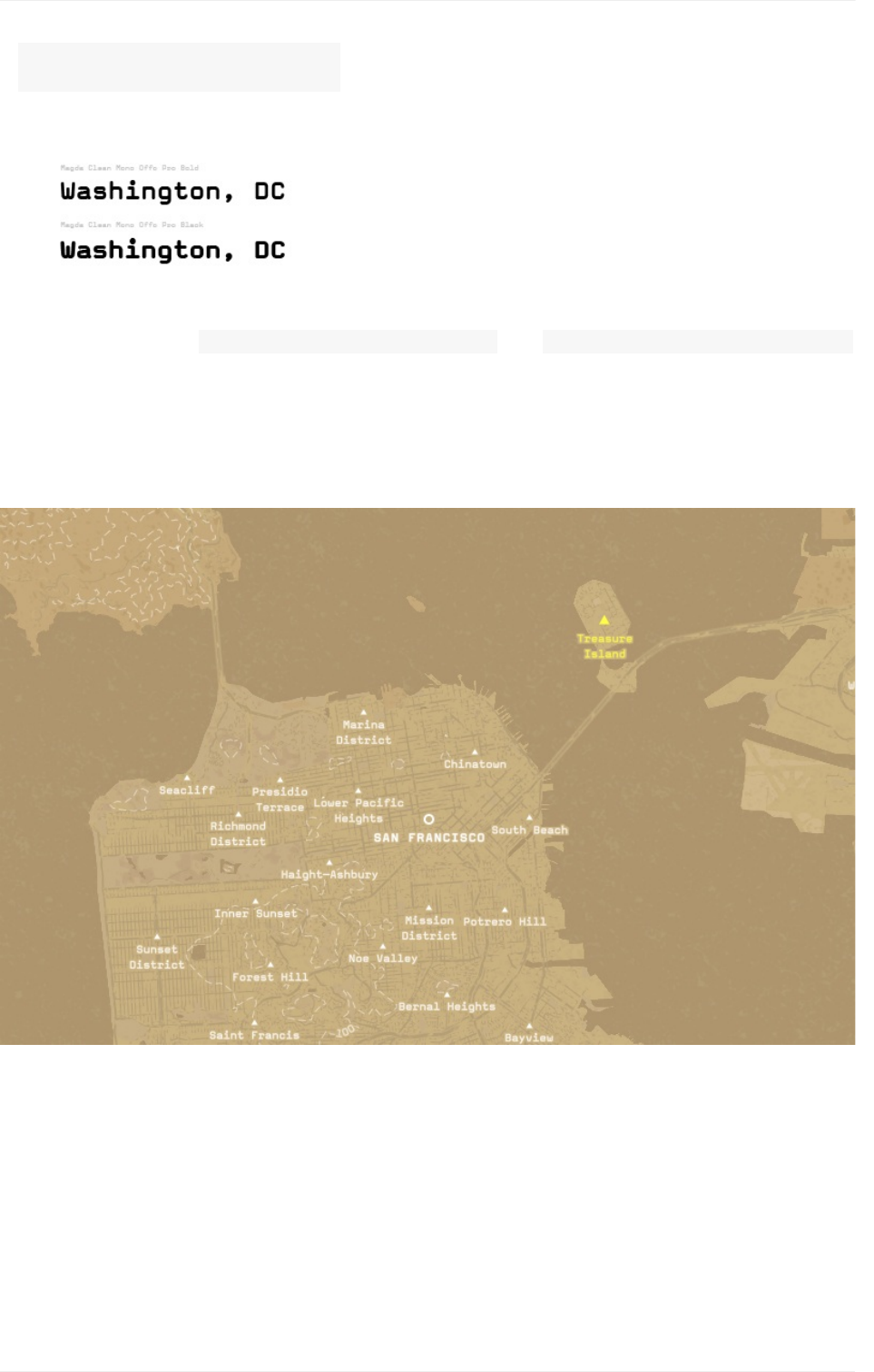
MagdaCleanMono:Nostalgicgrunge
Desertplanetuses MagdaCleanMonoOffcProBoldand MagdaCleanMonoOffcProBlack,
bothavailableinMapboxStudio.Anothermonospace,thisfonthasaboxytypewriterlook
givingitathrowbackappeal.Thereisalsoagrungy,edginesstothewidelettersandthe
letterspacingaddedtotheselabels.Thisfonthastonsofpersonalityandaddsastrong
narrativetothisdeserted,almostdystopicmapstyle.
Iconography
TheiconsyouuseonyourmaptypicallyindicatepointsofinterestorPOIs.Thesecanbe
anythingfromlibrariestocafestomuseumstobusstops.Theiconsyouuseinyourmap
shouldreinforceyourbrandandstrengthenyourmap'sbrandrecognitionandreadability.
Successfulmapiconsmustbewidelyrecognizableevenacrosscultures,assimpleas
possible,andlegibleatsizesassmallas11px.Creatingyourowncustommapiconsfor
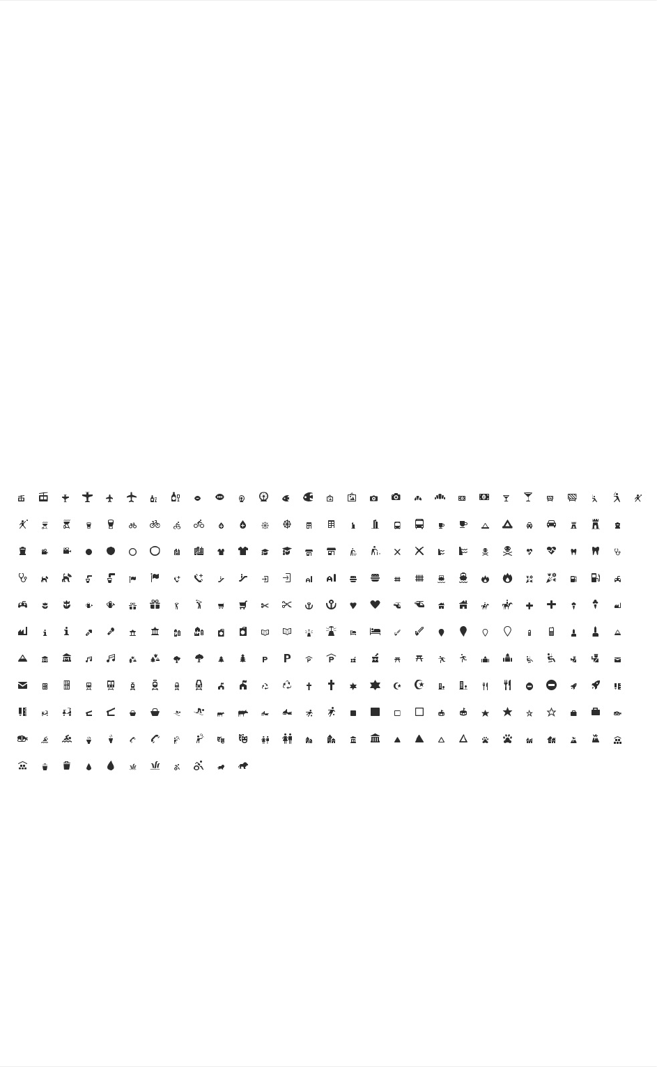
eachprojectisrathertime-consuming,soMapboxhascreatedacollectionofpixel-aligned
pointofinteresticonsmadebycartographersforcartography.Thiscollectionoficonsis
calledMaki.
Makiaimstobethemosthighquality,consistent,andcomprehensivepointofinteresticon
setpossible.MakiiconsaredesignedsimplyandworkseamlesslywithMapboxStudio.The
Makiiconeditorallowsyoutocustomizethestyleofyouriconsyoucanaddandremove
theseicons,categorizeandstylethemingroups,anddownloadthemforyourmapstyles.
Iconography
22
Full Makiiconset.
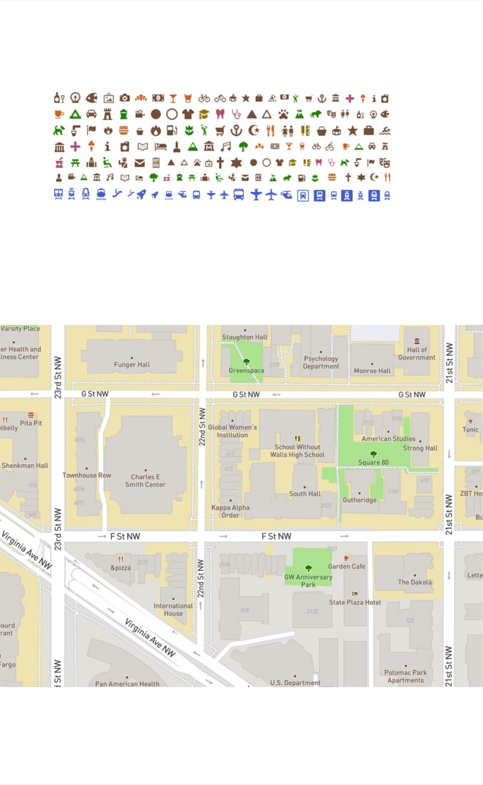
MakiiconsusedinMapboxStreetsmapstyle.
Noticethattheiconsaregroupedandstyleintofamiliarcategories.Forexample,thefood
categoryisallorangeandthetransitsallblue.Thesegroupingshelptheviewerrecognize
andfindPOIsmoreeasierastheynavigatethemap.
Styledandcategorizediconseachwithalightstroketopullthemslightlyfromthe
backgroundintheMapboxStreetsmapstyle.
Iconography
23
MapboxStreetsicons
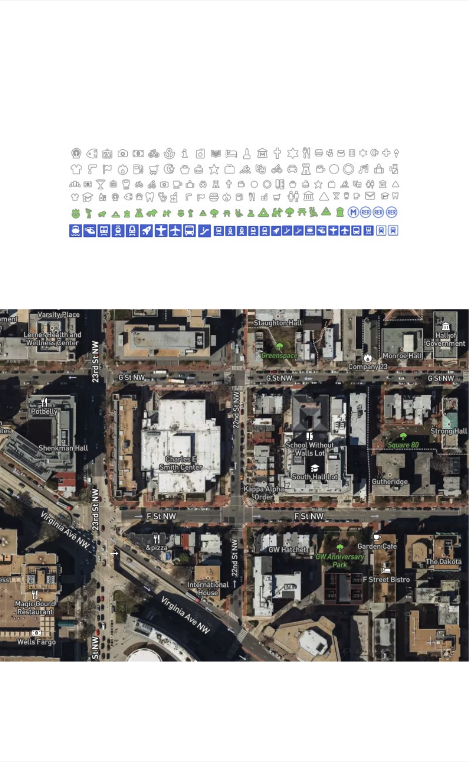
MapboxSatelliteStreetshoweverdealswithaSatelliteimagerylayer,andthisrequiresa
differenttreatmentoftheiconstoensuretheyarelegibleovervaryingterrainandurban
landscapes.
MakiiconsusedinMapboxSatelliteStreetsmapstyle.
SimplewhiteiconswithadarkgraystrokethatblendswithvaryingterrainforMapbox
SatelliteStreetsmapstyle.
Iconography
24
MapboxStreetsicons
Texture
Textureisanaddedbonusinyourmapdesigntoolkit.Itrepresentstheperceivedsurface
qualityofadesignpiece.Patternscanbeaddedtomapfeaturestodifferentiateorblend
elements.Theycanalsostandindependentlyasatextureforthemaporfullbackground
patterns.
TexturesneedtobeseamlessusproperlyapplythemtoyourmapsinMapboxStudio.A
seamlesstextureisanimageorpatternthatcanbeplacedside-by-sidewithitselfwithout
creatinganoticeableboundarybetweentwocopiesoftheimage.
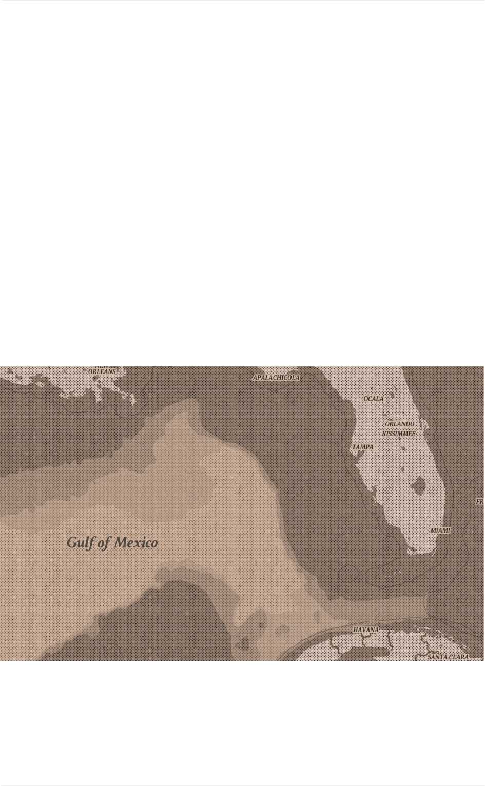
Addinganagedtexture
TheVintagemapstylewasdesignedtomimicthelookandfeeloftraditionalprinted maps.
The aged patternisappliedtothelandandbathymetrycustomthat was dataaddedtothe
map style.Over two dozen layers were styled layer-by-layerataverylowopacitywith
slightlydifferentcolortintstoget thiseffect.
Texture
25
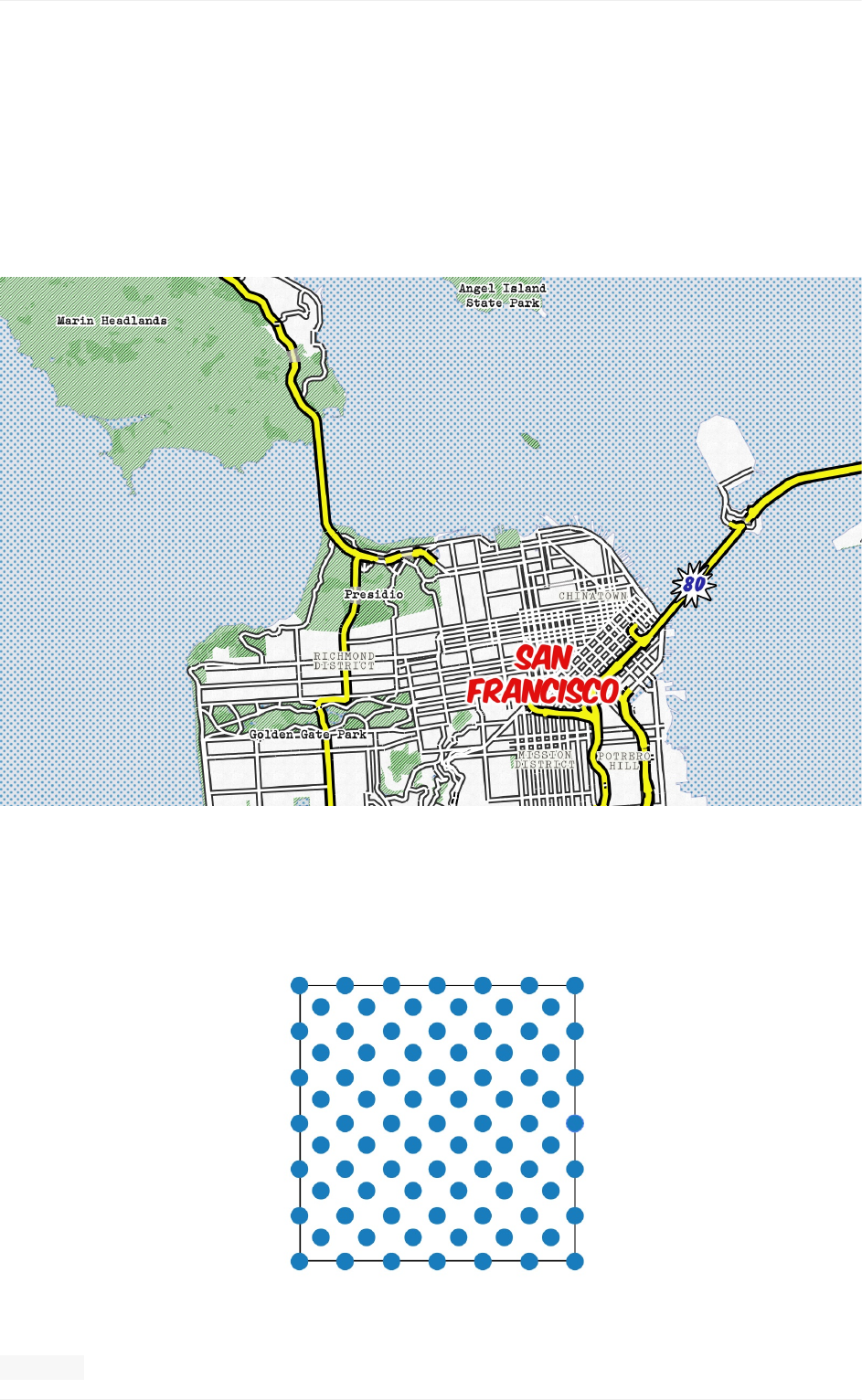
Acontrastingbluedotpatternappliedoverlightbluewaterandvibrant,greenlinetexturefor
park-typelanduse.
32x32pxtextureappliedtowaterfortheWhaam!mapstyle
Texture
27
Addingapopartfeel
TheWhaam!mapstyleemploysbright,playfulpatternstoshowbothtextureandevokethe
feelingofthispopartinspiration.Theentirewaterfeatureisfilledwithabluedotpattern.
Landusepolygonfeaturesareallclassifiedseparatelywithagreenstripedpatternandare
slightlytransparent.Thisallowsforareaswithoverlappinglandusetypestoappeardarker
showingelevationandhillshadingintheland.
Designprinciples
Herearesomeofthecoredesignprinciplesthatcartographersandmapdesignersapplyas
theystyletheirmaps.Togethertheseprinciplesformasystemforseeingandunderstanding
therelativeimportanceofthecontentinthemapandonthepage.Withoutthese,map-
basedcommunicationwillfail.Thefourdesignprincipleswewillcoverinclude:
Contrast
Hierarchy
Density
Legibility
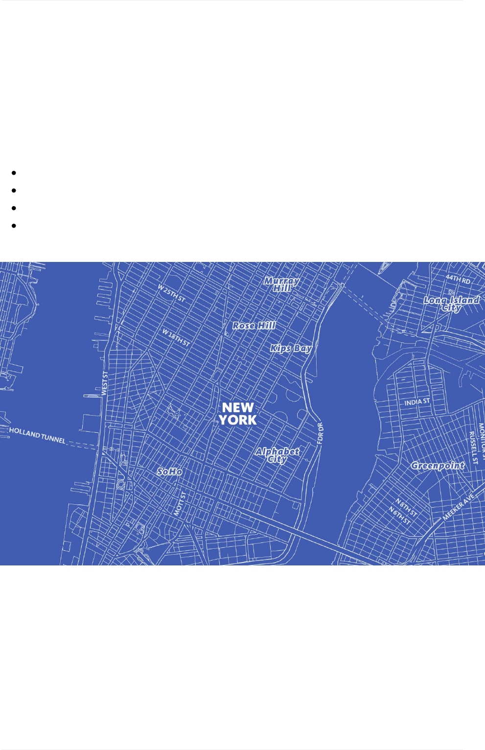
Blueprintmap style
Designprinciples
29
Contrast
Humanbeingsarewiredtonoticedifference.Thisiswhatmakescontrastsuchapowerful
designprincipleinmapdesign.Contrastattractsattentionanddrawstheeye.This
separatesfeaturesfromthesurroundingelementsandcaninstantlycreateemphasisand
interest.Inadditiontoattractingattention,contrastestablishesboundariesbetween
elements.
ColorContrast
Keepahealthyamountofcolorcontrastinyourmapstyletokeepitvibrantandlegible.You
don'twanttoomuchcontrastoryourcolorscouldscreamattheviewer.Ifyourcolorsaretoo
mutedtheymaystarttoblendtogether.Increasethesaturationofyourcolorstopushthe
contrastifnecessary.
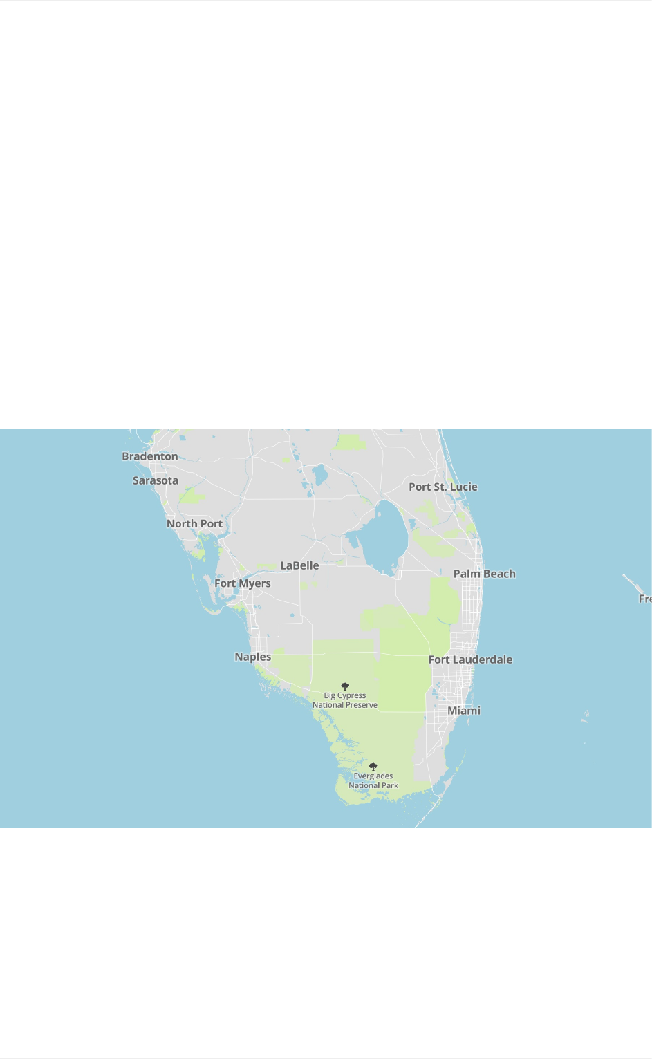
Lowcontrastmapwithsoft,lesssaturatedblue,greens,andabaselinegrayforlabels.
Contrast
30
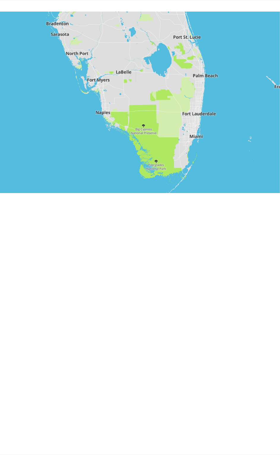
Highcontrastmapwithvibrantmoresaturatedblues,greens,andadarkergrayforlabels.
Contrastandreadability
Theamountofcolorcontrastinyourmapstylecanaffectyourmap'sreadability.For
example,thetextlabelsandiconographycouldeitherblendintothebackgroundelementsor
standoutinaglaringway.Keepthisinmindasyouareworkingwithyourmap'scolor
palette.Ahealthyamountofcolorcontrastinyourstylewillhelpthosewithlowvision,color
blindness,orworseningvisionbetterseeandreadthetextonyourmap.Makesureyou
haveafairamountofcontrastbetweenelements,butnottoomuch.
Contrast
31
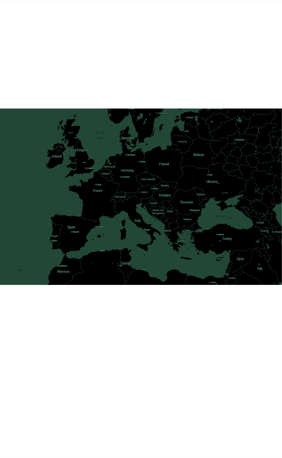
Decimalmapstyle,TristenBrown
Contrast
32
Visualizing data
Many maps use bright, primary colors against a stark, muted background map to highlight
important elements or show data visualizations. As long as there is simplicity and harmony
within your color palette this technique works well and can be super easy to customize or
alter with other color schemes. Decimal is one such style. This minimalist map style that
works great as a base for data visualizations or as a backdrop for your next game.
Hierarchy
Hierarchyhelpsviewersfocusonwhatisimportantwhileidentifyingpatterns.Astrong,
visiblehierarchicalasystemisoneofthemosteffectivewaystoincreasecomprehension.
Colorandscalearetwomajordesignelementsyouwanttofinessetoleveragethevisual
hierarchyofyourmapstyle.
Color
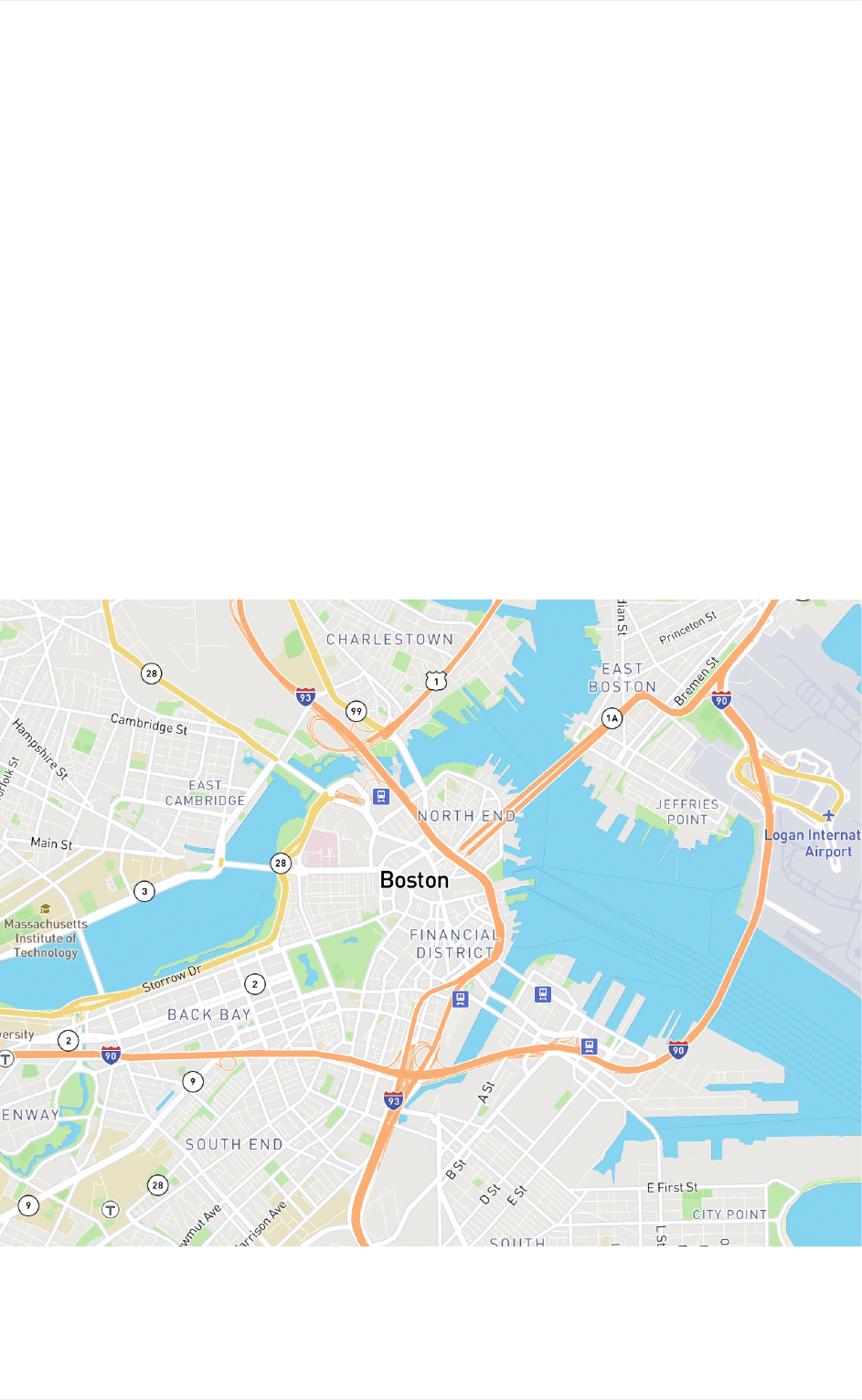
Usecolortodifferentiateandshowahierarchyofimportancebetweenmapfeatures.The
roadnetworksinMapboxStreetswhileusingthesamewidtharedistinguishedbycolorto
showhierarchy.Motorwaysarestyledorange,highperformanceroadsareyellow,and
primaryroadsarewhitewhilemaintainingthesamelinewidth.Thenextlevelofroadsare
styledwithathinnerwidthandlessvibrantwhitearerecedesmoreintothebackground,still
noticeablebutdocile.
Hierarchy
33
Scaleisboththeoverallsizeofanobjectandthatobject'ssizeinrelationshiptoother
elementsaroundit.Identifyingasystemofsizestorankmapfeatureslikelabelsorroad
widthswillhelptoindicatethehierarchyofthesefeatures.
Typographichierarchy
Thissystememploysbothscale,stylisticelements(likefontweight,i.e.light,normal,bold,
etc.),aswellastreatment(likeuppercase,lowercase,italic,outlineonly,etc.)toestablishan
orderofimportance.Thishierarchywillguidetheviewereasilyandquicklytothestartand
endofinformation,whilstenablingthemtoisolatecertaininformationbasedonthe
consistencyofuseinthestylethroughout.
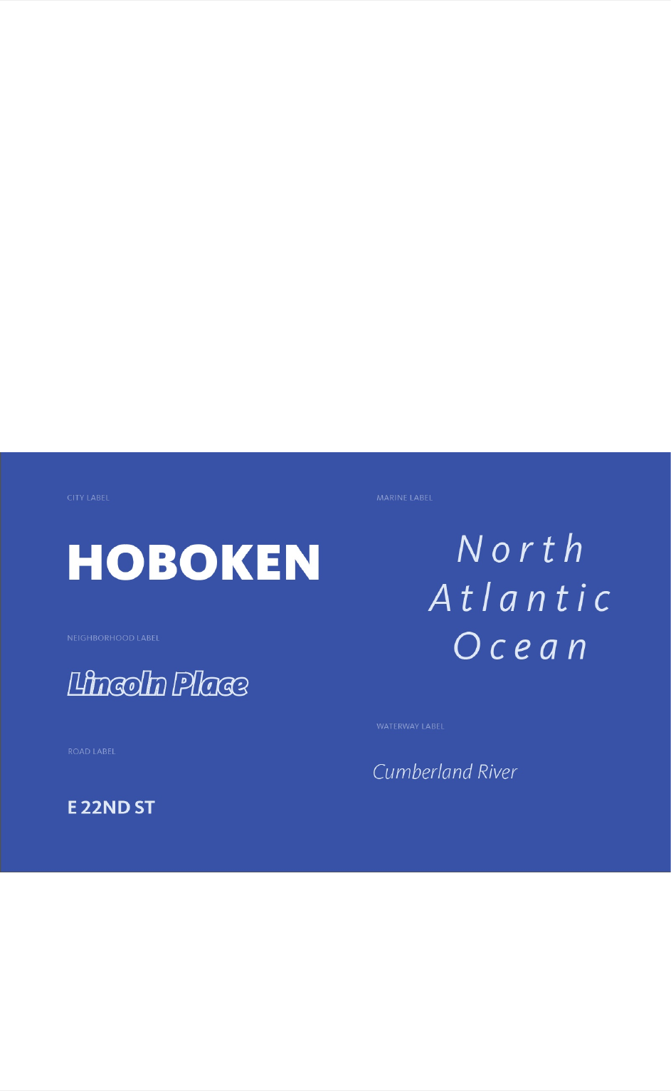
BelowisthehierarchysystemfortheBlueprintmap,whichusesavarietyoftechniquesto
indicateimportanceanddifferentiationbyformingvisualpatternsfortheusertobetter
comprehendthemapstyle.
Typographicstylingofplace,road,marine,andwaterwaylabelsintheBlueprintmapstyle.
Hierarchy
34
Scale
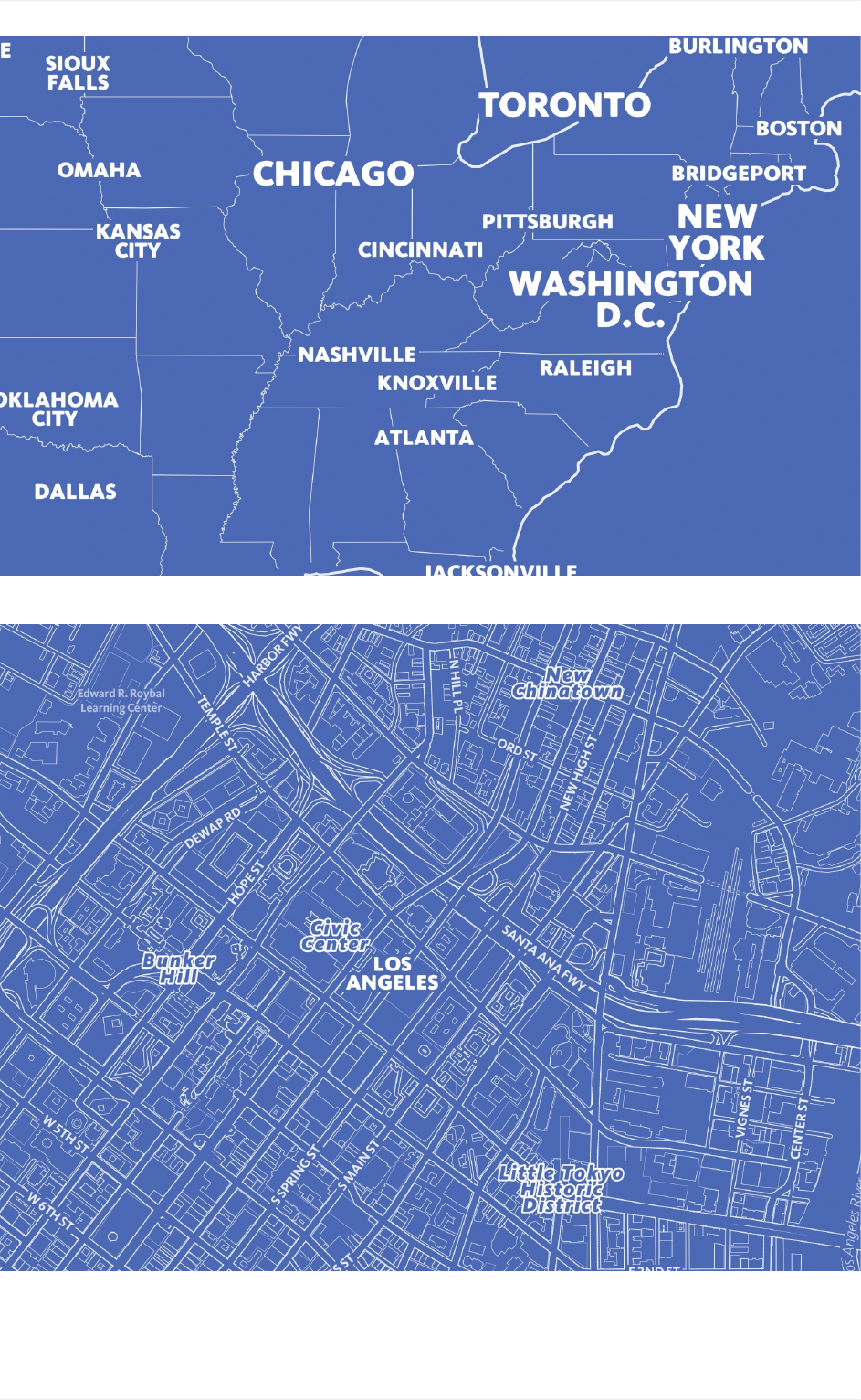
Typographichierarchystructuredbycitysize.
Differentiationintypographictreatmentforcityandneighborhoods.
Hierarchy
35
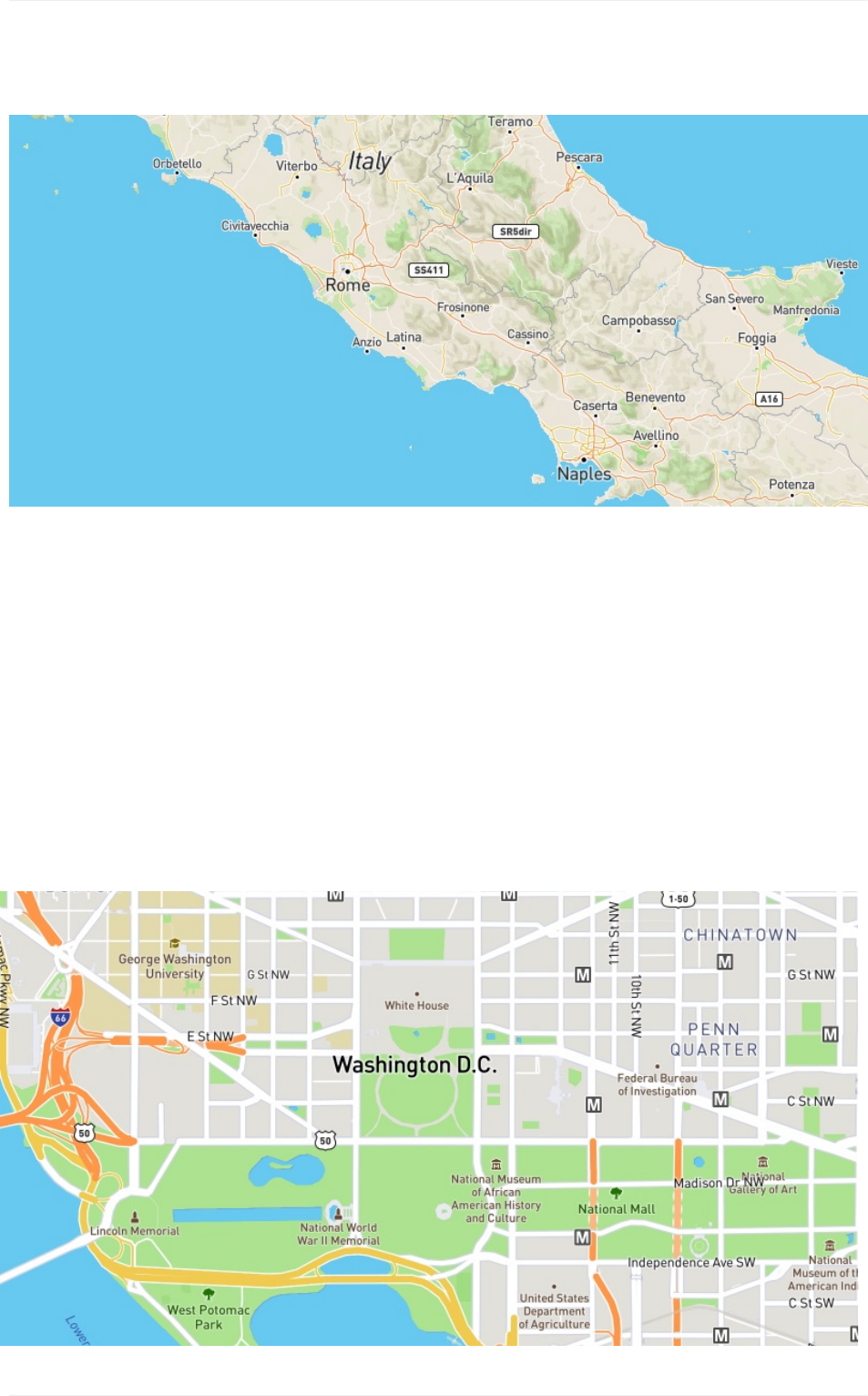
HereinMapboxStreets,thescalevariationismoresubtleoverallbutyoureyesarelead
aroundthemapbyorderofscaleintheplacelabels.
Generalpurposemaps
Mapsthatstyleavarietyofphysicalandculturalfeatures,liketerrain,roads,transitstops,
andpointsofinterest(POIs),aregeneralpurposemaps.Theyshowhierarchydifferently
thanthematicmapswhichnormallyfeatureasingleattributeortherelationshipamong
severalattributes.
Forgeneralpurposemaps,featuresshouldnotoverpowereachotherandshouldessentially
lieonthesamevisualplane.Herehierarchyisusuallymoresubtleandtheviewerbrings
elementstotheforefrontbyfocusingattentiononthem.
Hierarchy
36
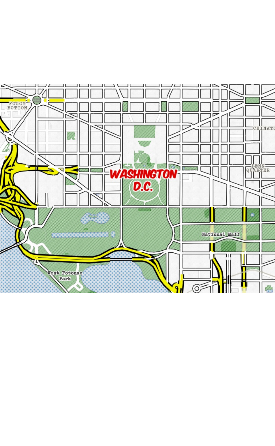
Thematicmaps
Thematicmapsaretypicallyemphasizespecificfeatureorlocationtoshowprominence.
Oftentimes,thethemeitselfismoreimportantthanthegeographiccontext.Hierarchythen
startstopresentitselfinthegroupingoffeaturesasstylisticelementsbycolor,texture,
scale,and/orstyle.
Hierarchy
37
Whaam!mapstyle-thematicstylingwithhighhierarchicalfocus.
Density
Althoughmapfeaturesmaybeavailableatacertainzoom,featuresshouldnotbestyled
basedonavailability.Revealingtoomuchinformationatacertainzoommaycause
confusionordiluteyourmap'sfocus.Asyoudesignyourmap,considerhowthedensity
of informationmayincreasesthevisualweightofthemap,disturbingthevisualhierarchy.
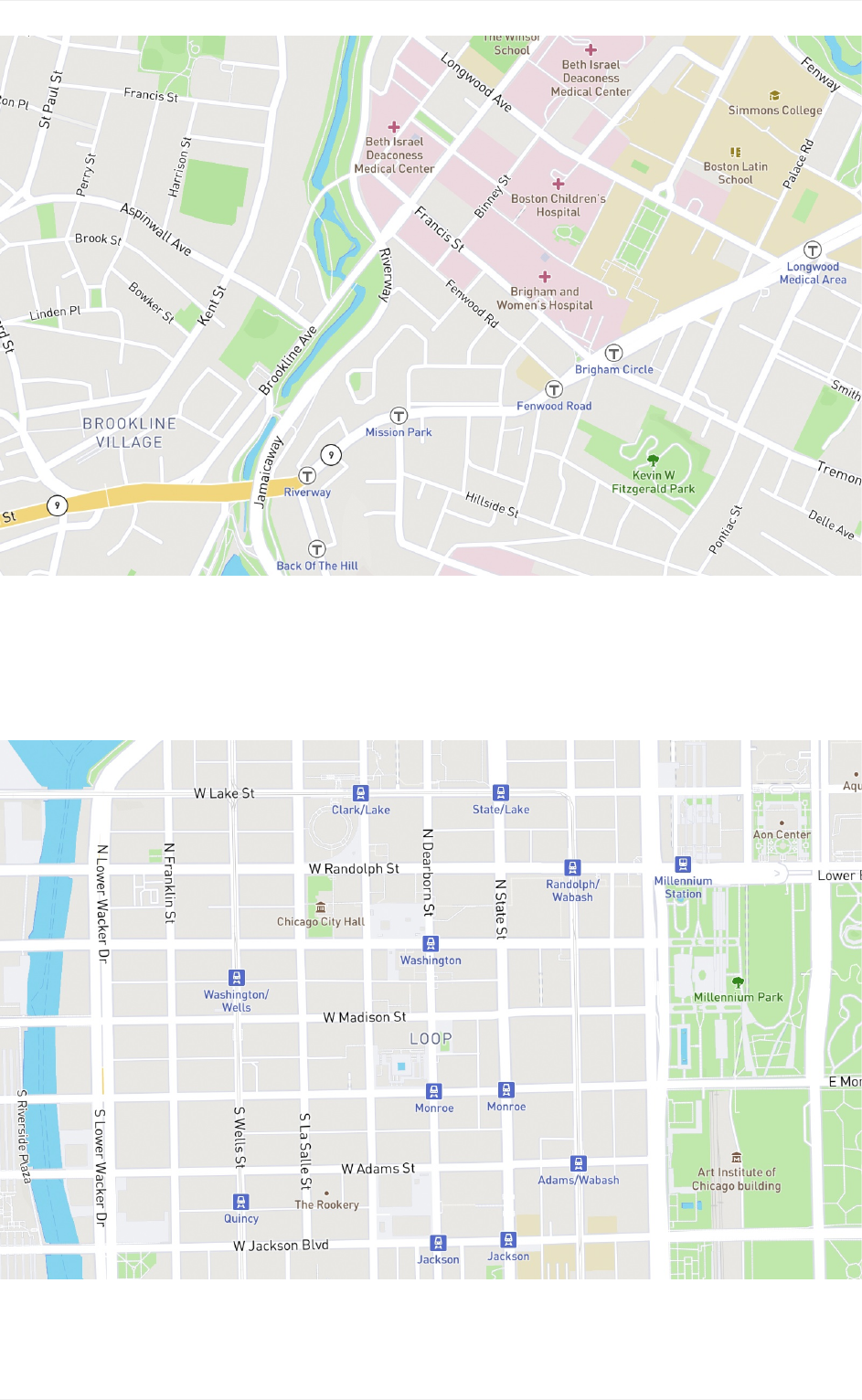
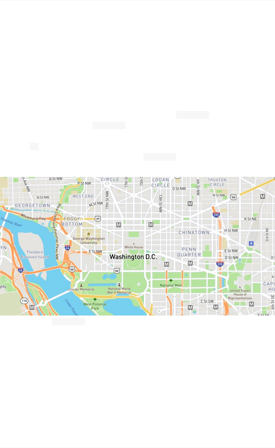
ThemapbelowshowsWashingtonDCstyledwithameasureddensityforthepointsof
interestorPOIs.MoreprominentPOIsarestyledbasedonscalerankwhichisafield
includedMapboxStreetsdata. scalerankisdeterminedbasedonanalgorithmthat
ranks importancebasedsizeandappendeddatafromWikipedia.MapboxStreetsbrings
inPOIs rankedat 1mostimportantandisstyledinlowerprioritythanneighborhoods,
highway shields,andtransitstops.Usinginformationlikescalerankorother
classificationstovary stylingandpriorityaregoodwaystocontroldensity.
POIsgroupedby scalerankandprioritizedaccordingly.
TheexamplebelowgroupsallPOIsintoonelayerwhichdoesn'tallowfordifferentiation
in styling.POIsshowupatcityviewalthoughtheymaynotberecognizablelandmarks
and addnovaluetothemapatthislevel.AfewofthesePOIsarealsoappearing
insteadof transitstopsorhighwayshieldswhichdoesn'thelpnavigationorwayfinding.
Measured densitymakesyourmapmorereadableandhelpsfocusthenarrativeand
usabilityofyour map.
Density
38
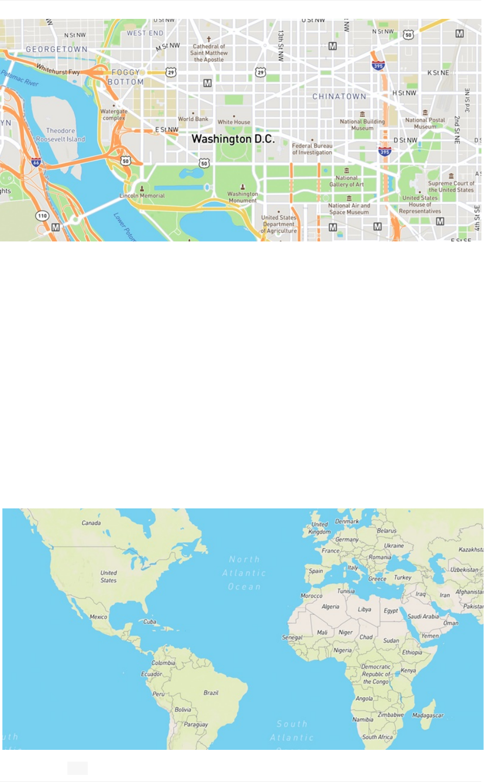
POIsstyleddenselywithnoprioritization.
Zoomlevels
Webmaps,asopposedtoprintmaps,havemoreflexibilityinwhatinformationcanbe
shownandwhen,thankstozoomlevels.Userscanexplorethemapfromagloballevel and/
orzoomintostreetleveldetailandeverythinginbetween.Zoomlevelsmovefromz0to
z22andalongthewaytheappropriatedataisavailablefromvectortilestobestyled.
Sometimes,itisnotpossibletolegiblydisplaydataatagivenzoomlevel.Forexample,a
denseseriesoftopographiclineswouldturnintoajumbleoffeatureswhenviewingthemap
atthestateorregionalzoomlevel.Conversely,stylingeveryPOI,likeparks,buildings,
restaurants,etc.,atacitylevelwouldappeartoocoarseandhardtocomprehendata
glance.Topreventthesepotentialissues,thecartographyteamhasdeterminedoptimal
maximumandminimumzoomlevelstomakedataavailableinourMapboxvectortiles.
Density
39
Globalview z1
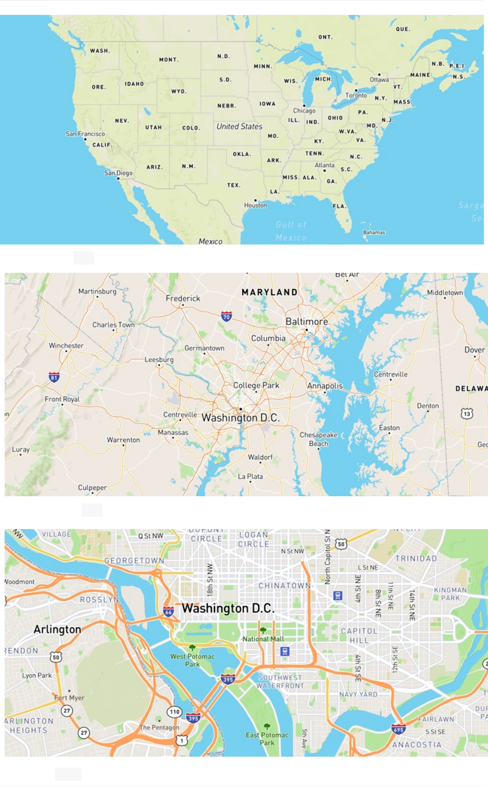
Nationalview z3
Density
40
Regionalview z7
Cityview z12
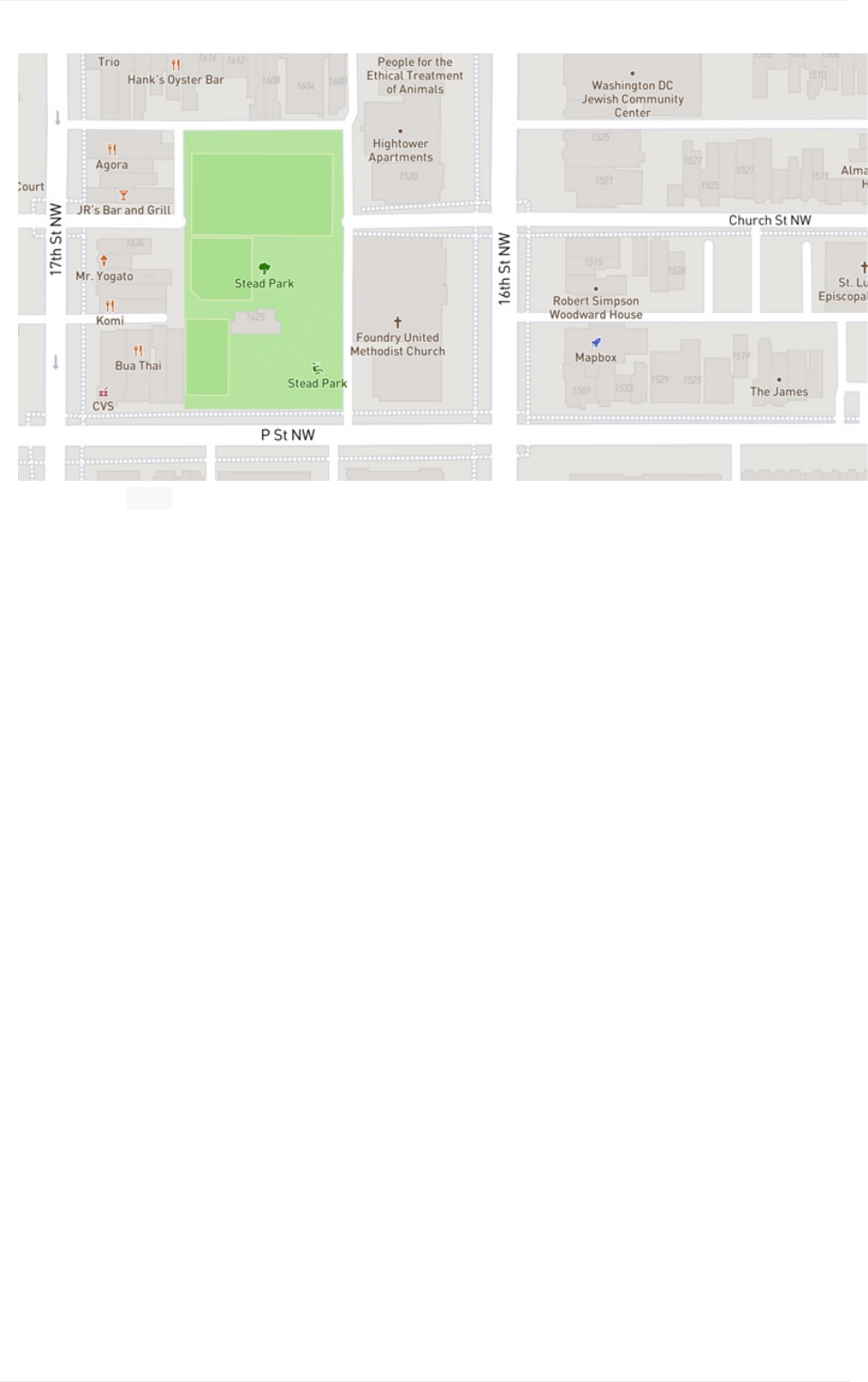
Density
41
Streetview z17
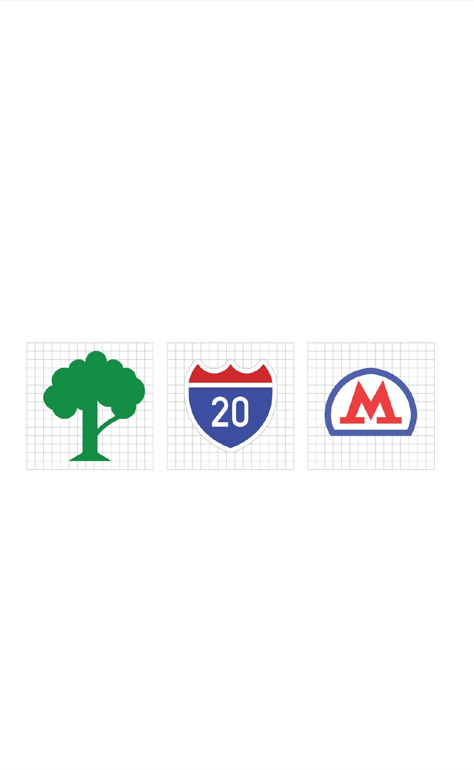
Legibility
Tobelegibleistobeeasilyread which is of utmost importance in mapdesign so theuser
caneasilyunderstandhowtonavigatetherepresentedspace.Legibilityof mostmap
featuresdependsoncolorandsize,and in addition to labels and text, can be iconography
too. Iconsmust be designed simply enough to recognizeat small sizes andoffergood
contrast againstthebackground.
Iconography
Forselectcitiesandcountries,ourMapboxStreetsiconsfeaturelocalpublic transiticons
andhighwayshieldstohelporienttheuserbyvisuallyconnectingthemapto their
environment.Weredesignedoriginalsymbols,simplifyingthedetailsandexaggeratingthe
formwhilebalancinggoodpixel-alignmentandvisualparitywiththeoriginals.
POIicons,highwayshieldsandrailiconsusedinMapboxStreets.
Legibility
42
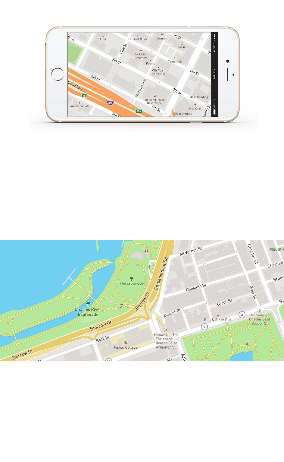
Text
A goodchoiceoffont with high x-heights and suitable at smaller sizes,colorcontrastfor
visual separation between foreground and background,as needed letter spacing,andthe
useoftext halos can vastly improve legibility in text labels.
Legibility
43
Mid-zoomviewofPOIiconsandhighwayshieldsinMapboxStreets.
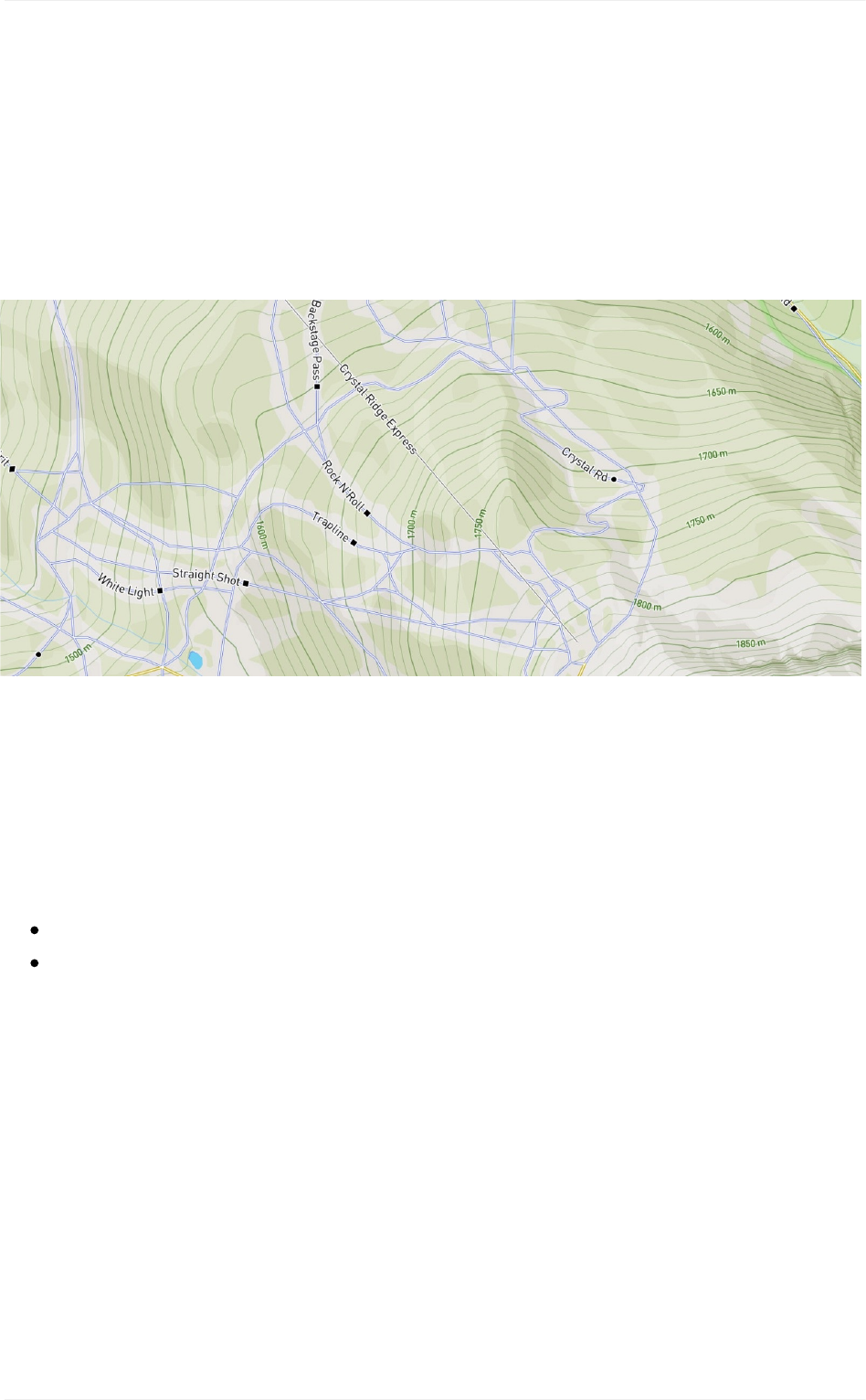
Legibility
44
DesigningMapboxStreetsandOutdoorsforMobile
MapboxOutdoorsredesign
Recommended Reading
Proximity
Theproximityofmapelementstoeachotherisalsoimportanttotheoveralllegibility.
Proximitycallsforrelateditemstobegroupedvisually,creatinglessclutterandmakingfor
a moreorganizedlayout.Attimesyouwillhavefeaturesverycloseoroverlappingyour
map, as you style createabalancebyusinglightercolorsaturation,softeropacity,and
substantial contrasttextandtexthalos if text is involved.Balanceiskey.
MapboxOutdoorsstylesoverlapping skipaths, contourlines, andhillshadesusing color
andstyletodifferentiate.

Specialconsiderations
TheMapboxCartographyTeampridesitselfonmakingmapsarebothusableandbeautiful.
OurcoreMapboxmapstylesarecreatedlargelyforgeneralpurposeuse.TheCartography
TeamstylesalmosteverymapfeatureandclassificationusingourglobalMapboxdata,and
themapsarereadytoplugandplayintoanymappingapp.Wealsohaveafewspeciality
mapswe'vebeenworkingonwithspecificusecases,conditions,and/orusersinmind.
Forthesekindsofmapsusedesignthinking,wetohelpensurethattheuserexperienceis
prioritized,designexecutionisoptimizedforplatformandperformance,andthatthemap
worksintheoverallenvironmentitwillultimatelylivein.Environmentalconsiderationscan
beanythingfromthetimeofday,locationofinteraction(outsideinthesun,insideanoffice),
modeoftransportation(car,bike,orfoot),theplatformbeingusedtoviewthemap(mobile,
web,etc.),oreventheuserinterfaceassociatedwiththemapstyle.
Thisprocesshelpsusbuildholisticdesignsolutionsforourproductsandtheexperienceof
endusers.Thesearetheusecaseswearedevelopingdesignprocessesfor:
Mapsformobile
Mapsfornavigation
Mapsfordatavisualization
Specialconsiderations
45
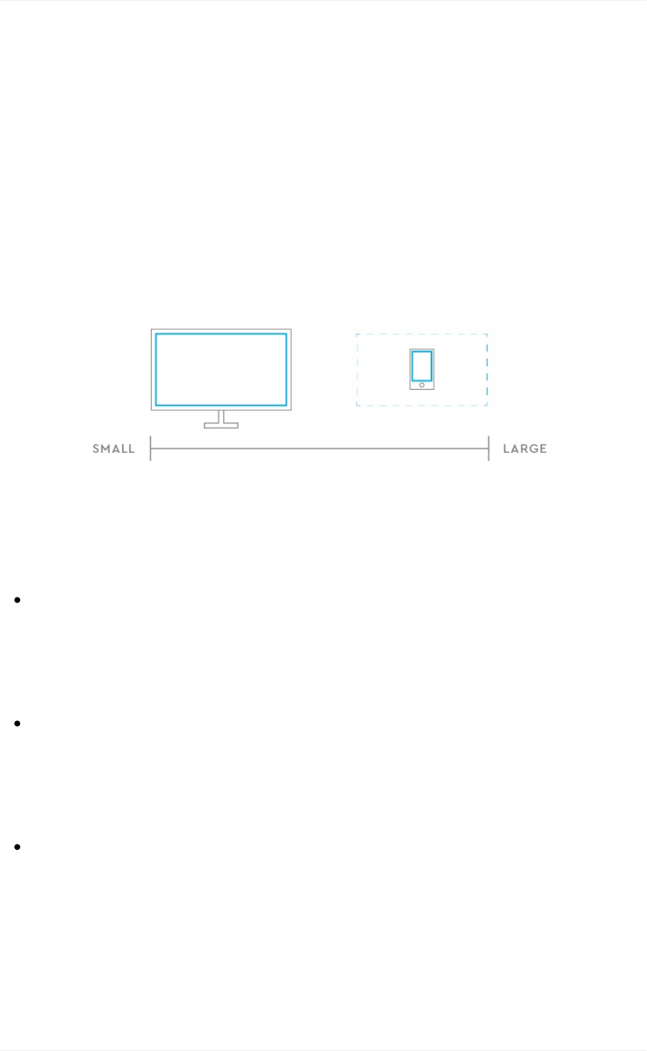
Mapsformobile
Smartphonesplayanimportantroleinhelpingpeoplenavigatetheirenvironmentandget
themtowheretheyneedtogo.67%ofsmartphoneownersusetheirphoneatleast
occasionallyforturn-by-turnnavigationwhiledriving.Aswedesignmoreandmorefor
mobilehereatMapbox,wetakeintoaccounttheuniquechallengesthatmobilemapsface
asopposedtothatofdesktopandprintmaps.Mobilemapshavearangeofuserand
environmentalvariablesthatrequireconsiderationthroughoutthedesignprocess.
Considerations
Spatialrestriction.Themobilescreenreintroducesspatialrestrictiontothedesign
process.Notonlyisthescreensmaller,butit’salsoasmallerviewportshowinga
similar-sizeddesktopmap,meaningmuchlessmapdataisviewedatonce.Thismeans
visualcuesandconnectionsaregoingtobehardertomake,anddifferentstyling
decisionsmustbemadesincefewermapelementscanbeseen.
Mapinteractivity.Themobilemapuserisconstantlyfiddlingwiththemap.Luckily
interactivitysuchaszoom,pan,andpitchvariablescanbeautomatedandcontrolledby
otherinformationsuchasuserlocation,userspeed,anddefinedroutedistances.Not
onlydoesthisfreetheuser’shands,butitalsoaddstolistofvariablesdesignersmust
accountforwhendesigningmobilemaps.
Usermanipulation.Userstendtomanipulatethemobilemapsconstantly.Although
usingone’sfingerstozoom,pan,andpitchamapisreallynodifferentthanusinga
mouse,thesizeconstrainttypicallyrequiresmoreuserinteractionandmanipulationto
viewmoremapcontextandcontent.Wecanseealooseconnectionbetweenscreen
sizeandinteractivity,duetothesimplefactthatthereislessmapinformationshownat
anygiventimeonmobilemaps.1
Mapsformobile
46
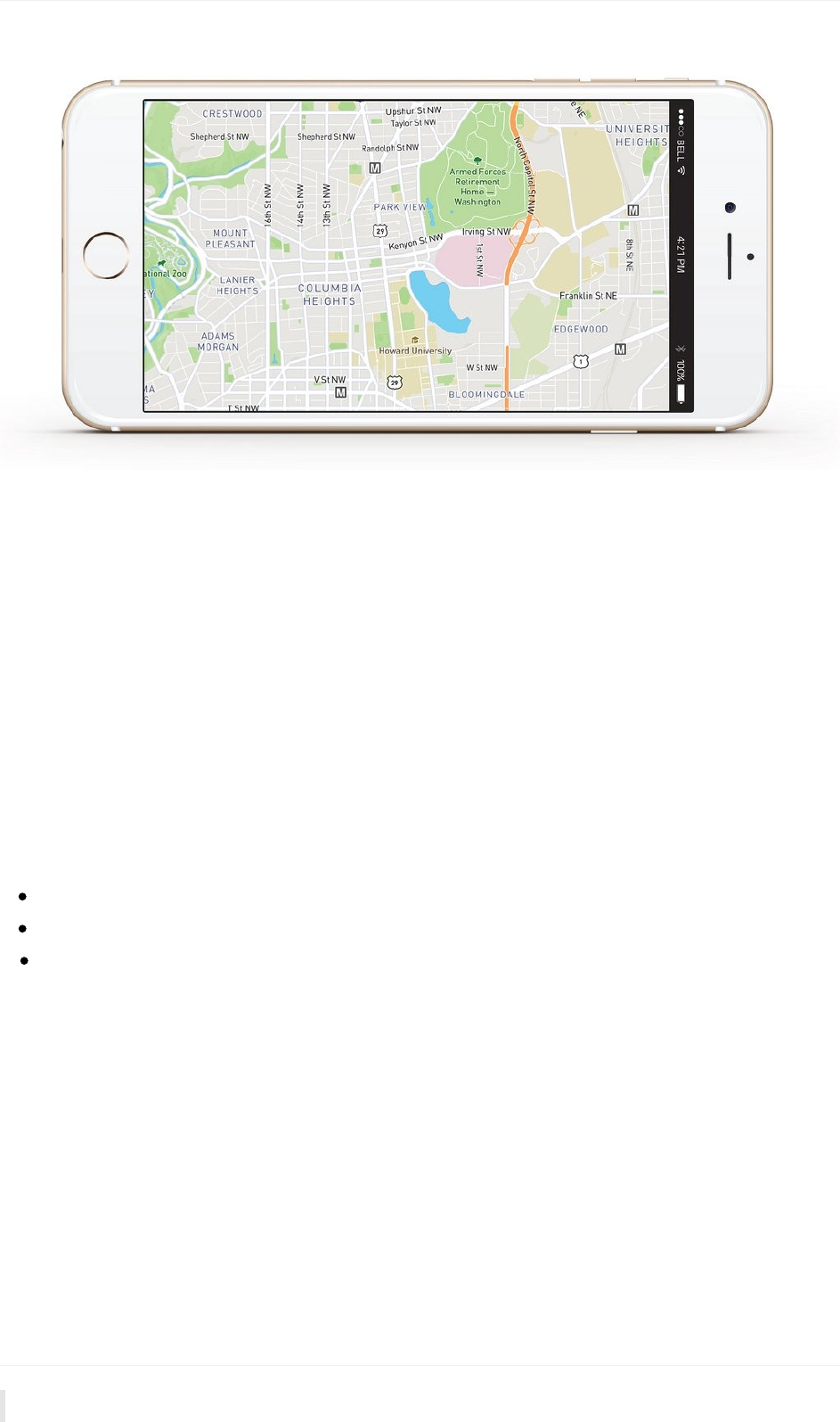
MapboxStreetsonmobiledevice.
Testingplatforms
Testingourmapsonasmanydevicesaspossiblegivesuscriticalfeedbackthatpropelsthe
iterativedesignprocess,andverifiesthattheuserexperiencewillbeasfunandproductive
aspossible.Oneofthemaintoolsweusetoquicklyteststylesistherecentlyreleased
StudioPreviewforiOS.AcompaniontoMapboxStudio,thepreviewappallowsustolog
intoouraccountandquicklyprototypemapstyleswithintheenvironmentsitwillbeusedin,
andtomimictheuserexperience.
Recommendedreading
SayhellototheStudioPreviewapp-viewmapstylesdirectlyfromyourdevice
BringyourmapstolifewithRuntimeStylingonmobile
DesigningMapboxStreetsandOutdoorsformobile
Mapsformobile
47
.DesigningMapsforMobile,NatSlaughter/Mapbox↩
1
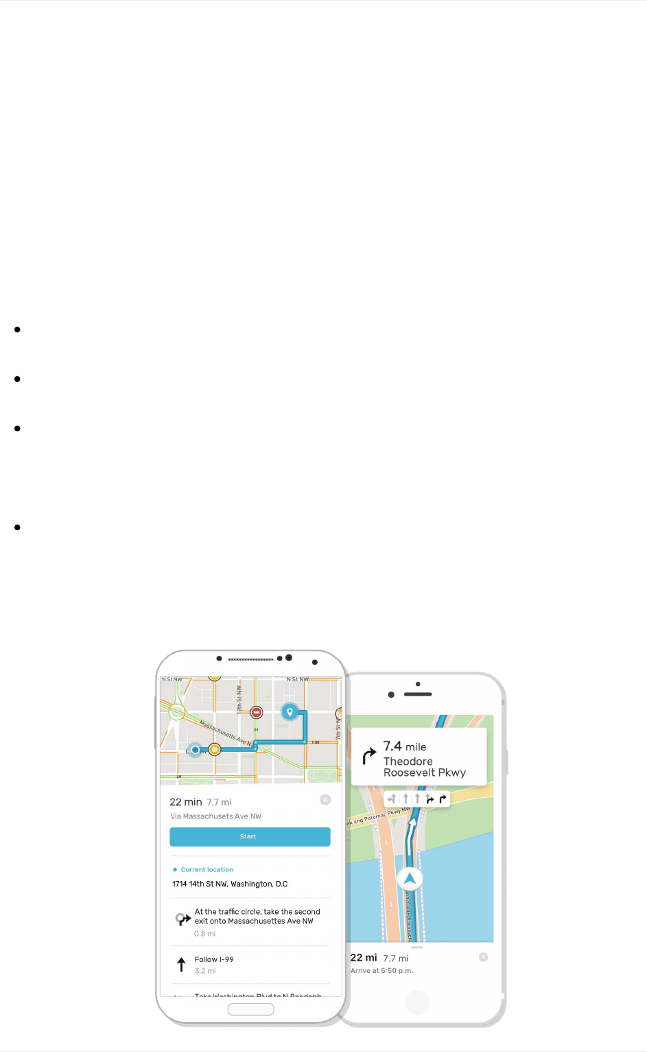
Mapsfornavigation
Thereisalotofoverlapbetweendesigningformobileandnavigationbecause,primarily,
navigationmappingisdoneonamobiledevice.Inaddition,navigationmapsmust
harmoniouslyintegratetoggleabletrafficdataandotherinformationoverlaystoprovideuser
controlledcontext.Toprovideguidancetothemapfordrivers,cyclistsorpedestrian,the
CartographyTeamtookintoconsiderationavarietyofenvironmental,speed,andtime
factorsfortheMapboxNavigationsuiteofmaps.
Intheearlyphasesofthemapdesignprocess,weconsider:
Thephysicalrelationshipbetweenthemapandtheuser:.Howfarawayisthemap
fromtheperson?Isithand-heldforapedestrian,orfixedtoawindshieldforadriver?
Viewingtime:Istheuserviewingthemapinshort,fragmentedglances,or
contemplativelysittingwithit?
Usermanipulation.Iftheuseriscurrentlydrivingtotheirdestinationtheanimation
alongthepathismostlikelybeleadingtheshow.Rotatingandzoomingastheirphone
movesclosertotheirdestination.Considerthecamerabehaviorslocation(lat/lng)and
zoomlevel(cameraposition)androtationandpitchasyoustyle.
ControlledDensity.Customoverlaydata,suchastrafficorbikelanes,shouldbekept
consistentandharmoniouswiththeunderlyingmapstyle.Thedatamustalsoaddvalue
insteadofmuddyingthewaters.Themostimportantinformationshouldbeclearly
visibleataglance.
Mapsfornavigation
48

Mapsanddatavisualizations
Datavisualizationscanbeexpressive,powerfulopportunitiestousemapstotellstoriesand
understandinformation.Acompellingbasemapsetsthesceneanddeepenstherelationship
betweenthewhatandthewhereoftheinformationnarrative.Whenuncoveringspatial
patternsorgettingactionableinsightsfromdata,seamlessintegrationbetweenthemap,
mapandinterfacearekey.Theuse-caseiscomprehension,andhelpingtheuserseethe
relationshipsinthedataistheultimategoal.
Considerthefollowingasyouco-designyourmapanddatavisualizations:
Exploreorexplainyourdata.Exploratorydatavisualizationsareappropriatewhen
youhavetonsofdataandyou’renotsurewhat’sinit.Explorationisgenerallybestdone
atahighlevelofgranularity.Ifyouoversimplifyorstripouttoomuchinformation,you
couldendupmissingsomethingimportant.Explanatorydatavisualizationisappropriate
whenyoualreadyknowwhatthedatahastosay,andyouaretryingtotellthatstoryto
somebodyelse.Youknowthestoryandthereforeyoucandesigntospecifically
accommodateandhighlightthatstory.Editthedatabydecidingwhichinformationstays
in,andwhichisdistractingorirrelevantandshouldcomeout.
Designathree-dimensionalvisualhierarchy.Oftentimesweseedatavisualizations
thatseemtoplopthedataontothemap.Thekeyisintegration,youwantthemapand
datatoworktogethernotagainsteachother.Color,value,andsaturationarekeyfor
theserelationships.Startwithastrong,limitedcolorpalettewithhighcontrast.Ifyou
startwiththeLightorDarkstyle,alterthehuetofityourbrand,startsmallwithline
widthsandeaseshapesfrom 0%to 100%opacity.Thegoalistoproduceathree-
dimensionaleffectinwhichcertainkeyfeaturesappeartoriseoffthemap'stwo-
dimensionalsurface.
Categorizesimilardata.Earlyinthedesignprocess,identifythebestandmost
accuratewaytosortandcategorizeyourdata.Dependingwhichtechniqueyouplanto
usefordisplayingyourdataonthemap,choropleth,heatmap,etc.,determiningthe
appropriategroupingsforyourdatawillkeepyourdatahonestandprovidevaluable
insights.
1
Mapsfordatavisualization
50
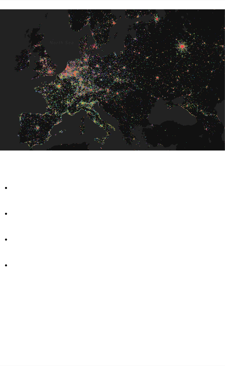
VisualizingEurovisionShazamtagswithMapboxGL
Visualizationstyles
Dotdensity — Amapstylethatusesadotorothersymboltoshowthecollective
presence(density)ofafeatureorphenomenon.Forexample,showingbusy
intersectionsorhigh/lowvolumesofactivitywithinareas.
Choropleth — Thisisathematicmapstylethatappliesshadedcolororpatterntextures
inproportiontotheintensityofthedatabeingdisplayedonthemap.Forexample,
showingpopulationdensityorper-capitaincome.
Hexagonalbinningorhexbin — Thismapstyleisgoodforshowinggeneralthemes
overageography.Itislessgranularthandotdensityandnotconstrainedbyboundaries
asisthecasewithchoroplethmaps.
Heatmap — Thismapstyleenablesthemapviewertoperceivedensityofpoints
independentlyofthezoomfactor.Itistheleastconstrainedofthemallbecauseitdoes
notcorrespondtogeographicbounds.
Customdata
Thereareavarietyofwaystoadddatatoyourmap.First,youcanuploaddatadirectlyinto
MapboxStudio,thiswillconvertyourdataintoawebandmobileready,highlyperformant
tileset.YourcustomtilesetwillbeaccessibleinanyMapboxStudiostyle.Anothermethodis
tocreateadatasetwithyourcustomdata.Thisisdoneinthedataseteditor,thereyoucan
Mapsfordatavisualization
51

adddatasources,drawnewdatapoints,lines,andpolygons,combinevariousdatasources
andmaintainyourrawdata.Onceyouaredoneaugmentingyourdata,youcanexportitas
atilesetandaddittoyourmapforstyling.Choosingatilesetordatasetdependsonifyou
areplanningtousethedataimmediatelyinyourstyleorifyouplantoenhanceormanage
thedataovertime.
ThefinalwaytoadddataiswithMapboxGLJSwhichallowsyoutoaddthedata
dynamically.Checkthisexampleforaddinglive GEOJSONdatatoyourmapstyle.Findout
aboutHowUploadsWorktolearnthedifferencesbetweentilesetsanddatasets,howthe
uploadprocessworks,techniquesforuploading,andresourcesforgettingstarted.
Recommendedreading
Dotsvs.polygons:HowIchoosetherightvisualization
LightandDarkmapsfordatavisualization
Dataunderneath:Labelsontop
VisualizingEurovisionShazamtagswithMapboxGL
1.DesigningDataVisualizationsbyJulieSteele,NoahIliinsky↩
Mapsfordatavisualization
52
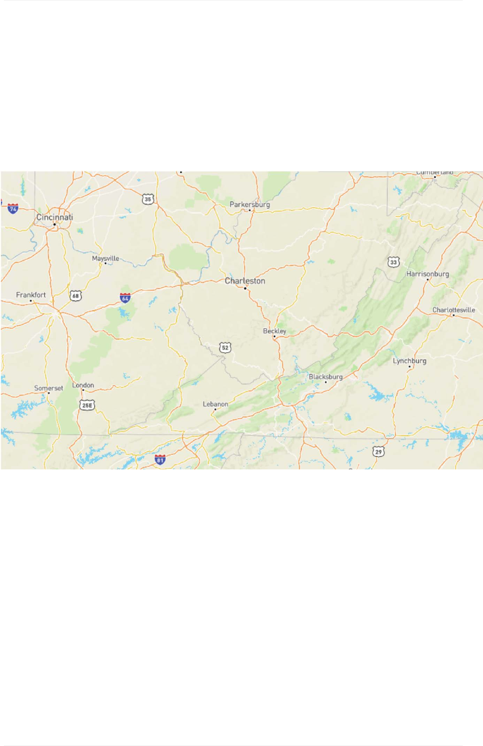
GettingstartedwithMapboxmaps
WhenyoudesignyourmapswithMapboxyouhaveaccesstoourglobaldata.Thisdata
happensinalllocationsandateveryzoomlevel.Asyoustyle,makesuretozoominandout
andconsiderhowtheystylelooksateachzoomlevel.Thedesignelementswejustcovered
visuallyrepresentthenaturalandmanmademapfeaturesthatmakeupourworld.
GettingstartedwithMapboxmaps
53
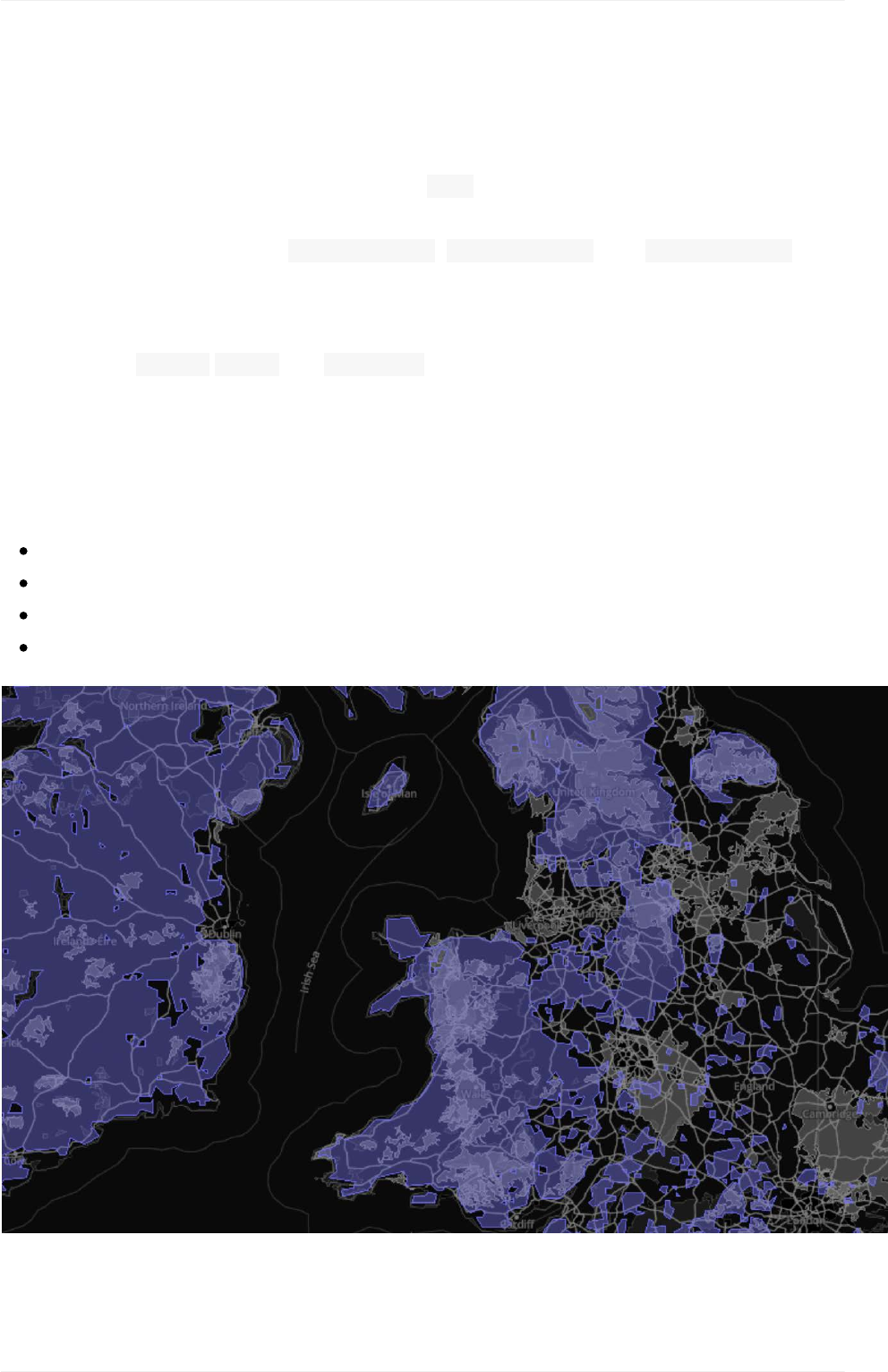
Mapbox-providedtilesets
Mapboxwebandmobile-readyvectortilesare75%smallerthanarastertilesets.This
resultsinfast,smoothzoomingfromtheworldviewofamapdowntostreet-leveldetail.
Mapboxvectortilesetsinclude: mapbox-streets, mapbox-terrain,and mapbox-traffic
whichareoutlinedinthenextsection.
Vectortilesetdataconsistsofgeographicallyreferencednaturalandmanmadefeatures
convertedinto points,lines,and polygons.Thisistheunderlyingframeworkofthemap
andprovidestheinformationthatwillbestyled.Mapdatafeaturestypicalfallintothe
followinggeneralcategories.
Naturalfeatures
water
land
landuse
terrain
Mapboxtilesets
54
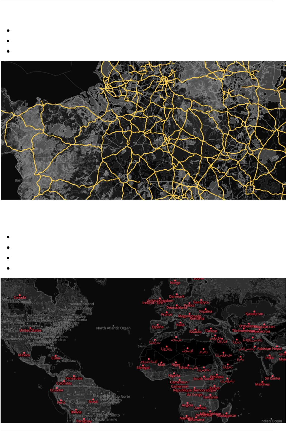
motorway
trunk
primary,etc.
Placelabels
country
state
city
island,etc.
Mapboxtilesets
55
Roadnetworks
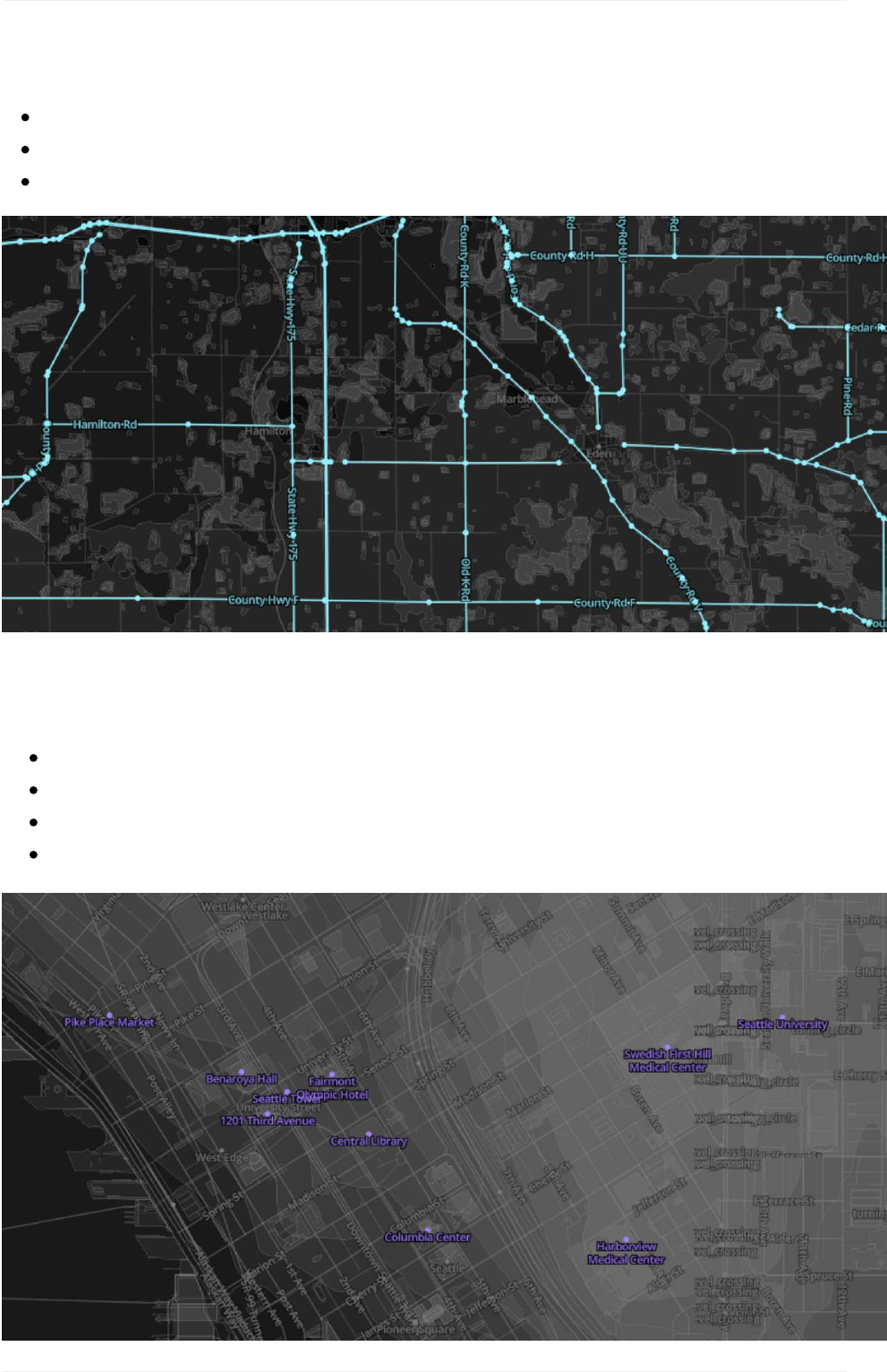
Generallabels
marine
water
roads,etc.
Mapboxtilesets
56
Pointsofinterest(POI)labels
naturalreserves
businesses
restaurants
attractions,etc.
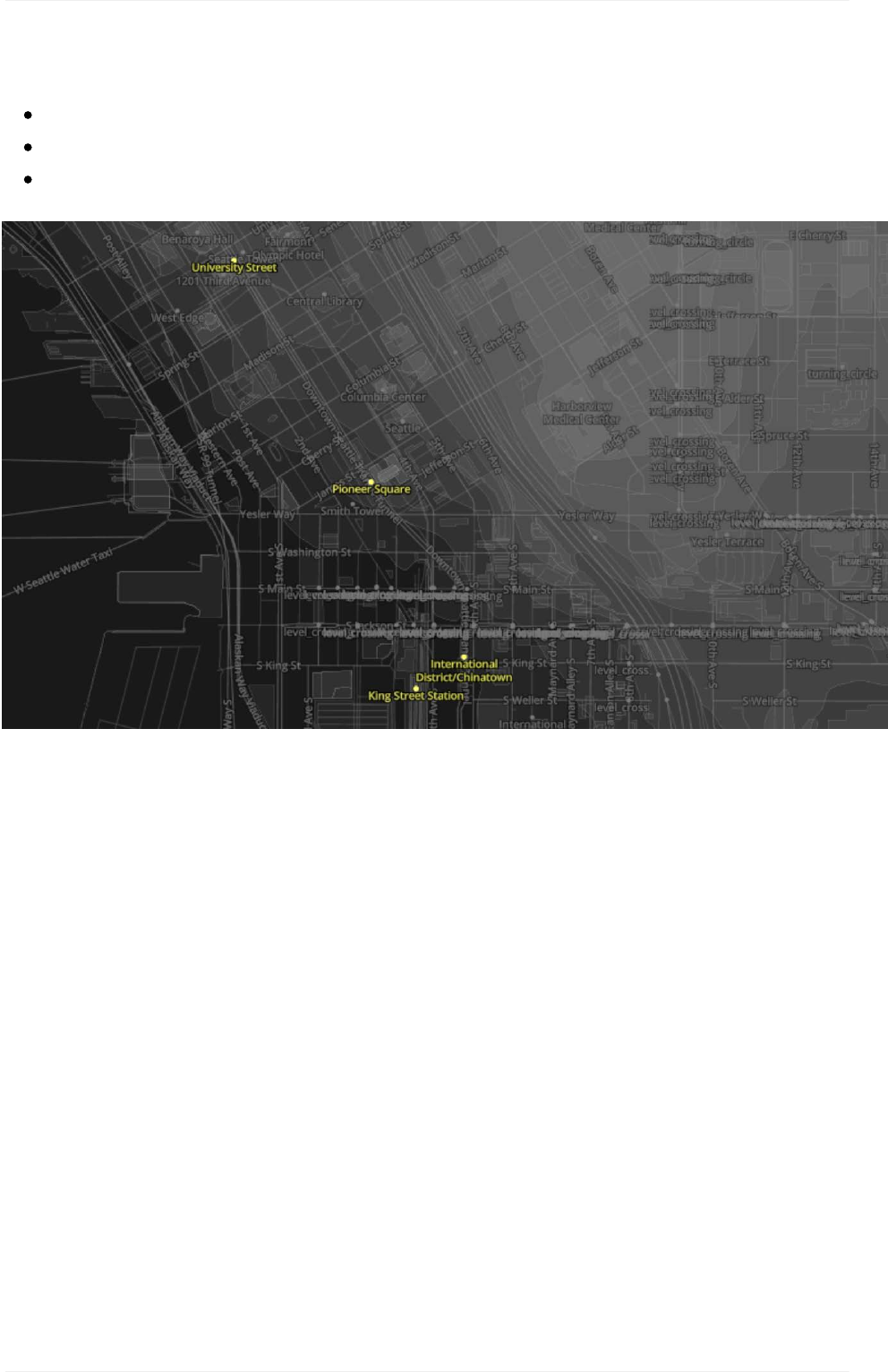
Transitlabels
airportlabels,
raillabels,
highwayshields,etc.
Mapboxtilesets
57
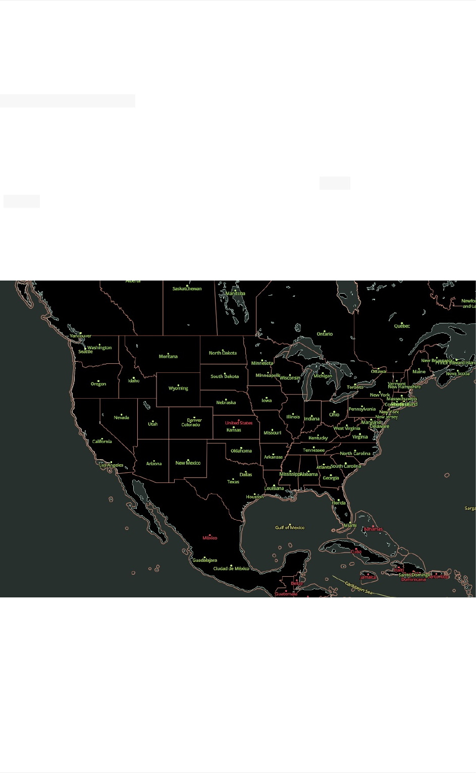
MapboxStreets
mapbox.mapbox-streets-v7
MapboxStreetsvectortilesarelargelybasedondatafromOpenStreetMap,afreeand
globalsourceofgeographicdatabuiltbyvolunteers.Whilestyling,referencethisMapbox
Streetsdataoverview,anin-depthguidetothedatacontainedintheMapboxStreetsvector
tileset.Thisoutlinesadditionallayerpropertiessuchastypes(type)andclassifications
(class)thatwillallowyoutofilteryourdataandstylecertainelementsdistinctly.
ExploretheMapboxStreetstileset!Youmaynotneedtoaddanycustomdata.Mapbox
Streetsmayhavethedatayouneed,andyoucanfilterthisdatatoaseparatelayerand
styleitaccordingly.
MapboxStreets
58
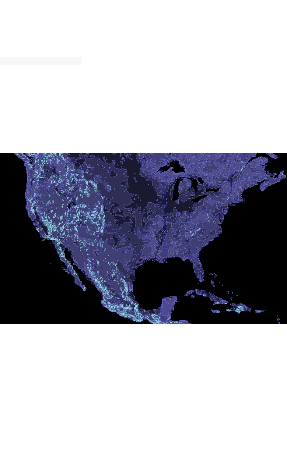
MapboxTerrain
mapbox.mapbox-terrain-v2
MapboxTerrainprovideshillshades,elevationcontours,andlandcoverdataallinvector
form.MapboxTerrainisbasedondatafromavarietyofsources(seetheaboutpagefor
details).WhenusingtheMapboxTerrainlayerpubliclyinadesignorapplicationyoumust
provideproperattribution.Whilestyling,keeptheMapboxTerraindataoverviewopento
ensureyouareassigningtheappropriateclassificationstoyourmapstyle.Thesevaluesare
alsoautomaticallyshowntopopulateasfiltersdirectlyinStudio,butthereferenceoffers
moredetailstotheirdefinition.
MapboxTerrain
59
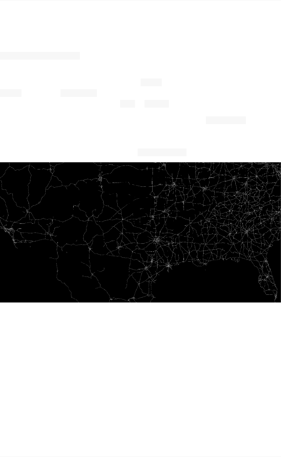
MapboxTraffic
mapbox.mapbox-traffic-v1
MapboxTrafficprovidesconstantlyupdatingcongestionforbothdirectionsontwo-way
roads.TrafficdataalignswithMapboxStreetsroadslayerandyoucanfilterbasedon
classvalues.The congestionfieldisameasureoftherelativeslowdownaroadsegment
isexperiencing.Thevaluesrangefrom lowto severe.
Whenstylingcongestion,ourcartographer'stypicallyaddapositiveline-offsettothelayer
tovisuallyseparatethedirectionsoftravel.Whilestyling,referencetheMapboxTrafficdata
overviewopentoensureyouareassigningtheappropriateclassvaluestoyourmapstyle.
Keepinmind,thisdatadoesnotappearuntilzoomlevel6.0.
MapboxTraffic
60

Mapbox-providedmapstyles
Beforeyou'reofftotheraces,let'sgooverthetemplatestylesthatareavailableinMapbox
Studio.Youcanuseanyofthesetemplatesasastartingpointyourmapstyle.Youjustneed
tostartanewstylewithoneoftheMapboxprovidedstylesandbegincustomizingittofit
yourbrand.Butwhichstyleshouldyoupick?Thatdependsonwhatyouaretryingto
achieveandwhatkindofdatayourmapwantstohighlight.
Basic/Bright
MapboxStreets
MapboxOutdoors
MapboxDark/MapboxLight
MapboxSatellite/MapboxSatelliteStreets
MapboxTrafficDay/MapboxTrafficNight
Let'srevieweachmapstyle,soyoucanfindtheonethatbestfitsyourneeds.
Mapboxtemplatestyles
61
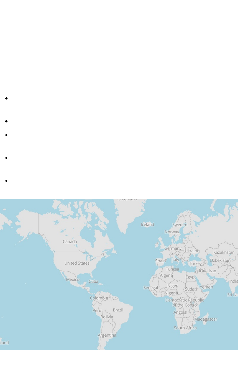
BothBasicandBrightareopensourcemapstylesthatareprimarilyforlearningabout
Mapboxmapstyles.
Basic
MapboxBasicisasimple,flexiblestartingmapstyleifyoujustneedasimplestyle.The
classificationsforroadsandplacelabelshavebeengeneralizedintomajororminor
categoriescoveringthefollowingtypesoffeatures:
Roadways.Lightlyorganizedroaddata,designedtoshowverybasicmajorandminor
roadhierarchy.
Administrativeboundaries.Onlycountryboundariesarestyled.
Builtfeatures.Buildingfootprints,railstations,urbanparks,landuse,andonlyhighly
rankedpointsofinterestarestyledwithonlytext.
Naturalfeatures.Rivers,lakes,streams,oceans,coastalboundaries,parks,land
cover,andbeaches.
Places.Generalhierarchyoflocationlabelsincludingcountries,islands,cities,and
suburbs,towns,hamlets,villages,andneighborhoods.
Basic/Bright
62
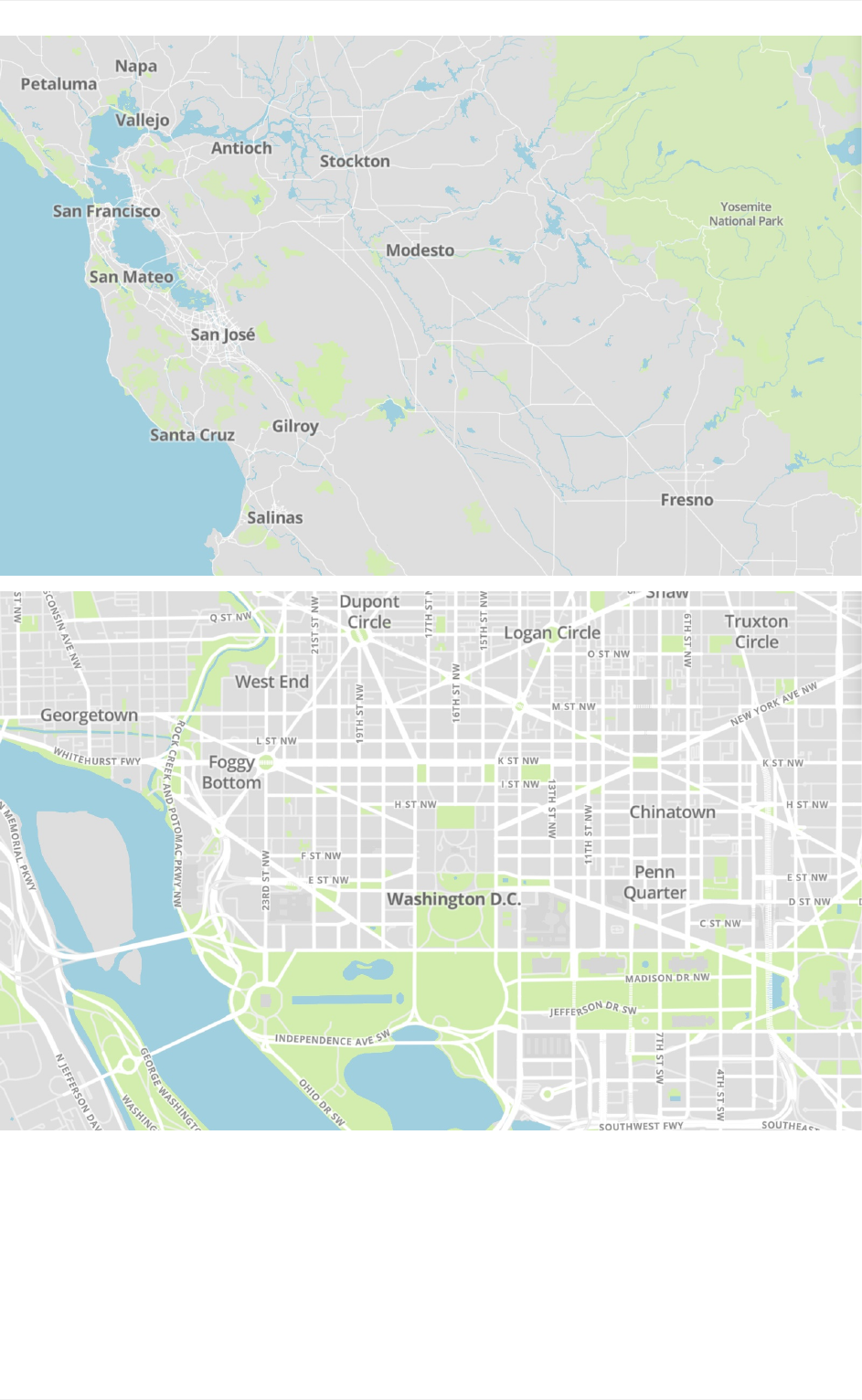
Basic/Bright
63
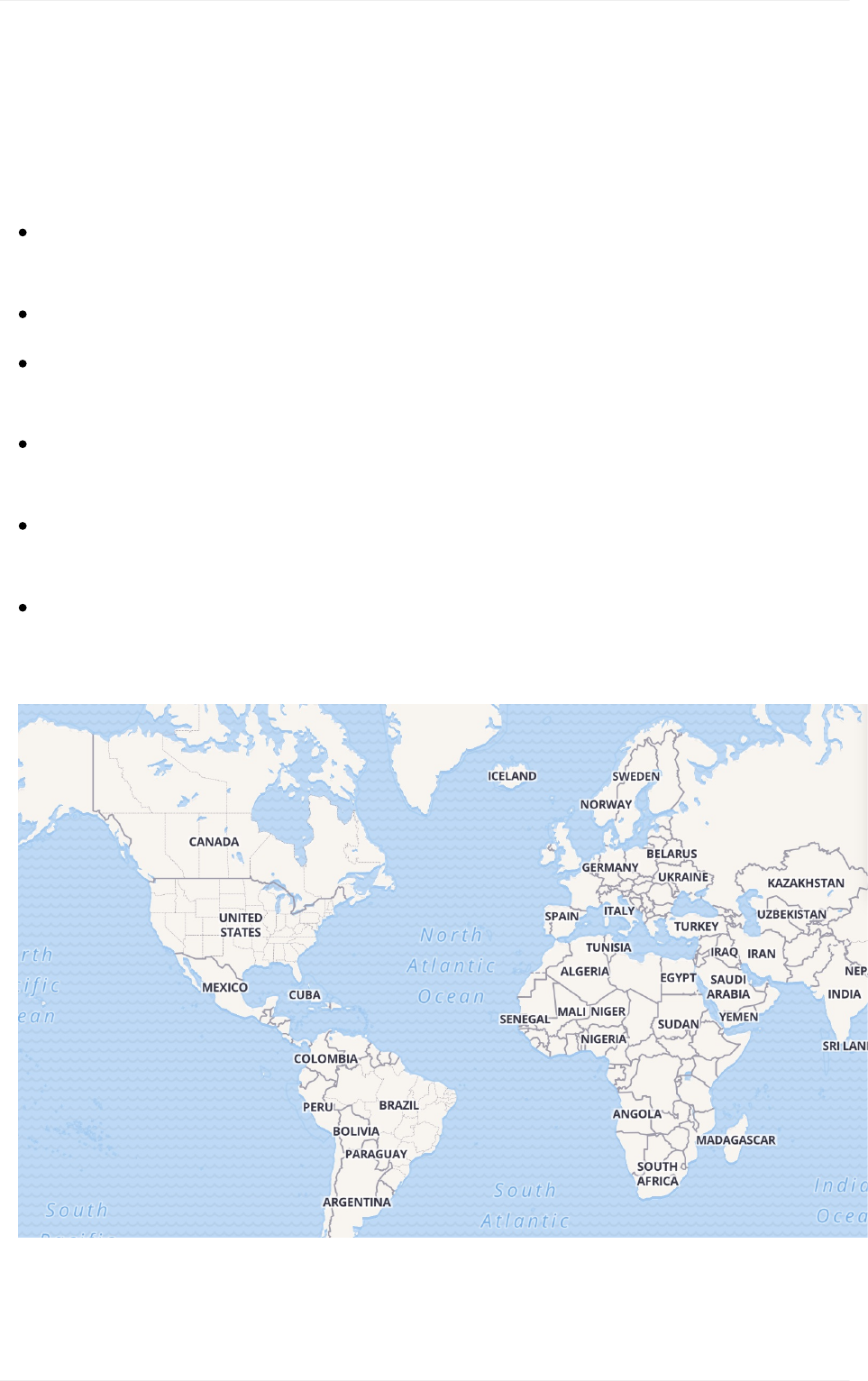
Roadways.Organizedroaddata,designedtoshowthedifferentclassificationsofroad
typesavailablewithMapboxStreets.
Administrativeboundaries.Aglobalpoliticalandadministrativeboundarylayer.
Builtfeatures. Buildingfootprints,railstations,urbanparks,landuse,famous
landmarks,andneighborhoodstores.
Naturalfeatures.Rivers,lakes,streams,oceans,coastalboundaries,parks,land
cover,andbeaches.
Places.Ageneralhierarchyoflocationlabels,fromcountriestocities,towns,and
villagesandneighborhoods.
Iconography.Thisstyleincludesgeneralmotorwayhighwayshieldsandusesatexture
forthewaterlayer.
Basic/Bright
64
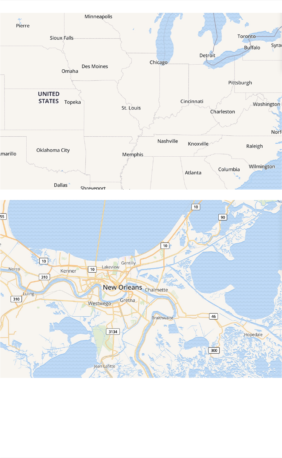
Bright
MapboxBrightisanothergoodtemplatetolearnhowdatalayersarecategorizedand
generallystyled.Thisstyleincludesmoreclassificationsoflabelandroadtypesandputs
datalayersintorelevantcategoriescoveringthefollowingtypesoffeatures:
Basic/Bright
65
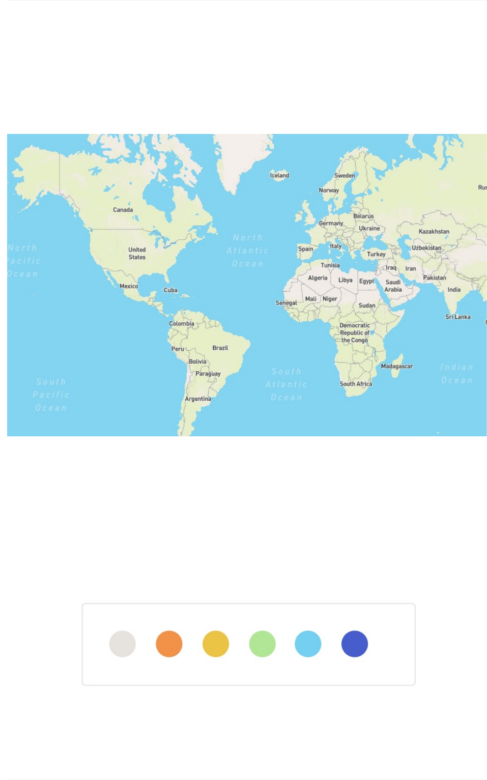
MapboxStreets
MapboxStreetsisourflagshipstyle,itisacomprehensive,general-purposemapthat
emphasizesaccurate,legiblestylingofroadandtransitnetworks.
Vibrantcolors
TheMapboxStreetshigh-contrastcolorsystemallowstheviewertoeasilyrecognizethe
map'sfeaturesandquicklyunderstanditshierarchiesandclassifications.Thecolorsystem
isfine-tunedtoworkperfectlyateachlevelandshiftssubtlyacrosszooms.
Streets
66
Streets
67
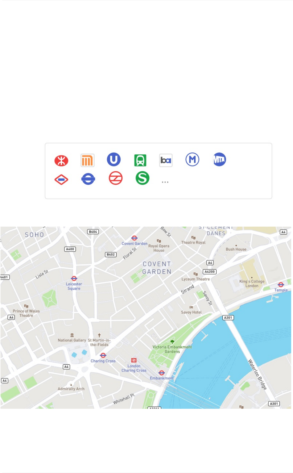
Detailedtransitstyling
MapboxStreetsincludesawidevarietyoftransitlayers–frommotorwaystopathstoferries
– andhasbeendesignedtoprovideanintricaterenderingoftheirroutes,intersections,and
overlaps.Inselectcitiesandcountries,MapboxStreetsalsofeatureslocalpublictransit
iconsandhighwayshieldstohelporienttheuserandconnectthemaptotheirenvironment.
Forincreasedlegibilityandconsistency,theCartographyTeamdesignedeachglobaltransit
overatwodozeniconsandaddedthemtothismaptoaddinplaceandcomprehensionfor
globalusage.
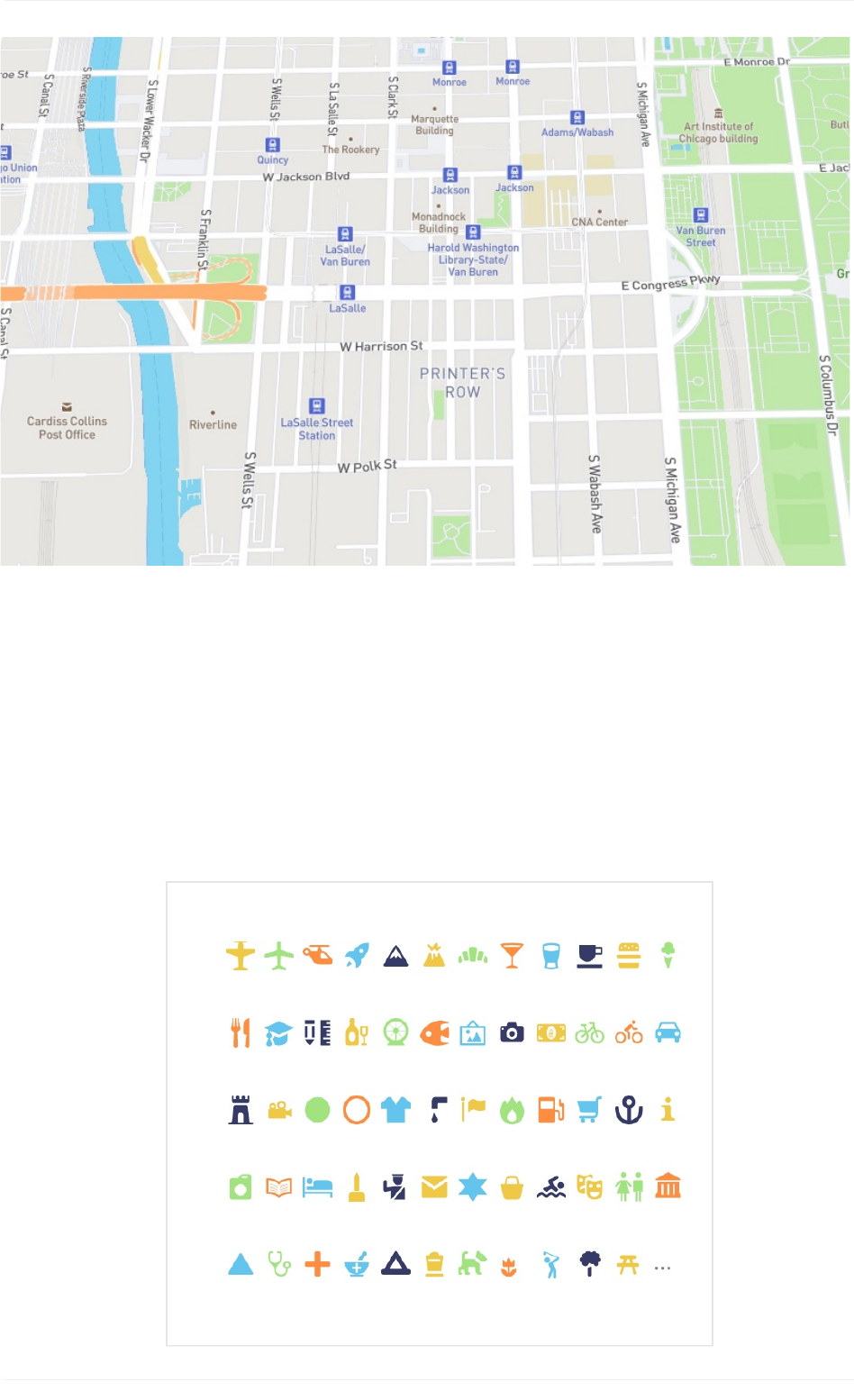
Pointsofinterest(POIs)
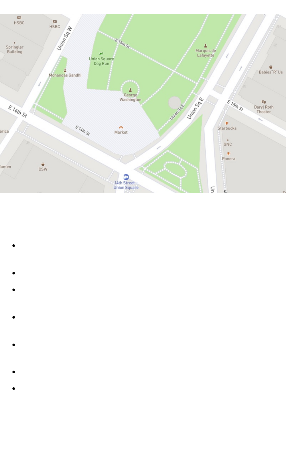
MapboxStreetsfeaturesabroadrangeofPOIsstyledtoindicatecategoryandfilteredto
onlyshowthemostimportantPOIsacrossthezoomrange.Theseiconsfromoursetof
opensourceMakiicons.MakiiconsaredesignedsimplyandworkseamlesslywithMapbox
Studio.TheMakiiconeditorallowsyoutocustomizethestyleofyouriconsyoucanaddand
Streets
68
removetheseicons,categorizeandstylethemingroups,anddownloadthemforyourmap
styles.
Streets
69
Additionaldesignfeatures
Roadways.Highlyorganizedroaddata,designedtopresentaclearlylegiblehierarchy
ofallroadtypesacrossawidezoomrange.
Administrativeboundaries.Aglobalpoliticalandadministrativeboundarylayer.
Builtfeatures.Buildingfootprints,railstations,urbanparks,landuse,famous
landmarks,andneighborhoodstores.
Naturalfeatures.Rivers,lakes,streams,oceans,coastalboundaries,parks,land
cover,andbeaches.
Places.Acompletehierarchyoflocationlabels,fromcountriesandstatesdownto
villagesandneighborhoods.
Terrain.Vividhillshadingshowelevation,contourlines,andatactiletopography.
Uniqueiconography.Selectcountriesandcitiesfeaturecustomhighwayshieldsand
publictransiticons.
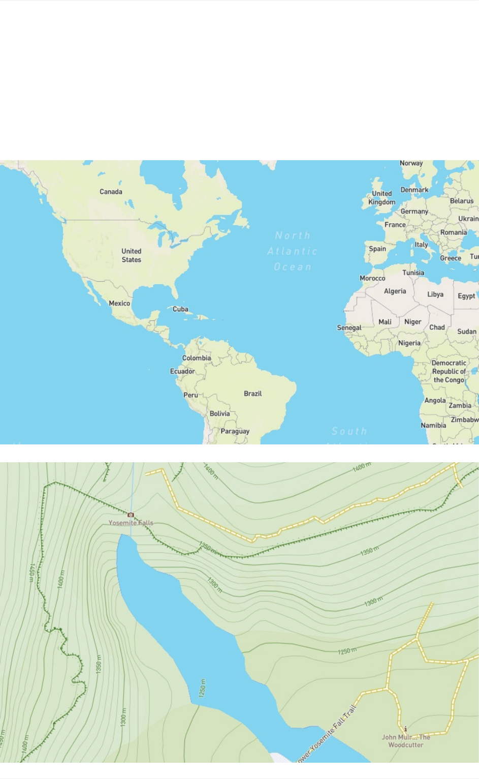
MapboxOutdoors
MapboxOutdoorsisageneral-purposemapwithcuratedtilesetsandspecializedstyling
tailoredtohiking,biking,andthemostadventuroususecases.Tomeettheneedsofthe
bikers,hikers,runners,andskiersthatrelyonMapboxOutdoors,ourcartographersmined
OpenStreetMapforitsextensivetrail,path,andpisteinformation,anddevelopedstylingthat
clearlyarticulateseachtypeformaximumlegibility.
Outdoors
70
Outdoors
71
Curatedterraindata
Mapbox Terrain's globalelevationandhillshade datalieattheheartofMapboxOutdoors.
Weprocessedsourcesfrom24datasetsacross13 organizations,includingtheU.S.
GeologicalSurvey,NorwegianMappingAuthority,and CanadianGeoBase,combiningthe
natural features into a robusttilesetwithnecessary pathandtrail data for an outdoors map.
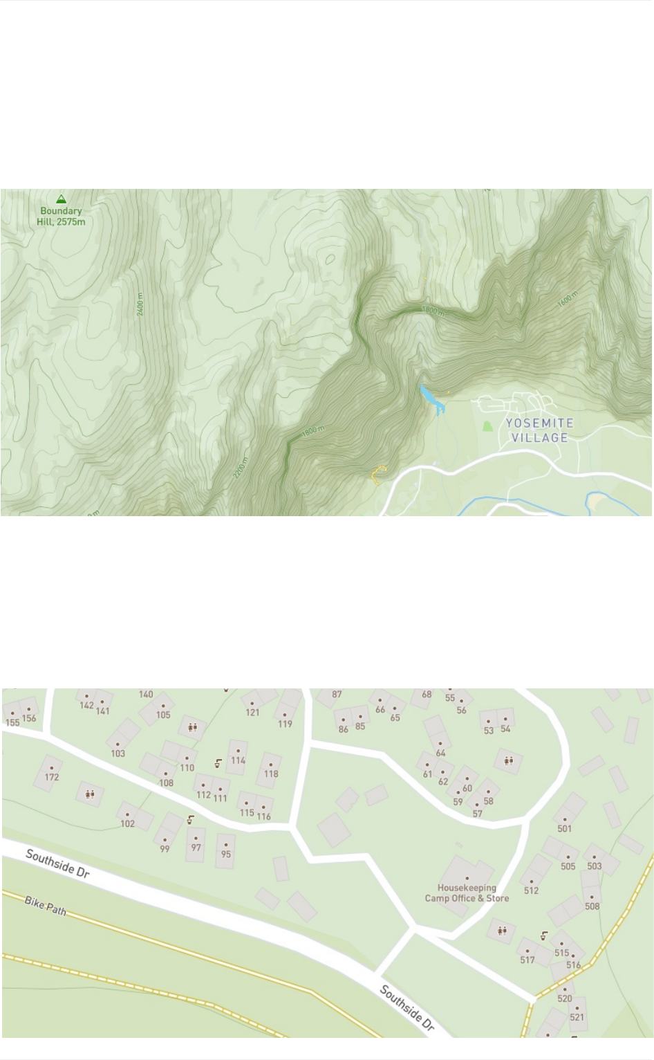
Relevantpointsofinterest
MapboxOutdoorscontainsanarrayofpointsofinterest(POI)datarelevanttoactiveuse
cases:youcanfindcampsites,publicrestrooms,andevenwaterfountainsinthese
specializedlayers.

Additionaldesignfeatures
Roadways.Highlyorganizedroaddata,designedtopresentalegiblehierarchyofall
roadtypesacrossawidezoomrange.
Administrativeboundaries.Aglobalpoliticalandadministrativeboundarylayer.
Pathsandtrails.Hikingpaths,footways,cycleways,andskitrails.
Builtfeatures.Buildingfootprints,railstations,urbanparks,landuse,famous
landmarks,andneighborhoodstores.
Naturalfeatures.Rivers,lakes,streams,oceans,coastalboundaries,parks,land
cover,andbeaches.
Places.Acompletehierarchyoflocationlabels,fromcountriesandstatesdownto
villagesandneighborhoods.
Terrain.Vividhillshadingdeliversvisuallytactiletopographyforoutdoorandactive
lifestyleapps.
Uniqueiconography.Selectcountriesandcitiesfeaturecustomhighwayshieldsand
publictransiticons.
Outdoors
72
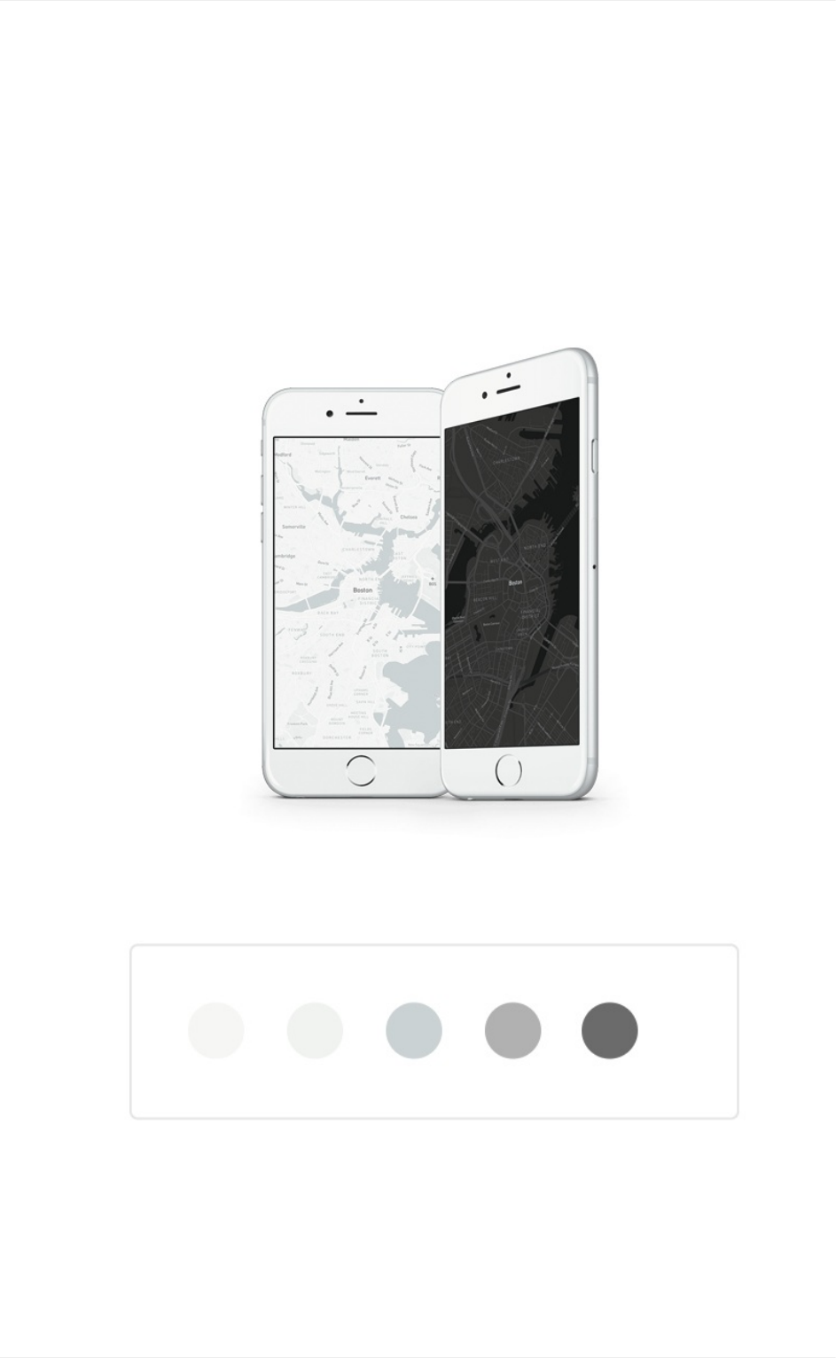
MapboxDarkandMapboxLight
MapboxLightandMapboxDarkaresubtle,full-featuredmapsdesignedtoprovide
geographiccontextwhilehighlightingthedataonyouranalyticsdashboard,data
visualization,ordataoverlay.TheCartographyTeamcreatedtwotightlyconstrainedcolor
palettesthatuseslightshiftsinhueandvaluetoprovidedepthandspacewithout
overwhelmingoverlaidcontent.
Dark/Light
73
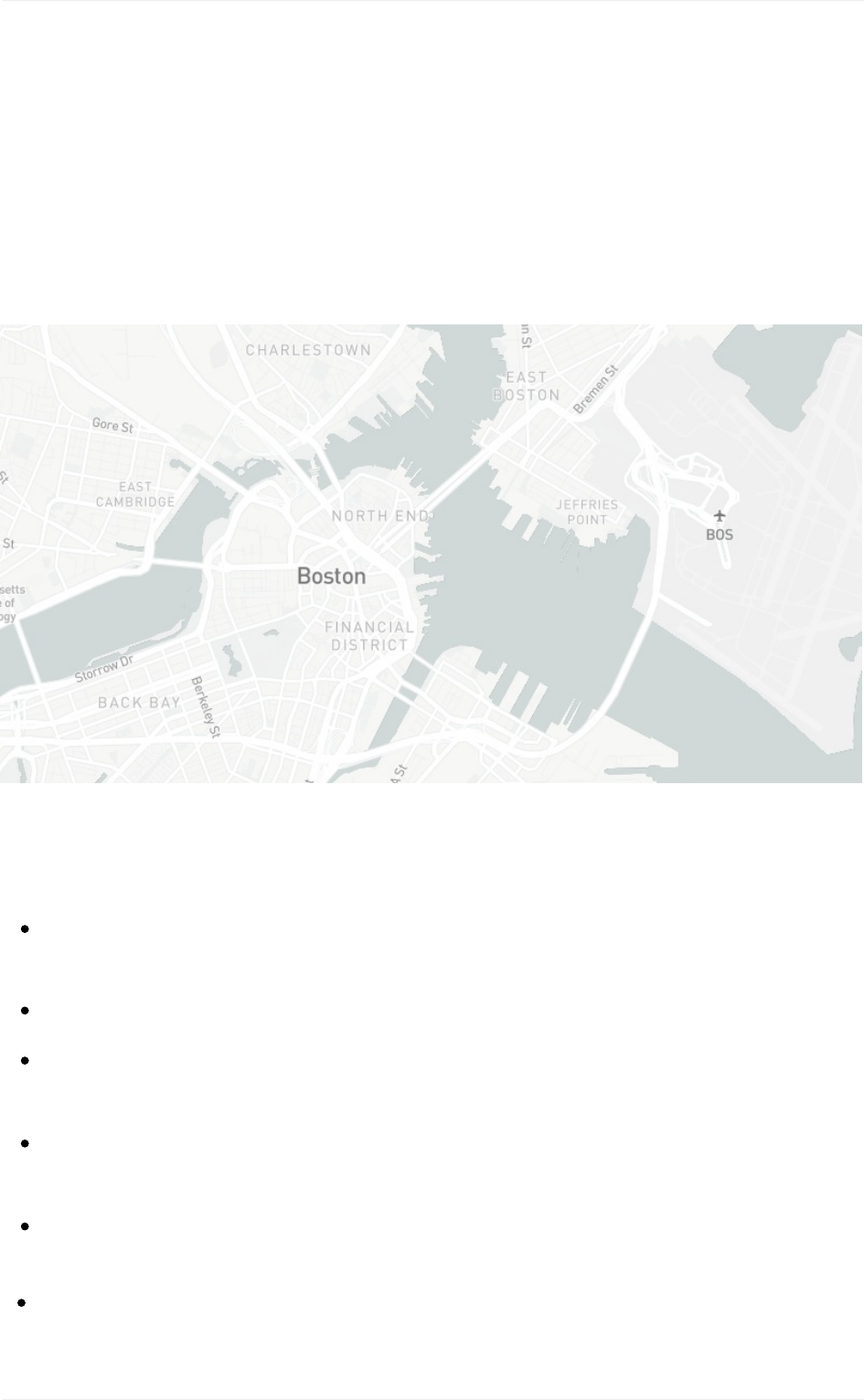
MapboxStreetsdata
MapboxLightandDarkusethesamevectortilesourceasourgeneral-purposemaps,
Mapbox Streets,and containthefullrangeofgeographicinformationrequiredtoprovide
contextforoverlays. LightandDarkarespeciallydesignedtoshowafullsetof
cartographicfeatureswithout distractingfromyourcontent.The Cartography Team
modifiedeveryelementofthesemaps–thinninglinewidths,loweringlabeldensities,
reducingcontrast–tomakesuretheyalways complementyourproject.
Additionaldesignfeatures
Roadways.Highlyorganizedroaddata,designedtopresentaclearlylegiblehierarchy
ofallroadtypesacrossawidezoomrange.
Administrativeboundaries.Aglobalpoliticalandadministrativeboundarylayer.
Builtfeatures.Buildingfootprints,railstations,urbanparks,landuse,famous
landmarks,andneighborhoodstores.
Naturalfeatures.Rivers,lakes,streams,oceans,coastalboundaries,parks,land
cover,andbeaches.
Places.Acompletehierarchyoflocationlabels,fromcountriesandstatesdownto
villagesandneighborhoods.
Dark/Light
74
Terrain.Subtlehillshadecomplements the simple design withtopographyforcontext.
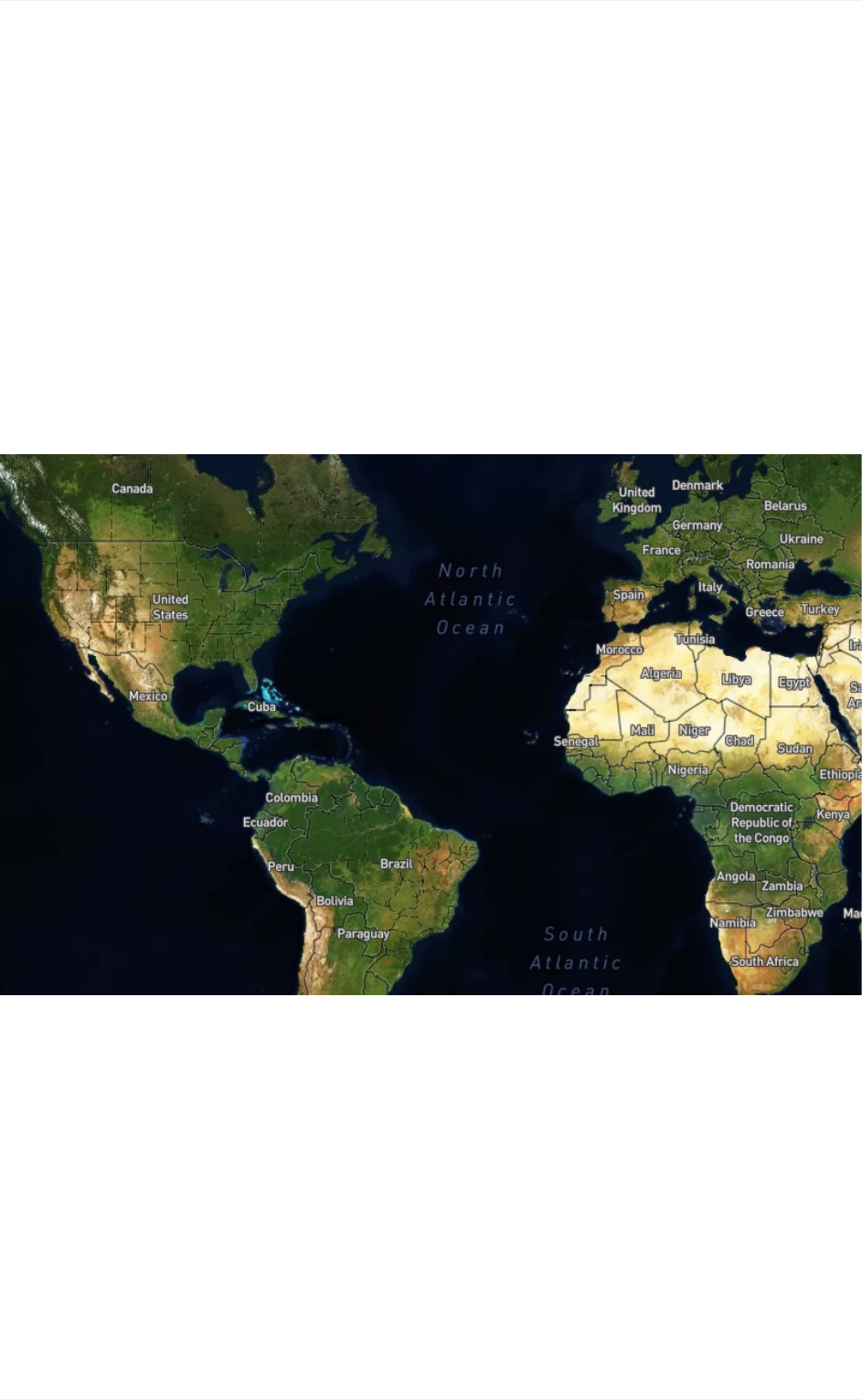
MapboxSatelliteandMapboxSatelliteStreets
MapboxSatelliteisourglobalhigh-resolutionsatelliteimagery.MapboxSatelliteStreets
combinestheMapboxSatellitebasemapwithvectordatafromMapboxStreetstobring
contextualinformation.MapboxSatelliteStreetsisdesignedtoenhanceourvibrantSatellite
imagerywithalightlayerofMapboxStreetsdata.Ourdesignershavecreatedclearand
legibleroadhierarchieswithacomprehensivesetofroad,place,andfeaturelabelsthat
balancelegibilityandusability.
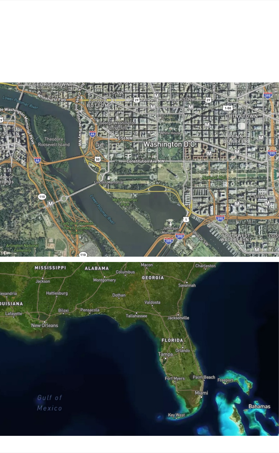
MapboxSatelliteStreetsusessamevectortilesourceasourgeneral-purposemapsand
containsthefullrangeofgeographicinformationrequiredtoprovidecontextforoverlays.
Satellite/SatelliteStreets
75
Satellite/SatelliteStreets
76
Imagery
MapboxSatelliteimagerycomesfromavarietyofcommercialproviders,aswellasopen
datafromNASA,USGS,andothers.Itisscolor-corrected,cloud-freerastertileset.Ascities
andlandscapeschange,weaddnewer,clearer,andmoreattractiveimagery.
Ifyounoticeanareawhereimageryneedsimprovementorupdatesforanyreason,letus
knowbyleavingyourfeedbackwithourimageryrequesttool.Thistooladdsyourrequests
toamasterlistthatweconsultwhenprioritizingupdates.Ifyouwishtorecommendan
imagerysource,pleasementionitinyourrequest.Pleasenotethatimageryisnotimproved
onasetscheduleandisupdatedwhenandwhereitbecomesavailable.
Satellite/SatelliteStreets
77
Globalcoverage
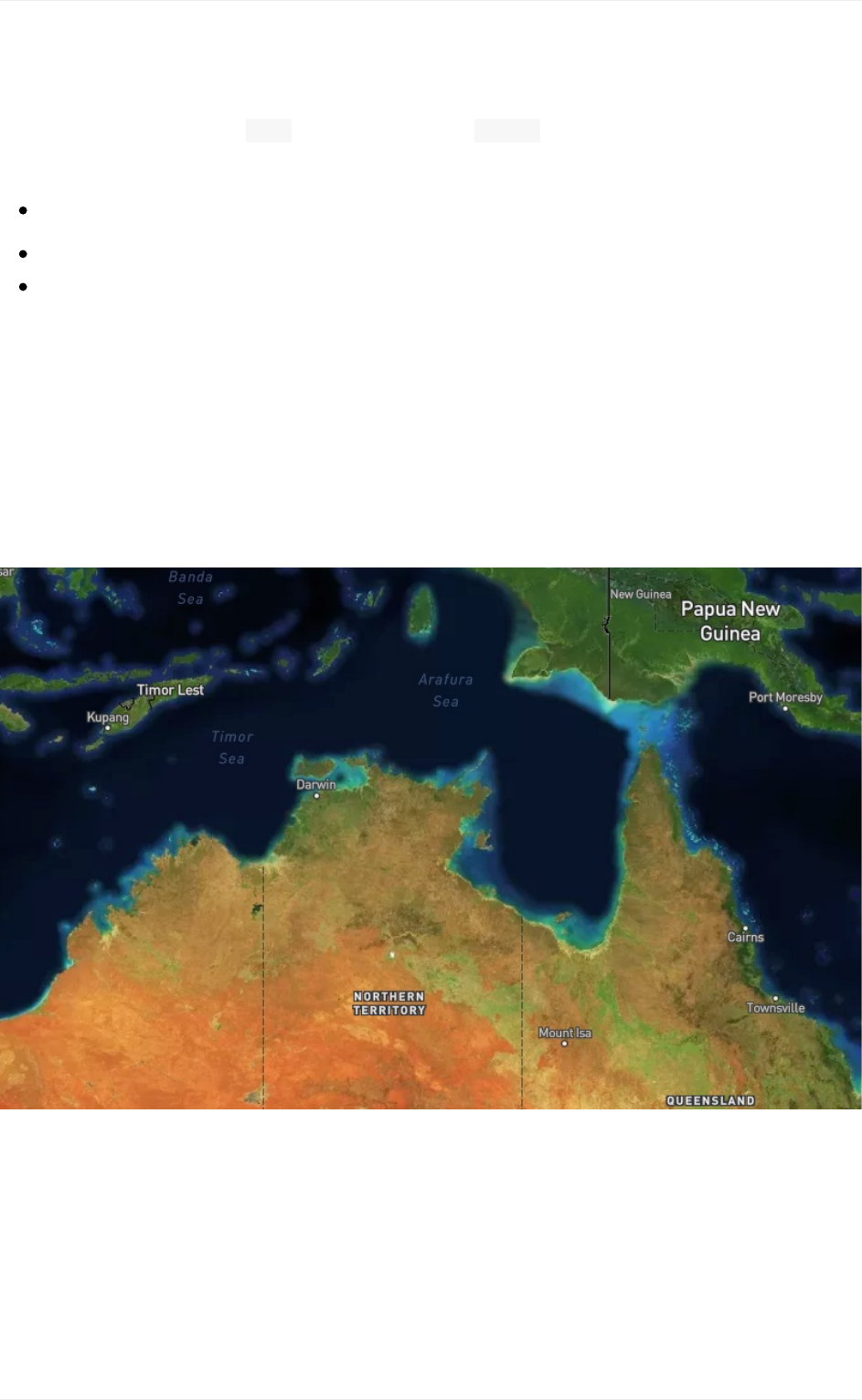
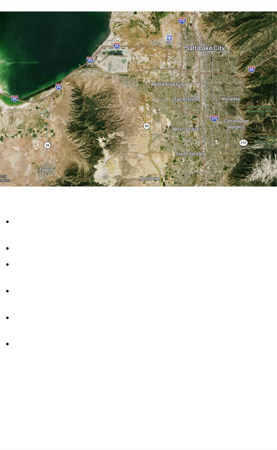
Cloudlessforzoomlevels 0–8andavailablefrom z0-19MapboxSatelliteimagerycomes
fromavarietyofsourcesdependingonzoomlevelandgeographicavailability.
Zoomlevels0-6.Usescloud-freedatafromNASAMODISsatellites.
Zoomlevels7-12.UsestheNASA/USGSLandsat5&7imagery.
Zoomlevels13+.Useacombinationofopenandproprietarysources,including
DigitalGlobeformuchoftheworld,USDA’sNAIP2011–2013inthecontiguousUnited
States, andopenaerialimageryfromDenmark,Finland,andpartsofGermany.
Additionaldesignfeatures
Roadways. Highlyorganizedroaddata,designedtopresentaclearlylegiblehierarchy
ofallroadtypesacrossawidezoomrange.
Administrativeboundaries. Aglobalpoliticalandadministrativeboundarylayer.
Builtfeatures. Buildingfootprints,railstations,urbanparks,landuse,famous
landmarks,andneighborhoodstores.
Naturalfeatures.Rivers,lakes,streams,oceans,coastalboundaries,parks,land
cover,andbeaches.
Places. Acompletehierarchyoflocationlabels,fromcountriesandstatesdownto
villagesandneighborhoods.
Uniqueiconography. Selectcountriesandcitiesfeaturecustomhighwayshieldsand
publictransiticons.
Satellite/SatelliteStreets
78

AmyLeeWaltonisamultidisciplinarydesignerthatwalksthefinelinebetweendesignand
code.AtMapbox,shebringsvisualnarrativeandsystems-baseddesignthinking intoher
cartographywork.Shetouchesmanyfacetsofcartography and user experience design
includingdesigningbeautifulthematicmaps,designingand maintaining general purpose
MapboxGLmaps,querying open source datasets, conducting online and in-person user
testing,and delivering valuable insight to product roadmaps for user-centered improvements.
AmyLeeholdsanMFAin graphicdesignfromtheMarylandInstituteCollegeofArt(MICA,
whereshecoalesced graphicdesignwithphysicalcomputing,generativeandcreativecode,
anddigital fabrication.Shehas designed, engineered, and shown herinteractiveinstallations
abroadwithinmultipleshowsinThe Netherlandsanddoneproject-baseddocumentation
workinIsrael.
An activespeaker,AmyLee builds curriculum for andleadstalksandworkshops discussing
the design process,purposeful programming,cartographyandvisual narratives.She's
passionateabout engaginginactsofsocialgood,cultivatingyourpersonalnetwork,and
championingdiversity andinclusionatyourplaceofemployment.Check out her Revision
Pathinterviewto hearherthoughtsondesign thinking,treatingcodelikeapaintbrush,and
changingthe waypeoplenavigatetheplanet.ReadherCommunicationArtsinterview,
Designeras Navigator,tofindouthowshegotstartedwithcartography.
AbouttheAuthor
79
