RM Acquisition 10002A GPS User Manual TND 720 User Manual 122812 LH indd
RM Acquisition LLC GPS TND 720 User Manual 122812 LH indd
UserManual.wiki
>
RM Acquisition
>
10002A User Manual
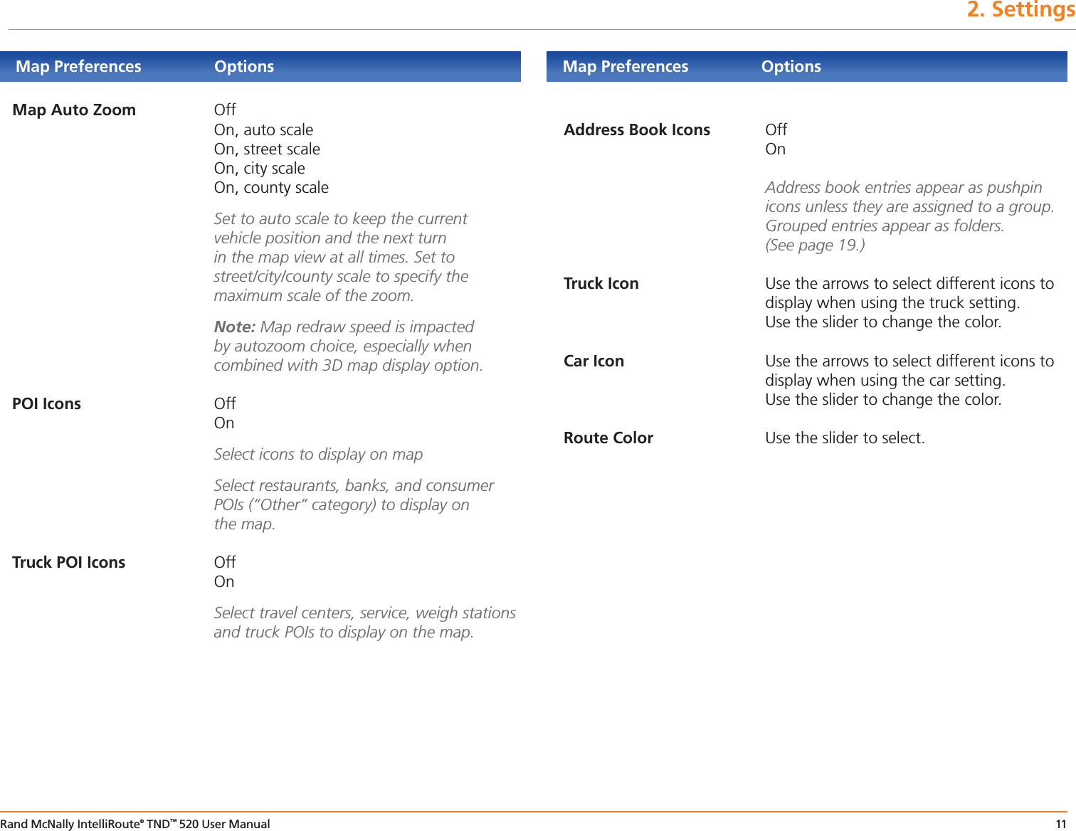
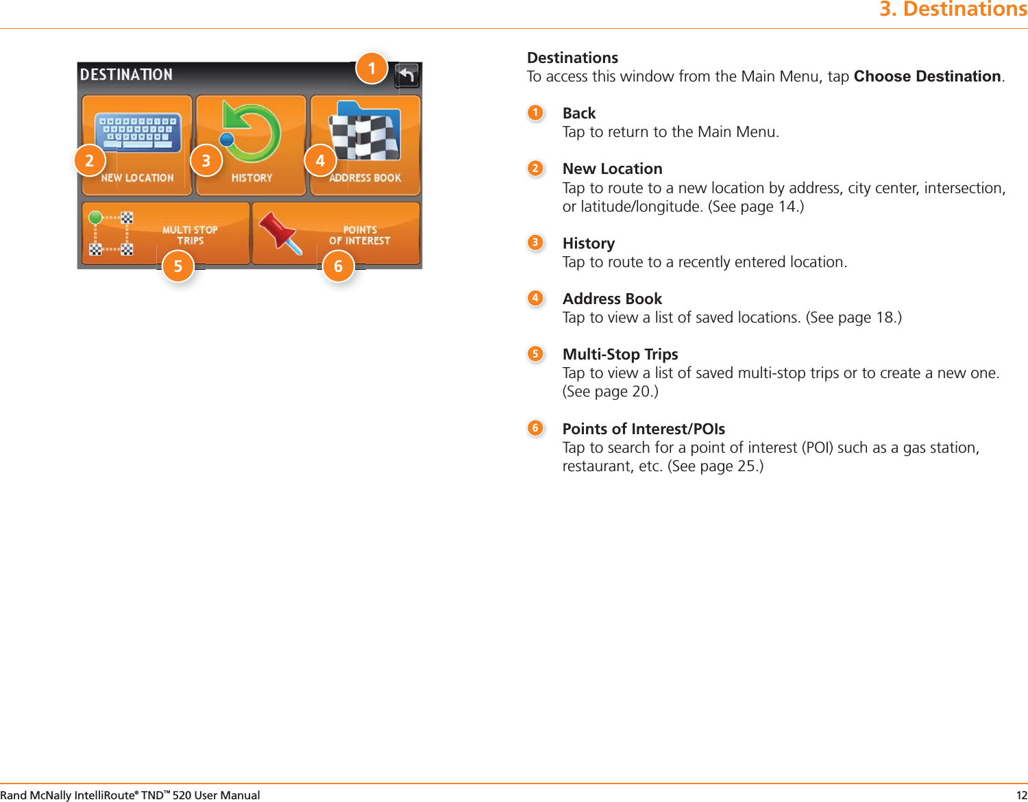
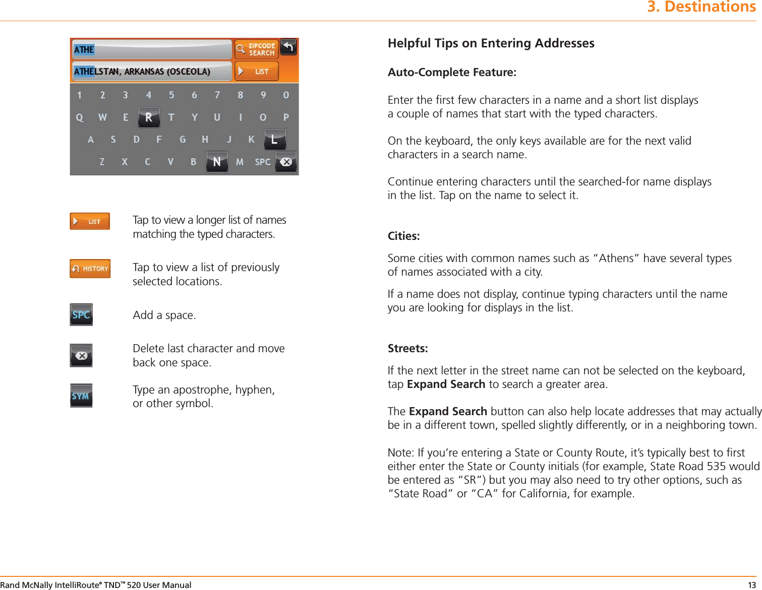
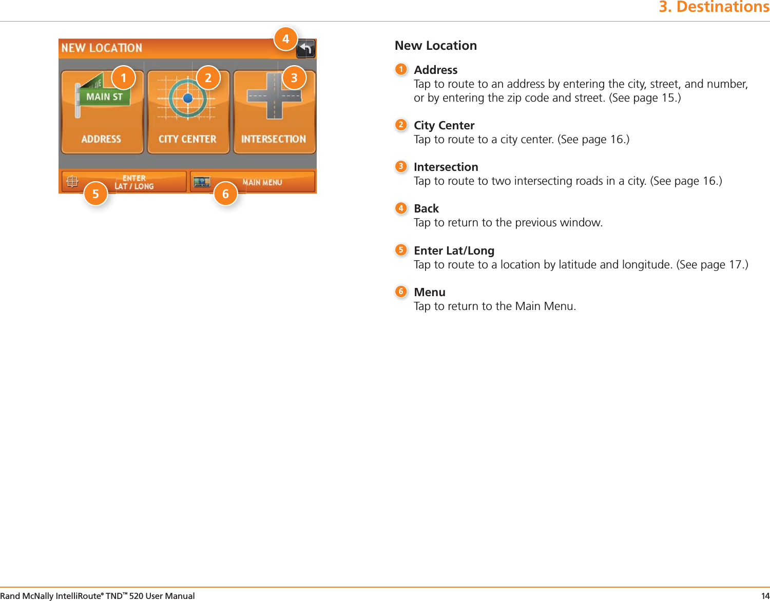
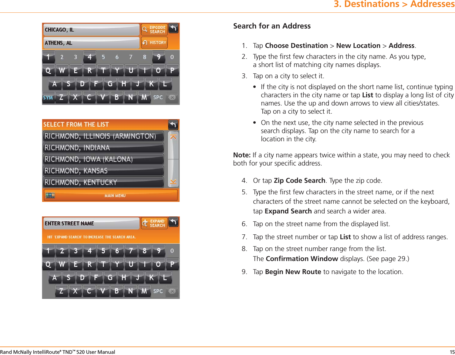
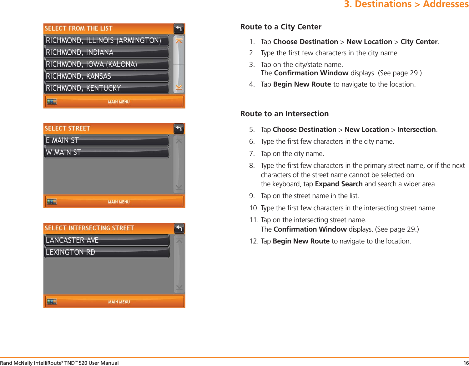
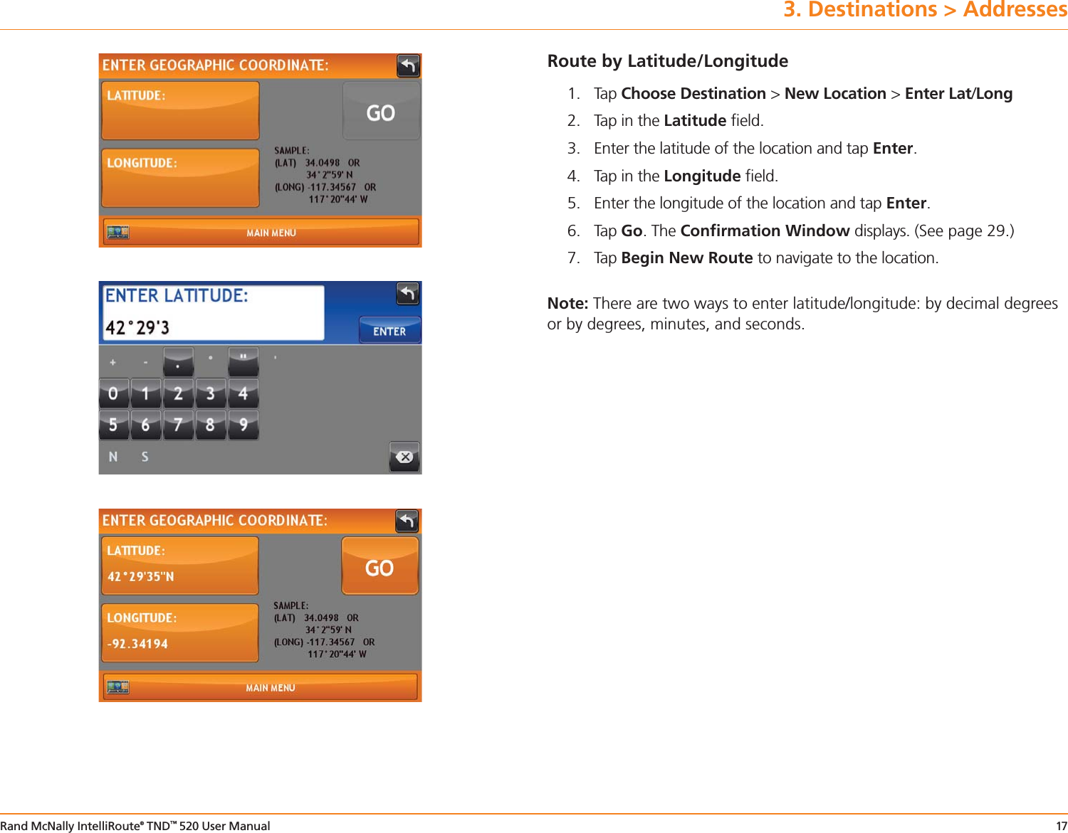
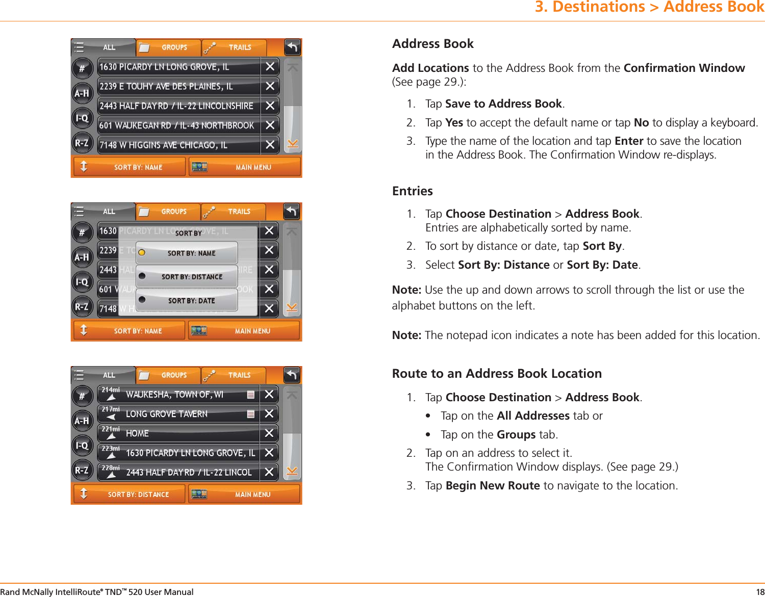
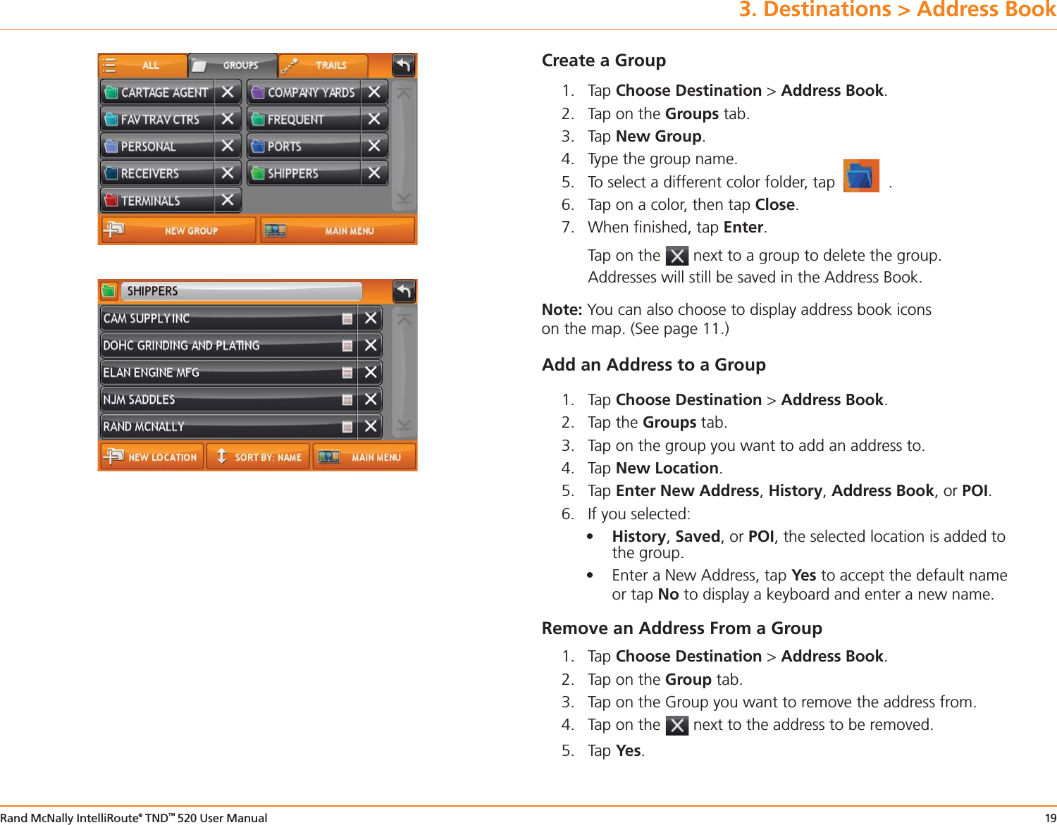
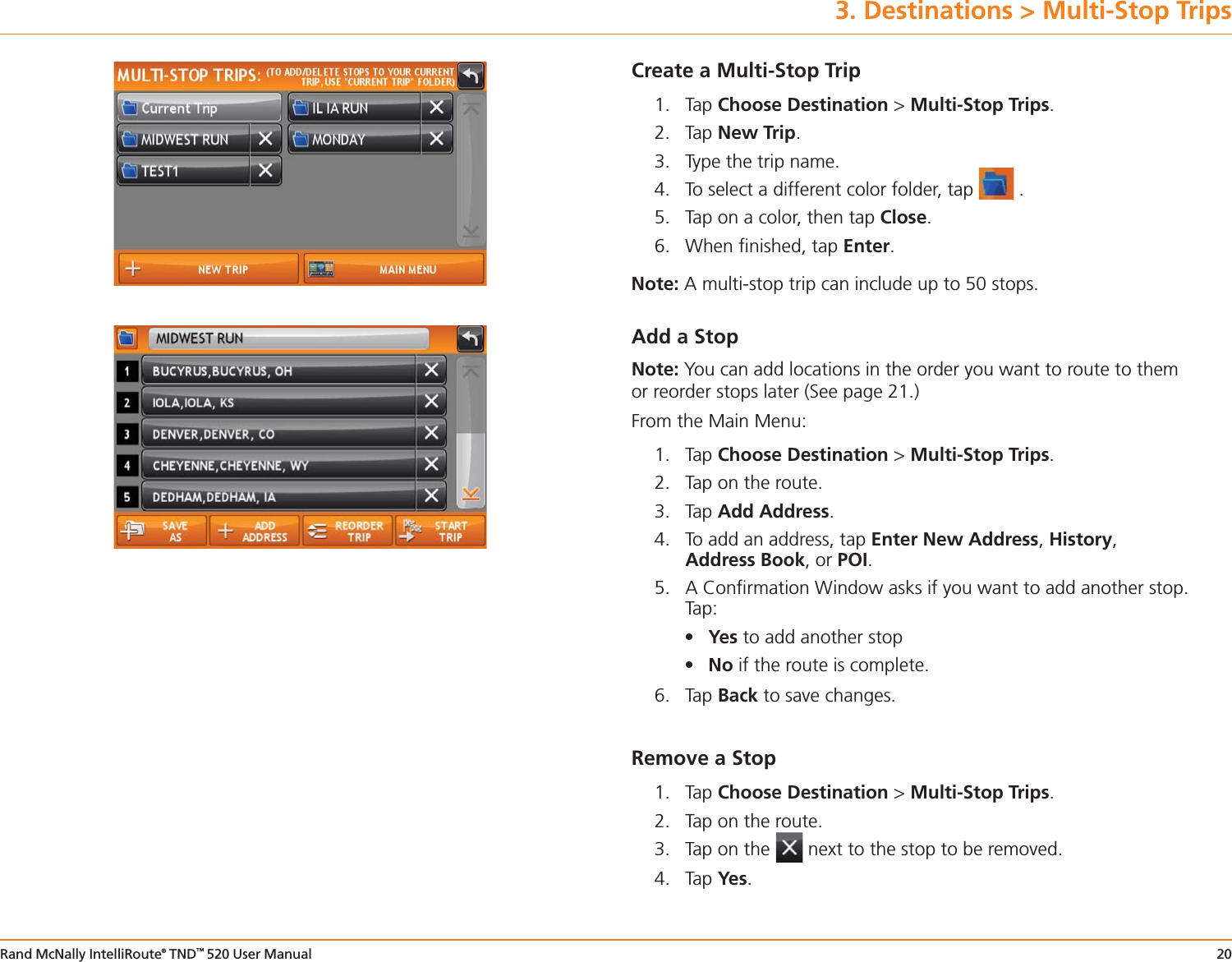
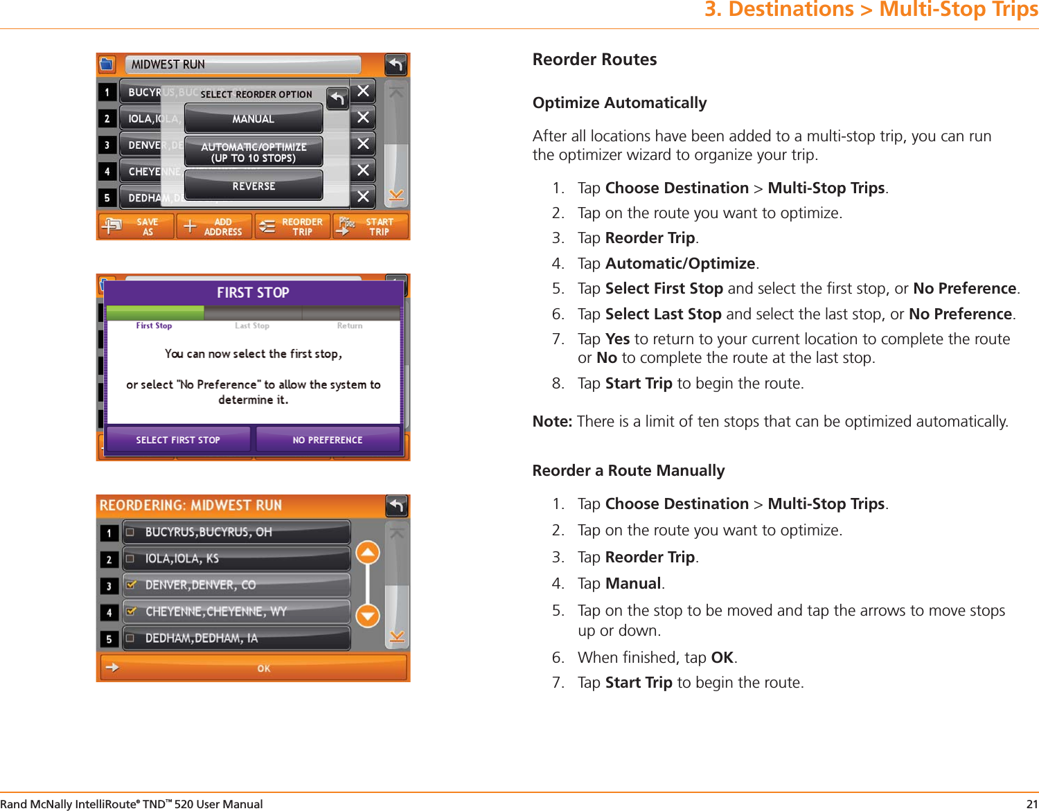
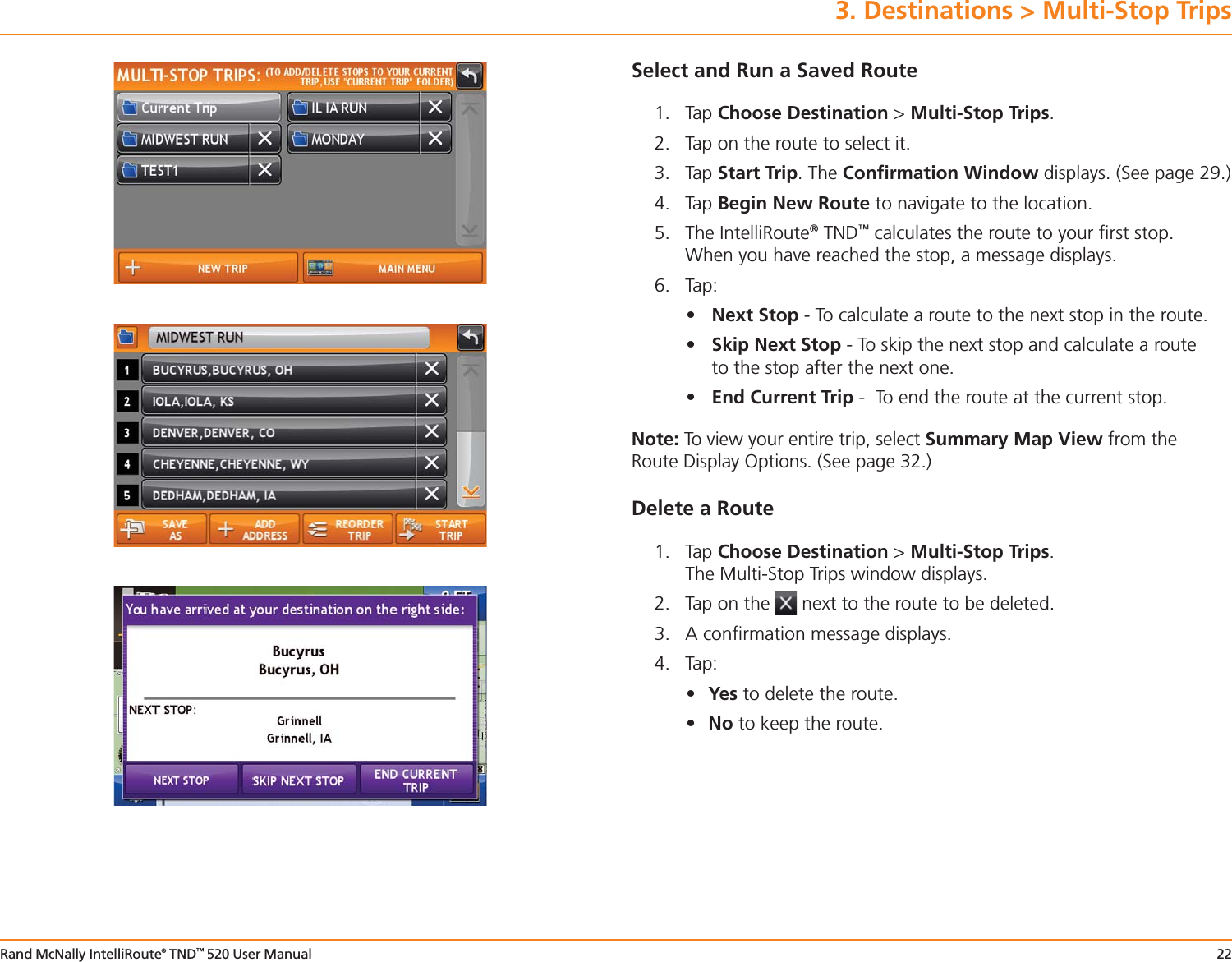
User manual 3-19
Navigation menu
Upload a User Manual
Namespaces
Wiki Guide
HTML
PDF
Info
Views
User Manual
Discussion / Help
Navigation