EVM User Guide
User Manual:
Open the PDF directly: View PDF ![]() .
.
Page Count: 27
Enhanced Vegetation Management
Reduction User Guide
09.2018

Table of Contents
Collector by ArcGIS Online
Overviews and Tutorials ...................................................................................................................... 3
How to Open ArcGIS.............................................................................................................................................................. 2
Home Screen Menu ................................................................................................................................................................ 4
Map Library....................................................................................................................................................................................... 6
Map Layers and Basemaps .......................................................................................................................................... 8
Location Search ........................................................................................................................................................................... 9
Adding Data................................................................................................................................................................... .10
Symbols ................................................................................................................................................................................................11
Parcels ...................................................................................................................................................................................................12
Project Starter, Vegetation Point, Vegetation Project.........................................................13
Conductor Inspector .......................................................................................................................................................... 14
GISInaccurate ...............................................................................................................................................................................15
Dos and Don'ts........................................................................................................................................................................... 16
Reference Layers .............................................................. ................................................................................ 17
GARB Environmental Layer ....................................................................................................................................... 18
Upload/Sync Offline Maps.................... .. ............................................................................ .. 20
Links and Resources...................... ...................................................................................................... .. 24
09.2018

Overviews and Tutorials
ArcGIS Collector
1 09.2018
How to Open ArcGIS Online
Overview
Summary
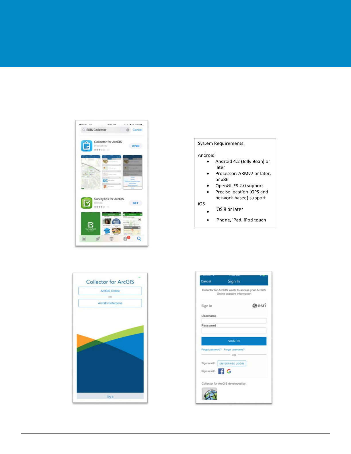
Below are step-by-step instructions for downloading, signing-in, and launching the ArcGIS Online app.
1. If needed, download Collector App by searching ESRI Collector in the App Store.
Basema
pLibrar
y
2. Start Collector App and sign in to ArcGIS Online.
Select ArcGIS
Sign-in
Online
2 09.2018
How to Open ArcGIS Online
Overview
3. Choose a map to work in. 4. The map will open and center on your location.
GPS On
When the ‘Current Location’ icon is
highlighted white, the GPS finder is on.
GPS Off
When the icon is not highlighted white,
the GPS tracker is off.
3 09.2018
Home Screen Menu
Overview
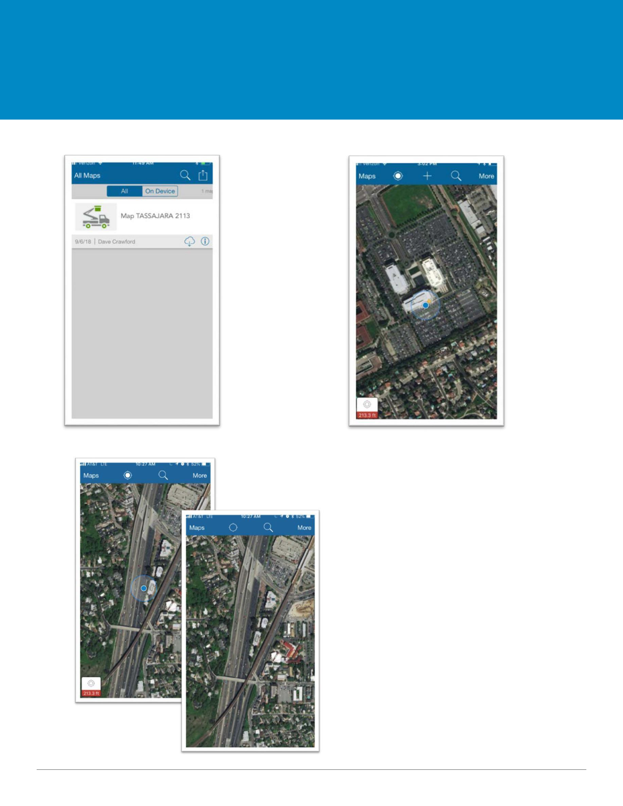
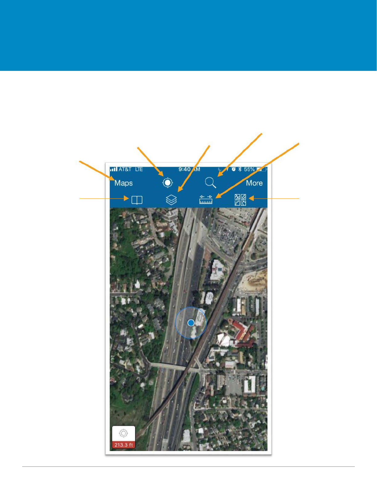
Summary
This is an overview of the ArcGIS Online for mobile interface.
Location Search
Measurement
Map Layers
Current Location
Tool
Map Library
Bookmarks
Basemaps
4 09.2018
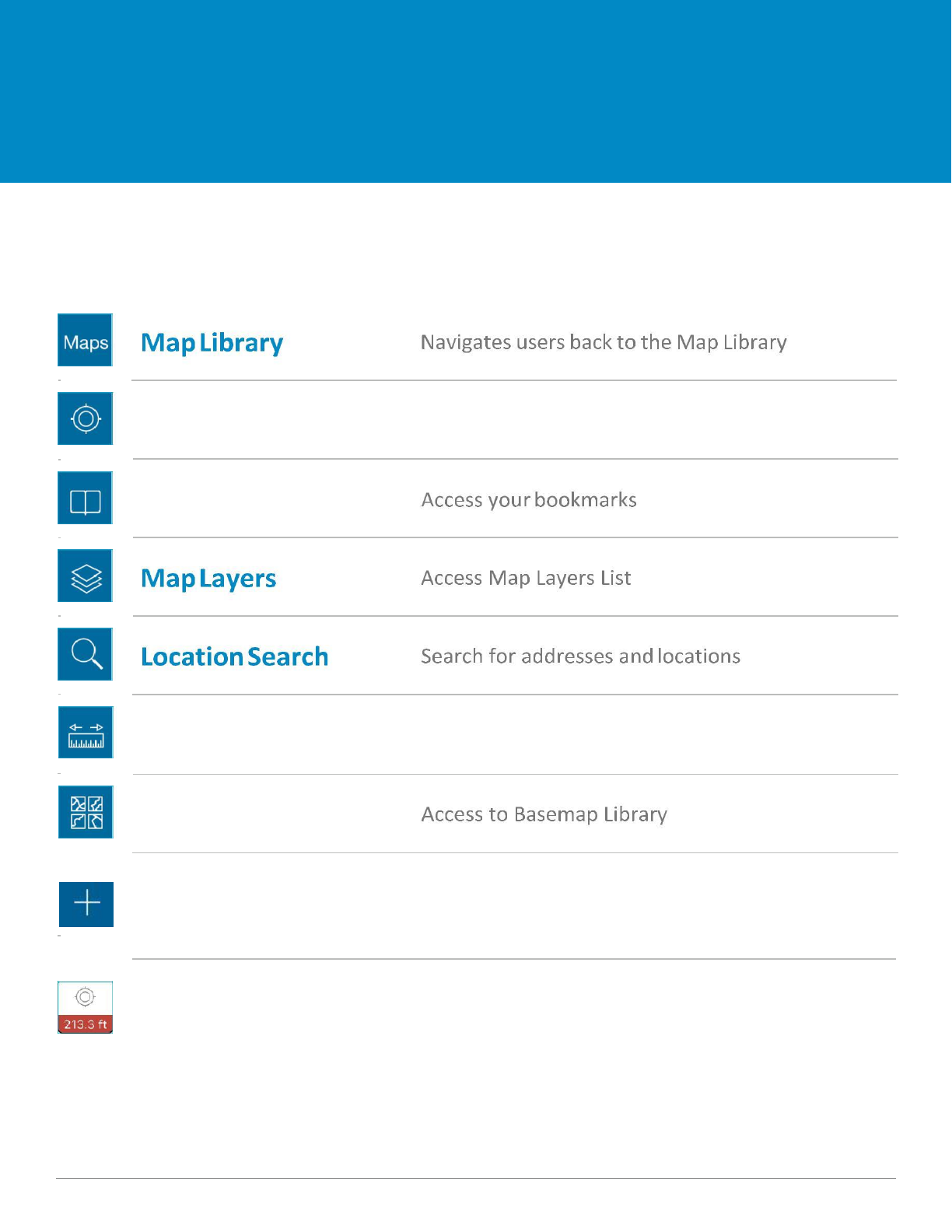
Home Screen Menu
Overview
Current Location
Center map on your current location
Bookmarks
Measuring Tool
Access Measurement Toolkit
Basemaps
Add a feature Create new point, polygon, or line
Accuracy Integration Horizontal and Vertical Accuracy
5 09.2018
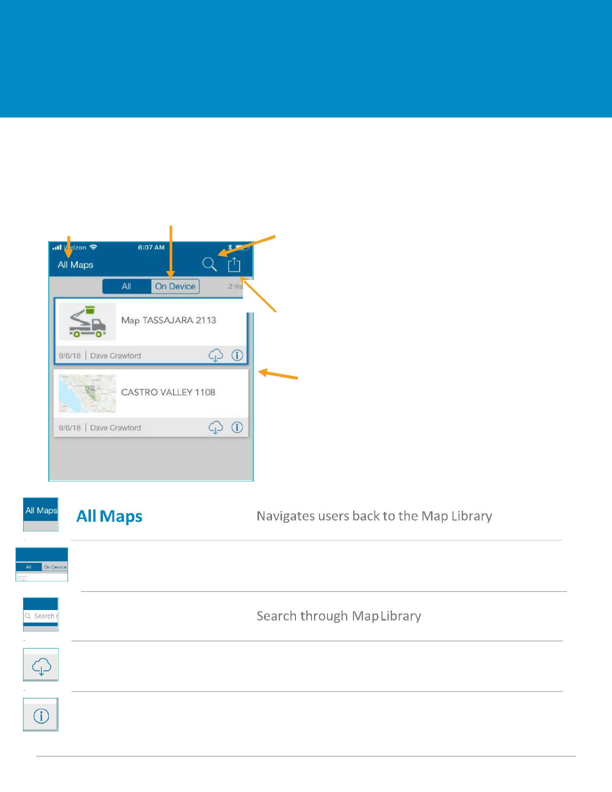
Map Library
Overview
Summary
This is where all your maps are stored. You’ll have the option to store the map on your device.
Map Library Toolbar
Map Library
Stored Maps
Search Maps
Account & Settings
Map Library
Stored Maps
Toggle between Cloud-Based and On Device
Search Maps
Download to Device
Store Maps on Device for ‘offline use’
Map Details
View map and survey details
6 09.2018
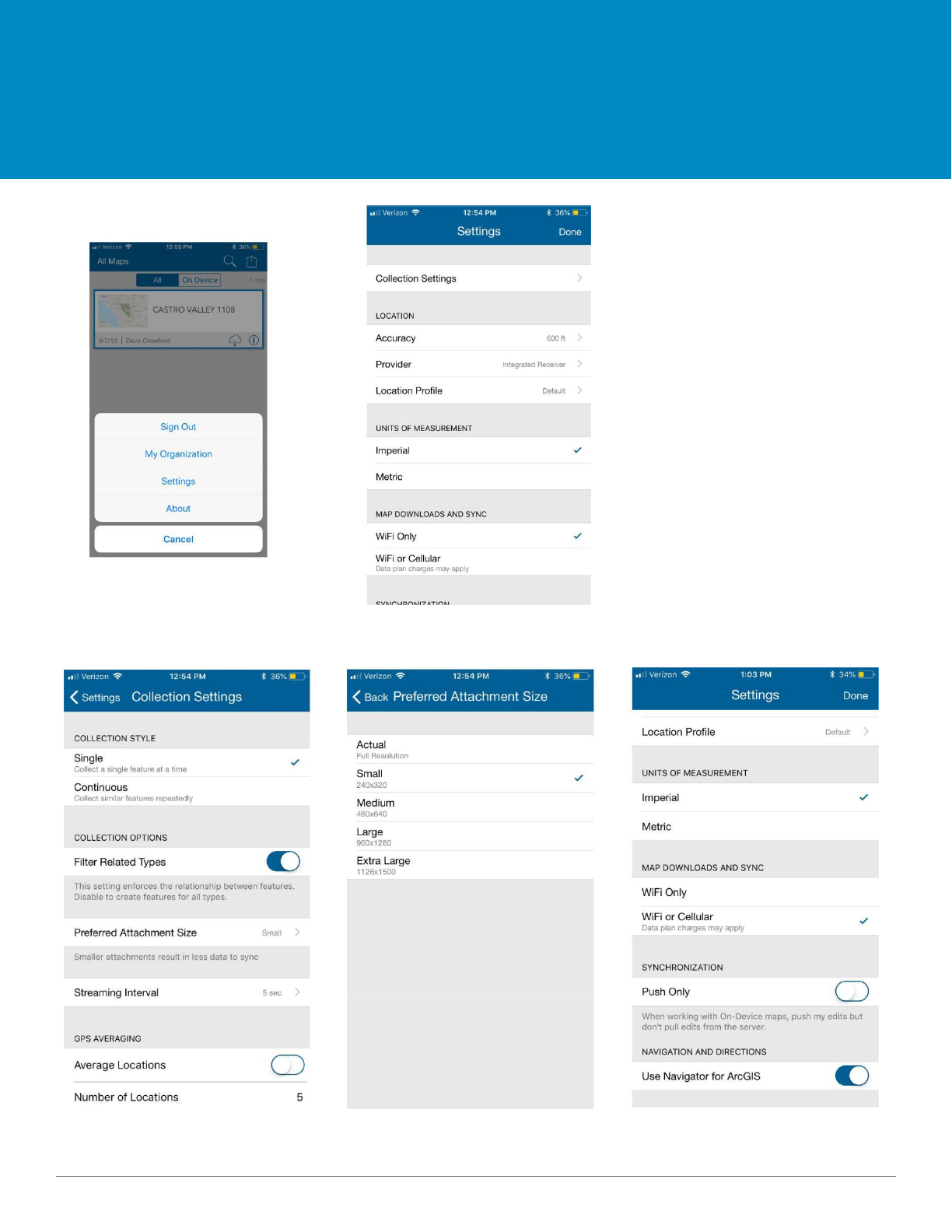
Map Library
Overview
Attachments should be saved as
a small file type.
Syncing of offline data should be
available via wifi or cellular data.
These can be configured in
settings on the home screen.
Open Settings and click on
Collection Settings.
Open Preferred Attachment Size Choose small attachment size. Choose Wifi or Cellular for Syncing
7 09.2018
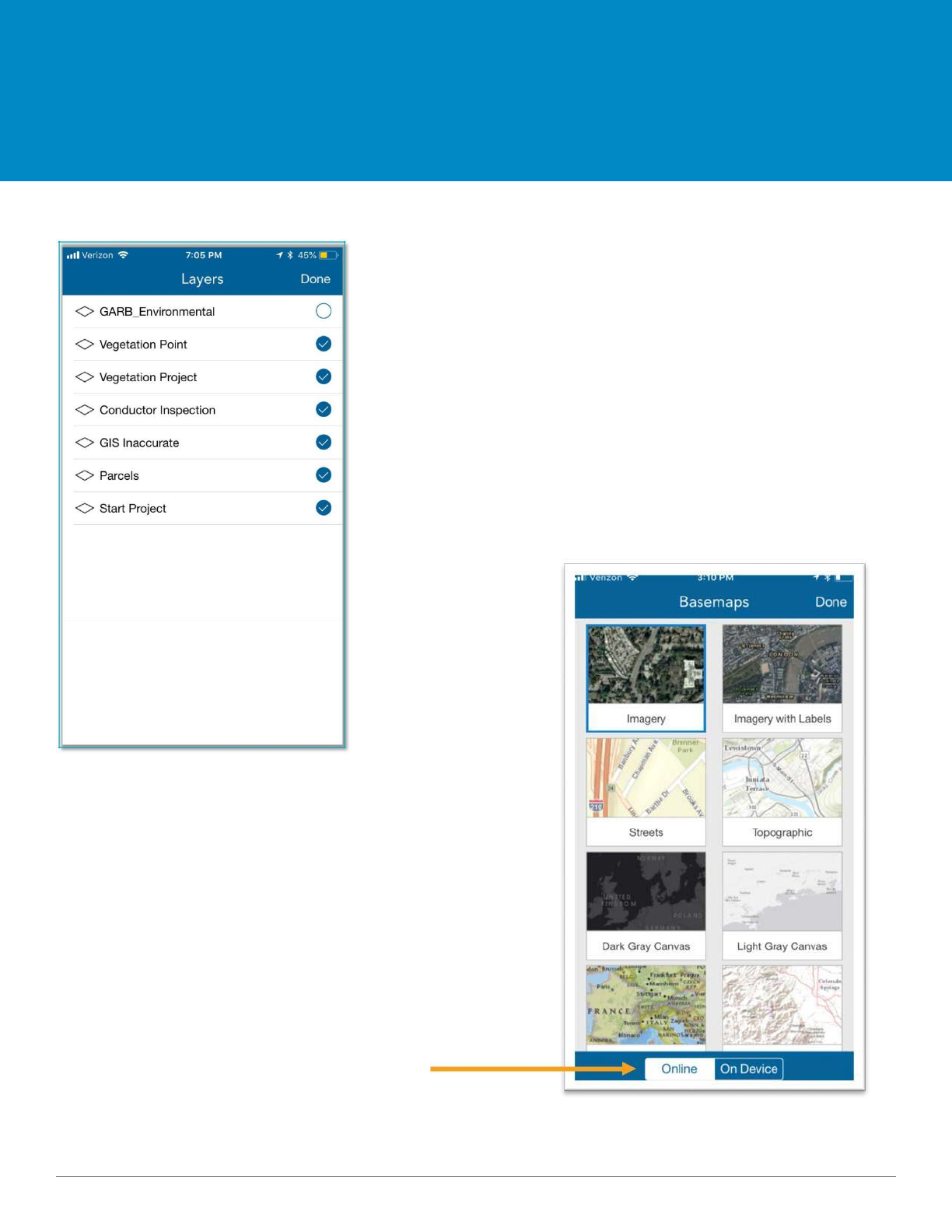
Map Layers and Basemaps
Overviiew
The available layers to view are 'GARB Environmental', ‘Vegetation
Point’, ‘Vegetation Project’, ‘Conductor Inspection’, ‘GIS
Inaccurate’, ‘Parcels’ and ‘Start a Project’. If the blue circle to the
left of the layer option is checked and blue, the layer is turned-on
and will appear on the map.
If connected to WIFI or mobile data (not working ‘On Device’) you
can access any ESRI basemap at any time. While connected to WIFI
or mobile data, you can store basemaps to be used when working
‘On Device’. This is where you can change the display type of the
map that appears on your screen.
Online/On
Device Toggle
8 09.2018
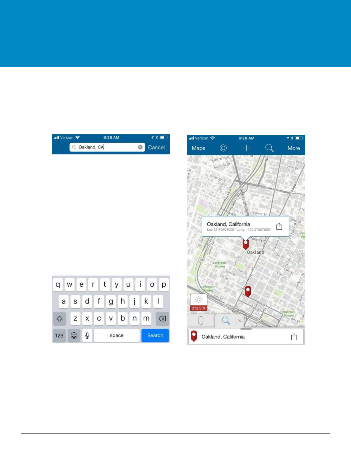
Location Search
Overview
Summary
This is where you can search for places or addresses. Once you enter the place or address you would like
to locate, the map will adjust accordingly.
9 09.2018

Adding Data
ArcGIS Collector
10 09.2018
Symbols
Legend
Summary
Below are the meanings of the symbols and colors that are seen throughout the map as you input
the information for each layer. These are based off of the Fuel Reductions Standards.
1.
The first layer that will
be updated will be the
EVM Parcels.
2.
3.
The last layer that will
be updated after the
inspection complete, is
the Conductor
Inspection Layer.
4.
5.
If necessary, Wood
Management points are
used by the Wood
Management Team.
The second layer that is updated is
the 'Start Project' layer This layer is
used to add a Vegetation Project or
to Add a Vegetation Point.
If necessary, a GIS Inaccurate
line can be added if the line in
GIS is not consistent with the
line in the field.
6.
GARB is an
environmental
reference layer.
See more details
on page 17.
11 09.2018
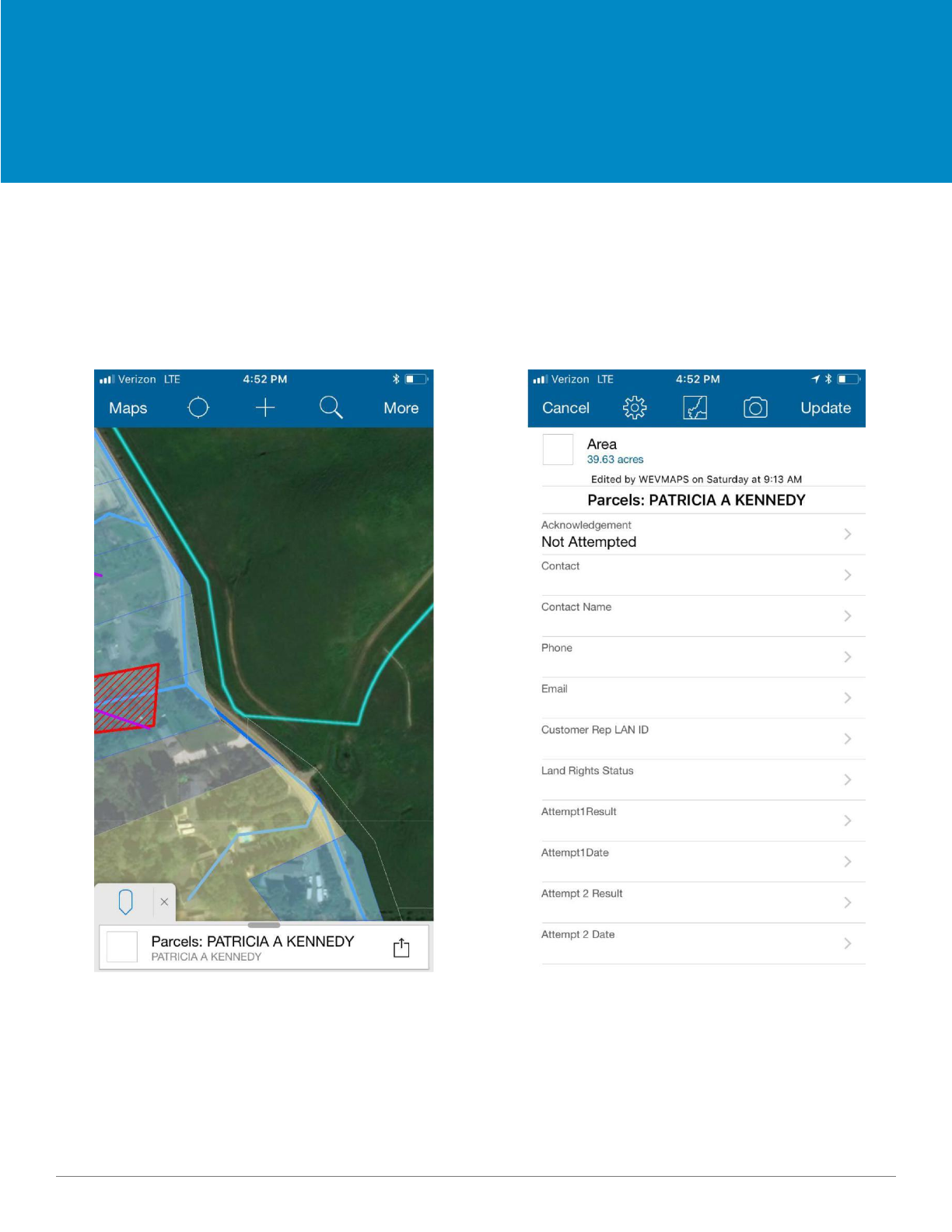
Parcels
Map Layers
Summary
The ‘Parcels’ layer is where you can enter the details for each property in the project assigned to you. Once
you click on the ‘Parcels’ option listed under the ‘Map Layers’ icon, you will see a list that needs to be
completed with information about the parcel. Make sure that an answer is selected for each of the items
listed.
12 09.2018
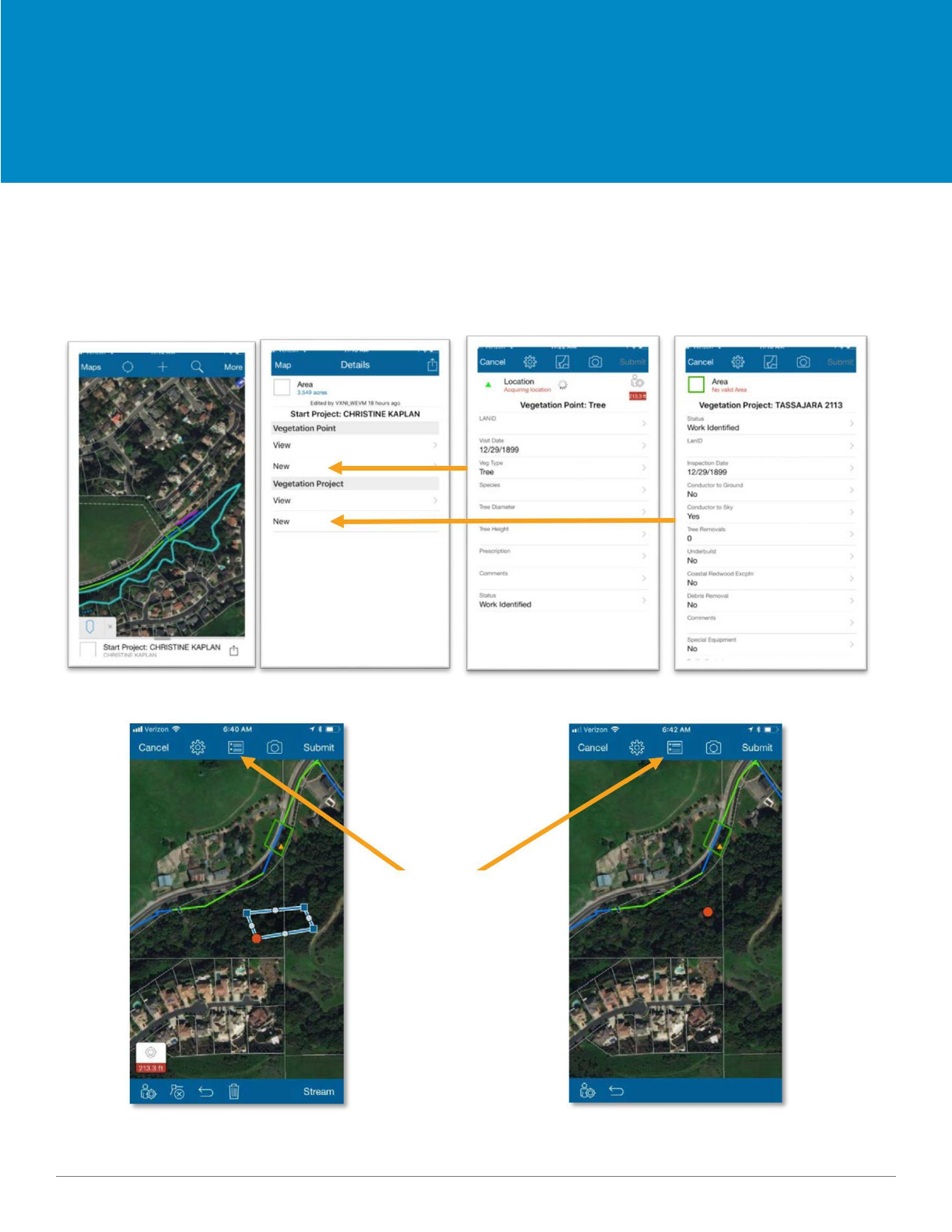
Upload/SyncProjectStarter,VegetationOfflinePoint,InputsVegetation Project
Map Layers
Start a Project
Use the ‘Start a Project’ layer to create a new Vegetation Project or to add a new Vegetation Point.
Once you open the ‘Project Starter’, to add a new project or point, click on ‘New’. This will open up the
screen with all the fields that need to be filled out for each project or point. After filling out each field,
toggle to the map to draw a new project or drop a new point.
Draw a project Draw a point
Click to toggle
back to the
data fields
13 09.2018
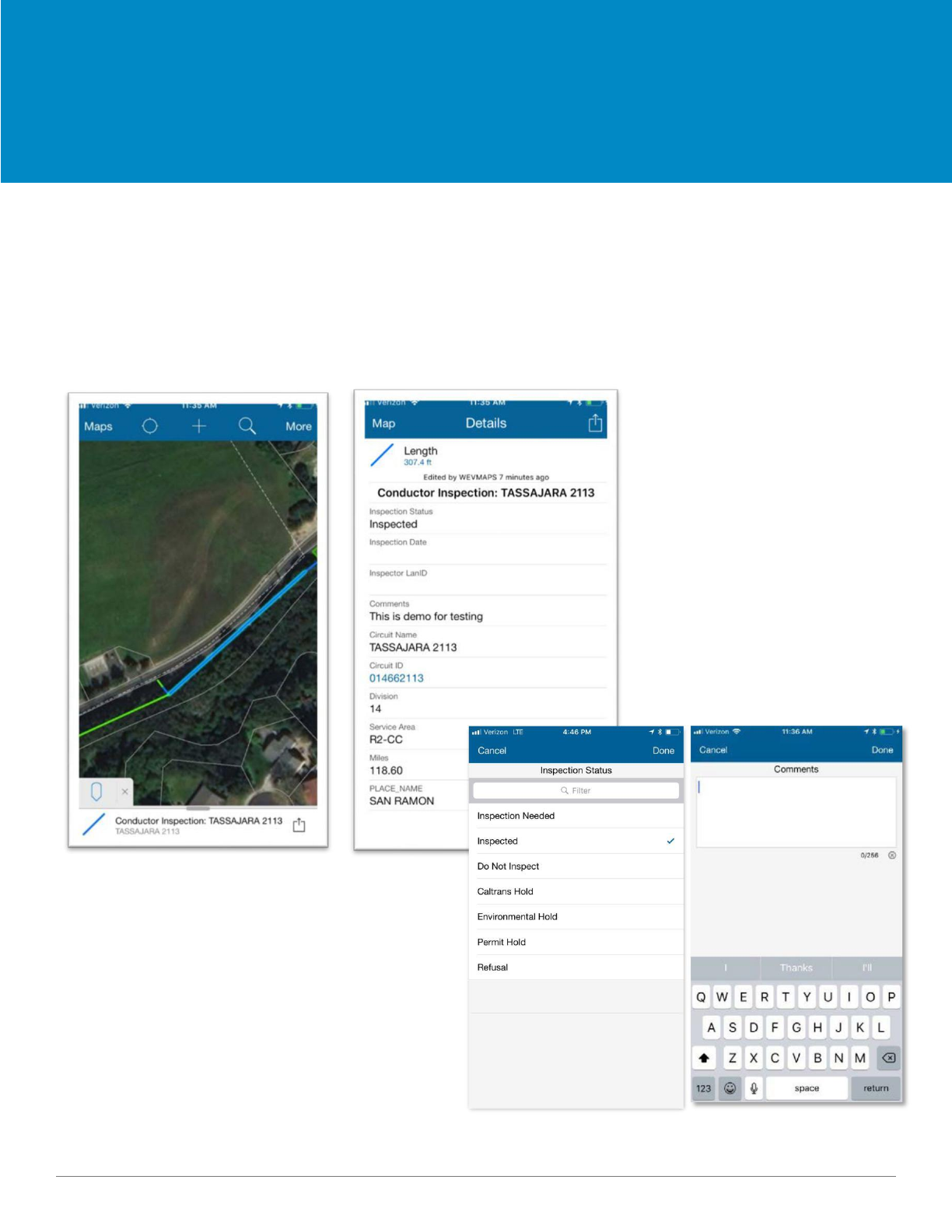
Conductor Inspection
Map Layers
Summary
The ‘Conductor Inspector’ layer is where you can enter the details for each powerline in the project
assigned to you. Once you click on the ‘Conductor Inspector’ option listed under the ‘Map Layers’ icon,
you will see a list that needs to be completed with information about the power line. Make sure that an
answer is selected for each of the items listed.
You will be prompted to either pick from
a list or enter text in an open field box.
14 09.2018
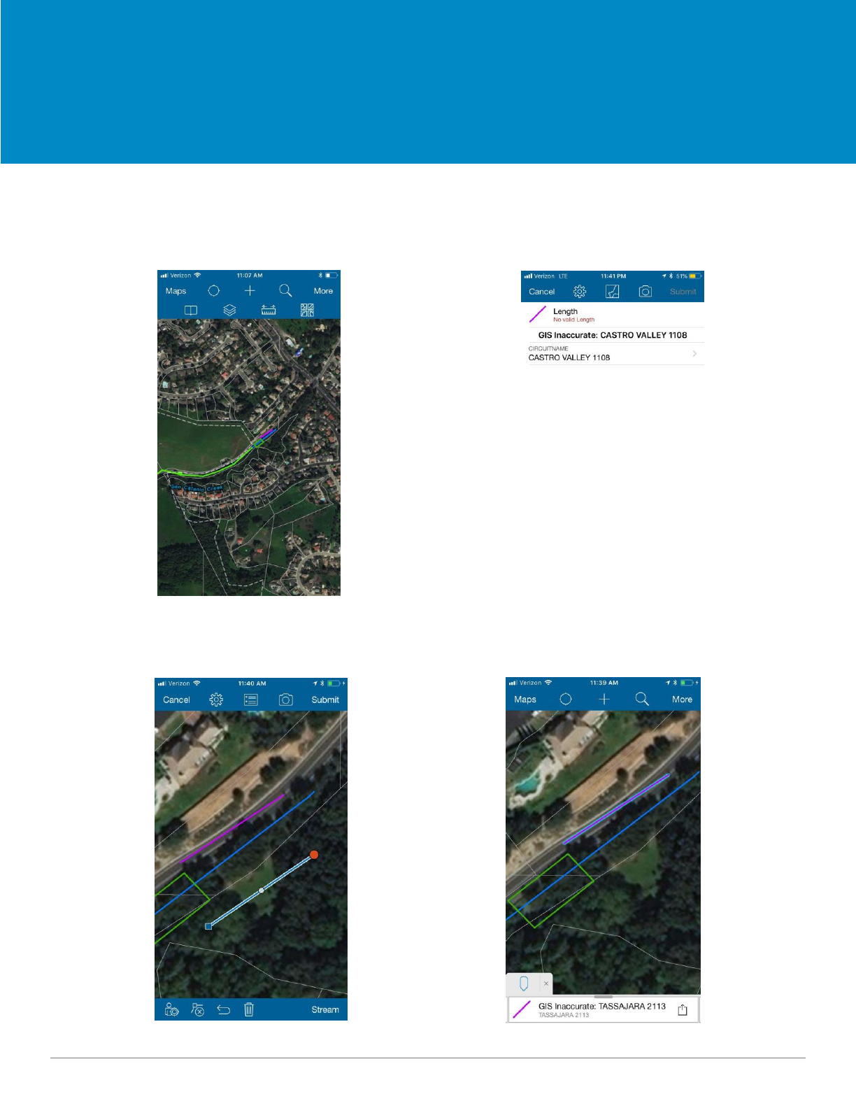
GIS Inaccurate
Map Layers
Summary
GIS Inaccurate is used when the electric line in the field is different than it is in GIS. if the line is inaccurate in GIS,
draw a line showing where the line is in the field.
Click on the + symbol to add a line Click on the map symbol to draw the line
Draw the line and hit submit There is now a new line segment
15 09.2018
Dos and Don'ts
Data Collection Best Practices
Follow these guidelines when creating projects and updating attributes.
Do
• Draw projects to encompass area of vegetation in the
field
• Draw projects to incorporate the line
• Draw multiple projects for locations where line is
along property line
• Associate all projects with the correct parcel
• Fill out all attribute fields
• Only draw projects where the work is
Don’t
• Draw overlapping projects
• Draw projects without line present.
If necessary, add a GIS inaccurate layer.
• Draw projects across multiple parcels
• Draw projects with the GIS Inaccurate
line.
16 09.2018

Reference Layers
ArcGIS Collector
17 09.2018
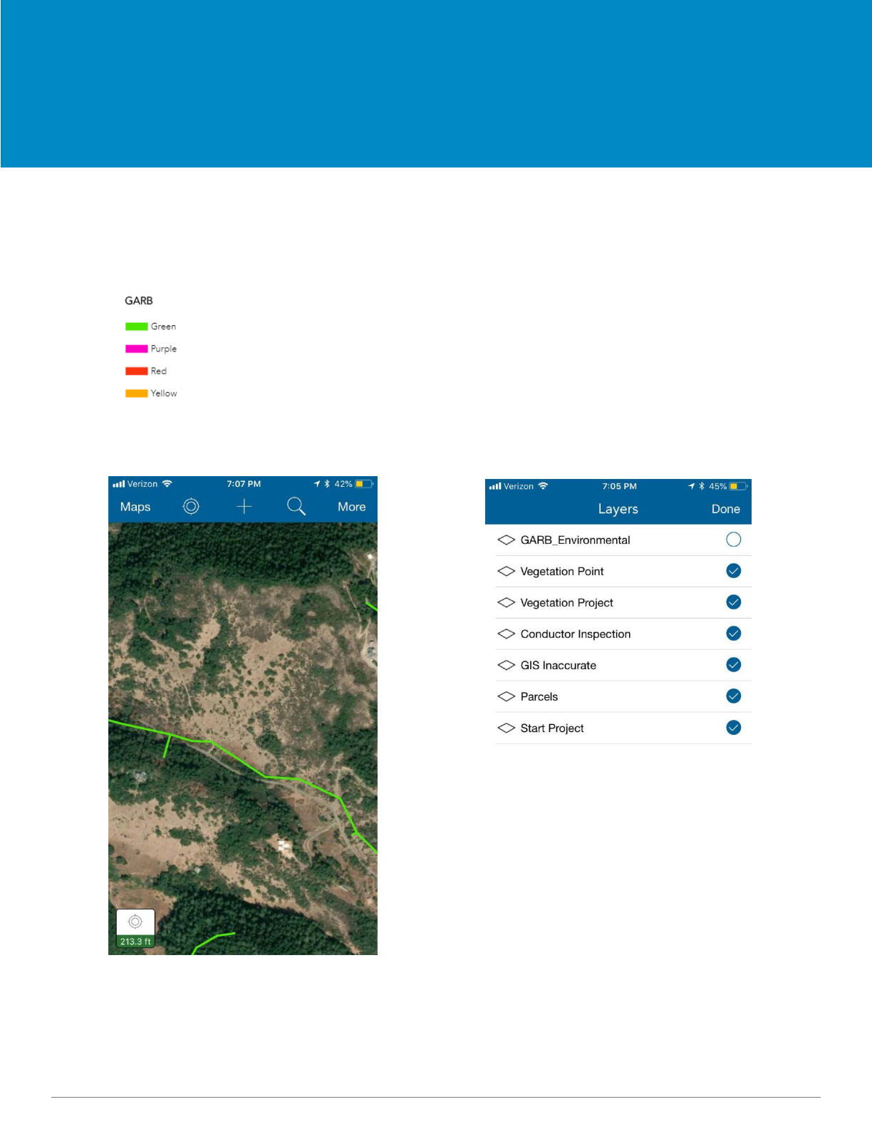
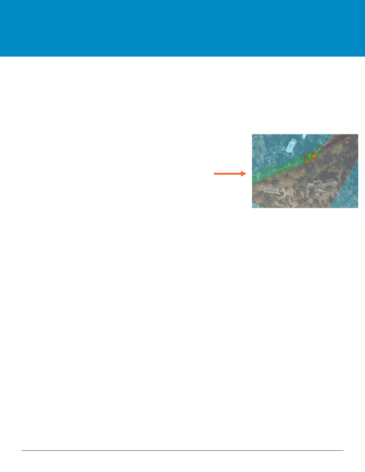
GARB Environmental Layer
Map Reference Layers
Summary
GARB is a reference layer visually displaying environmental information on the line as well as where there
may be additional constraints.
Green: Cleared with Standard BMPs – okay for ground to sky. Apply the Green
Environmental Release to Construction (ERTC)
Red: Agency land: Do not work. Permit Required. Consult with Environmental Lead.
Yellow: Caution: Conductor to sky only. Specific AMMs may apply. Amber ERTC
can be obtained from the Environmental Lead.
Purple: Places where reports have been written
The GARB layer is not turned on
upon login.
Open Layers to turn on the
GARB layer.
18 09.2018
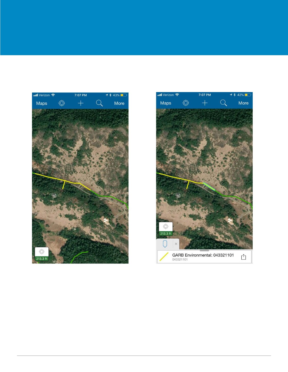
GARB Environmental Layer
Map Reference Layers
Once the GARB layer is turned on it
will be visible over the Conductor
Inspection Layer.
GARB is for reference only
and will not be editable.
19 09.2018

Upload and Sync
Offline Maps
ArcGIS Collector
20 09.2018
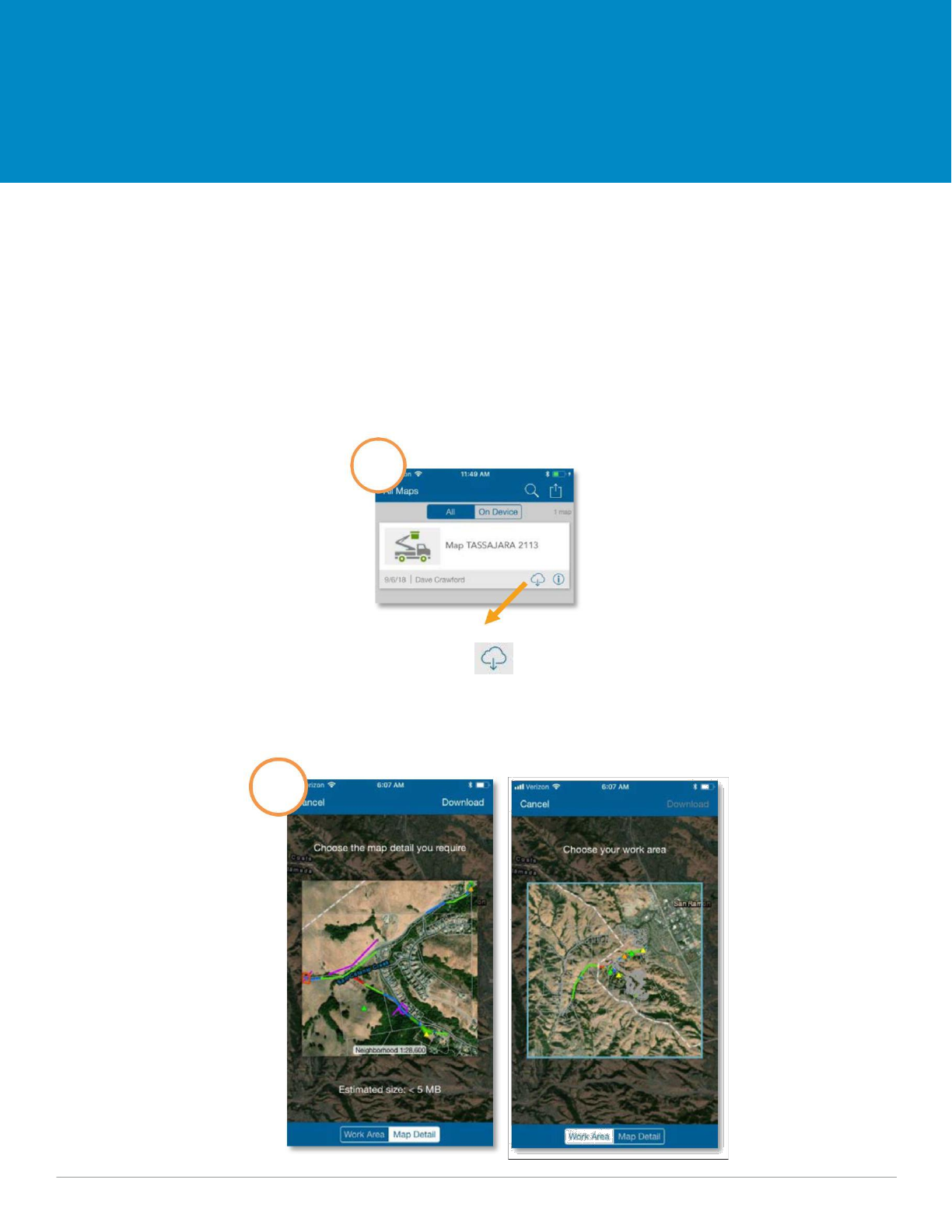
Upload/Sync Offline Maps
Summary
If you are working in a remote area with limited cellular service, you can download a map to work offline to
work ‘On Device’. If offline or working ‘On Device’, after you have re -established cellular service, you will
need to go back to the ‘Maps’ menu under ‘On Device’ and click the up/down cloud icon with the red
number (indicating the number of features that have not been uploaded to ArcGIS Online) and select the
cloud to submit and sync these features to ArcGIS Online. This requires cellular data or WIFI connection.
Downloading a map for offline use
1
Click on the icon to
download the map.
2
21 09.2018
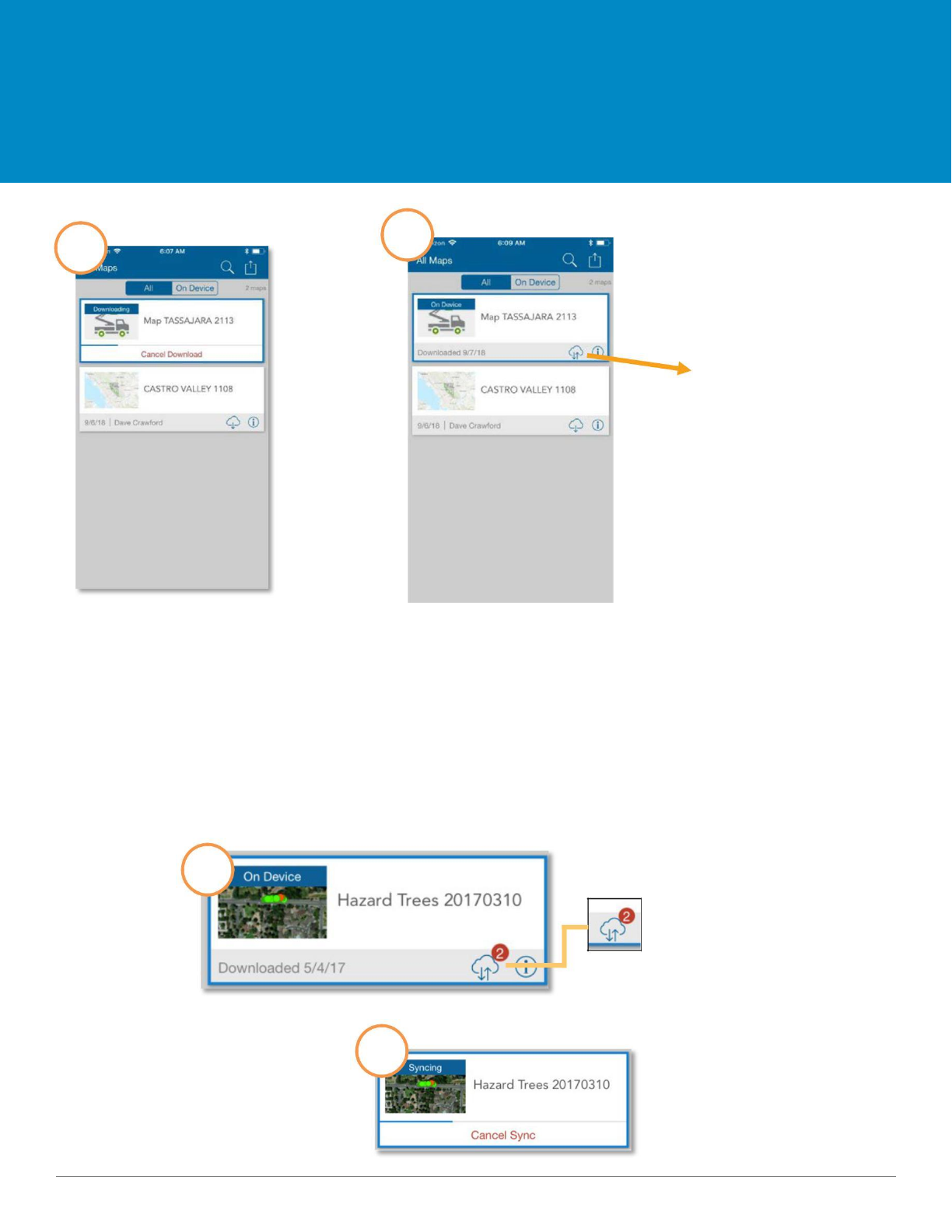
Upload/Sync Offline Maps
4
3
This icon means
the map is now
downloaded
onto your device
Syncing your offline activity
If you are working offline or ‘On Device’, be sure to sync your data once you have re-established either
cellular service or have a WiFi connection. Once you have finished syncing all your offline maps, you can
delete the saved maps from your device.
1
Select Sync to
Cloud icon to
submit the 2
features added
offline to
ArcGIS Online.
2
22 09.2018
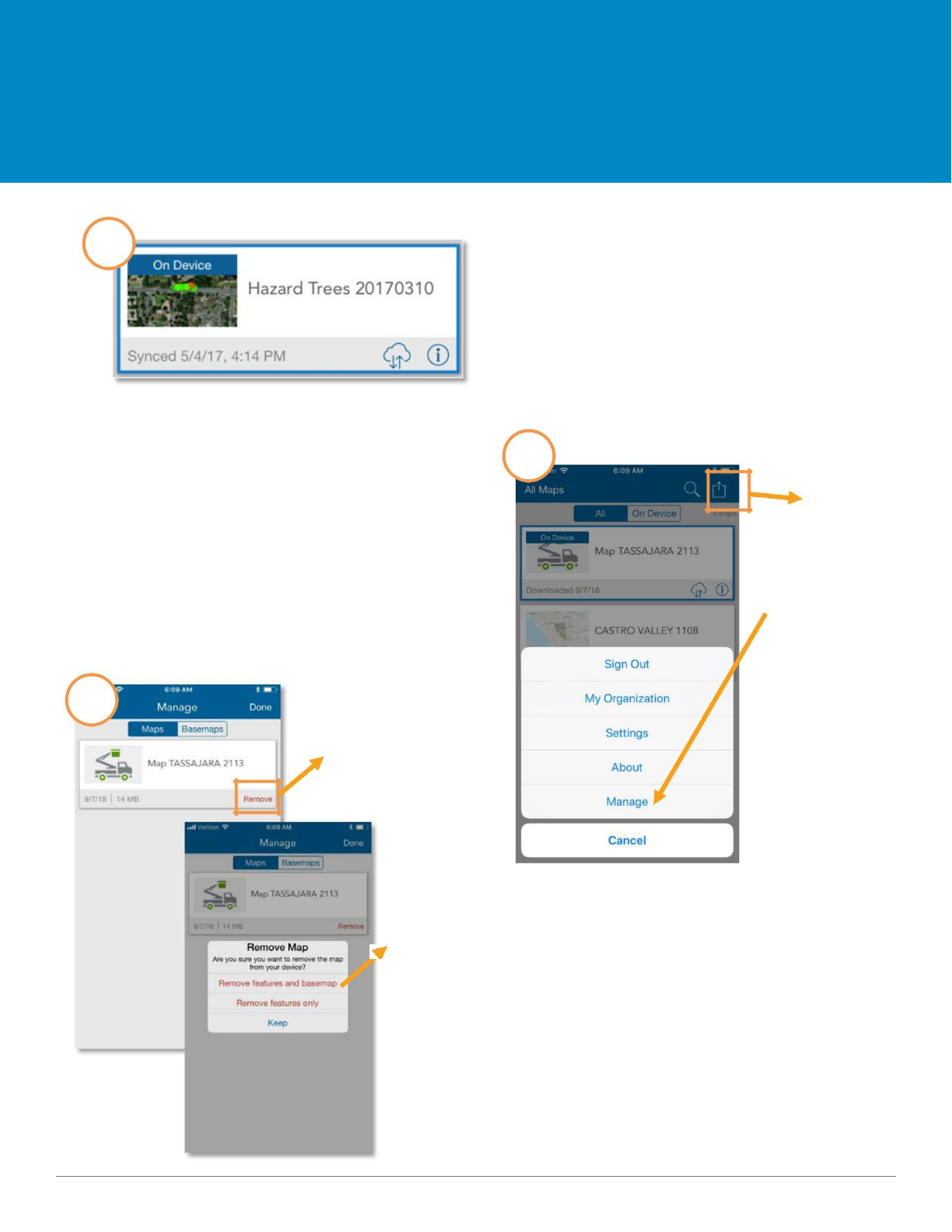
Upload/Sync Offline Maps
3
If you are working online, connected to ArcGIS
Online with WiFi or cellular data, you do not need
to sync because it is done every time you select
submit.
4
Click here and
select “Manage”
to delete the
map off of your
device once you
have completed
synced to ArcGIS
5
Select “Remove”
Select “Remove
features and
basemap” to delete
the map from your
device
23 09.2018

Links and Resources
ArcGIS Collector
24 09.2018

Links and Resources
All Documentation can be found at the following link:
https://tinyurl.com/EVM-User-Guide-pdf
The following can be found in this folder:
User Guide
Quick Start Guide
Collector Videos
First Time Login Instructions
General Guides
Questions related to Collector (adding and editing features, layers, etc.) can be directed
to the following email address:
AWRRMapsSupport@pge.com
Questions related to logging in or resetting passwords can be directed to TSC Support at
the following number: 415-973-3411.
25 09.2018
