Rec Boat Guide Port Phillip
rec_boat_guide_port_phillip
User Manual: Pdf
Open the PDF directly: View PDF ![]() .
.
Page Count: 2
parks victoria
port manager
for port phillip
Parks Victoria is the local port and waterway manager for
the local port of Port Phillip and manages piers and jetties,
mooring permits, aids to navigation and Marine National Parks
and Sanctuaries. Parks Victoria also acts as a referral agency for
planning matters and authorisation of new structures.
Parks Victoria has the accountability for the safety of water
users, control of vessel activities and movements in the local
port and is authorised under the Marine Act 1988 to issue
infringement notices or prosecute people who break the law.
The Victorian Water Police can also issue infringement notices
and work in partnership with Parks Victoria on Port Phillip to
ensure the bays are used safely.
For further information contact the Parks Victoria Information
Centre on 13 1963 or visit www.parkweb.vic.gov.au
boating safety
checklist
To ensure you have the best possible boating
experience on Port Phillip it’s important to do
a few things before you depart.
Be prepared before you leave
l Carry safety equipment according to the regulations, including
approved life jackets or PFD-1s.
l All children under the age of 10 years must wear an approved
lifejacket or buoyancy vest/garment, or PFD-1, 2 or 3 while in
a recreational boat that is underway, unless the child is within
a deckhouse, cabin, half cabin or a secure enclosed space.
l Have a chart of where you are going and a radio.
l Tell someone where you are going and when you expect
to return.
l Know the rules, local regulations and distress signals.
l Check out local conditions, weather and tides.
l Carry sufficient fuel, water and a first aid kit.
l Ensure engine reliability and adequate fuel system and always
carry sufficient fuel.
l Don’t overload your boat.
On the water
l Adhere to the prescribed speed limits.
l Ensure you always keep to the right of channels.
l Wear your life jackets.
l Keep a safe distance between your boat and other boats.
Remember your wake can affect others users, including those
on floating infrastructure.
l Keep a lookout at all times, especially for rowers or non
powered craft who are generally harder to see and hear.
l Never mix alcohol and operating a vessel.
l Keep well clear of moving ships as they may alter course and
without notice.
l Do not obstruct the movement of large vessels by drifting in
shipping channels and across shipping tracks.
l Be aware that the bow-wave or wash from large ships, including
the large commercial ferries, can cause your boat to capsize or roll
heavily as to cause serious injury to its occupants.
l Take care not to cross ahead of a large vessel as you may
underestimate its speed and not be seen.
l If you hear a vessel sounding at least five short and rapid blasts
on its horn, you must get out of its way.
l Keep a careful watch on the weather and watch out for other
boats and hazards.
l Ensure a low wake is maintained when passing rowers and
other non powered vessels.
Regulations to be observed
• Immediately slow down to 5 knots around swimmers or divers.
• Don’t exceed the speed limit.
• Observe boat zone boundaries and restrictions.
• Know the Marine National Park and Marine Sanctuary
boundaries and restrictions.
• Take all rubbish home with you and dispose of appropriately.
• Remember all native plants and animals are protected by law.
• Jumping or diving from piers or bridges is not permitted.
• Vessel operators over 21 years of age must have a BAC below 0.05.
• The discharge of sewage and other waste from boats is prohibited.
look after
the bay
Boat operators have a responsibility to protect the marine
environment and ensure it can be enjoyed for future generations
to come. You can protect Port Phillip and minimise your
environmental impact by following these simple guidelines:
• Avoid anchoring over seagrass and reef areas and consider
purchasing an anchor that does less damage to seabeds.
• Keep your boat clean and protected from aquatic pests.
• Reduce speed when operating power boats in shallow water or
when close to the shore line as propellers can cause considerable
damage to sensitive seabeds.
• Prevent pollutants such as petrol, oil, sewage and detergents
from entering the water.
• Store rubbish securely on your boat and always take all rubbish
home with you.
• Dispose of sewage waste properly and use pump out facilities
where they are available.
• Clean out bilges and sumps regularly.
• Launch or retrieve your craft at designated launching ramps.
• Observe recreational fishing regulations.
• Keep clear of bird nesting and roosting areas.
• Remember all native plants and animals are protected by law.
• Get involved with a marine friends group. For information
contact Parks Victoria.
Kite
Boarding
Area
Kite
Boarding
Area
St Kilda
Pier
Station
Pier
St Kilda
Beach
Lagoon
Pier
Kerferd
Road Pier
Albert Park
Port Melbourne
Middle Park
Sandridge
Beach
Boating
only
Swimming only
All vessels including personal
watercraft, powered and non power
vessels are not permitted in this zone
All vessels must adhere to 5 knot
speed limit within 200m of the shore
Port Phillip Directory
Emergency
000 or 27MHz – Ch 88 or VHF – Ch 16
Australian Hydrographic Service
02 4223 6500 www.hydro.gov.au
Australian Volunteer Coast Guard
9598 9092 www.coastguard.com.au
Bureau of Meteorology
9669 4000 www.bom.gov.au
Dept. of Primary Industries
136 186 www.dpi.vic.gov.au
Dept. of Sustainability and Environment
136 186 www.dse.vic.gov.au
Environment Protection Authority
9695 2722 www.epa.vic.gov.au
Fisheries Victoria
13 FISH (13 3474)
www.dpi.vic.gov.au/fishing
Government Information Centre
1300 366 356 www.vic.gov.au
Heritage Victoria
8644 8800 www.heritage.vic.gov.au
Marine Safety Victoria
1800 223 022
www.marinesafety.vic.gov.au
Parks Victoria
13 1963 www.parkweb.vic.gov.au
Port of Melbourne Corporation
1300 857 662 www.portofmelbourne.com
Victorian Regional Channels Authority
5225 3500 www.regionalchannels.vic.gov.au
Victorian Water Police
9399 7500
Peak Organisations
One of the best ways to learn more about
a new sport or recreational activities on
Port Phillip is to contact one of the following
specialist peak organisations:
Australian Powerboat Association
www.ausapba.com.au
Australian Volunteer Coastguard
On water assistance, boating skills and licences
www.coastguard.com.au
Boating Industry Association
www.biavic.com.au
Boating Victoria
www.boatingvictoria.com.au
Canoeing Victoria
www.vic.canoe.org.au
Kite Boarding Victoria
www.kbv.org.au
Life Saving Victoria
www.lifesavingvictoria.com.au
Rowing Victoria
www.rowingvictoria.asn.au
SCUBA Divers Federation of Victoria
www.sdfv.org.au
VR Fish – Victorian Recreational Fishing
www.vrfish.com.au
Victorian Water Ski Association
www.vicwaterski.com.au
Wake Board Victoria
www.wakeboardvictoria.com.au
Yachting Victoria
www.vic.yachting.org.au
Publications
Admiralty charts
Available from most mapping outlets
The Marine Act and associated regulations
Available from the Government Information
Centre
Port Phillip Safety Chart Grid
Available from the Australian Volunteer
Coast Guard
Victorian Recreational Boating Safety
Handbook
Available from Marine Safety Victoria
Victorian Tide Tables
Available from Port of Melbourne Corporation
Vessel Operating and Zoning Rules
Available from Marine Safety Victoria
It’s no wonder Port Phillip is one of Victoria’s
most popular recreational destinations.
Whether it’s fishing, boating, kite boarding,
diving, swimming or simply walking along
one of the many piers, there’s so much to see
and do both on and under the water.
Discover a sunken warship
Lying in approximately 28 metres under the surface, the ex-HMAS
Canberra is a spectacular dive with many sections of the ship open
for exploration including flight decks, the bridge, engine rooms,
galley, and accommodation quarters.
Access to the dive site is restricted to those participating in diving
and snorkelling activities only. To enter the dive site divers must
either book a dive tour with a licensed tour operator or book a
2 hour time slot on the public mooring. Contact Parks Victoria for
more information or for bookings visit www.parkstay.vic.gov.au
Map Ref F14
Encounter whales, dolphins and seals in their
natural habitat
As you travel across the bay, be on the lookout for whales,
dolphins or seals. Dolphins tend to be seen more often at the
southern end of Port Phillip while seals can be seen soaking up
the sun at Chinamans Hat. Remember to keep a safe distance
from wildlife at all times.
Contact the Department of Sustainability and Environment for
guidelines on watching wildlife.
Map reference K14
Experience the new Queenscliff Harbour
The redeveloped Queenscliff Harbour is definitely worth the trip.
Restaurants and cafes complement the setting and the viewing
tower provides stunning views over Port Phillip Heads and Swan
Bay. The historic Queenscliff Pier and the charming Queenscliff
Township are only a short stroll away.
Map reference J13
Explore amazing underwater marine life
Port Phillip is home to four Marine National Parks and Sanctuaries
which host diverse marine life not seen anywhere else in the world.
These marine protected areas provide a variety of snorkelling and
diving opportunities for varying skill levels. Within Port Phillip
Heads Marine National Park, Popes Eye is a great sheltered dive for
beginners while Portsea Hole is an excellent challenge for divers
with more experience. See Marine National Parks section.
Hook a fishing adventure
With a surface area more than 35 times the size of Sydney Harbour,
there’s endless scope for fishing adventures in Port Phillip.
Whether you’re catching trevally, snapper, squid, leatherjackets,
salmon or bream, most fantastic fishing adventures start at
Patterson River. Four launching ramps with multiple lanes,
ample parking and continually improving facilities cater for over
50,000 boat launches each year and make Patterson River one of
Australia’s most popular boat ramp facilities.
Map reference W8
Visit coastal villages
Plan a day trip to one of the many seaside villages dotted around
Port Phillip. Accessible via local piers, the coastal villages have a
range of services and attractions to explore including restaurants
and cafes. Highlights include the peaceful Portarlington fishing
village, the historic maritime precinct at Williamstown, St Kilda’s
cosmopolitan foreshore and the bustling boutiques of Sorrento.
Licensed Tour Operators
Take the easy approach to organising your great bay adventures
by booking a tour, dive or fishing trip with one of Parks Victorias
licensed tour operators. For more information contact Parks Victoria.
Rediscover
nature
Reconnect
with life
Throughout the world there is growing recognition
of the vital contribution parks and waterways make
to a healthy environment, healthy individuals and
a healthy society. Enjoying Port Phillip is not only
a great day out – it’s good for you.
For further information contact the
Parks Victoria Information Centre on 13 1963
or visit www.parkweb.vic.gov.au
There are a number of rules and regulations
that must be observed to protect the bay
environment and ensure safety for all users
of Port Phillip.
Anchoring
When anchoring ensure you always place anchors correctly and
securely. Anchors damage reefs and seagrass beds when they are
allowed to shift. Consider purchasing a new anchor that does less
damage to seabeds. Where possible avoid anchoring over seagrass
and reef areas. Anchoring is not permitted in mooring grounds or
shipping channels and fairways.
Aquaculture reserves
Eight offshore marine Aquaculture Fisheries Reserves have been
established in Port Philip. These reserves total 1,990 ha including
existing aquaculture areas and have been farmed for over 30 years.
The reserves are clearly identified by yellow ‘special marks’ (piles
or buoys) with ’Aquaculture‘ inscribed in black lettering on the
yellow ‘X’ top mark and yellow synchronised lights at the external
boundaries. Within the Reserves are Crown lease areas designated
for marine farming. Recreational users may enter the reserves at
their own risk and proceed with caution but cannot enter the lease
areas (within the marked boundaries) without permission of the
leaseholder.
Recreational fishing can be undertaken throughout non-leased
parts of the reserves in accordance with the conditions below:
• Keep to public areas of the Aquaculture Fisheries Reserves.
• Watch for divers and keep vessels and equipment a safe distance
from aquaculture equipment.
• Always travel at a safe speed and keep boat wash to a minimum.
• Be aware of and comply with all boating and fisheries related
regulations.
• Don’t enter Crown leases without the express permission of the
leaseholder.
• Don’t encroach on Crown leases by keeping all equipment such
as anchors, fishing lines and lures away from these areas.
• Don’t tie up to navigation aids, aquaculture equipment or
external Crown lease boundary buoys.
• Don’t berley, clean fish or discharge human waste in or around
the AFRs.
For more information contact Fisheries Victoria.
Aquatic pests
When you participate in recreational boating activities you may be
unknowingly spreading marine pests. You can protect Port Phillip
by keeping your boat and equipment clean and following these
simple steps:
1. Dislodge all plants and animals and bin them.
2. Drain water from boat and gear Try not to let it drain back
into the water.
3. Dispose of unwanted live bait in a bin.
4. Douse your boat and gear with freshwater and try not to let
it drain back into the water.
5. Dry your boat and equipment.
6. Don’t forget to apply an authorised antifoulant where
appropriate (within the antifoulant maximum in-service period
and as directed on the can).
For more information contact the Department of Primary Industries.
Berthing facilities
Public berthing is available on piers and jetties all over Port Phillip
for up to 48 hours at a time. Time limits and other restrictions are
detailed on Parks Victoria signs at each location. Some areas have
been leased or allocated for commercial boat operators only. These
berths are not available for public use, including short term berthing.
Please observe these restrictions to ensure fair access for everyone.
Key
l up to 48 hours (vessels should be attended)
l Short Term – up to 4 hours (check signage)
l Loading
l Permit and commercial
BERTH LOCATION Type Map Ref.
North
Port Phillip
Werribee Jetty lJ5
Altona Pier lN2
Gem Pier lQ1
Ferguson St Pier lllP1
Lagoon Pier lQ1
Kerferd Road Pier lR1
St Kilda Pier lR1
East
Port Phillip
Middle Brighton Pier lS3
Hampton Pier llS4
Black Rock Jetty lT5
Mordialloc Pier lV6
Seaford Pier lW9
Frankston Pier lW10
Mornington Pier llU12
Mornington Fisherman’s Jetty lU12
Dromana Pier lS15
Rosebud Pier lQ16
Rye Pier lN17
Sorrento Pier llL16
Portsea Pier llK15
West
Port Phillip
Point Lonsdale Pier lH14
Queenscliff South Pier lJ14
Swan Bay Jetty lI12
St Leonards Pier llK11
Indented Head Jetty lK10
Portarlington Pier lllI9
Berthing is also available in harbours, marinas and sheltered
waters throughout Port Phillip. Contact marina and harbour
operators to book a berth prior to arrival.
Dredging
When encountering a dredge vessel recreational boat operators
should always maintain a safe speed and pass on the non
obstruction side of the dredge vessel.
The safe side of passage is indicated by a double black diamond
signal on the vessel. A double black ball signal indicates the
obstruction side to avoid. A third black ball, black diamond, black
ball signal indicates the vessel is restricted in its manoeuvrability.
Maintenance dredging is conducted by Parks Victoria to maintain
safe access to boating facilities in key locations such as Queenscliff,
Patterson River, Werribee River, St Kilda Pier and Mordialloc Creek.
Water depth surveys for Patterson River and Mordialloc Creek are
available from the Parks Victoria website.
Dredging of shipping channels and fairways is managed by
the Port of Melbourne Corporation and Victorian Regional
Channels Authority.
Pass safely this side Obstruction this side
Event exclusion zones
A number of the spectacular events that take place on the
bay requires sections of Port Phillip to be closed for event and
spectator safety. Exclusion zones are created by a temporary
change to the Marine Act 1988 that allows the closure of a
designated area of water for the safety of event patrons and the
general public. Exclusion zones are patrolled by Parks Victoria
patrol boats and recreational boat operators should follow the
directions of Parks Victoria officers at all times.
The exclusion zone boundaries are usually indicated in the rivers
by red ‘Stop No Boats’ buoys for all events that require exclusion
zones in order to run an event organised race.
Exclusion zones and river closures are advertised periodically in
the public notices section of the Herald Sun and the Government
Gazette. A Notice To Mariners is distributed prior to the event. For
more information contact Parks Victoria.
Fishing
Fishing is permitted on Port Phillip and may be undertaken from
either a vessel or on land excluding channels and Marine National
Parks and Sanctuaries. A Recreational Fishing Licence is required
by all anglers in Victoria for persons aged between 18 – 70 unless
exempt. Please observe all fishing regulations and remember to
check bag and size limits, fishing methods and closed seasons. For
more information contact Fisheries Victoria.
Fuel
For your safety refuelling should always be carried out ‘on-boat’
and not by leaning over the boat from a pier, jetty or landing.
Care should always be taken to ensure fuel, oil and other potential
pollutants are stored and transferred carefully and not spilt –
especially on banks, in the water or on piers and jetties. When in
public areas all diesel or unleaded fuel should be transported in
AS2906 containers with a volume no greater than 25 litres. Larger
containers or smaller sub-standard containers should not be used.
Multiple containers can be used or fuel can be purchased from
boat fuel retailers around Port Phillip.
Fuel Retailers Map ref. Contact
Martha Cove Marina T14 5987 0287
Patterson Lakes Marina W8 9772 6622
Pier 35 Marina P0 9646 1200
Royal Geelong Yacht Club A10 5229 0799
Queenscliff Harbour J13 5258 5459
Sandringham Yacht Club S4 9598 7444
St Kilda Marina S2 9535 0448
Hazards and risks
Should you encounter damaged aids to navigation, malfunctioning
navigation lights, vessels adrift, submerged objects and other
dangerous debris floating in the local port, please contact Parks
Victoria to report them immediately on 13 1963.
Marine National Parks and Sanctuaries
Marine National Parks and Sanctuaries are magnificent places for
exploring marine life, snorkelling, scuba diving, swimming, low
speed recreational boating or sailing and photography. They protect
a unique and diverse range of marine plants, animals and habitats
for the benefit of current and future generations. Around 90 percent
of the plants and animals are found nowhere else in the world.
There are four Marine National Parks and Sanctuaries within
Port Phillip:
Q Jawbone Marine Sanctuary (30 ha)
W Point Cooke Marine Sanctuary (290 ha)
E Ricketts Point Marine Sanctuary (120 ha)
R Port Phillip Heads Marine National Park (3580 ha)
comprises six separate areas – Mud Islands, Point Lonsdale,
Point Nepean, Popes Eye, Portsea Hole and Swan Bay.
Marine National Parks
and Sanctuaries locations
The Barwon Bluff T and Mushroom Reef Y Marine
Sanctuaries are also nearby.
Know the boundaries – penalties apply
A number of activities are not permitted within the boundaries of
Victoria’s Marine National Parks and Marine Sanctuaries. It’s your
responsibility to know the boundaries.
• No fishing
• No spear fishing
• No taking or damaging of any animals,
plants and objects (artefacts)
Offences by individuals may incur an infringement notice, or carry
penalties of up to 12 months imprisonment and/or fines of up to
$20,000. Vessels, vehicles and equipment may also be seized.
To report offences call the Department of Primary
Industries on 13 3474.
For more information on Marine National Parks and Sanctuaries
contact Parks Victoria.
Snorkeler steps from a boat at Popes Eye
Moorings
Parks Victoria directly manage approximately 1,950 of an
estimated 2,900 swing moorings in 51 locations around Port Phillip
Bay and Western Port. The balance are managed by 11 various
Yacht and boat clubs and mooring associations acting as agents for
Parks Victoria. For more information contact Parks Victoria.
Book with Parks Victoria to stay at public destination moorings
in Queenscliff, Limeburners Bay (near Geelong), Williamstown
and Sorrento.
Notice to mariners
A Notice to Mariners is issued by a Harbour
Master, Port Manager or Waterway Manager
to advise commercial mariners, recreational
boaters and waterway users of a significant
change in a port or waterway which may affect
the safe navigation of a vessel. Boat operators
should always check the latest Notice to
Mariners before operating a boat on Port
Phillip. Notice to Mariners are available on the
Parks Victoria, Port of Melbourne Corporation
and Victorian Regional Channels Authority websites.
Boat operators should carry accurate Australian navigation charts
(Aus 143, Aus 144, Aus 153, Aus 154, Aus 155, Aus 157 and Aus
158) which can be purchased through mapping retailers and the
Australian Hydrographic Service.
Port security
Victorian Water Police manage port security in partnership with
port managers. If you see something suspicious on the water,
contact the Water Police.
Port security boats patrol the restricted waterside zones. In line
with the International Ship and Port Facility Security Code, ports
have three security levels– Level 1 is the default. The Port of
Melbourne Corporation website provides advice on the current
security level.
Pump out facilities
Poor water quality affects the health of the bay and in turn
the enjoyment of recreational boating and fishing activities on
Port Phillip. Discharge of sewage and other waste from boats is
prohibited, adds pollutants to our valuable waterways and poses
a risk to marine ecosystems and human health.
Use a holding tank for sewage and dispose of waste properly on
land or use provided pump out facilities. Boat sewerage pump
out systems are used designed for larger boats that have holding
tanks. Sewerage hoppers are designed for boats that use a
portable toilet.
Location Contact
Map ref.
Sewerage
Pump out
Hoppers
Anchorage Marina 9397 9677 P1 Yes No
Blairgowrie Yacht Squadron 5988 8453 M16 Yes No
Martha Cove Marina 5987 0287 T14 Yes Yes
Pier 35 Marina 9646 1200 P0 Yes Yes
Queenscliff Harbour 5258 5459 J13 Yes Yes
Royal Brighton Yacht Club 9592 4022 S3 Yes Yes
Sandringham Yacht Club 9598 7444 S4 Yes No
St Kilda Marina 9535 0448 S2 Yes No
Radio channels
Marine radio is potentially a life line for vessels in an emergency.
Avoid unnecessary communications on marine radio. Be aware
of the following Marine Radio channels and frequencies when
operating a motorised vessel in Port Phillip:
Recreational Vessels VHF Channel 72, 73 and 77
27MHz Channel 96
Port Operations VHF Channel 12
Emergency Calls and calling VHF Channel 16 and 67
27MHz Channel 86 and 88
Rowing and non powered vessels
Port Phillip is popular for non-motorised vessels such as kite
boarding, rowing, kayaking and canoeing. When passing non
powered vessels, please ensure a low wake is maintained so as not
to disturb or tip these vessels over as they are more susceptible to
capsizing than larger motorised vessels.
Shipping channels and fairways – steer clear
Large ships travel Port Phillip shipping channels during all hours
of the day and night and sometimes travel outside designated
fairways. A ship’s blind spot can extend for many hundreds of
metres and it is very difficult for ships to change course quickly.
It is the responsibility of recreational boat operators to:
• Keep clear of ships at all times.
• Never anchor in shipping channels or transit only zones.
• Never obstruct the path of ships or assume a ship can see you.
• Never tie up to navigation aids such as buoys or channel markers.
Penalties apply.
For more information contact Port of Melbourne Corporation or
Victorian Regional Channels Authority.
Shipwreck Protection Zones
Historic Shipwreck Protection Zones are no entry areas around
very fragile shipwrecks. It is important to steer clear of these zones
because the fragile wrecks within them could easily be damaged
by anchoring, fishing or diving activities. It is illegal to enter a
protected zone without a permit from Heritage Victoria. Penalties
apply. For more information contact Heritage Victoria.
Speed restrictions
Speed can be dangerous on the water. Not only is there a risk of
crashing into other vessels, land or navigation aids, there are many
other obstacles such as swimmers and divers or obstructions hidden
under the surface. Always maintain a good lookout and operate at
a safe speed and check local speed restrictions before you leave.
A maximum speed of 5 knots applies on Port Phillip when
operating a vessel:
• Within 50m of swimmers, other vessels and fixed
or floating structures.
• Within 100m of divers flags.
• Within 200m of waters edge in coastal and enclosed
waters. Greater speed limit distances are in place along
the shallower Mornington Peninsula bay beaches.
Swing basins
Swing basins are areas where large commercial ships turn when
entering and leaving berths. Be aware of ships at all times near
swing basins and steer clear for your safety.
Wildlife watching
Port Phillip is home to an amazing array of wildlife. When you
see dolphins, seals or whales, make sure you give them plenty
of space. Never approach closer than 100 metres and leave them
alone if they show signs of agitation such as diving or rapid
changes in direction.
At the Ticonderoga Bay sanctuary zone (map ref J15), vessels
cannot approach dolphins and whales any closer than 200 metres.
For more information contact the Department of Sustainability
and Environment.
Boat ramps
Boat ramps are managed by several different agencies and councils throughout Port Phillip. Launching fees and facilities vary at each site.
If you’re unfamiliar with a particular boat ramp its recommended you contact the relevant boat ramp manager for more information
before your trip.
Boat ramp location Map Ref. Managed by Contact no.
Northern
Port Phillip
Werribee South J5 Wyndham City Council 9742 0777
Altona O1 Hobsons Bay City Council 9932 1000
The Warmies P1 Hobsons Bay City Council 9932 1000
St Kilda S2 St Kilda Marina 9534 0448
Elwood S2 Bayside City Council 9599 4444
Eastern
Port Phillip
Black Rock T4 Bayside City Council 9599 4444
Mordialloc V6 Kingston City Council 1300 653 356
Patterson River W8 Parks Victoria 13 1963
Kannanook Creek W10 Frankston City Council 1300 322 322
Frankston – Olivers Hill W10 Frankston City Council 1300 322 322
Mornington U12 Mornington Peninsula Shire Council 1300 850 600
Fishermans Beach T12 Mornington Peninsula Shire Council 1300 850 600
Safety Beach S15 Mornington Peninsula Shire Council 1300 850 600
Anthonys Nose R16 Dromana Foreshore Committee 5981 0933
Tootgarook O17 Capel Sound Foreshore Committee 5986 4382
Rye N17 Mornington Peninsula Shire Council 1300 850 600
Blairgowrie – Tyrone M16 Whitecliffs – Camerons Bight Foreshore Committee 5985 3288
Sorrento L15 Mornington Peninsula Shire Council 1300 850 600
Western
Port Phillip
Queenscliff J14 Borough of Queenscliffe 5258 1377
Swan Bay I12 Parks Victoria 13 1963
St Leonards K11 Bellarine Bayside 5259 2764
Indented Head K10 Bellarine Bayside 5259 2764
Grassy Point J9 Bellarine Bayside 5259 2764
Point Richards H9 Bellarine Bayside 5259 2764
Clifton Springs F10 City of Greater Geelong 5272 5272
Limeburners Point A10 City of Greater Geelong 5272 5272
North Shore ZZ9 City of Greater Geelong 5272 5272
Corio A8 City of Greater Geelong 5272 5272
guide to
port phillip
great bay
adventures
other
information
Available from Parks Victoria:
Who do you call?
Guide to Government
departments and agencies on
Port Phillip and Western Port
Notice to Mariners
www.parkweb.vic.gov.au
© Copyright Parks Victoria 2010.
Free publication. 6th edition, July 2010.
NOTE: THIS IS NOT A NAVIGATION CHART
This map is not for navigation use. Navigation aids are shown for information only.
For navigation of Port Phillip, Chart AUS 143 should be consulted. Notices to
Mariners issued by Parks Victoria are published on www.parkweb.vic.gov.au
Disclaimer: Parks Victoria does not guarantee that the publication is without flaw
or is wholly appropriate for your particular purpose and therefore disclaims all
liability for any error, loss or other consequence which may arise from you relying
on any information in this publication.
For more information on the new boating and
swimming zones contact Parks Victoria on 13 1963
or visit www.parkweb.vic.gov.au
boating and swimming
zone review
Parks Victoria is introducing new boating and swimming zones
to improve safety across Port Phillip and Western Port.
The new zones will be introduced in stages with new aids to
navigation and clear signage installed prior to each new zone
coming into effect.
The new zone changes between Port Melbourne and St Kilda
will come into effect in September 2010.
The changes include:
• Revised kite board operating area near Catani Gardens
• Swimming only zone in front of Port Melbourne and South
Melbourne Life Saving Clubs
• Swimming only zone between Wright and Nimmo streets
in Middle Park
• Boating only zone at St Kilda Marina and entrance
• Swimming only zone between St Kilda Marina and St Kilda Pier
• Improved visibility of aids to navigation and easy to
understand signage
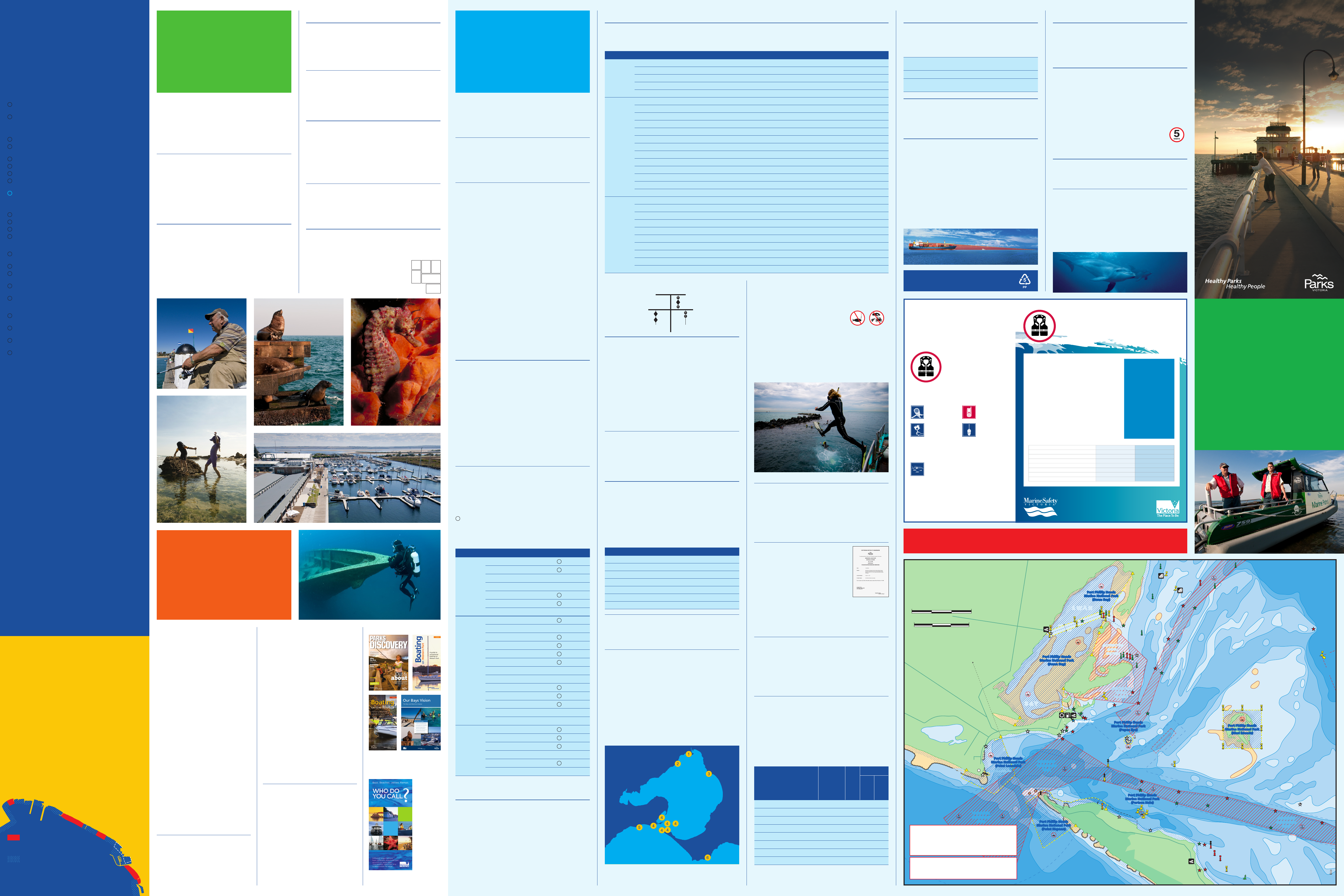
1 Fishing, Frankston Pier.
2 Seals, Chinamans Hat.
3 Pot-bellied seahorse (Hippocampus bleekeri),
Port Phillip Heads Marine National Park.
4 Beach Play, Mornington Peninsula National Park.
5 Queenscliff Harbour.
6 Diving, ex-HMAS Canberra dive site (Photo Mary Malloy).
YJoanna
SEE INSET
Observatory
Point
NEPEAN
B A Y
Port Phillip Heads
Marine National Park
(Point Lonsdale)
Port Phillip Heads
Marine National Park
(Point Nepean)
POINT NEPEAN
NATIONAL PARK
MORNINGTON PENNINSULA
NATIONAL PARK
Point Nepean
Nepean Reef
Corsair Rock
Big Rock
Petriana Reef
Nepean Rock W
THE RIP
Lonsdale Rock
38º17’35”S
144º36’09”E
38º17’22”S
144º36’20”E
38º17’22”S
144º36’20”E
38º18’03”S
144º37’18”E
38º18’16”S
144º37’24”E
38º19’33”S
144º39’01”E
38º18’45”S
144º40’00”E
38º18’21”S
144º41’14”E
38º16’59”S
144º46’53”E
38º13’29”S
144º41’54”E
38º13’08”S
144º41’04”E
38º15’38”S
144º46’53”E
38º15’36”S
144º45’13”E
38º16’57”S
144º45’10”E
38º17’31”S
144º38’24”E
Point Lonsdale
Reef
Mushroom Rock
Yellowtail Rock
Point Lonsdale
Lighthouse
LL
LONSDALE BAY
POINT LONSDALE Victory Shoal
Rocky Point
Jetty (ruins)
QUEENSCLIFF
SPOIL GROUND
LAKE
VICTORIA Wedge
Tide Pile
Chinaman’s Hat
The Narrows
Clarkes Beacon
Pilot Jetty
S W A NS W A N
B A YB A Y
S W A N
B A Y
Port Phillip Heads
Marine National Park
(Swan Bay)
Port Phillip Heads
Marine National Park
(Swan Bay)
GREAT
SAND
Fl.WR6s
West Channel Pile
Q.R
G
R
Swan Bay Jetty
Sorrento Pier
Aero Lt.VQ.R 2F.R
R
R
Y
G
Fl.R5sBRB
Fl.G5s
Point King
PORTSEA
Portsea Pier
SOUTH CHANNEL
Lighthouse Point
SOUTH SAND
Fl.W3s2M
South Channel Pile
Lighthouse Building
Sth Channel Fort
Sth Channel Fort Jetty
Fl.2M
PINNACE CHANNEL
CHANNEL
SYMONDS
WEST
CHANNEL
GRR
G
G
G
Ticonderoga Bay
sanctuary zone
Ticonderoga Bay
sanctuary zone
Marcus Hill
Column
Radar Tower
Port Phillip Heads
Marine National Park
(Mud Islands)
Port Phillip Heads
Marine National Park
(Popes Eye)
Fl.5s
Q.G
Y
Y
Y
Y
Y
Y
Y
Y
Y
Y
G
Y
Y
Point Lonsdale PierPoint Lonsdale Pier
AQUACULTUREAQUACULTURE
250m
500m
150m
150m
Queenscliff PierQueenscliff Pier
G
G
PROHIBITED
ANCHORAGE
ZONE
PROHIBITED
ANCHORAGE
ZONE
PROHIBITED
ANCHORAGE
ZONE
Y
Clarence
38º18’43”S
144º42’52”E
38º18’49”S
144º42’45”E
38º18’40”S
144º42’33”E
38º18’34”S
144º42’41”E
RESTRICTED
NAVA L
WATE R S
RESTRICTED
NAVA L
WATE R S
No.3
Fl(2)G4s
Fl.WR.6s
F & Oc.15s 40m 14M High Lt
Fl.R3s
Oc.WRG.15s 28m 12-6M Low Lt
F.WRG.21m 6/4M
F.AI.WR3s 12m 6/4M
Q.R
Fl.R3s
Q.R
YB
POPES EYE
VQ(6)+LFl.10s
Q
BY
Y
Or
Fl.WG3s
F.RG
No.1
Fl.G3s
No.7
Fl(4)G12s
No.2
Fl.R3s
No.3
Fl(2)G5s
No.4
Fl(2)R5s
No.6
Fl(3)R10s
No.3
Fl(2)G5s
No.10
Fl.R3s
No.8
Fl(4)R12s
Y Y Y
YY
Y Y
Y
LFl(2)WGR.15s 12/10M
Horn(2)30s
F.G
Q.G
F.Bu
Fl.Y5s No.2
Fl(2)R4s
No.4
Fl(2)R4s
Fl.R3s
Q.R
Coles
Fl.4s
No.5
Fl(2)G4s
No.7
Fl(2)G4s
No.6
Fl(2)R4s
G
Fl.G5s
G
R
No.8
Fl(2)R4s No.9
Fl(2)G4s
P
O
R
T
L
I
M
I
T
Port Phillip Heads
Marine National Park
(Portsea Hole)
KILOMETRES 0 3
1.5 0
SCALE 1:75,000
NAUTICAL MILES
THE RIP –
PORT PHILLIP HEADS
EMERGENCY
PROCEDURES
RAISE THIS ALARM
STAY WITH THE BOAT
ALL OCCUPANTS
TO PUT ON PFDs
LIFE JACKETS
SAVE LIVES!
• MARINE RADIO
27 MHz – Ch 88
VHF – Ch 16
• FLARES
Activate when
you see a
potential rescuer
• EMERGENCY
Call 000
• EPIRB
Activate your
distress beacon
• A vessel is a lot easier to
spot than a swimmer
• Anchor your boat to
maintain position if safe
to do so
All information is current at the time of printing (May 2010). For full
legislative details, refer to the Marine Act 1988 and the Marine Regulations
2009. For a free copy of the Victorian Recreational Boating Safety
Handbook call 1800 223 022 or visit www.marinesafety.vic.gov.au
LIFE JACKETS
SAVE LIVES!
Wearing PFDs on recreational vessels at all times
Wearing a PFD is now compulsory for all occupants when in an open areas
of the following vessels, whiles under way:
• Power driven vessels up to and including 4.8 metres (m) in length and
personal watercraft (PWC)
• Off-the-beach sailing yachts, pedal boats and fun boats
• Canoes, kayaks, rowing boats
• Recreational tenders
Wearing PFDs on recreational vessels during times of heightened risk
A PFD must also be worn by all occupants of the following vessels at time
of “heightened risk” when occupants are in an open area of a vessel which
is under way.
• Yachts (including monohull, trailerable and multihull yachts, excluding
off-the-beach sailing yachts)
• Power driven vessels greater than 4.8m and less then 12m.
What type of PFD must I wear?
When occupants of a vessel are required to wear a PFD (refer above), the
following specified PFDs must be worn.
“Heightened Risk” means:
• when boating alone
• when crossing an ocean bar
• when operating at night or in
restricted visibility
• when operating in an area
where a gale, storm of severe
thunderstorm warning or severe
weather warning issued by the
Bureau of Meteorology is current
• when the vessel is a yacht
without safety barriers or safety
harnesses in use
• when the vessel may capsize or
be swamped or when occupants
are at risk of falling overboard
Vessel type Coastal waters Enclosed waters
Powerboats up to and including 4.8m in length PFD Type 1 PFD Type 1
Powerboat greater than 4.8m and less than 12m PFD Type 1 PFD Type 1
Personal watercraft PFD Type 1 or 2 or 3 PFD Type 1 or 2 or 3
Recreational tender PFD Type 1 PFD Type 1 or 2
Off-the-beach sailing yacht PFD Type 1 (>2 nm) or 2 PFD Type 1 or 2
Yacht PFD Type 1 PFD Type 1 or 2
Kite board and sail board PFD Type 1 or 2 PFD Type 1 or 2 or 3
Canoe, kayak, rowing boat, raft, pedal boat or fun boat PFD Type 1 or 2 or 3 PFD Type 1 or 2 or 3
Port Phillip Heads – The Rip
Navigating Port Phillip Heads (or ‘The Rip’ as it’s commonly
known) can be quite difficult due to a combination of strong
tidal movements, large and unpredictable waves and frequent
shipping traffic. All boat operators should seek quality advice
before attempting to pass through Port Phillip Heads.
Vessels are prohibited from landing at Point Nepean within the
Port Phillip Heads Marine National Park.
Hovercraft are prohibited from entering Port Phillip Heads Marine
National Park.
1
6
2 3
5
4
A
ZZ
B
C
D
E
F
G
H
I
J
K
L
M
N
O
P
Q
R
S
T
U
V
W
H
I
G
F
J
K
L
M
N
O
P
Q
R
S
T
U
V
W
16
17
15
14
12
11
10
11
10
9
8
8
7
9
7
6
6
5
5
4
3
2
1
13
144° 40’
144° 50’
144° 30’ 144° 30’
144° 20’
145° 00’
144° 50’
145° 00’
38°20'38°20'
38°10'38°10'
38°00'38°00'
37°50'37°50'
SEE INSET
SEE INSET
SEE INSET
SEE INSET
SEE INSET
SEE INSET
SEE INSET
SEE INSET
SEE INSET
SEE INSET
SEE INSET
SEE INSET
SEE
INSET SEE INSET
DREDGE
MATERIAL
GROUND
R
Y
Fl.R5s
BRB
Q.G
BASS STRAIT
PORT PHILLIP
McCRAE
DROMANA
SAFETY BEACH
MOUNT MARTHA
MORNINGTON
MOUNT ELIZA
FRANKSTON
SEAFORD
CARRUM
CHELSEA
ASPENDALE
MORDIALLOC
MENTONE
BEAUMARIS
BLACK ROCK
SANDRINGHAM
HAMPTON
BRIGHTON
ELWOOD
ST KILDA
MIDDLE PARK
ALBERT PARK
MELBOURNE
WILLIAMSTOWN
NEWPORT
ALTONA
PORT MELBOURNE
GEELONG
SPOTSWOOD
YARRAVILLE
WERRIBEE SOUTH
NORTH SHORE
CORIO
BREAMLEA
TORQUAY
ROSEBUD
POINT
LONSDALE
Point Lonsdale
QUEENSCLIFF
BARWON HEADS
OCEAN GROVE
CLIFTON SPRINGS
PORTARLINGTON
INDENTED HEAD
ST LEONARDS
PORTSEA
SORRENTO
BLAIRGOWRIE
TOOTGAROOK
RYE
Beacon Point
Kirk Point
Point George
Point Nepean
Grassy Point
Point Richards
Point Wilson
Limeburners Point
Point
Henry
Wedge Point
Green Point
Point Ormond
Picnic Point
Ricketts Point
Davey Point
Schnapper Point
Fisherman Beach
Martha Point
Red Bluff
STINGAREE
B A Y
ANT SPIT
CHARLEMONT REEF
LIMEBURNERS
B A Y
LONG
REEF
PRINCE GEORGE
BANK
WEDGE SPIT
GOVERNOR
REEF
GREAT
CHANNEL
CHANNEL
COLES
PINNACE CHANNEL
SYMONDS
SAND
SAND
RYE CHANNEL
SOUTH
SOUTH CHANNEL
WEST
CHANNEL
BEAUMARIS
B A Y
ALTONA
REEF
SEAHOLME
REEF
WOOLEY REEF
Sth Channel Fort
Chimney
Water Tower
Water Tower
PATTERSON
RIVER
BARWON
RIVER LAKE
VICTORIA
WERRIBEE
RIVER
SERENDIP
SANCTURAY
CHEETHAM
WETLANDS
POINT COOK
COASTAL PARK
WERRIBEE
P A R K
YOU YANGS
REGIONAL PARK
ALBERT
P A R K
BRAESIDE
P A R K
KARKAROOK
P A R K
ARTHURS SEAT
STATE PARK
OCEAN GROVE
NATURE RESERVE
LAKE CONNEWARRE
STATE GAME RESERVE
MORNINGTON
PENINSULA
P A R K
ROSEBUD
FORESHORE
BELLARINE HWY
M‘TON PENIN
FWY
SURF COAST HWY
PRINCES FWY
WESTGATE FWY
NEPEAN HWY
LOWER DANDENONG RD
CENTRE RD
PRINCES HWY
M
O
R
N I
N
G
T
O
N P
E
N
I
N
S
U
L
A
F
W
Y
N
E P E A N H W Y
LAKE
CONNEWARRE
Lagoon Pier
St Kilda Pier
Brooks Jetty
SAILBOARDS ONLY
WILSON SPIT CHANNEL
POINT RICHARDS CHANNEL
HOPETOUN CHANNEL
KITE BOARDING ONLY
Middle Brighton Pier
Hampton Pier
Black Rock Jetty
Mordialloc Pier
Seaford Pier
Frankston Pier
Mornington Pier
Kerford Rd
Pier
Dromana Pier
Rosebud Pier
Rye Pier
Blairgowie
Safe Harbour
Sth Channel Fort Jetty
Portsea Pier
Queenscliff
Pier
Queenscliff
Pier
Point Lonsdale Pier
Swan Bay Jetty
Sorrento Pier
St Leonards Pier
Indented Head Jetty
Portarlington
Pier
Werribee Jetty
Altona Pier
Station Pier
Gem Pier
HARBOUR
S W A N
S W A N
B A Y
OUTER
CORIO BAY
NAVA L
WATE R S
RESTRICTED
WATERSKI ACCESS LANE
WATERSKI ACCESS LANE
WATERSKI ACCESS LANE
WATERSKI ACCESS LANE
WATERSKI ACCESS LANE
WATERSKI ACCESS LANE
WATERSKI ACCESS LANE
PERSONAL WATER CRAFT ONLY ZONE
WATERSKI ACCESS LANE
WATERSKI ACCESS LANE
WATERSKI
ACCESS LANE
AQUACULTURE
Q.R
Q.G
Fl.5s
Fl.G5s
Fl(2)WR7.5s
Fawkner Beacon Fl.5s
G
Fl.5s, Iso.WRG3s & B.Bu
VQ(4)Y4s 2F.
Fl.R5s
Fl(4).R6s
Fl(4).G6s
F.G
F.G
F.
F.R
F.R
F.R
F.R F.R
Fl.R5s
Fl.G5s
17A
F.G
Fl.G5s
Fl.G
Fl.G
Fl.R Fl.G3s
Fl.R3s
F.G
Chimney
F.R
Refinery Tower
F.R
F.R
3F.G
Fl.R2s
Fl.Y3s
Fl.G5s
Fl.Y4s
Fl.Y3s
Fl(3)Y10s Fl.WR5s
F.G
Y
Y
Y
YY
YY
Y
Y
DREDGE
MATERIAL
GROUND
RESTRICTED
WATE R S
F.G
F.R
Low Lt.
Oc.WRG15s
High Lt.
F&Oc.15s
Q.G
Fl.R3s
Fl(2)R4s
Fl(2)R4s
Q.R Fl(2)R4s
Q.G
Fl(2)G4s
Coles
Fl.4s
VQ(6)+LFI10s
Fl.WR6s
Q.
LFl(2)WGR15s
Aero Lt.
VQ.R 2F.R
Fl.G5s
Fl.R12.5s
Fl.WG3s
Monash
Fl(2)G4s
Fl(2)G4s
Fl(2)G4s
R
RR
R
R
R
R
G
G
G
GG
Tide Pile
G
G
G
G
G
G
R
Point Cook
Point King
The Sisters
OUTER ANCHORAGE
INNER
ANCHORAGE
FIRING
PRACT.
AREA
LEADING LIGHTS 309º26'(T)
Q.R
Fl(4)Y12s
Twr.
Y
Y
Y
No.3
No.1
Y
Y
Y
Y
Y
Y
Y
Y
Y
Y
Y
Y
Y
Y
Y
Y
Y
Y
Y
Y
Y
Y
YY
Y
Y
AQUACULTURE
AQUACULTURE
Fl(2)R5s
Fl.R6s
Fl.R3s
Eastern Light
(not in use)
Fl.6s
Chinaman’s Hat
Fl.W3s2M
South Channel
Pile Lighthouse
Building
Hovell Pile
West Channel Pile
DREDGE MATERIAL GROUND
BY
YB
YBY
YBY
BYB
R
G
Fl.G4s
Fl.6s
BRB
Fl.Y5s
Foul Ground
Y
LEADING LIGHTS
260º (T)
Iso.2s
F.G
R
Gas PipelineGas Pipeline
YB
Jetty
Station Peak
Fl.R
Wedge
WATERSKI ACCESS LANE
Y
Q.G
Fl(2)W6s
Artificial Reef
Fl.2M
0
10
20
30
40
50
60
70
80
90
180
190
200
210
220
230
240
250
260
170
160
150
140
130
120
110
100
270
280
290
300
310
320
330
340
350
ANONYMA
SHOAL
MAGNETIC NORTH 11º30'E 2009 (1'E)
Jawbone
Marine Sanctuary
YB
Port Phillip
Heads Marine
National Park
(Pt Lonsdale)
Port Phillip Heads
Marine National Park
(Swan Bay)
Port Phillip Heads
Marine National Park
(Swan Bay)
Port Phillip Heads
Marine National Park
(Popes Eye)
Port Phillip Heads
Marine National Park
(Mud Islands)
Y
Y
Y
Y
Y
Y
YY
Y
Y
Y
Y
Y
Y
Y
Y
Y
Y
Y
R
G
Port Phillip
Heads Marine
National Park
(Pt Nepean)
Barwon Bluff
Marine Sanctuary
Point
Cooke
Marine
Sanctuary
Jawbone
Marine Sanctuary
Ricketts Point
Marine Sanctuary
Y
Y
Fl.5s
TRUE NORTH
KILOMETRES
SCALE 1:125,000
NAUTICAL MILES0
0 5
3
Fl(4)Y12s
Y
Y
Y
Y
Y
Y
NATIONAL
Y Y
YY
Y
R
Y
POINT NEPEAN
NATIONAL PARK
F.WRG
37º55’39”S
144º46’49”E
37º54’37”S
144º47’49”E
37º55’14”S
144º48’42”E
37º55’45”S
144º48’41”E
37º56’02”S
144º46’48”E
F.G
YY
Fl.R
Y
BYB
Q(3)10s
Y
AQUACULTURE
Fl.3Y10s
R1
AQUACULTURE
AQUACULTURE
Fl(2)R4s
Fl.(4)Y6s Fl.(4)Y6s
Fl.(4)Y6sFl.(4)Y6s
Fl(4)Y12s
AQUACULTURE
Fl(4)Y12s
Fl(4)Y12s
Fl(4)Y12s
Fl(4)Y12s
Y
Y
Fl(4)Y12s
Fl(4)Y12s
Fl(4)Y12s
Fl(4)Y12s
Fl(4)Y12s
Fl(4)Y12s
Fl(4)Y12s
AQUACULTURE
Point Lillias
HIGH TRAFFIC SHIPPING AREA HIGH TRAFFIC SHIPPING AREA TRANSIT ONLY ZONE
TRANSIT ONLY ZONE NO ANCHORING
PROHIBITED
ANCHORAGE
ZONE
PROHIBITED
ANCHORAGE
ZONE
TRIAL ARTIFICIAL REEF
E145°05.479’
S38°08.483’
TRIAL ARTIFICIAL REEF
E 145°04.616’
S 38°02.168’
TRIAL ARTIFICIAL REEF
E 145°05.953’
S 38°05.245’
Martha
Cove
Fl.R
Fl.G
Clarence
Joanna
Cerberus
ex-HMAS
Canberra
VQ(9)10s
Q(3)5s
Q
PORT
OF GEELONG
LIMIT
PORT OF MELBOURNE
LIMIT
PARKS VICTORIA
PORT OF MELBOURNE
LIMIT
PARKS VICTORIA
PORT OF MELBOURNE
LIMIT
PARKS VICTORIA
P
O
R
T
O
F
M
E
L
B
O
U
R
N
E
L
I
M
I
T
PARKS VICTORIA
PORT OF MELBOURNE
LIMIT
Q(9)15s
DREDGE
MATERIAL
GROUND
DREDGE
MATERIAL
GROUND
DREDGE
MATERIAL
GROUND DREDGE MATERIAL
GROUND
DREDGE
MATERIAL
GROUND
Y
P2
Fl.Y4s
No.7
Fl(4)G12s
NO SAILBOARDS
AQUA
FOUL GROUND
AQUACULTURE
DREDGE
MATERIAL
GROUND
No.3
Fl(2)G5s
Fl.G4s
VQ(4)Y
VQ(4)Y
VQ(4)Y4S
VQ(4)Y4S
VQ(4)Y4S
VQ(4)Y4s
Q
Q(4)Y10s
Q(4)Y10s
Q(4)Y10s
Q(4)Y10s
Q(4)Y10s
Q(4)Y10s R
R
BY
Q
FL.R3s
F.G
Q.G
2f.Bu
Fl.G3s
Fl.G3s
Fl.G3s
Fl.G3s
Fl.G3s
Fl.R3s
Fl.R3s
Fl.R3s
Q(6)+LFl.Bu15s
Fl.G3s
F.R
F.R
Fl.R2s
Q.R WESTERN
& EASTERN
ANCHORAGE
WESTERN
& EASTERN
ANCHORAGE
SOUTHERN
ANCHORAGE
SOUTHERN
ANCHORAGE
Fl.R4s
Q.R
Q(9)15s
Q.R
F.Q(6)+LFl.Bu15s
Fl.R4s
Fl.R4s
No.6 Fl.R4s
No.8 Fl.R4s
F.R
Q.R
Q.R
Q.R
No.5 Fl.G4s
No.1 Fl.G4s
RG
YB
YB
YBY
YB
Q(4)Y12s
Y
R
R
GG
RG
Fl.Y6s Fl.Y6s
Fl.Y6s
Fl.Y6s
Fl.Y6s
Q.G
Q
BY
Q
BY
Fl(4)Y12s Fl(4)Y12s
Fl(4)Y12s Fl(4)Y12s Fl(4)Y12s
Fl(4)Y12s
YYFl.G6s
No.2
Fl.R4s
No.15
Fl.G4s
Fl.R4s Prince George Light
BY
Y
Y
BY
BY
YB
YB
YBY
BYB
BRB
BRB
No.4
Q.R
No.4
Fl.R3s
R
BYB
Q(3)10sR
YBY BYB
BRB
Y
R
Fl.G10s
G
Fl.WR6s
Fl(3)G10s
YB
YB
Y
Artificial
Reef
Fl(4)Y10s Fl(4)Y10s
Fl(4)Y10s
2FR(Vert.)
2F.Bu
Q
BY
No.17
Fl.G5s
No.71
Fl(2)G4s
No.11
Fl(2)G4s
No.15
Q(9)15s
No.12 Q.R
No.10 Fl.R4s
No.8 Fl.R4s
No.6 Fl.R4s
No.4 Fl.R4s
VQ(4)Y4s
VQ(4)Y4s
No.5 Fl(2)G4s
No.7 Fl(2)G4s
No.9 Fl(2)G4s
No.3 Fl(2)G4s
VQ(4)Y4s
VQ(4)Y4s
VQ(4)Y4s
VQ(4)Y4s
VQ(4)Y4s
VQ(4)Y4s
VQ(4)Y4s
VQ(4)Y4S
VQ(4)Y4S
VQ(4)Y4S
VQ(4)Y4S
VQ(4)Y4S
VQ(4)Y4S
VQ(4)Y4S
VQ(4)Y4s
VQ(4)Y4s
VQ(4)Y4s
No.2 Fl.R4s No.1 Fl(2)G4s
No.7 Fl.G4s
No.4
Fl.R4s No.2
Fl.R4s
No.3 Fl.G4s
No.9 Fl.G4s
No.11 Fl.G4s
No.7 Fl.G4s
No.5 Fl.G4s
No.3 Fl.G4s
No.1 Fl.G4s
No.12
Fl.R4s
No.10
Fl.R4s
No.8
Fl.R4s
No.6
Fl.R4s
No.4
Fl.R4s
No.2
Fl.R4s
No.13
Fl.G4s
No.11A
Fl.G4s
No.11
Fl.G4s
No.9
Fl.G4s
No.7A
Fl.G4s
No
.7
Fl.G4s
No.5
Fl.G4s
No.3
Fl.G4s
No.1
Fl.G4s
No.4
Fl.R4s
No.6
Fl.R4s
No.8
Fl.R4s
No.8A
Fl.R4s
No.10
Fl.R4s
No.12
Fl.R4s
No.12A
Fl.R4s
No.14
Fl.R4s
No.16
Fl.R4s
Ticonderoga
Bay sanctuary
zone
Ticonderoga
Bay sanctuary
zone
Fl.Y5s
Y
Y
Y
Y
Y
Y
Q(3)10s
BYB
TRANSIT ONLY
NO ANCHORING
No.12 Fl(2)R5s
No.14 Fl(3)R10s
No.14 Fl(4)R12s
No.10 Fl.R3s
No.8 Fl(4)R12s
No.6 Fl(3)R10s
No.4 Fl(2)R5s
No.2 Fl.R3s
No.1
Fl.G3s
Port Phillip Heads
Marine National Park
(Portsea Hole)
No.13
Fl(3)G10s
No.15
Fl(4)G12s
No.18
Fl.R3s
No.19
Fl(2)G5s
No.21
Fl(2)G5s
No.11
V.Q
No.9
Fl.G3s
No Boating
No Personal Water Craft
No Kite Boarding
No Personal Water Craft or Sailboards
Waterski Access Lane
Exposed at Low Water
Water between 0m and 2m deep
Water between 2m and 5m deep
Water between 5m and 10m deep
Water between 10m and 15m deep
Restricted Water and limited access
5 Knot Zone
10 Knot Zone
Water 15m and above
Rocks
Marine National Park / Marine Sanctuary
Shipping Fairway – Transit only zone
R
G
BY YBY
BYBYB
R
G
YY
YB YBYBY BYB
LIGHTS
Indicates a light structure or a lit beacon Special
Port hand – even numbers
Starboard hand – odd numbers
BRB
Isolated Danger (Black and Red)
Cardinal – Pile or Pillar Buoy (Yellow and Black)
with appropriate black top mark
North South East West
Fl. Flashing
Q. Quick Flashing
VQ. Very Quick Flashing
Iso. Isophase
Oc. Occulating
F. Fixed
eg. Fl.(2)8s A group of 2 flashes every 8 seconds
G Green R Red W White Y Yellow Bu Blue
Mo Morse Code
Beacon or Conspicuous Mark
MARKS
Y
Marine National Park boundary markers (land)
No fishing, netting, spearing, taking or killing of
marine life. All methods of fishing, from the shore
or at sea, are prohibited
Boat Ramp
Fuel
No swimmingNo anchoring
Swinging Basin
SB
National Park and Conservation Areas
Public destination mooring
Shipwreck protected zone
Pump out facility
LEGEND
SB
SB
SB
SB
SB
SB
SB
YARRA RIVER
Y
Y
Y
Y
Y
Y
Y
Y
Y
YY
No.47
F.G
G
GGG
Y
NO
BOATING
NO
BOATING
NO
BOATING
NO
BOATING
YARRAVILLE
Point Gellibrand
WILLIAMSTOWN
ALBERT PARK
PORT MELBOURNE
PRINCES
PIER
STATION
PIER LAGOON PIER
KERFORD RD
PIER
WEBB DOCK
HOBSONS BAY
POINT GELLIBRAND
COASTAL HERITAGE PARK
WESTGATE
PARK
STONY CREEK
BACKWASH
MARIBYRNONG
RIVER
PIER 35 MARINA
WESTGATE LANDING
SWANSTON
DOCK
NO PERSONAL
WATERCRAFT or
SAILBOARDS
COMMERCIAL SHIPPING CHANNELCOMMERCIAL SHIPPING CHANNEL
COMMERCIAL SHIPPING CHANNELCOMMERCIAL SHIPPING CHANNEL
TRANSIT ONLY ZONE
(NO ANCHORING
OR DRIFTING)
TRANSIT ONLY ZONE
(NO ANCHORING
OR DRIFTING)
WESTGATE
BRIDGE
BOLTE
BRIDGE
Holden
Dock
No.80 Fl(2)R4s
INLAND WATERSENCLOSED WATERS
Fl(2)R.5s
Fl(2)G.5s
BYB
VQ(9).10s
No.54
F.R+Fl.R2s
F.R
F.R
No.50
F.R+Fl.R2s
No.48
F.R+Fl.R2s
No.46
F.R+Fl.R2s
No.44
F.R+Fl.R2s
No.40
F.R+Fl.R2s
No.38
F.R+Fl.R2s
No.34
F.R+
Fl.R2s
Chimney
F.R
No.32
F.R+
Fl.R2s
No.30
F.R+Fl.R2s
No.36
F.R+
Fl.R2s
No.31
F.G+Fl.G2s
No.33
.G+Fl.G2s
No.29
F.G+Fl.G2s
No.27
F.G+Fl.G2s
No.25
F.G+Fl.G2s
No.35
.G+Fl.G2s
No.37
F.G+Fl.G2s
No.39
F.G+Fl.G2s
No.49
F.G+Fl.G2s
No.43
F.G+Fl.G2s
No.41
F.G+Fl.G2s
Fl.R2s
Fl.R2s
F.Bu
F.Bu
Fl.WRG3s
Fl.5s
F.Bu
F.G
F.Bu
F
No.78 Fl(2).R4s
No.74 Fl(2).R4s
No.73 Fl(4).G4sNo.72 Fl(2).R4s
No.76 Fl(2).R4s
No.75 Fl(4).G4s
No.77 Fl(4).G4s
No.79 Fl(4).G4s
No.70
Fl(2).R4s
No.71 Fl(2).G4s
No.17
Fl.G5s
No.17A Fl.G5s
No.19A Fl.G5s
No.19
Fl.G2s
F.R
No.28
F.R+Fl.R2s
No.28
F.R+Fl.R2s
VQ.G
No.84
Fl.R4s+F.R
No.82
Fl.R5s+F.R
No.23
Fl.G4s+F.G
VQ.WRG
No.24
F.R+Fl.R4s
No.81
Fl.G5s
No.21
Fl.G5s
No.22
Fl.R5s
No.20
Fl.R2s
F.G
F.R
F.G
2F.R(hor)
F. F.
Q
F.Fl.R2s
Fl.R2s
No.16
Fl.R5s
No.14
Fl(2)R4s
No.12
Q.R No.11 Fl(2)G4s
VQ(4)Y4s
Y
No.15
Q(9)15s
F.Bu+Q(3)10s
2F.(Vert)
F.R
F.G
SB
NO
BOATING
SB
Gem
Pier
Fergusion St Pier
Dockyard
Pier
Breakwater Pier
Gellibrand Pier
Reid St Pier
Booth Pier
Ann St Pier
Workshops Jetty
Boyd Jetty
Nelson
Pier West
COMMERCIAL SHIPPING CHANNEL
COMMERCIAL
VESSELS ONLY
PUBLIC
MOORING
F.R
2F.G
Y
F.
Fl.R2s
F.G
2F.R(hor)
F. F.
Q
PARKS VICTORIA
COMMITTEE OF MANGEMENT
PARKS VICTORIA
COMMITTEE OF MANGEMENT
No.19 Fl.G2s
No.17
Fl.G5s
No.17A Fl.G5s
No.19A Fl.G5s
No.20
Fl.R2s
Fl.R2s
No.21
Fl.G5s
No.22
Fl.R5s
TRANSIT ONLY ZONE
(NO ANCHORING
OR DRIFTING)
TRANSIT ONLY ZONE
(NO ANCHORING
OR DRIFTING)
WILLIAMSTOWN
NO
BOATING
Fl(2)10s
G
No.3
G
No.1
Point Ormond
G
G
Reef
Brooks Jetty
Fl.R5s
KITE BOARDING AREA
St Kilda
Harbour
Breakwater Slipway
Y
Y
YY
Y
Y
Y
ST KILDA
Obelisk
St Kilda
Marina
Y
Y
Gate
St Kilda Pier
& Kiosk
Elwood
Canal
NO
BOATING
NO
BOATING
ALBERT
PARK
ST KILDA WEST
MIDDLE PARK
PENGUIN HABITAT
NO ACCESS TO
BREAKWATER
PENGUIN HABITAT
NO ACCESS TO
BREAKWATER
R
ST KILdA HArbOur
KILOMETRES
SCALE 1:17,500
NAUTICAL MILES
FI.G5s
FI.2s
G Jetties
Bcn
Bcn
Beaumaris
Life Saving Club
Mentone
Life Saving Club
Ricketts Point
YB
YB
YBY
AQUACULTURE
FISHERIES
RESERVE
BEAUMARIS
B A Y
MENTONE
BEAUMARIS
NO BOATING
BYB
Fl(4)Y10s Fl(4)Y10s
Fl(4)Y10s Fl(4)Y10s
Table Rock
Point
WATKINS BAY
G
Y
Y
WATERSKI
ACCESS LANE
NO
BOATING
37º59’52”S
145º01’46”E
37º59’57”S
145º02’03”E
37º59’44”S
145º02’20”E
37º59’46”S
145º02’24”E
37º59’52”S
145º02’18”E
37º59’31”S
145º01’24”E
37º59’22”S
145º01’13”E
37º59’01”S
145º00’52”E
Ricketts
Point
Marine
Sanctuary
bEAuMArIS bAY
KILOMETRES0 1
0.50
SCALE 1:30,000
NAUTICAL MILES
Q.R
Q.G
Q(2)Y.4s2M
Y
Ramp 1
Ramp 2
Ramp 3
Ramp 4
Kiosk & Tackle Shop
BBQ
Carrum
Life Saving
Club
Bonbeach
Life Saving Club
CARRUM
BON BEACH
PATTERSON RIVER
Y
Y NO
BOATING
NO PERSONAL
WATERCRAFT
NO PERSONAL
WATERCRAFT
NO
BOATING
BOATING
ONLY
TRANSIT LANE
TRANSIT LANE
TRANSIT LANE
NO
SWIMMING
STRONG
CURRENTS
STRONG
CURRENTS
SCALE 1:12,500
KILOMETRES
NAUTICAL MILES
0 0.5
0.25
0
PATTErSON rIVEr
Note Dredge operates at entrance – navigate with
care. Check dredging information on reverse
side. for more details
R
LIMEBURNERS POINT
POINT ABEONA
AVALON BEACH
BIRD ROCK
BATES POINT
POINT HENRY
STINGAREE BAY
CORIO
Q U A Y
2F.Bu
RIPPLESIDE
Tower
Bcn.
Church Spire
Baths
Limeburners Y.C.
GEELONG
R.G.Y.C
Pier
LIMEBURNERS
B A Y
I N N E R
H A R B O U R
LASCELLES
WHARF
Commercial
Ramp
NORLANE
Bcn.
Silos
Refinery
Pier
Salt
Beds
Bank
Curlewis
Twr.
Grammar School
Chimney
Beacon
Tide
Gauge
Fl.R(3)8s
Fl.R(3)6s
Fl.R(3)6s
Fl.G(3)8s
Fl.G(3)6s
Fl.G(3)6s
AQUACULTURE
POINT LILLIAS
YB Q(6)+
LFl.Bu15s
HOPETOUN
CHANNEL
CITY
CHANNEL
CORIO
CHANNEL
NORTH
CHANNEL
DREDGE
MATERIAL
GROUND
Y
Q
BY
F.Bu
F.R Q.R
Q.R
Q.R
Q.R
F.Bu
F.Bu
YBY
Q(9)15s
BY
Q
Q.R
Q.R
Fl.R4s
Fl.R3s
F.R
F.R
F.G
F.G
Q.G
Q.R
F.G
Fl.R3s
Fl.R3s
F.R
Fl.R3s
Fl.R3s
Fl.R3s
F.G
Fl.R2s Fl.G3s
Fl.G3s
Fl.G4s
2F.R
F.R
Fl.G3s
Fl.G3s
Fl.G3s
Fl.G3s
YB F.Q(6)+
LFl.bu15ss
Fl.R4s
Fl.R4s
Fl.G4s
R
YBY
G
GR
WESTERN
& EASTERN
ANCHORAGE
WESTERN
& EASTERN
ANCHORAGE
SOUTHERN
ANCHORAGE
SOUTHERN
ANCHORAGE
G
R
G
R
YB
G
Q(4)Y12s
No.1
Q.Y
No.6
Fl.R4s
F.Bu
& Q.Bu
F.Bu
& Q.Bu
No.1
Fl.G4s
No.3
Fl.G4s
No.5
Fl.G4s
No.7
Fl.G4s
No.2
Fl.R4s
No.4
Fl.R4s
No.8
Fl.R4s
DREDGE
MATERIAL
GROUND
TRANSIT ONLY ZONE NO ANCHORING
KILOMETRES0 3
1.5
SCALE 1:60,000
0 NAUTICAL MILES
COrIO bAY
Ferry
Terminal
Fl.R5s
Q.R
F.Bu
F.G
Q.G
Coast
Guard
BRIDGE
Ferry
Terminal
Queenscliff
Pier
Yacht
Club
QUEENSCLIFF
RABBIT
ISLAND
SAND ISLAND
HARBOUR
HARBOUR
F.WG.28m 11/8M
KILOMETRES
SCALE 1:10,000
NAUTICAL MILES
QuEENSCLIff
NO PERSONAL
WATERCRAFT
NO PERSONAL
WATERCRAFT
NO PERSONAL
WATERCRAFT
NO PERSONAL
WATERCRAFT
F.Bu
Tide Pile
Fl.Y5s
Water Tower
Boat ramp
F.Bu
GroyneGroyne
Jetty
Jetty
Ramp for
Personal Water
Craft only & Personal
Water Craft Zone
WErrIbEE rIVEr
SCALE 1:9,000
NAUTICAL MILES
KILOMETRES 0 0.4
0.25
0
Ramp
Ramps
Car park
Fl.
Fl.
Basin
Breakwater
South
Channel Breakwater South
Channel
Breakwater
North
Basin
Breakwater
North
Pontoon Jetty
Pontoon Jetty
Jetty
Jetty
Fl.G3s
Fl.G3s
Fl.R3s
Fl.R
Fl.G3s
DREDGED
CHANNEL
DREDGED
BASIN
ALTONA HArbOur
SCALE 1:1,000
M E T R E S 1000
KILOMETRES0 1
SCALE 1:25,000
0.50 NAUTICAL MILES
Jawbone
Marine
Sanctuary
Jawbone
Marine
Sanctuary
JAWBONE
RESERVE
Y
Y
37º51’40”S
144º52’25”E
37º52’11”S
144º52’42”E
37º51’45”S
144º52’15”E
37º52’03”S
144º53’01”E
JAWbONE
SCALE 1:40,000
38º17’36”S
144º30’04”E
38º17’24”S
144º29’48”E
38º17’21”S
144º30’02”E
38º17’20”S
144º30’02”E 38º17’20”S
144º30’21”E
Barwon Bluff
Marine Sanctuary
Barwon Bluff
Marine Sanctuary
Point Flinders
(The Bluff)
Iso.2s
bArWON bLuff
SCALE 1:8,000
Fl.6s
ReefReefReef
SCHNAPPER
POINT
Car
Park
Boat Hire
Kiosk
Slipway
Ramp
Ramp
Ramp
Jetty
Jetty
Pier
Pier
MOrNINGTON HArbOur
SCALE 1:8,000
Note Dredge operates at entrance – navigate with
care. Check dredging information on reverse
side. for more details
Point Cooke
Marine Sanctuary
Point Cooke
Marine Sanctuary
Y
Y
Y
37º56’02”S
144º46’48”E
37º55’39”S
144º46’49”E
37º54’37”S
144º47’49”E
37º55’14”S
144º48’42”E
37º55’45”S
144º48’41”E
BYB
Q(3)10s
POINT COOK
SCALE 1:75,000
Note: When entering, transiting or leaving the Prohibited
Anchorage Zone, vessels at all times should keep to
eastward when inward bound and westward when
outward bound.
Note: Boat zones shown from Port Melbourne to
Point Ormond are revised boating and swimming
zones commencing September 2010.
Contact Parks Victoria for more information.
Note: Vessels are prohibited from landing along most
of Jawbone Marine Sanctuary shoreline
KILOMETRES0 2
10
SCALE 1:40,000
NAUTICAL MILES
HObSONS bAY
a n d
YArrA rIVEr
melbourne p o r t z o n e
1 2
3 4
Y
Y
N
12m
approx.
SPECIAL USE ZONE
Diving only
No boating
Moorings
14-17m
approx. 50m
17m
approx.
Note: Boat zones shown from Port Melbourne to
Point Ormond are revised boating and swimming
zones commencing September 2010.
Contact Parks Victoria for more information.
Ex-HMAS
CANbErrA
DEPARTMENT OF PRIMARY INDUSTRIES
Report illegal fishing
- call 13 FISH (133 474)
For bi-monthly reports on the 13 FISH
service visit www.dpi.vic.gov.au/fishing
or call 136 186.
Helpful information includes:
♦Time and date
of activity
♦Place
♦Number of
people involved
♦Vehicle/boat
registration
♦Activity
♦Equipment
Information provided will assist in
planning patrols and enforcement
operations when no immediate field
response is possible.
For your own safety, steer
clear of ships at all times
safety notice to
Boat operators
NOTE: THIS IS NOT
A NAVIGTION CHART
This map is not for navigation
use. Navigation aids are
shown for information only.
For navigation of Port Phillip,
Chart AUS 143 should be
consulted. Notices to Mariners
issued by Parks Victoria are
published on
www.parkweb.vic.gov.au
PORT
PHILLIP
recreational boating
6TH EDITION, JULY 2010 GUIDE
