SRT Marine Systems plc 4230002 AIS Coast Station User Manual Coast Station manual
Software Radio Technology plc AIS Coast Station Coast Station manual
UserManual.wiki
>
SRT Marine Systems plc
>
4230002 User Manual
User manual
Navigation menu
Upload a User Manual
Namespaces
Wiki Guide
HTML
PDF
Info
Views
User Manual
Discussion / Help
Navigation

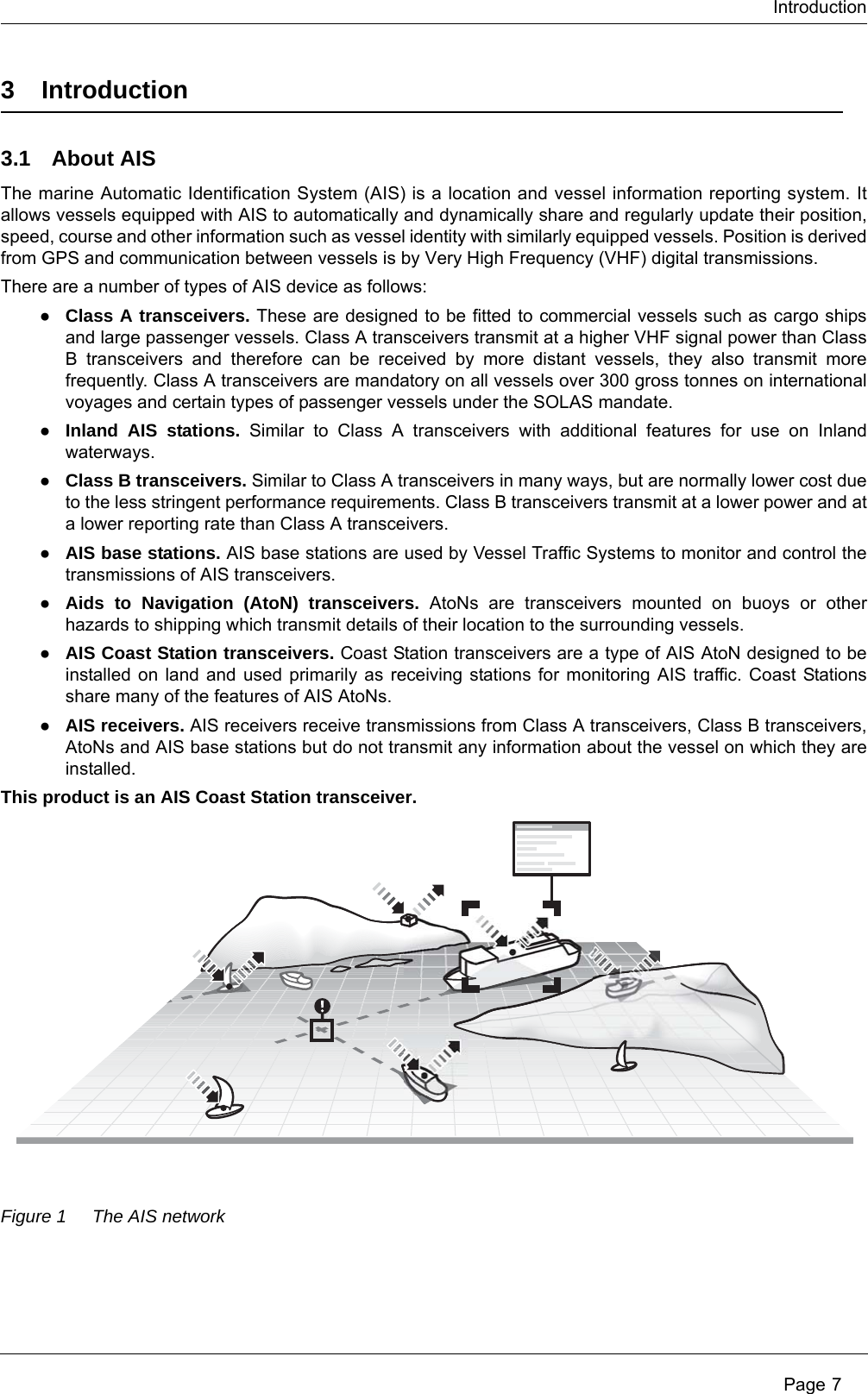
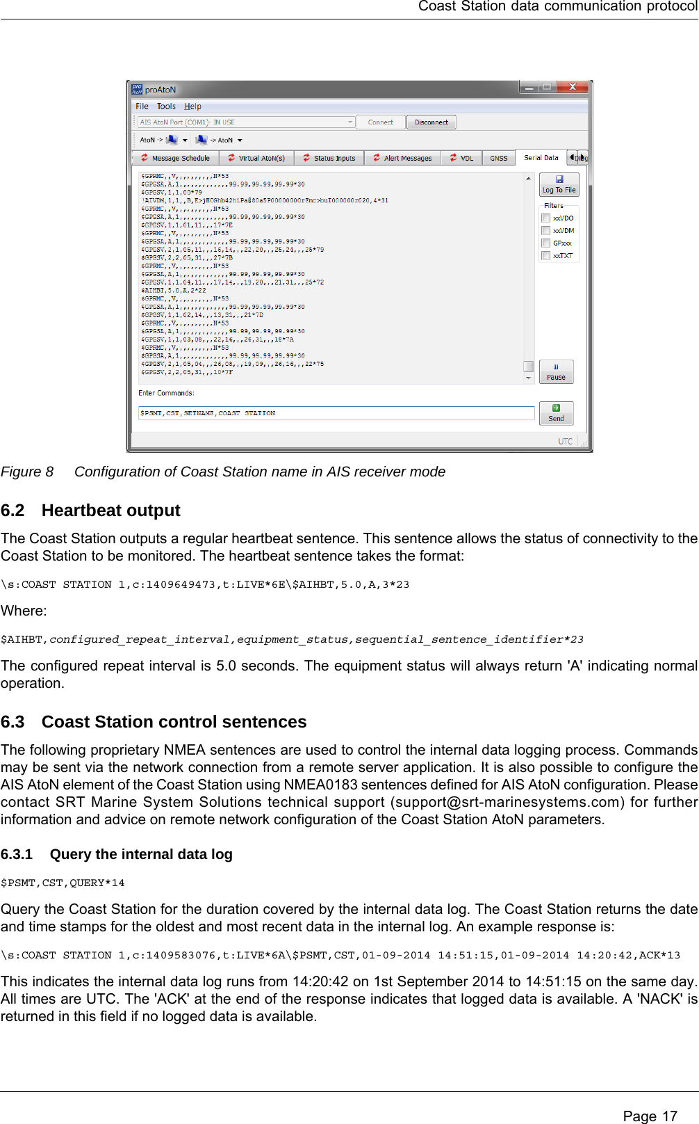
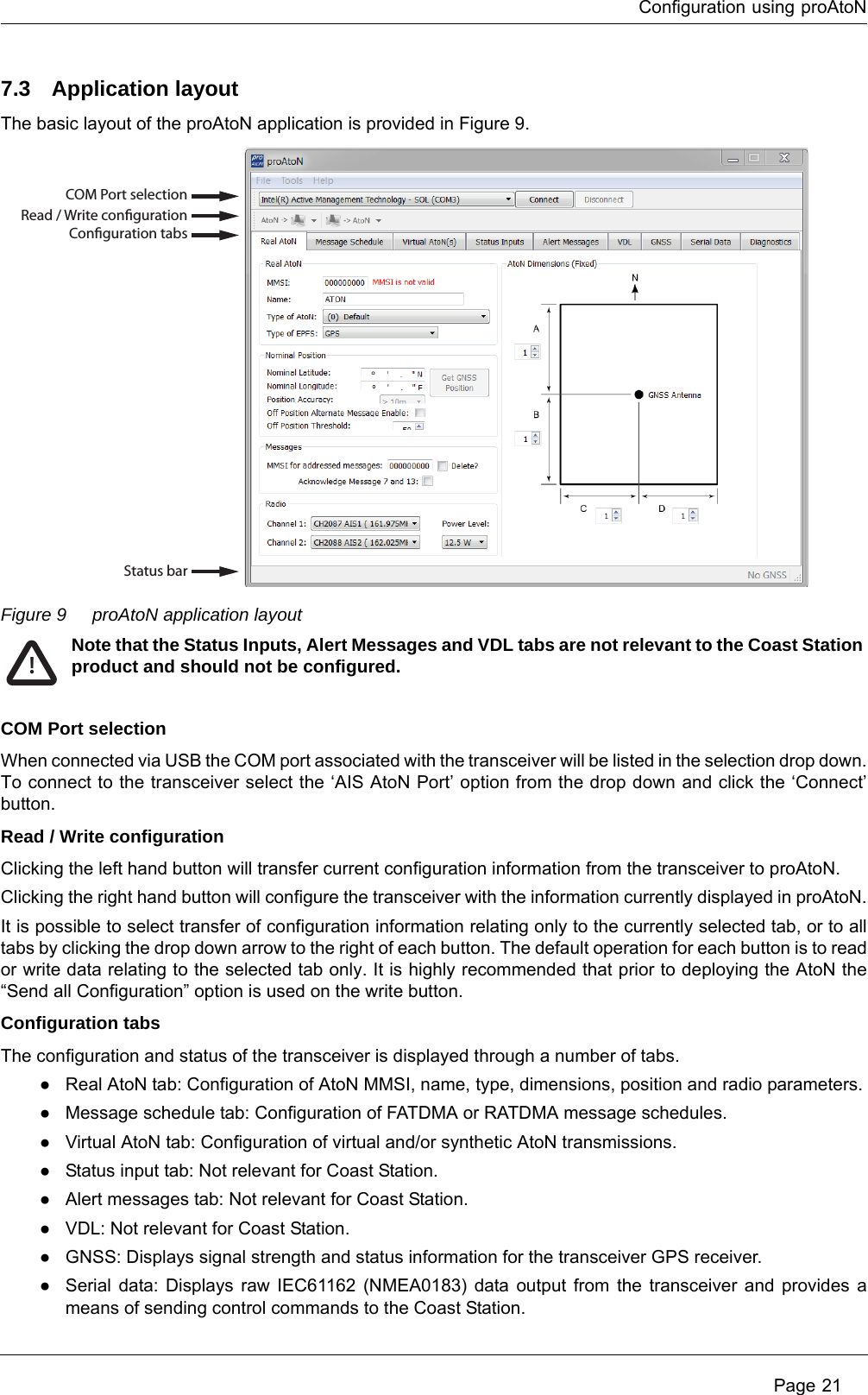
![Notices Page 52.3 Regulatory information2.3.1 Declaration of conformity - R&TTEWe, SRT Marine System Solutions Ltd, of Wireless House, Westfield Industrial Estate, Midsomer Norton, Bath, BA3 4BS declare under our own responsibility that the product CS100 AIS Coast Station to which this declaration refers conforms to the relevant sections of the following standards and / or other normative documents.For Article 3.1 (a) [Health & Safety]:EN60950-1:2006/A2:2013, relevant sections not addressed by IEC60945:2002-08IEC 60945:2002-08For Article 3.1 (b) [EMC]:IEC 60945:2002-08For Article 3.2 [Spectrum usage]:IEC62320-2:2008IEC61108-1:2003-07For Article 3.3 [Special requirements]:IEC62320-2:2008We, SRT Marine Solutions Ltd, declare that all essential radio test suites have been carried out and the above named product is in conformity with all essential requirements of Directive 1999/5/EC.The conformity assessment procedure referred to in Article 10 and detailed in Annex [III] and [IV] of Directive 1999/5/EC has been followed with the involvement of the following Notified Body.TÜV SÜD BABT. Octagon House, Concorde Way, Segensworth North, Fareham, Hampshire PO15 5RL England. Identification mark: 0168.The technical documentation relevant to the above equipment will be held at: SRT Marine Solutions Ltd, Wireless House, Westfield Industrial Estate, Midsomer Norton, Bath, BA3 4BS, England.Tel:+44 1761 409500www.srt-marinesystems.comName: Neil Peniket, Chief Operating OfficerDate: 1st October 20142.3.2 CE MarkingThe product carries the CE mark, notified body number and alert symbol as required by the R&TTE directive.The product is intended for sale in the following member states:Great Britain, France, Spain, Sweden, Austria, Netherlands, Portugal, Denmark, Norway, Belgium, Italy, Finland, Ireland, Luxembourg, Germany, Czech Republic, Bulgaria, Cyprus, Estonia, Greece, Hungary, Iceland, Latvia, Lithuania, Malta, Romania, Slovak Republic, Slovenia, Switzerland/Liechtenstein, Poland.Restrictions of use: Some EU member states may require a licence to operate this equipment.](https://usermanual.wiki/SRT-Marine-Systems-plc/4230002/User-Guide-2545240-Page-7.png)
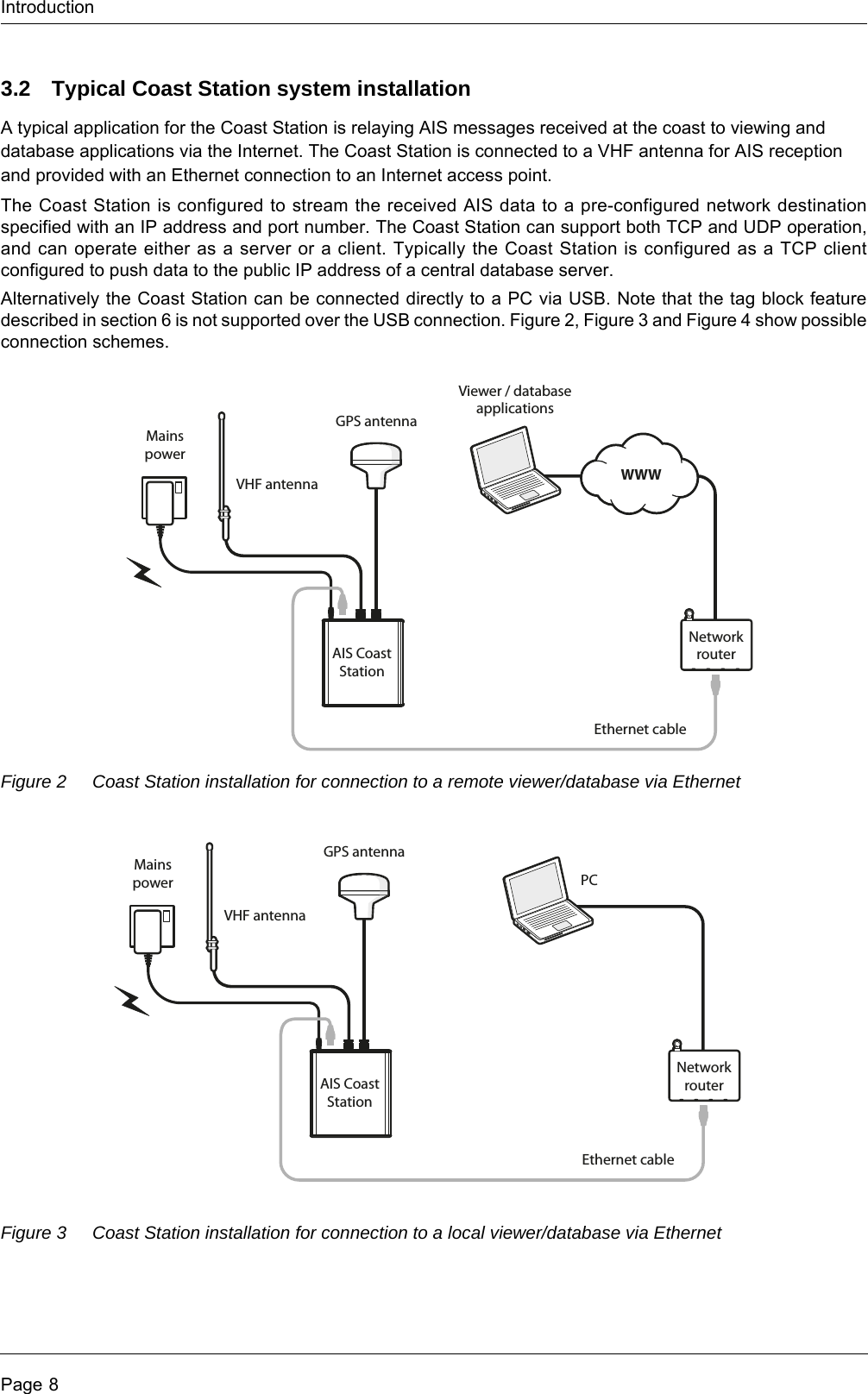
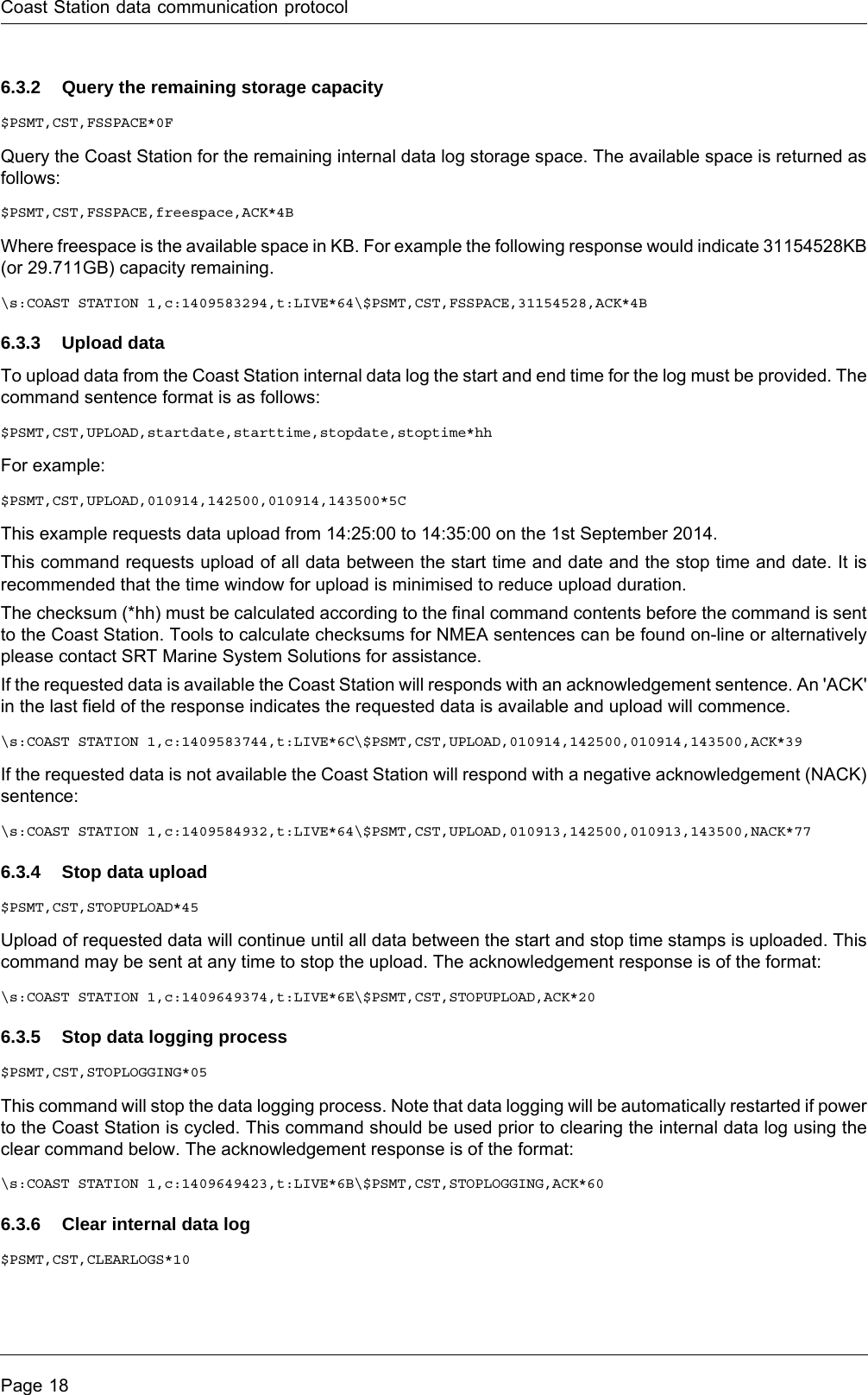
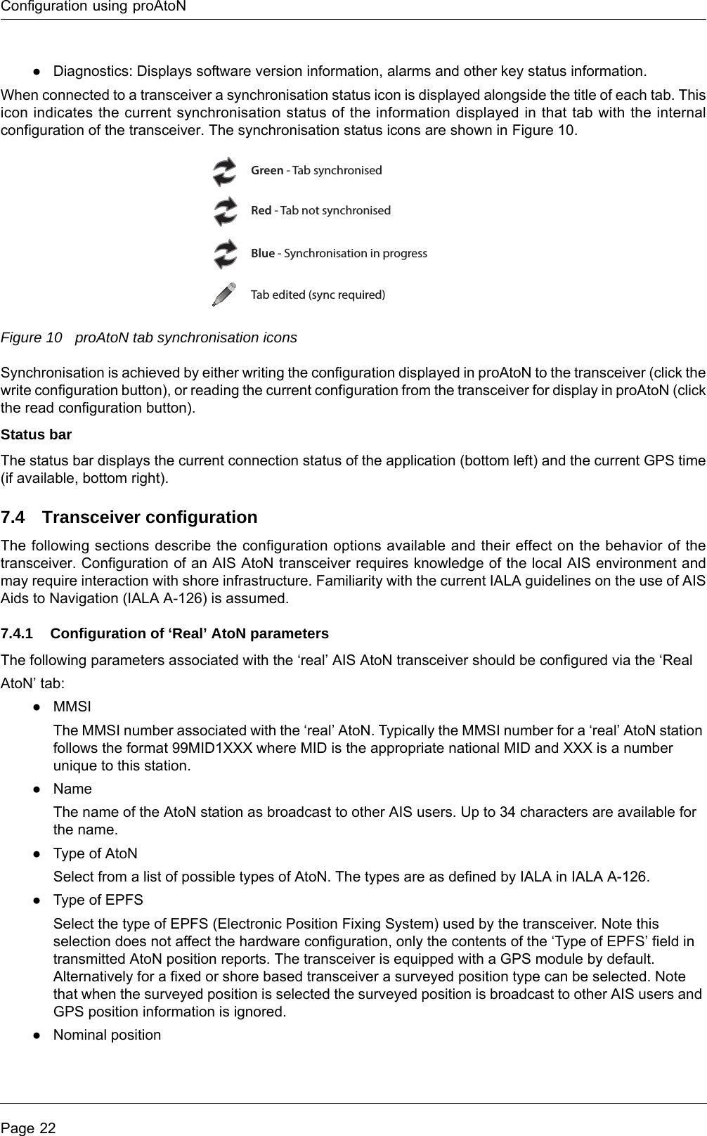
![NoticesPage 62.3.3 FCC and Industry Canada noticesA. FCC Part 15.19(a) statement:This device complies with part 15 of the FCC Rules. Operation is subject to the following two conditions: (1) This device may not cause harmful interference, and (2) this device must accept any interference received, including interference that may cause undesired operation.A. Part 15 Clause 15.105 [ EMC Class A/B statement ]:Note: This equipment has been tested and found to comply with the limits for a Class B digital device, pursuant to part 15 of the FCC Rules. These limits are designed to provide reasonable protection against harmful interference in a residential installation. This equipment generates, uses and can radiate radio frequency energy and, if not installed and used in accordance with the instructions, may cause harmful interference to radio communications. However, there is no guarantee that interference will not occur in a particular installation. If this equipment does cause harmful interference to radio or television reception, which can be determined by turning the equipment off and on, the user is encouraged to try to correct the interference by one or more of the following measures:- Reorient or relocate the receiving antenna.- Increase the separation between the equipment and receiver.- Connect the equipment into an outlet on a circuit different from that to which the receiver is connected.- Consult the dealer or an experienced radio/TV technician for help.B. Part 15 Clause 15.21 [ Do not modify warning ]Changes or modifications not expressly approved by the party responsible for compliance could void the user's authority to operate the equipment.C. RSS-Gen license-exempt notice:This device complies with Industry Canada licence-exempt RSS standard(s). Operation is subject to the following two conditions: (1) this device may not cause interference, and (2) this device must accept any interference, including interference that may cause undesired operation of the device.Le présent appareil est conforme aux CNR d'Industrie Canada applicables aux appareils radio exempts de licence. L'exploitation est autorisée aux deux conditions suivantes : (1) l'appareil ne doit pas produire de brouillage, et (2) l'utilisateur de l'appareil doit accepter tout brouillage radioélectrique subi, même si le brouillage est susceptible d'en compromettre le fonctionnement.D. RSS-Gen antenna notice:Under Industry Canada regulations, this radio transmitter may only operate using an antenna of a type and maximum (or lesser) gain approved for the transmitter by Industry Canada. To reduce potential radio interference to other users, the antenna type and its gain should be so chosen that the equivalent isotropically radiated power (e.i.r.p.) is not more than that necessary for successful communication.Conformément à la réglementation d'Industrie Canada, le présent émetteur radio peut fonctionner avec une antenne d'un type et d'un gain maximal (ou inférieur) approuvé pour l'émetteur par Industrie Canada. Dans le but de réduire les risques de brouillage radioélectrique à l'intention des autres utilisateurs, il faut choisir le type d'antenne et son gain de sorte que la puissance isotrope rayonnée équivalente (p.i.r.e.) ne dépasse pas l'intensité nécessaire à l'établissement d'une communication satisfaisante. E. FCC & IC RF Exposure related informationRF Exposure Guidance: This equipment complies with FCC and Industry Canada radiation exposure limits set forth for an uncontrolled environment. This equipment should be installed and operated with minimum distance 20cm between the radiator and your body. This transmitter must not be co-located or operating in conjunction with any other antenna or transmitter not described under this FCC ID and IC certification number, except in accordance with FCC and Industry Canada multi-transmitter product procedures.Guide d'Exposition RF : ce matériel est conforme aux normes FCC et Industrie Canada relatives aux limites maximales d'exposition aux radiations en milieu non-contrôlé. Cet équipement doit être installé et opéré à une distance de plus de 20cm entre la source de radiation et le corps de l'utilisateur. Cet émetteur ne peut être situé à proximité de ou opérer conjointement avec tout autre émetteur ou toute antenne non-classifiés sous le numéro de certification FCC ID et IC, sauf s'ils respectent la procédure FCC et Industrie Canada concernant tout produit multi-émetteurs.](https://usermanual.wiki/SRT-Marine-Systems-plc/4230002/User-Guide-2545240-Page-8.png)