Garmin 0163700 Receiver used w/Pt 15 Transmitter User Manual
Garmin International Inc Receiver used w/Pt 15 Transmitter
Garmin >
Contents
Users Manual 3
12-64
Garmin GTN 725/750 Pilot’s Guide
190-01007-03 Rev. J
Foreword
Getting
Started
Audio &
Xpdr Ctrl
Com/Nav
FPL
Direct-To
Proc
Charts
Wpt Info
Map
Traffic
Terrain
Weather
Nearest
Services/
Music
Utilities
System
Messages
Symbols
Appendix
Index
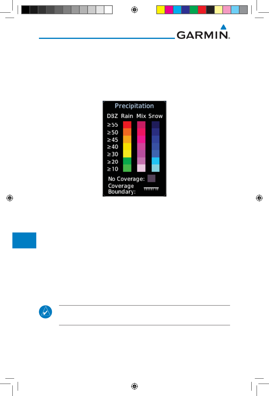
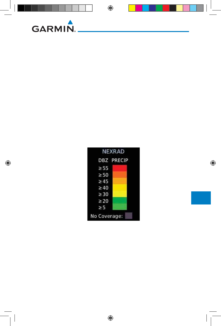
12.5.7 Precipitation (PRECIP) Data
Graphical data is overlaid on the map indicating the rainfall detected by
ground based radar for a specific area. The colors indicating increasing levels
of rainfall progresses from light green for light rainfall to red for heavy rainfall.
Review the Limitations section in the front of this guide for the limitations that
apply to the Connext data. Rainfall data is color coded as follows:
Figure 12-82 Connext PRECIP Weather Map Display and Legend
The "No Coverage" color indicates that no data is available for that area, and
rainfall in that area is unknown.
When weather data is received, the airborne system will display that data for
20 minutes. If no new data has been received for a given area, the rainfall will
be removed after 20 minutes and the area will revert back to the "No Coverage"
color.
The Connext Weather Function is based on a ground-to-air data link and
requires that the appropriate ground systems are broadcasting weather data and
the aircraft is within reception range of the Ground Broadcast Transceiver (GBT).
12.5.7.1 Animating Precipitation Data
NOTE: Animated Precipitation functionality is available in software version
6.00 and later.
When Precipitation Data is enabled for display and more than two
Precipitation images have been received by the GTN, the Precipitation display
can be animated on the Connext Weather page. As new Precipitation images are
190-01007-03-Final.indb 64 7/9/2015 2:08:16 PM
12-65190-01007-03 Rev. J
Garmin GTN 725/750 Pilot’s Guide
Foreword
Getting
Started
Audio &
Xpdr Ctrl
Com/Nav
FPL
Direct-To
Proc
Charts
Wpt Info
Map
Traffic
Terrain
Weather
Nearest
Services/
Music
Utilities
System
Messages
Symbols
Appendix
Index
received, the GTN will automatically store them for future animation. The GTN
can animate up to six Precipitation images from oldest to newest, showing each
for one second and the newest for two seconds.
1. While viewing the Connext Weather page with Precipitation
enabled for display, press the Play PRCP key to start the
Precipitation animation.
2. Touch the Stop PRCP key to stop the Precipitation animation.
The animation will also stop when leaving the page or turning
off Precipitation on the Connext weather page.
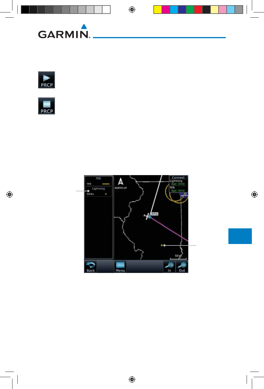
12.5.8 Lightning
Lightning data shows the approximate location of cloud-to-ground lightning
strikes. A strike icon represents a strike that has occurred within a two kilometer
(1.08 NM) region. The exact location of the lightning strike is not displayed.
Only cloud to ground strikes are reported in the US and extreme southern
Canada (cloud to cloud strikes are not reported).
Lightning
Symbol
Lightning
Legend
Figure 12-83 Connext Data Link Lightning and Legend
190-01007-03-Final.indb 65 7/9/2015 2:08:17 PM
12-66
Garmin GTN 725/750 Pilot’s Guide
190-01007-03 Rev. J
Foreword
Getting
Started
Audio &
Xpdr Ctrl
Com/Nav
FPL
Direct-To
Proc
Charts
Wpt Info
Map
Traffic
Terrain
Weather
Nearest
Services/
Music
Utilities
System
Messages
Symbols
Appendix
Index
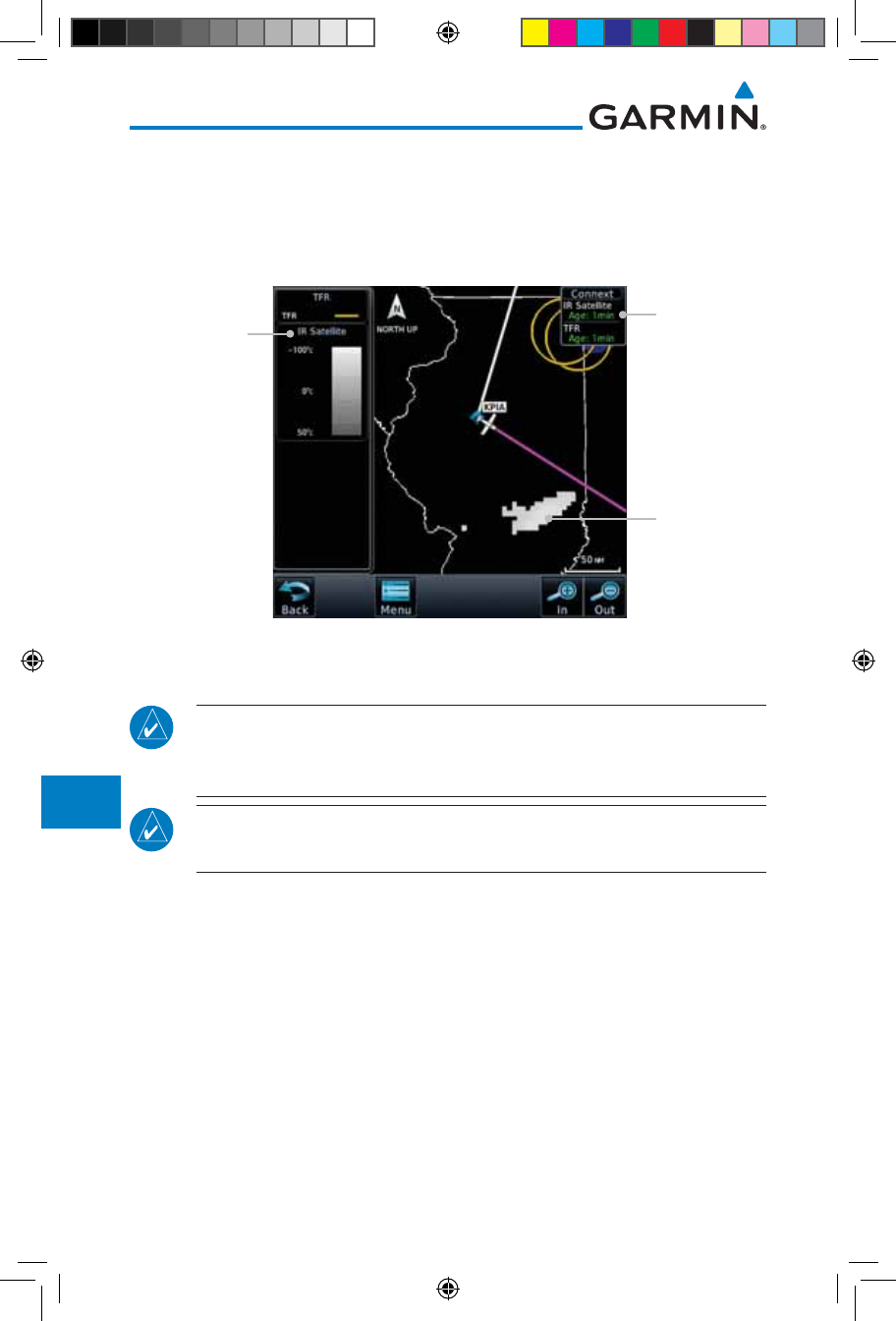
12.5.9 Infrared Satellite Data
Infrared Satellite data is available over North America and Europe and depicts
cloud top temperatures from satellite imagery. Brighter cloud top colors indicate
cooler temperatures occurring at higher altitudes. Information is updated every
half hour.
IR Satellite
Coverage
IR Satellite
Legend
IR Satellite
Product Age
Figure 12-84 Connext Infrared Satellite Data Map Display and Legend
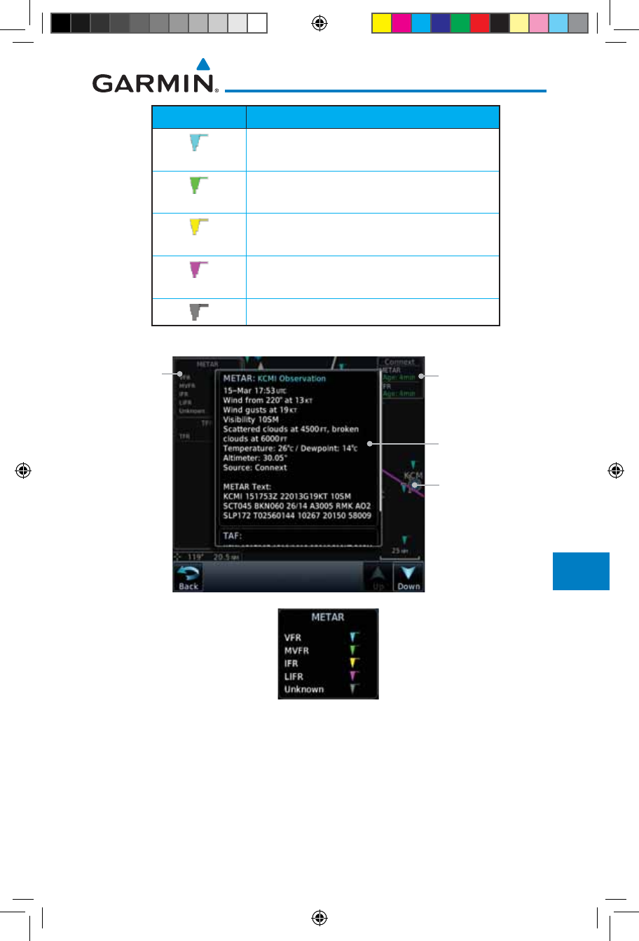
12.5.10 METARs
NOTE: Atmospheric pressure reported for METARs is given in hectopascals
(hPa), except in the United States, where it is reported in inches of mercury
(in Hg). Temperatures are reported in Celsius.
NOTE: METAR information is only displayed within the installed aviation
database service area.
METAR (METeorological Aerodrome Report), known as an Aviation Routine
Weather Report, is the standard format for current weather observations.
METARs are generally updated hourly, but some site are more frequent. Special
updates are done as conditions warrant. METARs typically contain information
about the temperature, dew point, wind, precipitation, cloud cover, cloud
heights, visibility, and barometric pressure. They can also contain information
on precipitation amounts, lightning, and other critical data. METARs are shown
as colored flags at airports that provide them.
190-01007-03-Final.indb 66 7/9/2015 2:08:17 PM
12-67190-01007-03 Rev. J
Garmin GTN 725/750 Pilot’s Guide
Foreword
Getting
Started
Audio &
Xpdr Ctrl
Com/Nav
FPL
Direct-To
Proc
Charts
Wpt Info
Map
Traffic
Terrain
Weather
Nearest
Services/
Music
Utilities
System
Messages
Symbols
Appendix
Index
METAR Symbol Description
VFR (ceiling greater than 3000 ft. AGL and
visibility greater than five miles)
Marginal VFR (ceiling 1000–3000 ft. AGL
and/or visibility three to five miles)
IFR (ceiling 500 to below 1000 ft. AGL and/or
visibility one mile to less than three miles)
Low IFR (ceiling below 500 ft. AGL or visibility
less than one mile)
Unknown
Table 12-7 METAR Symbols
Selected METAR (VFR)
Product Age
METAR Detail
Metar
Legend
Figure 12-85 Connext Weather - Graphic METARs and Legend
190-01007-03-Final.indb 67 7/9/2015 2:08:17 PM
12-68
Garmin GTN 725/750 Pilot’s Guide
190-01007-03 Rev. J
Foreword
Getting
Started
Audio &
Xpdr Ctrl
Com/Nav
FPL
Direct-To
Proc
Charts
Wpt Info
Map
Traffic
Terrain
Weather
Nearest
Services/
Music
Utilities
System
Messages
Symbols
Appendix
Index
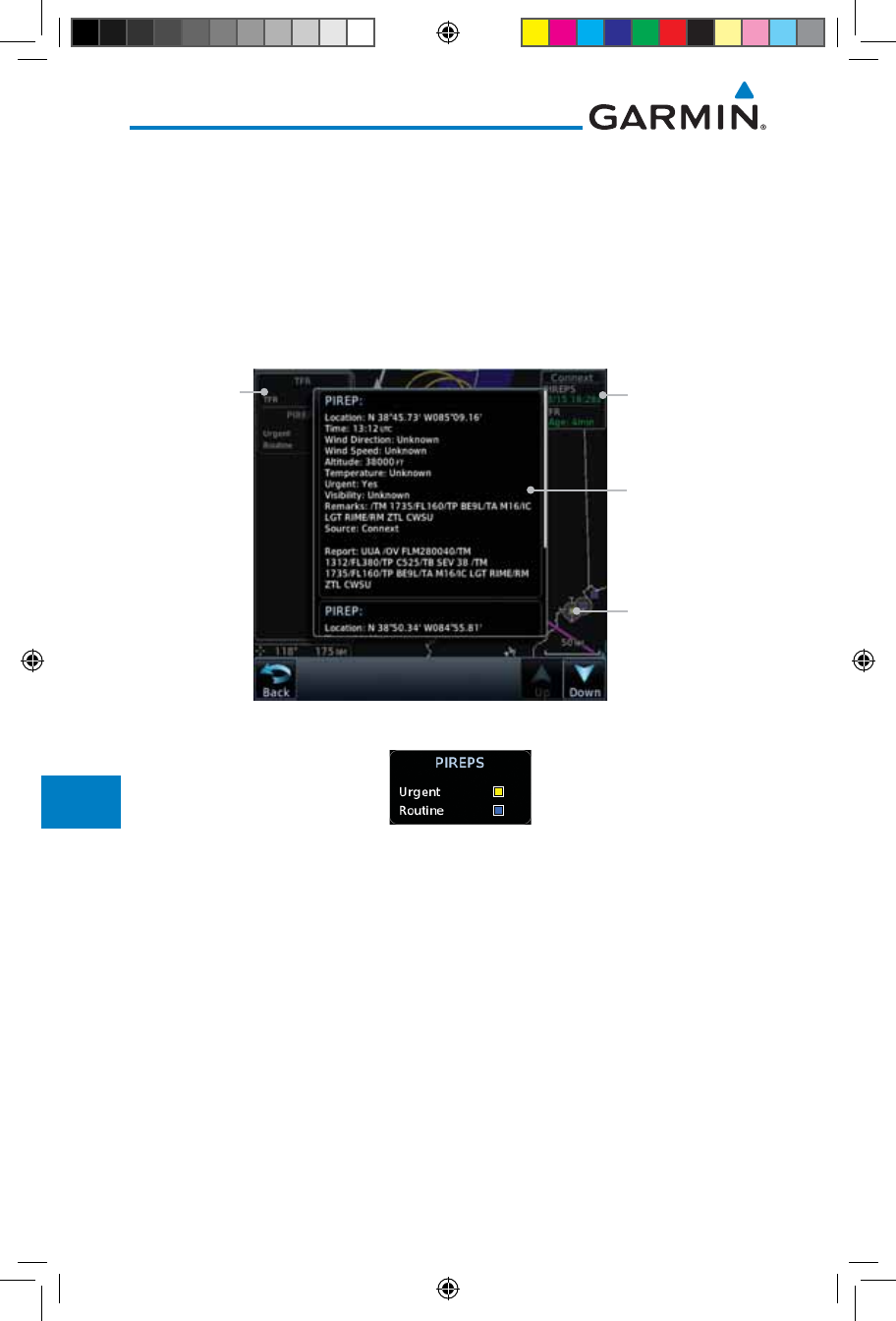
12.5.11 PIREPs
Pilot Weather Reports (PIREPs) provide timely weather information for a
particular route of flight. When significant weather conditions are reported or
forecast, Air Traffic Control (ATC) facilities are required to solicit PIREPs. A
PIREP may contain non-forecast adverse weather conditions, such as low in-
flight visibility, icing conditions, wind shear, and turbulence. PIREPs are issued
as either Routine (UA) or Urgent (UUA).
Selected PIREP
Product Age
PIREP Detail
PIREP
Legend
Figure 12-86 Connext Weather - PIREPs
Figure 12-87 Connext Weather - PIREPs Legend
190-01007-03-Final.indb 68 7/9/2015 2:08:17 PM
12-69190-01007-03 Rev. J
Garmin GTN 725/750 Pilot’s Guide
Foreword
Getting
Started
Audio &
Xpdr Ctrl
Com/Nav
FPL
Direct-To
Proc
Charts
Wpt Info
Map
Traffic
Terrain
Weather
Nearest
Services/
Music
Utilities
System
Messages
Symbols
Appendix
Index
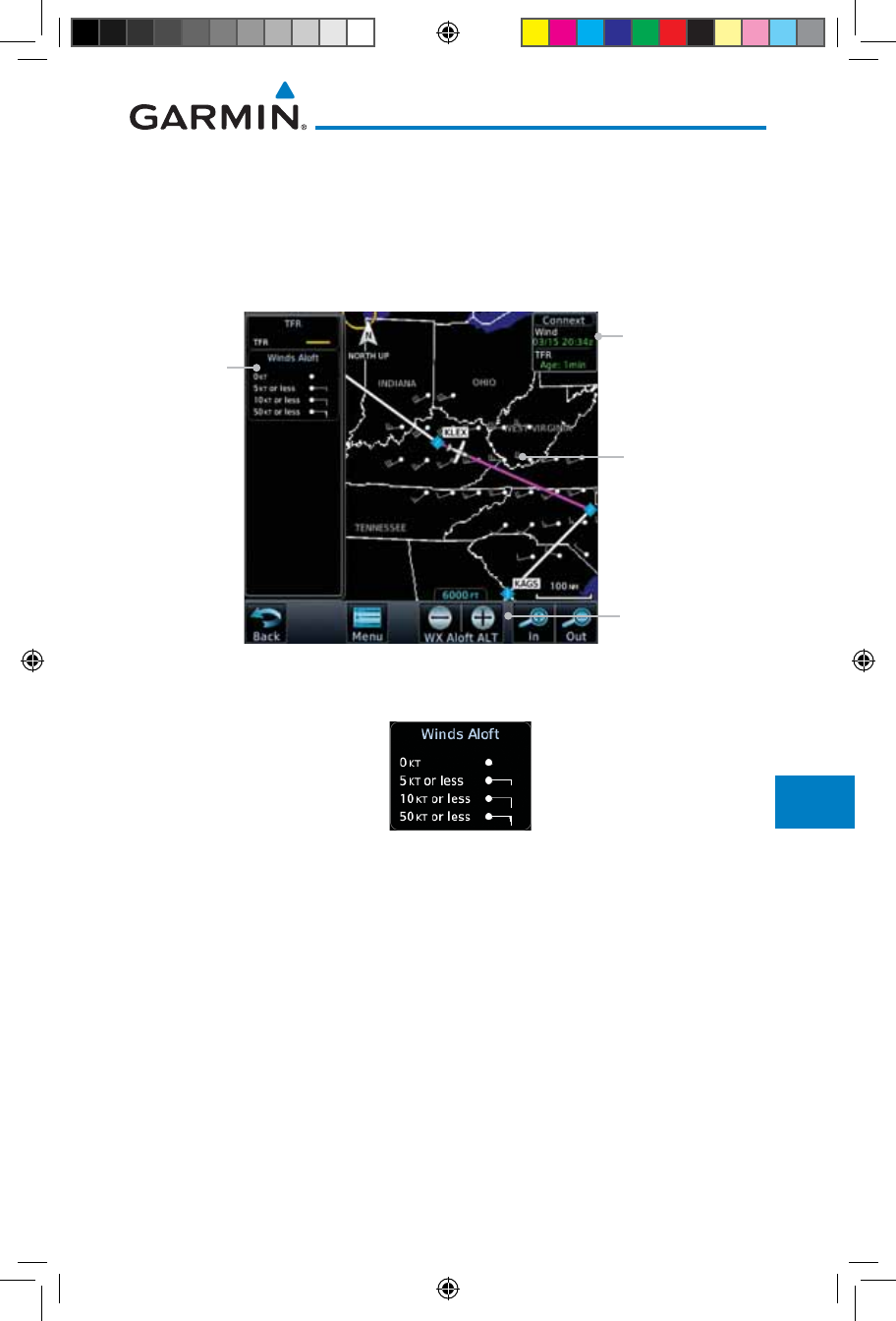
12.5.12 Winds Aloft
Winds Aloft data shows the forecast wind speed and direction at the surface
and at selected altitudes. Altitudes can be selected in 3000 foot increments from
the surface up to 42,000 feet MSL. Pressing the WX Aloft ALT + or – soft keys
steps down or up in 3,000 foot increments.
Product Age
Winds Aloft
Altitude Selection
Winds Aloft
Symbol
Winds Aloft
Legend
Figure 12-88 Connext Weather - Winds Aloft
Figure 12-89 Connext Weather - Winds Aloft Legend
Winds Aloft Altitude
The Winds Aloft Altitude option allows you to select the altitude for the
Winds Aloft weather product. Altitude can be selected in 3,000 foot increments
from the surface up to 42,000 feet MSL.
Pressing the WX Aloft ALT + or – soft keys steps down or up in 3,000 foot
increments. In the figure shown above, 6,000 feet is selected and Winds Aloft
data is shown for winds reported at an altitude of 6,000 feet.
190-01007-03-Final.indb 69 7/9/2015 2:08:17 PM
12-70
Garmin GTN 725/750 Pilot’s Guide
190-01007-03 Rev. J
Foreword
Getting
Started
Audio &
Xpdr Ctrl
Com/Nav
FPL
Direct-To
Proc
Charts
Wpt Info
Map
Traffic
Terrain
Weather
Nearest
Services/
Music
Utilities
System
Messages
Symbols
Appendix
Index
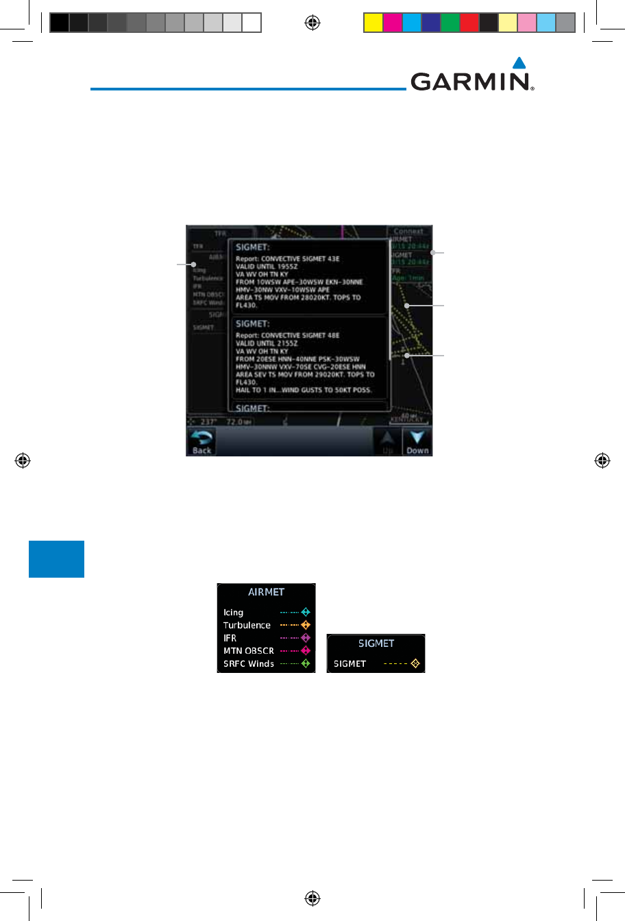
12.5.13 SIGMETs and AIRMETs
SIGMETs (SIGnificant METeorological Information) and AIRMETs (AIRmen’s
METeorological Information) are broadcast for potentially hazardous weather
considered of importance to aircraft. A Convective SIGMET is issued for
hazardous convective weather. A localized SIGMET is a significant weather
condition occurring at a localized geographical position.
SIGMET Line
Selected SIGMET
Line
Product Age
SIGMET/AIRMET
Legend
Figure 12-90 Connext Weather Page - AIRMETs/SIGMETs
When enabled, SIGMET/AIRMETs advise the pilot of potentially hazardous
weather. SIGMETs are directed to all aircraft. AIRMETs are intended for light
aircraft. SIGMET/AIRMET data covers icing, turbulence, dust, and volcanic ash
as issued by the National Weather Service. The update rate is selected in the
Connext Settings Menu.
Figure 12-91 Connext Weather - AIRMETs/SIGMETs Detail and Legend
When enabled, the following AIRMETs are available for display:
• Icing
• Turbulence
• IFR conditions
• Mountain obscuration
• Surface winds
190-01007-03-Final.indb 70 7/9/2015 2:08:18 PM
12-71190-01007-03 Rev. J
Garmin GTN 725/750 Pilot’s Guide
Foreword
Getting
Started
Audio &
Xpdr Ctrl
Com/Nav
FPL
Direct-To
Proc
Charts
Wpt Info
Map
Traffic
Terrain
Weather
Nearest
Services/
Music
Utilities
System
Messages
Symbols
Appendix
Index
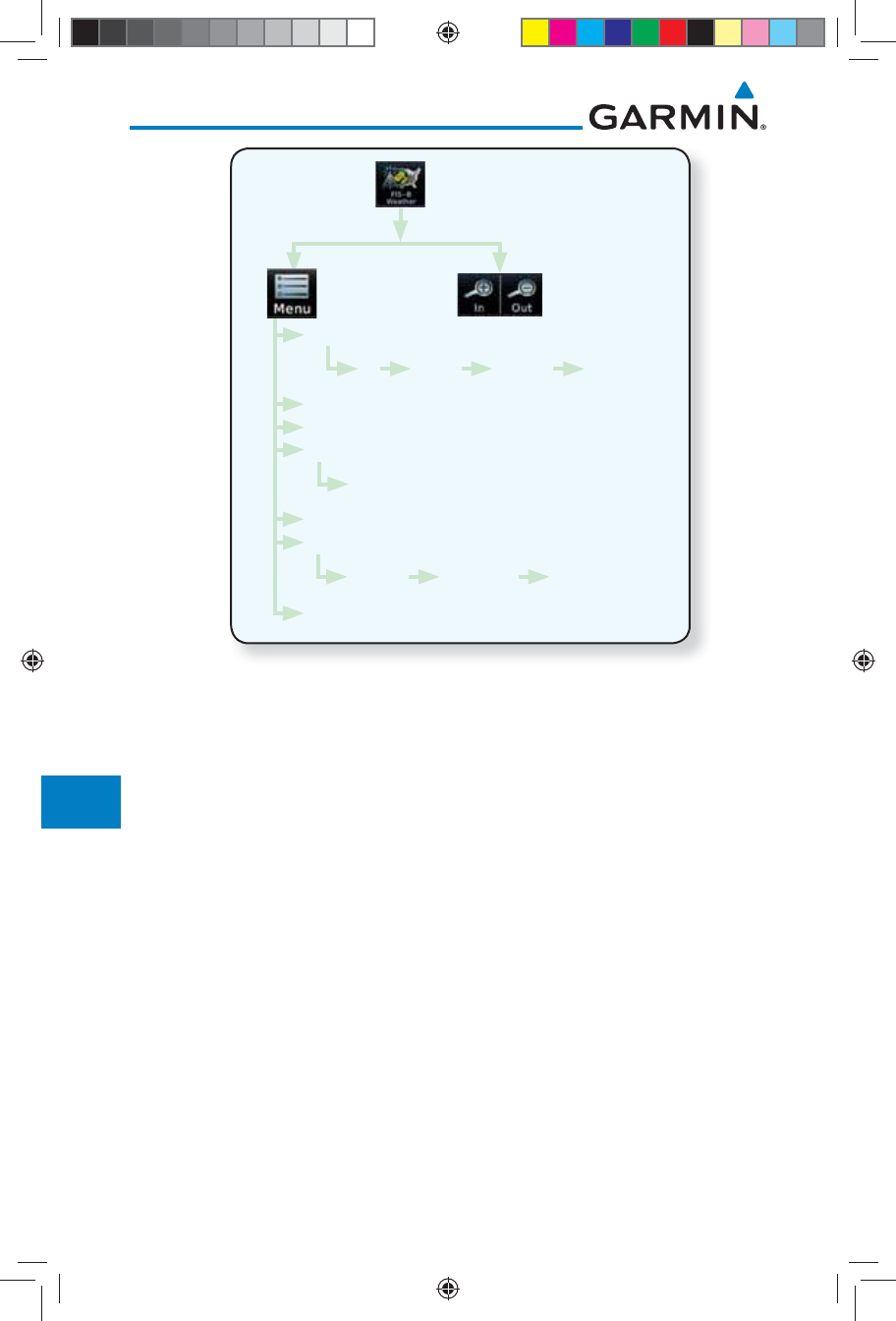
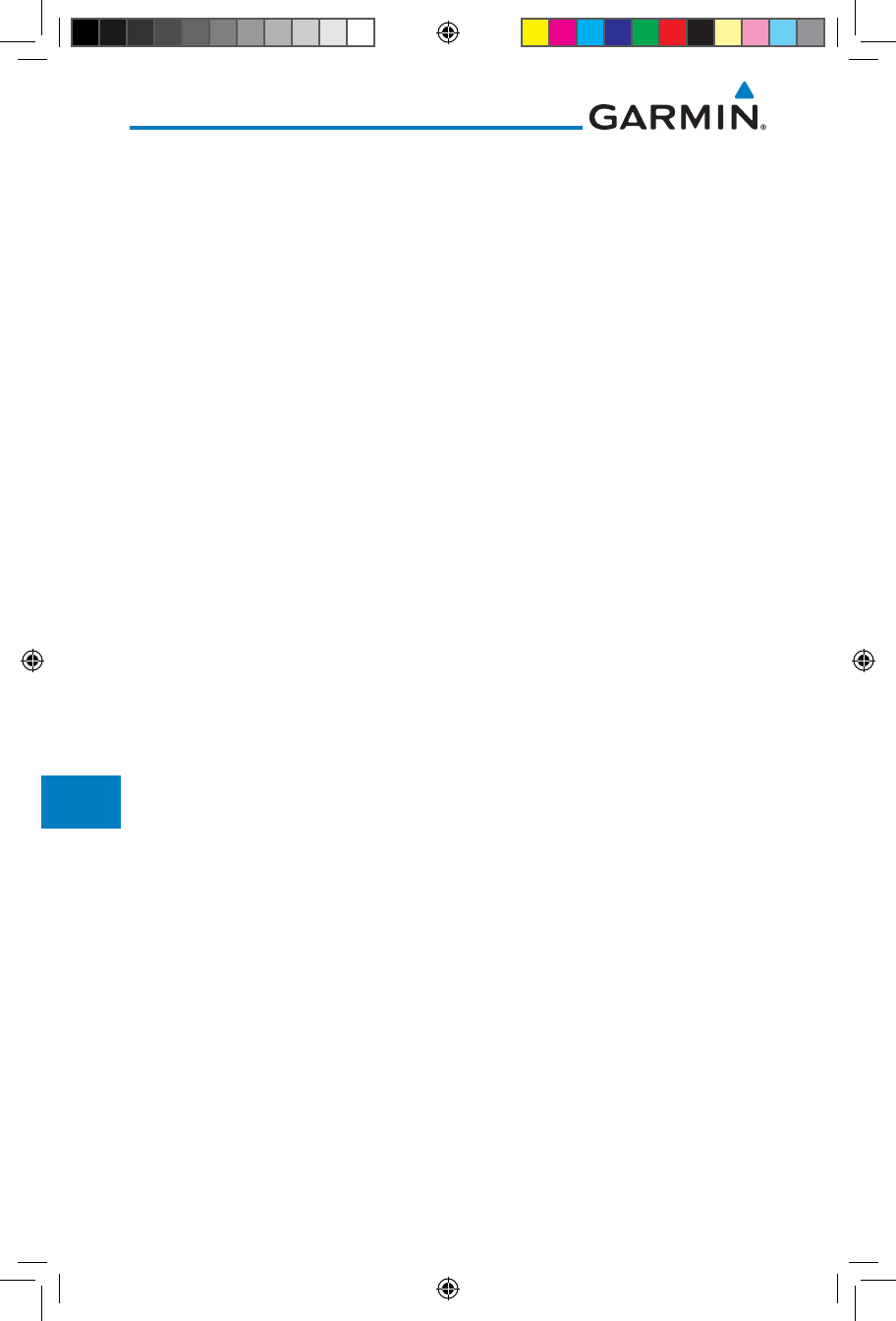
12.6 FIS-B Weather
The Flight Information Services (FIS-B) function is capable of displaying text
and graphic weather information with GDL 88 installations. No subscription for
FIS-B services is required with the GDL 88.
The FIS-B Function is a graphic weather display capable of displaying
graphical weather information on UAT equipped installations. Graphical data is
overlaid on the map indicating the rainfall detected by ground based radar for a
specific area. Colors are used to identify the different NEXRAD echo intensities
(reflectivity) measured in dBZ (decibels of Z). “Reflectivity” (designated by the
letter Z) is the amount of transmitted power returned to the radar receiver.
The dBZ values increase as returned signal strength increases. Precipitation
intensity is displayed using colors corresponding to the dBZ values. Review the
Limitations section in the front of this guide for the limitations that apply to the
FIS-B data. An example of how rainfall data is color coded follows:
Figure 12-92 FIS-B Weather Precipitation Legend
A cyan checkerboard pattern indicates that no data is available for that area,
and rainfall in that area is unknown.
The FIS-B Function is based on a ground-to-air data link and requires that
the appropriate ground systems are broadcasting weather data and the aircraft is
within reception range of the Ground Broadcast Transceiver (GBT).
190-01007-03-Final.indb 71 7/9/2015 2:08:18 PM
12-72
Garmin GTN 725/750 Pilot’s Guide
190-01007-03 Rev. J
Foreword
Getting
Started
Audio &
Xpdr Ctrl
Com/Nav
FPL
Direct-To
Proc
Charts
Wpt Info
Map
Traffic
Terrain
Weather
Nearest
Services/
Music
Utilities
System
Messages
Symbols
Appendix
Index
NEXRAD
METAR
PIREP
Wind/Temp Aloft
SIGMET/AIRMET
Orientation
Legend
Track Up Heading Up North Up
1,000 ft ... 45,000 ft
Off CONUS Regional Combined
Figure 12-93 FIS-B Weather Functional Diagram
190-01007-03-Final.indb 72 7/9/2015 2:08:18 PM
12-73190-01007-03 Rev. J
Garmin GTN 725/750 Pilot’s Guide
Foreword
Getting
Started
Audio &
Xpdr Ctrl
Com/Nav
FPL
Direct-To
Proc
Charts
Wpt Info
Map
Traffic
Terrain
Weather
Nearest
Services/
Music
Utilities
System
Messages
Symbols
Appendix
Index
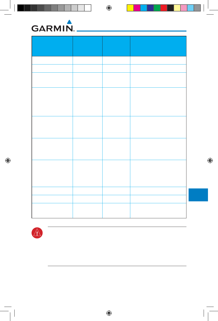
Weather Product Expiration
Time
(Minutes)
Transmission
Interval
(Minutes)
Update Interval (Minutes)
CONUS NEXRAD 60 15 15
Regional NEXRAD 30 2.5 5
AIRMETs 60 5 As Available
(Typically 20 minutes)
SIGMETs 60 5 As Available
(Typically 20 minutes), then
at 15 minute intervals for
1 hour
METARs 90 5 1 minute (where available),
As Available otherwise
(Typically d 20 minutes)
Winds and
Temperatures Aloft
90 or at the
end of the
valid period
10 12 hours
Pilot Weather
Report (PIREP)
(Blue - Regular,
Yellow - Urgent)
90 10 As available
|(Typically 20 minutes)
TAFs 60 10 8 hours
TFRs 60 10 20
NOTAMs 60 10 As available
(Typically 20 minutes)
Table 12-8 FIS-B Weather Products and Aging
WARNING: Do not use the indicated data link weather product age to
determine the age of the weather information shown by the data link
weather product. Due to time delays inherent in gathering and processing
weather data for data link transmission, the weather information shown by
the data link weather product may be significantly older than the indicated
weather product age.
190-01007-03-Final.indb 73 7/9/2015 2:08:18 PM
12-74
Garmin GTN 725/750 Pilot’s Guide
190-01007-03 Rev. J
Foreword
Getting
Started
Audio &
Xpdr Ctrl
Com/Nav
FPL
Direct-To
Proc
Charts
Wpt Info
Map
Traffic
Terrain
Weather
Nearest
Services/
Music
Utilities
System
Messages
Symbols
Appendix
Index
12.6.1 FIS-B Operation
Weather data reception time is shown in the upper right corner of the screen.
An indicated time shows if the aircraft is currently within reception coverage
of a ground station with weather broadcast capabilities. The ground system
determines the weather coverage area and extent of data that is transmitted by
each ground station. The GDL 88 can display weather from multiple ground
stations.
1. From the Home page, touch the Weather key on the Home
page and then touch the FIS-B Weather key (if necessary).
Age Of Selected
Weather Products
Touch + or - To
Select Map Range
NEXRAD
Selection
Weather
Product
Legends
Figure 12-94 FIS-B Weather Page (NEXRAD Key Shown)
2. While viewing the FIS-B weather page, touch the Menu key
to configure the Data Link Weather page.
Touch Legend Key
To Display Legend
Touch Keys To
Select Weather
Product. Green Bar
Indicates Selected
Product.
Touch NEXRAD
Key To Select Off,
CONUS, Regional,
or Combined
NEXRAD
NOTAM On/Off
Display Key
Weather Overlay
Map Orientation
Figure 12-95 FIS-B Weather Data Link Menu
3. Once you selected what items you want to display, touch BACK
to return to the FIS-B Weather page.
190-01007-03-Final.indb 74 7/9/2015 2:08:18 PM
12-75190-01007-03 Rev. J
Garmin GTN 725/750 Pilot’s Guide
Foreword
Getting
Started
Audio &
Xpdr Ctrl
Com/Nav
FPL
Direct-To
Proc
Charts
Wpt Info
Map
Traffic
Terrain
Weather
Nearest
Services/
Music
Utilities
System
Messages
Symbols
Appendix
Index
12.6.2 FIS-B NEXRAD
WSR-88D weather surveillance radar or NEXRAD (NEXt generation RADar) is
a Doppler radar system that has greatly improved the detection of meteorological
events such as thunderstorms, tornadoes, and hurricanes. An extensive network
of NEXRAD stations provides almost complete radar coverage of the continental
United States, Alaska, and Hawaii. The unobstructed range of each NEXRAD is
124 nautical miles.
12.6.2.1 NEXRAD Abnormalities
There are possible abnormalities regarding displayed NEXRAD images. Some,
but not all, causes of abnormal displayed information include:
• Ground Clutter
• Strobes and spurious radar data
• Sun strobes, when the radar antenna points directly at the sun
• Military aircraft deploy metallic dust which can cause alterations in radar
scans
• Interference from buildings or mountains, which may cause shadows
• Scheduled maintenance may put a radar off-line
12.6.2.2 NEXRAD Limitations
Certain limitations exist regarding the NEXRAD radar displays. Some, but
not all, are listed for the user’s awareness:
• The Regional NEXRAD “pixels” are 1.5 minutes (1.5 nautical miles
= 2.78 km) wide by 1 minute (1 nautical miles = 1.852 km) tall. The
CONUS NEXRAD “pixels” are 7.5 minutes (7.5 nautical miles = 13.89
km) wide by 5 minutes (5 nautical miles = 9.26 km) wide. Above 60
degrees of latitude the Regional NEXRAD "pixels" are 3 minutes/nautical
miles. CONUS NEXRAD is not available above 60 degrees of latitude.
The intensity level reflected by the pixel will be the highest level sampled
within the area covered by each pixel.
190-01007-03-Final.indb 75 7/9/2015 2:08:18 PM
12-76
Garmin GTN 725/750 Pilot’s Guide
190-01007-03 Rev. J
Foreword
Getting
Started
Audio &
Xpdr Ctrl
Com/Nav
FPL
Direct-To
Proc
Charts
Wpt Info
Map
Traffic
Terrain
Weather
Nearest
Services/
Music
Utilities
System
Messages
Symbols
Appendix
Index
12.6.2.3 NEXRAD Intensity
Colors are used to identify the different NEXRAD echo intensities (reflectivity)
measured in dBZ (decibels of Z). “Reflectivity” is the amount of transmitted power
returned to the radar receiver. Reflectivity (designated by the letter Z) covers a
wide range of signals (from very weak to very strong). So, a more convenient
number for calculations and comparison, a decibel (or logarithmic) scale (dBZ),
is used. The dBZ values increase as the strength of the signal returned to the
radar increases.
12.6.2.4 NEXRAD
When enabled, NEXRAD weather information is shown. Composite data
from all of the NEXRAD radar sites in the United States is shown. This data is
composed of the maximum reflectivity from the individual radar sweeps. The
display of the information is color-coded to indicate the weather level severity.
Refer to the legend for a description of the color code.
The NEXRAD option has selections of Regional, CONUS, or Combined
NEXRAD. CONUS NEXRAD includes a composite of available NEXRAD radar
imagery across the 48 states. Regional NEXRAD is a composite of available
NEXRAD radar imagery in a local area, showing a more detailed image
than CONUS NEXRAD. FIS-B weather data reception requires line-of-site
communication between the receiver and the ADS-B ground station. Incomplete
Regional and/or CONUS NEXRAD imagery displayed on the MAP and FIS-B
Weather Pages of the affected products is an indicator of poor FIS-B reception.
Affected Areas
Any area in the continental United States (CONUS) or Alaska where the
distance from ADS-B ground stations, or the combined effect of distance and
low altitude, is sufficiently great may cause poor reception. A good source of
information for ground station coverage can be found at:
http://www.faa.gov/nextgen/flashmap/
Reception will improve in some affected areas as the FAA completes the
NextGen ADS-B ground station infrastructure. However, due to line-of-sight
broadcast characteristics, operators with properly installed and functioning
equipment may still receive incomplete FIS-B data when signal reception is
limited by the distance from ground stations combined with a low altitude.
190-01007-03-Final.indb 76 7/9/2015 2:08:18 PM
12-77190-01007-03 Rev. J
Garmin GTN 725/750 Pilot’s Guide
Foreword
Getting
Started
Audio &
Xpdr Ctrl
Com/Nav
FPL
Direct-To
Proc
Charts
Wpt Info
Map
Traffic
Terrain
Weather
Nearest
Services/
Music
Utilities
System
Messages
Symbols
Appendix
Index
The example below displays an area where FIS-B data is degraded due to
poor reception:
Figure 12-96 Example of Areas Where FIS-B Reception Is Unavailable
Continental US NEXRAD (CONUS)
The Display CONUS NEXRAD selection shows NEXRAD radar information
for the entire continental United States. CONUS NEXRAD data is updated every
15 minutes.
CONUS Selected
On NEXRAD Key
CONUS NEXRAD
Coverage Shown
Out Of CONUS
NEXRAD Coverage
Figure 12-97 Weather Page With CONUS Displayed
190-01007-03-Final.indb 77 7/9/2015 2:08:19 PM
12-78
Garmin GTN 725/750 Pilot’s Guide
190-01007-03 Rev. J
Foreword
Getting
Started
Audio &
Xpdr Ctrl
Com/Nav
FPL
Direct-To
Proc
Charts
Wpt Info
Map
Traffic
Terrain
Weather
Nearest
Services/
Music
Utilities
System
Messages
Symbols
Appendix
Index
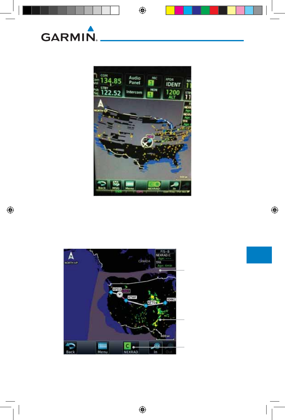
Regional NEXRAD
The Regional NEXRAD selection shows regional NEXRAD radar information
within 500 NM of the aircraft location.
Regional Selected
On NEXRAD Key
Regional NEXRAD
Coverage Shown
Out Of Regional
NEXRAD Coverage
Within Regional
NEXRAD Area But
Coverage Not Available
Figure 12-98 Weather Page With Regional NEXRAD Displayed
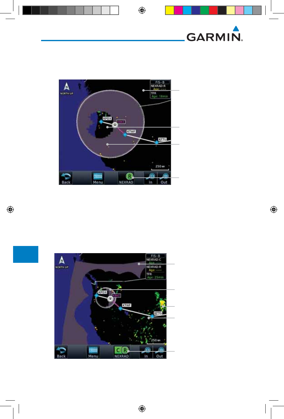
Combined NEXRAD
Regional NEXRAD data and CONUS NEXRAD data are shown together. The
two types of NEXRAD are separated by a white stippled border. This boundary
is updated whenever new Regional or CONUS NEXRAD data is received. The
radius of the boundary is fixed at 150 NM.
CONUS & Regional
Selected On NEXRAD Key
Regional NEXRAD
Boundary Shown
Out Of Regional
NEXRAD Coverage
NEXRAD Weather Shown
NEXRAD Weather Shown
Figure 12-99 Weather Page With Combined NEXRAD Displayed
190-01007-03-Final.indb 78 7/9/2015 2:08:19 PM
12-79190-01007-03 Rev. J
Garmin GTN 725/750 Pilot’s Guide
Foreword
Getting
Started
Audio &
Xpdr Ctrl
Com/Nav
FPL
Direct-To
Proc
Charts
Wpt Info
Map
Traffic
Terrain
Weather
Nearest
Services/
Music
Utilities
System
Messages
Symbols
Appendix
Index
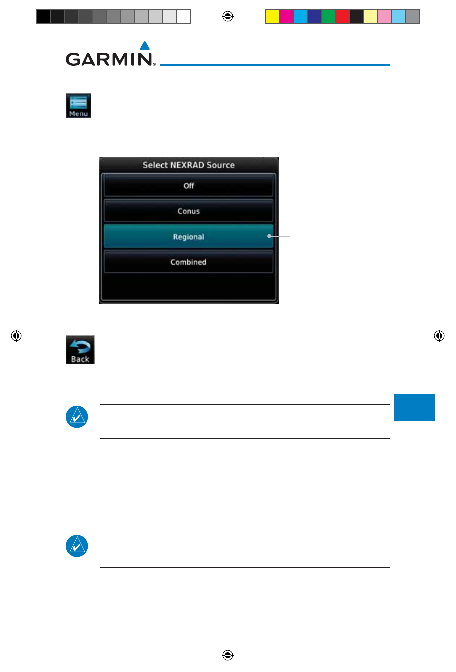
Selecting NEXRAD in the FIS-B Weather Menu
1. While viewing the FIS-B weather page, touch the Menu key
to select the NEXRAD choice.
2. Touch the NEXRAD key to select Off, Regional, CONUS, or
Combined NEXRAD.
Touch the Desired
NEXRAD Source
Figure 12-100 NEXRAD Source Selection
3. Touch the Back key to return to the FIS-B Weather Menu.
Animating NEXRAD FIS-B
NOTE: Animated NEXRAD functionality is available in software version
6.00 and later.
When Regional or CONUS NEXRAD is enabled for display and more than
two NEXRAD images have been received by the GTN, the NEXRAD display can
be animated on the FIS-B Weather page. As new NEXRAD images are received,
the GTN will automatically store them for future animation. The GTN can
animate up to six NEXRAD images from oldest to newest, showing each for one
second and the newest for two seconds.
NOTE: CONUS/Regional Combined NEXRAD cannot be animated. CONUS
and Regional NEXRAD can only be animated when displayed individually.
190-01007-03-Final.indb 79 7/9/2015 2:08:19 PM
12-80
Garmin GTN 725/750 Pilot’s Guide
190-01007-03 Rev. J
Foreword
Getting
Started
Audio &
Xpdr Ctrl
Com/Nav
FPL
Direct-To
Proc
Charts
Wpt Info
Map
Traffic
Terrain
Weather
Nearest
Services/
Music
Utilities
System
Messages
Symbols
Appendix
Index
1. While viewing the FIS-B Weather page with NEXRAD enabled
for display, press the Play NXRD key to start the NEXRAD
animation.
2. Touch the Stop NXRD key to stop the NEXRAD animation.
The animation will also stop when leaving the page or turning
off NEXRAD on the FIS-B weather page.
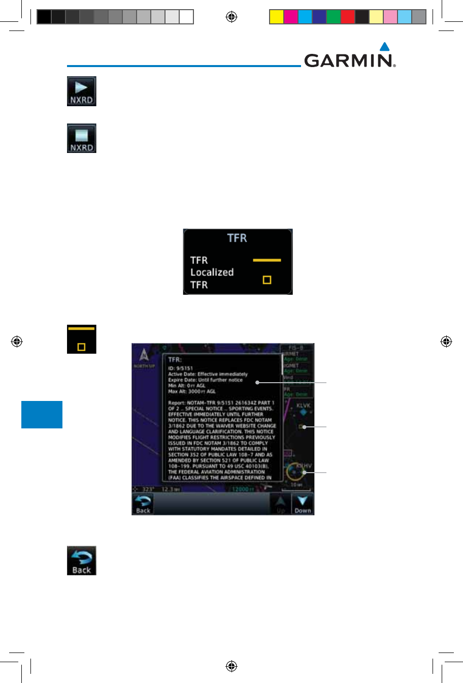
12.6.3 FIS-B TFRs
Temporary Flight Restrictions (TFRs) provide detailed information for local
short term restrictions. The update rate is approximately every 20 minutes.
Figure 12-101 FIS-B TFR Legend
1. Touch a TFR symbol on the Weather page to view details.
TFR Detail
Touch TFR Symbol
To View Details
Touch TFR Symbol
To View Details
Figure 12-102 FIS-B TFR Detail
2. Touch the Back key to return to the Weather display.
190-01007-03-Final.indb 80 7/9/2015 2:08:19 PM
12-81190-01007-03 Rev. J
Garmin GTN 725/750 Pilot’s Guide
Foreword
Getting
Started
Audio &
Xpdr Ctrl
Com/Nav
FPL
Direct-To
Proc
Charts
Wpt Info
Map
Traffic
Terrain
Weather
Nearest
Services/
Music
Utilities
System
Messages
Symbols
Appendix
Index
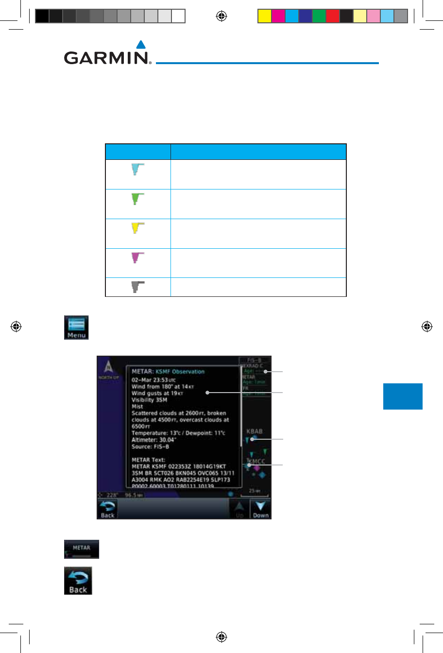
12.6.4 FIS-B METARs
When enabled, graphic METARs (METeorological Aviation Reports) are
shown as colored flags at airports that provide METAR reports. Press the
METARs key to enable or disable METARs. Refer to the Legend for a description
of the color code. The update rate is every five minutes.
METAR Symbol Description
VFR (ceiling greater than 3000 ft. AGL and
visibility greater than five miles)
Marginal VFR (ceiling 1000–3000 ft. AGL
and/or visibility three to five miles)
IFR (ceiling 500 to below 1000 ft. AGL and/or
visibility one mile to less than three miles)
Low IFR (ceiling below 500 ft. AGL or visibility
less than one mile)
Unknown
Table 12-9 METAR Symbols
1. While viewing the FIS-B weather page, touch the Menu key
to select the METAR choice. Touch an airport symbol for more
METAR detail.
Touch Airport For
METAR Detail
Product Age
METAR Flags
METAR Detail
Figure 12-103 METARS
2. Touch the METAR key to toggle METARS on or off.
3. Touch the Back key to return to the FIS-B Weather page.
190-01007-03-Final.indb 81 7/9/2015 2:08:20 PM
12-82
Garmin GTN 725/750 Pilot’s Guide
190-01007-03 Rev. J
Foreword
Getting
Started
Audio &
Xpdr Ctrl
Com/Nav
FPL
Direct-To
Proc
Charts
Wpt Info
Map
Traffic
Terrain
Weather
Nearest
Services/
Music
Utilities
System
Messages
Symbols
Appendix
Index
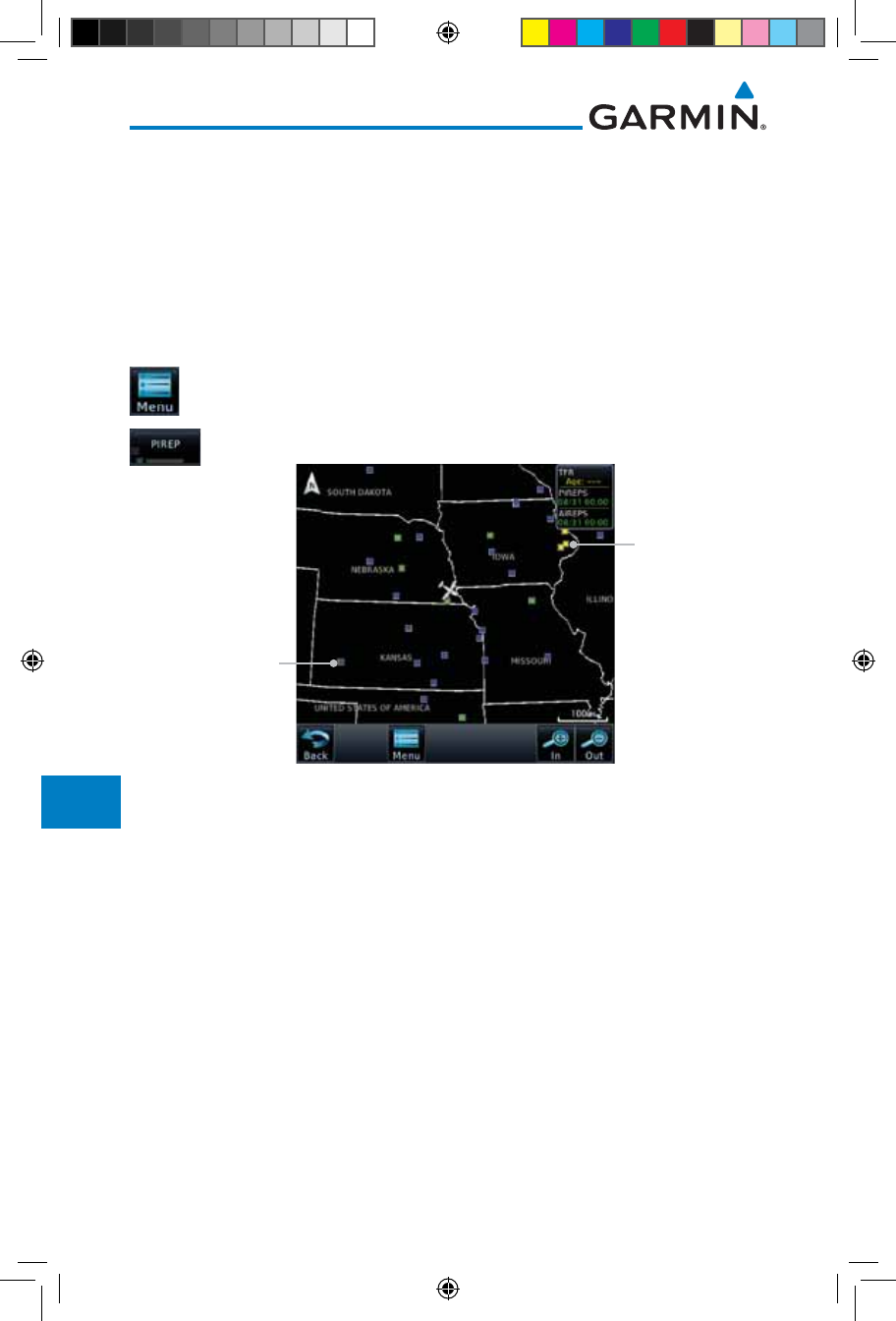
12.6.5 FIS-B PIREPs
Pilot Weather Reports (PIREPs) provide timely weather information. When
significant weather conditions are reported or forecast, Air Traffic Control (ATC)
facilities are required to solicit PIREPs. A PIREP may contain non-forecast
adverse weather conditions, such as low in-flight visibility, icing conditions,
wind shear, and turbulence. PIREPs are issued as either Routine (UA) or Urgent
(UUA). The update rate is approximately every 20 minutes.
1. While viewing the FIS-B weather page, touch the Menu key
to select the PIREP choice.
2. Touch the PIREP key to toggle PIREPs on or off.
Routine PIREP
Symbol (Blue).
Touch For Details.
Urgent PIREP
Symbol (Yellow).
Touch For Details.
Figure 12-104 Weather Display With PIREP Information Active
190-01007-03-Final.indb 82 7/9/2015 2:08:20 PM
12-83190-01007-03 Rev. J
Garmin GTN 725/750 Pilot’s Guide
Foreword
Getting
Started
Audio &
Xpdr Ctrl
Com/Nav
FPL
Direct-To
Proc
Charts
Wpt Info
Map
Traffic
Terrain
Weather
Nearest
Services/
Music
Utilities
System
Messages
Symbols
Appendix
Index
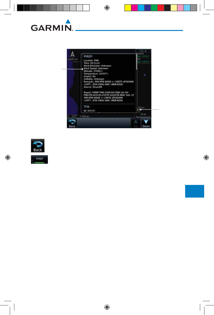
3. Touch a weather information symbol to view details for that
item.
PIREP Details
Selected PIREP
For Detail
Figure 12-105 PIREP Information Detail
4. Touch the Back key to remove the detailed information.
5. Touch the PIREP key again to turn it off.
190-01007-03-Final.indb 83 7/9/2015 2:08:20 PM
12-84
Garmin GTN 725/750 Pilot’s Guide
190-01007-03 Rev. J
Foreword
Getting
Started
Audio &
Xpdr Ctrl
Com/Nav
FPL
Direct-To
Proc
Charts
Wpt Info
Map
Traffic
Terrain
Weather
Nearest
Services/
Music
Utilities
System
Messages
Symbols
Appendix
Index
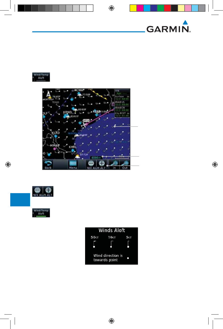
12.6.6 FIS-B Winds and Temperatures Aloft
Winds and Temperatures Aloft data shows the forecast wind speed, direction,
and Temperature at selected altitudes. Altitudes can be selected in increments
from the 1,000 feet up to 53,000 feet. The update rate is every 12 hours.
1. While viewing the Data Link Weather menu, touch the Wind/
Temp Aloft key.
Wind Symbols
Selected Wind Altitude
Touch To Select
Wind Altitude
Figure 12-106 Winds Aloft
2. Touch the WX Aloft ALT – or + keys to increase or decrease
the reporting altitude of the winds aloft in increments. The
selected altitude is shown in a window above the altitude keys.
3. Touch the Wind/Temp Aloft key again to turn it off.
Figure 12-107 FIS-B Winds Aloft Legend
190-01007-03-Final.indb 84 7/9/2015 2:08:20 PM
12-85190-01007-03 Rev. J
Garmin GTN 725/750 Pilot’s Guide
Foreword
Getting
Started
Audio &
Xpdr Ctrl
Com/Nav
FPL
Direct-To
Proc
Charts
Wpt Info
Map
Traffic
Terrain
Weather
Nearest
Services/
Music
Utilities
System
Messages
Symbols
Appendix
Index
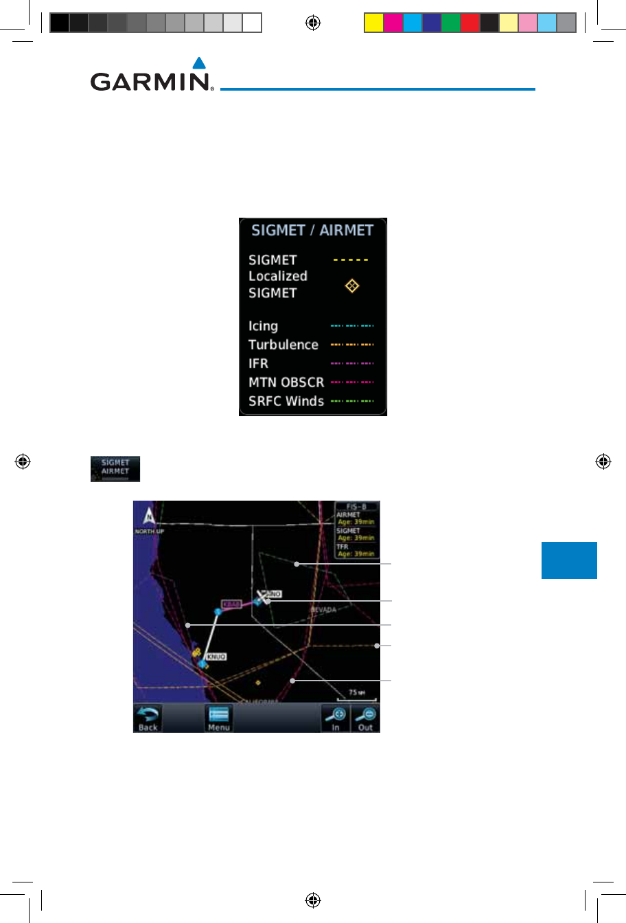
12.6.7 FIS-B SIGMETs and AIRMETs
SIGMETs (SIGnificant METerological Information) and AIRMETs (AIRmen’s
METerological Information) are broadcast for potentially hazardous weather
considered of importance to aircraft. The update rate is approximately every 20
minutes.
Figure 12-108 FIS-B SIGMET/AIRMET Legend
1. While viewing the FIS-B Weather menu, touch the SIGMET/
AIRMET key.
Surface Winds
Present Position
Turbulence Line
IFR Line
Mountain Obscured
Figure 12-109 FIS-B SIGMETs and AIRMETs
190-01007-03-Final.indb 85 7/9/2015 2:08:20 PM
12-86
Garmin GTN 725/750 Pilot’s Guide
190-01007-03 Rev. J
Foreword
Getting
Started
Audio &
Xpdr Ctrl
Com/Nav
FPL
Direct-To
Proc
Charts
Wpt Info
Map
Traffic
Terrain
Weather
Nearest
Services/
Music
Utilities
System
Messages
Symbols
Appendix
Index
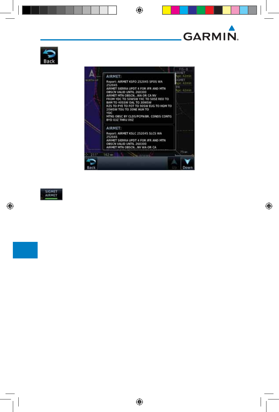
2. Touch a SIGMET/AIRMET line to view details. Touch the Back
key to return to the Weather display.
Figure 12-110 SIGMET and AIRMET Details
3. Touch the SIGMET/AIRMET key again to turn it off.
190-01007-03-Final.indb 86 7/9/2015 2:08:21 PM
13-1190-01007-03 Rev. J
Garmin GTN 725/750 Pilot’s Guide
Foreword
Getting
Started
Audio &
Xpdr Ctrl
Com/Nav
FPL
Direct-To
Proc
Charts
Wpt Info
Map
Traffic
Terrain
Weather
Nearest
Services/
Music
Utilities
System
Messages
Symbols
Appendix
Index
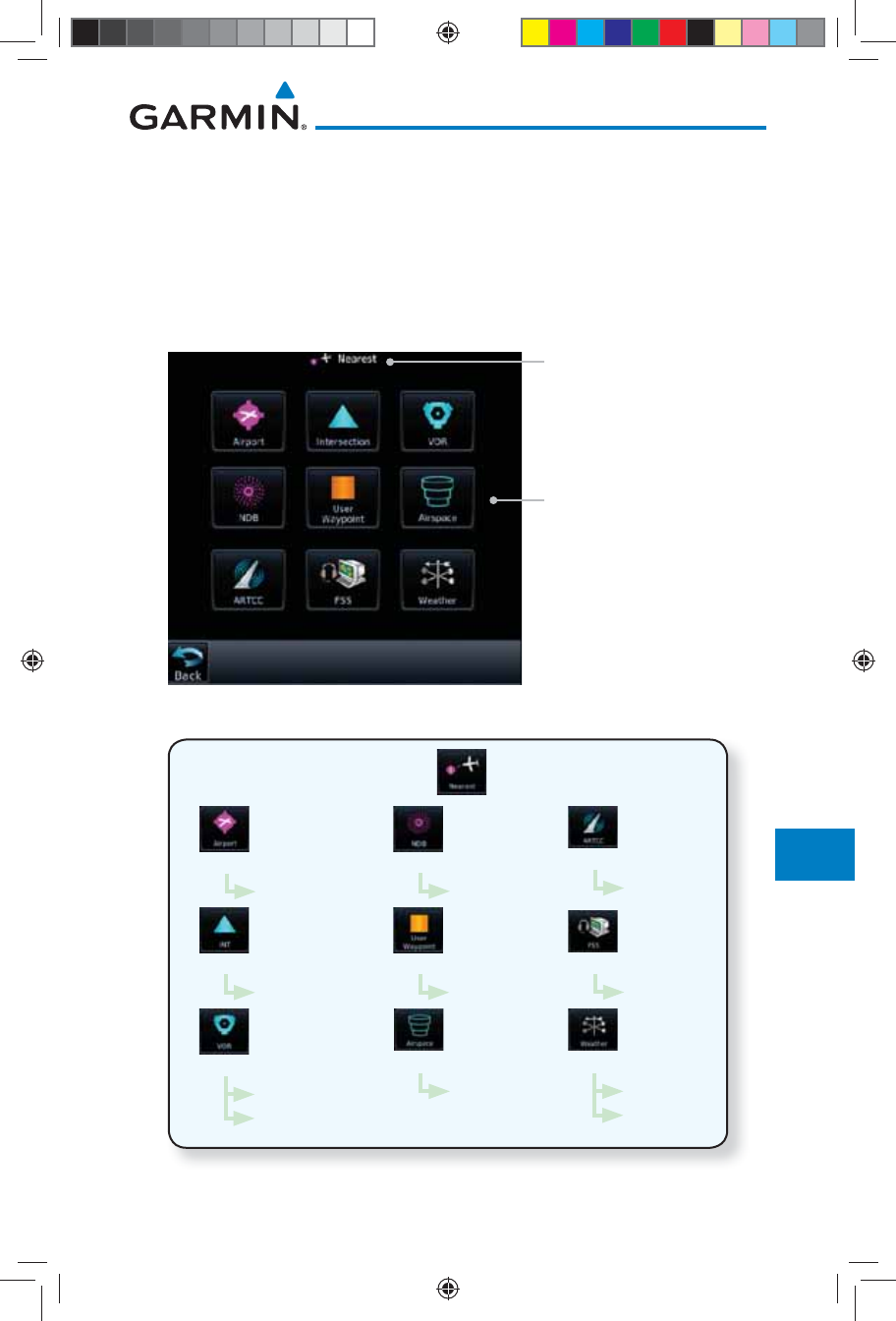
13 NEAREST
The Nearest function provides detailed information for the 25 nearest
airports, VORs, NDBs, Intersections and User waypoints within 200 NM of your
current position. In addition, the Nearest pages include the five nearest Flight
Service Station (FSS) and center (ARTCC/FIR) points of communication and
alert you to any Special Use (SUA) or Controlled Airspace you may be in or near.
Nearest Waypoint Types
Function Title
Figure 13-1 Nearest Page
Wpt Info
List
Wpt Info
Freq
List
Wpt Info
List
Wpt Info
List
Wpt Info
List
Airspace Info
List
Frequency
List
Frequency
List
Wpt Info
Frequency
List
Figure 13-2 Nearest Page Functional Map
190-01007-03-Final.indb 1 7/9/2015 2:08:21 PM
13-2
Garmin GTN 725/750 Pilot’s Guide
190-01007-03 Rev. J
Foreword
Getting
Started
Audio &
Xpdr Ctrl
Com/Nav
FPL
Direct-To
Proc
Charts
Wpt Info
Map
Traffic
Terrain
Weather
Nearest
Services/
Music
Utilities
System
Messages
Symbols
Appendix
Index
13.1 Select a Nearest Page
The available waypoint types are shown on the Nearest page. Touch the key
to display the nearest 25 waypoint types (FSS and ARTCC will display up to
five items). Not all 25 nearest waypoints can be displayed on the corresponding
Nearest page at one time. The Nearest page displays detailed information for five
nearest items.
1. On the Home page, touch the Nearest key.
2. Touch the desired waypoint type (Airport, VOR, etc.) and then
touch the Up and Down keys on the lower right of the display
to navigate through the list of available items. You can also
touch an item on the list and drag your finger to scroll the
list.
3. Touch the highlighted item to view more detailed
information.
4. To navigate Direct-To the waypoint you're viewing, press the
Direct-To key. The waypoint will be loaded into the Waypoint
window of the Direct-To function.
5. Touch the Activate key to navigate directly to that
waypoint.
13.2 Nearest Airport
The Nearest Airport Page displays the identifier, symbol, bearing and distance,
and the length of the longest runway for the 25 nearest airports (within 200 NM
of your present position).
The Nearest Airport Page can be configured to exclude shorter runways or
undesirable runway surface types, so that the corresponding airports do not
appear on the list. You may wish to use this feature to exclude seaplane bases,
heliports, or runway lengths which would be difficult or impossible to land upon.
See System - Setup - Nearest Airport Criteria for information about configuring the
Nearest Airport display criteria.
190-01007-03-Final.indb 2 7/9/2015 2:08:21 PM
13-3190-01007-03 Rev. J
Garmin GTN 725/750 Pilot’s Guide
Foreword
Getting
Started
Audio &
Xpdr Ctrl
Com/Nav
FPL
Direct-To
Proc
Charts
Wpt Info
Map
Traffic
Terrain
Weather
Nearest
Services/
Music
Utilities
System
Messages
Symbols
Appendix
Index
1. While viewing the Nearest function, touch the Airport key. A
list of the nearest 25 airports within 200 NM will be listed.
Scroll Bar Indicate
More Items On The List
Airport Information
Airport
Identifier
Figure 13-3 Nearest Airport
2. Touch the Up and Down keys to scroll through the list.
3. Touch the Airport Identifier key to show the Waypoint Info
page for the selected airport.
Airport
Information
Page
Distance & Bearing
Information
Referenced To
Current Position
Touch To View Charts
When Available
Figure 13-4 Nearest Airport Waypoint Info
4. Touch one of the tabs (Map, Procedures, Runways, etc.) on the
sides of the display for more information about the selected
airport.
190-01007-03-Final.indb 3 7/9/2015 2:08:22 PM
13-4
Garmin GTN 725/750 Pilot’s Guide
190-01007-03 Rev. J
Foreword
Getting
Started
Audio &
Xpdr Ctrl
Com/Nav
FPL
Direct-To
Proc
Charts
Wpt Info
Map
Traffic
Terrain
Weather
Nearest
Services/
Music
Utilities
System
Messages
Symbols
Appendix
Index
13.3 Nearest Intersection (INT)
The Nearest Intersection Page displays the identifier, symbol, bearing and
distance to the 25 nearest intersections (within 200 NM of your present position).
1. While viewing the Nearest function, touch the INT key. A list
of the nearest 25 Intersections within 200 NM will be listed.
Slider Indicates
More Items On
The List
Intersection
Information
Intersection
Identifier
Arrow Indicates
More Items On
The List
Figure 13-5 Nearest Intersection List
2. Touch the Up and Down keys to scroll through the list.
Slider Indicates
More Items On
The List
Arrows Indicate
More Items On
The List
Figure 13-6 Scrolling Down the Nearest Intersection List
190-01007-03-Final.indb 4 7/9/2015 2:08:22 PM
13-5190-01007-03 Rev. J
Garmin GTN 725/750 Pilot’s Guide
Foreword
Getting
Started
Audio &
Xpdr Ctrl
Com/Nav
FPL
Direct-To
Proc
Charts
Wpt Info
Map
Traffic
Terrain
Weather
Nearest
Services/
Music
Utilities
System
Messages
Symbols
Appendix
Index
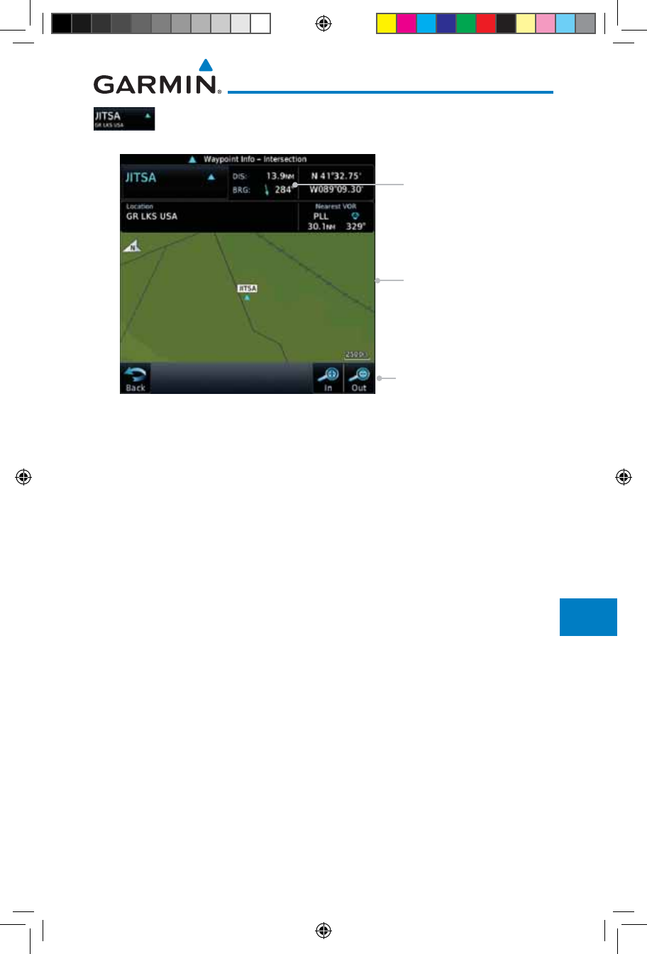
3. Touch the Intersection Identifier key to show the Waypoint
Info page for the selected Intersection.
Intersection
Map Detail
Distance & Bearing
Information Referenced
To Current Position
Map Range Keys
Figure 13-7 Nearest Intersection Waypoint Detail
190-01007-03-Final.indb 5 7/9/2015 2:08:22 PM
13-6
Garmin GTN 725/750 Pilot’s Guide
190-01007-03 Rev. J
Foreword
Getting
Started
Audio &
Xpdr Ctrl
Com/Nav
FPL
Direct-To
Proc
Charts
Wpt Info
Map
Traffic
Terrain
Weather
Nearest
Services/
Music
Utilities
System
Messages
Symbols
Appendix
Index
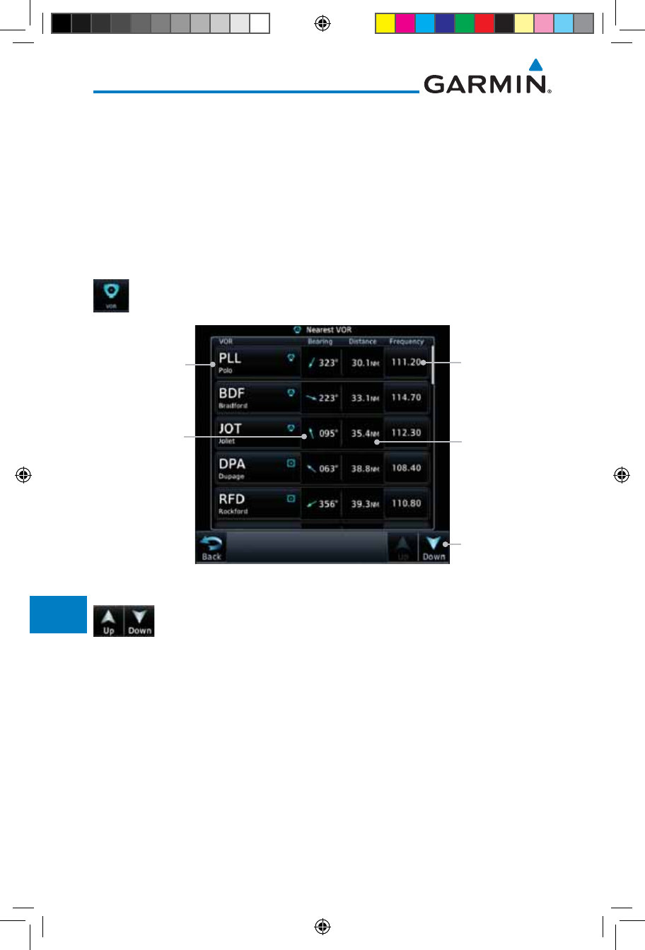
13.4 Nearest VOR
The Nearest VOR Page displays the identifier, symbol, bearing and distance
to the 25 nearest VORs (within 200 NM of your present position). For each VOR
listed, the Nearest VOR Page also indicates the frequency and may be used to
quickly tune the Nav radio to the nearby VOR (GTN 750 only).
Touch the VOR Frequency key to place the frequency in the standby field of the
Nav window. Touch the Nav Active window to flip/flop the Nav frequencies.
1. While viewing the Nearest function, touch the VOR key. A list
of the nearest 25 VORs within 200 NM will be listed.
Arrows Indicate
More Items On
The List
Distance
from Current
Position to VOR
Nearest VOR
Identifier
Nearest VOR
Frequency
Bearing
from Current
Position to VOR
Figure 13-8 Nearest VOR List and Information
2. Touch the Up and Down keys to scroll through the list.
190-01007-03-Final.indb 6 7/9/2015 2:08:22 PM
13-7190-01007-03 Rev. J
Garmin GTN 725/750 Pilot’s Guide
Foreword
Getting
Started
Audio &
Xpdr Ctrl
Com/Nav
FPL
Direct-To
Proc
Charts
Wpt Info
Map
Traffic
Terrain
Weather
Nearest
Services/
Music
Utilities
System
Messages
Symbols
Appendix
Index
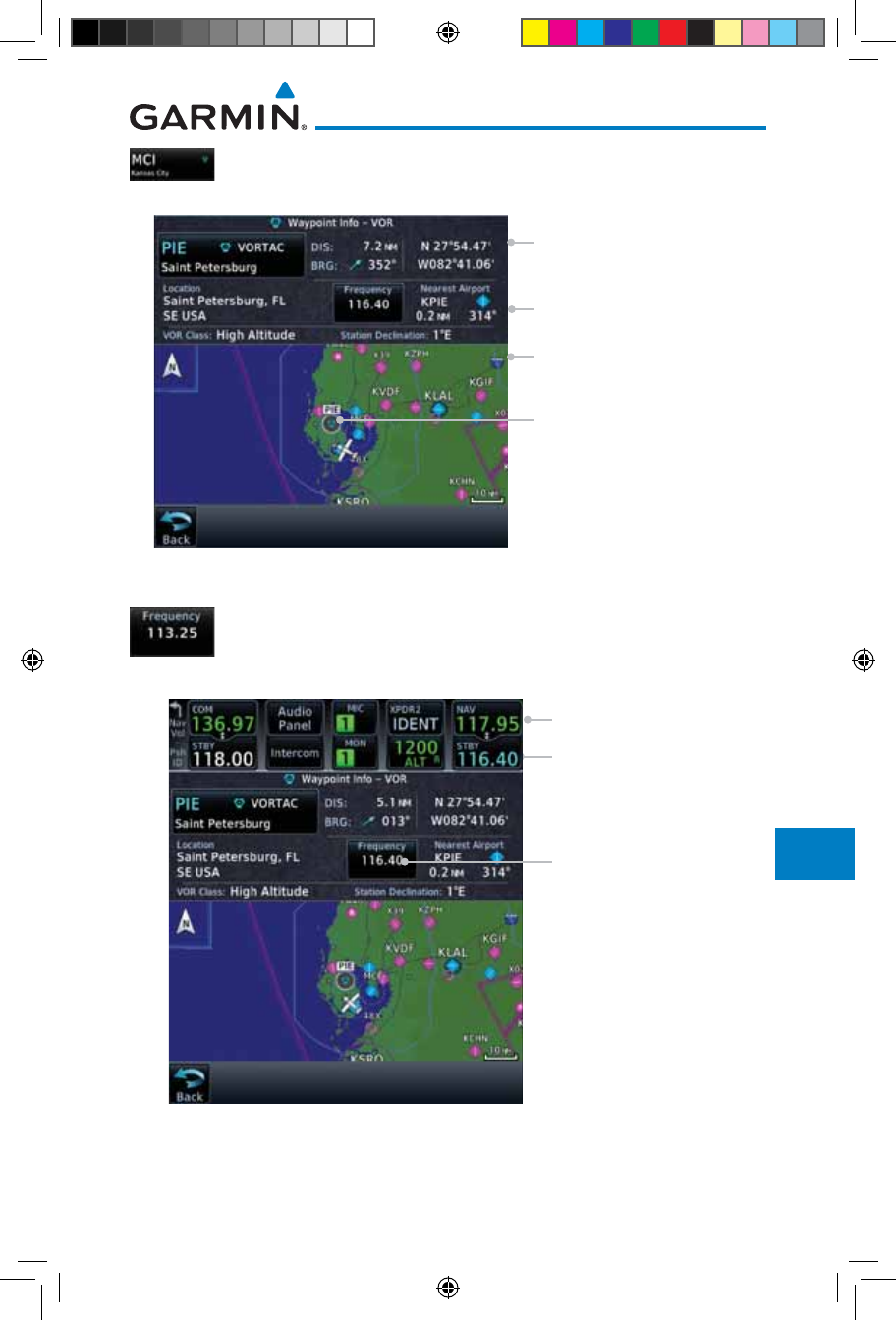
3. Touch the VOR Identifier key to show the Waypoint Info
page for the selected VOR.
VOR Map Detail
VOR Information
Referenced To Current
Position
Additional VOR Information
VOR Location
Figure 13-9 Nearest VOR Waypoint Information
4. Touch the Frequency key on this page or from the Nearest
VOR List page to place the selected frequency into the Nav
Standby window.
VOR Frequency Inserted
Into Standby Window.
VOR Frequency
Touch to Flip/Flop
Figure 13-10 Nearest VOR Frequency Entry
190-01007-03-Final.indb 7 7/9/2015 2:08:23 PM
13-8
Garmin GTN 725/750 Pilot’s Guide
190-01007-03 Rev. J
Foreword
Getting
Started
Audio &
Xpdr Ctrl
Com/Nav
FPL
Direct-To
Proc
Charts
Wpt Info
Map
Traffic
Terrain
Weather
Nearest
Services/
Music
Utilities
System
Messages
Symbols
Appendix
Index
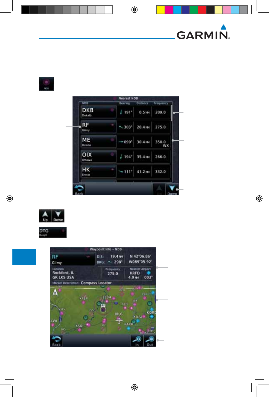
13.5 Nearest NDB
The Nearest NDB Page displays the identifier, symbol, bearing, distance and
frequency to the 25 nearest NDBs (within 200 NM of your present position).
1. While viewing the Nearest function, touch the NDB key. A list
of the nearest 25 NDBs within 200 NM will be listed.
Arrows Indicate More
Items On The List
NDB
Information
NDB
Identifier
Scroll Bar Indicates
More Items On The
List. Touch And Drag
Finger To Scroll.
Figure 13-11 Nearest NDB
2. Touch the Up and Down keys to scroll through the list.
3. Touch the NDB Identifier key to show the Waypoint Info
page for the selected NDB.
NDB Map Detail
Distance and Bearing
Referenced To Current
Position
Map Range Keys
Figure 13-12 Nearest NDB Waypoint Information
190-01007-03-Final.indb 8 7/9/2015 2:08:23 PM
13-9190-01007-03 Rev. J
Garmin GTN 725/750 Pilot’s Guide
Foreword
Getting
Started
Audio &
Xpdr Ctrl
Com/Nav
FPL
Direct-To
Proc
Charts
Wpt Info
Map
Traffic
Terrain
Weather
Nearest
Services/
Music
Utilities
System
Messages
Symbols
Appendix
Index
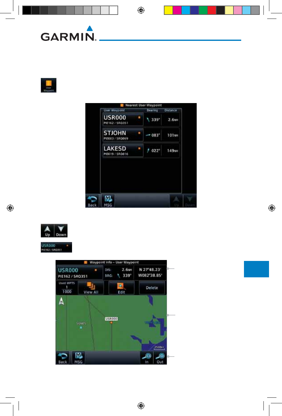
13.6 Nearest User Waypoint
The Nearest User Waypoint Page displays the name, bearing and distance to
the 25 nearest user waypoints (within 200 NM of your present position).
1. While viewing the Nearest function, touch the User Waypoint
key. A list of the nearest 25 User waypoints within 200 NM
will be listed.
Figure 13-13 Nearest User Waypoint
2. Touch the Up and Down keys to scroll through the list.
3. Touch the User Identifier key to show the Waypoint Info
page for the selected User waypoint.
User Wpt Map Detail
User Wpt Distance &
Bearing Referenced To
Current Position
Map Range Keys
Figure 13-14 Nearest User Waypoint Information
190-01007-03-Final.indb 9 7/9/2015 2:08:23 PM
13-10
Garmin GTN 725/750 Pilot’s Guide
190-01007-03 Rev. J
Foreword
Getting
Started
Audio &
Xpdr Ctrl
Com/Nav
FPL
Direct-To
Proc
Charts
Wpt Info
Map
Traffic
Terrain
Weather
Nearest
Services/
Music
Utilities
System
Messages
Symbols
Appendix
Index
13.7 Nearest Airspace
The Nearest Airspace Page, alerts you to as many as 25 controlled or special
use airspaces near or in your flight path. Alerts are provided according to the
following conditions:
• If your projected course will take you inside an airspace within the
next ten minutes, the alert message “AIRSPACE ALERT - Airspace entry
in less than 10 minutes” appears. The Nearest Airspace Page shows the
airspace as “Airspace Ahead.”
• If you are within two nautical miles of an airspace and your current
course will take you inside, the message “AIRSPACE ALERT - Within
2nm of airspace” appears. The Nearest Airspace Page shows the air-
space as “Airspace Within 2 NM.”
• If you are within two nautical miles of an airspace and your current
course will take you inside in less than 10 minutes, the message “AIR-
SPACE ALERT - Airspace within 2nm and entry in less than 10 minutes”
appears. The Nearest Airspace Page shows the airspace as “Ahead <
2 NM.”
• If you have entered an airspace, the message “AIRSPACE ALERT -
Inside Airspace” appears. The Nearest Airspace Page shows “Inside of
airspace.”
Note that the airspace alerts are based on three-dimensional data (latitude,
longitude and altitude) to avoid nuisance alerts. The alert boundaries for
controlled airspace are also sectorized to provide complete information on
any nearby airspace. Once one of the described conditions exists, the message
annunciator flashes, alerting you of an airspace message (if airspace alert messages
are enabled). See System-Alerts to set the Arrival Alert Proximity, Airspace Type,
and Altitude Buffer values.
NOTE: The Airspace Alert setting does not alter the depiction of airspace,
or change the Smart Airspace setting for the main map page.
190-01007-03-Final.indb 10 7/9/2015 2:08:23 PM
13-11190-01007-03 Rev. J
Garmin GTN 725/750 Pilot’s Guide
Foreword
Getting
Started
Audio &
Xpdr Ctrl
Com/Nav
FPL
Direct-To
Proc
Charts
Wpt Info
Map
Traffic
Terrain
Weather
Nearest
Services/
Music
Utilities
System
Messages
Symbols
Appendix
Index
Selected
Airspace
Sector
Current Position
Active Flight
Plan Leg
Runway
Extension
Airspace
Boundary
Airspace
Sector
Name
Map Pointer
Map Pointer
Location
Information
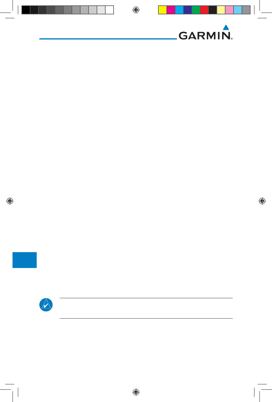
Figure 13-15 Airspace Sectors
1. While viewing the Nearest function, touch the Airspace key.
A list of the nearest 25 Airspaces within 200 NM along the
aircraft flight path will be listed, depending on the airspace
types and values set by the user.
Airspace
Information
Airspace
Name
Figure 13-16 Nearest Airspace List
2. Touch the Up and Down keys to scroll through the list.
3. Touch the Airspace Identifier key to show the Waypoint
Info page for the selected Airspace.
190-01007-03-Final.indb 11 7/9/2015 2:08:24 PM
13-12
Garmin GTN 725/750 Pilot’s Guide
190-01007-03 Rev. J
Foreword
Getting
Started
Audio &
Xpdr Ctrl
Com/Nav
FPL
Direct-To
Proc
Charts
Wpt Info
Map
Traffic
Terrain
Weather
Nearest
Services/
Music
Utilities
System
Messages
Symbols
Appendix
Index
Touch To
View Airspace
Frequency List
Airspace
Name
Airspace
Altitude
Airspace Contact
Name
Proximity
To Airspace
Figure 13-17 Nearest Airspace Waypoint Information
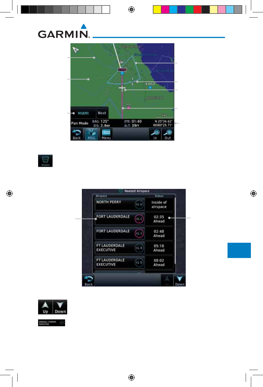
Once you have been provided an airspace alert message, detailed information
concerning the specific airspace is provided on the Nearest Airspace Page. The
Nearest Airspace Page displays the airspace name, status (“AIRSPACE ALERT -
inside Airspace”, “AIRSPACE ALERT - Airspace entry in less than 10 minutes”,
etc.), and a time to entry (if applicable). By selecting any airspace name listed
on the Nearest Airspace Page, additional details are provided — including
controlling agency, communication frequencies and floor/ceiling limits.
190-01007-03-Final.indb 12 7/9/2015 2:08:24 PM
13-13190-01007-03 Rev. J
Garmin GTN 725/750 Pilot’s Guide
Foreword
Getting
Started
Audio &
Xpdr Ctrl
Com/Nav
FPL
Direct-To
Proc
Charts
Wpt Info
Map
Traffic
Terrain
Weather
Nearest
Services/
Music
Utilities
System
Messages
Symbols
Appendix
Index
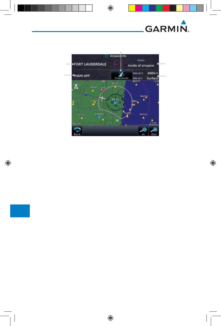
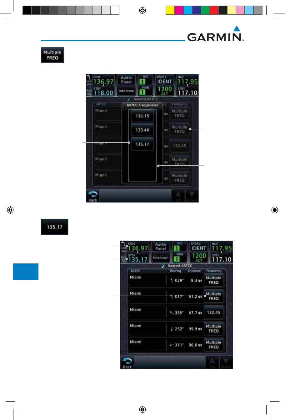
13.8 Nearest ARTCC
The Nearest ARTCC page displays the facility name, bearing to, distance, and
frequency to the five nearest Air Route Traffic Control Center (ARTCC) points
of communication (within 200 NM of your present position). For each ARTCC
listed, the Nearest ARTCC page also indicates the frequency(s) and may be used
to quickly tune the COM transceiver to the center’s frequency.
Touch the ARTCC Frequency key to place the frequency in the standby
field of the COM window. Touch the COM Active window to flip/flop the Com
frequencies (GTN 750 only).
1. While viewing the Nearest function, touch the ARTCC key. A
list of the nearest five ARTCCs within 200 NM will be listed.
ARTCC Frequency
Key
ARTCC
Name and
Information
ARTCC
Frequency Key
With Multiple
Frequencies
Available
Figure 13-18 Nearest ARTCC
2. Touch the Up and Down keys to scroll through the list as
needed.
190-01007-03-Final.indb 13 7/9/2015 2:08:24 PM
13-14
Garmin GTN 725/750 Pilot’s Guide
190-01007-03 Rev. J
Foreword
Getting
Started
Audio &
Xpdr Ctrl
Com/Nav
FPL
Direct-To
Proc
Charts
Wpt Info
Map
Traffic
Terrain
Weather
Nearest
Services/
Music
Utilities
System
Messages
Symbols
Appendix
Index
3. The Frequency category will show "Multiple" keys if multiple
frequencies are available. Touch the Multiple FREQ key to
display the frequencies.
Selected ARTCC
Frequency Key
ARTCC Multiple
Frequency List
ARTCC
Multiple
Frequency
Key
Figure 13-19 Nearest ARTCC Multiple Frequency List
4. Touch the key for the desired frequency to place the selected
frequency into the Com Standby window.
Selected ARTCC
Frequency Inserted
Into Standby Window
Selected ARTCC Multiple
Frequency List Key
Touch To Flip/Flop Active
And Standby Frequencies
Figure 13-20 Selected ARTCC Frequency From List
190-01007-03-Final.indb 14 7/9/2015 2:08:24 PM
13-15190-01007-03 Rev. J
Garmin GTN 725/750 Pilot’s Guide
Foreword
Getting
Started
Audio &
Xpdr Ctrl
Com/Nav
FPL
Direct-To
Proc
Charts
Wpt Info
Map
Traffic
Terrain
Weather
Nearest
Services/
Music
Utilities
System
Messages
Symbols
Appendix
Index
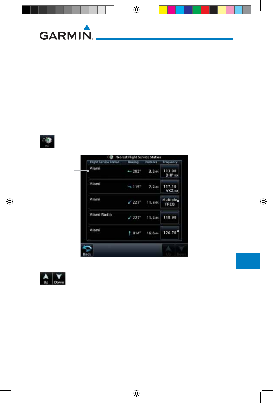
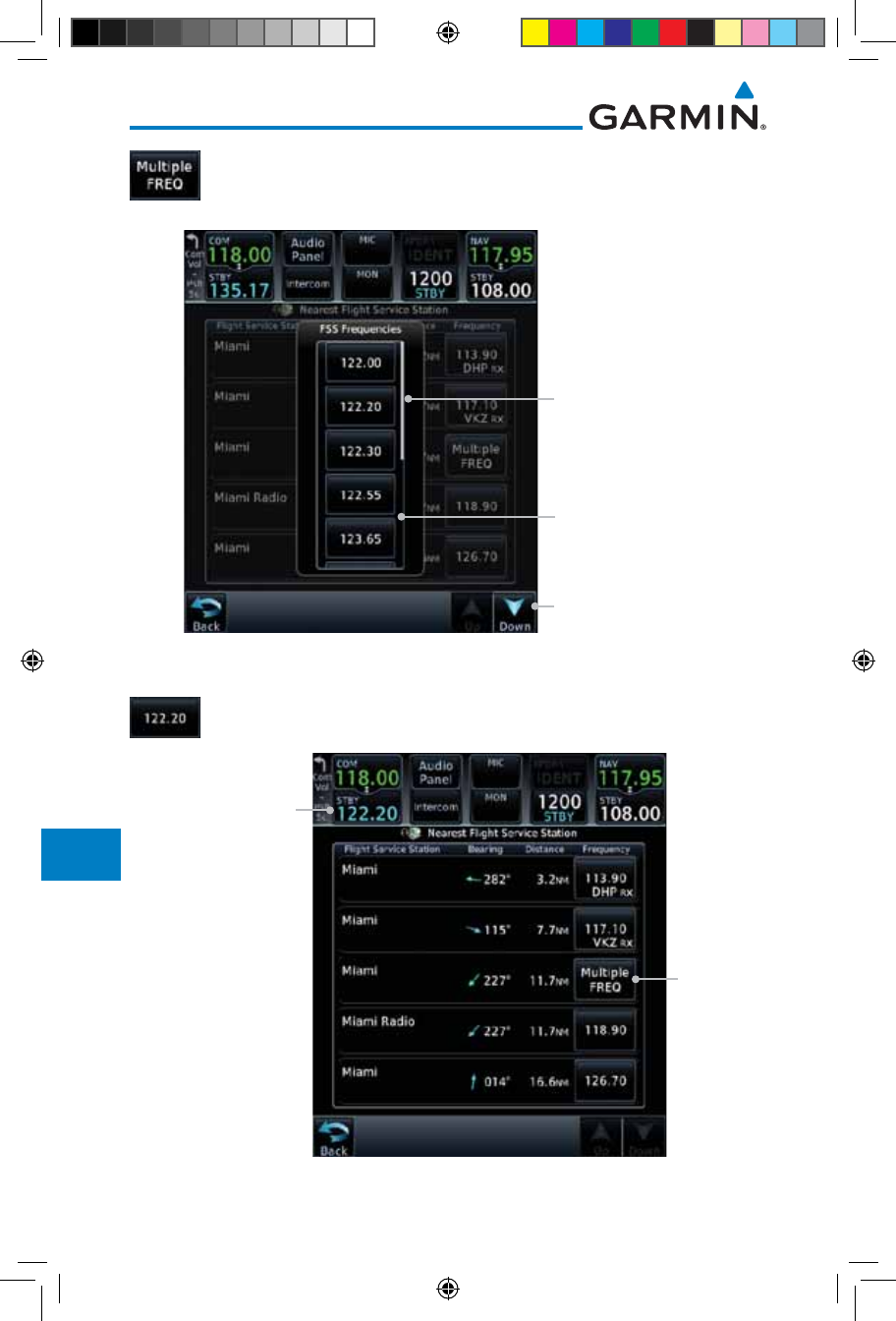
13.9 Nearest Flight Service Station (FSS)
The Nearest Flight Service Station (FSS) Page displays the facility name, bearing
to, distance, and frequency to the five nearest FSS points of communication
(within 200 NM of your present position). For each FSS listed, the Nearest FSS
Page also indicates the frequency(s) and may be used to quickly tune the COM
transceiver to the FSS’s frequency.
Touch the FSS Frequency key to place the frequency in the standby field of the
COM window. Touch the COM Active window to flip/flop the Com frequencies
(GTN 750 only). Receive-only frequencies are noted with a white "RX."
1. While viewing the Nearest function, touch the FSS key. A list
of the nearest five FSSs within 200 NM will be listed.
FSS Frequency
Key
FSS Name
and
Information
FSS Frequency
Key With
Multiple
Frequencies
Available
Figure 13-21 Nearest FSS
2. Touch the Up and Down keys to scroll through the list, if
necessary.
190-01007-03-Final.indb 15 7/9/2015 2:08:24 PM
13-16
Garmin GTN 725/750 Pilot’s Guide
190-01007-03 Rev. J
Foreword
Getting
Started
Audio &
Xpdr Ctrl
Com/Nav
FPL
Direct-To
Proc
Charts
Wpt Info
Map
Traffic
Terrain
Weather
Nearest
Services/
Music
Utilities
System
Messages
Symbols
Appendix
Index
3. The Frequency key will show "Multiple FREQ" if multiple
frequencies are available. Touch the Multiple FREQ key to
display the frequencies.
FSS Multiple
Frequency List
Slider Indicates More
Frequencies. Touch
And Drag Finger To
View More.
Touch The Up And
Down Keys To View
More Frequencies
Figure 13-22 Nearest FSS Multiple Frequency List
4. Touch the key for the desired frequency to place the selected
frequency into the Com Standby window.
FSS
Multiple
Frequency
Key
Selected FSS
Frequency Inserted
Into Standby Window
Figure 13-23 Selected FSS Frequency From List
190-01007-03-Final.indb 16 7/9/2015 2:08:25 PM
13-17190-01007-03 Rev. J
Garmin GTN 725/750 Pilot’s Guide
Foreword
Getting
Started
Audio &
Xpdr Ctrl
Com/Nav
FPL
Direct-To
Proc
Charts
Wpt Info
Map
Traffic
Terrain
Weather
Nearest
Services/
Music
Utilities
System
Messages
Symbols
Appendix
Index
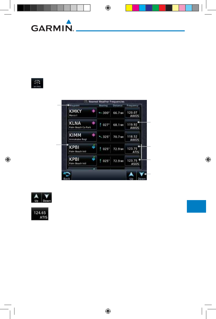
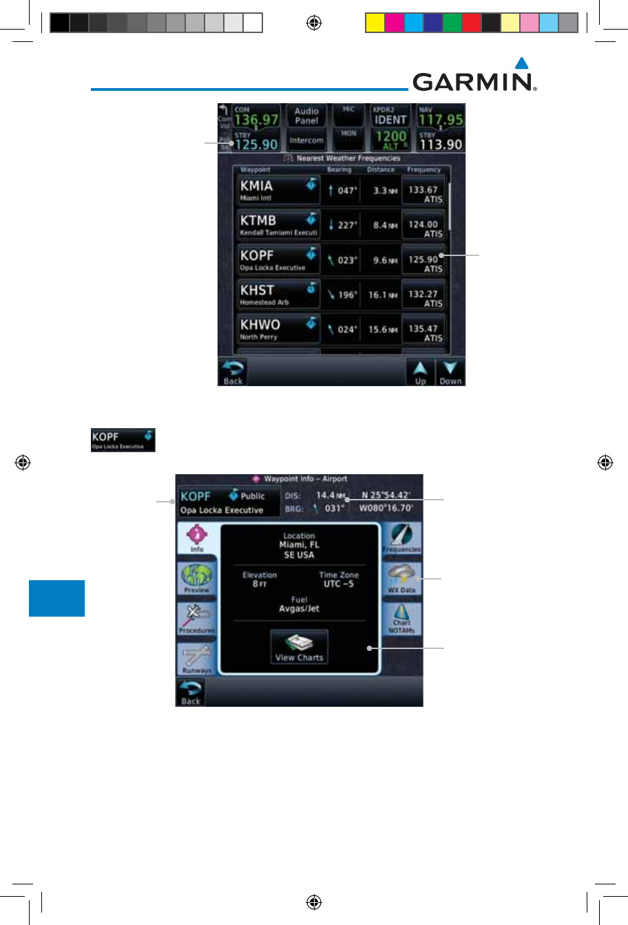
13.10 Nearest Weather Frequency (WX Freq)
The Nearest WX FREQ function displays facility name, bearing to, distance,
and frequency for the nearest 25 Automatic Terminal Information Service
(ATIS), Automated Service Observing System (ASOS), and Automated Weather
Observing Station (AWOS) weather reporting stations within 200 NM.
1. While viewing the Nearest function, touch the WX FREQ key.
A list of the nearest 25 Weather stations within 200 NM will
be listed.
Arrows Indicate
More Items On
The List
AWOS Frequency
Reporting
Weather
Waypoint
Identifier
Reporting
Weather
Waypoint
Information
ATIS Frequency
ASOS Frequency
Figure 13-24 Nearest Weather Station
2. Touch the Up and Down keys to scroll through the list, as
needed.
3. Touch the key for the desired frequency to place the selected
frequency into the Com Standby window.
190-01007-03-Final.indb 17 7/9/2015 2:08:25 PM
13-18
Garmin GTN 725/750 Pilot’s Guide
190-01007-03 Rev. J
Foreword
Getting
Started
Audio &
Xpdr Ctrl
Com/Nav
FPL
Direct-To
Proc
Charts
Wpt Info
Map
Traffic
Terrain
Weather
Nearest
Services/
Music
Utilities
System
Messages
Symbols
Appendix
Index
Selected
Weather
Frequency
Key
Selected Weather
Frequency Inserted
Into Standby Window
Figure 13-25 Nearest Weather Station Selected Frequency
4. Touch the Weather Station Identifier key to show the
Waypoint Info page for the selected Weather station.
Dis & Brg
Information
Referenced To
Current Position
Wpt
Information
Detail
Wpt
Identifier,
Type, and
Name
Weather Tab
Selected
Figure 13-26 Nearest Weather Station Waypoint Information
190-01007-03-Final.indb 18 7/9/2015 2:08:25 PM
14-1190-01007-03 Rev. J
Garmin GTN 725/750 Pilot’s Guide
Foreword
Getting
Started
Audio &
Xpdr Ctrl
Com/Nav
FPL
Direct-To
Proc
Charts
Wpt Info
Map
Traffic
Terrain
Weather
Nearest
Services/
Music
Utilities
System
Messages
Symbols
Appendix
Index
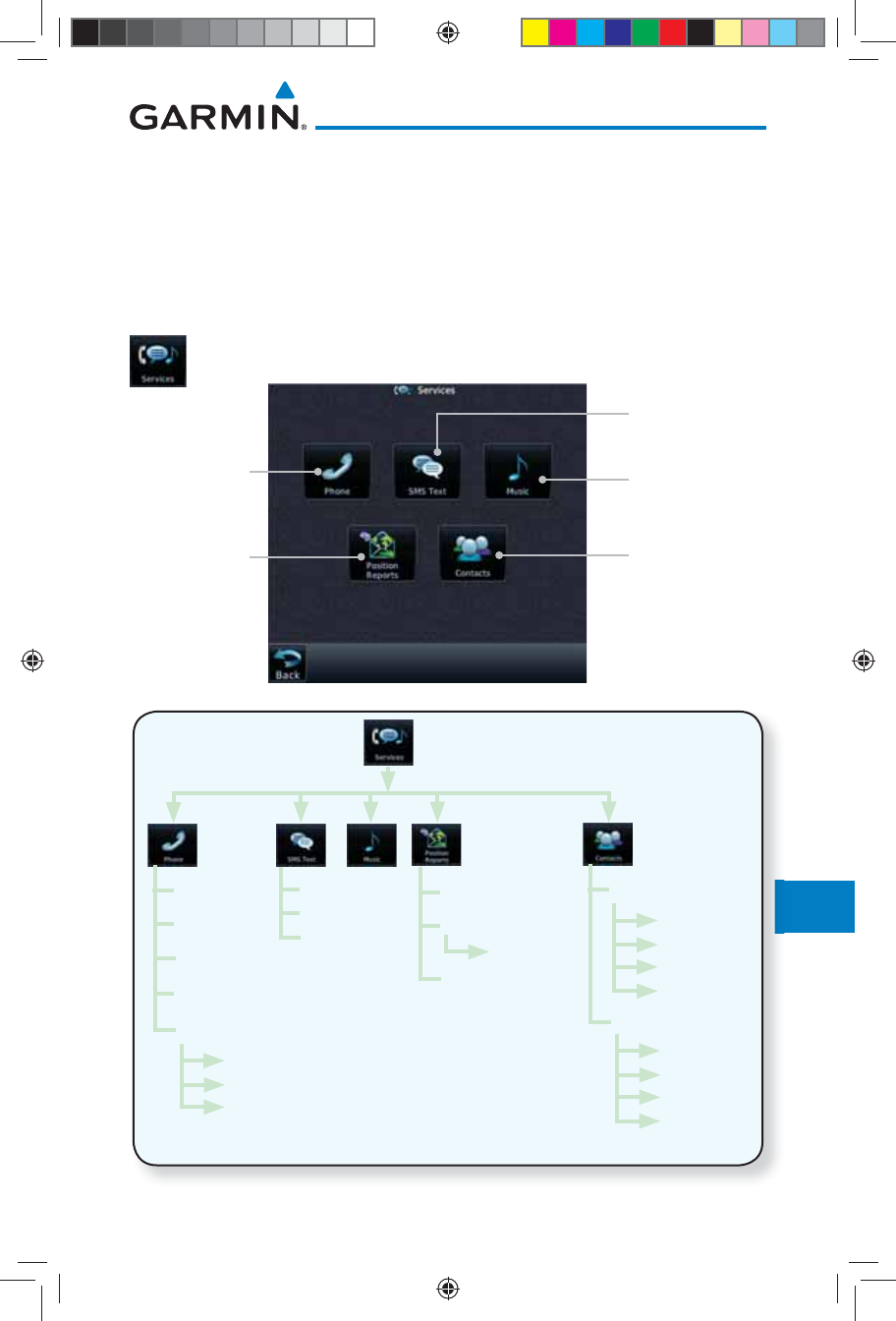
14 SERVICES/MUSIC
The Services function is available when certain optional features are installed
and enabled. The key will be labeled as Music when only the Music feature
is enabled. Music is provided through SiriusXM Satellite Radio. The GSR 56
is an Iridium® satellite transceiver that supports voice telephone calls, aircraft
position reporting, and world wide weather products.
While viewing the Home page, touch the Services key to view
the Services page.
Touch To Use
Phone Services Touch To Access
SiriusXM Music
Touch To Access
Your Contact List
Touch To
Setup Position
Reporting
Touch To Use
Text Messaging
Figure 14-1 Services Page
g
g
Off
On
On During
APR/MAPR/
TERM
Phone Number
Volume
Call/End Call
Status
Suppression
Inbox
Outbox
Drafts
Time Period
Automatic Reporting
Volume
Status Add
Name
Phone Number
Email Address
Save Contact
Call
Message
Edit
Delete
Existing Contact
Figure 14-2 Services Functional Diagram
190-01007-03-Final.indb 1 7/9/2015 2:08:26 PM
14-2
Garmin GTN 725/750 Pilot’s Guide
190-01007-03 Rev. J
Foreword
Getting
Started
Audio &
Xpdr Ctrl
Com/Nav
FPL
Direct-To
Proc
Charts
Wpt Info
Map
Traffic
Terrain
Weather
Nearest
Services/
Music
Utilities
System
Messages
Symbols
Appendix
Index
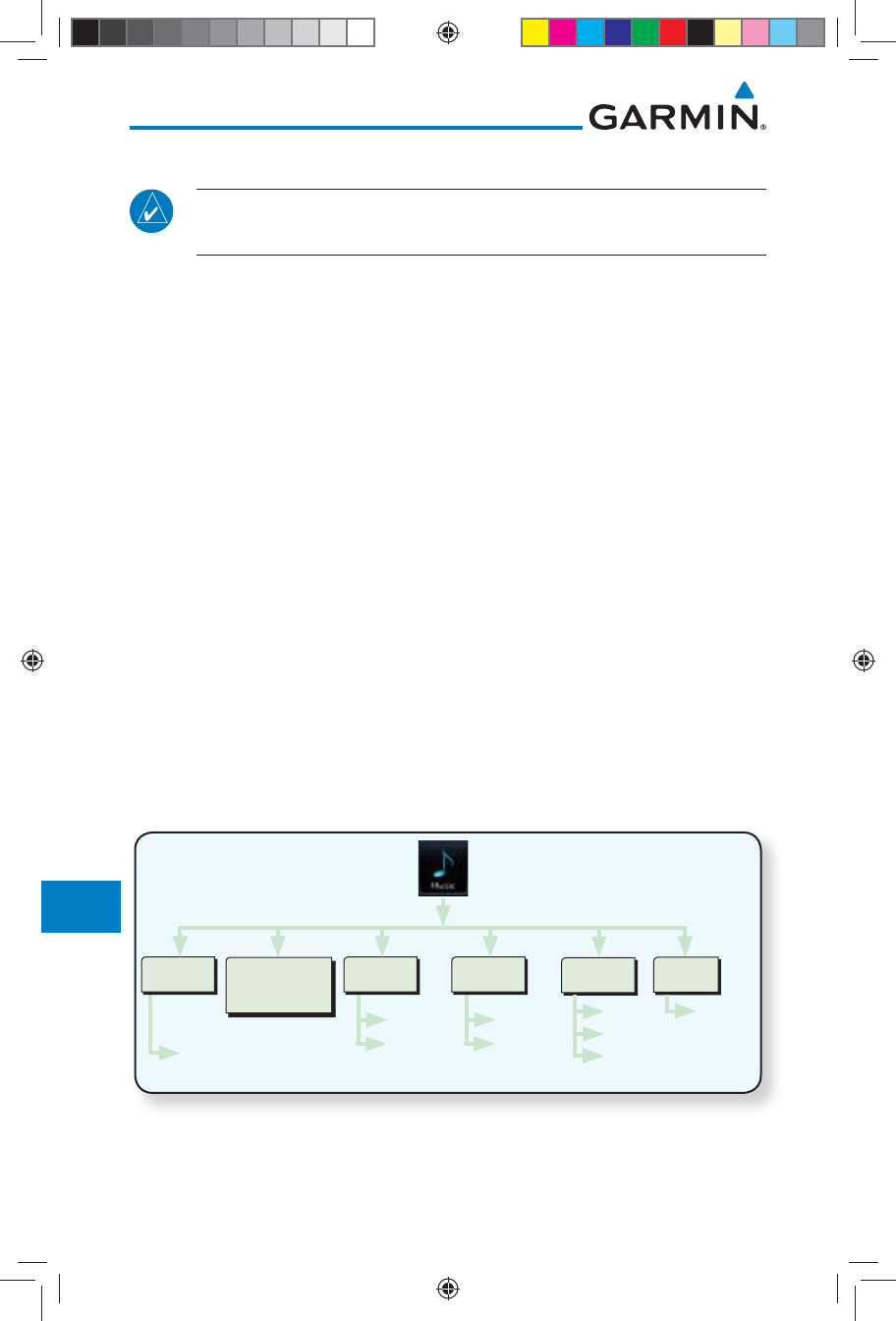
14.1 Music
NOTE: Refer to the Weather Section for information about SiriusXM
Weather products.
The optional SiriusXM Satellite Radio entertainment feature of the GDL 69A
Data Link Receiver is available for the pilot’s and passengers’ enjoyment. The
GDL 69A can receive SiriusXM Satellite Radio entertainment services at any
altitude throughout the Continental U.S. Entertainment audio is not available
on the GDL 69 Data Link Receiver.
SiriusXM Satellite Radio offers a variety of radio programming over long distances
without having to constantly search for new stations. Based on signals from satellites,
coverage far exceeds land-based transmissions. SiriusXM Satellite Radio services
are subscription-based. For more information on specific service packages, visit
http://www.garmin.com/xm/.
Audio entertainment is available through the SiriusXM Satellite Radio Service
when activated in the optional installation of the GDL 69A. The GTN unit serves
as the display and control head for your remotely mounted GDL 69A. When
enabled, the SiriusXM Satellite Radio audio entertainment is accessible in the
Music function.
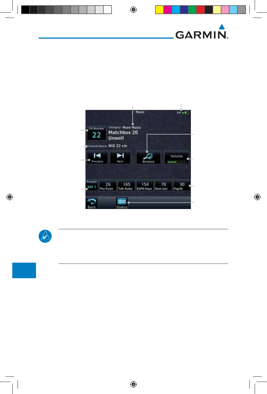
The information on the SiriusXM Satellite Radio display is composed of
four areas: the Active Channel, Available Channels, Category of the highlighted
channel, and the Volume setting. The Active Channel window shows the
Channel Name and Number, Artist, Song Title, and Category.
Prev/Next
Channel
Presets
XM 1
XM 2
XM 3
Select with
keypad
Channel
Channel
Category
Browse
Up/Down
Mute
Volume Status
GDL 69A
Status
Figure 14-3 Music Functional Diagram
190-01007-03-Final.indb 2 7/9/2015 2:08:26 PM
14-3190-01007-03 Rev. J
Garmin GTN 725/750 Pilot’s Guide
Foreword
Getting
Started
Audio &
Xpdr Ctrl
Com/Nav
FPL
Direct-To
Proc
Charts
Wpt Info
Map
Traffic
Terrain
Weather
Nearest
Services/
Music
Utilities
System
Messages
Symbols
Appendix
Index
14.2 Activating SiriusXM Satellite Radio Services
The service is activated by providing SiriusXM Satellite Radio with either
one or two coded IDs, depending on the equipment. Either the Audio Radio ID
or the Data Radio ID, or both, must be provided to SiriusXM Satellite Radio to
activate the entertainment subscription. The SiriusXM Satellite Radio Activation
Instructions are included with the GDL 69A (also available at www.garmin.
com, P/N 190-00355-04).
It is not required to activate both the entertainment and weather service
subscriptions with the GDL 69A. Either or both services can be activated.
SiriusXM Satellite Radio uses one or both of the coded IDs to send an activation
signal that, when received by the GDL 69A, allows it to play entertainment
programming.
These IDs are located:
• On the label on the back of the Data Link Receiver
• On the Music Menu
Contact the installer if the Data Radio ID and the Audio Radio ID cannot be
located.
NOTE: Refer to the GDL 69/69A SiriusXM Satellite Radio Activation
Instructions (190-00355-04) for further information.
1. Contact SiriusXM Satellite Radio through the e-mail address
listed on their web site (www.xmradio.com) or by the customer
service phone number listed on the web site (1-800-985-
9200).
2. Follow the instructions provided.
If SiriusXM weather services have not been activated, all the weather product
boxes are cleared on the XM Information Page and a yellow Activation Required
message is displayed in the center of the Weather Data Link Page (Map Page
Group). The Service Class refers to the groupings of weather products available
for subscription.
190-01007-03-Final.indb 3 7/9/2015 2:08:26 PM
14-4
Garmin GTN 725/750 Pilot’s Guide
190-01007-03 Rev. J
Foreword
Getting
Started
Audio &
Xpdr Ctrl
Com/Nav
FPL
Direct-To
Proc
Charts
Wpt Info
Map
Traffic
Terrain
Weather
Nearest
Services/
Music
Utilities
System
Messages
Symbols
Appendix
Index
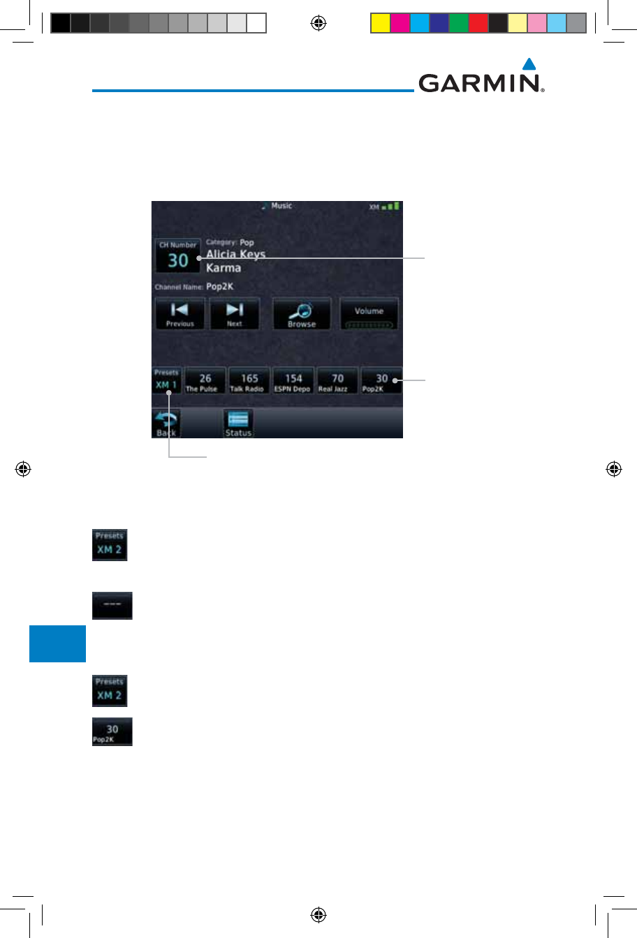
14.3 Music Operation
The GTN 7XX provides control for enjoying SiriusXM Satellite Radio
audio entertainment in the aircraft. The Music function allows selecting music
categories and specific channels, as well as saving category and channel selections
as presets for quick recall. The music volume level may also be managed.
Current
Volume. Touch
to Change
Volume.
Touch Step To
Previous Or Next
Channel
Current Channel.
Touch to Select a
Channel.
Touch To Select
Preset
Current Preset
Bank. Touch To
Step Through
Preset Banks.
Current
Category
Signal
Level
GDL Data Link
Status
Current Channel
Touch To Select
Category
Figure 14-4 Main Music Display
NOTE: The Music Configuration function can be set so that when there
is radio reception or intercom conversation, the music level is dropped to
a low, or background level. When the radio or intercom traffic ceases, the
level gradually returns to normal.
190-01007-03-Final.indb 4 7/9/2015 2:08:26 PM
14-5190-01007-03 Rev. J
Garmin GTN 725/750 Pilot’s Guide
Foreword
Getting
Started
Audio &
Xpdr Ctrl
Com/Nav
FPL
Direct-To
Proc
Charts
Wpt Info
Map
Traffic
Terrain
Weather
Nearest
Services/
Music
Utilities
System
Messages
Symbols
Appendix
Index
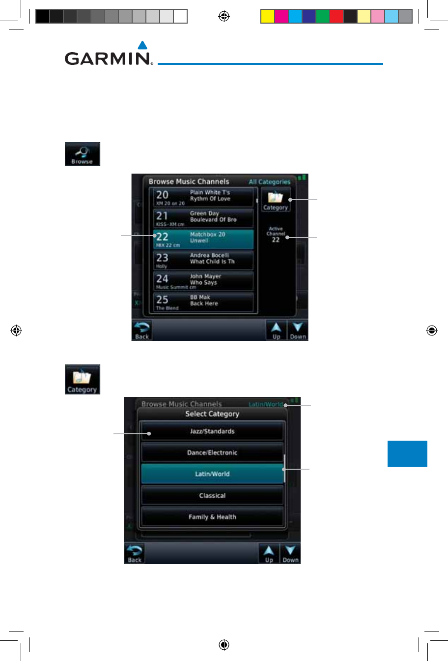
14.3.1 Browsing Channels and Categories
The Category window displays the currently selected category of audio.
Categories of channels, such as Jazz, Rock, or News, can be selected to list the
available channels for a type of music or other contents.
1. While viewing the Music page, touch the Browse key and
then touch the desired channel to select it.
Current
Channel
Touch to
Change
Categories
Active
Channel
Figure 14-5 Music Channels
2. Touch the Category key to activate Category selection and
then touch the desired Category to select it.
Selected
Category
Categories.
Touch to Select
Current
Category
Figure 14-6 Music Categories
3. The current category will be shown at the top of the display.
190-01007-03-Final.indb 5 7/9/2015 2:08:26 PM
14-6
Garmin GTN 725/750 Pilot’s Guide
190-01007-03 Rev. J
Foreword
Getting
Started
Audio &
Xpdr Ctrl
Com/Nav
FPL
Direct-To
Proc
Charts
Wpt Info
Map
Traffic
Terrain
Weather
Nearest
Services/
Music
Utilities
System
Messages
Symbols
Appendix
Index
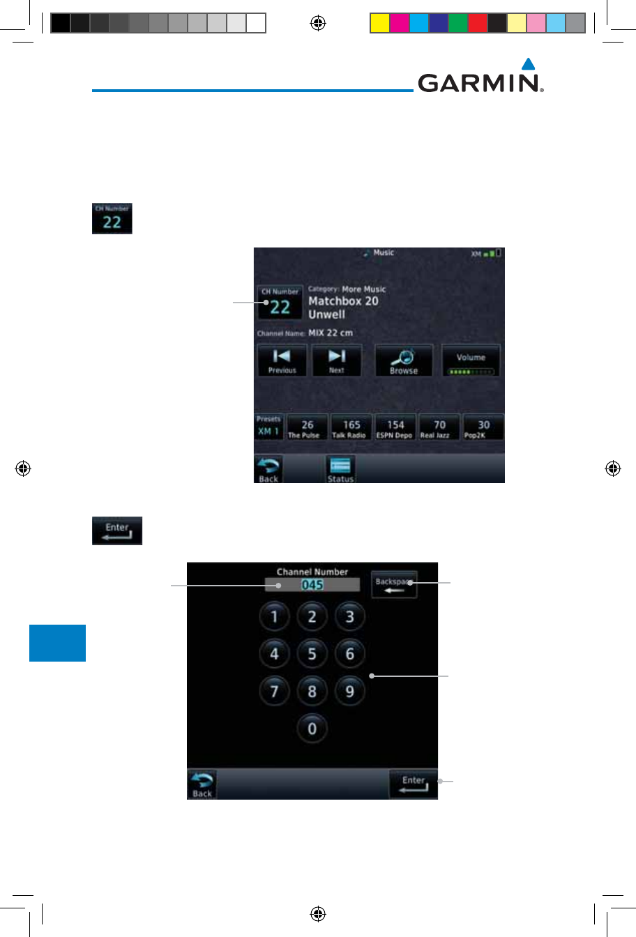
14.3.2 Selecting an SiriusXM Satellite Radio Channel
by Number
Channels may be selected directly in the selected category using the numeric
keypad.
1. While viewing the main Music page, touch the Channel key.
The Channel Number selection page will appear.
Touch Channel Key
Figure 14-7 Selecting Music Channels
2. Use the numeric keys to enter the number for the desired
channel and then touch the Enter key.
Channel
Number
Window
Touch to
Clear Channel
Number
Window
Touch to Select
Channel Shown
in Channel
Number
Window
Numeric Keypad
for in Channel
Number
Selection
Figure 14-8 Selecting Music Channels with the Numeric Keypad
190-01007-03-Final.indb 6 7/9/2015 2:08:27 PM
14-7190-01007-03 Rev. J
Garmin GTN 725/750 Pilot’s Guide
Foreword
Getting
Started
Audio &
Xpdr Ctrl
Com/Nav
FPL
Direct-To
Proc
Charts
Wpt Info
Map
Traffic
Terrain
Weather
Nearest
Services/
Music
Utilities
System
Messages
Symbols
Appendix
Index
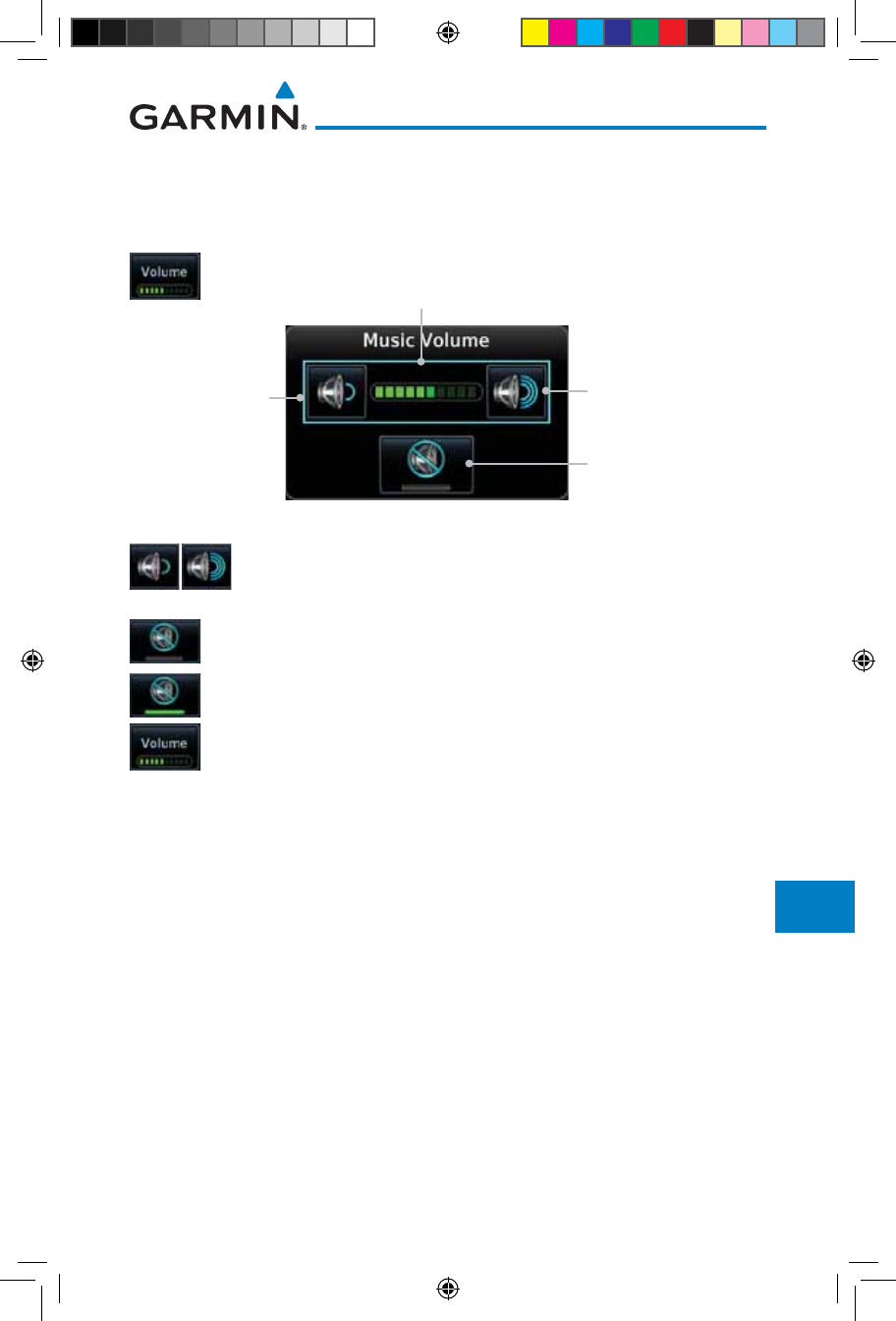
14.3.3 SiriusXM Satellite Radio Volume
The Volume control allows you to set the audio volume level, as well as mute
the audio.
1. While viewing the Music page, touch the Volume key.
Touch To Raise
The Volume
Touch To Lower
The Volume
Bar Graph Showing Volume Level
Touch To Toggle Mute
Figure 14-9 Music Volume Control
2. Touch the Up or Down Volume keys to adjust the radio
volume.
3. Touch MUTE to toggle muting of the radio volume.
4. Touch MUTE again or the Volume key to unmute the radio
volume.
190-01007-03-Final.indb 7 7/9/2015 2:08:27 PM
14-8
Garmin GTN 725/750 Pilot’s Guide
190-01007-03 Rev. J
Foreword
Getting
Started
Audio &
Xpdr Ctrl
Com/Nav
FPL
Direct-To
Proc
Charts
Wpt Info
Map
Traffic
Terrain
Weather
Nearest
Services/
Music
Utilities
System
Messages
Symbols
Appendix
Index
14.3.4 SiriusXM Satellite Radio Channel Presets
The Music Menu allows you to store the Active Channel into a selected preset
position for easy later recall. A delay of several seconds can occur when setting
or recalling a preset.
Touch To Select Bank of Presets (XM 1, XM 2, or XM 3)
Touch To Recall
Selected Preset
Selected Preset
Channel
Figure 14-10 Music Presets
14.3.4.1 Saving a Preset
1. While viewing the desired channel, select the preset bank
for saving the preset (XM 1, XM 2, or XM 3) by touching the
Presets key until the desire bank is shown.
2. Touch the desired Preset key and hold it for three seconds.
14.3.4.2 Recalling a Preset
1. Touch the Presets key to select the preset bank (XM 1, XM
2, or XM 3).
2. Touch the desired Preset key.
190-01007-03-Final.indb 8 7/9/2015 2:08:27 PM
14-9190-01007-03 Rev. J
Garmin GTN 725/750 Pilot’s Guide
Foreword
Getting
Started
Audio &
Xpdr Ctrl
Com/Nav
FPL
Direct-To
Proc
Charts
Wpt Info
Map
Traffic
Terrain
Weather
Nearest
Services/
Music
Utilities
System
Messages
Symbols
Appendix
Index
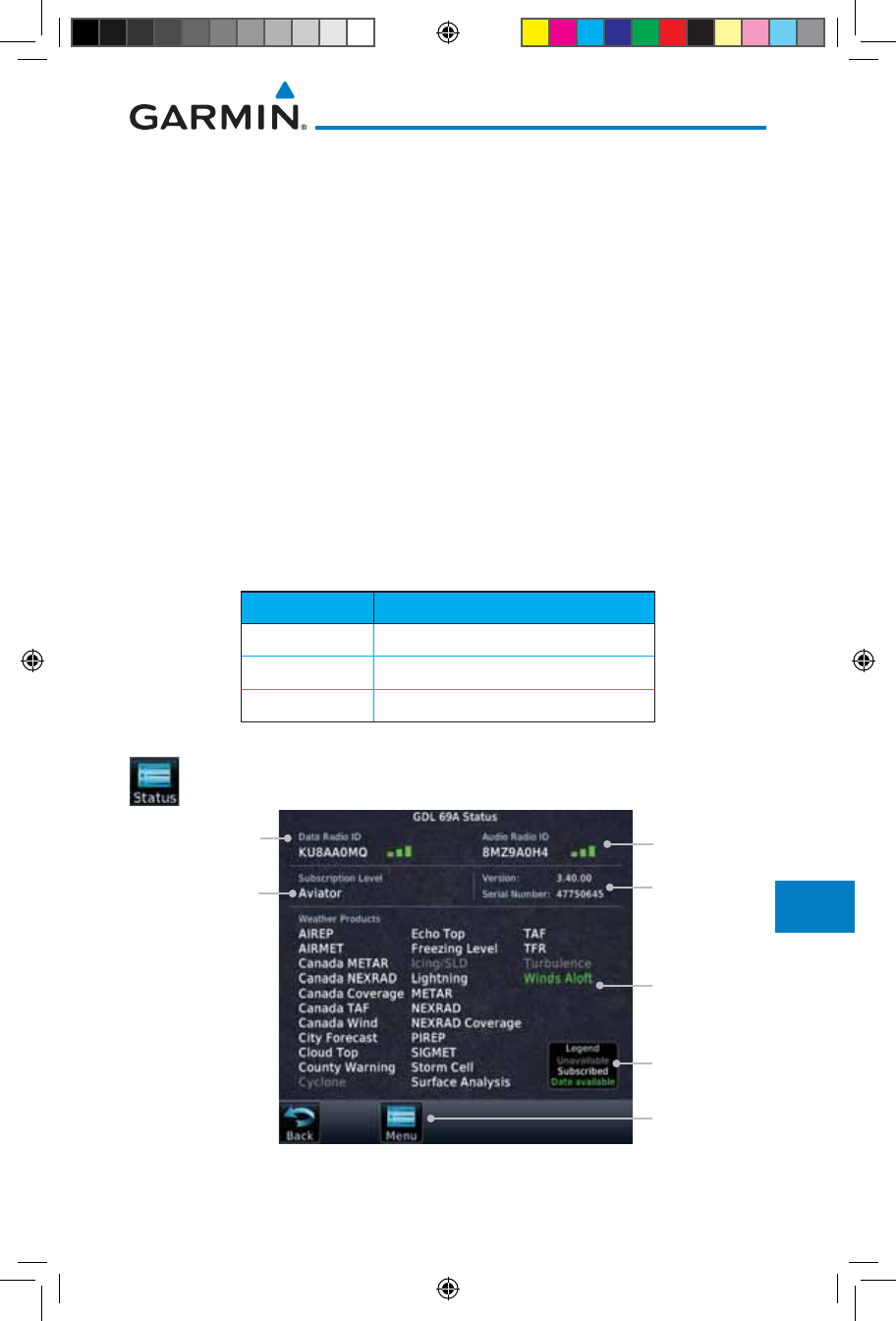
14.3.5 GDL 69/69A Data Link Receiver
Troubleshooting
Some quick troubleshooting steps listed below can be performed to find the
possible cause of a failure.
• Ensure the owner/operator of the aircraft in which the Data Link Receiver is
installed has subscribed to SiriusXM Satellite Radio
• Ensure the SiriusXM Satellite Radio subscription has been activated
• Perform a quick check of the circuit breakers to ensure that power is applied
to the Data Link Receiver
For troubleshooting purposes, check the Menu on the Music Page or the
GDL 69 Box on the System - External LRUs Page for Data Link Receiver
(GDL 69/69A) status, serial number, and software version number.
It may take several minutes for all subscribed data to become available after
power-up.
Text Color Description
White Subscribed
Grey Not Subscribed
Green Available
Table 14-1 Product Status
1. Touch the Status key on the Music page to display the
GDL 69/69A Status.
Weather
Product List
Weather
Product Legend
Music Menu
Subscription
Level
Audio Radio ID
& Signal Level
Data Radio ID &
Signal Level
GDL 69A SW
Version and
Serial Number
Figure 14-11 GDL 69 Status Page
190-01007-03-Final.indb 9 7/9/2015 2:08:27 PM
14-10
Garmin GTN 725/750 Pilot’s Guide
190-01007-03 Rev. J
Foreword
Getting
Started
Audio &
Xpdr Ctrl
Com/Nav
FPL
Direct-To
Proc
Charts
Wpt Info
Map
Traffic
Terrain
Weather
Nearest
Services/
Music
Utilities
System
Messages
Symbols
Appendix
Index
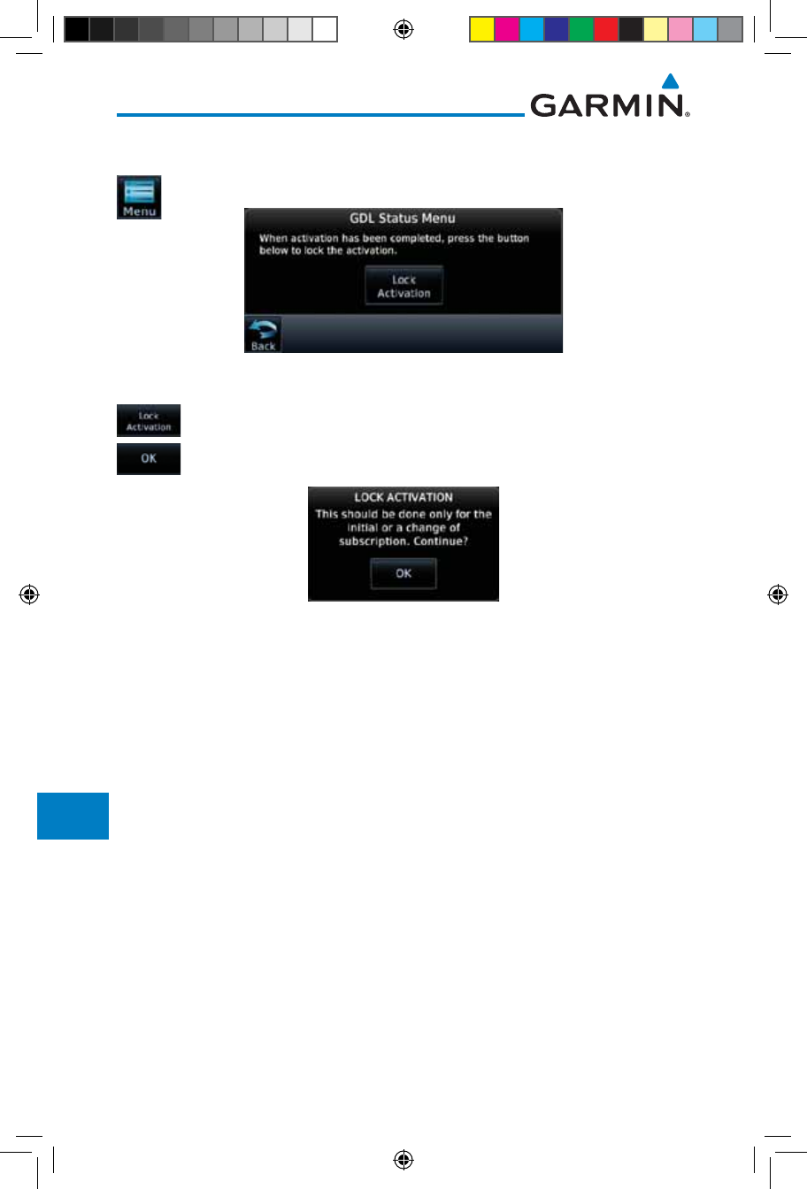
2. The GDL status information is provided on this page.
3. Touch the Menu key to display the GDL Status Menu.
Figure 14-12 GDL Status Menu
4. Touch the Lock Activation key if this is for the initial
subscription or a change in the subscription. Touch the OK
key to continue the operation.
Figure 14-13 Lock Activation
190-01007-03-Final.indb 10 7/9/2015 2:08:28 PM
14-11190-01007-03 Rev. J
Garmin GTN 725/750 Pilot’s Guide
Foreword
Getting
Started
Audio &
Xpdr Ctrl
Com/Nav
FPL
Direct-To
Proc
Charts
Wpt Info
Map
Traffic
Terrain
Weather
Nearest
Services/
Music
Utilities
System
Messages
Symbols
Appendix
Index
14.4 Iridium Phone Operation (Optional)
Optional satellite telephone operation is available through the Iridium®
satellite system that is interfaced through the Garmin GSR 56.
Phone Status
Touch To End
Phone Call
Touch To Select
Suppression
Option
Touch To Select
Phone Number
To Call
Touch To Start
Phone Call
Touch To Adjust
Phone Volume
Figure 14-14 Services Phone Page
14.4.1 Status
The Status section shows the Call Time, Phone Status, and Call Suppression
selected. The Call Time value shows the length of the call time for the current
call using the Iridium phone. Phone Status shows the current operating status
of the Iridium phone.
Status Description
Idle The Iridium phone is not using the GSR 56 for communicating
at this time.
Initializing The GSR 56 and its driver are currently initializing.
Connected The GSR 56 is connected to the called number.
Connecting Call The GSR 56 is in the process of connecting to the called
number.
Changing Volume The volume level on the GSR 56 is changing.
Busy The phone is in use by another service and the call may not be
made.
Dialing The GSR 56 is dialing the called number.
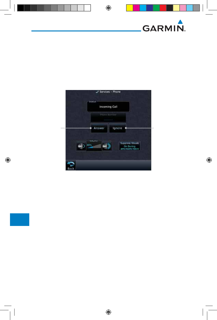
Incoming Call A call is being made to the GSR 56.
Hanging Up The GSR 56 is disconnecting from the current call.
Unavailable The GSR 56 is currently not usable by the Iridium phone system.
Table 14-2 Iridium Phone Status
190-01007-03-Final.indb 11 7/9/2015 2:08:28 PM
14-12
Garmin GTN 725/750 Pilot’s Guide
190-01007-03 Rev. J
Foreword
Getting
Started
Audio &
Xpdr Ctrl
Com/Nav
FPL
Direct-To
Proc
Charts
Wpt Info
Map
Traffic
Terrain
Weather
Nearest
Services/
Music
Utilities
System
Messages
Symbols
Appendix
Index
14.4.2 Making a Phone Call
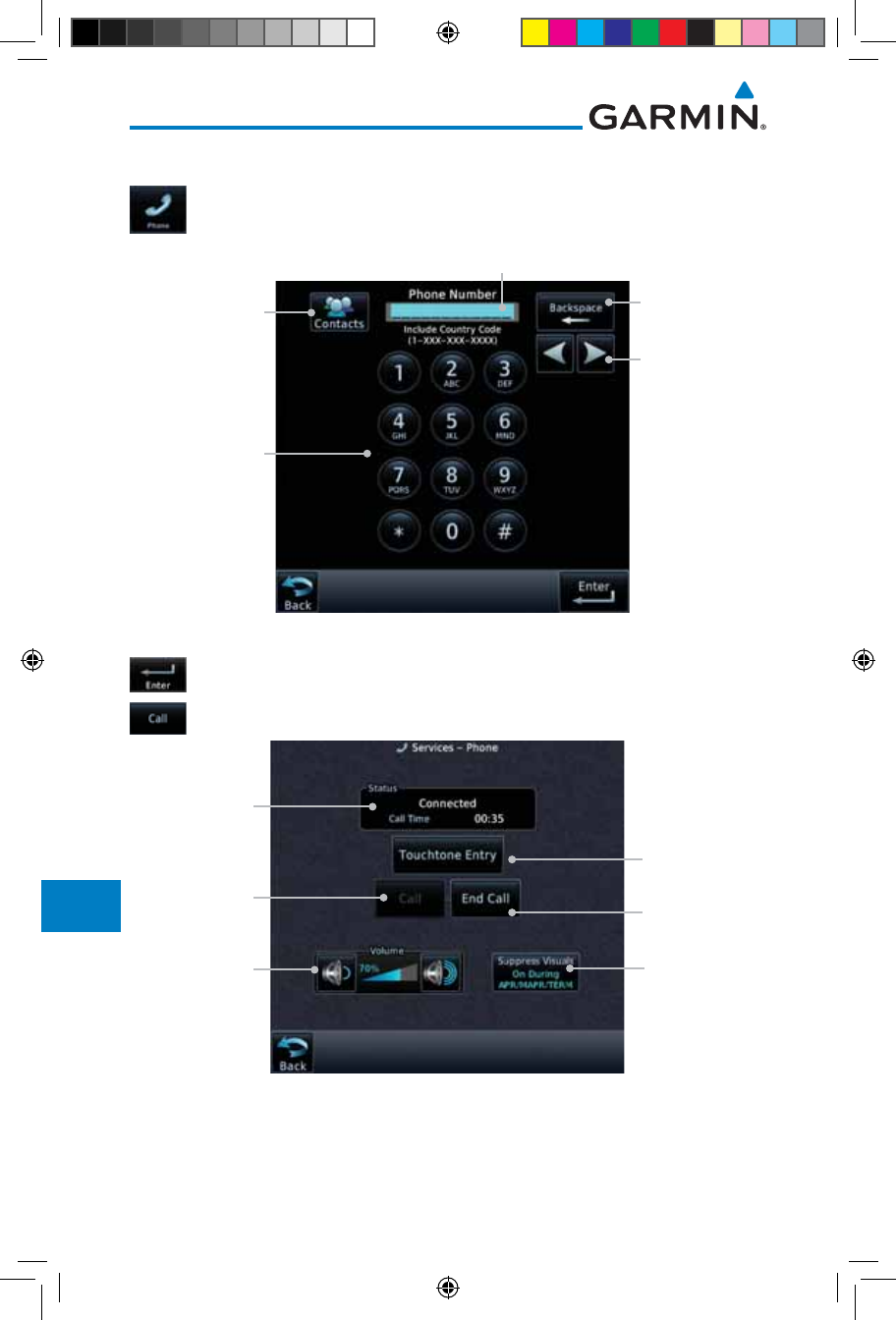
1. While viewing the Iridium Phone page, touch Phone, select
a phone number, or select one from Contacts.
Touch To Select
Number From
Existing Contacts
Touch To
Delete Previous
Character
Touch To
Select Phone
Number
Entered Phone Number
Touch To Move
Cursor
Figure 14-15 Making a Phone Call
2. Touch Enter to accept the selected number.
3. Touch the Call key.
Phone Status
Touch To End
Phone Call
Touch To Select
Suppression
Option
Touch To Select
Phone Number
To Call
Touch To Start
Phone Call
Touch To Adjust
Phone Volume
Figure 14-16 Phone Call In Progress
190-01007-03-Final.indb 12 7/9/2015 2:08:28 PM
14-13190-01007-03 Rev. J
Garmin GTN 725/750 Pilot’s Guide
Foreword
Getting
Started
Audio &
Xpdr Ctrl
Com/Nav
FPL
Direct-To
Proc
Charts
Wpt Info
Map
Traffic
Terrain
Weather
Nearest
Services/
Music
Utilities
System
Messages
Symbols
Appendix
Index
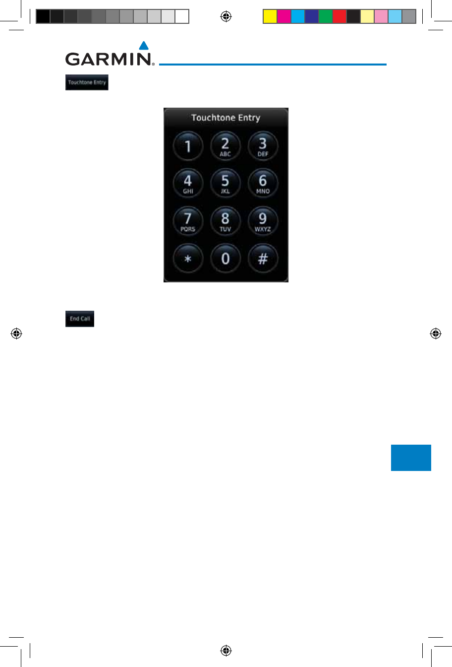
4. To make a direct call with a keypad, touch the Touchtone
Entry key.
Figure 14-17 Touchtone Entry Pad
5. After completing the call, touch the End Call key.
190-01007-03-Final.indb 13 7/9/2015 2:08:28 PM
14-14
Garmin GTN 725/750 Pilot’s Guide
190-01007-03 Rev. J
Foreword
Getting
Started
Audio &
Xpdr Ctrl
Com/Nav
FPL
Direct-To
Proc
Charts
Wpt Info
Map
Traffic
Terrain
Weather
Nearest
Services/
Music
Utilities
System
Messages
Symbols
Appendix
Index
14.4.3 Answering a Phone Call
An incoming phone call will generate a pop-up announcing the call. When
a call is accepted, the pop-up will show that the call is connected and the
cumulative call time will be shown.
1. When an incoming call is available, touch the Enter key or the
ANSWER key to answer the call. Or, press the Ignore key to
not answer the call and hang up.
Touch To Ignore
Phone Call
Touch To
Answer Phone
Call
Figure 14-18 Incoming Call Pop-Up
2. After a called is accepted and connected, the connection
time will be shown on the pop-up. Touch the ATT soft key
to attenuate the call volume; touching it again will return to
normal volume. Touch the HANG UP soft key to end the call.
190-01007-03-Final.indb 14 7/9/2015 2:08:28 PM
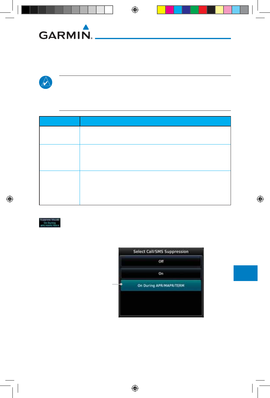
14-15190-01007-03 Rev. J
Garmin GTN 725/750 Pilot’s Guide
Foreword
Getting
Started
Audio &
Xpdr Ctrl
Com/Nav
FPL
Direct-To
Proc
Charts
Wpt Info
Map
Traffic
Terrain
Weather
Nearest
Services/
Music
Utilities
System
Messages
Symbols
Appendix
Index
14.4.4 Suppress Visuals
Call Suppression controls calling when use of the Iridium phone system is
allowed.
NOTE: The “Suppress Visuals” setting only affects the visual indication
of an incoming call/text. It does not inhibit the phone ringer or incoming
SMS chime. Garmin recommends that you inhibit the audio from the GSR
56 unless a phone call is active.
Status Description
Off Call Suppression is turned off. Calls may be transmitted and
received through the Iridium phone.
On Call Suppression is turned on. The incoming call pop-up will not
be shown. The call may still be answered on the phone page.
Outgoing calls are not affected.
On During APR/
MAPR/TERM
Call Suppression is turned on during Approach, Missed Approach,
and Terminal operations. The incoming call pop-up will not
be shown. The call may still be answered on the phone page.
Outgoing calls are not affected.
Table 14-3 Call Suppression
1. While viewing the Iridium Phone page, touch the Suppression
key.
2. Touch the desired Call Suppression type.
Touch To Select The
Desired Suppression
Figure 14-19 Select Call/SMS Suppression
3. Or, press Back to return to the Phone page without making
a selection.
190-01007-03-Final.indb 15 7/9/2015 2:08:29 PM
14-16
Garmin GTN 725/750 Pilot’s Guide
190-01007-03 Rev. J
Foreword
Getting
Started
Audio &
Xpdr Ctrl
Com/Nav
FPL
Direct-To
Proc
Charts
Wpt Info
Map
Traffic
Terrain
Weather
Nearest
Services/
Music
Utilities
System
Messages
Symbols
Appendix
Index
14.4.5 Phone Volume
Use the Phone Volume controls to adjust the loudness of the phone calls
you hear. Volume controls will only be available when the Idle, Connected, or
Changing Volume states are displayed.
Adjusting the Phone Volume with the Soft Keys
1. While viewing the Iridium Phone page, touch the VOL keys to
adjust the phone volume.
Touch To
Reduce Volume
Phone Volume
Level Bar Graph
Touch To
Increase Volume
Figure 14-20 Select Soft Keys for Phone Volume Adjustment
2. The phone volume level is shown as a bar graph.
14.4.6 SMS Text Operation
Send and receive text messages through the GSR 56 phone connection.
1. While viewing the Services page, touch the SMS Text key.
Touch To Compose
New Message
Touch To View
SMS Text Menu
Touch To Received
Messages
Touch To View
Draft Messages
Touch To View
Sent Messages
Touch To Return
To Previous Page
Figure 14-21 SMS Text Page
2. Select Compose, Inbox, Drafts, or Outbox.
190-01007-03-Final.indb 16 7/9/2015 2:08:29 PM
14-17190-01007-03 Rev. J
Garmin GTN 725/750 Pilot’s Guide
Foreword
Getting
Started
Audio &
Xpdr Ctrl
Com/Nav
FPL
Direct-To
Proc
Charts
Wpt Info
Map
Traffic
Terrain
Weather
Nearest
Services/
Music
Utilities
System
Messages
Symbols
Appendix
Index
14.4.6.1 SMS Text Messaging Menu
The SMS Text Messaging Menu allows you to sort, mark, or delete messages
and select call suppression.
Figure 14-22 SMS Text Messaging Menu
1. Touch the Time key to sort messages by Time or the Address
key to sort by Address.
2. Touch the Suppression key and then touch the call
suppression choice. The current choice will be shown on the
Suppression key.
3. While viewing the Inbox, Drafts, or Outbox, touch the Mark
All As Read to tag the messages as having been read.
4. Touch the Delete All Messages to delete the messages in
the viewed category.
14.4.6.2 Composing a SMS Text Message
1. While viewing the SMS Text page, touch the Compose key.
Touch To Compose
New Message
Touch To Send
Message
Touch To Select
Recipient
Figure 14-23 Compose a New SMS Text Message
2. Touch the To window to select the recipient. Select either a
Phone Number or E-mail Address.
190-01007-03-Final.indb 17 7/9/2015 2:08:29 PM
14-18
Garmin GTN 725/750 Pilot’s Guide
190-01007-03 Rev. J
Foreword
Getting
Started
Audio &
Xpdr Ctrl
Com/Nav
FPL
Direct-To
Proc
Charts
Wpt Info
Map
Traffic
Terrain
Weather
Nearest
Services/
Music
Utilities
System
Messages
Symbols
Appendix
Index
Touch To Select
Phone Number
Touch To Select
Email Address
Figure 14-24 Select Destination for the SMS Text Message
3. Use either the keypad or select from the Contacts.
4. Touch the Message window to enter the text for the message.
Use the keypad to create the message.
5. Touch Send to send the message. Touch Save to save the
message as a draft. Touch Delete to delete this message.
14.4.6.3 A Failed SMS Text Message
1. While viewing the Services page, touch the SMS Text key
and touch the Outbox tab. A failed message is noted with an
“x.”
Message With
Failed Mark
Outbox Group With
Failed Notation
Figure 14-25 SMS Text Message List Showing a Failed Message
2. Touch the failed message. Touch the Send Again key to resend
the message. Touch the Delete key to delete the message.
190-01007-03-Final.indb 18 7/9/2015 2:08:29 PM
14-19190-01007-03 Rev. J
Garmin GTN 725/750 Pilot’s Guide
Foreword
Getting
Started
Audio &
Xpdr Ctrl
Com/Nav
FPL
Direct-To
Proc
Charts
Wpt Info
Map
Traffic
Terrain
Weather
Nearest
Services/
Music
Utilities
System
Messages
Symbols
Appendix
Index
Touch To Delete
Message
Failed Message
Message Body
Touch Resend
Message
Figure 14-26 Resend a Failed SMS Text Message
14.4.7 Position Reporting
Position Reporting is a system which collects system variables and transmits
them over the Iridium® satellite at a given interval through the GSR 56.
1. While viewing the Services page, touch the Position Reports
key.
Touch To Enable
Automatic
Reporting
Report Status
Touch To Manually
Send A Report
Touch To Set
Automatic
Reporting Period
Figure 14-27 Services Position Reporting
2. Touch the Automatic Reporting key to enable Automatic
Reporting.
3. After Automatic Reporting is enabled, touch the Report
Period key to set the Reporting Period.
4. Select the Report Period with the keypad and press Enter.
5. When Automatic Reporting is disabled, touch the Send Report
key to manually send a report.
190-01007-03-Final.indb 19 7/9/2015 2:08:30 PM
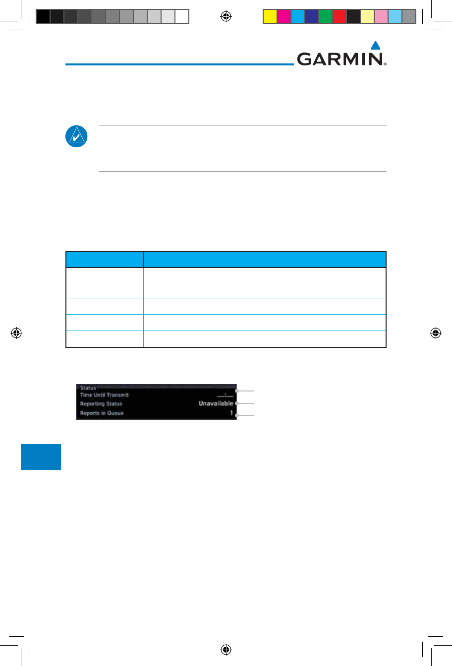
14-20
Garmin GTN 725/750 Pilot’s Guide
190-01007-03 Rev. J
Foreword
Getting
Started
Audio &
Xpdr Ctrl
Com/Nav
FPL
Direct-To
Proc
Charts
Wpt Info
Map
Traffic
Terrain
Weather
Nearest
Services/
Music
Utilities
System
Messages
Symbols
Appendix
Index
14.4.7.1 Status
The Status window shows the time until the next data transmission and the
status of the reporting system.
NOTE: The GSR 56 does not report its serial number until 90 seconds after
power up of the GTN. As a result, for that period, the product info for the
GSR 56 will show “Waiting.”
14.4.7.2 Position Reporting Status
The Time Until Transmit field is a countdown timer that shows the time until
the next data transmission. This field is blank when the aircraft is on the ground.
Position Reporting will be enabled when the aircraft is in the air.
Status Description
Idle The reporting system is not using the GSR 56 for reporting at
this time.
Initializing The GSR 56 and its driver are currently initializing.
Transferring A position report is currently being transmitted.
Unavailable The GSR 56 is currently not usable by the reporting system.
Table 14-4 Position Reporting Status
Countdown Time Until Transmit
Reporting Status
Number Of Reports In The Queue
Figure 14-28 Position Reporting Status
190-01007-03-Final.indb 20 7/9/2015 2:08:30 PM
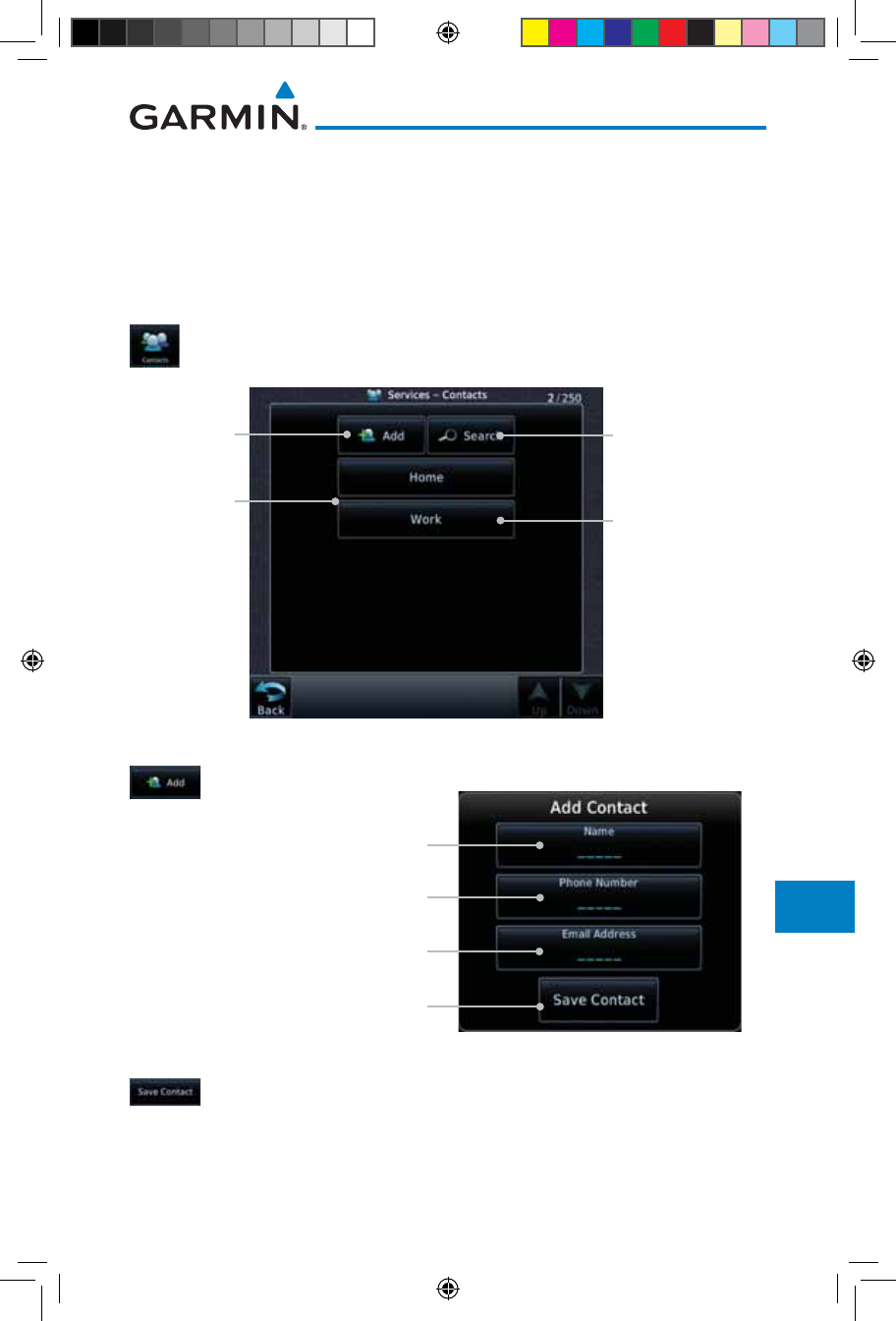
14-21190-01007-03 Rev. J
Garmin GTN 725/750 Pilot’s Guide
Foreword
Getting
Started
Audio &
Xpdr Ctrl
Com/Nav
FPL
Direct-To
Proc
Charts
Wpt Info
Map
Traffic
Terrain
Weather
Nearest
Services/
Music
Utilities
System
Messages
Symbols
Appendix
Index
14.4.8 Contacts
The Phone Book may hold up to 128 entries. A phone number may be
entered and dialed without saving it to the Phone Book. Note that it is necessary
to dial a “1,” the area code, and then the number.
14.4.8.1 Creating a Contact
1. While viewing the Services page, touch the Contacts key.
Existing
Contacts
Touch To Add
Contact
Touch To Edit
Contact
Touch To Search
Contact List
Figure 14-29 Contact List
2. Touch the Add key to add a new contact.
Touch To Add
Contact Name
Touch To Add Contact
Phone Number
Touch To Add Contact
Email Address
Touch To Save Contact
Figure 14-30 Add a New Contact
3. Use the keypad to enter the information for each item and
then touch the Save Contact key.
190-01007-03-Final.indb 21 7/9/2015 2:08:30 PM
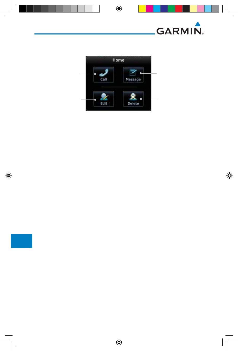
14-22
Garmin GTN 725/750 Pilot’s Guide
190-01007-03 Rev. J
Foreword
Getting
Started
Audio &
Xpdr Ctrl
Com/Nav
FPL
Direct-To
Proc
Charts
Wpt Info
Map
Traffic
Terrain
Weather
Nearest
Services/
Music
Utilities
System
Messages
Symbols
Appendix
Index
14.4.8.2 Using a Contact
1. While viewing the Contacts page, touch an existing contact.
Touch To Call The
Contact Phone Number
Touch To Send A
Message To The
Contact Phone Number
Touch To Edit The
Contact
Touch To Delete
The Contact
Figure 14-31 Using the Contact List
2. Touch the desired function for the selected Contact.
190-01007-03-Final.indb 22 7/9/2015 2:08:30 PM
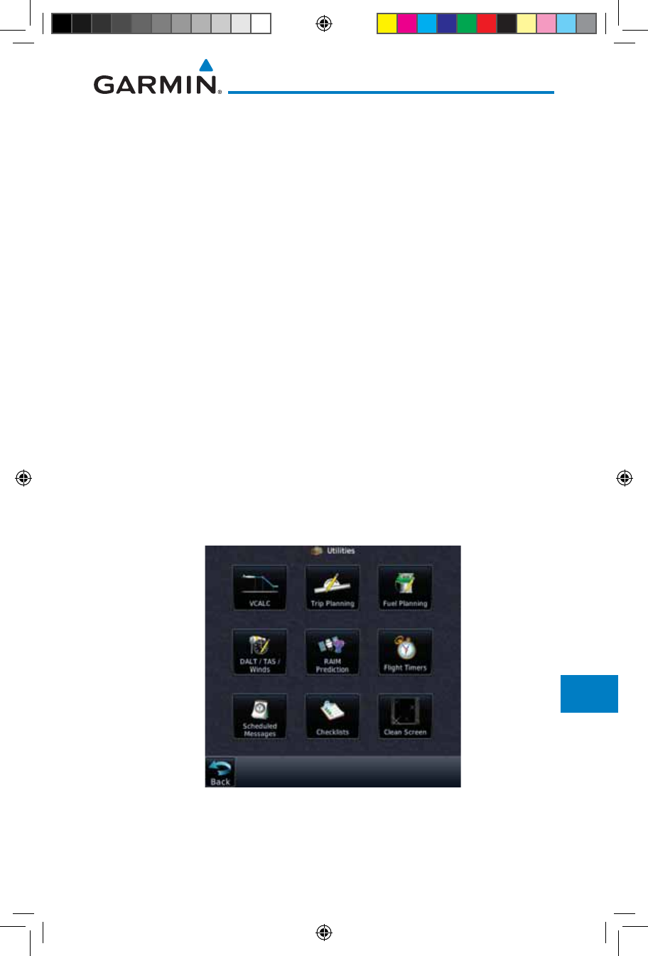
15-1190-01007-03 Rev. J
Garmin GTN 725/750 Pilot’s Guide
Foreword
Getting
Started
Audio &
Xpdr Ctrl
Com/Nav
FPL
Direct-To
Proc
Charts
Wpt Info
Map
Traffic
Terrain
Weather
Nearest
Services/
Music
Utilities
System
Messages
Symbols
Appendix
Index
15 UTILITIES
The Utilities page provides a group of features that will support your flight
planning to make them easier and more efficient. The Vertical Calculator
(VCALC) calculates the time to begin descent and vertical speed required
to reach a desired altitude at the chosen location. The Flight Timers feature
provides a number of timer types to assist in monitoring your time in flight.
RAIM Prediction predicts if GPS coverage is available for your current location
or at a specified waypoint at any time and date. RAIM performs checks to ensure
that the GTN unit has adequate satellite geometry during your flight. The Trip
Planning feature allows the pilot to view desired track (DTK), distance (DIS),
estimated time en route (ETE), en route safe altitude (ESA) and estimated
time of arrival (ETA) information for a direct-to, point-to-point between two
specified waypoints or for any programmed flight plan. The Fuel Planning
feature will display fuel conditions along the active direct-to or flight plan when
equipped with fuel flow (FF) and/or fuel on board (FOB) sensors. The DALT/
TAS/Winds feature performs calculations about Altitude, Airspeed, and Winds.
The Scheduled Messages function allows you to create scheduled messages by
Message, Type, and setting a Timer. The Checklists function provides a built-in
method of reviewing your aircraft checklist. The Clean Screen function will lock
the touchscreen so the display can be cleaned without activating any functions.
Figure 15-1 Utilities Home Page
190-01007-03-Final.indb 1 7/9/2015 2:08:30 PM
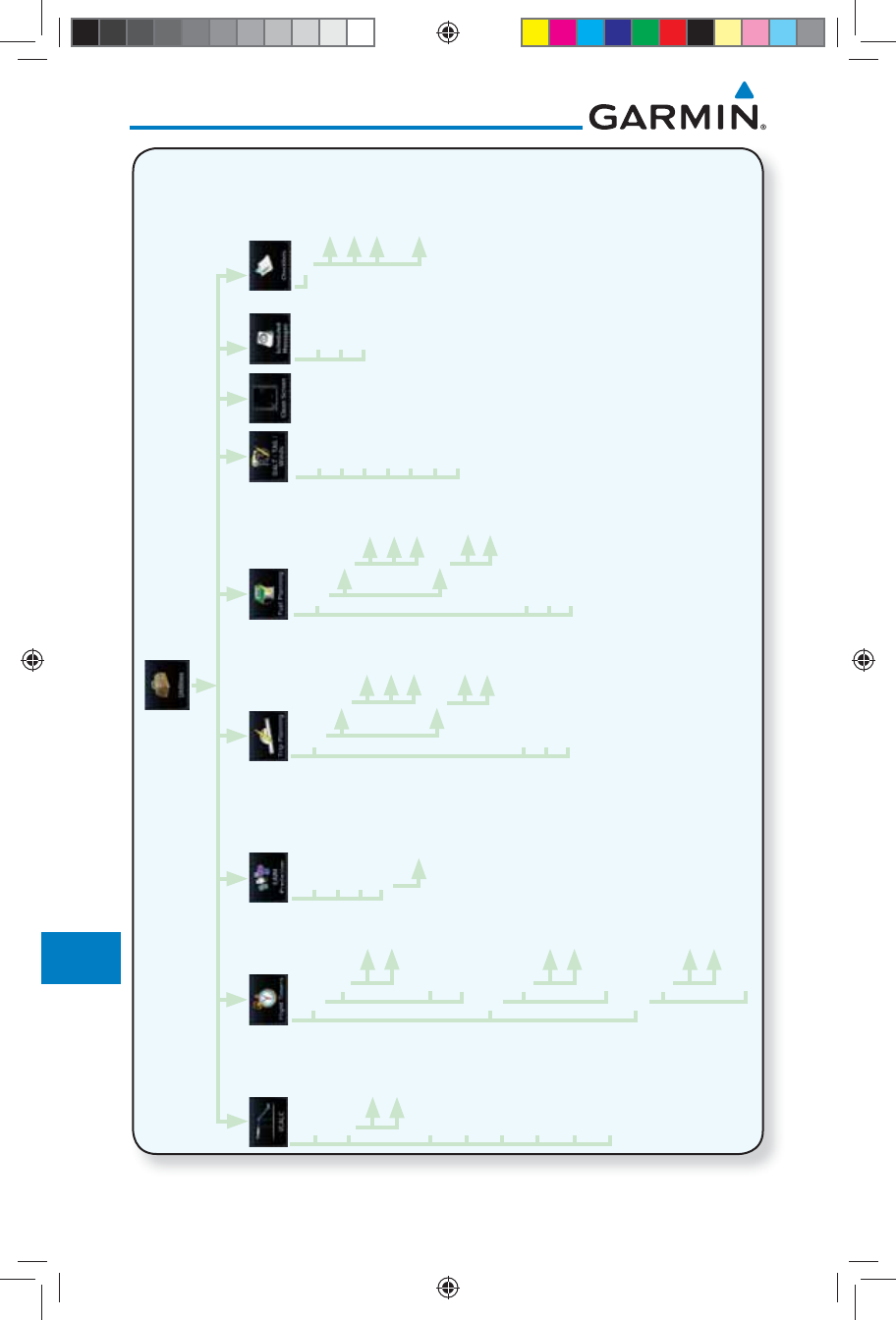
15-2
Garmin GTN 725/750 Pilot’s Guide
190-01007-03 Rev. J
Foreword
Getting
Started
Audio &
Xpdr Ctrl
Com/Nav
FPL
Direct-To
Proc
Charts
Wpt Info
Map
Traffic
Terrain
Weather
Nearest
Services/
Music
Utilities
System
Messages
Symbols
Appendix
Index
Generic Timer
Reset Timer
Start/Stop
Direction
Up
Down
Trip Timer
Reset Timer
Criteria
Power On
In Air
Departure Time
Reset Time
Criteria
Power On
In Air
Indicated ALT
BARO
CAS
TAT
TRK
HDG
Ground Speed
Mode
Depart Time
Depart Date
Ground Speed
Point to Point
Flight Plan
P.POS
From
To
FPL
Leg
Mode
Fuel on Board
Fuel Flow
Ground Speed
Point to Point
Flight Plan
P.POS
From
To
FPL
Leg
MSL
Above Wpt
Altitude Type
VS Profile
Offset
Before/After
Target Altitude
Target Waypoint
Restore Defaults
Display Messages
Waypoint
Arrival Date
Arrival Time
RAIM Status
Compute RAIM
Message
Type
Timer
Menu
Group
Checklist
Clear Current
Checklist
Clear All
Checklists
Figure 15-2 Utilities Functional Diagram
190-01007-03-Final.indb 2 7/9/2015 2:08:31 PM
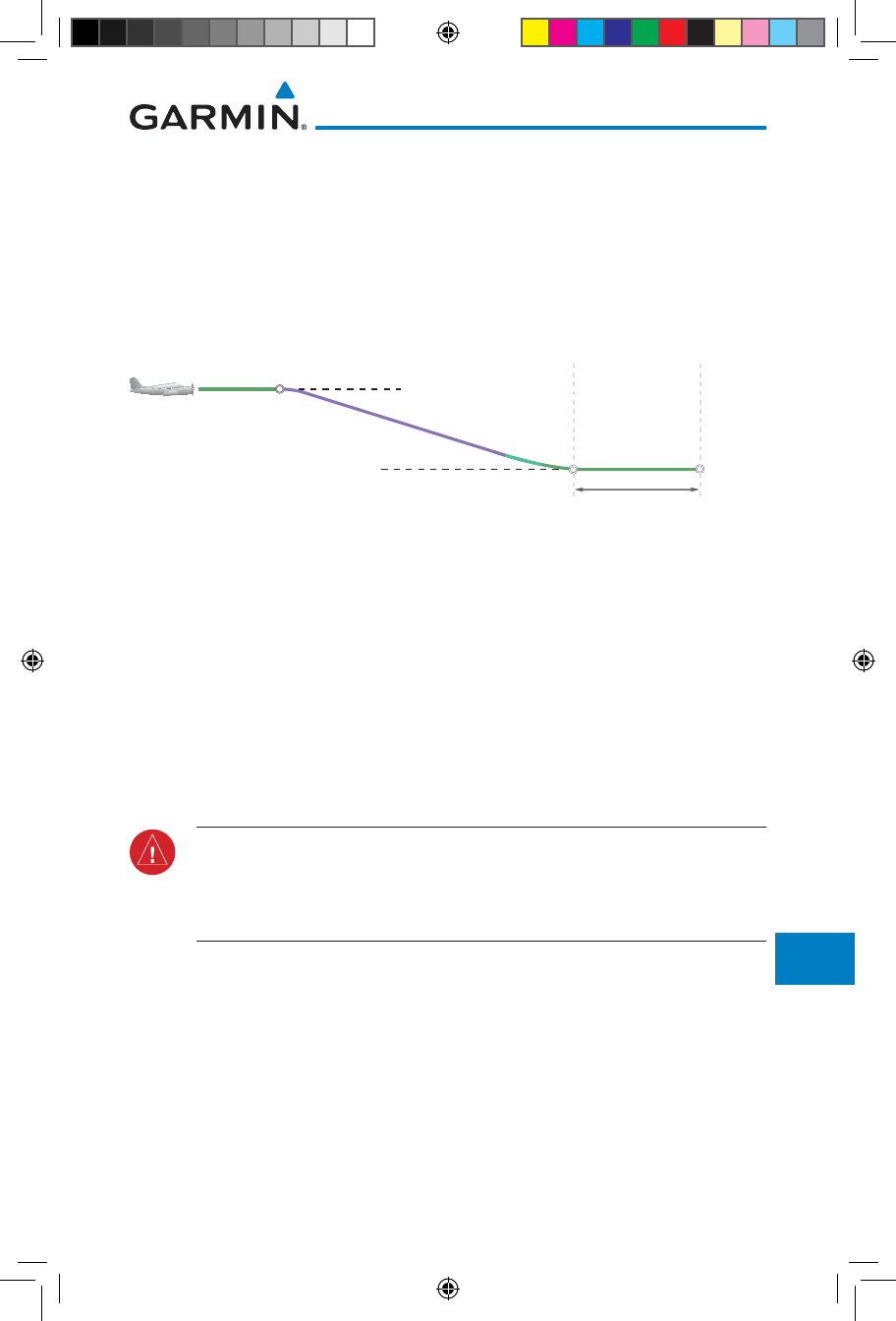
15-3190-01007-03 Rev. J
Garmin GTN 725/750 Pilot’s Guide
Foreword
Getting
Started
Audio &
Xpdr Ctrl
Com/Nav
FPL
Direct-To
Proc
Charts
Wpt Info
Map
Traffic
Terrain
Weather
Nearest
Services/
Music
Utilities
System
Messages
Symbols
Appendix
Index
15.1 Vertical Calculator (VCALC)
The Vertical Calculator (VCALC) function allows you to create a three-
dimensional profile which guides you from your present position and altitude
to a final (target) altitude at a specified location. This is helpful when you’d
like to descend to a certain altitude near an airport. Once the profile is defined,
message alerts and additional data can be configured on the Map Page to keep
you informed of your progress.
Cruise Altitude
Target Altitude
Target Offset (Before)
Target
Waypoint
Figure 15-3 VCALC Target
VCALC is inhibited in the following conditions:
• Groundspeed is less than 35 knots
• No active flight plan or direct-to destination
• SUSP mode
• Vectors-to-Final mode
• VLOC mode
• After the FAF on an approach
WARNING: Do not use VCALC messages as the only means of either avoiding
terrain/obstacles or following ATC guidance. VCALC provides advisory
information only and must be used in concert with all other available navigation
data sources.
190-01007-03-Final.indb 3 7/9/2015 2:08:31 PM
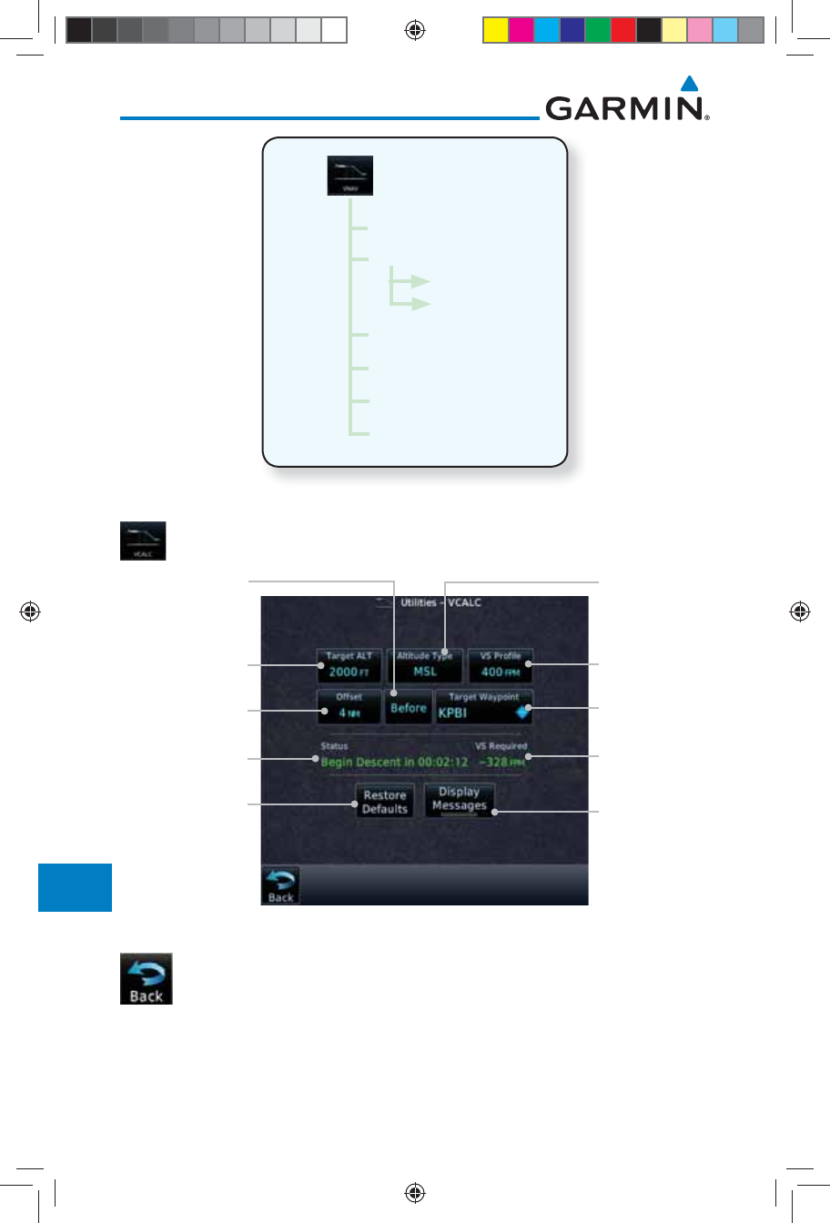
15-4
Garmin GTN 725/750 Pilot’s Guide
190-01007-03 Rev. J
Foreword
Getting
Started
Audio &
Xpdr Ctrl
Com/Nav
FPL
Direct-To
Proc
Charts
Wpt Info
Map
Traffic
Terrain
Weather
Nearest
Services/
Music
Utilities
System
Messages
Symbols
Appendix
Index
MSL
Above Wpt
Altitude Type
VS Profile
Target Offset
Before/After
Target Altitude
Target Waypoint
Figure 15-4 VCALC Page Functional Diagram
1. From the Utilities page, touch VCALC.
VCALC Status
Message
Vertical Speed
Required For
Target ALT At
Offset
Desired Target
Altitude
Desired Distance
From Target Offset
Desired
Vertical Speed
Altitude Type
Target Waypoint
Before/After
Target
Restore Factory
Defaults Display Status
Messages
Figure 15-5 VCALC Page
2. Select the VCALC items as necessary to set up parameters for
the next waypoint. Touch the Back key when finished.
190-01007-03-Final.indb 4 7/9/2015 2:08:31 PM
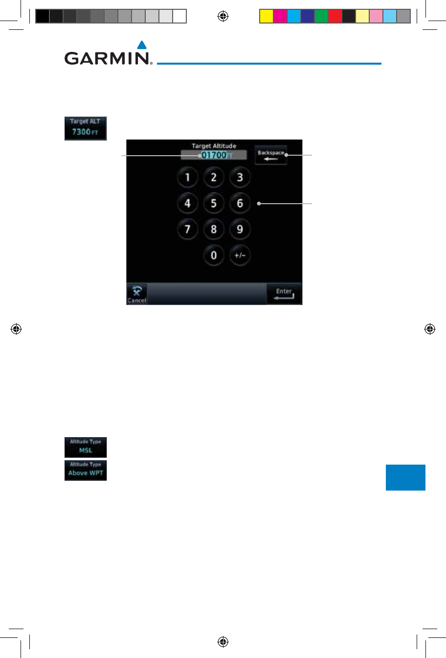
15-5190-01007-03 Rev. J
Garmin GTN 725/750 Pilot’s Guide
Foreword
Getting
Started
Audio &
Xpdr Ctrl
Com/Nav
FPL
Direct-To
Proc
Charts
Wpt Info
Map
Traffic
Terrain
Weather
Nearest
Services/
Music
Utilities
System
Messages
Symbols
Appendix
Index
15.1.1 Target Altitude
This sets the desired ending altitude for the VCALC setup.
1. While viewing the VCALC page, touch Target ALT.
Numeric
Keypad
Selected
Altitude
Backspace
Key
Figure 15-6 Select VCALC Target Altitude
2. Use the numeric keypad to select the desired Target Altitude
and then touch the Enter key.
15.1.2 Altitude Type
This value selects the altitude reference that will be used for VCALC
calculations.
1. While viewing the VCALC page, touch Altitude Type.
2. Touching the Altitude Type key will toggle between MSL and
Above WPT. "Above WPT" is only available for waypoints that
are airports.
190-01007-03-Final.indb 5 7/9/2015 2:08:32 PM
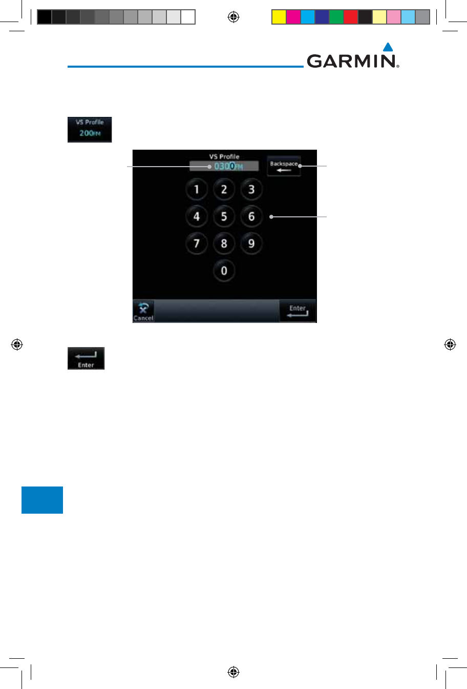
15-6
Garmin GTN 725/750 Pilot’s Guide
190-01007-03 Rev. J
Foreword
Getting
Started
Audio &
Xpdr Ctrl
Com/Nav
FPL
Direct-To
Proc
Charts
Wpt Info
Map
Traffic
Terrain
Weather
Nearest
Services/
Music
Utilities
System
Messages
Symbols
Appendix
Index
15.1.3 Vertical Speed (VS) Profile
This value sets the desired vertical speed.
1. While viewing the VCALC page, touch VS Profile.
Numeric
Keypad
Selected
Vertical
Speed
Backspace
Key
Figure 15-7 Select VCALC Vertical Speed
2. Use the numeric keypad to select the desired Vertical Speed
and then touch the Enter key.
190-01007-03-Final.indb 6 7/9/2015 2:08:32 PM
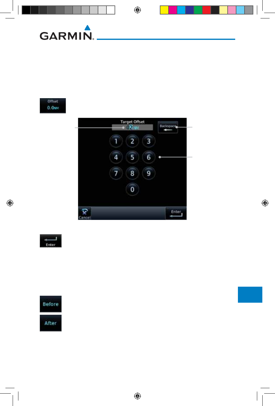
15-7190-01007-03 Rev. J
Garmin GTN 725/750 Pilot’s Guide
Foreword
Getting
Started
Audio &
Xpdr Ctrl
Com/Nav
FPL
Direct-To
Proc
Charts
Wpt Info
Map
Traffic
Terrain
Weather
Nearest
Services/
Music
Utilities
System
Messages
Symbols
Appendix
Index
15.1.4 Target Offset
The Target Offset is a pilot-selected distance value that represents the
geographical location where you wish to arrive at the target altitude. This
distance is measured from the Target Waypoint and, in a separate data field on
the VCALC page, designated as either before or after the Target Waypoint.
1. While viewing the VCALC page, touch the Offset key.
Numeric
Keypad
Selected
Target
Offset
Backspace
Key
Figure 15-8 Select VCALC Target Offset
2. Use the numeric keypad to select the desired Target Offset and
then touch the Enter key.
15.1.5 Before/After Target Waypoint
This setting designates whether the offset distance defines a point before you
reach the target reference waypoint or after you reach the waypoint. The “After”
selection is not available for the last waypoint in a flight plan.
1. While viewing the VCALC page, touch the Before/After
key.
2. Touching the Before/After key will toggle between Before
and After the Target Waypoint.
190-01007-03-Final.indb 7 7/9/2015 2:08:32 PM
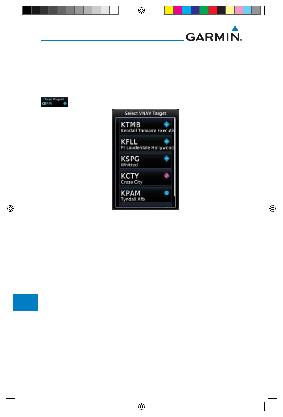
15-8
Garmin GTN 725/750 Pilot’s Guide
190-01007-03 Rev. J
Foreword
Getting
Started
Audio &
Xpdr Ctrl
Com/Nav
FPL
Direct-To
Proc
Charts
Wpt Info
Map
Traffic
Terrain
Weather
Nearest
Services/
Music
Utilities
System
Messages
Symbols
Appendix
Index
15.1.6 Target Waypoint
Select the waypoint in the flight plan that will be used for planning a descent.
When using a flight plan, the target waypoint is a reference that can be specified
from the waypoints contained in the flight plan. By default, the last waypoint in
the flight plan is selected.
1. While viewing the VCALC page, touch Target Waypoint.
Figure 15-9 Select VCALC Target Waypoint List
2. A list of the remaining waypoints in the flight plan will be
shown. Touch the desired waypoint to select it as the Target
Waypoint.
190-01007-03-Final.indb 8 7/9/2015 2:08:32 PM
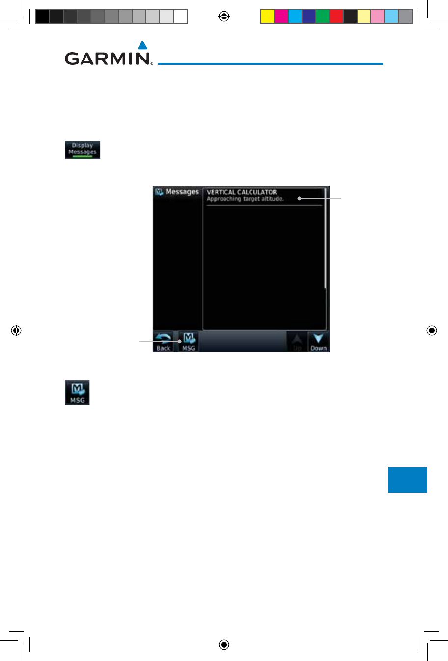
15-9190-01007-03 Rev. J
Garmin GTN 725/750 Pilot’s Guide
Foreword
Getting
Started
Audio &
Xpdr Ctrl
Com/Nav
FPL
Direct-To
Proc
Charts
Wpt Info
Map
Traffic
Terrain
Weather
Nearest
Services/
Music
Utilities
System
Messages
Symbols
Appendix
Index
15.1.7 Display VCALC Messages
Selecting Display Messages will allow the display of messages about the
VCALC function when they occur. With Display Messages not selected,
VCALC messages will not be displayed.
1. While viewing the VCALC page, touch Display Messages
to toggle the display of VCALC messages in the Message
function.
Touch To Toggle
Messages
VCALC
Message
Figure 15-10 VCALC Approaching Target Altitude Message
2. Touch the MSG key to toggle the display of available messages.
15.1.8 Restore VCALC Defaults
While viewing the VCALC page menu, touching the Restore Defaults
key will reset all of the VCALC values back to their default values. The Target
Waypoint will not be changed.
190-01007-03-Final.indb 9 7/9/2015 2:08:32 PM
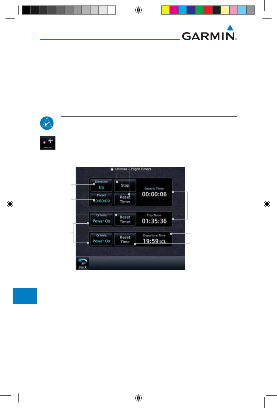
15-10
Garmin GTN 725/750 Pilot’s Guide
190-01007-03 Rev. J
Foreword
Getting
Started
Audio &
Xpdr Ctrl
Com/Nav
FPL
Direct-To
Proc
Charts
Wpt Info
Map
Traffic
Terrain
Weather
Nearest
Services/
Music
Utilities
System
Messages
Symbols
Appendix
Index
15.2 Flight Timers
The Flight Timers function provides count up/down timers, plus automatic
recording of departure time, and total trip time. Departure and total trip time
recording can be configured to run either any time unit power is on, or only
when your ground speed exceeds the in-air threshold set by the installer (for
example, 30 knots). A flexible Generic Timer is available for general timing
needs.
NOTE: When a count up timer is used, the preset value has no function.
1. While viewing the Utilities page, touch the Flight Timers
key.
Departure Time
(Local Time)
Selected
Counter
Direction
Elapsed
Time
Start/Stop Generic Timer Reset or Preset Timer
Select Preset
Time
Set Departure Time
To Current Local
Time Of Timer Start
Select
Criteria For
Timer Start
Reset Timer
Figure 15-11 Utility Flight Timers Page
2. If the Generic Timer Direction counter is set to "Up," the Reset
Timer key will be shown and when touched will return the
timer to 00:00:00. If the Direction counter is set to "Down,"
the Preset Timer key will be shown and the key will return the
timer to the Preset time value.
3. Touch each key as desired to set up timer operation.
190-01007-03-Final.indb 10 7/9/2015 2:08:32 PM
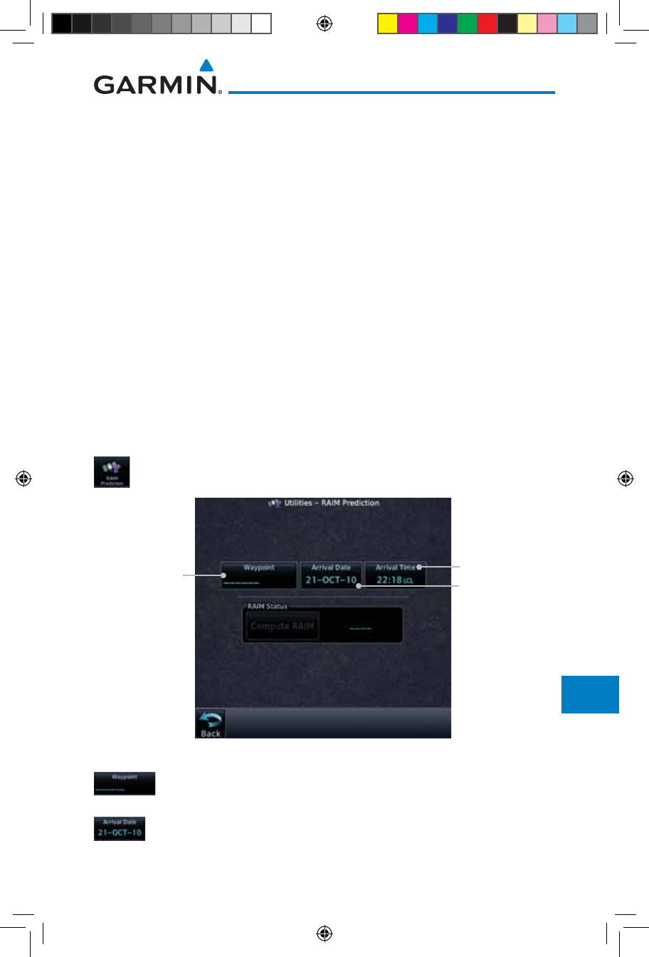
15-11190-01007-03 Rev. J
Garmin GTN 725/750 Pilot’s Guide
Foreword
Getting
Started
Audio &
Xpdr Ctrl
Com/Nav
FPL
Direct-To
Proc
Charts
Wpt Info
Map
Traffic
Terrain
Weather
Nearest
Services/
Music
Utilities
System
Messages
Symbols
Appendix
Index
15.3 RAIM Prediction
RAIM Prediction predicts if GPS coverage is available for your current location
or at a specified waypoint at any time and date. RAIM performs checks to
ensure that the GTN unit has adequate satellite geometry during your flight.
RAIM availability is near 100% in Oceanic, En Route and Terminal phases
of flight. Because the FAA’s TSO requirements for non-precision approaches
specify significantly better satellite coverage than other flight phases,
RAIM may not be available when flying some approaches. The GTN unit
automatically monitors RAIM during approach operations and warns you if
RAIM is not available. In such cases, use a non-GPS based approach. RAIM
prediction helps you plan for a pending flight to confirm GPS operation during
an approach.
RAIM prediction only predicts the availability of Fault Detection (FD)
integrity in the absence of SBAS corrections. It cannot predict the availability
of LPV or L/VNAV approaches. The FAA provides a NOTAM service for LPV
approach availability.
1. While viewing the Utilities page, touch the RAIM Prediction
key.
Touch To Select
Local Arrival Time
Touch To Select
Destination
Waypoint Touch To Select
Local Arrival Date
Figure 15-12 Utility RAIM Prediction Page
2. Touch the Waypoint key and select the waypoint for RAIM
Prediction.
3. Touch the Arrival Date key and select the date of arrival at
the selected waypoint.
190-01007-03-Final.indb 11 7/9/2015 2:08:33 PM
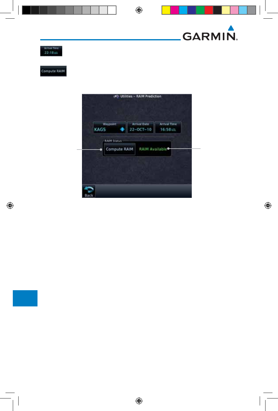
15-12
Garmin GTN 725/750 Pilot’s Guide
190-01007-03 Rev. J
Foreword
Getting
Started
Audio &
Xpdr Ctrl
Com/Nav
FPL
Direct-To
Proc
Charts
Wpt Info
Map
Traffic
Terrain
Weather
Nearest
Services/
Music
Utilities
System
Messages
Symbols
Appendix
Index
4. Touch the Arrival Time key and select the local time of
expected arrival at the selected waypoint.
5. When the Waypoint, Arrival Date, and Arrival Time values have
been entered, touch the Compute RAIM key to determine if
RAIM is available.
RAIM Prediction
Result
Touch To
Compute RAIM
Figure 15-13 RAIM Prediction Completed
15.4 Trip Planning
The GTN 7XX allows the pilot to view desired track (DTK), distance (DIS),
estimated time en route (ETE), en route safe altitude (ESA) and estimated time of
arrival (ETA) information for a direct-to, point-to-point between two specified
waypoints or for any programmed flight plan. This item also displays the
sunrise/sunset times for your destination waypoint (for the selected departure
date). All times are based on the time set in System-Setup. For trip planning
inputs: departure time and date are manually entered, while ground speed can
be provided by sensor data, if selected.
The trip statistics are calculated based on the selected starting and ending
waypoints and the trip planning inputs.
In Flight Plan mode with a stored flight plan selected, and the entire flight
plan (CUM) selected, the waypoints are the starting and ending waypoints of the
selected flight plan.
In Flight Plan mode with a stored flight plan selected, and a specific leg
selected, the waypoints are the endpoints of the selected leg.
190-01007-03-Final.indb 12 7/9/2015 2:08:33 PM
15-13190-01007-03 Rev. J
Garmin GTN 725/750 Pilot’s Guide
Foreword
Getting
Started
Audio &
Xpdr Ctrl
Com/Nav
FPL
Direct-To
Proc
Charts
Wpt Info
Map
Traffic
Terrain
Weather
Nearest
Services/
Music
Utilities
System
Messages
Symbols
Appendix
Index
In Point-To-Point mode these are manually selected waypoints (if there is an
active flight plan, these default to the endpoints of the active leg).
Some of the calculated trip statistics are dashed when the selected leg of the
active flight plan has already been flown.
• Desired Track (DTK) - DTK is shown as nnn° and is the desired track
between the selected waypoints. It is dashed unless only a single leg is
selected.
• Distance (DIS) - The distance is shown in tenths of units up to 99.9, and
in whole units up to 9999.
• Estimated time en route (ETE) - ETE is shown as hours:minutes until less
than an hour, then it is shown as minutes:seconds.
• Estimated time of arrival (ETA) - ETA is shown as hours:minutes and is
the local time at the destination.
- If in Point-To-Point mode then the ETA is the ETE added to the
departure time.
- If a flight plan other than the active flight plan is selected it shows the
ETA by adding to the departure time all of the ETEs of the legs up
to and including the selected leg. If the entire flight plan is selected,
then the ETA is calculated as if the last leg of the flight plan was
selected.
- If the active flight plan is selected the ETA reflects the current position
of the aircraft and the current leg being flown. The ETA is calculated
by adding to the current time the ETEs of the current leg up to and
including the selected leg. If the entire flight plan is selected, then the
ETA is calculated as if the last leg of the flight plan was selected.
• En Route safe altitude (ESA) - The ESA is shown as nnnnnFT.
• Destination sunrise and sunset times - These times are shown as
hours:minutes and are the local time at the destination.
NOTE: The capability of using Sensor Data for the trip planning functions
is available in SW Versions 2.00, 4.10, and later.
190-01007-03-Final.indb 13 7/9/2015 2:08:33 PM
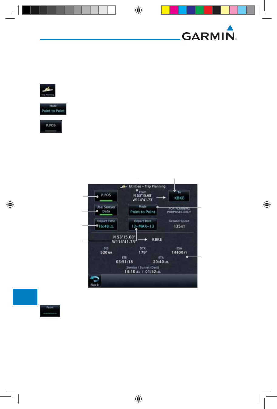
15-14
Garmin GTN 725/750 Pilot’s Guide
190-01007-03 Rev. J
Foreword
Getting
Started
Audio &
Xpdr Ctrl
Com/Nav
FPL
Direct-To
Proc
Charts
Wpt Info
Map
Traffic
Terrain
Weather
Nearest
Services/
Music
Utilities
System
Messages
Symbols
Appendix
Index
15.4.1 Point-To-Point Mode
The Trip Planning Point-to-Point mode shows trip calculations between two
selected points: either two waypoints from the database or from your present
position to a selected waypoint.
1. While viewing the Utilities page, touch the Trip Planning
key.
2. Touch the Mode key to toggle to Point-to-Point.
3. Touch the P.POS key to toggle between using your present
position as the From waypoint when selected or a waypoint
selected from the database when P. P O S is deselected. If P. P O S
is selected, the Lat/Lon of the present position will be shown
in the From position.
Touch To Select
P-to-P or Flight
Plan Mode
Touch To Use
Present Position
As Departure
Point
Touch To Select
Departure Time
Touch To Select
Departure Date
Lat/Lon Of Present
Position
Touch To Select
Arrival Waypoint
Trip Statistics
Touch To Toggle
Sensor Data Use
Figure 15-14 Utility Trip Planning Page (Point-To-Point Mode) - Sensor Data Used
4. If P.POS is not selected for the From point, touch the From
key and then use the keypad to select a waypoint from the
database and touch Enter.
190-01007-03-Final.indb 14 7/9/2015 2:08:33 PM
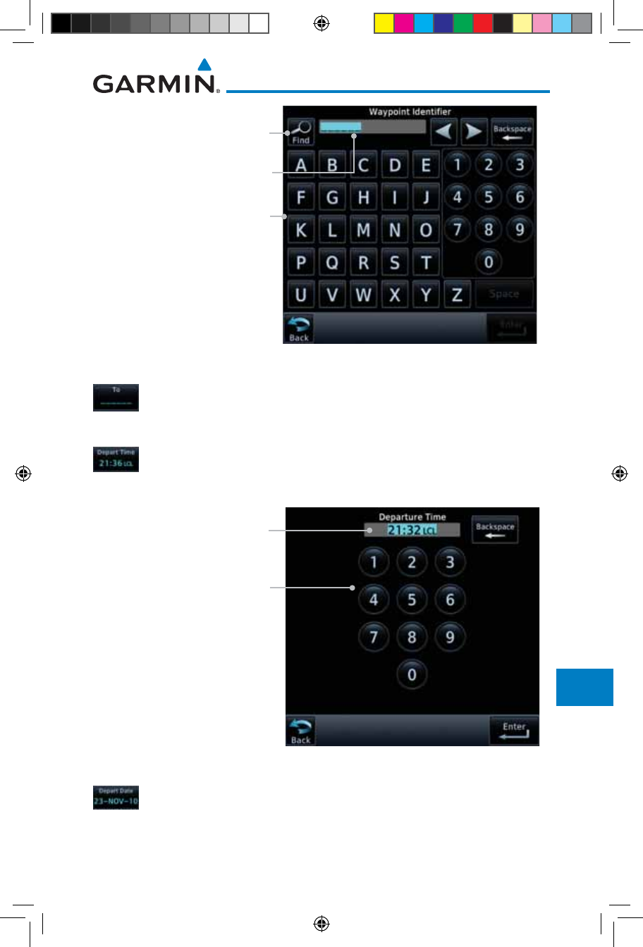
15-15190-01007-03 Rev. J
Garmin GTN 725/750 Pilot’s Guide
Foreword
Getting
Started
Audio &
Xpdr Ctrl
Com/Nav
FPL
Direct-To
Proc
Charts
Wpt Info
Map
Traffic
Terrain
Weather
Nearest
Services/
Music
Utilities
System
Messages
Symbols
Appendix
Index
Touch For
Waypoint Search
Touch To Select From Waypoint
Selected From Waypoint
Figure 15-15 Selecting a From Waypoint
5. Touch the To key and then use the keypad to select a waypoint
from the database for the destination waypoint and touch
Enter.
6. Touch the Depart Time key and then use the keypad to select
the departure time (local time at From waypoint) and touch
Enter.
Touch To Select Departure Time
Selected Departure Time
Figure 15-16 Selecting Departure Time
7. Touch the Depart Date key and then the Departure Date
page to select the departure year, month, and day and then
touch Enter.
190-01007-03-Final.indb 15 7/9/2015 2:08:33 PM
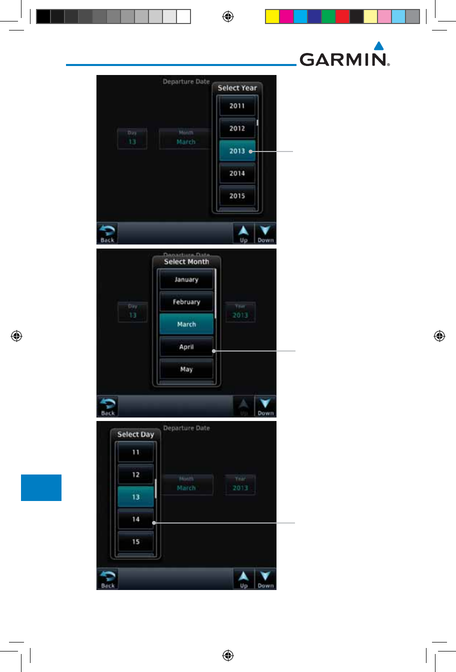
15-16
Garmin GTN 725/750 Pilot’s Guide
190-01007-03 Rev. J
Foreword
Getting
Started
Audio &
Xpdr Ctrl
Com/Nav
FPL
Direct-To
Proc
Charts
Wpt Info
Map
Traffic
Terrain
Weather
Nearest
Services/
Music
Utilities
System
Messages
Symbols
Appendix
Index
Touch To Select
Departure Year
Touch To Select
Departure Month
Touch To Select
Departure Day
Figure 15-17 Selecting Departure Date
190-01007-03-Final.indb 16 7/9/2015 2:08:34 PM
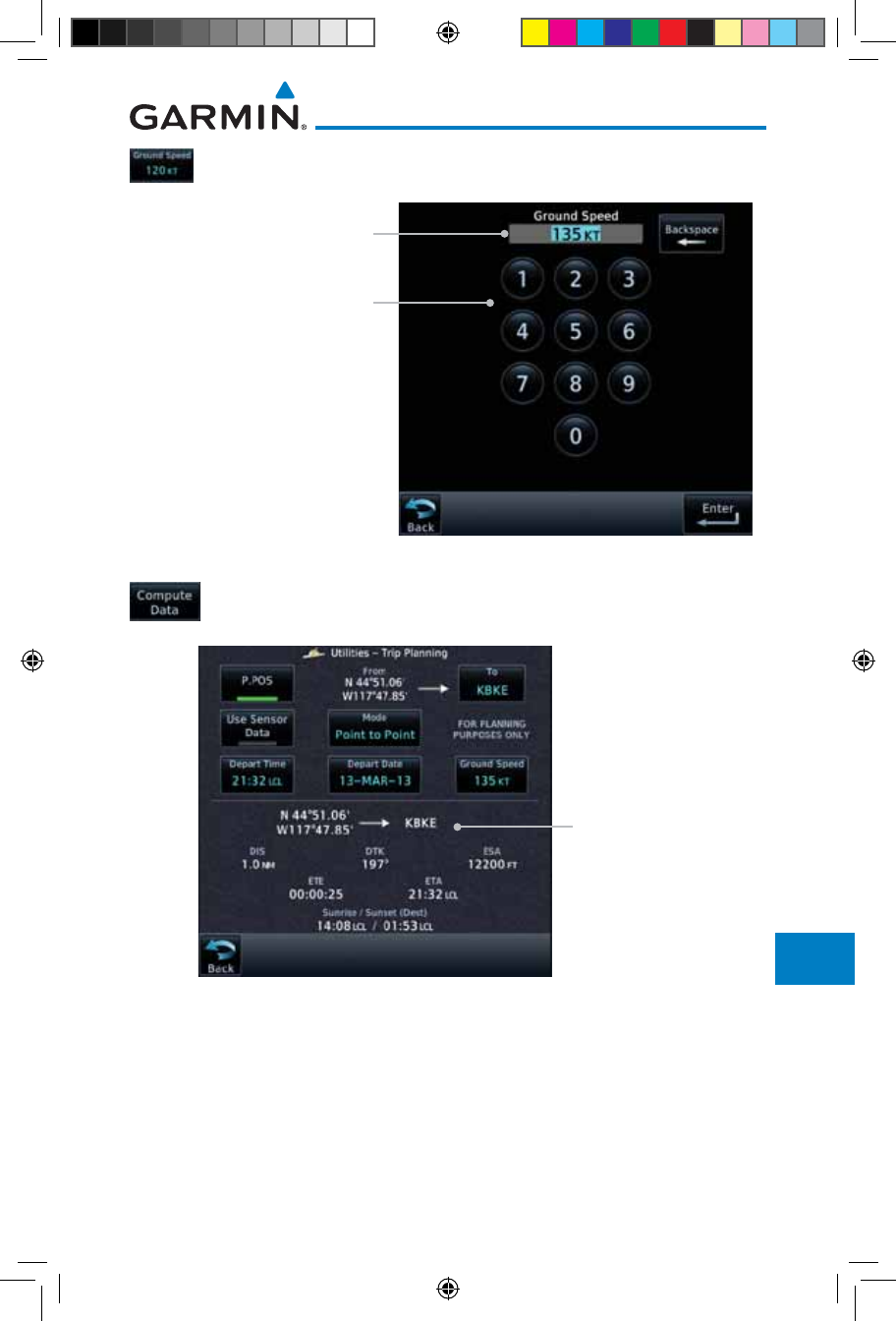
15-17190-01007-03 Rev. J
Garmin GTN 725/750 Pilot’s Guide
Foreword
Getting
Started
Audio &
Xpdr Ctrl
Com/Nav
FPL
Direct-To
Proc
Charts
Wpt Info
Map
Traffic
Terrain
Weather
Nearest
Services/
Music
Utilities
System
Messages
Symbols
Appendix
Index
8. Touch the Ground Speed key and then the keypad to select
the average ground speed for the trip and touch Enter.
Touch To Select Ground Speed
Selected Ground Speed
Figure 15-18 Selecting Expected Average Ground Speed
9. After completing the Trip Planning selections, the trip statistics
will be shown in the lower half of the display.
Trip Statistics For
Selected Route
Figure 15-19 Utility Trip Planning Page With Computed Data (Point-To-Point Mode)
190-01007-03-Final.indb 17 7/9/2015 2:08:34 PM
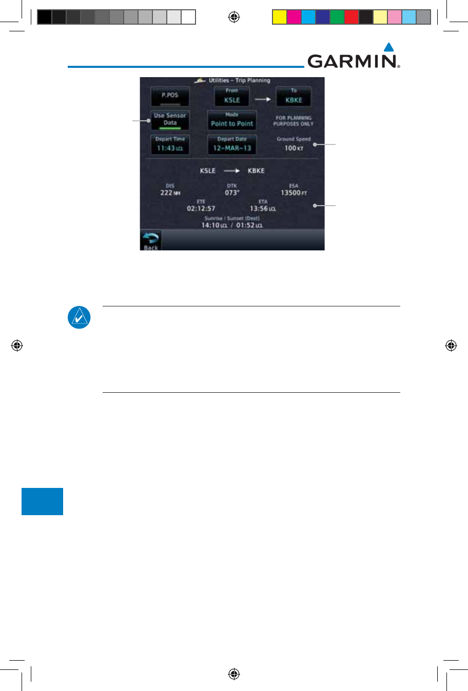
15-18
Garmin GTN 725/750 Pilot’s Guide
190-01007-03 Rev. J
Foreword
Getting
Started
Audio &
Xpdr Ctrl
Com/Nav
FPL
Direct-To
Proc
Charts
Wpt Info
Map
Traffic
Terrain
Weather
Nearest
Services/
Music
Utilities
System
Messages
Symbols
Appendix
Index
Trip Statistics For
Selected Route
Ground Speed
Set By Sensor
Data
Use Sensor
Data Selected
Figure 15-20 Utility Trip Planning Page With Computed Data (Point-To-Point Mode) - Use
Sensor Data Selected
NOTE: When Local Time is selected in the Setup-Date/Time feature, Sunrise/
Sunset calculations in the Trip Planning feature are based on the From
waypoint time zone. For instance, a flight plan originating in the Pacific
time zone and ending in the Central time zone would show Sunset/Sunrise
times at the destination in Pacific time. This potential offset does not occur
when UTC time is used.
190-01007-03-Final.indb 18 7/9/2015 2:08:34 PM
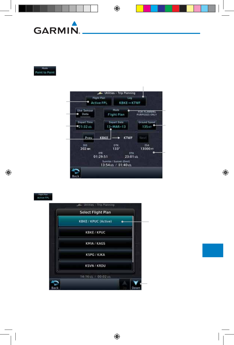
15-19190-01007-03 Rev. J
Garmin GTN 725/750 Pilot’s Guide
Foreword
Getting
Started
Audio &
Xpdr Ctrl
Com/Nav
FPL
Direct-To
Proc
Charts
Wpt Info
Map
Traffic
Terrain
Weather
Nearest
Services/
Music
Utilities
System
Messages
Symbols
Appendix
Index
15.4.2 Flight Plan Mode
The Trip Planning Flight Plan mode shows trip calculations between two legs
of the flight plan or the cumulative flight plan.
1. Touch the Mode key to select Flight Plan mode, if required.
Touch To Select
P-to-P or Flight
Plan Mode
Touch To Select
Flight Plan From
Catalog
Touch To Select
Expected Average
Ground Speed
Touch To Select
Departure Time
Touch To Select
Departure Date
Touch To Select
Flight Plan Leg
Trip Statistics
Select To Toggle
Sensor Data Use
Figure 15-21 Utility Trip Planning Page (Flight Plan Mode)
2. Touch the Flight Plan key to select the flight plan.
Touch To Scroll List
Touch To Select
Flight Plan (Active
FPL Shown)
Figure 15-22 Select Flight Plan
190-01007-03-Final.indb 19 7/9/2015 2:08:34 PM
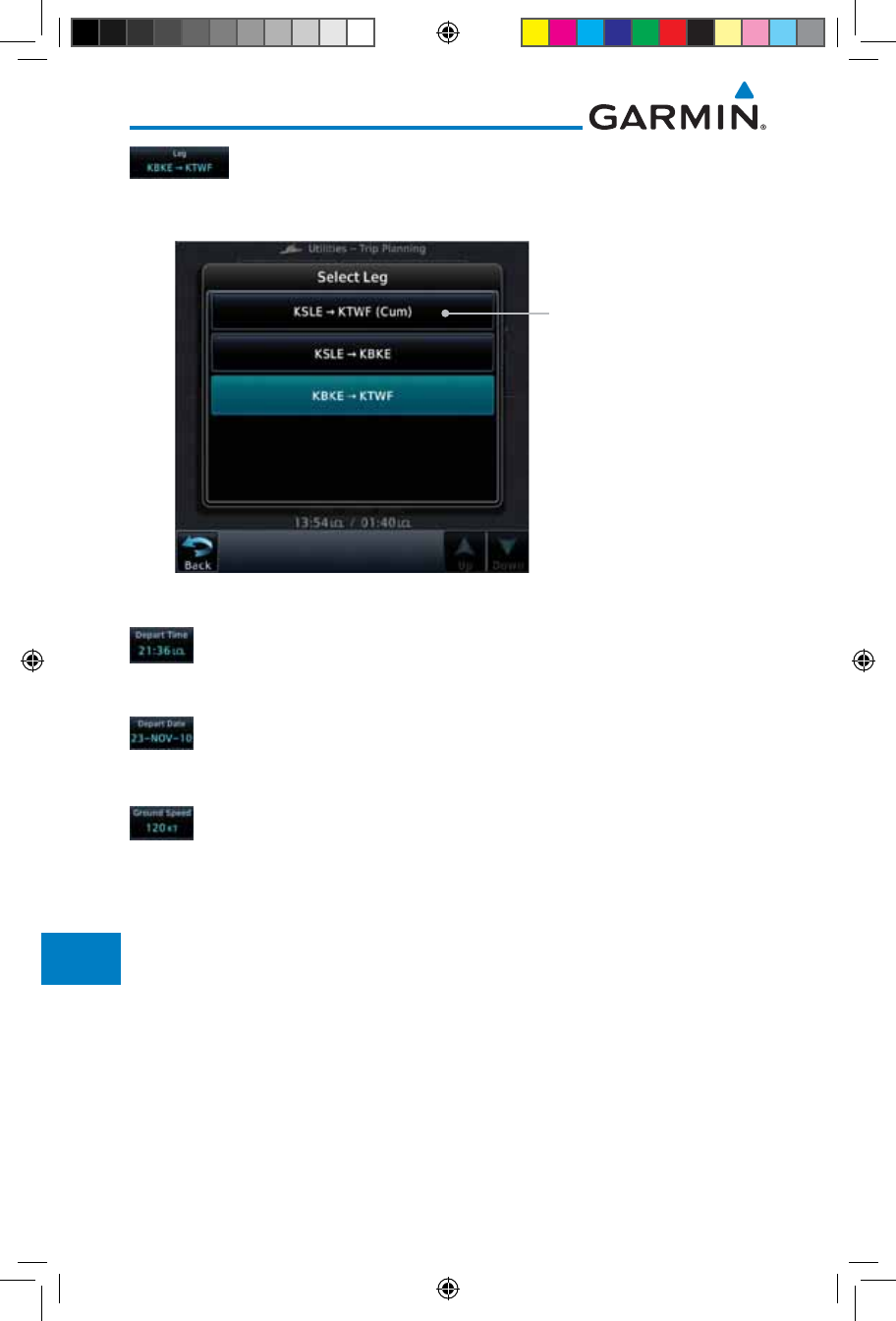
15-20
Garmin GTN 725/750 Pilot’s Guide
190-01007-03 Rev. J
Foreword
Getting
Started
Audio &
Xpdr Ctrl
Com/Nav
FPL
Direct-To
Proc
Charts
Wpt Info
Map
Traffic
Terrain
Weather
Nearest
Services/
Music
Utilities
System
Messages
Symbols
Appendix
Index
3. Touch the Leg key to select the flight plan leg. If the
“Cumulative” selection is chosen, statistics will relate to the
entire flight plan.
Touch To Select Flight
Plan Leg (Cumulative
FPL Shown)
Figure 15-23 Select Flight Plan Leg
4. Touch the Depart Time key and then use the keypad to select
the departure time (local time at From waypoint) and touch
Enter.
5. Touch the Depart Date key and then the Departure Date
page to select the departure year, month, and day and then
touch Enter.
6. Touch the Ground Speed key and then the keypad to select
the average ground speed for the trip and touch Enter.
190-01007-03-Final.indb 20 7/9/2015 2:08:35 PM
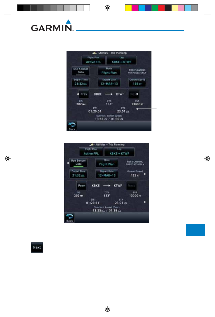
15-21190-01007-03 Rev. J
Garmin GTN 725/750 Pilot’s Guide
Foreword
Getting
Started
Audio &
Xpdr Ctrl
Com/Nav
FPL
Direct-To
Proc
Charts
Wpt Info
Map
Traffic
Terrain
Weather
Nearest
Services/
Music
Utilities
System
Messages
Symbols
Appendix
Index
7. Statistics for the current flight plan leg are displayed in the
lower half of the display.
Trip Statistics
Touch To View
Statistics For
Next FPL Leg
Touch To View
Statistics For
Previous FPL Leg
Figure 15-24 Utility Trip Planning Page Computed Data View (Flight Plan Mode)
Trip Statistics For
Selected Route
Ground Speed
Set By Sensor
Data
Use Sensor
Data Selected
Figure 15-25 Utility Trip Planning Page Computed Data View (Flight Plan Mode) -
Use Sensor Data Selected
8. Touch the Next key to view statistics for the next leg in the
flight plan.
190-01007-03-Final.indb 21 7/9/2015 2:08:35 PM
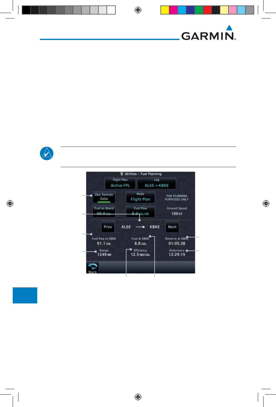
15-22
Garmin GTN 725/750 Pilot’s Guide
190-01007-03 Rev. J
Foreword
Getting
Started
Audio &
Xpdr Ctrl
Com/Nav
FPL
Direct-To
Proc
Charts
Wpt Info
Map
Traffic
Terrain
Weather
Nearest
Services/
Music
Utilities
System
Messages
Symbols
Appendix
Index
15.5 Fuel Planning
Fuel Planning — This item displays fuel conditions along the active
direct-to or flight plan. You may manually enter fuel flow, ground speed
(GS) and fuel on board figures for planning purposes. Fuel planning figures
can be displayed not only for the currently active flight plan or direct-to,
but also point-to-point between two specified waypoints and for any pro-
grammed flight plan.
Fuel on board and fuel flow may be manually entered in the unit start-up
sequence and used to recalculate fuel on board as it is consumed. When fuel
flow or fuel on board is manually entered, the figures are retained the next time
you view the page (with fuel on board continuously recalculated).
NOTE: The capability of using Sensor Data for the trip planning functions
is available in SW Versions 2.00, 4.10, and later.
Flight Time
Available With
Remaining Fuel
At Destination
Fuel Required For
the Flight Plan
Range With
Existing Fuel Flight Time
Available With
Existing Fuel
Selected
Distance
Measured
Remaining Fuel
At Destination
Fuel Usage Rate
Use Sensor Data
Selected
Figure 15-26 Utility Fuel Planning Page (Flight Plan Mode) - Use Sensor Data Selected
190-01007-03-Final.indb 22 7/9/2015 2:08:35 PM
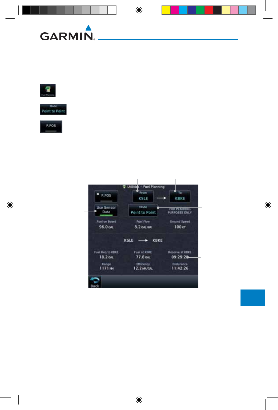
15-23190-01007-03 Rev. J
Garmin GTN 725/750 Pilot’s Guide
Foreword
Getting
Started
Audio &
Xpdr Ctrl
Com/Nav
FPL
Direct-To
Proc
Charts
Wpt Info
Map
Traffic
Terrain
Weather
Nearest
Services/
Music
Utilities
System
Messages
Symbols
Appendix
Index
15.5.1 Point-To-Point Mode
The Fuel Planning Point-to-Point mode shows fuel calculations between two
selected points: either two waypoints from the database or from your present
position to a selected waypoint.
1. While viewing the Utilities page, touch the Fuel Planning
key.
2. Touch the Mode key to toggle to Point-to-Point.
3. Touch the P.POS key to toggle between using your present
position as the From waypoint when selected or a waypoint
selected from the database when P. P O S is deselected. If P. P O S
is selected, the Lat/Lon of the present position will be shown
in the From position.
Touch To Select
P-to-P or Flight
Plan Mode
Touch To Use
Present Position
As Departure
Point
Lat/Lon Of Present
Position
Touch To Select
Arrival Waypoint
Fuel Statistics
Use Sensor Data
Selected
Figure 15-27 Utility Trip Planning Page (Point-To-Point Mode) - Use Sensor Data Selected
190-01007-03-Final.indb 23 7/9/2015 2:08:35 PM
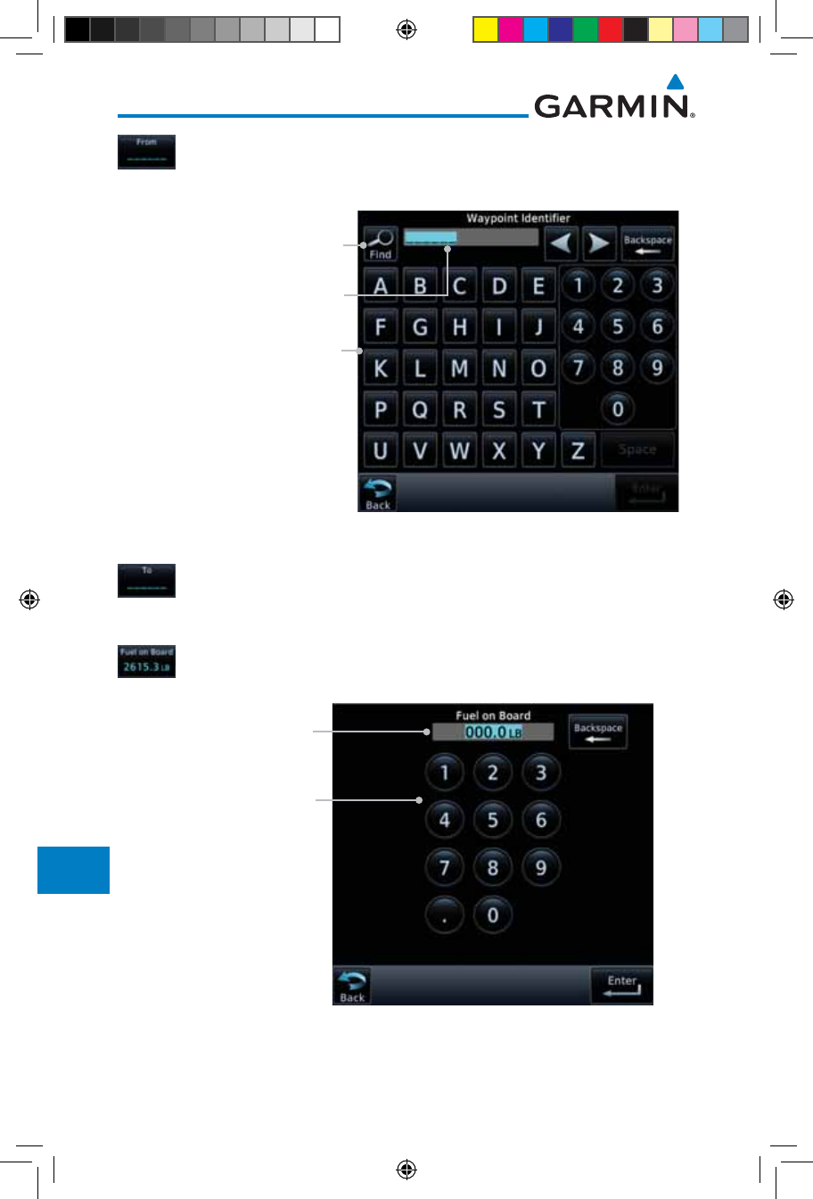
15-24
Garmin GTN 725/750 Pilot’s Guide
190-01007-03 Rev. J
Foreword
Getting
Started
Audio &
Xpdr Ctrl
Com/Nav
FPL
Direct-To
Proc
Charts
Wpt Info
Map
Traffic
Terrain
Weather
Nearest
Services/
Music
Utilities
System
Messages
Symbols
Appendix
Index
4. If P.POS is not selected for the From point, touch the From
key and then use the keypad to select a waypoint from the
database and touch Enter.
Touch For Waypoint Search
Touch To Select From Waypoint
Selected From Waypoint
Figure 15-28 Selecting the From Waypoint
5. Touch the To key and then use the keypad to select a waypoint
from the database for the destination waypoint and touch
Enter.
6. Touch the Fuel on Board key and then use the keypad to
select the current amount of fuel on board and touch Enter.
Touch To Select Fuel On
Board Value
Selected Fuel On
Board Value
Figure 15-29 Selecting Current Fuel On Board
190-01007-03-Final.indb 24 7/9/2015 2:08:35 PM
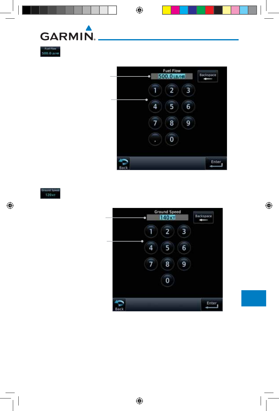
15-25190-01007-03 Rev. J
Garmin GTN 725/750 Pilot’s Guide
Foreword
Getting
Started
Audio &
Xpdr Ctrl
Com/Nav
FPL
Direct-To
Proc
Charts
Wpt Info
Map
Traffic
Terrain
Weather
Nearest
Services/
Music
Utilities
System
Messages
Symbols
Appendix
Index
7. Touch the Fuel Flow key and then use the keypad to select
the average fuel flow and touch Enter.
Touch To Select Fuel Value
Selected Fuel
Flow Value
Figure 15-30 Selecting Fuel Flow
8. Touch the Ground Speed key and then the keypad to select
the average ground speed for the trip and touch Enter.
Touch To Select
Ground Speed Value
Selected Ground
Speed Value
Figure 15-31 Selecting Ground Speed
190-01007-03-Final.indb 25 7/9/2015 2:08:36 PM
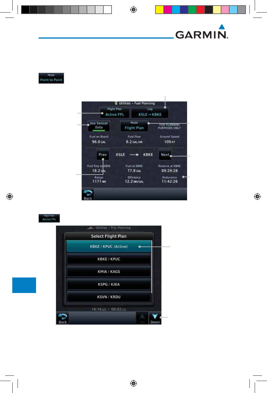
15-26
Garmin GTN 725/750 Pilot’s Guide
190-01007-03 Rev. J
Foreword
Getting
Started
Audio &
Xpdr Ctrl
Com/Nav
FPL
Direct-To
Proc
Charts
Wpt Info
Map
Traffic
Terrain
Weather
Nearest
Services/
Music
Utilities
System
Messages
Symbols
Appendix
Index
15.5.2 Flight Plan Mode
The Fuel Planning Flight Plan mode shows fuel calculations between two legs
of the flight plan or the cumulative flight plan.
1. Touch the Mode key to select Flight Plan mode, if required.
Touch To Select
P-to-P or Flight
Plan Mode
Touch To Select
Flight Plan From
Catalog
Touch To Select
Flight Plan Leg
Fuel Statistics
Touch To Select
Previous FPL Leg
Touch To Select
Next FPL Leg
Use Sensor Data
Selected
Figure 15-32 Utility Fuel Planning Page (Flight Plan Mode)
2. Touch the Flight Plan key to select the flight plan.
Touch To Scroll List
Touch To Select
Flight Plan (Active
FPL Shown)
Figure 15-33 Select Flight Plan
190-01007-03-Final.indb 26 7/9/2015 2:08:36 PM
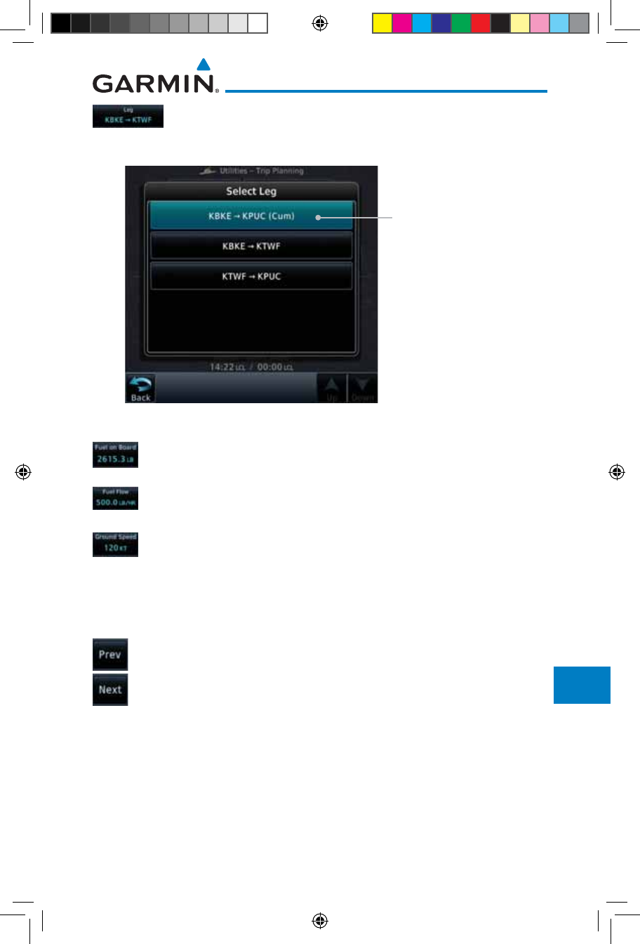
15-27190-01007-03 Rev. J
Garmin GTN 725/750 Pilot’s Guide
Foreword
Getting
Started
Audio &
Xpdr Ctrl
Com/Nav
FPL
Direct-To
Proc
Charts
Wpt Info
Map
Traffic
Terrain
Weather
Nearest
Services/
Music
Utilities
System
Messages
Symbols
Appendix
Index
3. Touch the Leg key to select the flight plan leg. If the
“Cumulative” selection is chosen, statistics will relate to the
entire flight plan.
Touch To Select Flight
Plan Leg (Cumulative
FPL Shown)
Figure 15-34 Select Flight Plan Leg
4. If desired, touch the Fuel on Board key and then use the
keypad to select the Fuel on Board value and touch Enter.
5. If desired, touch the Fuel Flow key and then use the keypad
to select the Fuel Flow value and touch Enter.
6. Touch the Ground Speed key and then the keypad to select
the average ground speed for the trip and touch Enter.
7. Statistics for the current flight plan leg are displayed in
the lower half of the display. The Cumulative flight plan is
shown.
8. Touch the Previous and Next keys to view statistics for the
previous and next legs in the flight plan.
190-01007-03-Final.indb 27 7/9/2015 2:08:36 PM
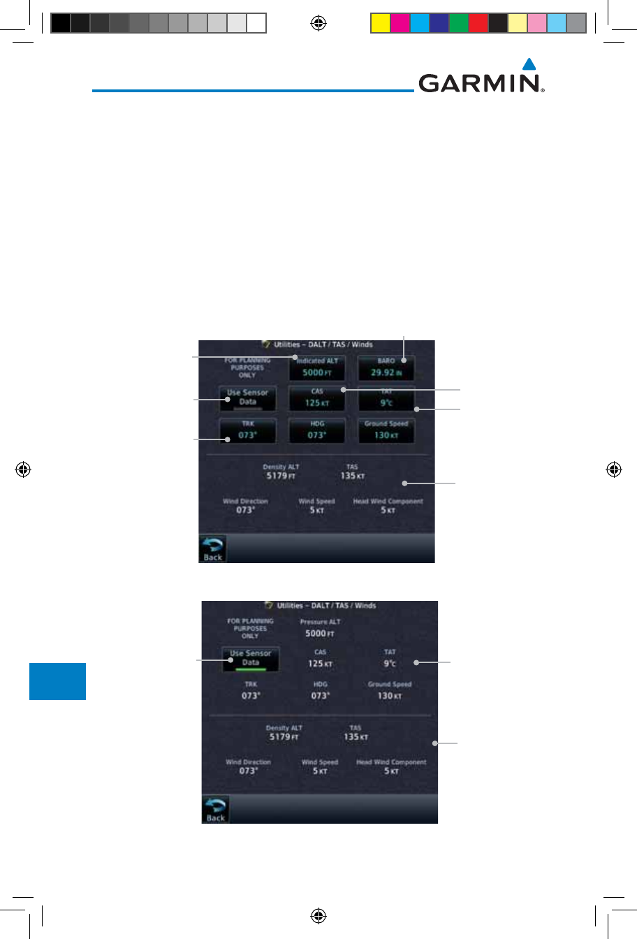
15-28
Garmin GTN 725/750 Pilot’s Guide
190-01007-03 Rev. J
Foreword
Getting
Started
Audio &
Xpdr Ctrl
Com/Nav
FPL
Direct-To
Proc
Charts
Wpt Info
Map
Traffic
Terrain
Weather
Nearest
Services/
Music
Utilities
System
Messages
Symbols
Appendix
Index
15.6 DALT/TAS/Winds
Density Alt / TAS / Winds — indicates the theoretical altitude at which
your aircraft performs depending upon several variables, including indicated
altitude (Indicated ALT), barometric pressure (BARO) and total air tempera-
ture (TAT; the temperature, including the heating effect of speed, read on
a standard outside temperature gauge). This item computes true airspeed
(TAS) and density altitude, based upon the factors above. Also, this feature
determines winds aloft — the wind direction and speed — and a head
wind/tail wind component, based on true airspeed, aircraft heading (HDG)
and ground speed. When a FADC provides pressure altitude and the Use
Sensor Data option is selected, the Baro key will not be present in the edit
mode and the Baro indication will not be shown in computed results.
Touch To Select
Indicated Altitude
DALT, TAS, and
Winds Statistics
Touch To Select Baro Pressure
Touch To Select
Calibrated Air
Speed
Touch To Select
Total Air Temp
TRK, HDG, &
GS Statistics
Touch To Toggle
Sensor Data Use
Figure 15-35 Utility DALT/TAS/Winds Page Using Indicated Altitude and Not Using Sensor Data
DALT, TAS, and
Winds Statistics
TRK, HDG, &
GS Statistics
Touch To Toggle
Sensor Data Use
Figure 15-36 Utility DALT/TAS/Winds Page Using Sensor Data and Pressure Altitude
190-01007-03-Final.indb 28 7/9/2015 2:08:36 PM
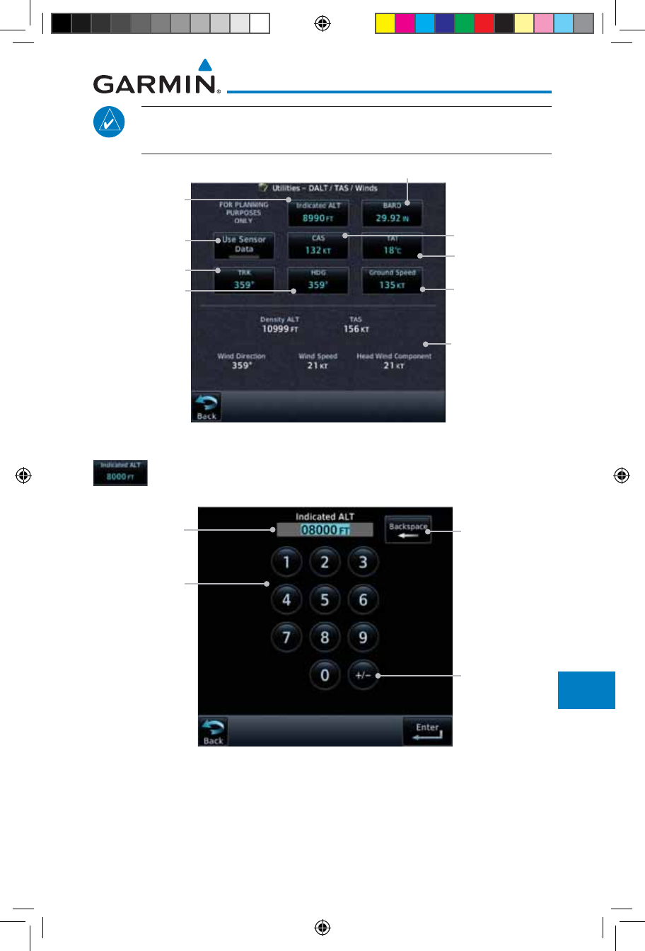
15-29190-01007-03 Rev. J
Garmin GTN 725/750 Pilot’s Guide
Foreword
Getting
Started
Audio &
Xpdr Ctrl
Com/Nav
FPL
Direct-To
Proc
Charts
Wpt Info
Map
Traffic
Terrain
Weather
Nearest
Services/
Music
Utilities
System
Messages
Symbols
Appendix
Index
NOTE: The capability of using Sensor Data for the trip planning functions
is available in SW Versions 2.00, 4.10, and later.
Touch To Select
Ground Speed
Touch To Select
Indicated Altitude
DALT, TAS, and
Winds Statistics
Touch To Select Baro Pressure
Touch To Select
Calibrated Air
Speed
Touch To Select
Total Air Temp
Touch To Select
Track Value
Touch To Select
Heading Value
Touch To Toggle
Sensor Data Use
Figure 15-37 Utility DALT/TAS/Winds Page Using Manually Entered Data
1. Touch the Indicated ALT key and then the keypad to select
the Indicated Altitude and then touch Enter.
Touch To Select
Indicated
Altitude Value
Selected
Indicated
Altitude Value
Touch To Clear
Values
Touch To
Select Above
Or Below Sea
Level
Figure 15-38 Select Indicated Altitude Value
190-01007-03-Final.indb 29 7/9/2015 2:08:36 PM
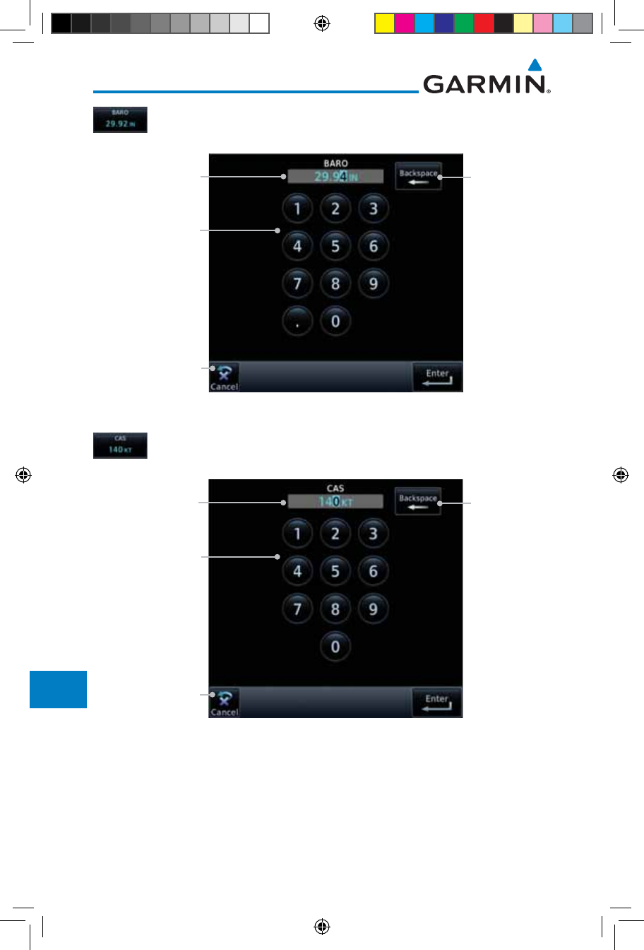
15-30
Garmin GTN 725/750 Pilot’s Guide
190-01007-03 Rev. J
Foreword
Getting
Started
Audio &
Xpdr Ctrl
Com/Nav
FPL
Direct-To
Proc
Charts
Wpt Info
Map
Traffic
Terrain
Weather
Nearest
Services/
Music
Utilities
System
Messages
Symbols
Appendix
Index
2. Touch the BARO key and then the keypad to select the
Barometric Pressure and then touch Enter.
Touch To Select
Barometric Pressure
Value
Selected Barometric
Pressure Value Touch To Clear
Values
Touch To Cancel
Selection
Figure 15-39 Select Barometric Pressure Value
3. Touch the CAS key and then the keypad to select the Calibrated
Air Speed and then touch Enter.
Touch To Select
Calculated Air
Speed Value
Selected Calculated
Air Speed Value Touch To Clear
Values
Touch To Cancel
Selection
Figure 15-40 Select Calculated Air Speed Value
190-01007-03-Final.indb 30 7/9/2015 2:08:37 PM
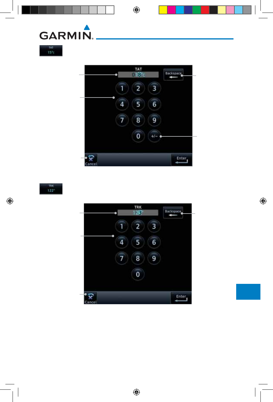
15-31190-01007-03 Rev. J
Garmin GTN 725/750 Pilot’s Guide
Foreword
Getting
Started
Audio &
Xpdr Ctrl
Com/Nav
FPL
Direct-To
Proc
Charts
Wpt Info
Map
Traffic
Terrain
Weather
Nearest
Services/
Music
Utilities
System
Messages
Symbols
Appendix
Index
4. Touch the TAT key and then the keypad to select the Total Air
Temperature and touch Enter.
Touch To
Select Total Air
Temperature
Value
Selected Total
Air Temperature
Value
Touch To Clear
Values
Touch To
Select Above
Or Below 0
Degrees
Touch To Cancel
Selection
Figure 15-41 Select Total Air Temperature Value
5. Touch the TRK key and then the keypad to select the Track
Angle and then touch Enter.
Touch To Select
Track Angle
Value
Selected Track
Angle Value Touch To Clear
Values
Touch To Cancel
Selection
Figure 15-42 Select Track Angle Value
190-01007-03-Final.indb 31 7/9/2015 2:08:37 PM
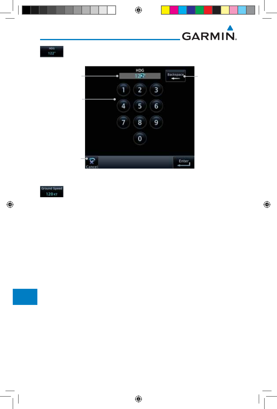
15-32
Garmin GTN 725/750 Pilot’s Guide
190-01007-03 Rev. J
Foreword
Getting
Started
Audio &
Xpdr Ctrl
Com/Nav
FPL
Direct-To
Proc
Charts
Wpt Info
Map
Traffic
Terrain
Weather
Nearest
Services/
Music
Utilities
System
Messages
Symbols
Appendix
Index
6. Touch the HDG key and then the keypad to select the Heading
value and then touch Enter.
Touch To Select
Heading Value
Selected
Heading Value Touch To Clear
Values
Touch To Cancel
Selection
Figure 15-43 Select Heading Value
7. Touch the Ground Speed key and then the keypad to select
the average ground speed for the trip and then touch Enter.
190-01007-03-Final.indb 32 7/9/2015 2:08:37 PM
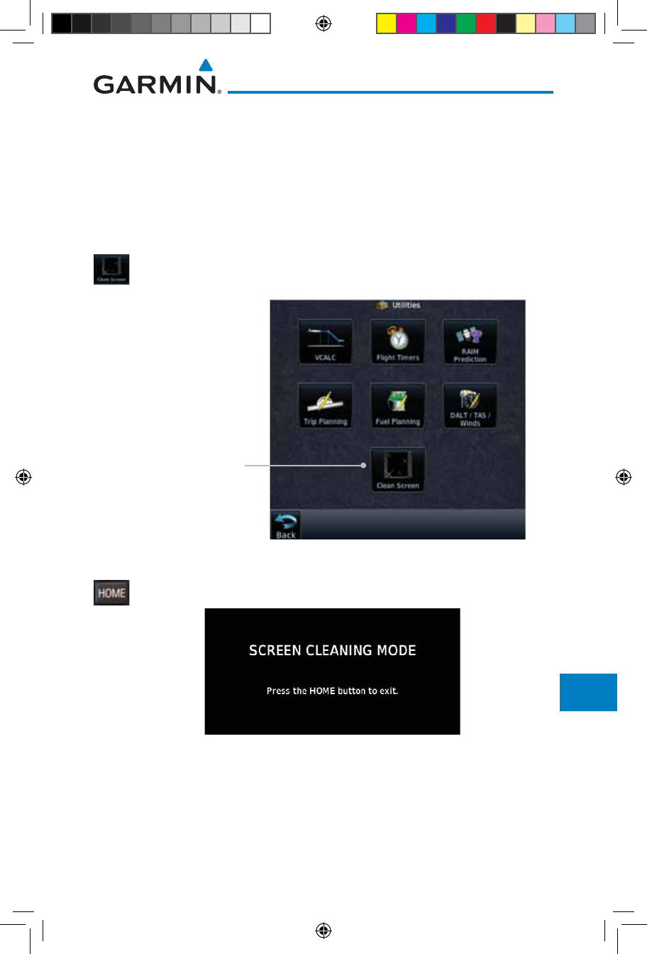
15-33190-01007-03 Rev. J
Garmin GTN 725/750 Pilot’s Guide
Foreword
Getting
Started
Audio &
Xpdr Ctrl
Com/Nav
FPL
Direct-To
Proc
Charts
Wpt Info
Map
Traffic
Terrain
Weather
Nearest
Services/
Music
Utilities
System
Messages
Symbols
Appendix
Index
15.7 Clean Screen Mode
The Clean Screen mode makes the touchscreen inactive so the display can
be manually cleaned. The front bezel, keypad, and display can be cleaned with
a microfiber cloth or with a soft cotton cloth dampened with clean water. DO
NOT use any chemical cleaning agents. Care should be taken to avoid scratching
the surface of the display.
1. While viewing the Utilities page group, touch the Clean
Screen key to start Screen Cleaning Mode.
Touch To Clean Screen
Figure 15-44 Utilities Page
2. Touch the HOME key to exit Screen Cleaning Mode.
Figure 15-45 Screen Cleaning Mode
190-01007-03-Final.indb 33 7/9/2015 2:08:37 PM
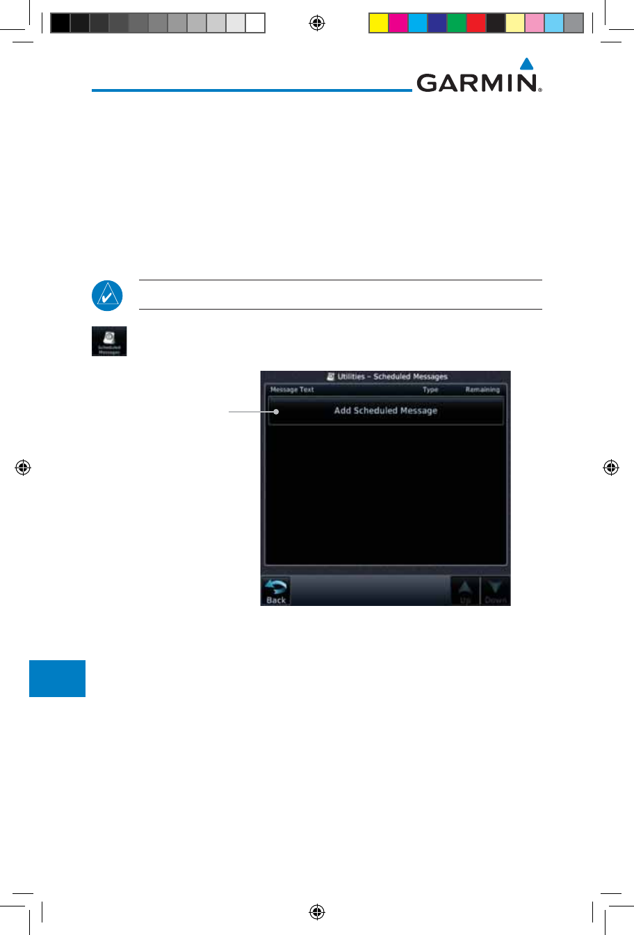
15-34
Garmin GTN 725/750 Pilot’s Guide
190-01007-03 Rev. J
Foreword
Getting
Started
Audio &
Xpdr Ctrl
Com/Nav
FPL
Direct-To
Proc
Charts
Wpt Info
Map
Traffic
Terrain
Weather
Nearest
Services/
Music
Utilities
System
Messages
Symbols
Appendix
Index
15.8 Scheduled Messages
The Scheduled Messages utility displays reminder messages (such as “Change
oil”, “Switch fuel tanks”, “Overhaul”, etc.). One-time, periodic, and event-based
messages are allowed. One-time messages appear once the timer expires and
reappear each time the GTN-series unit is powered on, until the message is
deleted. Periodic messages automatically reset to the original timer value, once
the message is displayed. Event-based messages do not use a timer, but rather a
specific date and time.
NOTE: This feature is available in SW Versions 5.00, and later.
1. While viewing the Utilities page group, touch the Scheduled
Messages key to start the Scheduled Messages function.
Touch To Add A
Scheduled Message
Figure 15-46 Scheduled Messages Page
190-01007-03-Final.indb 34 7/9/2015 2:08:37 PM
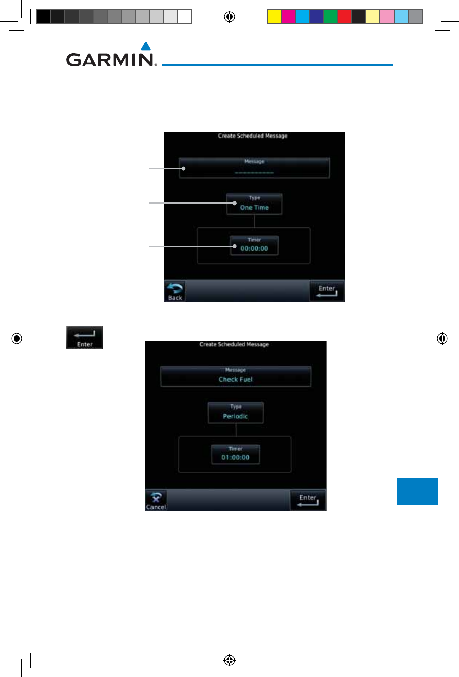
15-35190-01007-03 Rev. J
Garmin GTN 725/750 Pilot’s Guide
Foreword
Getting
Started
Audio &
Xpdr Ctrl
Com/Nav
FPL
Direct-To
Proc
Charts
Wpt Info
Map
Traffic
Terrain
Weather
Nearest
Services/
Music
Utilities
System
Messages
Symbols
Appendix
Index
2. Touch the Message selection and enter the desired message to
be displayed. Touch the Type selection to choose the message
type. Touch the Timer selection to set the countdown time for
the message to be displayed.
Touch To Enter
Message Text
Touch To Select
Message Type
Touch To
Enter Message
Countdown Timer
Figure 15-47 Create a Scheduled Message
2. After completing the selections, touch the Enter key.
Figure 15-48 Sample Scheduled Message
190-01007-03-Final.indb 35 7/9/2015 2:08:38 PM
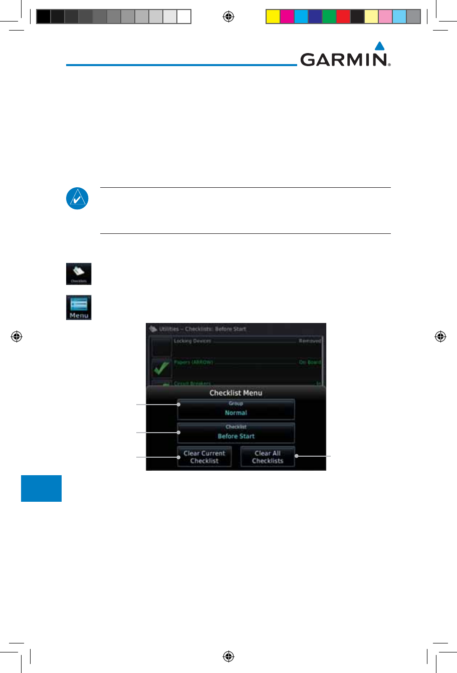
15-36
Garmin GTN 725/750 Pilot’s Guide
190-01007-03 Rev. J
Foreword
Getting
Started
Audio &
Xpdr Ctrl
Com/Nav
FPL
Direct-To
Proc
Charts
Wpt Info
Map
Traffic
Terrain
Weather
Nearest
Services/
Music
Utilities
System
Messages
Symbols
Appendix
Index
15.9 Checklists
The Checklists function provides a built-in method of reviewing your aircraft
checklist. Checklists are created using the Garmin Checklist Editor software
(available online) and stored on the data card as “chklist.ace.” As each Checklist
is completed, you can advance to the next one in order. In the Checklist Menu,
you can access any Checklist, or group of Checklists, and clear the current or
all Checklists.
NOTE: This feature is available in SW Versions 5.10, and later. In software
version 6.00 and later, the installer may configure the title of this feature
to be Task Lists or Checklists.
15.9.1 Checklists Menu
1. While viewing the Utilities page group, touch the Checklists
key to start the Checklists function.
2. Touch the Menu key to select an option from the Checklist
Menu.
Touch To Clear
Current Checklist
Touch To Clear
All Checklists
Touch To Select
A Checklist
Touch To Select A
Checklist Group
Figure 15-49 Utility Checklist Menu
190-01007-03-Final.indb 36 7/9/2015 2:08:38 PM
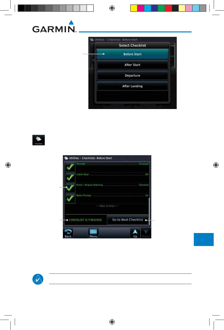
15-37190-01007-03 Rev. J
Garmin GTN 725/750 Pilot’s Guide
Foreword
Getting
Started
Audio &
Xpdr Ctrl
Com/Nav
FPL
Direct-To
Proc
Charts
Wpt Info
Map
Traffic
Terrain
Weather
Nearest
Services/
Music
Utilities
System
Messages
Symbols
Appendix
Index
Touch To Select
A Checklist
Figure 15-50 Select a Checklist from the Checklist Menu
15.9.2 Viewing Checklists
1. While viewing the Utilities function, touch the Checklist key.
Use the existing Checklists in the order provided or touch the
Menu key to select another checklist.
Completed
Checklist Item
Checklist
Status
Touch To Advance
To Next Checklist
Figure 15-51 Checklist Completion
2. After completing the Checklist, touch Go to Next Checklist,
Menu, or Back to exit the Checklist function.
NOTE:
All checklists are cleared after a power cycle.
190-01007-03-Final.indb 37 7/9/2015 2:08:38 PM
15-38
Garmin GTN 725/750 Pilot’s Guide
190-01007-03 Rev. J
Foreword
Getting
Started
Audio &
Xpdr Ctrl
Com/Nav
FPL
Direct-To
Proc
Charts
Wpt Info
Map
Traffic
Terrain
Weather
Nearest
Services/
Music
Utilities
System
Messages
Symbols
Appendix
Index
This page intentionally left blank
190-01007-03-Final.indb 38 7/9/2015 2:08:38 PM
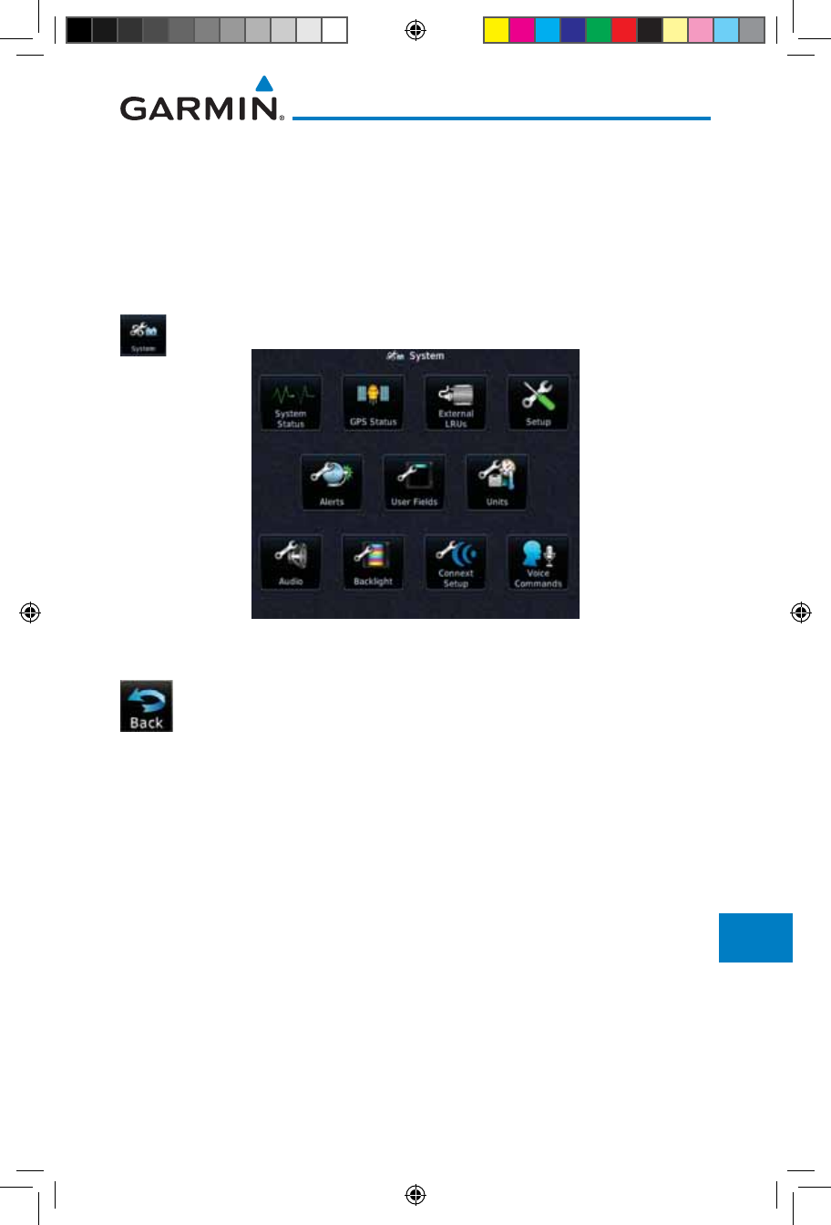
16-1190-01007-03 Rev. J
Garmin GTN 725/750 Pilot’s Guide
Foreword
Getting
Started
Audio &
Xpdr Ctrl
Com/Nav
FPL
Direct-To
Proc
Charts
Wpt Info
Map
Traffic
Terrain
Weather
Nearest
Services/
Music
Utilities
System
Messages
Symbols
Appendix
Index
16 SYSTEM
The System function allows you to change unit settings, customize operation
to your preferences, and check on the operation of your unit. The System pages
cover System Status, Database Info and transfer, GPS Status, External LRUs,
Setup, Alerts, Units, Audio, Backlight control function, and Connext Setup.
1. From the Home page, touch the System key.
Figure 16-1 System Home Page
2. Touch the desired key to reach that function. To return to the
System page, touch the Back key.
190-01007-03-Final.indb 1 7/9/2015 2:08:39 PM

16-2
Garmin GTN 725/750 Pilot’s Guide
190-01007-03 Rev. J
Foreword
Getting
Started
Audio &
Xpdr Ctrl
Com/Nav
FPL
Direct-To
Proc
Charts
Wpt Info
Map
Traffic
Terrain
Weather
Nearest
Services/
Music
Utilities
System
Messages
Symbols
Appendix
Index
Manual Offset
Arrival Destination Proximity
Class B/TMA
Class C/TCA
Class D
Restricted
MOA (Military)
Other
Airspace Altitude Buffer
CDI
Date/Time
Com/Nav
Nearest Airport
Crossfill
Volume
TAWS Alert Voice
Serial No. & Sys ID
SW/HW Version Info
Database Info
SBAS WAAS
Nav Angle
Mag Var
Temp
Fuel
Position Format
Connext Setup **
* - Available When Space Allows On Top Row
** - Optional
User Fields *
Voice Commands **
Figure 16-2 System Function Summary
190-01007-03-Final.indb 2 7/9/2015 2:08:39 PM
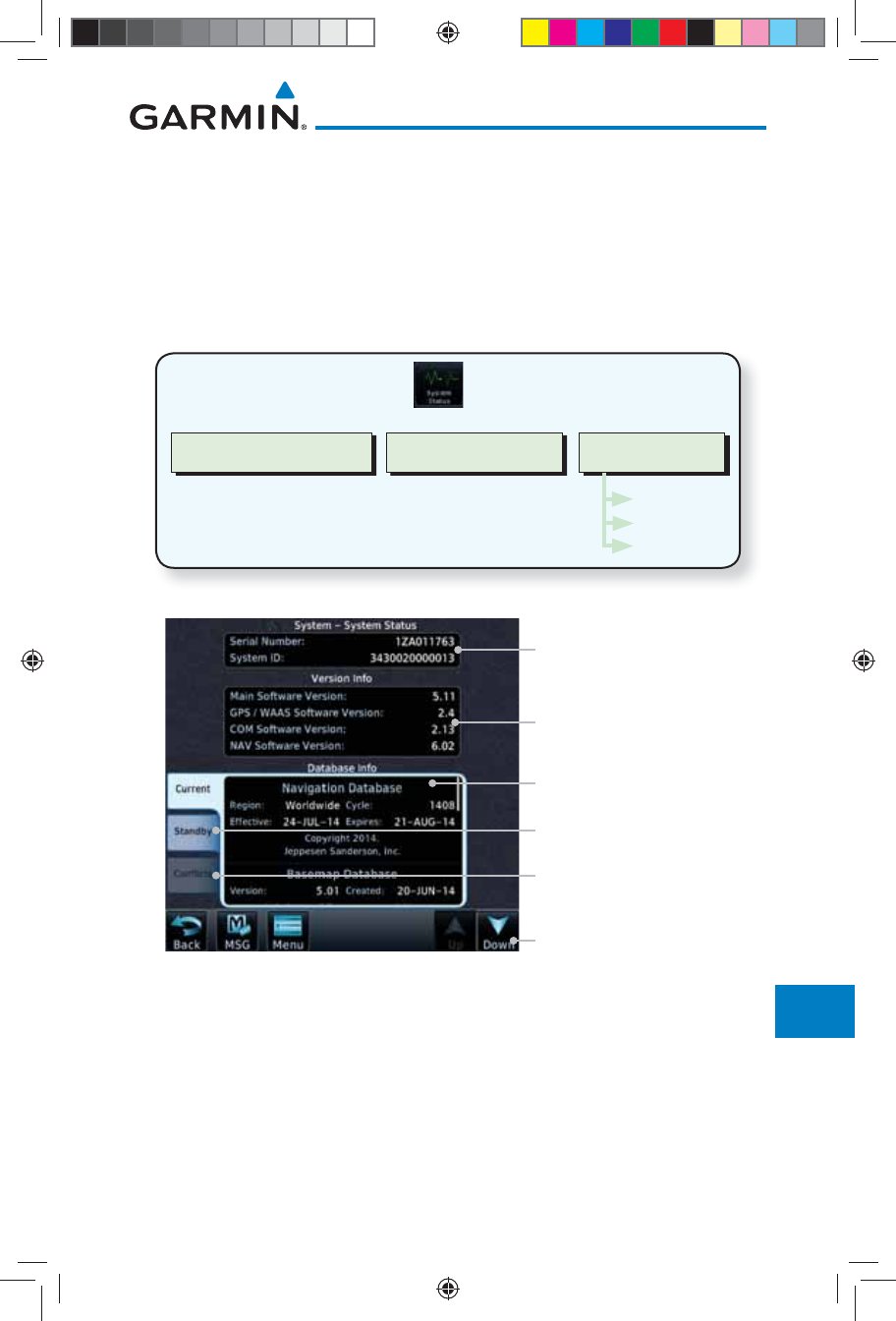
16-3190-01007-03 Rev. J
Garmin GTN 725/750 Pilot’s Guide
Foreword
Getting
Started
Audio &
Xpdr Ctrl
Com/Nav
FPL
Direct-To
Proc
Charts
Wpt Info
Map
Traffic
Terrain
Weather
Nearest
Services/
Music
Utilities
System
Messages
Symbols
Appendix
Index
16.1 System Status
The System status page of the System function provides information about
the GTN unit and the equipment attached to it. This information is useful if it
is necessary to contact Customer Service. The System Status page shows the
System ID and serial number for the GTN unit, hardware and software versions,
as well as a list of the installed databases.
Software VersionsSerial # & System ID Database Info
Current
Standby
Conflicts
Figure 16-3 System Status Functional Diagram
Serial No. And System ID
Internal SW Versions
Current Database Information
Touch To Scroll List
Database Not Active and On
Standby
Database Conflicts
Figure 16-4 System Function System Status Page Description
190-01007-03-Final.indb 3 7/9/2015 2:08:39 PM
16-4
Garmin GTN 725/750 Pilot’s Guide
190-01007-03 Rev. J
Foreword
Getting
Started
Audio &
Xpdr Ctrl
Com/Nav
FPL
Direct-To
Proc
Charts
Wpt Info
Map
Traffic
Terrain
Weather
Nearest
Services/
Music
Utilities
System
Messages
Symbols
Appendix
Index
1. While viewing the System page, touch System Status.
2. Use the Up and Down arrow keys as needed to view the
Database Information.
3. Touch the Back key to return to the System page.
16.1.1 Serial Number and System ID
The System Status section shows the unit Serial Number and the System ID.
16.1.2 Version Information
The software versions of the GTN unit are displayed. This information is
useful when contacting Customer Support.
16.1.3 Database Information
The Database Information section lists the name of the database, its version,
and expiration date for the currently used databases, and also contains the
Database SYNC function. Standby databases are listed for databases not currently
used, but available on the data card. Database conflicts will be shown in the
Conflicts section.
NOTE: The data contained in the terrain and obstacle databases comes from
government and private agencies. Garmin accurately processes and cross-
validates the data, but cannot guarantee the accuracy and completeness
of the data.
The following databases are stored on Supplemental Data Cards provided by
Garmin:
• Terrain – The terrain database contains terrain mapping data. It is updated
periodically and has no expiration date. Approximately one minute is
required to verify the rotorcraft terrain database on start up.
• Obstacles – The obstacles database contains data for obstacles, such as
towers, that pose a potential hazard to aircraft. Obstacles 200 feet and
higher are included in the obstacle database. The rotorcraft database
includes all reported obstacles regardless of height. It is very important to
note that not all obstacles are necessarily charted and therefore may not
be contained in the obstacle database. This database is updated on a 56-
day cycle. Obstacles will still be shown after the database has expired.
190-01007-03-Final.indb 4 7/9/2015 2:08:39 PM
16-5190-01007-03 Rev. J
Garmin GTN 725/750 Pilot’s Guide
Foreword
Getting
Started
Audio &
Xpdr Ctrl
Com/Nav
FPL
Direct-To
Proc
Charts
Wpt Info
Map
Traffic
Terrain
Weather
Nearest
Services/
Music
Utilities
System
Messages
Symbols
Appendix
Index
Several obstacle database options are available. Obstacle databases created
for GTN software version 5.10 or later include all power lines or only HOT
lines depending on the type of obstacle database installed. Hazardous
Obstacle Transmission (HOT) Lines are those power lines that are co-located
with other FAA-identified obstacles. The installed obstacle database type
can be verified on the System Status page. Power line data is available for
the contiguous United States as well as small parts of Canada and Mexico.
• SafeTaxi – The SafeTaxi database contains detailed airport diagrams
for selected airports. These diagrams aid in following ground control
instructions by accurately displaying the aircraft position on the map in
relation to taxiways, ramps, runways, terminals, and services. This database
is updated on a 56-day cycle. SafeTaxi will still be shown after it has expired.
• FliteCharts – The FliteCharts database contains procedure charts for the
United States only. This database is updated on a 28-day cycle. If not updated
within 180 days of the expiration date, FliteCharts no longer functions.
• Basemap - The Basemap database contains land and water data, such as
roads, boundaries, rivers, and lakes.
• Aviation – The Navigation database is updated on a 28 day cycle. Navigation
database updates are provided by Garmin and may be downloaded from the
Garmin web site “http://fly.garmin.com” or from Jeppesen at "http://www.
jeppdirect.com/Garmin" onto a Garmin provided Supplemental Datacard.
Contact Garmin at http://fly.garmin.com for navigation database updates
and update kits.
• Charts – The optional ChartView database is updated on a 14 day cycle. The
ChartView database is provided directly from Jeppesen. Contact Jeppesen
(www.jeppesen.com) for ChartView subscription and update information.
NOTE: Do not use SafeTaxi or Chartview functions as the basis for ground
maneuvering. SafeTaxi and Chartview functions do not comply with the
requirements of AC 20-159 and are not qualified to be used as an airport
moving map display (AMMD). SafeTaxi and Chartview are to be used by
the flight crew to orient themselves on the airport surface to improve pilot
situational awareness during ground operations.
190-01007-03-Final.indb 5 7/9/2015 2:08:39 PM
16-6
Garmin GTN 725/750 Pilot’s Guide
190-01007-03 Rev. J
Foreword
Getting
Started
Audio &
Xpdr Ctrl
Com/Nav
FPL
Direct-To
Proc
Charts
Wpt Info
Map
Traffic
Terrain
Weather
Nearest
Services/
Music
Utilities
System
Messages
Symbols
Appendix
Index
Database
Name
Function Where
Stored
Update
Cycle
Provider Notes
Aviation Airport, NAVAID,
Waypoint, and
Airspace information
Internal
memory
28 days fly.garmin.com Updates installed via
SD card and copied
into internal memory.
For helicopter
applications an
Aviation database
that includes
additional heliports is
available.
SafeTaxi Airport surface
diagrams
Internal
memory
56 days fly.garmin.com Updates installed via
SD card and copied
into internal memory
Terrain Topographic map,
Terrain/TAWS
SD card As required fly.garmin.com Systems using HTAWS
require a 2.5 arc-
second database.
Obstacle Obstacle information
for map, and TAWS
Internal
memory
56 days fly.garmin.com Updates installed via
SD card and copied
into internal memory.
Databases that
include HOT lines
and power lines are
available for use
with GTN software
version 5.10, or
later. For helicopter
applications, Obstacle
databases that
include additional
low height obstacles
and power lines are
available.
Basemap Boundary and road
information
Internal
Memory
As required fly.garmin.com Updates installed via
SD card and copied
into internal memory
FliteCharts FAA-published
terminal procedures
SD card 28 days fly.garmin.com Disables 180 days
after expiration date.
ChartView Jeppesen terminal
procedures
SD card 14 days Contact
Jeppesen
Optional feature
that requires Garmin
dealer enablement.
Disables 70 days after
expiration date.
Table 16-1 Database List
190-01007-03-Final.indb 6 7/9/2015 2:08:40 PM
16-7190-01007-03 Rev. J
Garmin GTN 725/750 Pilot’s Guide
Foreword
Getting
Started
Audio &
Xpdr Ctrl
Com/Nav
FPL
Direct-To
Proc
Charts
Wpt Info
Map
Traffic
Terrain
Weather
Nearest
Services/
Music
Utilities
System
Messages
Symbols
Appendix
Index
16.1.3.1 Database Info
The Database Info page shows the Current databases, databases on Standby
on the SD card for future use, and database conflicts. Current databases show all
databases that are currently being used. Standby databases are loaded onto the
card, but are not being used. Database conflicts are shown and can be resolved
in the Conflicts tab.
16.1.3.2 Database Sync Operation
Database SYNC allows the GTN to synchronize databases from a single unit.
The pilot only needs to update a single database card and the new databases are
automatically SYNC'd through the units connected in the cockpit and configured
for Database Syncing.
Database SYNC is supported by these database types:
• Navigation
• Obstacle
• SafeTaxi
• Airport Directory
• Chartview (when support is added by Jeppesen)
• FliteCharts
• Basemap
When Database SYNC is enabled in the LRUs and a database card is inserted
that is created for Database SYNC, the GTN will coordinate with the other
LRUs in the cockpit to determine which unit has the newest databases. Once
the determination has occurred, the connected LRUs will begin to transfer the
databases. This process may take several minutes. The status of the database
transfers to a unit can be viewed on the System Status page under the “Standby”
tab. The GTN will display the source of the received databases (in this example:
“Database SYNC - GTN #2”). If a database transfer is pending, completed, or not
authorized, the status will also be indicated.
When the transfer is complete, if there are new and current databases to
be used, and if the aircraft is stopped and has yet to takeoff, the pilot will
be prompted with the option to restart the unit that has the new databases
transferred to it. During the restart process, the unit will prompt you to update
(transfer from the card to the unit's memory) to the newer databases so they can
be used.
190-01007-03-Final.indb 7 7/9/2015 2:08:40 PM
16-8
Garmin GTN 725/750 Pilot’s Guide
190-01007-03 Rev. J
Foreword
Getting
Started
Audio &
Xpdr Ctrl
Com/Nav
FPL
Direct-To
Proc
Charts
Wpt Info
Map
Traffic
Terrain
Weather
Nearest
Services/
Music
Utilities
System
Messages
Symbols
Appendix
Index
NOTE: This feature is available in SW Versions 5.10, and later.
NOTE: When a database card is inserted into a GTN that does not support
certain types of databases (charts in a GTN 6XX or an airport directory in
any GTN), the GTN is still capable of SYNCing the database to other LRUs
that do support that database.
NOTE: Restarting the GTN must only be performed when the aircraft is
on the ground as navigation and communication from the restarted unit
will be lost for a period of time.
1. With the GTN turned off, insert the database card.
2. Turn the GTN on. The Database SYNC will occur automatically
in the background. During the Database SYNC process, normal
operation of the GTN is not affected.
3. On the System Status page, touch the Standby tab to view
the transfer process.
Figure 16-5 Database Transfer In Process
Figure 16-6 Database Pending
190-01007-03-Final.indb 8 7/9/2015 2:08:40 PM
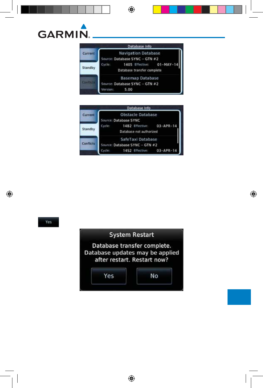
16-9190-01007-03 Rev. J
Garmin GTN 725/750 Pilot’s Guide
Foreword
Getting
Started
Audio &
Xpdr Ctrl
Com/Nav
FPL
Direct-To
Proc
Charts
Wpt Info
Map
Traffic
Terrain
Weather
Nearest
Services/
Music
Utilities
System
Messages
Symbols
Appendix
Index
Figure 16-7 Database Transfer Complete
Figure 16-8 Database Transfer Not Authorized
4. Once all of the database transfers have completed, if the GTN
determines that at least one of the newly transferred databases
is effective and the aircraft is on the ground and stopped prior
to a flight, a pop-up and confirmation will be presented to
restart the GTN. No pop-up will appear if the aircraft is moving
or has been in the air since the GTN was turned on.
5. Touch Yes to continue updating the database.
Figure 16-9 System Restart - Step 1
190-01007-03-Final.indb 9 7/9/2015 2:08:40 PM
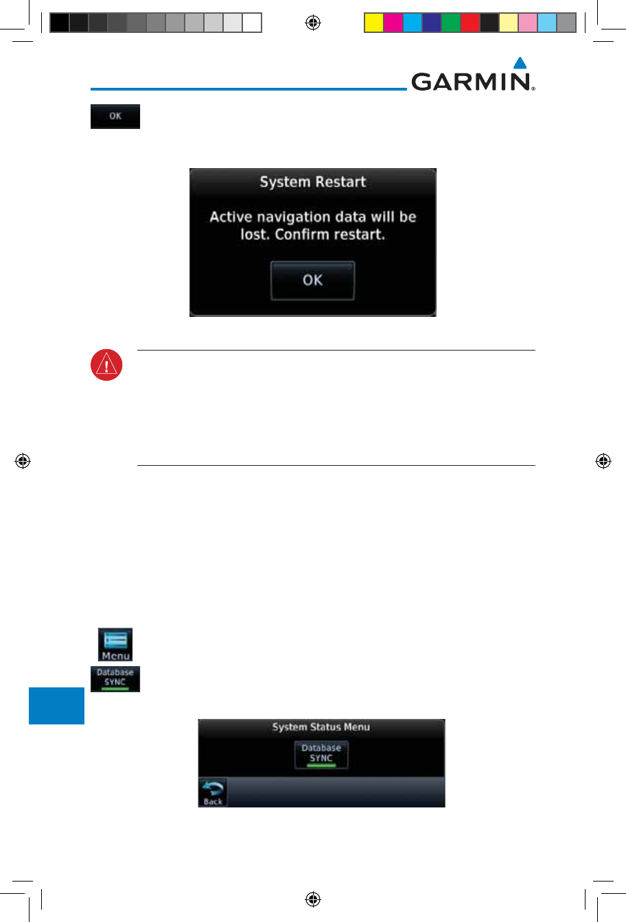
16-10
Garmin GTN 725/750 Pilot’s Guide
190-01007-03 Rev. J
Foreword
Getting
Started
Audio &
Xpdr Ctrl
Com/Nav
FPL
Direct-To
Proc
Charts
Wpt Info
Map
Traffic
Terrain
Weather
Nearest
Services/
Music
Utilities
System
Messages
Symbols
Appendix
Index
6. Touch OK to complete the restart process. Following the
restart, the pilot will be prompted to update to the effective
databases (just like when a new database card is inserted).
Figure 16-10 System Restart - Step 2
WARNING: The unit will reset and all GPS navigation and moving map
functions may be lost while the unit regains GPS position. Communication
functions will be lost for a few seconds while the unit resets. Additionally,
if the user selects to update databases at that point, the ability to interact
with the GMA 35 audio panel, or change com frequencies will be lost until
all databases are updated.
7. When the unit restarts, the pilot will be prompted to update
the GTN to the newly transferred databases.
16.1.3.3 Database Sync Setup
When the GTN installer option is turned on to allow Database SYNC, the
pilot controls are available to turn Database SYNC on or off (Database SYNC is
turned on by default).
To change the Database SYNC preference:
1. While viewing the System Status page, touch the Menu key and
then touch the Database SYNC key to enable or disable the
Database SYNC feature. Once the feature is enabled, Database
SYNC will occur automatically when a card is inserted into the
GTN.
Figure 16-11 Database Sync from System Status Menu
190-01007-03-Final.indb 10 7/9/2015 2:08:40 PM
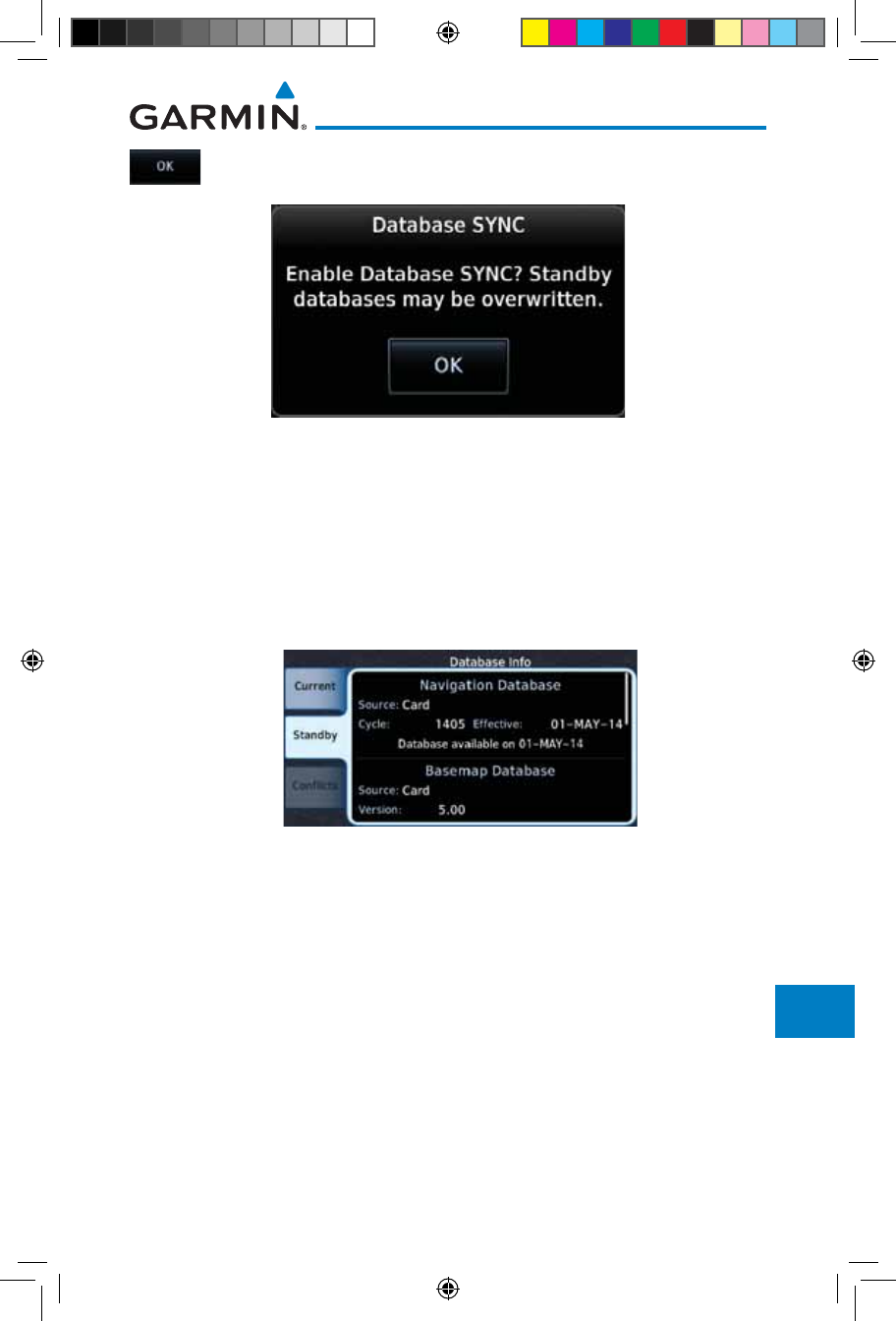
16-11190-01007-03 Rev. J
Garmin GTN 725/750 Pilot’s Guide
Foreword
Getting
Started
Audio &
Xpdr Ctrl
Com/Nav
FPL
Direct-To
Proc
Charts
Wpt Info
Map
Traffic
Terrain
Weather
Nearest
Services/
Music
Utilities
System
Messages
Symbols
Appendix
Index
2. Touch OK at the prompt to confirm the enabling of Database
SYNC.
Figure 16-12 Prompt to Continue Database Transfer
16.1.3.4 Standby Databases
The GTN supports a standby copy of each database, allowing the pilot to pre-
load the next cycle without losing the active cycle. The GTN will automatically
treat any received database (via SD card or Database SYNC) as the standby
database until it is activated by the pilot. The standby databases are listed on the
System Status page.
Figure 16-13 Database Standby Display
The GTN will use Database SYNC in the background to SYNC the standby
database with other LRUs in the cockpit. As a result, when the standby database
becomes effective, the pilot will be prompted on all LRUs to update to the new
database.
If a the standby database is out of date or not yet effective, the pilot will not
be prompted to update to that database until it becomes effective. This prevents
the pilot from accidentally overwriting the effective, active database.
If the pilot does actually want to overwrite the active database with a not yet
effective or out of date database, they can do so by pressing and holding the
small right knob while applying power to the GTN.
190-01007-03-Final.indb 11 7/9/2015 2:08:40 PM
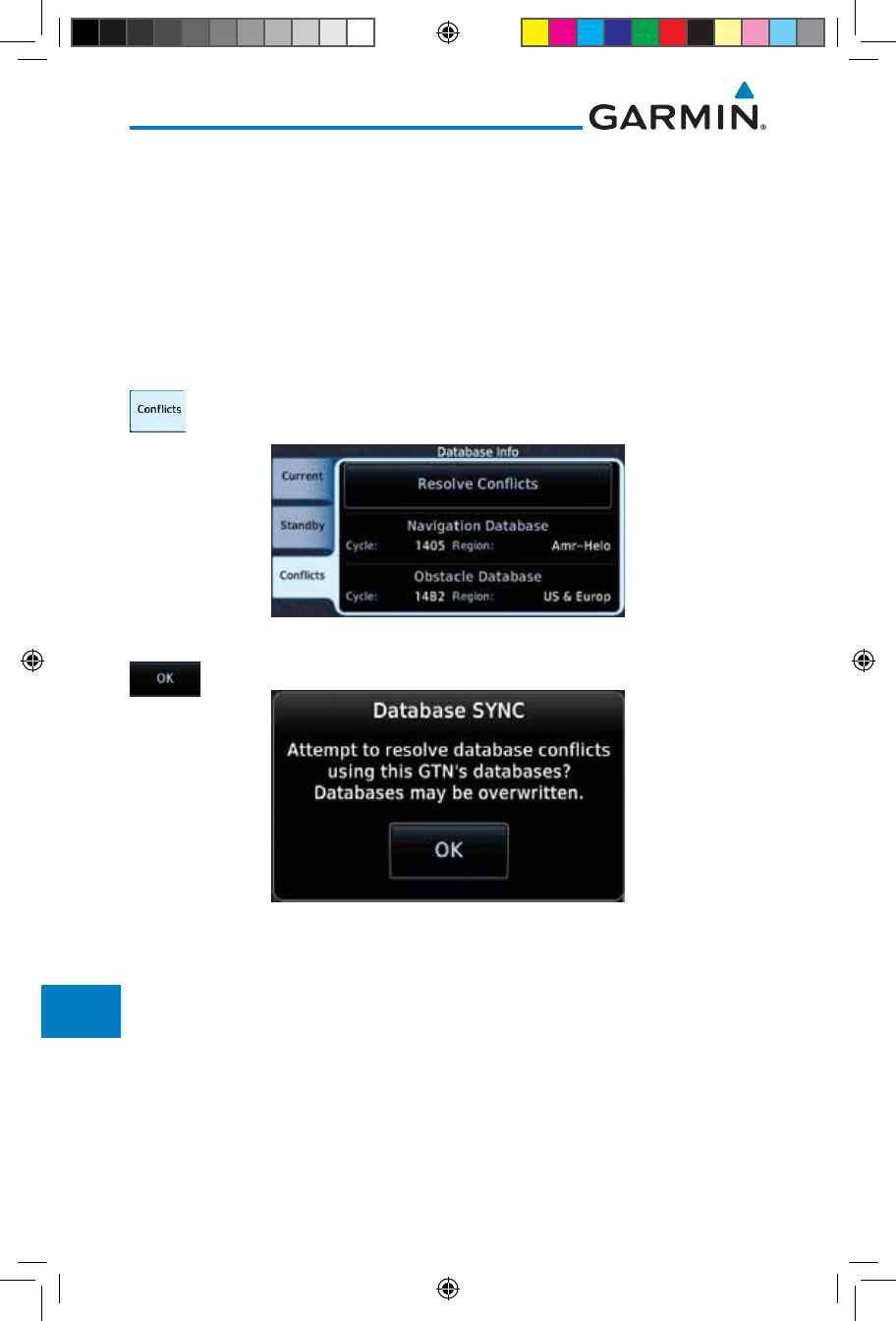
16-12
Garmin GTN 725/750 Pilot’s Guide
190-01007-03 Rev. J
Foreword
Getting
Started
Audio &
Xpdr Ctrl
Com/Nav
FPL
Direct-To
Proc
Charts
Wpt Info
Map
Traffic
Terrain
Weather
Nearest
Services/
Music
Utilities
System
Messages
Symbols
Appendix
Index
16.1.3.5 Resolving Database Conflicts
If the GTN determines that there are multiple LRUs with the newest cycle of
a database, but they have different regions or types of that database (i.e.; Fixed-
wing vs. Rotorcraft navigation database, different regions of the navigation
database, or different obstacle database types) then a database conflict will
occur. When a database conflict occurs, that database will not be SYNC'd until
the pilot resolves the conflict. Initiate the resolve conflicts function on the unit
that has the databases to send to the other units.
1. Touch the Conflicts tab, and then touch Resolve Conflicts
on the LRU with the desired databases.
Figure 16-14 Database Conflicts
2. Touch OK at the prompt to continue conflict resolution.
Figure 16-15 Confirm Conflict Resolution
190-01007-03-Final.indb 12 7/9/2015 2:08:40 PM
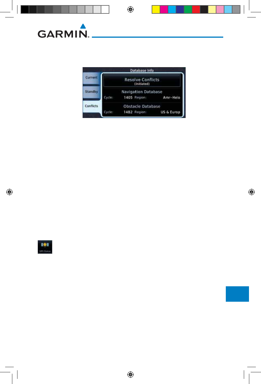
16-13190-01007-03 Rev. J
Garmin GTN 725/750 Pilot’s Guide
Foreword
Getting
Started
Audio &
Xpdr Ctrl
Com/Nav
FPL
Direct-To
Proc
Charts
Wpt Info
Map
Traffic
Terrain
Weather
Nearest
Services/
Music
Utilities
System
Messages
Symbols
Appendix
Index
3. Once touched, the desired database will be SYNC'd to the
other LRUs and “Initiated” will be displayed on the Resolve
Conflicts field.
Figure 16-16 Database Conflicts Resolved (Initiated)
16.2 GPS Status
16.2.1 GPS Status Page
The GPS Status Page provides a visual reference of GPS receiver functions,
including current satellite coverage, GPS receiver status, position accuracy, and
displays your present position (in latitude and longitude) and altitude. The GPS
Status Page also displays the current UTC time at the top right of the page.
The Satellite Status Page is helpful in troubleshooting weak (or missing) signal
levels due to poor satellite coverage or installation problems. You may wish to
refer to this page occasionally to monitor GPS receiver performance and establish
a normal pattern for system operation. Should problems occur at a later date, you
may find it helpful to have an established baseline from which to compare.
1. While viewing the System page, touch GPS Status.
190-01007-03-Final.indb 13 7/9/2015 2:08:41 PM
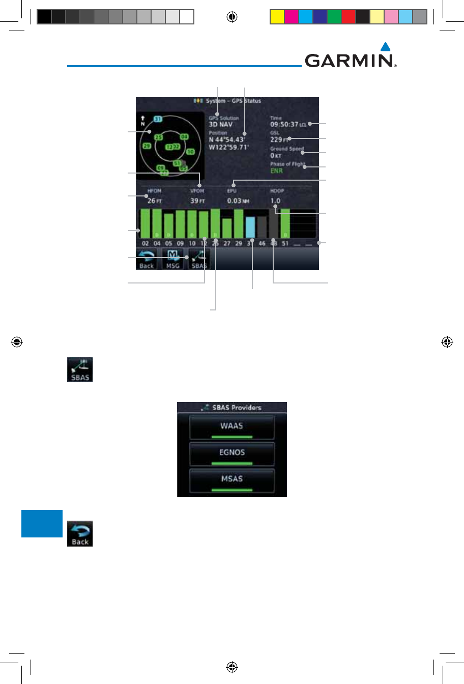
16-14
Garmin GTN 725/750 Pilot’s Guide
190-01007-03 Rev. J
Foreword
Getting
Started
Audio &
Xpdr Ctrl
Com/Nav
FPL
Direct-To
Proc
Charts
Wpt Info
Map
Traffic
Terrain
Weather
Nearest
Services/
Music
Utilities
System
Messages
Symbols
Appendix
Index
GPS Receiver Status
Sky View
of satellite
positions
Signal Strength
Bars Satellite Numbers
Horizontal
Figure of Merit
Estimated Position
Uncertainty
Acquiring
Satellite, not
ready for use
Satellite
acquired
and used for
position fix Satellite acquired,
used for position fix,
and has differential
corrections
Current UTC Time
Vertical Figure
of Merit
Lat/Lon Position
GPS Altitude
Horizontal Dilution
of Precision
Ground Speed
Phase of Flight
SBAS Selection
Tracked
Satellite, not
used
Figure 16-17 GPS Status Page
2. If desired, touch the SBAS key to select an SBAS provider. The
SBAS list is based on the Aviation database.
3. Touch the key for the desired SBAS provider.
Figure 16-18 SBAS Provider List
4. Touch the Back key to return to the System Status page.
190-01007-03-Final.indb 14 7/9/2015 2:08:41 PM
16-15190-01007-03 Rev. J
Garmin GTN 725/750 Pilot’s Guide
Foreword
Getting
Started
Audio &
Xpdr Ctrl
Com/Nav
FPL
Direct-To
Proc
Charts
Wpt Info
Map
Traffic
Terrain
Weather
Nearest
Services/
Music
Utilities
System
Messages
Symbols
Appendix
Index
As the GPS receiver locks onto satellites, a signal strength bar appears for each
satellite in view, with the appropriate satellite number (01-32, SBAS satellites will
have higher numbers) underneath each bar. The progress of satellite acquisition
is shown in the following stages:
Graph Symbol Description
No signal strength bars The receiver is looking for the satellites indicated.
Grey signal strength bars The receiver has found the satellite(s) and is collecting
data.
Yellow signal strength bars
The receiver has collected the necessary data but the
satellite is not being used in the position solution as it
has been excluded.
Cross-hatch cyan signal
strength bars
The receiver has found the satellite(s) but it has been
excluded by the FDE program as a faulty satellite.
Solid cyan signal strength
bars
The receiver has collected the necessary data, but is
not using the satellite in the position solution.
Solid green signal strength
bars
The receiver has collected the necessary data and the
satellite is being used in the position solution.
D
The “D” character inside the bars indicates differential
corrections (e.g. WAAS) are being used for that
satellite.
Table 16-2 Signal Strength Bar Graph Description
The Time and other data may not be displayed until the unit has acquired
enough satellites for a fix.
The sky view display at the left of the page shows the satellites currently in view
as well as their respective positions. The outer circle of the sky view represents
the horizon (with north at the top of the circle); the inner circle represents 45°
above the horizon and the center point shows the position directly overhead.
Each satellite has a 30-second data transmission that must be collected
(hollow signal strength bar) before the satellite may be used for navigation (solid
signal strength bar). Once the GPS receiver has determined your position, the
GTN unit indicates your position, altitude, track and ground speed. The GPS
receiver status field also displays the following messages under the appropriate
conditions:
190-01007-03-Final.indb 15 7/9/2015 2:08:41 PM
16-16
Garmin GTN 725/750 Pilot’s Guide
190-01007-03 Rev. J
Foreword
Getting
Started
Audio &
Xpdr Ctrl
Com/Nav
FPL
Direct-To
Proc
Charts
Wpt Info
Map
Traffic
Terrain
Weather
Nearest
Services/
Music
Utilities
System
Messages
Symbols
Appendix
Index
GPS Signal Message Description
Acquiring
The GPS receiver is acquiring satellites for navigation.
In this mode, the receiver uses satellite orbital data
(collected continuously from the satellites) and last
known position to determine the satellites that should
be in view.
3D Nav The GPS receiver is in 3D navigation mode and
computes altitude using satellite data.
3D Diff Nav The GPS receiver is in 3D navigation mode and
differential corrections are being used.
LOI
The “LOI” (Loss Of Integrity) annunciator (bottom left
corner of the screen) indicates that satellite coverage
is insufficient to pass built-in integrity monitoring
tests.
Table 16-3 GPS Signal Messages
The GPS Status Page also indicates the accuracy of the position fix, using
Horizontal Figure of Merit (HFOM), Vertical Figure of Merit (VFOM), and
Estimated Position Uncertainty (EPU). HFOM and VFOM represent the 95%
confidence levels in horizontal and vertical accuracy. The lowest numbers are
the best accuracy and the highest numbers are worse. EPU is the horizontal
position error estimated by the Fault Detection and Exclusion (FDE) algorithm,
in feet or meters.
190-01007-03-Final.indb 16 7/9/2015 2:08:41 PM
16-17190-01007-03 Rev. J
Garmin GTN 725/750 Pilot’s Guide
Foreword
Getting
Started
Audio &
Xpdr Ctrl
Com/Nav
FPL
Direct-To
Proc
Charts
Wpt Info
Map
Traffic
Terrain
Weather
Nearest
Services/
Music
Utilities
System
Messages
Symbols
Appendix
Index
NOTE: Operating outside of an SBAS service area with SBAS enabled
may cause elevated EPU values to be displayed on the satellite status
page. Regardless of the EPU value displayed, the LOI annunciation is the
controlling indication for determining the integrity of the GPS navigation
solution.
NOTE: The FDE Prediction program is used to predict FDE availability.
This program must be used prior to all oceanic or remote area flights for
all operators using the GTN as a primary means of navigation under FAR
parts 91, 121, 125, and 135. The FDE program is part of the GTN trainer,
available for download from the GTN product information page on Garmin’s
web site, www.garmin.com.
If the GTN has not been operated for a period of six months or more,
acquiring satellite data to establish almanac and satellite orbit information can
take 5 to 10 minutes.
The Time and other data may not be displayed until the unit has acquired
enough satellites for a fix.
16.2.2 Satellite-Based Augmentation System (SBAS)
SBAS is a system that supports wide area, or regional, augmentation through
the use of additional satellite broadcast messages. WAAS, EGNOS, and MSAS
are known SBAS providers.
At the time of printing, SBAS providers support the following areas:
• WAAS provides SBAS service for Alaska, Canada, the 48 contiguous
states, and most of Central America.
• EGNOS provides SBAS service for most of Europe and parts of North
Africa.
• MSAS provides SBAS service for Japan only.
1. While viewing the System page, touch GPS Status.
2. If desired, touch the SBAS key to select an SBAS provider. The
SBAS list is based on the Aviation database.
190-01007-03-Final.indb 17 7/9/2015 2:08:41 PM
16-18
Garmin GTN 725/750 Pilot’s Guide
190-01007-03 Rev. J
Foreword
Getting
Started
Audio &
Xpdr Ctrl
Com/Nav
FPL
Direct-To
Proc
Charts
Wpt Info
Map
Traffic
Terrain
Weather
Nearest
Services/
Music
Utilities
System
Messages
Symbols
Appendix
Index
3. Touch the key for the desired SBAS provider.
Figure 16-19 SBAS Selection Page
4. Touch the Back key to return to the System Status page.
16.2.3 Circle of Uncertainty
The Circle of Uncertainty depicts an area where the ownship location is
guaranteed to be when the aircraft location cannot be accurately determined.
The area of the Circle of Uncertainty becomes larger as GPS horizontal accuracy
degrades and smaller as it improves. The Circle of Uncertainty is shown only
when the aircraft is on the ground. The Circle of Uncertainty area is transparent
so that features within it may still be seen.
Area Within The
Circle Of Uncertainty
Ownship Symbol
Figure 16-20 Circle of Uncertainty
190-01007-03-Final.indb 18 7/9/2015 2:08:41 PM
16-19190-01007-03 Rev. J
Garmin GTN 725/750 Pilot’s Guide
Foreword
Getting
Started
Audio &
Xpdr Ctrl
Com/Nav
FPL
Direct-To
Proc
Charts
Wpt Info
Map
Traffic
Terrain
Weather
Nearest
Services/
Music
Utilities
System
Messages
Symbols
Appendix
Index
16.3 External LRUs
The External LRU page displays the external equipment connected to the
GTN and their connection status.
1. While viewing the System page, touch the External LRUs
key.
LRU Available And
Communicating
LRU Not Available
Or Communicating
Touch For More
Information
Figure 16-21 External LRU Page
2. When more information is available about the listed units,
touch the More Info key to view the information.
16.3.1 GDL 69 (and GDL 69A) Status
The GDL 69 Status page displays the serial numbers for the Data Radio for the
GDL 69/69A and the Audio Radio for the GDL 69A. Subscription status displays
the level of service available for your particular subscription. The Weather
Products section lists the products available for your particular subscription.
1. While viewing the External LRUs page, touch More Info for
the GDL 69 LRU.
190-01007-03-Final.indb 19 7/9/2015 2:08:41 PM
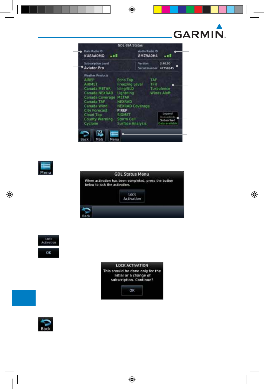
16-20
Garmin GTN 725/750 Pilot’s Guide
190-01007-03 Rev. J
Foreword
Getting
Started
Audio &
Xpdr Ctrl
Com/Nav
FPL
Direct-To
Proc
Charts
Wpt Info
Map
Traffic
Terrain
Weather
Nearest
Services/
Music
Utilities
System
Messages
Symbols
Appendix
Index
Weather
Product List
Weather
Product Legend
Touch To View
GDL Status Menu
SW Version and
Serial Number
Audio Radio ID
& Signal Level
Data Radio ID &
Signal Level
Subscription
Level
Figure 16-22 GDL 69/69A Status Page
2. Touch the Menu key to display the GDL 69 Status Menu.
Figure 16-23 GDL Status Menu
3. Touch the Lock Activation key if this is for the initial
subscription or a change in the subscription. Touch the OK
key to continue the operation.
Figure 16-24 Lock Activation
4. Touch the Back key to return to the System page.
190-01007-03-Final.indb 20 7/9/2015 2:08:42 PM
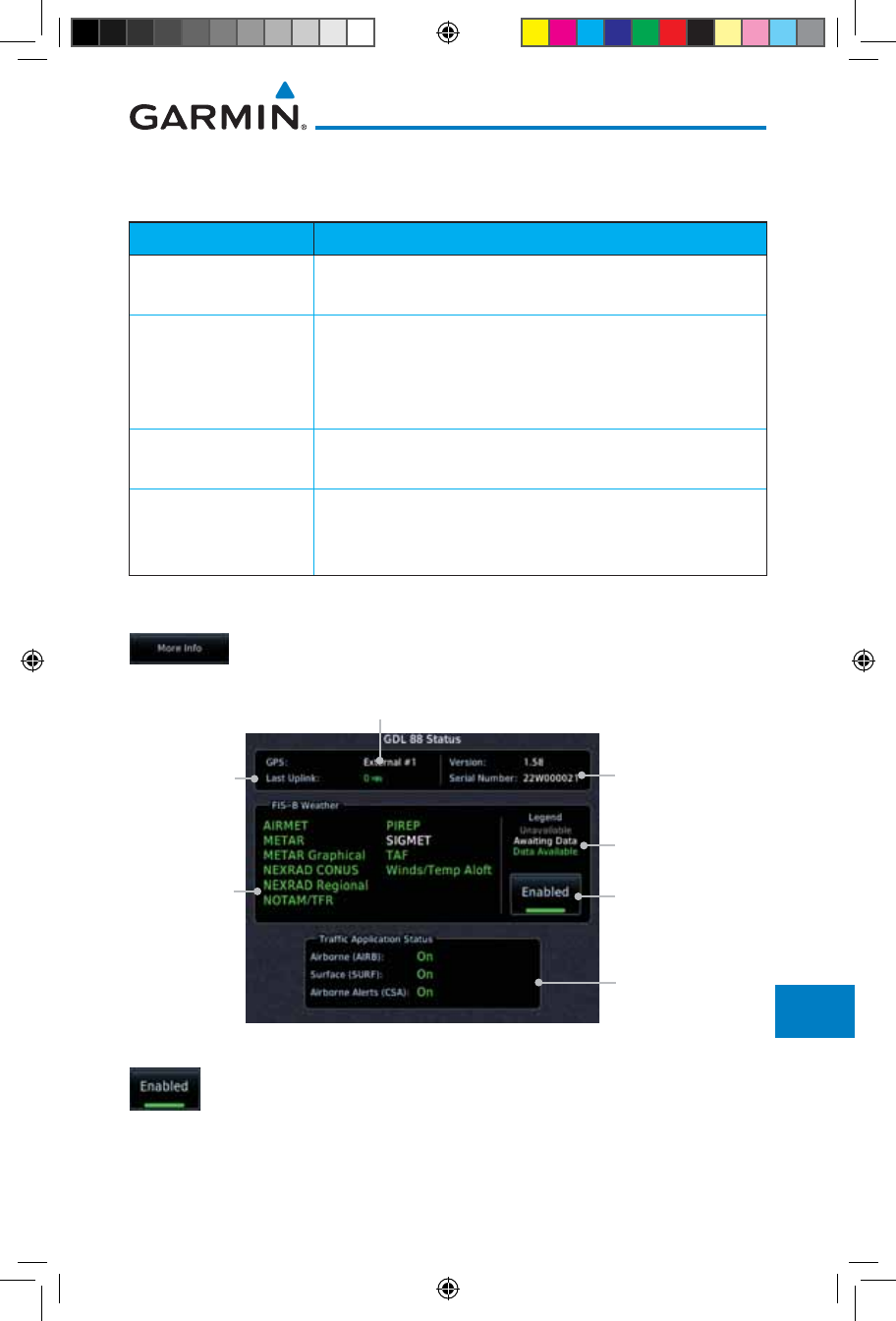
16-21190-01007-03 Rev. J
Garmin GTN 725/750 Pilot’s Guide
Foreword
Getting
Started
Audio &
Xpdr Ctrl
Com/Nav
FPL
Direct-To
Proc
Charts
Wpt Info
Map
Traffic
Terrain
Weather
Nearest
Services/
Music
Utilities
System
Messages
Symbols
Appendix
Index
16.3.2 GDL 88 Status
The GDL 88 Status page displays information about the status of the GDL 88.
Status Description
On Application is on/running. Required ownship input data is
available and meets the performance criteria.
Available to Run
Application is configured. Required input data is available
and meets the performance criteria. This state represents
that the ASA Application is manually or automatically
selected off.
Unavailable – Fault Required Input data is not available due to a failure or the
ASA Application process is failed.
Unavailable to Run
Required Input data is available but does not meet the
performance criteria or is not available due to Non-
Computed Data (NCD) conditions.
Table 16-4 Traffic Application Status
1. While viewing the External LRUs page, touch More Info for
the GDL 88 LRU.
Touch To
Enable/Disable
FIS-B Weather
Traffic Status
GDL 88 SW Version
and Serial Number
Weather Product
Legend
Time In
Minutes From
Last Ground
Uplink
FIS-B
Weather
Products
Internal or External GPS Source
Figure 16-25 GDL 88 Status
2. Touch the Enabled key to toggle whether FIS-B Weather is
enabled/disabled for use.
190-01007-03-Final.indb 21 7/9/2015 2:08:42 PM
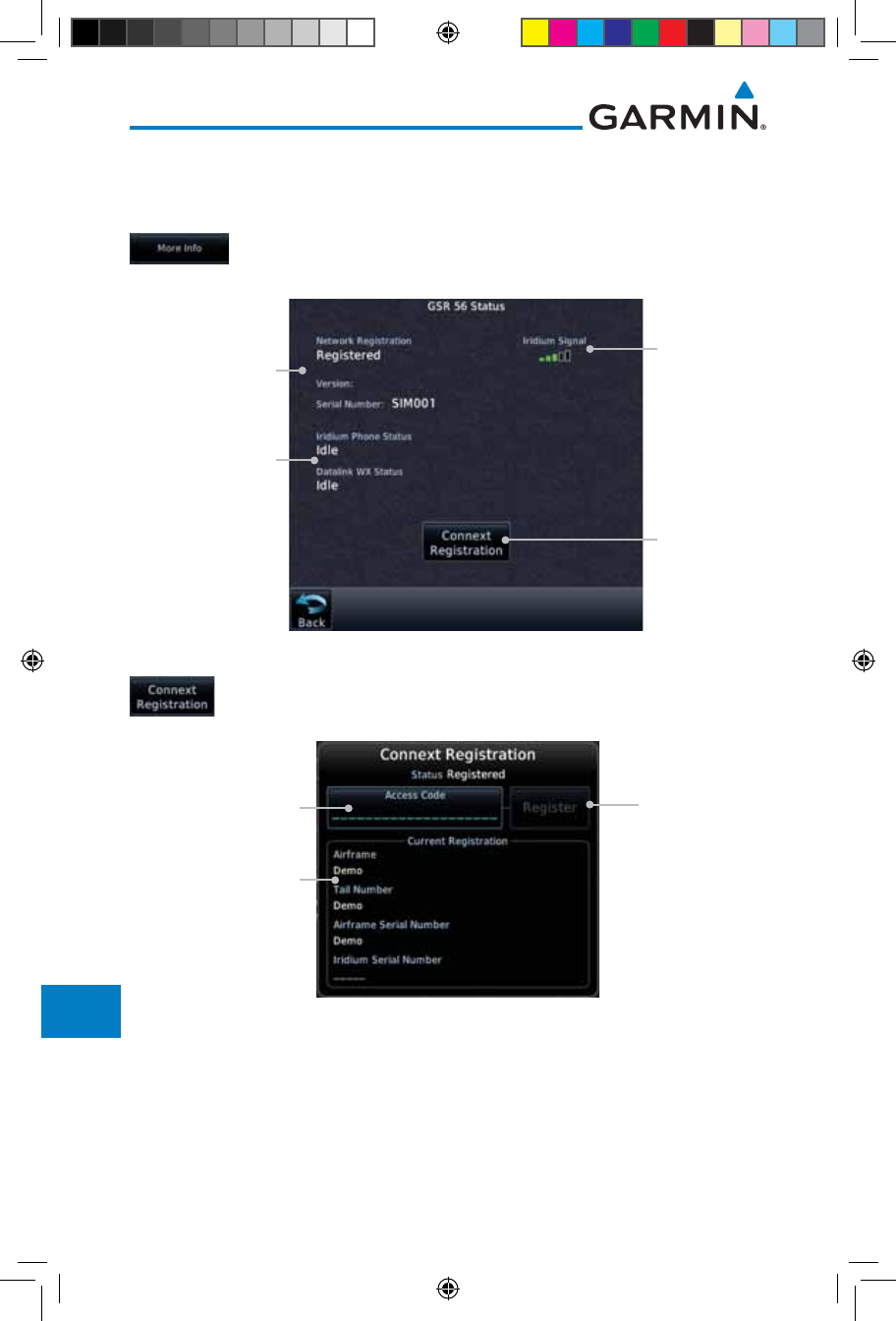
16-22
Garmin GTN 725/750 Pilot’s Guide
190-01007-03 Rev. J
Foreword
Getting
Started
Audio &
Xpdr Ctrl
Com/Nav
FPL
Direct-To
Proc
Charts
Wpt Info
Map
Traffic
Terrain
Weather
Nearest
Services/
Music
Utilities
System
Messages
Symbols
Appendix
Index
16.3.3 GSR 56 Status
The GSR 56 Status page displays information about the status of the GSR 56.
1. While viewing the External LRUs page, touch More Info for
the GSR 56 LRU.
Touch To
Register
Phone and
Datalink Status
Current
Registration Info
Iridium
Signal Level
Figure 16-26 GSR 56 Status
2. Touch the Connext Registration key to display the Connext
Registration display.
Touch To
Register
Touch To Enter
Access Code
Current
Registration Info
Figure 16-27 Connext Registration Page
190-01007-03-Final.indb 22 7/9/2015 2:08:42 PM
16-23190-01007-03 Rev. J
Garmin GTN 725/750 Pilot’s Guide
Foreword
Getting
Started
Audio &
Xpdr Ctrl
Com/Nav
FPL
Direct-To
Proc
Charts
Wpt Info
Map
Traffic
Terrain
Weather
Nearest
Services/
Music
Utilities
System
Messages
Symbols
Appendix
Index
16.4 Setup
System Setup allows setting the time convention, Com channel spacing,
crossfilling to a second GTN or GNS unit, and Nearest Airport search filtering.
Local Offset
Time Format
Date/Time
Nearest Airport
Reverse Frequency Lookup
CDI
CDI Scale
ILS CDI Capture
Runway Surface
Min Rwy Length
Com Channel Spacing
25.0 kHz
8.33 kHz
Crossfill
Com/Nav
Figure 16-28 System Setup Functions
190-01007-03-Final.indb 23 7/9/2015 2:08:42 PM
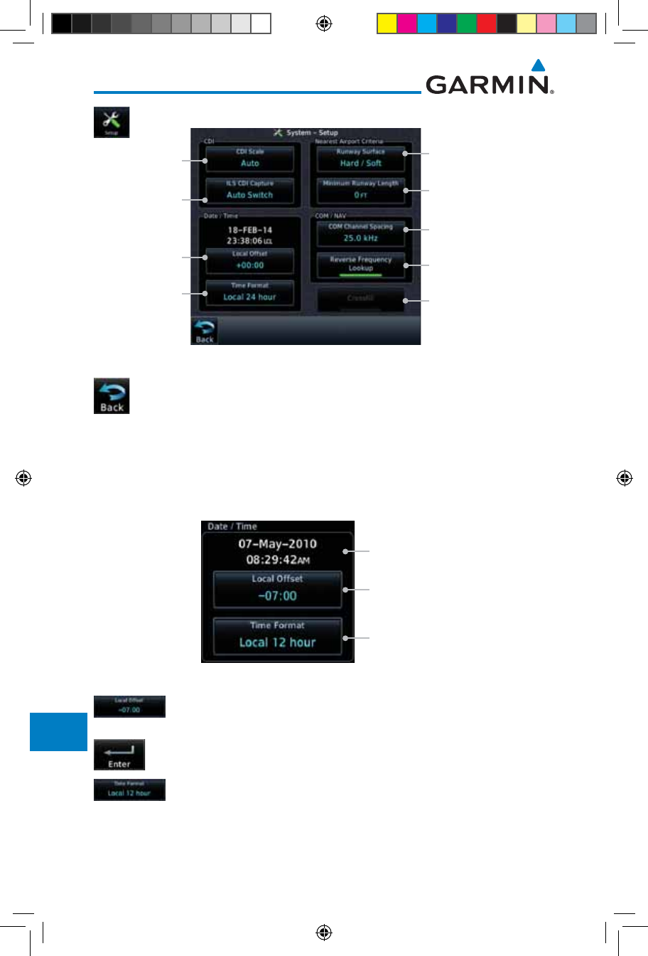
16-24
Garmin GTN 725/750 Pilot’s Guide
190-01007-03 Rev. J
Foreword
Getting
Started
Audio &
Xpdr Ctrl
Com/Nav
FPL
Direct-To
Proc
Charts
Wpt Info
Map
Traffic
Terrain
Weather
Nearest
Services/
Music
Utilities
System
Messages
Symbols
Appendix
Index
1. While viewing the System page, touch the Setup key.
Touch Key to
Set Time Format
Touch Key to Set Com
Channel spacing
Touch Key to Set
Min Runway Length
Touch Key to Enable
Crossfill With Dual GTN
Units
Touch Key to Set
Runway Surface Type
Touch Key to
Set Time Offset
Touch Key to
Set ILS CDI
Capture
Touch Key to
Select CDI Scale
Touch Key to Activate
Rev Freq Lookup
Figure 16-29 System Setup Page
2. After making the desired selections, touch the Back key to
return to the Setup page.
16.4.1 Date/Time
The Date/Time setting provides selection of time format (local or UTC; 12-
or 24-hour). UTC (also called “GMT” or “Zulu”) date and time are calculated
directly from the GPS satellites’ signals and cannot be changed.
Current Selected
Date and Time
Touch To Select
Local Time Offset
Touch To Select
Time Format
Figure 16-30 System Date and Time Setup
1. While viewing the System Setup page, touch Local Offset to
set the time offset for local time.
2. Use the keypad to select the desired local offset and then
touch Enter.
3. While viewing the System Setup page, touch the Time Format
key to select local 12 hour, local 24 hour, or UTC time.
190-01007-03-Final.indb 24 7/9/2015 2:08:43 PM
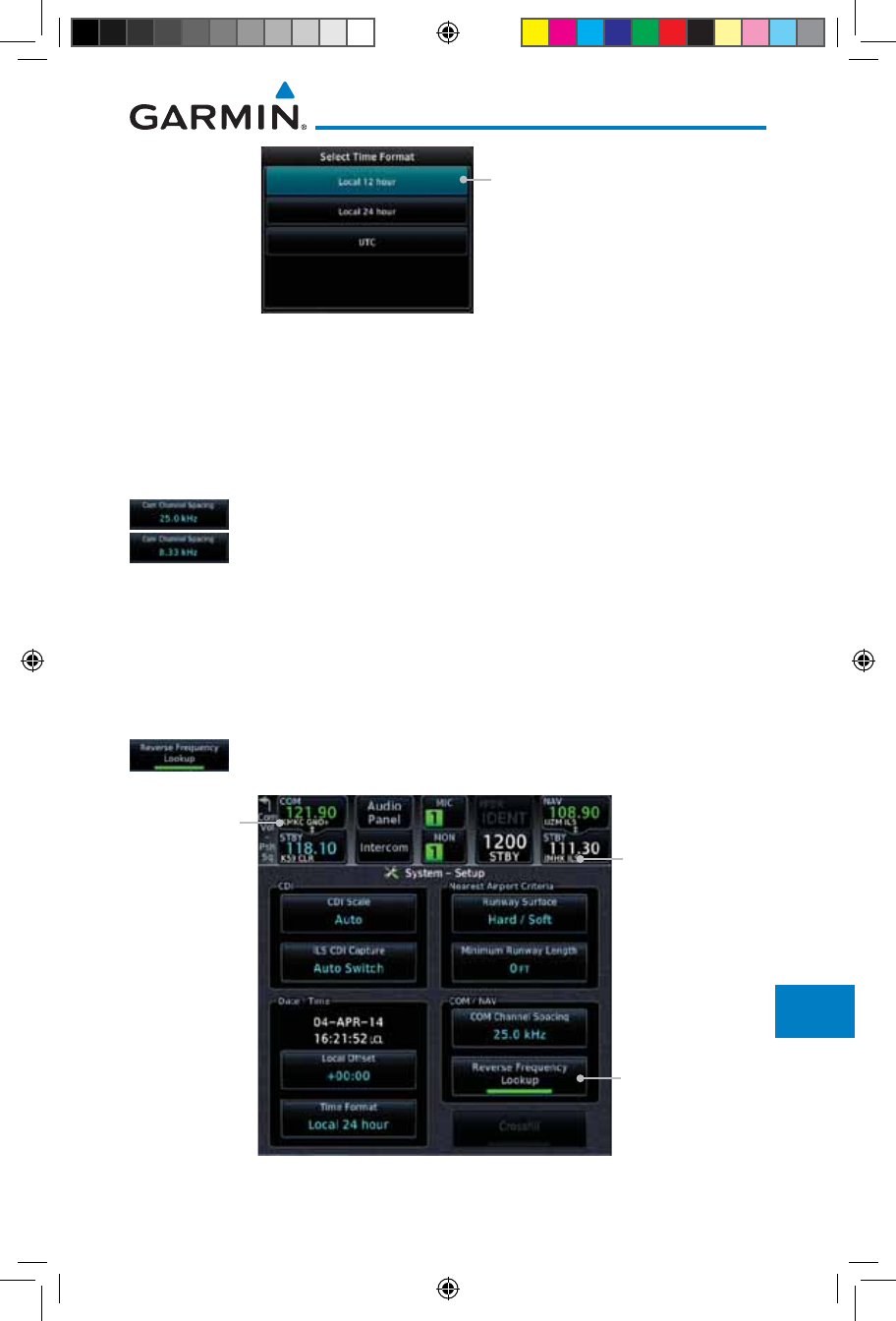
16-25190-01007-03 Rev. J
Garmin GTN 725/750 Pilot’s Guide
Foreword
Getting
Started
Audio &
Xpdr Ctrl
Com/Nav
FPL
Direct-To
Proc
Charts
Wpt Info
Map
Traffic
Terrain
Weather
Nearest
Services/
Music
Utilities
System
Messages
Symbols
Appendix
Index
Touch Key to Select
Time Format
Figure 16-31 Select System Time Format
4. Touch the key for the desired time format.
16.4.2 Com Channel Spacing
Com transceiver channel spacing may be selected between 8.33 kHz and
25.0 kHz.
While viewing the System Setup page, touch Channel Spacing
to toggle between 8.33 kHz and 25.0 kHz channel spacing.
16.4.3 Reverse Frequency Look-Up
The identifier and frequency type will be shown for the selected Com and
Nav frequencies for the nearest stations that are in the database when the unit is
receiving a valid position input. Station Identifiers with a “+” sign will have more
stations associated with this frequency than just the type displayed.
1. While viewing the System Setup page, touch the Reverse
Frequency Lookup key to toggle the function.
Reverse Frequency
Lookup Selected
Identifier and
Type Shown
For Freqs In
Database
Airport
Identifier and
Type Shown
For Freqs In
Database.
The “+” Sign
Indicates
More Stations
Associated
With This
Frequency
Figure 16-32 Reverse Frequency Lookup Selected
190-01007-03-Final.indb 25 7/9/2015 2:08:43 PM
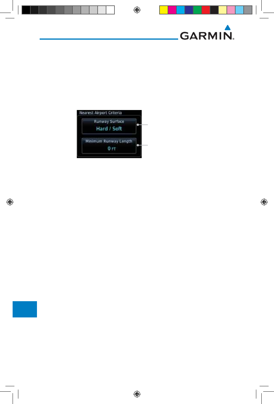
16-26
Garmin GTN 725/750 Pilot’s Guide
190-01007-03 Rev. J
Foreword
Getting
Started
Audio &
Xpdr Ctrl
Com/Nav
FPL
Direct-To
Proc
Charts
Wpt Info
Map
Traffic
Terrain
Weather
Nearest
Services/
Music
Utilities
System
Messages
Symbols
Appendix
Index
16.4.4 Nearest Airport Criteria
Nearest Airport Criteria defines the surface type and minimum runway
length used when determining the 25 nearest airports to display on the Nearest
Airport Page. A minimum runway length and/or surface type may be entered to
prevent airports with small runways, or runways that do not have an appropriate
surface, from being displayed. The default settings are “0 feet (or meters)” for
runway length and “any” for runway surface type.
Touch To Select
Runway Surface Type
Touch To Select Minimum
Runway Length
Figure 16-33 Select Nearest Airport Criteria
190-01007-03-Final.indb 26 7/9/2015 2:08:43 PM
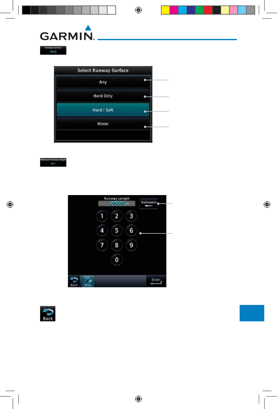
16-27190-01007-03 Rev. J
Garmin GTN 725/750 Pilot’s Guide
Foreword
Getting
Started
Audio &
Xpdr Ctrl
Com/Nav
FPL
Direct-To
Proc
Charts
Wpt Info
Map
Traffic
Terrain
Weather
Nearest
Services/
Music
Utilities
System
Messages
Symbols
Appendix
Index
1. While viewing the System Setup page, touch Runway Surface
to display the options. Touch the desired surface type.
Touch to Select Any
Runway Surface
Touch to Select Hard
Runway Surfaces Only
Touch to Select Hard or
Soft Runway Surfaces
Touch to Select Water
Surfaces Only
Figure 16-34 Nearest Airport Runway Surface Type
2. Touch Minimum Runway Length to display the keypad
for selecting the minimum runway length. Select the desired
minimum runway length with the numeric keypad. A selection
of "0" will allow any length.
Touch Keys to
Set Values
Touch Key to
Delete Values
Figure 16-35 Nearest Airport Runway Length
3. After selecting the runway length, touch the Enter key to
save the entered values or touch the Back key to return to
the System Setup page without saving a value.
190-01007-03-Final.indb 27 7/9/2015 2:08:43 PM
16-28
Garmin GTN 725/750 Pilot’s Guide
190-01007-03 Rev. J
Foreword
Getting
Started
Audio &
Xpdr Ctrl
Com/Nav
FPL
Direct-To
Proc
Charts
Wpt Info
Map
Traffic
Terrain
Weather
Nearest
Services/
Music
Utilities
System
Messages
Symbols
Appendix
Index
16.4.5 Crossfill
Dual units may be interfaced to crossfill information between the two units.
This option will not be available unless dual units are configured.
When Crossfill is turned on with one GTN, it is automatically turned on in the
other GTN. Some items are always crossfilled regardless of the crossfill setting;
others are dependent on the crossfill setting.
The GTN can be can also be interfaced with the GNS 400W/500W units. The
GTN can automatically send the Active Flight Plan and active Direct-To course to
the GNS unit. The GTN User Waypoints can be manually sent to the GNS unit. The
GNS unit can manually send its User Waypoints to the GTN unit.
Waypoint names longer than six characters, or duplicates, sent from the GTN
unit to the GNS unit will replace some characters with a "+" sign, while leaving
significant characters to aid in identification (such as, USR003 becomes US+003).
NOTE: Upon crossfill being activated, the GTNs may take up to 10 seconds
to crossfill the flight plans. The pilot must verify the flight plan in each unit
prior to use. The GTN and GNS units must have databases with the same cycle.
NOTE: When GPS navigation is lost in either unit, crossfilling may not be
available until GPS is restored in both units. Crossfilling will resume once the
flightplan is changed on one of the units or crossfill is re-enabled.
NOTE: If two GTN 7XX units are crossfilled, then the same type (ChartView
or FlightCharts) and version (cycle number and effective dates) for the chart
database must be installed on both units in order for the correct chart to
be overlaid on the main map page.
16.4.5.1 GTN-to-GTN Crossfilling
This data is always crossfilled:
• User waypoints
• Flight plan catalog
• Alerts (traffic pop-up acknowledgement, missed approach waypoint pop-
up acknowledgement, altitude leg pop-up acknowledgement)
• External sensors (transponder status and commands, synchro heading)
• System setup:
- User-defined NAV frequencies to store favorites
- Date/Time convention
- Nearest airport criteria
- Units (Nav angle, Distance/Speed, etc.)
190-01007-03-Final.indb 28 7/9/2015 2:08:43 PM
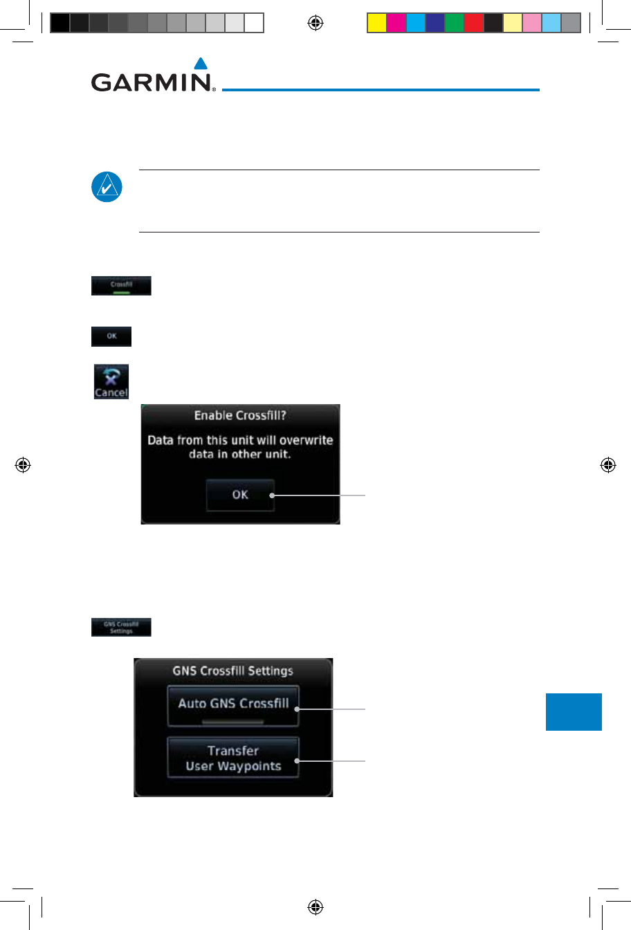
16-29190-01007-03 Rev. J
Garmin GTN 725/750 Pilot’s Guide
Foreword
Getting
Started
Audio &
Xpdr Ctrl
Com/Nav
FPL
Direct-To
Proc
Charts
Wpt Info
Map
Traffic
Terrain
Weather
Nearest
Services/
Music
Utilities
System
Messages
Symbols
Appendix
Index
- User-defined COM frequencies to store favorites
- CDI Scale setting
- ILS CDI Capture setting
NOTE: There is an installer option to turn on a system message that will
be provided anytime crossfill is turned off to alert the pilot that flight plans
are not being crossfilled.
This data is crossfilled only if crossfill is turned on by the pilot:
• Active navigation (flight plan)
1. While viewing the System Setup page, touch the Crossfill key
to toggle between Enabled and Disabled Crossfill.
or
2. When Crossfill is about to be enabled, you will be prompted
to note that data will be overwritten in the other unit. Touch
OK to enable Crossfill or touch Cancel to return to the System
Setup page without enabling Crossfill.
Touch OK to Enable
Crossfill With Dual Units
Figure 16-36 Confirming Crossfill Selection
16.4.5.2 GTN-GNS Crossfilling
• GTN to GNS – Active flight plans, active direct-to, User waypoints
• GNS to GTN – User waypoints
1. While viewing the System Setup page, touch the GNS Crossfill
Settings key
to reach the GNS Crossfill settings.
Touch OK to Enable Auto
Crossfill With Dual Units
Touch OK to Manually
Transfer User Waypoints
Figure 16-37 GTN-GNS Crossfill Selection
190-01007-03-Final.indb 29 7/9/2015 2:08:44 PM
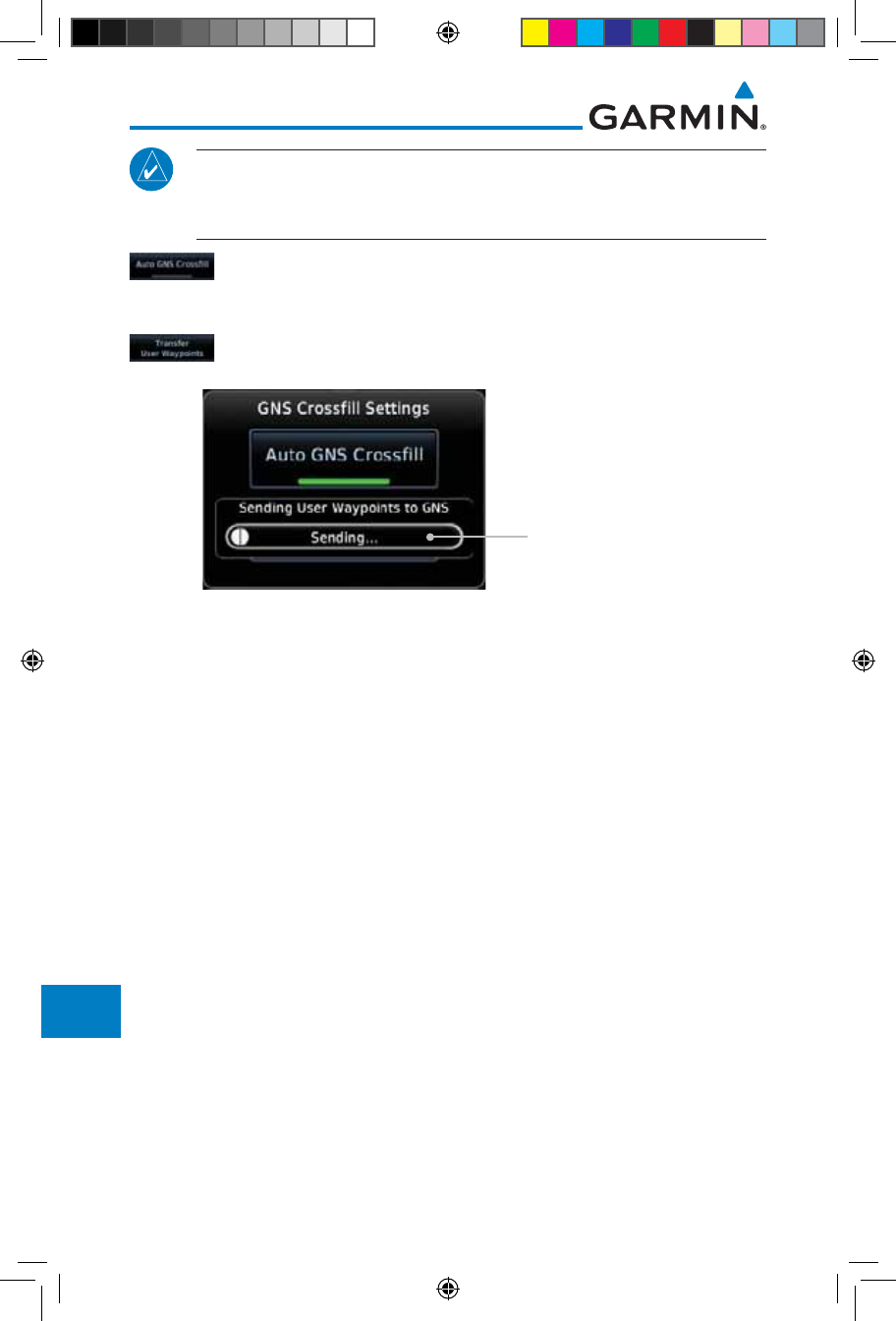
16-30
Garmin GTN 725/750 Pilot’s Guide
190-01007-03 Rev. J
Foreword
Getting
Started
Audio &
Xpdr Ctrl
Com/Nav
FPL
Direct-To
Proc
Charts
Wpt Info
Map
Traffic
Terrain
Weather
Nearest
Services/
Music
Utilities
System
Messages
Symbols
Appendix
Index
NOTE: When the active flight plan on the GTN contains legs or features
that are not supported by the GNS, those legs will not be crossfilled and
will not be present in the active flight plan on the GNS.
2. Touch Auto GNS Crossfill to enable Crossfill and send the
Active Flight Plans and the active Direct-To course to the GNS
unit.
3. Touch the Transfer User Waypoints key to transfer the User
Waypoints from the GTN unit to the connected GNS unit.
Transfer Of User
Waypoints In Progress
Figure 16-38 GTN-GNS Crossfill
16.4.6 CDI Scale Selection
The CDI source and ILS CDI Capture type may be selected manually or
automatically. The selected CDI Scale will be reflected in the annunciation bar at
the bottom of the display.
CDI Scale Selection
allows you to define the scale for the course deviation
indicator (both on the GTN unit's on-screen CDI and the external CDI). The
scale values represent full scale deflection for the CDI to either side. The default
setting is “Auto”. At this setting, the CDI scale is set to 2.0 NM during the
“en route” phase of flight. Within 31 NM (terminal area) of your destination
airport, the CDI scale linearly ramps down to 1.0 NM over a distance of 1 NM.
Likewise, when leaving your departure airport the CDI scale is set to 1.0 NM
and gradually ramps up to 2 NM beyond 30 NM (from the departure airport).
During GPS approach operations the CDI scale gradually transitions down to an
angular CDI scale. At 2.0 NM before the final approach fix (FAF), CDI scaling is
tightened from 1.0 NM to the angular full scale deflection (typically the angular
full-scale deflection is 2.0°, but will be as defined for the approach).
If a lower CDI scale setting is selected (i.e., 1.0 or 0.3 NM), the higher scale
settings are not selected during ANY phase of flight. For example, if 1.0 NM is
selected, the GTN unit uses this for en route and terminal phases and ramps down
further during an approach. Note that the Horizontal Alarm (HAL) protection
190-01007-03-Final.indb 30 7/9/2015 2:08:44 PM
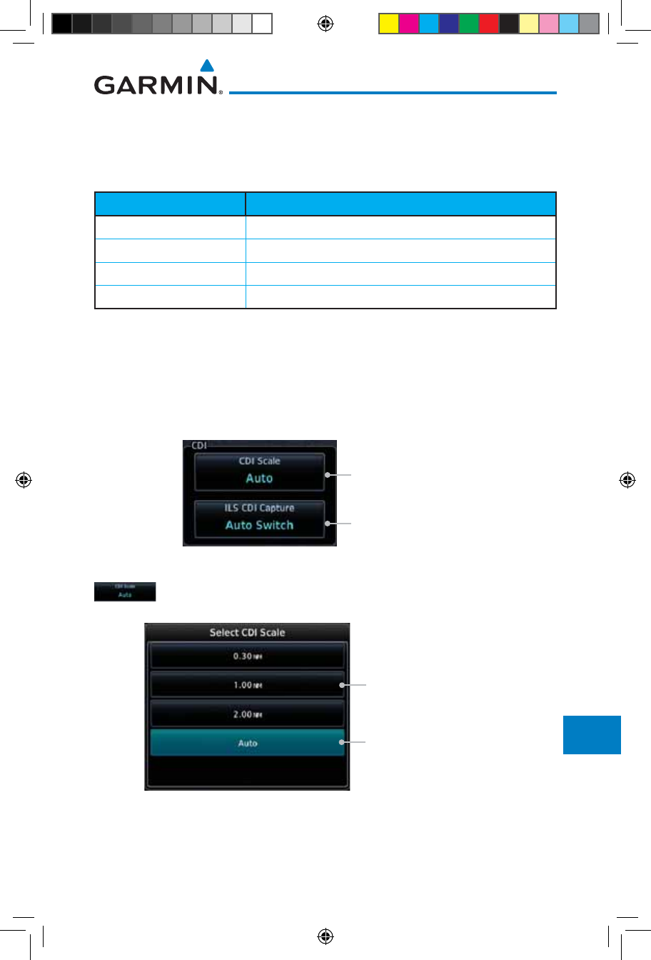
16-31190-01007-03 Rev. J
Garmin GTN 725/750 Pilot’s Guide
Foreword
Getting
Started
Audio &
Xpdr Ctrl
Com/Nav
FPL
Direct-To
Proc
Charts
Wpt Info
Map
Traffic
Terrain
Weather
Nearest
Services/
Music
Utilities
System
Messages
Symbols
Appendix
Index
limits listed below follow the selected CDI scale, unless corresponding flight
phases call for lower HAL. For example, if the 1.0 NM CDI setting is selected,
full-scale deflection during approach will still follow the approach CDI scale
settings.
CDI Scale Horizontal Alarm Limit
Auto (oceanic) 2.0 NM
±2.0 NM or Auto (en route) 2.0 NM
±1.0 NM or Auto (terminal) 1.0 NM
±0.3 NM or Auto (approach) 0.3 NM
Table 16-5 CDI Scale and Horizontal Alarm Limits
An “auto” ILS CDI selection allows the GTN unit to automatically switch the
external CDI from the GPS receiver to the VLOC receiver, when intercepting
the final approach course. Or, select “manual” to manually switch the external
CDI connection, as needed (using the CDI key). If the unit is installed with a
KAP140/KFC225 autopilot, automatic switching will not take place.
Touch To Select CDI Scale
Touch To Select ILS CDI
Capture Type
Figure 16-39 CDI Selection
1. While viewing the System Setup page, touch the CDI Scale key
to allow automatic selection or to choose a CDI Scale manually.
Touch To Select 1 NM CDI
Scaling
Touch To Select Automatic
CDI Scaling
Figure 16-40 CDI Scale Selection
190-01007-03-Final.indb 31 7/9/2015 2:08:44 PM
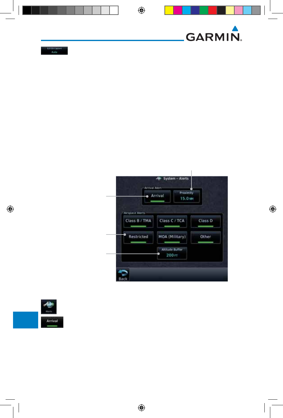
16-32
Garmin GTN 725/750 Pilot’s Guide
190-01007-03 Rev. J
Foreword
Getting
Started
Audio &
Xpdr Ctrl
Com/Nav
FPL
Direct-To
Proc
Charts
Wpt Info
Map
Traffic
Terrain
Weather
Nearest
Services/
Music
Utilities
System
Messages
Symbols
Appendix
Index
2. Touch the ILS CDI Capture key to select automatic or manual.
This feature enables the unit to automatically switch from GPS
to VLOC on an ILS approach. See
Procedures-ILS Approaches
for
more detail on ILS approaches.
16.5 Alerts Settings
The Alerts Setup page controls two functions: Arrival Alerts and Airspace
Alerts. Arrival Alerts, when active, will generate a message when the aircraft
is within the selected proximity of the destination. Airspace Alerts generate a
message and filtering of the Nearest Airspace list. The altitude component of
Airspace Alerts are dependent on both aircraft and airspace altitude and the
values set for the Altitude Buffer.
Touch to Select
Distance Values
Selected Airspace
Type (green bar)
Airspace
Altitude Buffer
Arrival
Figure 16-41 Alerts Setup Page
1. While viewing the System page, touch the Alerts key.
2. Touch the Arrival key to toggle activation. A green bar will
appear when it is active.
190-01007-03-Final.indb 32 7/9/2015 2:08:44 PM
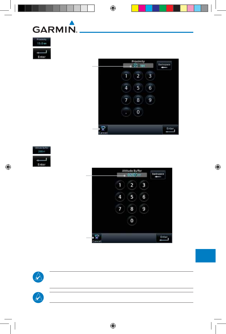
16-33190-01007-03 Rev. J
Garmin GTN 725/750 Pilot’s Guide
Foreword
Getting
Started
Audio &
Xpdr Ctrl
Com/Nav
FPL
Direct-To
Proc
Charts
Wpt Info
Map
Traffic
Terrain
Weather
Nearest
Services/
Music
Utilities
System
Messages
Symbols
Appendix
Index
3. Touch the Proximity key to set the Proximity distance values.
A numeric keypad will appear. Select the desired values and
then touch Enter.
Touch To Cancel
Selected Proximity Value
Figure 16-42 Airspace Alert Proximity Selection
4. Touch the Altitude Buffer key to set the buffer altitude value.
A numeric keypad will appear. Select the desired value and
then touch Enter.
Touch To Cancel
Selected Altitude
Buffer Value
Figure 16-43 Airspace Alert Altitude Buffer Selection
5. Touch the Airspace type keys to toggle activation. A green bar
will appear when it is active.
NOTE: The Airspace Alert setting does not alter the depiction of airspace,
or change the Smart Airspace setting for the main map page.
NOTE: Airspace alerts for Prohibited airspace cannot be disabled.
190-01007-03-Final.indb 33 7/9/2015 2:08:44 PM
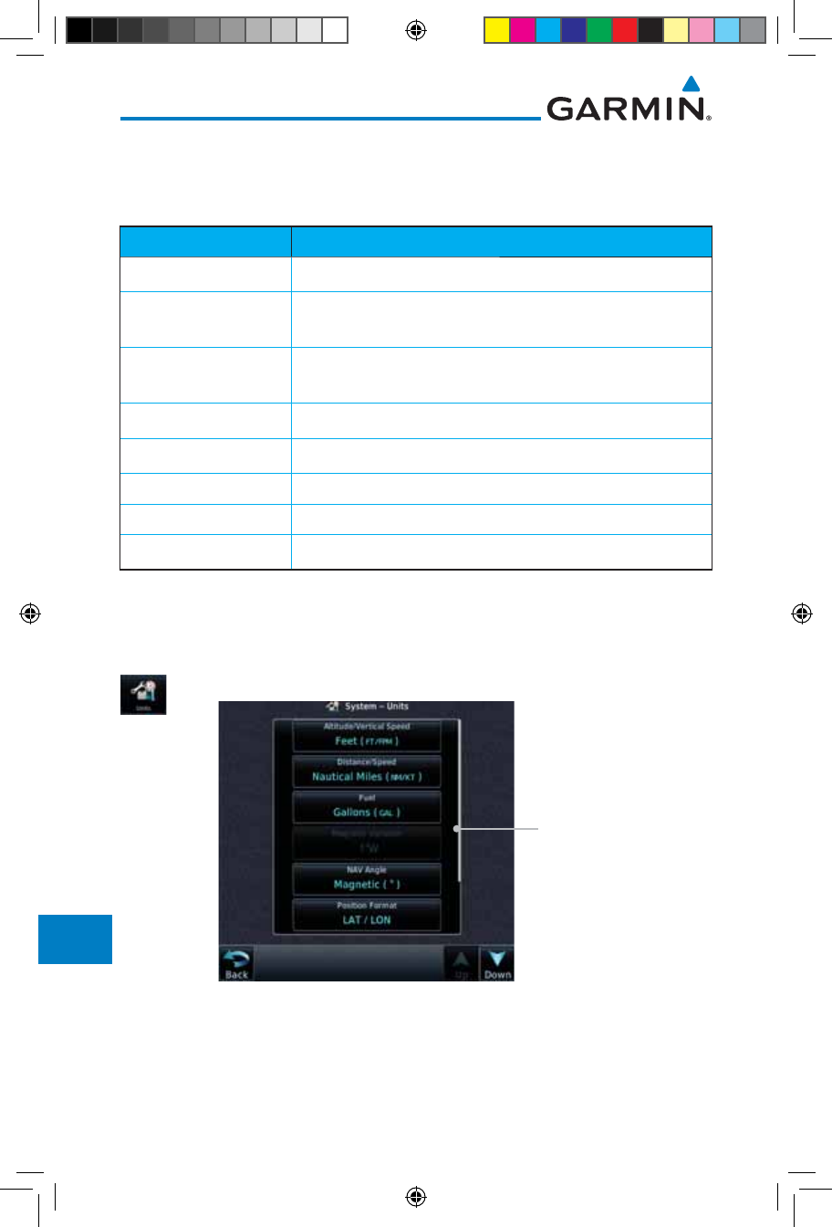
16-34
Garmin GTN 725/750 Pilot’s Guide
190-01007-03 Rev. J
Foreword
Getting
Started
Audio &
Xpdr Ctrl
Com/Nav
FPL
Direct-To
Proc
Charts
Wpt Info
Map
Traffic
Terrain
Weather
Nearest
Services/
Music
Utilities
System
Messages
Symbols
Appendix
Index
16.6 Units Settings
The Units Setup page allows you to select the conventions for the various
units that are displayed.
Units Type Units Values
Altitude/Vertical Speed Feet(FT/FPM), Meters (M/MPS)
Distance/Speed Nautical Miles (NM/KT), Kilometers (KM/KPH), Statue Miles
(SM/MPH)
Fuel Gallons (GAL), Imperial Gallons (IG), Kilograms (KG), Liters
(LT), or Pounds (LB)
Nav Angle Magnetic (°), True (°T), User (°u)
Magnetic Variation Enter numeric value, E or W
Position Format LAT/LON, MGRS, UTM
Pressure Inches of Mercury (IN), Hectopascals (HPA), Millibars (MB)
Temperature Celsius (°C) or Fahrenheit (°F)
Table 16-6 System Units Setup
16.6.1 Setup Units
Use these settings to set the units for values displayed in the unit operation.
1. While viewing the System page, touch the Units key.
Touch Key to
Set Units
Figure 16-44 System Units Page
2. Touch the key for the desired units. A window with a list of
unit values will appear. Touch the desired value on the list.
190-01007-03-Final.indb 34 7/9/2015 2:08:45 PM
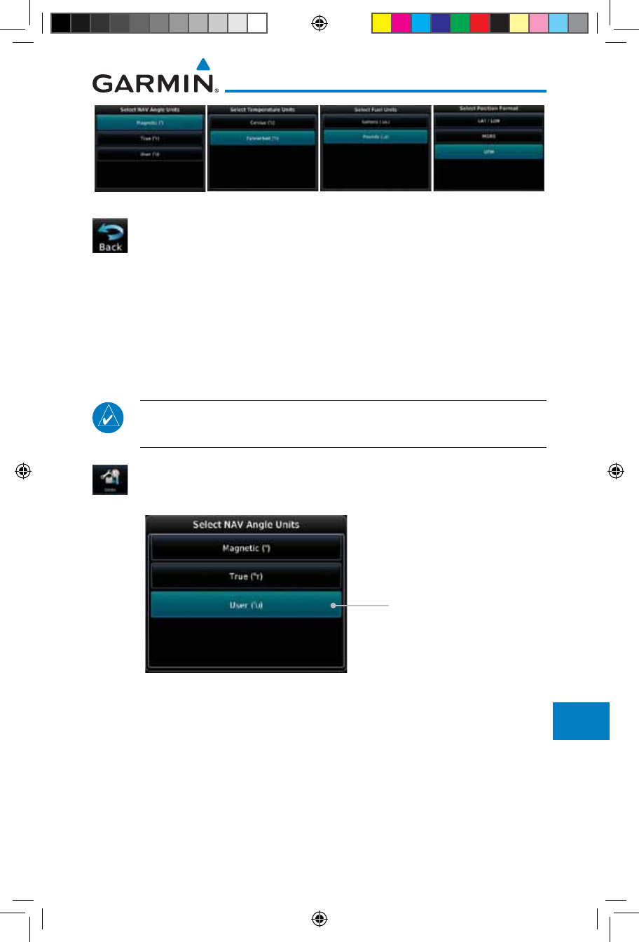
16-35190-01007-03 Rev. J
Garmin GTN 725/750 Pilot’s Guide
Foreword
Getting
Started
Audio &
Xpdr Ctrl
Com/Nav
FPL
Direct-To
Proc
Charts
Wpt Info
Map
Traffic
Terrain
Weather
Nearest
Services/
Music
Utilities
System
Messages
Symbols
Appendix
Index
Figure 16-45 Setup Units Selection Windows
3. After making the desired selections, touch the Back key to
return to the Setup page.
16.6.2 Setting a User-Configured (Manual) Nav Angle
There are three variation (heading) options: Magnetic, True, and User. If
“Magnetic” is selected, all track, course and heading information is corrected
to the magnetic variation computed by the GPS receiver. The “True” setting
references all information to true north. The “User” selection allows the pilot to
enter values between 0º and 179º E or W.
NOTE: When changing the Nav angle, the DTK on the Flight Plan page
for an approach does not change until that approach is reloaded.
1. While viewing the System page, touch Units key.
2. Touch the Nav Angle key and then the User key.
Touch to select User
(manual) mag var
Figure 16-46 Nav Angle Selections
190-01007-03-Final.indb 35 7/9/2015 2:08:45 PM
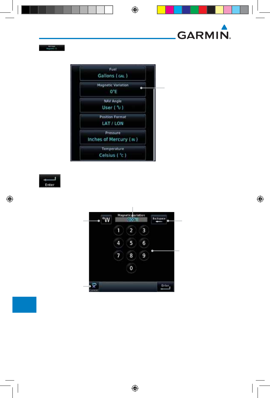
16-36
Garmin GTN 725/750 Pilot’s Guide
190-01007-03 Rev. J
Foreword
Getting
Started
Audio &
Xpdr Ctrl
Com/Nav
FPL
Direct-To
Proc
Charts
Wpt Info
Map
Traffic
Terrain
Weather
Nearest
Services/
Music
Utilities
System
Messages
Symbols
Appendix
Index
3. After User is selected, touch the Magnetic Variation key to
set the value.
Touch to set
manual mag var
Figure 16-47 Magnetic Variation is Available for Editing
4. Touch the keys on the numeric keypad to set the Magnetic
Variation and then touch Enter.
Use the Numeric
Keypad to Select User
(manual) Magnetic
Variation
Touch Key to
Delete Values
Touch Key to
Toggle Hemisphere
Current User
Mag Var Value
Cancel Selection
And Return To
Previous Page
Figure 16-48 Numeric Keypad for Setting Manual Magnetic Variation
190-01007-03-Final.indb 36 7/9/2015 2:08:45 PM
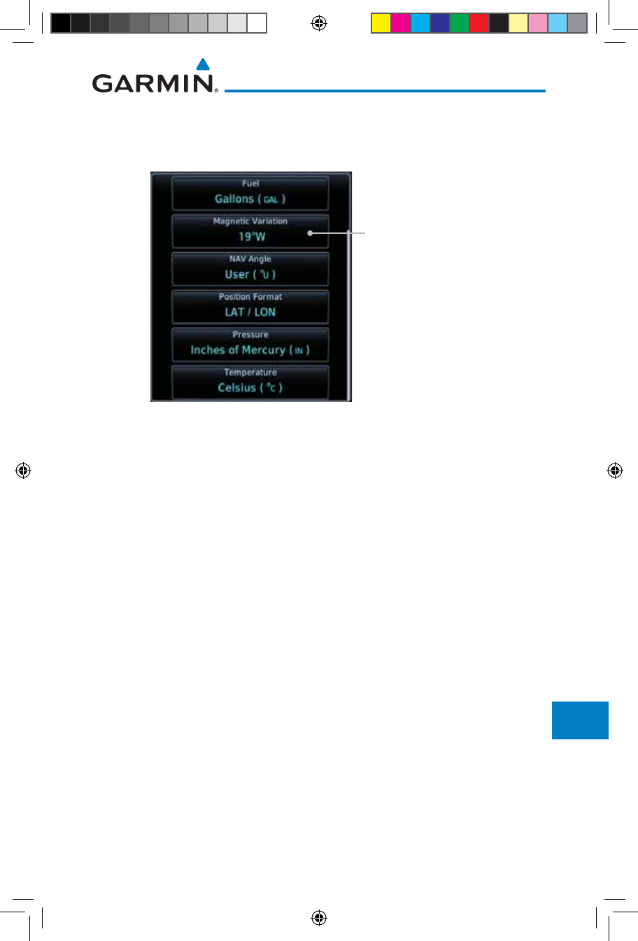
16-37190-01007-03 Rev. J
Garmin GTN 725/750 Pilot’s Guide
Foreword
Getting
Started
Audio &
Xpdr Ctrl
Com/Nav
FPL
Direct-To
Proc
Charts
Wpt Info
Map
Traffic
Terrain
Weather
Nearest
Services/
Music
Utilities
System
Messages
Symbols
Appendix
Index
5. The User Nav Angle value will be used for all angular values.
Remember to change the value when traveling to an area
requiring another value.
Selected User (manual)
Magnetic Variation
Figure 16-49 User (Manual) Magnetic Variation
190-01007-03-Final.indb 37 7/9/2015 2:08:45 PM
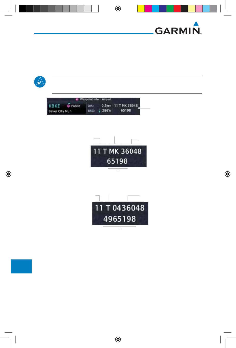
16-38
Garmin GTN 725/750 Pilot’s Guide
190-01007-03 Rev. J
Foreword
Getting
Started
Audio &
Xpdr Ctrl
Com/Nav
FPL
Direct-To
Proc
Charts
Wpt Info
Map
Traffic
Terrain
Weather
Nearest
Services/
Music
Utilities
System
Messages
Symbols
Appendix
Index
16.6.3 Position Format Selection
There are three Position Formats available: Lat/Lon, the Military Grid
Reference System (MGRS), and the Universal Transverse Mercator (UTM)
grid system. The format selected will be shown in all locations where position
information is shown.
NOTE: The Position Format Selection function is available in SW Versions
4.10, and later.
MGRS Position Format
Figure 16-50 MGRS Position Format Shown On Waypoint Info Page
Grid
Designator
100 km Square
Identifier Easting Numeric
Location
Northing Numeric Location
Figure 16-51 MGRS Position Format Detail
Grid Zone
Latitude Band Easting Value
Northing Value
Figure 16-52 UTM Position Format Detail
190-01007-03-Final.indb 38 7/9/2015 2:08:45 PM
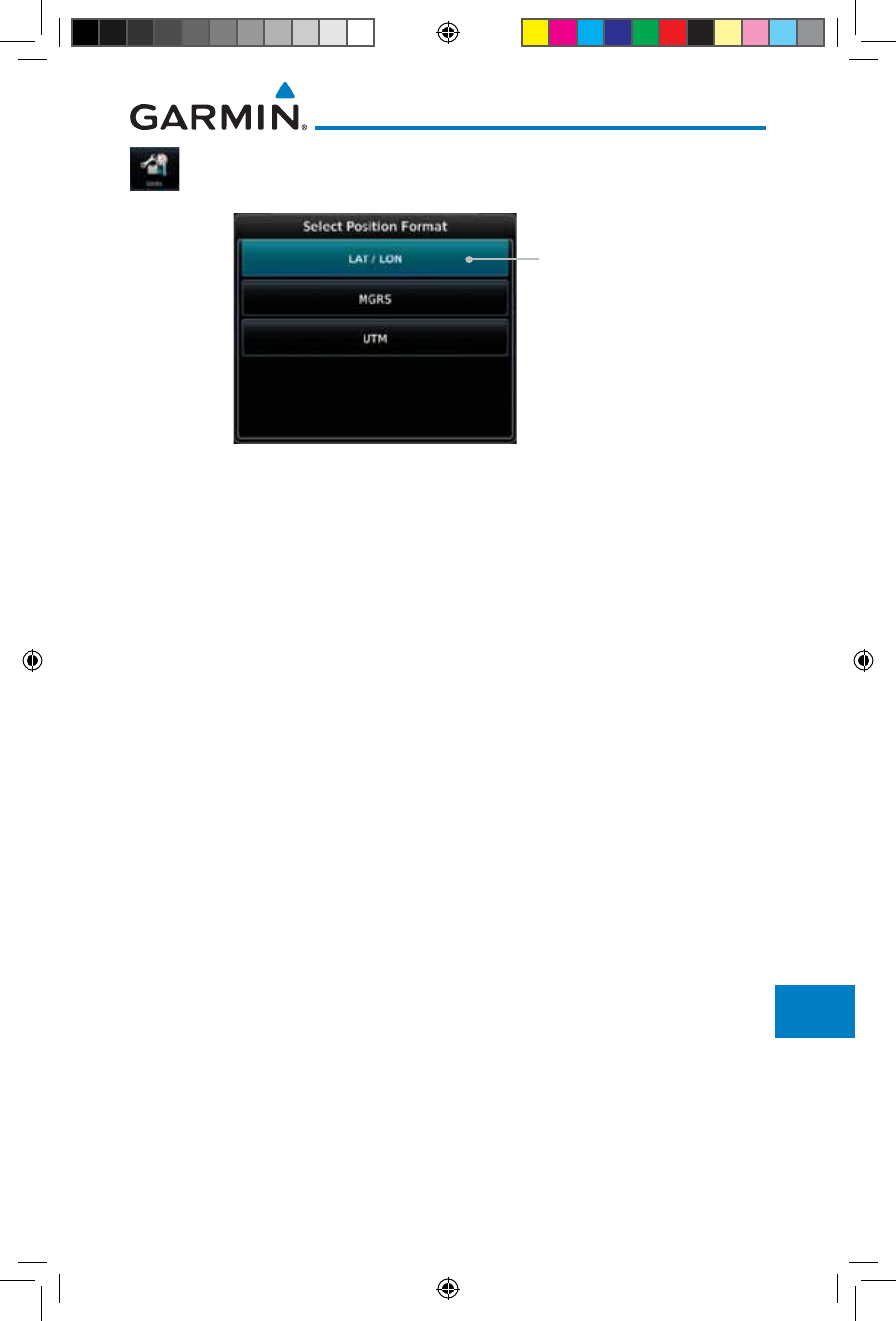
16-39190-01007-03 Rev. J
Garmin GTN 725/750 Pilot’s Guide
Foreword
Getting
Started
Audio &
Xpdr Ctrl
Com/Nav
FPL
Direct-To
Proc
Charts
Wpt Info
Map
Traffic
Terrain
Weather
Nearest
Services/
Music
Utilities
System
Messages
Symbols
Appendix
Index
1. While viewing the System page, touch Units key.
2. Touch the Position Format key.
Touch to select
Position Format
Figure 16-53 Position Format Selection
3. Touch the desired Position format.
190-01007-03-Final.indb 39 7/9/2015 2:08:45 PM
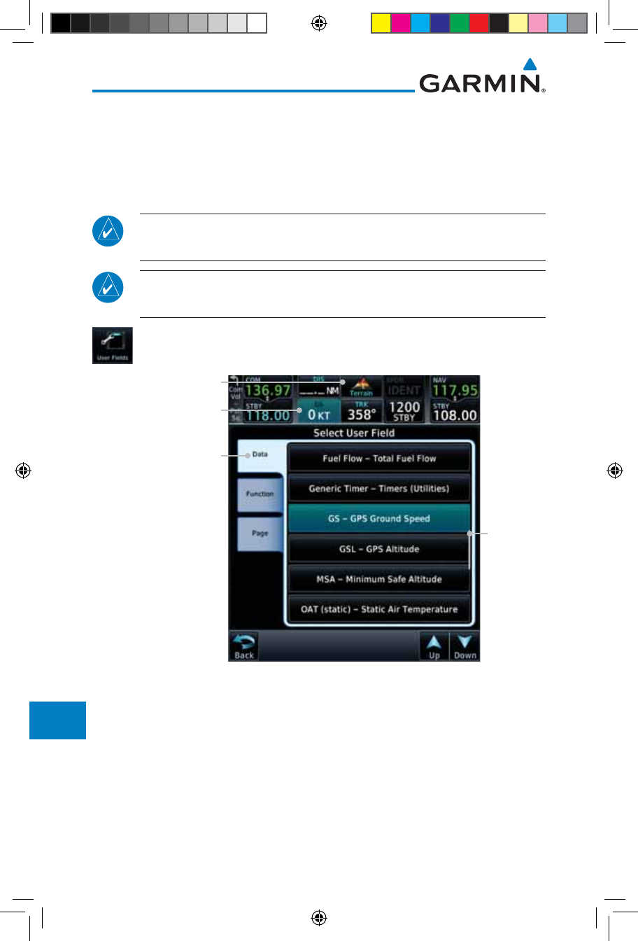
16-40
Garmin GTN 725/750 Pilot’s Guide
190-01007-03 Rev. J
Foreword
Getting
Started
Audio &
Xpdr Ctrl
Com/Nav
FPL
Direct-To
Proc
Charts
Wpt Info
Map
Traffic
Terrain
Weather
Nearest
Services/
Music
Utilities
System
Messages
Symbols
Appendix
Index
16.7 User Fields
The User Fields selection allows you to configure the data field type shown at
the top of the display in the center fields when they are not occupied by controls
for an audio panel or transponder. The data shown in each field may be selected
from a list after touching the desired field.
NOTE: Data Field Types that use the term "Destination" refer to the final
destination in the flight plan.
NOTE: ETE to Destination is not available when a procedure is loaded and
there are waypoints in the Enroute section of the flight plan.
1. While viewing the System page, touch the User Fields key,
then touch an available field in the top of the display.
List of
Data Types
Available
Touch To Select Category
(Data, Function, or
Page). Data selected in
this case.
Touch To Select Field
Terrain Page Assigned
To Field
Figure 16-54 User Fields Selection
2. Touch the Data, Function, or Page tab to display a list
of available selections. A list of information types will be
displayed.
190-01007-03-Final.indb 40 7/9/2015 2:08:46 PM
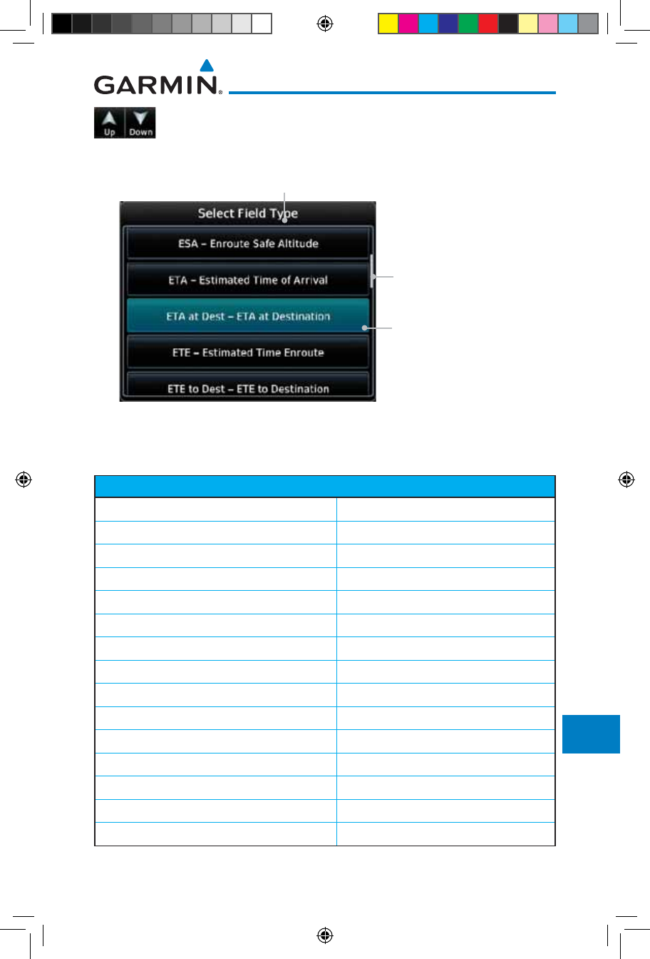
16-41190-01007-03 Rev. J
Garmin GTN 725/750 Pilot’s Guide
Foreword
Getting
Started
Audio &
Xpdr Ctrl
Com/Nav
FPL
Direct-To
Proc
Charts
Wpt Info
Map
Traffic
Terrain
Weather
Nearest
Services/
Music
Utilities
System
Messages
Symbols
Appendix
Index
3. Touch the Up or Down keys or touch the display and drag
your finger to scroll through the list. Touch the desired item
to select it or touch the Back key to cancel selection.
Field Type List. Touch To
Select Data Field
Selected Field Type
Slider Indicates More
Selections Available. Press
Finger and Slide To View
More Selections.
Figure 16-55 Map Data Field Type Selections
The options available are shown in the following tables. Selections available
vary depending on installed equipment.
Data Field Type
ACTV WPT - Active Waypoint MSA - Minimum Safe Altitude
B/D APT - BRG/DIS from Dest APT 1OAT (static) - Static Air Temperature
BRG - Bearing to Current Waypoint OAT (total) - Total Air Temperature
DIS - Distance to Current Waypoint RAD ALT - Radar Altimeter
DIS to Dest - Distance to Destination 2Time - Current Time
DTK - Desired Track Time to TOD - Time to Top of Descent
ESA - Enroute Safe Altitude TKE - Track Angle Error
ETA - Estimated Time of Arrival TRK - Track
ETA at Dest - ETA at Destination Trip Timer - Timer Display
ETE - Estimated Time Enroute VOR/LOC - Tuned VOR/LOC Info
ETE to Dest - ETE to Destination VSR - Vertical Speed Required
Fuel Flow - Total Fuel Flow Wind - Wind Speed and Direction
GS - GPS Ground Speed XTK - Cross Track Error
GSL - GPS Altitude OFF - Do Not Display Data Field
Generic Timer - Timer Display
Table 16-7 Data User Field Selections
190-01007-03-Final.indb 41 7/9/2015 2:08:46 PM

16-42
Garmin GTN 725/750 Pilot’s Guide
190-01007-03 Rev. J
Foreword
Getting
Started
Audio &
Xpdr Ctrl
Com/Nav
FPL
Direct-To
Proc
Charts
Wpt Info
Map
Traffic
Terrain
Weather
Nearest
Services/
Music
Utilities
System
Messages
Symbols
Appendix
Index
Note 1: B/D APT is the straight line distance.
Note 2: Dist to DEST is the distance along the flight plan.
Function Field Type
CDI - Course Deviation Indicator Passenger Address - PA Toggle
Flap Override - Flap Override1Playback - Play Last Recording
GPWS Inhibit - GPWS Inhibit1TAWS Inhibit - TAWS Inhibit
G/S Inhibit - G/S Inhibit1Gen Timer - Generic Timer Control
HTAWS RP Mode - HTAWS RP Mode2WX RDR Controls - Weather Radar
Controls
OBS/Suspend/Unsuspend Button OFF - Do Not Display Data Field
On Scene - "On Scene" Mode Toggle
Table 16-8 Function User Field Selections
Note 1: With TAWS-A enabled.
Note 2: With HTAWS enabled.
Map Page Field Type
Charts - Charts Page Fuel PLAN - Fuel Planning Page
Flight Plan - Flight Plan Page SCHED MSG - Scheduled Messages
Map - Map Page Trip PLAN - Trip Planning Page
Nearest - Nearest Page VCALC - VCALC Page
NEAR APT - Nearest Airport Page User FREQ - User Frequencies
PROC - Procedures Page WPT INFO - Waypoint Information
Approach - Approach Page Weather - Weather Page
Arrival - Arrival Page CNXT WX - Connext WX Page
Departure - Departure Page FIS-B WX - FIS-B Weather Page
Services - Services Page Stormscope - Stormscope Page
Traffic - Traffic Page WX Radar - Weather Radar Page
Terrain - Terrain Page SiriusXM WX - Sirius XM WX Page
Utilities - Utilities Page OFF - Do Not Display Page Field
Checklist - Checklist Page
Table 16-9 Page User Field Selections
190-01007-03-Final.indb 42 7/9/2015 2:08:46 PM
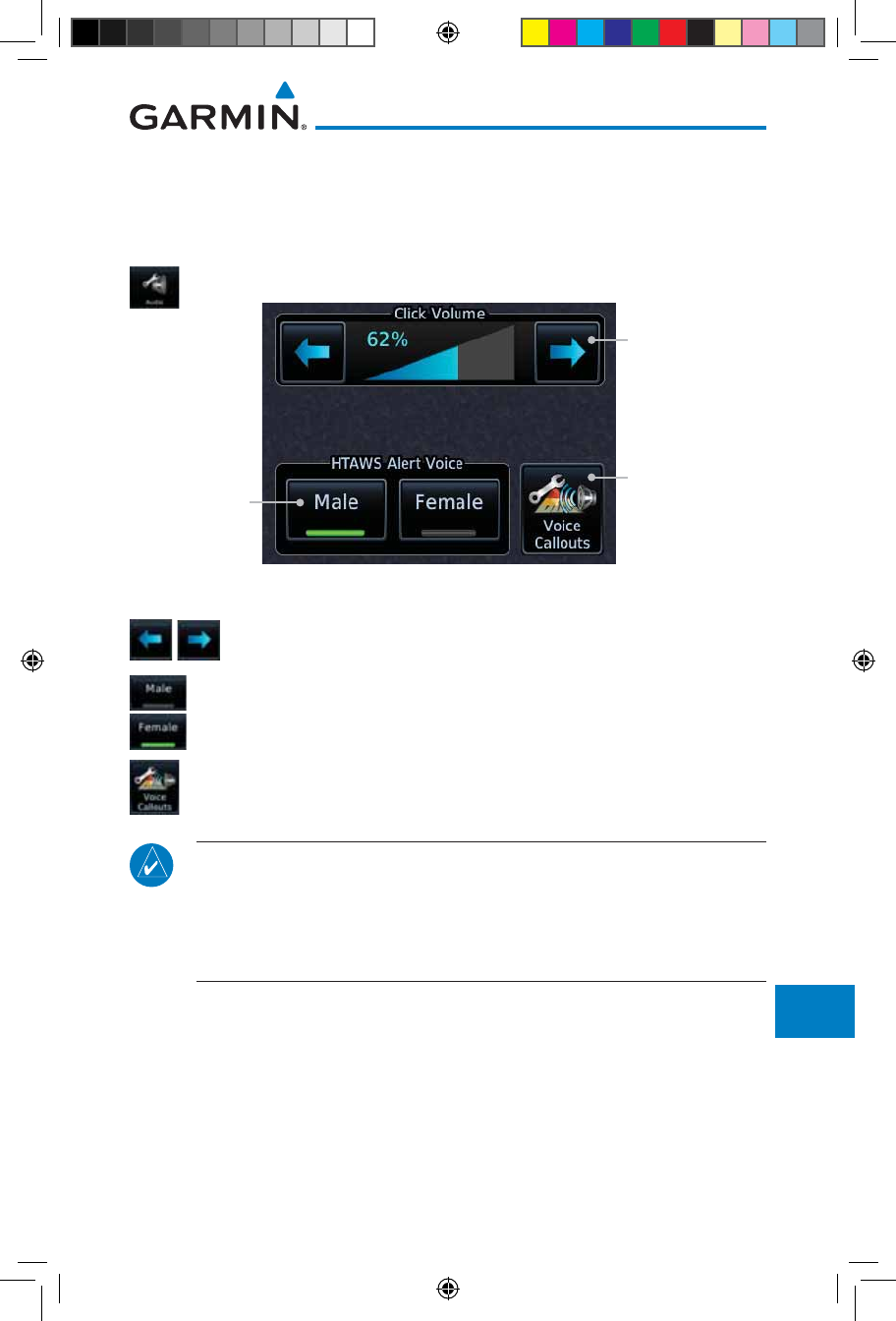
16-43190-01007-03 Rev. J
Garmin GTN 725/750 Pilot’s Guide
Foreword
Getting
Started
Audio &
Xpdr Ctrl
Com/Nav
FPL
Direct-To
Proc
Charts
Wpt Info
Map
Traffic
Terrain
Weather
Nearest
Services/
Music
Utilities
System
Messages
Symbols
Appendix
Index
16.8 Audio
The Audio Settings allows the adjustment of the volume the click sound
when controls are touched.
1. While viewing the System page, touch Audio key.
Touch The Arrow
Keys To Adjust
Click Volume
Touch To Select
Voice
(TAWS Only)
Touch To Select
Voice Call Outs
(Optional)
Figure 16-56 System Audio Selection
2. Touch the Arrow keys to adjust the Key Click Volume.
3. Touch the Male or Female key to select the audio voice type.
4. When HTAWS is installed, a Voice Call Outs option may be
available. Touch the Voice Callouts key to select the Max
Voice Call Out value.
NOTE: VCOs are available down to 100 feet above terrain when HTAWS is
installed and use GSL above terrain to generate callouts (no radar altimeter
required). If a radar altimeter is interfaced to the GTN, alerts are available
down to 50 feet and the height above terrain from the radar altimeter is
used to generate the callouts.
190-01007-03-Final.indb 43 7/9/2015 2:08:46 PM
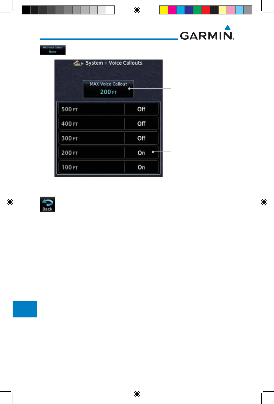
16-44
Garmin GTN 725/750 Pilot’s Guide
190-01007-03 Rev. J
Foreword
Getting
Started
Audio &
Xpdr Ctrl
Com/Nav
FPL
Direct-To
Proc
Charts
Wpt Info
Map
Traffic
Terrain
Weather
Nearest
Services/
Music
Utilities
System
Messages
Symbols
Appendix
Index
5. Touch the MAX Voice Callout key to select the value.
Touch To Select Voice
Call Out Value
Touch To Select
Max Voice Callout
Figure 16-57 Select Voice Call Out Value
6. Touch Back when complete.
190-01007-03-Final.indb 44 7/9/2015 2:08:46 PM
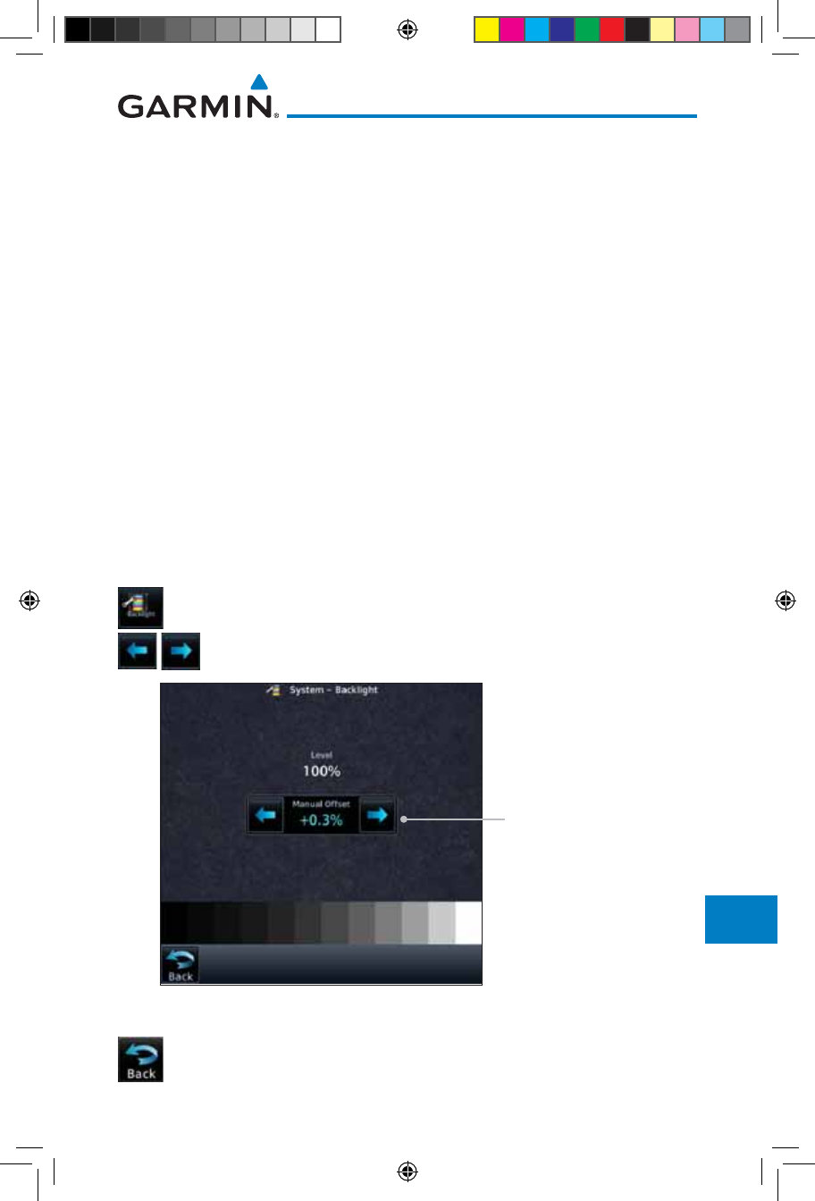
16-45190-01007-03 Rev. J
Garmin GTN 725/750 Pilot’s Guide
Foreword
Getting
Started
Audio &
Xpdr Ctrl
Com/Nav
FPL
Direct-To
Proc
Charts
Wpt Info
Map
Traffic
Terrain
Weather
Nearest
Services/
Music
Utilities
System
Messages
Symbols
Appendix
Index
16.9 Backlight Settings
The backlighting of the display and bezel keys can be adjusted automatically
or manually. The default setting (automatic backlighting adjustment) uses
photocell technology to automatically adjust for ambient lighting conditions.
Photocell calibration curves are pre-configured to optimize display appearance
through a broad range of cockpit lighting conditions. A manual offset creates
a deviation form the normal curve. Manual adjustments may be made from
+100% to -10%. The negative adjustment is limited to prevent the backlight
from being accidently decreasing the backlight to the point where the display of
information could not be seen.
The backlight offset function is not available when a dimmer input is active.
The GTN is capable of accepting lighting inputs from the built-in photocell,
aircraft dimmer bus, or both. If the lighting is not satisfactory, contact the
installer to adjust the curves.
Manual backlighting adjustment can be accomplished using the existing
instrument panel dimmer bus or the following procedures.
1. While viewing the System page, touch the Backlight key.
2. Touch the Arrow keys to adjust the Backlight level.
Touch The Arrow Keys
For Manual Offset
Figure 16-58 Backlight Level Selection
3. After making the desired selections, touch the Back key to
return to the System page.
190-01007-03-Final.indb 45 7/9/2015 2:08:46 PM
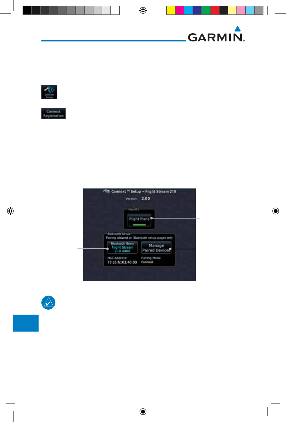
16-46
Garmin GTN 725/750 Pilot’s Guide
190-01007-03 Rev. J
Foreword
Getting
Started
Audio &
Xpdr Ctrl
Com/Nav
FPL
Direct-To
Proc
Charts
Wpt Info
Map
Traffic
Terrain
Weather
Nearest
Services/
Music
Utilities
System
Messages
Symbols
Appendix
Index
16.10 Connext Setup - GSR 56
This page provides information about the GSR 56 and the Connext
Registration page. See section 16.3.3 GSR 56 Status for more details.
1. While viewing the System page, touch Connext Setup to
access the GSR 56 LRU Status page.
2. Touch Connext Registration to set up the Connext account.
Follow the information provided in
16.3.3 GSR 56 Status
.
16.11 Connext Setup - Flight Stream 210
The GTN can interface with the Flight Stream 210 Bluetooth transceiver.
Using the Flight Stream 210 and the GTN, flight plans can be sent and received
over Bluetooth. In addition, GPS position is provided from the GTN and attitude
can be forwarded from a connected GDU. The GTN can also configure the Flight
Stream's Bluetooth.
Touch To Enable
Flight Plan Import
Touch To Set
The Bluetooth
Name
Touch To Manage
Paired Devices
Figure 16-59 Connext Setup for Flight Stream 210
NOTE: Turning Flight Plan imports off will remove the ability of the GTN
to receive flight plans from the Flight Stream 210. This could be used if
there are repeated erroneous attempts by a portable device application
to send flight plans to the GTN.
190-01007-03-Final.indb 46 7/9/2015 2:08:47 PM
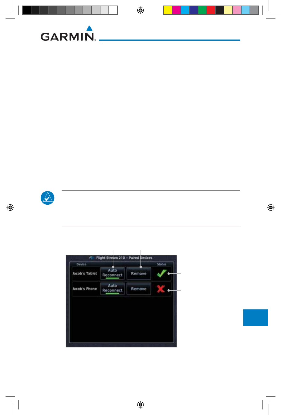
16-47190-01007-03 Rev. J
Garmin GTN 725/750 Pilot’s Guide
Foreword
Getting
Started
Audio &
Xpdr Ctrl
Com/Nav
FPL
Direct-To
Proc
Charts
Wpt Info
Map
Traffic
Terrain
Weather
Nearest
Services/
Music
Utilities
System
Messages
Symbols
Appendix
Index
16.11.1 Operation
Data output from the GTN and Flight Stream 210 occurs automatically
and requires no pilot action (such as, flight plan, GPS position, and attitude).
Additionally, ADS-B traffic and weather can be output from the Flight Stream
when connected to a GDL 88 and XM WX and SiriusXM satellite radio
information can output when connected a GDL 69.
From the Connext Setup page, the pilot can enable/disable flight plan
importing, change the Flight Stream Bluetooth name, and manage paired
devices.
The device status indicates if the portable device is connected and
communicating with the Flight Stream. The “Auto-Reconnect” setting determines
if the Flight Stream will automatically connect to up to four devices when in
range. When this setting is disabled, the pilot must initiate the connection from
the device. Removing a device from this page by pressing “Remove” will require
the device to be paired again before transferring data.
NOTE: If the pairing is removed from either device (portable device or
GTN) it must be removed on the other device before a new pairing to that
same device is established again. Essentially, pairing must be removed on
both devices before repairing.
Device Is
Connected And
Communicating
Device Is Not
Connected Or
Communicating
Touch To Remove
The Device
Touch To Automatically
Connect To The Device
When In Range
Figure 16-60 Managing Paired Devices
190-01007-03-Final.indb 47 7/9/2015 2:08:47 PM
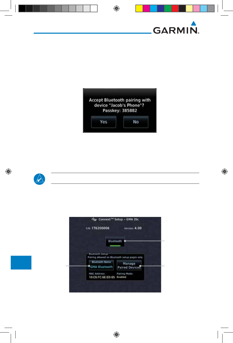
16-48
Garmin GTN 725/750 Pilot’s Guide
190-01007-03 Rev. J
Foreword
Getting
Started
Audio &
Xpdr Ctrl
Com/Nav
FPL
Direct-To
Proc
Charts
Wpt Info
Map
Traffic
Terrain
Weather
Nearest
Services/
Music
Utilities
System
Messages
Symbols
Appendix
Index
16.11.2 Pairing a Device
New devices can only be paired with the Flight Stream when it is in “Pairing
Mode”. The Flight Stream will be in pairing mode when the GTN is navigated
to the Connext Setup page and/or the Manage Paired Devices page. The pairing
must be initiated by the portable device. Pop-ups displayed on the portable
device and GTN will be displayed to confirm the pairing.
Figure 16-61 Confirm Pairing With A New Device
Selecting “Manage Paired Devices” opens a page that lists all of devices paired
to the Flight Stream 210.
16.12 Connext Setup – GMA 35c
NOTE: This feature is available in software version 6.00 or later.
The GTN can interface with the GMA 35c Bluetooth audio panel. Using the
GMA 35c and the GTN, audio or telephone calls from a portable device can be
streamed over Bluetooth to the GMA. The GTN can also configure the Bluetooth
functions of the GMA 35c.
Touch To Enable
Bluetooth
Touch To Set
Bluetooth Name Touch To Manage
Paired Devices
Figure 16-62 Connext Setup for GMA 35c
190-01007-03-Final.indb 48 7/9/2015 2:08:47 PM
16-49190-01007-03 Rev. J
Garmin GTN 725/750 Pilot’s Guide
Foreword
Getting
Started
Audio &
Xpdr Ctrl
Com/Nav
FPL
Direct-To
Proc
Charts
Wpt Info
Map
Traffic
Terrain
Weather
Nearest
Services/
Music
Utilities
System
Messages
Symbols
Appendix
Index
From the Connext Setup page, the pilot can enable/disable Bluetooth, change
the GMA 35c Bluetooth name, and manage paired devices. On the Paired
Devices page, the device status indicates if the portable device is connected and
communicating with the GMA 35c. Only one portable device can be connected
to the GMA 35c at a time. To connect a different device when one is already
connected, the existing connection must be ended by removing the portable
device pairing from the GMA 35c or by disconnecting or disabling Bluetooth on
the portable device. Removing a device from this page by pressing “Remove” will
require the device to be paired again before streaming audio.
NOTE: If the pairing is removed from either device (portable device or
GMA) it must be removed on the other device before a new pairing to that
same device is established again. Essentially, pairing must be removed on
both devices before repairing.
New devices can only be paired with the GMA 35c when it is in “Pairing
Mode”. The GMA will be in pairing mode when on the Connext Setup page or
the Manage Paired Devices page. The pairing must be initiated by the portable
device. A pop-up will be displayed on the portable device to confirm the pairing.
190-01007-03-Final.indb 49 7/9/2015 2:08:47 PM
16-50
Garmin GTN 725/750 Pilot’s Guide
190-01007-03 Rev. J
Foreword
Getting
Started
Audio &
Xpdr Ctrl
Com/Nav
FPL
Direct-To
Proc
Charts
Wpt Info
Map
Traffic
Terrain
Weather
Nearest
Services/
Music
Utilities
System
Messages
Symbols
Appendix
Index
16.13 Voice Command
NOTE: This feature is available in software version 6.00, or later.
The Voice Command page allows controlling the voice command function
and viewing the voice command status and recent commands. Voice Commands
are only available when connected to a compatible Garmin audio panel and
when enabled by the installer.
Installed Voice
Command
Grammar
Version
Touch To View
Recently Spoken
Commands
Voice Command
Tone Status
Touch To
Activate Voice
Commands
Figure 16-63 Voice Command Setup
1. While viewing the System page, touch the Voice Commands
key.
2. Touch the Voice Commands key to toggle activation. A green
bar will appear when Voice commands are active.
3. Touch the Command History key to open a list of recently
spoken commands.
Crew Member
Who Issued
Command
Time Command
Was Issued
Command Name
Command Status
Figure 16-64 Voice Command History
190-01007-03-Final.indb 50 7/9/2015 2:08:47 PM
17-1190-01007-03 Rev. J
Garmin GTN 725/750 Pilot’s Guide
Foreword
Getting
Started
Audio &
Xpdr Ctrl
Com/Nav
FPL
Direct-To
Proc
Charts
Wpt Info
Map
Traffic
Terrain
Weather
Nearest
Services/
Music
Utilities
System
Messages
Symbols
Appendix
Index
17 MESSAGES
When a Message has been issued by the unit, the Message (MSG) key/
annunciator in the lower left of the display will blink. Touch the MSG key to
view the messages. After viewing the messages, touch the Back key to return
to the previously viewed page. The Messages provide an aid to troubleshooting
system operation.
System messages are not crossfilled between GTN units. Each GTN will display
messages based on data received by that unit. This may result in duplication of
messages between units, however the pilot should view messages on both GTN
units when more than one is installed to ensure all messages are received.
Message Key -
Touch To Toggle
Message Display
Message List
Figure 17-1 Message Display
190-01007-03-Final.indb 1 7/9/2015 2:08:48 PM
17-2
Garmin GTN 725/750 Pilot’s Guide
190-01007-03 Rev. J
Foreword
Getting
Started
Audio &
Xpdr Ctrl
Com/Nav
FPL
Direct-To
Proc
Charts
Wpt Info
Map
Traffic
Terrain
Weather
Nearest
Services/
Music
Utilities
System
Messages
Symbols
Appendix
Index
Message Description Action
ABORT
APPROACH -
GPS approach no
longer available.
This message is
triggered outside
the MAP if the GTN
system can no longer
provide approach
level of service.
Vertical guidance
will be removed from
the external CDI/HSI
display.
Initiate a climb to the MSA or
other published safe altitude, abort
the approach, and execute a non-
GPS based approach.
AIRSPACE ALERT -
Inside airspace.
The aircraft inside an
airspace type for which
alerts are configured.
No action is necessary; message is
informational only.
AIRSPACE ALERT -
Airspace within
2 nm and entry
in less than 10
minutes.
The aircraft is within 2
nm and predicted to
enter an airspace type,
within 10 minutes,
for which alerts are
configured.
No action is necessary; message is
informational only.
AIRSPACE ALERT -
Airspace entry
in less than 10
minutes.
The aircraft is predicted
to enter an airspace
type, within 10 minutes,
for which alerts are
configured.
No action is necessary; message is
informational only.
AIRSPACE ALERT -
Within 2 nm of
airspace.
The aircraft is within
2nm of an airspace
type for which alerts
are configured.
No action is necessary; message is
informational only.
APR GUIDANCE
AVAILABLE -
Press “Enable APR
Output” before
selecting APR on
autopilot.
The GTN is configured
for KAP140/KFC225
autopilot, and approach
guidance is now
available.
Press the “Enable APR Output”
key on the GTN, this will cause
the autopilot to go into ROL
mode. Engage the autopilot into
approach mode. See section 6.14
for additional information.
190-01007-03-Final.indb 2 7/9/2015 2:08:48 PM

17-3190-01007-03 Rev. J
Garmin GTN 725/750 Pilot’s Guide
Foreword
Getting
Started
Audio &
Xpdr Ctrl
Com/Nav
FPL
Direct-To
Proc
Charts
Wpt Info
Map
Traffic
Terrain
Weather
Nearest
Services/
Music
Utilities
System
Messages
Symbols
Appendix
Index
Message Description Action
APPROACH
DOWNGRADE -
Approach
downgraded. Use
LNAV minima.
Approach has been
downgraded from
LPV or LNAV/VNAV,
to an LNAV approach.
Vertical guidance
will be removed from
the external CDI/HSI
display.
Continue to fly the approach using
published LNAV minimums.
APPROACH NOT
ACTIVE -
Do not continue
GPS approach.
GPS approach could
not transition to active
(e.g., the GTN is on
an approach and did
not have the required
HPL/VPL to get into at
least LNAV, so is still in
TERM).
Abort the approach, and execute a
non-GPS based approach.
AUDIO PANEL -
Audio panel needs
service.
The GMA 35 is
reporting to the GTN
that it needs service.
The audio panel may
continue to function.
Contact dealer for service.
AUDIO PANEL -
Audio panel is
inoperative or
connection to GTN
is lost.
The GTN is configured
for Garmin audio panel
control (GMA 35)
and the GTN cannot
communicate with the
GMA 35. No control
of the GMA 35 will be
possible.
Remove power from the GMA 35
audio panel by pulling the circuit
breaker labeled “Audio.” The pilot
will be able to communicate with
the Com 2 radio. Contact dealer
for service.
CDI SOURCE -
Select appropriate
CDI source for
approach.
Aircraft is on a GPS
approach but CDI is set
to VLOC, or aircraft is
on VLOC approach and
CDI is set to GPS and
aircraft is less than 2
nm from the FAF.
Select the appropriate CDI source
for approach.
190-01007-03-Final.indb 3 7/9/2015 2:08:48 PM

17-4
Garmin GTN 725/750 Pilot’s Guide
190-01007-03 Rev. J
Foreword
Getting
Started
Audio &
Xpdr Ctrl
Com/Nav
FPL
Direct-To
Proc
Charts
Wpt Info
Map
Traffic
Terrain
Weather
Nearest
Services/
Music
Utilities
System
Messages
Symbols
Appendix
Index
Message Description Action
CDI/HSI FLAG -
Main lateral/
vertical flag
on CDI/HSI is
inoperative.
The Main Lateral
Superflag or Main
Vertical Superflag
output has been turned
off due to an over-
current condition.
Verify course guidance is valid
and correct by crosschecking with
the GTN on-screen CDI and other
navigational equipment. Contact
dealer for service.
COM RADIO -
Com radio needs
service.
The com radio is
reporting that it needs
service. The com radio
may continue to
function.
Cycle the power to the COM radio.
Contact dealer for service.
COM RADIO -
Com radio may be
inoperative.
The com radio is not
communicating properly
with the system.
Press and hold the volume knob or
the external com remote transfer
(COM RMT XFR) switch, if installed
– this will force the com radio to
121.5 MHz. Contact dealer for
service.
COM RADIO -
Com overtemp
or undervoltage.
Reducing
transmitter power.
Com radio is
in overtemp or
undervoltage mode
and transmitting power
has been reduced to
prevent damage to the
com radio. Radio range
will be reduced.
Decrease length of com
transmissions, decrease cabin
temperature and increase cabin
airflow (especially near the GTN).
Check aircraft voltage and reduce
electrical load as necessary.
Contact dealer for service if this
message persists.
COM RADIO -
Com locked to
121.5 MHz. Hold
remote com
transfer key to exit.
Com radio is locked to
121.5 MHz.
The external com remote transfer
(COM RMT XFR) switch has been
held and the com radio is tuned to
121.5. To exit this mode, hold the
com remote transfer (COM RMT
XFR) switch for two seconds.
190-01007-03-Final.indb 4 7/9/2015 2:08:48 PM

17-5190-01007-03 Rev. J
Garmin GTN 725/750 Pilot’s Guide
Foreword
Getting
Started
Audio &
Xpdr Ctrl
Com/Nav
FPL
Direct-To
Proc
Charts
Wpt Info
Map
Traffic
Terrain
Weather
Nearest
Services/
Music
Utilities
System
Messages
Symbols
Appendix
Index
Message Description Action
CONFIGURATION
- Terrain/TAWS
configuration is
invalid. GTN needs
service.
TAWS is inoperative
due to a configuration
problem with the GTN.
This message will be
accompanied by a TER
FAIL annunciation.
Contact dealer for service.
CONFIGURATION
MODULE -
GTN configuration
module needs
service.
The GTN cannot
communicate with its
configuration module.
The GTN may still have
a valid configuration.
Contact dealer for service.
COOLING -
GTN overtemp.
Reducing backlight
brightness.
Backlight brightness
has been reduced
due to high display
temperatures. The
backlight level will
remain high enough to
be visible in daylight
conditions.
Decrease cabin temperature and
increase cabin airflow (especially
near the GTN). Contact dealer for
service if this message persists.
COOLING FAN -
The cooling fan has
failed.
The GTN cooling fan is
powered, but it is not
turning at the desired
RPM.
Decrease cabin temperature and
increase cabin airflow (especially
near the GTN) to prevent damage
to the unit. Contact dealer for
service.
CROSSFILL
ERROR -
Crossfill is
inoperative. See
CRG for crossfilled
items.
Crossfill is not
working due to loss
of communication
with other GTN or due
to one GTN needing
service.
See section 16.4.1.4 for a list of
crossfilled items that will no longer
be crossfilled. Contact dealer for
service.
190-01007-03-Final.indb 5 7/9/2015 2:08:48 PM

17-6
Garmin GTN 725/750 Pilot’s Guide
190-01007-03 Rev. J
Foreword
Getting
Started
Audio &
Xpdr Ctrl
Com/Nav
FPL
Direct-To
Proc
Charts
Wpt Info
Map
Traffic
Terrain
Weather
Nearest
Services/
Music
Utilities
System
Messages
Symbols
Appendix
Index
Message Description Action
CROSSFILL
ERROR -
GTN software
mismatch. See
CRG for crossfilled
items.
Crossfill is configured
“on” but is not working
due to software
mismatch.
See section 16.4.1.4 for a list of
crossfilled items that will no longer
be crossfilled. Contact dealer to
have software versions updated.
CROSSFILL
ERROR - GTN
Navigation DB
mismatch. See
CRG for crossfilled
items.
The navigation
databases do not
match between GTNs
resulting in a loss
of communication
between two units.
Check the specified database
version of both GTNs and ensure it
is up-to-date. Update the specified
database if needed.
CROSSFILL
STATUS - Crossfill
is turned off.
Crossfill is turned off.
No action.
DATABASE -
Chart function
unavailable.
The GTN is configured
for ChartView or
FliteCharts and chart
verification has failed.
Contact dealer for service.
DATABASE -
Chart database
valid until [DATE].
The GTN is configured
for ChartView or
FliteCharts and the
chart database has or is
about to expire.
Verify chart database expiration
date on the System – System
Status page. Update chart
database if necessary for
operations.
DATABASE -
A procedure has
been modified in
a cataloged flight
plan.
A new database update
caused a procedure to
be truncated because
the flight plan now has
too many waypoints or
removed a procedure
because it no longer
exists in the database.
Verify stored cataloged flight plans
and procedures. Modify stored
flight plans and procedures as
necessary to include the current
procedures by re-loading those
procedures to the stored flight plan
routes.
190-01007-03-Final.indb 6 7/9/2015 2:08:48 PM

17-7190-01007-03 Rev. J
Garmin GTN 725/750 Pilot’s Guide
Foreword
Getting
Started
Audio &
Xpdr Ctrl
Com/Nav
FPL
Direct-To
Proc
Charts
Wpt Info
Map
Traffic
Terrain
Weather
Nearest
Services/
Music
Utilities
System
Messages
Symbols
Appendix
Index
Message Description Action
DATABASE -
Verify user-
modified
procedures in
stored flight plans
are correct.
A stored flight plan
contains procedures
that have been
manually updated, and
a navigation database
update has occurred.
Verify that the user-modified
procedures in stored flight plans
are correct.
DATABASE -
Verify airways in
stored flight plans
are correct.
A stored flight plan
contains an airway that
is no longer consistent
with the current
navigation database.
Verify that the airways in stored
flight plans are correct. Modify
stored flight plans as necessary to
include the current airways by re-
loading those airways to the stored
flight plan routes.
DATABASE -
Terrain or Obstacle
database not
available.
The terrain or obstacle
database is missing or
corrupt.
Re-load these databases on the
external data card.
DATABASE -
Terrain display
unavailable for
current location.
The aircraft is outside
the terrain database
coverage area.
Terrain and TAWS functions will
be unavailable. If terrain coverage
is desired in the area, load
appropriate coverage area on the
external data card.
DATACARD
ERROR -
SD card is invalid
or failed.
External data card has
an error and the unit
is not able to read the
databases.
ChartView, FlightCharts, and
Terrain databases will not be
accessible by the unit. Contact
dealer for service.
DATACARD
REMOVED -
Reinsert SD card.
External data card was
removed.
Reinsert data card.
DATALINK -
ADS-B fault: UAT
receiver.
The GDL 88 has
detected a UAT receiver
fault.
Contact dealer for service.
DATALINK -
ADS-B fault: 1090
receiver.
The GDL 88 has
detected a 1090
receiver fault.
Contact dealer for service.
190-01007-03-Final.indb 7 7/9/2015 2:08:48 PM

17-8
Garmin GTN 725/750 Pilot’s Guide
190-01007-03 Rev. J
Foreword
Getting
Started
Audio &
Xpdr Ctrl
Com/Nav
FPL
Direct-To
Proc
Charts
Wpt Info
Map
Traffic
Terrain
Weather
Nearest
Services/
Music
Utilities
System
Messages
Symbols
Appendix
Index
Message Description Action
DATALINK - GDL
69 is inoperative or
connection to GTN
is lost.
The GTN is configured
for a Garmin datalink
(GDL 69 or 69A)
and the GTN cannot
communicate with the
datalink. Data from
the datalink will not be
available.
Contact dealer for service.
DATALINK -
GDL 88 ADS-B
failure. Unable to
transmit ADS-B
messages.
GDL 88 is not able
to transmit an ADS-B
message due to a
failure with the GDL 88
system or antenna(s).
Contact dealer for service.
DATALINK -
GDL 88 ADS-B
fault.
The GDL 88 has
detected a fault with
one of the GDL 88
UAT/1090 antennas.
Contact dealer for service.
DATALINK -
GDL88 ADS-B
fault. Pressure
altitude input is
invalid.
The GDL 88 has lost
communication with
the pressure altitude
source.
Contact dealer for service.
DATALINK -
GDL88 ADS-B is
not transmitting
position. Check
GPS devices.
The GDL 88 has
detected a position
input fault.
Contact dealer for service.
DATALINK -
GDL88 ADS-B
traffic has failed.
GDL 88 may have lost
GPS position.
The GDL 88 has
detected an internal
failure.
Contact dealer for service.
190-01007-03-Final.indb 8 7/9/2015 2:08:48 PM

17-9190-01007-03 Rev. J
Garmin GTN 725/750 Pilot’s Guide
Foreword
Getting
Started
Audio &
Xpdr Ctrl
Com/Nav
FPL
Direct-To
Proc
Charts
Wpt Info
Map
Traffic
Terrain
Weather
Nearest
Services/
Music
Utilities
System
Messages
Symbols
Appendix
Index
Message Description Action
DATALINK -
GDL88
configuration
module needs
service.
The GDL 88
has detected a
configuration module
fault.
Contact dealer for service.
DATALINK -
GDL88 control
input fault. Check
transponder is in
correct mode.
The GDL 88 has lost
communication with
the transponder.
Contact dealer for service.
DATALINK -
GDL88 CSA failure.
The GDL 88 is reporting
to the GTN that the
CSA application has
failed. Traffic alerting
on ADS-B traffic is
unavailable.
Ensure the aircraft has a clear view
of the sky. If the problem persists.
Contact dealer for service.
DATALINK -
GDL88 external
traffic system has a
low battery.
The GDL 88 is reporting
that the external traffic
system has a low
battery.
Contact dealer for service.
DATALINK - GDL
88 external traffic
system has been in
standby for more
than 60 seconds.
The aircraft is airborne
and the GDL 88 is
reporting that the
external traffic system
has been in standby for
more than 60 seconds.
Set the TAS/TCAS/TCAD traffic
device to “operate” on the traffic
page if traffic alerts are desired.
DATALINK -
GDL88 external
traffic system
inoperative or
connection lost.
The GDL 88 has
detected a TAS/TCAS
input fault.
Contact dealer for service.
190-01007-03-Final.indb 9 7/9/2015 2:08:48 PM

17-10
Garmin GTN 725/750 Pilot’s Guide
190-01007-03 Rev. J
Foreword
Getting
Started
Audio &
Xpdr Ctrl
Com/Nav
FPL
Direct-To
Proc
Charts
Wpt Info
Map
Traffic
Terrain
Weather
Nearest
Services/
Music
Utilities
System
Messages
Symbols
Appendix
Index
Message Description Action
DATALINK -
GDL 88 is
inoperative or
connection to GTN
is lost.
The GTN is configured
for a Garmin datalink
(GDL 88) and the GTN
cannot communicate
with the datalink. Data
from the datalink will
not be available.
Contact dealer for service.
DATALINK -
GDL88 needs
service.
GDL 88 has detected
an internal fault.
Contact dealer for service.
DATALINK -
GSR56 is
inoperative or
connection to GTN
is lost.
The GTN is configured
for a Garmin GSR 56
and the GTN cannot
communicate with the
GSR 56. GSR Weather,
Position Reporting, and
Phone Services will be
unavailable.
Close the GSR 56 circuit breaker
and ensure the GSR 56 is receiving
power. Contact dealer for service.
DATALINK -
GSR56 data
services
inoperative;
registration
required.
The GSR 56 is not
registered. GSR
Weather, Position
Reporting, and Phone
Services will be
unavailable.
Contact dealer for service.
DATA LOST -
Pilot stored data
was lost. Recheck
settings.
User settings such as
map detail level, nav
range ring on/off, traffic
overlay on/off, and alert
settings have been lost.
Recheck settings.
DATA SOURCE -
Pressure altitude
source inoperative
or connection to
GTN lost.
The GTN is configured
to receive pressure
altitude but is not
receiving it from any
source.
If the GTN is being used to forward
pressure altitude to a transponder,
the transponder will not be
receiving pressure altitude from the
GTN while that message is present.
Contact dealer for service.
190-01007-03-Final.indb 10 7/9/2015 2:08:48 PM

17-11190-01007-03 Rev. J
Garmin GTN 725/750 Pilot’s Guide
Foreword
Getting
Started
Audio &
Xpdr Ctrl
Com/Nav
FPL
Direct-To
Proc
Charts
Wpt Info
Map
Traffic
Terrain
Weather
Nearest
Services/
Music
Utilities
System
Messages
Symbols
Appendix
Index
Message Description Action
DATA SOURCE -
Heading source
inoperative or
connection to GTN
lost.
The GTN is configured
to receive heading
information but is not
receiving it from any
source.
Heading up map displays will not
be available. Contact dealer for
service.
DATA SOURCE -
Radar Altimeter
source inoperative
or connection to
GTN lost.
The GTN is configured
to receive radio altitude
information but is not
receiving it from any
source.
50 foot aural annunciation
is unavailable for HTAWS
installations. Contact dealer for
service.
DEMO MODE -
Demo mode is
active. Do not use
for navigation.
The GTN is in Demo
Mode and must not
be used for actual
navigation.
Do not use for navigation. Power
cycle the GTN to exit demo mode.
Also ensure that the Direct-To key
is not stuck.
FLIGHT PLAN
IMPORT - Flight
plan import failed.
Catalog is full.
The flight plan
catalog is full and the
requested flight plan
could not be imported.
Edit the flight plan catalog to
remove unneeded flight plans.
FLIGHT PLAN
IMPORT - Flight
plan import failed.
The requested flight
plan could not be
imported because the
GTN was unable to
decode the contents of
the flight plan.
Check for proper operation of
the needed components. If the
problem persists. Contact dealer
for service.
FLIGHT PLAN
IMPORT - New
imported flight
plan(s) available
for preview.
The GTN has received a
new flight plan that is
available for preview by
the pilot.
No action is necessary; message is
informational only.
190-01007-03-Final.indb 11 7/9/2015 2:08:48 PM

17-12
Garmin GTN 725/750 Pilot’s Guide
190-01007-03 Rev. J
Foreword
Getting
Started
Audio &
Xpdr Ctrl
Com/Nav
FPL
Direct-To
Proc
Charts
Wpt Info
Map
Traffic
Terrain
Weather
Nearest
Services/
Music
Utilities
System
Messages
Symbols
Appendix
Index
Message Description Action
FPL WAYPOINT
LOCKED -
Stored flight plan
waypoint is not in
current navigation
database.
A stored flight plan
waypoint is no longer in
the current navigation
database.
Verify stored cataloged flight plans
and procedures. Modify stored
flight plans as necessary to include
waypoints that are in the current
navigation database.
FPL WPT MOVED -
Stored flight plan
waypoint has
changed location.
A stored flight plan
waypoint has moved
by more than 0.33 arc
minutes from where
previously positioned.
Verify stored cataloged flight plans
and procedures. Modify stored
flight plans as necessary to include
waypoints that are in the current
navigation database.
GLIDESLOPE -
Glideslope receiver
needs service.
The glideslope board is
indicating that it needs
service. The glideslope
board may continue to
function.
Verify glideslope deviation
indications with another source
and crosscheck final approach
fix crossing altitude. If another
glideslope source is not available
for verification, fly a GPS based
approach. Contact dealer for
service.
GLIDESLOPE -
Glideslope receiver
has failed.
The glideslope board
is not communicating
property with the
system.
Fly an approach that does not use
the glideslope receiver (VOR, LOC,
GPS). Contact dealer for service.
GNS CROSSFILL -
GTN user
waypoint(s)
replaced with GNS
user waypoints.
A user waypoint from
the GNS replaced
one or more existing
waypoints on the GTN.
Ensure that the waypoints on the
GNS have unique names before
transferring to the GTN to avoid
overwriting existing waypoints.
GNS CROSSFILL -
Catalog full; not all
GNS waypoint(s)
transferred.
A user waypoint from
the GNS could not be
created because the
user waypoint catalog
is full.
Remove some of the waypoints
from the catalog to make room for
the waypoints from the GNS.
190-01007-03-Final.indb 12 7/9/2015 2:08:48 PM

17-13190-01007-03 Rev. J
Garmin GTN 725/750 Pilot’s Guide
Foreword
Getting
Started
Audio &
Xpdr Ctrl
Com/Nav
FPL
Direct-To
Proc
Charts
Wpt Info
Map
Traffic
Terrain
Weather
Nearest
Services/
Music
Utilities
System
Messages
Symbols
Appendix
Index
Message Description Action
GNS CROSSFILL -
Waypoint transfer
failed.
Waypoint transfer
failed/incomplete.
The data transfer should be
reattempted.
GPS
NAVIGATION
LOST -
Insufficient
satellites. Use other
navigation source.
GPS position has been
lost due to lack of
satellites.
Wait for GPS satellite geometry
to improve. Ensure the aircraft
has a clear view of the sky. Use a
different GPS receiver or a non-
GPS based source of navigation.
Contact dealer for service.
GPS
NAVIGATION
LOST -
Erroneous
position. Use other
navigation source.
GPS position has been
lost due to erroneous
position.
Use a different GPS receiver
or a non-GPS based source of
navigation. Contact dealer for
service.
GPS RECEIVER -
GPS receiver has
failed. Check GPS
coax for electrical
short.
Internal communication
to the SBAS board is
inoperative.
Use a different GPS receiver
or a non-GPS based source of
navigation. Contact dealer for
service.
GPS RECEIVER -
Low internal clock
battery.
The GPS module
indicates that its clock
battery is low. Almanac
data may have been
lost. The unit will
function normally, but
may take a longer
than normal period to
acquire a GPS position.
Contact dealer for service.
GPS RECEIVER -
GPS receiver needs
service.
The GPS module
is reporting that it
needs service. The GPS
module may continue
to function.
Use a different GPS receiver
or a non-GPS based source of
navigation. Contact dealer for
service.
190-01007-03-Final.indb 13 7/9/2015 2:08:48 PM

17-14
Garmin GTN 725/750 Pilot’s Guide
190-01007-03 Rev. J
Foreword
Getting
Started
Audio &
Xpdr Ctrl
Com/Nav
FPL
Direct-To
Proc
Charts
Wpt Info
Map
Traffic
Terrain
Weather
Nearest
Services/
Music
Utilities
System
Messages
Symbols
Appendix
Index
Message Description Action
GPS SEARCHING
SKY -
Ensure GPS
antenna has an
unobstructed view
of the sky.
The GPS module is
acquiring position and
may take longer than
normal. This message
normally occurs after
initial installation or if
the unit has not been
powered for several
weeks.
No action is necessary; message is
informational only.
GTN -
GTN needs service.
The GTN has lost
calibration data that
was set by Garmin
during manufacturing.
Contact dealer for service.
HOLD EXPIRED -
Holding EFC time
has expired.
The selected Expect
Further Clearance (EFC)
time for a user-defined
hold has passed.
No action is necessary; message is
information only.
HTAWS -
Invalid Terrain
Database.
The terrain database is
of insufficient resolution
for use with HTAWS.
Load HTAWS specific terrain
database on the external SD card.
INTERFACE
ADAPTER -
GAD 42
configuration
needs service.
GAD 42 indicates a
configuration error.
Verify all input/output data from/
to the GAD 42 Interface Adapter.
Contact dealer for service.
INTERFACE
ADAPTER -
GAD 42 needs
service.
GAD 42 indicates it
needs service. The GAD
42 may continue to
function.
Verify all input/output data from/
to the GAD 42 Interface Adapter.
Contact dealer for service.
INTERNAL SD
CARD ERROR -
GTN needs service.
Internal SD card has an
error. This card is not
accessible by the user.
Contact dealer for service.
190-01007-03-Final.indb 14 7/9/2015 2:08:48 PM

17-15190-01007-03 Rev. J
Garmin GTN 725/750 Pilot’s Guide
Foreword
Getting
Started
Audio &
Xpdr Ctrl
Com/Nav
FPL
Direct-To
Proc
Charts
Wpt Info
Map
Traffic
Terrain
Weather
Nearest
Services/
Music
Utilities
System
Messages
Symbols
Appendix
Index
Message Description Action
INTERNAL SD
CARD REMOVED -
GTN needs service.
Internal SD card was
removed or failed. This
card is not accessible by
the user.
Contact dealer for service.
KEY STUCK -
HOME key is stuck.
The HOME key has
been in pressed
position for at least 30
seconds. This key will
now be ignored.
Verify the HOME key is not
pressed. Press the Home key again
to cycle its operation. Contact
dealer for service if this message
persists.
KEY STUCK -
Direct-To key is
stuck.
The Direct-To key
has been in pressed
position for at least 30
seconds. This key will
now be ignored.
Verify the Direct-To key is not
pressed. Contact dealer for service
if this message persists.
KNOB STUCK -
Volume knob
is stuck in the
pressed position.
The Volume knob
has been in pressed
position for at least
30 seconds. This knob
press will now be
ignored.
Verify the volume knob is not
pressed. Contact dealer for service
if this message persists.
KNOB STUCK -
Dual concentric
inner knob is stuck
in the pressed
position.
The dual concentric
inner knob has been in
pressed position for at
least 30 seconds. This
knob press will now be
ignored.
Verify the dual concentric knob
is not pressed. Contact dealer for
service if this message persists.
LOCKED FLIGHT
PLAN
Cannot activate
a flight plan
containing a locked
waypoint.
The user is trying to
activate a flight plan
that contains a locked
waypoint.
Unlock the flight plan by modifying
stored flight plans as necessary
to include waypoints, procedures,
and airways that are in the current
navigation database.
190-01007-03-Final.indb 15 7/9/2015 2:08:48 PM

17-16
Garmin GTN 725/750 Pilot’s Guide
190-01007-03 Rev. J
Foreword
Getting
Started
Audio &
Xpdr Ctrl
Com/Nav
FPL
Direct-To
Proc
Charts
Wpt Info
Map
Traffic
Terrain
Weather
Nearest
Services/
Music
Utilities
System
Messages
Symbols
Appendix
Index
Message Description Action
LOSS OF
INTEGRITY (LOI)-
Verify GPS
position with
other navigation
equipment.
Antenna may be
shaded from satellites.
The GPS module has
reported a loss of
integrity.
Make sure the aircraft is clear of
hangars, buildings, trees, etc. Use
a different GPS receiver or a non-
GPS based source of navigation.
Contact dealer for service if this
message persists.
MAGNETIC
NORTH
APPROACH -
Verify NAV angles
are referenced
to magnetic
north (magnetic
variation).
The NAV angle is not
set to Magnetic and a
magnetic approach is
loaded.
Change NAV angle setting to
Magnetic.
MAGNETIC
VARIATION -
Aircraft in area
with large mag var.
Verify all course
angles.
MagVar is flagged
as unreliable in the
MagVar database.
This normally occurs
when operating at high
latitudes that do not
support a Nav Angle of
Magnetic.
Verify that the geographical region
supports navigation based on
magnetic variation.
MARK ON
TARGET -
Waypoint creation
has failed. MOT
requires GPS
position.
Mark on target
waypoint creation
has failed because of
missing GPS position.
Wait for GPS satellite geometry to
improve. Ensure the aircraft has a
clear view of the sky. Reattempt
waypoint creation. Contact dealer
for service.
NAV ANGLE -
NAV Angles are
referenced to True
North (T).
Nav angle is set to True. No action is necessary; message is
informational only.
190-01007-03-Final.indb 16 7/9/2015 2:08:49 PM
17-17190-01007-03 Rev. J
Garmin GTN 725/750 Pilot’s Guide
Foreword
Getting
Started
Audio &
Xpdr Ctrl
Com/Nav
FPL
Direct-To
Proc
Charts
Wpt Info
Map
Traffic
Terrain
Weather
Nearest
Services/
Music
Utilities
System
Messages
Symbols
Appendix
Index
Message Description Action
NAV ANGLE -
NAV Angles are
referenced to a
User set value (U).
Nav angle is set to User. No action is necessary; message is
informational only.
NON-WGS84
WAYPOINT -
See CRG. Location
may be different
than where
surveyed for [WPT].
The active waypoint is not
referenced to the WGS84
datum.
See Note 1 at the end of
the table.
No action is necessary; message is
informational only.
OBS -
OBS is not
available due to
dead reckoning or
no active waypoint.
OBS requires an active
waypoint and is not
supported in dead
reckoning mode.
No action is necessary; message is
informational only.
PARALLEL TRACK -
Parallel track not
supported past IAF.
Parallel track is
not supported on
approaches.
No action is necessary; message is
informational only.
PARALLEL TRACK -
Parallel track not
supported for turns
greater than 120
degrees.
Parallel track is not
supported for turns
greater than 120
degrees due to the
acute angle.
No action is necessary; message is
informational only.
PARALLEL TRACK -
Parallel track not
supported for leg
type.
Parallel track is not
supported on current
leg type.
No action is necessary; message is
informational only.
190-01007-03-Final.indb 17 7/9/2015 2:08:49 PM

17-18
Garmin GTN 725/750 Pilot’s Guide
190-01007-03 Rev. J
Foreword
Getting
Started
Audio &
Xpdr Ctrl
Com/Nav
FPL
Direct-To
Proc
Charts
Wpt Info
Map
Traffic
Terrain
Weather
Nearest
Services/
Music
Utilities
System
Messages
Symbols
Appendix
Index
Message Description Action
REMOTE KEY
STUCK -
Remote OBS key is
stuck.
The remote OBS (OBS
MODE SEL) key/switch
has been in pressed
position for at least 30
seconds. This input will
now be ignored. This
input is not available in
all installations.
Verify the OBS MODE SEL key/
switch is not stuck. Contact dealer
for service if this message persists.
REMOTE KEY
STUCK -
Remote CDI key is
stuck.
The remote CDI (CDI
SRC SEL) key/switch
has been in pressed
position for at least 30
seconds. This input will
now be ignored. This
input is not available in
all installations.
Verify the CDI SRC SEL key/switch
is not stuck. Contact dealer for
service if this message persists.
REMOTE KEY
STUCK -
Com push-to-talk
key is stuck.
The Push To Talk key/
switch has been in
pressed position for
at least 30 seconds.
This input will now be
ignored and the com
radio will no longer
transmit.
Verify the Push To Talk key/switch
is not stuck. Contact dealer for
service if this message persists.
REMOTE KEY
STUCK -
Com remote
transfer key is
stuck.
The remote com
transfer (COM RMT
XFR) key/switch has
been in pressed
position for at least 30
seconds. This input will
now be ignored. This
input is not available in
all installations.
Verify the COM RMT XFR key/
switch is not stuck. Contact dealer
for service if this message persists.
190-01007-03-Final.indb 18 7/9/2015 2:08:49 PM

17-19190-01007-03 Rev. J
Garmin GTN 725/750 Pilot’s Guide
Foreword
Getting
Started
Audio &
Xpdr Ctrl
Com/Nav
FPL
Direct-To
Proc
Charts
Wpt Info
Map
Traffic
Terrain
Weather
Nearest
Services/
Music
Utilities
System
Messages
Symbols
Appendix
Index
Message Description Action
REMOTE KEY
STUCK -
Com remote
frequency
increment key is
stuck.
The remote com
frequency increment
(COM CHAN UP) key/
switch has been in
pressed position for
at least 30 seconds.
This input will now
be ignored. This input
is not available in all
installations.
Verify the COM CHAN UP key/
switch is not stuck. Contact dealer
for service if this message persists.
REMOTE KEY
STUCK -
Com remote
frequency
decrement key is
stuck.
The remote com
frequency decrement
(COM CHAN DN) key/
switch has been in
pressed position for
at least 30 seconds.
This input will now
be ignored. This input
is not available in all
installations.
Verify the COM CHAN DN key/
switch is not stuck. Contact dealer
for service if this message persists.
REMOTE KEY
STUCK -
Nav remote
transfer key is
stuck.
The remote nav transfer
(NAV RMT XFR) key/
switch has been in
pressed position for
at least 30 seconds.
This input will now
be ignored. This input
is not available in all
installations.
Verify the NAV RMT XFR key/
switch is not stuck. Contact dealer
for service if this message persists.
190-01007-03-Final.indb 19 7/9/2015 2:08:49 PM
17-20
Garmin GTN 725/750 Pilot’s Guide
190-01007-03 Rev. J
Foreword
Getting
Started
Audio &
Xpdr Ctrl
Com/Nav
FPL
Direct-To
Proc
Charts
Wpt Info
Map
Traffic
Terrain
Weather
Nearest
Services/
Music
Utilities
System
Messages
Symbols
Appendix
Index
Message Description Action
REMOTE KEY
STUCK -
Remote go around
key is stuck.
The remote go around
(RMT GO ARND) key/
switch has been in
pressed position for
at least 30 seconds.
This input will now
be ignored. This input
is not available in all
installations.
Verify the RMT GO ARND key/
switch is not stuck. Contact dealer
for service if this message persists.
REMOTE KEY
STUCK -
TAWS inhibit key is
stuck.
The TAWS INHIBIT
discrete input has been
in pressed position for
at least 30 seconds.
This input will now
be ignored. This input
is not available in all
installations.
Verify the TAWS INHIBIT key/switch
is not stuck. Contact dealer for
service if this message persists.
REMOTE KEY
STUCK -
Alert Acknowledge
key is stuck.
The remote TAWS
alert acknowledge
(ALRT ACK) key/switch
has been in pressed
position for at least 30
seconds. This input will
now be ignored. This
input is not available in
all installations.
Verify the ALRT ACK key/switch
is not stuck. Contact dealer for
service if this message persists.
REMOTE KEY
STUCK -
RP Mode key is
stuck.
The remote RP MODE
key/switch has been
in pressed position for
at least 30 seconds.
This input will now
be ignored. This input
is not available in all
installations.
Verify the RP MODE key/switch
is not stuck. Contact dealer for
service if this message persists.
190-01007-03-Final.indb 20 7/9/2015 2:08:49 PM

17-21190-01007-03 Rev. J
Garmin GTN 725/750 Pilot’s Guide
Foreword
Getting
Started
Audio &
Xpdr Ctrl
Com/Nav
FPL
Direct-To
Proc
Charts
Wpt Info
Map
Traffic
Terrain
Weather
Nearest
Services/
Music
Utilities
System
Messages
Symbols
Appendix
Index
Message Description Action
REMOTE KEY
STUCK -
Pilot/Co-Pilot voice
command push-
to-command key is
stuck.
The remote push-to-
command key/switch
has been in pressed
position for at least 30
seconds. This input will
now be ignored. This
input is not available in
all installations.
Verify the push-to-command key/
switch is not stuck. Contact dealer
for service if this message persists.
SELECT
FREQUENCY -
Select appropriate
NAV frequency for
approach.
Correct NAV frequency
is not set in the active
NAV frequency for the
approach procedure.
Insert the correct frequency into
the active navigation frequency
window.
SET COURSE -
Set course on CDI/
HSI to [current
DTK].
The selected course
on the CDI/HSI does
not match the current
desired track.
Set the CDI/HSI selected course to
the current desired track.
STEEP TURN -
Aircraft may
overshoot course
during turn.
Flight plan contains an
acute course change
ahead which will
require a bank in excess
of normal to follow the
guidance. If coupled
to the autopilot, the
autopilot may not be
able to execute the
steep turn needed
to follow the course
guidance.
No action is necessary; message is
informational only. If desired, slow
the aircraft to shallow the turn.
STORMSCOPE -
StormScope is
inoperative or
connection to GTN
is lost.
The GTN is configured
for a WX-500
StormScope but is not
receiving data from it.
Close the Stormscope circuit
breaker and ensure Stormscope is
receiving power. Contact dealer for
service.
190-01007-03-Final.indb 21 7/9/2015 2:08:49 PM

17-22
Garmin GTN 725/750 Pilot’s Guide
190-01007-03 Rev. J
Foreword
Getting
Started
Audio &
Xpdr Ctrl
Com/Nav
FPL
Direct-To
Proc
Charts
Wpt Info
Map
Traffic
Terrain
Weather
Nearest
Services/
Music
Utilities
System
Messages
Symbols
Appendix
Index
Message Description Action
STORMSCOPE -
Invalid heading
received from
StormScope.
The WX-500
StormScope reports
that it has an invalid
heading source.
GTN StormScope data is correct
and may be used. Contact dealer
for service.
TAWS AUDIO
INHIBITED -
TAWS audio inhibit
input is stuck.
The TAWS Audio
Inhibit discrete input
has been active for
at least 30 seconds.
This input is active in
all installations. TAWS
audio may be heard at
the same time as other
audio alerts.
Contact dealer for service.
TIMER -
Timer has expired.
A user-configured timer
has expired.
No action is necessary; message is
informational only.
TRAFFIC -
Traffic device is
inoperative or
connection to GTN
is lost.
The GTN is configured
for a traffic device but
is not receiving data
from it. Traffic will not
be displayed on the
GTN.
Contact dealer for service.
TRAFFIC -
Traffic device has
been in standby
for more than 60
seconds.
The GTN is airborne
and the traffic device
has been in standby for
more than 60 seconds.
Set the traffic device to “operate”
on the traffic page if traffic alerts
are desired.
TRAFFIC -
Traffic device
battery low. Traffic
device user config
settings not saved.
The TCAD system
has indicated that its
battery is low.
Contact dealer for service.
190-01007-03-Final.indb 22 7/9/2015 2:08:49 PM

17-23190-01007-03 Rev. J
Garmin GTN 725/750 Pilot’s Guide
Foreword
Getting
Started
Audio &
Xpdr Ctrl
Com/Nav
FPL
Direct-To
Proc
Charts
Wpt Info
Map
Traffic
Terrain
Weather
Nearest
Services/
Music
Utilities
System
Messages
Symbols
Appendix
Index
Message Description Action
TRANSPONDER -
Transponder 1
and 2 Mode S
addresses do not
match.
The GTN is configured
for two transponders
and their Mode S
addresses do not
match. This message
is intended to assist
installers and will not
occur in a properly
configured system.
Contact dealer for service.
TRANSPONDER
1 OR 2
Transponder 1 or 2
needs service.
The transponder is
reporting to the GTN
that it needs service.
The transponder may
continue to function.
Verify squawk code and altitude
with ATC. Contact dealer for
service.
TRANSPONDER
1 OR 2
Transponder 1 or
2 is inoperative or
connection to GTN
is lost.
The GTN is configured
for transponder 1 or
2 but is not able to
communicate with the
transponder.
Verify squawk code and altitude
with ATC. Contact dealer for
service.
TRANSPONDER
1 OR 2
ADS-B is not
transmitting
position.
The transponder has
insufficient data to
support ADS-B.
Ensure the aircraft has a clear
view of the sky. Contact dealer for
service.
TRUE NORTH
APPROACH -
Verify NAV Angles
are referenced to
True North (T).
A procedure is loaded
that is referenced
to true north and
the active leg has a
published true north
reference.
Verify the Nav Angle is set to True
North.
190-01007-03-Final.indb 23 7/9/2015 2:08:49 PM

17-24
Garmin GTN 725/750 Pilot’s Guide
190-01007-03 Rev. J
Foreword
Getting
Started
Audio &
Xpdr Ctrl
Com/Nav
FPL
Direct-To
Proc
Charts
Wpt Info
Map
Traffic
Terrain
Weather
Nearest
Services/
Music
Utilities
System
Messages
Symbols
Appendix
Index
Message Description Action
USER WAYPOINT
IMPORT - User
waypoints
were imported
successfully.
All user waypoints
were imported
successfully.
No action is necessary; message is
informational only.
USER WAYPOINT
IMPORT - User
waypoint import
failed.
User Waypoint import
failed due to improper
file format.
Ensure the media has the correct
file format. If the problem persists.
Contact dealer for service.
USER WAYPOINT
IMPORT - User
waypoint import
failed. User
waypoint database
is full.
User Waypoint catalog
is full and the requested
user waypoints could
not be imported.
Edit the User Waypoint catalog to
remove unneeded user waypoints.
USER WAYPOINT
IMPORT - User
waypoints
imported
successfully -
existing waypoints
reused.
User waypoints
imported and existing
waypoints are used
instead of creating
duplicate waypoints.
No action is necessary; message is
informational only.
VCALC -
Approaching top of
descent.
User has configured
a vertical descent
calculation, and the
aircraft is within
60 seconds of the
calculated top of
descent.
No action is necessary; message is
informational only.
VCALC -
Arriving at VCALC
target altitude.
User has configured
a vertical descent
calculation, and the
aircraft is approaching
the target altitude.
No action is necessary; message is
informational only.
190-01007-03-Final.indb 24 7/9/2015 2:08:49 PM
17-25190-01007-03 Rev. J
Garmin GTN 725/750 Pilot’s Guide
Foreword
Getting
Started
Audio &
Xpdr Ctrl
Com/Nav
FPL
Direct-To
Proc
Charts
Wpt Info
Map
Traffic
Terrain
Weather
Nearest
Services/
Music
Utilities
System
Messages
Symbols
Appendix
Index
Message Description Action
VLOC RECEIVER -
Navigation receiver
needs service.
The nav radio is
reporting that it needs
service. The nav radio
may continue to
function.
Use GPS based navigation. Contact
dealer for service.
VLOC RECEIVER -
Navigation receiver
has failed.
The nav radio is
not communicating
property with the
system.
Use GPS based navigation. Contact
dealer for service.
WAYPOINT -
Arriving at [wpt
name].
User has configured
the arrival alarm and
is within the specified
distance.
No action is necessary; message is
informational only.
WX ALERT -
Possible severe
weather ahead.
The weather radar
system is indicating
the presence of severe
weather ahead.
Check weather radar. See
Section12.4.8.2 for more
information.
WX RADAR FAIL -
Weather radar is
inoperative.
The GTN is configured
for a weather radar but
is not receiving data
from it. Weather Radar
will not be displayed on
the GTN.
Contact dealer for service.
WX RADAR
SERVICE -
Weather radar
needs service.
Return unit for
repair.
Weather radar is
reporting a system
fault.
Contact dealer for service.
Table 17-1 Messages
190-01007-03-Final.indb 25 7/9/2015 2:08:49 PM

17-26
Garmin GTN 725/750 Pilot’s Guide
190-01007-03 Rev. J
Foreword
Getting
Started
Audio &
Xpdr Ctrl
Com/Nav
FPL
Direct-To
Proc
Charts
Wpt Info
Map
Traffic
Terrain
Weather
Nearest
Services/
Music
Utilities
System
Messages
Symbols
Appendix
Index
Note 1: There are several reference datums that waypoints can be surveyed against.
TSO-C146 normally requires that all waypoints be referenced to the WGS84
datum, but allows for navigation to waypoints that are not referenced to the
WGS84 datum so long as the pilot is notified. Certain waypoints in the navigation
database are not referenced to the WGS84 datum, or their reference datum is
unknown. If this is the case, this message is displayed. Garmin cannot determine
exactly how close the non-WGS84 referenced waypoint will be to the WGS84
datum that the GTN uses. Typically, the distance is within two nautical miles.
The majority of non-WGS84 waypoints are located outside of the United States.
190-01007-03-Final.indb 26 7/9/2015 2:08:49 PM
18-1190-01007-03 Rev. J
Garmin GTN 725/750 Pilot’s Guide
Foreword
Getting
Started
Audio &
Xpdr Ctrl
Com/Nav
FPL
Direct-To
Proc
Charts
Wpt Info
Map
Traffic
Terrain
Weather
Nearest
Services/
Music
Utilities
System
Messages
Symbols
Appendix
Index
18 SYMBOLS
The following tables describe the symbols that are found on the Map display.
18.1 Map Page Symbols
Symbol Description
Unknown Airport
Non-towered, Non-serviced Airport
Towered, Non-serviced Airport
Non-towered, Serviced Airport
Towered, Serviced Airport
Soft Surface, Serviced Airport
Soft Surface, Non-serviced Airport
Private Airport
Heliport
Intersection
LOM (compass locator at outer marker)
NDB (Non-directional Radio Beacon)
VOR
VOR/DME
ILS/DME or DME-only
VORTAC
TACAN
Table 18-1 Map Page Symbols
190-01007-03-Final.indb 1 7/9/2015 2:08:50 PM
18-2
Garmin GTN 725/750 Pilot’s Guide
190-01007-03 Rev. J
Foreword
Getting
Started
Audio &
Xpdr Ctrl
Com/Nav
FPL
Direct-To
Proc
Charts
Wpt Info
Map
Traffic
Terrain
Weather
Nearest
Services/
Music
Utilities
System
Messages
Symbols
Appendix
Index
18.2 SafeTaxi™ Symbols
Symbol Description
Helipad
Airport Beacon
Under Construction Zones
Unpaved Parking Areas
Table 18-2 SafeTaxi Symbols
190-01007-03-Final.indb 2 7/9/2015 2:08:50 PM
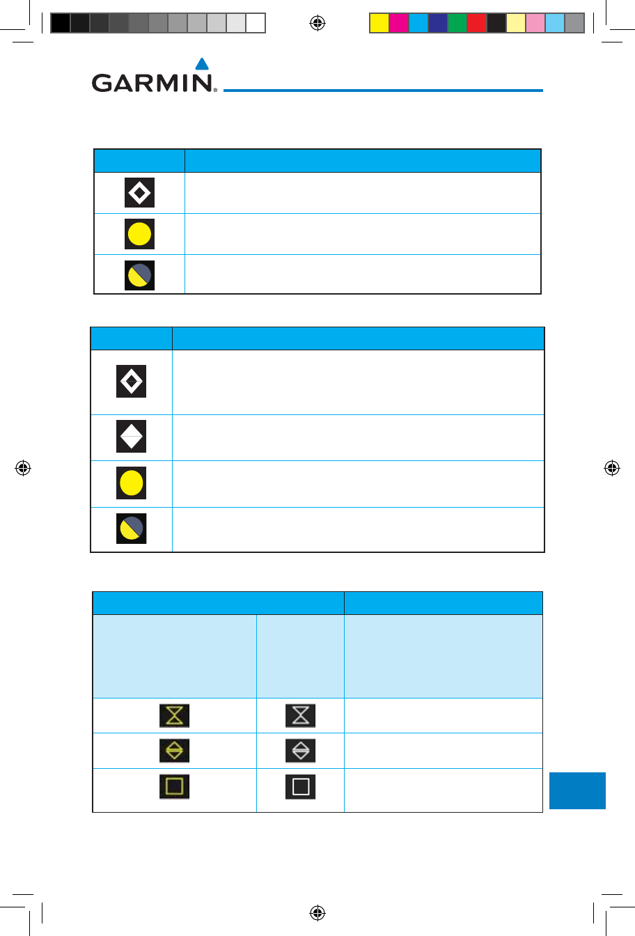
18-3190-01007-03 Rev. J
Garmin GTN 725/750 Pilot’s Guide
Foreword
Getting
Started
Audio &
Xpdr Ctrl
Com/Nav
FPL
Direct-To
Proc
Charts
Wpt Info
Map
Traffic
Terrain
Weather
Nearest
Services/
Music
Utilities
System
Messages
Symbols
Appendix
Index
18.3 Traffic Symbols
TIS Symbol Description
Non-Threat Traffic
Traffic Advisory (TA)
Traffic Advisory Off Scale
Table 18-3 TIS Symbols
TAS Symbol Description
Non-Threat Traffic
(intruder is beyond 5 NM and greater than 1200 ft vertical
separation)
Proximity Advisory (PA)
(intruder is within 5 NM and less than 1200 ft vertical separation)
Traffic Advisory (TA)
(closing rate, distance, and vertical separation meet TA criteria)
Traffic Advisory Off Scale
Table 18-4 TAS Symbols
Symbol Description
Imminent Traffic
(Traffic within ±500 feet
AND 1.0 NM; OR no altitude
AND within 1.0 NM)
Non-Imminent
Traffic
Traffic Closing Vertically
Traffic Diverging Vertically
Traffic not Closing or Diverging
Vertically
Table 18-5 9900B TCAD Symbols
190-01007-03-Final.indb 3 7/9/2015 2:08:50 PM
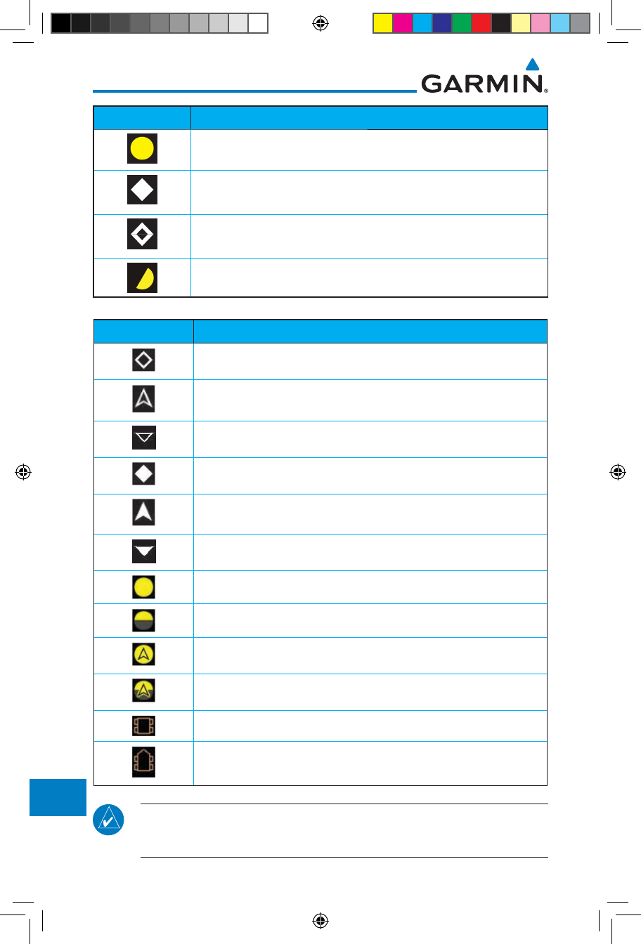
18-4
Garmin GTN 725/750 Pilot’s Guide
190-01007-03 Rev. J
Foreword
Getting
Started
Audio &
Xpdr Ctrl
Com/Nav
FPL
Direct-To
Proc
Charts
Wpt Info
Map
Traffic
Terrain
Weather
Nearest
Services/
Music
Utilities
System
Messages
Symbols
Appendix
Index
Symbol Description
Traffic Advisory
Proximity Advisory
(color may be configured as cyan)
Other Traffic
(color may be configured as cyan)
Out-of-Range Traffic Advisory
Table 18-6 9900BX (TCAS) Symbols
Symbol Description
Basic Non-Directional Traffic
Basic Directional Traffic
Basic Off-scale Selected Traffic
Proximate Non-Directional Traffic
Proximate Directional Traffic
Proximate Off-scale Selected Traffic
Non-Directional Alerted Traffic
Off-Scale Non-Directional Alerted Traffic
Directional Alerted Traffic
Off-Scale Directional Alerted Traffic
Non-Directional Surface Vehicle
Directional Surface Vehicle
Table 18-7 ADS-B Traffic Symbols
NOTE: Color of basic and proximate traffic is dependent on configuration
(cyan or white) and airborne/on-ground status of target (target is brown when
on the ground, see the surface vehicles).
190-01007-03-Final.indb 4 7/9/2015 2:08:51 PM
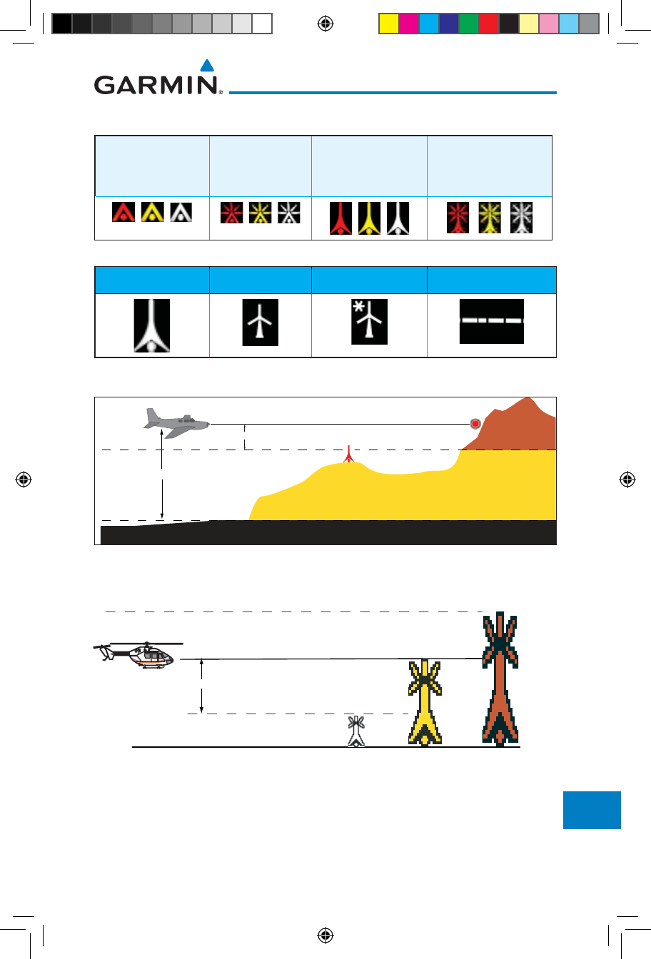
18-5190-01007-03 Rev. J
Garmin GTN 725/750 Pilot’s Guide
Foreword
Getting
Started
Audio &
Xpdr Ctrl
Com/Nav
FPL
Direct-To
Proc
Charts
Wpt Info
Map
Traffic
Terrain
Weather
Nearest
Services/
Music
Utilities
System
Messages
Symbols
Appendix
Index
18.4 Terrain Obstacle Symbols
Unlighted Obstacle
(Height is less than
1000 ft AGL)
Lighted Obstacle
(Height is less
than 1000 ft AGL)
Unlighted Obstacle
(Height is greater
than 1000 ft AGL)
Lighted Obstacle
(Height is greater than
1000 ft AGL)
Table 18-8 Obstacle Altitude/Color Correlation
Tower Windmill Windmill in Group Power Line
Table 18-9 Obstacle Icon Types
Threat Location
Unlighted Obstacle
Projected Flight Path
1000 ft
100 ft Threshold
Terrain more than 1000 ft below the aircraft altitude (Black)
Terrain between 100 ft and 1000 ft below the
aircraft altitude (Yellow)
Terrain above or
within 100 ft
below the aircraft
altitude (Red)
Figure 18-1 Terrain Altitude/Color Correlation
18.5 HTAWS Obstacle Symbols
Obstacle is at or above the aircraft altitude (Red)
250 ft Obstacle is between 250 ft and 0 ft
below the aircraft altitude (Yellow)
Obstacle is 250 ft, or more,
below the aircraft altitude (White)
Figure 18-2 HTAWS Obstacle Altitude Correlation
190-01007-03-Final.indb 5 7/9/2015 2:08:52 PM
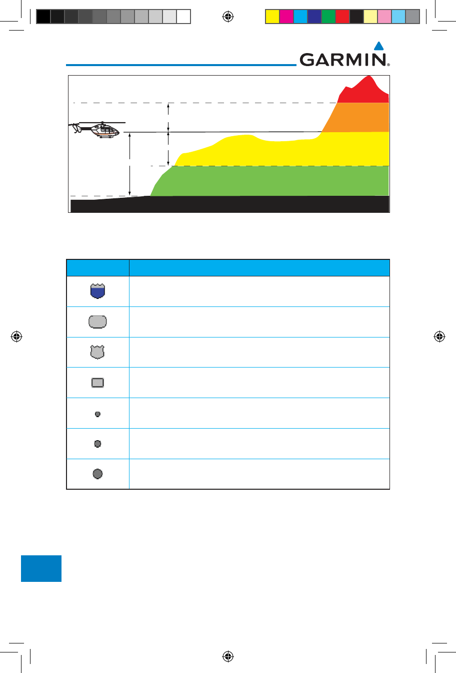
18-6
Garmin GTN 725/750 Pilot’s Guide
190-01007-03 Rev. J
Foreword
Getting
Started
Audio &
Xpdr Ctrl
Com/Nav
FPL
Direct-To
Proc
Charts
Wpt Info
Map
Traffic
Terrain
Weather
Nearest
Services/
Music
Utilities
System
Messages
Symbols
Appendix
Index
Terrain more than 500 ft below the aircraft altitude (Black)
Terrain is between 0 ft and 250 ft below the aircraft altitude (Yellow)
Terrain is more than 250 ft above
the aircraft altitude (Red)
Terrain is between
0 ft and 250 ft above
the aircraft altitude
(Orange)
250 ft
250 ft
Terrain is between 250 ft and 500 ft below the aircraft altitude (Green)
500 ft
Figure 18-3 HTAWS Altitude/Color Correlation
18.6 Basemap Symbols
Symbol Description
Interstate Highway
State Highway
US Highway
National Highway - 2-digit drawn inside
Small City or Town
Medium City
Large City
Table 18-10 Basemap Symbols
190-01007-03-Final.indb 6 7/9/2015 2:08:52 PM
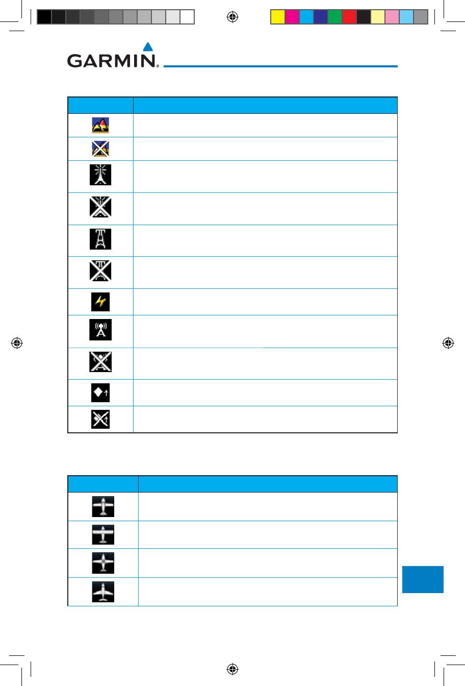
18-7190-01007-03 Rev. J
Garmin GTN 725/750 Pilot’s Guide
Foreword
Getting
Started
Audio &
Xpdr Ctrl
Com/Nav
FPL
Direct-To
Proc
Charts
Wpt Info
Map
Traffic
Terrain
Weather
Nearest
Services/
Music
Utilities
System
Messages
Symbols
Appendix
Index
18.7 Map Tool Bar Symbols
Symbol Description
Terrain Proximity Enabled and Available Indicator
Terrain Proximity Enabled and Not Available Indicator
Point Obstacle Enabled and Available Indicator
(Software version 5.12 and later)
Point Obstacle Enabled and Not Available Indicator
(Software version 5.12 and later)
Wire Obstacles Enabled and Available Indicator
(Software version 5.12 and later)
Wire Obstacles Enabled and Not Available Indicator
(Software version 5.12 and later)
StormScope
Ownship is receiving TIS-B and ADS-R services
(Software version 5.11 or earlier)
Possible incomplete traffic picture – ownship is not receiving one (or
both) of the TIS-B or ADS-R services (Software version 5.11 or earlier)
Traffic Enabled and Available Indicator
Traffic Enabled and Not Available Indicator
Table 18-11 Map Tool Bar Symbols
18.8 Miscellaneous Symbols
Symbol Description
Low-Wing Prop (Default Ownship)
High-Wing Prop
Kit Plane
Turboprop
190-01007-03-Final.indb 7 7/9/2015 2:08:53 PM
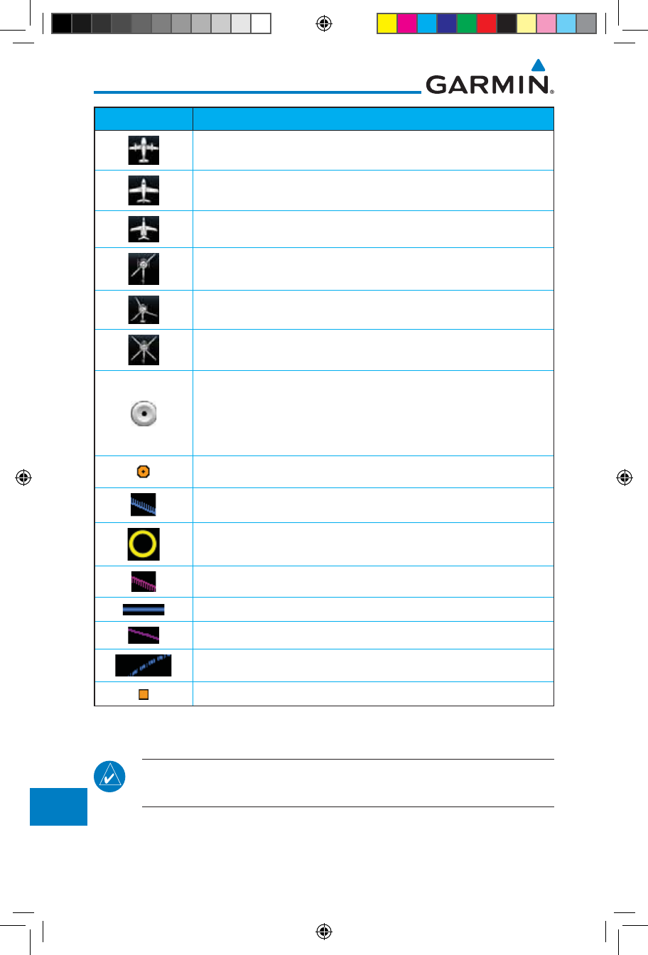
18-8
Garmin GTN 725/750 Pilot’s Guide
190-01007-03 Rev. J
Foreword
Getting
Started
Audio &
Xpdr Ctrl
Com/Nav
FPL
Direct-To
Proc
Charts
Wpt Info
Map
Traffic
Terrain
Weather
Nearest
Services/
Music
Utilities
System
Messages
Symbols
Appendix
Index
Symbol Description
Twin-Engine Prop
Single-Engine Jet
Business Jet
2-Blade Rotorcraft
3-Blade Rotorcraft
4-Blade Rotorcraft
Non-directional ownship is shown if there is no heading or
ground track. This typically only occurs during start-up. In
helicopters without a heading source, the non-directional
ownship symbol will also appear below 15 kts.
Parallel Track Waypoint
Restricted/Prohibited/Warning/Alert
TFR (Temporary Flight Restrictions)
MOA
Class B Airspace
Class C Airspace
Class D Airspace
User Waypoint
Table 18-12 Miscellaneous Symbols
NOTE: Ownship icons are configured by the installer and can be colored
magenta for enhanced visibility (Software version 5.12 or later).
190-01007-03-Final.indb 8 7/9/2015 2:08:53 PM
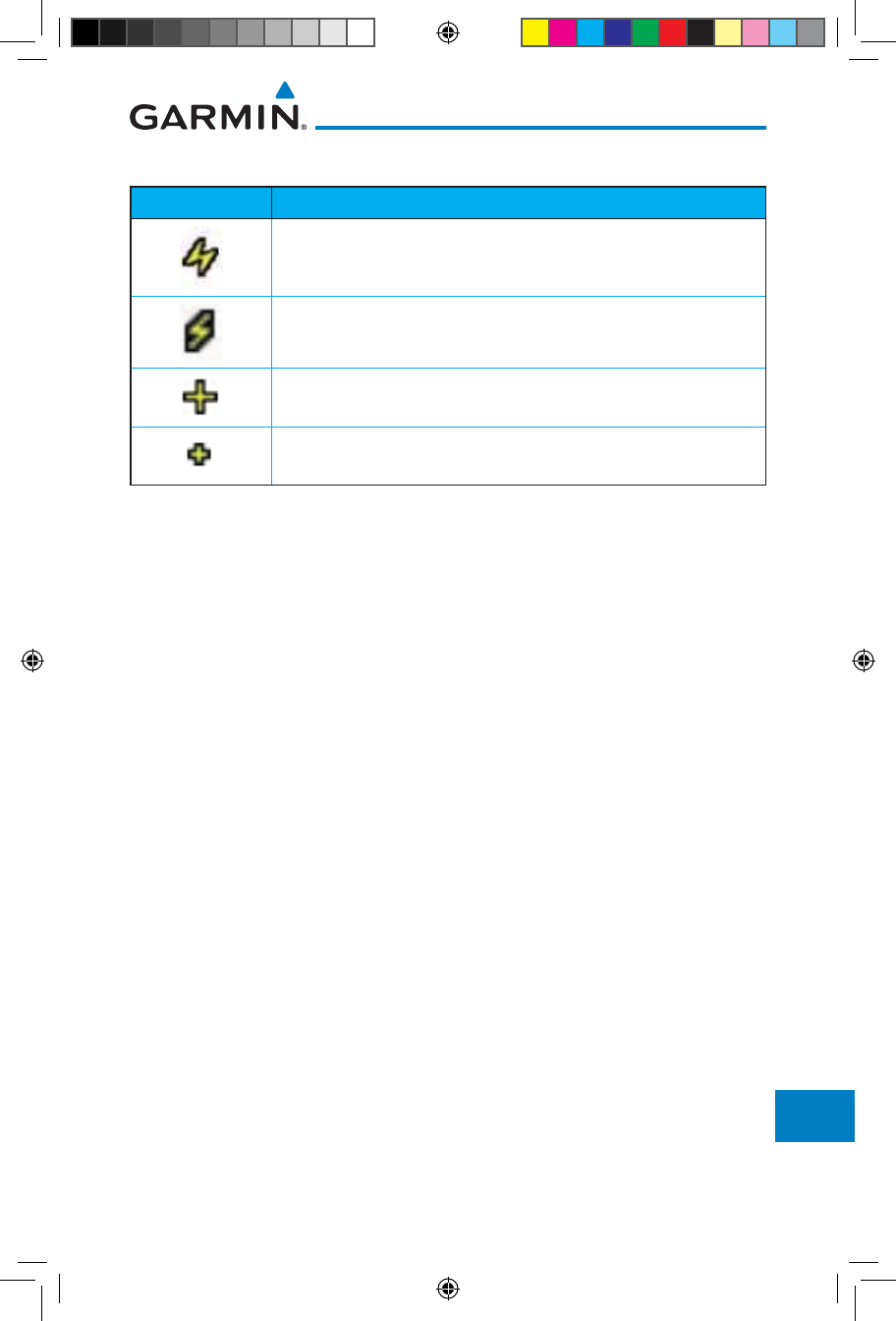
18-9190-01007-03 Rev. J
Garmin GTN 725/750 Pilot’s Guide
Foreword
Getting
Started
Audio &
Xpdr Ctrl
Com/Nav
FPL
Direct-To
Proc
Charts
Wpt Info
Map
Traffic
Terrain
Weather
Nearest
Services/
Music
Utilities
System
Messages
Symbols
Appendix
Index
18.9 Stormscope Symbols
Symbol Time Since Strike (Seconds)
6
60
120
180
Table 18-13 Stormscope Symbols
190-01007-03-Final.indb 9 7/9/2015 2:08:53 PM
18-10
Garmin GTN 725/750 Pilot’s Guide
190-01007-03 Rev. J
Foreword
Getting
Started
Audio &
Xpdr Ctrl
Com/Nav
FPL
Direct-To
Proc
Charts
Wpt Info
Map
Traffic
Terrain
Weather
Nearest
Services/
Music
Utilities
System
Messages
Symbols
Appendix
Index
This page intentionally left blank
190-01007-03-Final.indb 10 7/9/2015 2:08:53 PM

19-1190-01007-03 Rev. J
Garmin GTN 725/750 Pilot’s Guide
Foreword
Getting
Started
Audio &
Xpdr Ctrl
Com/Nav
FPL
Direct-To
Proc
Charts
Wpt Info
Map
Traffic
Terrain
Weather
Nearest
Services/
Music
Utilities
System
Messages
Symbols
Appendix
Index
19 APPENDIX
19.1 Glossary
ACT, ACTV active, activate
ACT Altitude Compensated Tilt
ADC Air Data Computer
ADF Automatic Direction Finder
ADI Attitude Direction Indicator
AFM Airplane Flight Manual
AFMS Airplane Flight Manual Supplement
AGL Above Ground Level
AIM Airman’s Information Manual
AIRMET Airman’s Meteorological Information
ALT altitude
AP autopilot
APR approach
APT airport, aerodrome
ARINC Aeronautical Radio Incorporated
ARSPC airspace
ARTCC Air Route Traffic Control Center
AS airspeed
ASOS Automated Surface Observing System
ATC Air Traffic Control
ATCRBS ATC Radar Beacon System
ATIS Automatic Terminal Information Service
AUX auxiliary
AWOS Automated Weather Observing System
BARO barometric setting
BC backcourse
Bearing The compass direction from the present position to a
destination waypoint
BRG bearing
C center runway
ºC degrees Celsius
CDI Course Deviation Indicator
CHNL channel
190-01007-03-Final.indb 1 7/9/2015 2:08:53 PM

19-2
Garmin GTN 725/750 Pilot’s Guide
190-01007-03 Rev. J
Foreword
Getting
Started
Audio &
Xpdr Ctrl
Com/Nav
FPL
Direct-To
Proc
Charts
Wpt Info
Map
Traffic
Terrain
Weather
Nearest
Services/
Music
Utilities
System
Messages
Symbols
Appendix
Index
CLD cloud
CLR clear
CNXT Connext
CONFIG configuration
Course The line between two points to be followed by the
aircraft
Crosstrack Error The distance the aircraft is off a desired course in either
direction, left or right
CRS course
CRSR cursor
CTA Control Area
CTAF Common Traffic Advisory Frequency
CTRL control
CUM The total of all legs in a flight plan
DALT density altitude
DB, DBASE database
DCLTR, DECLTR declutter
deg degree
DEP departure
Desired Track (DTK) The desired course between the active “from” and
“to” waypoints
DEST destination
DFLT default
DIS distance
Distance The “great circle” distance from the present position
to a destination waypoint
DME Distance Measuring Equipment
DP Departure Procedure
DPRT departure
DSBL disabled
DTK Desired Track
EDR Excessive Descent Rate
EGNOS Provides SBAS service for most of Europe and parts of
North Africa
ELEV elevation
EMI Electromagnetic Interference
ENR en route
190-01007-03-Final.indb 2 7/9/2015 2:08:54 PM
19-3190-01007-03 Rev. J
Garmin GTN 725/750 Pilot’s Guide
Foreword
Getting
Started
Audio &
Xpdr Ctrl
Com/Nav
FPL
Direct-To
Proc
Charts
Wpt Info
Map
Traffic
Terrain
Weather
Nearest
Services/
Music
Utilities
System
Messages
Symbols
Appendix
Index
En Route Safe Altitude The recommended minimum altitude within ten miles
left or right of the desired course on an active flight
plan or direct-to
ERR error
ESA En route Safe Altitude
ETA Estimated Time of Arrival
ETE Estimated Time En Route
ºF degrees Fahrenheit
FAA Federal Aviation Administration
FCC Federal Communication Commission
FCST forecast
FD flight director
FIR Flight Information Region
FIS-B Flight Information Services-Broadcast
FISDL Flight Information Service Data Link
FLTA Forward Looking Terrain Avoidance
FPL flight plan
FREQ frequency
FRZ freezing
FSS Flight Service Station
ft foot/feet
GCS Ground Clutter Suppression
GDC Garmin Air Data Computer
GDL Garmin Satellite Data Link
GEO geographic
GLS Global Navigation Satellite Landing System
GMA Garmin Audio Panel System
GMT Greenwich Mean Time
GMU Garmin Magnetometer Unit
GPS Global Positioning System
GPSS GPS Roll Steering
Ground Speed The velocity that the aircraft is travelling relative to a
ground position
Ground Track
see Track
GRS Garmin Reference System
GS Ground Speed
G/S, GS glideslope
190-01007-03-Final.indb 3 7/9/2015 2:08:54 PM

19-4
Garmin GTN 725/750 Pilot’s Guide
190-01007-03 Rev. J
Foreword
Getting
Started
Audio &
Xpdr Ctrl
Com/Nav
FPL
Direct-To
Proc
Charts
Wpt Info
Map
Traffic
Terrain
Weather
Nearest
Services/
Music
Utilities
System
Messages
Symbols
Appendix
Index
GTX Garmin Transponder
HDG heading
Heading The direction an aircraft is pointed, based upon
indications from a magnetic compass or a properly set
directional gyro
HFOM Horizontal Figure of Merit
Hg mercury
hPa hectopascal
HPL Horizontal Protection Level
HSDB High-Speed Data Bus
HSI Horizontal Situation Indicator
HTAWS Helicopter Terrain Awareness and Warning System
Hz Hertz
IAF Initial Approach Fix
ICAO International Civil Aviation Organization
IFR Instrument Flight Rules
IGRF International Geomagnetic Reference Field
ILI Imminent Line Impact
ILS Instrument Landing System
IMC Instrument Meteorological Conditions
IOI Imminent Obstacle Impact
INFO information
in HG inches of mercury
INT intersection(s)
INTEG integrity (RAIM unavailable)
ITI Imminent Terrain Impact
L left, left runway
LAT latitude
LCD Liquid Crystal Display
LCL local
LED Light Emitting Diode
Leg The portion of a flight plan between two waypoints
LIFR Low Instrument Flight Rules
LNAV Lateral Navigation
LOC localizer
190-01007-03-Final.indb 4 7/9/2015 2:08:54 PM

19-5190-01007-03 Rev. J
Garmin GTN 725/750 Pilot’s Guide
Foreword
Getting
Started
Audio &
Xpdr Ctrl
Com/Nav
FPL
Direct-To
Proc
Charts
Wpt Info
Map
Traffic
Terrain
Weather
Nearest
Services/
Music
Utilities
System
Messages
Symbols
Appendix
Index
LOI loss of integrity (GPS)
LON longitude
LPV Localizer Performance with Vertical guidance
LRU Line Replacement Unit
LT left
LTNG lightning
MAG Magnetic
MAG VAR Magnetic Variation
MapMX A proprietary data format used to forward navigation
information between Garmin units
MAX maximum
MAXSPD maximum speed (overspeed)
MDA barometric minimum descent altitude
METAR Aviation Routine Weather Report
MGRS MIlitary Grid Reference System
MIN minimum
Minimum Safe Altitude Uses Grid MORAs to determine a safe altitude within
ten miles of the aircraft present position
MKR marker beacon
MOA Military Operations Area
MOT Mark On Target
MOV movement
mpm meters per minute
MSA Minimum Safe Altitude
MSAS Provides SBAS service for Japan only
MSG message
MSL Mean Sea Level
MT meter
mV millivolt(s)
MVFR Marginal Visual Flight Rules
NAV navigation
NAVAID NAVigation AID
NCR Negative Climb Rate
NDB Non-Directional Beacon
NEXRAD Next Generation Radar
190-01007-03-Final.indb 5 7/9/2015 2:08:54 PM

19-6
Garmin GTN 725/750 Pilot’s Guide
190-01007-03 Rev. J
Foreword
Getting
Started
Audio &
Xpdr Ctrl
Com/Nav
FPL
Direct-To
Proc
Charts
Wpt Info
Map
Traffic
Terrain
Weather
Nearest
Services/
Music
Utilities
System
Messages
Symbols
Appendix
Index
OAT Outside Air Temperature
OBS Omni Bearing Selector
PA Proximity Advisory
PC personal computer
PDA Premature Descent Alert
P. POS Present Position
PTK parallel track
QTY quantity
R right, right runway
RAIM Receiver Autonomous Integrity Monitoring
RAM random access memory
REF reference
REQ required
REV reverse, revision, revise
RLC Reduce Required Line Clearance
RMI Radio Magnetic Indicator
RNG range
RNWY runway
ROC Reduced Required Obstacle Clearance
RT right
RTC Reduced Required Terrain Clearance
SAR Search and Rescue
SBAS Satellite-Based Augmentation System
SCIT Storm Cell Identification and Tracking
SD Secure Digital
SFC surface
SIAP Standard Instrument Approach Procedures
SID Standard Instrument Departure
SIGMET Significant Meteorological Information
SLP/SKD slip/skid
SMBL symbol
SPD speed
SRVC, SVC service
190-01007-03-Final.indb 6 7/9/2015 2:08:54 PM

19-7190-01007-03 Rev. J
Garmin GTN 725/750 Pilot’s Guide
Foreword
Getting
Started
Audio &
Xpdr Ctrl
Com/Nav
FPL
Direct-To
Proc
Charts
Wpt Info
Map
Traffic
Terrain
Weather
Nearest
Services/
Music
Utilities
System
Messages
Symbols
Appendix
Index
STAR Standard Terminal Arrival Route
STATS statistics
STBY standby
STD standard
SUA Special Use Airspace
SUSP suspend
SW software
SYS system
T true
TA Traffic Advisory
TACAN Tactical Air Navigation System
TAF Terminal Aerodrome Forecast
TAS True Airspeed
TAS Traffic Advisory System
TAT Total Air Temperature
TAWS Terrain Awareness and Warning System
TCA Terminal Control Area
TCAS Traffic Collision Avoidance System
TEMP temperature
TERM terminal
TFR Temporary Flight Restriction
T HDG True Heading
TIS Traffic Information System
TMA Terminal Maneuvering Area
Topo topographic
Track Direction of aircraft movement relative to a ground
position; also ‘Ground Track’
TRK track
TRSA Terminal Radar Service Area
UNAVAIL unavailable
USR user
UTC Coordinated Universal Time
UTM/UPS Universal Transverse Mercator/ Universal Polar
Stereographic Grid
V, Vspeed velocity (airspeed)
VAR variation
190-01007-03-Final.indb 7 7/9/2015 2:08:54 PM

19-8
Garmin GTN 725/750 Pilot’s Guide
190-01007-03 Rev. J
Foreword
Getting
Started
Audio &
Xpdr Ctrl
Com/Nav
FPL
Direct-To
Proc
Charts
Wpt Info
Map
Traffic
Terrain
Weather
Nearest
Services/
Music
Utilities
System
Messages
Symbols
Appendix
Index
VFR Visual Flight Rules
VHF Very High Frequency
VLOC VOR/Localizer Receiver
VMC Visual Meteorological Conditions
VNAV, VNV vertical navigation
VOR VHF Omni-directional Range
VORTAC very high frequency omnidirectional range station and
tactical air navigation
VS Vertical speed
VSI Vertical Speed Indicator
WAAS Wide Area Augmentation System
WGS-84 World Geodetic System - 1984
WPT waypoint(s)
WX weather
XPDR transponder
XTK cross-track
190-01007-03-Final.indb 8 7/9/2015 2:08:54 PM
19-9190-01007-03 Rev. J
Garmin GTN 725/750 Pilot’s Guide
Foreword
Getting
Started
Audio &
Xpdr Ctrl
Com/Nav
FPL
Direct-To
Proc
Charts
Wpt Info
Map
Traffic
Terrain
Weather
Nearest
Services/
Music
Utilities
System
Messages
Symbols
Appendix
Index
19.2 SD Card Use and Databases
The GTN 7XX System uses Secure Digital (SD) cards to load and store various
types of data. For basic flight operations, SD cards are required for database
storage as well as database updates.
Database
Name
Function Where
Stored
Update
Cycle
Provider Notes
Navigation Airport, NAVAID,
Waypoint, and
Airspace information
Internal
GTN
memory
28 days (on
Thursdays)
fly.garmin.com Updates installed via
SD card and copied
into internal memory
SafeTaxi Airport surface
diagrams
Internal
GTN
memory
56 days (on
Thursdays)
fly.garmin.com Updates installed via
SD card and copied
into internal memory
Terrain Topographic map,
Terrain/TAWS
SD card As required fly.garmin.com
Obstacle Obstacle information
for map, and TAWS
Internal
GTN
memory
56 days (on
Thursdays)
fly.garmin.com Updates installed via
SD card and copied
into internal memory
Basemap Boundary and road
information
Internal
GTN
memory
As required fly.garmin.com Updates installed via
SD card and copied
into internal memory
FliteCharts FAA-published
terminal procedures
SD card 28 days (on
Thursdays)
fly.garmin.com Disables 180 days
after expiration date.
ChartView Jeppesen terminal
procedures
SD card 14 days (on
Fridays)
Contact
Jeppesen
Optional feature
that requires Garmin
dealer enablement.
Disables 70 days
after expiration date.
Table 19-1 Database List
More information about databases and updates can be found at:
https://fly.garmin.com/fly-garmin/support.
190-01007-03-Final.indb 9 7/9/2015 2:08:54 PM
19-10
Garmin GTN 725/750 Pilot’s Guide
190-01007-03 Rev. J
Foreword
Getting
Started
Audio &
Xpdr Ctrl
Com/Nav
FPL
Direct-To
Proc
Charts
Wpt Info
Map
Traffic
Terrain
Weather
Nearest
Services/
Music
Utilities
System
Messages
Symbols
Appendix
Index
19.2.1 Jeppesen Databases
The navigation database is updated on a 28-day cycle. Navigation database
updates are provided by Garmin and may be downloaded from the Garmin web
site “fly.garmin.com” onto a Garmin provided Supplemental Data card. Contact
Garmin at fly.garmin.com for navigation database updates and update kits. The
Navigation database is stored internally and the data card is only used to transfer
the database into the unit.
The optional ChartView database is updated on a 14 day cycle. The ChartView
database is provided directly from Jeppesen. Contact Jeppesen (www.jeppesen.
com) for ChartView subscription and update information. An enablement card
that is purchased from Garmin is separate from the Jeppesen database and is
required to enable ChartView.
NOTE:
Garmin requests that the flight crew report any observed
discrepancies related to database information. These discrepancies could
come in the form of an incorrect procedure, incorrectly identified terrain,
obstacles and fixes, or any other displayed item used for navigation or
communication in the air or on the ground. Go to “FlyGarmin.com” and at
the bottom of the page select “Aviation Data Error Report.”
Updating the Jeppesen navigation database
1. With the GTN 7XX System OFF, insert the SD card containing the
navigation database update into the card slot of the GTN 7XX
to be updated (label of SD card should face to the right).
2. Turn the GTN 7XX System ON.
3. Verify the correct update cycle is loaded during power-up.
190-01007-03-Final.indb 10 7/9/2015 2:08:54 PM
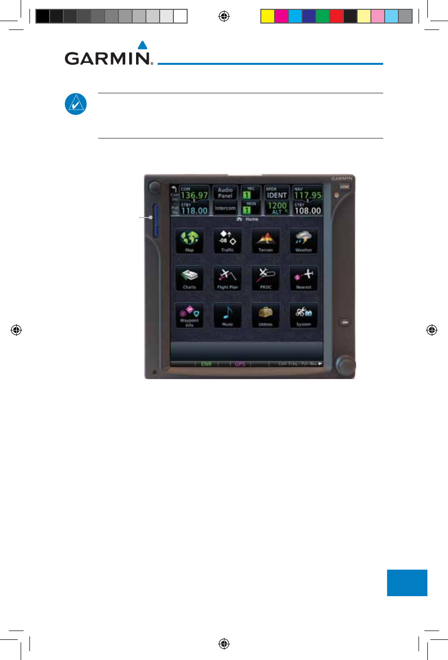
19-11190-01007-03 Rev. J
Garmin GTN 725/750 Pilot’s Guide
Foreword
Getting
Started
Audio &
Xpdr Ctrl
Com/Nav
FPL
Direct-To
Proc
Charts
Wpt Info
Map
Traffic
Terrain
Weather
Nearest
Services/
Music
Utilities
System
Messages
Symbols
Appendix
Index
19.2.2 Garmin Databases
NOTE: The data contained in the terrain and obstacle databases comes from
government agencies. Garmin accurately processes and cross-validates the
data, but cannot guarantee the accuracy and completeness of the data.
The Supplemental Data Card should not be removed except to update the
databases stored on the card. The data cards cannot be moved between units.
SD Card
Figure 19-1 SD Card Database Location
The Garmin databases can be updated by following the instructions on fly.
garmin.com. Once the updated files have been downloaded from the web site, a
PC equipped with an appropriate SD card reader is used to unpack and program
the new databases onto the existing Supplemental Data Cards. The following
equipment is required to perform the update:
• Windows-compatible PC computer (Windows 2000, XP, Vista, or Windows
7 recommended)
• SanDisk SD Card Reader, P/Ns SDDR-93 or SDDR-99 or equivalent card
reader
• Updated database obtained from the Garmin web site
• Existing Garmin Supplemental Database SD Card
It may be necessary to have the system configured by a Garmin authorized
190-01007-03-Final.indb 11 7/9/2015 2:08:55 PM
19-12
Garmin GTN 725/750 Pilot’s Guide
190-01007-03 Rev. J
Foreword
Getting
Started
Audio &
Xpdr Ctrl
Com/Nav
FPL
Direct-To
Proc
Charts
Wpt Info
Map
Traffic
Terrain
Weather
Nearest
Services/
Music
Utilities
System
Messages
Symbols
Appendix
Index
service facility in order to use certain database features.
Common Problems/Troubleshooting Tips for Databases
• SD Cards
- The supplied SD cards, and most commercially available SD cards, have
a small sliding tab located on the top left of the card (when viewing the
card label-side up).
- When the sliding tab is in the Down position (as in farther away from
the gold contacts on the back of the card), you will not be able to write
data to the card, as it will be write protected.
- The tab must be in the Up position to work correctly.
• Card Programmer
- If a card programmer is having trouble finding or writing data to
the SD cards, you may have to upgrade to a High Capacity SD card
programmer.
- SD cards with a capacity of 4GB are considered high capacity.
- Most non-high capacity card programmers will not work with a high
capacity SD card. High capacity card programmers can be easily
purchased at a consumer electronics store.
- Ensure that your card programmer is not plugged into a USB hub, your
computer screen, or your keyboard.
- Make sure it is plugged directly into your computer (the back of the
computer, if using a desktop computer).
• If you accidentally place a file onto the wrong card, call Garmin’s Aviation
Product Support team to look at the files and delete the proper files.
- Do not format the cards
190-01007-03-Final.indb 12 7/9/2015 2:08:55 PM

19-13190-01007-03 Rev. J
Garmin GTN 725/750 Pilot’s Guide
Foreword
Getting
Started
Audio &
Xpdr Ctrl
Com/Nav
FPL
Direct-To
Proc
Charts
Wpt Info
Map
Traffic
Terrain
Weather
Nearest
Services/
Music
Utilities
System
Messages
Symbols
Appendix
Index
Updating Garmin Databases
1. Download the data to the data cards from the appropriate web site.
2. Insert Navigation Database SD card in the slot of the GTN 7XX.
3. Apply power to the GTN 7XX System. View the power-up splash screen. Check
that the databases are initialized and displayed on the splash screen. Some
databases can take up to 15 minutes to update.
4. The database update page will prompt to either Update or Continue. Touch the
Update
key to update the database(s). Touch the Continue key to continue
to normal operation without updating a database. This process will repeat for
each database that is available on the card for updating.
5. After the database(s) have completed the update process, touch OK to continue
the normal progression of start-up displays.
6. From the Home page, touch the System key. Then, touch the System Status
key.
7. Check that all databases are current and there are no errors. If a database is
highlighted in yellow, it is either expired or the GTN 7XX can not determine the
date.
190-01007-03-Final.indb 13 7/9/2015 2:08:55 PM
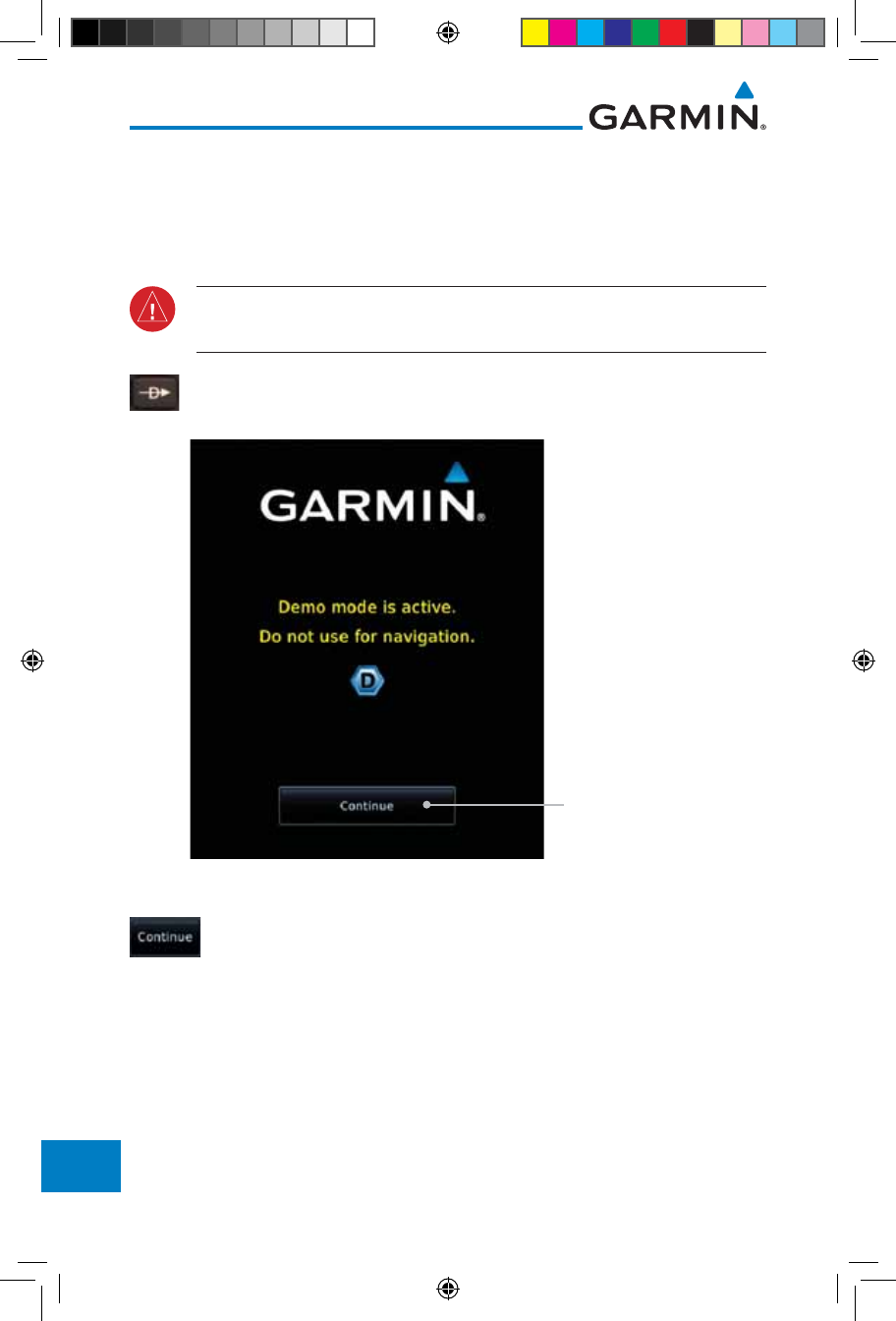
19-14
Garmin GTN 725/750 Pilot’s Guide
190-01007-03 Rev. J
Foreword
Getting
Started
Audio &
Xpdr Ctrl
Com/Nav
FPL
Direct-To
Proc
Charts
Wpt Info
Map
Traffic
Terrain
Weather
Nearest
Services/
Music
Utilities
System
Messages
Symbols
Appendix
Index
19.3 Demo Mode
The GTN product contains a “Demo” mode that allows simulation of all
operations of the product to allow practice and familiarization while staying on
the ground.
WARNING: Do not use the GTN to navigate while Demo mode is active.
Do not use or enter Demo mode while airborne.
1. Press in and hold the Direct-To key and then apply power to
the unit.
Touch To Continue
Figure 19-2 Demo Mode Start Up Display
2. Touch the Continue key and Fuel keys as normally needed to
start operations.
190-01007-03-Final.indb 14 7/9/2015 2:08:55 PM
19-15190-01007-03 Rev. J
Garmin GTN 725/750 Pilot’s Guide
Foreword
Getting
Started
Audio &
Xpdr Ctrl
Com/Nav
FPL
Direct-To
Proc
Charts
Wpt Info
Map
Traffic
Terrain
Weather
Nearest
Services/
Music
Utilities
System
Messages
Symbols
Appendix
Index
3. Touch the Demo key in the lower part of the display to reach
the Demo Setup functions.
Touch For GPS Settings
Touch For NAV Settings
Touch For Date
And Time Settings
Figure 19-3 Demo Mode Setup
4. Touch the GPS key to reach the Demo GPS Settings page.
The Position Error values (Horizontal Protection Level Fault
Detection [HPL FD], HPL SBAS, and Vertical Protection Level
[VPL] SBAS) may be adjusted to reflect errors induced by
naturally occurring conditions, but are normally not adjusted
for most Demo mode operations.
Touch For HPL
SBAS Settings
Touch For VPL
SBAS Settings
Touch To Select GPS
Solution
Touch To Select Lat/
Lon Coordinates For
Current Position
Touch To Select
Current Position
From A Wpt In
The Database
Touch To Select
HPL FD Values, If
Desired
Figure 19-4 Demo Mode GPS Settings
190-01007-03-Final.indb 15 7/9/2015 2:08:55 PM
19-16
Garmin GTN 725/750 Pilot’s Guide
190-01007-03 Rev. J
Foreword
Getting
Started
Audio &
Xpdr Ctrl
Com/Nav
FPL
Direct-To
Proc
Charts
Wpt Info
Map
Traffic
Terrain
Weather
Nearest
Services/
Music
Utilities
System
Messages
Symbols
Appendix
Index
5. Touch the Nav key to reach the Demo Navigation Settings
page.
Touch To Select
Airspeed
Touch To Select
Altitude
Touch To Select
Track Mode
Touch To Select
Vertical Speed
Figure 19-5 Demo Mode Navigation Settings
6. Touch the Date/Time key to reach the Demo Date/Time
Settings page.
Touch To Set Date
Touch To Set Time
Figure 19-6 Demo Mode Date/Time Settings
7. After completing the settings for Demo mode, touch the HOME
key or Back key to get started with operating the GTN.
190-01007-03-Final.indb 16 7/9/2015 2:08:56 PM

19-17190-01007-03 Rev. J
Garmin GTN 725/750 Pilot’s Guide
Foreword
Getting
Started
Audio &
Xpdr Ctrl
Com/Nav
FPL
Direct-To
Proc
Charts
Wpt Info
Map
Traffic
Terrain
Weather
Nearest
Services/
Music
Utilities
System
Messages
Symbols
Appendix
Index
19.4 Glove Qualification Procedure
This procedure is used to qualify a specific glove for use with the GTN system
by guiding the user through a variety of tasks that use the touchscreen. Due to
differences in finger size, glove size, and touchscreens between the 6XX or 7XX
unit, the qualification granted by this procedure is specific to the pilot/glove and
6XX or 7XX combination. GTN 7XX and 6XX units must be evaluated separately.
The GTN touchscreen uses capacitive touch technology to sense the proximity
of skin to the display. A glove increases the distance between skin and the display
glass and may reduce the ability of the GTN to detect touches. Therefore, when
selecting a glove for use with the GTN, thinner gloves tend to work better than
thicker gloves. Leather gloves and gloves designed to work specifically with
capacitive touchscreen devices are often found to be acceptable. Additionally,
altering your touch technique to use the pad of your finger to touch the unit
rather than the tip will increase the touchscreen sensitivity while using gloves.
This qualification must be completed on the ground. Performing this
procedure in flight is not authorized. Table 19-1 contains tasks that are required
to qualify a glove. Table 19-2 contains tasks that are not required to qualify a
glove, but may limit the manner in which some functions are accessed while a
glove is worn.
1. Sit in the pilot’s seat.
2. Start the GTN in Demo mode by pressing and holding the Direct To key during
power up.
3. Perform the tasks listed in Table 19-1 and Table 19-2 with an non-gloved hand.
You do not need to record any results for this step.
4. Perform the tasks listed in Table 19-1 and Table 19-2 with a gloved hand. For
each task, determine whether the operation is the same or worse as it was
without the glove. Record the results in Table 19-1 and Table 19-2. Items that
may cause the operation to be worse include, but are not limited to:
a. Multiple attempts to select a key
b. Unintentional selection of adjacent keys
c. Excessive force on the touchscreen to select a key
5. If all applicable tasks in Table 19-1 respond in the same way with and without
a glove then the glove used to complete these tasks may be used by the pilot
190-01007-03-Final.indb 17 7/9/2015 2:08:56 PM
19-18
Garmin GTN 725/750 Pilot’s Guide
190-01007-03 Rev. J
Foreword
Getting
Started
Audio &
Xpdr Ctrl
Com/Nav
FPL
Direct-To
Proc
Charts
Wpt Info
Map
Traffic
Terrain
Weather
Nearest
Services/
Music
Utilities
System
Messages
Symbols
Appendix
Index
who performed this evaluation on the unit (6XX or 7XX) that was used during
this procedure.
Pilot: _______________________________________
Glove Description: ______________________________
GTN (circle one): 6XX or 7XX
Task Operation With Glove
(circle one)
Navigate to the Home Screen. NA
Touch the Demo key. Same Worse
Touch the GPS key. Same Worse
Touch the Waypoint key. Same Worse
Type “KSLE” using the touchscreen, then touch Enter. Same Worse
Navigate to the Home Screen (Press HOME). NA
Touch the Flight Plan key. Same Worse
Enter the following waypoints using the Add
Waypoint key at the bottom of the list of flight plan
waypoints:
KSLE
KMMV
KONP
BTG
Same Worse
Select BTG, then touch the Load Airway key to load
the following airway: V23 ALFOR.
Same Worse
While viewing the flight plan page, touch the Up/
Down arrow keys to scroll up and down to view the
flight plan waypoints.
Same Worse
Touch the Back key to return to the Home screen. Same Worse
Touch the COM standby frequency to activate the
com frequency entry keypad (Task applicable to
635/650/750 only).
Same Worse
Enter a valid com frequency and touch the Enter key
(635/650/750 only).
Same Worse
190-01007-03-Final.indb 18 7/9/2015 2:08:56 PM
19-19190-01007-03 Rev. J
Garmin GTN 725/750 Pilot’s Guide
Foreword
Getting
Started
Audio &
Xpdr Ctrl
Com/Nav
FPL
Direct-To
Proc
Charts
Wpt Info
Map
Traffic
Terrain
Weather
Nearest
Services/
Music
Utilities
System
Messages
Symbols
Appendix
Index
Task Operation With Glove
(circle one)
Touch the active com frequency to flip/flop the com
frequencies. (635/650/750 only).
Same Worse
Touch the active nav frequency to flip/flop the nav
frequencies (750 only).
Same Worse
Touch the Menu key (650 only). Same Worse
Table 19-2 Tests Required for Glove Qualification
Task Operation With Glove
(circle one)
Navigate to the flight plan page. NA
While viewing the flight plan page, touch the list and
drag up/down to view the flight plan waypoints.
Same Worse
While viewing the flight plan page, touch and flick the
list to view the flight plan waypoints.
Same Worse
Navigate to the map page. NA
Touch the Map to enter Pan mode, then touch the
Graphically Edit FPL key.
Same Worse
Remove KONP from the flight plan graphically by
touching KONP and dragging it to an area without
any waypoints (Pan and zoom in/out as necessary to
accomplish the task).
Same Worse
Insert KSPB between KMMV and BTG by dragging the
leg between KMMV and BTG to KSPB.
Same Worse
Table 19-3 Tests Not Required for Glove Qualification
190-01007-03-Final.indb 19 7/9/2015 2:08:56 PM

19-20
Garmin GTN 725/750 Pilot’s Guide
190-01007-03 Rev. J
Foreword
Getting
Started
Audio &
Xpdr Ctrl
Com/Nav
FPL
Direct-To
Proc
Charts
Wpt Info
Map
Traffic
Terrain
Weather
Nearest
Services/
Music
Utilities
System
Messages
Symbols
Appendix
Index
This page intentionally left blank
190-01007-03-Final.indb 20 7/9/2015 2:08:56 PM

Index-1190-01007-03 Rev. J
Garmin GTN 725/750 Pilot’s Guide
Foreword
Getting
Started
Audio &
Xpdr Ctrl
Com/Nav
FPL
Direct-To
Proc
Charts
Wpt Info
Map
Traffic
Terrain
Weather
Nearest
Services/
Music
Utilities
System
Messages
Symbols
Appendix
Index
INDEX
Symbols
3D Audio 2-11
3D navigation 16-16
A
Abbreviations 8-14
About this guide xxvii
Above Ground Level 11-11
Acquiring satellites 16-14, 16-16
ACT 12-54
Activate flight plan 4-33
Activate leg 4-6
Activating XM 14-3
Active flight plan page 4-4
Active leg 4-6, 6-15, 6-17, 6-23
Add User frequency 3-11
ADF 19-1
ADIZ 9-33
ADS-B 2-5, 10-18
Age 12-6, 12-62
Aircraft symbol 9-1
AIREP 12-28
AIRMETs 12-7, 12-17, 12-62, 12-70, 12-
73, 12-86
Airport beacon 18-2
Airport diagram 7-16, 16-5
Airport frequencies 8-8
Airports 12-82
Airspace 13-10
Airspace altitude buffer 16-33
Airways 4-12, 9-5, 9-33
Alerts 1-13, 10-9, 11-5, 11-15, 11-16,
11-18, 11-22, 16-32, 11-51
ALT 15-28
Altimeter ii, 11-10
Altitude 6-15, 11-5, 16-13, 16-15
Altitude buffer 16-32
Altitude Display Mode 10-6, 10-15
Altitude mode 10-27
Altitude reporting 2-3
Altitude type 15-5
Angle of incidence 12-37
Annunciations 1-6, 1-21, 6-2, 10-10,
10-11, 10-16, 10-17, 11-9, 11-15,
11-22, 11-62
Anonymous mode 2-5
Answering a phone call 14-14
Antenna 12-75
Antenna stabilization 12-54
Antenna tilt 12-34, 12-35, 12-39, 12-48,
12-52, 12-53
Approach
Channel 6-12
Approaches 7-2, 7-16, 19-1, 11-19,
11-52
Select 1-20
Approach operations 6-2
Approach shield 10-33
Approach with hold 6-15
Arc 11-7, 11-13, 11-14
Arrivals 7-16
ARTCC 13-1, 13-13
ASOS 13-17
ATCRBS 10-7
ATIS 13-17
Attitude 19-1
Audio panel 2-8
Audio split mode 2-15
Aural message 11-11, 11-15, 11-17, 11-
20, 11-22, 11-58
Automatic CDI switching 6-24
Autopilot 6-14, 6-19, 6-23, 6-24, 6-25
Auto-pilot output 6-25
Auto squelch 2-20
Auto zoom 9-16
AUX - System Status Page 16-3
Aviation map data 9-23
AWOS 13-17
B
Backcourse 6-24
Backlighting 16-45
Baro-corrected altitude 6-1, 11-10
Barometric pressure 15-28
Basemap 16-5
190-01007-03-Final.indb 1 7/9/2015 2:08:56 PM

Index-2
Garmin GTN 725/750 Pilot’s Guide
190-01007-03 Rev. J
Foreword
Getting
Started
Audio &
Xpdr Ctrl
Com/Nav
FPL
Direct-To
Proc
Charts
Wpt Info
Map
Traffic
Terrain
Weather
Nearest
Services/
Music
Utilities
System
Messages
Symbols
Appendix
Index
Basemap symbols 18-6
Basic approach operation 6-2
Beacon 18-1, 18-2
Blind Alley 12-42
Bluetooth 16-46
C
Calibrated gain 12-50
Call suppression 14-15
Catalog 4-2
Category 14-5
Cautions iii, 9-33, 11-11, 11-16, 11-42,
11-43, 12-44, 12-46, 11-12
CDI 9-42
Ceiling 13-12
Cell movement 12-7, 12-16
Channel 14-2, 14-5, 14-8
Channel spacing 1-12
Chart airport info 7-9
Chart airport selection 7-4
Chart Color Scheme 9-23
Chart detail
Approaches 7-6
Arrivals 7-8
Departures 7-7
Information 7-5
Chart full-split screen 7-10
Chart info 4-1, 6-1, 7-5
Chart invert colors 7-14
Chart layers 7-12
All 7-12
Header 7-12
Minimums 7-13
Plan 7-12
Profile 7-13
Charts 7-1, 7-16, 9-9
ChartView 1-4, 7-1, 8-10, 16-5, 19-10
ChartView database 1-4, 7-15, 16-5,
19-10
ChartView subscription 7-15, 16-5, 19-10
Checklists 15-36
Circle of uncertainty 16-18
City 9-33, 12-7, 12-37
City forecast 12-7, 12-23
Class B airspace 18-8, 9-33
Class C airspace 18-8, 9-33
Class D airspace 18-8, 9-33
Clean screen 15-33
Clearance recorder 2-16
Cloud tops 12-7, 12-15
Cloudy 12-8
Com 1-17, 3-1
Channel spacing 1-12, 16-25
Frequency monitoring 3-15
Tuning 3-3
Window 3-3
Combined NEXRAD 12-78
Connext 4-39, 16-46
Connext weather 12-55
Contacts 14-21
Continental US NEXRAD 12-77
Controlled airspace 9-44, 13-10
Controls 1-4
CONUS 12-77
Conventions xxviii, 1-2
Copy flight plan 4-35
County warnings 12-7, 12-18
Creating a flight plan 1-19, 4-2
Creating user waypoints 8-16, 9-37
Crossfill 1-12, 1-15, 16-28
CTAF 8-8
Customer service i, 12-61, 14-3
Customizing maps 9-14
Cycle number 1-6, 7-16, 7-19
Cyclone 12-7, 12-21
D
Database 1-4, 1-6, 3-5, 3-18, 7-16, 7-19,
11-1, 11-5, 11-22, 12-66, 16-3,
16-4, 19-9, 19-11
Database SYNC 16-4, 16-7, 16-11
Database verification 1-7
Data card 1-4
Data link 10-3, 12-62
Data Link Receiver troubleshooting 14-9
Data request 12-58
Data user field 16-41
Date 7-15, 7-16, 7-19, 15-11, 15-12,
190-01007-03-Final.indb 2 7/9/2015 2:08:57 PM

Index-3190-01007-03 Rev. J
Garmin GTN 725/750 Pilot’s Guide
Foreword
Getting
Started
Audio &
Xpdr Ctrl
Com/Nav
FPL
Direct-To
Proc
Charts
Wpt Info
Map
Traffic
Terrain
Weather
Nearest
Services/
Music
Utilities
System
Messages
Symbols
Appendix
Index
16-4, 16-24
Date/Time 19-16
DCLTR soft key 9-32
Dead reckoning 1-21
Declutter 9-27
Delete flight plan 4-36, 4-37
Demo mode 19-14
Density altitude 15-28
Departures 6-3, 7-16, 11-19, 11-52
Departure time 15-10
Destination proximity 16-33
Direct-To 1-5, 1-16, 5-1
Direct-To Fpl Wpt 5-3
Direct-To Nrst Airport 5-4
Distance 9-16
DME 18-1
DME Arc 6-16
Don't sink 11-17, 11-20, 11-58
DP 7-16
Dual installation 1-15
E
Echo tops 12-7, 12-14
Edit flight plan 4-34, 9-38
Edit FPL data fields 4-30
EGNOS 16-17
Emergency frequency 3-13
Enablement card 7-2, 7-15, 19-10
ENR 6-3
EPU 16-14, 16-16
European airways 9-27
Excessive Closure Rate 11-54
Excessive descent rate alert 11-17, 11-18,
11-51
Expiration time 12-62
Exposure level 12-38
Extended squitter 2-7
External LRU 16-19
F
Facility name 13-13, 13-15, 13-17
Failed text message 14-18
FastFind 1-22
FDE 16-16
Field elevation 10-29
Find Com frequency 3-5
FIR 13-1
FIS-B 12-71
Five-hundred aural alert 11-17
Flap Override 11-57
Flight ID 2-5
Flight Into Terrain 11-56
Flight phase 11-19, 11-52
Flight plan 1-19, 4-1, 9-16, 15-19, 15-26
Flight plan frequency 3-9
Flight plan import 4-43, 16-46
Flight plan menu 4-25
Flight Stream 4-39, 16-46
Flight timers 15-10
FliteCharts 7-16, 16-5
FliteCharts database 7-16
Flood 12-8
fly.garmin 11-2, 12-56, 16-5, 16-6, 19-9,
19-10, 19-11
Fog 12-8, 12-36
Forward looking terrain avoidance 11-18,
11-33, 11-52
Freezing level 12-7, 12-19, 12-48
Frequency
Flight plan 3-9
Monitoring 3-15
Nearest 3-6
New user 3-11
Recent 3-6
Frequency finding 3-5, 3-18
FSS 13-1, 13-15
Fuel planning 15-22
Fuel settings 1-7, 16-34
Function user field 16-42
G
GBT 12-64, 12-71
GDC 74A ii
GDL 69/69A 14-2, 14-3, 14-9, 16-19
GDL 69/69A status 16-19
GDL 69 troubleshooting 14-9
GDL 88 2-5, 16-21
Geo-reference 7-14
190-01007-03-Final.indb 3 7/9/2015 2:08:57 PM

Index-4
Garmin GTN 725/750 Pilot’s Guide
190-01007-03 Rev. J
Foreword
Getting
Started
Audio &
Xpdr Ctrl
Com/Nav
FPL
Direct-To
Proc
Charts
Wpt Info
Map
Traffic
Terrain
Weather
Nearest
Services/
Music
Utilities
System
Messages
Symbols
Appendix
Index
Getting started 1-1
Glideslope 3-16
Glossary 19-1
GMT 16-24
GPS 19-15
GPS altitude ii, 11-5, 11-10
GPS status 16-13
Graphically editing flight plan 4-39, 5-8,
9-38
Graphical Weather 12-71
Ground 2-3
Ground Clutter Suppression 12-54
Ground return 12-37, 12-39, 12-53
Ground speed 11-22, 11-62
GSL 11-5, 11-10
GSR 56 12-55, 14-1, 14-11, 14-20, 16-22
GTN 725 1-1
GTN 750 1-2
GWX Radar 12-44
H
Hail 12-11, 12-36, 12-41, 12-43
Haze 12-8
HDOP 16-14
Heading 10-5, 10-14, 11-13
Helipad 8-10, 18-2
Heliport 18-1
HFOM 16-14, 16-16
Hold 6-15
Home page 1-5
Horizontal scan 12-33, 12-51, 12-52
Hot spots 7-17, 7-18
HSI 9-42
HSI annunciation 6-19
HTAWS 11-23, 18-5, 18-6
Hurricanes 12-75
I
Icing 12-26, 12-70
Ident 2-2, 3-16
IFR 1-20, 12-20, 12-67, 12-70, 12-82
ILS 18-1
ILS Approach 2-13, 6-18
ILS CDI Selection 6-24
Imminent Line Impact 11-18, 11-52
Imminent obstacle impact 11-18, 11-47,
11-48, 11-52
Imminent terrain impact 11-18, 11-52
Import user waypoints 8-21
Infra-Red 12-66
Insert after 4-9
Insert before 4-7
Intercom 2-17
Intersection 8-11, 13-4, 9-23, 18-1, 9-33
Invert colors 7-14
Invert flight plan 4-26, 4-33
Iridium 12-55, 14-1, 14-11, 14-19
J
Jeppesen 19-10
Jeppesen database 19-10
K
King autopilot 6-25
Knobs 1-2, 1-5
L
Land data 9-5, 9-25
Legend 12-4, 12-69
Level 11-16, 11-19, 12-41, 11-52
Lighting 16-45
Lightning 9-33, 12-7, 12-22, 12-65,
12-66
Limitations 10-7, 11-9, 12-11, 12-75
LNAV 6-3, 6-19
LNAV+V 6-3, 6-19
LNAV/VNAV Approach 6-3
Load procedures in FPL 4-10
Localizer 3-16, 6-24
Local offset 16-24
Lock activation 16-20
Locking screw 1-3
Low alt 6-3
LP approach 6-3, 6-19
LP +V 6-3, 6-19, 6-21
LPV Approach 6-3, 6-19
L/VNAV 6-19
190-01007-03-Final.indb 4 7/9/2015 2:08:57 PM

Index-5190-01007-03 Rev. J
Garmin GTN 725/750 Pilot’s Guide
Foreword
Getting
Started
Audio &
Xpdr Ctrl
Com/Nav
FPL
Direct-To
Proc
Charts
Wpt Info
Map
Traffic
Terrain
Weather
Nearest
Services/
Music
Utilities
System
Messages
Symbols
Appendix
Index
M
Magnetic variation 16-34, 16-35
Making a phone call 14-12
Manual mag var 16-35
Map 9-1
Symbols 9-44
Map controls 9-37
Map Detail 9-32
Map menu 9-3
Map orientation 9-16, 12-60
Map overlay 9-4
Map panning 9-34
MAPR 6-3
Map range 7-17, 9-16, 10-15, 11-13
Map setup 9-13
Map symbols 18-1, 18-6
Map toolbar symbols 18-7
Marker beacon 2-13
Marker Hi Sense 2-14
Mark on target 8-17
Mean Sea Level 11-5
Message 11-17, 11-22, 17-1
METARs 12-7, 12-20, 12-62, 12-66, 12-
73, 12-82
MGRS 16-38
Mic selection 2-10
Military grid reference system 16-38
Minimum runway length 1-12
Miscellaneous symbols 18-7
Missed Approach 6-14
MOA 9-33, 18-8
Model descriptions 1-1
Monitor 2-11
Monitoring frequency 3-15
Morse code 3-17
Motion vector 10-20, 10-21, 10-27
Mountains 12-75
Moving map 1-3
MPEL 12-38
MSAS 16-17
MSL 11-10
Music 2-22, 14-1, 14-4
Mute 14-7
N
NACO 7-16
National Weather Service 12-9, 12-70
Nav angle 16-34, 16-35
Navigation database 16-5, 19-10
Navigation map 7-17
Navigation source iii
Nav Radio 1-17
Nav range ring 9-18
NDB 8-13, 13-8, 9-23, 18-1, 9-33
Nearest airport 1-12, 1-16, 13-2, 16-26
Nearest airspace 13-10
Nearest ARTCC 13-13
Nearest frequency 3-6
Nearest FSS 13-15
Nearest intersection 13-4
Nearest NDB 13-8
Nearest User Wpt 13-9
Nearest VOR 13-6
Nearest waypoint 13-1
Nearest weather 13-17
Negative climb rate 11-17, 11-20, 11-58
NEXRAD 9-8, 12-7, 12-9, 12-76
Limitations 12-11
NEXRAD Canada 12-12
Next airspace 9-35
Non-directional ownship 18-8
North up 9-16, 12-1
NOTAM 8-10
O
OBS 9-43, 19-6
Obstacle data 11-5, 11-10, 11-22, 16-4,
19-11
Obstacles 9-5, 9-20, 9-25, 10-9, 11-1,
11-5, 11-8, 11-9, 11-10, 11-11,
18-5
Obstructions 11-8, 11-9
OCN 6-3
On scene mode 10-25
Operating distance 12-38
Overview 1-3
Ownship 18-7
190-01007-03-Final.indb 5 7/9/2015 2:08:57 PM

Index-6
Garmin GTN 725/750 Pilot’s Guide
190-01007-03 Rev. J
Foreword
Getting
Started
Audio &
Xpdr Ctrl
Com/Nav
FPL
Direct-To
Proc
Charts
Wpt Info
Map
Traffic
Terrain
Weather
Nearest
Services/
Music
Utilities
System
Messages
Symbols
Appendix
Index
P
Page menus 9-14, 9-23, 9-27, 9-28
Page user field 16-42
Pairing 16-47, 16-48
Panning 9-34
Parallel track 4-27, 18-8
Parking area 18-2
Part Sun 12-8
Passenger address 2-11
Phone call 14-12
Phone volume 14-16
Photocell 16-45
Pilot controls 1-4
PIREP 12-28, 12-68, 12-83
Point obstacle 9-20
Point-to-Point 15-14, 15-23
Position format 16-38
Position reporting 14-19
Position reporting status 14-20
Power 12-76
Power line 9-22
Power-up 7-15, 7-16, 7-19, 10-10, 11-1,
19-10, 11-11, 11-22, 19-13,
11-62
Precipitation 12-11, 12-33, 12-35, 12-36,
12-45, 12-47, 12-52, 12-53, 12-
64, 12-66
Precipitation intensity levels 12-41, 12-50
Premature descent alerting 11-19, 11-52
Preset 14-8
Preview flight plan 4-34, 4-38
Procedures 1-20, 6-1
Procedure turn 6-14
Product age 12-6, 12-62
Product description 1-3
Product Support vii
Proximity advisory 10-5
R
Radar 9-12, 10-7, 10-9, 12-9, 12-11, 12-
33, 12-44, 12-64, 12-71, 12-75,
12-76
Radar gain 12-50
RAIM 15-11
Rain 12-64
Rainy 12-8
Range ring 9-18, 10-5, 10-15, 10-18, 10-
22, 10-27, 10-31, 10-35, 11-13,
12-53
Recent frequency 3-6
Record of Revisions vii
Reduced protection 11-28
Reduced required obstacle clearance 11-
18, 11-52
Reduced required terrain clearance 11-18,
11-52
Reflectivity 12-9, 12-10, 12-11, 12-36,
12-43, 12-76
Regional NEXRAD 12-78
Register with GFDS 12-61
Registration vii
Remote frequency control 1-18, 3-14
Remove FPL waypoint 4-9
Reverse frequency look-up 3-14, 16-25
Revisions vii
RLC 11-18, 11-52
RNAV 6-19
ROC 11-47, 11-48
Roll steering 6-14, 6-23
Rotorcraft traffic page orientation 10-25
Route options 4-32
Runway 16-26
Runway extension 9-23
Runway length 1-12, 16-27
Runways 8-7
Runway surface 1-12, 16-27
Ryan TCAD 10-26
S
SafeTaxi 7-17, 7-19, 9-16, 9-23, 16-5,
18-2
SafeTaxi symbols 18-2
Satellite telephone 14-11
SBAS 16-17
Scale 9-19, 10-13, 18-3
Scheduled messages 15-34
Search and Rescue (SAR) 4-5, 4-18
Sector scan 12-33, 12-51
190-01007-03-Final.indb 6 7/9/2015 2:08:57 PM
Index-7190-01007-03 Rev. J
Garmin GTN 725/750 Pilot’s Guide
Foreword
Getting
Started
Audio &
Xpdr Ctrl
Com/Nav
FPL
Direct-To
Proc
Charts
Wpt Info
Map
Traffic
Terrain
Weather
Nearest
Services/
Music
Utilities
System
Messages
Symbols
Appendix
Index
Secure Digital (SD) card 1-3, 1-4, 19-9
Select approach 6-10
Select arrival 6-7
Select departure 6-4
Selected Altitude 12-69
Self-test 1-7
Sensor data 15-14, 15-22
Serial numbers 14-9, 16-4
Service Class 14-3
Services 12-71, 14-1
Setup 16-23
Shield setup 10-33
SIDs 1-20
SIGMET 12-7, 12-17, 12-62, 12-70, 12-
73, 12-86
Smart Airspace 9-26
SMS 14-16
Snow 12-8, 12-11, 12-36
Software version 14-9, 16-3
Sort alpha 4-13
Special Use Airspace 13-1
Speed 11-19, 11-52
Squawk code 2-4
Squelch 1-4, 2-20, 3-2
Standby 2-2
Standby database 16-4, 16-7, 16-11
STAR 6-7, 7-16
STARs 1-20
Start-up 1-6
Status 14-20, 16-13, 16-19
Store flight plan 4-26
Storm cell 12-47
Stormscope 9-11, 12-29, 18-9
Stuck microphone 3-14
Sunny 12-8
Sunrise/Sunset 15-12
Support vii
Suppress Visuals 14-15
Surface analysis 12-23
Surface winds 12-70
Symbols 9-44, 10-4, 10-13, 12-6, 11-16,
18-1, 12-8, 18-3, 11-42
System ID 16-4
System power 1-6
System setup values 1-11, 1-12
System status 10-10, 10-16, 16-3, 11-22,
16-3, 11-62
T
TACAN 18-1
TAF 12-66
Target altitude 15-5
Target offset 15-7
Target waypoint 15-7, 15-8
TAS 10-3, 10-12, 10-13, 15-28
TAWS-A 11-1, 11-40
TAWS-A alerts 11-44, 11-46
TAWS-B 11-1, 11-9, 11-40
TAWS-B alerts 11-10, 11-16
TAWS failure alert 11-22
TAWS system test 11-11, 11-22, 11-62
TCAD 10-26
TCAD 9900B 10-31
TCAD 9900BX 10-26, 10-35
TCAS 10-4
Telephone 2-23
Telligence 2-25
Temperature 12-8, 16-34
Temporary 8-17
TERM 6-3
Terrain 1-4, 9-5, 9-25, 10-9, 11-1, 18-5,
11-9, 12-37, 11-47, 11-48, 11-49,
11-47, 11-47
Terrain alerts 11-1, 11-20, 11-58
Terrain Awareness and Warning System
11-40
Terrain data 9-7, 11-8, 11-9, 16-4
Terrain limitations 11-8
Terrain obstacle symbols 18-5, 11-12,
11-43
Terrain proximity ii, 11-5, 18-7
Text 12-71
Text messaging 14-17
TFR 9-23, 12-81, 18-8
Thunderstorm 12-75
Thunderstorms 12-8, 12-36, 12-40, 12-
41, 12-43
Time 12-7, 12-62, 12-73, 16-15, 16-17,
190-01007-03-Final.indb 7 7/9/2015 2:08:58 PM

Index-8
Garmin GTN 725/750 Pilot’s Guide
190-01007-03 Rev. J
Foreword
Getting
Started
Audio &
Xpdr Ctrl
Com/Nav
FPL
Direct-To
Proc
Charts
Wpt Info
Map
Traffic
Terrain
Weather
Nearest
Services/
Music
Utilities
System
Messages
Symbols
Appendix
Index
16-24
Time format 1-12
Time until transmit 14-20
TIS 10-3, 10-4, 10-7, 10-9
Topo data 9-5
Topo scale 9-19
Tornadoes 12-8, 12-43
Tornados 12-75
Touchscreen 1-2, 1-6
Track vector 10-8
Traffic 9-12, 10-1
Traffic Advisory 9-27, 10-3, 10-4
Traffic audio 10-29, 10-32
Traffic Pop-Up 10-1
Traffic symbols 10-4, 10-13, 10-19, 18-3
Traffic test 10-2
Transponder 2-1, 10-3, 10-7, 10-9, 10-10,
10-13
Trip planning 15-12
Trip planning - point-to-point 15-12, 15-
13, 15-14, 15-17
Troubleshooting 17-1, 19-12
Turbulence 12-27, 12-33, 12-36, 12-41,
12-70
Turbulence Detection 12-54
U
Under construction 18-2
Units 1-13, 16-34
Universal Transverse Mercator 16-38
User-defined hold 4-16, 5-8
User fields 9-29, 16-40
User frequency 3-11
User waypoint 8-14, 8-16, 9-37, 13-9
UTC 1-12, 16-24
Utilities 15-1
UTM 16-38
V
VCALC 15-3, 15-4
Vector Duration 10-24
Vector motion 10-21
Vector-To-Final 6-17
Version 1-6, 7-19, 11-1, 11-11
Vertical Calculator 15-3
Vertical scan 12-33, 12-41, 12-42, 12-47
Vertical speed 15-6
VFOM 16-14, 16-16
VFR 2-3, 12-20, 12-67, 12-82
View catalog 4-32
VNV 19-8
Voice alert 10-9
Voice call out 11-17, 11-22, 11-34, 11-
35, 11-42, 11-49, 11-61, 16-43
Voice command 2-25, 16-50
Voice recognition 2-25
Volume 1-4, 3-2, 14-2, 14-7
VOR 3-16, 8-12, 11-13, 9-23, 13-6, 18-1,
13-6, 9-33
VOR-based approach 6-24
VORTAC 18-1
W
WAAS 16-17
Warnings ii
Warranty i
WATCH 12-35, 12-52
Waypoint information 4-11, 8-1
Waypoint options 4-5
Weather 8-9, 9-28, 12-1, 12-55
Weather alert 12-53
Weather forecast 12-23
Weather legend 12-4
Weather mapping 12-40
Weather product 12-62, 14-3
Weather radar 9-12, 12-44
Wind 9-1, 12-7, 12-8, 12-62, 12-66, 12-
69, 12-70, 12-73
Winds 15-28
Winds aloft 12-7, 12-25, 12-62, 12-69,
12-73, 12-85
Winds aloft altitude 12-69
Wire obstacle 9-22
WX-500 9-11, 12-29
X
XM 14-2
XM channel categories 14-5
190-01007-03-Final.indb 8 7/9/2015 2:08:58 PM

Index-9190-01007-03 Rev. J
Garmin GTN 725/750 Pilot’s Guide
Foreword
Getting
Started
Audio &
Xpdr Ctrl
Com/Nav
FPL
Direct-To
Proc
Charts
Wpt Info
Map
Traffic
Terrain
Weather
Nearest
Services/
Music
Utilities
System
Messages
Symbols
Appendix
Index
XM radio activation 14-3
XM radio channel presets 14-8
XM radio channels 14-6
XM radio volume 14-7
XM Satellite Radio 14-2
XM troubleshooting 14-9
XM weather 12-2
Z
Zulu 16-24
190-01007-03-Final.indb 9 7/9/2015 2:08:58 PM
Index-10
Garmin GTN 725/750 Pilot’s Guide
190-01007-03 Rev. J
Foreword
Getting
Started
Audio &
Xpdr Ctrl
Com/Nav
FPL
Direct-To
Proc
Charts
Wpt Info
Map
Traffic
Terrain
Weather
Nearest
Services/
Music
Utilities
System
Messages
Symbols
Appendix
Index
This page intentionally left blank
190-01007-03-Final.indb 10 7/9/2015 2:08:58 PM

190-01007-03-Final.indb 11 7/9/2015 2:08:58 PM

© 2015 Garmin Corporation
Garmin International, Inc.
1200 East 151st Street, Olathe, Kansas 66062, U.S.A.
Tel. 913/397.8200 or 866/739.5687
Fax 913/397.8282
Garmin AT, Inc.
2345 Turner Rd., S.E., Salem, Oregon 97302, U.S.A.
Tel. 503/581.8101 or 800/525.6726
Fax. 503/364.2138
Garmin (Europe) Ltd.
Liberty House, Bulls Copse Road, Hounsdown Business Park,
Southampton, SO40 9LR, U.K.
Tel. +44 (0) 87 0850 1243
Fax +44 (0) 23 8052 4004
Garmin Singapore Pte. Ltd.
46 East Coast Road
#05-06 Eastgate
Singapore 428766
Tel. (65) 63480378
Fax (65) 63480278
www.garmin.com
Part Number 190-01007-03 Rev. J
190-01007-03-Final.indb 12 7/9/2015 2:08:58 PM