Flir BelgiumBA DP4KW Light Marine Navigational Radar User Manual E Series Networked Display Ref Manual Part 2
Raymarine UK Ltd. Light Marine Navigational Radar E Series Networked Display Ref Manual Part 2
Contents
E Series Guide Part 2
Note:
Note:
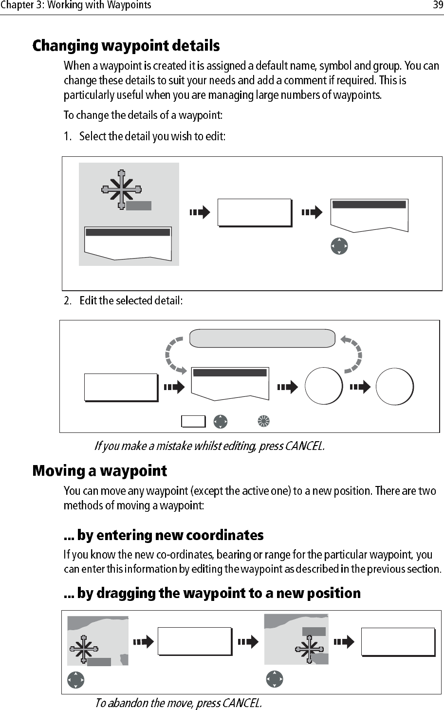
Edit Waypoint
D8286-1
WPT
Or
VIEW AND EDIT
DETAILS
Waypoint List
Select required waypoint with
cursor or via waypoint list
Highlight field
for changing
Edit Waypoint
EDIT SYMBOL
Edit details as required using: To save
e.g.
To save and
exit editing
Soft key reflects
highlighted field
OK OK
Repeat for other fields, if necessary
,and/or
Soft key
D8287-1
D8288-1
WPT
MOVE WAYPOINT PLACE WAYPOINT
Select waypoint
for moving
Drag waypoint
to new location
WPT
WPT
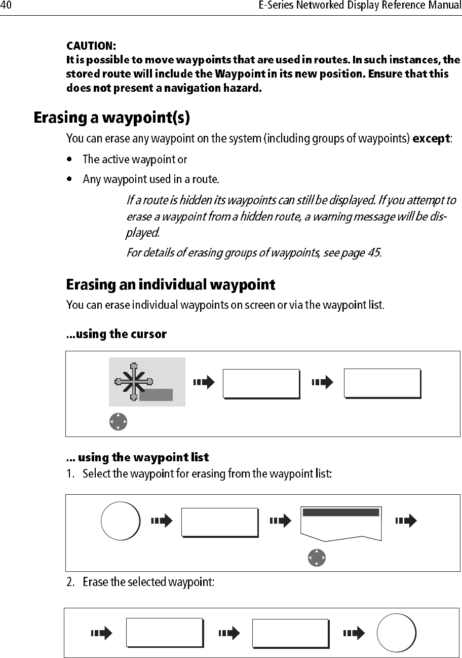
Notes: (1)
(2)
D8289-2
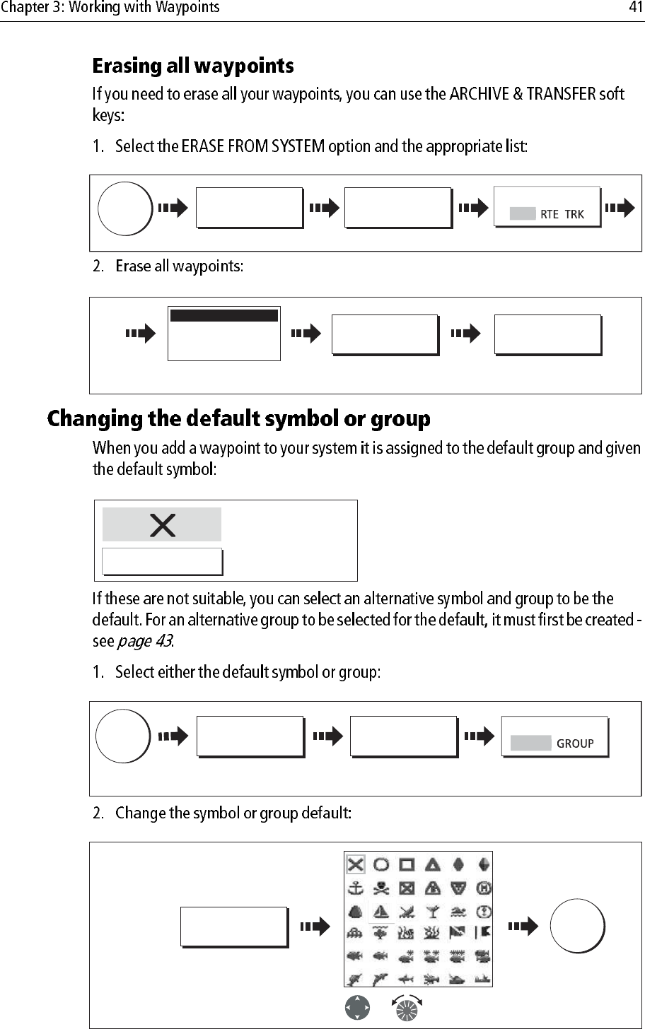
WPT
ERASE WAYPOINT YES
Select waypoint
for erasing
Confirm the pop-up
message
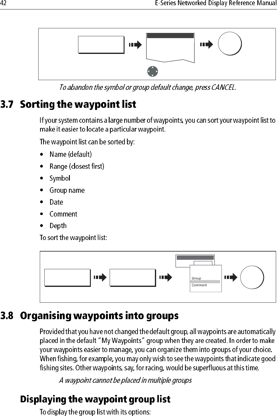
REVIEW AND EDIT
WAYPOINTS...
Select waypoint
for erasing
WPTS
MOB
Waypoint List
D8843_1
D8844_)
YES
ERASE WAYPOINT
OK
D8716-1
ARCHIVE AND
TRANSFER
ERASE FROM
SYSTEM...
SELECT LIST
DATA
W
PT
Select the WPT list
D8851_1
ERASE ALL
WAYPOINTS YES
Waypoint Group 1
Waypoint Group 2
Waypoint Group 3
System Waypoint List
System waypoint list
displayed
D6658-2
Default Symbol
Default Group
My Waypoints
D8290-1
WPTS
MOB
REVIEW AND EDIT
WAYPOINTS...
SET DEFAULT SYM
& GROUP...
SET UP DEFAULT
Toggle to required option.
Default displayed.
S
YMB
D8291-1
EDIT DEFAULT
Select required
default symbol
To save
OK
Symbol
Or
Note:
Note:
D9055-1
Select required
default group
EDIT DEFAULT
To save
OK
Group
Group List
D8292-1
SORT LIST SELECT SORT
OPTION
Save
OK
Select sort method
Range
SORT LIST BY
Order by:
Name
Range
Symbol
Depth
Dat
e
D6885-3
WPTS/
MOB
REVIEW AND EDIT
WAYPOINTS ...
WAYPOINT
GROUPS ...
Deep fishing
Shallow fishing
Reef fishing
GROUP LIST
e.g.
D8293_1
MAKE NEW
GROUP...
OK
D8293_1
MAKE NEW
GROUP...
OK
Or
EDIT GROUP
NAME
OK
Edit name Save
MAKE NEW
GROUP...
MAKE NEW
GROUP...
OK
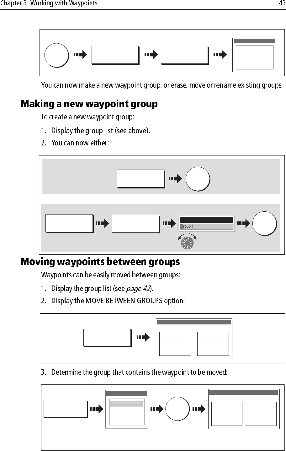
Make a new group and accept the default name:
Make a new group and customise the name:
NEW WAYPOINT GROUP
G
D8293_2
D8295_1
MOVE BETWEEN
GROUPS...
Fishing
GROUP LIST
My Waypoints
Waypoint 1
Waypoint 2
Waypoint 3
MOVE BETWEEN GROUPS
GROUP A GROUP B
D8297_1
OK
SELECT GROUP A
Deep fishing
Shallow fishing
Reef fishing
GROUP LIST
My
Wa
yp
oint
s
Waypoints in selected group
listed.
My Waypoints
Waypoint 1
Waypoint 2
Waypoint 3
MOVE BETWEEN GROUPS
GROUP A
Select group
containing waypoint
to be moved.
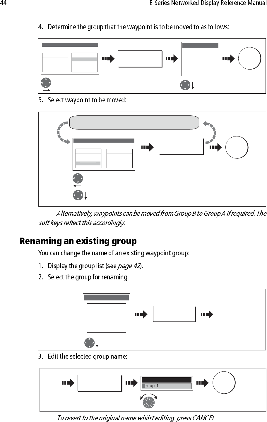
Note:
Note:
D8298_1
OK
Fishing
GROUP LIST
My Waypoints
Waypoint 1
Waypoint 2
Waypoint 3
MOVE BETWEEN GROUPS
GROUP A GROUP B
SELECT GROUP B
My Waypoints
Deep fishing
Shallow fishing
Reef fishing
GROUP LIST
Move control to
Group B Select group to
add waypoint to
D8299_1
OK
Fishing
GROUP LIST
My Waypoints
Waypoint 1
Waypoint 2
MOVE BETWEEN GROUPS
GROUP A GROUP B
Waypoint
3
MOVE WAYPOINT
FROM A TO B
Move control to Group A.
Select required waypoint.
Repeat until all changes made
D8300_1
RENAME GROUP...
My Waypoints
Deep fishing
Shallow fishing
Reef fishing
GROUP LIST
Select required
group
D8301_1
Edit name
OK
EDIT GROUP
NAME
Save new
name
NEW WAYPOINT
G
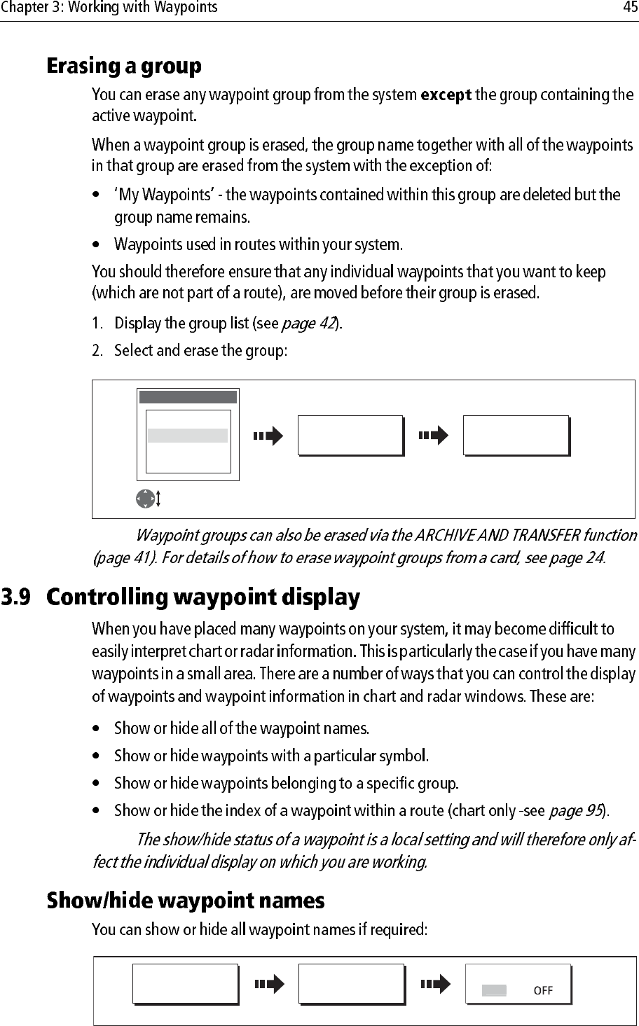
Note:
Note:
D8302_1
ERASE GROUP... YES
My Waypoints
Deep fishing
Shallow fishing
Reef fishing
GROUP LIST
Highlight page
set for editing
Confirm the pop-up
message
D8306_1
PRESENTATION... SHOW/HIDE
WAYPOINTS...
WAYPOINT NAME
Select status
O
N
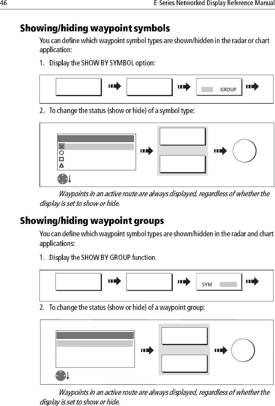
Note:
Note:
D8839_1
PRESENTATION... SHOW/HIDE
WAYPOINTS...
SHOW BY
Select SYM
S
YM
D8304_1
OK
Select status
Fish HIDE
Ra SHOW
Day HIDE
SHOW BY SYMBOL
M
S
H
OW
Select required group
ON CHART
SHOW HIDE
ON RADAR
SHOW HIDE
Or
D8721_1
PRESENTATION... SHOW/HIDE
WAYPOINTS...
SHOW BY
Select GROUP
GROU
P
D8305_1
OK
Select required group
Fishing SHOW
Racing SHOW
Day trips HIDE
SHOW BY GROUP
My Waypoints
S
H
O
W
Select status
ON CHART
SHOW HIDE
ON RADAR
SHOW HIDE
Or
Note:
FIND
SHIP CURSOR GOTO... ROUTES... TRACKS... PRESENTATION...
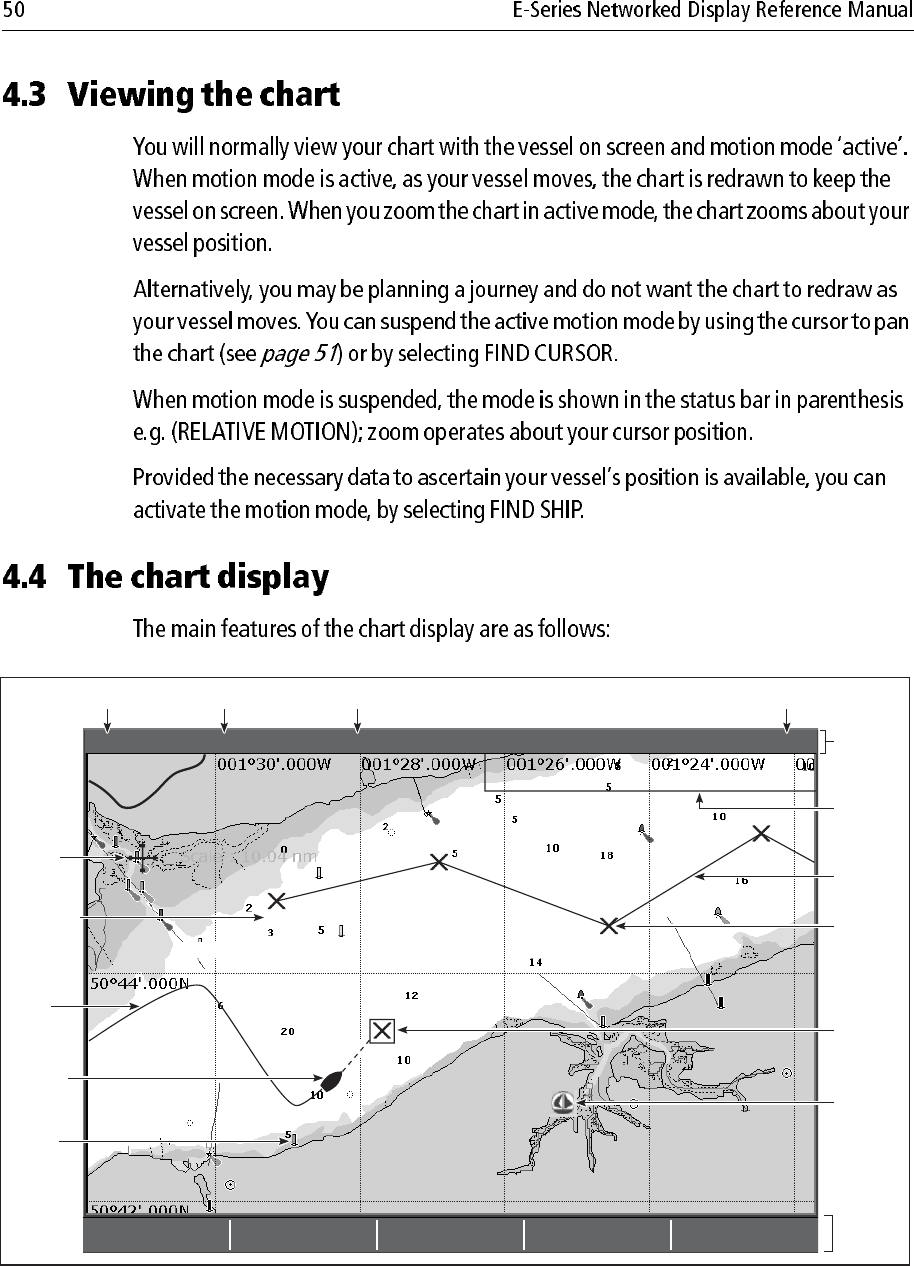
4nm North-Up (Relative Motion) Local
Gully Ridge
Creek point
Port point
Portside
Chart
boundary
Chart range Chart orientation Motion mode
Status
bar
Cursor
Route
Waypoint
name
Current
position
Waypoint
Track
Carto-
graphic
object
Active
waypoint
Soft
keys
D6605_2
Chart view
Port
Services
Note:
Note:
Note:
Note:
D6627-1
Boat symbol
D8714_1
FIND
S
HIP
Chart redraws with boat at centre
Toggle to FIND SHIP
If you cannot see your boat:
WPTS
MOB OK
Accepts default
(or wait 3 seconds)
x2
To mark your current position:
D6583-3
D6585-2
D6585-1
RANGE
IN
OUT
Note:
... about your boat:
... about the cursor:
Chart zooms in/out on your boat
Motion mode active
Chart zooms in/out on the cursor
Motion mode inactive
If 3D SYNC is active, 3D chart
also centres on cursor
e.g.
e.g.
D8672_1
FIND
FIND
SHIP
CU
R
SOR
FIND SHIP selected
FIND CURSOR selected
D6585-1
OUT
IN
RANGE
D6585-1
OUT
IN
RANGE
3nm N-UP RM Sys
1nm N-UP (RM) Sys
D 6771-2
Move cursor over object, to
display basic information.
OK
More detailed information for
selected object displayed.
D 8308_1
Highlight the required subject area.
Details displayed in right-hand column.
Scroll through detailed list
Move control to right hand column
D8260_1
OK
Move cursor to
required position
FIND NEAREST...
D8310_1
FIND
FIND NEAREST...
WAYPOINTS
PORT SERVICES
TIDE STATIONS
CURRENT STATIONS
WRECKS
OBSTRUCTIONS
P
ORTS
SELECT PORT
16 nearest to cursor in selected
category displayed.
Select required
category
Direction and speed of current (green arrows)
Tide height
D10607_1
Note:
Note:
T
D8311_1
OK
Position cursor
over tidal diamond
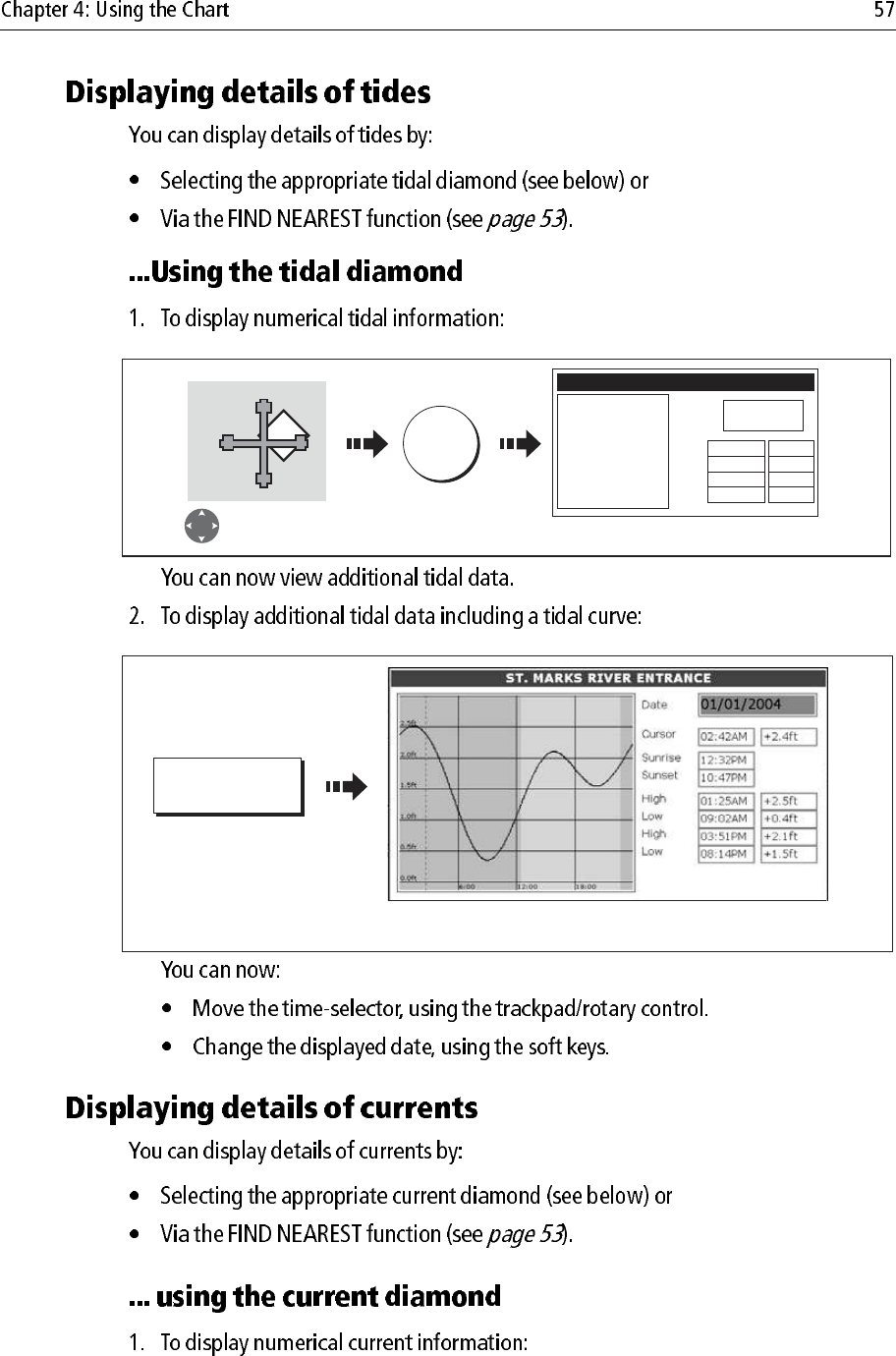
OBJECT INFO
ST MARKS RIVER
High
Low
High
Low
Position 30
004.700N
84010.700W
01:25AM +2.5ft
09:02AM +0.4ft
03:51AM +2.1ft
08:14AM +1.5ft
Tidal information displayed
D6782_3
TIDAL DATA
Detailed data is shown for the selected time
(red, dashed, vertical line).
D8313_1
OK
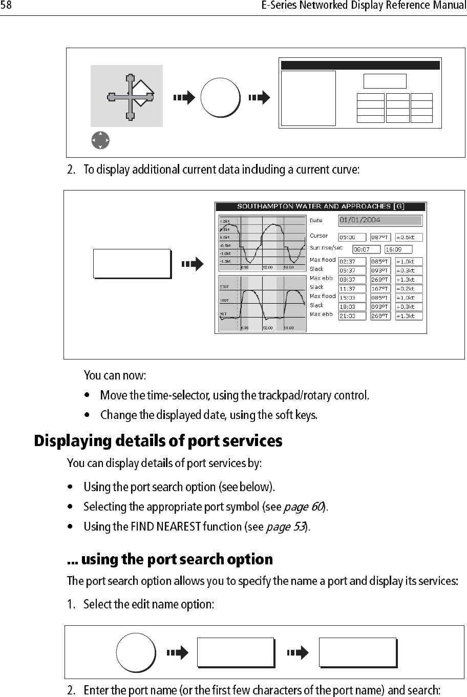
Position cursor over
current diamond
OBJECT INFO
FOUR MILE POINT
Ebb
Flood
Ebb
Flood
Position 30006'.700N
84012'.700W
05:41AM +187.0
01:08AM +358.0
06:17AM +0.0
11:30AM +358.0
0.5kt
0.2kt
0.0kt
0.2kt
Current information displayed
C
D7513_2
CURRENT DATA
Detailed data is shown for the selected time.
D8314_1
OK
SEARCH BY NAME EDIT NAME
Note:
D 8309_1
SEARCH BY NAME
Enter Port Name
GA
Enter port name (or part of)
using:
OK
,or
Soft key
SEARCH
D8742_1
SELECT PORT
GANDERS MARINE
GANDERS BASIN
Position
Bearing and
Range from
selection
29043.730N
84058.957W
Restaurants
Travel Agencies
Beauty Shops
3420T.007nm
G
ANDERS QUAY
SELECT PORT
GANDERS MARINE
GANDERS BASIN
GANDERS QUAY
Position
Bearing and
Range from
selection
29043.730N
84058.957W
Restaurants
Beauty Shops
3420T.007nm
Trave
l
Agencie
s
Highlight required port Highlight required service
Select highlighted port
D8743_1
VIEW DETAILS...
GANDERS QUAY - Travel Agencies
T
ravel A
g
encie
s
DAVIS TRAVEL
GANDERS QUAY - Travel Agencies
Travel Agencies
Tel: 1234567
1 High Street
Ganders Quay
Select service Details of service displayed
D
AVIS TRAVE
L
Note:
D8316_1
OK
OBJECT INFO
RAINBOW HARBOR
Photos
Pilot Book
Position 29058'.147N
093052'.215W
Utilities
Banks
Restaurants-Bars
Supplies
Hookups
Fuel
Services for selected port displayed
Select appropriate
port symbol
D8317_1
Highlight required service
Water Transportation
Car Services
Utilities
Stores
Banks
R
estaurants-
B
ar
s
Move control to utilities column
OBJECT INFO
RAINBOW HARBOR
Photos
Pilot Book
Land area
Position 29032'.778N
095001'.479W
Car Services
Utilities
Stores
Banks
Restaurants-Bars
W
ater Transportat
i
o
n
D8318_1
RAINBOW HARBOR - Restaurants-Bars
Ichibon Japanese Seafood
Landrys Restaurants Inc
Joes Crab Shack
Redfish Island
Restaurants-Bar
s
VIEW DETAILS...
Details of selected service displayed.
D7927_1
D8744_1
OK
Highlight the pilot book option
Select the pilot book option
Select appropriate
port symbol
OBJECT INFO
RAINBOW MARINA
Photos
Position 29058'.147N
093052'.215W
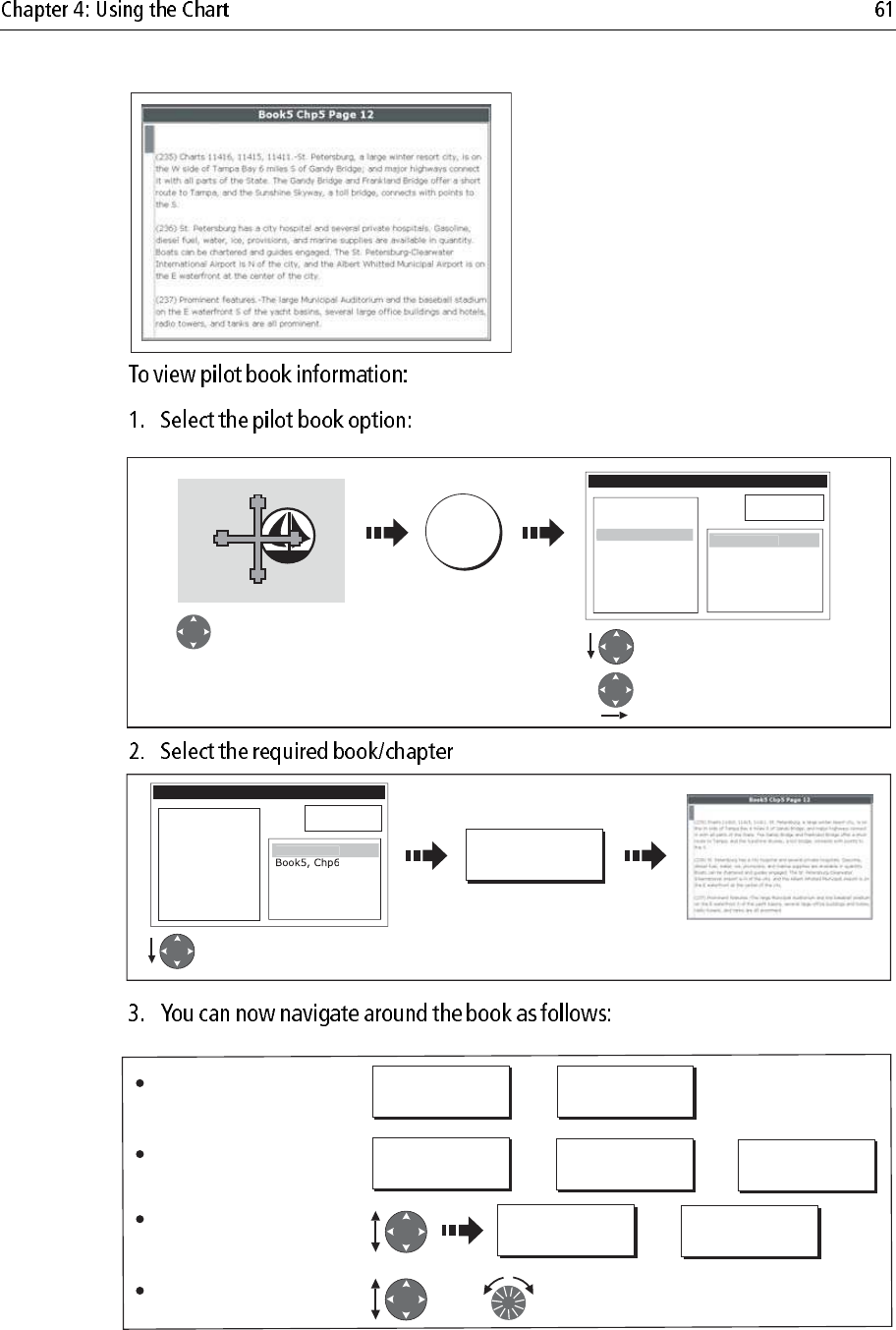
Book5, Chp6
B
ook5, Chp
5
Pi
lo
t B
ook
D8745_1
OBJECT INFO
RAINBOW MARINA
Photos
Pilot Book
Position 29058'.147N
093052'.215W
Highlight required book/chapter Selected book/chapter
displayed
VIEW PILOT BOOK
Boo
k
5, C
h
p
5
D8746_1
PREVIOUS PAGE NEXT PAGE
Or:
Or: Or:
Or:
PAGE INDEX
BOOK INDEX
Or: GOTO CHAPTER
GOTO BOOK
CHAPTER INDEX
To move between the pages
of the selected chapter:
To display the various
indexes:
To select and go to a
chapter or book:
To scroll through an index or
through text within a page:
D8262-1
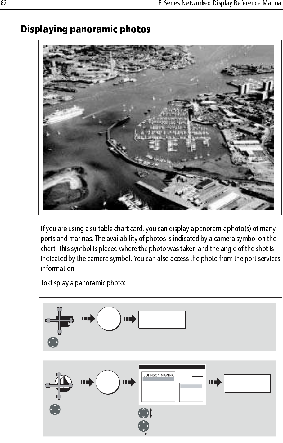
D8263_1
Select required
camera symbol
VIEW PHOTO
OK
VIEW PHOTO
OK
Or
Select required
port symbol Select Photos option.
OBJECT INFO
Pilot Book
Depth area
Photo
s
Photo 456
Position
P
hoto 12
3
xxx
Select individual photo.
Note:
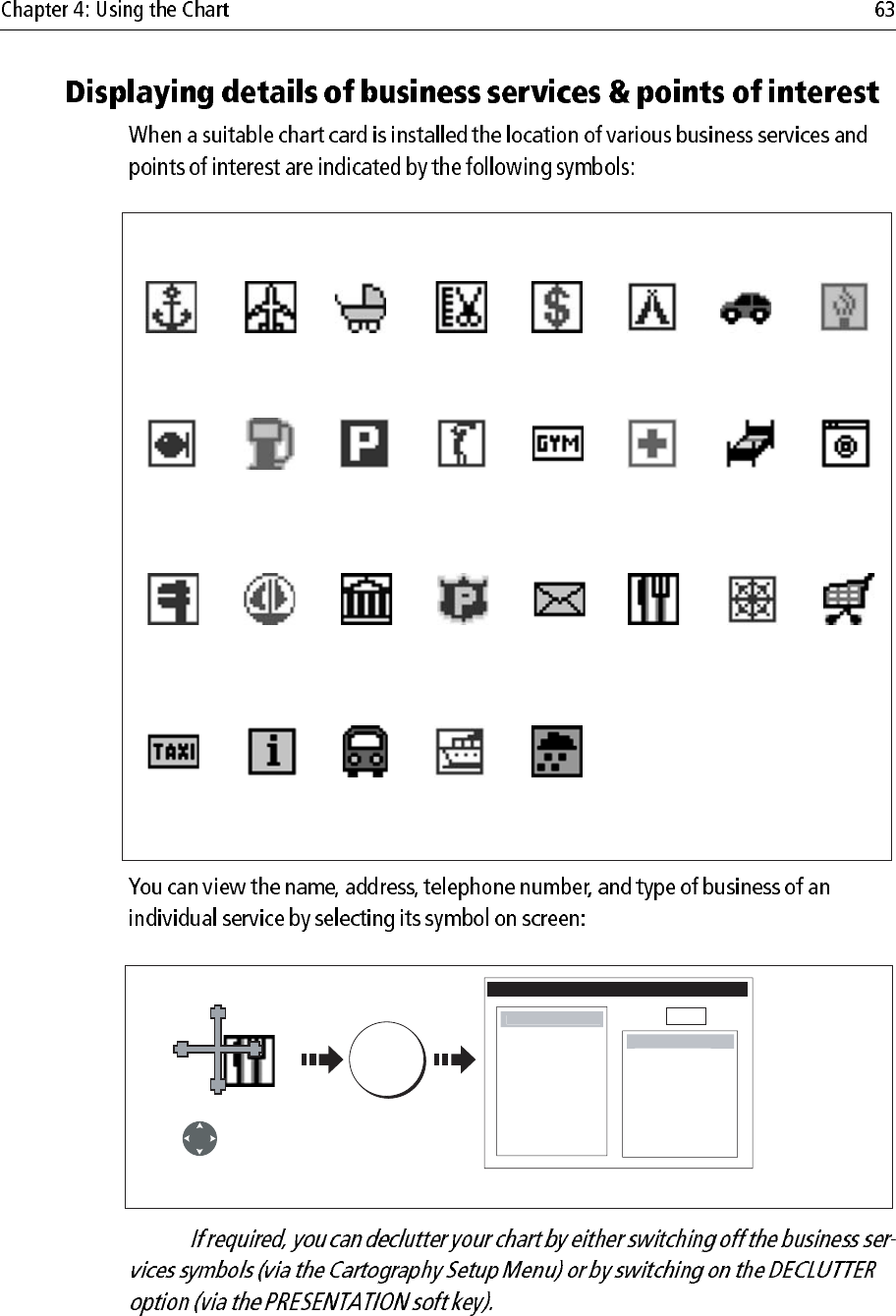
Business services/points of interest symbols
Airport Babysitting Barber Bank Camping Car hire
Fishing
equipment
Parking
Firemen
Gas/Petrol
MarinaNautical
repairs
LaundryHotelHospitalGym
Golf
Post OfficePoliceMuseum
Anchorage
Water
transport
TrainTourist
information
Taxi
station
ShopShip
repairs
Restaurant
Weather
station
D8226_1
D8264_1
OK
Select business
service symbol
e.g restaurant
OBJECT INFO
Land area
N
am
e
The Haven
Address
20 High Rd
Seaview
Isle of Wight
Phone
0123 45678
Position xxx
Po
int
o
f Interes
t
Eating p
l
ace
s
Additional information displayed
Note:
D8265_1
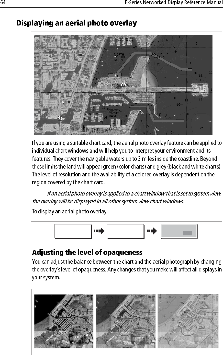
D8319-1
CHART LAYERS...PRESENTATION…
Enable soft key
AERIAL OVERLAY
O
N
O
FF
D8266_1
20% level
40% level
70% level
ie:
In shallow
water, in some parts of the world
where the photos are good and
clear you will actually see bottom
features like sandbanks, reefs etc.
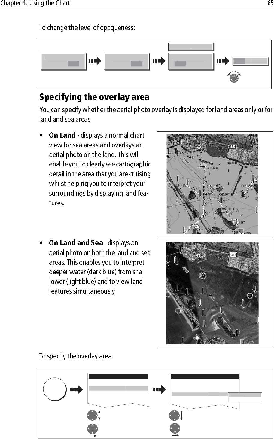
D8320-1
AERIAL
O
VERLA
Y
O
N
O
FF
AERIAL
O
VERLA
Y
O
N
O
F
F
A
ERIAL
O
VERLAY
O
F
F
O
N
40
0
Adjust
overlay level
as required
Overlay slider
displayed
Enable soft key
D8267_2
D8581_1
Select Cartographic
setup
Highlight Cartographic
setup Highlight Aerial Photo overlay
Select Aerial Photo overlay
D8268_1
MENU
Setup
Chart Setup...
GPS Setup...
Carto
g
rap
h
y Setu
p
Cartography Setup Menu
.....
Coloured SeaBed Areas OFF
Business Services ON
Roads ON
A
erial Photo Overla
y
O
n L
a
y
On Land and Sea
O
n Lan
d
D9056_1
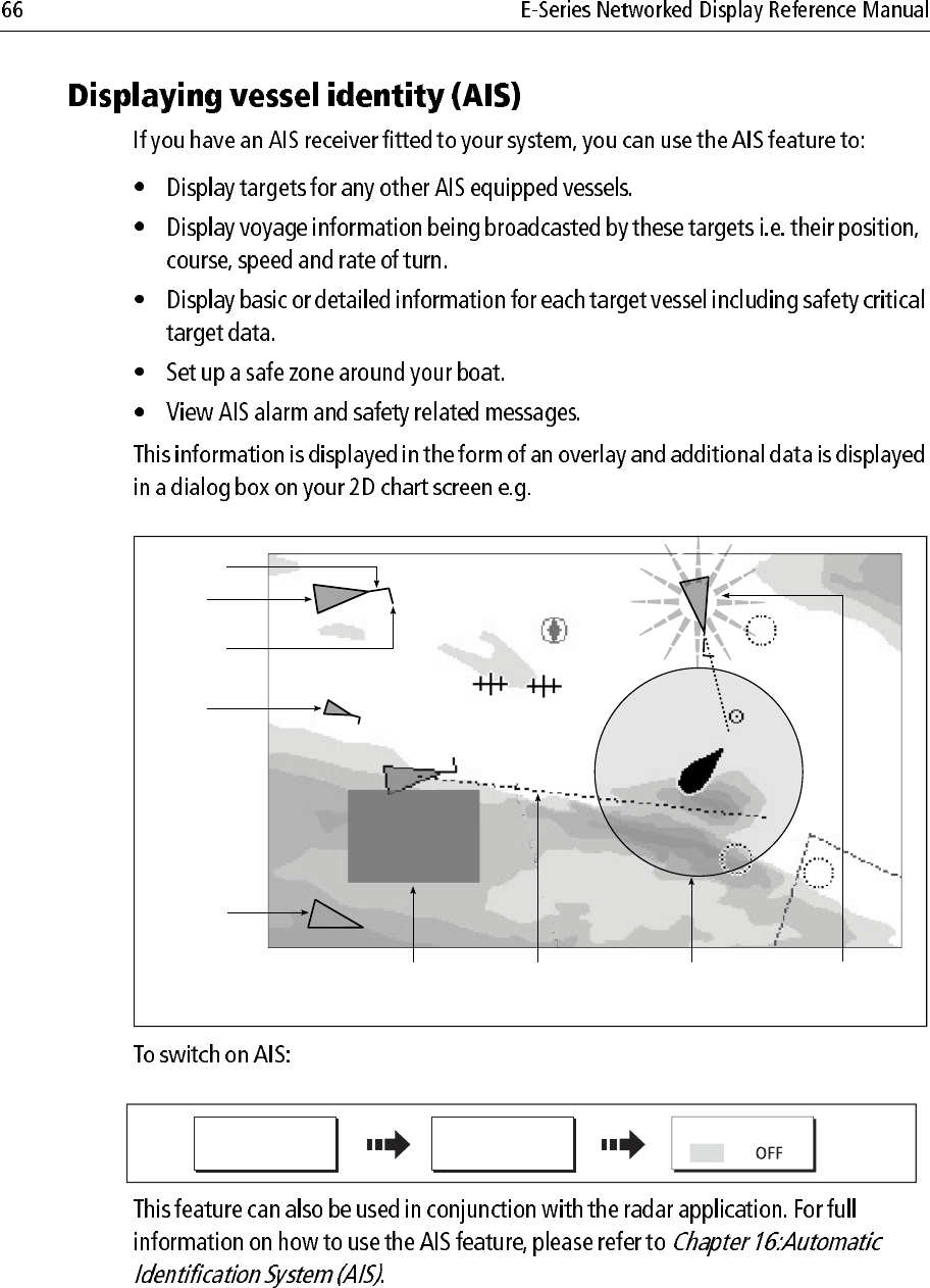
097°T
11.6kt
1.237nm
00h04m33s
Safety
critical data
Heading
Large
vessel
Direction
of turn
Small
vessel
COG/SOG
vector
Safe zone (defined by
distance or time)
Dangerous
target (flashes)
Sleeping
target
D9023_1
CHART LAYERS... AIS LAYER
PRESENTATION ON
Note:
;
D6665-3
DATA
RULER
Position cursor
at start point. Range & bearing from A to B
displayed. ADJUST B highlighted.
A
B
065
0
T
0.18nm
OK
033oT
0.60nm
A
B
To fix new ruler
position
Move cursor to end point.
Distance and bearing displated.
D8321-1
OK
008
o
T
0.46nm
A
B
ADJUST A
ADJUST B
Or
Select which point to adjust Move cursor to new position
To fix new
ruler
position
D8322-1
D8323_1
CLEAR RULER
DATA RULER
Note:
Note:
D6608-3
GOTO CURSOR
STOP GOTO RESTART XTE
4nm North-Up (Relative Motion) Local
Boat's heading changes
to follow course to
temporary waypoint
Press to stop GOTO
and remove
temporary waypoint
Dashed line
marking original
course of GOTO
Temporary waypoint
(within white box)
placed at cursor
Temporary
waypoint
name
GOTO...
D6493-2
GOTO CURSOR
Position cursor at
desired destination
Temporary waypoint
placed at the cursor.
Note:
:
GO TO WAYPOINT
D7461_2
WPT
Position cursor
over required
waypoint. Dashed line from boat to
active (boxed) waypoint.
Navigation commences.
WPTS/
MOB
D6543-2
GOTO WAYPOINT
OPTIONS ... GOTO WAYPOINT
GOTO
Or
Waypoint List
Select required
waypoint
o
Note:
D8325_2
NAVIGATION ALARM
Waypoint Arrival
D8326_1
ACKNOWLEDGE
Wait 10 seconds
Or
D8324_1
GOTO... STOP GOTO
PRESENTATION
D7509-2
CHART MODE AND
ORIENTATION
AR
SHOW/HIDE
ROUTES ...
FOLLOW ROUTE
OPTIONS ...
BUILD NEW
ROUTE ...
REVIEW AND EDIT
ROUTES ...
D6534-2
D8327_1
Sunday Trip
Waypoint
Route name
Route
destination
Note:
ROUTES
D8343_1
PLACE WAYPOINT
BUILD NEW
ROUTE
Position cursor
at required
position
To place new way-
point at cursor's
position
D8344_1
PLACE WAYPOINT
Move cursor to
next waypoint
position
Next waypoint placed
Dashed line now solid
Cursor joined to waypoint
with dashed line.
Route 1
Note:
Sunday Trip#
GULLY RIDGE
Sunday Trip#
PORT POINT
Sunday Trip#
CREEK VIEW
CREEK POINT
PORTSIDE
Port point
Portside
D6546_2
RTE
SHOW/HIDE
ROUTES…
FOLLOW ROUTE
OPTIONS…
BUILD NEW
ROUTE
REVIEW AND EDIT
ROUTES…
4nm North-Up (Relative Motion) Local
D8351_1
Move cursor
over required
waypoint.
Includes waypoint in
route
ROUTES BUILD NEW
ROUTE
USE THIS
WAYPOINT
Repeat as necessary
WPT
Note:
D6498-3
USE WAYPOINT
LIST
BUILD NEW
ROUTE
ROUTES...
D8355-1
INSERT
WAYPOINT
Highlight required
waypoint
Waypoint added to New Route.
Make Route
New Route Waypoints
Crag Rock
Blyth Bay
y y
Waypoints
Crag Rock
Blyth Bay
Sandy Bay
Make Route
S
an
dy
Ba
y
New Route
0
1 San
d
y Bay
D8357-1
USE WAYPOINT
LIST...
USE CURSOR.....
Chart to Make Route dialog
Make Route
New Route
01 Sandy Bay
02 Crag Rock
03 Rush Creek
Waypoints
Crag Rock
Blyth Bay
Sandy Bay
Make Route dialog to chart
Make Route
New Route
01 Sandy Bay
02 Crag Rock
03 Rush Creek
Waypoints
Crag Rock
Blyth Bay
Sandy Bay
D8352_1
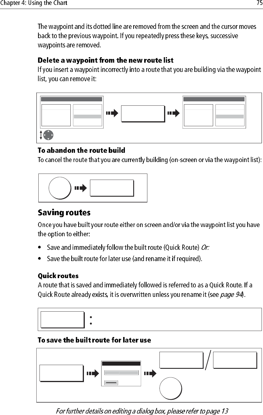
UNDO WAYPOINT
o
Note:
D8356-1
REMOVE
WAYPOINT
Highlight incorrect
waypoint Remaining waypoints close-up
and renumber accordingly
Make Route
New Route
01 Sandy Bay
02 Crag Rock
03 Rush Creek
Waypoints
Crag Rock
Blyth Bay
Sandy Bay
Make Route
New Route
01 Sandy Bay
02 Rush Creek
Waypoints
Crag Rock
Blyth Bay
Sandy Bay
D8353_1
CANCEL
YES
D8348-1
FOLLOW (QUICK)
ROUTE
Route saved under 'Quick Route'
Follow route commences
D8350_1
SAVE ROUTE...
EDIT NAME EDIT COLOR
To accept default
Save Route
R
ou
te
1
Name
Color
OK
Or:
Note:
NORTH POINT
KNOLL
COWES
4nm North-Up (Relative Motion) Local
D6606-2
ADVANCE
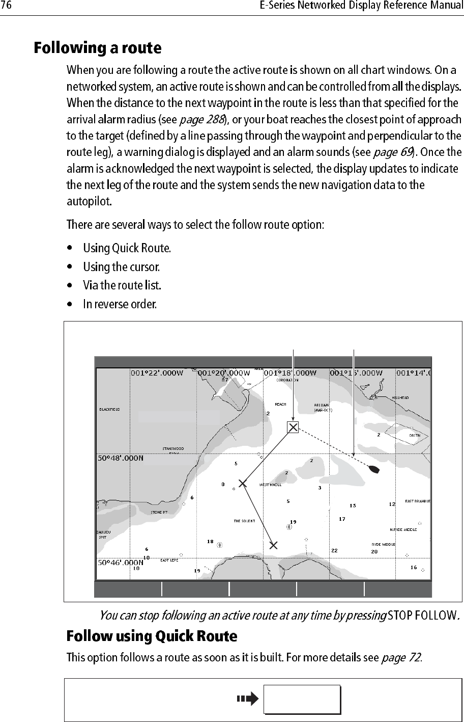
WAYPOINT STOP FOLLOW RESTART XTE
Target waypoint
highlighted
Course to active
waypoint
D6542-2
Build your route
FOLLOW (QUICK)
ROUTE
Note:
FOLLOW THIS
ROUTE
D7510-2
Position cursor over any
leg of required route
FOLLOW FROM
HERE
D6717-3
Position cursor over
appropriate waypoint
D6539-4
FOLLOW ROUTE
OPTIONS... FOLLOW ROUTE
ROUTES...
GOTO...
Or:
Route List
Color Name
---- Quick Route
---- Route 1
---- Route 2
---- Route 3
Select route to
follow
To start follow route
D8362_1
FOLLOW ROUTE
OPTIONS...
REVERSE AND
FOLLOW
ROUTES...
GOTO...
Or:
Route List
Color Name
---- Quick Route
---- Route 1
---- Route 2
---- Route 3
Select required
route
Reverse-follow
route starts
Note:
D6603_3
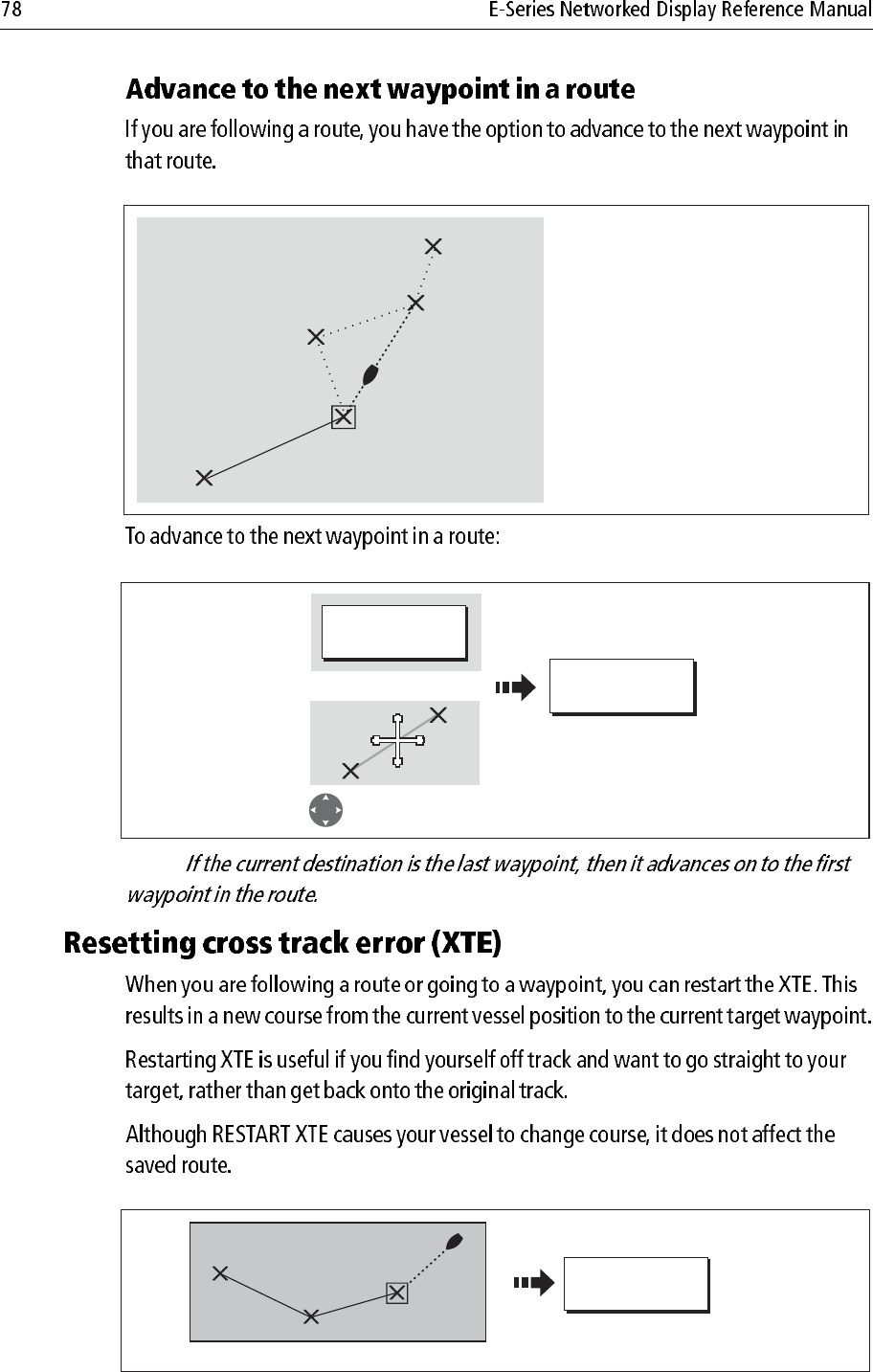
2
3
4
W.Wight
1
W.Wight
5
Example:
In this example, the advance
waypoint option was selected
following arrival at Waypoint 2.
This has resulted in Waypoint 3
being dismissed and the course of
the route advancing to Waypoint 4.
D6499-4
ADVANCE
WAYPOINT
GOTO…
Position cursor over route
Or
D6549_3
When you are following a route ..
RESTART XTE