Flir BelgiumBA DP4KW Light Marine Navigational Radar User Manual E Series Networked Display Ref Manual Part 7
Raymarine UK Ltd. Light Marine Navigational Radar E Series Networked Display Ref Manual Part 7
Contents
E Series Guide Part 7
KSUT
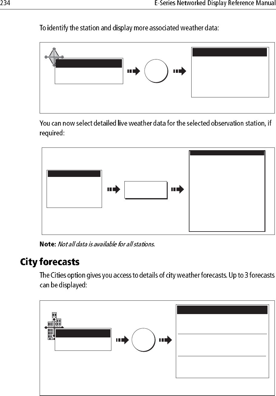
OK for more info
OBJECT INFO
e.g.
Time
Wind speed
Wind Direction
Wave Height
Sea Temperature
Visibility
Station Data
02:36PM
19.4kt
003
o
t
13.1ft
50.0
o
F
0.540nm
D8576_1
Move cursor over station graphic
Displays detailed information at
selected station
OK
D8578_1
VIEW FULL
REPORT...
Time
Wind Speed
Wind Direction
Wave Height
Sea Temperature
Visibility
Station Data
02:36PM
19.4kt
003ot
13.1ft
50.0oF
0.540nm
Station ID
Station Name
Station Type
Latitude
Longitude
Time
Date
Air Temperature
Horizontal Visibility
Vertical Visibility
Sea Level Pressure
3 Hour Pressure Change
Pressure Tendancy
Wind Direction
Wind Speed
Peak Wind Speed
Gust Wind Speed
Water Temperature
Tidal Elevation
Wave Height
Wave Period
Dominant Swell Direction
Dominant Swell Height
Dominant Swell period
Lesser Swell Direction
Lesser Swell Height
Lesser Swell Period
KEYW
Key West, FL
METAR Automatic
23
o
33' .000N
081
o
45'.000W
08:26AM
21/12/2005
68.4
o
F
13.53km
-,--kh
-mb
-mb
---
036
o
T
13.0kt
-,-kt
-,-kt
-,-
o
F
-,-ft
-,-ft
--h--m--s
---
o
T
-,-ft
--h--m--s
---
o
T
-,-ft
--h--m--s
Station Report
Forecast for Monday
A mix of clouds and sun. High 22F.
Winds NNE at 5 to 10 mph.
Forecast for Monday night
Mostly coudy skies. Low near 20F.
Winds NW at 5 to 10 mph.
Forecast for Tuesday
Sunshine along with some passing clouds.
High near 25F. Winds NW at 5 to 10.
Forecast for Summer Bay
Summer Bay
OK for more info
OBJECT INFO
e.g.
D8579_1
Move cursor over city symbol
Displays detailed information for selected
city
OK
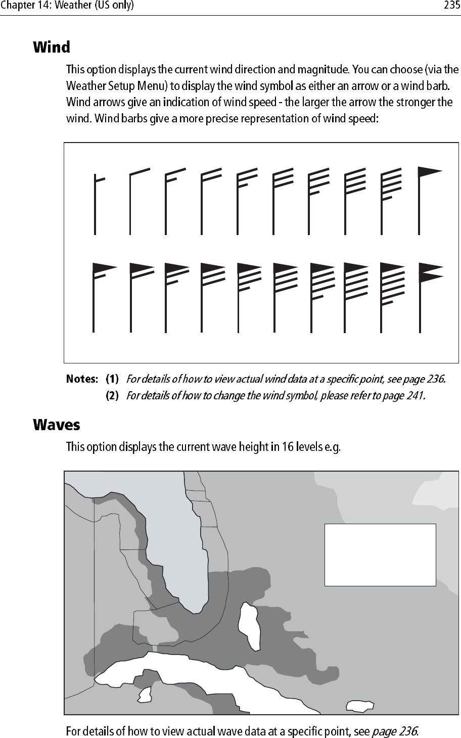
3-7 kts 8-12 kts 13-17 kts 18-22 kts 23-27 kts 28-32 kts 33-37 kts 38-42 kts 43-47 kts 48-52 kts
53-57 kts 78-82 kts73-77 kts68-72 kts63-67 kts58-62 kts 88-92 kts83-87 kts 98-102 kts93-97 kts
Wind speed symbols
D8571_1
etc.
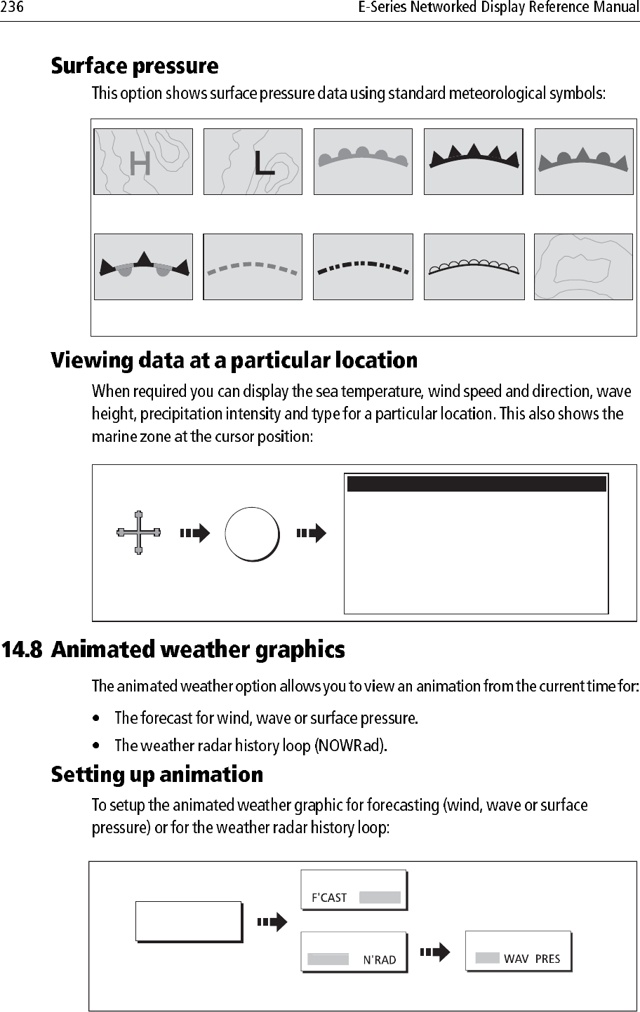
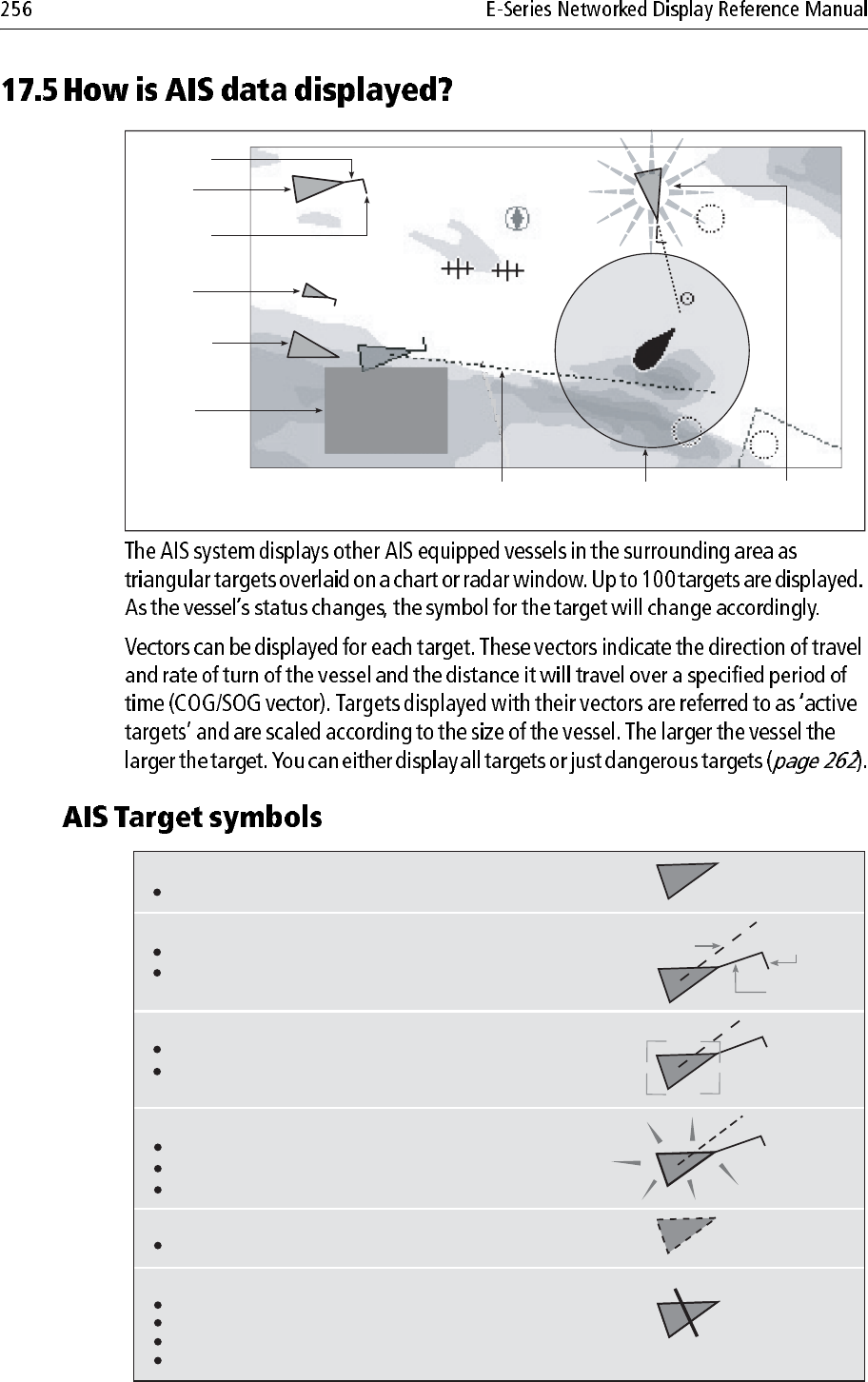
Waves shown in
16 shades of colour from:
Reds - Highest waves
Greens - Intermediate waves
Blues - Lowest waves
Cuba
Florida
Wave height ranges
D8603_1
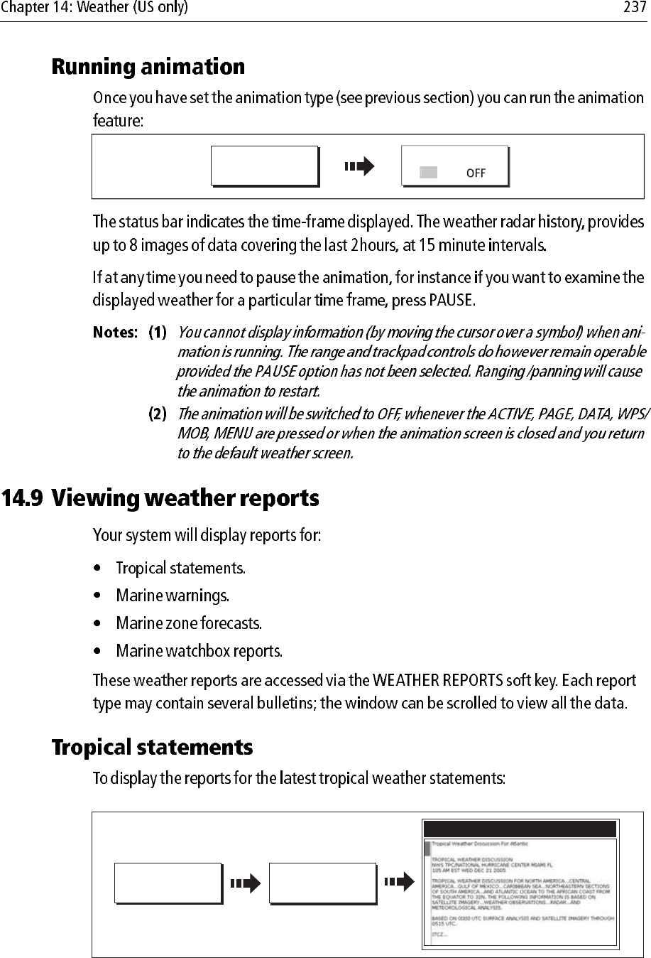
D8651_1
Squall line (red)
High pressure
(blue)
High pressure
(red) Cold front (blue)Warm front (red) Occluded front
(purple)
Stationary front
(red-blue)
Trough (brown) Isobars (grey)
1012
1010
Dry line (brown)
D8572_1
Move cursor
to required
location
OK
Zone desription
North Altantic Ocean between 31N and 67N latitude and
between the East Coast North America and 35W lonitude
Zone ID
Precipitation Intensity
Precipitation Type
Sea Surface temperature
Wind Speed
Wind Direction
Wave Height
XXX
<5dBz
None
-.-oF
20.0kt
255oT (WSW)
-.-ft
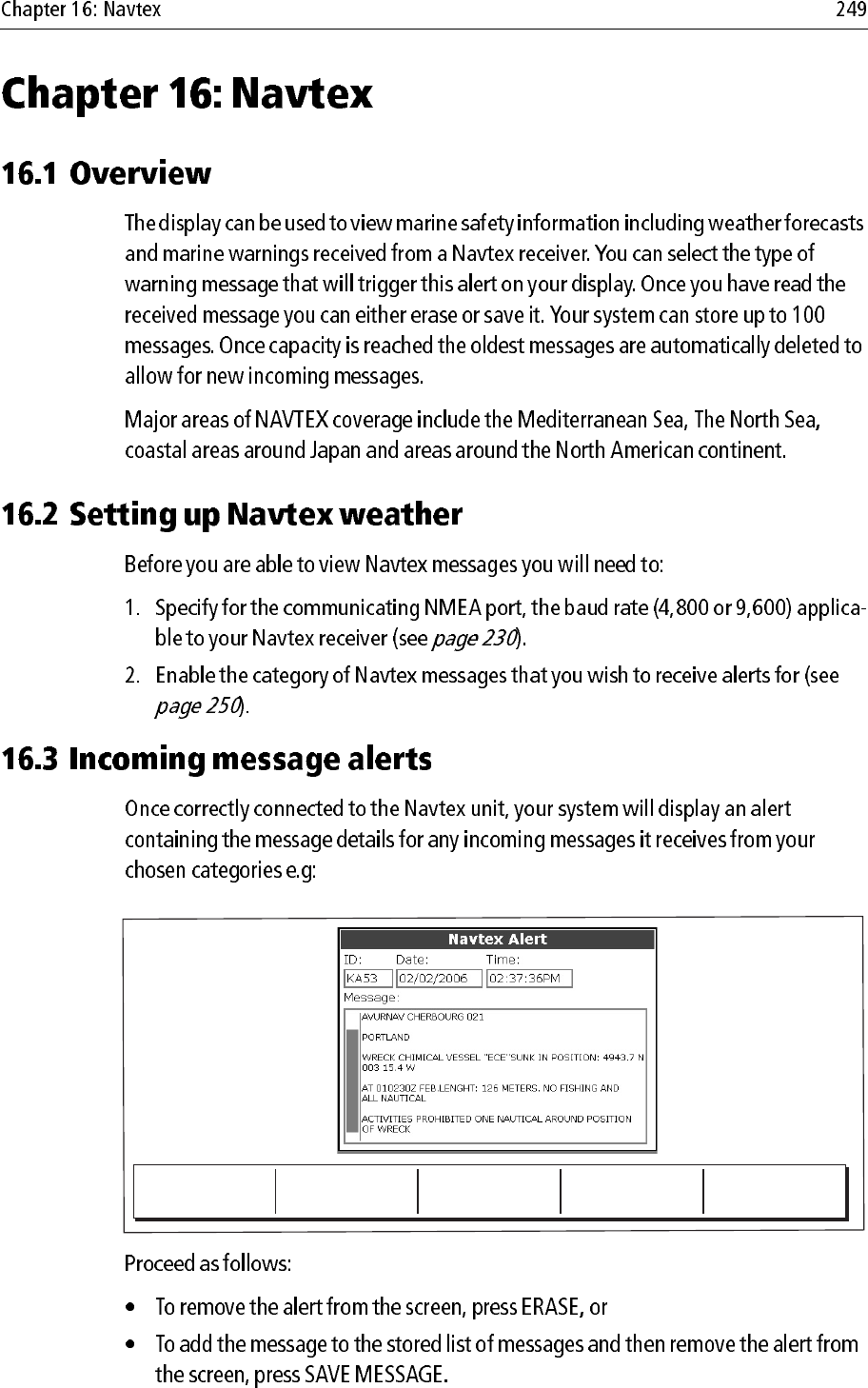
Weather Info
ANIMATE TYPE
ANIMATE
WEATHER...
D8580_1
Toggle to required
option
Select required
forecast option
N'RA
D
ANIMATE TYPE
F'
CAST
FORECAST
W
IN
OR:
ANIMATE
WEATHER...
ANIMATE
D8601_1
ON
D8619_1
TROPICAL
STATEMENT
WEATHER
REPORTS...
Tropical Statements
e.g
D8618_1
MARINE
WARNINGS
WEATHER
REPORTS...
D9058_1
FORECAST AT
Toggle to required
report position
S
HI
P
Marine Warnings
WEATHER
REPORTS...
MARINE ZONE
FORECASTS
D8617_1
D9057_1
Marine Zone Forecasts for
FORECAST AT
Toggle to required
report position
SHI
P
WEATHER
REPORTS...
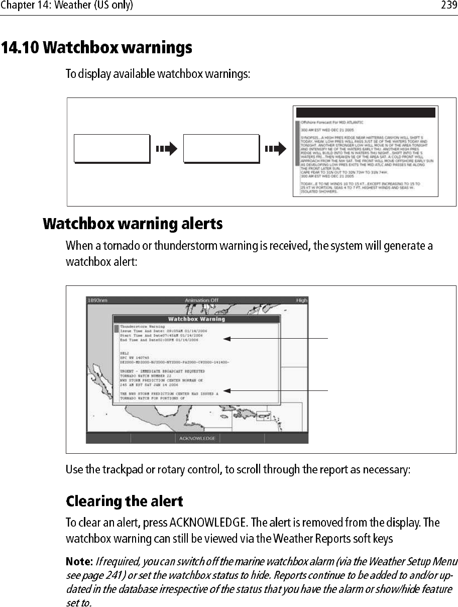
WATCHBOX
WARNINGS
D9012_1
Watchbox warnings
e.g.
D8606_1
Warning type and
period for which
warning is valid
Watchbox report
text
D8608_1
Watchbox alert
warning area
WATCHBOX
HID
E
PRESENTATION...
D8607_1
Toggle as required
VIEW WARNING
Move cursor over relevant
watchbox
Issue time
Date
Thunderstorm or tornado
OBJECT INFO
e.g.
D8611_1
D8612_1
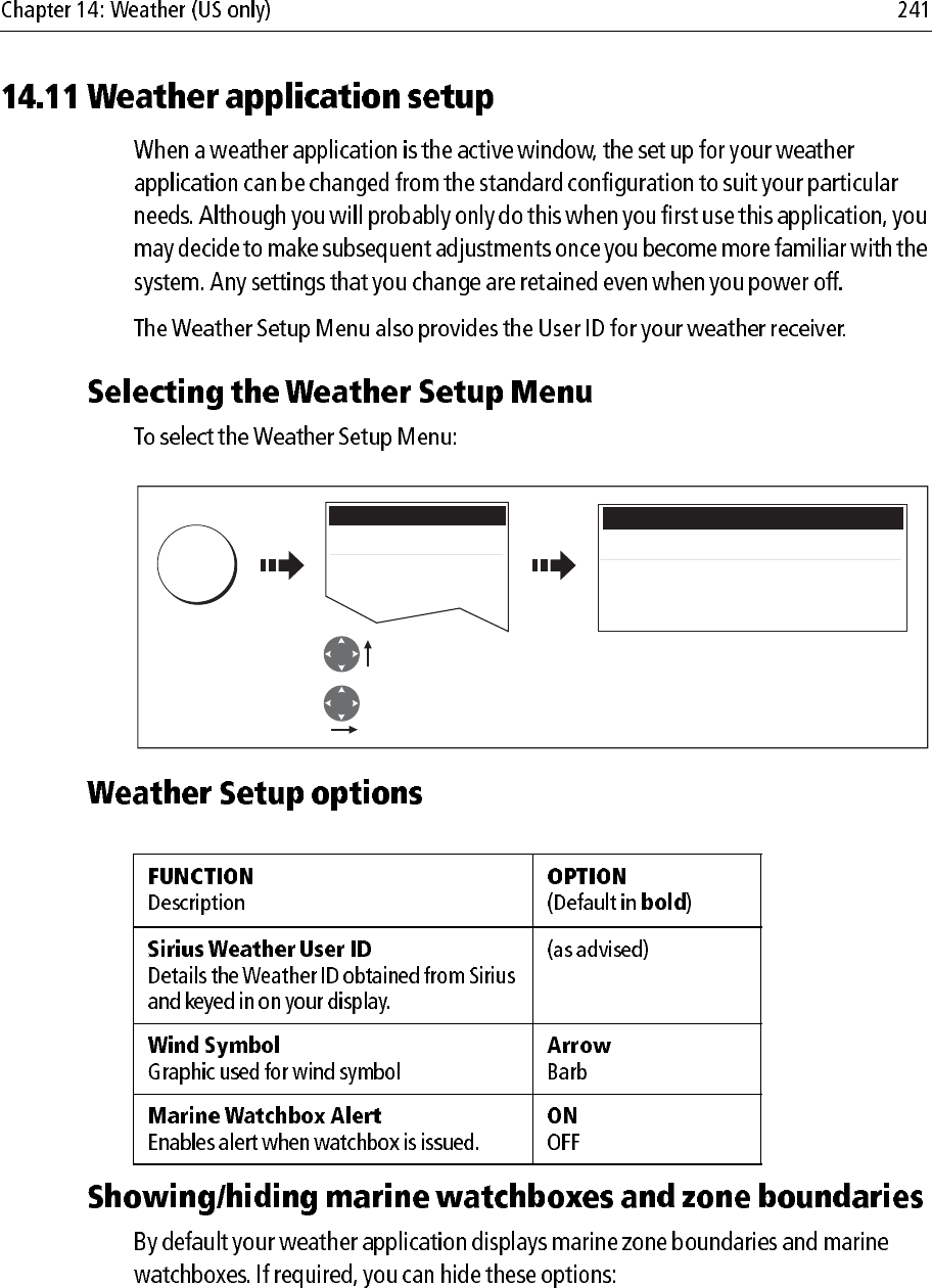
MENU
Setup
Weather Setup Menu...
GPS Setup...
Compass Setup...
Highlight Weather
Setup menu
Enter Weather
Setup menu
Weather Setup Menu
Sirius Weather User ID
Wind Symbol Arrow
Marine Watchbox Alerts ON
D8660_1
Toggle as required
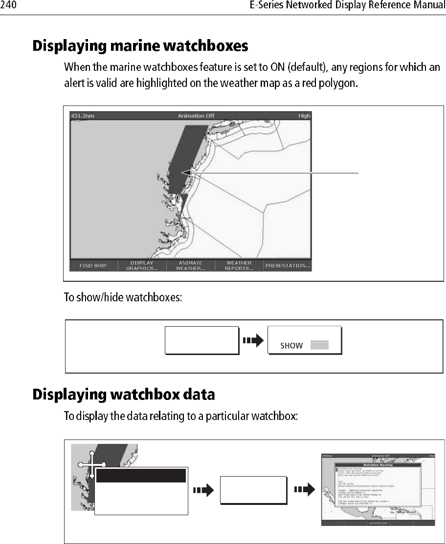
PRESENTATION
MARINE ZONES
WATCHBOX
OK
S
H
O
W
HID
E
D8870_1
ERASE MESSAGE SAVE MESSAGE
D8871_1
Setup
Radar Setup...
GPS Setup...
Compass Setup...
AIS Setup...
Navtex Messages
Highlight Navtex
messages
Select Navtex
messages
MENU
D8872_1
Highlight required item in list.
Associated message displayed
in message box
Move control to
message box
Scroll message
(if applicable)
D8876_1
Highlight category
Select category
Toggle to required status
SETUP ALERTS
Navtex Alert Menu
B - Meteorological warnings ON
C - Ice reports ON
D - Search and rescue information ON
E - Meteorological forecasts OFF
F - ilot service messages OFF
G - Decca messages OFF
H - Loran messages ON
I - Omega messages OFF
J - Satnav messages ON
K - Other electronic navaid messages ON
L - Additional navigational messages ON
V - Notice to fishermane (US only) ON
W - Environmental (US only) OFF
X - Special services ON
Y - Special services ON
Z - No message on hand (QRU) ON
A - Navi
g
ationa
l
warnin
g
s
ON
D8875_1
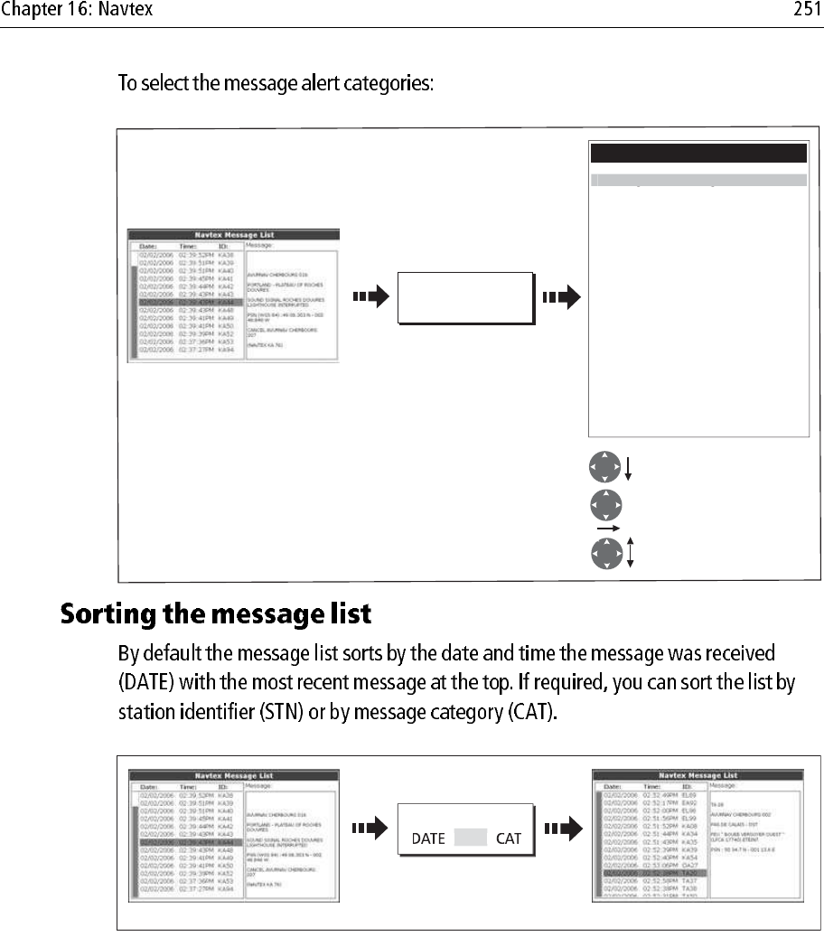
Toggle to required sort
option e.g. station
List sorts accordinglyList sorted by DATE (default)
SORT LIST
S
TN
e.g.

D8966_1
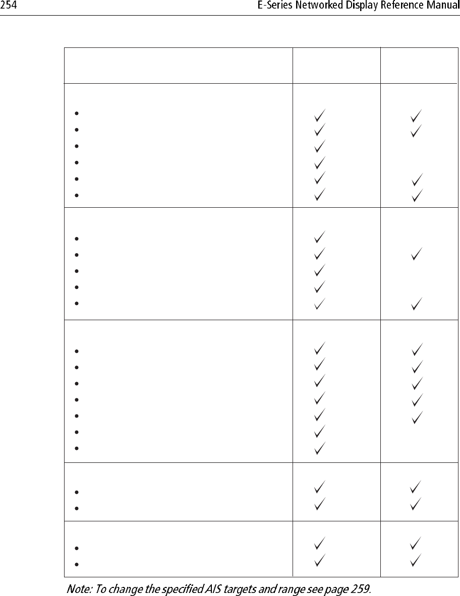
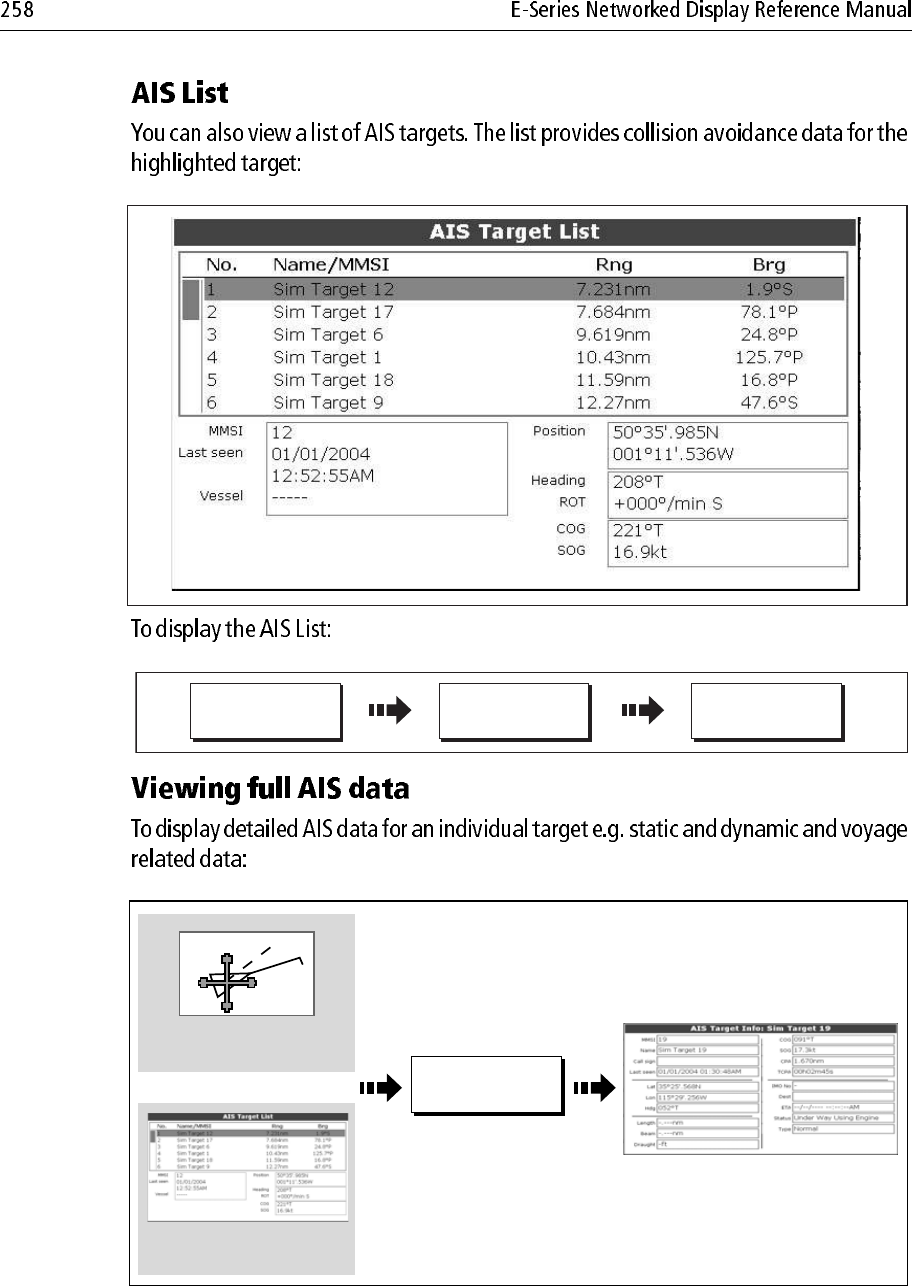
Static Data
Ship's name
Type
Call sign
IMO number
Length and beam
Antenna loctation
Draft
Cargo information
Destination
ETA
Other relevant information
Time
Ship's position
COG
SOG
Gyro heading
Rate of turn
Navigational status
Dynamic Data
Voyage Related Data
Data details Class A
(Sends and receives)
Class B
(receives only)
Ship's speed
Ship's status
Dynamic Reports
Alarm
Safety
Messages
Note:
PRESENTATION...
D8521_1
Toggle as required
On chart windows:
On radar windows:
CHART LAYERS...
PRESENTATION...
Toggle as required
AIS LAYER
ON OFF
AIS LAYER
ON OFF
D9014_1
AIS unit not available
i.e. not connected or off.
AIS unit switched on and
operating.
AIS unit switched on and
operating but dangerous &
lost target alarm disabled.
AIS unit on with active
alarm.
D9056_1
097°T
11.6kt
1.237nm
00h04m33s
Safety
critical data
Heading
Large
vessel
Direction
of turn
Small
vessel
Sleeping
target
Dangerous
target (flashes)
Safe zone (defined by
distance or time)
COG/SOG
vector
Uncertain target
Calculated CPA/TCPA value uncertain.
Sleeping target
Target not activated, dangerous or lost.
Activated target
Target activated i.e. AIS vector displayed.
Vector line (optional) shows predicted distance travelled within
given time.
Dangerous target
Targets within specified distance (CPA) or time (TCPA).
Dangerous target alarm sounds if en-abled.
Target flashes.
Lost target
When signal of dangerous target not received for 20 seconds.
Target in latest predicted position.
Alarms sounds if enabled.
Target flashes.
Selected target
Target selected with cursor.
Can activate the target and view detailed data.
COG/SOG
vector
Heading
Direction
of turn
AIS
D8523-1
D9051_1
Move cursor over
relevant target
AIS AIS
AIS VECTOR
O
N
D9052_1
Move cursor over
relevant target Safety critical data
displayed
AIS DATA
AU
T
O
1870T
10.9kt
7.719nm
00h57m27s
AIS
D9092_1
D9091_1
AIS OPTIONS... TARGET
TRACKING... AIS LIST
D8693_1
Move cursor over
required target
Select required target
on AIS list
VIEW FULL AIS
DATA...
Or
D9082_1
D8688_1
TARGET
TRACKING...
MARPA & AIS
OPTIONS...
Highlight and select TIME TO SAFE
ZONE. Select required duration.
MARPA & AIS OPTIONS...
Highlight and select OWN VESSEL
SAFE ZONE. Select required distance.
VECTOR LENGTH 6min
TARGET HISTORY Off
TIME TO SAFE ZONE 3min
SAFE ZONE RING HIDDEN
O
WN VESSEL SAFE ZONE 0.5n
m
REMOVE
MESSAGE
VIEW AIS
ALARM LIST...
4nm North-Up (Relative Motion) Local
AIS message
AIS Local Alarm
This alarm must be acknowledged on your
AIS Receiver.
To remove this message press REMOVE
MESSAGE.
"AIS message"
D8968_1
AIS Alarm
active icon
D8967_1
REMOVE
MESSAGE
Removes pop-up, adds alarm to and displays AIS Alarm List
Removes pop-up and
adds alarm to AIS
Alarm List.
VIEW AIS
ALARM LIST...
Or
D8969_1
AIS Layer Setup
AIS Alarms List...
D
isplayed Tar
g
et Type
s
All
Setup
Chart Setup...
Cartography Setup...
GPS Status...
Compass Setup...
AIS Layer Setup
Highlight AIS
Layer Setup
Select AIS
LayerSetup
MENU
Highlight required
option
Select option
Set/view as required
Do not use any abrasive materials including a dry cloth.
Do not use any cleaning solutions, polishes or sprays.
Do not use a jet wash.
D9203
D8662_1
MENU
Highlight System
Setup menu
Select System
Setup menu
Position mode...
ID Setup...
Simulator...
Bearing Mode...
MOB Data Type...
Manual Variation...
Language...
Extendeded Charater Set...
Ground Trip Reset
Settings And Data Reset
Lat/Long
ON
True
Position
Auto (01oE)
00oEnglish (US)
OFF
System Setup Menu
S
ettin
g
s Rese
t
Highlight Settings Reset
Select settings
reset
Yes
Setup
Radar Setup...
GPS Status...
Compass Setup...
S
y
stem Setu
p
..
.
D8663_1
MENU
Highlight System
Setup menu
Select System
Setup menu
Position mode...
ID Setup...
Simulator...
Bearing Mode...
MOB Data Type...
Manual Variation...
Language...
Extendeded Charater Set...
Ground Trip Reset
Settings Reset
Lat/Long
ON
True
Position
Auto (01oE)
00oEnglish (US)
OFF
System Setup Menu
Settin
g
s an
d
Data Rese
t
Highlight settings
and data reset
Select settings
and data reset
Yes
Setup
Radar Setup...
GPS Status...
Compass Setup...
S
ystem
S
etup..
.
D8665_1
MENU
Setup
Highlight System
Diagnostics menu
Select System
Diagnostics menu
System Diagnostics
Highlight software
services
Select software
services menu
Radar Setup...
GPS Status
System Diagnostics...
Remove CF Card...
External Interfaces.....
Internal Interfaces.....
Software Services....
D8666_1
Unit Info : Software Details
Product Name
Product Family
Product ID
Serial Number
Bootcode Version
World Map Version
App Version
App Build Time
App Build Label
App Build Machine
MAC Address
E120 Display
E Series
D598
Serial no.xxxxxxxxxx
v0.06
v1.00
v3.99
Thu 22 Sep 2005 08:09:05
GMT
Development build
LT1325
Full details of your particular unit and its
software displayed.