Furuno USA 9ZWRTR104 Transceiver for Radar Sensor DRS4DL User Manual
Furuno USA Inc Transceiver for Radar Sensor DRS4DL
Contents
- 1. User Manual I
- 2. User Manual II Part 1
- 3. User Manual II Part 2
- 4. User Manual II Part 3
- 5. User Manual II Part 4
- 6. User Manual II Part 5
- 7. User Manual II Part 6
- 8. User Manual II Part 7
- 9. User Manual II Part 8
- 10. User Manual II Part 9
- 11. User Manual II Part 10
- 12. User Manual II Part 11
- 13. User Manual II Part 12
User Manual II Part 12
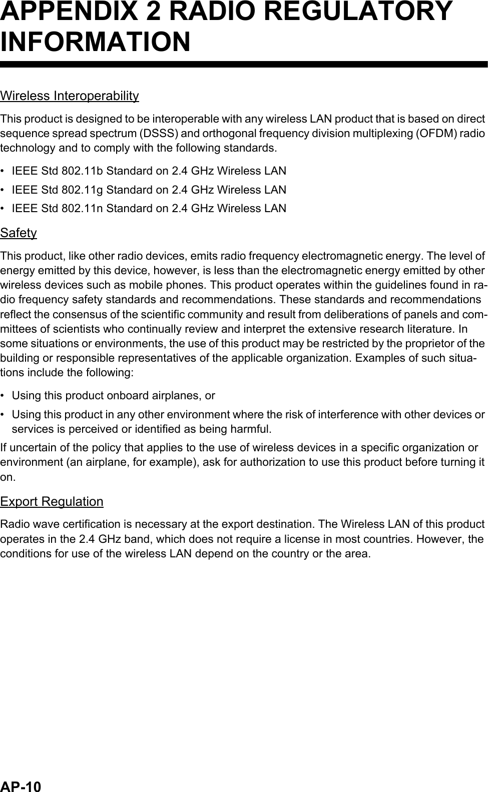
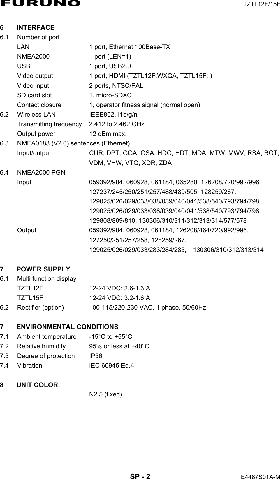
![13. OTHER FUNCTIONS13-913.5 Software UpdateYou can update the software for this equipment via the internet. See section 1.18 for how to connect to the internet. It is recommended to back up stored data (waypoints, routes, etc.) to a micro SD card before updating the software, in case something should go wrong during the updating.1. Open the home screen, then tap [Settings] - [General].2. Tap [Check for Software Update]. The following messages appear.3. Tap [Yes].The system starts updating. Do not turn off the power during the updating. The power switch turns orange when the updating is completed.iSoftware UpdateChecking new version availability...NEW VERSION DETECTED:BILLFISH VERSION 1.0.0 (SIZE = 1.45 MB)DO YOU WANT TO DOWNLOAD IT?YesNo](https://usermanual.wiki/Furuno-USA/9ZWRTR104.User-Manual-II-Part-12/User-Guide-2522496-Page-1.png)
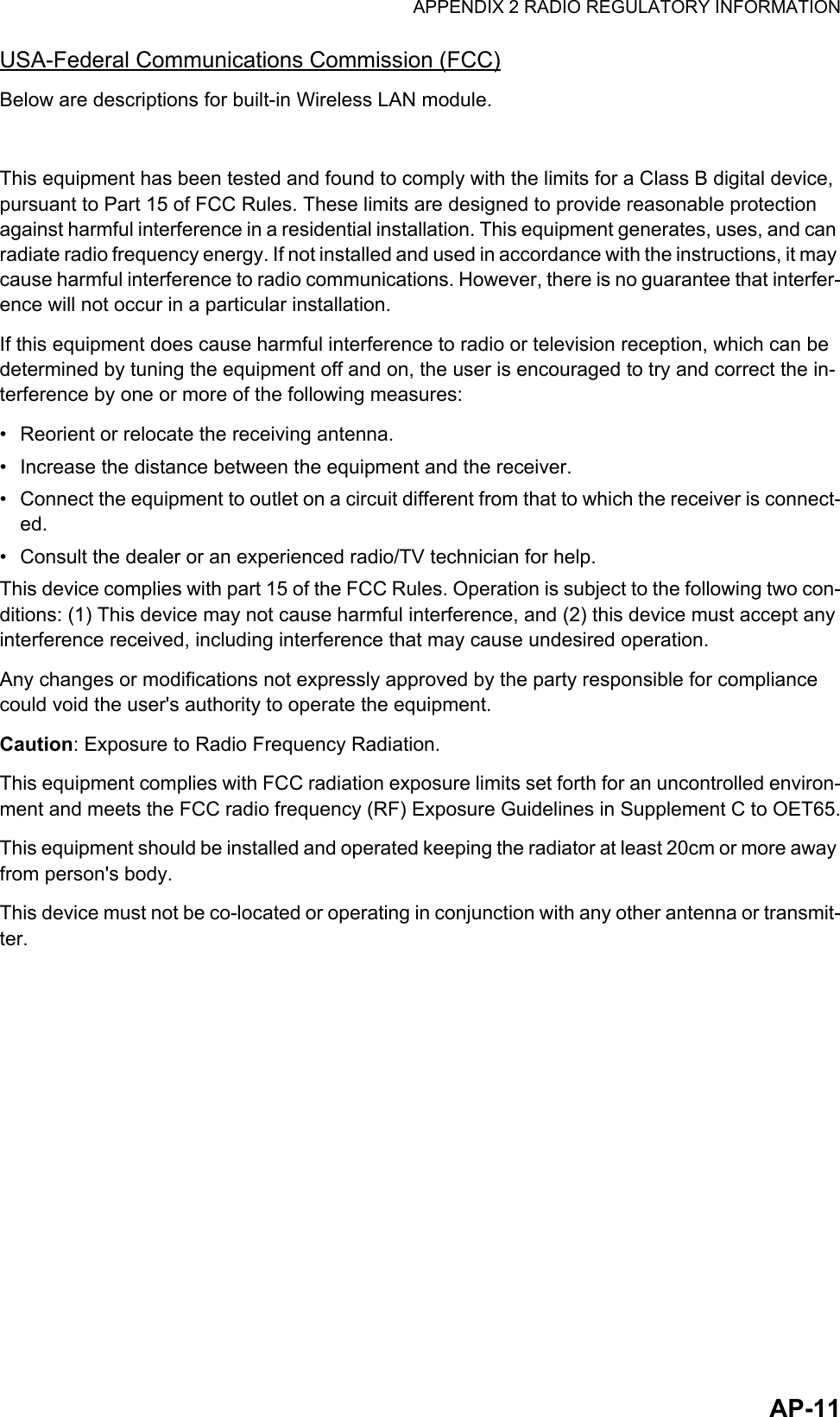
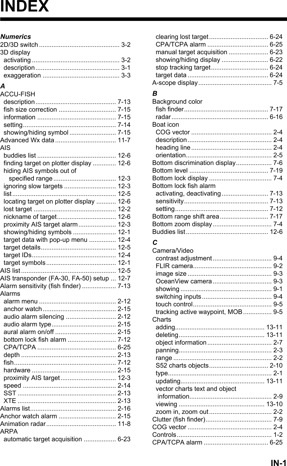
![13. OTHER FUNCTIONS13-1013.6 How to Manage Your ChartsThe NavNet TZtouch2 uses the same Mapmedia charts as NavNet 3D. Even though NavNet TZtouch2 is a master-less system in networking, for charts one NavNetTZtouch2 unit should be set as Chart Master to share the System ID, which will be necessary to obtain an unlock code of a chart from Mapmedia.13.6.1 How to view your chartsTap the Home icon to show the home screen, then tap [Catalog] to display your charts catalog.Icon MeaningFree chart. An unlock code is not necessary.Unlock code is necessary to use the chart. Tap the [Insert Code] but-ton at the top of the [Charts Catalog]. Enter the unlock code then tap to finish.Unlock code entered for the chart.System ID displayTap to enter unlock codeChart manufacturerChart file name Chart file typeChart status(see below)Chart versionno.](https://usermanual.wiki/Furuno-USA/9ZWRTR104.User-Manual-II-Part-12/User-Guide-2522496-Page-2.png)
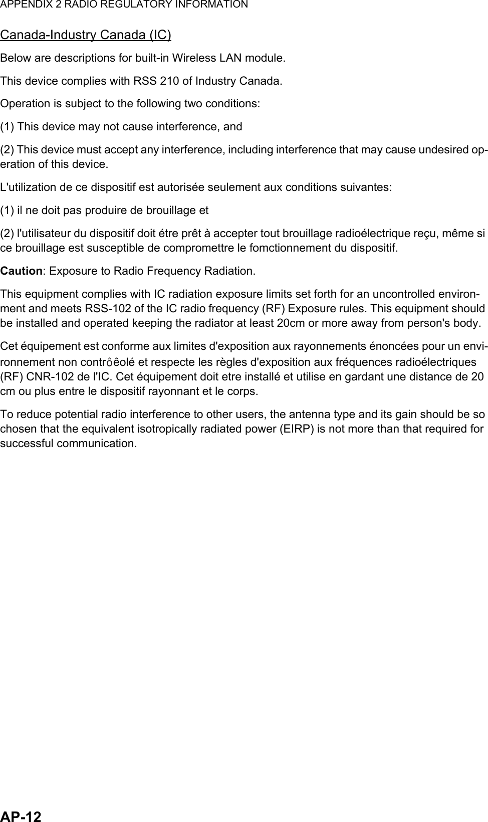
![13. OTHER FUNCTIONS13-1113.6.2 How to update or add chartsFree (USA and NOAA) and for-fee NavNet TZtouch2 compatible charts are provided by FURUNO and Mapmedia. Go to the URLs shown below to download chart data.Download the chart file to your desktop. Unzip the file, then copy it to the root of a mi-cro SD card. Insert the card into the SD card slot on the display unit, or the left card slot in the SD Card Unit (SD-001). For the detailed procedure, refer to the instructions on the FURUNO website.A for-fee chart requires that you enter its chart unlock code. Go to the Home screen and tap [Catalog] to show the [Charts Catalog] display. Tap the [Insert Code] button then enter the chart unlock code from the software keyboard.Where to obtain chart data:FURUNOhttp://www.furunousa.com/Products/Products.aspx?category=Prod-ucts+%3a+NavNet+TZtouch+%3a+Charts+for+NavNet+TZtouchMapmediahttp://www.mapmedia.com/charts-catalog.html13.6.3 How to delete chartsBefore replacing a chart you should delete the old chart data on every NavNetTZtouch2 unit. Only delete the chart data that you intend to replace or no longer re-quire.Open the charts catalog. Tap the trashcan icon of the chart to delete. You are asked "ARE YOU SURE YOU WANT TO DELETE THIS FILE?" Tap [OK] to delete the file.](https://usermanual.wiki/Furuno-USA/9ZWRTR104.User-Manual-II-Part-12/User-Guide-2522496-Page-3.png)
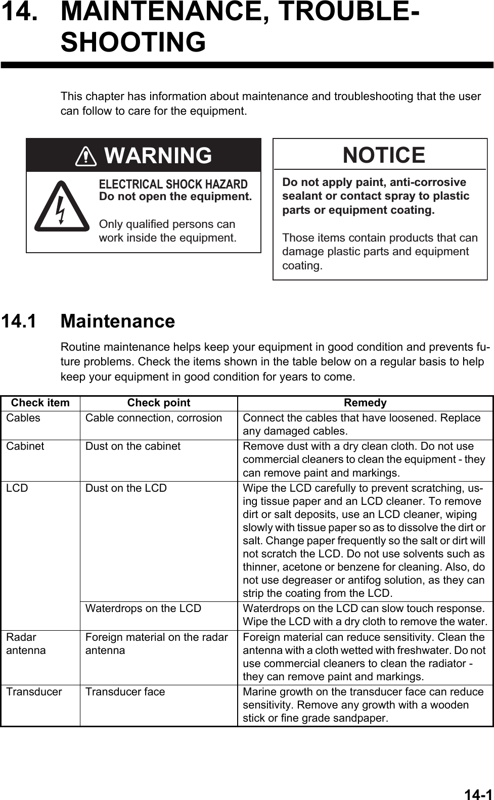
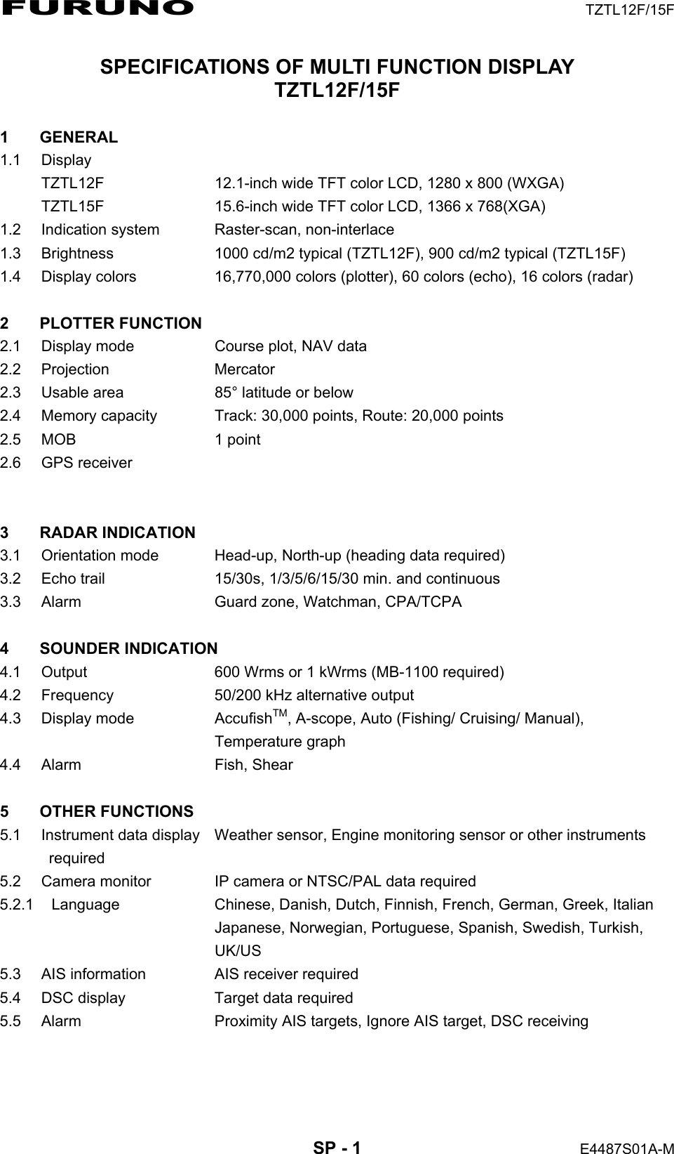
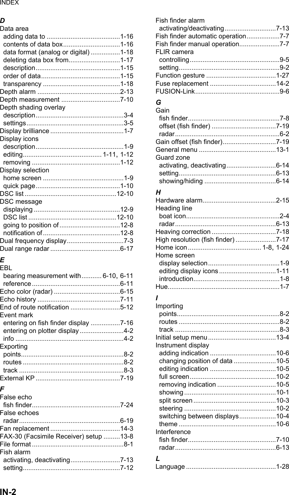
![14. MAINTENANCE, TROUBLESHOOTING14-314.4 TroubleshootingThis section provides simple troubleshooting procedures that the user can follow to re-store normal operation. If you cannot restore normal operation, do not check inside the unit. Have a qualified technician check the equipment.14.4.1 General troubleshooting14.4.2 Radar troubleshooting14.4.3 Plotter troubleshootingProblem RemedyYou can not turn on the power. • Check for blown fuse.• Check that the power connector is fastened.• Check for corrosion on the power cable connector.• Check for damaged power cable.• Check battery for correct voltage output.Picture is not displayed properly. Turn off and on the power. If the picture is still improper, contact your dealer for instructions.Nothing appears on the screen after you press the power switch.Check if the unit is plugged in.The display has frozen. Push the power switch until the screen goes blank. Turn the power on again.Problem RemedyYou tapped the [TX] icon on the radar display to transmit but nothing happens.• Tap the [TX] icon again. (The icon is filled in white when the ra-dar is in transmit state.)• Check that the antenna cable is fastened.• Check if the radar source is correct.Marks and characters appear, but echoes do not appear.Check that the antenna cable is fastened.Picture is not updated or the picture freezes.• Check antenna cable.• If the picture has frozen, turn the power off and on again.You tuned the receiver, but the sensitivity is weak.The magnetron may have reached its life. Have a technician check the magnetron.You changed the range, but the radar picture does not change.• Try to change the range again.• Turn the power off and on again.Poor discrimination in range. Adjust the sea control.Range rings are not displayed. Check if [Range Rings] is turned on in the [Layers] menu.You tapped the [TX] icon to transmit. The "TX screen" ap-pears momentarily, but the ra-dar soon goes into stand-by.This problem indicates that the overload protection has activated. To restore normal operation, turn off all equipment in the network. Wait a few seconds then turn on all the equipment.Problem RemedyPosition is not fixed. Check for interfering objects near the display unit that might be blocking reception.The track of your ship is not plotted.The track display may be disabled. Check if [Tracks] is turned on in the [Layers] menu.](https://usermanual.wiki/Furuno-USA/9ZWRTR104.User-Manual-II-Part-12/User-Guide-2522496-Page-7.png)
![14. MAINTENANCE, TROUBLESHOOTING14-414.4.4 Fish finder troubleshootingProblem RemedyYou selected a fish finder dis-play, but no picture appears.• Check that the transducer cable is fastened.• Check that the fish finder source is correct.• If you are using a network fish finder, check that it is properly connected.Marks and characters appear, but no picture appears.Check if the transducer cable is connected.Picture appears but zero line does not appear.• The picture is shifted. Check the shift setting.• Check if draft is set to zero or higher.The picture sensitivity is too low.• If you are in the manual mode, check the gain setting.• Check the transducer face for marine life or air bubbles.• Bottom is too soft to return an acceptable echo.The depth indication does not appear.• For manual operation, adjust gain and range to display the bot-tom echo (in reddish-brown).• Adjust bottom level HF/LF.Noise or interference shows on the display.• Make sure the transducer cable is not near the engine.• Check the ground.• Check if another fish finder in the vicinity of your boat has the same frequency as your fish finder.• Try to reject the interference with [Interference Rejection] in the [Settings] - [Sounder] menu.](https://usermanual.wiki/Furuno-USA/9ZWRTR104.User-Manual-II-Part-12/User-Guide-2522496-Page-8.png)
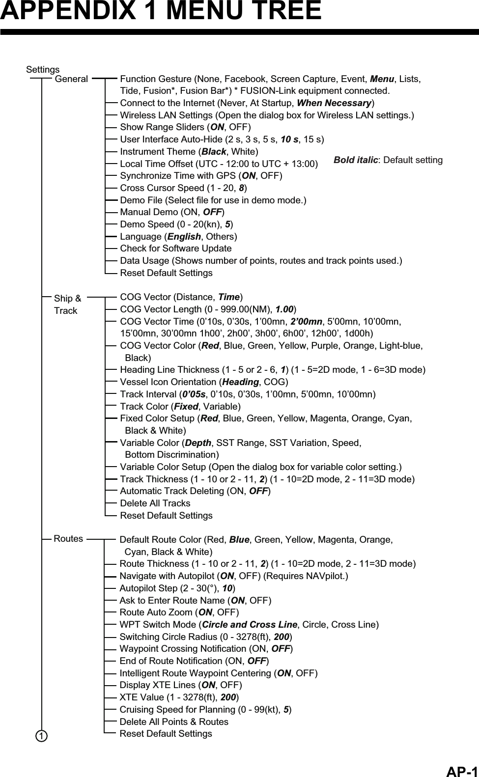
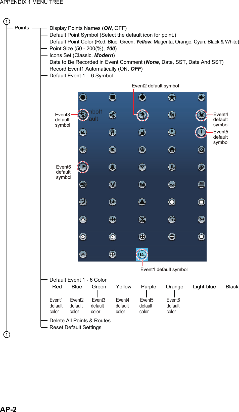
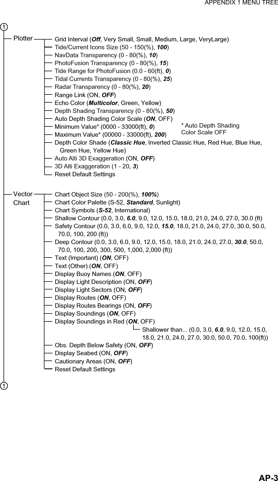
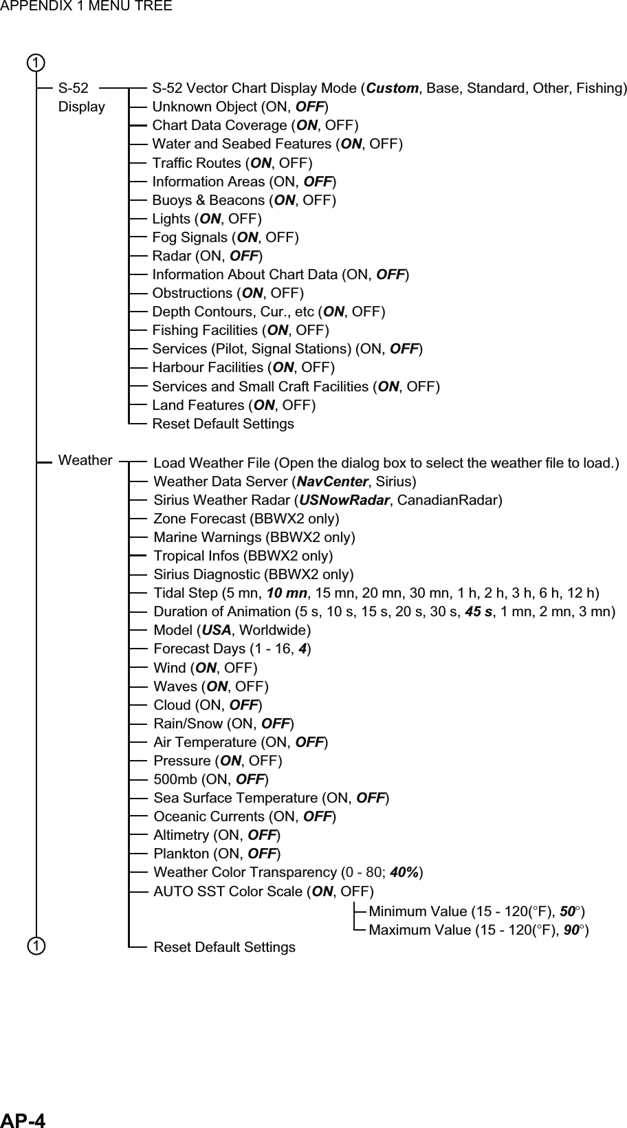
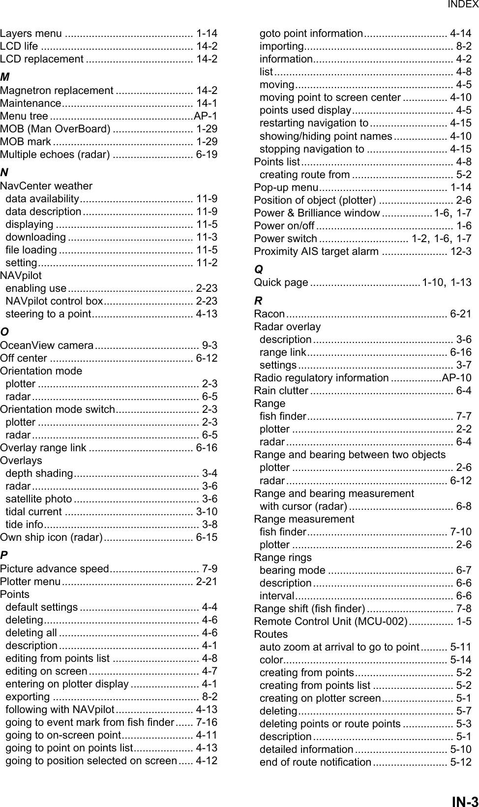
![APPENDIX 1 MENU TREEAP-5Radar Source (Select the antenna host name.)Day Background Color (Black, Dark Blue, White)Night Background Color (Black, Dark Blue)Echo Color (Multicolor, Green, Yellow)Rings Interval (Auto, 1, 2, 3, 4, 5, 6, 7, 8, 9)Own Ship Icon (ON, OFF)Echo Interpolation (ON, OFF)Bearing Scale Mode (Relative, True)EBL Reference (True, Relative)Watchman (5 minutes, 10 minutes, 20 minutes)Antenna Rotation (Auto, 24 RPM)Antenna Heading Align (-180 - +180(°), 0)Main Bang Suppression (0 - 100, 0)Enable Sector (1, 2) Blanking (ON, OFF)Start Angle* (0 - 360, 0)End Angle* (0 - 360, 0)Antenna Longitudinal Position (0 - 3275(ft), 20)Antenna Lateral Position (-Port) (-320 - 320(ft), 0)Antenna Height (For DRS: Under 3 m, 3 m - 10 m, Over 10 m)(For IMO: 5 m, 7.5 m, 10 m, 15 m, 20 m, 25 m, 30 m, 35 m, 40 m, 45 m, 50 m)Auto Tuning (ON, OFF)Tuning Source (Range1, Range2)Manual Tuning** (-50 - 50, 0)Radar Monitoring (Open the radar monitor window.)Radar OptimizationARPA Advanced Settings (Open the dialog box for ARPA setting.)Hardware Factory DefaultReset Default Settings 11Radar* Available when [Enable Sector (1, 2) Blanking] is [ON].Display Target IDs (ON, OFF)Hide AIS Targets Farther than ... (1 NM, 2 NM, 3 NM, 6 NM, 12 NM, 18 NM, 24 NM, 48 NM, 84 NM, 96 NM)Ignore Alarms for AIS Slower than... (0.0 - 9.9(kn), 1)CPA/TCPA Alarm (ON, OFF)CPA Alarm Value (0.01 - 99. 99(NM), 0.5)TCPA Alarm Value (0 - 59(min), 10)Proximity AIS Target Alarm (ON, OFF)Proximity AIS Target Alarm Value (10 - 999(m), 100)Buddies List (AIS & DSC) (Open the buddies list.)Reset Default Settings**Available when [Auto Tuning] is [OFF].Targets](https://usermanual.wiki/Furuno-USA/9ZWRTR104.User-Manual-II-Part-12/User-Guide-2522496-Page-13.png)